Maple Ridge (Vancouver) to Cranbrook, British Columbia

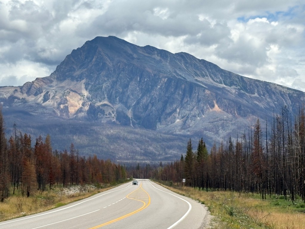
I got my first loooong driving day in Canada out of the way early in the trip. I had only been in Canada a little over a week and I needed to drive the majority of the way across southern British Columbia to the town of Cranbrook. Mapquest indicated point-to-point between my two Airbnb’s was about 500 miles and would take a little over 9 hours. I would drive east a short distance on the Trans Canada Highway (which hasn’t given me a reason yet to call it “the dreaded TCH”), before turning right on BC Highway 3, the “Crowsnest Highway” to continue east. I would be on it the rest of the way, and it continues all the way to Alberta province.

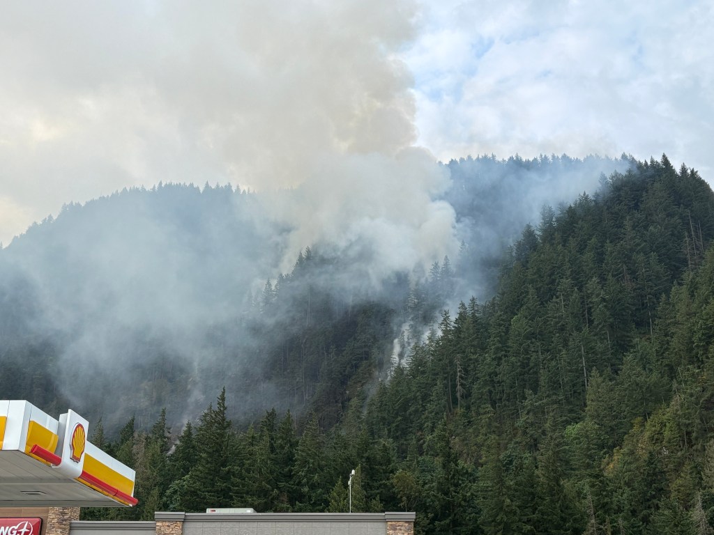
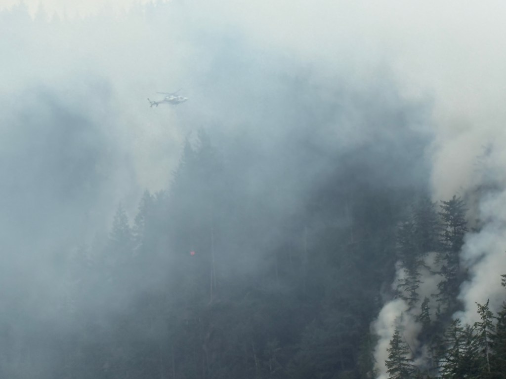
I recently posted a few photos in the “tease” post of the small wildfire I saw as soon as I exited the TCH near the town of Hope. I had stopped at a gas station (previously planned), and the fire was burning on a steep hillside behind the gas station and on the opposite side of the exit I had just taken. I stayed there a little while to watch a helicopter come and go, about every 4 minutes, to drop a large “bucket” of water on specific spots. I have no idea how much water was dropped on each trip but given the size of the helicopter I’m guessing it may only be about a third the size of my car.

The folks inside the gas station said the fire had been burning about a month and hadn’t gotten better or worse during that time. It was still classified as “out of control” the day I was there, and is STILL smoldering as I write this about another month later, but is now classified as “being held”. British Columbia as a whole is still bone dry and the fire danger is extreme. Parks Canada just implemented fire restrictions in Jasper and Banff National Parks, in the Canadian Rockies, which had been low risk but are now on the extreme list along with all of BC.

Here are some of the things I saw as I drove east towards Cranbrook:

There was a fairly substantial overcast to start the day but it would clear up and be a rather pleasant drive.

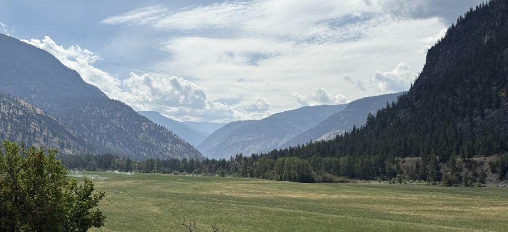
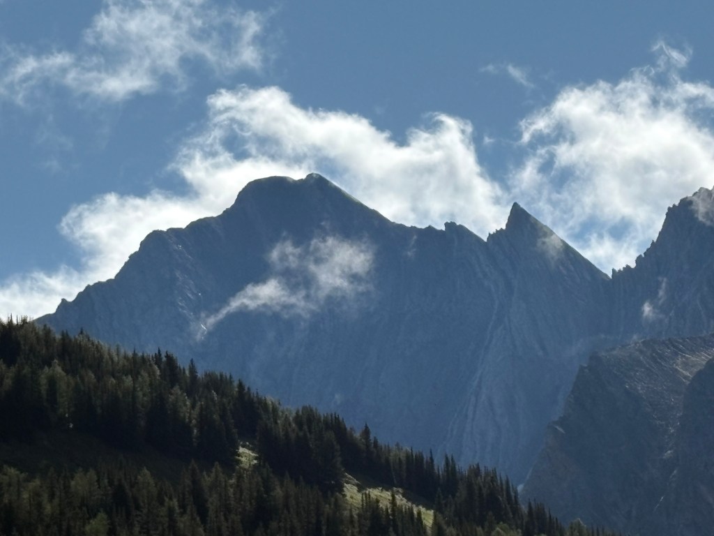
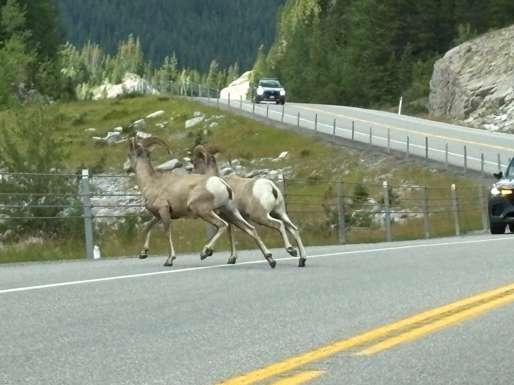
Route 3 kind of weaved between lots of large mountains but I only experienced a significant elevation change a handful of times. I also started seeing warning signs about various animals I would rather not hit with my car – bears, deer and elk, moose and even these guys:

Canada frequently covers several bases with a LARGE sign showing images of three or four animals, something I have not seen done in the US.

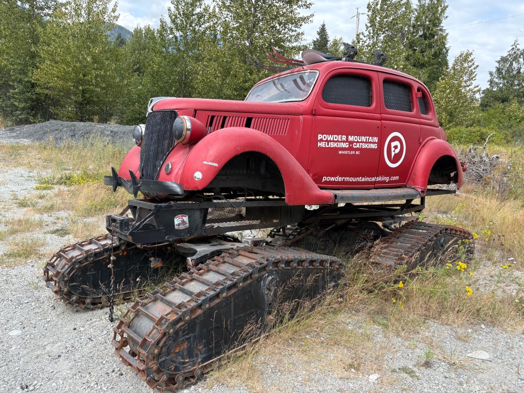
There was a small river which ran alongside the highway various places and at one point I saw this unusual watercraft on a pedestal just off the roadway:

Further up the road there were several cars pulled over and people were milling about with their cameras. I stopped, grabbed my cameras, and joined them – thinking it was an animal sighting. I was mistaken. It was an unusual lake which has significance to the indigenous people of the area.

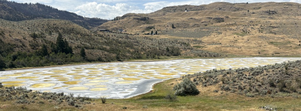
I’m guessing the largest circles are probably 10-12 feet across.

I have other photos of the signage explaining the significance of the lake but have not had time to read them or research the issue further. I was near the Okanagan (pronounced oak-uh-NOGGIN) Valley, known for large farms and fruit groves, among other things, and will be spending more time there later in the trip when I stop in Kamloops. I did drive past some farm stands after taking these photos.

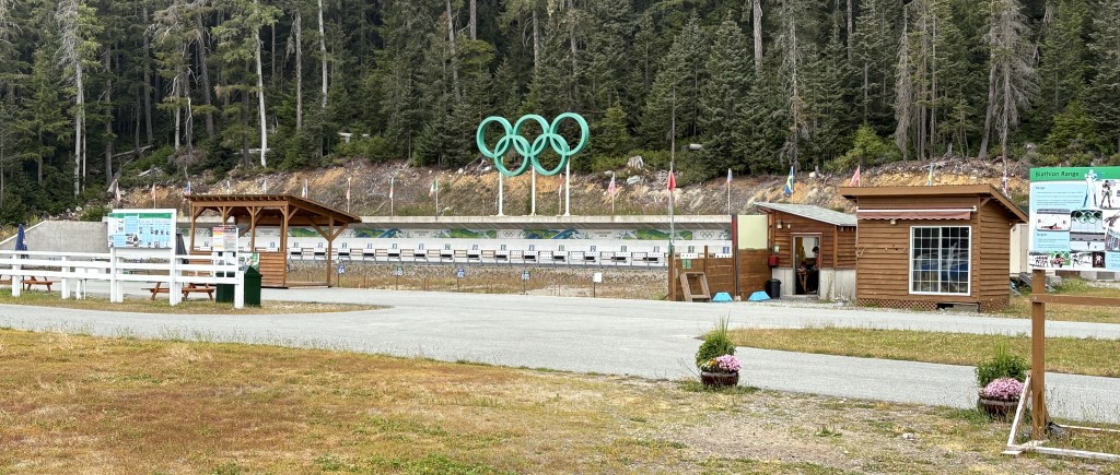
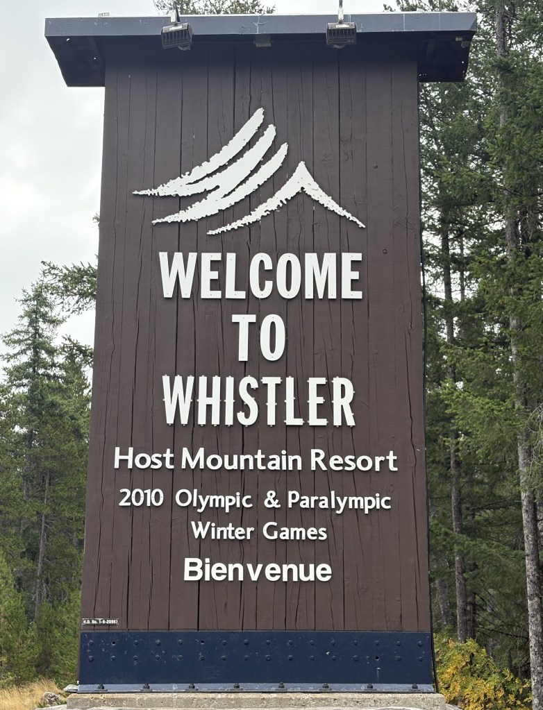
There is a pronounced indigenous presence in various places throughout the western US but nothing like it is up here. Indigenous tribes are EVERYWHERE in western Canada, and make their presence known. They sometimes pool their resources with other local tribes to help protect the greater good and provide resources for their people. Many large commercial Canadian ventures (like WhistlerBlackcomb ski resort, northeast of Vancouver) sit on indigenous land.

At one point when the highway did climb to a fairly high elevation we had to stop for a one-lane section of the roadway due to construction. I was stopped behind this truck, a support vehicle for the Snowbirds, Canada’s precision flying team, which has been putting on airshows throughout the country during the summer.

I recently posted a photo in the “tease” post of one of their jets atop a pedestal outside the Moose Jaw, Saskatchewan, Visitor Information Center. The Snowbirds are based at a military base just south of Moose Jaw.

I soon came to the town of Osoyoos (pronounced oh-SUE-yuss, NOT oh-SOY-yoos as it appears). I became interested in Osoyoos because of a billboard I saw advertising a business there and decided I would stop in town for lunch.

Another climb to elevation and there was a scenic overlook (they call them Viewpoints up here) which showed a rather expansive town with two large lakes.

I would have guessed this was the west side of town, because of my direction of travel, but looking at the map I realize this is the north side – significant for a reason I will explain shortly.

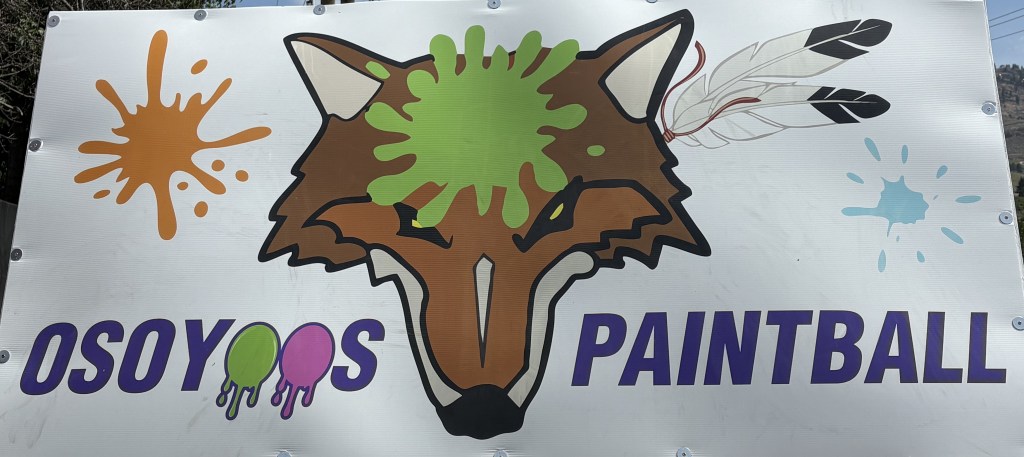
While I was in town I stopped at the business I saw advertised as I approached town. It is a Paintball facility, and I really like their logo. I found the place but it didn’t seem to be open. The owner pulled up just as I was about to leave. Unfortunately he didn’t have any t-shirts in my size, so I left empty-handed. Here is their logo, on their sign next to the highway.

I climbed another big hill as I was leaving town and had a great view of the south lake.

This is significant because the majority of the south lake is in the United States! The town of Osoyoos, between the two lakes, is only a very short distance from the border.

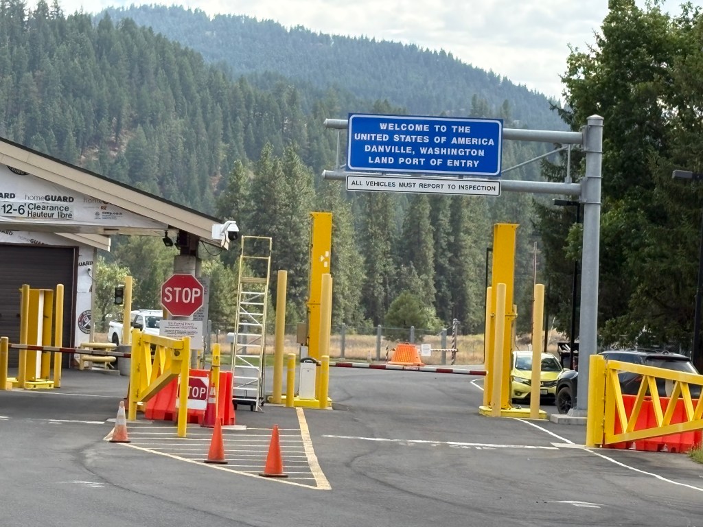
Further east on the Crowsnest Highway, at the town of Almond Gardens, I turned right at one of the many signs I had seen during my drive indicating “turn right to US Border.” I forget the exact distance but it was probably less than a mile:

I turned right around and headed back to Highway 3 and my journey east. Not feeling homesick yet – by any stretch of the imagination!

I stopped in the little town of Castlegar, which had been highly recommended by one of the folks in the Campbell River Visitor Center. I spoke with a young man at the Visitor Center there, picked up maps and brochures, but was already “on the clock” to make it to Cranbrook before dark so I told him I would probably return there someday. Someday is today. I am sitting in my Airbnb in Castlegar as I make this post, and the area has exceeded my expectations. I will save the photos I took yesterday when I arrived and today while I was out and about. They will have to wait their turn and be posted in sequence, but they will be worth waiting for.

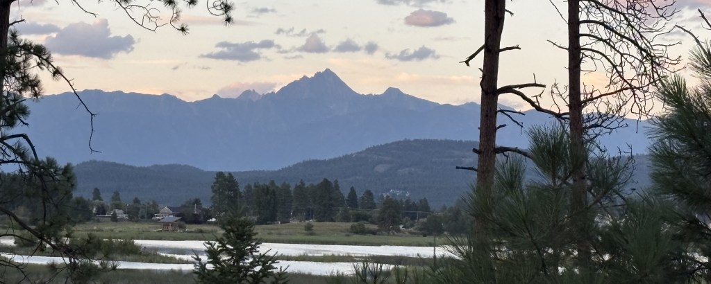
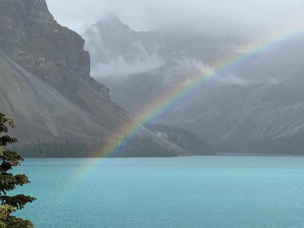
The remainder of my drive to Cranbrook went without incident. I posted photos in the “tease” post of the amazing sight of a portion of the southern Canadian Rockies which I took just as the sun was setting. I was hoping for a repeat performance the next night, but low clouds spoiled it. It doesn’t look like I will get another bite at that apple this trip.

It ended up being just over 12 hours in the car because of all the stops I made, but it was a very enjoyable day.

Recalculating…. ⏳

As I write this I am wrapping up my second night in Medicine Hat, Alberta, Canada. I spent several hours this afternoon in the gorgeous backyard of my Airbnb host’s home here updating the itinerary for the remainder of my trip, all the way through my return home to Durham in time for US Thanksgiving.

My changes include dropping some unnecessary multiple night stays in small towns and the addition of more towns I have been advised to visit or have passed through and determined they warrant a least an overnight stay. The changes also take into account the fact that I now plan to drive to Alaska rather than fly, which will require several stays in northern British Columbia and extreme southern Yukon provinces – both on the way up and the way back.

There are still events (weather, wildfires, volcanoes – yes, you read that right!) which could require further tweaks but based on what I know right now, and pending additional information from new sources I still need to seek out, this will be the plan for now.

I will review my notes and numbers tomorrow or the next day and send some people an updated .pdf file with the new schedule. I will also update the statistics through the first 8 weeks of my trip (4 weeks in the US and 4 weeks, and counting, in Canada).

I have been blessed with good weather most places and am out doing things pretty much all day, every day. By the time I get to my Airbnb each night I am usually exhausted and go to bed. And not many rainy days to get caught up on posts, so please continue to hang in there…

WhistlerBlackcomb Ski Resort

After I visited the 2010 Olympic Park northeast of Vancouver I drove further up the mountain road to get to Whistler. The town itself was renamed to Whistler after marmots found here, which have the unfortunate nickname “whistle pig” because of the warning sound they emit to warn others of predators, and because they can grow to be rather chubby. A marmot is the largest member of the squirrel family (squirrels, groundhogs, marmots, chipmunks, etc) and I will be sharing photos of some in other posts later. I posted photos of some marmots when I was in northeast Colorado a few years ago.

WhistlerBlackcomb is comprised of two large ski areas, one on Whistler Mountain and the other on Blackcomb Mountain. Almost all of the trails end up in Whistler Village. Together they form the largest ski resort in North America:

(Photo credit: SkiTDS.com)

The Village is a very busy place! Lots of big hotels, restaurants and bars, shopping, and various activities in both winter and summer.

This is one of the chairlifts to the top of Blackcomb Mountain.

It was overcast with low clouds in the area the day I was here, which occasionally obscured the various mountain peaks. I hope to come back to Whistler later in my trip, hopefully on a nice, sunny day, and to visit a particular facility which was closed the day I was here.

In addition to the chairlifts, there are enclosed gondolas which go up the mountain from the Village. I also saw a gondola package advertised which brings people up TO the Village from the highway at the base of the mountain near Squamish, at the coast, many miles away!! It is a very expensive, multi hour affair which promises spectacular views (so long as you are not claustrophobic and/or afraid of heights).

There are large electronic signs which, in the winter, indicate the status of various lifts (e.g. you don’t need to ski all the way down and ride all the way back up).

Only two operate in the summer.

The day I was here, people were engaging in various activities other than skiing, and the village was quite busy. There is a large bike (bicycle, not motorbike) trail at the base of the ski lift, which seemed to be the most popular.

There weren’t riders on it as I took that photo but there were lots of young people with bikes queuing up to be released together.

There many more, not shown in the photos.

Canadians are very big on recycling everything. There was a place to put used, blown out tires and innertubes, and there were tools (tied down) to enable folks to work on their bikes.

People in another area were getting outfitted to ride the chairlift part way up the mountain and then zipline down.

There was also a place to rent a 4-wheeler or other ATV.

You see a small child, maybe 4 or 5 years old, riding his tiny bike towards the vehicles on the right side of the photo above. He dismounted, carefully leaned his bike against the rock wall and immediately climbed up on the 4-wheeler in the foreground. I told his mother “I guess you know what he wants for Christmas!” In a few years, maybe… I told the young man I really liked his helmet (which he still had on) and told him he was really smart to wear one. I always try to tell kids that when I see then wearing safety equipment.


As I mentioned, there are lots of big, fancy hotels in the Village, and in other areas nearby.

And lots of fancy restaurants:

There is also a Squamish Cultural Centre in town (the indigenous tribe on whose land all of this sits!):

As I was heading out of the Village to drive back down the mountain to Squamish and then on to my Airbnb in Maple Ridge, I noticed this sign on the traffic light at a big intersection. Space in the Village is really at a premium and there was no place to land a helicopter in an emergency – so they just stop traffic and it land on the street!!

I have never seen that done anywhere!

Finally, as I drove down the mountain I stopped to photograph this unusual vehicle I had seen as I arrived in the morning. It is used to catch your attention to promote a local business.

Mission accomplished.

Seven city teaser post

I know, it has been a week since I posted anything substantial, and that was from way back near Vancouver. As usual, I am way behind but can assure you I am accumulating LOTS of photos.

Driving across southern Alberta province a few days ago, on my way to Moose Jaw, I decided I would post a few photos from each city I have stayed in since leaving Vancouver Island to whet your appetite for what is still to come.

HOPE, BC – I didn’t stay there but it provided some excitement early in my loooong drive to Cranbrook from east of Vancouver. There was an electronic sign next to the Trans Canada Highway warning of a wildfire ahead and telling drivers NOT to stop along the roadway. Well, it turns out the fire was on a hillside above a gas station I was already planning to stop at, where Route 3 branches off from the TCH to take me east across southern British Columbia, very close to the US/Canadian border. So I didn’t stop along the roadway, I stopped at a gas station off the exit.

This fire had been burning for about a month (and still is as I write this). It is quite small by wildfire standards but is stubborn due to the steep terrain on the hillside. While I was getting gas, a helicopter arrived about every 4 minutes to dump a large bucket of water on the hotspots, then flew off to a nearby water source to bring more. Imagine the pilot(s), doing that all day, every day.

That particular drop hit right on the “sweet spot” where I could see visible flames.

This was as close as I ever need to get to a wildfire.

CRANBROOK – After 12 hours in the car (with stops) I approached Cranbrook and got my first look at the southernmost Canadian Rockies. The sun was just setting as I could see the very impressive mountains in the distance. By the time I found a place to stop with a fairly clear view only one set of mountains were still getting sunlight and the others were now in full shade.

There was a third set of mountains further north that I could see but I couldn’t get a clear shot at them from this vantage point.

GOLDEN, BC – After spending two nights in Cranbrook I headed north to spend 6 nights in Golden, from which I would visit 6 National Parks.

This was from the drive towards Jasper NP, a huge Park which suffered considerable damage from a large wildfire last year. I drove over 3 hours north on the Icefield Parkway, and stopped at these two lakes and saw LOTS of mountains along the way:

The next day I drove west from Golden through (the Canadian) Glacier NP.

I would also go through Kootenay, Yoho, Mount Revelstoke and Banff National Parks from my base in Golden.

CANMORE, BC – Rather than staying in Banff proper I went 22 kilometers south to spend 4 nights in Canmore which is a very nice little town without the massive crowds that Banff experiences. I did make two early morning stops in Banff before the tour buses and RV’s started to arrive in the late mornings, and will post those photos later.

From Canmore I drove a long way south one day in an area known as Kananaskis Country (pronounced can-a-NASS-kiss):

As I was driving home, there were two full grown Bighorn Sheep in the road and traffic was stopped. Note the Park Ranger’s truck approaching behind the black car which was stopped.

The Ranger lit up the emergency lights and started honking the horn as the truck swerved around the stopped car, scaring the sheep over the guardrail and off the road.

CALGARY, AB – After 10 nights total in the Canadian Rockies I went west from Canmore to Calgary, the provincial capital of Alberta. There I found the huge Wonderland sculpture in front of a building on a busy city street:

And the Calgary Tower, similar to the CN Tower in Toronto, but shorter and designed to look like the Olympic torch (Calgary is another Canadian city which has hosted the Winter Olympics):

The tower used to dominate the skyline but is now dwarfed by many of the new skyscrapers downtown.

I apparently haven’t downloaded some of the other photos I took in Calgary which I had planned to include here but will post them later.

MOOSE JAW, SK – Three days ago I drove due east from Calgary for about 7 hours, across southern Alberta and into western Saskatchewan, to a town I have wanted to visit for a very long time.

I give you Mac the Moose:

He stands proudly outside the Visitor Centre in Moose Jaw. Inside the Visitor Centre I found his sidekick, Cheese the cat:

Get it? Mac and Cheese?

Next to Mac there was a replica of one of the Canadian Snowbirds jets.

The Snowbirds are Canada’s precision flying team and are based at the military airfield just outside of Moose Jaw. I saw their support truck twice on the highways as I went from town to town, and they just recently put on an airshow in Nanaimo, where I took the ferry from when I sailed from Vancouver Island to Vancouver city at the beginning of this trip.

REGINA, SK – Which brings me to where I am tonight. I didn’t get into town until noon, and stopped at the Visitor Centre for maps and brochures to add to what I had already found elsewhere. I went to a series of sports arenas, all gathered on one part of town, and drove to several nice city parks to enjoy the cooler weather. In one of them I found this rabbit, casually eating grass:

It’s hard to tell from the photo but he is huge – every bit as large as my 16-pound cat (Bigfoot) that I had when I lived in Pennsylvania.

Unfortunately I scared him as I tried to get closer and he used his long legs to run off.

I haven’t had a chance to really explore the city but I will review my notes when I get up in the morning and make a full day of it.

I hope this will hold you over until I have time to review, crop and organize more photos from all of these places.

Po-TAY-to, Po-TA-to

Real-time post, photo at the end.

Today I arrived in Regina, Saskatchewan, the capital of the province.

I have confirmed that the locals pronounce it re-JYE-na (sounds like a sensitive part of the female anatomy). I worked with someone in Pennsylvania who pronounced it re-GEE-na. Today I was even presented with a conflict between Google Maps and my “sometimes trusty” GPS 4.0. The GPS unit correctly pronounced it as the people who live here do, whereas Google Maps used the other pronunciation. I didn’t even bother to put in my two cents since neither device pays any attention to what I tell them.

This is as far east as I will be going in Canada on this trip. Regina is just west of the Montana/North Dakota border vertically, and is due north of Cheyenne, Wyoming and Denver, Colorado. When I entered the province two days ago on my way to Moose Jaw (which I can confirm IS two words) I crossed into the Central Time Zone. Almost all of British Columbia is in the Pacific Time Zone, save for Golden and Cranbrook, two towns I stayed in, and a strip of land west of the southernmost Canadian Rockies, which slant from NW to SE. Alberta province is in the Mountain Time Zone, and Saskatchewan is in Central. I also learned today that Sask (as the locals call it) does not play the Daylight Savings Time game. I was confused the two days I was in Moose Jaw because the time on my phone never changed, which it normally does automatically when I am in the US. Lo and behold, I should have just left Mountain time alone and not told my car that I was in CDT. MDT = CST.

I will be in Regina two nights, then head northwest to Saskatoon for two nights. I almost eliminated Saskatchewan from my itinerary altogether due to air quality issues from the wildfires in the northern part of the province. I checked the numbers every day before committing to reserving my Airbnb’s past Banff. About two weeks ago the numbers dropped to safe levels in all of the towns I was planning to stay in except one, presumably because they received a fair amount of rain which washed the smoke particles out of the air. I haven’t noticed any of the smoke “haze” the three days I have been in the province.

The only casualty from my original schedule is Prince Albert National Park, which is pretty far north from Regina, and which was very close to the fires and had very bad air quality numbers. So I am adjusting my itinerary, eliminating multiple nights from many small towns, which will free up time to reallocate elsewhere.


I will end this post with a photo I took from my bedroom window early this morning in Moose Jaw, SK. This was taken at 506 local time, about an hour before sunrise. The 3 bright spots in the photo are, the Moon (lower center), Venus (above it and to the right) and Saturn (further above and to the right). I darkened the photo a bit so it would look exactly like what I was seeing. The Moon appears as a thin crescent. It was really an amazing sight.

Final images from Olympic Park

Here are a few photos I took of other things before I left the Olympic Park to head further up the mountain to Whistler Blackcomb ski resort.

These are two, relatively short (in my opinion), ski jumps. I am not a skier. My three brothers all skied but I never had any interest in it. My opinion of these ski jumps is based on others I have seen firsthand. Maybe my depth perception is skewed, but this is a training facility and perhaps they scaled things down for maximum “repeat time”.

You see – very compact.

There were ski areas in eastern Pennsylvania, where my family lived for many years. They were small by Rocky Mountain standards, but we were two hours from both New York City and Philadelphia so they were very popular with city folk. My older brother and his wife built a house after they got married, in a small resort town about 45 minutes away from where our families lived. They could see the slopes of Big Boulder ski area from their deck.

My youngest brother, who was born after we moved to Pennsylvania, lived in Salt Lake City, Utah for many years and when I would go out to visit, he and his wife would take me up to Park City, which has also hosted Winter Olympic games and has training facilities similar to these. The ski jumps we saw there seemed much bigger than these.

Here is something I noticed as I walked back to my car after having taken the photos above:

Once again, the electric bear fence.

Within walking distance of the ski jumps I found a large Inukshuk statue, perched high on a boulder:

This symbol has meaning the indigenous Inuit language, and was adopted as the logo of the 2010 Winter Olympic games.

As you can see of you look closely at the photo on the sandwich board above, the large Inukshuk has inspired many “Mini-Me’s,” constructed by visitors.

Some better than others…

I have a small, wooden Inukshuk keychain which I bought in Toronto when I was there in 2019.


My next posts will be of what I saw when I visited Whistler Blackcomb ski resort, just up the road from the Olympic Park. For now – a JohnBoy Travel Update. As I write this post I am in Canmore, Alberta, just south of Banff, in the Canadian Rockies. I drove down here yesterday from where I had been staying in Golden, British Columbia. From Golden, I drove through parts of six National Parks. I will be based here in Canmore for four nights before moving on to Calgary and points east.

I’ve been lots of places and seen lots of things between Whistler and Canmore, and I will be getting to those posts soon. Thank you for your continued patience. My days are filled with seeing new, amazing things and I am accumulating LOTS of photos and stories.

I’m peddling as fast as I can….

Olympic Biathlon facility

Tucked up on a hill away from everything else is a gun range used to practice one’s Biathlon skills in the summer. Here is a board explaining how a Biathlon works:

So given the lack of snow, athletes train by using skis on wheels. There is a fairly level oval paved loop immediately behind the gun range that the athletes use their ski poles to propel themselves around. When they get to their assigned station at the shooting range they stop, lay their ski poles down and quickly pivot their rifle (a .22 caliber gun with certain weight specifications, containing a 5-round clip) which they have been carrying on their back. They then shoot at 5 white targets which will each change to black when they hit them. Simple, right? Probably not, which is why they constantly train to hone their skills, and it IS an Olympic sport so it certainly isn’t a cakewalk!

Here is the gun range, seen from a distance.

You’ll get a closer look in a moment.

I spoke with a young man working in the small shed to the immediate right of the range as seen in the photo. I asked if he was operating the range and he said no, it is automated. He was cleaning and repairing rifles. Later in the day I could pay to try the shooting part if I wanted to (and could demonstrate I wouldn’t be a threat to myself or others). I told I would pass on that offer, but thanked him anyway. There were a few people, male and female, making laps on their roller skis, some were pobably training, others may have just been doing it for exercise. I imagine it alone is a pretty good workout.

I stood and watched for a while and it soon became clear that one young woman and three young men were clearly here to train.

I didn’t want to take pictures while they were making laps but I did take a few while they were focused on shooting.

When he was done shooting and was talking with his buddy I did engage the guy in the red shirt in a brief conversation. I didn’t bother the young woman who seemed to be getting pointers from someone.

The guy in red has been shooting for ten years. I didn’t ask how old he is but he appeared to be late teens or early 20’s. His shirt indicated he is part of Team Canada, but I don’t know if he is a candidate if he can prove himself or if he is already on the team.

Here is a better look at what they are shooting at:

He was shooting at target 14, below the right-most two Olympic rings. Looks like he hit 2 out of 5 shots.

Keep in mind, he is doing this now in pleasant temperatures, wearing shorts and a t-shirt. Conditions and attire when they are competing would be VERY different.

I thanked him for his time and for discussing things with me and wished him good luck. Later, as I was driving away from the Park I saw his buddy “skating” out on the main road, down a rather steep hill!

2010 Winter Olympic Park

Before getting to the Whistler Blackcomb ski resort in Whistler I took a turnoff to drive back to the Olympic Park, built for the 2010 Winter Olympics which were held here in British Columbia. It isn’t just a dormant facility sitting here rotting. Many of the facilities are actively being used, even in the summer.

First a map of the general layout:

Next, a map of the campgrounds on site, and other details.

After I took that second photo I noticed something written off to the side (not in the photo)

Whoa! – that middle item really got my attention. Let’s have another look at that map but we’ll zoom in a bit:

Perimeter around the remote campground – check.

Perimeter around the primary RV sites and kid’s playground – double check.

Here is a door I found behind the Day Lodge (which contains a cafeteria, gift shop, washrooms and showers for the campers, and various support facilities for running the Park).

PLEASE remember to close & lock the door behind you!!

And here is a look at the Day Lodge itself:

The left side is the front entrance, the right side is the cafeteria and off camera to the left is the gift shop.

Also around back was this item promoting a nearby business. In the US we would call this a bobsled, but here in Canada it is a bobsleigh. And no, I didn’t get in it (after my experience in New Mexico where I got in a life size replica of an IndyCar outside a racing museum and for a few tense moments, couldn’t get out).

This is here to promote the Whistler Sliding Centre. That facility is located high on the mountain above the ski area, further up the road, but unfortunately the Sliding Centre wasn’t open the day I was here.

When my youngest brother and his family lived in Salt Lake City they took me to a similar Olympic Center up in Park City, where the 2002 Winter Olympics were held. We watched sleds some roaring down the track (outfitted for summer use). When they launched one from the top a voice on the loudspeakers would announce “Bob on track !” so those of us down below could get our cameras ready.

People can pay to ride with an experienced “driver” but we didn’t do that in Utah and I wouldn’t have here even if the facility had been open on Mondays.

Next I’ll show you what was happening at the Biathlon facility elsewhere on the property.

Please don’t pet the bears

Monday I had scheduled a daytrip up to Whistler ski resort, northeast of Vancouver. I left Maple Ridge early in the morning so I could bypass the city westward on the Trans Canada Highway before morning rush hour.

Before I got to the road going up the mountain to Whistler I went through the coastal town of Squamish. It is the English name of an indigenous tribe on whose land Whistler resort, and many other towns, sits (their land consists of 2,600 square miles (NOT kilometers)). Most signs carry both the English and Indigenous spellings.

Those numbers are kilometers, not miles, by the way. Things up here are almost always expressed in metric measurements but when I discuss them on my blog I generally use the US system since that is what many of my followers can relate to.

As I approached the town I could see a huge rock formation right by the highway in the distance:

Here is a photo of the rockface looking in right next to the formation (but from the other side of the highway):

And here is another photo which includes the parking lot below the formation. As you might guess, it is VERY popular with rock climbers, and there is a special parking area right below it for their vehicles, which are loaded with their climbing gear.

I didn’t see any climbers on the face either going by in the morning or later in the day as I was heading back to Maple Ridge, but I could see people resting in the afternoon from having climbed earlier in the day when it was cooler and without the sun beating on the face of the formation.

After taking photos here in the morning I continued on up the mountain towards Whistler.

Followed immediately by:

Many of you have perhaps seen a sign like this in your travels (even in the mountains and near the coast in North Carolina) and I think most people assume it only applies to black bears. Well, in places like Yellowstone National Park in the US and most places here in Canada, it also applies to another type of bear.

I was first warned about grizzly bears when I was at the north end of Vancouver Island earlier in my trip. Evidently young males from the mainland swim over to VI in search of new turf and perhaps a place to raise a family. They must have convinced some female grizzlies to tag along, as the grizzly bear population on the island is growing. I didn’t see any, but there were plenty of signs warning about them.

And my nephew, Sam, will be pleased to know that every day that I am near the woods and out of my car I am packing bear spray:

When I visited my brother and sister-in-law, and their son Sam, in Wyoming back in 2021, Sam invited me to the place where he worked, just outside of town. In the hills above the complex where he worked there are petroglyphs on the rock walls. When I got there he asked “where’s your bear spray?” I replied “in my backpack”. He told me “No, when you need bear spray you need it RIGHT NOW”. It comes with a carrying case which you can strap onto your belt. It should be worn at all times when you are in a place which may also be inhabited by bears.

I never needed the can I bought in Wyoming and while it may still work, the expiration date has passed. I still have it but I bought two new cans for this trip and wear one of them at all times when I am out of my car.

My stay in the Vancouver area

I had reserved four nights near Vancouver, hoping to explore the city and the many beautiful sites I’ve heard so much about. My visit got off on the wrong foot, as I documented in a previous post, with an Airbnb venue problem. That plus the fact that I hadn’t budgeted nearly enough time, plus the fact that the public transportation into the city wasn’t to my liking, plus the fact that I’ve read Vancouver is being overrun with tourists (and is already a very busy city), plus other factors, led me to ignore the city on this visit altogether!! I will come back better prepared at the end of this trip, especially since I now know I will be cutting back in other areas of the country due to air quality issues, etc. I would rather take the time to do better planning and give Vancouver the attention it deserves.

I already explained my disagreement with the Surrey Visitor Centre. Here is proof of the exorbitant parking fee I had to pay just to go in the building and find that they weren’t even there any more. I became even more upset this morning when I saw this photo as I was reviewing photos to post and saw that the city even added TAX to the parking fee!!

Fortunately I was easily distracted by something I had seen on my way there. My mind is always distracted by new “shiny objects,” and this one was indeed shiny.

THAT is a spiffy new Ford F-650 Crew Cab pickup truck, outfitted with a removeable camper called Bigfoot. I saw it parked in front of a house as I was driving on a city street, and after I passed it I turned around to go back and get a photo. I was alarmed when I saw it pulling out of where it had been parked and was prepared to pursue it (within reason). Fortunately the driver was only moving it across the street so he could get another vehicle out of his driveway.

My comparatively tiny Toyota Camry parked in front of it:

I spent a few minutes speaking with the owner, who proudly proclaimed the truck is one of only two in the area (camper sold separately). There was a sign in the back window indicating the owner is evidently in the septic system cleaning business, and clearly business is very good! Ironically (and I mean that in the very literal sense of the word) he was wearing a UNC Tarheels t-shirt! I pointed to it and asked if he had gone to school there (he was probably in his late 20’s). He replied no, he had bought it at local thrift shop for just a few bucks.

Those of you who know me are keenly aware of my obsession with buying unusual new t-shirts for only a few bucks at one of my favorite chain stores in the Mid-Atlantic states, so between the cool truck and the t-shirt story it helped make my day and get my mind off the goofy parking fee.

Another thing that impressed me during my brief stay near Vancouver were it’s many bridges. I will show you three of the ones I used personally. Most of these photos I found on the internet. Believe me I tried to find places where I could take my own photos but that quickly became a huge waste of time.

The first one I crossed was the Pattullo Bridge. As I crossed the old bridge I could see the ongoing construction of a much larger new bridge right next to it. For this one I have to resort to internet photos:

The old bridge, on the left, still in use:

(Photo credit: readsitenews.com)

You can see them beginning to build the concrete superstructure supports in the center of the photo above. They are much further along now than when that photo was taken.

The new bridge. The photo below is pretty much how it looked the day I drove over the old bridge:

(Photo credit: TI Corp)

And to prove my point about it being a waste of time trying to take my own photos, I went out of my way to go to a place called Bridgeview Park. This was all I got for that effort:

I tried.

Another bridge I crossed several times while I was in the area is the Port Mann bridge. Perseverance paid off as I was finally able to find a nearby city street where I could get a good photo of it:

And finally, the Golden Ears Bridge, which I probably crossed at least a dozen time while I was staying in Maple Ridge.

(Photo credit: hgcacoustics.com)

I’ve tried to enlarge that photo but don’t seem to be able to. I don’t know why it was so difficult to find a photo of this beautiful bridge. I want to get this post finished but will try to find a better photo later and replace the one above.