I was originally planning a much longer drive on my first full day based in Campbell River but with the tsunami warning issued after the big earthquake in Russia the night before I decided not to go near the ocean. Authorities were still warning British Columbians to stay away from the coast, although those warnings were lifted after I was already on the road.
I chose another route which would take me about as far from the ocean as I could get. I took Route 28 out of Campbell River and headed west, up towards Gold River. It’s only about 55 miles but Google Maps said it would take about an hour and 15 minutes, though with all my stops to take photos it took a lot longer than that. I even turned around before I got to Gold River as I had other places I wanted to go as well.
These are photos of various lakes, mountains, and distant mountains with snow on them, even in early August. I apologize for not knowing the names of most of them – there were only signs in two places. I don’t know the lay of the land and, as I learned to my dismay in Victoria a few days earlier, I don’t even know which direction I am looking, or walking. This is one reason I don’t hike.
Just enjoy the views as I did. A lot of repetition I know, but everything is just gorgeous…

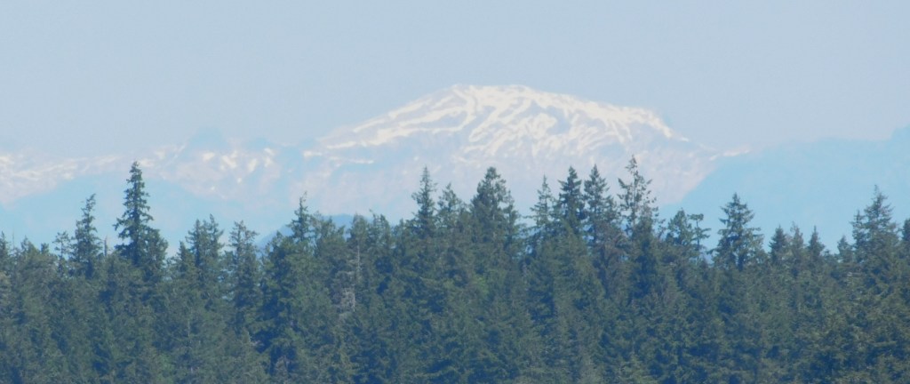
I suspect I am seeing the mountain above from various places on the island but I still don’t know which one it is!


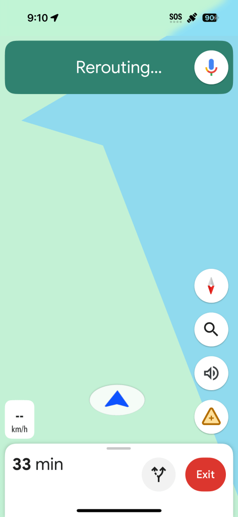
I posted the photo above because, while I started using Google Maps to guide me to Gold River, it got to a point where it apparently didn’t know where I was, either!! Scary thought…
I will tell you again about an app which may also be useful in a situation like this. It is called What Three Words. Someone has plotted a 10-square-meter grid over the entire planet and assigned each grid section a unique three word designation. Like: bacon, lettuce, tomato. If you provide the EXACT three words for where you are, anyone with access to What Three Words can see your location, within 10 meters. Less confusing than GPS coordinates, but with either of them you MUST be precise or you might send your rescuers to the middle of some lake close to where you actually are, or to another continent… Plurals matter. Spelling very much matters.
As I write this I am at blatant.glided.snakeskin (which should take you to Cranbrook, BC, Canada). Use glided NOT gilded. If you made two errors and gave 911 blantantly.gilded.snakeskin it would send my rescuers to Kugluktuk, Nunavut – still in Canada but 2,044 km away from where I am, and I think we’d ALL be cranky.
I was without cell service for long periods while I was on Vancouver Island, and that will be the case once I get to the mainland, too.
If you note in the upper right hand corner of the photo above you will see a satellite icon next the 90 (showing that my phone is charged to 90% capacity). This is something new on Verizon. If you are out of cell service but get the satellite icon you may still be able to send a text message (ONLY, for emergencies most likely) but not voice calls or sending photos (like of the grizzly bear which is about to consume you). I tried it and it asked me to point the phone towards the satellite in the sky (like a divining rod…). Even on satellite it seemed that I only had a marginal signal and I didn’t send an actual text to anyone, but I did find the satellite in the sky using the image projected on my phone’s screen. Clever, IF it works….
OK – back to the photos:


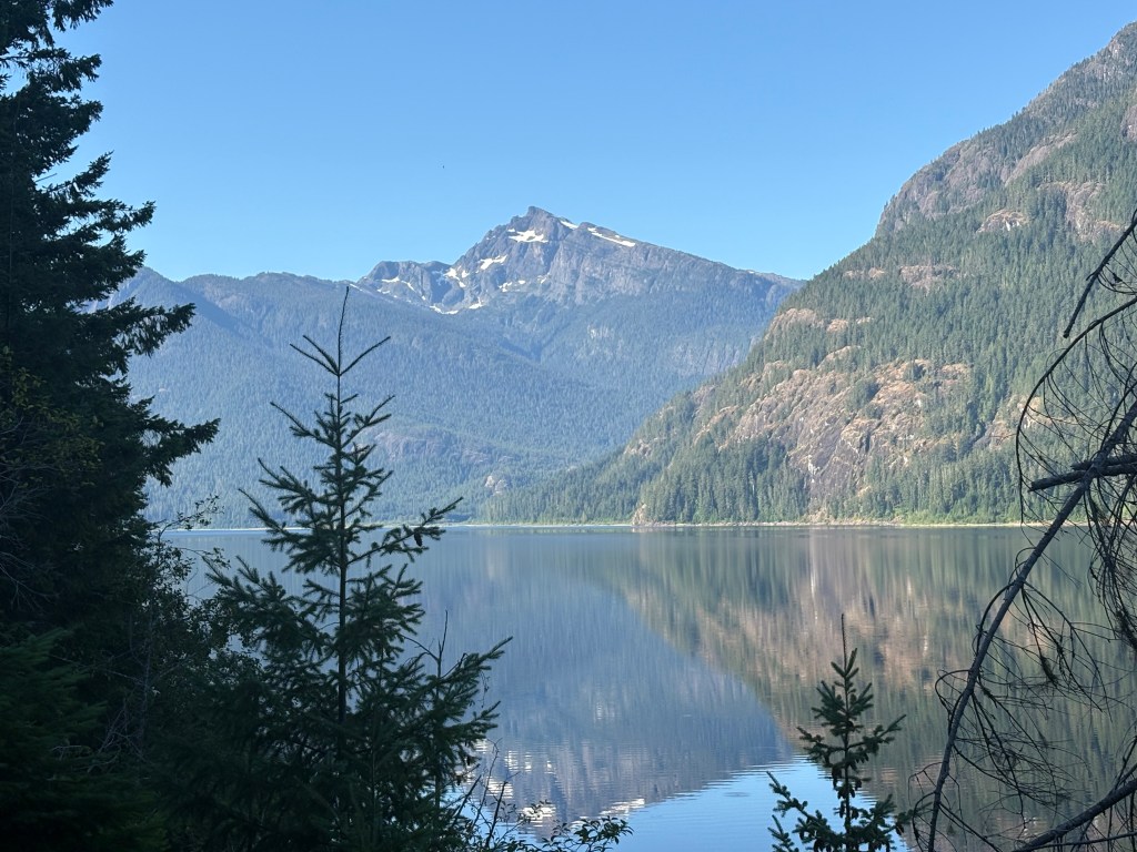
That one I know (thanks to a sign pointing to it). Marble Peak, elevation about 5,800 feet.
The one just to the left of it from my scenic viewpoint is Mt. Phillips, just a few feet shorter:
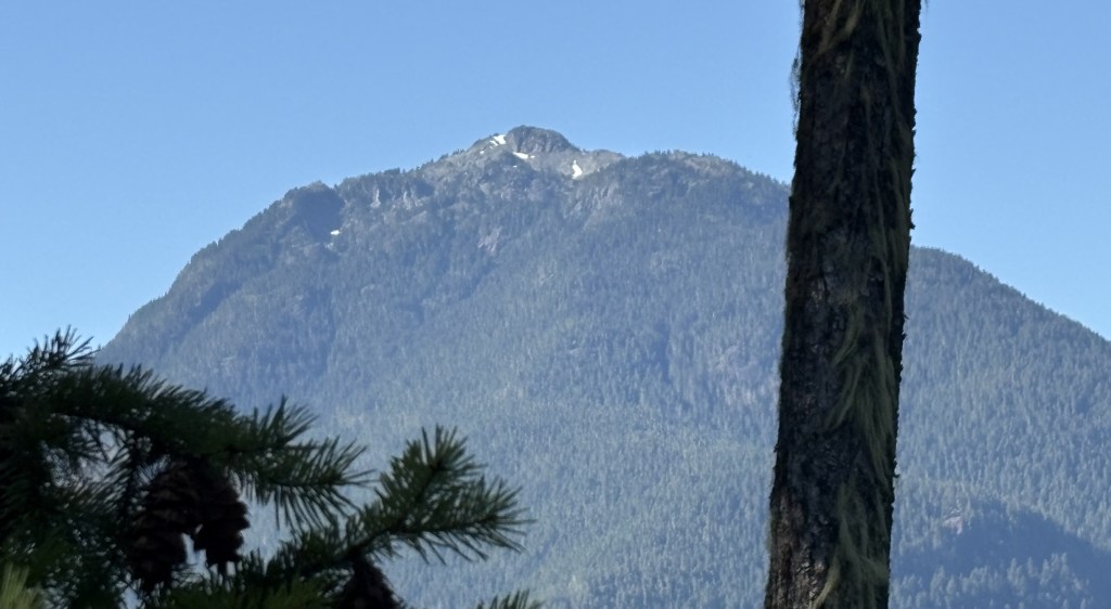
Sorry about the tree. If I had tried to move just a tad to the left there was another obstruction blocking where I could stand.
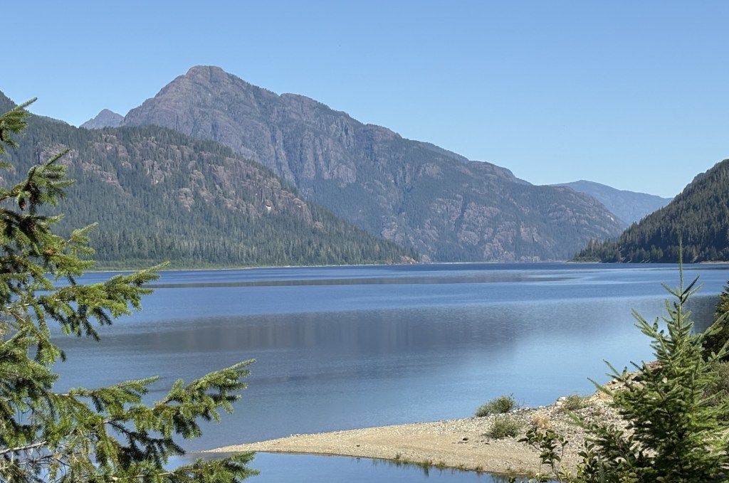


The sign above was located just past Strathcona Park Lodge, a large, modern resort about halfway between Campbell River and Gold River (the towns). Just about every body of water in this post is Upper Campbell Lake, which covers a massive area.
I saw very little traffic as I ascended the mountain but there were lots more vehicles going up as I went back down later in the morning. Had I made it to Gold River its elevation is “only” about 524 feet but the mountains along the way are much higher than that.
FYI – the highest peak on Vancouver Island is Golden Hinde, which tops out at 7,201 feet. Who knows, it might be the mystery mountain with lots of snow on it…