Port Alice

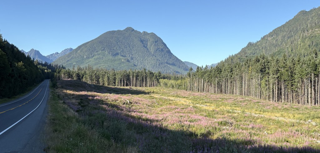
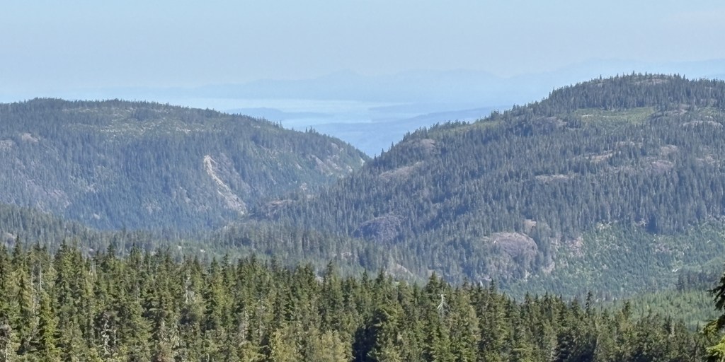
This port is located down another road near Port Hardy. It is a very narrow, winding road and there were lots of logging roads which went off to the sides with big trucks driving very fast and kicking up lots of dust.

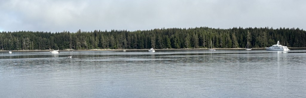
I drove for quite a while and finally arrived at a beautiful spot with lots of pickup trucks and other vehicles which had hauled boats on trailers to the water. I went in the office to ask some questions of the harbourmaster and as I was leaving I said “Thank you, I’m going to go take some photos of your lake”. She immediately responded “It’s the ocean”. Silly JohnBoy, that’s why it’s called a Port.

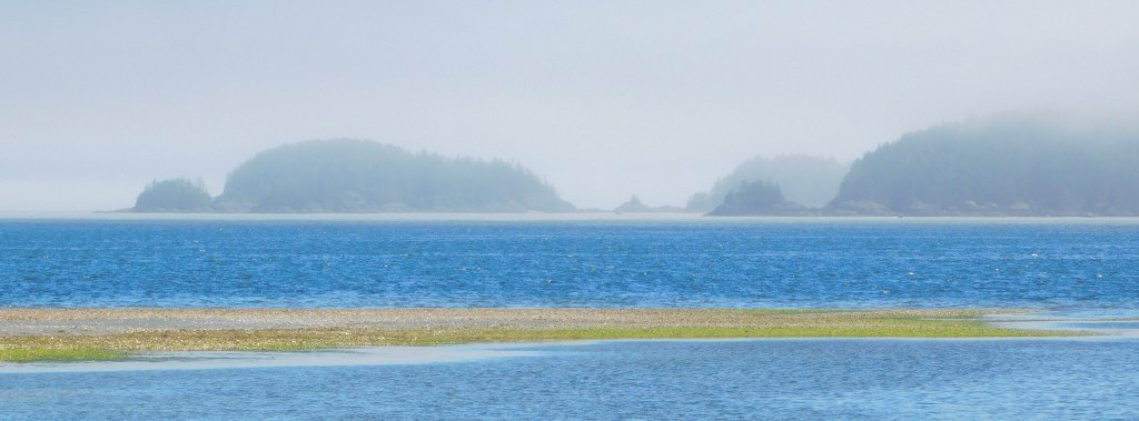
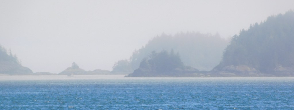
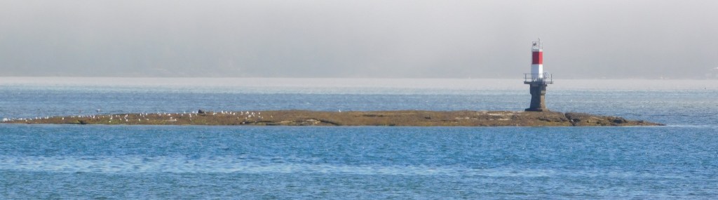
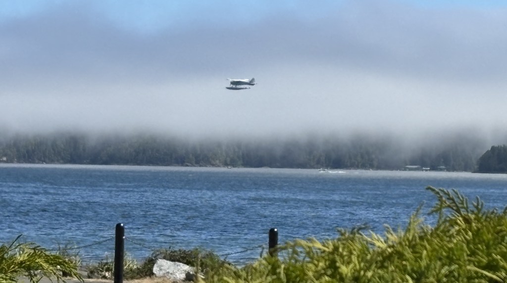
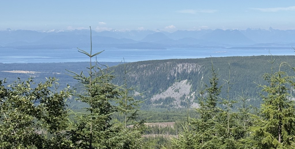
This body of water is the Neroutsos Inlet, named after Captain Cyril Demetrius Neroutsos.

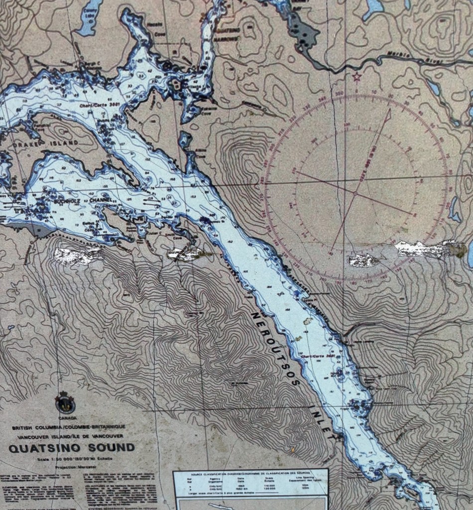
Port Alice is in the lower right quadrant of the map above.

After taking my photos, and forgoing a side trip which the young ladies at the Visitor Center in Port McNeill told me about (on a long gravel and dirt road, too far off the paved road to attempt with all the logging trucks running around, to find the “Devil’s Bath”) I reversed course and headed back to Campbell River.

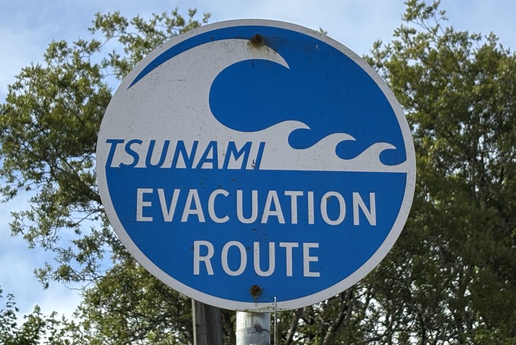
I came across this sign, which I had seen in another location not conducive to stopping to take a photo of it.

It reminded me of the many humorous road signs I saw when I traveled to Canada’s Maritime Provinces in 2019 (see multiple posts). I haven’t seen too many so far this trip but maybe I will when I start getting out into the countryside.


Shortly after I got home I went back out to take a photo of a helicopter I saw at the hospital the day I arrived in town, and saw this ominous cloud in the sky as I drove towards the highway. I knew it looked very different from other clouds in the sky that day.

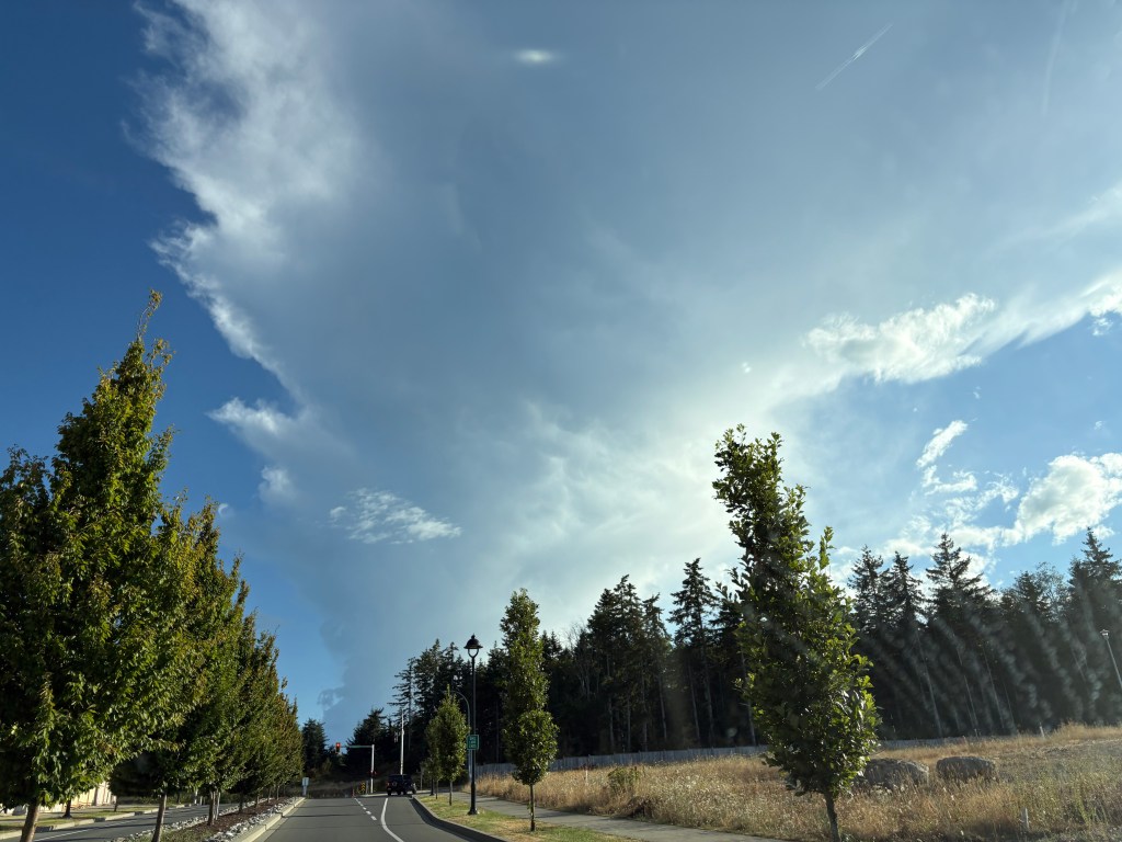
Turns out it was the initial smoke plume from what became the Wesley Ridge Fire, further southeast down the island near Nanaimo. It was discovered around midnight the night before I took this photo and has grown steadily since then. It is near a small lake and many people have been evacuated from their homes. There was no visible smoke when I left early the next morning to drive to Nanaimo to take a ferry over to Vancouver but I could see the smoke at ground level once I got down there and could definitely smell it. Fortunately, no one has been injured fighting it.

Port Hardy

After making a few stops on the way up from Campbell River I arrived in Port Hardy around lunchtime. I bought some fast food at an establishment in town and took it down by the water to enjoy it in a small city park, under a shelter.

There was a pretty heavy marine layer (clouds close to the ground near the water) when I arrived. I could see there were some small islands out there but I waited a while for them to become a little more visible.

After I ate and enjoyed the solitude for a while I was going to start exploring the town. Just before I left to do that I saw a man standing not far from where I was, staring up into a tree. I walked around to take a look and saw this large hawk, hidden in the tree’s branches.

It didn’t take him long to spot me.

I left soon after that and drove around the little town. Not much to see, frankly, but there was a small park with some interesting items in it – like this:

Yes, that’s a 10-foot tall wooden carrot (which is located in Carrot Park). I will explain the significance of it in a moment.

I also saw a seaplane taking off from the water:

I came across this short, squat totem pole with its hand out. Not sure what the significance of that is but I will soon be doing some research on totem poles and hope to find out what the symbolism of the various portrayals are.

There was a nice memorial to soldiers from the town who lost their lives in various conflicts. I thought I had taken a photo of it but don’t see it in either camera.

I spotted this vehicle in town, getting ready to back out of the parking space it was in. Looks like they came prepared to have fun.

So now, the mystery of the carrot:

Remind me of someone in the US who is also referred to by the color that doesn’t rhyme with any other word.

As I was leaving town to head to my next destination I saw this bald eagle way up in the top of a tree by the city street I was on:

Welcome to Port Hardy

Before I got to Port Hardy proper I stopped at this roadside Welcome Station which had a large map of the area.

It also included a rather unusual trinket which I have never before seen used in this manner:

THAT, my friends, is a single blade from a wind turbine. It was placed here by the folks at the local Rotary Club.

The purpose of the blade is to help promote the green energy initiative adopted by the folks in Port Hardy. There is a “windmill farm” west of town which now provides much of the electricity for the area.

To give you a better idea of the size of the blade, which most people only see way up in the air, I moved my car around and parked in front of it:

This particular blade was damaged en route to the windmill farm so the Rotary Club arranged to have it placed here. The blade is 161 feet long and weighs 7.5 tonnes (8.27 US tons). I hope it doesn’t topple over onto my car. That would be quite a tale for my insurance company!

Campbell River to Port Hardy

My last full day on Vancouver Island would take me to the northernmost tip of the island. Port Hardy is 145 miles northwest (the island slants from NW to SE) of my current base of Campbell River, and Google Maps said it would take 2 1/2 hours to get there. My goal when I planned this trip was to drive on ALL the major roads on the island (there aren’t many). Mission accomplished, save for the road out to Tofino which I skipped because of the alleged tsunami threat. There are several small towns along the Strait of Juan de Fuca on that route which are all along the coast, and facing that direction they might have experienced the full force of a tsunami had it held together, so I opted to listen to the authorities and stay inland that day. I will just have to wait and visit Tofino when I come back! From my pre-trip research it sounded like it had some interesting stops.

It was a beautiful morning when I started driving towards Port Hardy. I should have mentioned this earlier but as I have driven northwest from Victoria the entire time I have been on Vancouver Island I’ve encountered more and more mountains, not so much that I had to drive on since most of the main roads skirt both coasts (the exception being the ones I did yesterday, and the road out to Tofino) but every day I seemed to see more, and taller mountains.

Curiously I never saw the tallest mountain on the island, but it was probably obscured by smaller mountains, or trees, adjacent to the roads I was driving on. As I mentioned in an earlier post, it may well have been the mountain with the most snow on it which I could see from many other locations, but for all I know that mountain could have also be on the British Columbian mainland.

Before I got to Port Hardy I saw a sign for Alert Bay, which indicated it was the location of the world’s tallest totem pole, and well as a reference to a killer whale which was lost on me.

When I got to that point on the highway I turned right and drove a short distance to Port McNeill. There I found a small harbour, and there was a small ferry just getting ready to dock.

There were also some boats anchored out in the main waterway.

I’d like the one on the extreme right, please.

There is also a marine research facility out on one of the islands in Alert Bay and this is one of the boats used by their scientists.

As I mentioned, a small ferry which transports vehicles and people to some of the numerous small islands off the coast was just getting ready to dock:

And as I was leaving the dock to head downtown to the Visitor Center I saw this timely sign, given the events of the past few days:

As usual, the young ladies in the Visitor Center were extremely helpful in pointing out various things I could see and do as I continued north to Port Hardy, some of which were on my list but others, not. They also told me that getting out to Alert Bay to see the totem pole was a pleasant, but time consuming task. Yes, a short ferry ride out there, but the big blue sign didn’t mention that in order to get back to Port McNeill one had to ride the ferry to several other islands in the vicinity, and that would take more time than I had today. Add that to the to-do list when I come back.

I bid Port McNeill a fond adieu and drove back to the main road to continue my trek northwest.

Future plans & Mt. Washington, BC

After my morning road trip towards Gold River I returned to Campbell River to speak with someone who works at the Visitor Center but who wasn’t working the day before. She used to live in Stewart, Alaska, which borders northwest British Columbia, so is very knowledgeable about the roads up that way. I initially thought I would fly to Alaska but now I am pondering the long drive up and back. I had spoken with some young people near the original Starbucks when I was in Seattle and they had just driven down from Alaska via the southern edge of the Yukon Province and then south all the way through British Columbia!

The young lady at the Visitor Center gave me some great ideas on places to stop to see some unique scenery and wildlife, making an already long drive even longer, but hey, I’ve come this far…

I am still reviewing how and when I will get to Alaska, depending largely on exactly how long I am in Canada. I just read today that authorities are keeping an eye on a possible volcanic eruption due west (not very far by Alaska standards) of Anchorage AK, perhaps triggered by the rash of recent earthquakes, so that gives me one more thing to keep track of…


After speaking with her I had lunch in town, then headed to my next stop – Mount Washington Alpine Resort ski area. My Airbnb host was working there today (he is retired but helps out at the ski area a few days a week). I thought I would surprise him by showing up at the chair lift he was operating. I stopped for gas in Courtenay, then headed for the mountain.

Mt Washington Alpine Resort has year-round activities and there were a fair number of people up there. I chatted briefly with my host but he was working so I let him get back to it. I wandered around and took some photos, then headed back to Campbell River as I would have an even longer driving day tomorrow before taking a ferry from Nanaimo to Vancouver the day after.

Here are some of the things I saw up on Mt. Washington. The base elevation there is 3,558 feet so there were some pretty good views looking back towards Discovery Passage near Campbell River, and south towards Nanaimo. They get an average of 38 feet of snow each winter, which apparently is a pretty big deal and draws lots of skiers.

One of the more popular attractions during the summer is an extensive series of bike trails (bicycle, not motor bike). There was a canopy set up and a young man seemed to have his hands full with repairs on tires and such. Here are two lists of bike trails and the experience level needed to ride each.

I kind of dropped the ball on this one, folks. I didn’t realize at the time how big of a role the Bike Park had so the photos above weren’t straight on shots and I didn’t even take a photo of the canopy or ongoing bike repairs.

Here are some of the other activities available to folks at the resort:

Zip line training, to hone your skills before going big time much further off the ground. At the center of the photos is a kid kind of dangling from the zip line, and others with their helmets on waiting their turn.

A Water Tube, which didn’t seem to be in use the day I was there. I threw in a panorama shots while I was at it. And don’t forget, you can right click on any photos I took to save them to your computer. Then open them up on the biggest screen available. This is especially true with panorama shots.

I drove down to the Nordic Center on the advice of my Airbnb host but they were having a private event and the sign asked people to be respectful and not even proceed past it, so I left. There were lots of vehicles so it must have been a pretty big deal, whatever it was.

I went back to main lodge and took some photos of the views. This was the main road going in (which they are in the process of repaving)

This is looking towards Campbell River, I believe. The water you see in these photos is the Strait of Georgia, which separates Vancouver Island from the British Columbian mainland (and narrows to become Discovery Passage up near Campbell River):

And this is looking further south, towards Courtenay and Nanaimo: