Let’s see, where was I ? Oh yes, the ferry had just taken me to the north side of Vancouver. It was late morning and I wanted to get around the city before traffic increased so I just got on the Trans Canada Highway and headed east towards the suburb on the east side where my Airbnb for 4 nights was reserved.
The suburb is called Surrey and on the maps it looked like a nice area and close to public transportation. When I mentioned to my Airbnb hosts in Campbell River that I was lucky to be able to snag a spot on an early morning ferry at the last minute because I needed to get to Surrey to find my Airbnb, my hostess exclaimed “Oh no, you don’t want to stay in Surrey!!” Evidently Surrey has a very bad reputation for gang violence, among other unsavory things. Before I went to bed I reread the listing and reviews that the family had. The photo looked very nice – a new house on a nice residential street. The reviews were all favorable about how charming the family that lived there was and how the mother often included the Airbnb guests in family meals. No mention of gangs or cars being vandalized or broken into. I decided to wait and have a look for myself before jumping to conclusions.
I first stopped at the Visitor Centre in Surrey. Well, I went to where Google Maps said it was. A business complex in which I had to pay to park. I have never had to pay to park at a visitor center!!
I went in the lobby and didn’t see the Visitor Centre listed in Suite 100. I called the number in the Google listing and a man answered, saying simply “hello?”. I asked if this was the Visitor Centre and he replied, “yes, that is the number you called”. I asked “Where are you? I am standing in the lobby of the building you are supposed to be in”. He said “Oh, we closed that location and now everything is virtual”. I asked “How am I supposed to get maps of the area?” He paused, like I was speaking Martian, and said “Maps?” I said “Yes, maps! I am a VISITOR that JUST ARRIVED IN TOWN and I need MAPS to show me where the various things I want to do are so I can organize my days here”. He hung up on me.
So I went back to my car and drove to where my Airbnb was, after having wasted at least 45 minutes going out of my way.
I found the house in a rather scruffy neighborhood and it looked NOTHING LIKE the photos in the listing. Oh, it was the same house, but it was clearly much older than when the photo was taken and the yard and shrubs in the front yard were WAY overgrown and untrimmed. The neighborhood looked sketchy and I was uncomfortable being there. So I left, drove to a safe location, cancelled the reservation and sent a message to the host explaining why I had done so.
I got on Airbnb and after some searching, and being turned down by the first host I sent a request to, found a very nice place in a suburb even further east, called Maple Ridge. I was much happier there and don’t regret my choice one iota.
I rely very heavily on guest reviews, and maybe I’m too uppity, but I can’t believe so many people stayed there and never mentioned the condition of the house or the neighborhood. The family may have been very nice, but….
It was almost 6 by the time I got settled in the new place and I just stayed put and went to bed early. And my host there also knew of the reputation Surrey has.
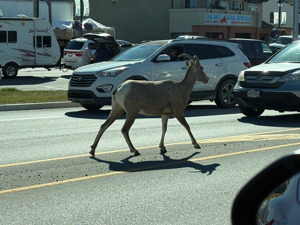
I can now confirm what most of you already knew – that bighorn sheep DO, in fact, exist.
Despite the warning signs I have seen in lots of places over the years, I’ve just been looking in the wrong place.
About 1030 this morning I saw four, young, bighorn sheep walking calmly down both the north and southbound lanes of British Columbia Highway 95, smack dab in the middle of a little town called Radium Hot Springs!
Of the three lead lambs, the head of the flock started walking right down the middle of the southbound slow lane, while the next two lined up right on the white line separating the fast and slow lanes. I followed them in that configuration for about a quarter mile.
After I had s l o w l y passed the fourth one in line (the single one, in the first two photos) I lost track of it, but I later saw that it was still bringing up the tail end of the line.
They were in no big hurry and seemed completely oblivious to the vehicles on the road and people taking photos.
Naming conventions for bighorn sheep: Ram, Ewe, Lamb, Flock or Drove
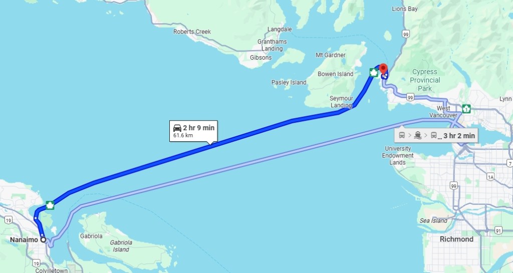
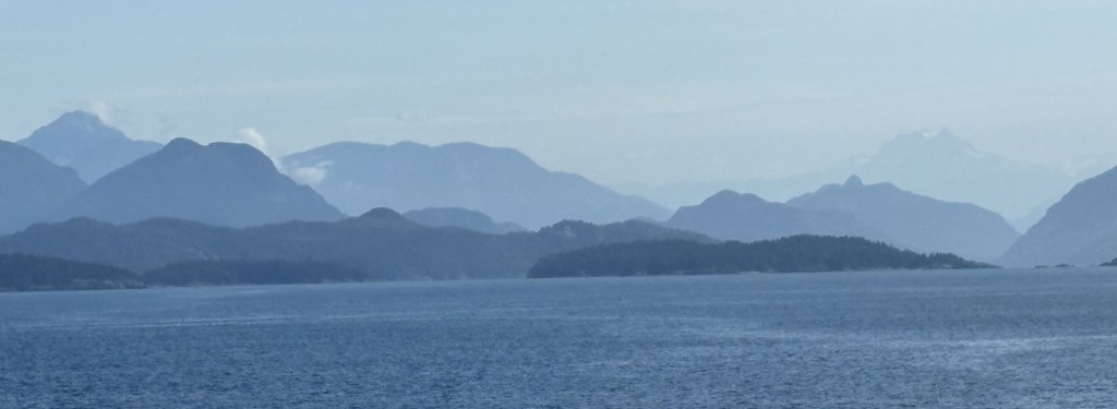
Since I was staying in Campbell River on Vancouver Island the last three days, I cancelled the ferry I had reserved from Victoria to the mainland (I’m not really sure why I booked that one anyway…) and got a reservation on another ferry from Nanaimo to Horseshoe Bay, a few miles north of Vancouver.
(Photo credit: Screensave of Google Maps image)
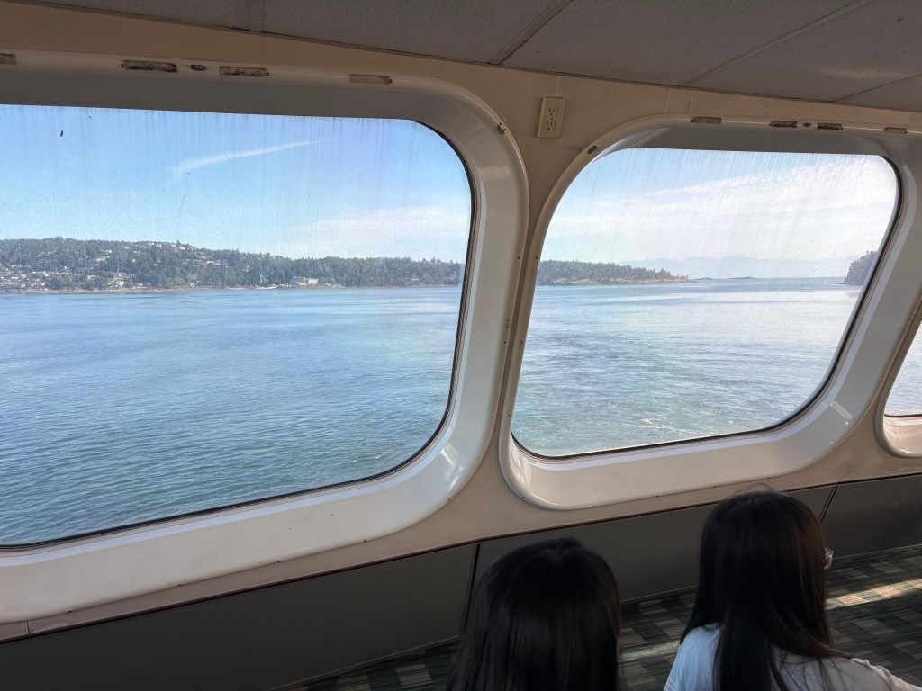
Ignore the light blue line. And ignore the fact that it is showing travel by car. Of course my car was stowed several decks below me, but I was initially in the top indoor level of the ship with comfortable seats, tables and a cafeteria, and later went up to the outdoor viewing deck where there were some not-as-comfortable seats and tables in a semi-enclosed area with windows but I opted to walk around (in the cold and WIND) to take some photos. I had dressed appropriately knowing it would be quite nippy outside, but still had to forego trying to wear any kind of hat.
These photos were all taken using my smartphone. I took lots of photos with my digital camera and zoom lens but they are not blogworthy. Between the wind and trying to stabilize myself to take the shots, those photos are all blurry.
First, a view out of the window as we set sail out of Nanaimo:
Once we were out on the open water there wasn’t much to see until we started to approach the mainland. My Airbnb hosts in Campbell River told me I might see whales but I never saw any people onboard react as if there had been sightings and my experience has been that even if we did, it would be hard to anticipate the event and zoom in enough to get a decent shot. So I just enjoyed the ride.
I realize there will be lots of repetition in these photos but there were such interesting land masses (little islands closest and the mainland in the background) I wanted to capture the wide variety of things I was seeing.
I was surprised I was able to get a good panorama shot given the wind and movement of the ship:
These are as we were getting closer to the mainland and some of the land masses were a tad clearer. I am convinced that in and around Vancouver itself the haze is due to smog. Not sure where the smoke from the wildfires in Alaska goes but it may be contributing to this as well. Either way it’s a shame, as these views would be even more spectacular if they were clear. Sadly, such is the case in most places these days…
I decided that if there was some calamity which befell the ship, this was MY life raft:
We were getting closer to our arrival terminal and were also getting a better look at downtown Vancouver, or as they call it up here (for any sizeable town), City Centre.
And as we were getting closer to land we started to see other small ships out on the water.
This was a very pleasant experience and was the start of what would become a very unusual day.
Two weeks in Canada and I have already seen so many amazing places. And I still have 6 weeks to go! I am going to wait a few more days to decide for sure but I believe I will be shortening some planned stops in Saskatchewan, and taking others off the to-do list completely, due to air quality from wildfire smoke in that province. I check the numbers every day, and they do fluctuate, but if they are anything other than low risk to my health I will probably pass.
The good news is that it will give me more time to revisit southwest British Columbia to do more things and revisit some of the places I’ve already been to. I didn’t budget enough time initially so now I’ll get another bite at the apple.
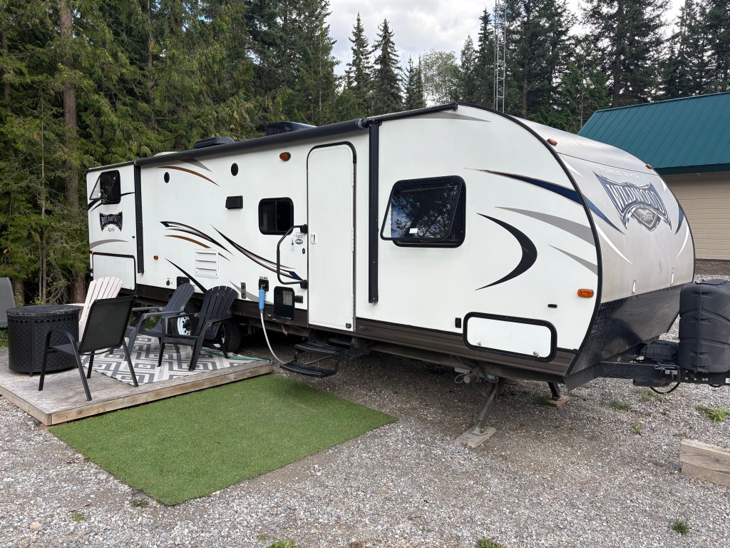
As I write this I am in Golden, BC, sitting at 3,303.33 feet elevation in the kitchen/dining area of the travel camper I am staying in for 6 nights.
I am near the base of a mountain north of Golden but it only takes me a few minutes to get down to the highway. The property is at the end of a dead-end road so it is remote and extremely quiet. The only thing I would change about it would be to put a huge net over it to keep the mosquitoes out! Not much my Airbnb host can do about that…
My first impressions of western Canada are all positive, mosquitoes notwithstanding. This is my first encounter with the pesky little insects this trip, but while I am out and about they really haven’t been a problem until this particular location.
People drive pretty fast in Canada, except people in RV’s who insist on driving the exact speed limit (or slower on inclines) and invariably have long queues behind them until they get to a passing zone. Can’t fault them for obeying the speed limit, though. Cities and towns have speed limits of 30, 40 or 50 km/h and the highways are generally 60 (in places with lots of curves), 80, 90 or 100 km/h, and the wide open road is often 110km/h. In National Parks the speed limit is never higher than 90 km/h, and in areas where people stop for viewpoints or to cross the road, much slower.
30km/h equates to 18.6 mph, 40 = 24.8, 50 = 31.1, 60 = 37.3, 70 = 43.5, 80 = 49.7, 90 = 55.9, 100 = 62.1, and top speed of 110 = 68.4 mph
So slower overall than we are used to in the US. I generally set my cruise control to around 5 or 6 km/h over the current limit and that keeps me pretty much in the regular flow of traffic. I finally switched my speedometer to metric because the conversions were driving me crazy. I had a cheat-sheet in my other car when I went to eastern Canada in 2019.
The roads have been in excellent condition, save for one I drove on my first day in-country which made me almost seasick. Fortunately that was the exception, not the rule. They may get a little worse the further north I go but I’ll just have to wait and see.
Drivers are very polite and there doesn’t seem to be any road rage up here.
The weather has been fantastic. The days often require only a t-shirt and shorts but the mornings and evenings cool down quite a bit so I may start and end the day with long pants and a sweatshirt, or at least a long-sleeved t-shirt. Now that I’m in the Canadian Rockies I wear long pants all the time but have layers for my upper body. Yesterday I was up at 6,300 feet elevation but mid-day it was very pleasant.
Thus far I have only traveled through the southern part of British Columbia, and now in Golden. I will be spending a few days in Alberta province starting in three days when I go down to Banff for 4 nights, and Calgary for one or two. I will then head further east to western Saskatchewan province, though as I mentioned above, some of those stops will likely be shortened or eliminated.
British Columbia badly needs rain but the Canadian Rockies have had a good bit so far this summer. East of the Rockies has also been dry, which is why they are having so many wildfires.
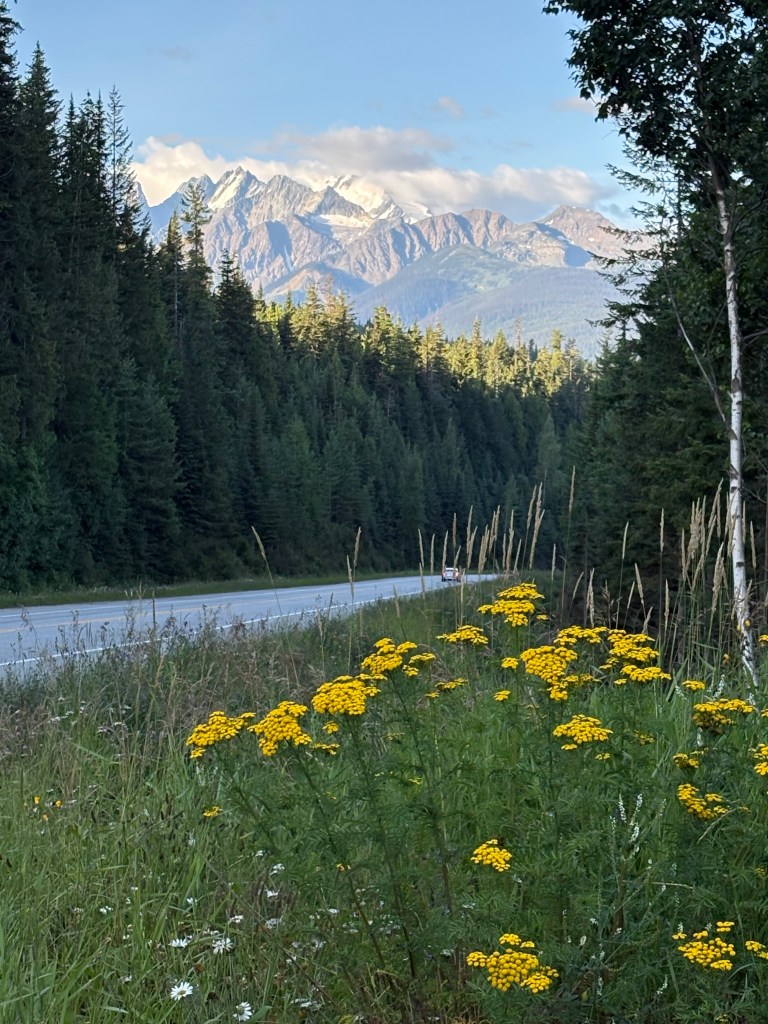
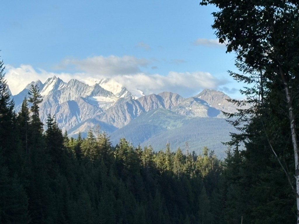
The scenery has been stunning. I am going to run out of superlatives to describe it. While planning this trip I noticed that the Canadian Rockies “weren’t that tall”. The highest points in the British Columbia and Alberta provinces are “only” 12,972 and 12,294 feet respectively. Colorado alone has 58 mountains taller than 14,000 feet. Well, now that I am here and looking at them with my own two eyes, I can say that the mountains in the Canadian Rockies, and elsewhere in western Canada that I have been to so far, are VERY IMPRESSIVE and many of them are unlike mountains I have seen elsewhere. I’ve taken lots of photos in the 6 National Parks I have been to, all within 4 hours of where I am now staying. I am staying “home” today to do laundry, wash my car, and download and review the photos I have taken the last few days and prep them for making additional posts.
Here is a tease of a Park I drove through yesterday:
Lots more where that came from, I assure you.
I haven’t seen nearly as many critters in these first two weeks as I expected to. I am always vigilant, especially when I am driving, and try to always have my digital camera within easy reach. I’ve only seen one black bear, a cub which ran across the road well ahead of me while I was in northeast Vancouver Island. I neglected to mention that in the post for that day. I saw a white-tail deer here in Golden, as I was driving down to the highway yesterday morning. It ran alongside the road to my left for a short distance and then stopped. I saw a moose cow (adult female) grazing just off the small road I was taking to get to a popular resort near Jasper, BC two days ago. I saw a herd of elk (thank you to my brother Steve for correcting me when I called them moose). I hadn’t looked at the photos on my computer yet and as you will see when I post the photos from Jasper they were all laying down and resting in a burnt-out wooded area just off a major highway, and just outside of town, so it wasn’t obvious exactly what they were. I have photos of a few birds of prey I have seen in various places. I am going to a Wolf Center just outside of Golden later this afternoon but that won’t count since they are in captivity.
I see warning signs for lots of things – deer, elk, bear (black and grizzly), moose, bison, mountain goats, and bighorn sheep (I still think they’re extinct – I have never had a confirmed sighting in all my travels in the US and now Canada). And yesterday I saw signs warning of frogs and salamanders on the road in a National Park west of here! I hope they’re not big enough to damage my car!!
No lions or tigers but they may be in Saskatchewan. I’ve heard they’re a pretty tough bunch over there…
I’ve driven just under 2,800 miles from when I crossed into Canada back on July 27 to last night when I filled my tank here in Golden. Gas prices are relatively high in Washington State and here in British Columbia. I expect them to drop in Alberta (once I get past Banff) and Saskatchewan provinces.
One thing I really like about traveling up here is that there are warning signs when you are about to go a considerable distance with no gas stations along the way. And there is no cell phone service across vast areas. Some days I go almost the whole day with no cell service. Verizon does make satellite texting for emergencies available when there is no cell service. If I start the day using Google Maps guidance on my smartphone for a specific destination it will work for quite a while but eventually stops if I’ve had no cell service for an extended period. This is why, for years, I’ve had a stand-alone GPS unit in my car. Even my new-to-me car doesn’t have a navigation system or GPS built in. Google Maps doesn’t always work.
I haven’t experienced any really bad crowds yet, but then I didn’t go into Vancouver or to a popular Garden destination in Victoria which probably would have been packed with people. The National Parks are so big it is fairly easy to get around within them, though at some of the popular stopping points the parking lots fill up pretty quickly, same as they do in the US. I do expect the city of Banff to be crowded, and I don’t know yet how many of the areas within the Park itself I can drive to. Jasper and Banff National Parks are both enormous, though some portions of Jasper are still closed due to the devastating wildfire they had last summer. I will give more specifics when I start posting photos from with each Park.
I was delighted to hear upon my arrival at the first National Park, where I planned to buy my senior annual pass, like I had in eastern Canada, that admission to all Canadian National Parks is free until September 2. Yay!
I feel like I’m forgetting something but when I think of it I’ll add it to another post.
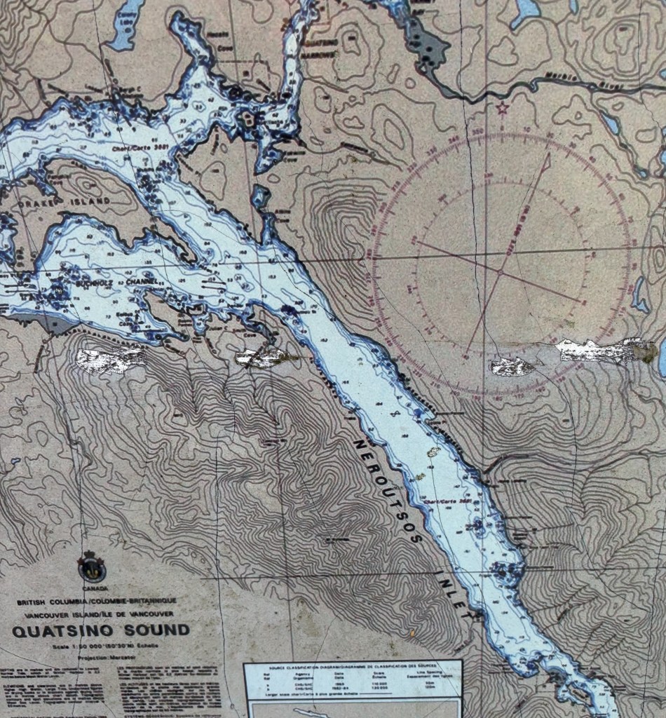
This port is located down another road near Port Hardy. It is a very narrow, winding road and there were lots of logging roads which went off to the sides with big trucks driving very fast and kicking up lots of dust.
I drove for quite a while and finally arrived at a beautiful spot with lots of pickup trucks and other vehicles which had hauled boats on trailers to the water. I went in the office to ask some questions of the harbourmaster and as I was leaving I said “Thank you, I’m going to go take some photos of your lake”. She immediately responded “It’s the ocean”. Silly JohnBoy, that’s why it’s called a Port.
This body of water is the Neroutsos Inlet, named after Captain Cyril Demetrius Neroutsos.
Port Alice is in the lower right quadrant of the map above.
After taking my photos, and forgoing a side trip which the young ladies at the Visitor Center in Port McNeill told me about (on a long gravel and dirt road, too far off the paved road to attempt with all the logging trucks running around, to find the “Devil’s Bath”) I reversed course and headed back to Campbell River.
I came across this sign, which I had seen in another location not conducive to stopping to take a photo of it.
It reminded me of the many humorous road signs I saw when I traveled to Canada’s Maritime Provinces in 2019 (see multiple posts). I haven’t seen too many so far this trip but maybe I will when I start getting out into the countryside.
Shortly after I got home I went back out to take a photo of a helicopter I saw at the hospital the day I arrived in town, and saw this ominous cloud in the sky as I drove towards the highway. I knew it looked very different from other clouds in the sky that day.
Turns out it was the initial smoke plume from what became the Wesley Ridge Fire, further southeast down the island near Nanaimo. It was discovered around midnight the night before I took this photo and has grown steadily since then. It is near a small lake and many people have been evacuated from their homes. There was no visible smoke when I left early the next morning to drive to Nanaimo to take a ferry over to Vancouver but I could see the smoke at ground level once I got down there and could definitely smell it. Fortunately, no one has been injured fighting it.
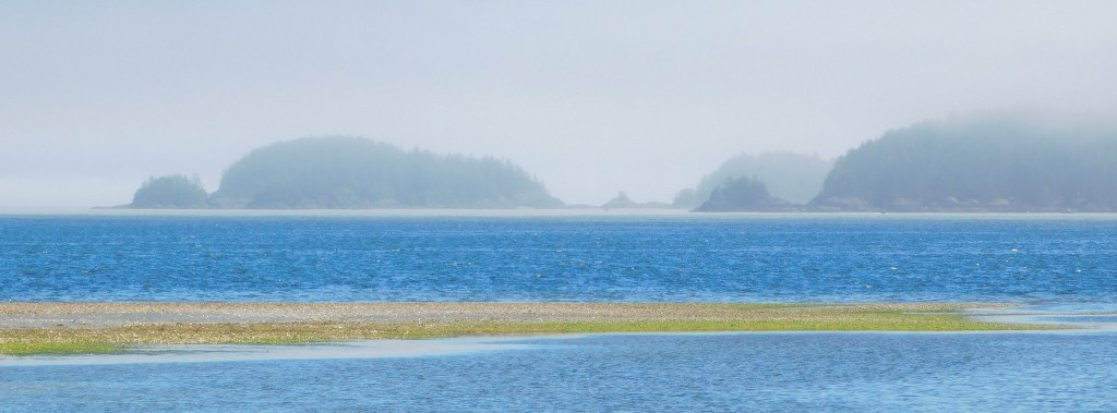
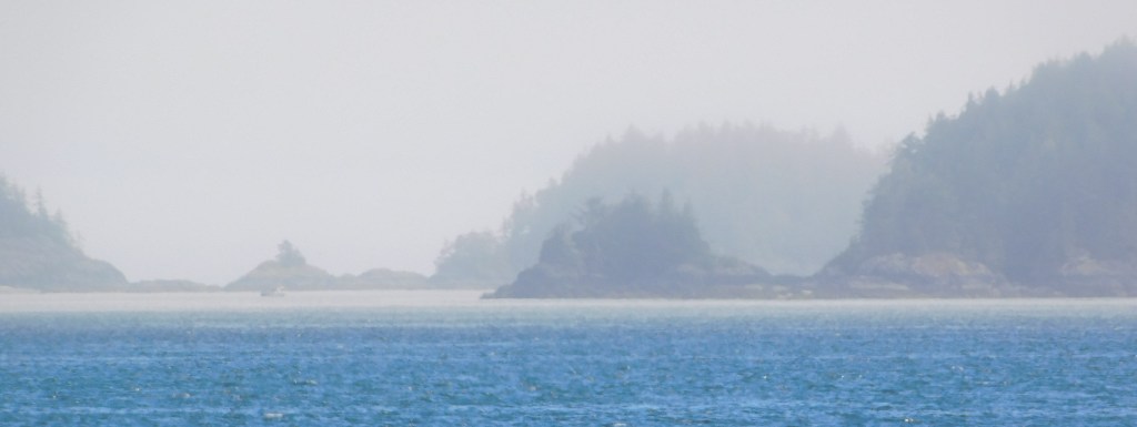
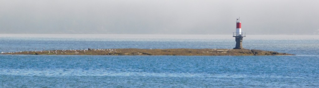
After making a few stops on the way up from Campbell River I arrived in Port Hardy around lunchtime. I bought some fast food at an establishment in town and took it down by the water to enjoy it in a small city park, under a shelter.
There was a pretty heavy marine layer (clouds close to the ground near the water) when I arrived. I could see there were some small islands out there but I waited a while for them to become a little more visible.
After I ate and enjoyed the solitude for a while I was going to start exploring the town. Just before I left to do that I saw a man standing not far from where I was, staring up into a tree. I walked around to take a look and saw this large hawk, hidden in the tree’s branches.
It didn’t take him long to spot me.
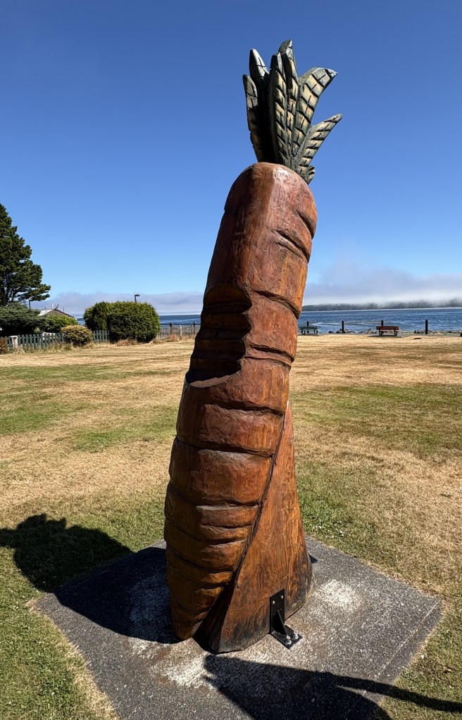
I left soon after that and drove around the little town. Not much to see, frankly, but there was a small park with some interesting items in it – like this:
Yes, that’s a 10-foot tall wooden carrot (which is located in Carrot Park). I will explain the significance of it in a moment.
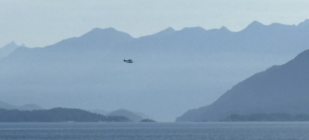
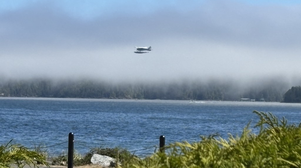
I also saw a seaplane taking off from the water:
I came across this short, squat totem pole with its hand out. Not sure what the significance of that is but I will soon be doing some research on totem poles and hope to find out what the symbolism of the various portrayals are.
There was a nice memorial to soldiers from the town who lost their lives in various conflicts. I thought I had taken a photo of it but don’t see it in either camera.
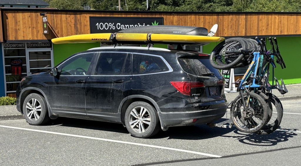
I spotted this vehicle in town, getting ready to back out of the parking space it was in. Looks like they came prepared to have fun.
So now, the mystery of the carrot:
Remind me of someone in the US who is also referred to by the color that doesn’t rhyme with any other word.
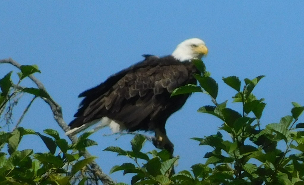
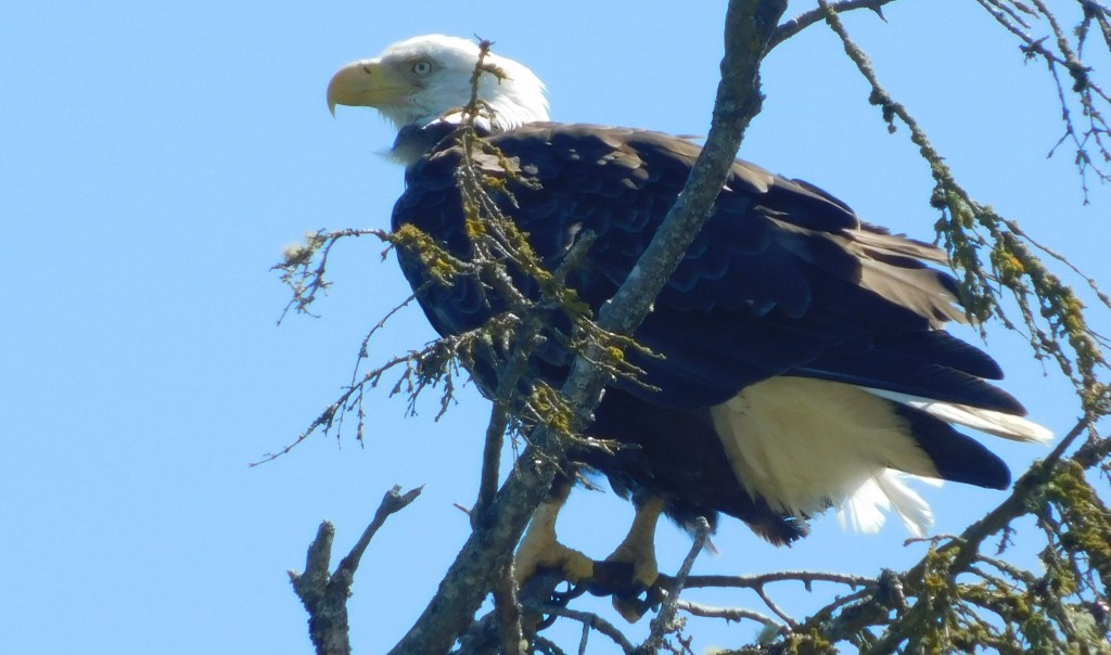
As I was leaving town to head to my next destination I saw this bald eagle way up in the top of a tree by the city street I was on:
Before I got to Port Hardy proper I stopped at this roadside Welcome Station which had a large map of the area.
It also included a rather unusual trinket which I have never before seen used in this manner:
THAT, my friends, is a single blade from a wind turbine. It was placed here by the folks at the local Rotary Club.
The purpose of the blade is to help promote the green energy initiative adopted by the folks in Port Hardy. There is a “windmill farm” west of town which now provides much of the electricity for the area.
To give you a better idea of the size of the blade, which most people only see way up in the air, I moved my car around and parked in front of it:
This particular blade was damaged en route to the windmill farm so the Rotary Club arranged to have it placed here. The blade is 161 feet long and weighs 7.5 tonnes (8.27 US tons). I hope it doesn’t topple over onto my car. That would be quite a tale for my insurance company!
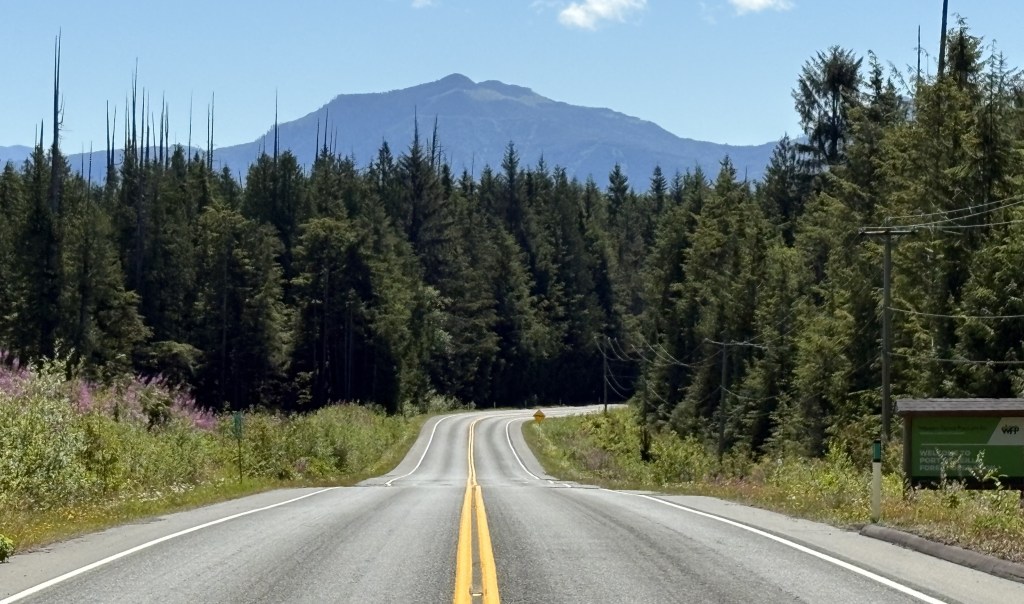
My last full day on Vancouver Island would take me to the northernmost tip of the island. Port Hardy is 145 miles northwest (the island slants from NW to SE) of my current base of Campbell River, and Google Maps said it would take 2 1/2 hours to get there. My goal when I planned this trip was to drive on ALL the major roads on the island (there aren’t many). Mission accomplished, save for the road out to Tofino which I skipped because of the alleged tsunami threat. There are several small towns along the Strait of Juan de Fuca on that route which are all along the coast, and facing that direction they might have experienced the full force of a tsunami had it held together, so I opted to listen to the authorities and stay inland that day. I will just have to wait and visit Tofino when I come back! From my pre-trip research it sounded like it had some interesting stops.
It was a beautiful morning when I started driving towards Port Hardy. I should have mentioned this earlier but as I have driven northwest from Victoria the entire time I have been on Vancouver Island I’ve encountered more and more mountains, not so much that I had to drive on since most of the main roads skirt both coasts (the exception being the ones I did yesterday, and the road out to Tofino) but every day I seemed to see more, and taller mountains.
Curiously I never saw the tallest mountain on the island, but it was probably obscured by smaller mountains, or trees, adjacent to the roads I was driving on. As I mentioned in an earlier post, it may well have been the mountain with the most snow on it which I could see from many other locations, but for all I know that mountain could have also be on the British Columbian mainland.
Before I got to Port Hardy I saw a sign for Alert Bay, which indicated it was the location of the world’s tallest totem pole, and well as a reference to a killer whale which was lost on me.
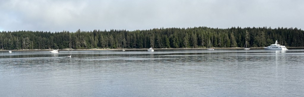
When I got to that point on the highway I turned right and drove a short distance to Port McNeill. There I found a small harbour, and there was a small ferry just getting ready to dock.
There were also some boats anchored out in the main waterway.
I’d like the one on the extreme right, please.
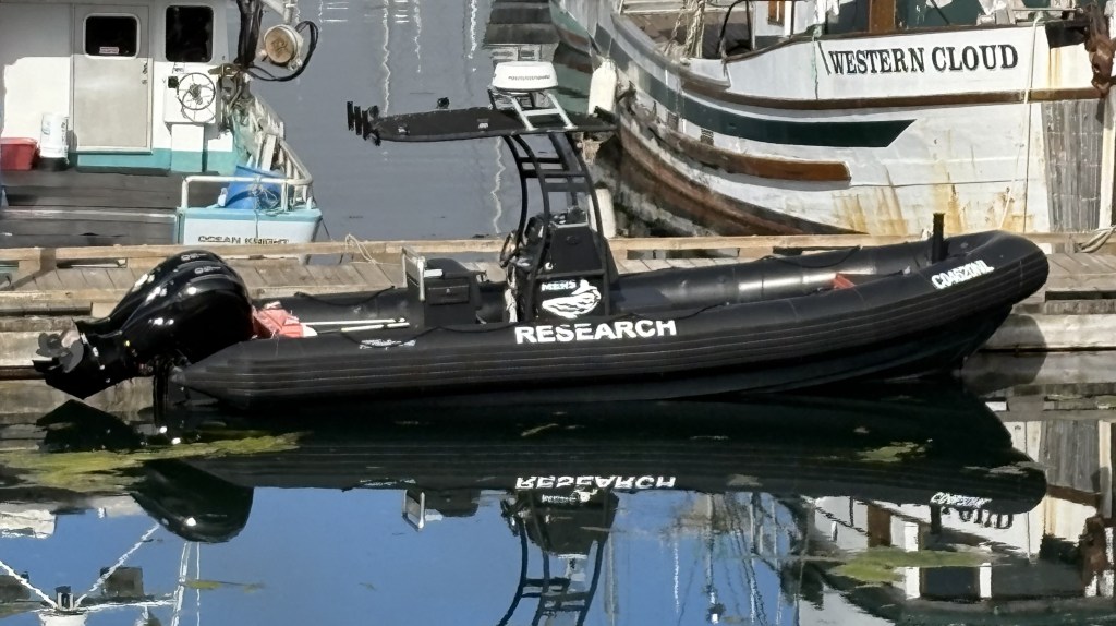
There is also a marine research facility out on one of the islands in Alert Bay and this is one of the boats used by their scientists.
As I mentioned, a small ferry which transports vehicles and people to some of the numerous small islands off the coast was just getting ready to dock:
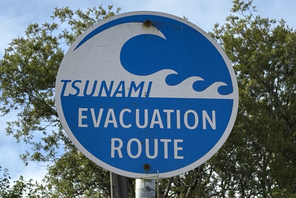
And as I was leaving the dock to head downtown to the Visitor Center I saw this timely sign, given the events of the past few days:
As usual, the young ladies in the Visitor Center were extremely helpful in pointing out various things I could see and do as I continued north to Port Hardy, some of which were on my list but others, not. They also told me that getting out to Alert Bay to see the totem pole was a pleasant, but time consuming task. Yes, a short ferry ride out there, but the big blue sign didn’t mention that in order to get back to Port McNeill one had to ride the ferry to several other islands in the vicinity, and that would take more time than I had today. Add that to the to-do list when I come back.
I bid Port McNeill a fond adieu and drove back to the main road to continue my trek northwest.
After my morning road trip towards Gold River I returned to Campbell River to speak with someone who works at the Visitor Center but who wasn’t working the day before. She used to live in Stewart, Alaska, which borders northwest British Columbia, so is very knowledgeable about the roads up that way. I initially thought I would fly to Alaska but now I am pondering the long drive up and back. I had spoken with some young people near the original Starbucks when I was in Seattle and they had just driven down from Alaska via the southern edge of the Yukon Province and then south all the way through British Columbia!
The young lady at the Visitor Center gave me some great ideas on places to stop to see some unique scenery and wildlife, making an already long drive even longer, but hey, I’ve come this far…
I am still reviewing how and when I will get to Alaska, depending largely on exactly how long I am in Canada. I just read today that authorities are keeping an eye on a possible volcanic eruption due west (not very far by Alaska standards) of Anchorage AK, perhaps triggered by the rash of recent earthquakes, so that gives me one more thing to keep track of…
After speaking with her I had lunch in town, then headed to my next stop – Mount Washington Alpine Resort ski area. My Airbnb host was working there today (he is retired but helps out at the ski area a few days a week). I thought I would surprise him by showing up at the chair lift he was operating. I stopped for gas in Courtenay, then headed for the mountain.
Mt Washington Alpine Resort has year-round activities and there were a fair number of people up there. I chatted briefly with my host but he was working so I let him get back to it. I wandered around and took some photos, then headed back to Campbell River as I would have an even longer driving day tomorrow before taking a ferry from Nanaimo to Vancouver the day after.
Here are some of the things I saw up on Mt. Washington. The base elevation there is 3,558 feet so there were some pretty good views looking back towards Discovery Passage near Campbell River, and south towards Nanaimo. They get an average of 38 feet of snow each winter, which apparently is a pretty big deal and draws lots of skiers.
One of the more popular attractions during the summer is an extensive series of bike trails (bicycle, not motor bike). There was a canopy set up and a young man seemed to have his hands full with repairs on tires and such. Here are two lists of bike trails and the experience level needed to ride each.
I kind of dropped the ball on this one, folks. I didn’t realize at the time how big of a role the Bike Park had so the photos above weren’t straight on shots and I didn’t even take a photo of the canopy or ongoing bike repairs.
Here are some of the other activities available to folks at the resort:
Zip line training, to hone your skills before going big time much further off the ground. At the center of the photos is a kid kind of dangling from the zip line, and others with their helmets on waiting their turn.
A Water Tube, which didn’t seem to be in use the day I was there. I threw in a panorama shots while I was at it. And don’t forget, you can right click on any photos I took to save them to your computer. Then open them up on the biggest screen available. This is especially true with panorama shots.
I drove down to the Nordic Center on the advice of my Airbnb host but they were having a private event and the sign asked people to be respectful and not even proceed past it, so I left. There were lots of vehicles so it must have been a pretty big deal, whatever it was.
I went back to main lodge and took some photos of the views. This was the main road going in (which they are in the process of repaving)
This is looking towards Campbell River, I believe. The water you see in these photos is the Strait of Georgia, which separates Vancouver Island from the British Columbian mainland (and narrows to become Discovery Passage up near Campbell River):
And this is looking further south, towards Courtenay and Nanaimo:
I was originally planning a much longer drive on my first full day based in Campbell River but with the tsunami warning issued after the big earthquake in Russia the night before I decided not to go near the ocean. Authorities were still warning British Columbians to stay away from the coast, although those warnings were lifted after I was already on the road.
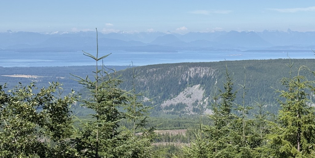
I chose another route which would take me about as far from the ocean as I could get. I took Route 28 out of Campbell River and headed west, up towards Gold River. It’s only about 55 miles but Google Maps said it would take about an hour and 15 minutes, though with all my stops to take photos it took a lot longer than that. I even turned around before I got to Gold River as I had other places I wanted to go as well.
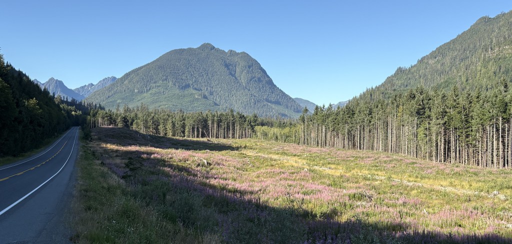
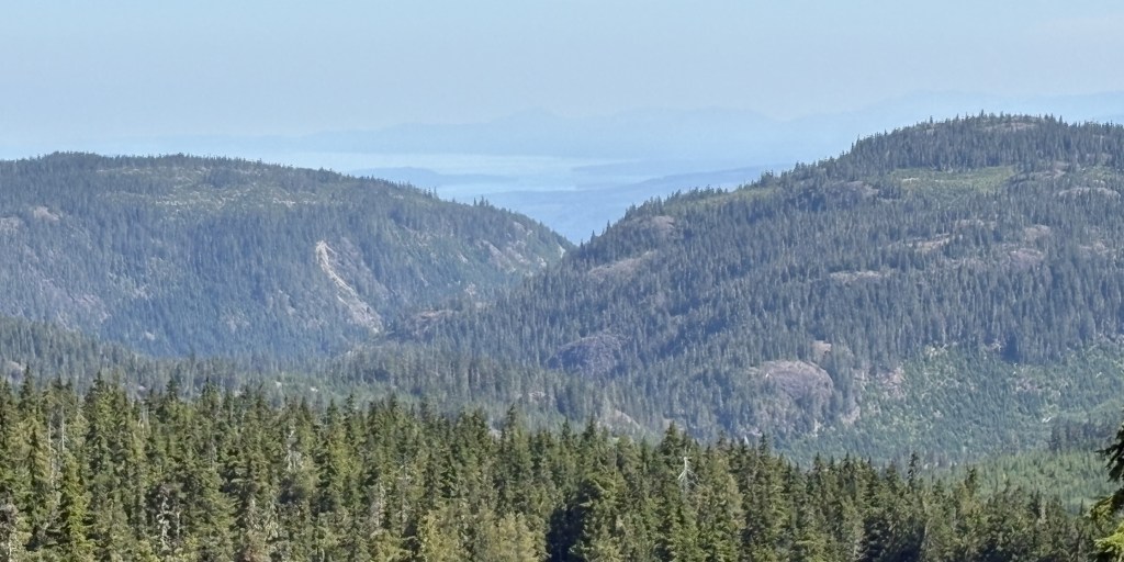
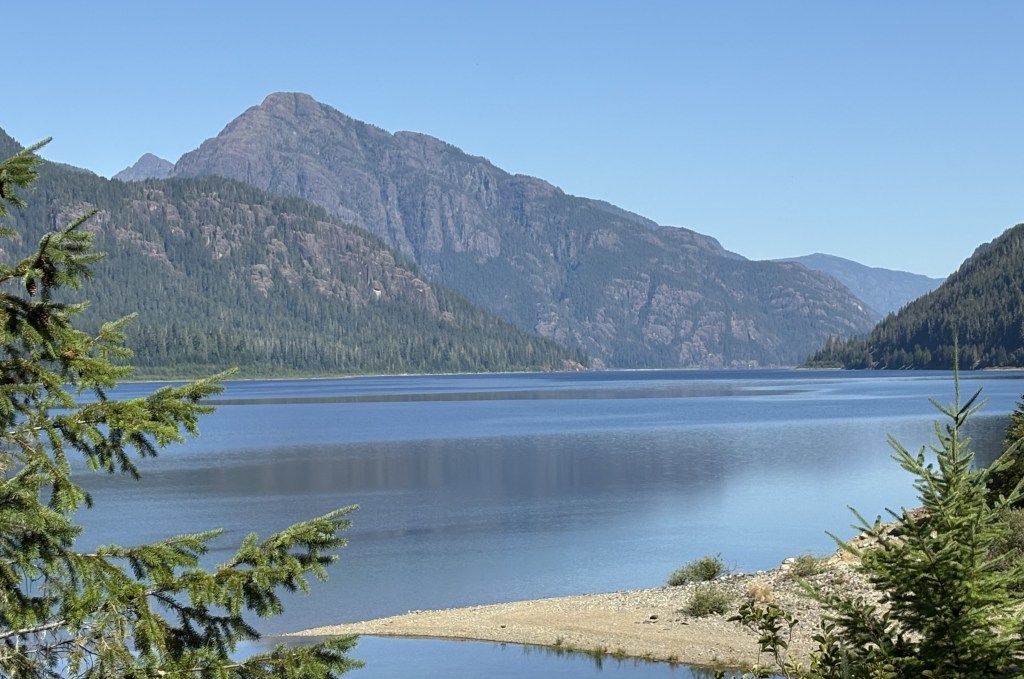
These are photos of various lakes, mountains, and distant mountains with snow on them, even in early August. I apologize for not knowing the names of most of them – there were only signs in two places. I don’t know the lay of the land and, as I learned to my dismay in Victoria a few days earlier, I don’t even know which direction I am looking, or walking. This is one reason I don’t hike.
Just enjoy the views as I did. A lot of repetition I know, but everything is just gorgeous…
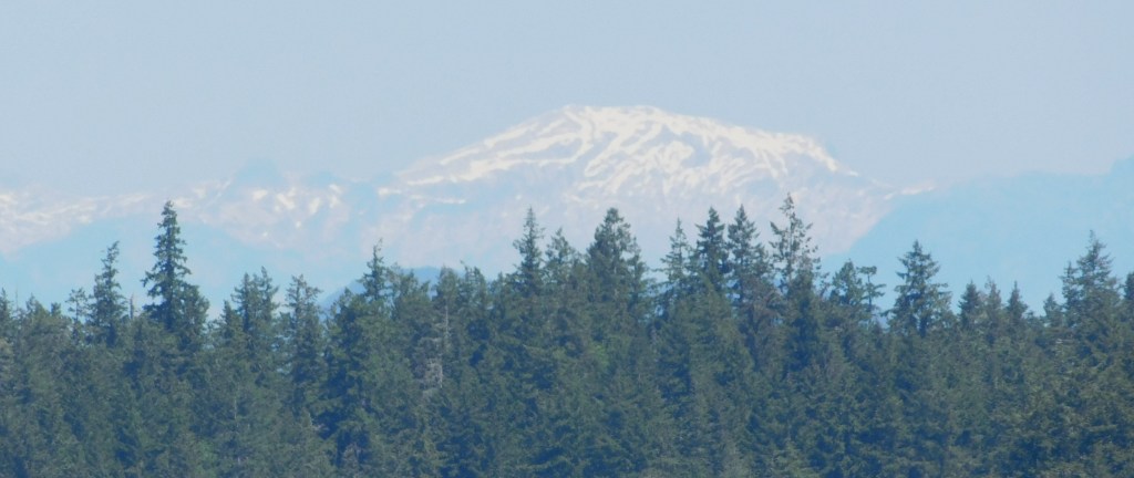
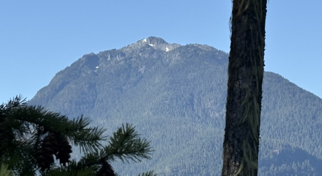
I suspect I am seeing the mountain above from various places on the island but I still don’t know which one it is!
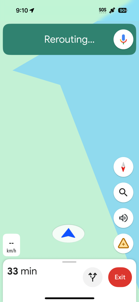
I posted the photo above because, while I started using Google Maps to guide me to Gold River, it got to a point where it apparently didn’t know where I was, either!! Scary thought…
I will tell you again about an app which may also be useful in a situation like this. It is called What Three Words. Someone has plotted a 10-square-meter grid over the entire planet and assigned each grid section a unique three word designation. Like: bacon, lettuce, tomato. If you provide the EXACT three words for where you are, anyone with access to What Three Words can see your location, within 10 meters. Less confusing than GPS coordinates, but with either of them you MUST be precise or you might send your rescuers to the middle of some lake close to where you actually are, or to another continent… Plurals matter. Spelling very much matters.
As I write this I am at blatant.glided.snakeskin (which should take you to Cranbrook, BC, Canada). Use glided NOT gilded. If you made two errors and gave 911 blantantly.gilded.snakeskin it would send my rescuers to Kugluktuk, Nunavut – still in Canada but 2,044 km away from where I am, and I think we’d ALL be cranky.
I was without cell service for long periods while I was on Vancouver Island, and that will be the case once I get to the mainland, too.
If you note in the upper right hand corner of the photo above you will see a satellite icon next the 90 (showing that my phone is charged to 90% capacity). This is something new on Verizon. If you are out of cell service but get the satellite icon you may still be able to send a text message (ONLY, for emergencies most likely) but not voice calls or sending photos (like of the grizzly bear which is about to consume you). I tried it and it asked me to point the phone towards the satellite in the sky (like a divining rod…). Even on satellite it seemed that I only had a marginal signal and I didn’t send an actual text to anyone, but I did find the satellite in the sky using the image projected on my phone’s screen. Clever, IF it works….
OK – back to the photos:
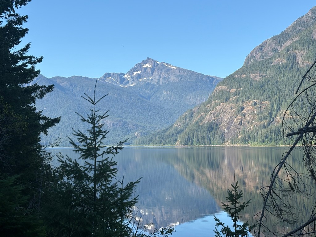
That one I know (thanks to a sign pointing to it). Marble Peak, elevation about 5,800 feet.
The one just to the left of it from my scenic viewpoint is Mt. Phillips, just a few feet shorter:
Sorry about the tree. If I had tried to move just a tad to the left there was another obstruction blocking where I could stand.
The sign above was located just past Strathcona Park Lodge, a large, modern resort about halfway between Campbell River and Gold River (the towns). Just about every body of water in this post is Upper Campbell Lake, which covers a massive area.
I saw very little traffic as I ascended the mountain but there were lots more vehicles going up as I went back down later in the morning. Had I made it to Gold River its elevation is “only” about 524 feet but the mountains along the way are much higher than that.
FYI – the highest peak on Vancouver Island is Golden Hinde, which tops out at 7,201 feet. Who knows, it might be the mystery mountain with lots of snow on it…