Jasper, Alberta – Part 2

August 8, 2025

After walking and driving through parts of downtown I drove “around back” to see two lakes located behind town. Once I got back there there was absolutely no indication that anything bad had happened.

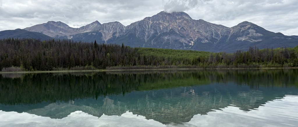
This is Pyramid Lake, and behind it is Pyramid Mountain.

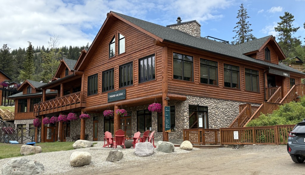
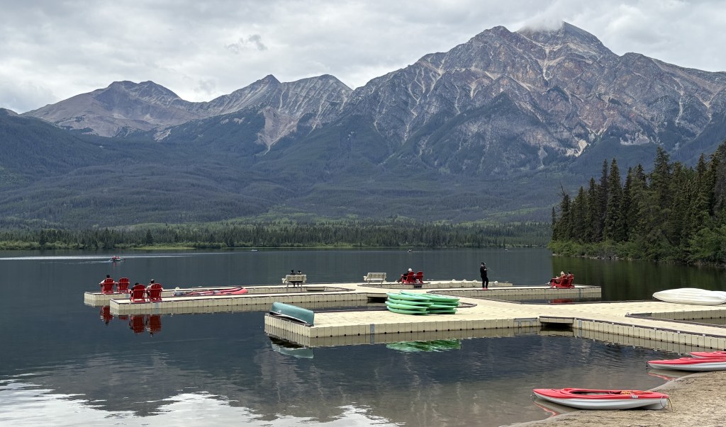
That is the Pyramid Lake Lodge and across the road is another view of the lake with docks and various watercraft for guests to use.

I wasn’t able to get to Patricia Lake, although I don’t think it was technically off limits.

I drove back towards the downtown area and crossed the Athabasca River to take a quick drive through the Fairmont Jasper Park Lodge property, a high-end hotel. It is on the “fire side” of the tracks but was apparently protected by workers and firefighters and only lost a few small buildings. The main lodge and most of the other buildings appeared to be intact.

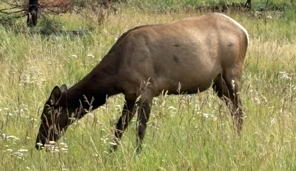
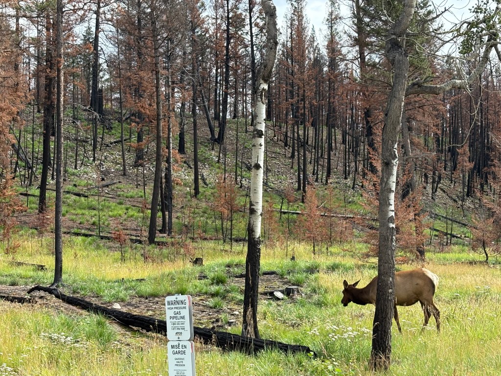
Just off the road to the Fairmont property I did see this animal, eating grass in a burned out area of the forest. I initially thought it was a cow moose but I now believe it was an elk because a few minutes later I saw 30 or so elk as I was leaving Jasper. I sent pictures of them to a few friends called them moose and one of my brothers pointed out that they were elk.

This is the intersection of Hwy 16 (Connaught Drive) and Hwy 93 (the Icefields Parkway) as I was leaving town.

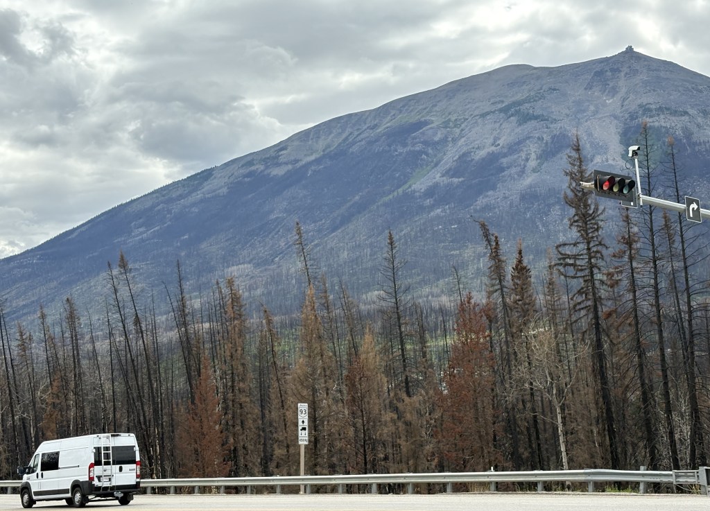
Across the intersection is Whistlers Peak which is where the Jasper Sky Tram goes. It is the highest and longest aerial tram in Canada. As far as I can tell that part of the mountain was not affected by the wildfire. Left of that is Marmot Mountain where the Marmot Basin ski area is located. It, too, was unaffected by the fire.

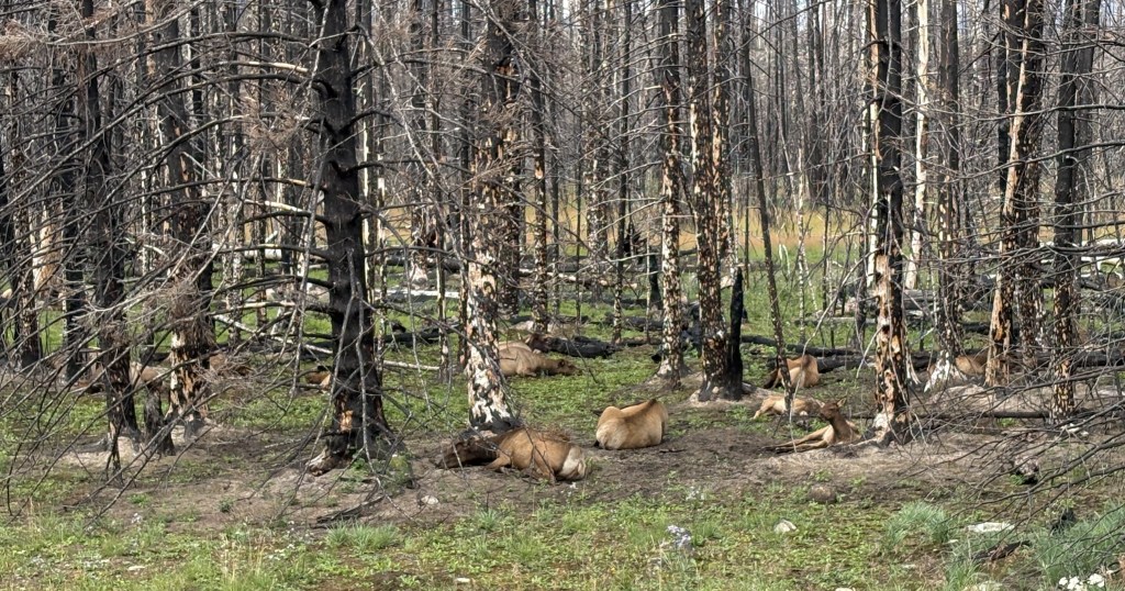
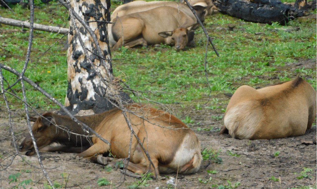
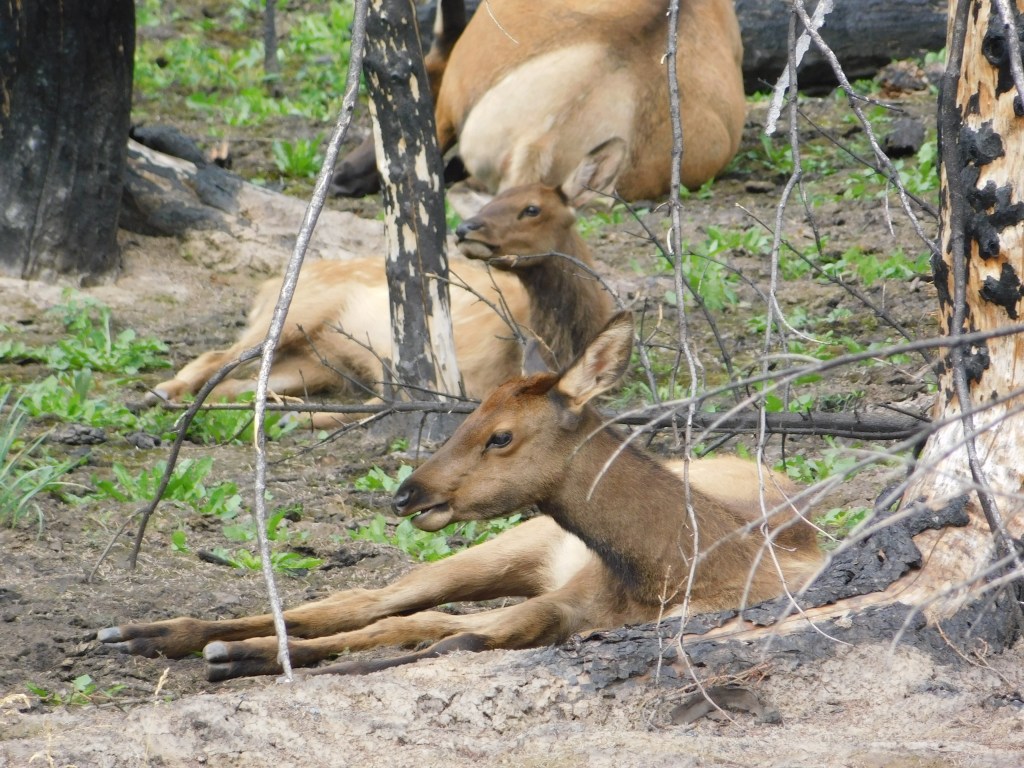
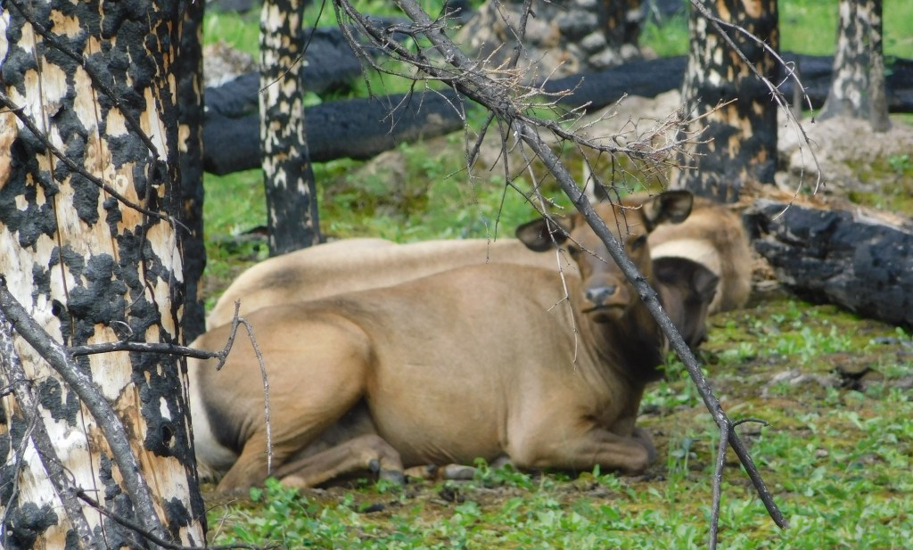
Once I turned south on Hwy 93 there were several vehicles stopped on both sides of the road and people were milling about with their cameras. Of course I stopped and joined them. There were about 30 elk resting on the ground in a grove of burnt out trees. They appeared to be adult females and some younger ones but I didn’t see any antlers so apparently there weren’t any adult males.

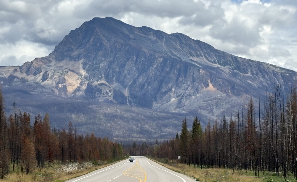
I continued south towards Golden, wanting to get there before dark. This is the view as I approached Mt. Hardisty. You can see the burnt out trees on both sides of the highway.

Jasper (the town), Alberta – Part 1

August 8, 2025

I chose Jasper as my first National Park to visit after arriving in Golden (although I drove through 3 others getting there). I really didn’t know what to expect when I got to the town of Jasper, as I was aware of the wildfire in 2024 but didn’t know the extent of damage. The town of Jasper is about a 3 1/2 hour drive (if done non-stop) from Golden, although I stopped many, many places to take pictures.

As I mentioned in the last post, I started seeing evidence of the fire as I drove around two mountains south of town – about 16 miles away. All the trees on either side of Highway 93 were destroyed by the intense fire. When I finally arrived in town around 1 pm, I stopped to walk the main street in town. I also went to the Parks Canada Visitor Centre, which wasn’t affected by the fire. There I was told where I could and couldn’t go within the Park. While I was there, some parts of the Park were still off limits due to damage caused by the wildfire.

Here are some of the things I saw:

Those are railroad tracks on the south side of town, significant because they are a main transcontinental line operated by CN Rail (The Canadian National Railway). Rail traffic through the Park was suspended the night the fire started, and CN Rail brought in one of their firefighting trains to help fight the growing blaze. Just beyond the tracks is the Athabasca River (out of view), and in the distance are the Colin Range of mountains, located southeast of town.

That is the tourist “photo op” sign in Jasper (in a rare moment someone wasn’t having their picture taken in front of it), and behind it is the Parks Canada Visitor Centre.

Those are the views of Connaught Drive, the main street in Jasper, looking in from each end.

This is an Akita taking a break while his handler was on the phone.

This is a statue outside the pizza place where I had lunch.

This is one of the few signs of the fire I saw downtown. It is a set of gas pumps on the same side of the street as the main shops.

Another gas station was destroyed on the other side of the street. The structures destroyed in the fire have been razed and the lots cleared. Many of the businesses which were affected indicate online that they are only “Temporarily Closed”.

Here is a map of downtown Jasper showing which structures were lost in the fire. The map states that 420 structures were destroyed or visibly damaged while 620 showed no damage. Wikipedia states that 358 of 1,113 structures were destroyed. Either way, the town did suffer significant property losses.

(Photo credit: Calgary Herald)

These are trailers which were brought in as temporary housing for some of the residents who lost their homes. I saw them at several locations in the area.

The next post will show some other things I saw in the area before heading back to Golden.

2024 Jasper Wildfire

August 8, 2025

I am now approaching the town of Jasper, AB from the south and have started to see damage caused by the massive wildfire which started a little over a year before I arrived in early August, 2025. You won’t see much evidence of it in my photos but I would be remiss if I didn’t explain what happened.

Jasper National Park is the largest of the six National Parks I would visit over the next few days from my base in Golden, BC. At 4,335 square miles it is larger than Yellowstone National Park (3,472 square miles). Comprised mainly of mountains, forests, lakes and rivers, it is a popular tourist destination.

The town of Jasper has a population of around 4,800 permanent residents according to the 2021 Census. That population swells significantly over the summer months.

Around 700pm the evening of July 22, 2024, a fire was detected northeast of town. A short time later, other fires were discovered well south of town. All of the fires are believed to have been started by lightning, and spread rapidly.

Within several hours, authorities made the decision to evacuate the entire Park! This was done due to the weather and ground conditions, as well as the forecast for the coming days. There are not many escape options, and it was the middle of summer so there were thousands of people visiting the area, in hotels, camping or staying in their RV’s. It is estimated that 25,000 residents, employees and visitors were told to immediately evacuate the town and Park.

Here is a map of the area eventually consumed by the fire.

(Photo credit: Parks Canada)

As I stated, the fire started July 22, 2024 and wasn’t considered “under control” until September 7, more than a month later. Due to the remote wooded areas within the Park it wasn’t actually considered “extinguished” until April 1, 2025! In all, the fire consumed 156 square miles.

I am approaching the town on Route 93 and started seeing burnt out areas on both sides of the road after I drove around Mount Kerkeslin and Mount Hardisty at the bottom of the photo. Everyone south of town was probably encouraged to drive south on 93. People in and around the town of Jasper could go either east or west on Route 16. Due to the fact that some of the fires were northeast of town, most people probably went west and eventually ended up in Valemount, which quickly became overrun with evacuees.

Only one death was attributed to the fire. A 24-year old trained firefighter died northeast of town when a tree fell on him. He had come up from Calgary to assist in fighting the blaze. No doubt that quick action by authorities, mere hours after the small fires were first discovered, saved countless other lives.

I will discuss the impact on the town of Jasper in my next post.