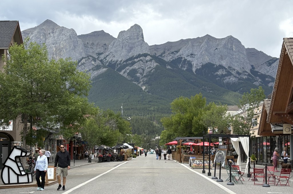
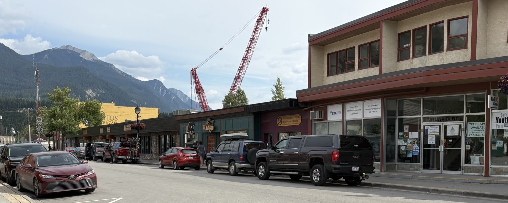
I drove south 20 miles from the town of Banff to the town of Canmore, about triple the side of Banff with a permanent population of around 16,000. Canmore is just outside the southern end of Banff National Park. Golden and Canmore were, by far, the most expensive Airbnb’s on my trip but they are both close to the places people want to be and can command higher prices. Staying in Banff proper would have cost even more…
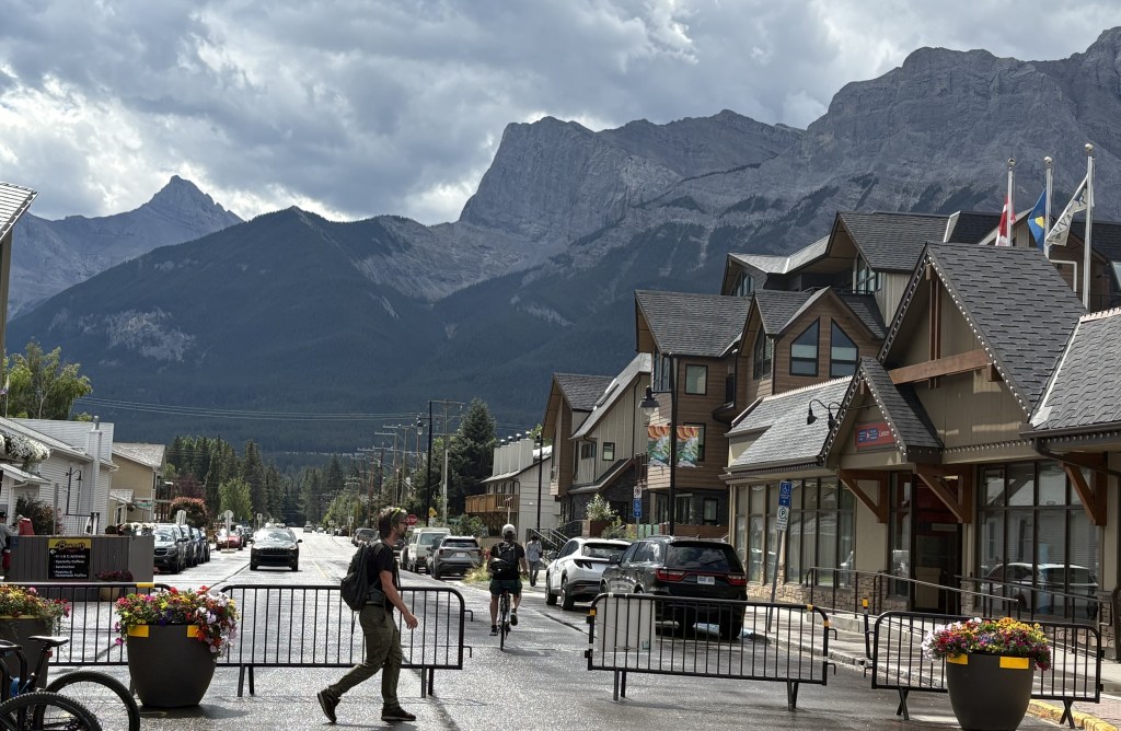
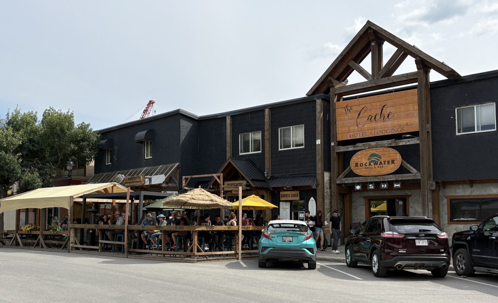
I went downtown and parked and found that I was in a very nice little town that didn’t feel as congested as Banff. They also had a few blocks of their downtown area blocked off to traffic to form a pedestrian mall of sorts. I walked around and went in a few shops and immediately felt at ease. I also noticed that no matter which direction I looked I could see mountains.
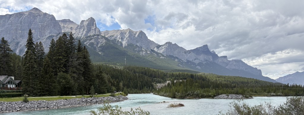
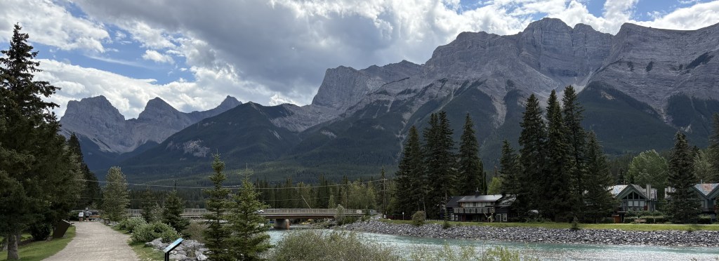
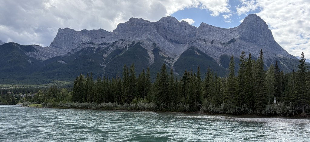
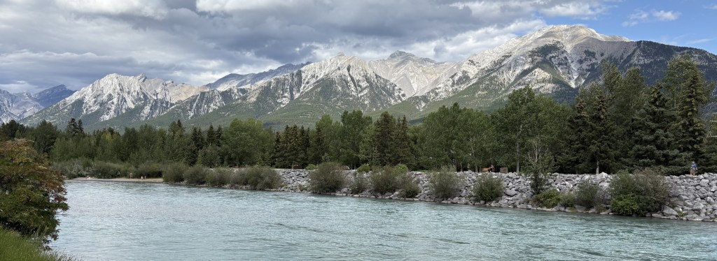
I walked a short distance to a town park located along the Bow River.
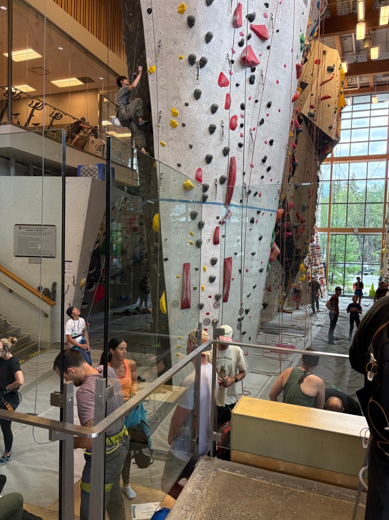
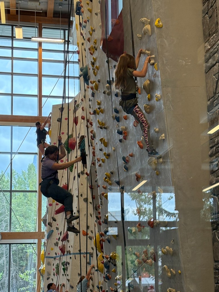
Before I checked in at my Airbnb I decided to go to the library to print some documents from my computer. What I found there was totally unexpected.
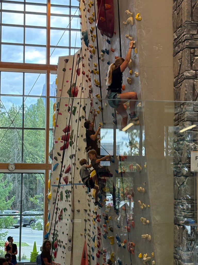
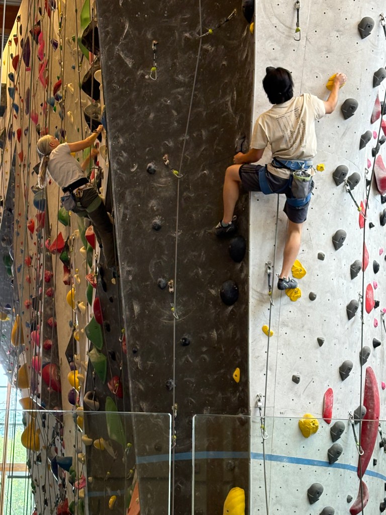
A multi-story climbing wall! The library is located inside the Elevation Place Recreation Centre which also features a fitness gym, an aquatic centre and an art gallery! The climbing walls seemed to be the most popular and there were not only adults but also some rather young, but fearless, children.
Some of the walls go as high as 45 feet and the are some much lower ones which arced out to give an additional challenge to the climbers (not shown).
I stood for quite a while in the entrance area and marveled at the ability of the climbers. I even went back on another day to watch some more as I found it fascinating.
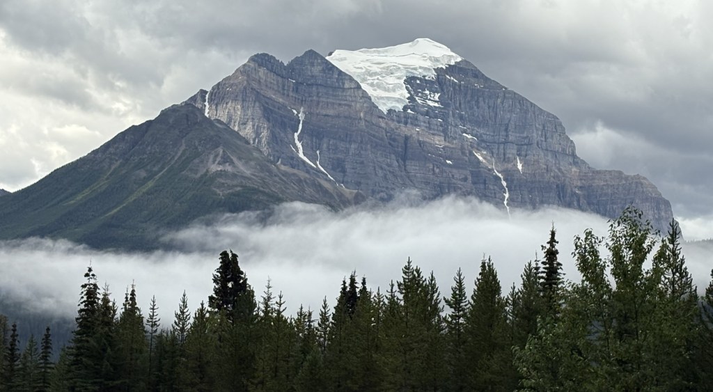
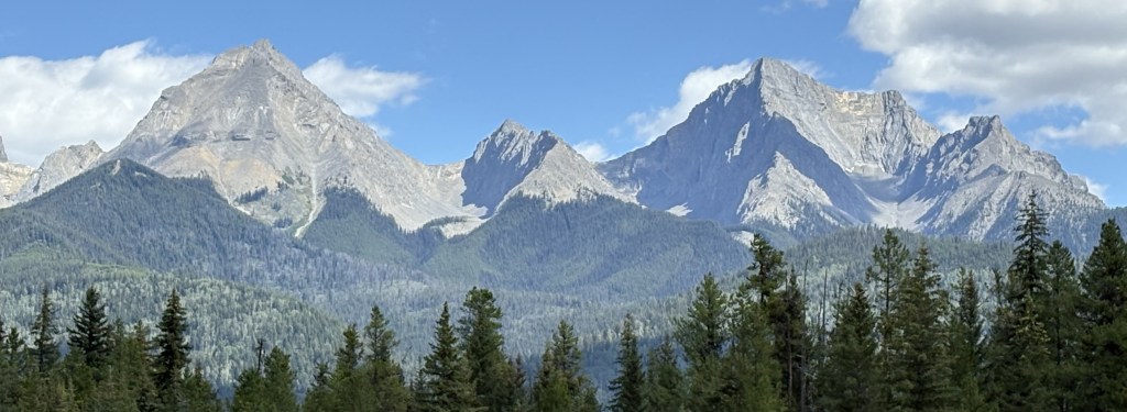
After leaving Yoho National Park I crossed into Banff National Park and began my trek southeast. Jasper and Banff National Parks both have an elongated footprint which slants northwest to southeast. They are both on the spine of the Canadian Rockies and help form the western edge of Alberta province. Banff National Park covers just under 2,600 square miles, about 60% the size of Jasper NP. Banff NP has over 100 named mountain peaks.
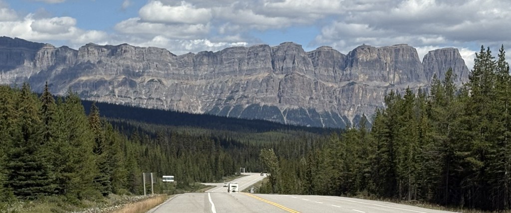
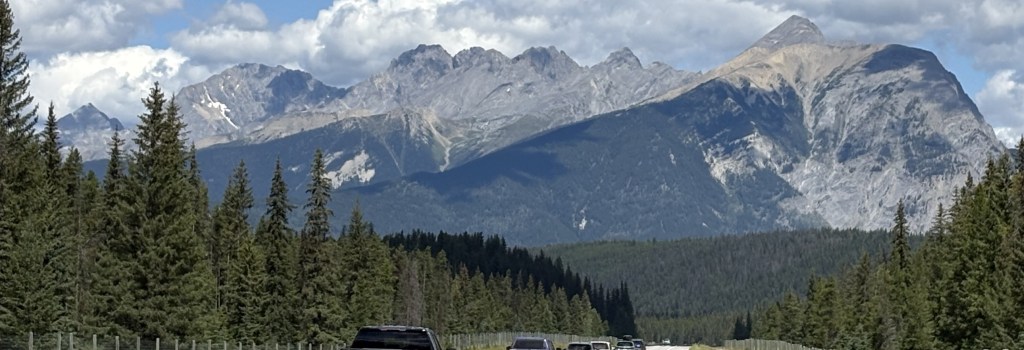
Once I pass the town of Lake Louise on the Trans Canada Highway I would travel about 40 miles to get to the town of Banff. I have traveled the northern part of this road twice, both times driving northwest after leaving Kootenay National Park. Today I will be driving southeast so I be seeing a different vantage point of several mountains I have already seen, and will be seeing some new ones which I could not see as I drove north,
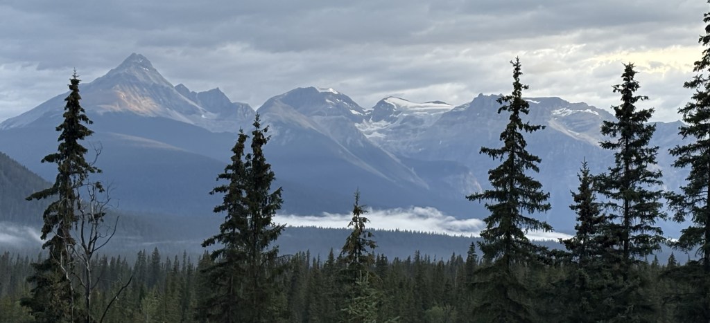
The next two sets of mountains were being backlit by the early morning sun as I approached them.
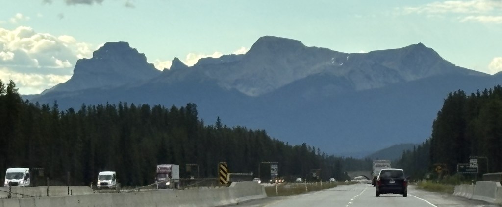
I stopped at a rest area before reaching Banff and took these photos. The first one is looking back northwest towards Kootenay NP.
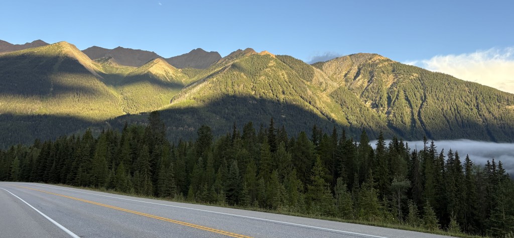
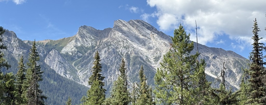
And this next one is looking back towards the highway I had just driven down, with the upper part of mountain now basking in the morning sun.
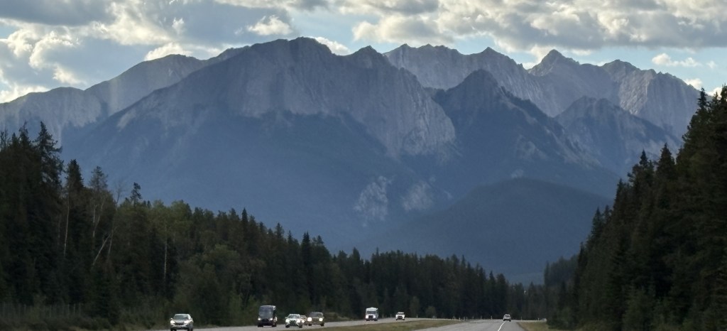
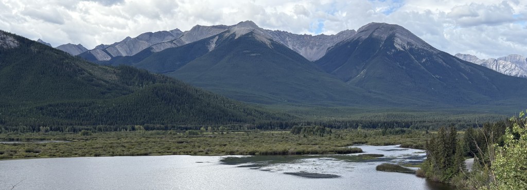
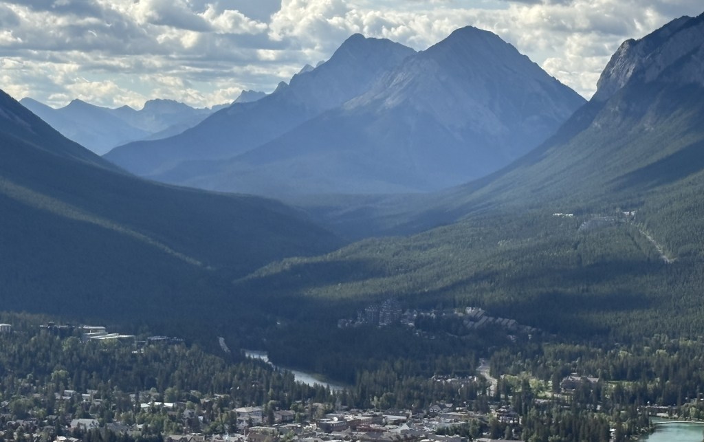
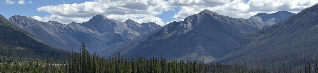
The next one is looking southwest towards the town of Banff.
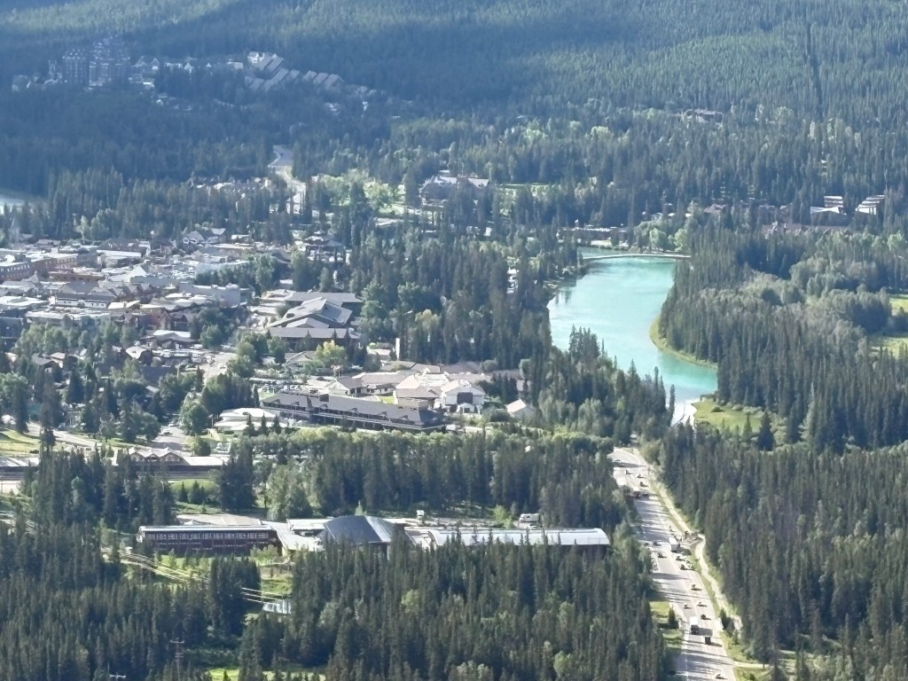
I would soon exit the highway and turn left, climbing a mountain towards the Mount Norquay ski area. From a scenic viewpoint along that road this is the view looking towards the town of Banff. You can see Hwy 1 going from left to right at the bottom of the photo.
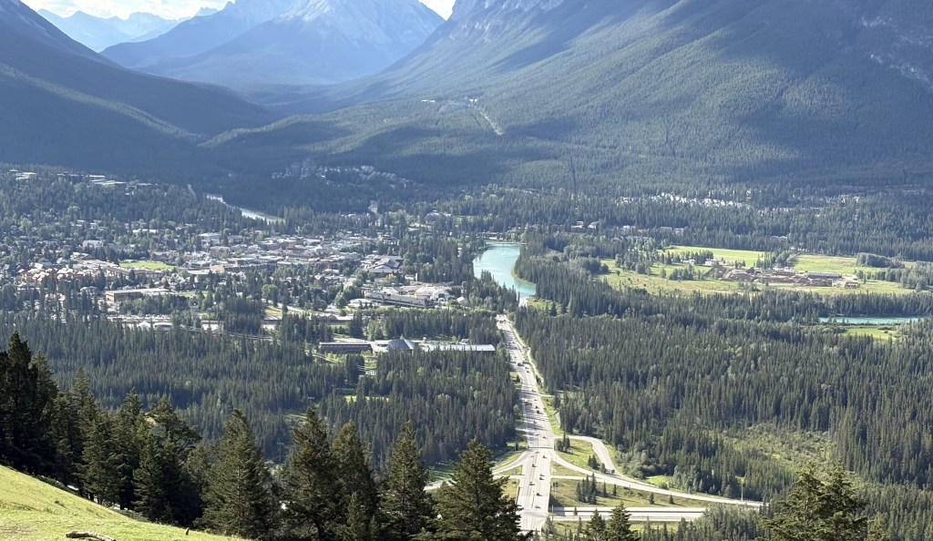
Below is a closer look at town. You can see the Bow River on the right and the shopping district to the left of it. If you look closely at the upper left hand corner of the photo you can see the large Fairmont Banff Springs hotel. You will be seeing more photos of all those things in subsequent posts.
Banff sits at an elevation of 4,600 feet and has a permanent population of about 8,300. As with Jasper, and many other towns in Canada, that number increases significantly with year-round visitors. It was named by a railroad executive after his hometown in Scotland.
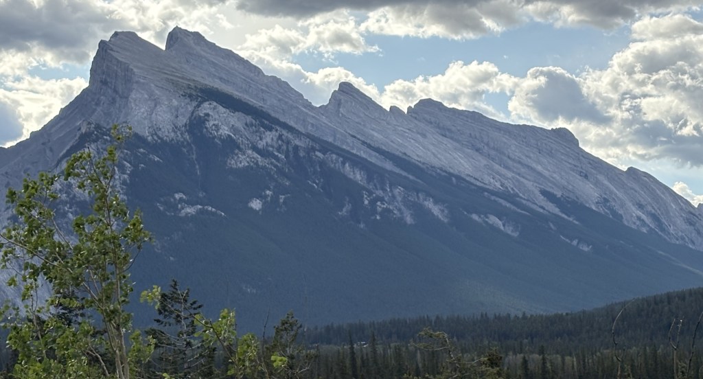
Below are some of the big mountains west of town. In that photo the Banff Springs Hotel is just right of center at the bottom. To the right and above it is the road leading up to the Banff Hot Springs and the Banff Gondola.
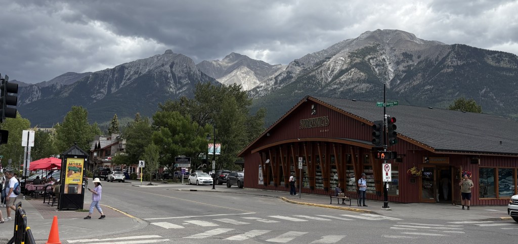
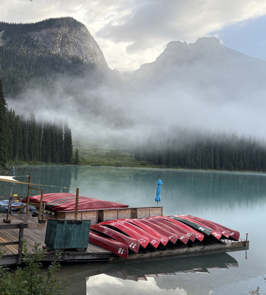
I ventured into town to get some maps and get a feel for the lay of the land. Banff has a reputation for being overrun with tourists, especially in the winter when people are visiting the local ski areas. I would actually be staying in the town of Canmore, about 20 miles further south, for several nights but will make a quick trip into Banff today, and will drive up from Canmore on another day to try and beat the crowds.
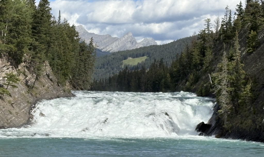
Here is the first place I visited when I drove downtown.:
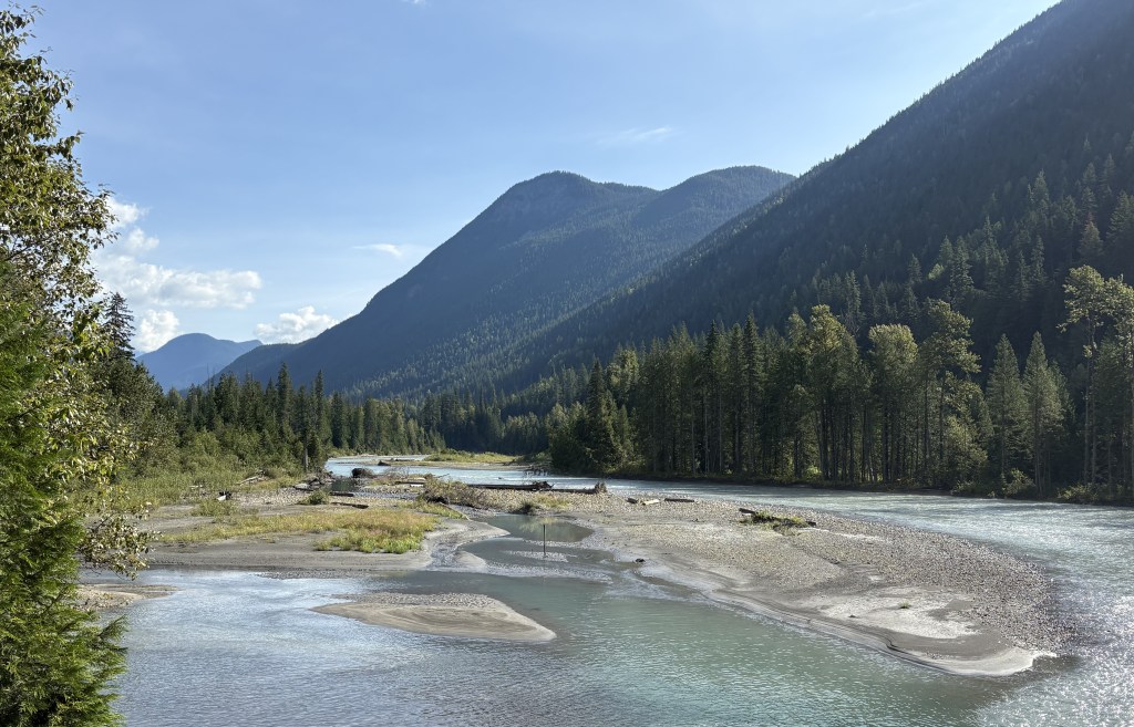
The photo above is of Bow Falls. The Bow River originates at the Bow Glacier up in Jasper National Park, along the Icefields Parkway. It will pass through southern Alberta and Saskatchewan provinces before turning north, pass through Manitoba province and empty into Hudson Bay.
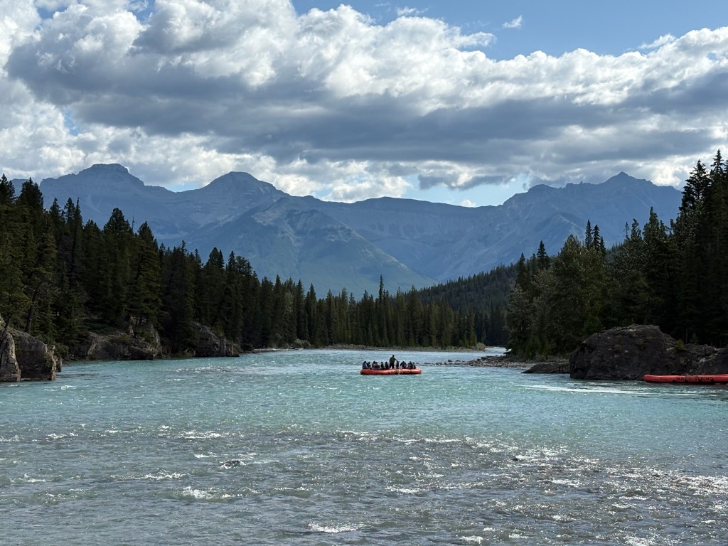
Below are some rafters setting out on the lower part of the Bow River.
After navigating mid-day traffic in town I decided to go back out to the highway and drive down to Canmore and get settled into my Airbnb there. I will return to Banff in a day or two to spend more time here and will have lots of photos to share.
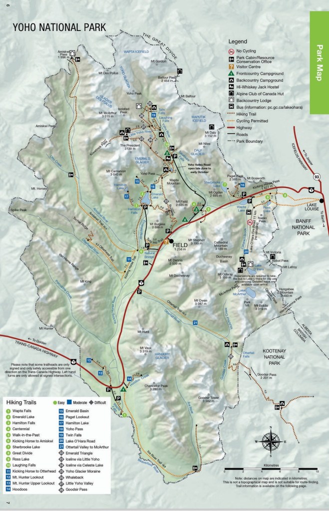
I have driven through Yoho National Park 4 times during my visit to Golden and thought I’d better tell you a little bit about it as I pass through it a final time on my way south to Banff.
The name is an exclamation of surprise in the indigenous Cree language, though there isn’t any record of the Cree people ever having lived here so I don’t really know why it was chosen. The Park covers a little over 500 square miles and has 28 named mountain peaks over 9,800 feet. The tallest is Mount Goodsir at 11,703 feet, not visible from the highway due to closer mountains obscuring the view. As you will see, some of the mountains are low enough to only be covered with trees, and it is a very popular destination among hikers. It may be hard to see but the colored dotted lines on the map represent cycling or hiking trails.
(Photo credit: Parks Canada)
The only road which passes through the Park is the Trans Canada Highway (Hwy 1), shown on the map in red. Several roads branch off from it but I only took one of them as I left Golden.
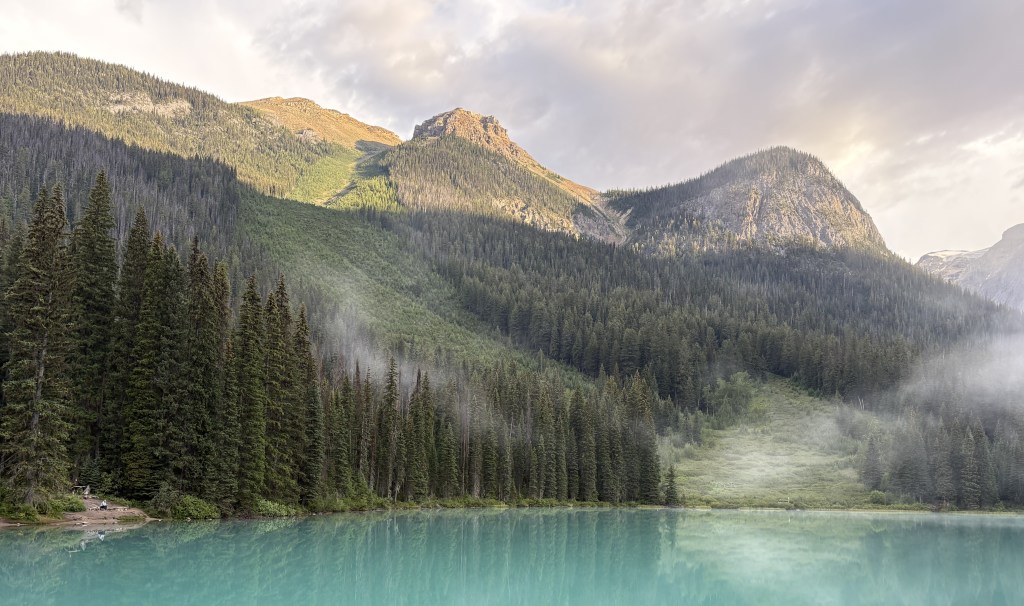
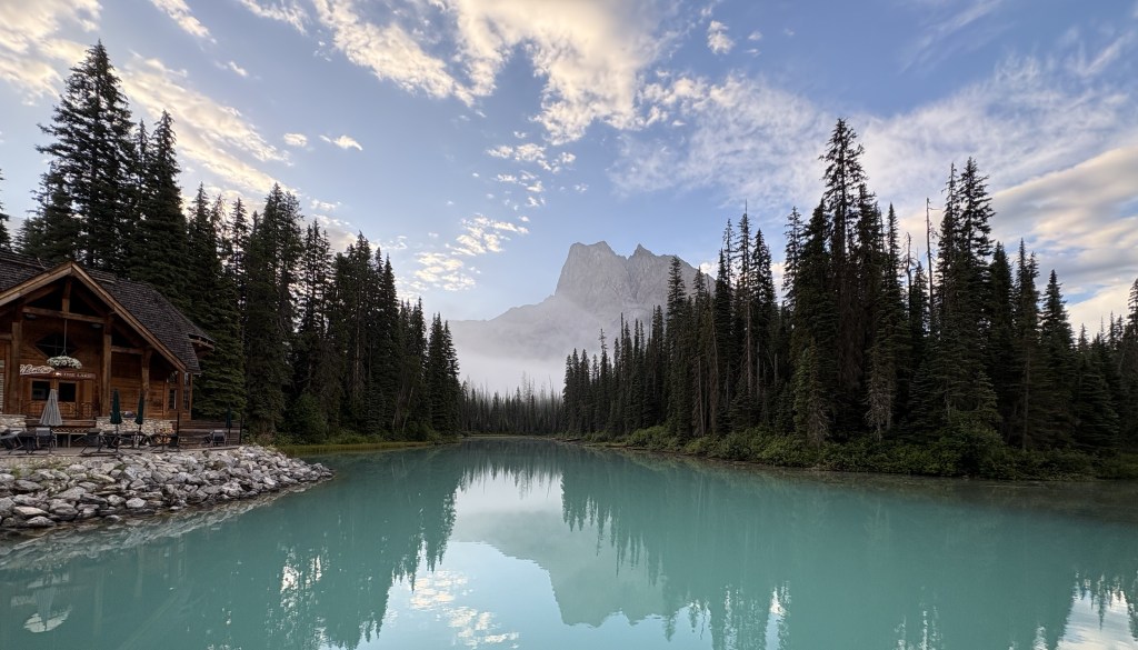
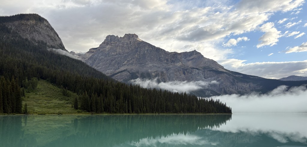
Emerald Lake (upper portion of the map, above and left of the town of Field) is frequently shown in brochures because of it’s brilliant color. Every time I passed by the road there was an electric sign near the highway exit indicating that the parking lot was full. As I returned from my second trip through Kootenay NP I took a chance and drove up anyway, only to find that traffic was at a standstill before I even got to the parking lot. I sat there for a while hoping to see vehicles leaving but since we seemed to be at a dead stop I turned around and left, deciding that I would drive up first thing in the morning as I was leaving Golden.
Here are some of the things I saw during that drive.
It was a strange morning, cloudwise. The two photos above were taken one minute apart, from the same section of the highway! I know it was clearing in one direction but there were heavy clouds when looking in another.
I drove directly up the mountain to Emerald Lake – no line, no waiting. The parking lot was only partially filled so the “go early” advice was sound.
The lake surface is at 4,267 feet elevation and Golden is at 2,600 feet so I had climbed over 1,600 feet to get here, encountering fog or low clouds along the way.
You can see that the sun was finally able start burning off the fog.
Another lake in the Park, Lake O’Hara (up near Hwy 1), is only accessible by making bus reservations in advance. The long road leading north to Takakkaw Falls is only open a portion of the year and is considered difficult to navigate for large vehicles. Recreational vehicles or vehicles towing trailers are not permitted on it.
From what I’ve read and brochures I’ve seen, Yoho is extremely popular with hikers and I’ve seen many great pictures by visitors who have hiked up to high elevations. If you enjoy hiking you could plan your whole vacation in the Canadian Rockies and have a never-ending variety of things to see.
The photos below were taken as I started driving down to Highway 1.
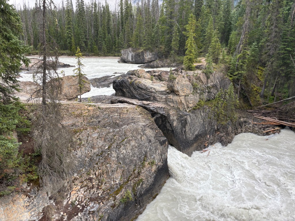
When I got to the bottom I stopped at Natural Bridge.
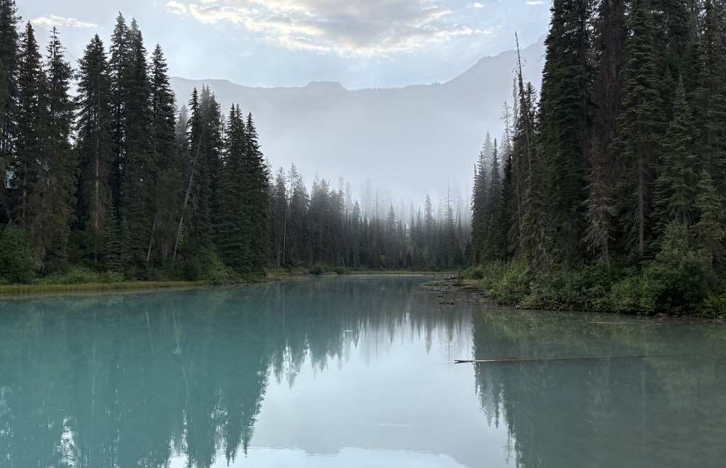
After driving through Kootenay National Park from south to north a second time I would again turn left onto the Trans Canada Highway (Hwy 1) in order to return to Golden. I would continue on the TCH a short distance and cross into Yoho National Park, thereby crossing BACK into British Columbia province.
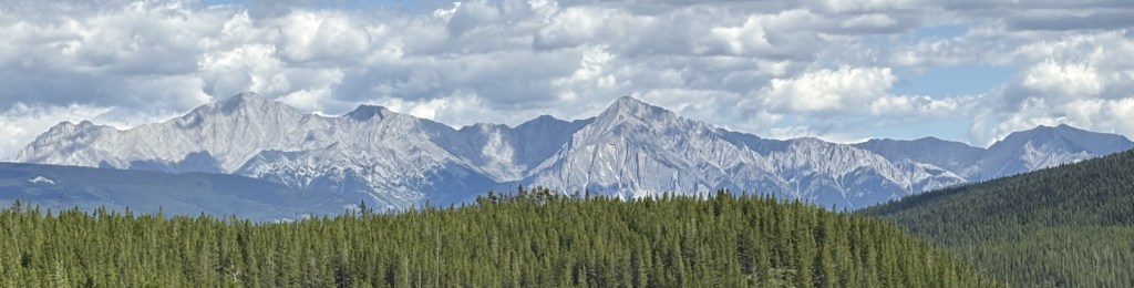
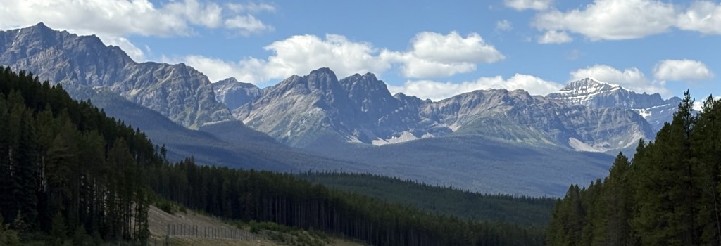
Here are some photos from that final leg of my trip for the day. Once again, mountains which you may have seen before but taken on a clearer day.
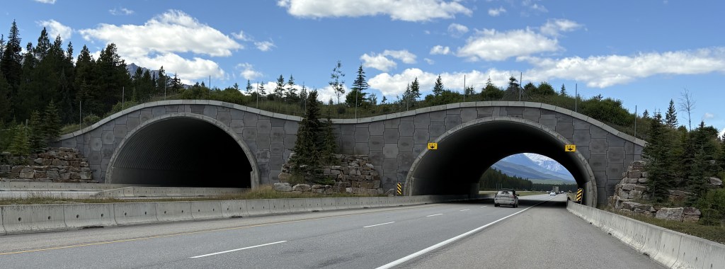
The photo above is a wildlife crossover, one of many I saw as I traveled throughout Canada.
That photo above is of Mount Stephen which is 10,495 feet tall.
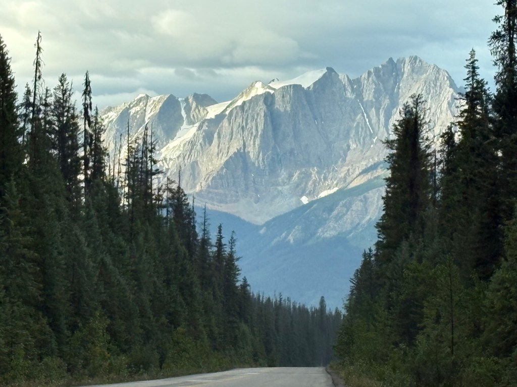
Here are some photos I took with the zoom lens on my digital camera after reaching the Trans Canada Highway.
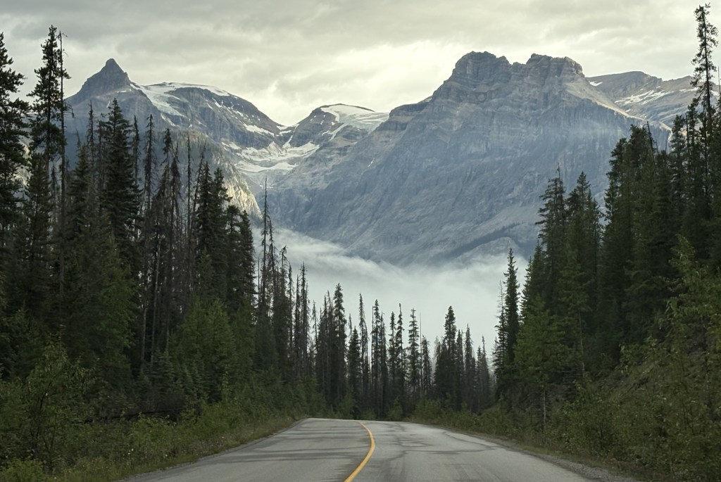
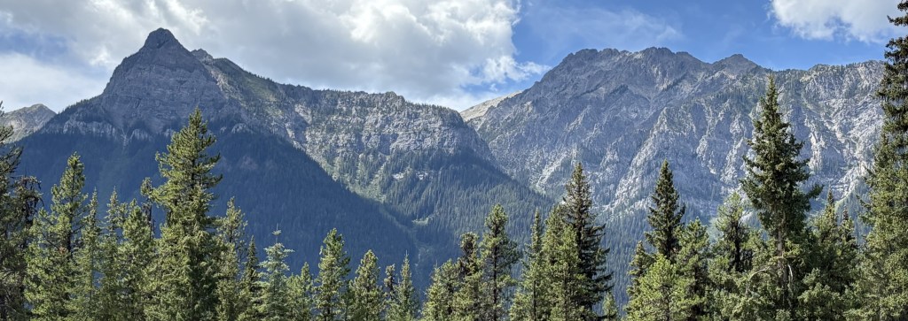
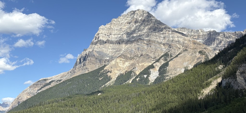
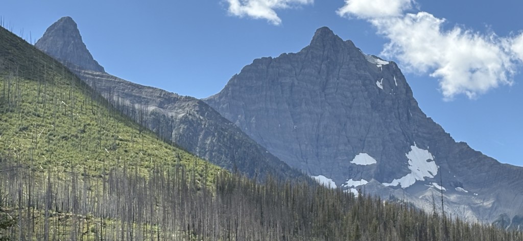
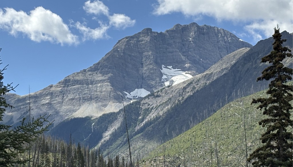
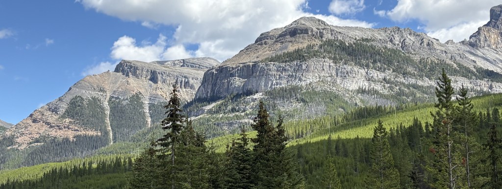
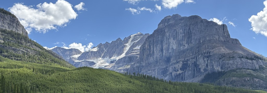
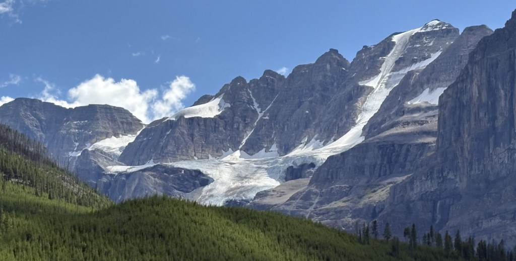
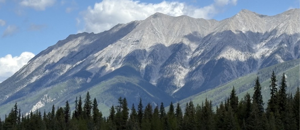
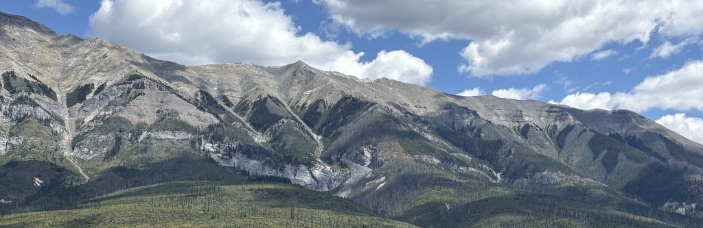
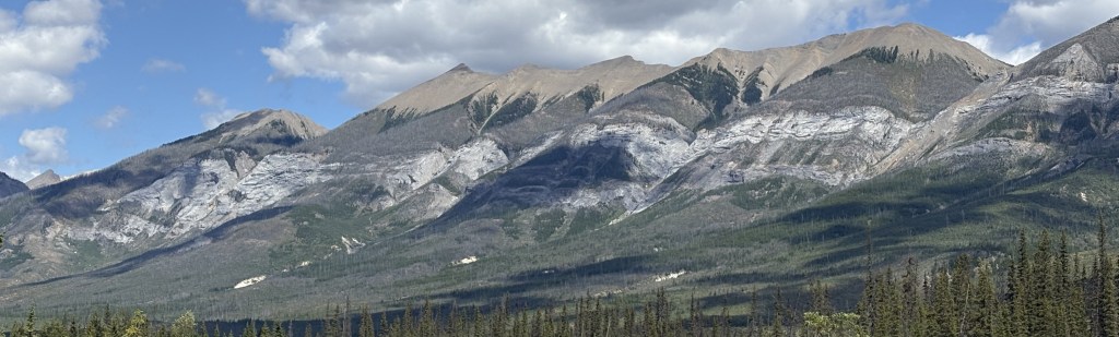
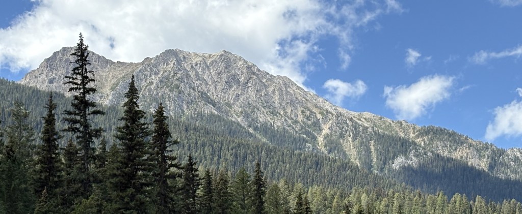
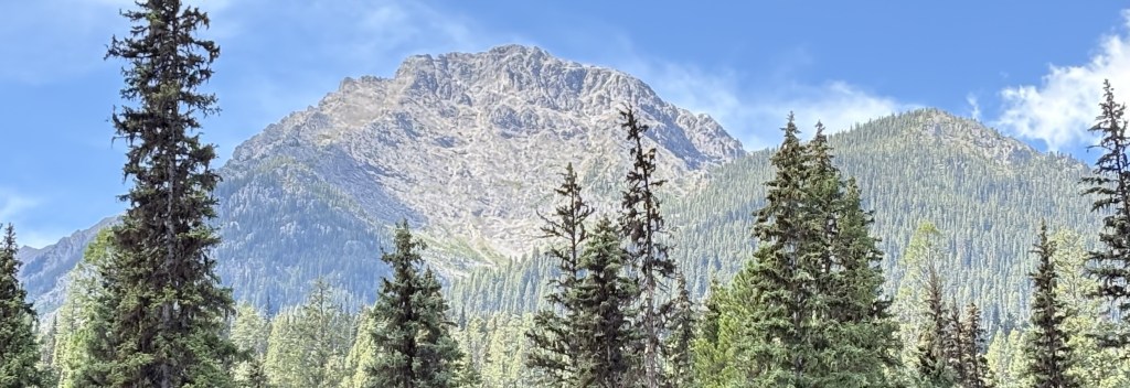
Here are more photos of the mountains I saw as I traveled through Kootenay National Park in British Columbia from south to north.
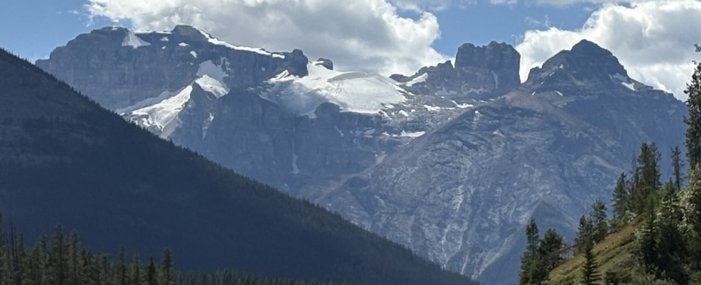
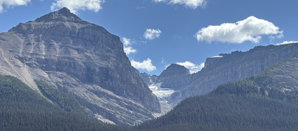
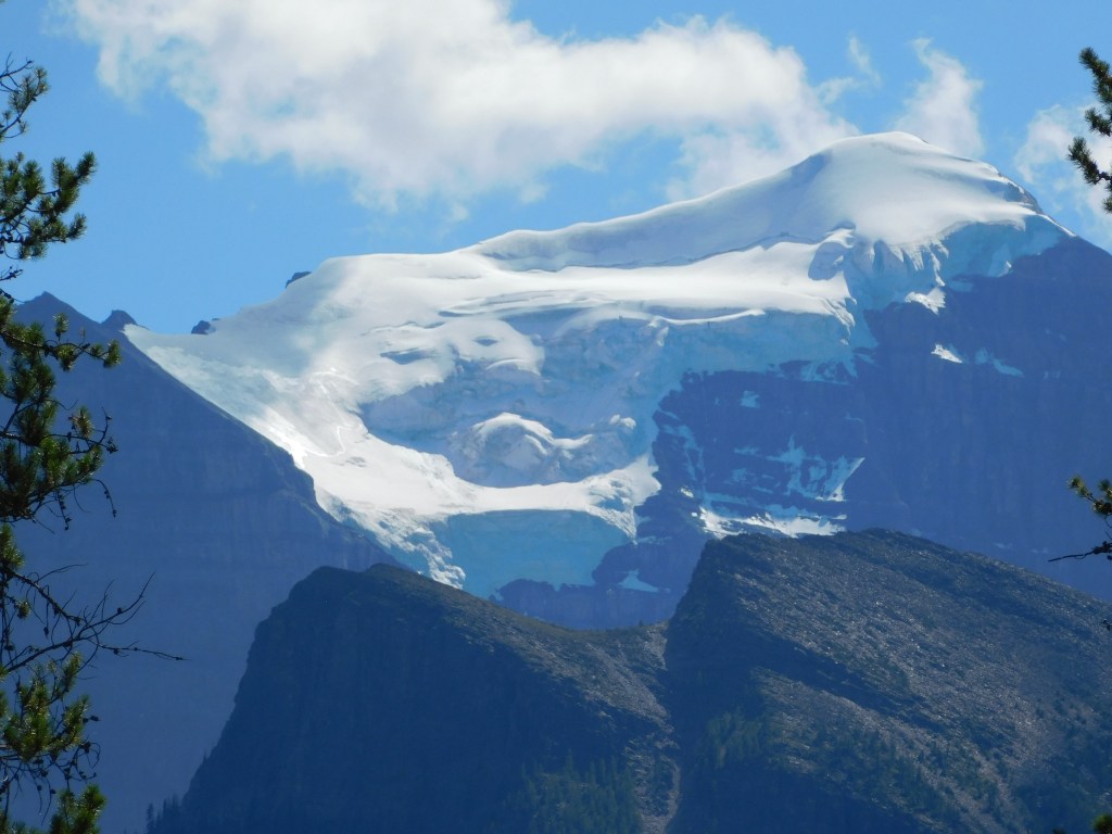
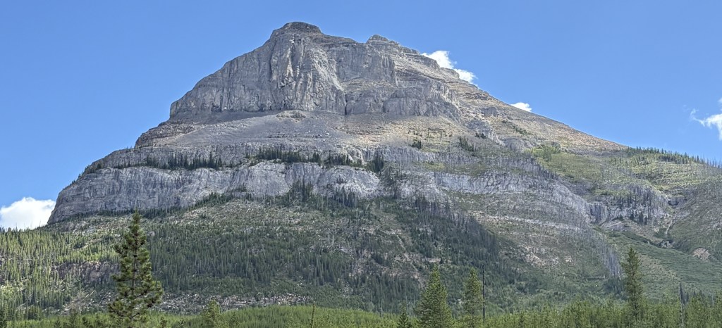
The mountain above is one of the ones I CAN identify. It is Stanley Peak, 10,351 feet tall, which is home to the Stanley Glacier:
Shortly after passing the Stanley Glacier I would go through Vermilion Pass and cross the Continental Divide. That signifies the northern end of Kootenay National Park as I would cross into the northern portion of Banff National Park and, in doing so, cross into the Alberta Province.
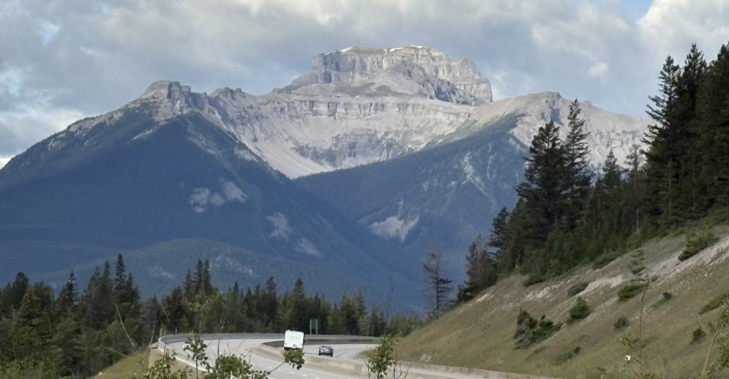
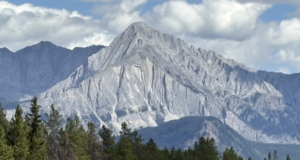
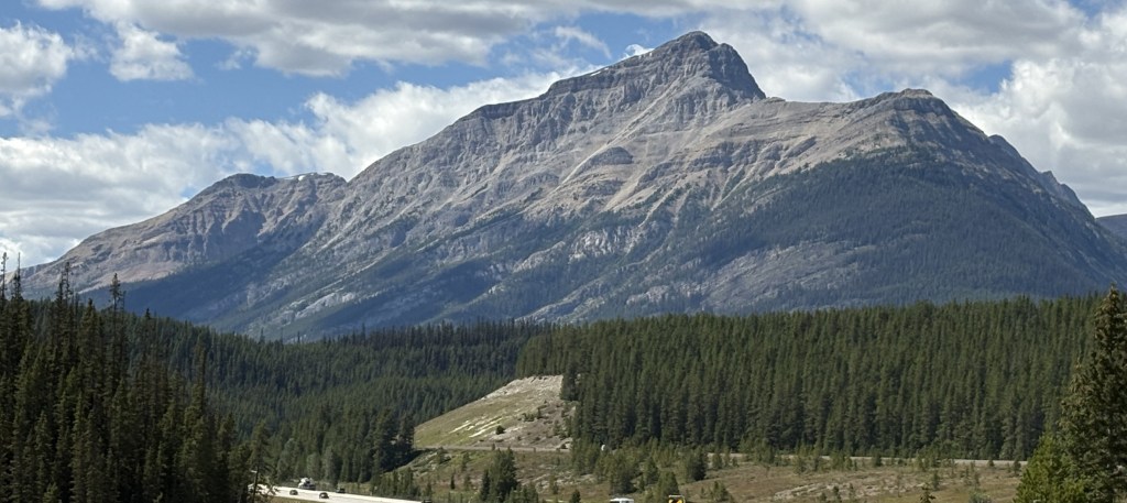
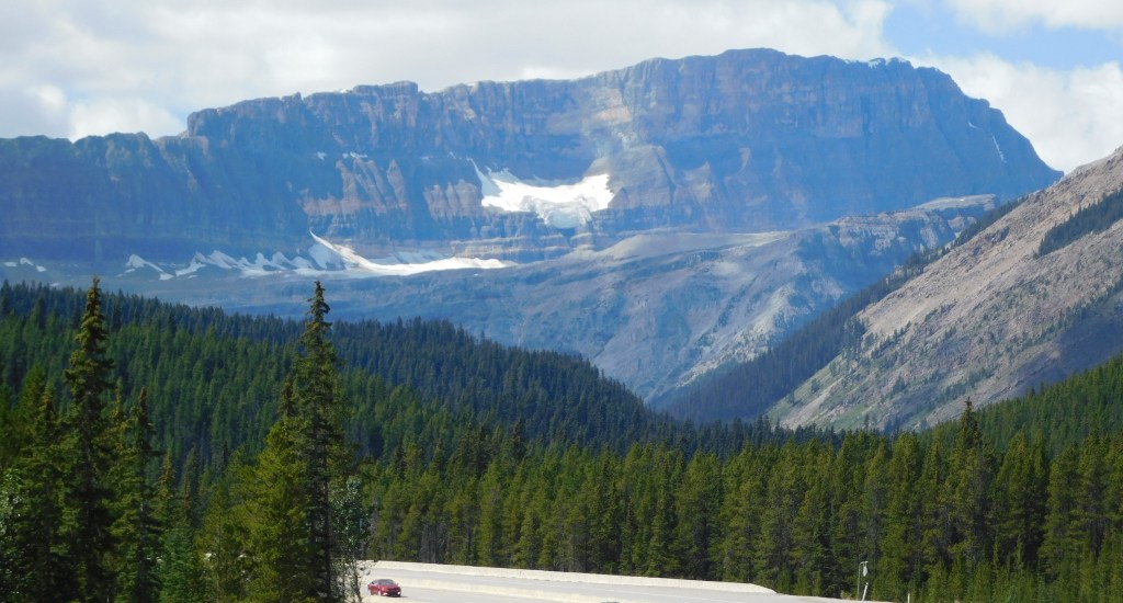
The mountain in the distance (below) is Castle Mountain, which is 9,075 feet tall and is on the opposite side of the Trans Canada Highway (Hwy 1). It is several miles away, and is very imposing as you drive past it on the TCH.
Today I decided to drive back down south and go through Kootenay National Park again. The first time I went through the weather was less than ideal for photos, with some low clouds obscuring some of the mountain tops. The weather was forecast to be better today so I thought I’d give it another go.
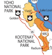
Sorry the map is kind of small but it focuses on the route I would take. From Golden I drove south on Highway 95 to the town of Radium Hot Springs. There I would turn left on Highway 93S which goes through Kootenay National Park and up to the Trans Canada Highway (Hwy 1), which I would take back to Golden. The entire loop is about 200 miles.
I did post some photos of my original trek through the Park so you will probably see things you have seen before. I have more photos than what I am about to post but I went through them and eliminated ones that seemed repetitive or were not very clear. I am in the Canadian Rockies so obviously mountains are the main things I see. Many of the mountains have a different appearance than ones I have seen elsewhere so I hope you enjoy the variety as much as I do!
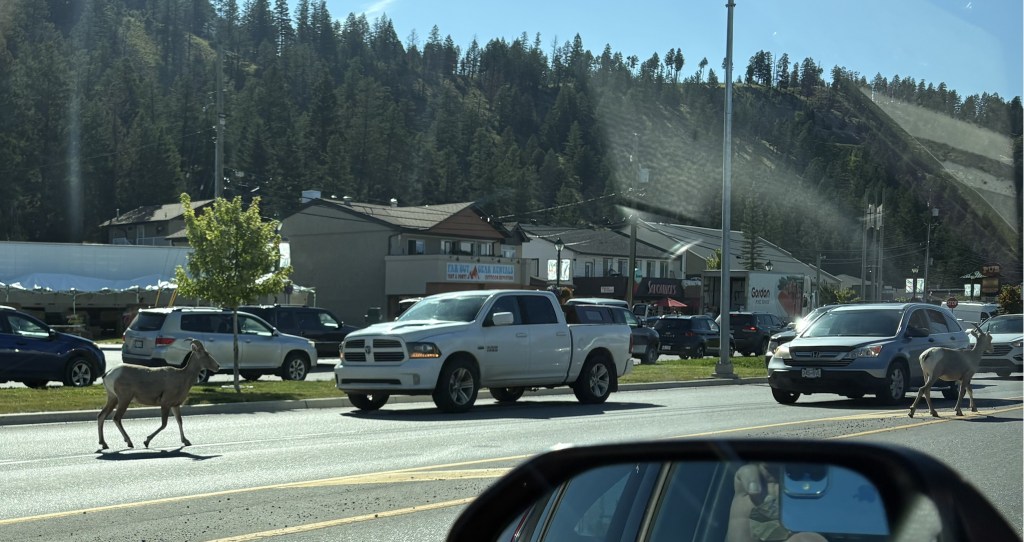
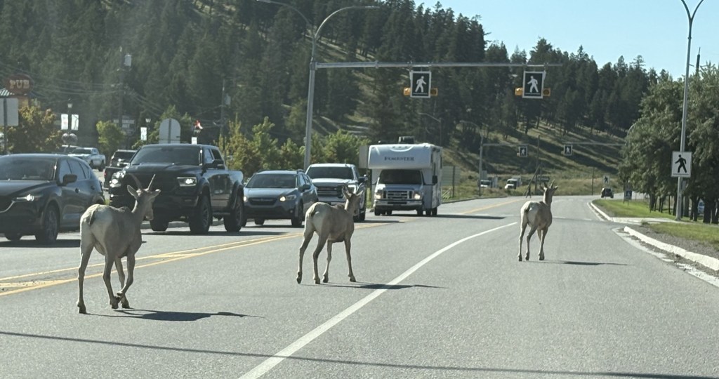
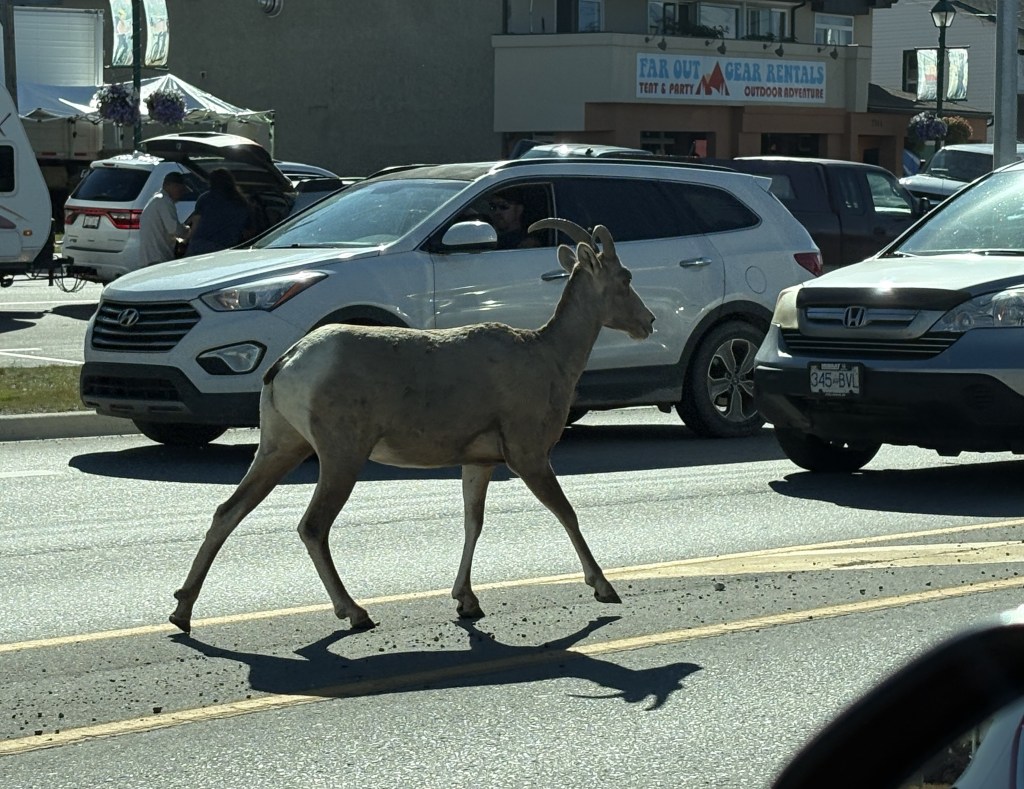
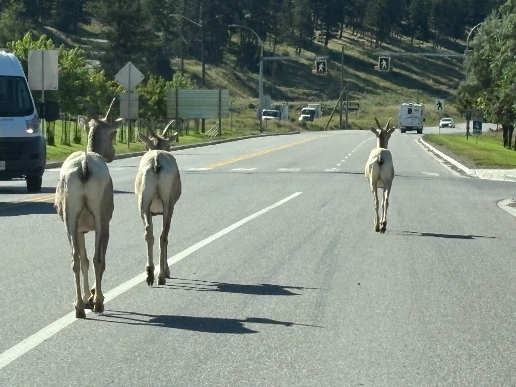
I start off with a few repeat photos from Radium Hot Springs (the town). As I drove in to town around 10am I encountered several young bighorn sheep, strolling down the highway seemingly oblivious to the traffic around them.
I stopped briefly in the Visitor Centre and then drove back about a half mile to enter the Park itself. A short ways in are the actual Radium Hot Springs, which gives the town its name. They are an odorless natural hot springs which are popular among visitors to the area. They have their own fee structure and one must have a Park Pass to access them. I was thankful that Canada waived the entrance fees to their National Parks for the summer, though I was prepared to buy an annual pass when I arrived here.
This time I was better prepared for the first thing I saw after I drove past the hot springs.
There wasn’t anyone behind me so I was able to stop in the road and take that photo through the windshield.
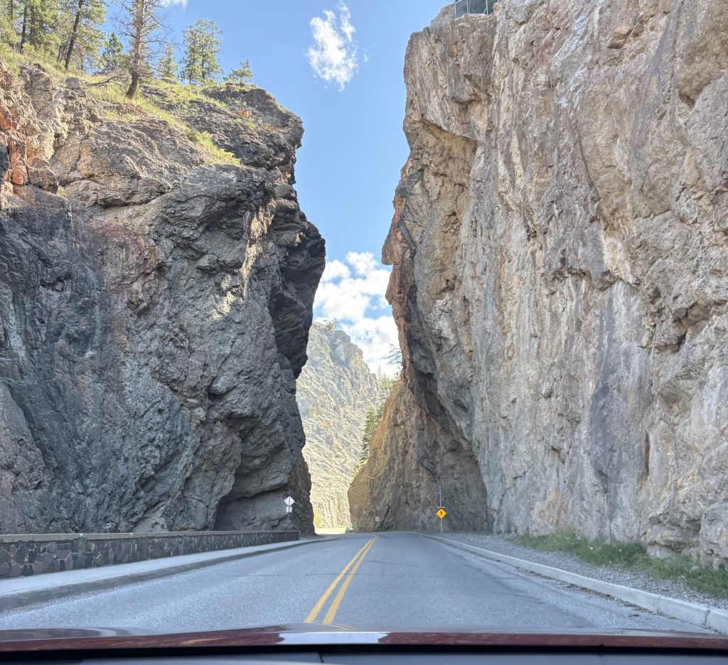
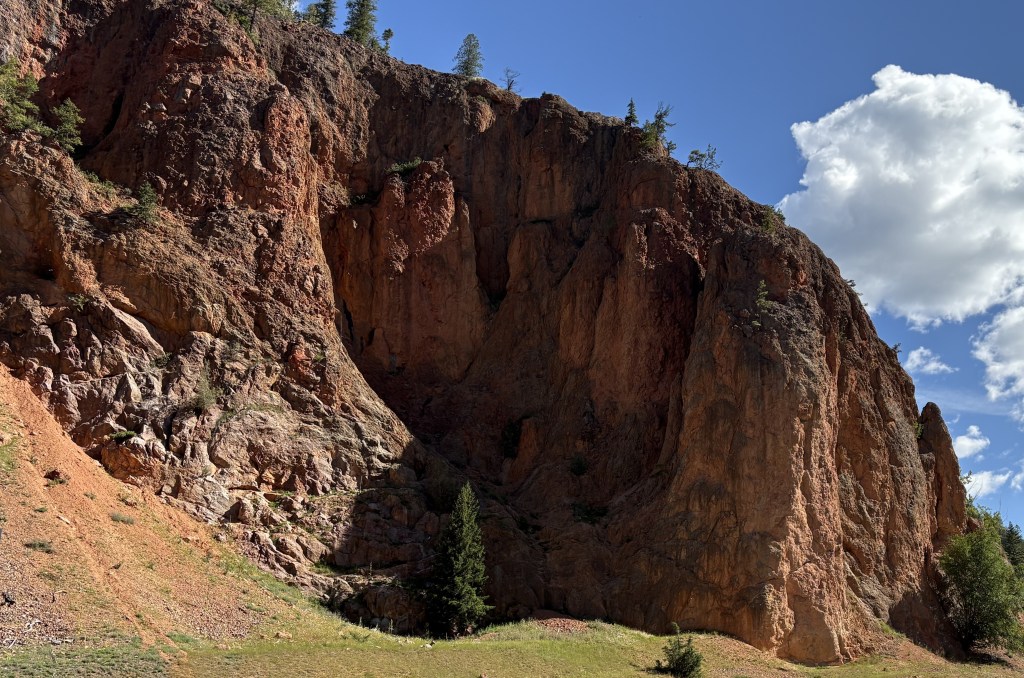
The next thing I saw was also something I didn’t photograph the first time through the Park. A large red rock wall on the left side Highway 93S. This time I pulled off into the area where the entrance gate for the Park is and walked back to take a photo of the wall. I have not seen anything like it so far in Canada and suddenly I felt like I was in southern Utah!
Redstreak Mountain is located right behind the Visitor Centre, and I presume this is how it got its name.
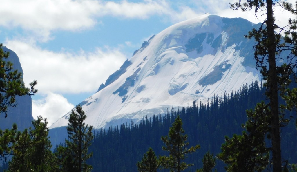
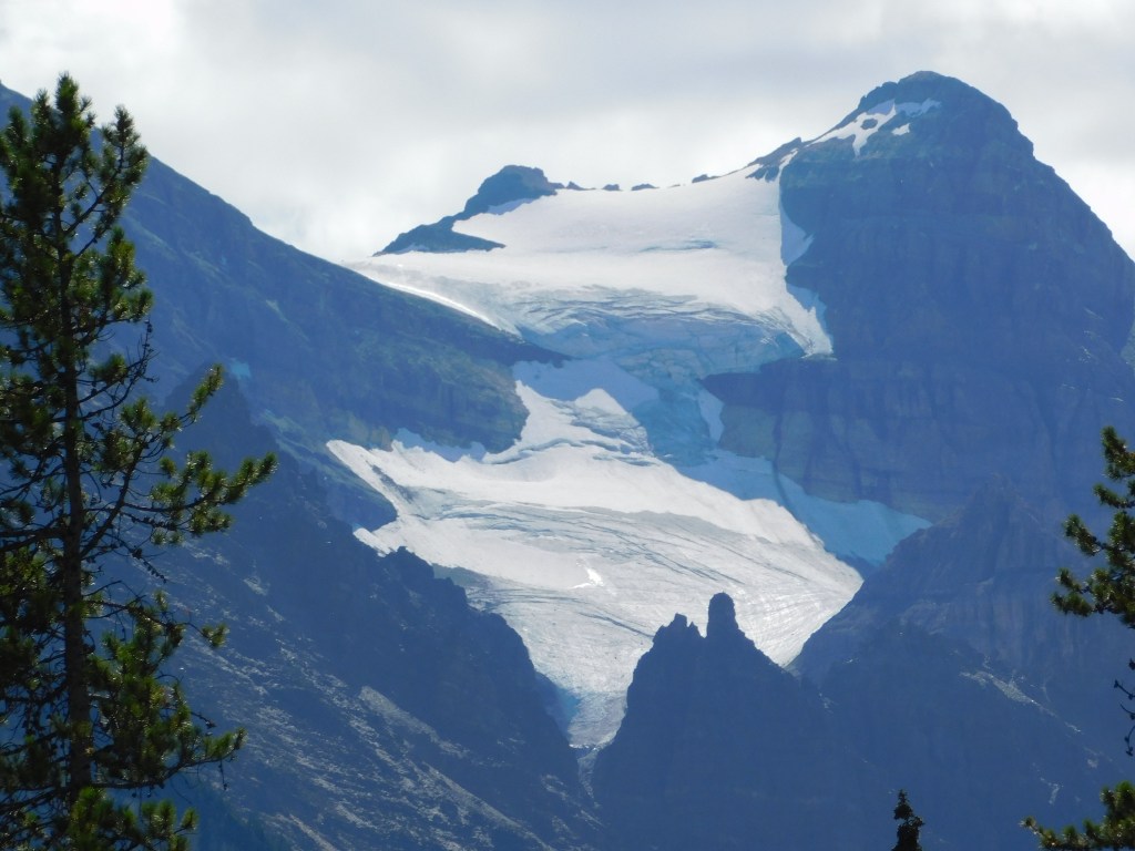
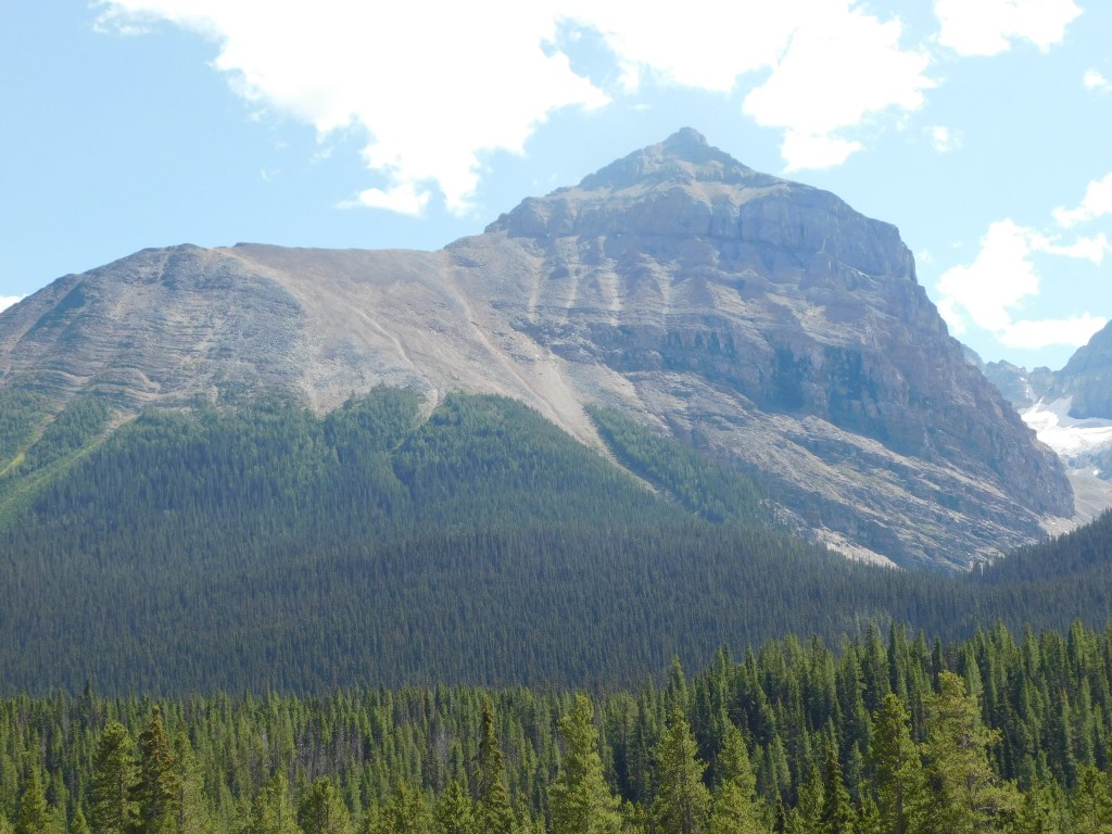
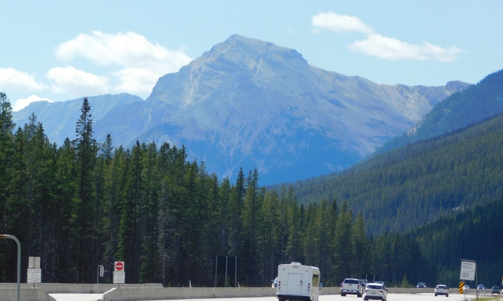
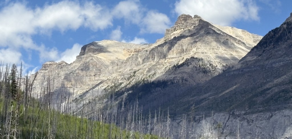
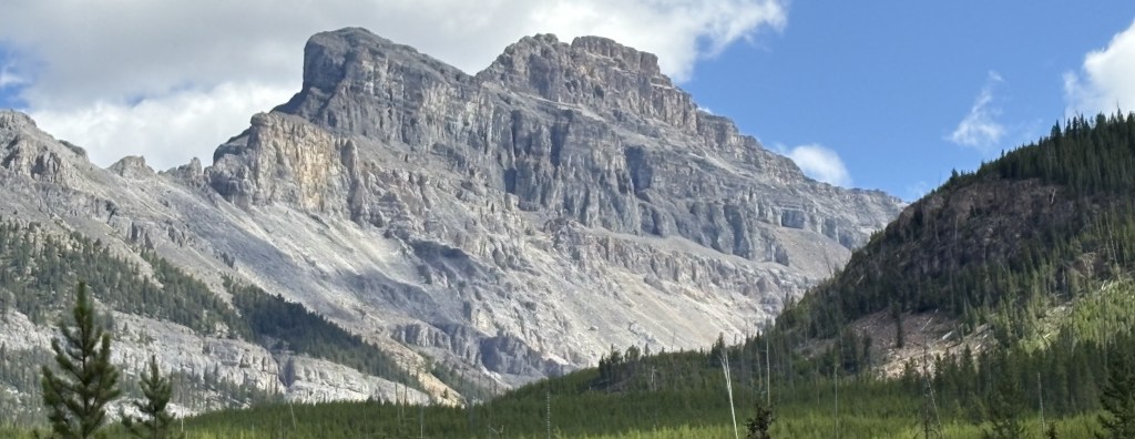
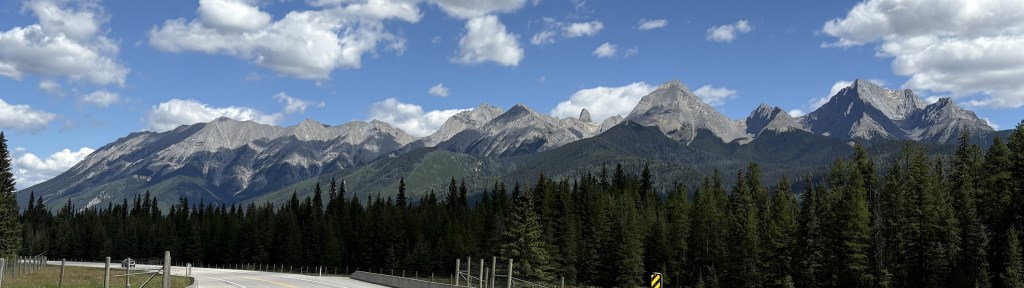
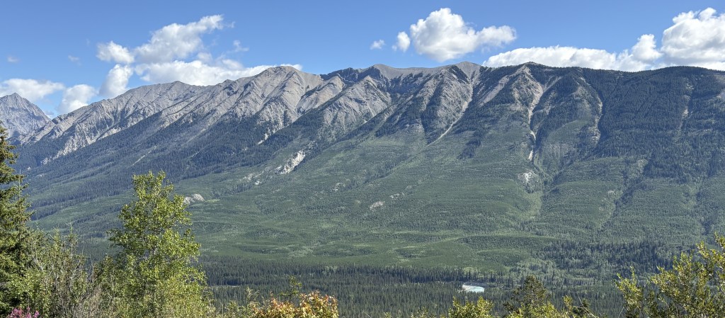
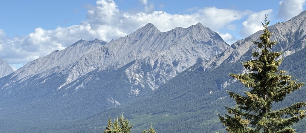
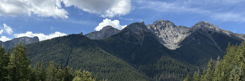
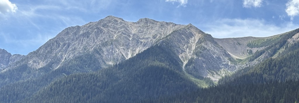
Ok, so from this point forward all you will see are mountains. Most are a fair distance off the road. I have tried to crop the photos to focus on the mountains themselves but occasionally left in more of the surroundings for perspective.
The map for this Park did a much better job of identifying many of the mountains but I will not try to match them to the photos. According to Wikipedia there are 71 named peaks within the Park but the map identifies only about half that many. There are at least 5 mountains over 10,000 feet tall and at least 11 over 9,000 feet tall.
The Park ranges from 3,012 feet elevation at the south entrance to 11,234 feet at Deltaform Mountain, near the north entrance and the Continental Divide. The roadway ranges from around 2,600 feet at Radium Hot Springs to 5,510 feet at Vermilion Pass near the north end of the Park.
The tallest mountain in British Columbia, Mt. Assiniboine (11,870 feet), is located south of the Park in its own Provincial Park. Despite its height it is not visible from within the Park due to other mountains which are closer blocking the view.
Here, now, are three posts with photos of some of the mountains.
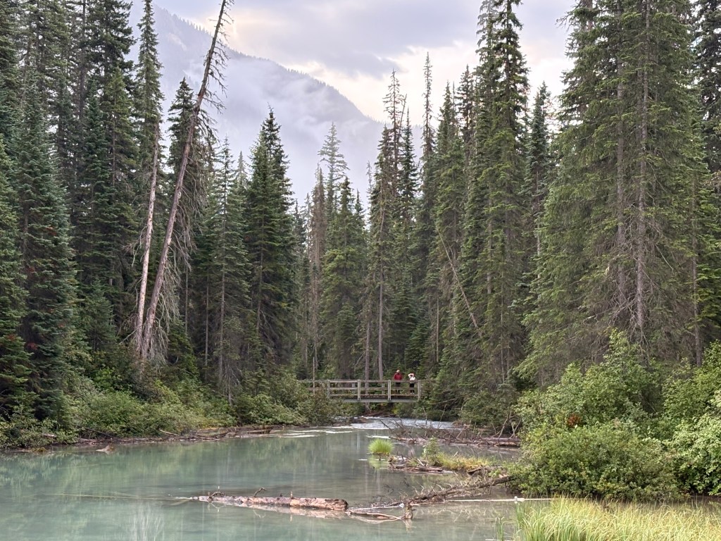
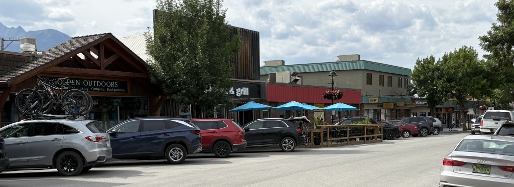
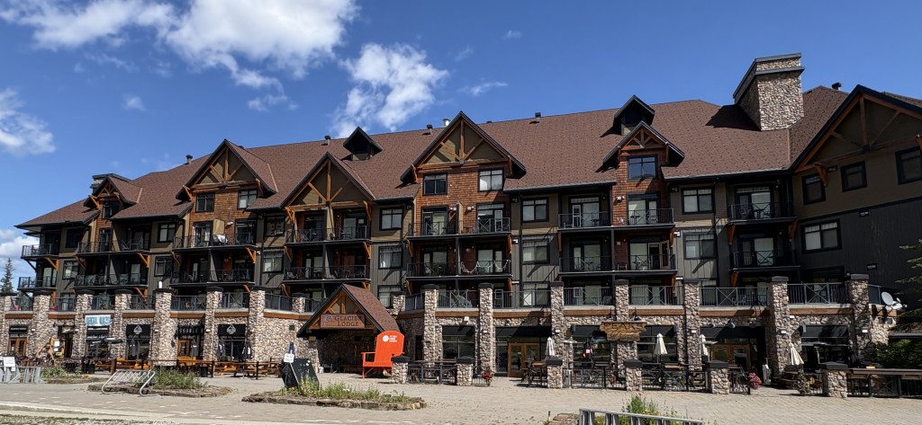
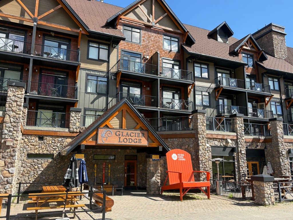
After checking out the pedestrian bridge over the Kicking Horse River I meandered downtown to get a feel for what the town is like. The highway that takes you to town from the TCH is one block off the street where many of the restaurants and shops are located.
I should mention that some of these photos were taken on different days but I am showing them all in this post.
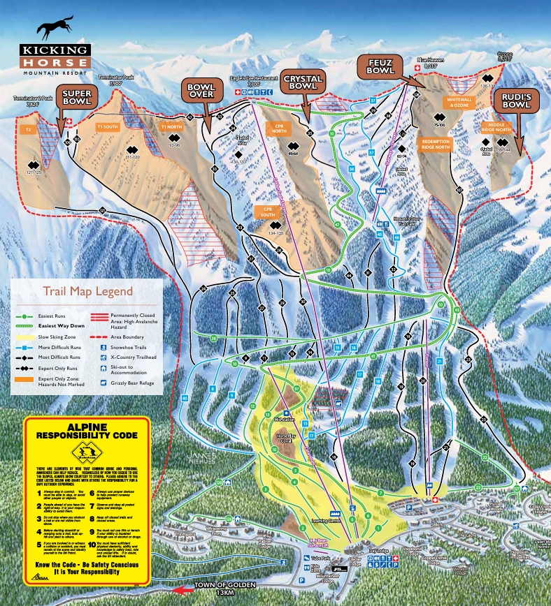
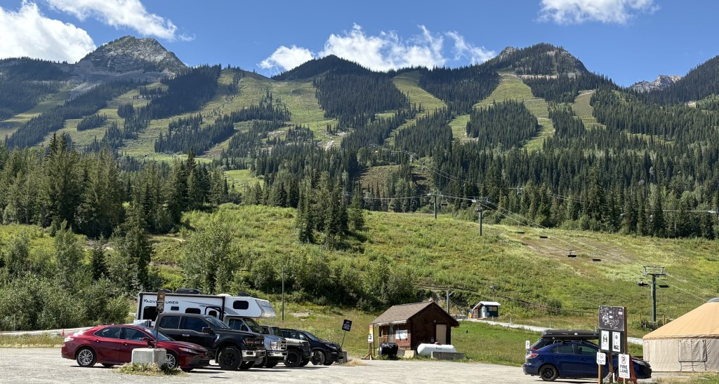
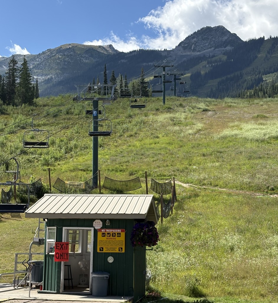
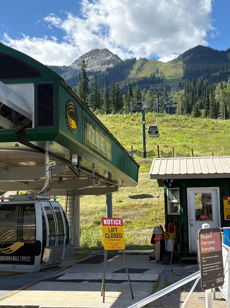
I drove away from town on the street which brought me in from Hwy 1 as I wanted to go up the mountain to check out the Kicking Horse Mountain Resort. It is the 3rd largest ski area in Canada and has the 4th highest vertical drop in North America at 4,314 feet. It is normally a very busy place in the winter but this past ski season there was an incident which put a considerable damper on things. I will explain what happened in a moment.
The slopes can be seen from the Trans Canada Highway as one descends into Golden from the east. The base is located 4 miles west of downtown. The resort has a very wide footprint and obviously the top is pretty high, at 8,200 feet. I am going to post a map from their website to help illustrate what I am about to explain. Please keep in mind that I am NOT a skier so forgive me if I get some of the terminology wrong. I will try to keep it simple.
(Photo credit: KickingHorseResort.com)
There are two traditional ski-lifts (purple lines) which start at the bottom of the mountain. One is located at the main hotel and lodge (a little right of center at the bottom of the map) and the other further right near the resort “village” (next to the red and white “+” sign). For the moment please disregard the longer purple line between them.
As you can see, the two ski lifts only go part way up the mountain. From where the lift on the left ends one may ski left or right to get to various trails to ski back down to the base. From the lift on the right, which goes slightly higher up the mountain, one may again go left, right or immediately back down and ride one of the lifts back up. Going left from that vantage point gives the skier many more trail options.
OK so far?
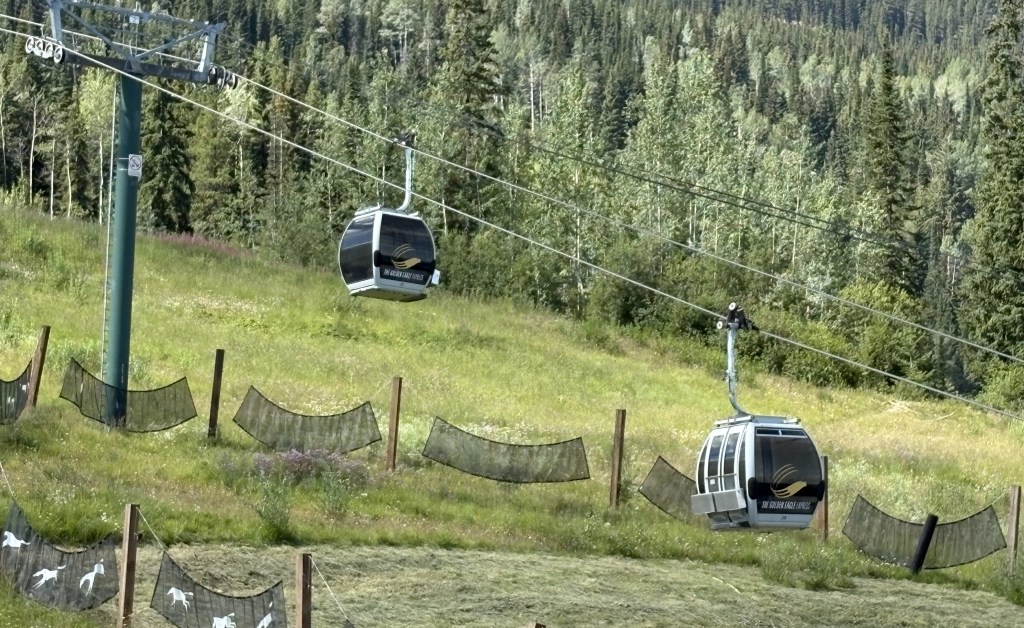
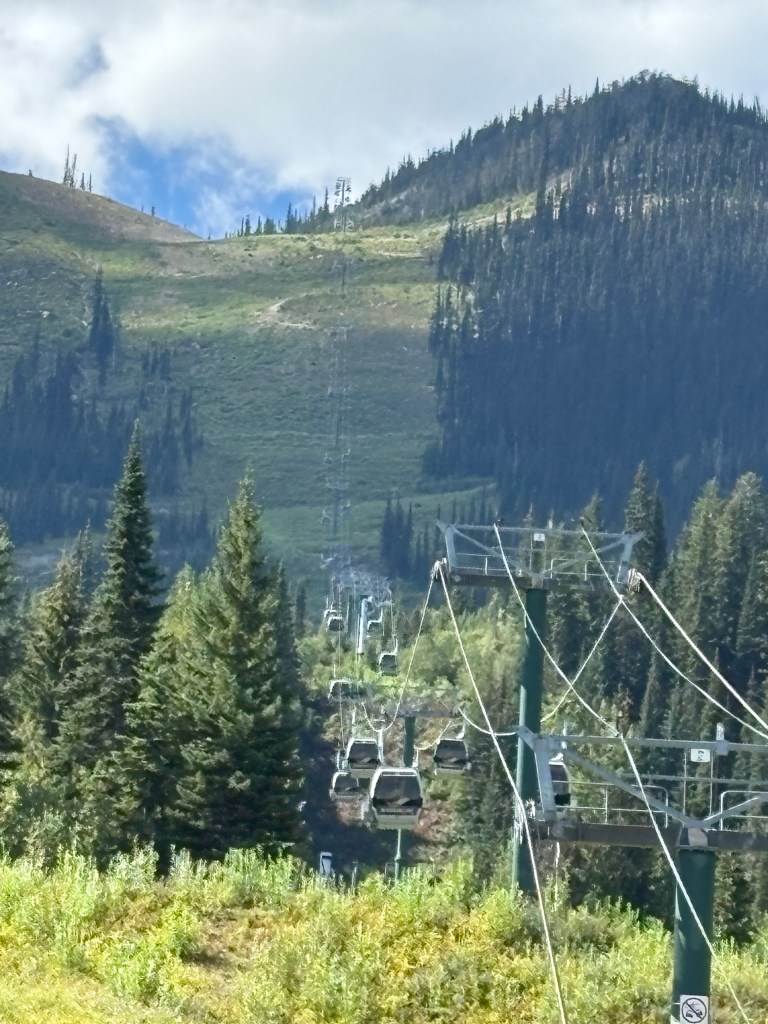
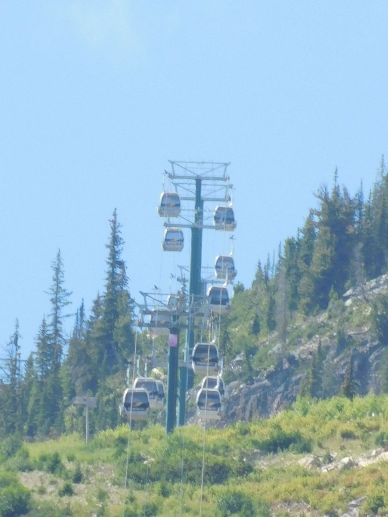
Now, the long purple line which is between the two described above is the Golden Eagle Express gondola which goes all the way to the top of the mountain. Those upper trails are mostly rated “double-black-diamond” which means they are ONLY for expert skiers, although there are other “single-black-diamond” trails which are difficult but not as severe.
One of the reasons I went to the resort was to ride the gondola all the way to the top and check out the view looking west towards Glacier National Park (which, as the crow flies, is only a few miles away). This enterprise was suggested to me by the folks at the Golden Visitor Centre.
Everything was going very well until I arrived at the base only to find that the gondola was not running. I subsequently learned that at 920am on March 10, 2025, one of the gondola cars dislodged from the cable and fell to the ground. Fortunately for the 8 occupants (and the resort, no doubt) the car was only a few feet from the boarding station at the base and only fell a little over 3 feet before tipping over. Thankfully there were only minor injuries among the occupants, but the gondola ride was immediately stopped and the occupants of ALL the other gondola cars had to be rescued from where they were, either by rope or by helicopter.
Hence the gondola was still not operating while I as there in August, though they did get it up and running before the current ski season began. I suspect it being out of order seriously curtailed the remainder of the 2025/26 ski season as skiers could only go part way up the mountain, although they do offer a heli-ski option for those who can afford it.
But no gondola ride or Glacier NP view for JohnBoy.
Now that I’ve explained all that, here are some photos I took while up on the mountain:
Using my digital camera with the zoom lens I took a photo of some of the cars near the top, which would have dropped a much more considerable distance if they had become dislodged from the cable).
Aside from skiing, many ski resorts offer the use of their trails to mountain bikers when there isn’t snow on the ground. Because of the severe slope of the upper trails, mountain biking is usually extremely popular during the summer at Kicking Horse, but not being able to ride the gondola to the top also put the kibosh on that activity. The resort was practically deserted when I was there.
There is a bear enclosure (the call it a “refuge”) part way up the mountain which has a single grizzly bear as it’s occupant. One may get to it by riding the left chair lift but I passed, as I felt that seeing a grizzly bear in an enclosure was cheating, and I didn’t see any other takers, either.
After two days of driving to several National Parks I decided to stay in Golden for the day. I knew there were some things here to see, needed to do laundry and wash the car, and just decided to stay close to “home”.
Golden is a small town but is strategically located for my purpose. It sits at an elevation of about 2,600 feet and has a permanent population of about 4,000. There is a ski resort which brings in lots of visitors during the winter, but many people (like me) probably stay here during the other seasons because it is located just outside Yoho National Park and is relatively close to five others.
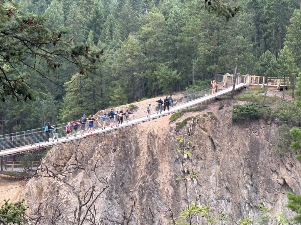
My Airbnb was located just north of town and every day I drove past another one of the major tourist draws – the Golden Skybridge.
It’s main attraction would be the two suspension bridges, one 492 feet long and 426 feet above Hospital Creek (that alone would probably prevent me from walking out on it, never mind my fear of heights). The smaller one is 459 feet across but “only” 262 feet high. They are the highest suspension bridges in Canada.
There are lots of other activities to engage in which would appeal to adults and children alike. The cost depends on how many of those activities you want to participate in, but I’m sure lots of people think “hey, we’re here… why not?,” especially if they have kids. As I mentioned, I drove past it every day and, with the exception of early morning before it opened, the large parking lot was always packed.
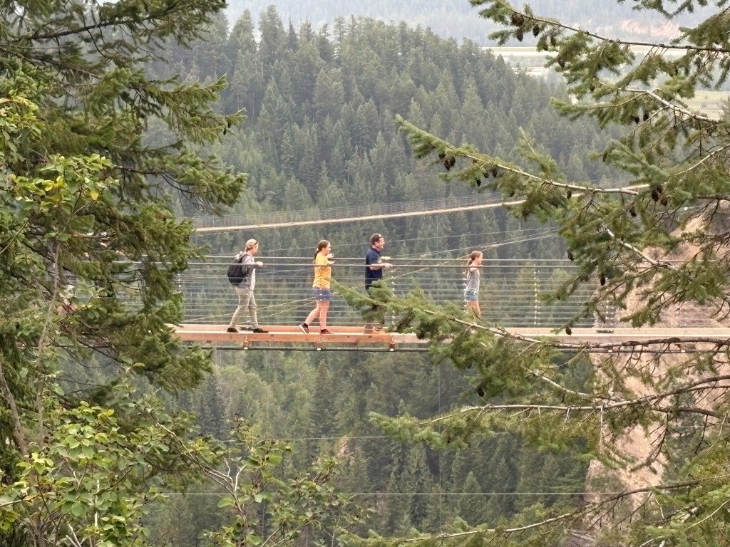
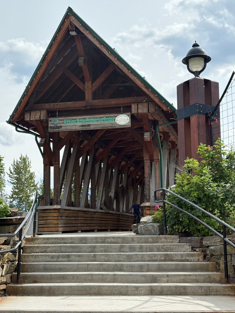
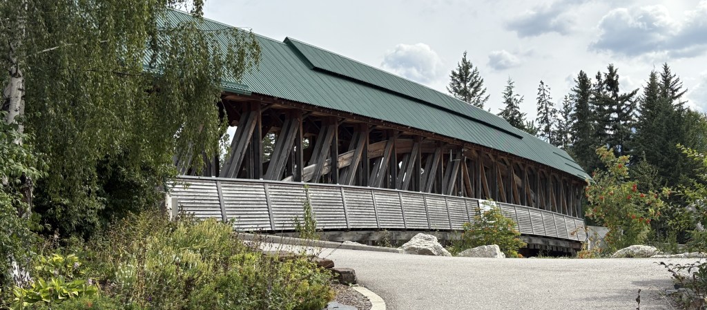
Another place featured in many brochures about Golden is the Kicking Horse pedestrian bridge near downtown. The Kicking Horse name is attached to many things in and around Golden, a river, a mountain, a mountain pass, and the ski area, among others. According to Wikipedia the river got its name in 1858 when a member of the Palliser Expedition was kicked by his packhorse while exploring the river and trying to rescue another horse from it.
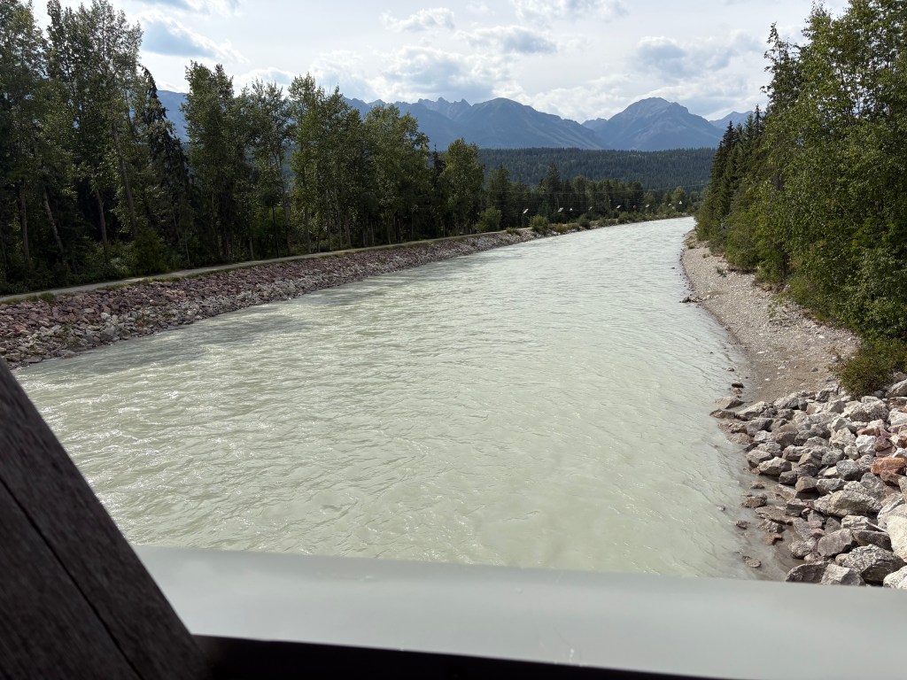
The bridge, the longest freestanding timber-framed bridge in Canada, spans the Kicking Horse River. The Kicking Horse river joins the Columbia River just north of the bridge, near the airport and Confluence Park.
Now I know what you’re probably thinking – “JohnBoy, you told us just yesterday that you saw the Columbia River next to the town of Revelstoke, more than two hours west of here”. That’s true, I did. Here’s the deal…
The Columbia River starts at a small lake (not surprisingly, Columbia Lake) near Fairmont Hot Springs, well south of Golden. I passed it as I drove from Cranbrook, in southeast British Columbia, up to Radium Hot Springs, before I turned off to drive through Kootenay National Park. It initially flows NORTH, parallel to Hwy 93/95, and after Radium Hot Springs continues to follow Hwy 95 up to Golden.
(Photo credit: Americanrivers.org)
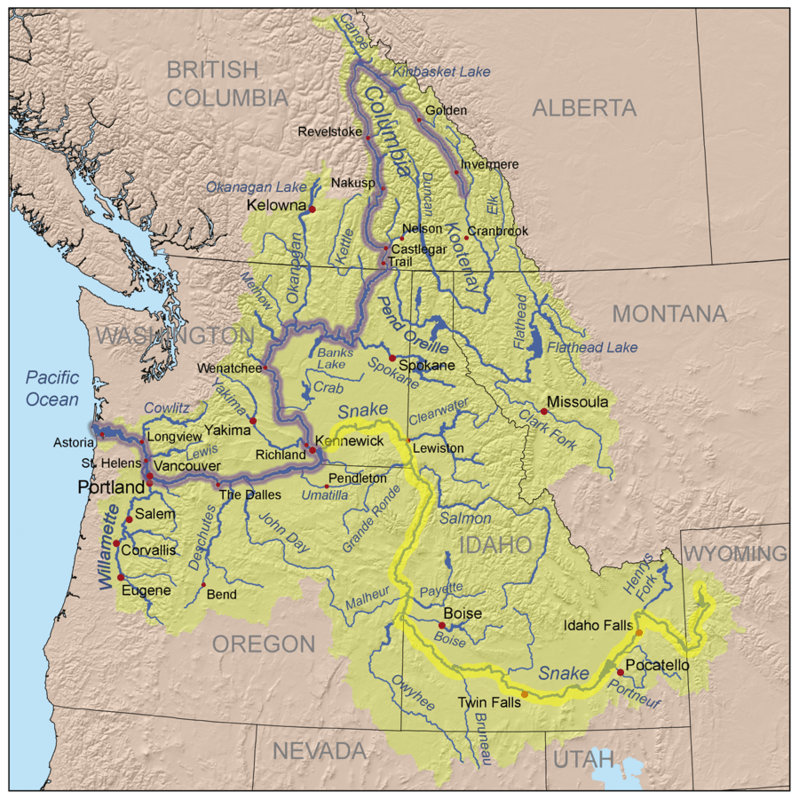
After passing through Golden it continues north past the Columbia Icefields, where it undoubtedly picks up a lot more water, and continues north until it gets near Mica Creek, where it changes direction and starts heading SOUTH. It will then flow past Revelstoke and continue on down to Castlegar (which you will see when I post photos from there later in my trip). It continues south into Washington State, eventually passing through the Coulee Dam, past Wenatchee, WA on down to the border between Washington and Oregon, where it then flows west, forming the Columbia River Gorge, and eventually out into the Pacific Ocean.
I have more things to show you from in and around Golden and will share them in the next post.
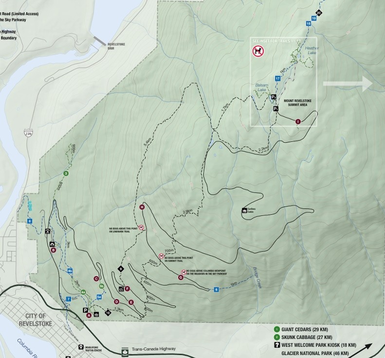
After passing through Glacier National Park I continued west on Hwy 1 to Mt. Revelstoke. It is located next to the highway, near the town of Revelstoke.
(Photo credit: Parks Canada)
I stopped at the information kiosk between the two Parks and the ranger there suggested I get to Mt. Revelstoke sooner rather than later, as parking near the top gets scarce as more people arrive. She was right.
The Trans Canada Highway doesn’t even go through the Park, but runs along part of the southern edge. Once I got close to town I pulled off onto the entry road and found that the only road in the Park is the “Meadows in the Sky Parkway,” a 16-mile, two lane road comprised of a set of many switchbacks (and with a low speed limit) which leads to the top. There were a handful of parking areas for hiking trails along the way.
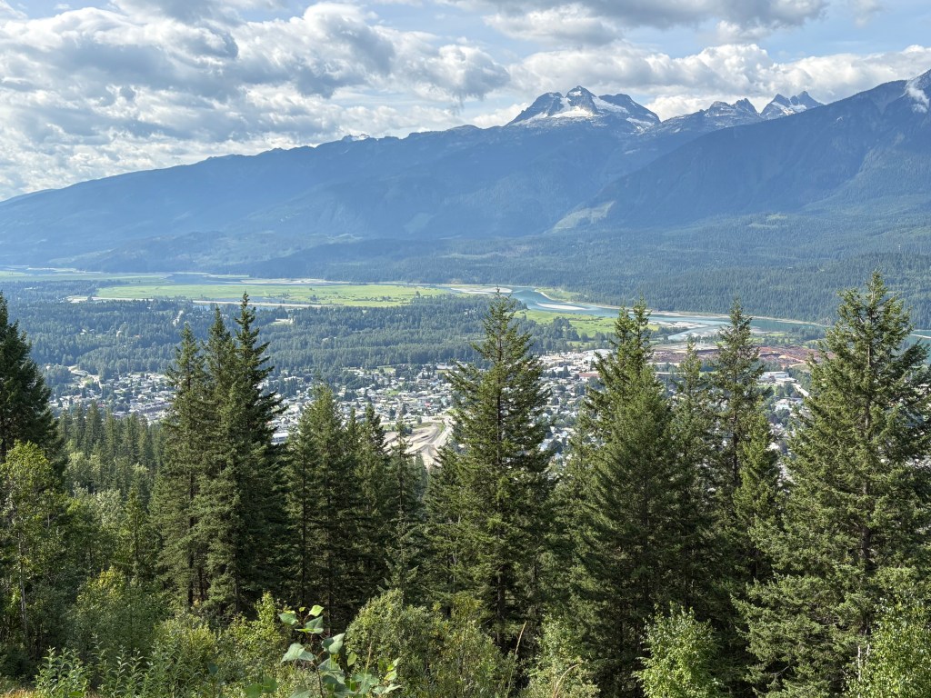
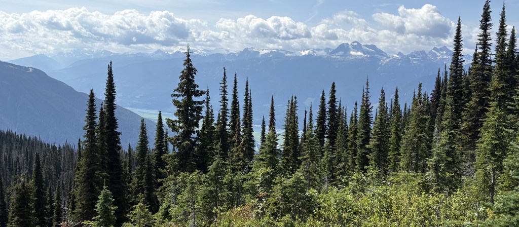
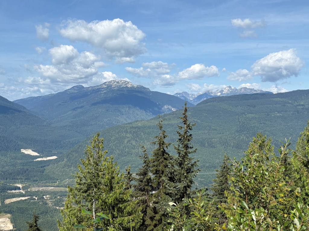
This one looks down at the town of Revelstoke. Beyond it is the Columbia River, and the mountain in the distance is Mt. Begbie, which is almost 8,000 feet tall. I proceeded all the way up to the small parking area at the top (which I had to walk to as vehicles were lining up along the access road). There was a small cabin with rangers to answer questions.
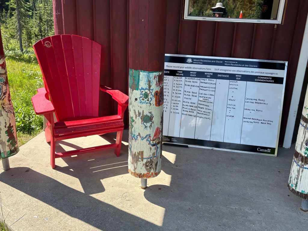
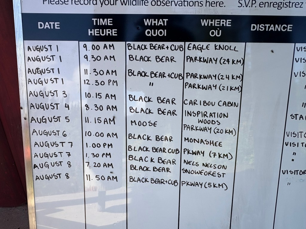
The sign reports recent wildlife sightings:
There wasn’t even a view from this vantage point, and one had to hike out to the actual mountain peak to see anything. There was a sign indicating I was at 6,360 feet elevation.
I asked if there were places to get views on the way back down and stopped at two of the places that were suggested to me.
I should also mention that as I was driving up the mountain I was interested to see a sign in the road prohibiting dogs “beyond this point”. Of all the Parks I have been in I have never seen that restriction. Apparently, some dog owners would let their pets run loose, contrary to Park rules (which pretty much all Parks have. Pets must be on a leash). This often resulted in bear attacks, and then the bears might think that, hey, this might be a nice place to hang out. So this Park decided to ban dogs altogether above a certain elevation.
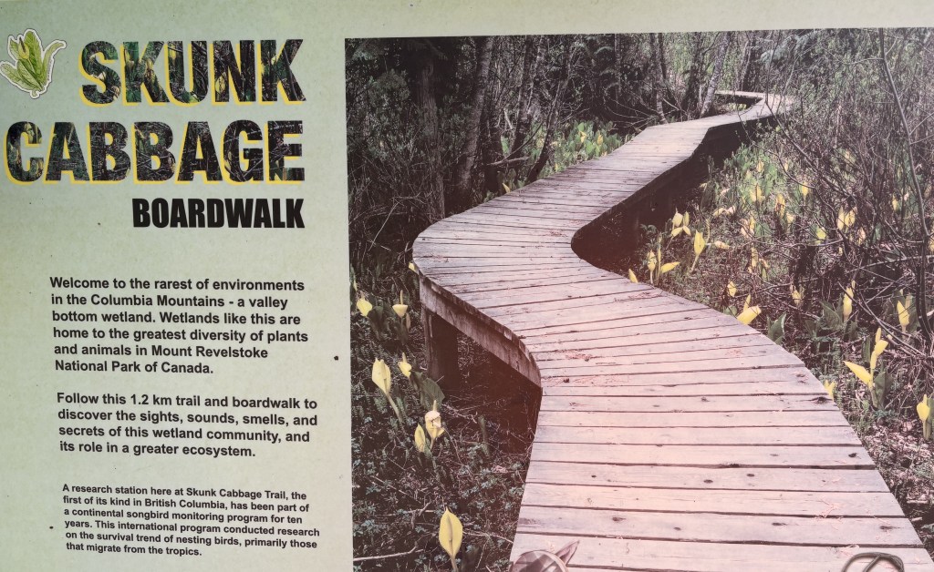
When I got back down I went into town to get something to eat and then started back to Golden, a 2 1/2 hour drive. When I had stopped at the kiosk earlier the ranger had suggested two places I would now pass on my way home. The first was a place called the Skunk Cabbage Boardwalk, a wetlands area next to the Illecillewaet River (the name is pronounced Ill-a-silhouette) and the water flows down from an enormous glacier of the same name in Glacier National Park. It is well south of the highway and not visible from the road.
I walked towards the boardwalk but met some people coming back who told me that there was a chain across the pathway that prevented anyone from going any further. I found out later that there were probably birds nesting in the area and authorities didn’t want them to be disturbed.
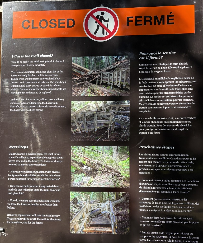
So I drove to the Giant Cedars Boardwalk just up the road, and the lack of vehicles there should have been a clue. It, too, was closed:
It is in a small rainforest and some of the trees toppled, severely damaging the boardwalk.
So although it was a nice day it was incredibly disappointing in many respects. I was hoping to see much more, especially in Glacier, but it just wasn’t meant to be.
Later in my trip when I shared with my family where I had been one of my brothers, an avid skier, asked me about the ski area at Mt. Revelstoke. I told him I never heard of it, and didn’t recall seeing any signs for it.
I looked into it and found that the Revelstoke Mountain Resort is across the road from the National Park, and is located east of the town of Revelstoke. It is actually located on Mount MacKenzie. It features the longest vertical drop in North America, at 5,620 feet (from a top elevation of 7,300 feet), and they compare themselves to Breckenridge in Colorado, which is an enormous resort, and is where my brother who asked me about it worked for one season after getting out of college. Revelstoke Mountain Resort is one third the size of WhistlerBlackcomb near Vancouver, and the longest run is over 9 miles!