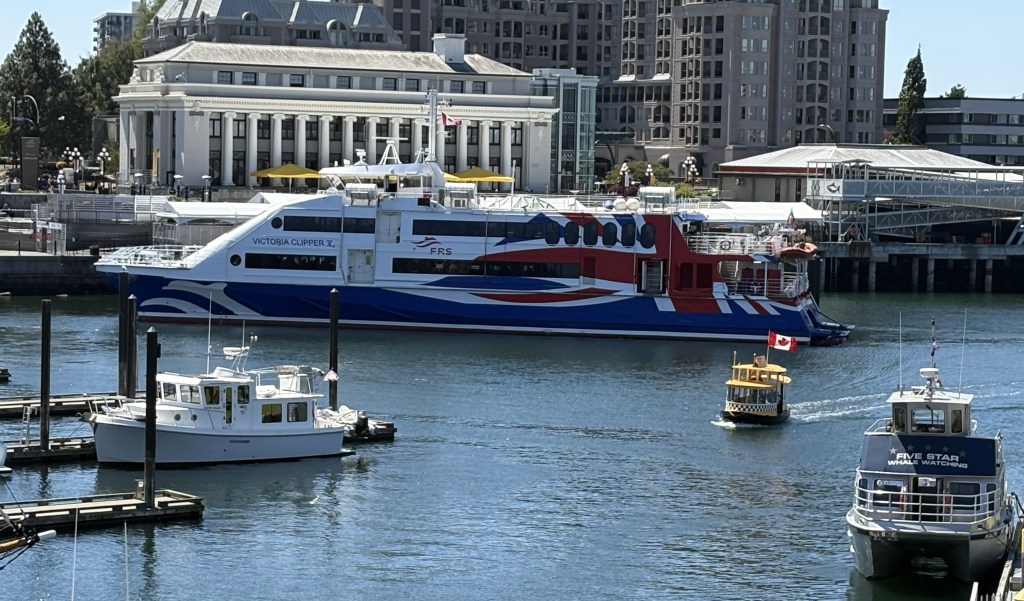
The red, white and blue vessel above is one of several Victoria Clipper ships, some of which transport people at high speed either locally or between Seattle and Victoria. I rode one many years ago and during that trip also saw a new one being delivered aboard the equivalent of a floating flatbed. This one sat in the harbour all day until I returned to the harbour after having become disoriented and walking way more that I intended to.
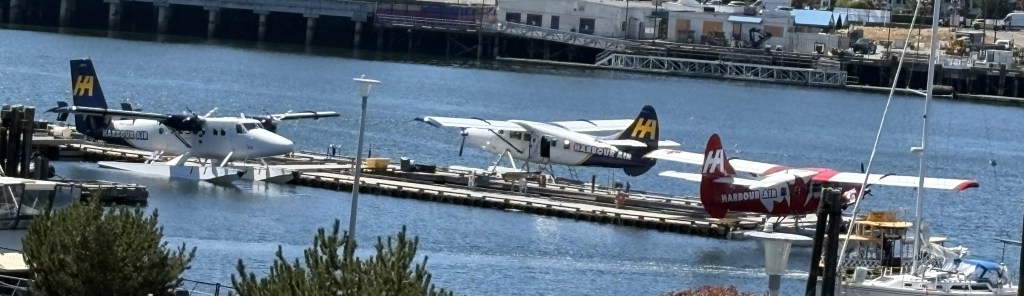
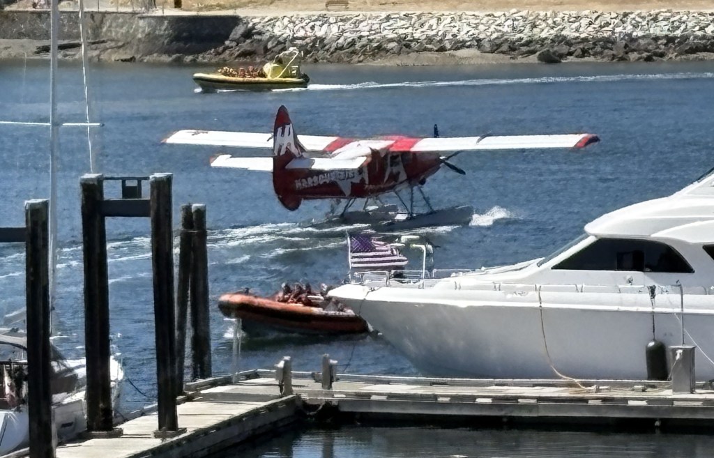
Three sailplanes were docked in the harbour. Shortly after I took this photo the red and white one fired up it’s engines and propelled itself out to the “water airport” I mention in a post a few days ago where it took to the sky.
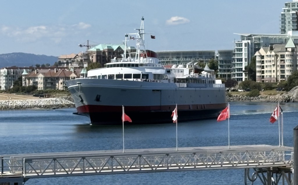
And exactly 24 hours after I arrived in Victoria on it the day before, here came the MV Coho, transporting another batch of travelers from Washington State:
Monday I drove into downtown Victoria and parked in a multi-story Parkade deck about three blocks from the Inner Harbour. My plan was to walk to see many of the various attractions I had noted on my “things to do” list. I was a little concerned that the city and the attractions might be too crowded because large cruise ships dock near Victoria and discharge many of their passengers into town. It wasn’t nearly as bad as I feared it might be. Here are some of the things I saw as I walked around the city:
An “on the sidewalk” toilet:
A store selling some pretty amusing t-shirts:
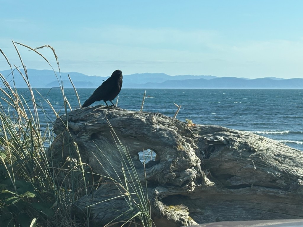
Later in the day I saw two different people wearing the raven t-shirt. I believe what I saw out by the water was a crow, not a raven. Ravens have noticeably curved beaks while crows do not.
Some words of wisdom from the late Jimmy Dean (who died in 2010, yet still promotes his products in radio and tv ads):
A very hungry seagull which, surprisingly, I didn’t see all that many of as I walked around by the harbour.
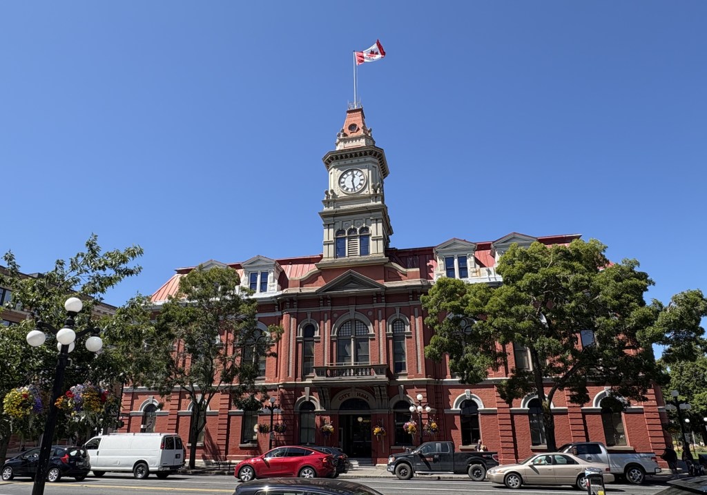
City Hall:
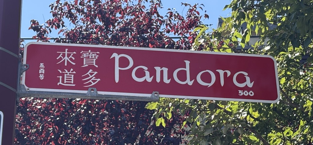
Signs near Chinatown, including special street name signs:
I had to wait in order to walk out into the middle of the street for that one.
Some amusing signs:
Some nice tilework in an entryway to a courtyard in the open space between buildings:
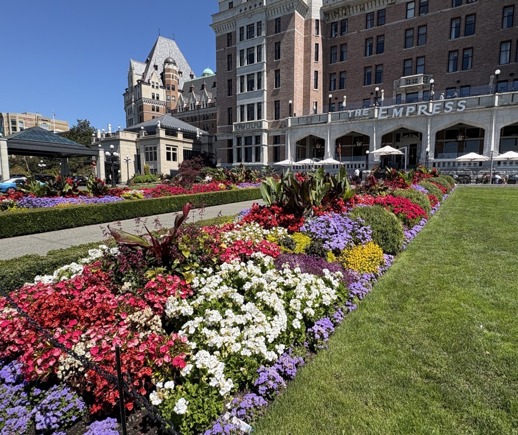
But the thing that impressed me the most were all the baskets of pretty flowers hanging on the lamp posts around town:
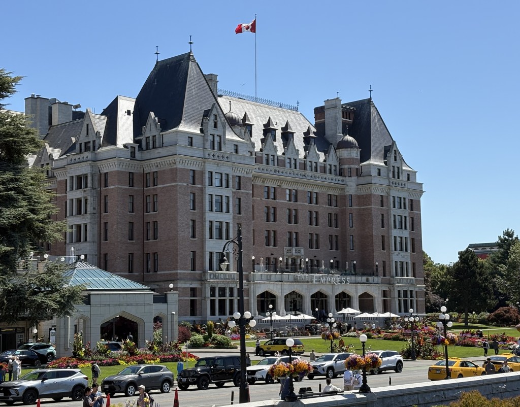
They were everywhere. I think that always adds a nice look to a city street. I also walked around many residential streets near the harbour and they, too, were well adorned with pretty flower beds. The only place that overdid it a bit, IMHO, was the Empress Hotel, a swanky hotel near the harbour. Their display was quite gaudy and could have been cut way back without sacrificing anything.
I could have gone in to the Empress for high tea and sipped the nectar with my pinky extended but I’m too cheap.
I saw this statue near the harbour as well:
“I will now make this bird disappear by passing it through this horseshoe”
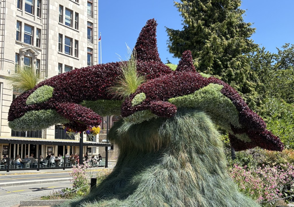
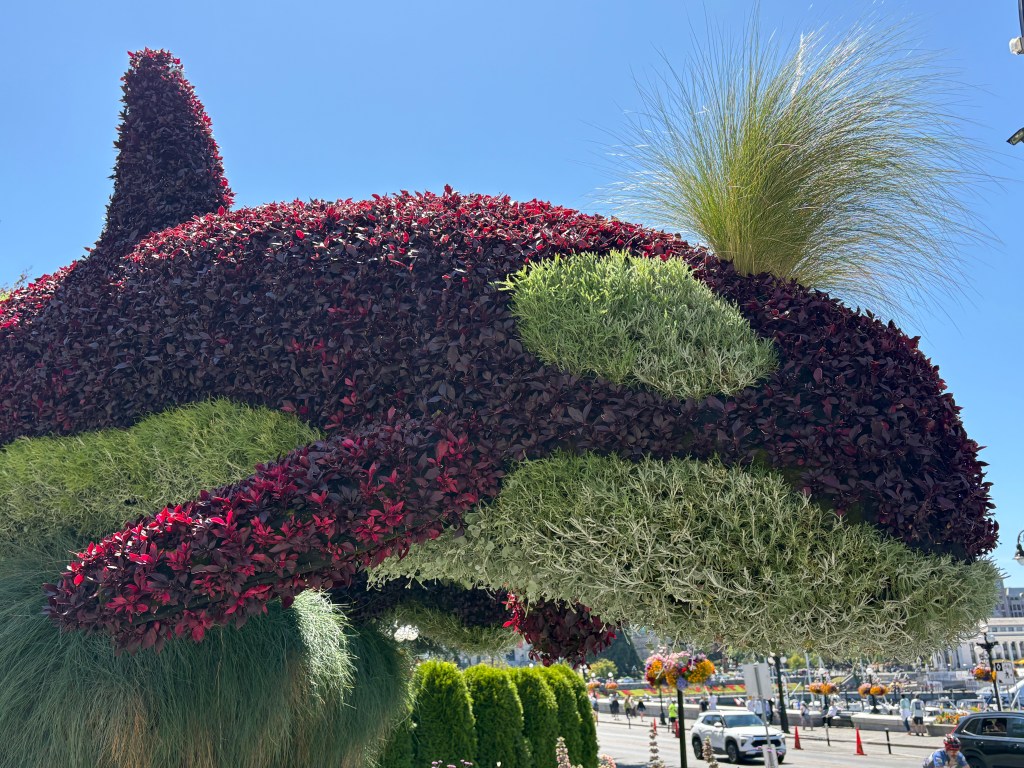
About a block from the Empress Hotel was this large whale topiary:
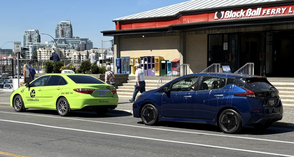
And finally, outside the ferry terminal building, an example why you might not want to buy a dark blue car instead of a lime green one:
The ferry from Port Angeles, Washington State dropped us off in the harbour in Victoria mid-afternoon. I had a scenic drive which would take two hours each way planned so I decided to go ahead and get it checked off the list since I didn’t know my way around the city. It was easy to get on Route 1 (the Trans-Canada Highway) from the ferry terminal and then I hopped on Route 14 which would take me around the bottom of the island to the southwest and then follow the Strait of Juan de Fuca which separates Vancouver Island from Washington State.
I passed through little towns like Langford, Sooke, Shirley and Jordan River. The road eventually turned inland and climbed up into the San Juan Ridge of mountains. Ultimately the road would end at Port Renfrew. I never made it that far. Once the road started climbing up into the woods, a) the drive became like something I could do in North Carolina or Virginia – driving through a tunnel of trees, but more importantly, b) the road had lots of curves, but more distressing were the severe undulations which often caused the car to almost bottom out if I went too fast. I now drive a Toyota Camry which, when loaded with all my stuff, sits pretty low to the ground (and I bought it with low profile tires on it compared to what I normally buy). I finally said “enough” and turned around. I was getting carsick on land!
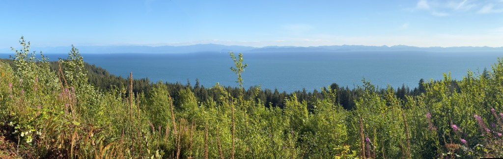
Here are some panoramas looking west towards Washington State. The photos make them look tiny, especially using the panorama format, but actually looking at the mountains of Olympic National Park was very impressive, even from a distance.
This crow landed on the rock in front of me as I was getting ready to back out from my parking place by the beach.
That photo was taken at Jordan River and from there it would take me about an hour to get to my Airbnb for the next two nights.
Now that I have been in Canada for nearly a week I have decided to put all my posts from the United States, traveling from Durham to Seattle during July, on hold and post them at a later date. I took lots of photos in Ohio (Cleveland and Cincinnati), Indianapolis, a surprise destination in Kansas, Boise and Seattle, plus unexpected finds I stumbled upon along the way. It takes time to go through them all and select which ones I want to post (and I am now using both my smartphone and my digital camera). So they will wait until I get back to Durham, or if I get snowed in somewhere up here in the Great White North.
I do want to tell the amusing JohnBoy story I promised you before I switch countries. This took place the morning I drove west of Boise and then south past Kuna to get to the Snake River.
When I arrived at first overlook there was a small car already in the parking lot. I didn’t see anyone around and assumed they were down by the top of the cliff overlooking the river (which I couldn’t see from the gravel parking lot).
I was moving my car around trying to decide which way to angle it to make my sunshields in the windows most effective. I tried pulling in behind the silver car which was parked parallel to the edge of the parking area but with the front of my car facing the edge, thus perpendicular to the silver car. I was quite shocked when something popped up into the rear window and looked towards me.
In that split second I thought “there’s a frickin’ baby gorilla in that car!!”. I swear to God that’s what it looked like. Now keep in mind, I had my sunglasses on, and the back windows of the small car were tinted, making anything inside it look dark.
I pulled my car to the other end of the parking area, got my smartphone out and walked over to the car to take a picture. About that time, a man who had been sleeping in the back of the car opened the back door and got out. Boy did I have egg on my face…
He walked over to the lavatory to use it and I waited at a distance for him to come out. I started to explain why I was approaching his car the way I did (he might have thought I was going to break into it) but he muttered something that implied he wasn’t terribly interested so I left him alone, used the lavatory myself, and headed down towards the river.
Now I know what you’re thinking…. JohnBoy, why in the world did you think there would be a baby gorilla inside someone’s car near Kuna, Idaho??? I will direct your attention to a post I made in 2017. Enter “Boise” in the search box on the home page and then go down to the link that will take you to a post titled “Boy, I sure didn’t see this one coming”….
Fortunately, the tsunami turned out to be no problem here in British Columbia. I did change my route for yesterday and called off the planned drive to Tofino, on the side of the island facing Washington State, but had a glorious day driving in the mountains of inland Vancouver Island, as far away from the ocean as I could get! More on that later. I know, I am SO FAR BEHIND posting but am accumulating lots of photos and stories. Just waiting for the proverbial rainy day…
Last night, after returning home from “Latin Night” in Campbell River (I was invited to tag along by my Airbnb hosts here, though none of us participated in the dancing), I learned that a wildfire was just detected on Tuesday, east of Vancouver, which may affect my travel early next week. A fire was detected in Sasquatch Park (I kid you not) and a large area has had mandatory evacuations imposed. It will likely affect getting to Route 3, which runs along the border with the United States, and which I was planning to take Tuesday morning of next week when I finish my stay in Surrey/Vancouver. I will monitor this situation closely.
And speaking of wildfires, sadly, the wildfire at the North Rim of the Grand Canyon has gotten MUCH WORSE and is now consuming much of the area north of the Park entrance on that side of the canyon.
Looking from the South Rim towards the North Rim entrance.
I crossed from Port Angeles, Washington to Victoria, BC, Canada on Sunday, July 27.
We sailed aboard the MV Coho ferry:
It took about an hour and a half to traverse the Salish Sea in the Strait of Juan de Fuca before arriving in Victoria, British Columbia. Victoria is located at the southeastern end of Vancouver Island, a huge island about the size of Kansas. Vancouver Island is the 8th largest island in the world.
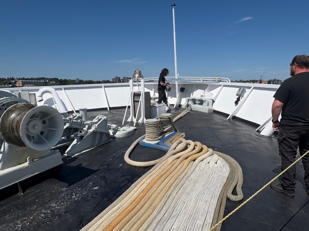
Some of the deckhands prepping our ship for docking:
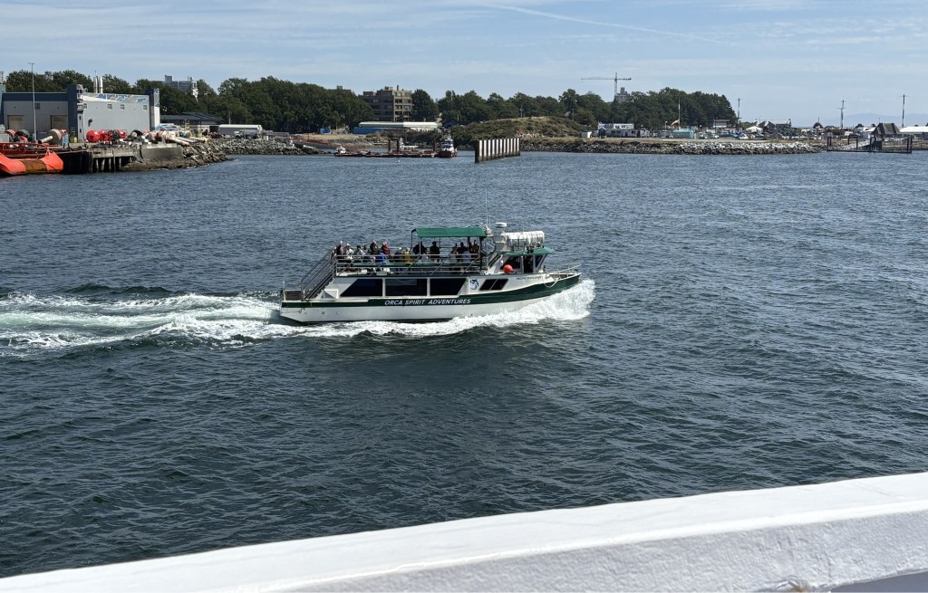
Some of the things we saw as we approached the harbour (I’m in Canada now and have to talk the talk):
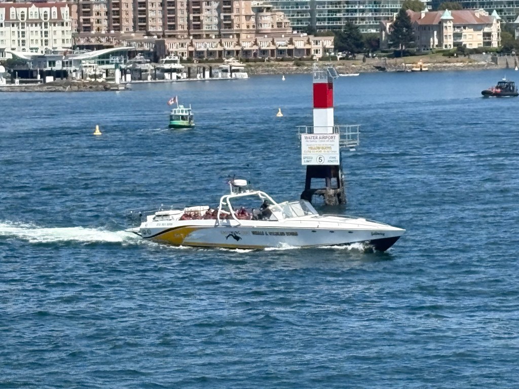
A dichotomy of speed:
The Air Traffic Control tower (well, building) for managing approaching and departing seaplanes. One of the photos above shows a buoy with a sign reading “Water Airport”
Part of the Canadian Coast Guard fleet:
And once I got on land I treated myself to a reward, confirming that I was actually in Canada!
I have been on the road 2 days shy of 4 weeks. When I arrived at the ferry terminal in Port Angeles, immediately before leaving the United States, I had driven exactly 4,600 miles since leaving Durham, 759 miles over my projection (which was point-to-point mileage between the towns I would be staying in and didn’t include side trips).
I never imagined I’d be talking about sex on my blog, although when I entered that word in the Search box on the Homepage several posts appeared which included the word in their content. My mother is probably spinning in her grave… Sorry, Mom, but this is important stuff.
As I drove across several corn producing states on my way out west I noticed something I had never really paid attention to. In one specific field there were alternating, machine-wide rows (maybe 10 to 12 stalks wide), one group with tassels on the top and the next without. That got me thinking – male/female? Not so fast, Skippy. Upon doing a little research all corn stalks are monoecious, meaning they have both male and female “parts”. Yikes!!
(Photo credit: Nature Journals)
The tassel, a flower at the top of all corn stalks, is the male part and produces pollen. The sperm, if you will.
The ear, which grows before fertilization, has lots of silk strands which grow out of the end (and which you remove, along with the husk, when preparing the ear for consumption). Each strand of silk is attached to an individual kernel (the fruit) which will develop once the silk is pollinated. Let the wind do its matchmaking and voila!
So the farmer who planted the field I saw was trying to promote cross-pollination. The hope is that by removing the tassels at the top of one section of corn the silk on that stalk must get pollinated from a neighboring plant that still has a tassel atop it. They don’t want a stalk to “self-pollinate” (bad stalk…).
Who knew???
Only every farmer that grows corn.
Relax Mom, at least I didn’t name this post Corn Porn…
And since we’re talking about corn and not porn, here is a fun fact:
The highest ranking corn producing states in the US in 2024 were:
1 – Iowa – 2,627 million bushels
2 – Illinois – 2,311
3 – Nebraska – 1,803 (take that, Cornhuskers…)
4 – Minnesota – 1,345
5 – Indiana – 1,000
Then South Dakota, Kansas, Missouri, Ohio and North Dakota rounding out the top ten.
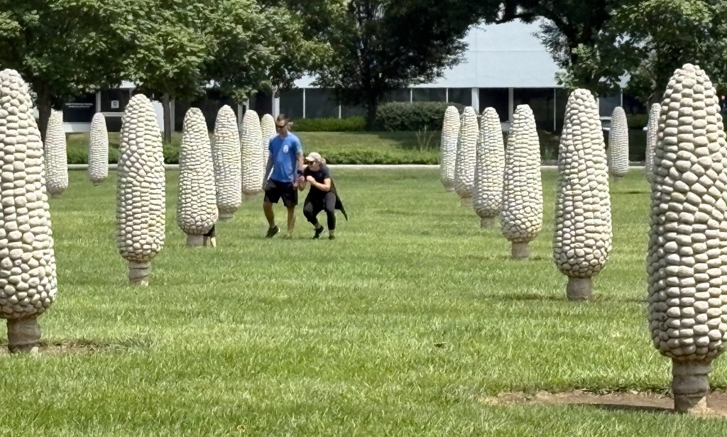
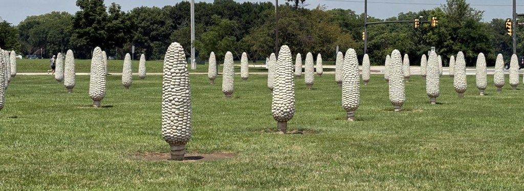
Now that I’ve talked about irrigation here is something that hasn’t needed a drop of water since 1994. The Field of Corn in Dublin, Ohio – a small town located just northwest of Columbus.
This is an art project commissioned by the Dublin Arts Council as a tribute to Sam Frantz, who actually grew corn on this piece of land, and as a proud reminder of Dublin’s agricultural history (Source – Wikipedia). Mr. Frantz was both a farmer and an inventor, and created several hybrid corn species. The type of corn used to create the molds for this display is Corn Belt Dent Corn, a double-cross hybrid.
Each ear is 6′ 3″ tall and weighs 1,500 pounds!
There were actually 3 molds made and when they were installed they were each rotated slightly so it would appear that each was unique. I would have never noticed…
There are 109 ears on the property, plus two rows of Osage Orange trees, the purpose of which is unclear to me. I didn’t read all the signage and wasn’t aware that there was more to it than corn. The artist, by the way, is Malcolm Cochran. He is from Columbus. The project was finished in 1994.
As my friend Shawn likes to say when I drive across Iowa and Nebraska – “Corn, corn, corn, town, corn, corn, corn, corn…”
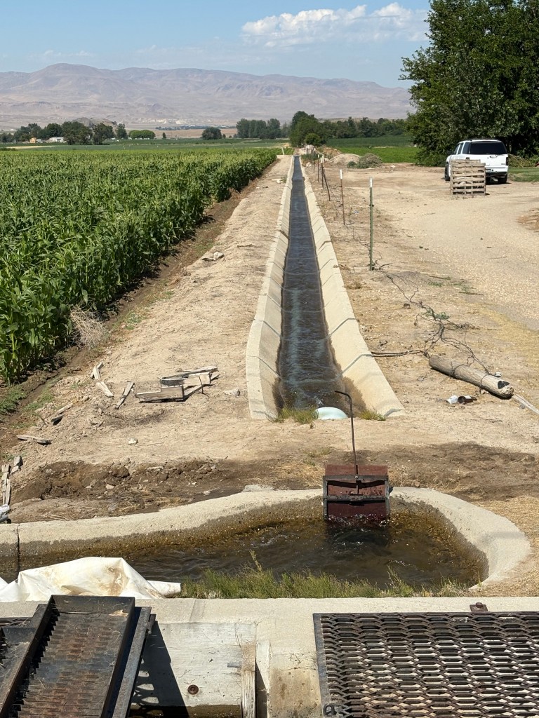
These photos illustrate how modern irrigation techniques are employed on many farms throughout the central and western US. What prompted me to stop driving and start taking photos was this tree in someone’s yard.
As you can see, the lawn in front of the house (lower left of photo) was a gorgeous, thick green mat which you often see in tv ads for fertilizer. Beyond the tree you can see fields with two different types of crops planted. Just to the right of the trunk of the tree I could hear water gurgling and next you will see what prompted me to walk over and check it out.
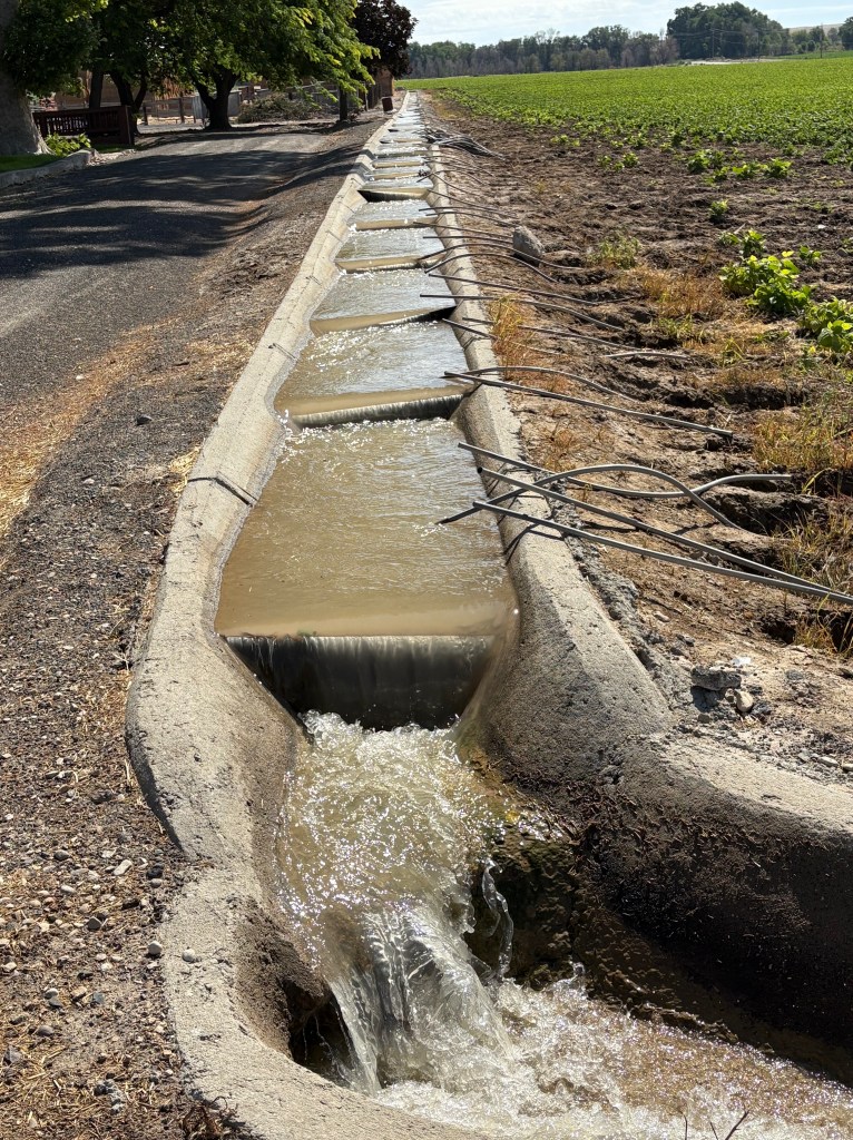
To the right of the driveway as I looked west from the road, was this long cascade of water flowing down from a slightly higher elevation.
It then went down a drain next to the road – it’s destination not obvious at the time, but not a storm sewer I assure you. Water is a precious commodity and farmers use utilize every drop of it they can get access to.
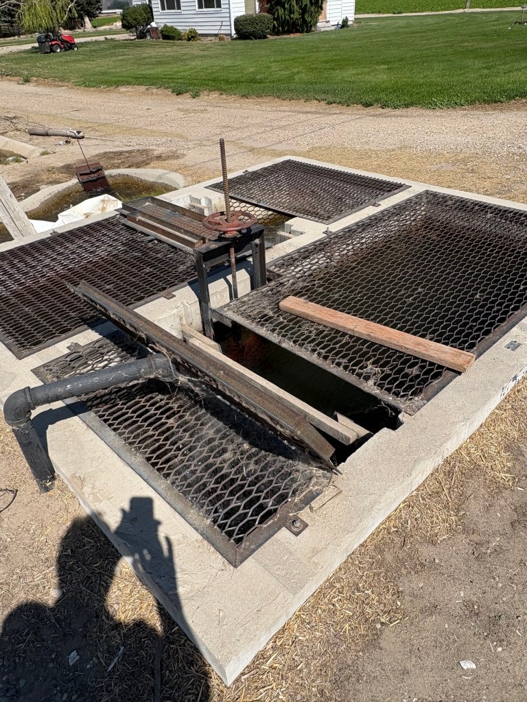
Further up the road I saw what the next step in the process is. At strategic locations, a series of large pumps are located underground to bring the water coming in from elsewhere back up to the surface where it can continue to flow downward, thanks to gravity and water always seeking its lowest point. The surface of the ground raises and lowers as one drives on the roads and at some point the water needs to be boosted back up to the surface to continue its downwards trek.
Looking away from the road, after having been pumped up from below, it flows downward, off in the distance:
And looking left, down the road I had just driven up after taking photos of the lush lawn and beautiful tree further down the hill.
And if not from rain, how does the water get into the fields in the first place? It is pumped up through a series of pipes directly to a large sprinkler system (not shown) to move through the fields and spray water from above. It may also be siphoned off the flowing water to go through a series of pipes to be applied directly to the roots of the plants.
Actually, in the photo above you can see a thin white metal wheel (like an oversized bicycle tire rim) which is repeated down the road and rolls slowly through the field to the left, applying water to the roots of the plants. There are also much larger contraptions which pivot from a base to spray water from much higher up (for corn and such). I will take photos the next time I see some and add it to this post later.
I have also seen large holding tanks or collection ponds where water, having reached its lowest useful point, is stored to be pumped out into tanker trucks to be employed elsewhere.
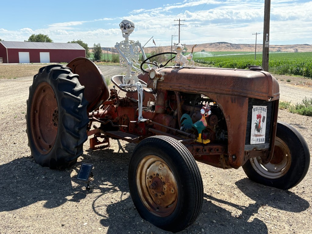
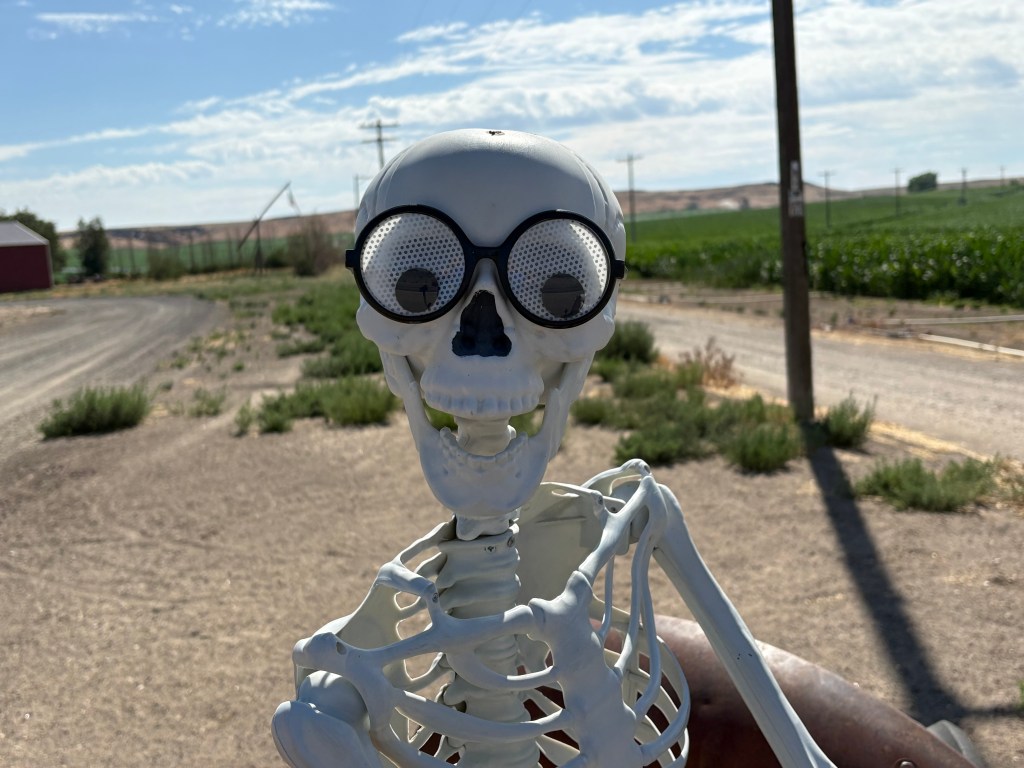
This is something I came across near the little town of Melba, Idaho, southwest of Kuna, as I was returning to Boise after my 3 stops at various overlooks along the Snake River (see immediate previous posts, below).
This tractor was alongside a house adjacent to more lush growing fields. Irrigation is a serious enterprise, critical to growing crops in this desert-like area. There were many farms around Kuna and Melba which employ a sophisticated irrigation system, as do most farms in the western US. My next post will illustrate how it works. Nothing funny about it!
These photos are all from the Boise area but as I drove northwest to get to my next stop in Bellevue, Washington (just SE of Seattle) I saw lots and lots of fertile growing fields, all with extensive irrigation systems, I’m sure. It reminded me of when I stayed in Wenatchee, WA back in 2017 and posted photos of the large apple, cherry, and other orchards in that area.
The area of southeast Washington State I drove through as I entered the state earlier this week called itself “the Palm Springs of Washington”. It is all very impressive.