Waterton Lakes NP – Part 2 of 2

August 27, 2025

(Photo credit: Parks Canada)

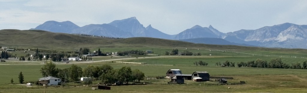
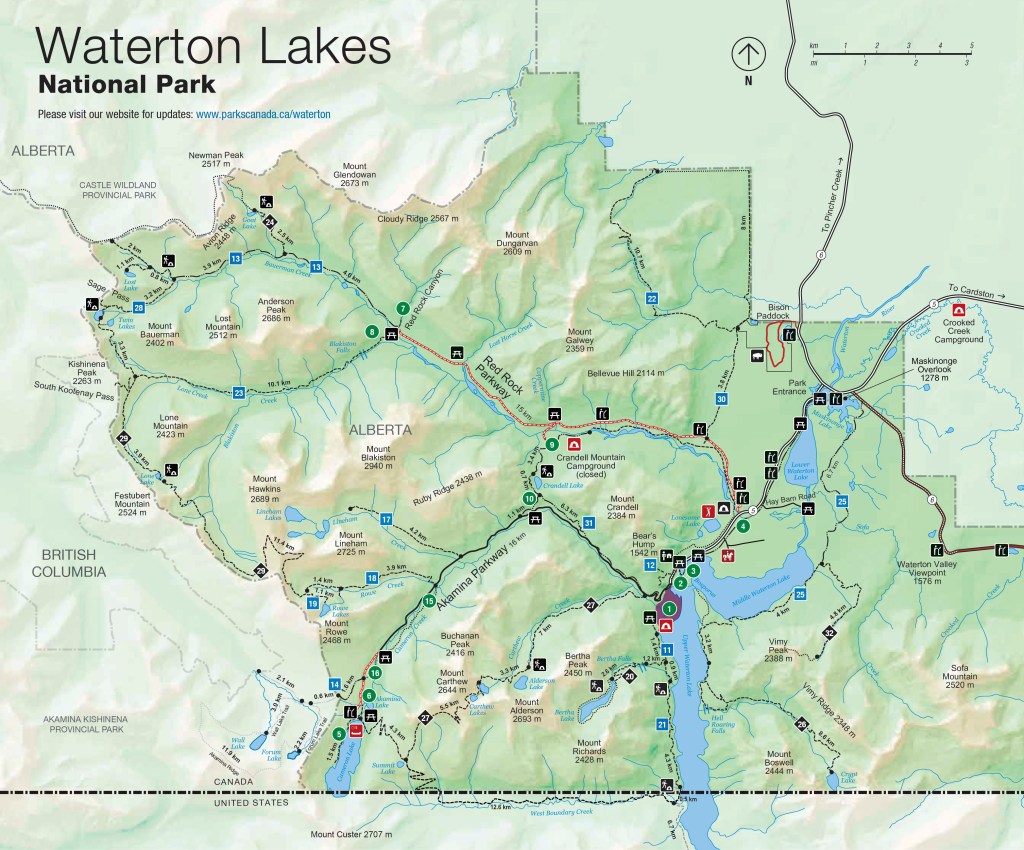
After I arrived at the hamlet of Waterton Park I turned right onto Akamina Parkway to traverse the 10 miles out to Cameron Lake.

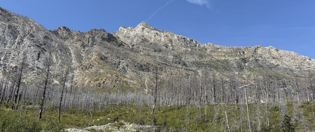
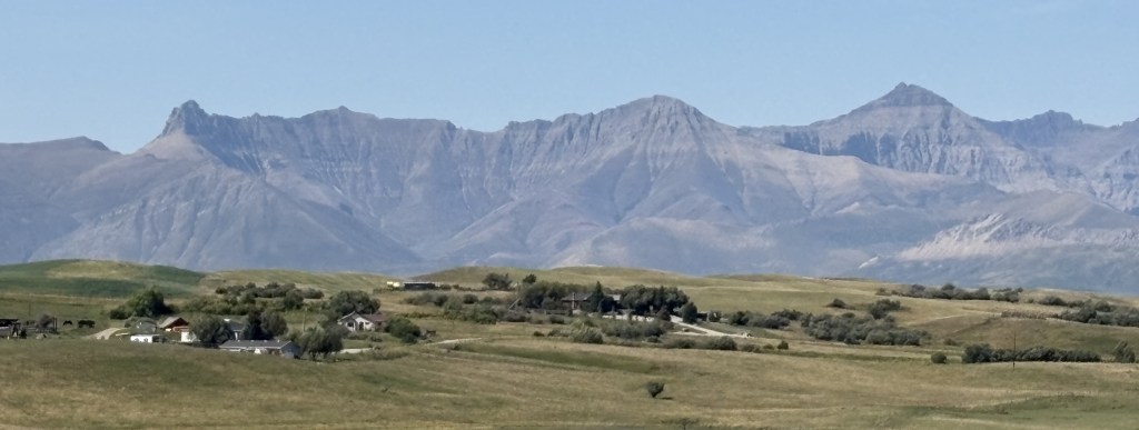
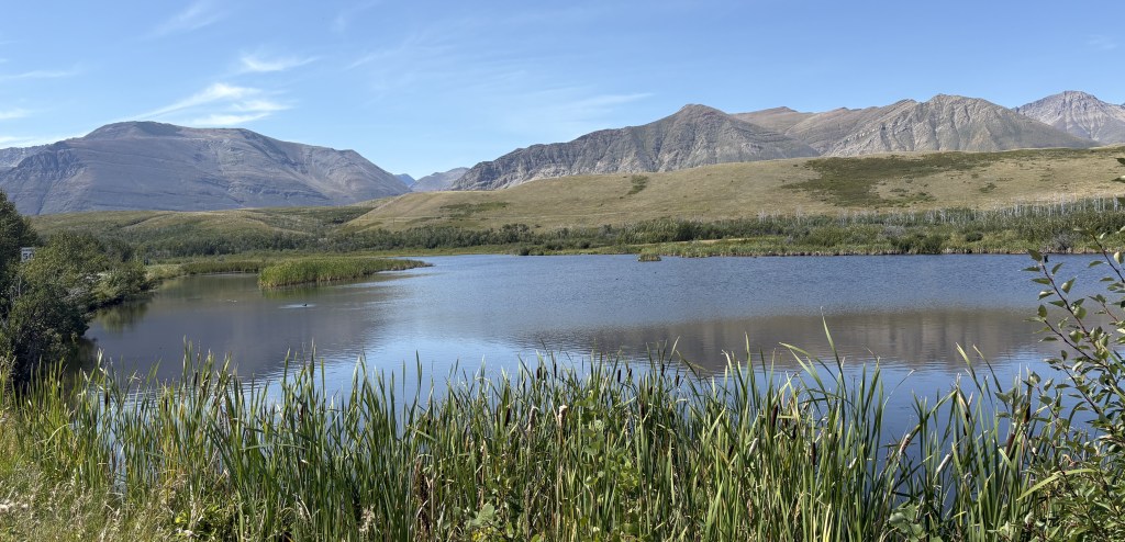
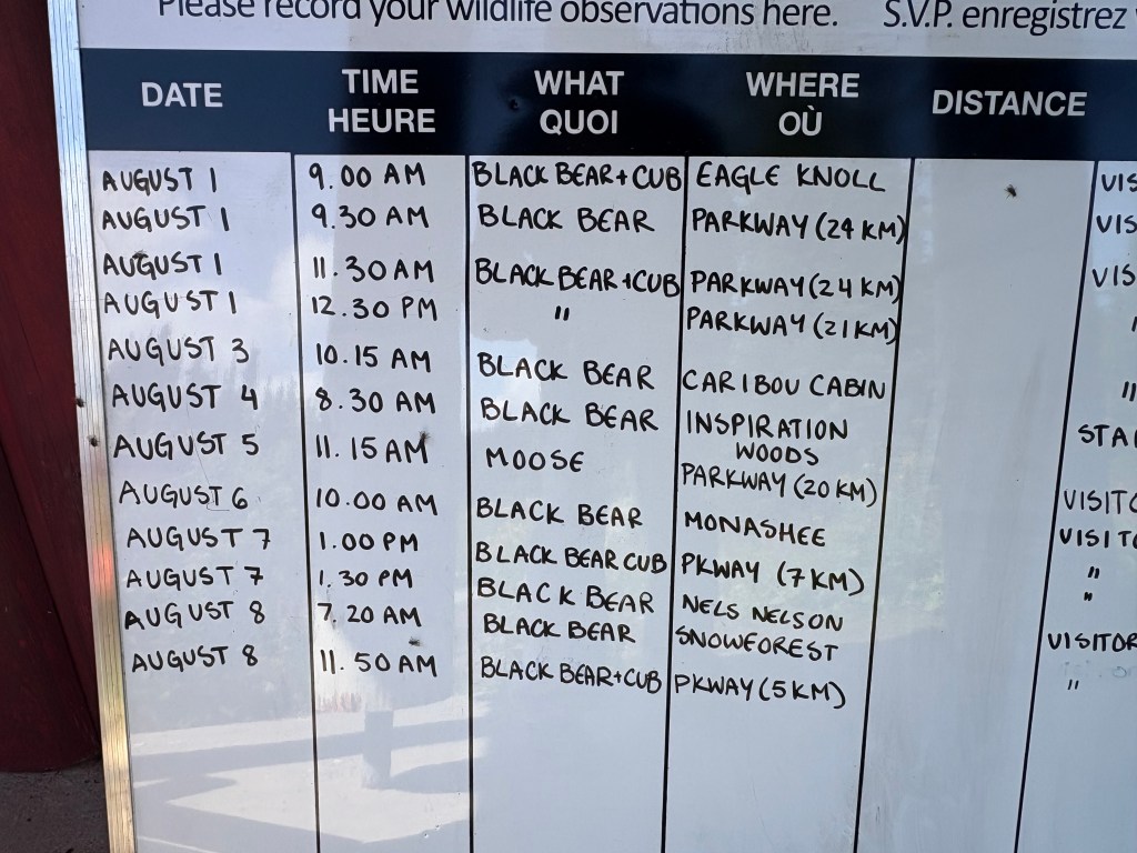
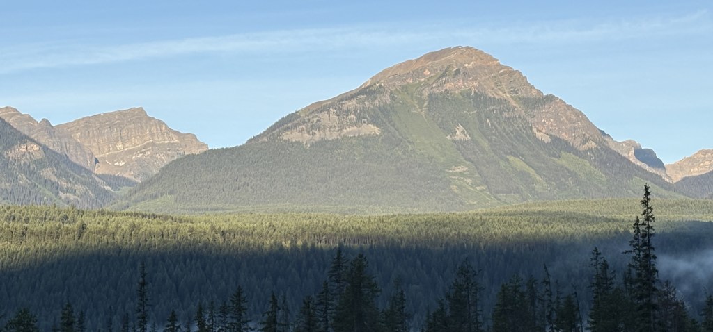
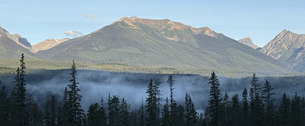
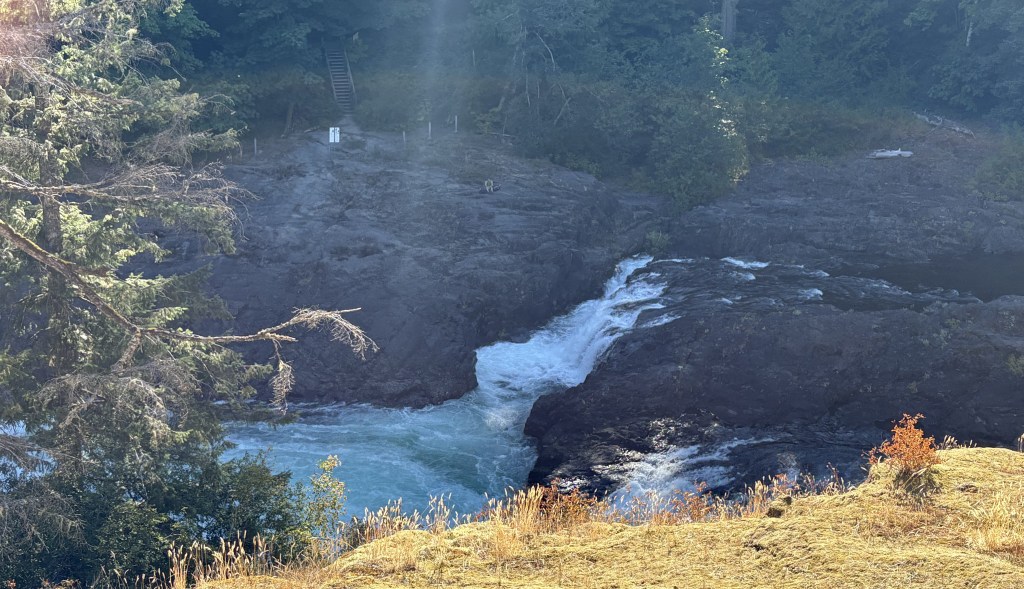
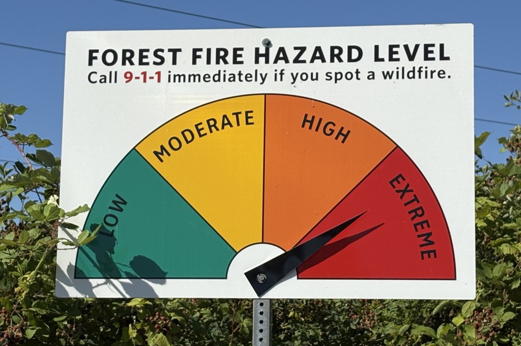
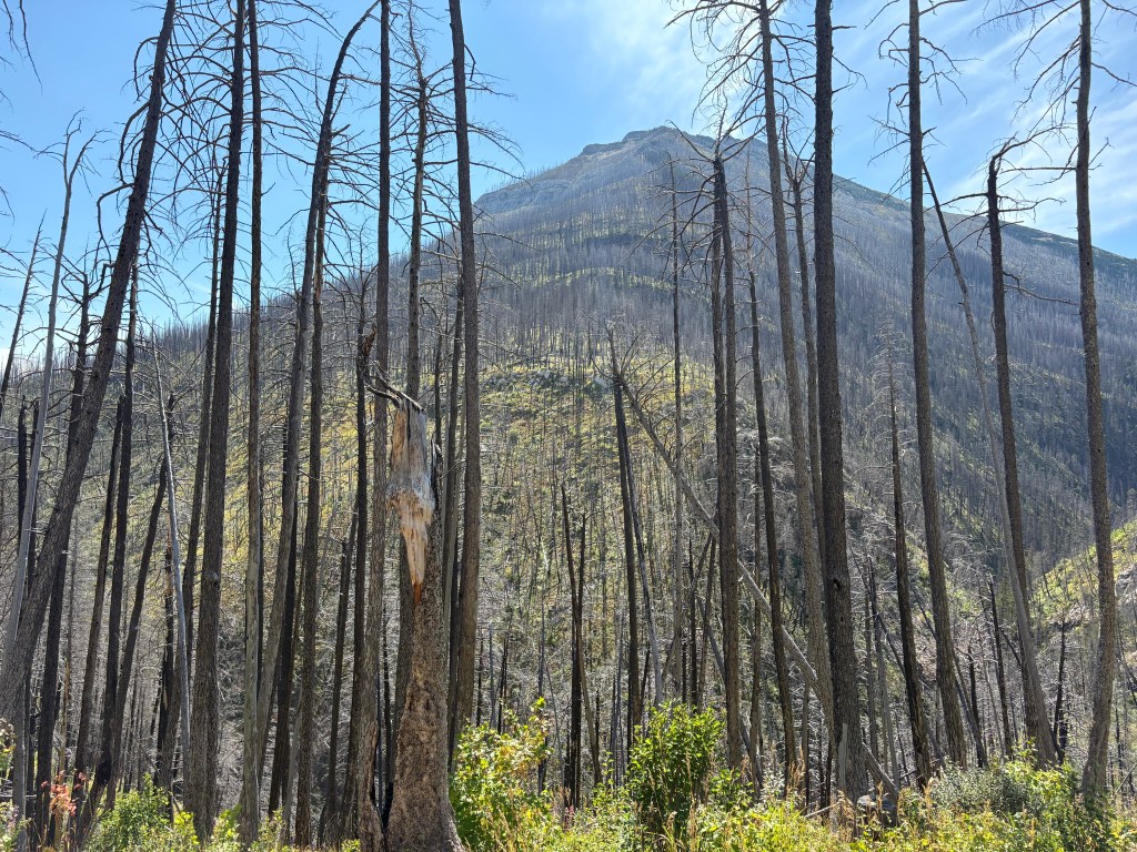
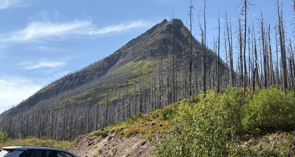
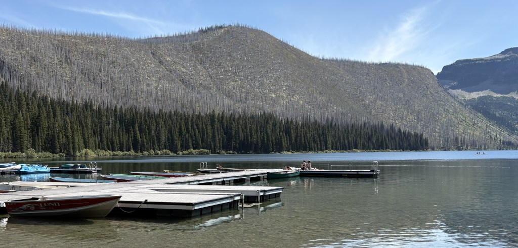
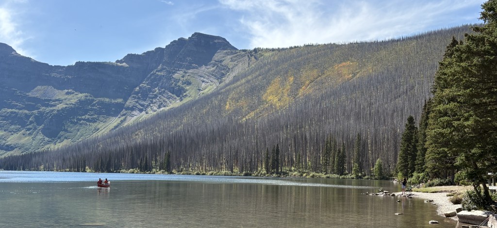
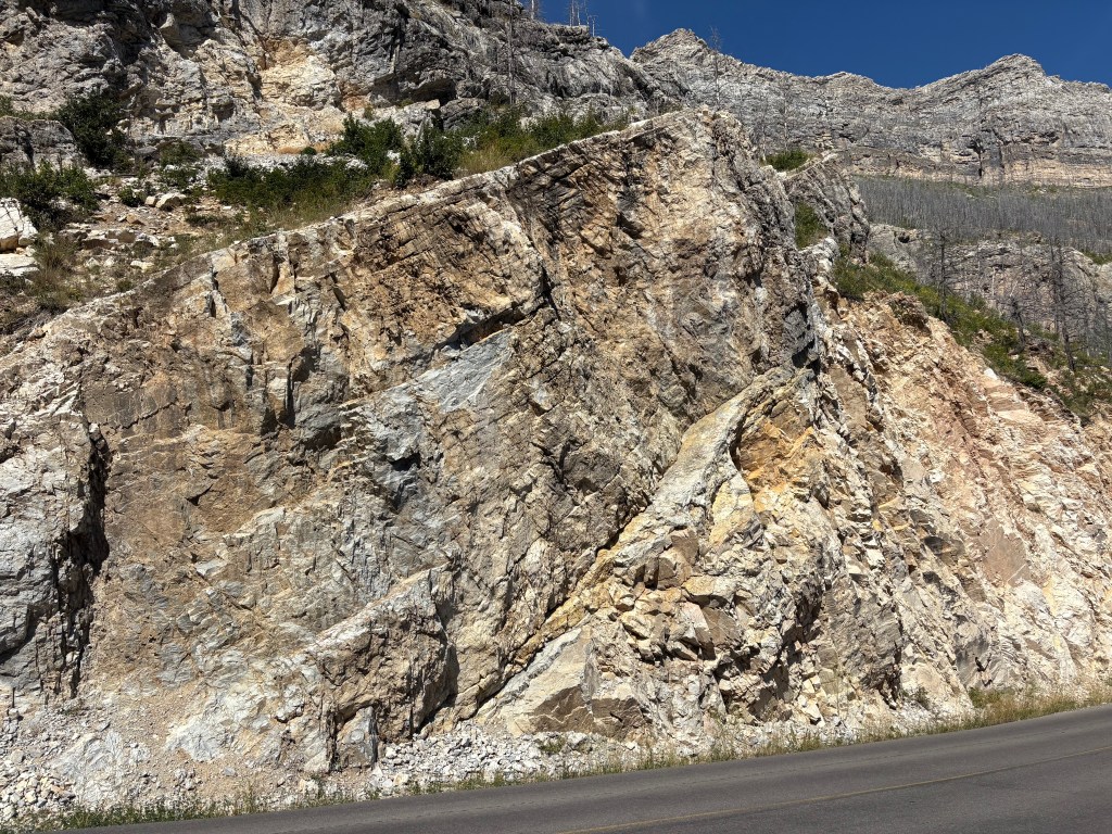
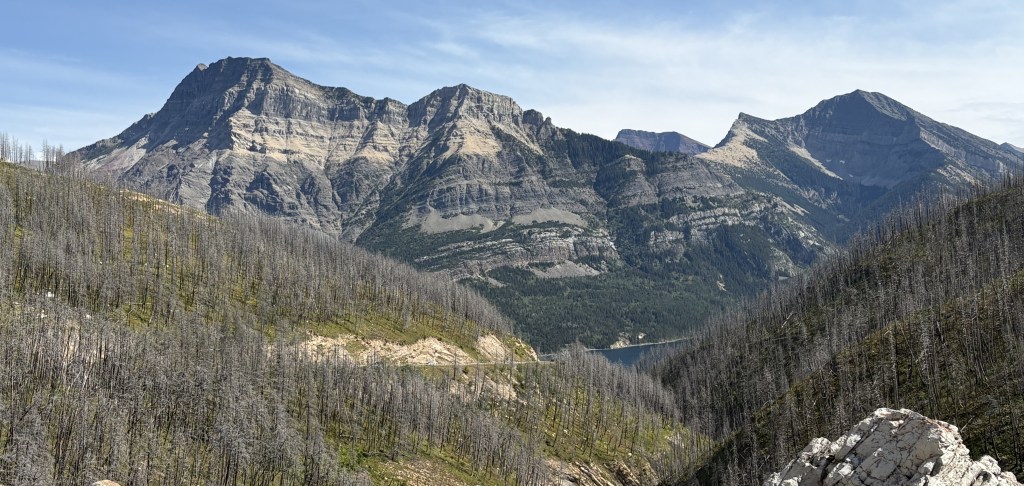
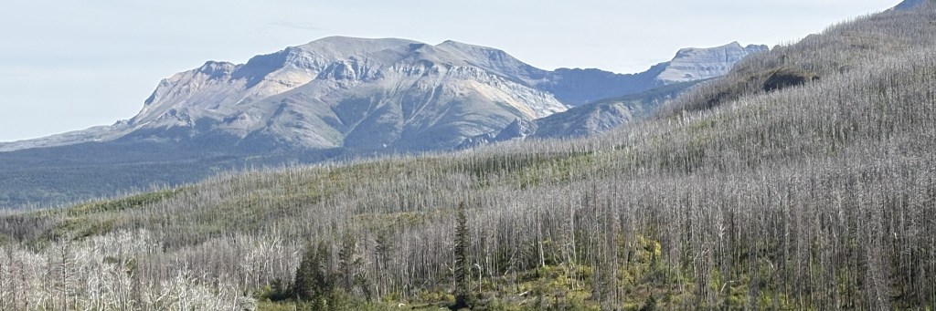
This is the part of our program where I tell you about the wildfire in 2017. It was started by lightning and began outside the Park but worked its way south and consumed roughly 39% of the trees in the Park.

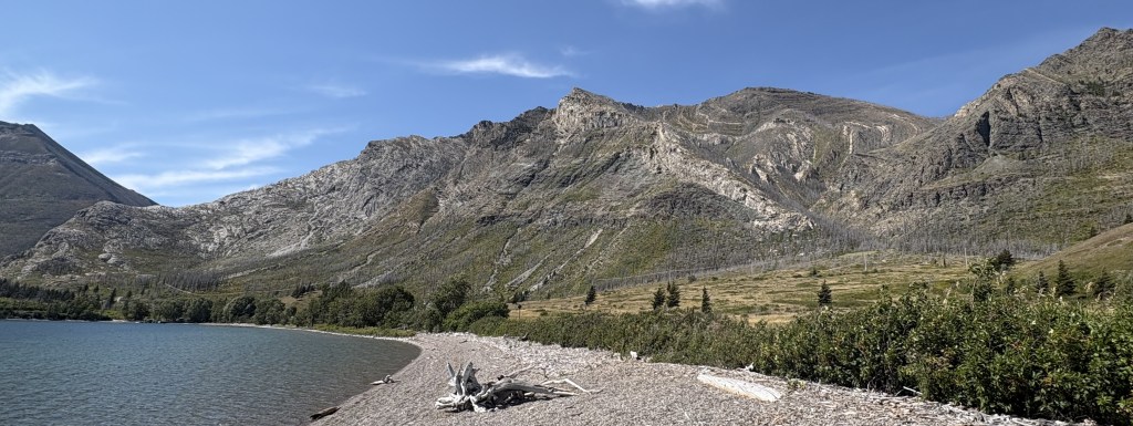
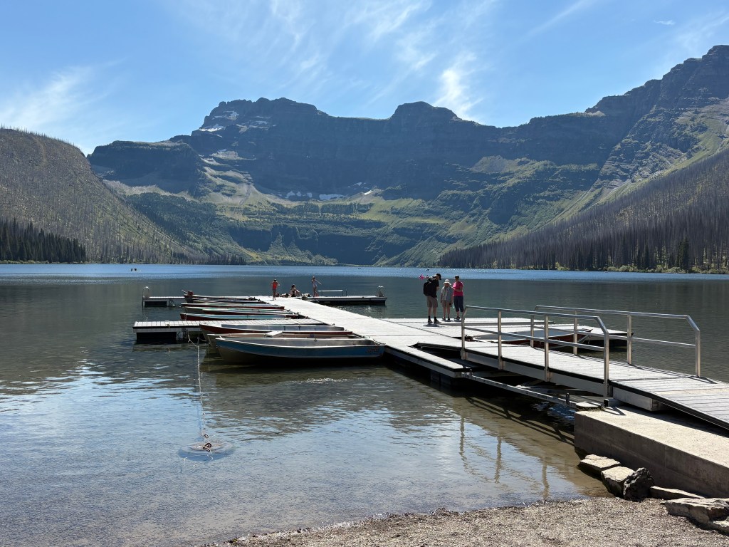
There were several parking lots where visitors could leave their vehicles and hike. I finally arrived at Cameron Lake.

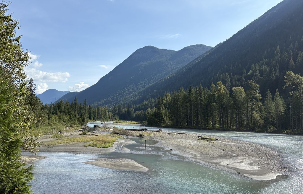
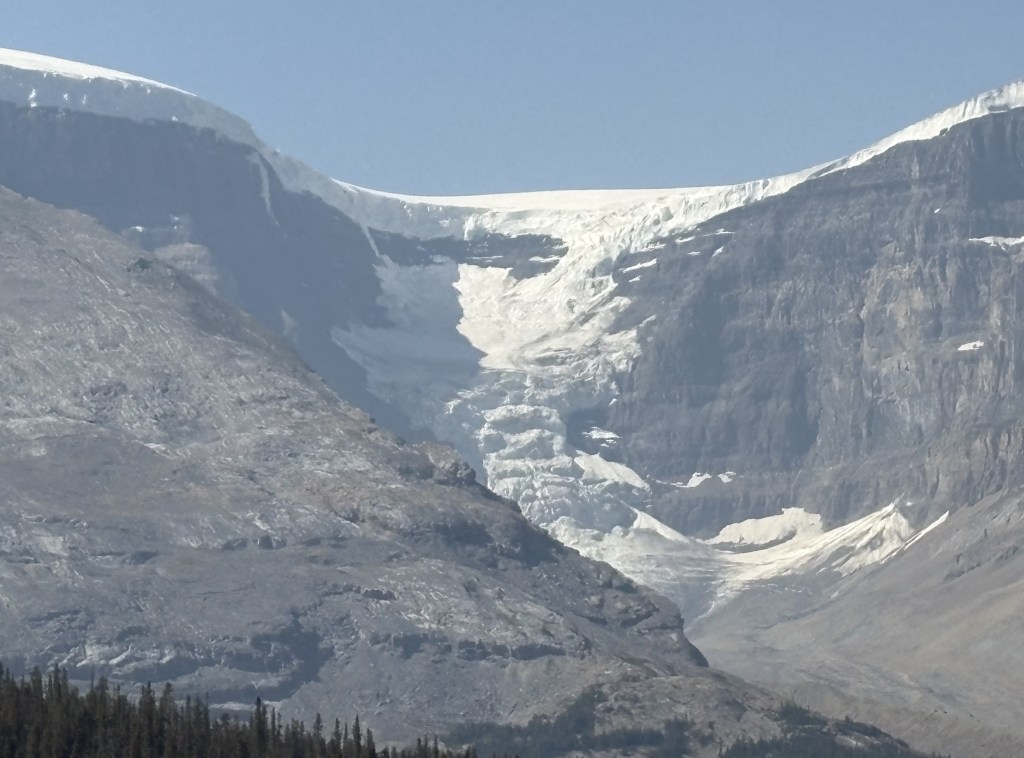
And looking left and right from the pier you can see the damage to the distant trees caused by the wildfire.

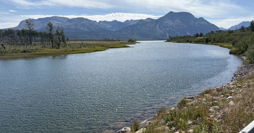
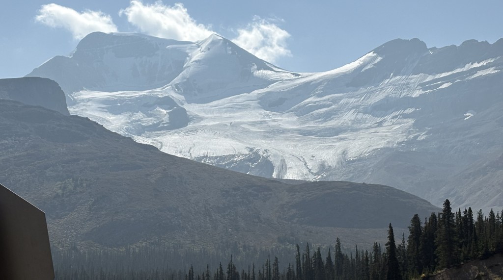
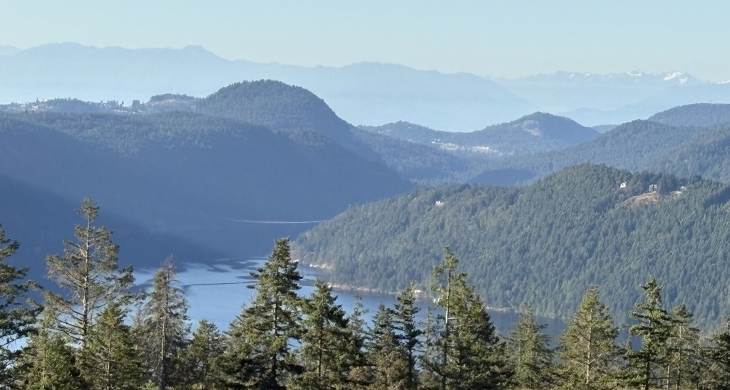
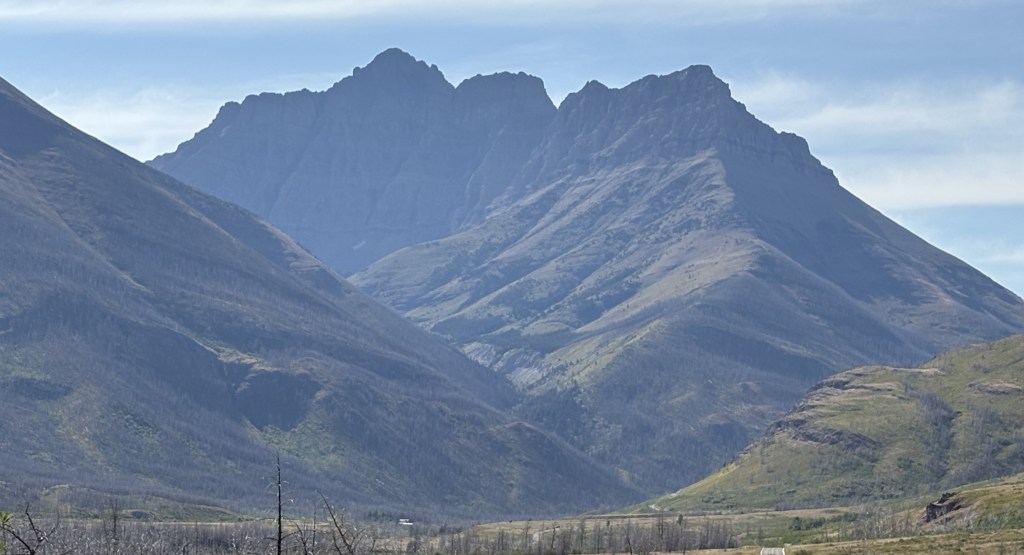
As you look straight out across the lake the mountain you see at the far end is actually in the United States, as is a small portion of the lake itself.

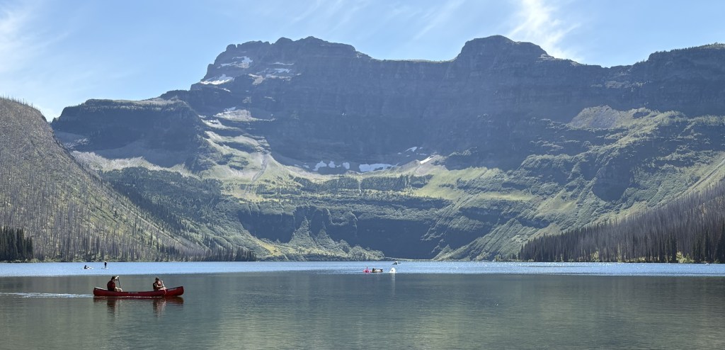
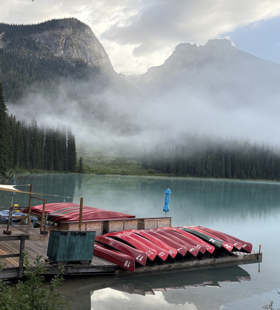
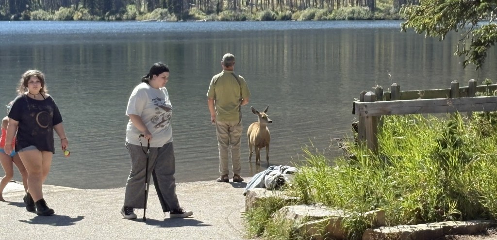
There was a large parking lot and a building where visitors could rent canoes and small boats to go out on the lake, and I imagine earlier in the summer swimming might be popular as well. There were rangers available to answer questions or give directions to visitors.

I stood and spoke with some of the other visitors before I left and was surprised to see a small deer calmly walk out of the lake:

I started driving back towards the village.

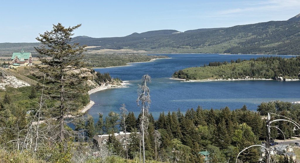
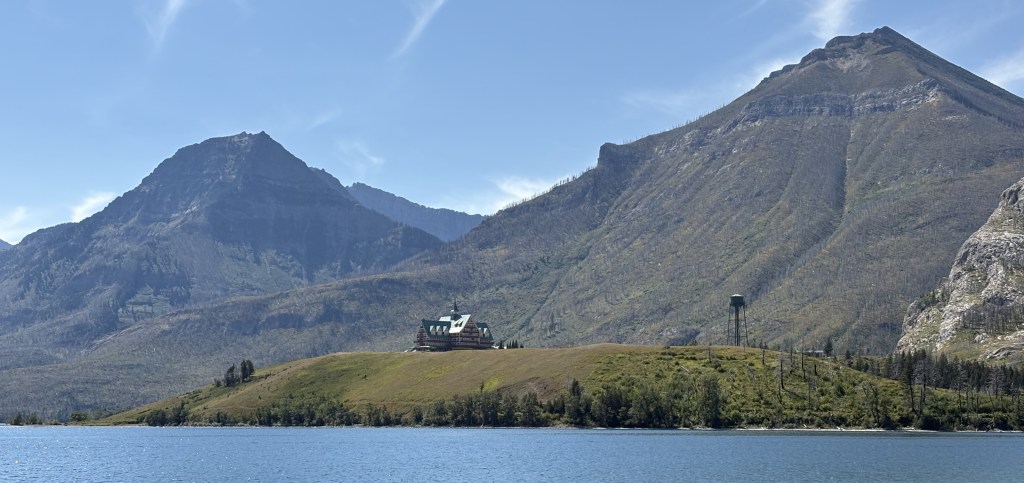
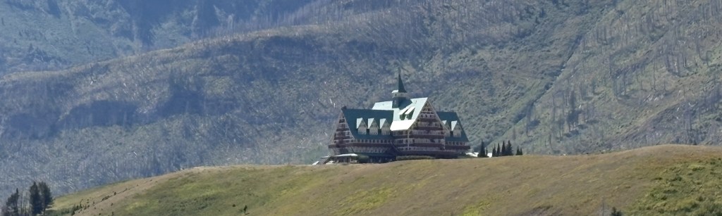
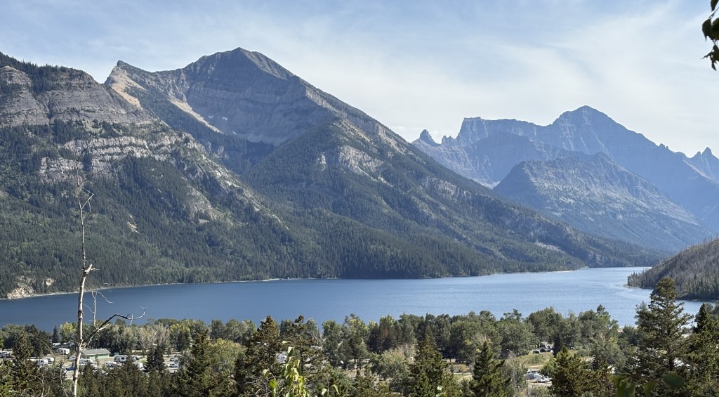
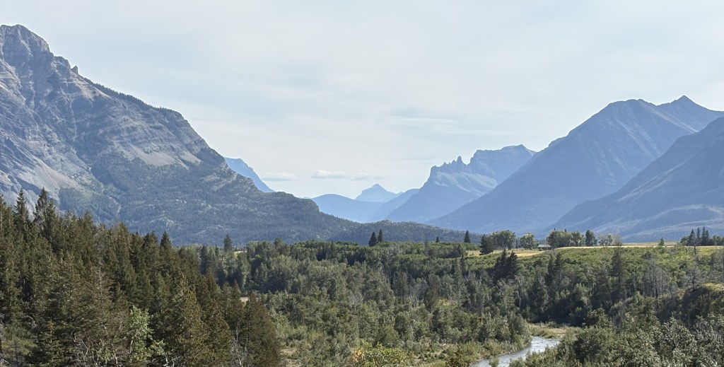
In the photo above you can see the Prince of Wales Hotel on the left, a small part of the village below and to the right, and parts of both Upper Waterton Lake (near) and Middle Waterton Lake (distance).

In the photo below you can see more of the village at the bottom of the frame and more of Upper Waterton Lake which continues south, well into the United States.

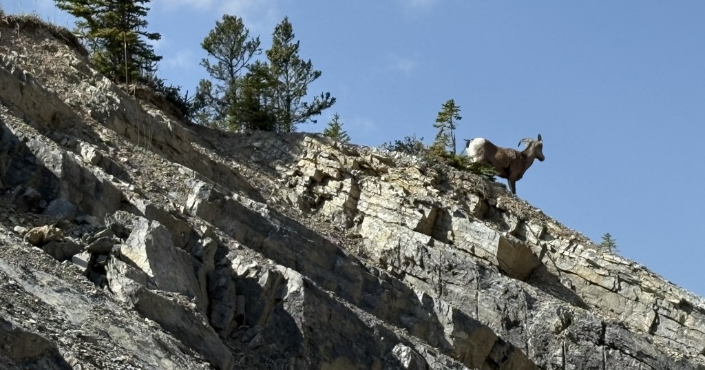
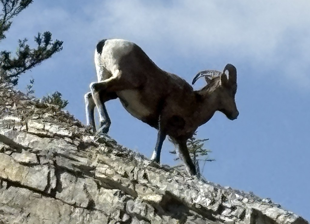
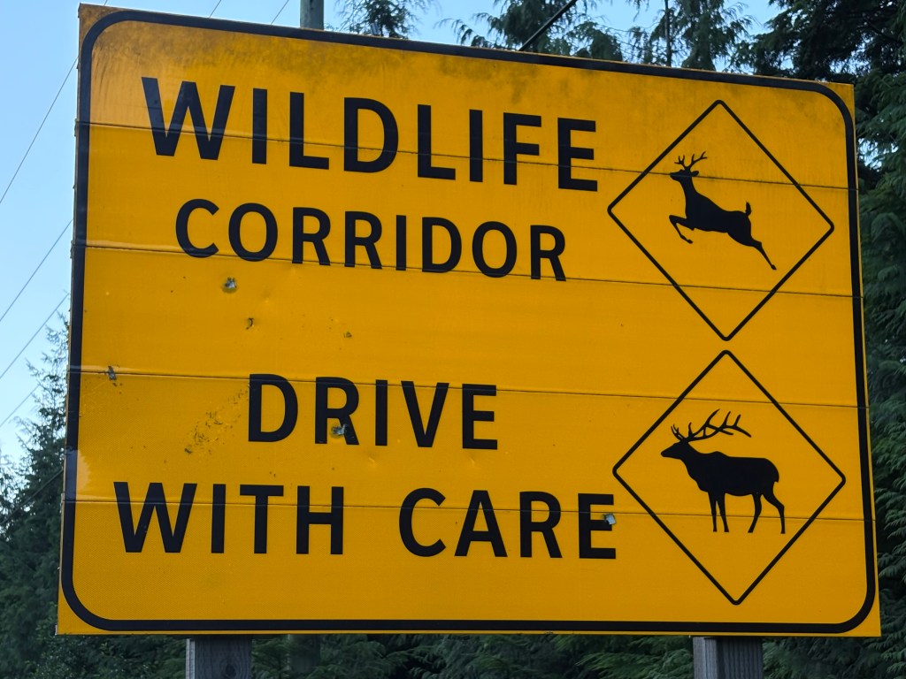
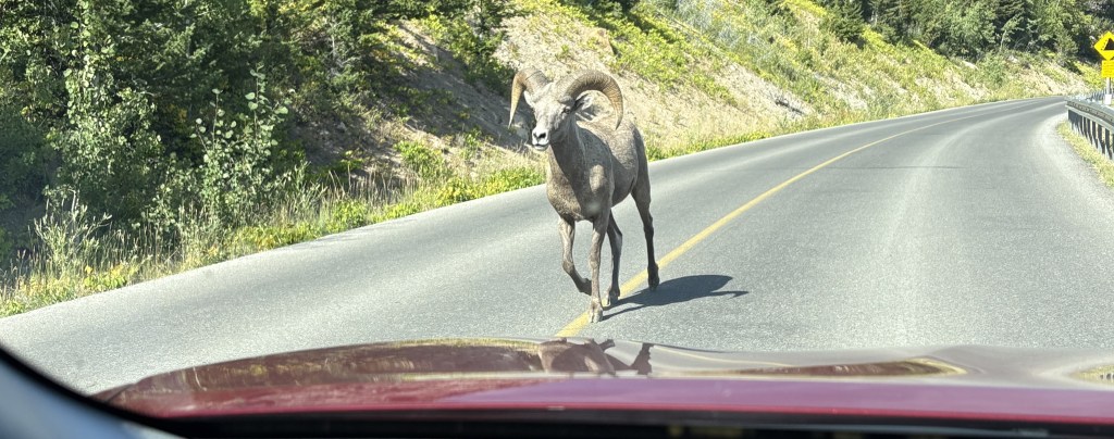
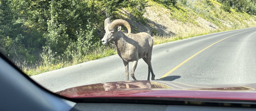
After descending down into the village I would start driving back towards the Park entrance, but encountered this lone bighorn sheep casually walking up the road before I got all the way down the hill.

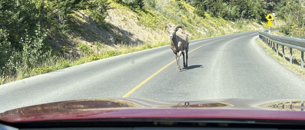
There was no one behind me so I stopped in the road and put my hazard lights on. My next thought, after not wanting to get run into by another vehicle, was “do sheep with horns react to red cars like bulls might??”

Evidently not because he walked right past me without a care in the world.

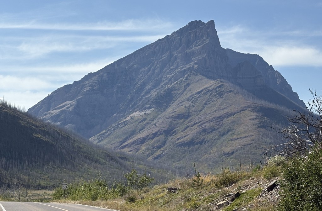
When I got further up the road I turned left on Red Rock Parkway to check out that side of the Park. Some of the campgrounds and trails along that road were still closed as a result of the wildfire.

I must say I was very impressed with this Park and am glad some people convinced me it was worthwhile to visit after I had almost talked myself out of it.

Waterton Lakes NP – Part 1 of 2

August 27, 2025

I headed out early from Medicine Hat because I had a busy day ahead of me. My next stop would be Lethbridge, in southern Alberta, but today’s journey would take me well beyond that to Waterton Lakes National Park, in the southwest corner of Alberta, where it lies against the Canada/United States border. In fact, if you hike or travel across the border you will find yourself in Glacier National Park in Montana.

I have previously referred to this Park by two other names – just Waterton, though Lakes is technically part of the name, and Waterton Peace Park, which isn’t correct either. Within Waterton Lakes NP is the Waterton-Glacier International Peace Park, a World Heritage site. All of that was kind of rattling around in my brain and I wish I had done my due diligence and researched the Peace Park part as I would have liked to go see it.

I came very close to not even visiting this Park at all. I knew it was here, and that I would pass by close to it, but several people along my route told me they didn’t think it was worth seeing. The consensus seemed to be “If you’ve seen the US Glacier NP (which I have) then there isn’t much to see at Waterton Lakes”. Now that I’ve been here I couldn’t disagree more, especially if you’re a hiker.

Getting to Lethbridge would take me a little less than two hours. I stopped for maps and brochures at the Visitor Centre and then set out for the Park, which would take me about an hour and a half more. I will go back to Lethbridge to spend the night, and will post photos from there tomorrow.

Getting to the Park would be a very pleasant drive on Hwy 5, through lots of farmland and small towns. I had been in relatively flat Saskatchewan and Alberta and would now be heading back into the southern tip of the Canadian Rockies.

It didn’t take long to start seeing big mountains ahead of me.

The mountains in the two photos above look very similar, but it appears that the two “pyramids” are now further away from the larger, “rectangular” mountain as I evidently had traveled further north and was now looking at them from a different angle. That is one thing that really plays games with my mind because as I drive the view of some mountains I see looks different as I get further down the road and pass by them.

Even after having been to the Park it is difficult for me to determine which of these mountains are in the United States and which are in Canada.

The small lake shown above is Maskinonge Lake, and is located at the point where Hwy 5 would turn left and become the access road into the Park itself. On the map below you will see the road I was coming in from on the right.

(Photo credit: Parks Canada)

The next lake I would see after the entry gate is Lower Waterton Lake:

And the next one would be Middle Waterton Lake:

Perched on the hill above this lake is the Prince of Wales Hotel:

I wasn’t allowed to park and get better pictures of the hotel from their parking lot because I was not staying there, but it is a very impressive building.

Shortly after that I came to a small hamlet of Waterton Park which apparently had about 200 private residences but seemed to be more about restaurants, hotels and gift shops. Hwy 5 ends in the village.

Photos of the rest of the National Park will continue in the next post.

Yoho National Park

August 13, 2005

I have driven through Yoho National Park 4 times during my visit to Golden and thought I’d better tell you a little bit about it as I pass through it a final time on my way south to Banff.

The name is an exclamation of surprise in the indigenous Cree language, though there isn’t any record of the Cree people ever having lived here so I don’t really know why it was chosen. The Park covers a little over 500 square miles and has 28 named mountain peaks over 9,800 feet. The tallest is Mount Goodsir at 11,703 feet, not visible from the highway due to closer mountains obscuring the view. As you will see, some of the mountains are low enough to only be covered with trees, and it is a very popular destination among hikers. It may be hard to see but the colored dotted lines on the map represent cycling or hiking trails.

(Photo credit: Parks Canada)

The only road which passes through the Park is the Trans Canada Highway (Hwy 1), shown on the map in red. Several roads branch off from it but I only took one of them as I left Golden.

Emerald Lake (upper portion of the map, above and left of the town of Field) is frequently shown in brochures because of it’s brilliant color. Every time I passed by the road there was an electric sign near the highway exit indicating that the parking lot was full. As I returned from my second trip through Kootenay NP I took a chance and drove up anyway, only to find that traffic was at a standstill before I even got to the parking lot. I sat there for a while hoping to see vehicles leaving but since we seemed to be at a dead stop I turned around and left, deciding that I would drive up first thing in the morning as I was leaving Golden.

Here are some of the things I saw during that drive.

It was a strange morning, cloudwise. The two photos above were taken one minute apart, from the same section of the highway! I know it was clearing in one direction but there were heavy clouds when looking in another.

I drove directly up the mountain to Emerald Lake – no line, no waiting. The parking lot was only partially filled so the “go early” advice was sound.

The lake surface is at 4,267 feet elevation and Golden is at 2,600 feet so I had climbed over 1,600 feet to get here, encountering fog or low clouds along the way.

You can see that the sun was finally able start burning off the fog.

Another lake in the Park, Lake O’Hara (up near Hwy 1), is only accessible by making bus reservations in advance. The long road leading north to Takakkaw Falls is only open a portion of the year and is considered difficult to navigate for large vehicles. Recreational vehicles or vehicles towing trailers are not permitted on it.

From what I’ve read and brochures I’ve seen, Yoho is extremely popular with hikers and I’ve seen many great pictures by visitors who have hiked up to high elevations. If you enjoy hiking you could plan your whole vacation in the Canadian Rockies and have a never-ending variety of things to see.

The photos below were taken as I started driving down to Highway 1.

When I got to the bottom I stopped at Natural Bridge.

Mt. Revelstoke National Park

August 9, 2025

After passing through Glacier National Park I continued west on Hwy 1 to Mt. Revelstoke. It is located next to the highway, near the town of Revelstoke.

(Photo credit: Parks Canada)

I stopped at the information kiosk between the two Parks and the ranger there suggested I get to Mt. Revelstoke sooner rather than later, as parking near the top gets scarce as more people arrive. She was right.

The Trans Canada Highway doesn’t even go through the Park, but runs along part of the southern edge. Once I got close to town I pulled off onto the entry road and found that the only road in the Park is the “Meadows in the Sky Parkway,” a 16-mile, two lane road comprised of a set of many switchbacks (and with a low speed limit) which leads to the top. There were a handful of parking areas for hiking trails along the way.

This one looks down at the town of Revelstoke. Beyond it is the Columbia River, and the mountain in the distance is Mt. Begbie, which is almost 8,000 feet tall. I proceeded all the way up to the small parking area at the top (which I had to walk to as vehicles were lining up along the access road). There was a small cabin with rangers to answer questions.

The sign reports recent wildlife sightings:

There wasn’t even a view from this vantage point, and one had to hike out to the actual mountain peak to see anything. There was a sign indicating I was at 6,360 feet elevation.

I asked if there were places to get views on the way back down and stopped at two of the places that were suggested to me.

I should also mention that as I was driving up the mountain I was interested to see a sign in the road prohibiting dogs “beyond this point”. Of all the Parks I have been in I have never seen that restriction. Apparently, some dog owners would let their pets run loose, contrary to Park rules (which pretty much all Parks have. Pets must be on a leash). This often resulted in bear attacks, and then the bears might think that, hey, this might be a nice place to hang out. So this Park decided to ban dogs altogether above a certain elevation.

When I got back down I went into town to get something to eat and then started back to Golden, a 2 1/2 hour drive. When I had stopped at the kiosk earlier the ranger had suggested two places I would now pass on my way home. The first was a place called the Skunk Cabbage Boardwalk, a wetlands area next to the Illecillewaet River (the name is pronounced Ill-a-silhouette) and the water flows down from an enormous glacier of the same name in Glacier National Park. It is well south of the highway and not visible from the road.

I walked towards the boardwalk but met some people coming back who told me that there was a chain across the pathway that prevented anyone from going any further. I found out later that there were probably birds nesting in the area and authorities didn’t want them to be disturbed.

So I drove to the Giant Cedars Boardwalk just up the road, and the lack of vehicles there should have been a clue. It, too, was closed:

It is in a small rainforest and some of the trees toppled, severely damaging the boardwalk.

So although it was a nice day it was incredibly disappointing in many respects. I was hoping to see much more, especially in Glacier, but it just wasn’t meant to be.


Later in my trip when I shared with my family where I had been one of my brothers, an avid skier, asked me about the ski area at Mt. Revelstoke. I told him I never heard of it, and didn’t recall seeing any signs for it.

I looked into it and found that the Revelstoke Mountain Resort is across the road from the National Park, and is located east of the town of Revelstoke. It is actually located on Mount MacKenzie. It features the longest vertical drop in North America, at 5,620 feet (from a top elevation of 7,300 feet), and they compare themselves to Breckenridge in Colorado, which is an enormous resort, and is where my brother who asked me about it worked for one season after getting out of college. Revelstoke Mountain Resort is one third the size of WhistlerBlackcomb near Vancouver, and the longest run is over 9 miles!

Glacier National Park (Canada!)

August 9, 2025

After returning to Golden from Jasper National Park I had now seen parts of 4 of the 6 Parks I planned to visit while I was based in Golden. Today I would go west, continuing on the Trans Canada Highway which brought me to Golden, to visit Glacier and Mount Revelstoke National Parks. Of course there is a Glacier National Park in the United States (in northwest Montana) which connects to the Canadian border but on the other side of the border the Canadian National Park there is called Waterton. I will visit it later in my trip.

I arrived in Golden towards the end of the day August 7 and left early on the 8th to backtrack and go north to Jasper. As I embarked on my drive west today I had my first good look at some of the mountains around Golden.

Those are all located west of Hwy 1 (the TCH) and actually sit between Golden and Glacier NP, which is located due west of town. I would have to drive northwest on Hwy 1 to the town of Beaver before turning back south to get to Glacier.

(Photo credit: Parks Canada)

The map above shows the two Parks I would visit today. Compared to the Parks I have seen so far these are quite small. Glacier NP covers 521 square miles and spreads out on both sides of Hwy 1. About 10 miles separate the two Parks, and Mount Revelstoke covers only 100 square miles, all on the north side of the highway.

Here is another map showing some more details:

(Photo credit: Parks Canada)

As you can see, the Trans Canada Highway (Hwy 1) is the only road passing through Glacier National Park, although there are several hiking paths which branch off in multiple directions.

I saw this impressive mountain as I approached the Park.

Once again I am faced with the naming problem. I suspect that may be Mount Dawson (because it has snow on it and is over 11,000 feet tall) but it is located pretty far off the highway so I may be mistaken.

This, I believe, is Mount MacDonald, which is about 9,500 feet tall.

After seeing these two mountains as I approached the Park the area next to the road narrowed as it started to climb up to Rogers Pass. Before getting to the Visitor Centre there I stopped at one of the parking areas for the Hermit hiking trail. Here I found several signs with some stern warnings.

First, I was now in avalanche country.

As you can see from the “You are here” X, the road is passing through near the base of these mountains, creating both a significant avalanche risk (though hopefully not on August 9) and also preventing me from seeing other mountains on either side of the highway.

Another sign warned me that I was in Grizzly and Black bear country and that I should take appropriate safety steps (e.g. don’t hike the trails alone, keep your distance from wildlife and carry bear spray). There was also a warning about mountain goats in the area, asking me to report any sightings. Curiously the sign didn’t ask me to Dial 911 for emergencies but, rather, listed a traditional phone number with area code. I presume this is because there generally isn’t cell service in any of the Parks and you would need to send an emergency text IF you could find a satellite signal.

I later read that the number one cause of death among visitors to Glacier National Park is water. People underestimate the power and extreme cold of the water within the Park, and if they should fall into it they are quickly overcome.

I resumed driving and stopped at the Rogers Pass Discovery Centre, only to find it closed, but for the bathrooms (which are called washrooms in Canada). It is being renovated and/or replaced and was not open. I had apparently gained some altitude as when I looked across the parking lot as I was leaving I could see a mountain back from where I had just come.

As I was about to pull out onto the highway I could see a few more mountains spread out before me.

Further up the road I came to a spot where they were doing some road work.

When I mentioned this to my Airbnb host in Golden he said it is a long overdue project to widen the highway from 2-lanes to 4-lanes.

So that was really all I saw of Glacier National Park. There are lots and lots of mountains, and a large number of glaciers, but you can’t see them without getting off the road, and even then you may not see very much.

Icefields Parkway to Jasper, AB

August 8, 2025

To refresh your memory, I effectively stopped making “current” posts with photos I had taken August 8 while en route from the town of Golden, BC to the town of Jasper, AB.

(Photo credit: Parks Canada)

On July 7 I had traveled through Kootenay National Park (brown) and then through part of Banff NP (blue) and Yoho NP (yellow) to get to Golden, where I would be based for 6 nights. The following day I backtracked to Lake Louise and went north towards Jasper National Park (green) and have already posted photos taken in the northern part of Banff NP getting to the point where I crossed into Jasper NP, which is where the Columbia Icefield is located. The entire road (Highway 93N from Lake Louise to the town of Jasper) is called the Icefields Parkway and is considered by many to be among the most scenic roads in Canada.

Here are more photos I took as I traveled north, deeper into Jasper NP.

The two photos above are of the Athabasca Glacier, the largest one in a group of six which comprise the Columbia Icefield. I actually took those photos on my way south back towards Golden after having been to the town on Jasper.

The Columbia Icefield is a major tourist draw, so much so that I didn’t take part in the guided bus tour and excursion to the new Icefield Skywalk (a viewing platform similar to the one in the western Grand Canyon). To do those things most people make reservations at the Icefields Center, a large building next to the highway. Here are two photos I found on someone else’s blog:

(Photo credit: Thebanffblog.com)

Those blue buses will transport you to the base of the glacier so you may get an up-close look. They also give you exclusive access to the Columbia Icefield Skywalk:

(Photo credit: Thebanffblog.com)

There is another company that has large, red and white specialty vehicles with oversized snow tires which will actually take you out onto the glacier itself.

So you must park your car and use other means of transportation to truly experience the glaciers. I didn’t do any of those things.

I opted to continue driving north as I wanted to see the town of Jasper and get back to Golden before dark.

I am embarrassed to admit that I don’t know the names of the rest of these mountains. I have scoured maps and brochures but they don’t always name them and even looking at pictures online didn’t help, as they are often taken from other vantage points. In hindsight I wish I had taken better notes of exactly where I was when I took each photo. Most things don’t have signs explaining what you are looking at, and even using the time stamp on the photo didn’t help much since I make so many stops and frequently backtrack if I see something interesting.

My apologies!

I have the tour bus that was on the road ahead of me to thank for the last two photos. It had pulled off the side of the road to let the passengers take pictures of the bighorn sheep high up on the rocky hill next to the highway. I wouldn’t have seen it otherwise.

If you are a hiker and plan to visit the Canadian Rockies I strongly encourage you to budget considerably more time than I did. There are MANY popular campgrounds and hiking opportunities and they can get you to places where you’ll have even more incredible views than I had from the road.

Please don’t pet the bears

Monday I had scheduled a daytrip up to Whistler ski resort, northeast of Vancouver. I left Maple Ridge early in the morning so I could bypass the city westward on the Trans Canada Highway before morning rush hour.

Before I got to the road going up the mountain to Whistler I went through the coastal town of Squamish. It is the English name of an indigenous tribe on whose land Whistler resort, and many other towns, sits (their land consists of 2,600 square miles (NOT kilometers)). Most signs carry both the English and Indigenous spellings.

Those numbers are kilometers, not miles, by the way. Things up here are almost always expressed in metric measurements but when I discuss them on my blog I generally use the US system since that is what many of my followers can relate to.

As I approached the town I could see a huge rock formation right by the highway in the distance:

Here is a photo of the rockface looking in right next to the formation (but from the other side of the highway):

And here is another photo which includes the parking lot below the formation. As you might guess, it is VERY popular with rock climbers, and there is a special parking area right below it for their vehicles, which are loaded with their climbing gear.

I didn’t see any climbers on the face either going by in the morning or later in the day as I was heading back to Maple Ridge, but I could see people resting in the afternoon from having climbed earlier in the day when it was cooler and without the sun beating on the face of the formation.

After taking photos here in the morning I continued on up the mountain towards Whistler.

Followed immediately by:

Many of you have perhaps seen a sign like this in your travels (even in the mountains and near the coast in North Carolina) and I think most people assume it only applies to black bears. Well, in places like Yellowstone National Park in the US and most places here in Canada, it also applies to another type of bear.

I was first warned about grizzly bears when I was at the north end of Vancouver Island earlier in my trip. Evidently young males from the mainland swim over to VI in search of new turf and perhaps a place to raise a family. They must have convinced some female grizzlies to tag along, as the grizzly bear population on the island is growing. I didn’t see any, but there were plenty of signs warning about them.

And my nephew, Sam, will be pleased to know that every day that I am near the woods and out of my car I am packing bear spray:

When I visited my brother and sister-in-law, and their son Sam, in Wyoming back in 2021, Sam invited me to the place where he worked, just outside of town. In the hills above the complex where he worked there are petroglyphs on the rock walls. When I got there he asked “where’s your bear spray?” I replied “in my backpack”. He told me “No, when you need bear spray you need it RIGHT NOW”. It comes with a carrying case which you can strap onto your belt. It should be worn at all times when you are in a place which may also be inhabited by bears.

I never needed the can I bought in Wyoming and while it may still work, the expiration date has passed. I still have it but I bought two new cans for this trip and wear one of them at all times when I am out of my car.

Elk Falls Suspension Bridge

After spending a good, long while out on Discovery Pier, enjoying a beautiful summer afternoon after a busy driving day, I headed inland a few kilometers to check out this new bridge, built by BC Hydro, to allow visitors to walk down and get an up-close look at the powerful waterfall along the Elk River.

After following the well-marked path through the woods leading down to the bridge from the parking lot (the information center had closed for the day) I descended a long set of sturdy, metal stairs to arrive at the bridge.

From the platform on the other side of the bridge, this was the view looking left towards the river taking water to the main fall.

I then crossed back over the bridge and went down yet another set of sturdy, metal stairs to a viewing platform very close to the main fall. You can see the mist rising from the water after it dropped to the rocks below.

And the “natural” part of this attraction – the main fall itself.

Once the water has fallen it travels on to its ultimate destination, as seen from the extension bridge:

When I walked back up to the parking lot I took this “photo of a photo” which was on an information board explaining the bridge project, and the ongoing construction of yet another dam to back-up the water supply to Campbell River. It shows everything I just described from high above.

(Photo credit: BC Hydro)

My Airbnb host in Campbell River explained that BC Hydro ran a new set of pipes VERY far underground to channel water to the town (and others, I’m sure). This whole area sits atop a major fault line which runs up and down the west coast and their house, built 8 years ago, had to meet strict earthquake-proof standards. The fear is that if an earthquake occurs, the current water supply may get cut off.

Victoria to Duncan, BC

After two nights in Victoria it was time to head northwest, up the eastern (inland) side of Vancouver Island. Shortly after leaving the city I immediately I started to see huge highway signs warning of Elk. Not deer. ELK.

Oh, they have deer too, mind you…

… but Elk are much larger and pose a greater risk to motorists. Oh, and they bears up here too. Black bears AND grizzly bears. I brought two cans of bear spray for this trip. A small black bear ran across the road well ahead of me the other day at about 10 in the morning. One must always be vigilant when driving.

Soon after leaving town I stopped as a rest area near Malahat. I didn’t need to rest, but wanted to take in the scenic view.

And for those of you with eagle eyes, yes, that is snow on the distant mountains in the upper right corner of the photo.

When I texted that photo to friends and family members I said that it was the mountains in the Olympic National Park in northwest Washington State. That is not correct. It is actually Mount Baker, and other mountains, still in northwest Washington but further inland, up near the Canadian land border, looking east from this vantage point, not south.

Another lake I could see from another scenic overlook just a little ways up the road:

I got back on the highway and soon arrived in the little town of Duncan. Duncan is known for it’s totem poles. There were lots of them scattered around town but the visitor center there wasn’t open yet and I needed a map to find them all. It was also early in the morning and the sun angle was not conducive to taking great photos.

Here are a few that I was able to find:

And I spotted this big guy across an intersection, in front a round office building.

It is called Cedar Man, and is the widest totem pole in the world, measuring 5 feet, eleven inches across. The carver is a man whose “English name” is Richard Hunt. He is a member of the Kwagu’l indigenous tribe and his given name is actually Gwe-la-y-gwe-la-gya-les. I got that information from the small sign at the base of the pole, which is present at each pole in town.

Indigenous words are all presented in a very elaborate font which I can’t replicate here, but when I start posting more photos of totem poles and their carvers after I have researched them in more detail I will show you photographic evidence of what I’m talking about.

A little further north of Duncan I turned off to head over to Mount Prevost, which promised fantastic views of the area.

I left the house in the photo to give viewers some reference of just how tall the mountain is (2,585 feet). I drove up the road towards the parking area but the road was closed before I got to it and I could tell it was still quite a climb to the top. I am not a hiker so I turned around and left. There is quite a view, though, based on photos I found online.

As I was driving back to the main highway I saw this sign which shows the current fire level risk in Vancouver Island.


I read this morning that the fires in Manitoba province are getting worse and even more have been detected in just the last week. They have already experienced three times the average amount of land loss to wildfires, and tens of thousands of people have been evacuated, mostly by air (not many roads up north). Think about that. Tens of thousands. There are still large, out of control fires in northern Saskatchewan province, too. All of them are producing dangerous smoke and there are health warnings in many areas well south of the actual fires.

This area has been under a huge high pressure dome the entire week I’ve been here. That’s good for me, nice clear days and pleasant temperatures, but bad for residents of those two provinces because high pressure keeps the smoke close to the ground. The weather forecast indicates that that situation is fixin’ to change here in a few days and hopefully that will help clear some of the smoke out.

I am going to resume booking my Airbnb’s along my original route and will make a bee line for Saskatchewan province and get that portion of the trip done so I can focus on Alberta and British Columbia. There are always new fires popping up and the situation can still change on short notice. Canada has excellent resources for monitoring all of the various fires so I will be well informed as to their status.