After walking and driving through parts of downtown I drove “around back” to see two lakes located behind town. Once I got back there there was absolutely no indication that anything bad had happened.
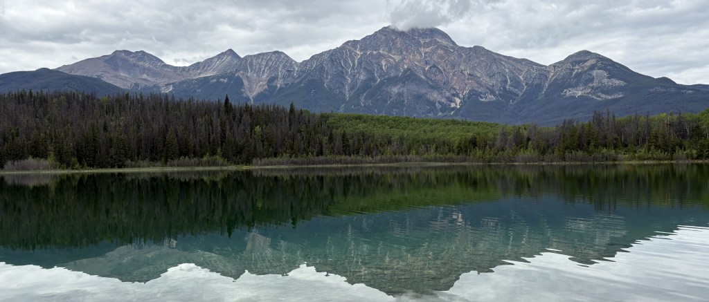
This is Pyramid Lake, and behind it is Pyramid Mountain.
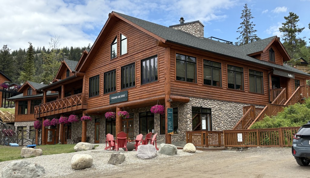
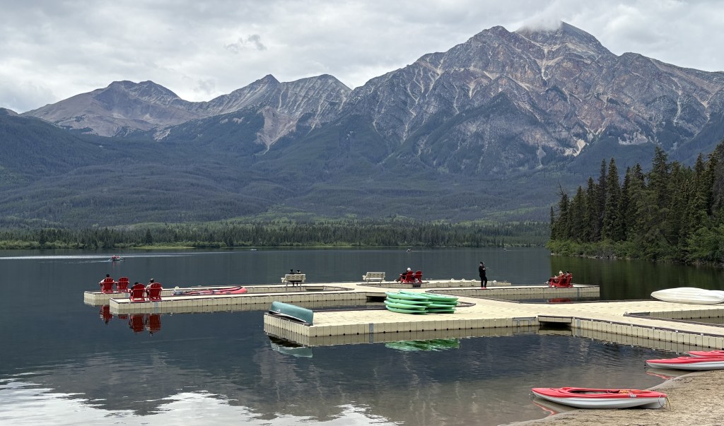
That is the Pyramid Lake Lodge and across the road is another view of the lake with docks and various watercraft for guests to use.
I wasn’t able to get to Patricia Lake, although I don’t think it was technically off limits.
I drove back towards the downtown area and crossed the Athabasca River to take a quick drive through the Fairmont Jasper Park Lodge property, a high-end hotel. It is on the “fire side” of the tracks but was apparently protected by workers and firefighters and only lost a few small buildings. The main lodge and most of the other buildings appeared to be intact.
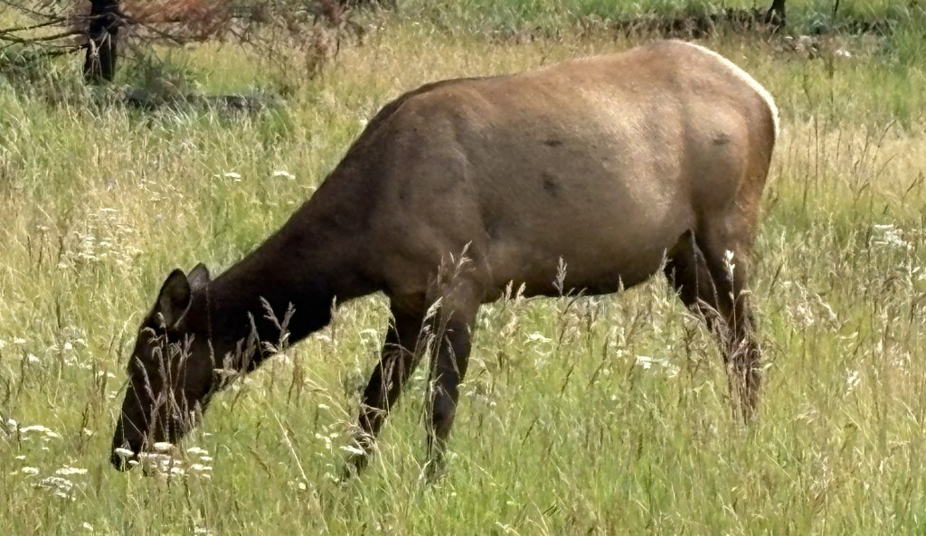
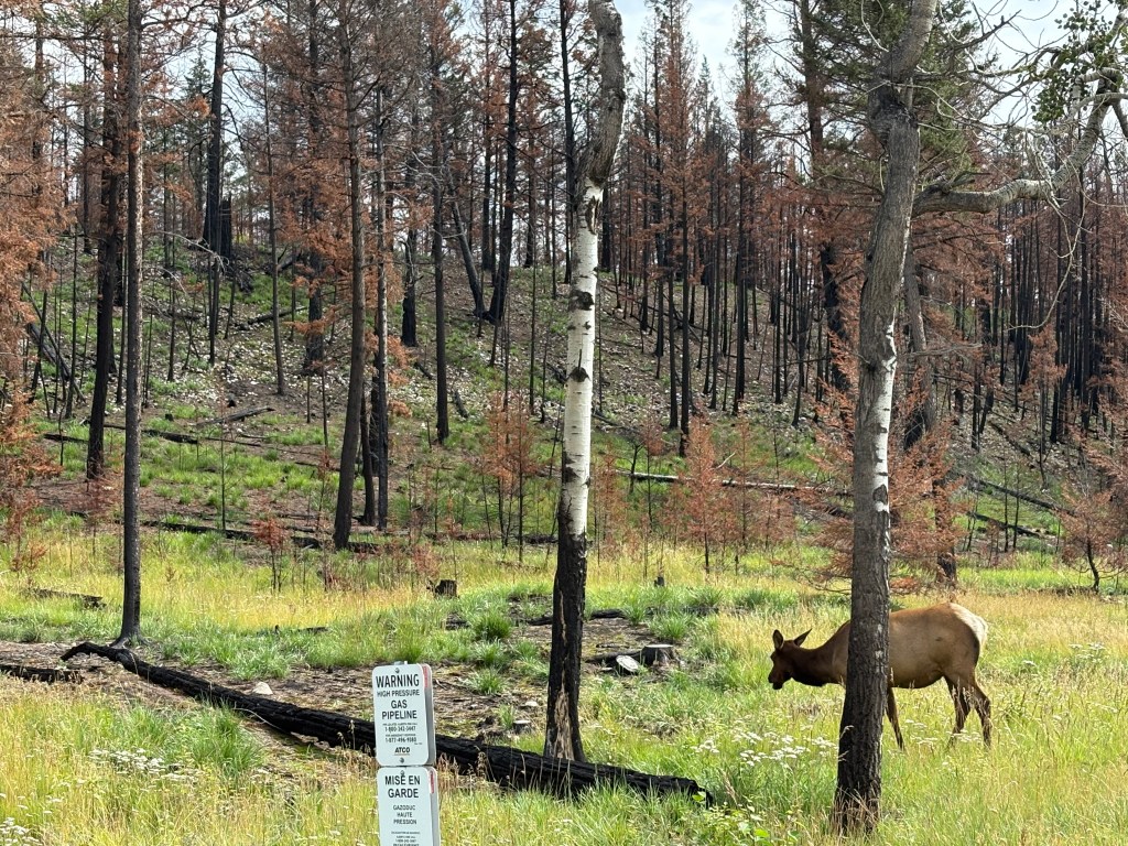
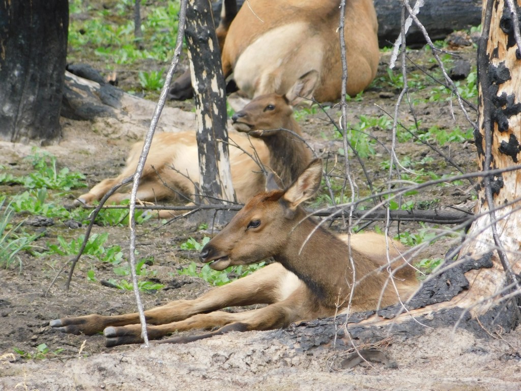
Just off the road to the Fairmont property I did see this animal, eating grass in a burned out area of the forest. I initially thought it was a cow moose but I now believe it was an elk because a few minutes later I saw 30 or so elk as I was leaving Jasper. I sent pictures of them to a few friends called them moose and one of my brothers pointed out that they were elk.
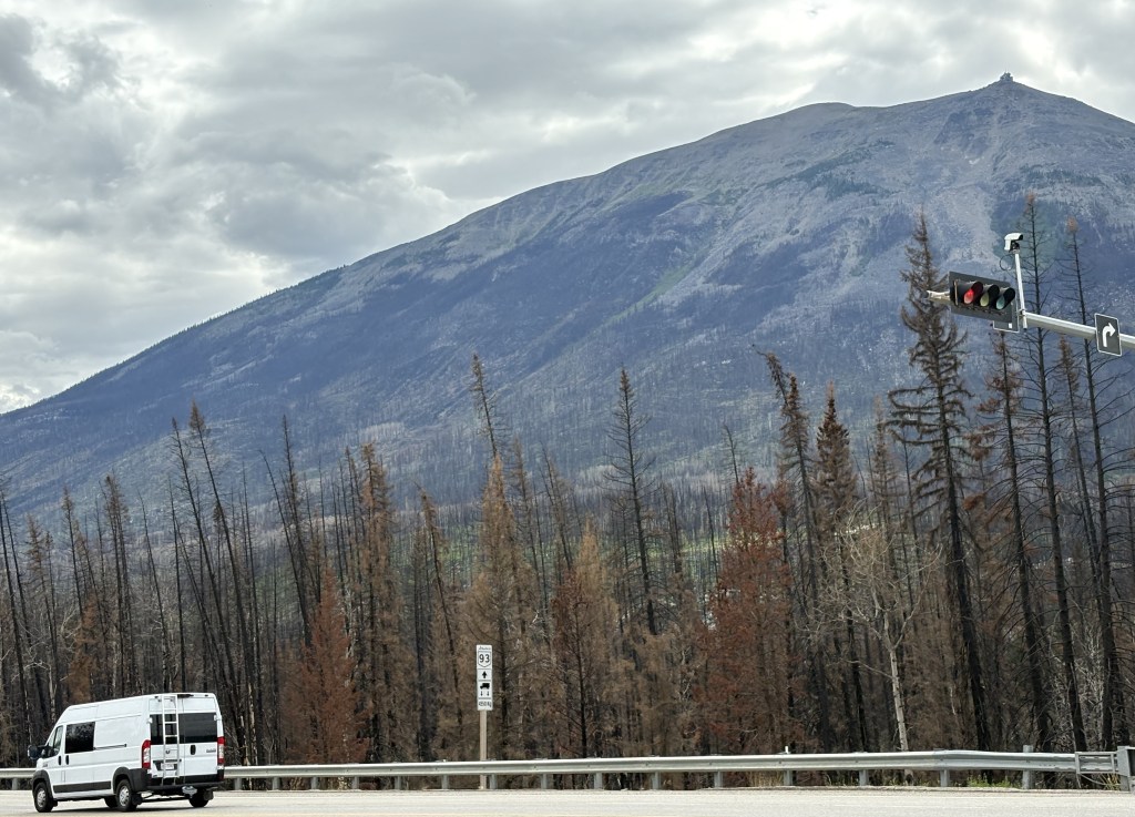
This is the intersection of Hwy 16 (Connaught Drive) and Hwy 93 (the Icefields Parkway) as I was leaving town.
Across the intersection is Whistlers Peak which is where the Jasper Sky Tram goes. It is the highest and longest aerial tram in Canada. As far as I can tell that part of the mountain was not affected by the wildfire. Left of that is Marmot Mountain where the Marmot Basin ski area is located. It, too, was unaffected by the fire.
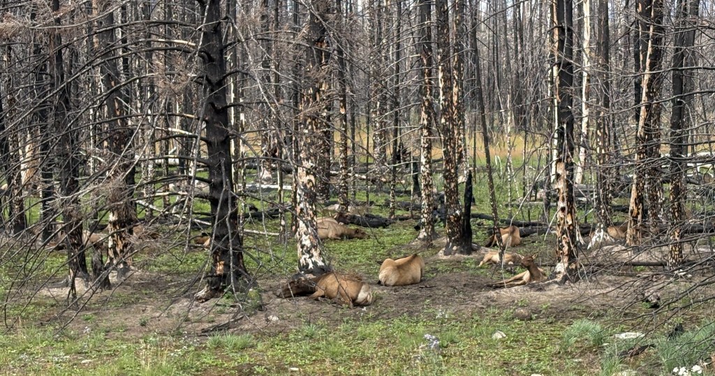
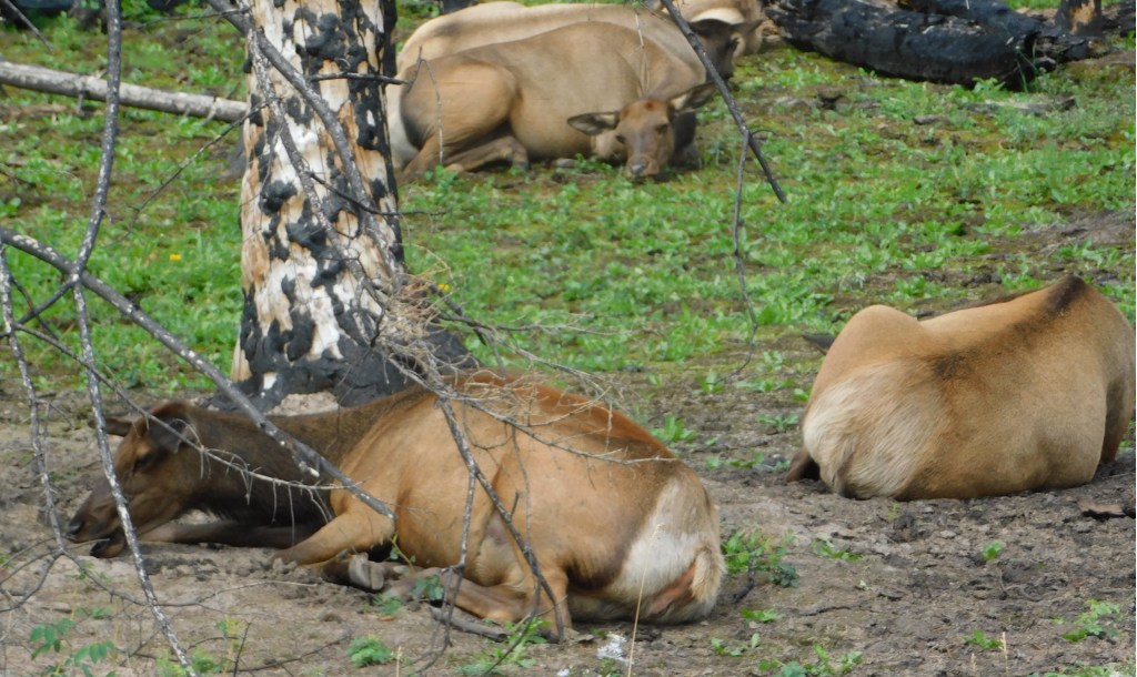
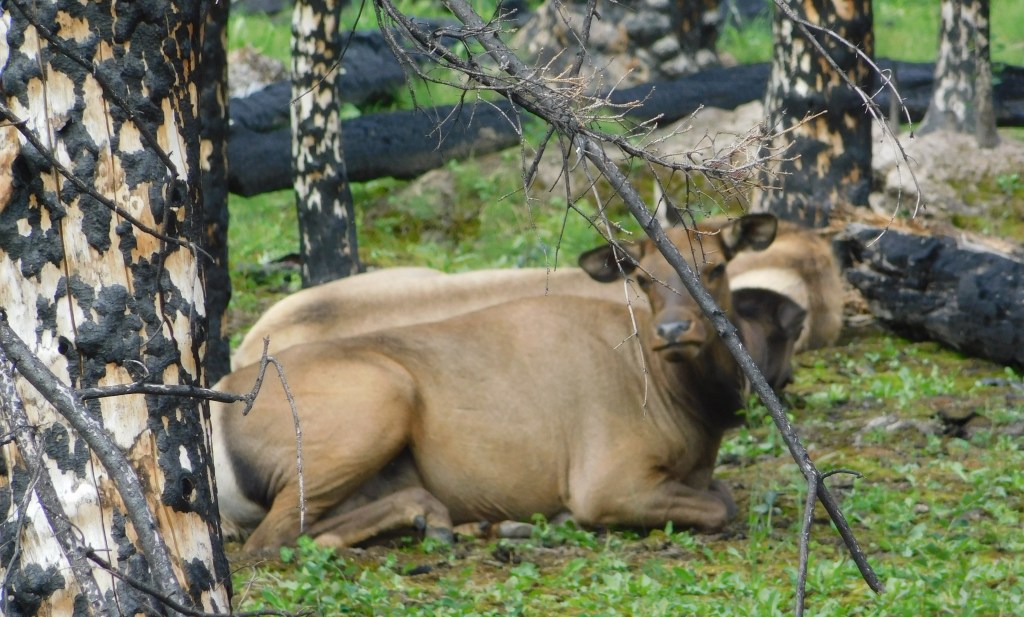
Once I turned south on Hwy 93 there were several vehicles stopped on both sides of the road and people were milling about with their cameras. Of course I stopped and joined them. There were about 30 elk resting on the ground in a grove of burnt out trees. They appeared to be adult females and some younger ones but I didn’t see any antlers so apparently there weren’t any adult males.
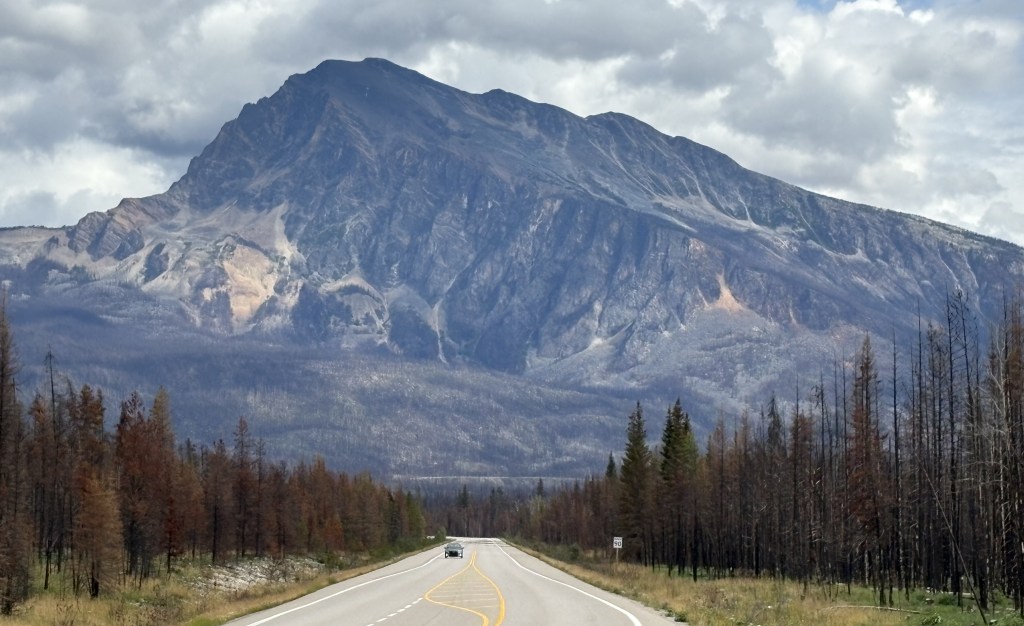
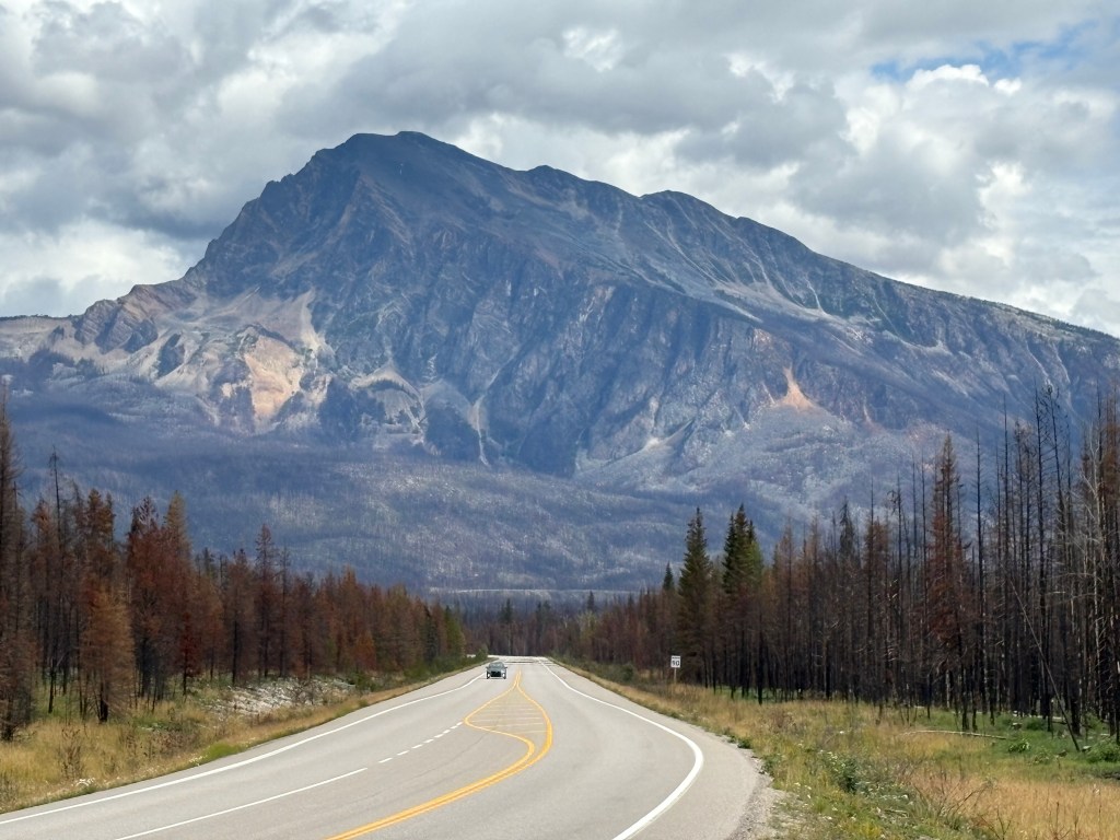
I continued south towards Golden, wanting to get there before dark. This is the view as I approached Mt. Hardisty. You can see the burnt out trees on both sides of the highway.
I chose Jasper as my first National Park to visit after arriving in Golden (although I drove through 3 others getting there). I really didn’t know what to expect when I got to the town of Jasper, as I was aware of the wildfire in 2024 but didn’t know the extent of damage. The town of Jasper is about a 3 1/2 hour drive (if done non-stop) from Golden, although I stopped many, many places to take pictures.
As I mentioned in the last post, I started seeing evidence of the fire as I drove around two mountains south of town – about 16 miles away. All the trees on either side of Highway 93 were destroyed by the intense fire. When I finally arrived in town around 1 pm, I stopped to walk the main street in town. I also went to the Parks Canada Visitor Centre, which wasn’t affected by the fire. There I was told where I could and couldn’t go within the Park. While I was there, some parts of the Park were still off limits due to damage caused by the wildfire.
Here are some of the things I saw:
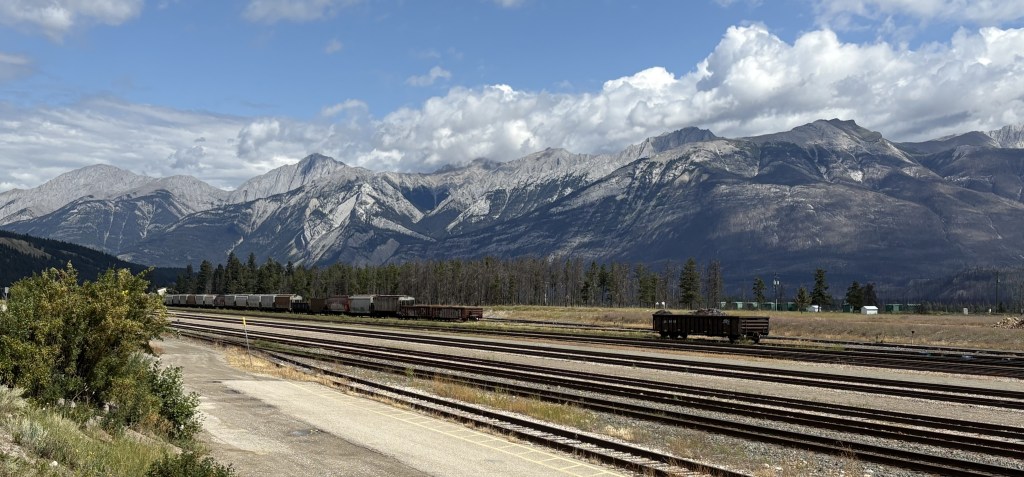
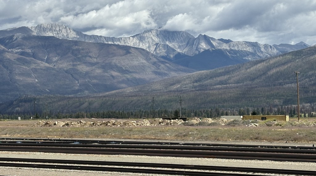
Those are railroad tracks on the south side of town, significant because they are a main transcontinental line operated by CN Rail (The Canadian National Railway). Rail traffic through the Park was suspended the night the fire started, and CN Rail brought in one of their firefighting trains to help fight the growing blaze. Just beyond the tracks is the Athabasca River (out of view), and in the distance are the Colin Range of mountains, located southeast of town.
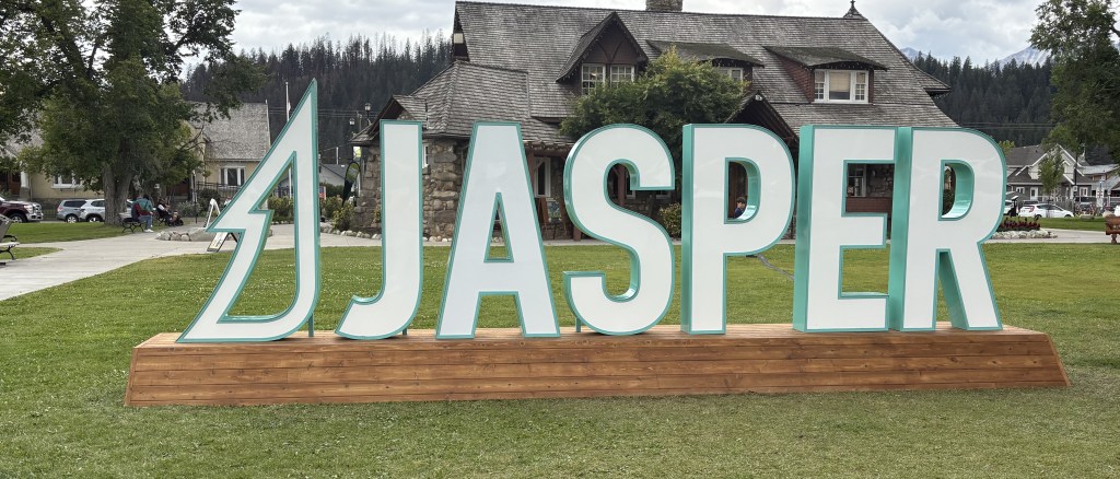
That is the tourist “photo op” sign in Jasper (in a rare moment someone wasn’t having their picture taken in front of it), and behind it is the Parks Canada Visitor Centre.
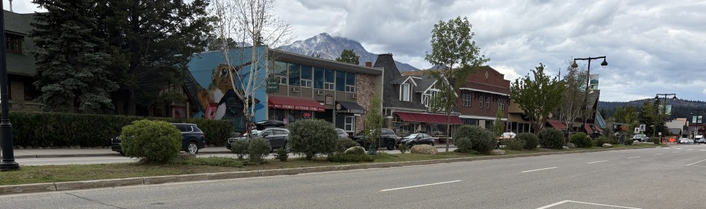
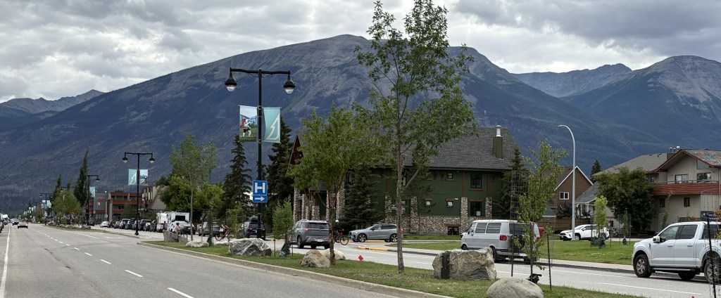
Those are the views of Connaught Drive, the main street in Jasper, looking in from each end.
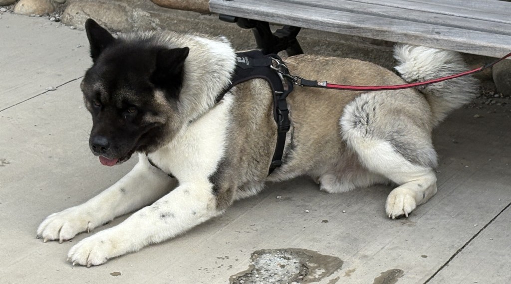
This is an Akita taking a break while his handler was on the phone.
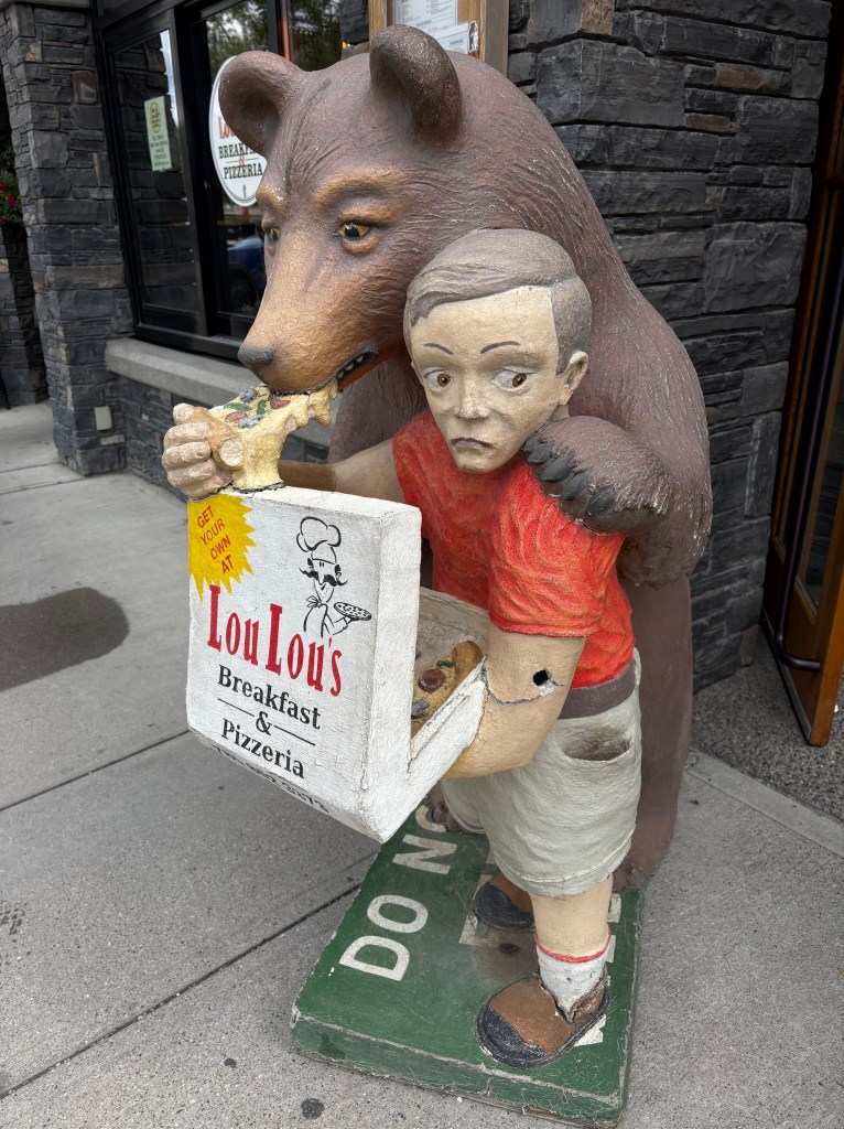
This is a statue outside the pizza place where I had lunch.
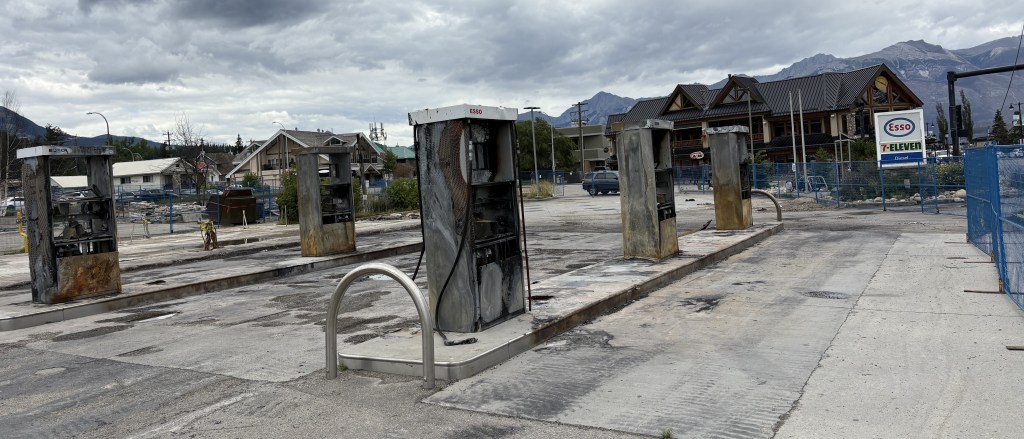
This is one of the few signs of the fire I saw downtown. It is a set of gas pumps on the same side of the street as the main shops.
Another gas station was destroyed on the other side of the street. The structures destroyed in the fire have been razed and the lots cleared. Many of the businesses which were affected indicate online that they are only “Temporarily Closed”.
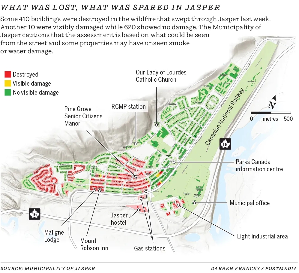
Here is a map of downtown Jasper showing which structures were lost in the fire. The map states that 420 structures were destroyed or visibly damaged while 620 showed no damage. Wikipedia states that 358 of 1,113 structures were destroyed. Either way, the town did suffer significant property losses.
(Photo credit: Calgary Herald)
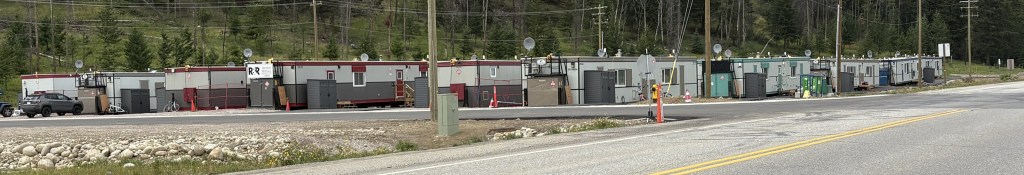
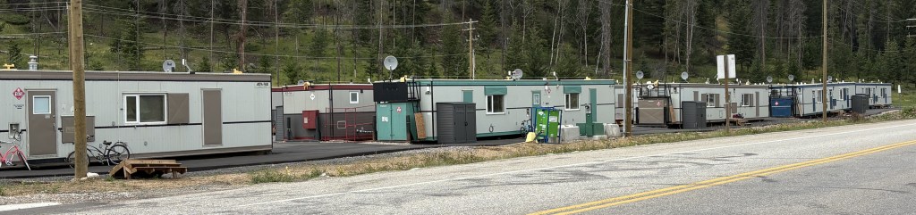
These are trailers which were brought in as temporary housing for some of the residents who lost their homes. I saw them at several locations in the area.
The next post will show some other things I saw in the area before heading back to Golden.
The first full day based in Golden I decided to drive to up to Jasper National Park to see how the recovery from the devastating wildfire last year is coming along, and to see the extent of damage for myself. To get there I would first have to go back through Yoho National Park to get to Hwy 93. I then drove quite a while in Banff NP before actually getting to Jasper NP at the start of the “Icefields Parkway,” which is considered by some to be the most scenic drive in Canada. So I will break this first Jasper post up into 4 parts – Going through Banff NP, driving up the Icefields Parkway, Jasper NP and, finally, the town of Jasper.
After driving north through Yoho NP I turned left on Route 93 to head towards the town of Jasper. Mapquest says the total drive time from Golden to the town of Jasper is 3 1/2 hours. It will take considerably longer than that because it seemed like I was stopping every 10 minutes to take photos of something.
As soon as I got on Rte 93 I started taking pictures. This is Herbert Lake. Looking left:
And looking right:
It’s all on one side of the highway, it’s just a big lake! Seemingly everywhere you look up here there are mountains.
And this is just getting from Point A to Point B!
A closer look at the mountain on the right, and the more of many glaciers you will see.
One of the amusing trailhead and campsite signs I saw.
I wonder if this mosquito attracts many humans? I suspect so….
Rivers and streams come in two types up here – glacier fed and normal rain runoff. This is an example of the latter:
Crystal clear, and very cold, water
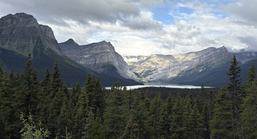
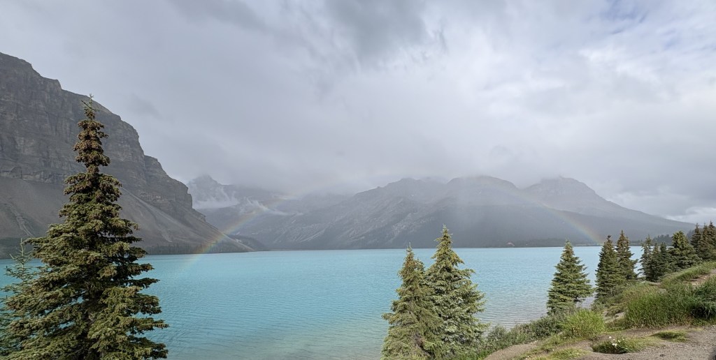
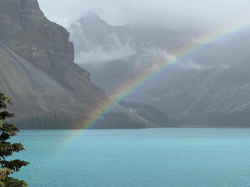
This is my first look at Bow Lake, fed by the Bow Glacier. Remember that name, as it will be a recurring theme once I get further down the road to the town of Banff.
Glacier fed lakes and rivers have various tints, depending on the minerals released when the ice pack (glacier) on top of the mountain melts. This one is a very pretty turquoise color. As you can tell from the photos it was overcast this morning so the color of the water isn’t as rich as it would be if there was a bright blue sky overhead. Bow Lake is quite large. This is a little further up the road where there was a pullout for cars and tour buses to stop.
Sometimes the reward for taking pictures is being in the right place at precicely the right time. As I was walking back to the pullout area where I had parked my car the sun came out behind me VERY briefly. Just long enough to create a rainbow over the lake.
The photos don’t really do it justice. Because I was so close to it the colors in the rainbow were very vivid, especially the blues, indigos and violets.
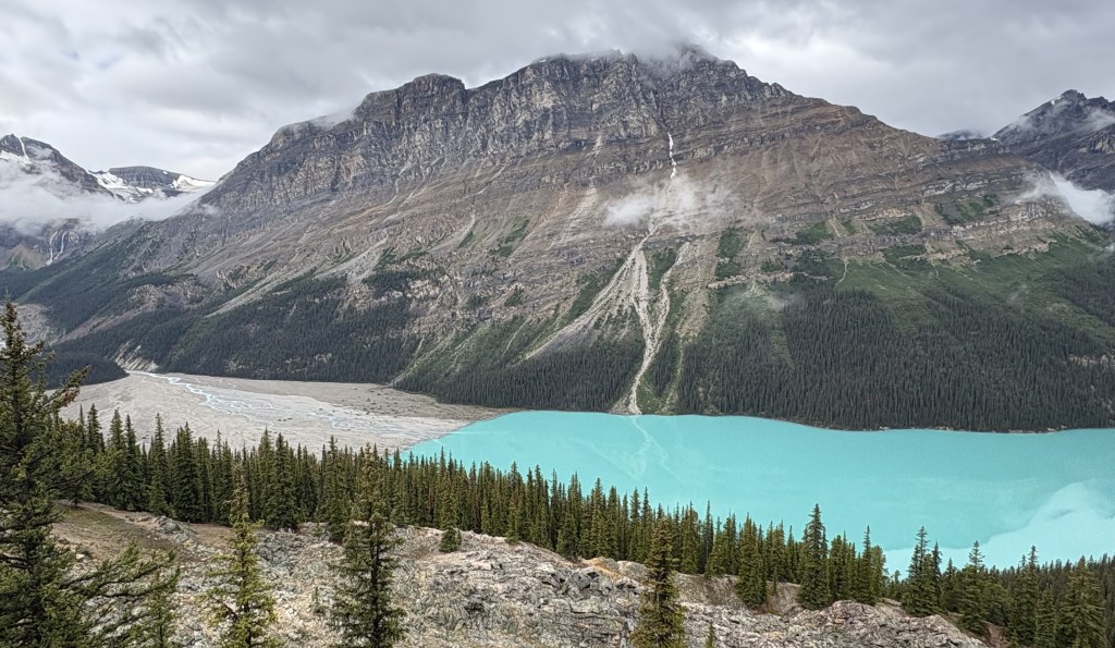
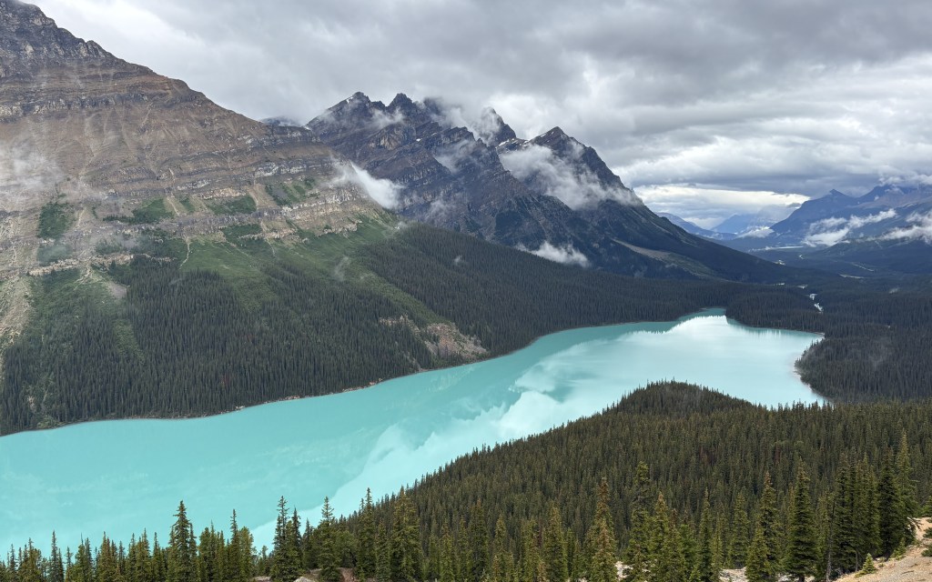
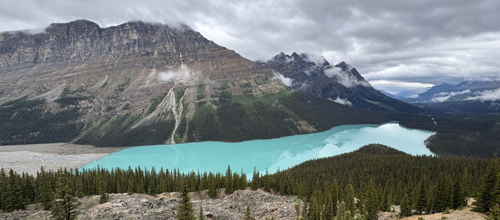
This was walking up the hill to another lake just up the road. Peyto Lake is also glacier fed, from the, you guessed it, Peyto Glacier.
There was a sign indicating we were at 2,078 meters elevation (6,817 feet), the highest point on the Icefields Parkway. I presume they were talking about the roadway getting here, as we were still walking up a VERY steep, albeit paved, trail to get to a scenic viewpoint for the lake below. I was huffing and puffing, and exclaimed to another person walking near me that I didn’t expect to have to climb a mountain to see a lake. I found him when we got to the observation platform and told him it was SO worth it.
The glacier, which you can’t really see because of the clouds, is in the upper far left corner of both photos above. If you look closely you can see how the water drains down through the brownish gray area to get to the lake itself.
Here’s the whole lake in one photo:
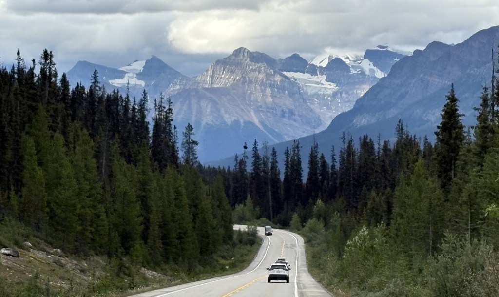
The next section of my journey to the town of Jasper would take me through the Icefields Parkway. If you think you’ve seen some glaciers so far, you ain’t seen nothin’ yet!
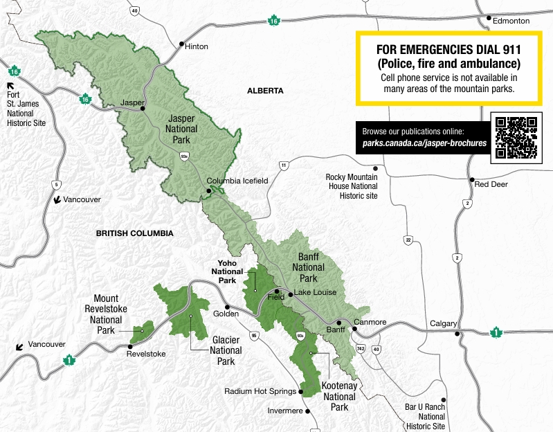
Before I post any more Park pictures let me show part of the Jasper National Park Visitor Guide, published and distributed to Park guests by Parks Canada.
(Photo credit: Parks Canada)
This will give you the “lay of the land” as I describe the Parks I went through while I was based in the town of Golden (bottom center of map, above the words Glacier National Park). The two biggest Parks are Jasper and Banff, both in light green on the map above. They hug the peaks of the Canadian Rockies.
Jasper is the largest, at 4,335 square miles. This makes it larger than Yellowstone, one of the best known American National Parks in northwest Wyoming, which covers 3,472 square miles. It is hard to visualize the comparison because Yellowstone is basically rectangular whereas Jasper is elongated as it spreads down the Canadian Rockies. Believe me, it covers a lot of territory.
Banff, perhaps the best known Canadian National Park, covers 2,564 square miles. That makes it a little less than half the size of Jasper. It stretches out to about the same length in the Rockies but isn’t as wide in the northwest portion.
Kootenay, which I already made one post about, is the next largest. The map above is a little deceiving with regard to Kootenay and Yoho, which are shown in the same color. It appears that a highway separates them, but there is more of Yoho on the south side of the Trans Canada Highway than the map above indicates. The map in the Yoho Visitor Guide gives a much more accurate depiction:
(Photo credit: Parks Canada)
This second map clearly shows how I drove through Kootenay from Radium Hot Springs at the bottom of the map, out to the Trans Canada Highway (Route 1) in Banff NP, left towards Lake Louise, then curving left again to enter Yoho NP and drive past the town of Field to get to Golden.
The two remaining Parks, Glacier and Mount Revelstoke, are both quite small and I drove west to see both of them the third day I was based in Golden.
I know, it has been a week since I posted anything substantial, and that was from way back near Vancouver. As usual, I am way behind but can assure you I am accumulating LOTS of photos.
Driving across southern Alberta province a few days ago, on my way to Moose Jaw, I decided I would post a few photos from each city I have stayed in since leaving Vancouver Island to whet your appetite for what is still to come.
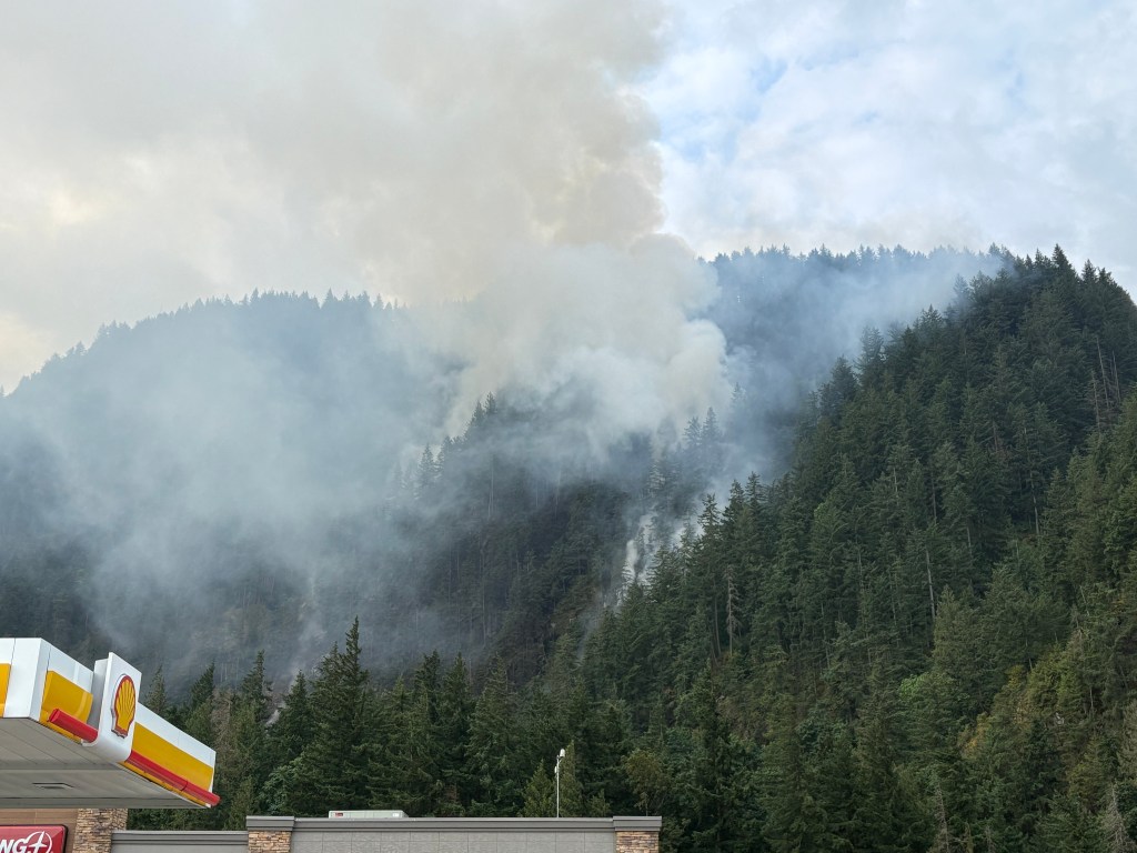
HOPE, BC – I didn’t stay there but it provided some excitement early in my loooong drive to Cranbrook from east of Vancouver. There was an electronic sign next to the Trans Canada Highway warning of a wildfire ahead and telling drivers NOT to stop along the roadway. Well, it turns out the fire was on a hillside above a gas station I was already planning to stop at, where Route 3 branches off from the TCH to take me east across southern British Columbia, very close to the US/Canadian border. So I didn’t stop along the roadway, I stopped at a gas station off the exit.
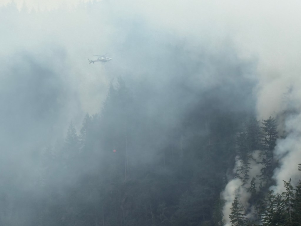
This fire had been burning for about a month (and still is as I write this). It is quite small by wildfire standards but is stubborn due to the steep terrain on the hillside. While I was getting gas, a helicopter arrived about every 4 minutes to dump a large bucket of water on the hotspots, then flew off to a nearby water source to bring more. Imagine the pilot(s), doing that all day, every day.
That particular drop hit right on the “sweet spot” where I could see visible flames.
This was as close as I ever need to get to a wildfire.
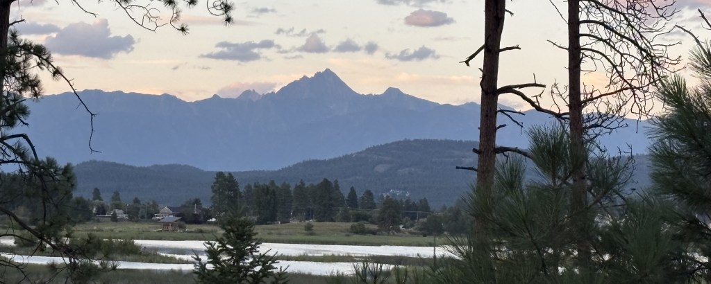
CRANBROOK – After 12 hours in the car (with stops) I approached Cranbrook and got my first look at the southernmost Canadian Rockies. The sun was just setting as I could see the very impressive mountains in the distance. By the time I found a place to stop with a fairly clear view only one set of mountains were still getting sunlight and the others were now in full shade.
There was a third set of mountains further north that I could see but I couldn’t get a clear shot at them from this vantage point.
GOLDEN, BC – After spending two nights in Cranbrook I headed north to spend 6 nights in Golden, from which I would visit 6 National Parks.
This was from the drive towards Jasper NP, a huge Park which suffered considerable damage from a large wildfire last year. I drove over 3 hours north on the Icefield Parkway, and stopped at these two lakes and saw LOTS of mountains along the way:
The next day I drove west from Golden through (the Canadian) Glacier NP.
I would also go through Kootenay, Yoho, Mount Revelstoke and Banff National Parks from my base in Golden.
CANMORE, BC – Rather than staying in Banff proper I went 22 kilometers south to spend 4 nights in Canmore which is a very nice little town without the massive crowds that Banff experiences. I did make two early morning stops in Banff before the tour buses and RV’s started to arrive in the late mornings, and will post those photos later.
From Canmore I drove a long way south one day in an area known as Kananaskis Country (pronounced can-a-NASS-kiss):
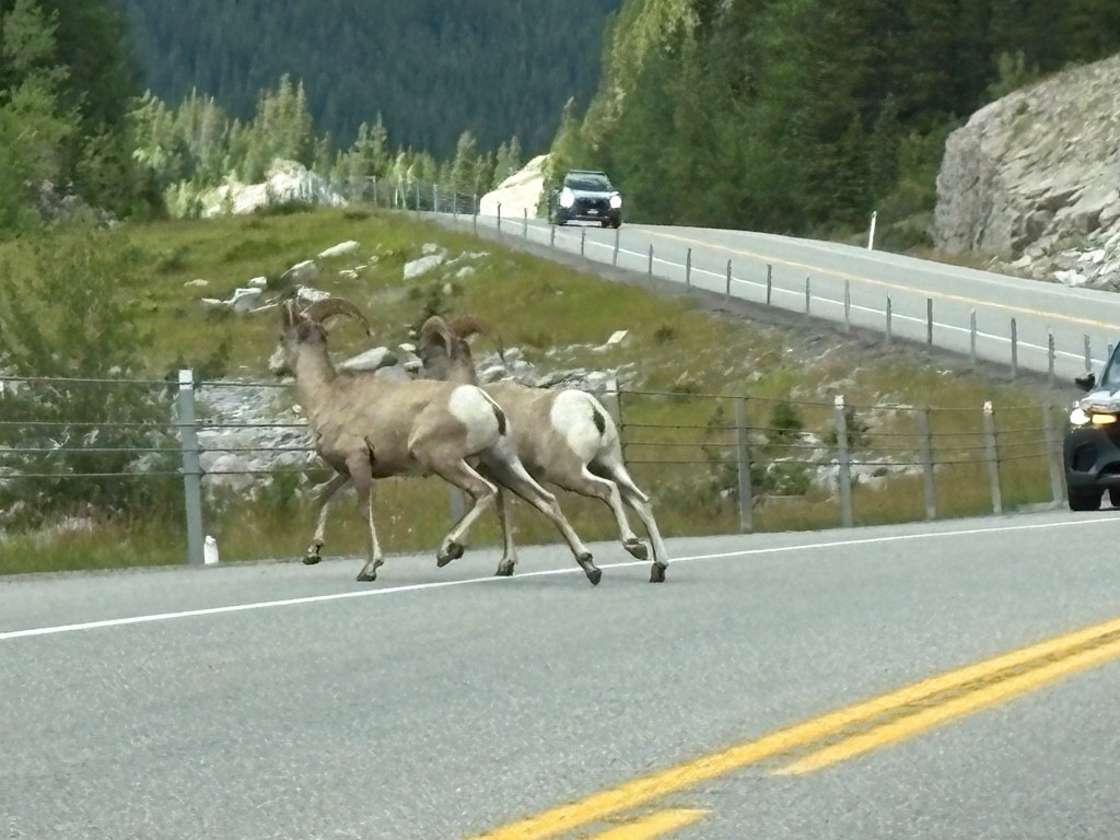
As I was driving home, there were two full grown Bighorn Sheep in the road and traffic was stopped. Note the Park Ranger’s truck approaching behind the black car which was stopped.
The Ranger lit up the emergency lights and started honking the horn as the truck swerved around the stopped car, scaring the sheep over the guardrail and off the road.
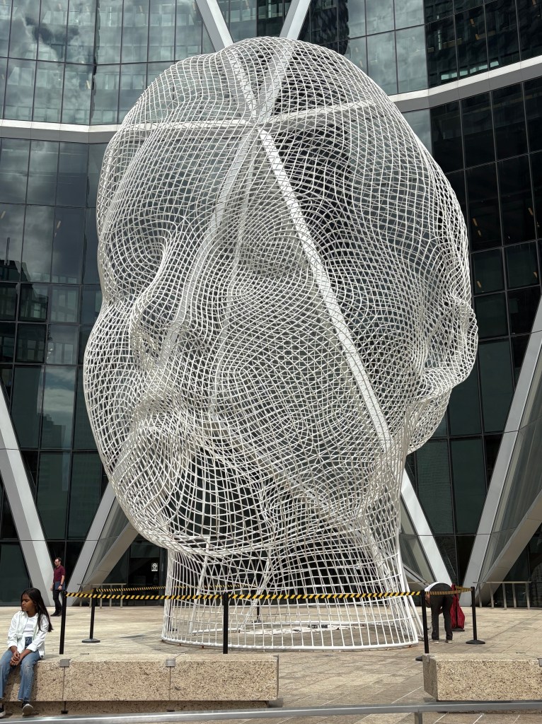
CALGARY, AB – After 10 nights total in the Canadian Rockies I went west from Canmore to Calgary, the provincial capital of Alberta. There I found the huge Wonderland sculpture in front of a building on a busy city street:
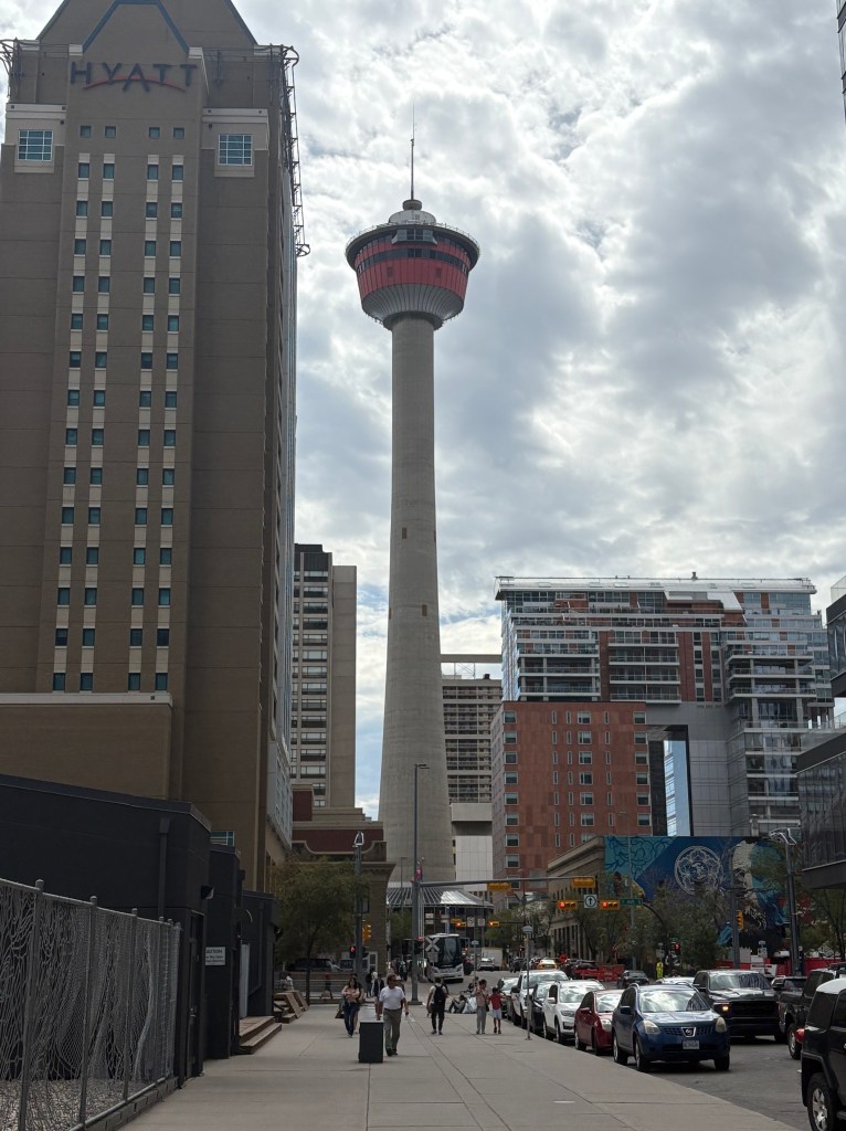
And the Calgary Tower, similar to the CN Tower in Toronto, but shorter and designed to look like the Olympic torch (Calgary is another Canadian city which has hosted the Winter Olympics):
The tower used to dominate the skyline but is now dwarfed by many of the new skyscrapers downtown.
I apparently haven’t downloaded some of the other photos I took in Calgary which I had planned to include here but will post them later.
MOOSE JAW, SK – Three days ago I drove due east from Calgary for about 7 hours, across southern Alberta and into western Saskatchewan, to a town I have wanted to visit for a very long time.
I give you Mac the Moose:
He stands proudly outside the Visitor Centre in Moose Jaw. Inside the Visitor Centre I found his sidekick, Cheese the cat:
Get it? Mac and Cheese?
Next to Mac there was a replica of one of the Canadian Snowbirds jets.
The Snowbirds are Canada’s precision flying team and are based at the military airfield just outside of Moose Jaw. I saw their support truck twice on the highways as I went from town to town, and they just recently put on an airshow in Nanaimo, where I took the ferry from when I sailed from Vancouver Island to Vancouver city at the beginning of this trip.
REGINA, SK – Which brings me to where I am tonight. I didn’t get into town until noon, and stopped at the Visitor Centre for maps and brochures to add to what I had already found elsewhere. I went to a series of sports arenas, all gathered on one part of town, and drove to several nice city parks to enjoy the cooler weather. In one of them I found this rabbit, casually eating grass:
It’s hard to tell from the photo but he is huge – every bit as large as my 16-pound cat (Bigfoot) that I had when I lived in Pennsylvania.
Unfortunately I scared him as I tried to get closer and he used his long legs to run off.
I haven’t had a chance to really explore the city but I will review my notes when I get up in the morning and make a full day of it.
I hope this will hold you over until I have time to review, crop and organize more photos from all of these places.