Mount Denali, et al – Part 2 of 2

September 17, 2025

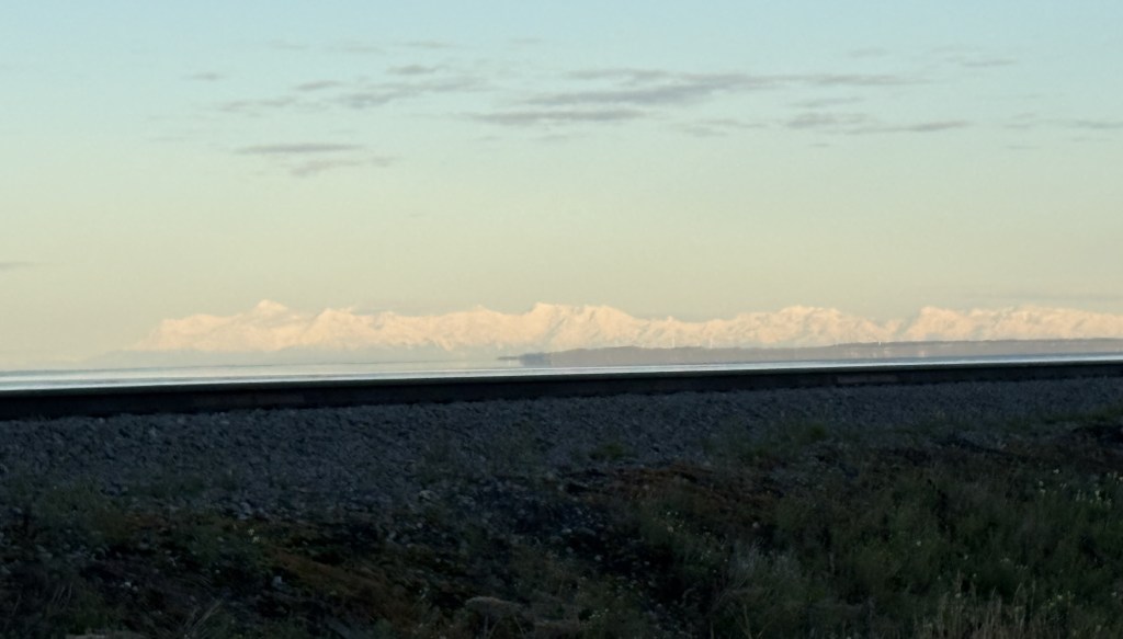
These are photos taken at the Denali South Viewpoint. There were signs indicating which mountains I was looking at, how far away they are, and how tall the black mountains (without snow) in front of them are.

We’ll get Mt. Foraker out of the way first. I posted a photo taken from the side road at a higher elevation, which gave me a very good view (see previous post). This was the view from the South Viewpoint:

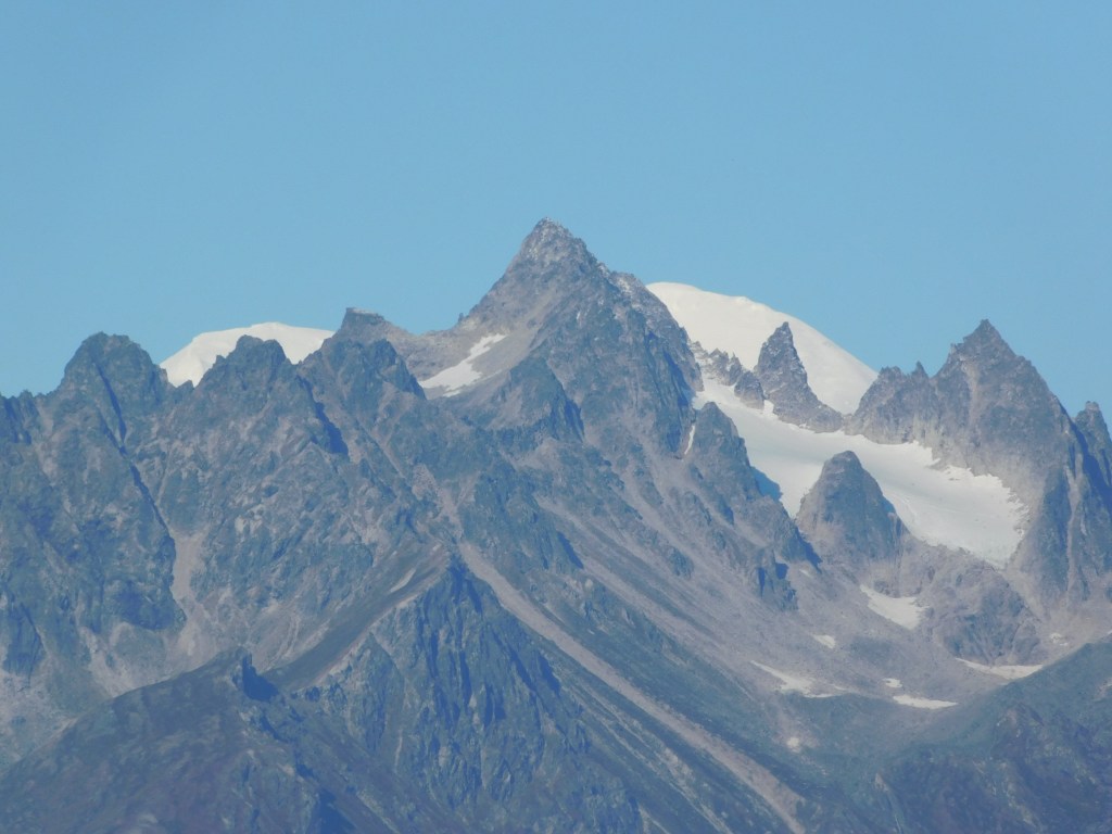
Not real impressive, eh? Despite Mount Foraker being 17,400 feet tall, the view was being blocked by a 5,150 foot tall mountain (which actually had a little bit of snow on it) much closer to the viewpoint, so you can only see two small parts of Foraker! Signage at the viewpoint indicated Foraker was 45.5 air miles away.

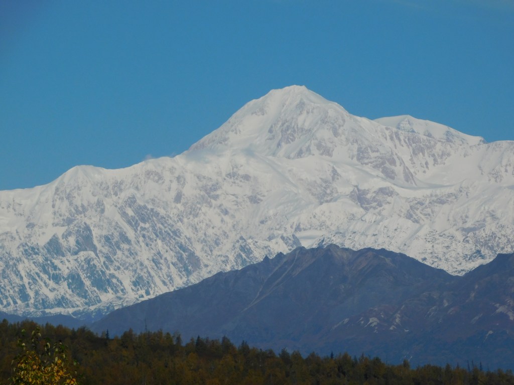
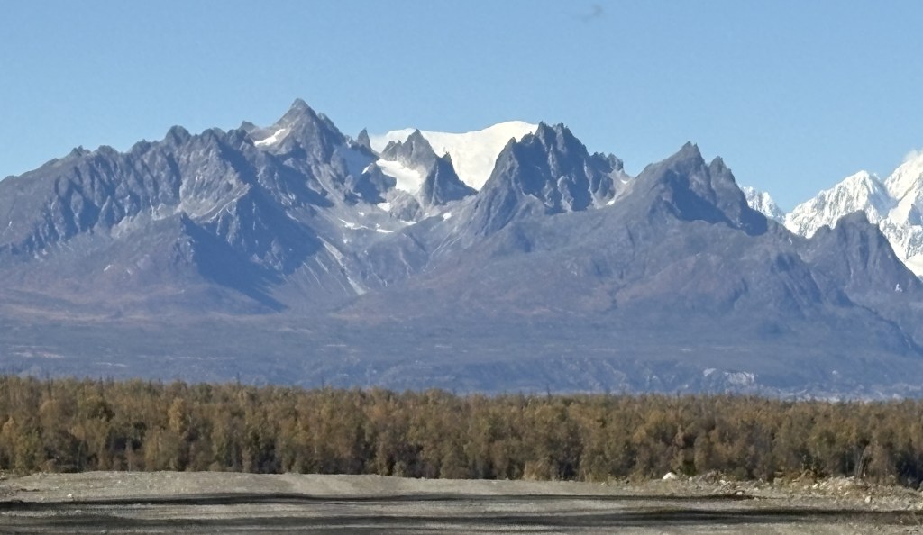
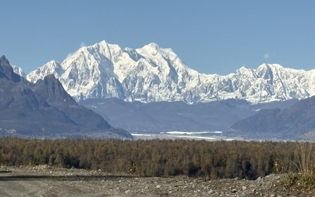
Hunter mountain was a little better. This was taken with the zoom lens:

Mt Hunter is on the left side of the photo above and is actually comprised of three peaks, South (left) at 13,967 feet. Middle (above the right peak on the black mountain) at 13,400 feet, and North (right, in the center of the photo) at 14,574 feet. The whole mountain is on an angle with the right side further away than the left side. Hunter is closer to the road but is still partially blocked by the smaller 4,205 foot peak even closer to the road. The signs at the viewpoint indicated that Hunter North Peak was 37 air miles away.

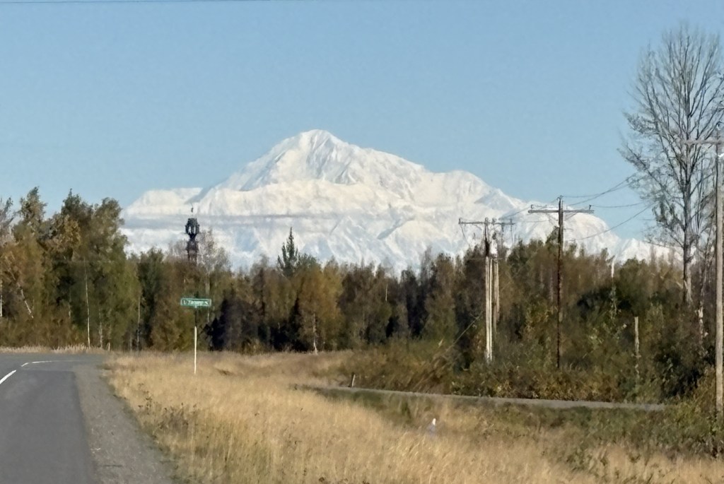
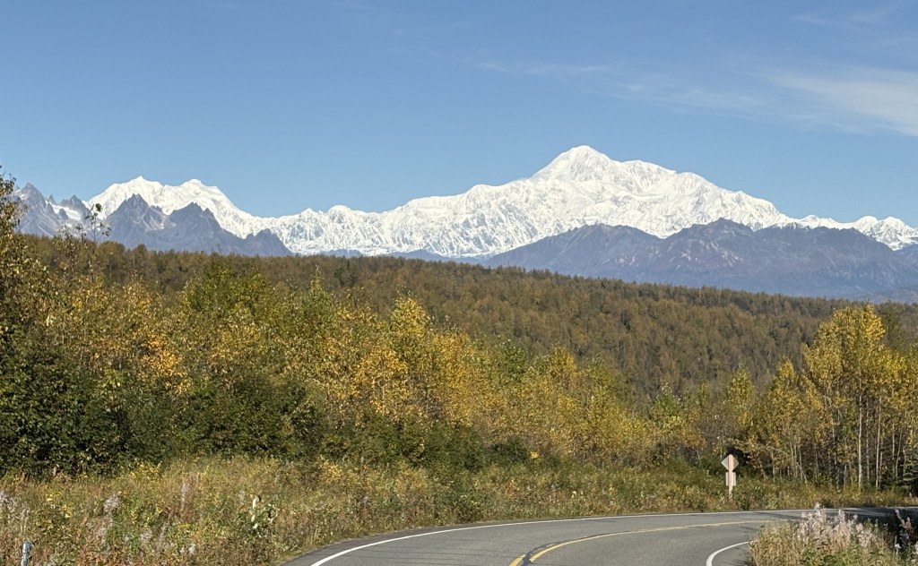
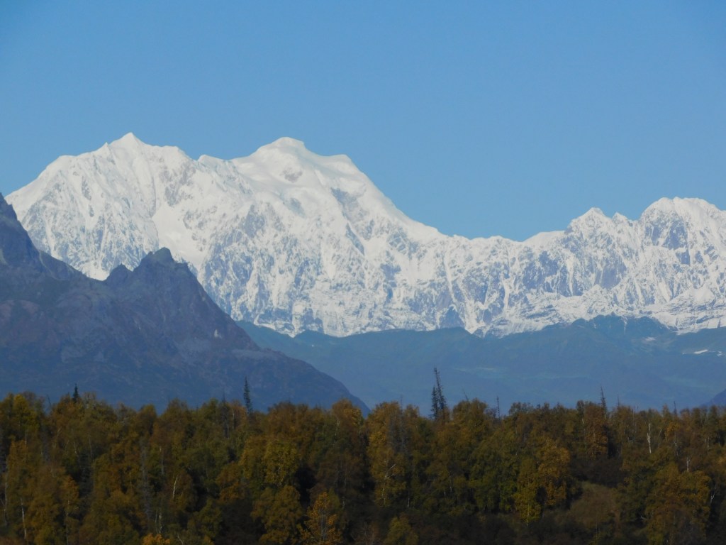
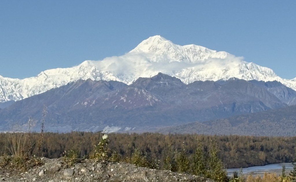
Here is my best shot of Denali, taken with my smartphone camera:

There will be another one from a little further up the road. Again, the main peak is at 20,310 feet elevation but the black mountain in front is at 5,160 feet and is closer to the viewpoint. South (main) peak was 41.5 air miles away, North peak (to the right) was 43 air miles away.

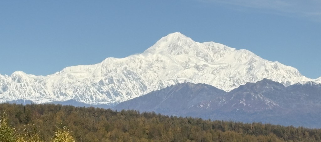
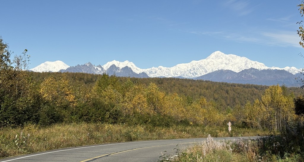
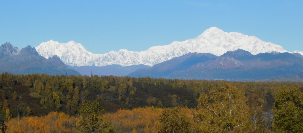
Here is a shot of Hunter and Denali together (digital w/zoom):

There were 3 other viewpoints further up the road. Campground (just a small pull off area next to the road), 3 miles away, Veterans Park, 15 miles away, and North Viewpoint, 30 miles away.

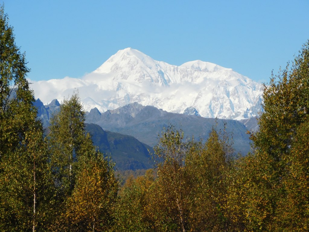
Here are three photos from Campground:

Foraker:

Still mainly blocked.

Hunter:

Much more defined. I am personally shocked in the difference between this photo of Hunter and the others. I don’t tinker with camera settings other than zooming in.
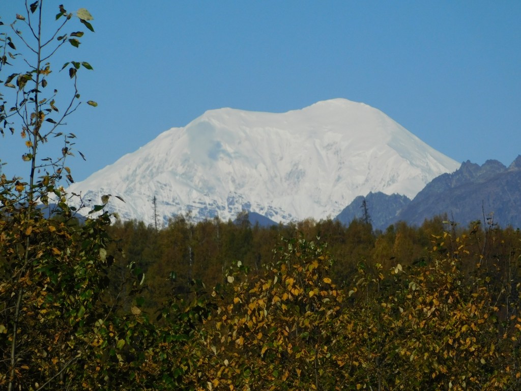
Denali:

A wider view but with the pesky black mountain blocking. You can also see a wisp of clouds starting to form.

I stopped at Veterans Park further up the road. There were several sobering historical and memorial tributes to various conflicts and branches of the service, as well as this statue:

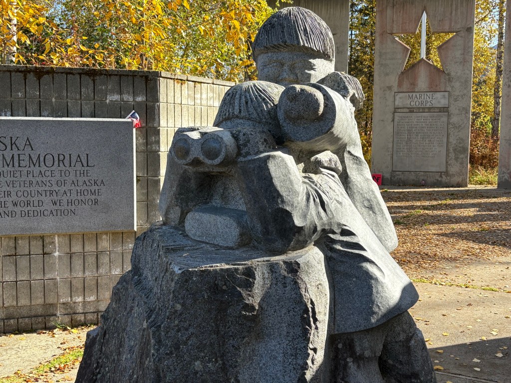
Here is what the soldier with the binoculars was looking at (Denali):

I drove up to the North Viewpoint but after having been to the others, I was not terribly impressed with what I was seeing.

I had only come up to try and see these mountains on a clear day, and had to drive back to Anchorage for the night. I would come back to these places again when I will be spending a night in Talkeetna, and a third time when I drive from Talkeetna up to Fairbanks, with a brief orientation stop in Denali National Park.

I will return later in my trip when I will spend 3 1/2 days in Denali National Park on my second trip to Fairbanks. Due to weather conditions I will not see these mountains again, and there aren’t many opportunities from within the Park itself which I will explain when I get to that point in my trip.

I was VERY happy that I had the opportunity to come up today and be part of the 33% that could actually see Mt. Denali.

Mount Denali, et al – Part 1 of 2

September 17, 2025

These next two posts will include photos from my first trip to Denali. This first post will show pictures taken on my way north from Anchorage. I have taken LOTS of pictures but have gone through them and selected the best ones for posting.

The name of the mountain itself is subject to some debate but I still call it Denali, as that was the original name given to the mountain centuries ago by the indigenous people who lived here. The name McKinley was first proposed in 1896 to honor candidate, and then President, William McKinley. It was officially changed in 1917 and remained until 2015 when it was changed back to Denali. Our current president changed it back to McKinley in early 2025, shortly after being elected. The National Park has always been called Denali.

My day actually started off with me driving south from Anchorage towards another destination. I stopped at a pullout area next to the highway to take a photo of something and as I was walking back to my car this is what I saw looking north.

It was a clear morning and I immediately knew that what I was seeing in the distance was what I call the “Denali Complex” – a group of mountains in the Alaska Range. That photo was taken at 813am.

I have learned that only about 1/3 of the people who travel to see Mt. Denali actually get to see it because of its tendency to shroud itself in clouds. When I saw it basking in the sun I told myself “I need to go there RIGHT NOW” and immediately turned my car around and headed north. Using the “calculate distance” feature in Google Maps I determined that I was currently 146 air miles (direct point-to-point) from Mt. Denali, though driving there would be much further and it would take over three hours to get to what I later determined was the best and closest viewing spot that was accessible to me.

Here is a map which shows some of the nearby landmarks I will be talking about in these two posts.

(Photo credit: Alaska.org The Alaska Map)

You can see the names of seven of the major mountains. I will only be talking about three in these two posts: Mt. Foraker (Wife), Mt. Hunter (Child) and Mt. Denali (High One). Hunter is harder to find but it is just above the letter ‘R’ in Range, and is closer to the highway than the other two.

For me the best photo opportunity would be at the South Viewpoint, at the bottom of the map, above the white 3 indicating the highway number. I made a dot and wrote the letter V to show approximately where the viewpoint is (though it is actually on the left side of the road driving north). You can also see on the map that even from the viewpoint the mountains are still pretty far away, and the entrance to Denali National Park is way up at the top of the map, over 100 driving miles from the South Viewpoint.

I saw a sign in “Earthquake Park” on the north side of Anchorage where the Denali mountains are sometimes visible on a clear day. A sign there indicated it is 135 air miles away, so I was already over 10 miles further away, and driving there is not a straight shot.

As I drove north, when I got close to the town of Talkeetna I could see Mt. Denali ahead of me.

I tried enlarging the image by cropping out some of the top and bottom but it didn’t really improve the image and I thought I would leave it alone so you could see exactly what I was seeing. I’m not sure exactly where I was when I took that photo at 1021am but I believe I was about 78 air miles away.

Just before getting to the South Viewpoint I noticed Mt. McKinley Lodge Road to the right side of the highway which appeared to climb a hill. I thought that might give me a better perspective so I drove up a short ways and found a spot where I could park and have an opening in the trees.

From that vantage point this was the view of Mt. Denali:

It looks very different from the photo I took south of Talkeetna because of the angle. There is a shorter range of mountains (not currently covered by snow) between where I was and the mountain itself. The highest peak on Denali is obvious and is 20,310 feet above sea level – making it the highest mountain in North America. That is the South peak. The North peak is slightly to the right and is further away from this spot. It rises 19,470 feet above sea level.

This is a shot of Mt. Denali and Mount Hunter, to the left.

Again, Hunter is shorter, at around 14,000 feet, although it is closer to the highway. From this angle it is almost completely hidden by the black mountains in front of it. The part blocking Hunter from this vantage point is about 4,200 feet tall but it is even closer to the highway, making it an effective impediment to seeing Hunter.

Further to the left is Mt. Foraker. This is the best photograph I have of it:

The other photos above were taken with my smartphone camera but this photo of Foraker was taken with my digital camera and zoom lens. Foraker is 17,400 feet tall, and even with that elevation, from other vantage points it is barely visible due to the black mountains. You will see that in the next post.

Here is a photo of all three mountains, taken with my smartphone.

And here is a photo of Denali taken with the zoom lens from this spot:

I estimate that I was 43 air miles from Denali at this spot. The photos from this vantage point were taken around 1114am – three hours after I turned around earlier this morning.

The photos in my next post are the best ones I have of Denali and Hunter. As you will see, you will hardly be able to see Foraker from the South Viewpoint, which is only about three miles from here, further up Hwy 3.