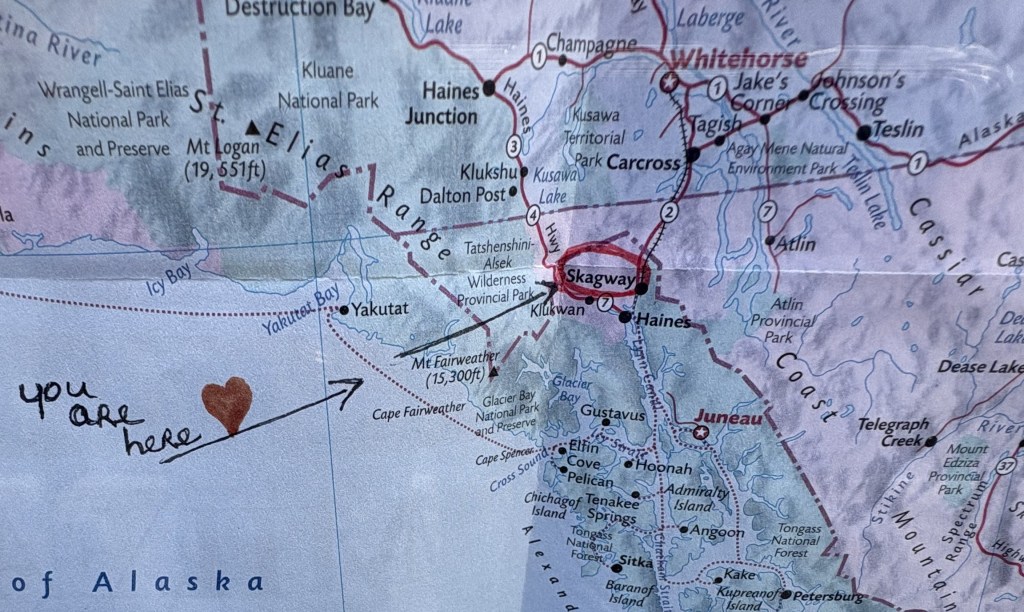
This is my last stop in Alaska. Skagway (and Haines) are located at the top of the panhandle of Alaska, which then proceeds southeast to Juneau and Ketchikan. There will be a map below which will show the area.
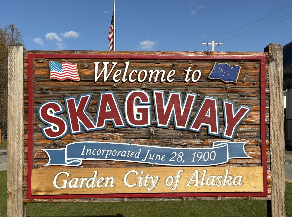
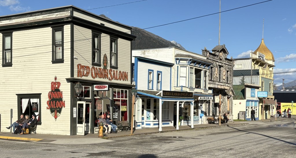
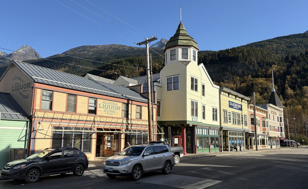
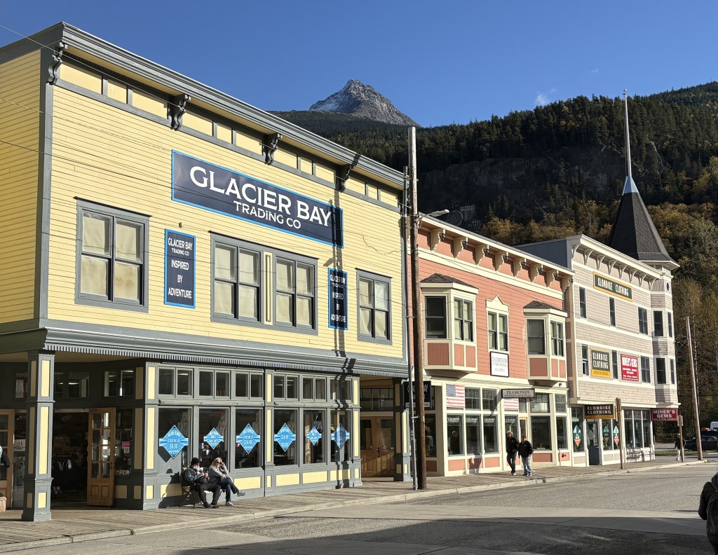
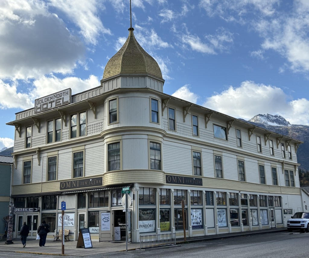
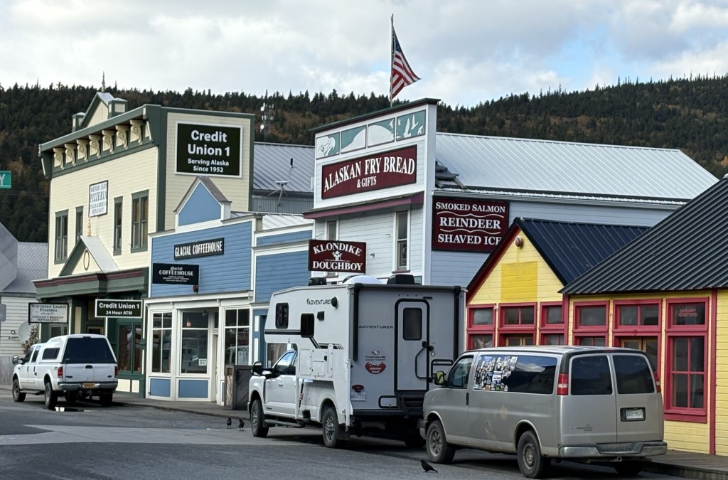
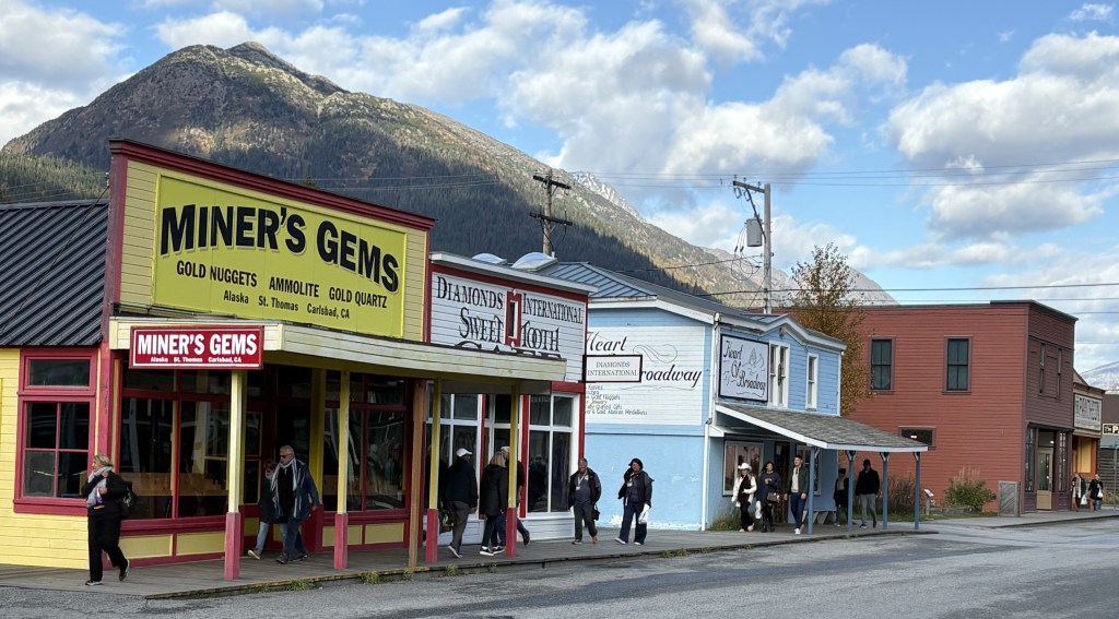
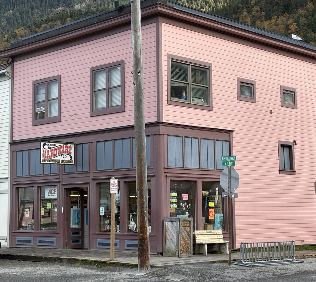
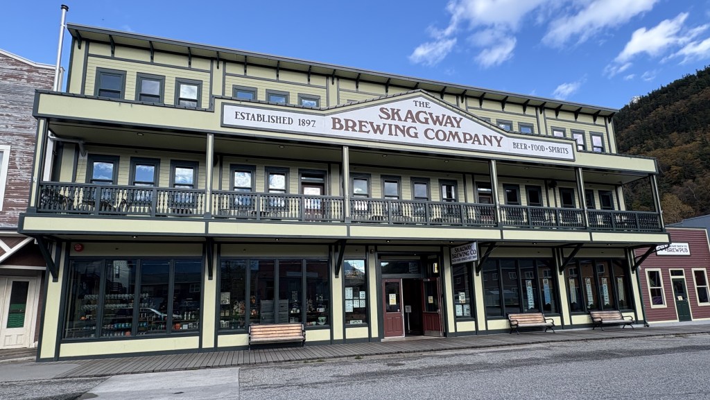
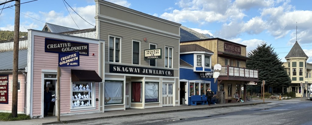
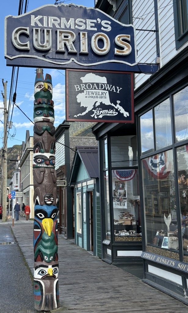
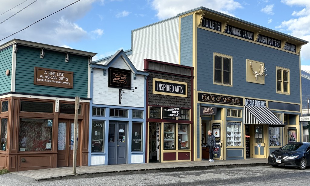
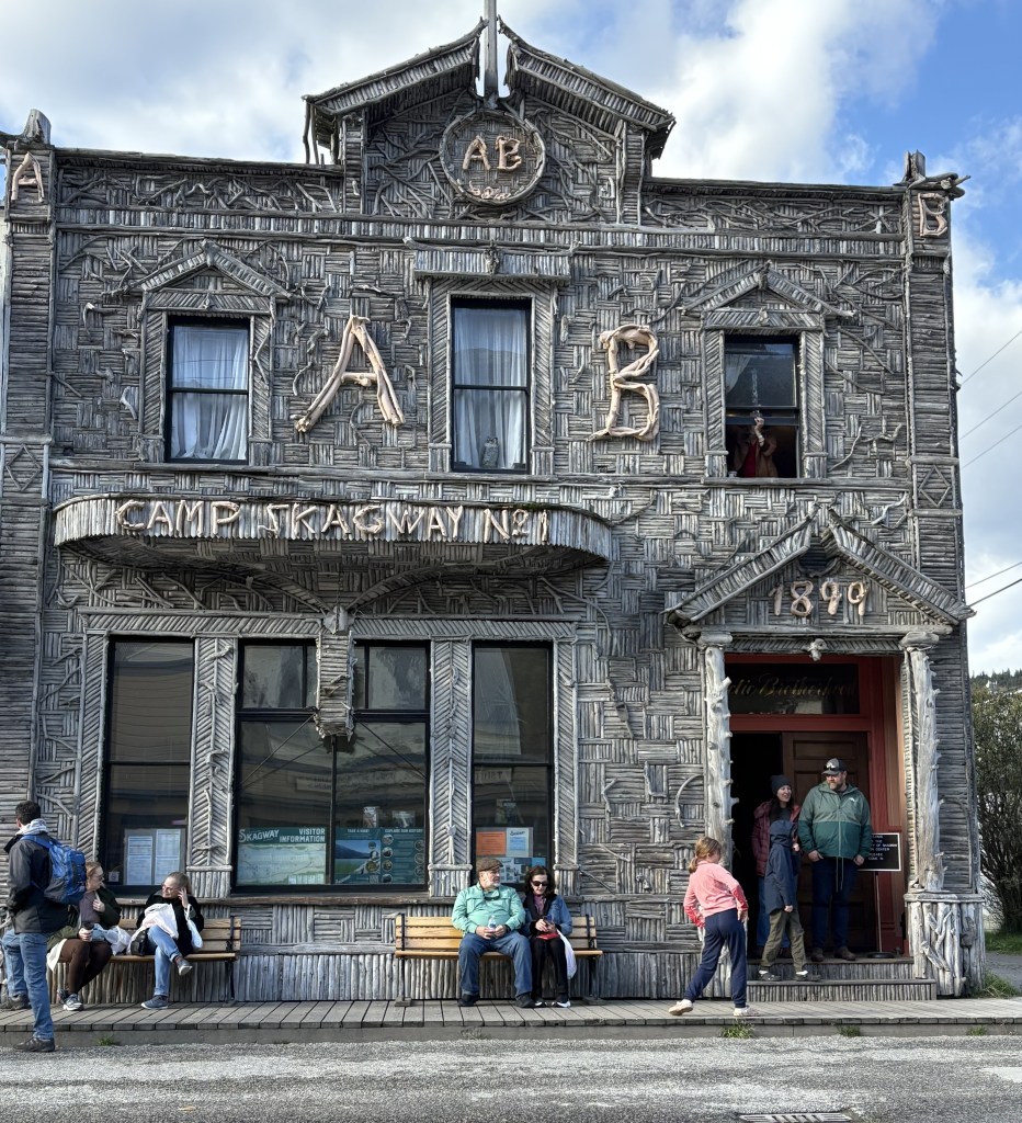
Skagway is about half the size of Haines, with a permanent population of around 1,200 people. It was a “Gold Rush” town, and some of the buildings here date back to that timeframe. It is a popular cruise shop port and consists mainly of retail and gift shops, restaurants, museums and jewelry stores. Summer activities include a steam railroad ride up into the mountains, which is apparently very scenic.
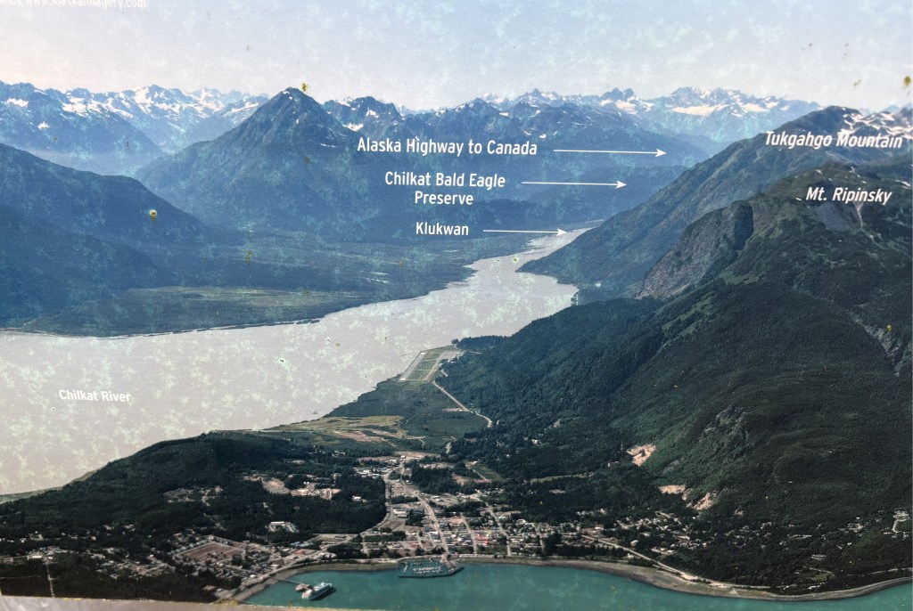
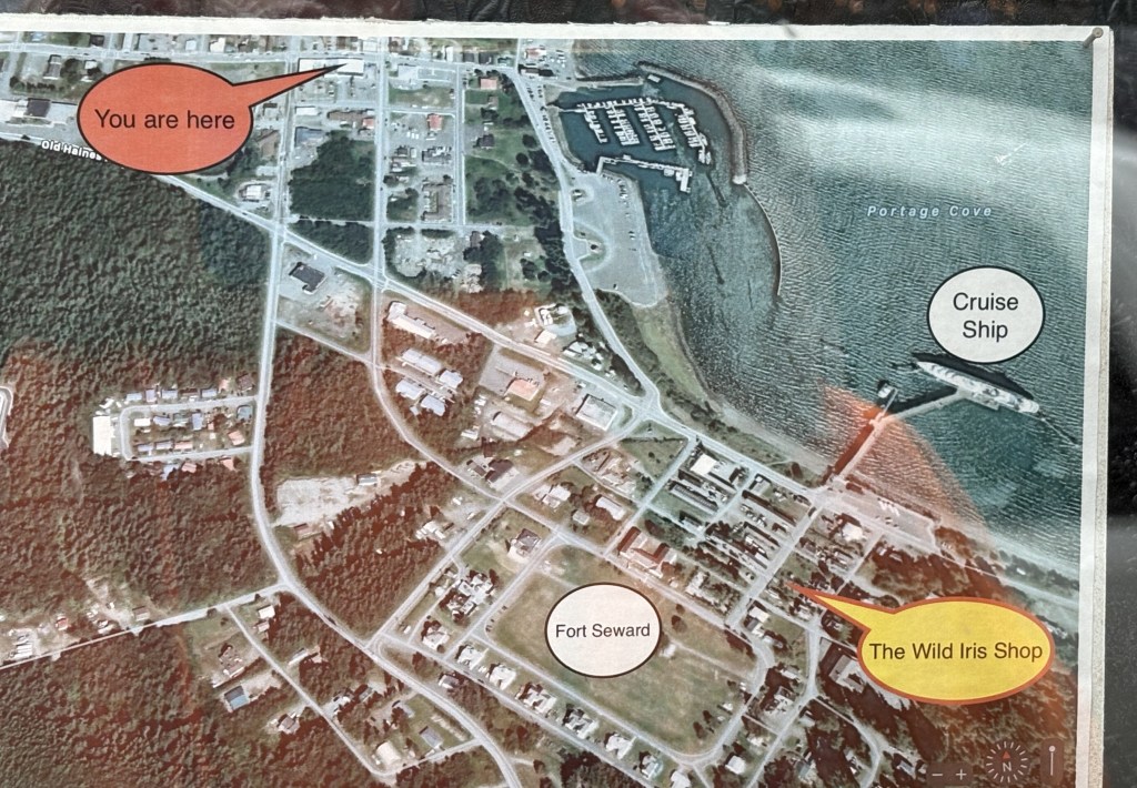
(Photo credit: Unknown. This is a photo I took of a map through the window of a gift shop, and it already had the notations on it.)
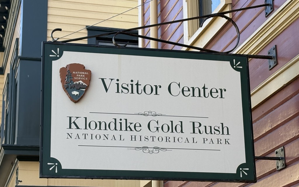
This visitor center was closed for the season.
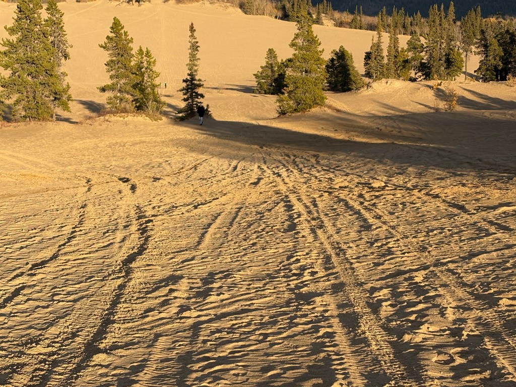
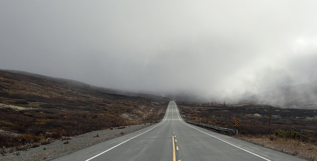
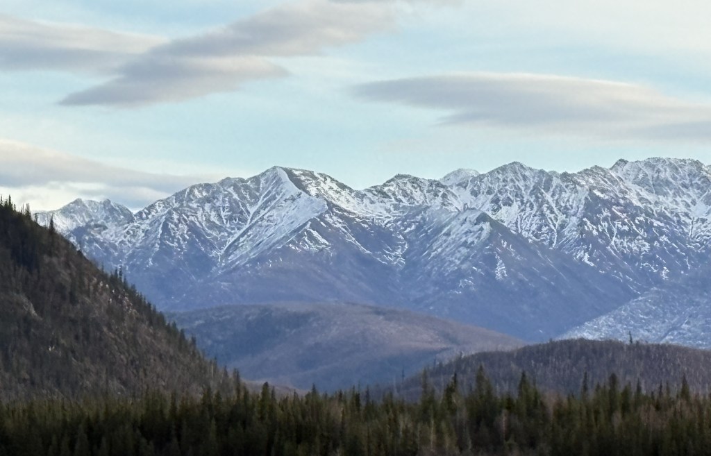
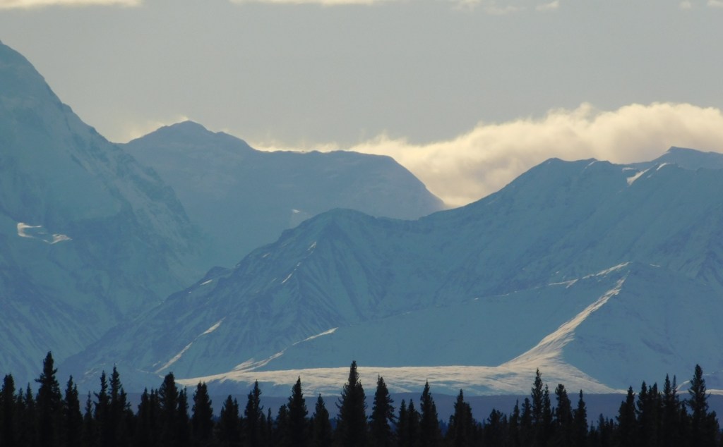
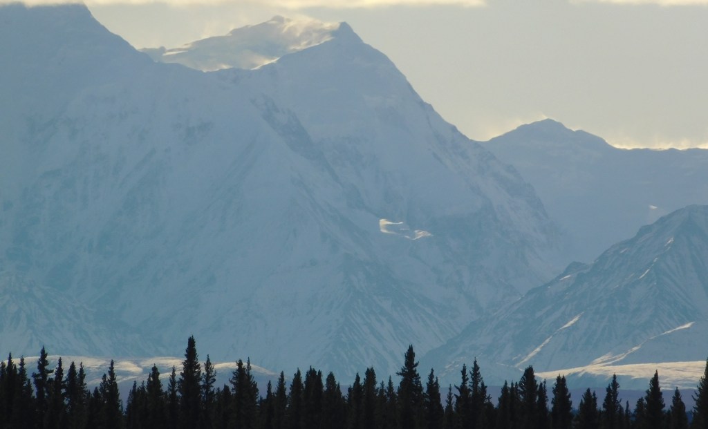
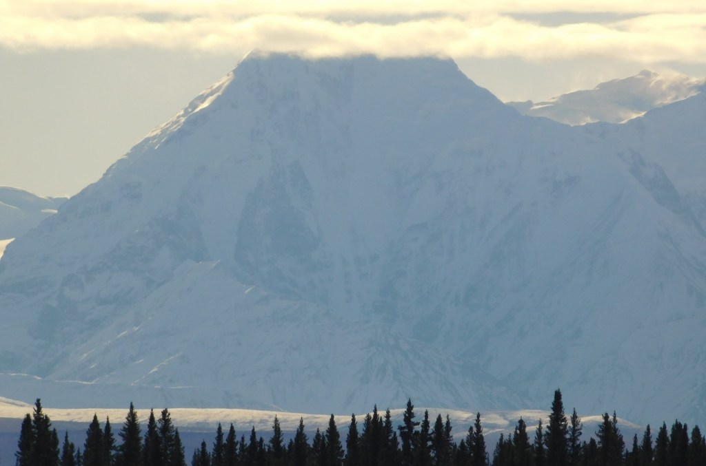
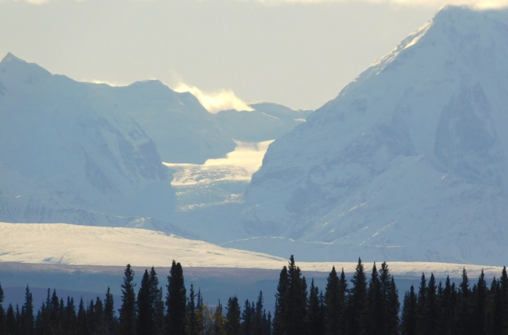
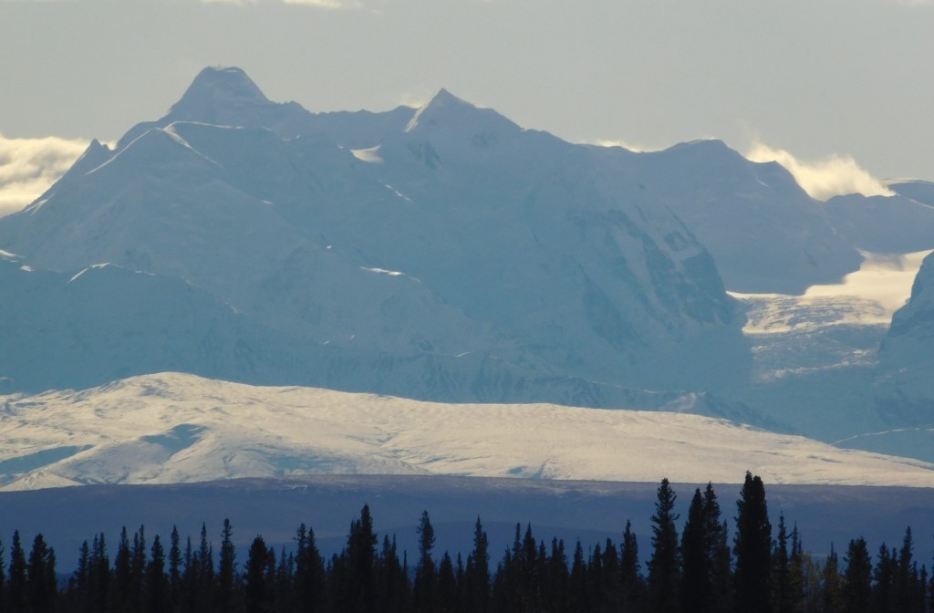
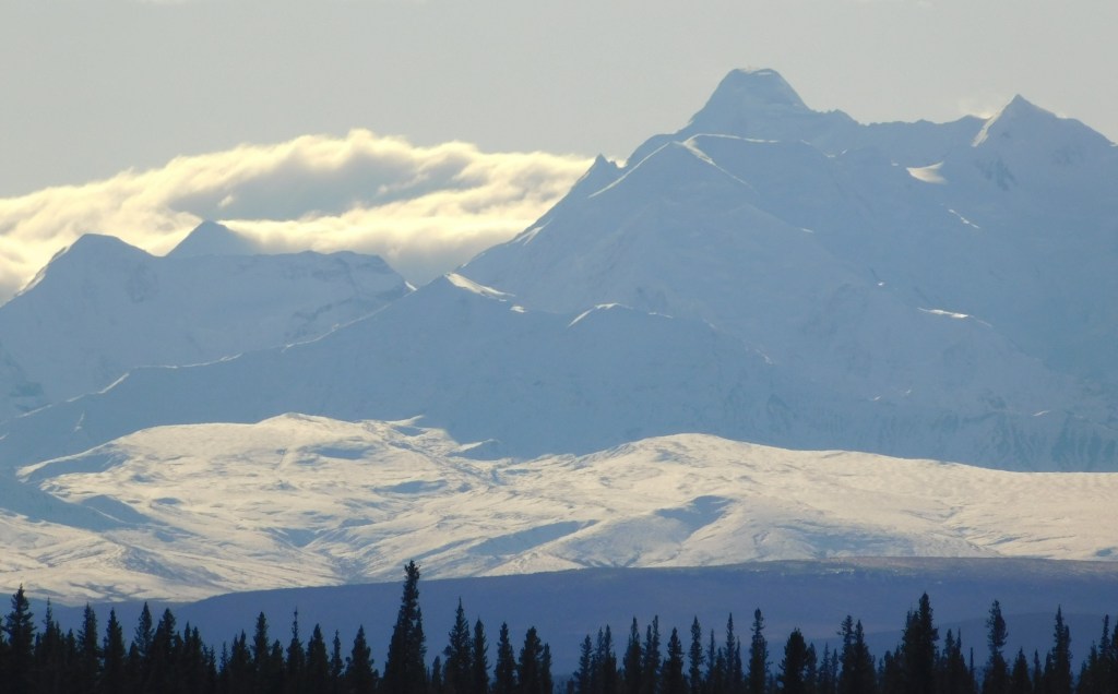
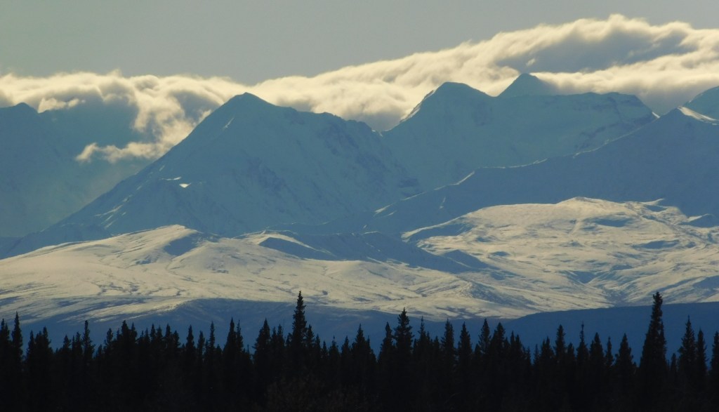
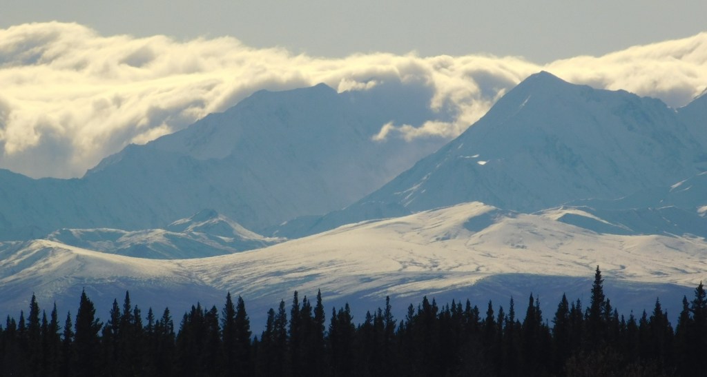
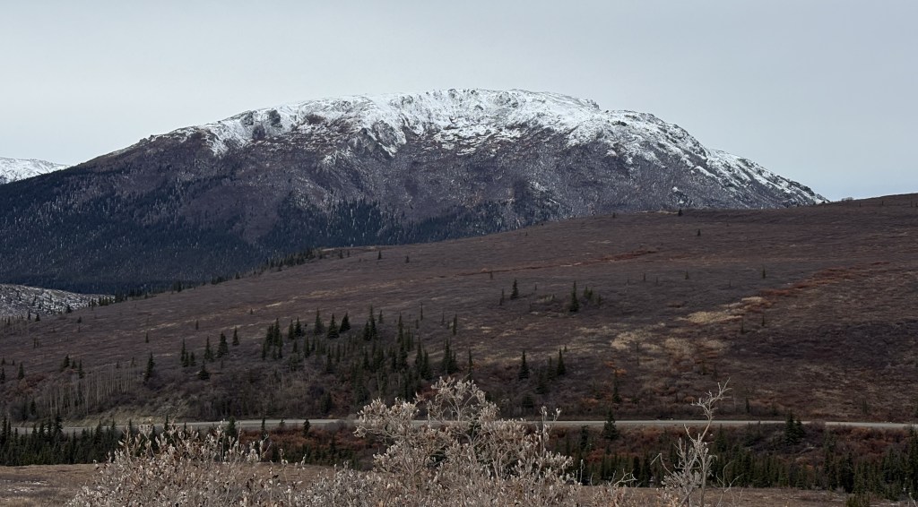
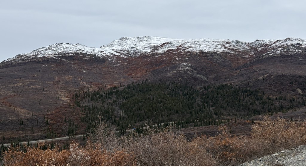
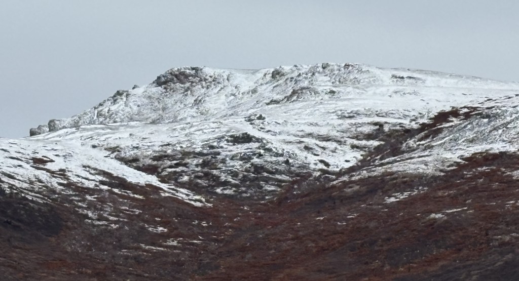
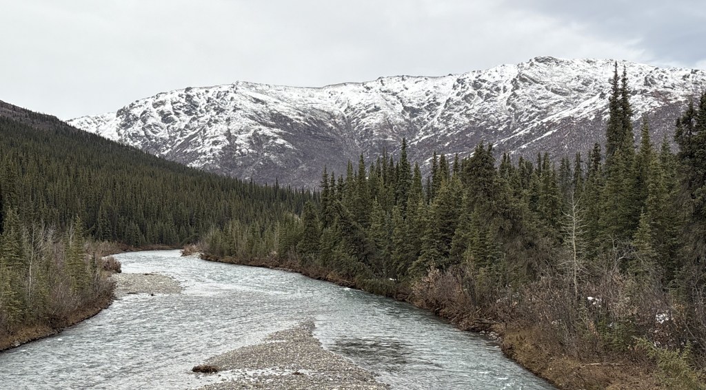
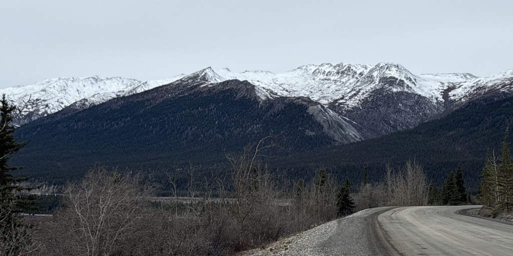
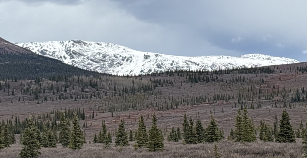
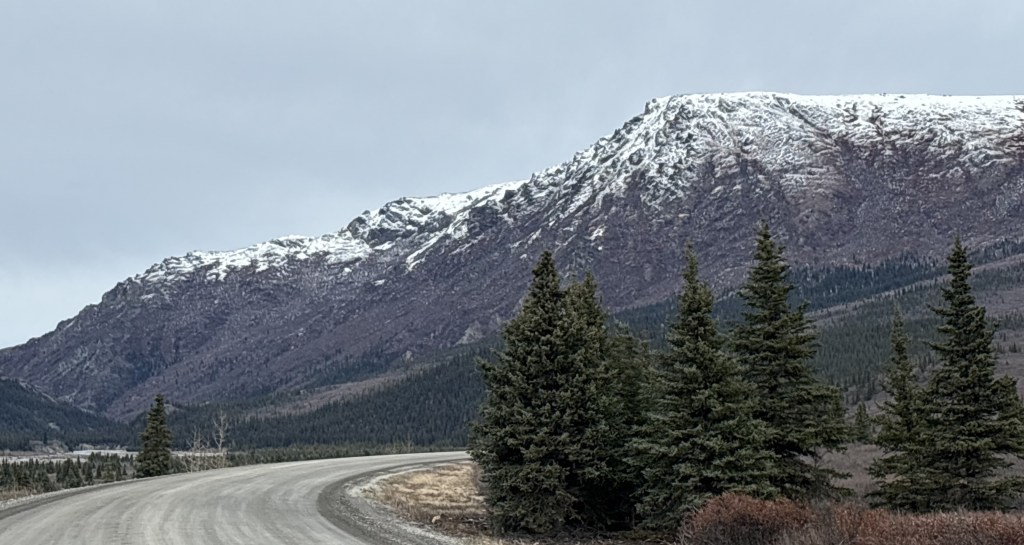
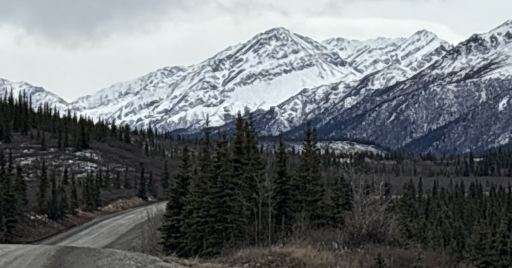
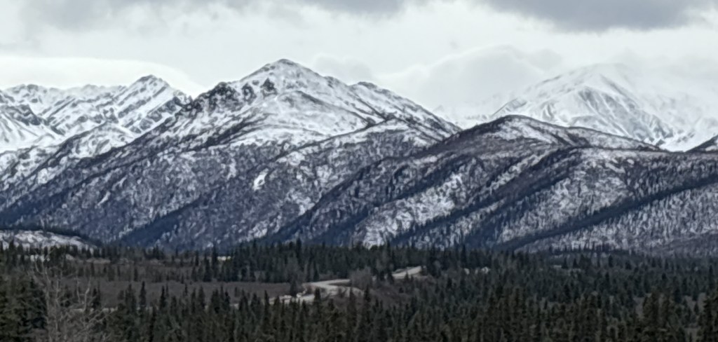
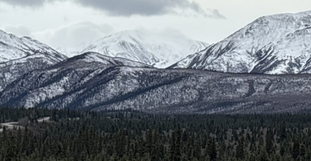
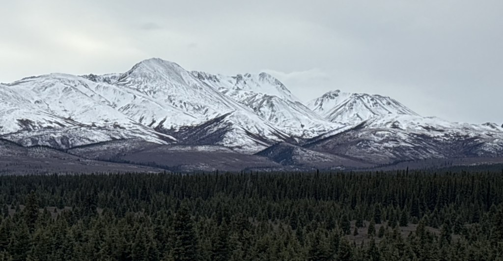
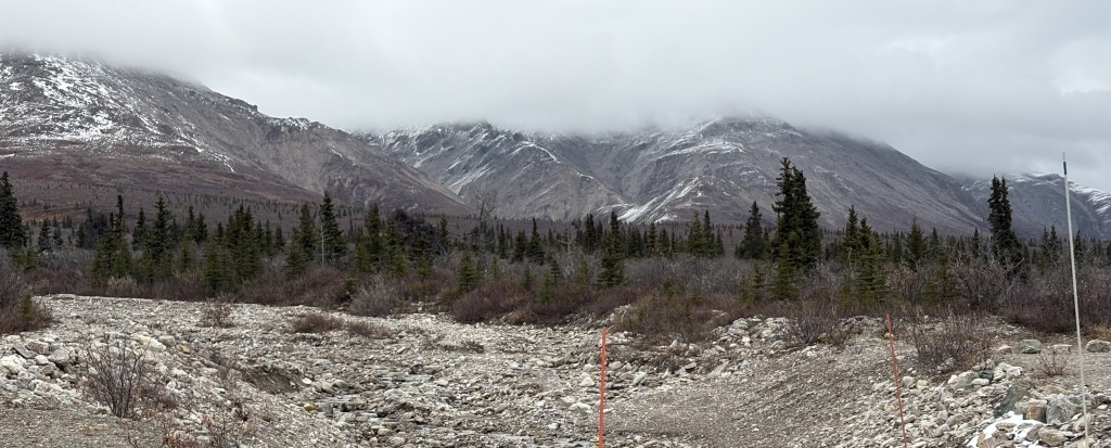
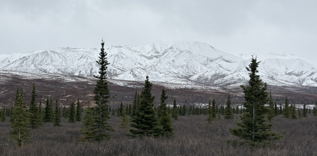
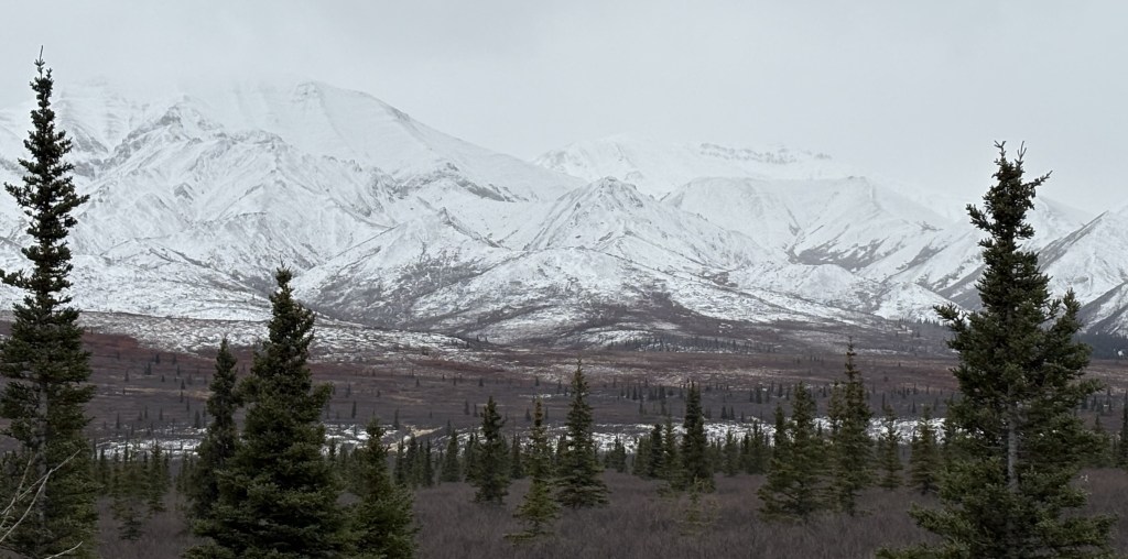
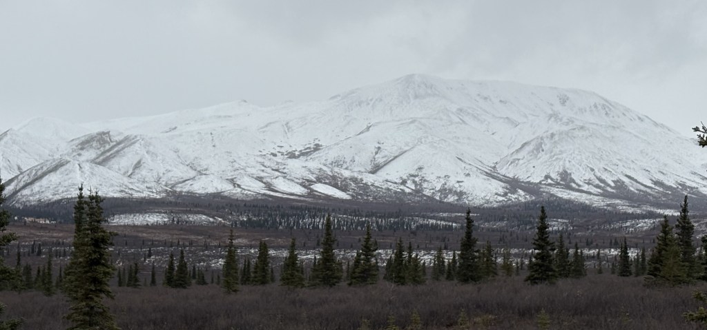
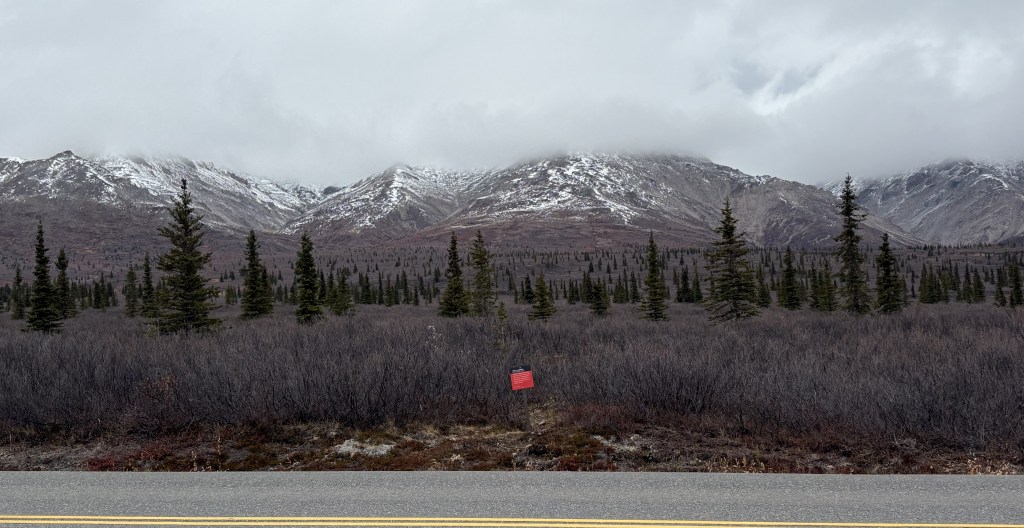
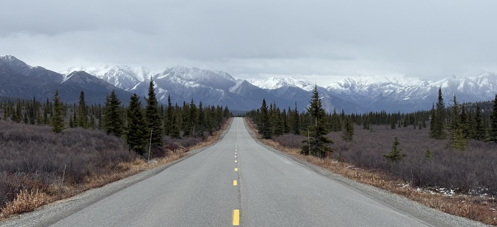
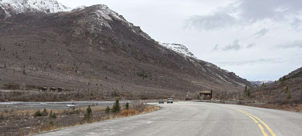
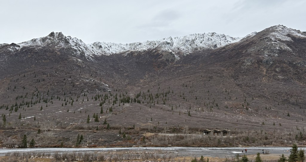
After my walk around the shopping district I had lunch and then headed north towards Whitehorse in the Yukon Territory. The drive covers 110 miles and is supposed to take about 2 1/4 hours (without stops).
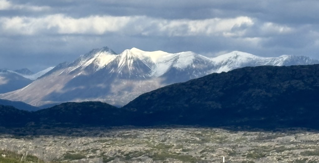
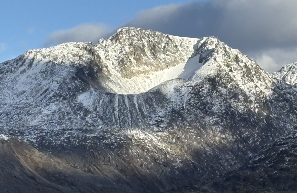
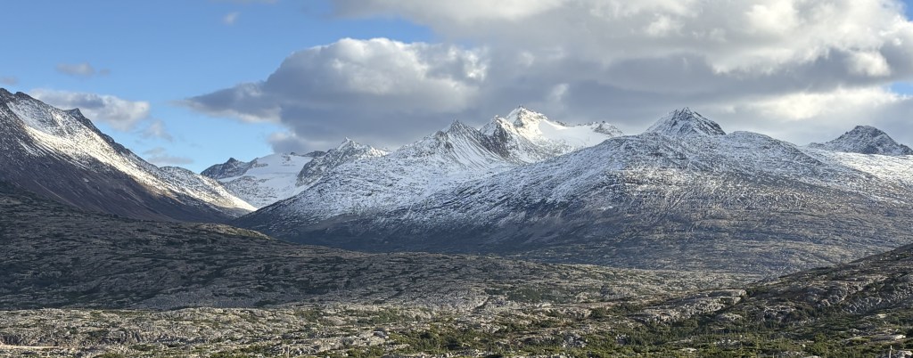
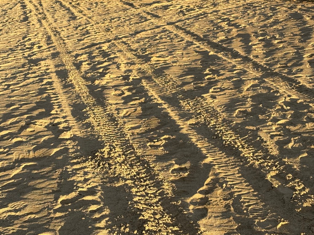
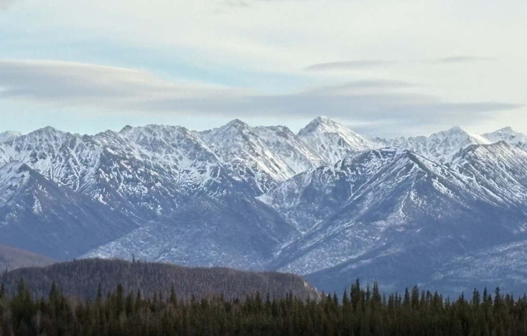
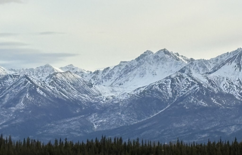
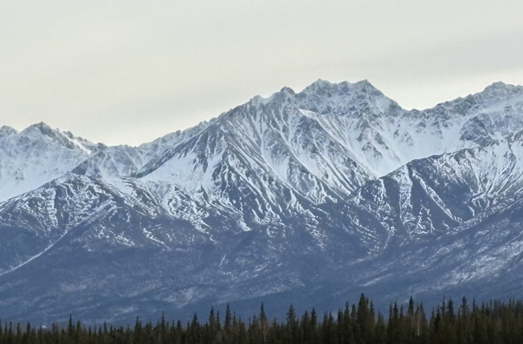
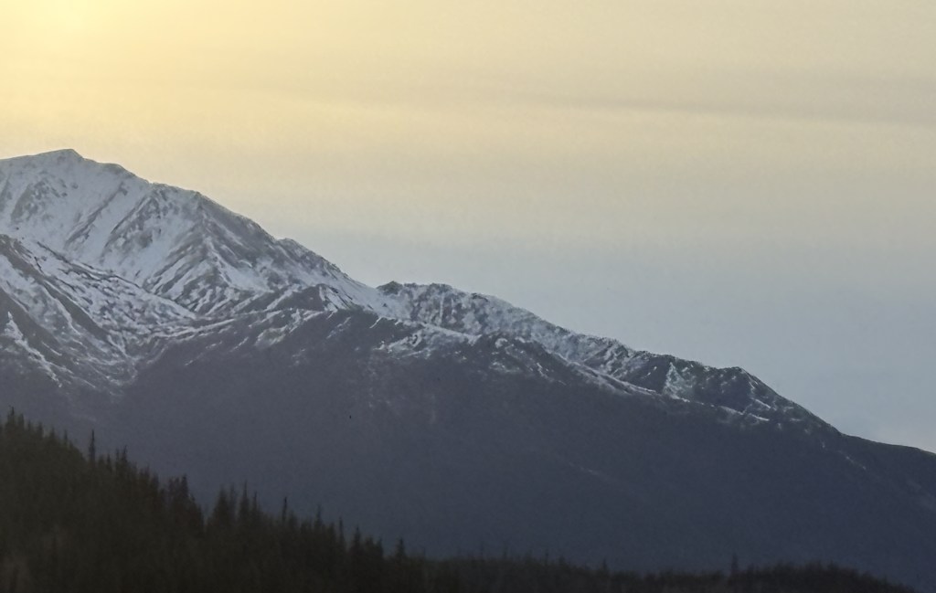
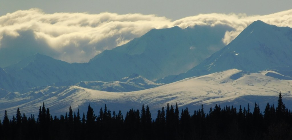
Here are some of the things I saw during the drive.
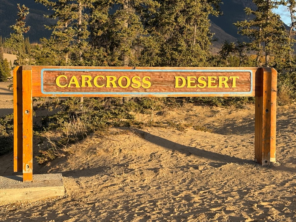
This was a place the woman at the Radio Shack store in Haines told me about. It is in the tiny town of Carcross in the Yukon Territory and she said her dog loves it.
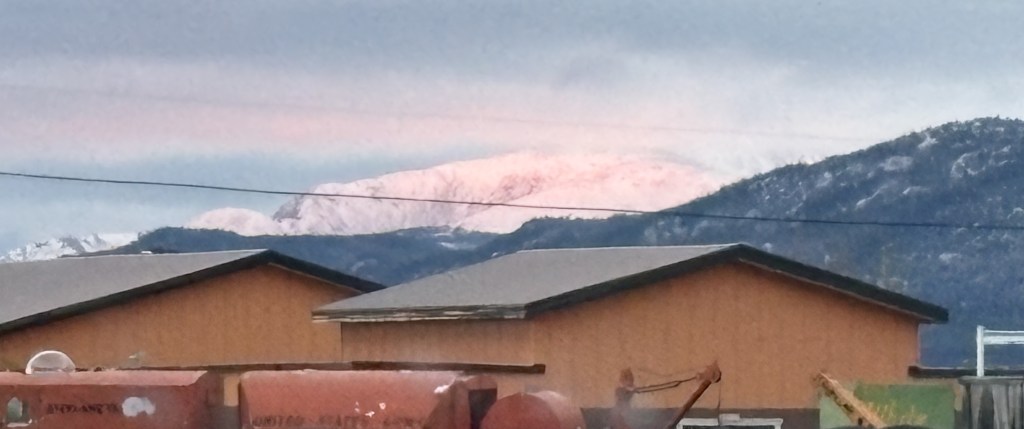
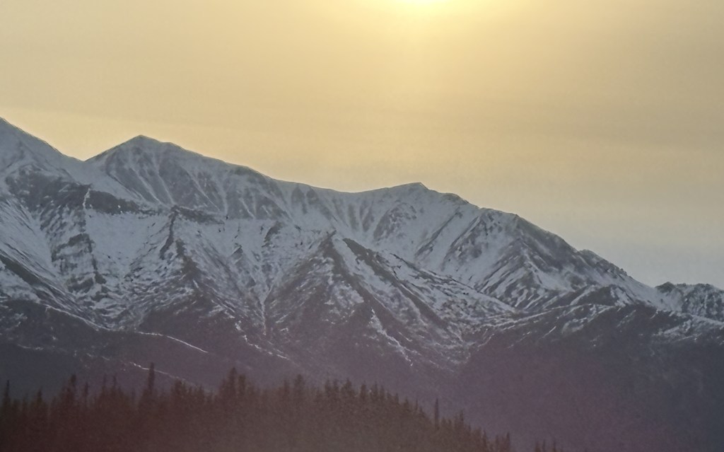
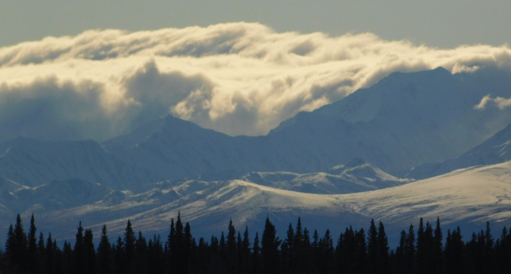
The photo below was taken as I was driving west on the Alaska Highway, approaching the Whitehorse airport. It was partially overcast and the sun was about to set. Evidently the sun’s rays were reflecting off the clouds onto a snow covered mountain, creating a vivid pink coloration on the snow. Unfortunately, I saw it while I was driving and by the time I got to a safe place with a view where I could stop the color had diminished significantly. Believe me – it was much more vivid when I first saw it.
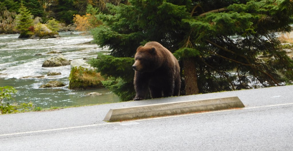
I returned to the State Park near where I had seen a grizzly bear yesterday. It had crossed south of the bridge and swam across the northern tip of Lutak Inlet. It then strolled down the shoreline, and started to come back before venturing into the woods west of the bridge.
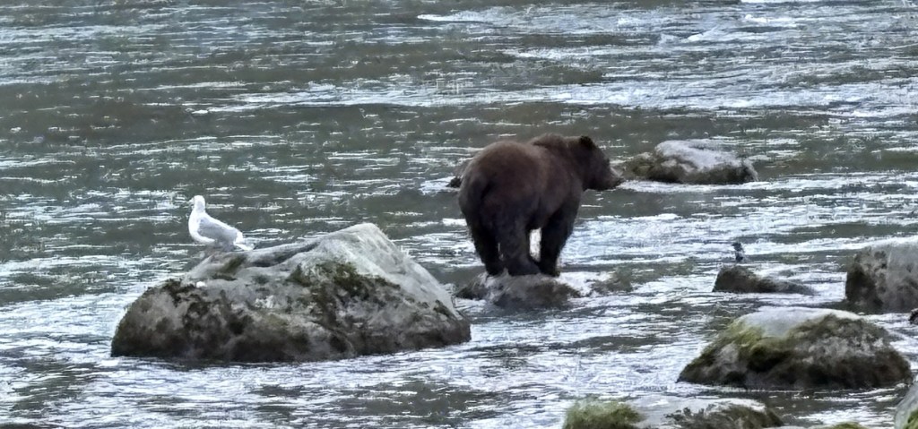
When I arrived today I drove in the access road and saw some of the photographers I had met yesterday. One of them was waving at me and pointing out into the water, and sure enough, there was a grizzly bear out on a rock- probably the same bear I saw yesterday.
Those were both taken with my iPhone camera. Most of the rest of the bear photos will be taken with the digital camera.
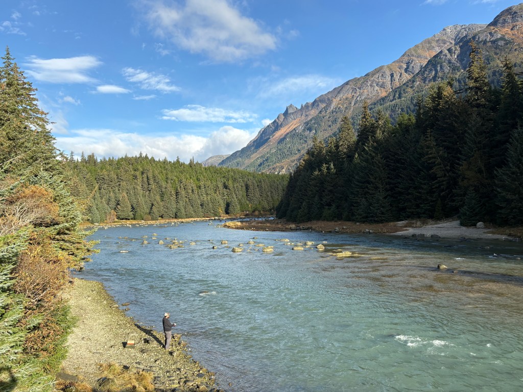
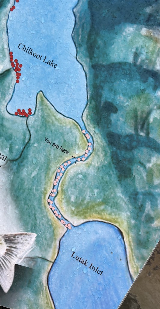
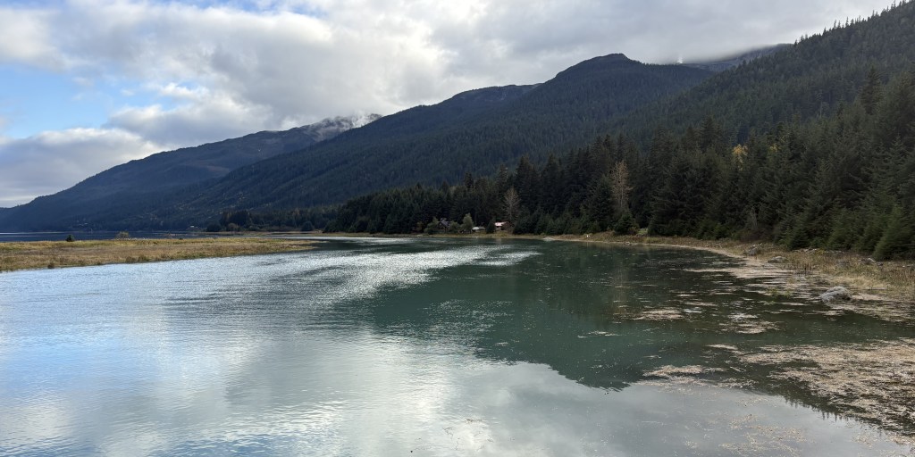
Before I go on I should describe where I am. The Lutak Inlet is south of the bridge I took photos from yesterday, and is south of where I am now. Chilkoot Lake is a short distance north of where I am. The stream with all the rocks in it is called a “weir” and connects the two bodies of water. Water flows south from the lake, through the weir, to the Inlet.
That is looking north from the bridge.
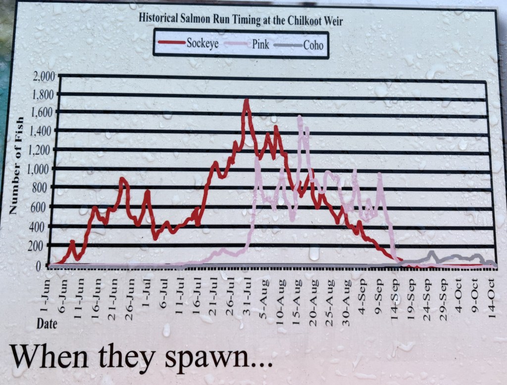
In this situation, the weir enables fish, mostly salmon, to swim north from the Inlet to the Lake, and enables authorities to monitor how many fish pass through. Of course bears eat fish, so this is a major draw for them to have a reliable source of food.
This is a graph showing the timing and volume of three types of salmon who pass through this weir.
I am here in early October, so the Sockeye and Pink salmon period has passed, and the salmon the bear is finding are now Coho. As you can see, the supply of fish was considerably higher from early June to mid-September, and I imagine there were probably lots more bears here at those times.
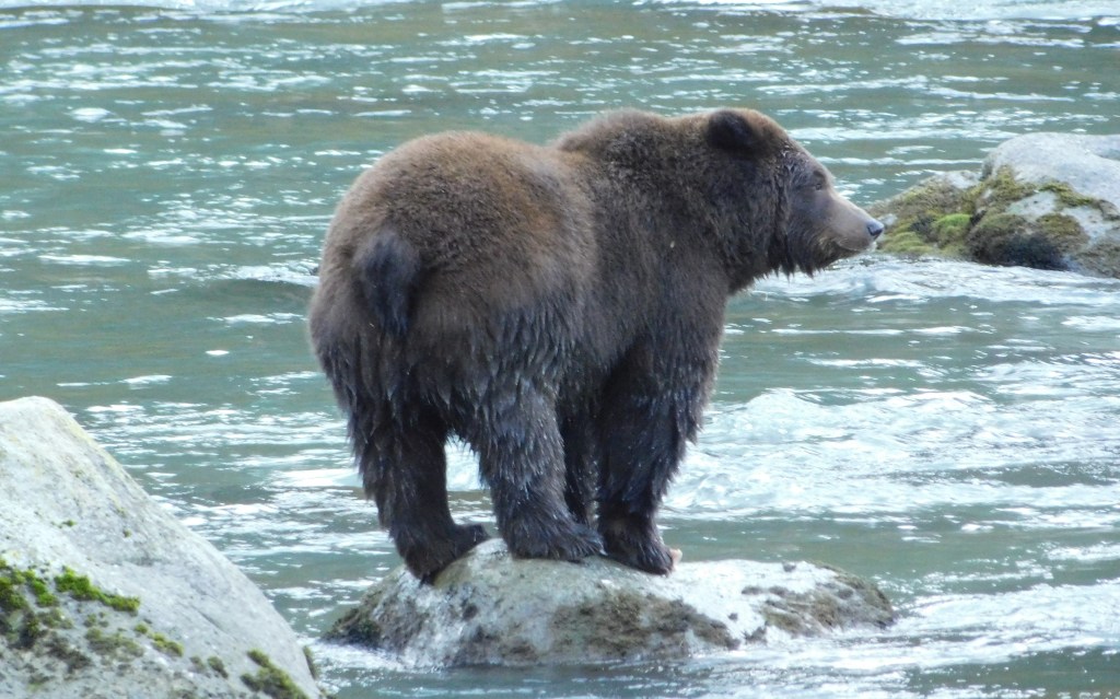
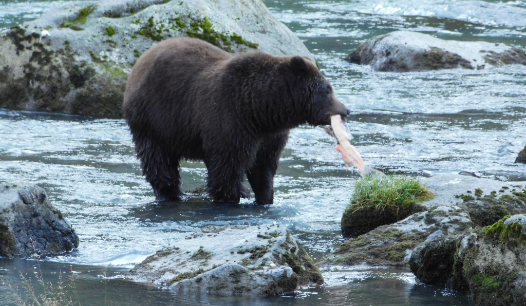
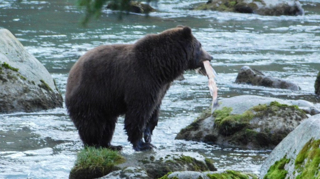
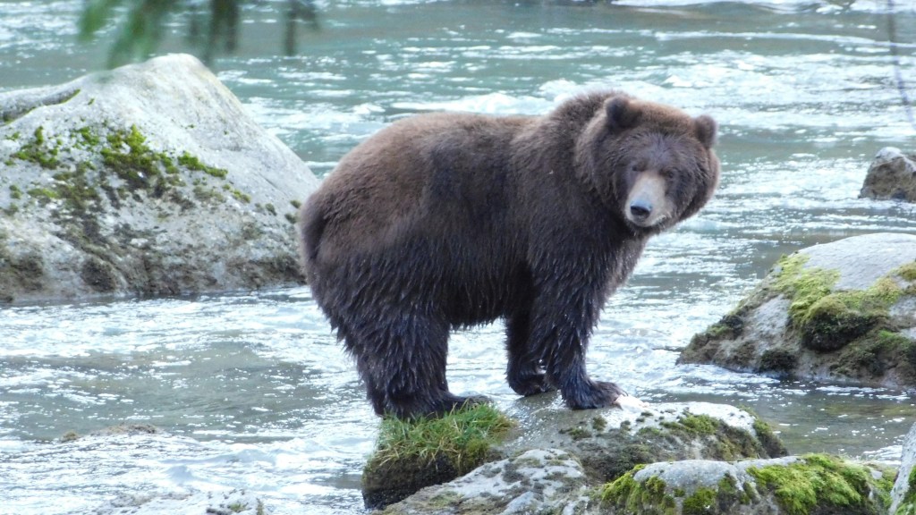
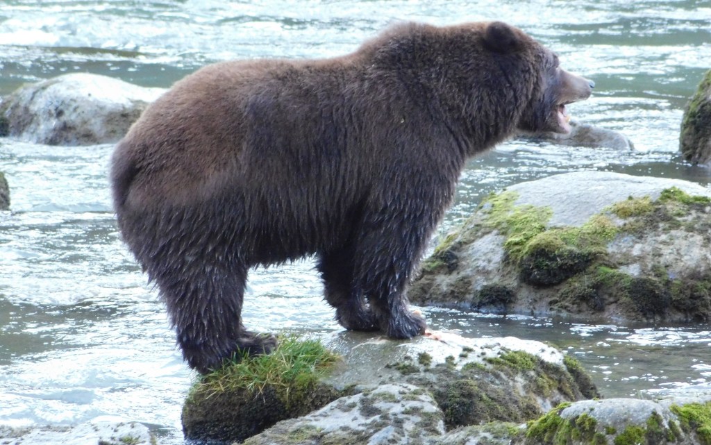
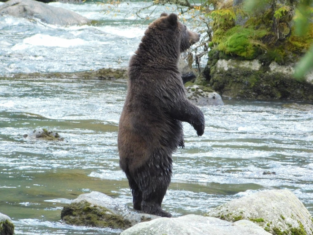
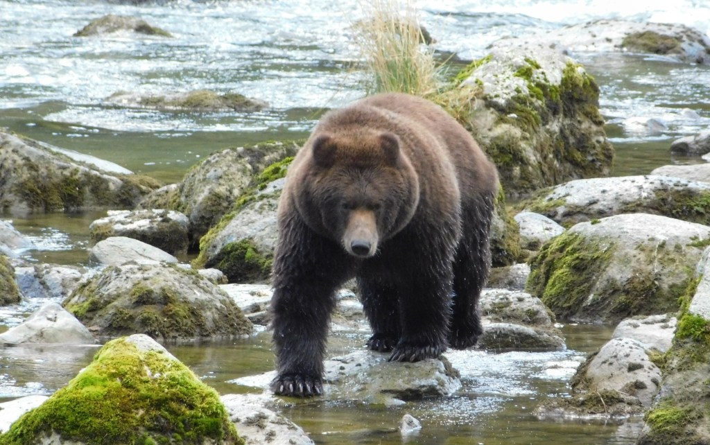
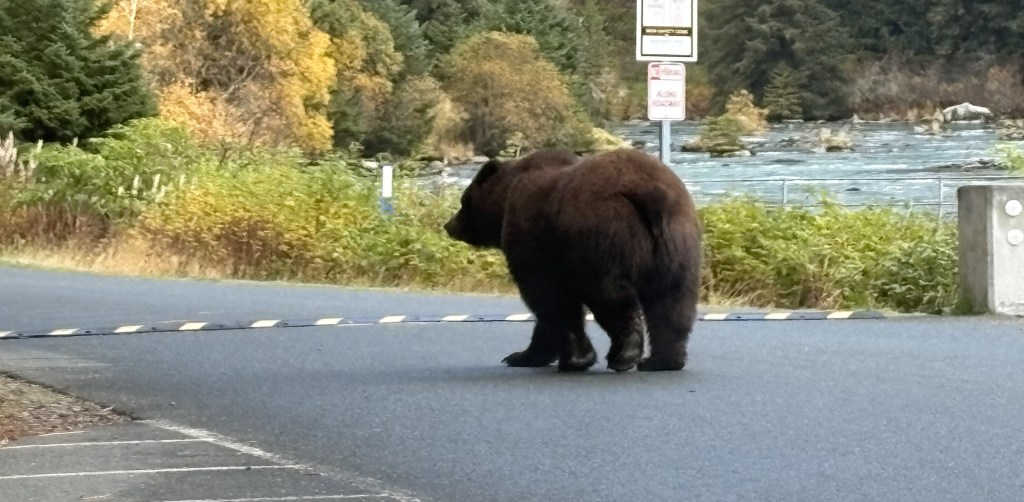
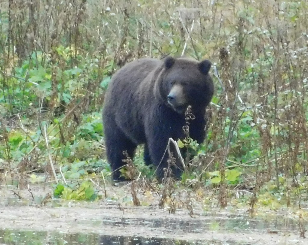
OK. Enough talk. Here are more bear pictures. This is the only one I saw, and according to the “locals” it is most likely the same one I saw yesterday.
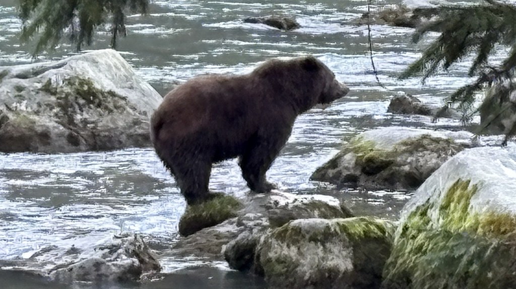
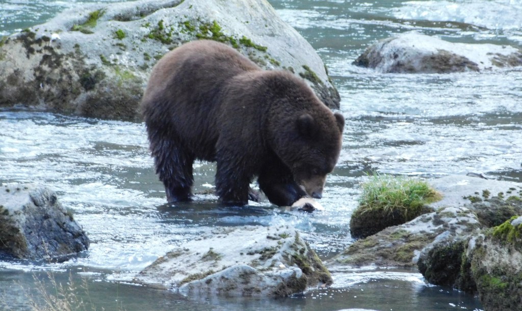
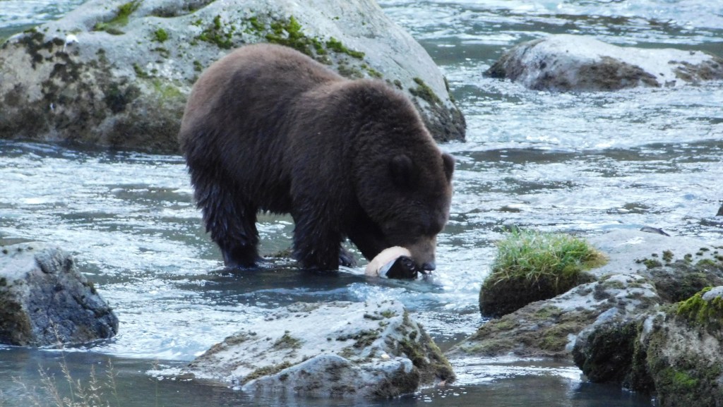
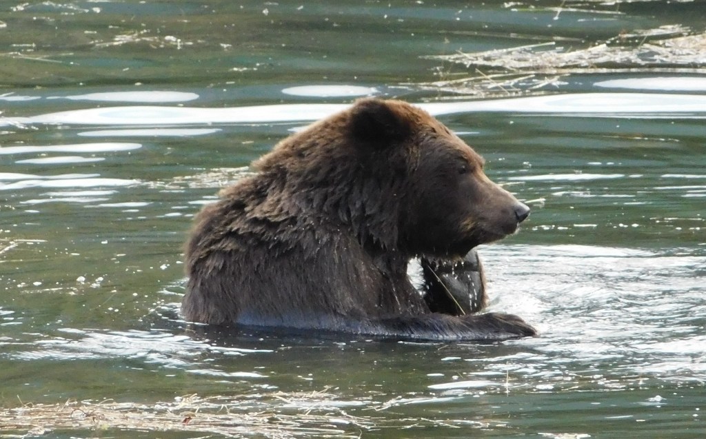
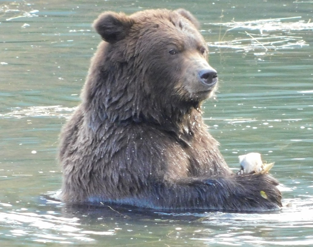
The next 5 photos are a sequence which show him catching and methodically eating a fish. He brought it up out of the water and set it down on the rock he was on.
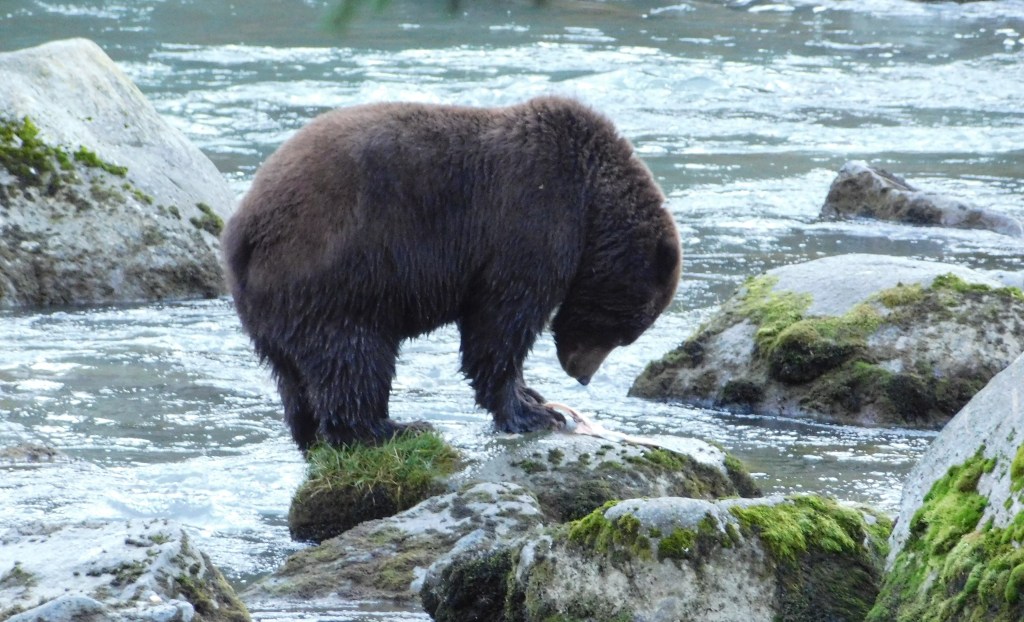
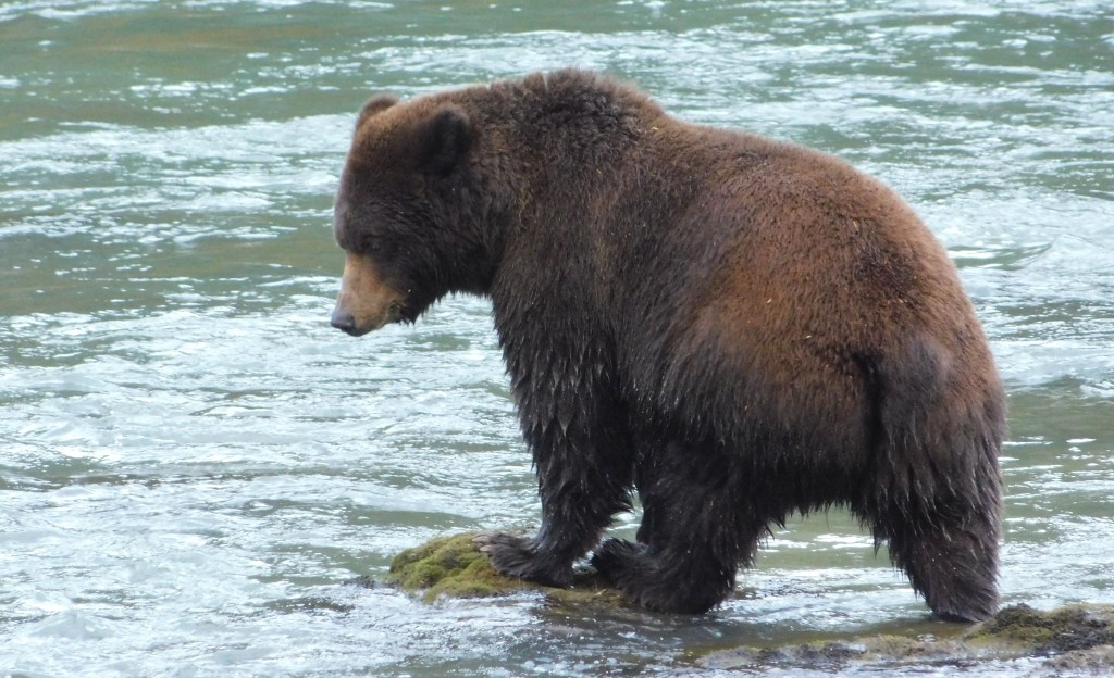
When he was finished with that one he kind of wandered around looking for more salmon.
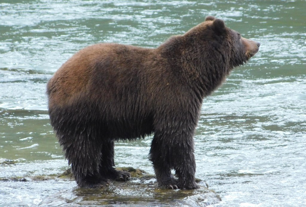
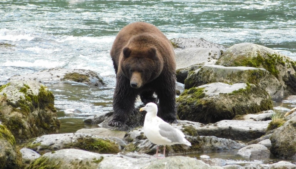
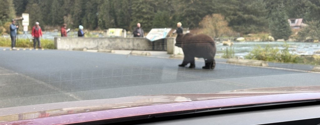
This when he decided he had had enough and started coming ashore. I was up on edge of the road near the water as I took these photos. When it appeared that he was coming back to land I moved to the far side of my car, which was parked parallel to the weir on the opposite side of the one lane road.
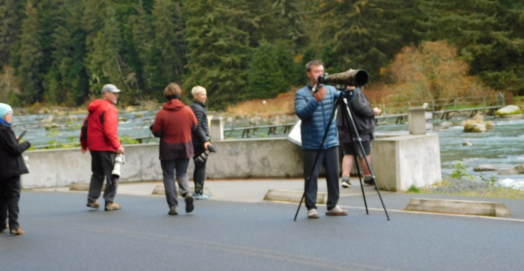
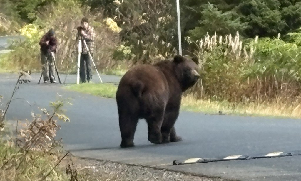
When it was clear he was coming up to the road the other photographers started moving further up the road and behind a short concrete wall. They were familiar with this location and felt that the bear posed no risk, though I was told all of them had bear spray with them (as did I).
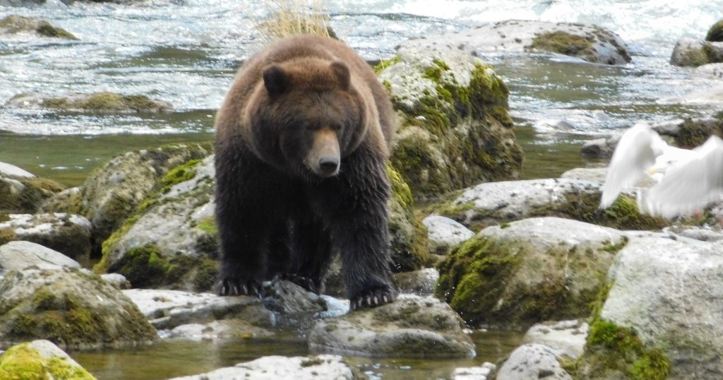
At this point I got IN my car.
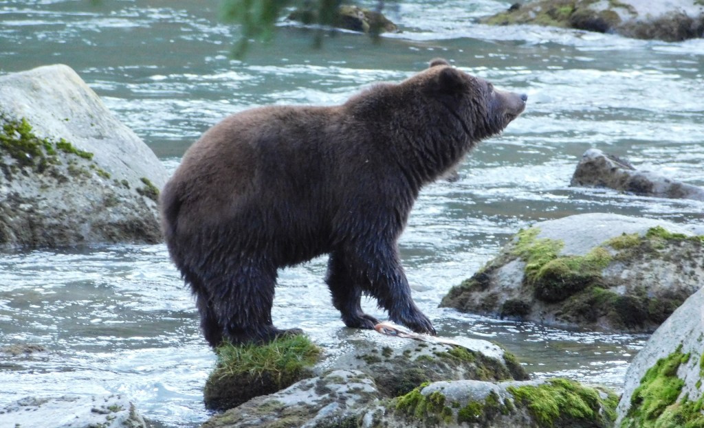
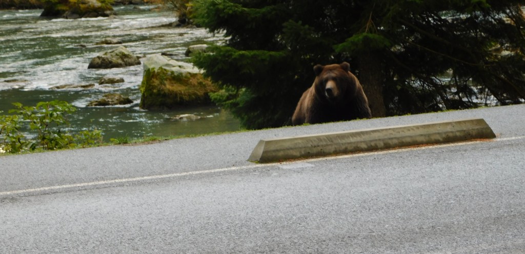
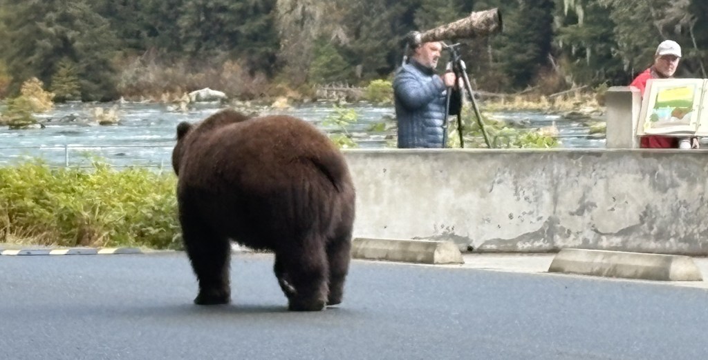
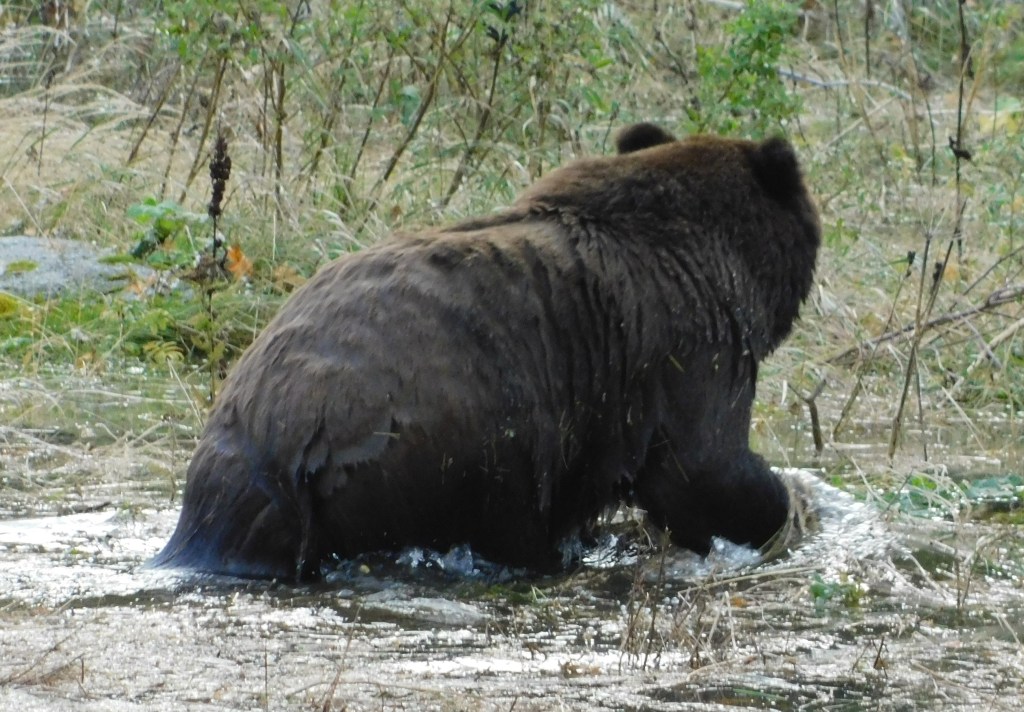
Before he crossed the concrete barrier which prevents vehicles from driving off the road, he stood and looked off to the right for a short time, then turned around and started walking up the road to the left.
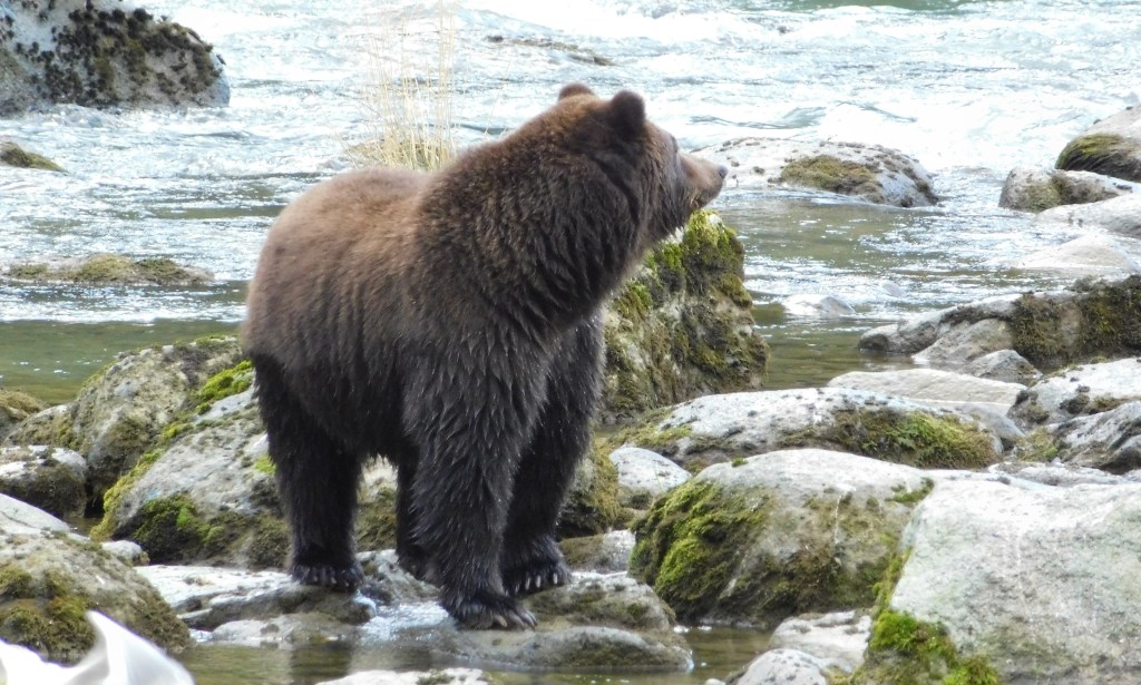
When he started walking away I got out of the car to take my final photos.
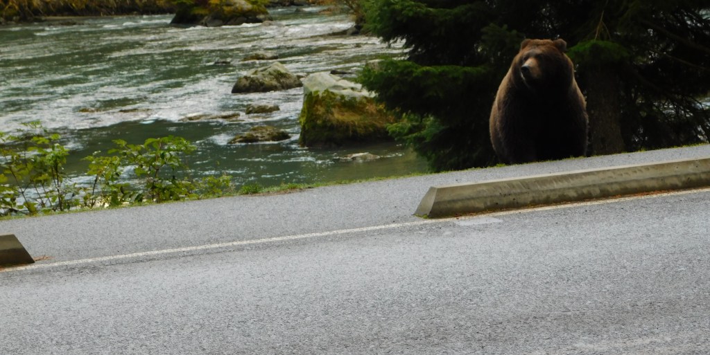
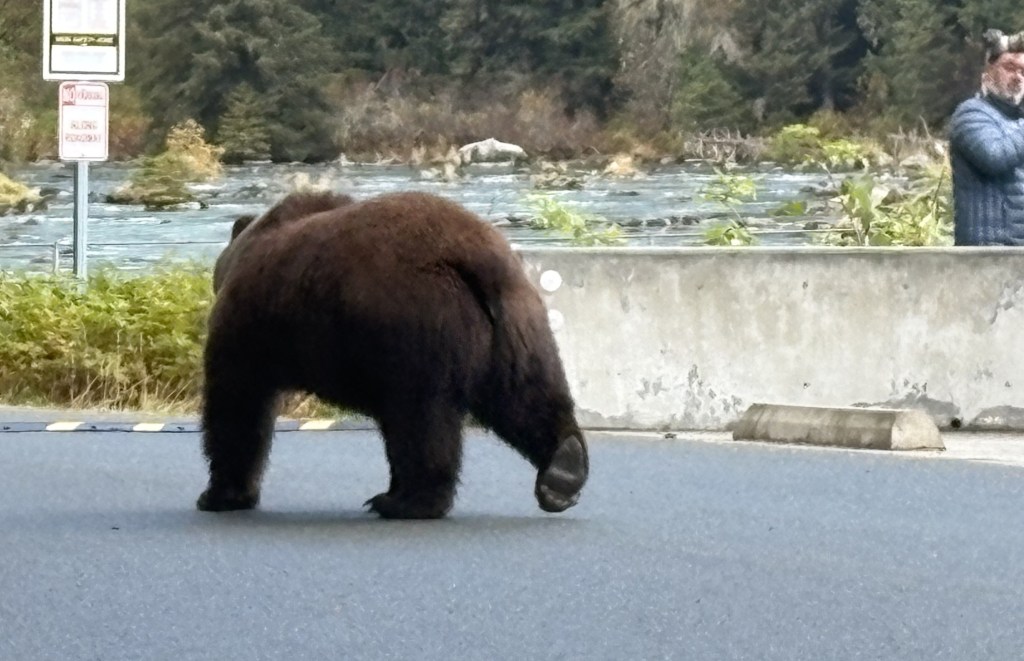
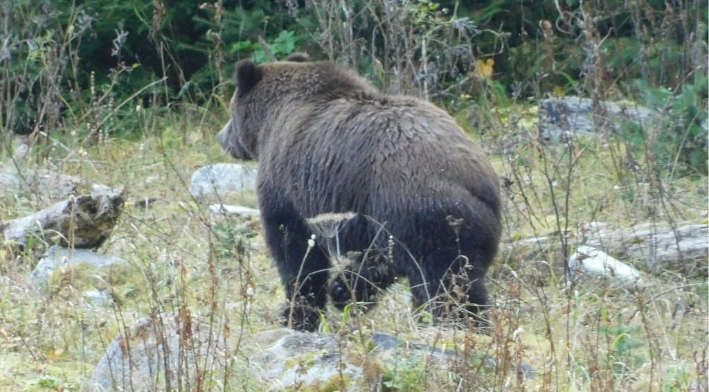
He continued walking up the road and eventually went up into the woods. The other photographers apparently felt the show was over and they dispersed. The road only continues a short ways before reaching the lake.
From start to finish, this whole photo encounter took 16 minutes. I hung around for a little while but soon had to leave to get back to the ferry terminal.
I will post photos from the ferry ride, and the town of Skagway, tomorrow.
I left my Airbnb early in the morning to spend a little more time downtown, drive up to the ferry terminal to check in for my mid-day ride up to Skagway, and return to where I had seen the grizzly bear yesterday to try my luck again.
Haines is a very small town. I have seen population figures ranging from 1,800 to 2,400 permanent residents. The population increases in the summer as visitors arrive, either in their own vehicles, on cruise ships, or on ferries that shuttle people and vehicles between coastal towns.
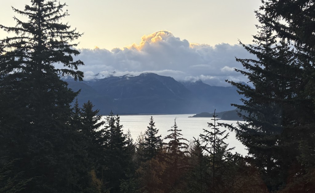
This was the view from the deck at my Airbnb, in the woods above the downtown area.
It was a mostly clear morning but there were some clouds above some of the mountains – mainly on the opposite side of the Bay, as seen above.
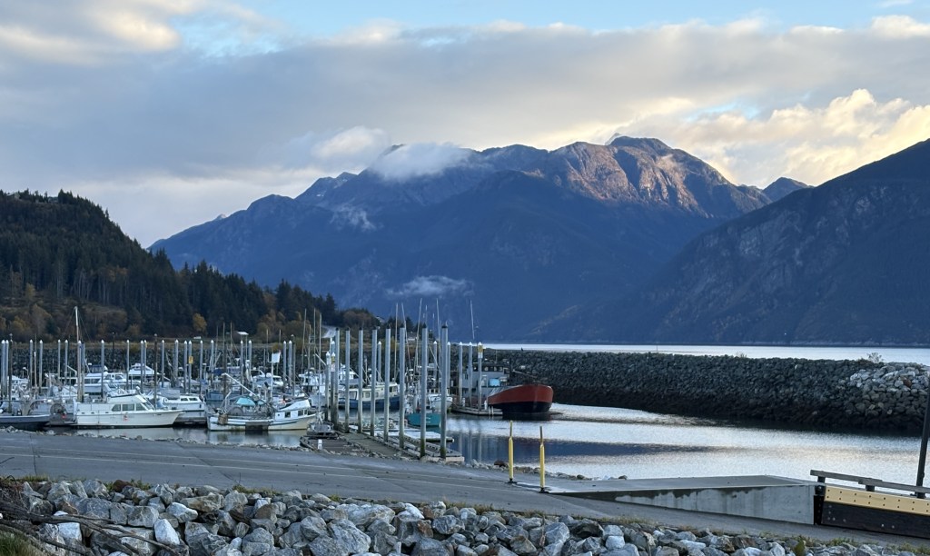
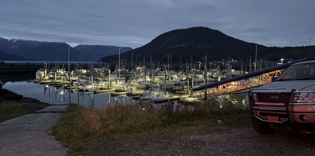
This is the view from the marina parking area looking across the Bay as the sun was getting ready to rise above the clouds.
And this is the view from the same spot looking north, towards where I will be going to try and see more bears.
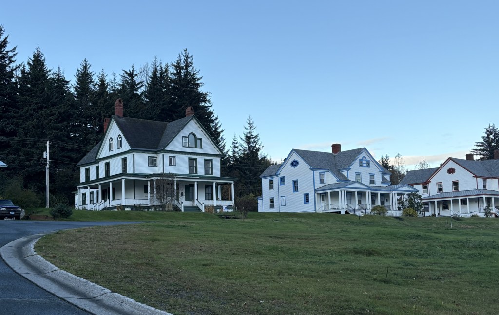
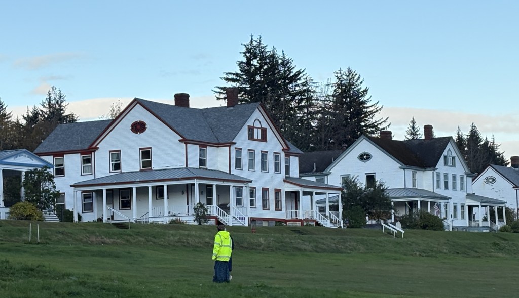
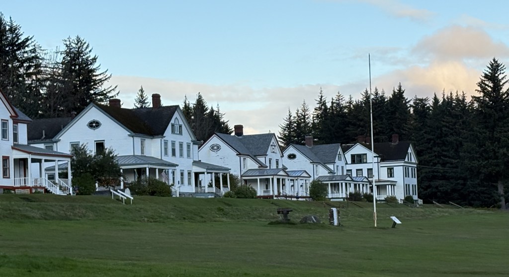
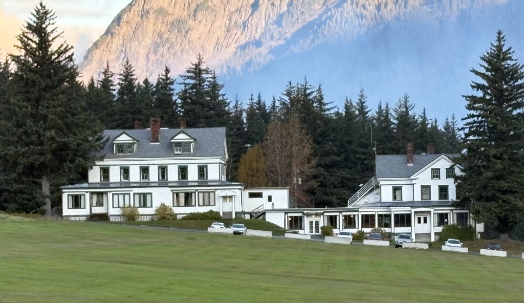
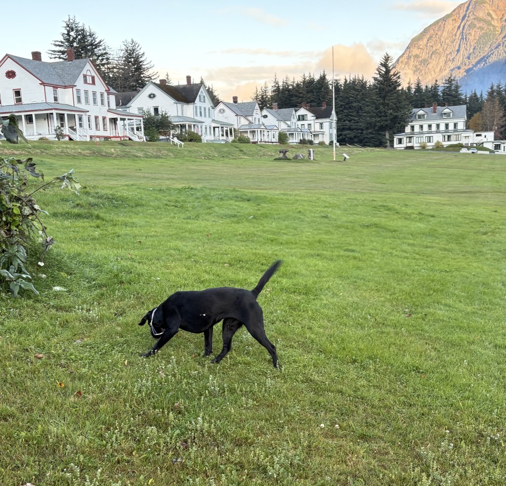
These were some of the houses at the former military base. They bordered a large, grassy field overlooking the Bay..
And this is a hotel, across the field from where I was parked.
I wish I had paid more attention and included more of the mountain in the background and less of the grass in the photo.
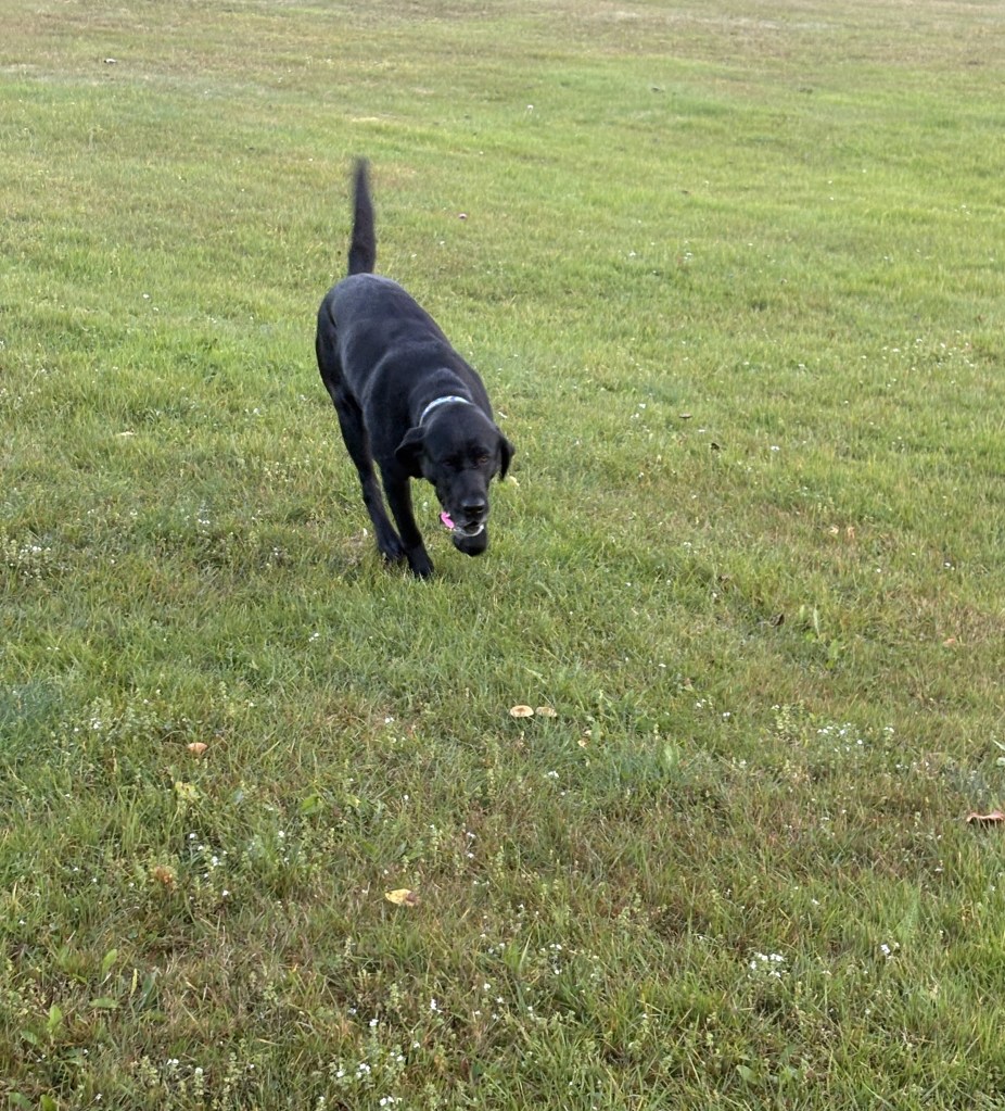
This black dog showed up with a ball in his mouth and wanted to play fetch. I indulged him for a few minutes but then told him I had places to be.
Back in town I stopped to take a photo of the Hammer Museum. It was too early for it to be open, and it may have been closed for the season anyway.
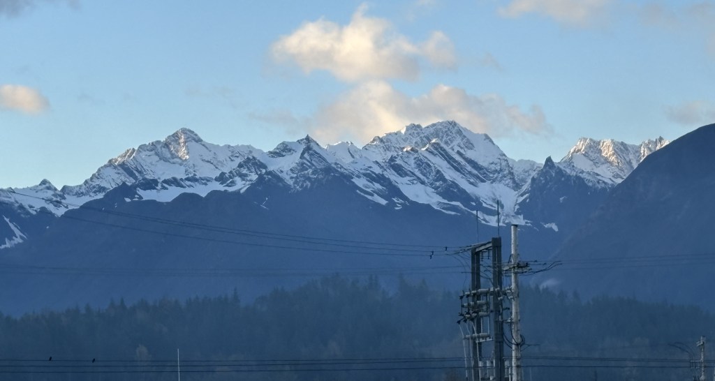
As I started to drive north towards the ferry terminal and this was the view from a parking area looking back towards town. Some of the buildings near the marina are visible, as are the houses at the former military base which are up on a hill.
Below is the view looking further left, across the Bay, in the direction that cruise ships would traverse to and from the Gulf of Alaska. Some stop here in Haines, some continue on up to Skagway, and they may well go to both. Juneau, the capital of Alaska, is only about 90 miles southeast of Haines, so there are ferries that shuttle people and vehicles between them. In fact the ferry I will take to Skagway originated in Juneau.
While Juneau has streets, there are no highways that go there, so people must get there by ferry if they have a vehicle, or by air. Since I am driving most places, I did not have it on my agenda. I did speak with another visitor at one of my Airbnb’s who told me she had never seen so many bald eagles in one place as she did in Juneau. She even seemed to think the eagles outnumbered people.
Below is the view looking straight across the Bay. I am glad I am on this side, as the clouds over there would certainly make picture taking problematic.
This is the view looking north, where I am going to try and see more bears.
I have been having an amazing trip through Canada and Alaska, but if I had to point to a disappointment it would be not seeing many wild animals. I finally have my chance to see a grizzly bear in the wild.
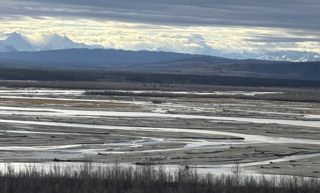
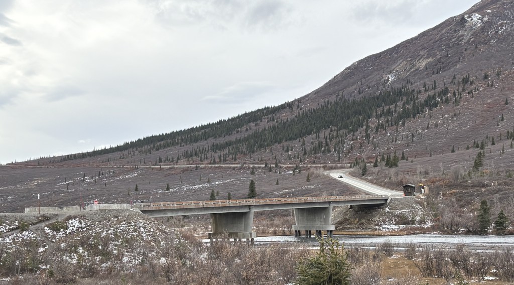
As I mentioned in the previous post, these photos were taken from a bridge at the north end of Lutak Inlet, about 10 miles north of Haines.
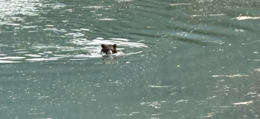
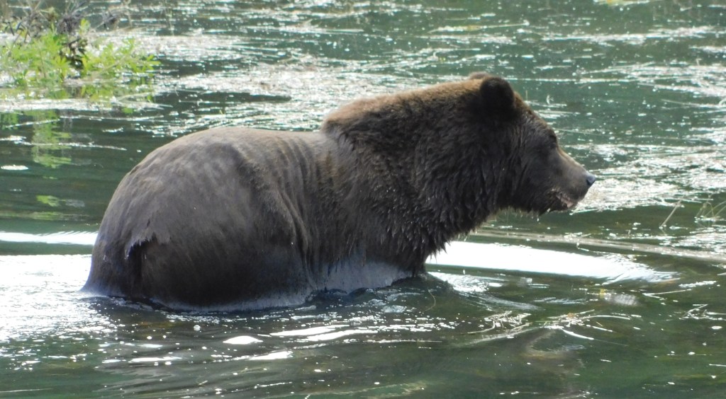
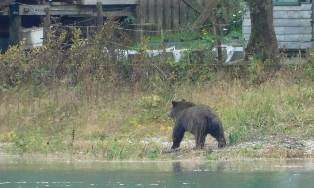
I spotted the bear swimming across the Inlet from left to right.
Here is the photo I posted, taken with my iPhone camera.
The rest of these were taken with my digital camera, with a zoom lens.
He appeared to be sitting down in the river, scratching the left side of his head:
He soon brought up a dead fish, which he proceeded to consume.
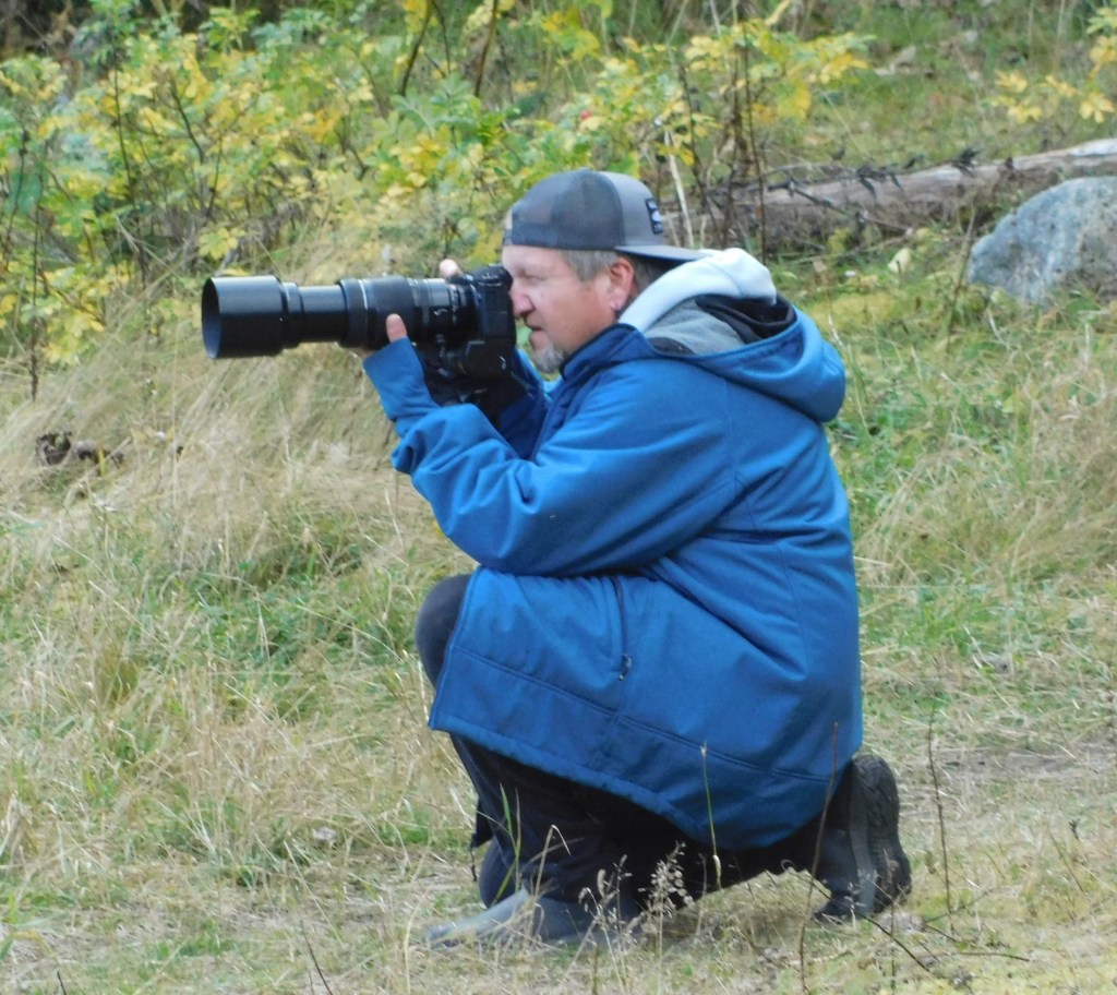
This is a photographer I had seen coming down the road as the bear was walking down towards the water. I spoke with him later and he is one of the people who told me that this bear is a “regular” and is seen just about every day.
He is possibly what the bear was looking at in the photo above.
He started walking towards the shore. You can see where his hair is matted down from being in the water. I read somewhere that bears don’t like to get their ears wet, which is probably why he kept his head above water.
He shook off most of the water and started walking south, away from the bridge I was on.
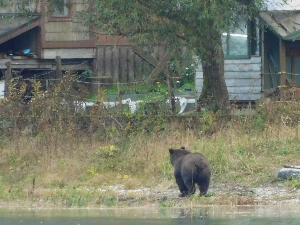
He reached the house I mentioned in the prior post – which was pretty far away from the bridge I was on.
He finally turned around and started walking back north. Shortly after I took this photo he turned to his left and I lost sight of him.
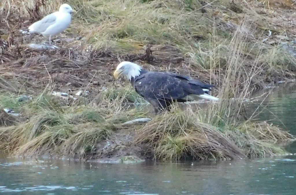
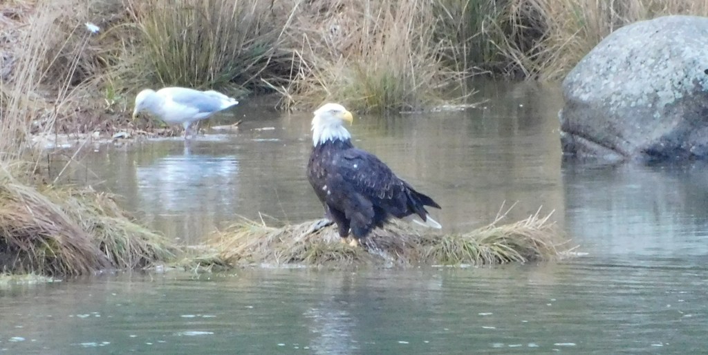
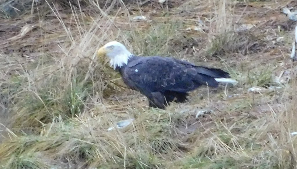
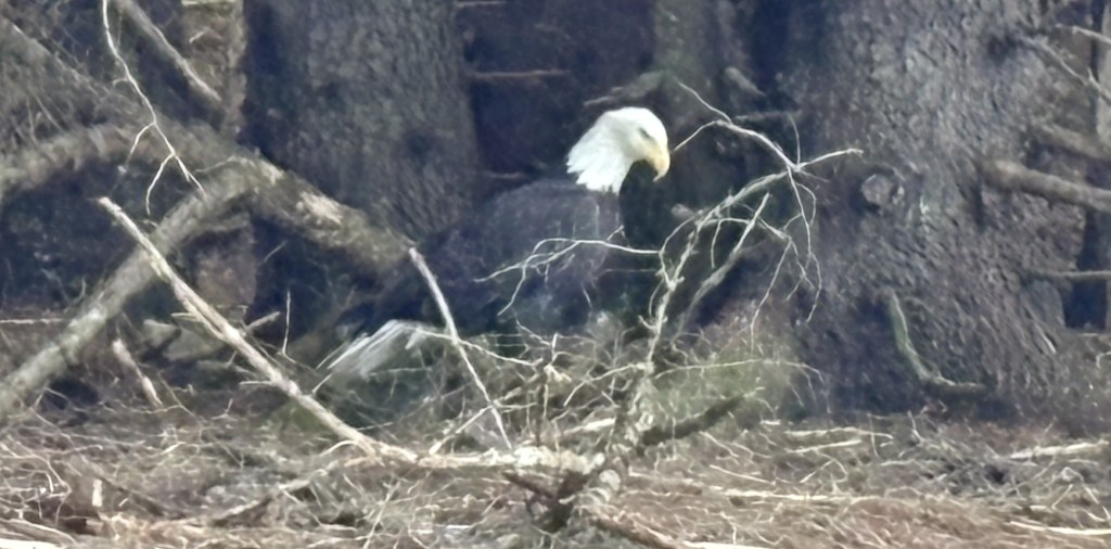
I then spotted a bald eagle near the waterway between the Inlet and Chilkoot Lake, north of the bridge I was on. It was eating a fish that it had apparently caught.
I will drive back up here in the morning after I stop at the ferry terminal to confirm that I am in town and will be there for boarding. They understood, and told me what time I needed to be back.
I had spoken with several people in Denali National Park, as well as in Anchorage, who shared stories of bears they had seen near Haines. When I made my Airbnb reservation my hostess assured me that she would guide me to a spot not far from town where I would be VERY likely to see some grizzly bears, so I was really looking forward to getting there.
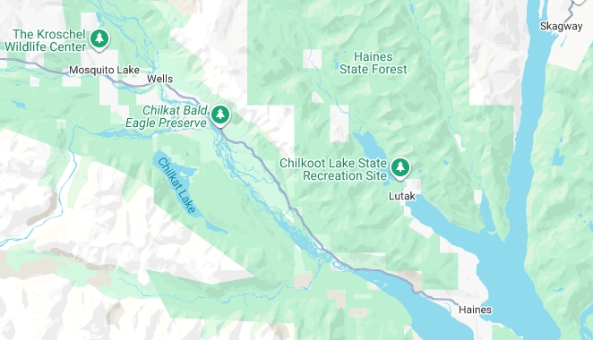
Here is an overview of the area I will be in for most of the next two days.
(Photo credit: Google Maps)
You will see the Bald Eagle Preserve in the upper left portion of the map. The town of Haines is the lower right hand corner. I will indeed see a grizzly bear twice near the entrance road to Chilkoot Lake State Recreation Site (above Haines). Tomorrow morning, after seeing the bear again, I will take a ferry to the town of Skagway, in the upper right corner of the map. I will be showing some other maps shortly so you can better visualize the places I will be referring to.
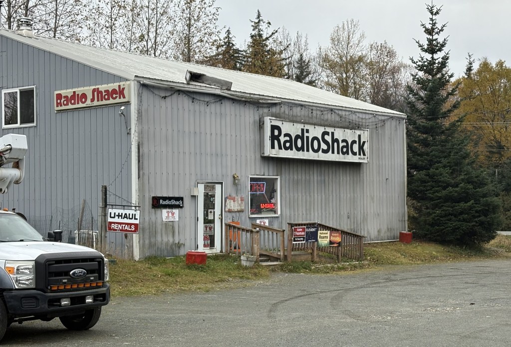
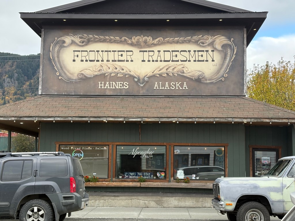
I imagine this is not the first thing you were expecting to see. I went in to ask if it is indeed a Radio Shack store. I thought they had gone out of business a few years ago, though I did see one in Lander, Wyoming back in 2021. The woman behind the register informed me that yes, there are a few former Radio Shack locations still in existence, though the main company is gone. The loyal owners share their stock and ship items to where they are wanted. This store sold other things as well (such as fishing and hunting supplies).
I had a rather long conversation with the clerk, and she shared a video of someone who had been fishing at Chilkoot Lake and as they were leaving the property came across a mother bear with three cubs, walking towards them in the road. The driver stopped and started taking the video with his phone of the bears approaching the truck and walking past the driver’s door. He lowered the camera to continue shooting the video in the rear view mirror, and when the mother bear got towards the back of the boat he was hauling on a trailer the bear stopped and stood up on her hind legs, apparently smelling the “catch of the day” onboard. It was sealed in a cooler (there are huge fines for letting a bear get hold of a fish you had caught) so the bears finally went on their way.
The lake road he was on is where I will spot a bear both days while I am here.
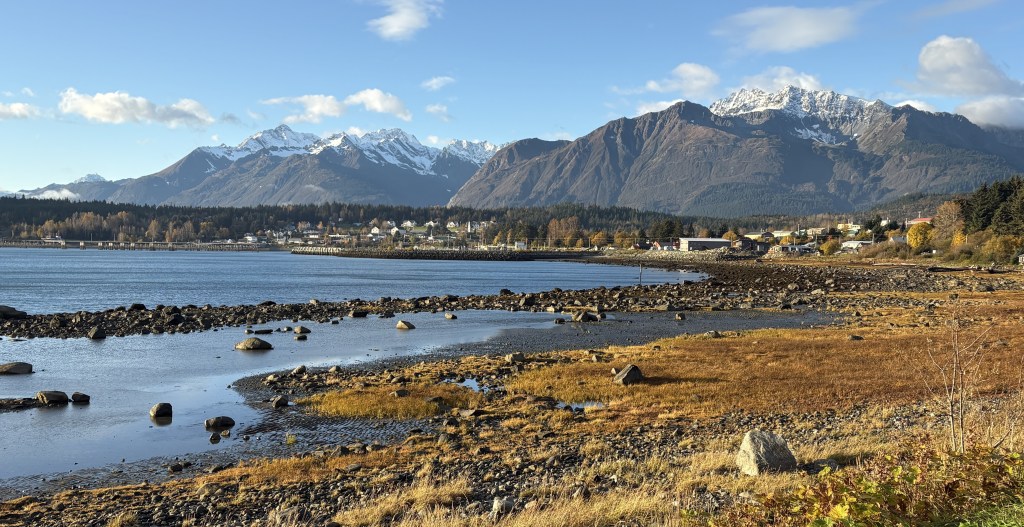
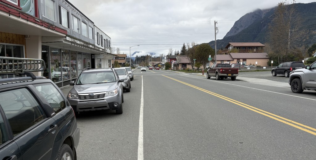
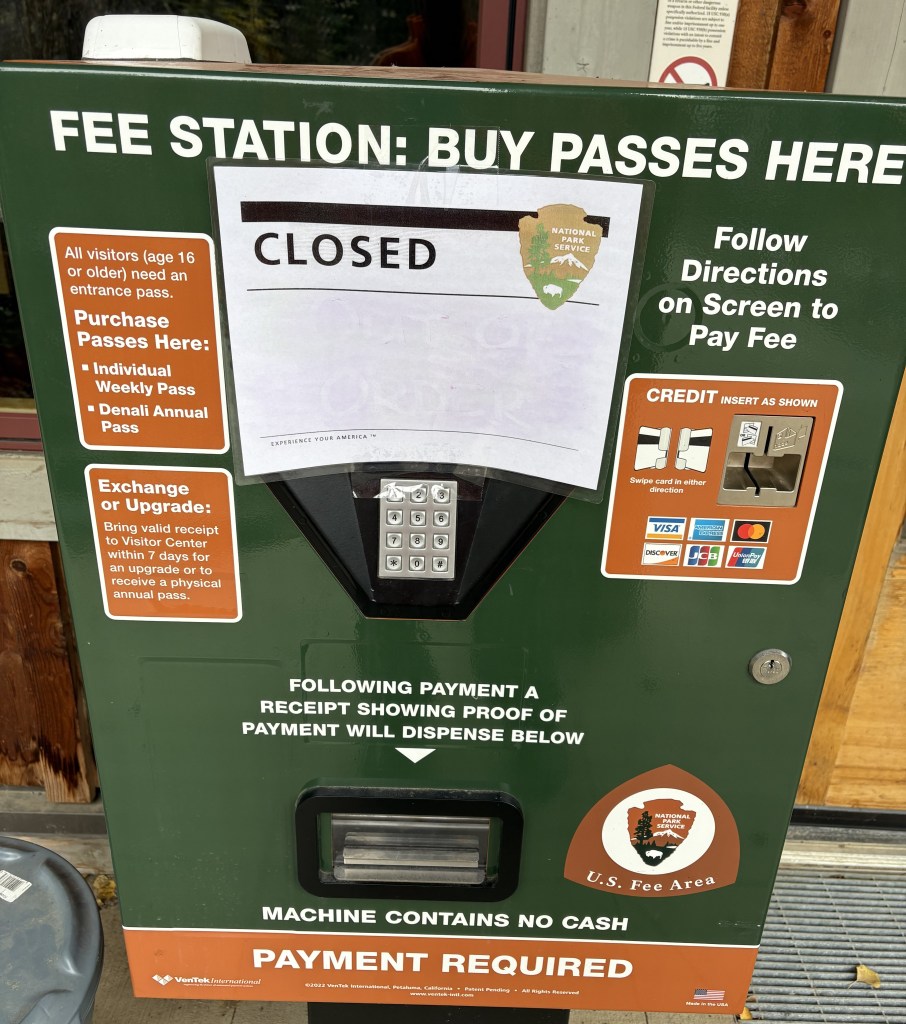
I drove into town and took a few photos before going to the Visitor Center.
When I got to the Visitor Center I found this sign outside. I will show various portions of it.
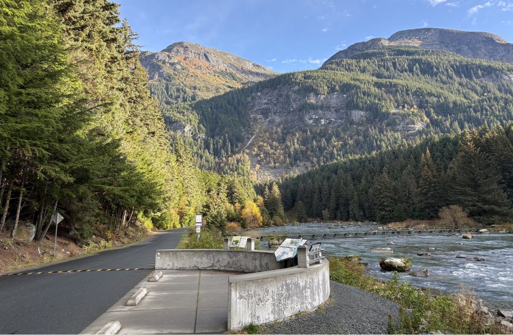
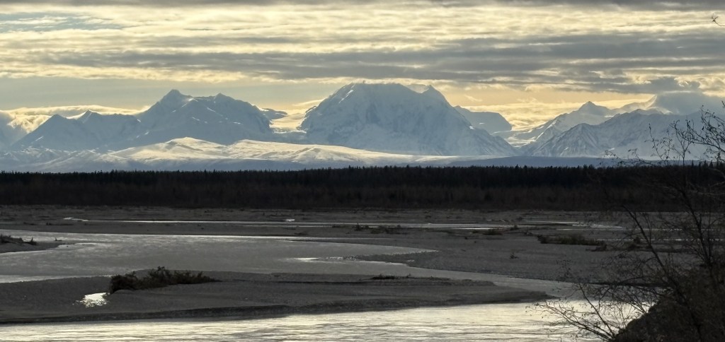
The photo above shows the route I came in on. It ran right along the Chilkat River until it got to town. All four of these photos show some substantial mountains in all views.
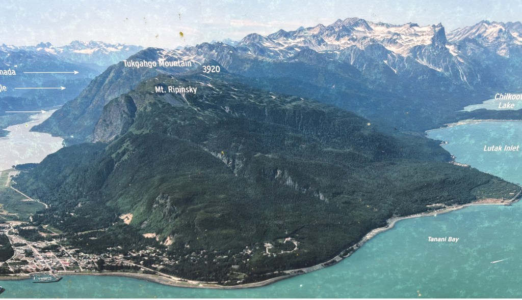
The photo above is looking further right (east) and shows Chilkoot Lake in the upper right hand corner. I will drive the road which runs along the Bay, past the place where I will be boarding a ferry with my car tomorrow, and eventually ends at the entrance to the Chilkoot Lake State Park. It is about 10 miles from town.
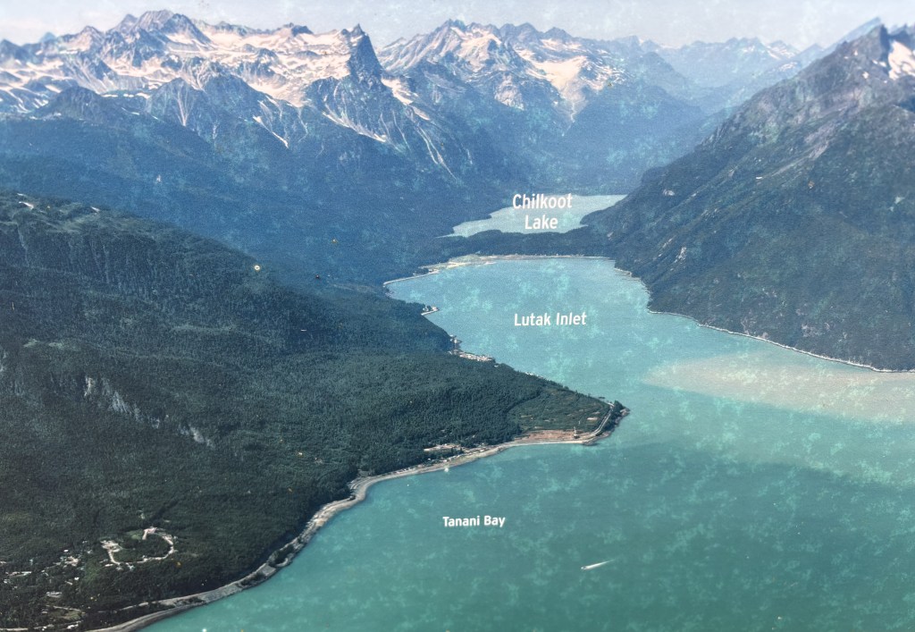
The photo above omits Haines but more clearly shows the Lutak Inlet which ends before Chilkoot Lake.
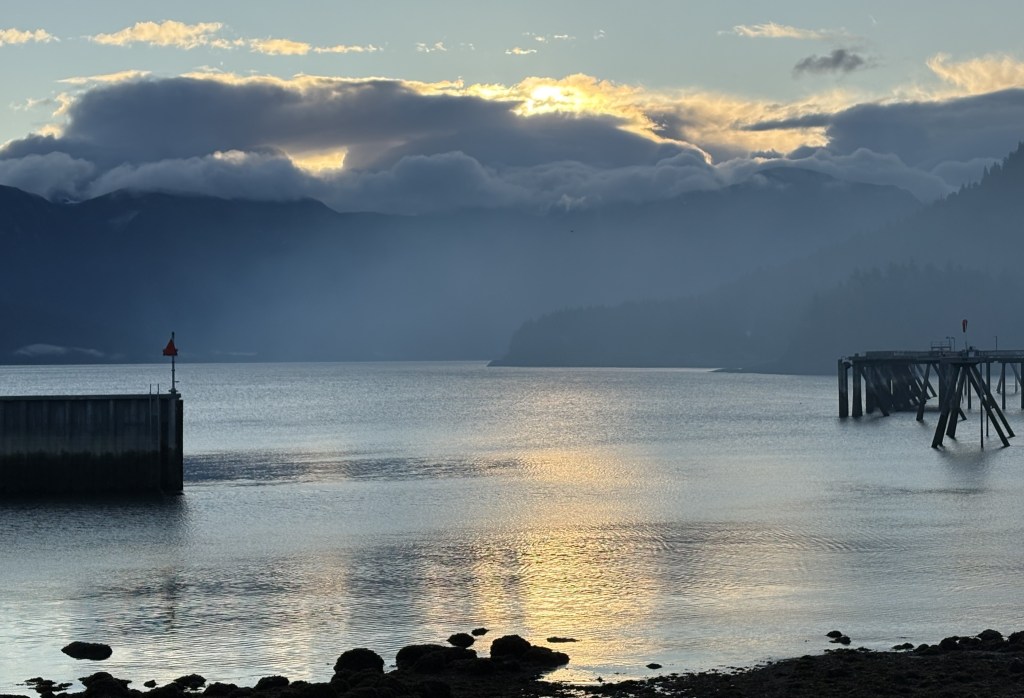
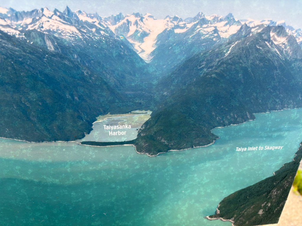
The last part of the map shows the Taiya Inlet which the ferry will navigate to take me to Skagway. After I board it the ferry will come down Lutak Inlet from the upper left and turn left to go to up Taiya Inlet to get to Skagway.
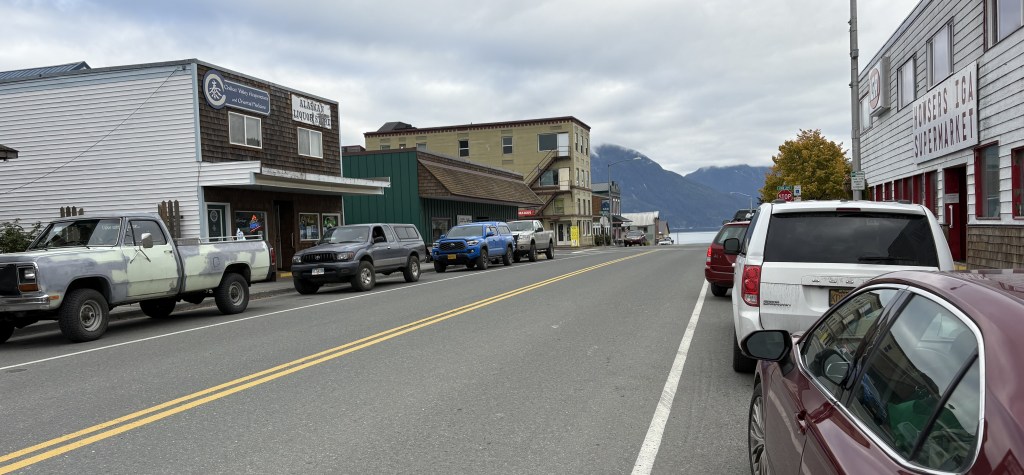
Here is yet another photo of downtown Haines. It was located on Main Street.
It shows the main street (You are here), the harbor at the end, and the cruise ship dock on the right side. Fort Seward is an old military installation which is now just residential buildings.
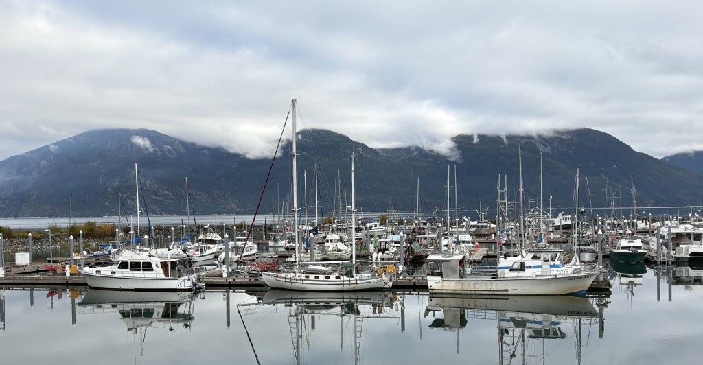
Here are two photos of the harbor:
After taking a look at the town I drove up to the place where I hoped to finally see some grizzly bears!
I parked in a small dirt parking area near a bridge which crosses the north end of the Inlet. That bridge leads to some houses, where the road dead-ends.
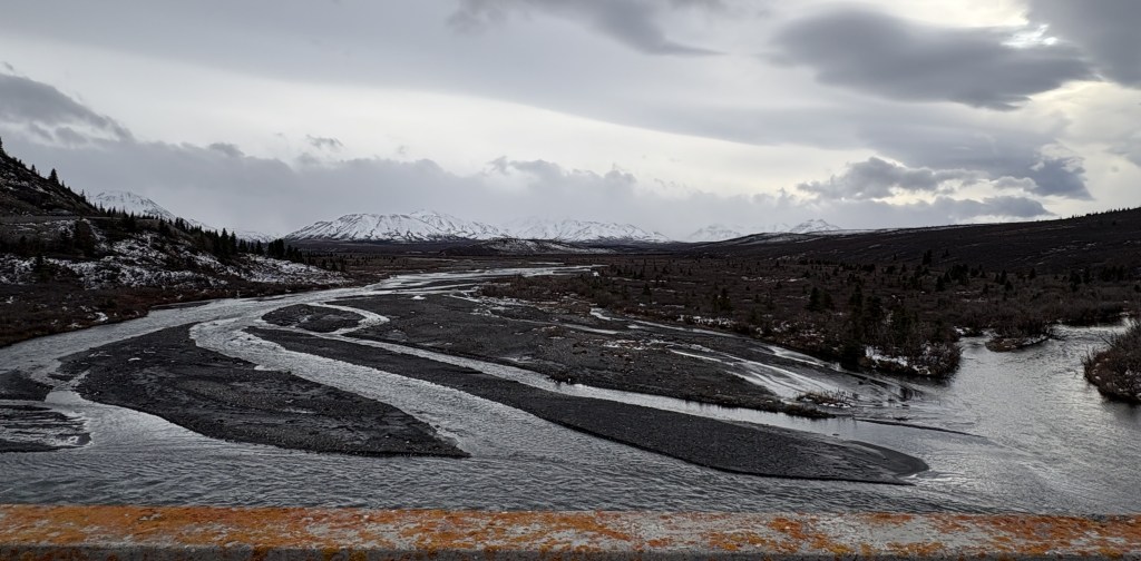
From the bridge, this is the view looking down the Inlet towards Haines.
I know it is quite small, but please note the house just right of the center of the photo. I will make a reference to it in my next post.
After checking out the bridge and the waterway between the Inlet and Chilkoot Lake, I got in my car and drove into the State Park. As soon as I got on the road I saw a grizzly bear walking down towards the water on my right. I drove further into the State Park until I could safely park my car, grabbed my cameras and walked briskly (with my bear spray!) towards where I had seen the bear.
I walked back out on the bridge and soon spotted it swimming across the Inlet from my left to right.
My first bear sighting in the wild!! My next post will be photos taken with my digital camera, as the zoom lens will come in handy.
After taking bear photos I walked back to my car and spotted a bald eagle on the ground in the woods next to the Park access road.
I hung around the access road talking with other visitors and photographers. It turns out the bear I saw is a “regular” and they see it just about every day. They also knew about the female with the three cubs which I had seen a video of when I arrived in town.
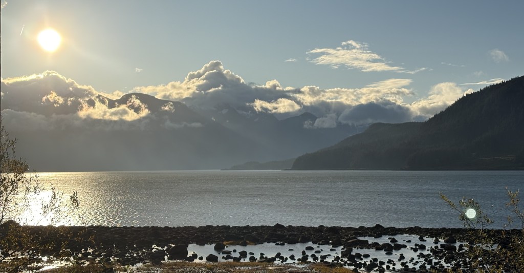
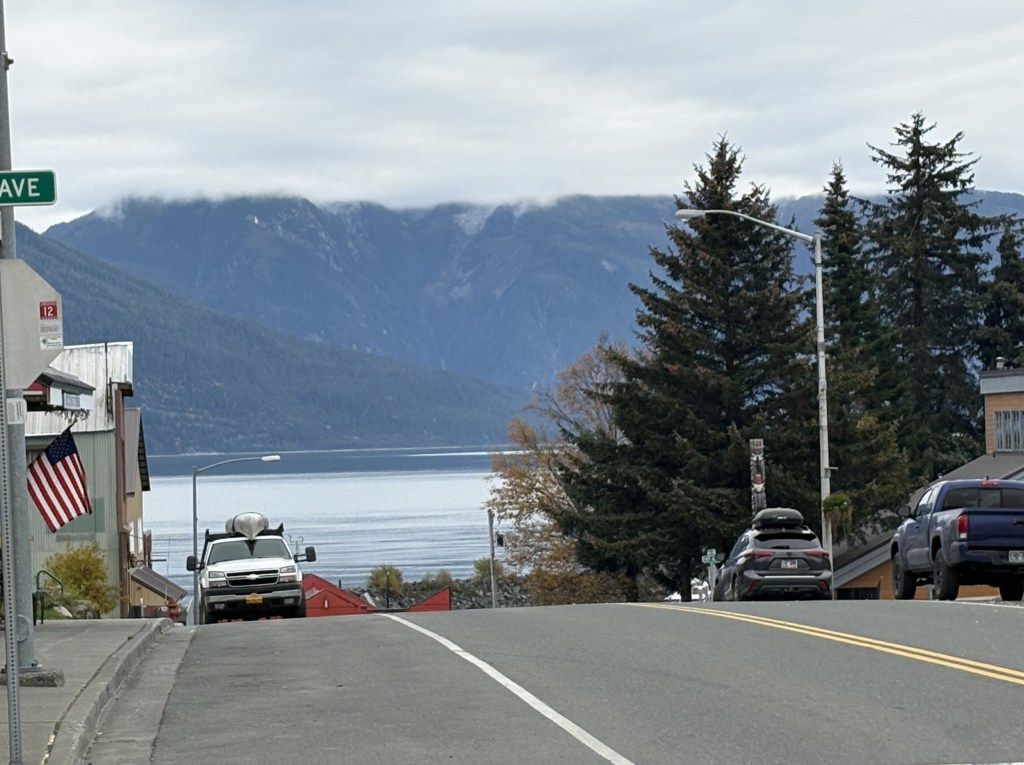
I finally decided to drive back into town and grab some dinner before checking in at my Airbnb. This was the view of the harbor when I left the restaurant, which was adjacent to it.
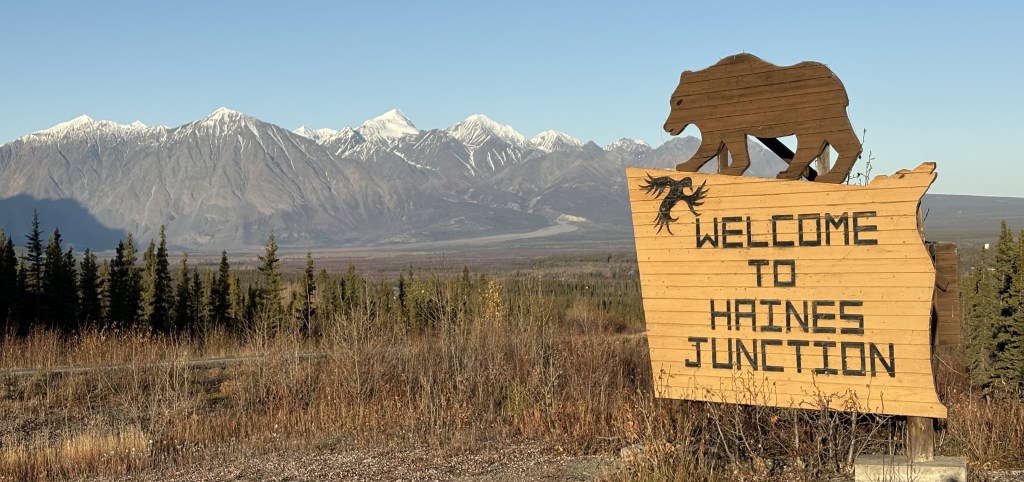
After spending the night in Haines Junction I filled my car with gas and headed south towards Haines, Alaska. The drive is a little under 3 hours, and will involve another border crossing.
It started off as a beautiful sunny morning.
That is actually the sign looking back towards town. I don’t recall seeing a sign as I drove south into town yesterday but I may have just missed it.
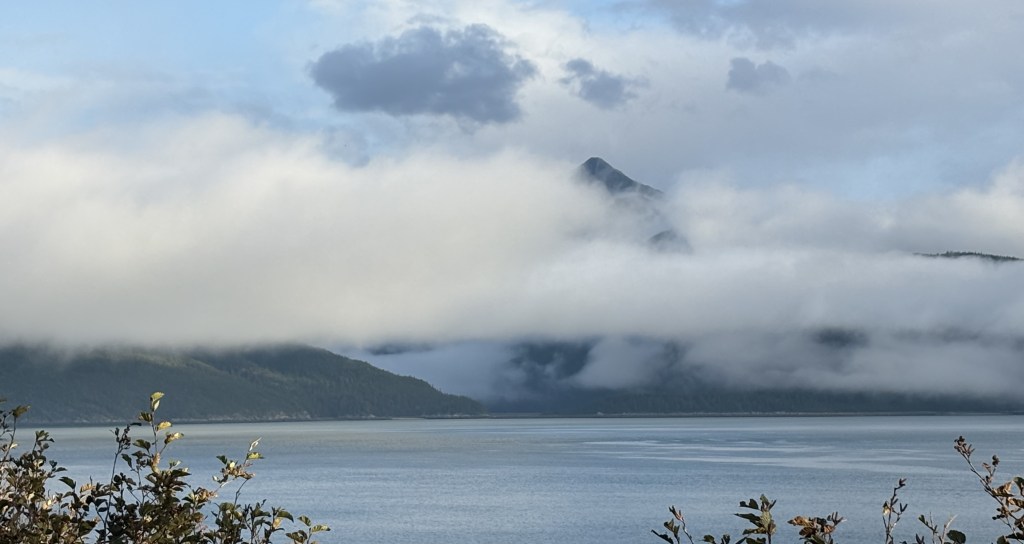
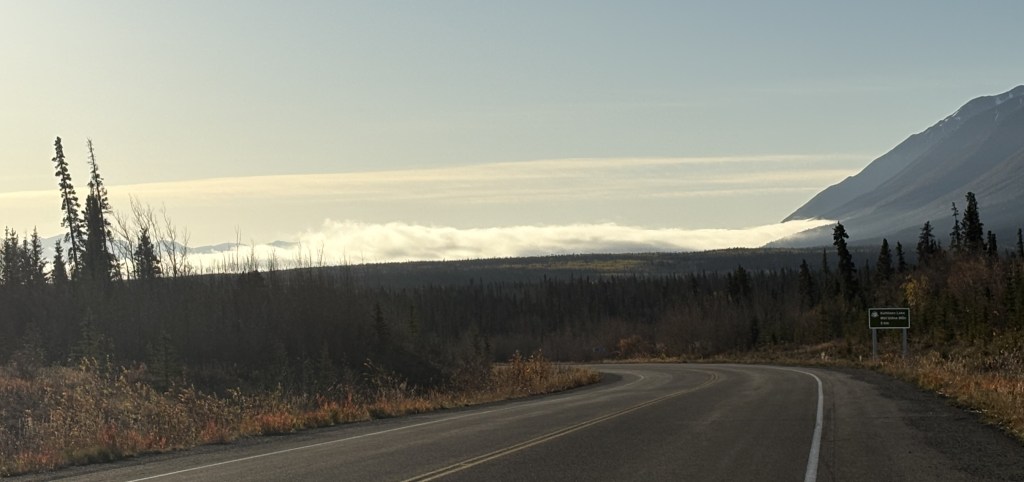
I was surprised to see those low clouds in the distance. As I got closer I realized that I was approaching a lake and I thought perhaps it was just morning fog over the water. I couldn’t have been more wrong.
Even after I had passed the lake, extremely low clouds persisted.
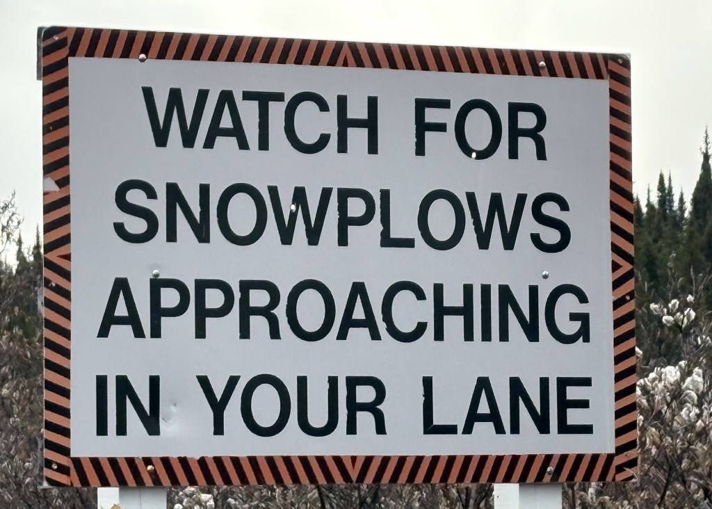
I could see well enough to spot this sign near the road:
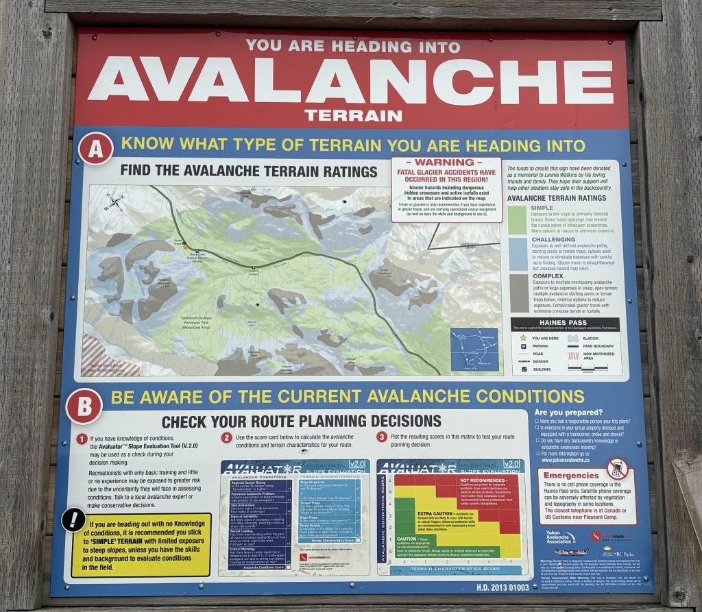
That is the first time I have ever seen such a sign. Of course I wasn’t worried about snow plows this time of year, but I soon saw another sign which helped explain things a little better.
I was approaching a series of very tall mountains on both sides of the road which have a very high risk for experiencing avalanches during the winter. I never really felt that the elevation of the roadway was changing significantly, so apparently the road was weaving between the mountains. With the low clouds I couldn’t see ANY mountains, must less determining how close I was to them or how tall they were.
So the wrong-way snowplows are apparently employed to clear the roads quickly after an avalanche.
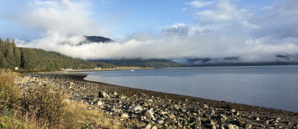
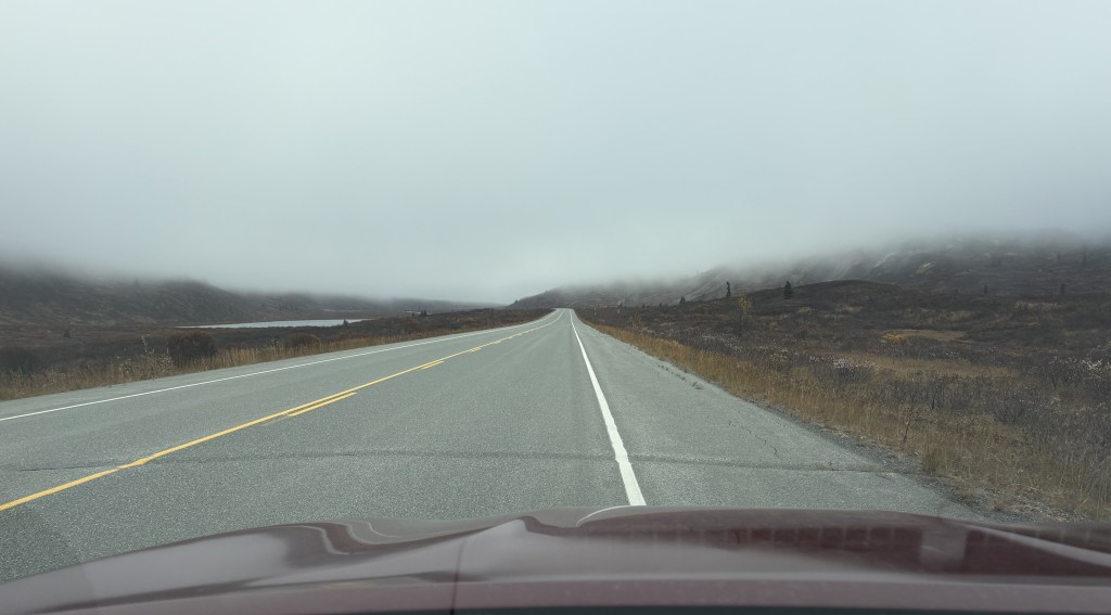
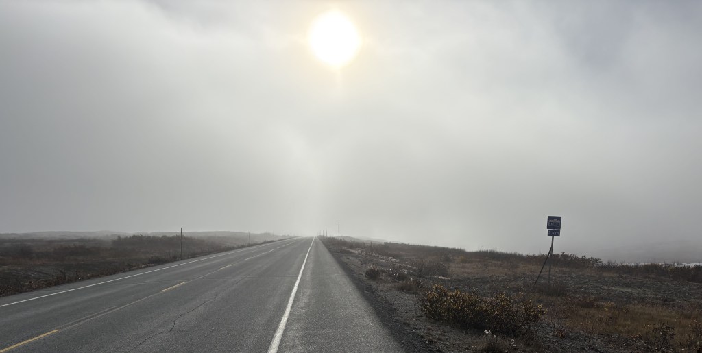
The low clouds did close in a little bit, but visibility was not a problem.
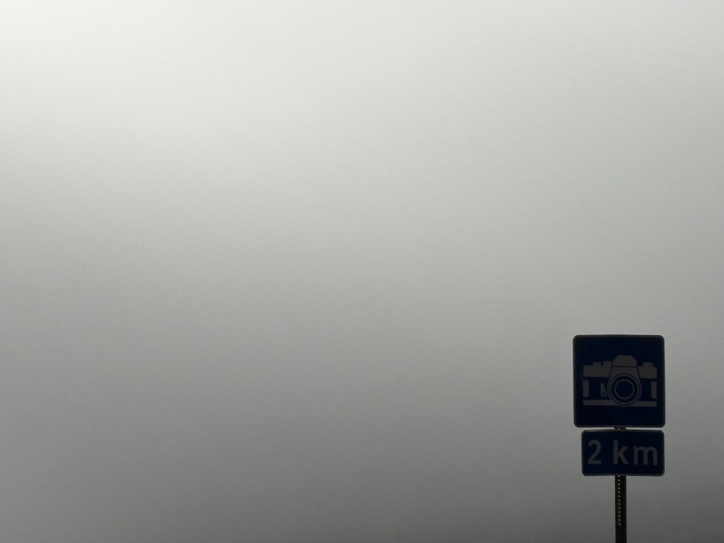
I admit I stopped and got out of the car to take the photo above. I saw the sign indicating a “photo op” 2 kilometers ahead, and walked over to get a shot of just the sign and the clouds.
I soon crossed the border and entered Alaska. The clouds were lifting enough that I could at least see a little ways off the road, but didn’t really see anything worth stopping for.
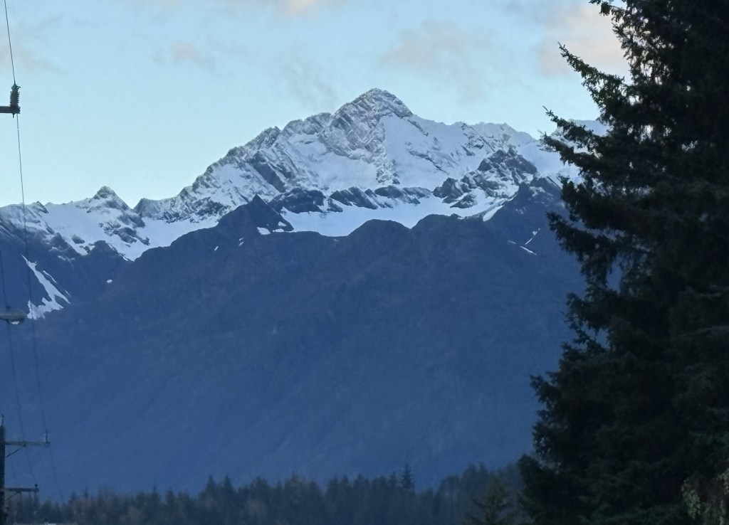
When I was a few miles away from Haines I came to this sign advising me that I was entering a Bald Eagle Preserve.
When I got to a place where there was a large parking area I stopped and got out of the car to walk up and down the road to see if I could spot any bald eagles. I did see a few, but they were flying pretty high up in the sky and perching up in the trees. Few things are as difficult for me than taking a photo of a bird in flight. I was content to just enjoy the solitude. I will have an opportunity to see some bald eagles on the ground later in the day.
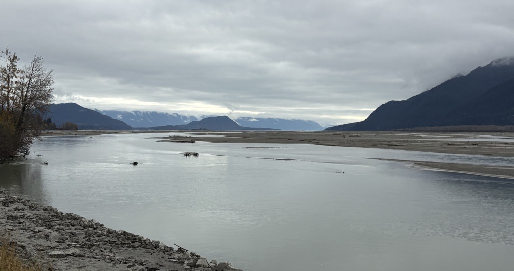
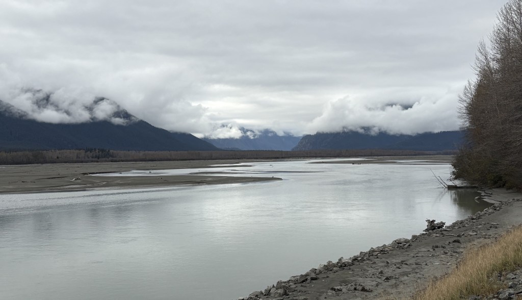
These are views of the Chilkat River, looking north and south from where I had stopped.
After taking a break I drove into town to get my bearings. I will show you those photos in the next post, and will be showing some maps I found on a sign in town which better illustrate where I am.
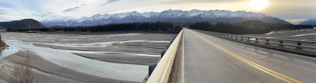
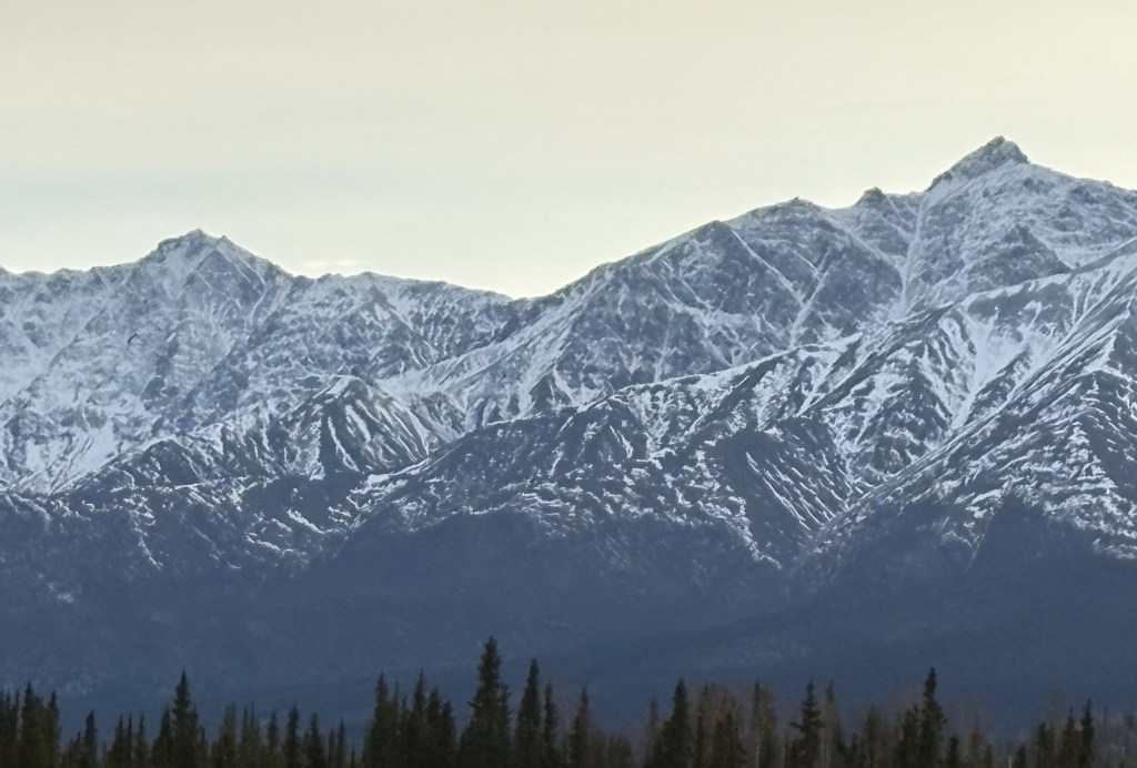
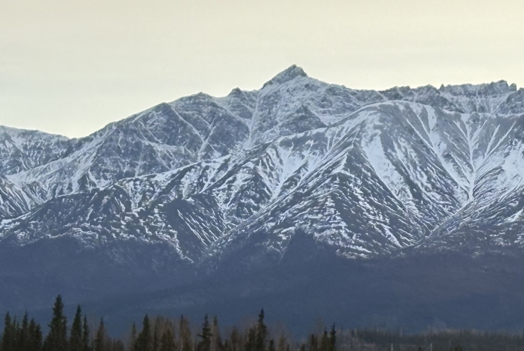
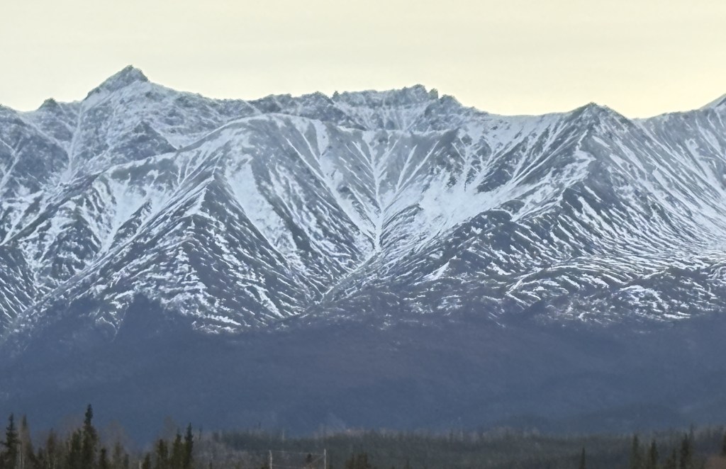
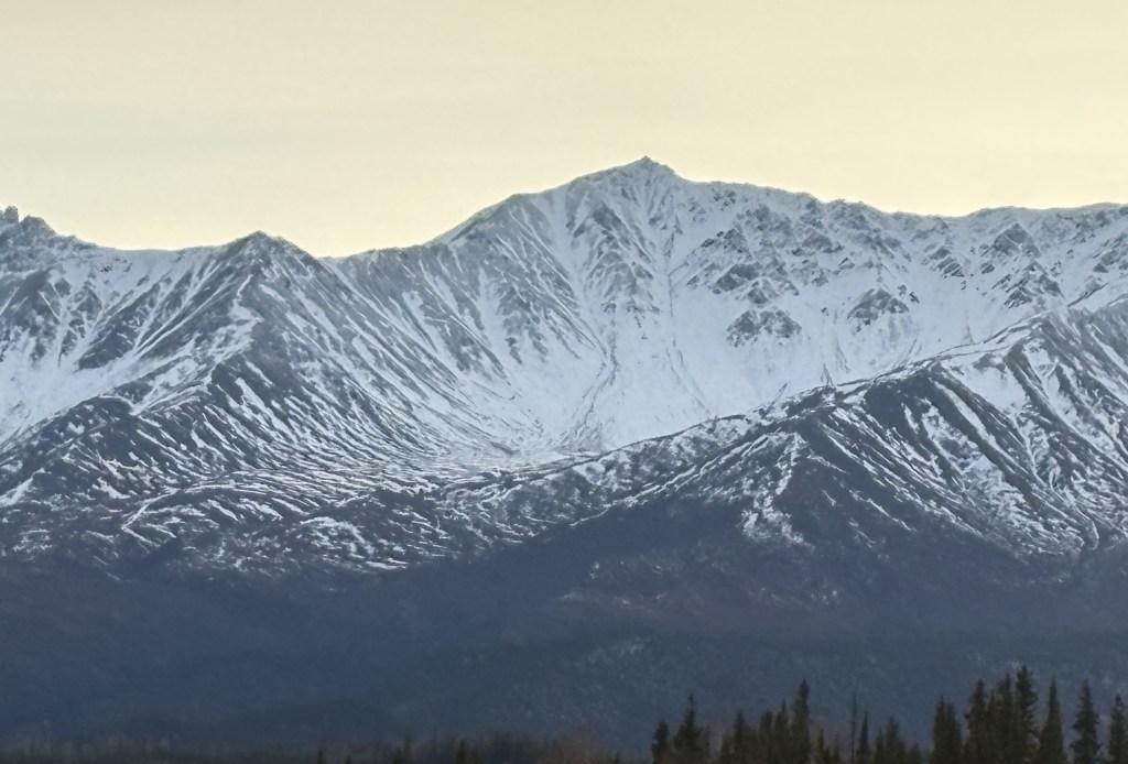
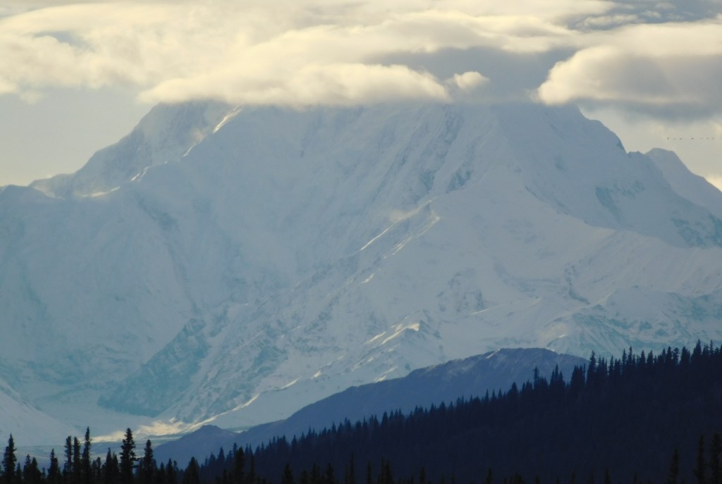
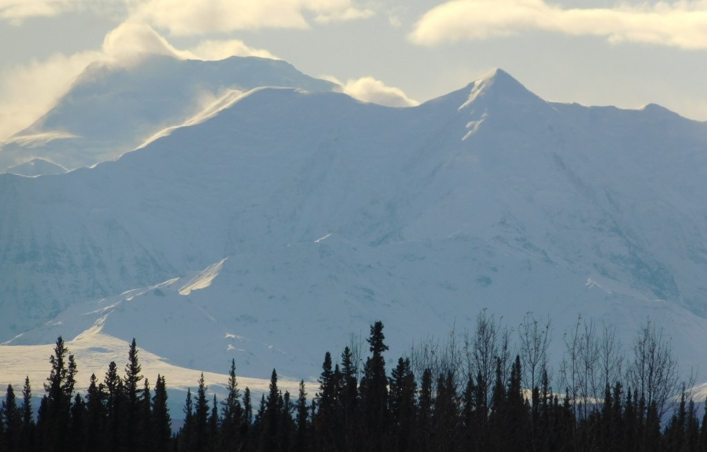
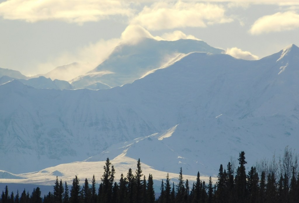
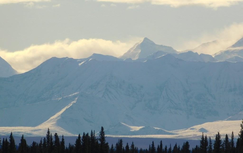
Here is one more of my multi-photo panoramas. This mountain range was beyond a long bridge I was approaching. I took a “conventional” single-shot panorama photo with my iPhone and will post it first to show the entirety of the range. It will be followed by a bunch of photos, taken with my iPhone, panning from left to right. The mountains were much closer than they appear in the single shot, one reason I don’t take that many of that type of photo as they end up being too small to see much detail when posted. I tried crossing the bridge to get even closer but then the low pine trees were blocking part of the mountains, so I came back to this end of the bridge.
Here are the individual photos:
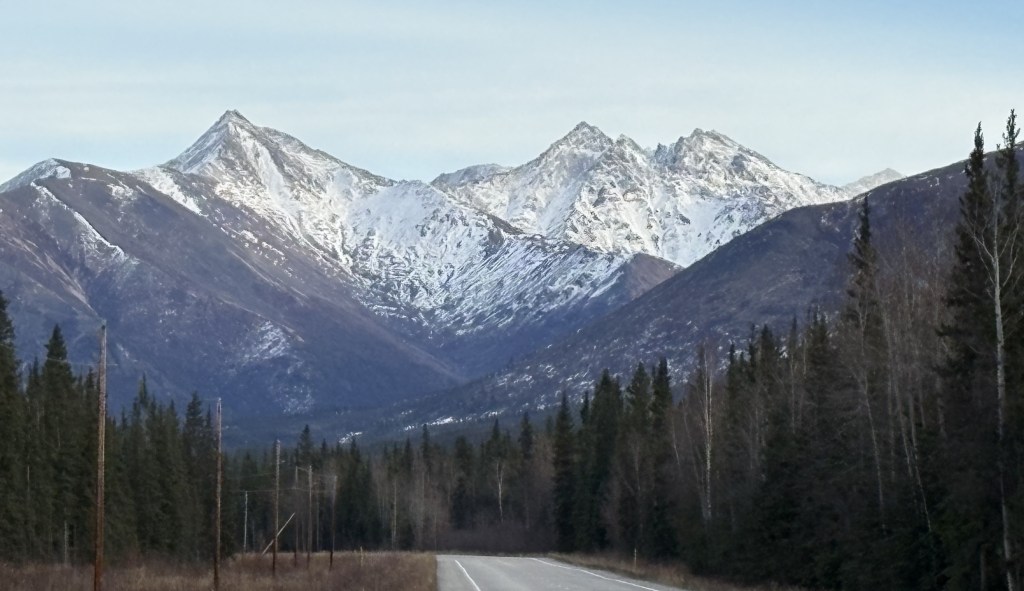
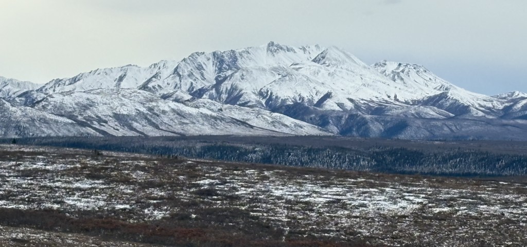
I continued driving towards Tok and saw these two sets of mountains ahead of me, further down the road.
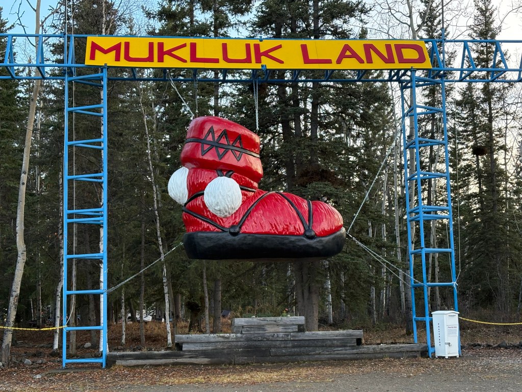
As I was approaching town I saw this entrance to a touristy area next to the road, but it was closed for the season.
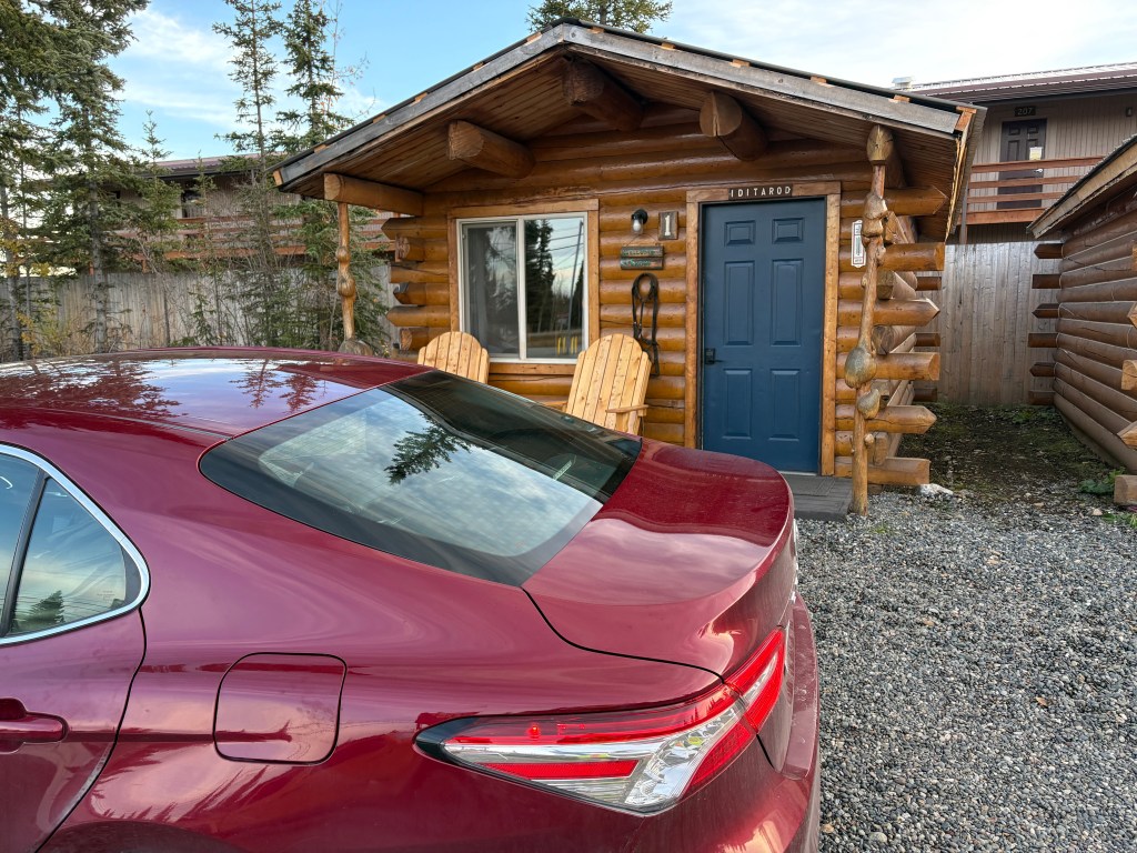
I finally arrived in Tok. I was staying in a different place than I did when I arrived in Alaska. This was my little cabin. I was very modern inside, and I wish it had been available on Airbnb when I arrived in Tok a few weeks ago.
After getting my stuff for the night moved in from the car I decided to treat myself to a steak dinner at one of the few restaurants in town.
This will not be my last night in Alaska. After crossing the border into Canada tomorrow I will drive south in the western part of the Yukon Territory to the town of Haines Junction. The next day I will drive further south and cross into the panhandle of Alaska to go to the coastal town of Haines, and then I will take a ferry to another coastal Alaska town – Skagway.
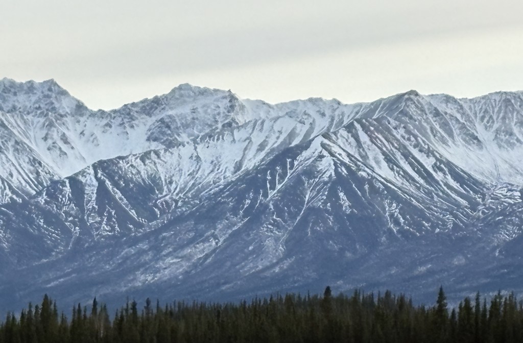
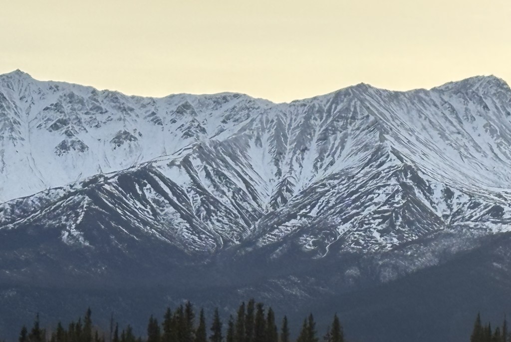
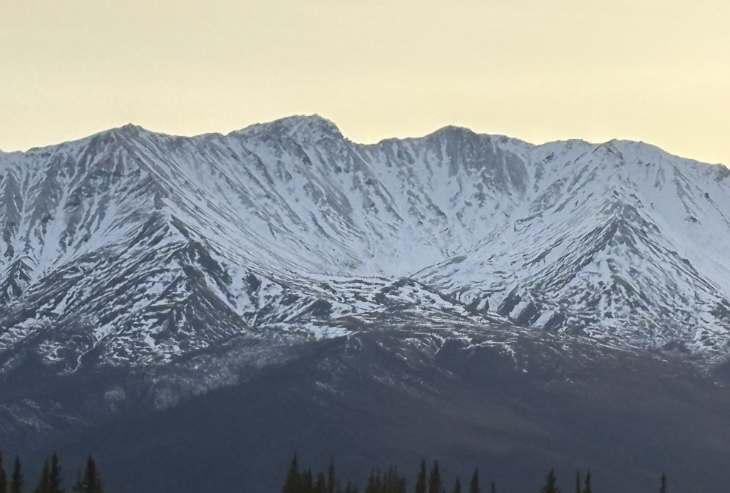
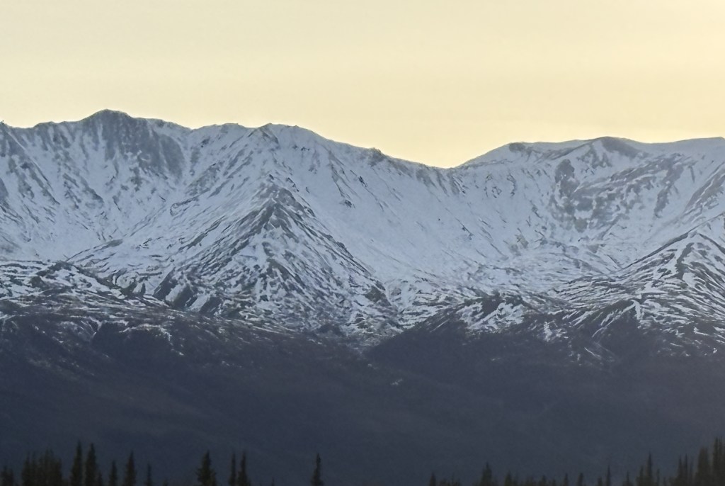
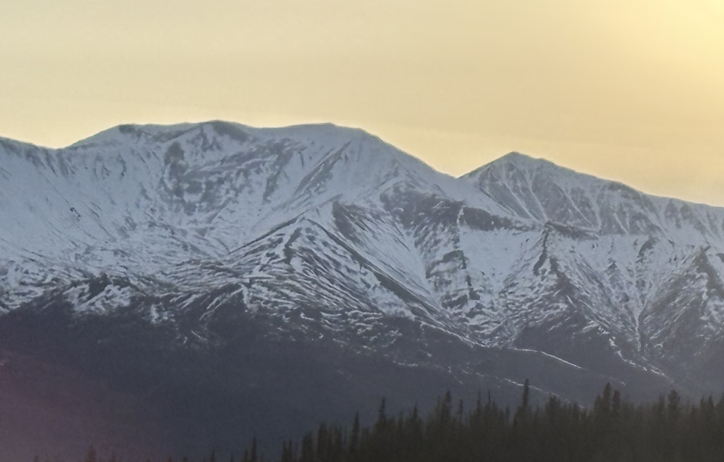
I am going to break up my trip to Tok into two parts – getting from Fairbanks to Delta Junction (which I have done before) and getting from there to Tok (which will cover new turf). I took lots of photos of several mountain ranges and will post them in a somewhat different manner.
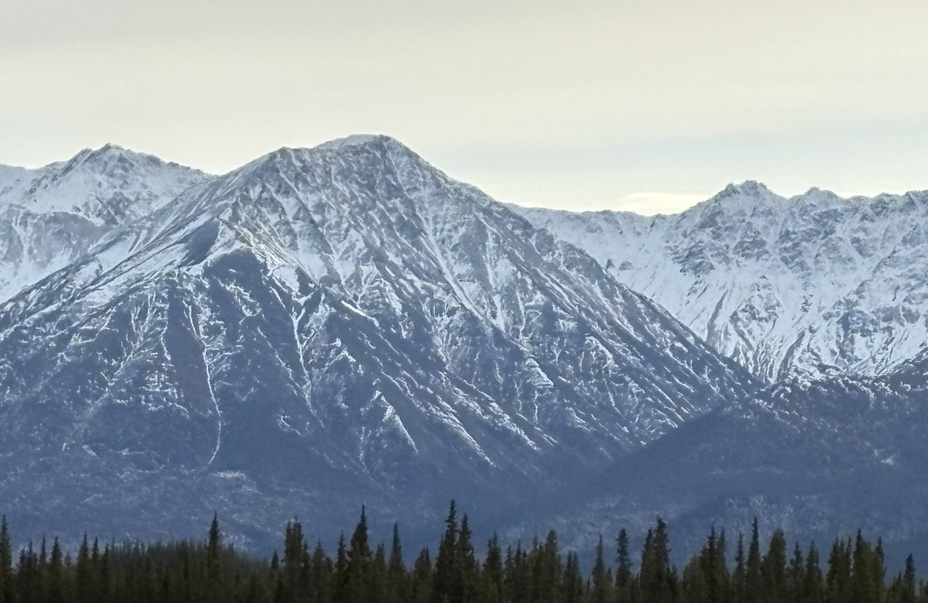
The first set will be of mountains that were to my right, looking across a wide river which I posted photos of when I made this trip the first time. It will start with a few photos I took with my iPhone that will create a “panorama” from left to right when viewed in sequence. There are two sets of three, which were taken 1 hour and 16 minutes apart, so they were from slightly different vantage points on the highway. The second set of three will then be followed by 28 photos taken with my digital camera zoomed in to show detail of the terrain, depth of view and snow cover. There may be some duplicates, and you will see some “overlap” as I moved the camera from left to right (i.e. what is on the right side in one photo may be in the center or left side on in the next photo). I am pleased with the quality of the digital photos so am just going to post them all.
Here is the first set of three, taken at 103pm. Again, these create a panorama effect, from left to right, when viewed in sequence.
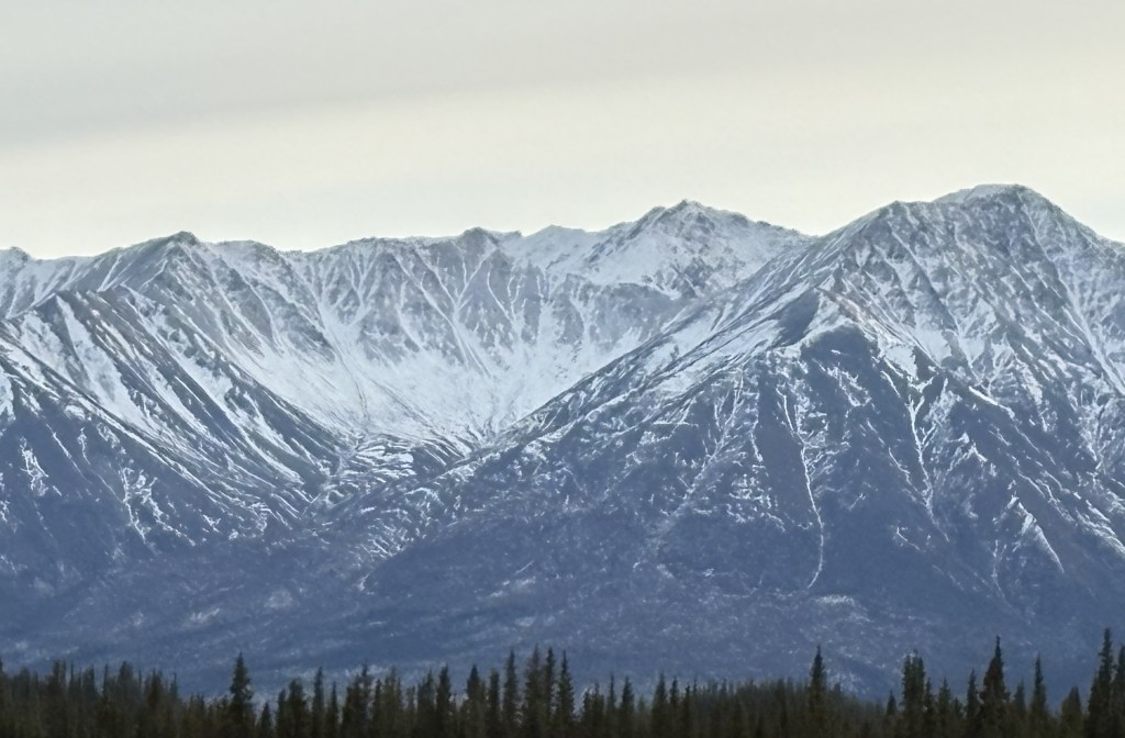
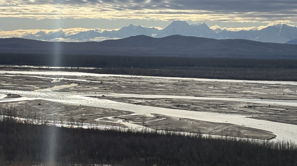
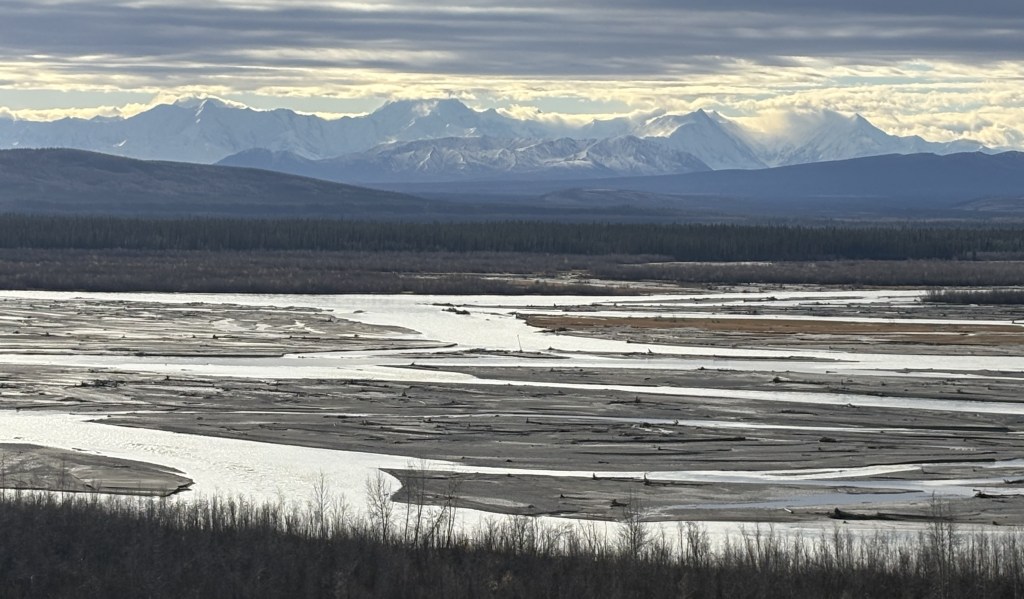
And here are three photos of the same mountain range, taken from further down the road at 219pm.
Those three don’t show the entire mountain range but it appears the road I was on had taken me closer to the mountains. This was the vantage point from which the digital photos were taken.
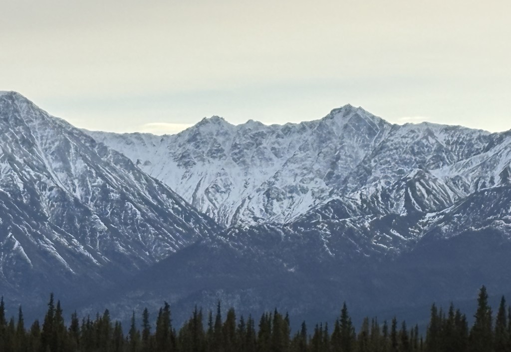
I will now post the first 14 photos taken with the digital camera. The following post will include the second group of 14 photos. My intent is for you to view these photos on a standalone basis and just take in the variety of terrain in each of them.
These are in random order and don’t necessarily follow the left to right viewing scheme.
The only road that goes in to Denali National Park extends 92 miles west from the main Visitor Center. The first 15 miles, which are paved, are open to all visitors using their personal vehicles. When the buses stopped running on September 15, the next 15 miles are also opened to all visitors, weather permitting. That goes at far as the Teklanika River campground, and was where I had to turn around today.
Beyond that campground the road continues to Mile Marker 53, the Toklat River ranger station, then to Mile Marker 66, the Eielson Visitor Center, then to Mile Marker 85, Wonder Lake (which has a spectacular view of Mt. Denali), and ends at Mile Marker 92, where there is an airstrip for planes.
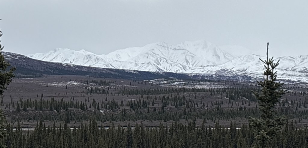
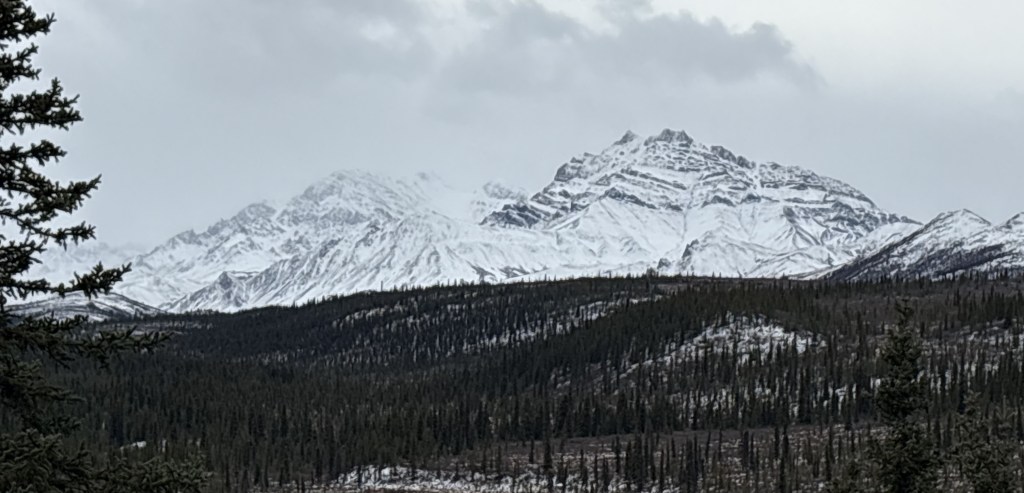
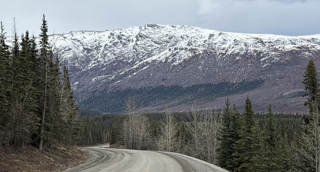
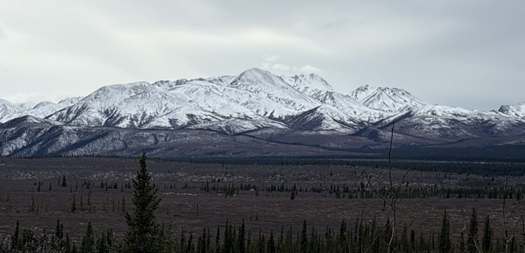
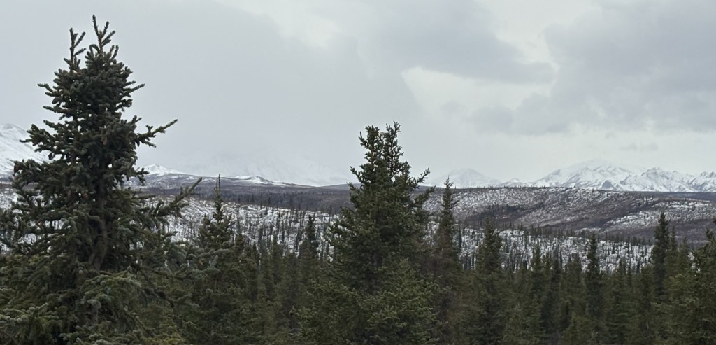
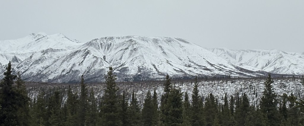
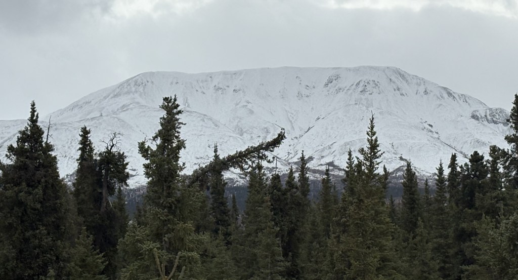
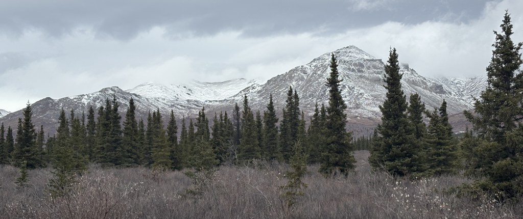
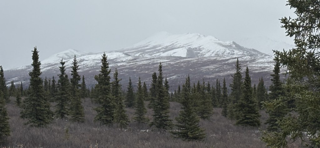
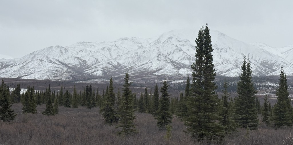
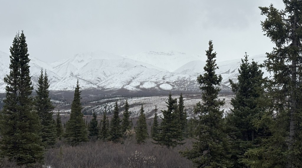
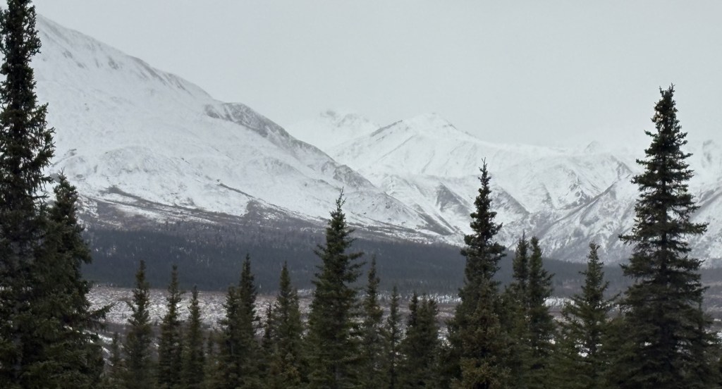
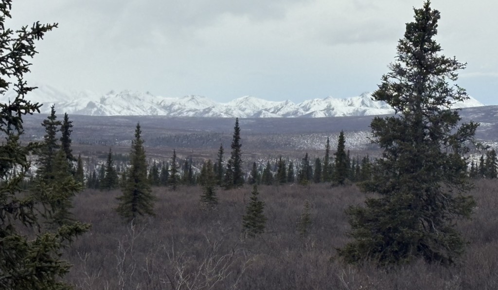
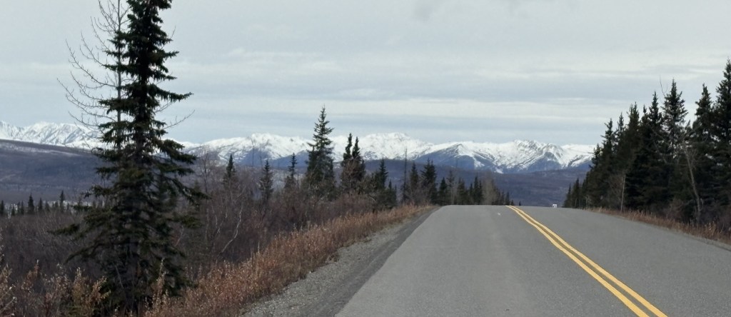
Here are more of the things I saw as I drove from Mile Marker 15 to Mile Marker 30:
That was as far as I was allowed to drive in today. I don’t think I was anywhere near Mt. Denali itself so I doubt if I somehow got a photo of it. I wasn’t very close to any of the mountains I saw, and the road went up and down between hills which probably blocked my view looking deeper into the Park.
I stopped taking photos and focused more on looking for animals on the way out. It was almost 6pm when I turned around and I’ve heard that wildlife sighting typically increase in the morning early morning and early evening. Black bears may have started hibernating but grizzly bears may have still be out and about. I did speak to a couple from Europe when I was here two weeks ago and they had a video of three grizzly bears crossing the road just a few feet in front of their vehicle, and they said it was on the section of road back here.
If I had known that I wouldn’t have an opportunity to speak with any rangers on this visit I might have asked more questions when I was here about two weeks ago. Never having been here I had no idea what to expect.
This was my only opportunity to drive the additional 15 miles in. There will be more snow arriving overnight and the gate at the Savage River bridge was closed for the remainder of my visit.
Having driven up from Wasilla, I had now arrived at the Park. My first sign that there was something amiss was when I pulled into the parking lot at the Visitor Center. Hardly any cars. I had been here about two weeks ago and while it wasn’t “packed” by any means, there were definitely a lot more vehicles. I also discovered that the large Visitor Center I had been in two weeks ago was closed, with a sign directing people to the “Winter Visitor Center,” a short walk away.
I walked down the hill to the other Visitor Center, only to find that it, too, was closed.
I walked back to where I had parked and found that a few other vehicles had arrived. I told them not to bother going down the hill. This was when someone mentioned that the US Government had “shut down” the night before due to a funding bill not being passed. I knew that the last time that happened the National Parks remained open, but with limited staffing. I explained that in my opinion, if we weren’t supposed to go in they would most likely have had a barrier across the road to keep us out.
I went ahead and drove in, but I believe most of the people I had seen probably left, thinking the Park was actually closed, because I hardly saw any vehicles after I went in. I did see two Park rangers drive by at various times during the day but they never stopped to talk with me.
My first stop was at the viewpoint where I theoretically could have seen Mt. Denali if the conditions were right. Given how poor the distance visibility was as I drove up I wasn’t terribly optimistic.
Nope. I could barely even see the shorter mountains which were much closer.
I proceeded to drive in on the 15 miles of paved road which I knew would be open. There had obviously been some snowfall recently and these are the things I saw. Most of the mountains I will show you were on the left side of the road going in. Having been here two weeks ago, I knew they were larger and more “impressive” than the ones on the right.
The next two were on the right. They basically start higher than the road surface so I was looking up at them.
Back to the left side:
The next shot is looking right from the same spot on the road. This is one of the places which drain water runoff from the mountains on the right, downhill to a river near the base of the mountains on the left.
Three more on the left:
One last one on the right:
This is from the road looking back towards the Park entrance.
I honestly didn’t remember that I could see that many mountains looking that direction but there they are. They may not have had snow on them when I was here previously, so wouldn’t have been as noticeable.
I continued deeper into the Park towards the gate at the 15-mile mark.
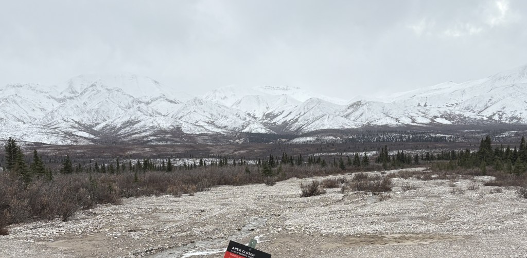
This is the small parking area there. It is the end of the paved road and is normally where regular vehicles must stop and turn around. As you can see, there were only two vehicles parked there, and it was 440pm.
This is the mountain on the opposite side of the Savage River:
And this is the bridge which crosses the river.
This is me driving over the bridge!
The gate was OPEN and the rangers I had spoken with two weeks ago told me that since the Park buses had stopped running for the season, visitors were allowed to drive in an additional 15 miles on a dirt road, weather permitting. As it turned out, there will be snow coming overnight so today will be the only day I will be able to drive to the “Back 15”.
I will show you those photos tomorrow in the next two posts. There are lots of photos but I have gone through them several times trying to pick the best ones. I will tell you now that I saw NO animals! Based on my discussions with other visitors two weeks ago it sounded like the “Back 15” was the most likely place to see bears, but don’t get your hopes up. While I spent lots of time every day scanning the fields for moose or bears (sometimes with my binoculars), I hardly saw any animals the whole time I was here.