Fairbanks Loop

September 18, 2025

I referenced this “loop” in my previous post and thought it might be wise to post a picture of map and explain my thinking:

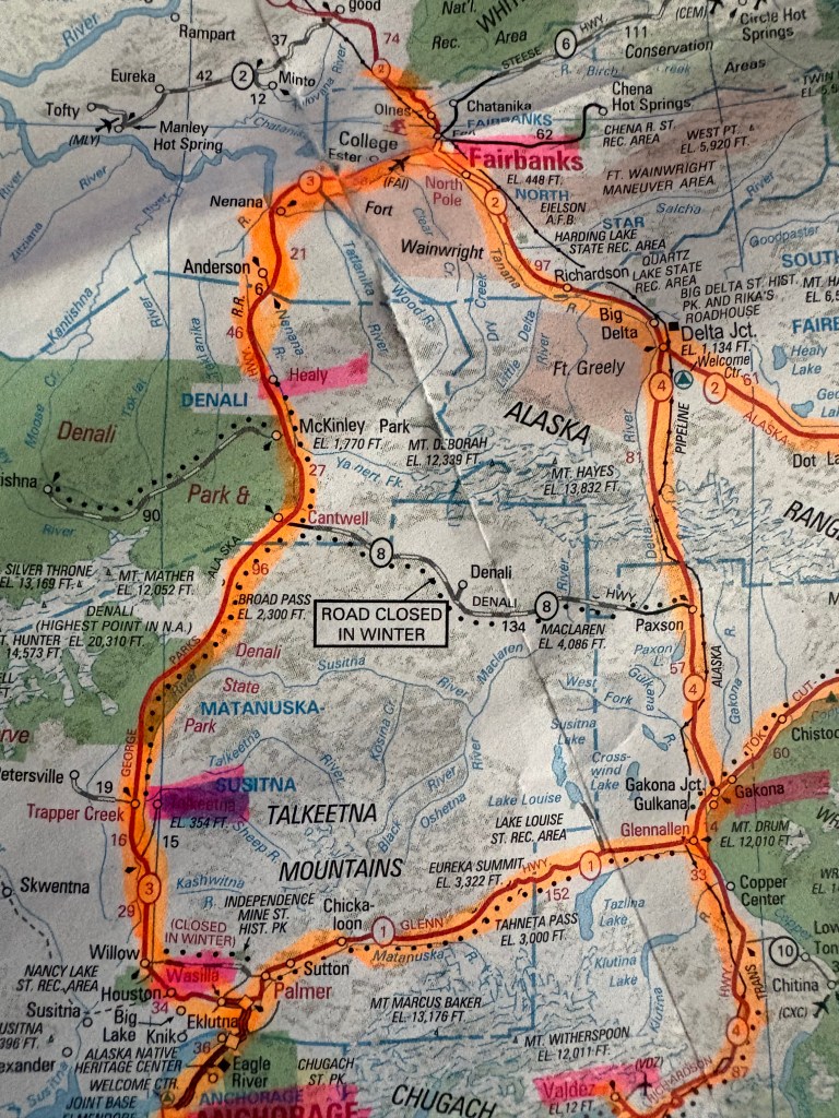
(Photo credit: AAA.com Alaska Map)

The two biggest towns in Alaska are Anchorage and Fairbanks. There are major highways (1,2,3 and 4) which connect them in a loop fashion. I will use smaller towns along them to illustrate my overview.

A small town fairly close to Anchorage (lower left corner of the map) is called Wasilla. From there north to Fairbanks is 316 driving miles on Hwy 3 and according to Google Maps takes 5 hours 22 minutes to drive. Coming down the east side of the loop, Fairbanks to Glennallen is in two parts – Fairbanks southeast to Delta Junction on Hwy 2, then Delta Junction south to Glennallen on Hwy 4. Total distance of those two parts is 247 miles and drive time is 4 hours 20 minutes. Then from Glennallen roughly west to Wasilla is on Hwy 1. Distance is 148 miles and drive time is 2 hours 38 minutes.

To do the whole loop covers 711 miles and takes 12 hours and 20 minutes (without stops). Hence the need to break it up into bite-sized pieces.

This first lap I am stopping in Talkeetna, Fairbanks, Gakona (near Glennallen) and eventually back to Anchorage. I was originally going to do a second loop in the opposite direction later in the trip because I often see things driving the opposite direction on some roads than I saw going the other way. It turned out that I would do both loops in the same direction for reasons which I will explain when I get to that point in my trip.

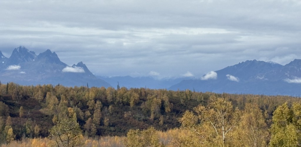
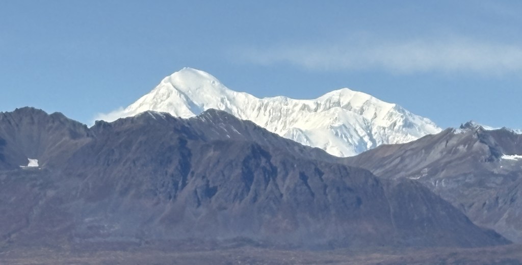
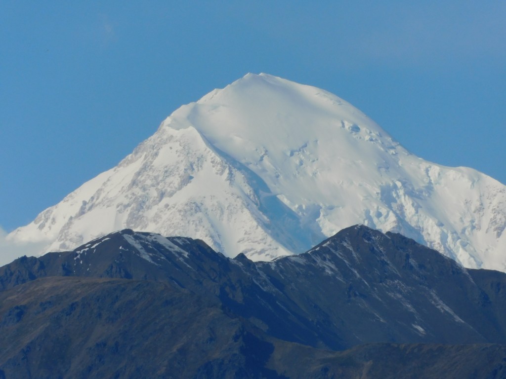
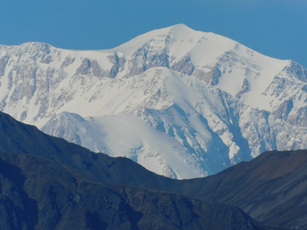
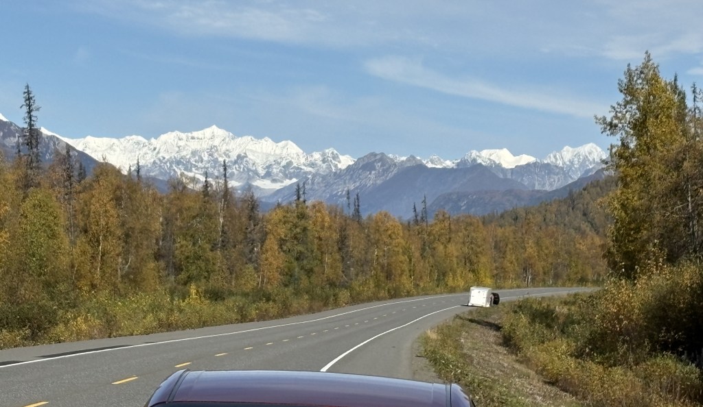
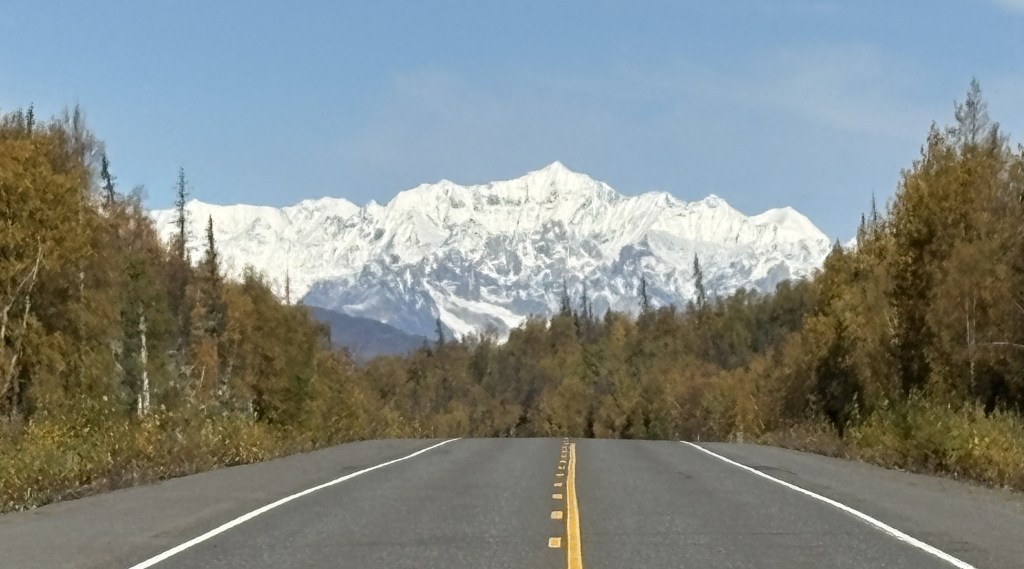
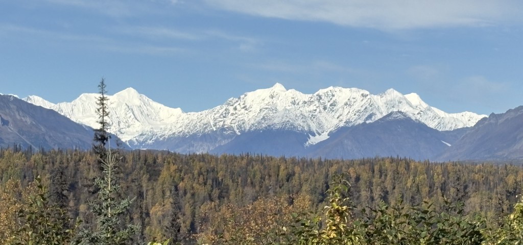
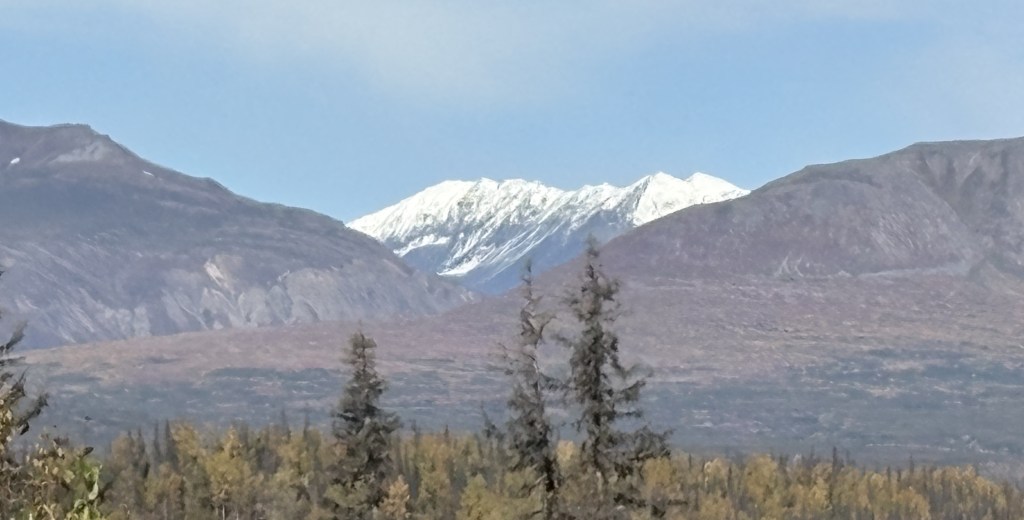
My first loop is to visit those towns and get a feel for road conditions and elevation changes. This is my first time in Alaska and I have no idea what to expect. My first big lesson was that Talkeetna is a LONG way from Denali National Park, and the Alaska Range where the Denali Mountains are located is also a LONG way from Denali National Park. On my second loop I will stay in Healy, about 20 miles north of the Park entrance, and visit the Park for 3 1/2 days with much less driving!

Anchorage to Talkeetna

September 18, 2025

When I left Anchorage to make my first loop up to Fairbanks and back (covering several days) I had booked my first Airbnb in the little town of Talkeetna (pronounced tal-KEET-na). I drove past the turnoff when I made my impromptu trip up to see Mount Denali on a clear day yesterday. Talkeetna is actually about 14 miles off Hwy 3 on a roughly parallel road. Today I once again overshot the turnoff and went right to the various viewpoints I had visited the day before.

Before I left Anchorage I took this photo of a neon sign I saw on a tiny ice cream shop I drove past every day. For some reason I liked it’s simplicity:

As I drove north on Hwy 3 I saw this vehicle just off the highway to my right, in the little town of Houston AK.

It was promoting the “Grass Station,” a marijuana dispensary (of which there are many on Canada and Alaska).

Points for being clever.

I also passed an elementary school with this impressive (covered) outdoor recreation space for the kids to safely play away from the highway:

There was also a fenced in area on a grassy lawn on the other side of the building with the usual park-type playground equipment for kids.

Just up the road from the school was a company which apparently makes and/or markets seaplanes:

The plane on the roof was motorized to rotate slowly. There was a small lake behind this building with a few seaplanes docked, and I took a video of one taking off. I saw LOTS of seaplanes flying around while I was in Anchorage and will have photos later in the trip of a lake by the Anchorage International Airport which claims to have the highest concentration of seaplanes in the world.

When I finally made it to the South Viewpoint I had visited on a clear day yesterday, this is what I saw:

Exactly NONE of the big, snow covered Denali mountains. Only the shorter black mountains in front of them.

I really had nothing else to do so I just hung around and talked with other visitors. It was too far to drive up to the actual Denali National Park entrance, and I will be stopping there tomorrow on my way to Fairbanks.

After a while I headed back to Talkeetna to be there at my check-in time. It was a nice new house (bigger than a tiny house but not by much) and even had heated floors! What a concept. It had two levels (my part was at ground level) which is why I really didn’t think of it as a tiny house. The owners lived nearby but I never had a chance to meet them. The house was on a rough unpaved road and was in the woods. They told me I might see moose in the yard but I never did, though two walked across the road a short ways in front of me as I was leaving the next morning. It happened too quick for me to get photos.

I did come upon the Denali Brewing Company on my way to the Airbnb. I was surprised to find it near such a small town.

Oh, and I had seen this colorful display just off Hwy 3 as I drove south to Talkeetna from the Viewpoint.

It was across a large sandy area from the highway but the colors caught my eye so I parked and walked over to take a photo.

Tomorrow I will drive much further north to get to Denali National Park itself and will have a few hours there to get a sneak preview of the Park before continuing on to Fairbanks.

Other Denali Mountains

September 17, 2025

There were a few other mountains in the “Denali Complex” that I could see as I drove about 30 miles further north on Hwy 3 from the Southern Viewpoint. They are mostly other large mountains, but I don’t know exactly which ones they are. And I found three more of Mt. Denali itself, taken from a more northerly viewpoint and which clearly shows the separation of the South and North peaks. Let me show those first:

And I used the digital camera with zoom lens to get a closer look at the two main peaks:


The rest of these are mountains further northeast of Mt. Denali itself. One of them is probably Mt. Silverthorne and another may be Mt. Mather. The Alaska Range continues for quite a distance, and the entire range is aligned from southwest to northeast.

Some photos were taken from the highway and some are from the North Viewpoint (but there was no sign there identifying them as there was at the South Viewpoint). I didn’t want to post these with the others as I presumed that most people were interested in the three main mountains.

The mountains in the Alaska Range southwest of Mt. Foraker are further away from the highway so I never even got a glimpse of them as I drove north. The road had trees on the side in many places which blocked my view, and of course I was mainly focused on driving.

The second one appears to be the same mountain on the left in the photo above it, but the road had turned left so I was looking right at it. They were taken 2 minutes apart.

These were all taken the same day as I took the main Denali photos. I would come back up here the next day but you will see in the next post that it was overcast and I couldn’t see these mountains at all.