Alferd Packer site

This was my “never saw that coming” find for the day.  As I was saying goodbye to some folks I was talking to at a scenic overlook one of them said – “Oh, and be sure to check out the cannibalism memorial before you get in to the next town…”.

Okay.

I’ll let the signage at the site tell the story.  This was just south of Lake City, Colorado.

IMG_20171003_132917171

IMG_20171003_132947944

IMG_20171003_132852124

And while this is all very serious and disturbing I found this quote on the sign to be even more strange:

IMG_20171003_132931362

Hmmm… Cannibalism…  Eating Democrats…  I hope Trump doesn’t get any ideas.

Durango-to-Silverton train

Monday I spent all day on the Durango & Silverton Narrow Gauge Railroad.  This train is very similar to the one I rode about a week and a half ago down in New Mexico.  Many of these trains which run over high mountains are “narrow gauge,” meaning that the track rails are only 3 feet apart as opposed to conventional trains whose track rails are 4 feet 8 inches apart.  This allows them to lay tracks on and navigate much tighter spaces.

I left home in plenty of time to get downtown and park a few blocks away from the station (for free, as opposed to paying $8 to park in their lot).  Our train departed at 845am for the slightly more than 4-hour ride north to Silverton (which is featured in the next post).  Durango is at about 6,500 feet elevation and Silverton is at about 9,300 feet so it was all uphill on the way north.  The train stopped three times to take on water for the coal-fired steam engine.

Speaking of coal, I learned during the Yard tour on Friday that on an average round-trip each train (and they run several each day, depending on demand) goes through 4-6 tons of coal.  TONS!   And the car attendant today told us that some poor soul up in the engine throws a 20-pound shovelful of coal into the engine every 4 seconds!  Yikes!  And when the trains are in Durango overnight they put wood pellets in the engines to keep them warm for the next day.

We had a 90-minute layover in Silverton for lunch.  The trip back to Durango went a little quicker (although the train averages less than 15 mph) as we only had to stop once for water and the engine didn’t have to work as hard going downhill.  We got back to Durango a little past 630pm.

This is the car I rode in, which inside was almost identical to the one I rode in on the Chama train.

IMG_20171002_081108565_HDR

The couple I shared a table with, Harry and Beverly, were visiting from Oklahoma.  They come to this area every year in their Jeep and like to travel on old mining roads and other off-road type places, mainly north of Silverton and Ouray, which is about 25 miles further north.  Beverly is a veterinarian and owns her own practice.  Her jacket had an emblem for an organization which is studying Golden Retrievers.  It is following the lives of 3,000 dogs as research into why they develop certain diseases.  Her daughter has a Golden and is participating in the study.

Ironically the couple sitting across the aisle from our table is in the process of moving to Durango from Durham!

IMG_20171002_085818127

He used to work at Fullsteam Brewery, an establishment which which I am somewhat familiar.  They are staying at another Airbnb as they hunt for a place to live.  Small world.

The scenery during the ride was a little different from what I saw on the Chama train.  We were in the mountains for most of the trip and there were trees and rocks which made it hard to take pictures at times.  There were some dramatic views as we paralleled the Animas River for most of the trip and there were great cliff views as we climbed and descended the mountain.  The windows on this car opened up, not down and it was colder outside so I rarely had the window open.  I stayed in my seat most of the time and just enjoyed the ride (and talked too much, I’m sure….).  Despite my preparations I didn’t take nearly as many pictures as I thought I would.

IMG_20171002_101037258

IMG_20171002_103421135

IMG_20171002_170448564_HDR

IMG_20171002_170532847

IMG_20171002_171554319

IMG_20171002_174527060


Silverton, Colorado

We had a 90-minute layover in Silverton before taking the train back to Durango.  Silverton is a small mining town about 45 miles north of Durango.  It sits at 9,318 feet elevation and the weather today was cold and windy, with low clouds and light precipitation.  The year-round population is only around 600, although during the peak summer months there is probably an increase with temporary workers for the restaurants and shops whose owners largely depend on train riders for their livelihood.  Silverton is accessible by car but I’m sure several trainloads of eager tourists each day is their bread and butter.

My table-mates have taken the train to Silverton for several years and said they wouldn’t mind if I tagged along with them for lunch.  They knew of a nice restaurant a few blocks from where we disembarked from the train.  There had been a train which left Durango about 45 minutes before ours and those folks were finishing up their meals so there was a brief wait for a table.  We were seated in front of a big open fireplace (which was very nice on a cold, blustery day) and I had an elk burger and a cup of green chile soup, both of which were very good.

After we ate there was only about 15 minutes before we had to be back on the train so I took a quick walk through town and took these photos.  There were tall mountains in all directions, most of which had a little bit of snow on them and some of the peaks were hard to see because of the low clouds.  I now wish I had stopped here when I drove past town about a month ago as I would have liked to have had more time to see the Victorian architecture and visit some of the shops.  I thought the train layover was longer but I was mistaken.

IMG_20171002_140500056_HDR

IMG_20171002_140505585_HDR

IMG_20171002_140513503_HDR

IMG_20171002_140531855

IMG_20171002_140538309_HDRIMG_20171002_140552581_HDR

IMG_20171002_140733456

IMG_20171002_140840759

IMG_20171002_140845070

IMG_20171002_140850843


Mesa Verde – Various dwellings

There was a series of overlooks at an area of Mesa Verde National Park called Sun Point.  From those overlooks you could see several cliff dwellings, of various size, across Cliff Canyon.

IMG_20171001_142513141_HDR

This one was below Sun Palace (see next post) and sat on top of a cliff, exposed to the elements, unlike the others which were covered to some extent.

IMG_20171001_142529842

IMG_0460

IMG_0461

IMG_0462

IMG_20171001_142515710_HDR

IMG_0453

IMG_0454

IMG_0455

IMG_0456

And from another angle:

IMG_0478

IMG_0479


Mesa Verde – Sun Temple

On top of the mesa, across Cliff Canyon from the Sun Point overlook, sits Sun Temple.

IMG_20171001_142535996

IMG_0475

IMG_20171001_144423911

According to the signage, this curious structure was probably constructed near the end of the time during which people lived in the cliff dwellings below.  It has no doors, windows or firepits, and there was no evidence that it ever had a roof.  It is thought to have been left unfinished and was perhaps intended to be some type of ceremonial facility.

The Park Service added the pinkish roofing material between the walls you’ll see in the following photos, probably to divert rain water from building up inside the structure.  Some of the exterior walls were quite tall so it was difficult to see inside.

IMG_20171001_144302479

IMG_20171001_144322138

IMG_20171001_144450456

IMG_20171001_144454553

IMG_20171001_144520946

Mesa Verde – Cliff Palace

Cliff Palace is one of the largest cliff dwellings at Mesa Verde National Park.  It has 132 rooms and 32 kivas.  It is normally open to the public for ranger-guided tours but was closed to the general public the day I was at the Park for a special function.  While I was at the overlook taking these photos there was a large group of people on the other side of Cliff Canyon, above and off to the side of Cliff Palace (you can see them if you look closely in the upper left hand corner of the first picture below), and there was a gentleman down in the ruins climbing and walking around by himself.  My guess is it was some type of archeological class and perhaps the instructor was down in the ruins pointing out specific features to his students.  Even if it had been open for tours it sounded too strenuous for me to have attempted.

These were all taken from across the canyon at another overlook:

IMG_20171001_142546295

IMG_0508

IMG_0512

IMG_0511

IMG_0510

Here are some close-ups.  The color is a little different because I am now looking at areas which are mostly in the shade:

IMG_0513

IMG_0514

IMG_0515

IMG_0516

IMG_0517

IMG_0518

Mesa Verde National Park

Sunday I spent the whole day at Mesa Verde.  The rain from Saturday moved away and the day started out completely clear, although some scattered clouds developed during the afternoon.  It was still quite windy, although most of the Park is above 7,000 feet so that may always be the case.

One of the first things I noticed as I drove through the Park were the fall colors.  Because of all the forest fires there aren’t that many tall trees, but there are a lot of shrubs and bushes on the hillsides and in the fields and they put on quite a show.  Not the brilliant colors that one might see in New England or other places, but impressive nonetheless.  These are more subdued shades of golden yellow, burnt orange, red, and reddish brown.

There are other things I saw throughout the Park which I will include in future posts but for now I’ll focus on colors:

IMG_20171001_093142517

IMG_20171001_093148503

IMG_20171001_093321873

IMG_20171001_123540880

IMG_20171001_123553150_HDR

IMG_0373

And there was one more colorful thing I saw today.  As I was beginning my descent to the Step House cliff dwelling I saw a black wasp with red wings!  It was quite a sight and I was very surprised.  It landed on a plant near me briefly but I couldn’t get the camera out quickly enough to get a picture.  I saw it a second time but it was in flight.

It was quite large and the body was jet black.  The wings were red or orange and it was quite an attention-getter when in flight both because of the size and the color combination.  When I got home I found this photo online:

TarantulaHawkWasp bugguide.net

(Photo credit:  bugguide.net)

It is called a Tarantula Hawk wasp and is a predator of, you guessed it, tarantulas.  It is a good thing it didn’t sting me because apparently the sting is quite painful to humans.  They normally don’t bother humans unless provoked and although I would have liked to have gotten a nice picture of it I certainly wasn’t planning to harass it.  It was really quite beautiful.  I have never seen one before but I hope I do again.

Mesa Verde – Towers

There are several types of towers at Mesa Verde National Park, each with a purpose.

This is Rock Canyon Tower.  I will first show you where it is (on the other side of Rock Canyon from where I am standing) using my amazing JohnBoy finger-pointing technology:

IMG_20171001_110044112

IMG_0336

IMG_0337

It was a watchtower or signalling tower, to watch for enemies or other threats and they were often built at strategic locations so messages could be relayed to people in other locations.  There was also a small cliff dwelling on the hillside below the tower, perhaps to house the sentinels.

********

This is Cedar Tree Tower.  It is on ground level, on the Chapin Mesa and is away from everything else and exposed to the elements.  There is also a kiva (the ceremonial circle) next to the tower and a tunnel connecting the two. Kivas are often found next to towers.

Perhaps this was an outdoor “theater” where ceremonies or rituals were held.  The tower may have been to elevate an authority figure and the tunnel may have allowed that person to get to the kiva without being seen.

IMG_20171001_131254468

IMG_20171001_131327199

IMG_20171001_131332991

IMG_20171001_131339738

IMG_20171001_131358825

IMG_20171001_131401817_HDR

********

And then there are fire towers.  Almost 75% of Mesa Verde National Park has been affected by fire at one time or another.  The largest, the Bircher Fire in 2000, destroyed over 22,000 acres.  Thankfully most of the others were significantly smaller, each less than 5,000 acres.  This was the area near Cedar Tree Tower:

IMG_0392

And this is one of the three fire towers in the Park.  There is a main tower at the highest point which is completely enclosed.  My guess is that this open tower may only be used when there is a problem brewing on this side of the Park:

IMG_0393

********

This is the main fire tower, located atop Park Point at 8,572 feet.  It affords Park Rangers a 360 degree view of the area and has the necessary tools to calculate where a fire is, although modern GPS technology is probably put to use to provide a precise location once they know approximately where to send a ground crew or reconnaissance aircraft.

IMG_20170930_125759966

IMG_20170930_130706283

Mesa Verde – Step House

This is the one cliff dwelling which was still open for a self-guided tour (and was a reasonable walking distance from the parking lot.  I don’t do hikes over a mile in length).

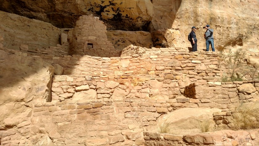
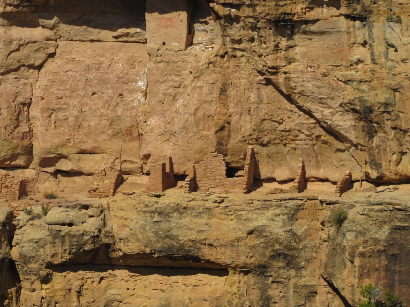
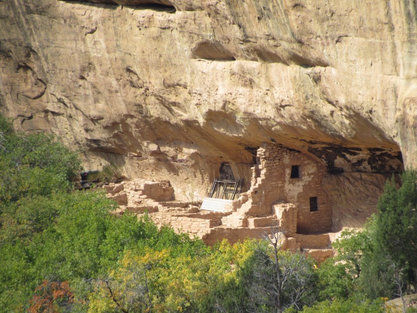
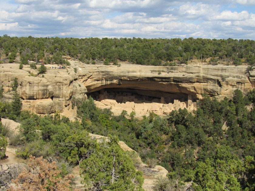
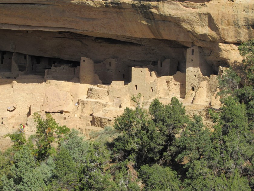
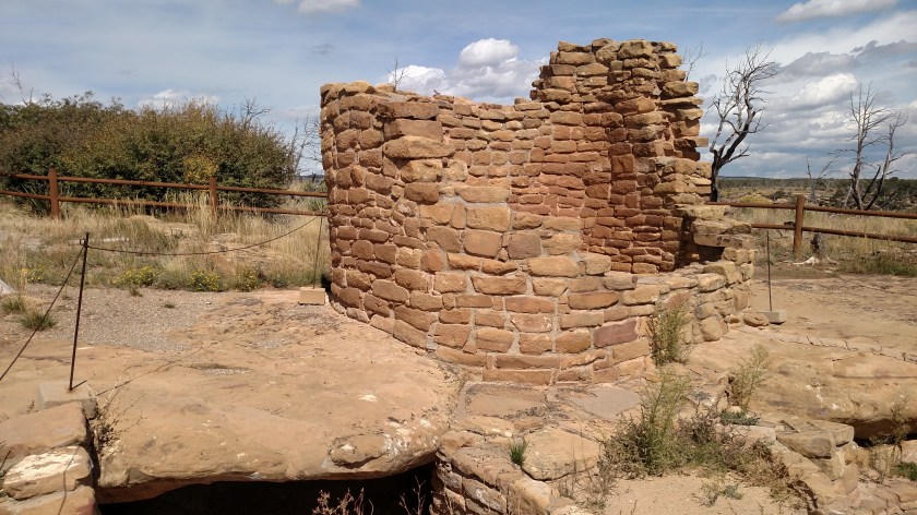
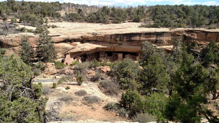
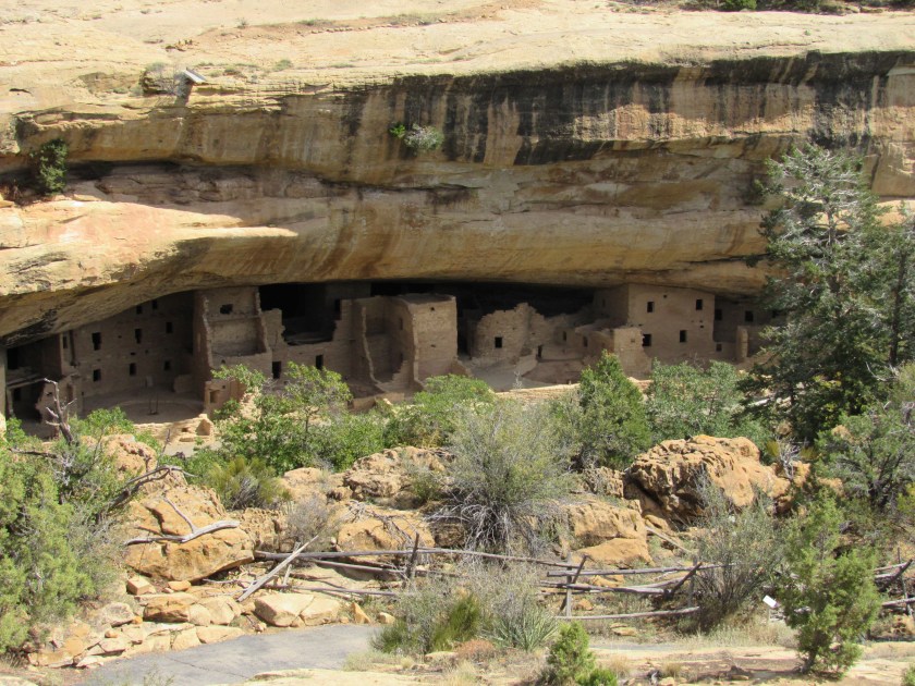
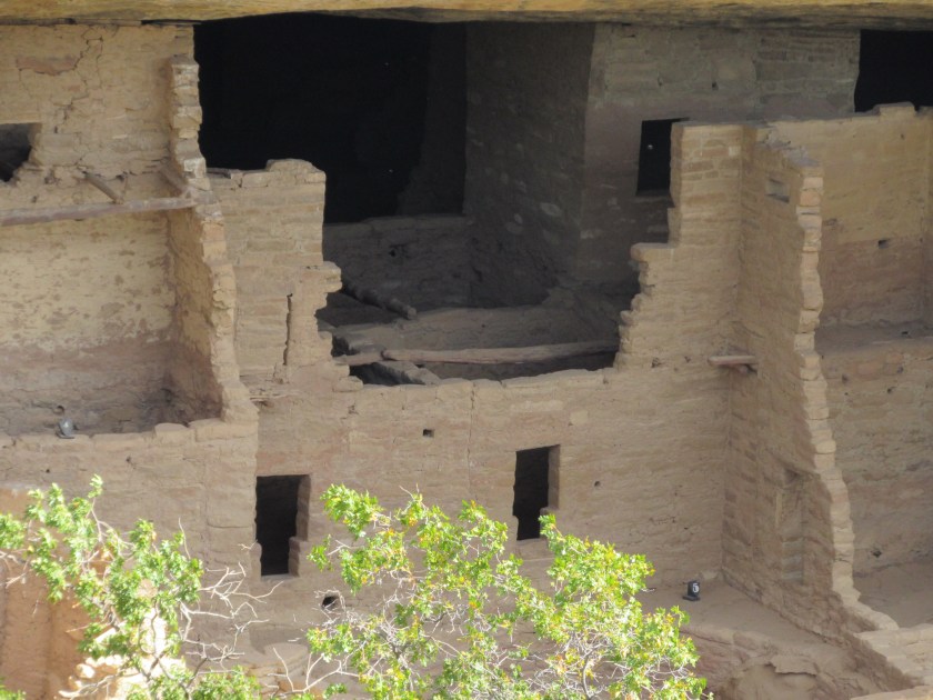
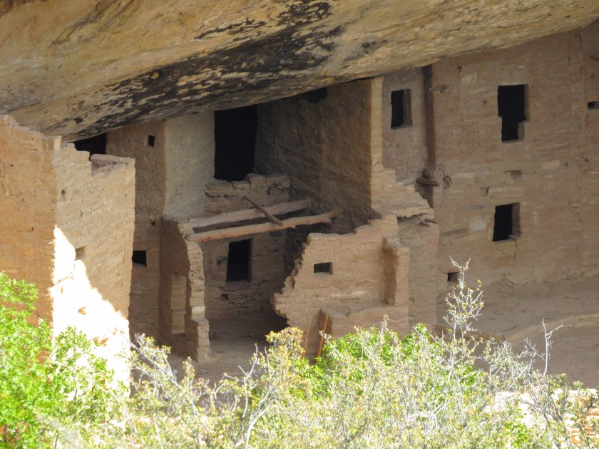
This was the first view I had of Step House:

IMG_0349

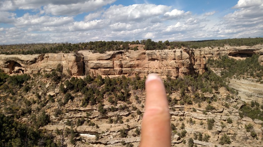
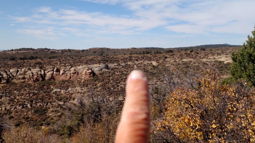
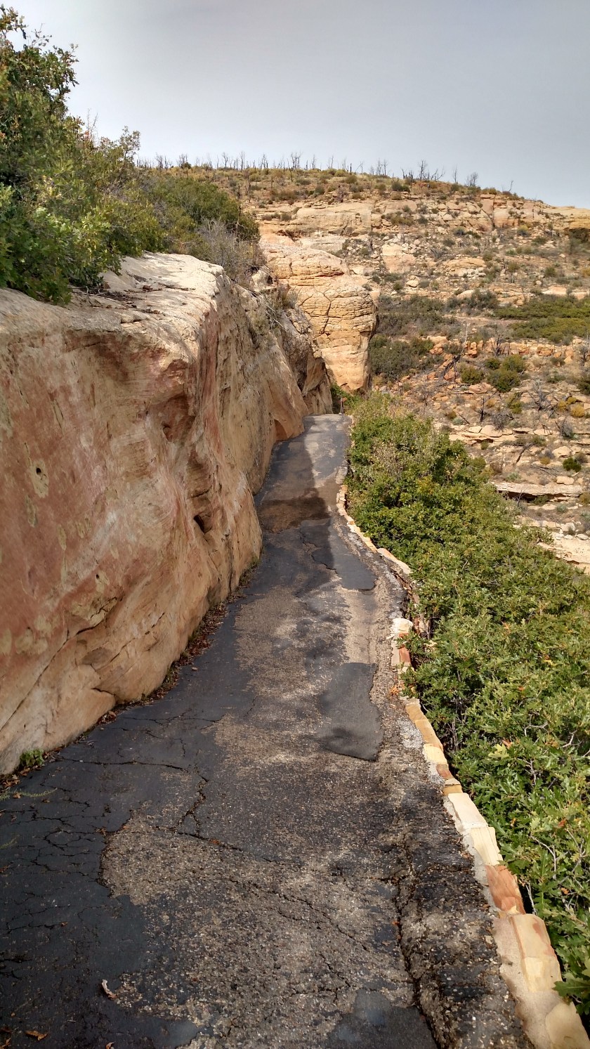
To give you some orientation – my car is parked up on the mesa at the level of the trees at the top of the photo.  From the parking lot I looked east and the dwelling was over the cliff, below me (at a lower level, not under my car).  From the vantage point I took this picture from I would walk further away from the cliff (to my right/rear as seen from here) then double back and walk down a path constructed by the CCC back in the 1930’s and enter the dwelling from the left as seen from the front.  I would exit from the right and take another path and series of switchbacks to get back up to the parking area.  The total walking distance (both the entry and exit paths) was about a mile.

IMG_0348

IMG_0347

And here we go….  This was after I turned at the switchback and started taking the path down to the dwelling.  The switchback is where I saw the Tarantula Hawk wasp shown in the first post of the day.

IMG_20171001_112621761_HDR

Then down these stairs:

IMG_20171001_112806744

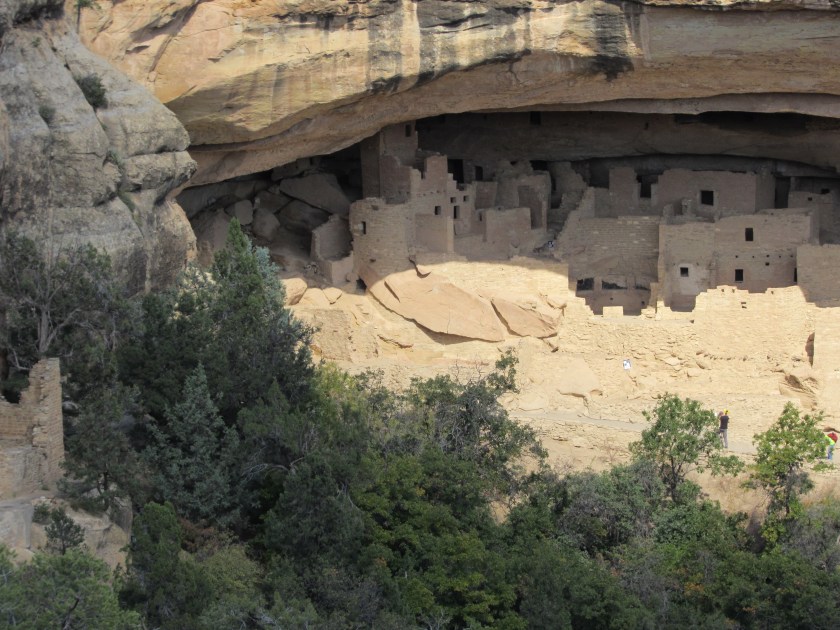
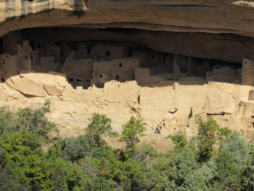
And along more pathway to get to the dwelling:

IMG_20171001_113017122_HDR

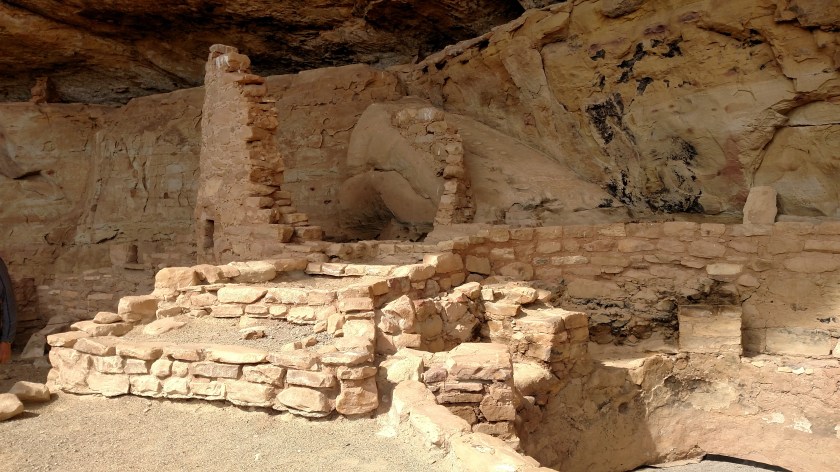
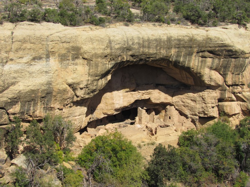
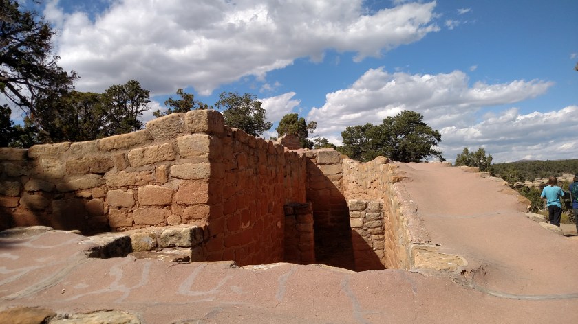
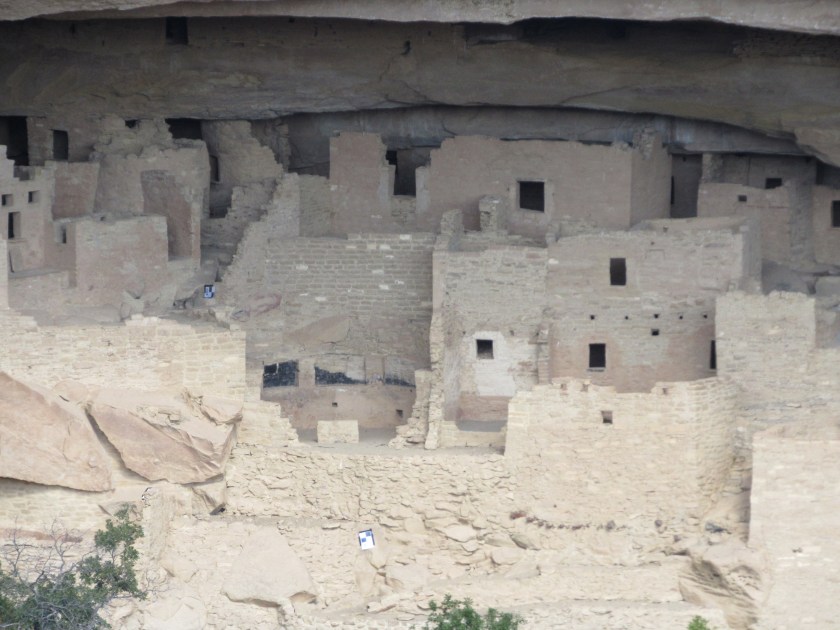
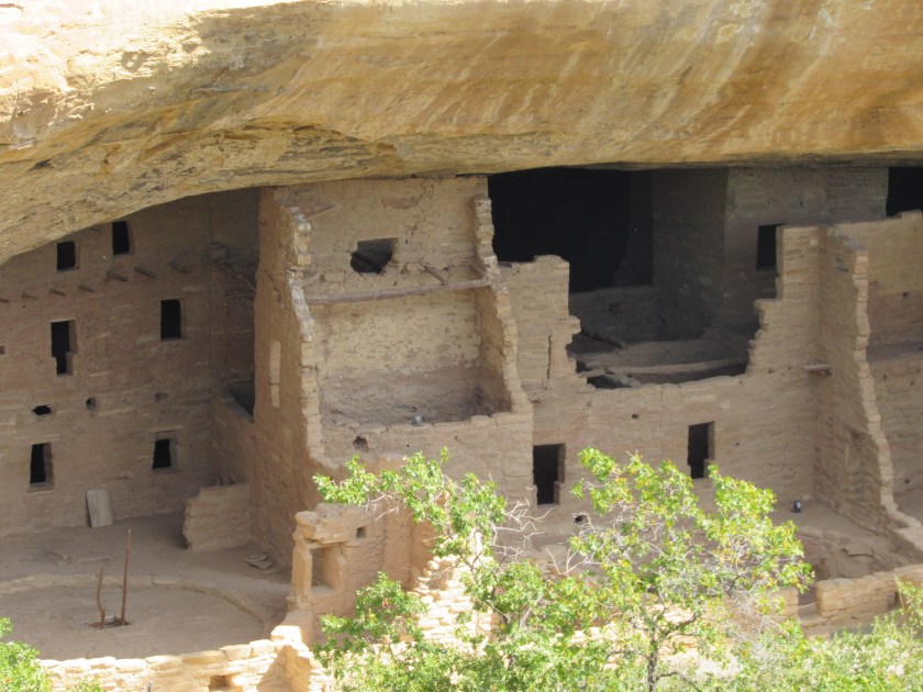
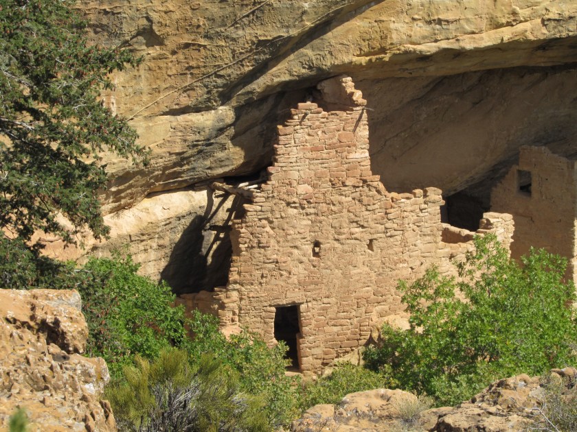
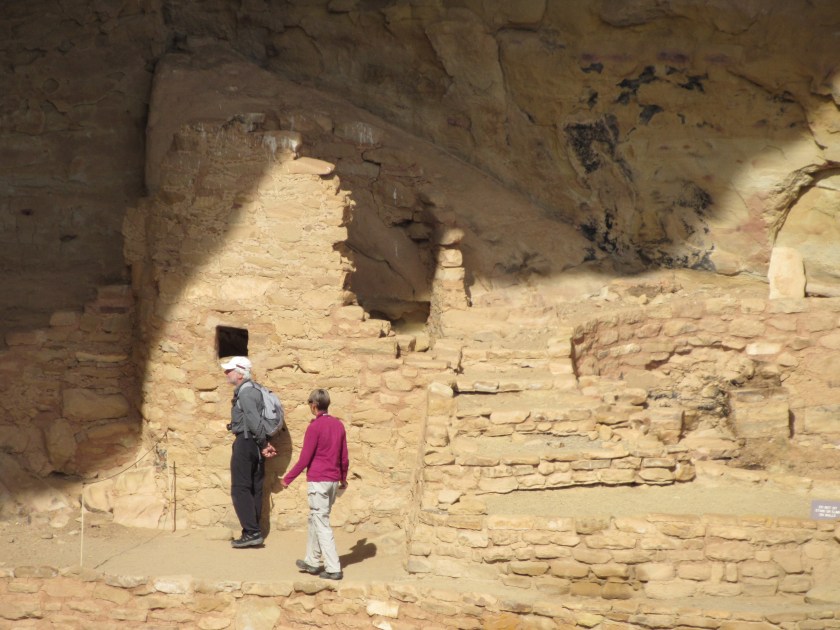
Once I got to the dwelling there was a ranger there to answer questions about what I was seeing.  My first question was, before the nice path that the Civilian Conservation Corps built, how did the people who lived here get in and out?  He pointed out the original “steps” (which is why they call this Step House).

IMG_20171001_115721371_HDR

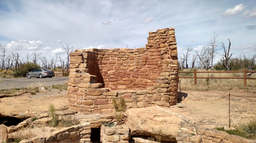
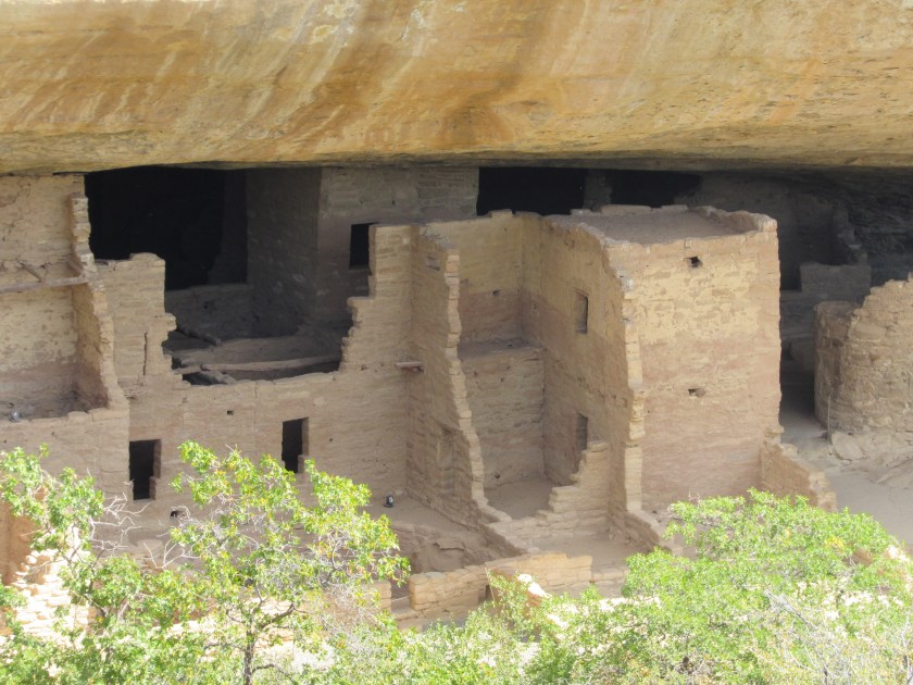
I know it looks like I was holding the camera crooked but keep in mind that the cliff roof curves out over the dwelling and over open space.  I assure you, this is with the camera held straight.  The sign at the bottom right of the photo shows that I am standing upright.

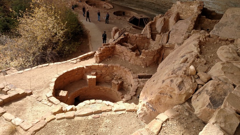
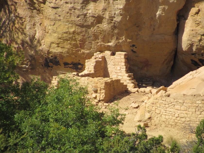
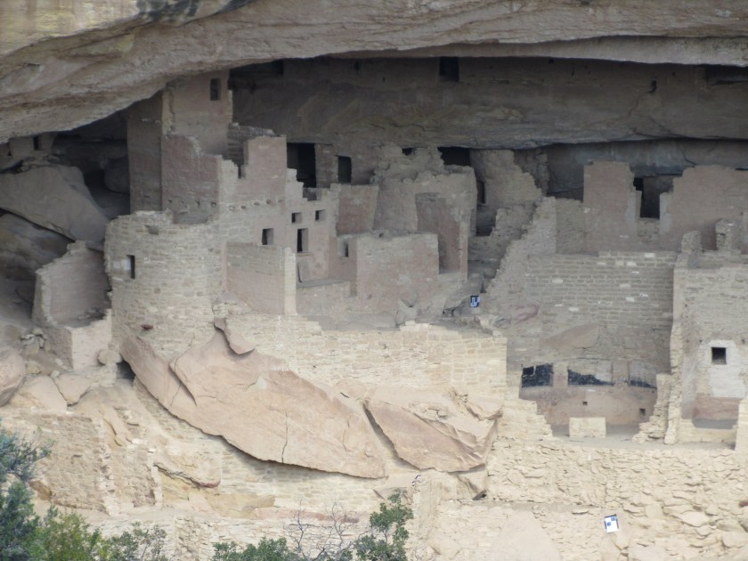
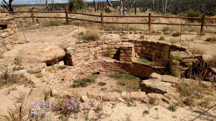
The first things I saw upon getting to the dwelling were two open pits and one pit house.

IMG_20171001_114118607

IMG_20171001_114145848

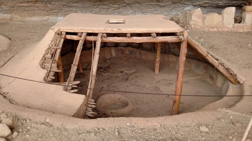
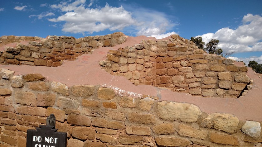
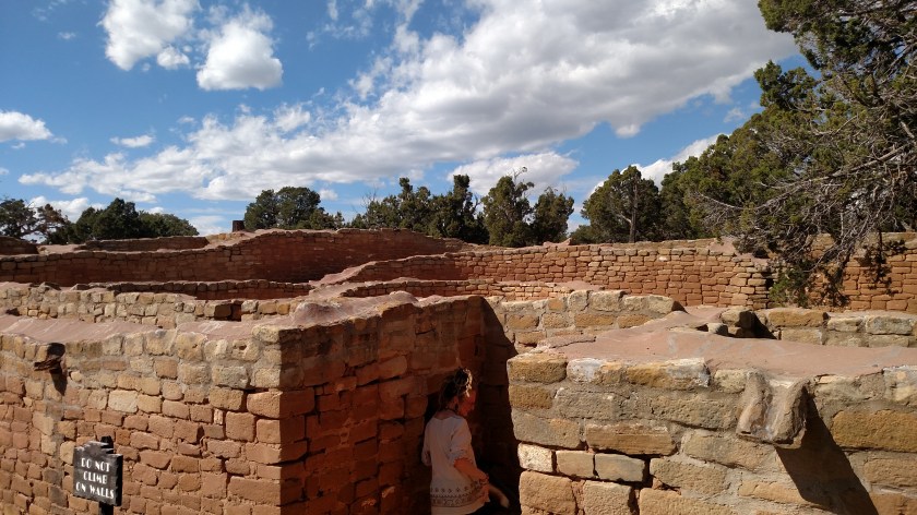
The pit house is like the one Casey, at Canyon de Chelly, had built a miniature of.  It would have been completely enclosed and accessed by a ladder through the hole in the roof.  The ranger told me that there was evidence of logs and other material in this pit which is why they surmised that it had been a pit house.  The roof, as well as the walls on all three pits were reconstructed with the help of folks from National Geographic and a team of archeologists.  The other structures in the dwelling are pretty much as they were found.  There was actually some debris (collapsed walls, etc) which was cleared away and used to help shore up the paths built by the CCC.  Some of the remaining walls may have been reinforced for safety, but other than that everything else is original.

IMG_20171001_114156552

IMG_20171001_114215811

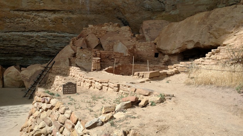
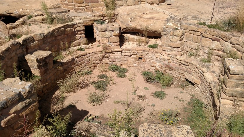
This was after climbing the ladder and was looking back at the three pits.  The ranger is at the left of the photo below:

IMG_20171001_114745819

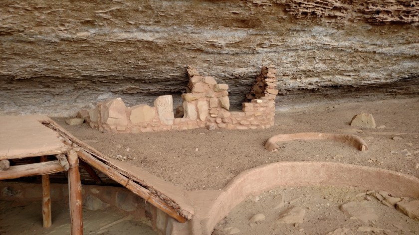
And this ladder wasn’t all that long.  The one I had to climb down on when I was visiting a cliff dwelling in New Mexico back in May was maybe three times longer and, while sturdy, was a little more intimidating.  Other dwelling tours at this Park involve climbing multiple ladders, like this but longer, as well as crawling through tunnels and going through narrow holes and passageways.  They also required longer hikes to get there, which is why I wouldn’t have done them anyway.  Some of the dwellings at this Park are closed for the season, or for special functions or safety reasons.

IMG_20171001_114821337_HDR

IMG_20171001_114938277_HDR

IMG_20171001_114941971

IMG_20171001_115109338

IMG_20171001_115119620

IMG_20171001_115207913


Mesa Verde – Spruce Tree House

This is not a tree house, it is a cliff dwelling located near the Chapin Mesa Archeological Museum in Mesa Verde National Park.  Normally this cliff dwelling would be open for self-guided tours, however the Park has signs up that due to “Rock Fall Hazards” the trail to the dwelling is closed.  Given the unfortunate events at Yosemite National Park in California over the last few days (a tourist killed and several others injured by falling rocks) the Park Service isn’t taking any chances.

There is a parking area off the main road and there are several buildings including a gift shop and snack shop (where I had a great lunch at a reasonable price) and the Archeological Museum.  The photos below were taken from behind the museum, at an overlook which allowed me to view and photograph the dwelling without actually going over to it.  It was maybe 200-300 feet away.

The Spruce Tree House consists of 130 rooms and 8 kivas (the round, largely ceremonial areas).  It is believed to have housed as many as 25 families of Ancient Pueblo People.  That seems to be a general classification for people before Indians began establishing tribes.  One-level cliff dwellings soon gave way to multi-level dwellings and eventually multi-story dwellings like this one.

IMG_20171001_135428028

IMG_20171001_135436976

And since I couldn’t go see the dwelling up close I used the digital camera to zoom in and get some close-up shots:

IMG_0395

IMG_0396

IMG_0397

IMG_0398

IMG_0399

IMG_0400

IMG_0409

IMG_0410

And zoomed in even a little closer of some specific areas to try and show some of the detail:

IMG_0403

IMG_0404

IMG_0405

IMG_0406

IMG_0408