As of Tuesday night I have been on the road 14 weeks. In that time I have put 17,231 miles on my car, compared with 30,686 miles in the first 14 weeks of my “Northwest” trip last year.
As of Tuesday night I have been on the road 14 weeks. In that time I have put 17,231 miles on my car, compared with 30,686 miles in the first 14 weeks of my “Northwest” trip last year.
No photo.
I have been keeping an eye on wildfire activity and there is still no immediate threat to my journey. In two days I am heading up to the northern end of the Olympic Peninsula and will spend some time there visiting Olympic National Park. There is a fire there in the southeast part of the Park, but the roads I will be on are in the extreme northern part so while there may be some visibility and air quality issues, I don’t expect any problems.
Tuesday, when I was away from the water, the visibility in southwest Washington was noticeably worse than it was the day before. There are two fires east of Portland, near the Columbia River and I thought maybe it was coming up from there (they are not very far away from where I am) but a couple visiting the area told me yesterday that they saw on the TV news that this smoke is coming down from Canada, as it did when I visited Oregon last year.
The Carr Fire near Redding California is now at 211,038 acres but is growing very slowly and the city appears to be out of danger. The Mendocino Complex, down near Ukiah, CA where I spent a few nights, is still growing and is now the largest fire in California history. Largely rural, there haven’t been nearly as many homes lost as there were with the Carr Fire.
And Yosemite has reopened to visitors. I looked at their webcams yesterday and while still not ideal, visibility is much better than when that fire first started.
Looking forward, there is a fire in Glacier National Park in northwest Montana but while I will be passing by near there I don’t think it will affect me. There are lots of smaller fires in northern Idaho and western Montana and while I won’t be there until early September I will continue to keep an eye on things.
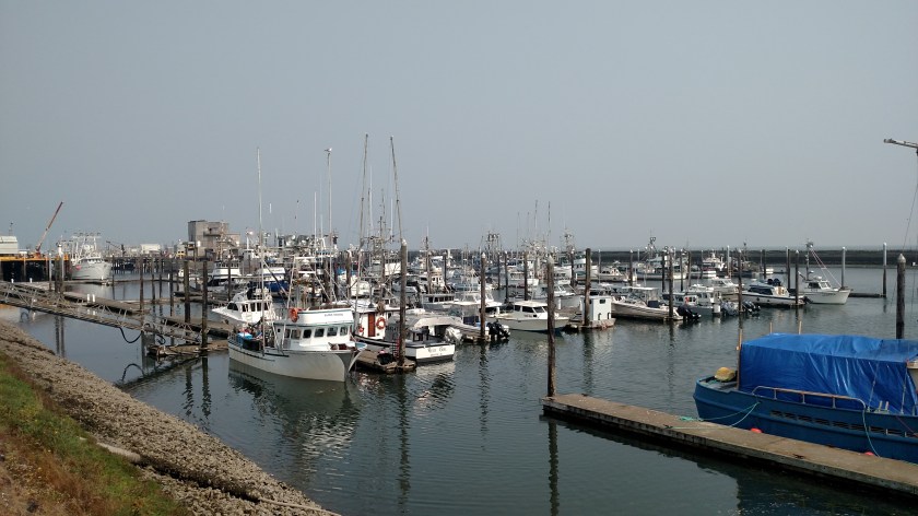
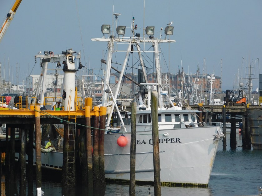
Tuesday I drove up and spent a good part of the day in this harbor town a short distance from where I’m staying in Grayland, Washington. As I determined shortly after I arrived, it is a big fishing port. This was the part of the harbor I saw first, with almost all the boats docked being fishing boats of various sizes.
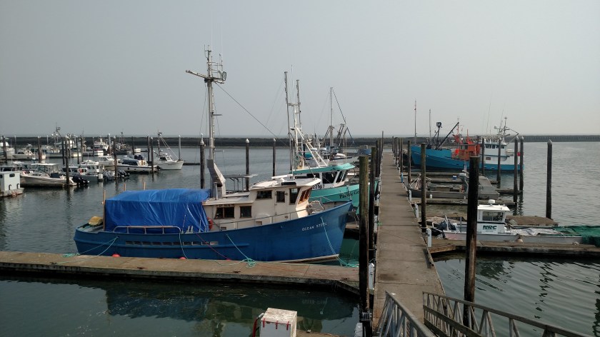
One of the largest I saw was the Sea Clipper, which appeared to be unloading it’s bounty.
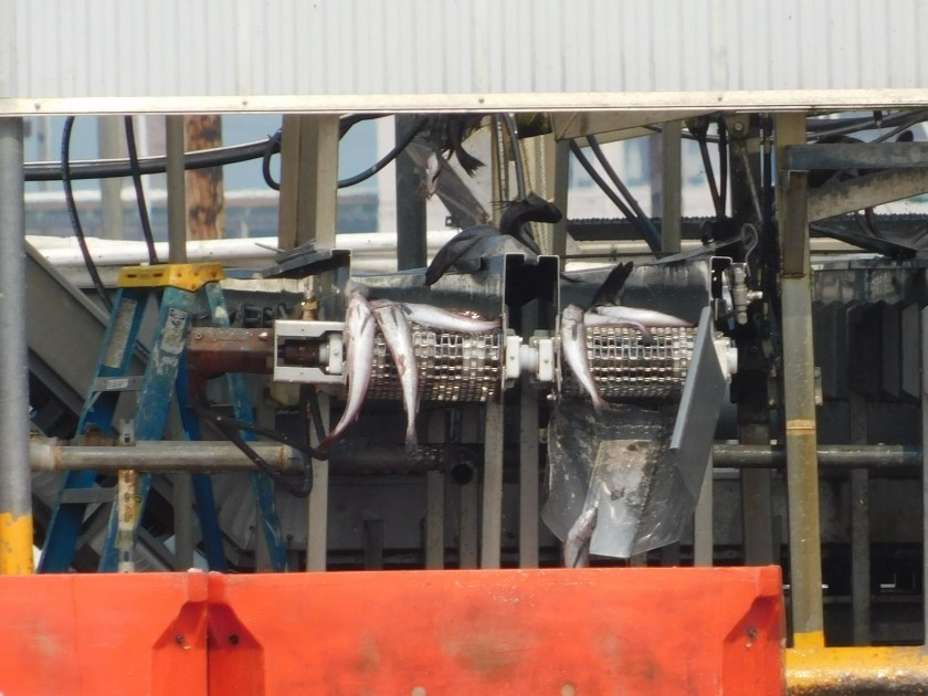
It appeared that large conveyor belts were moving the fish to a series of red and blue plastic containers:
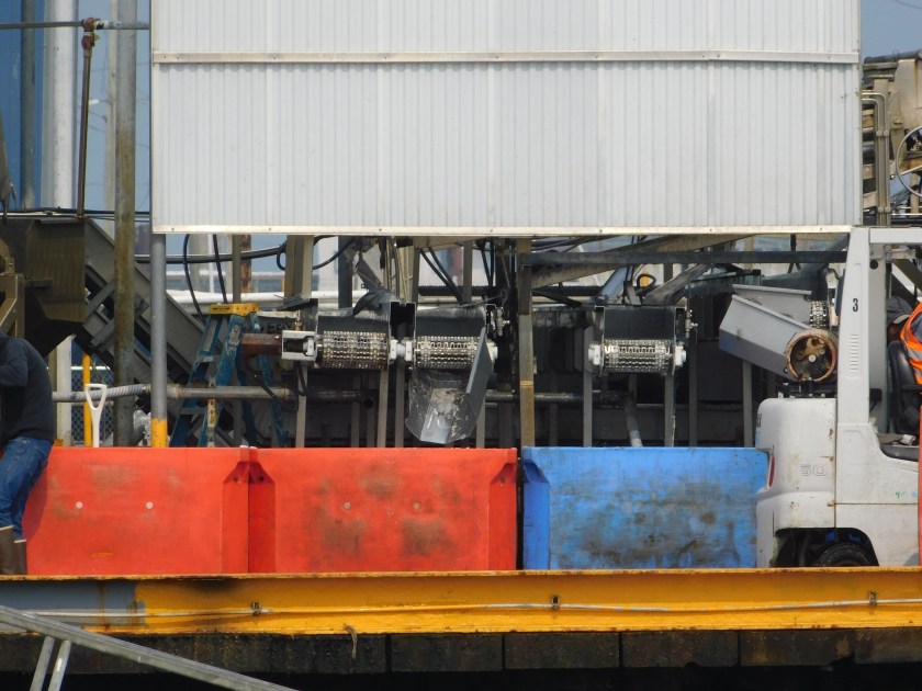
Of course when I took that the flow of fish had stopped. There was a guy shoveling huge amounts of ice into the containers to keep the fish cold, and another guy was driving a forklift, moving the, then very heavy, containers to a warehouse. Here come more fish…

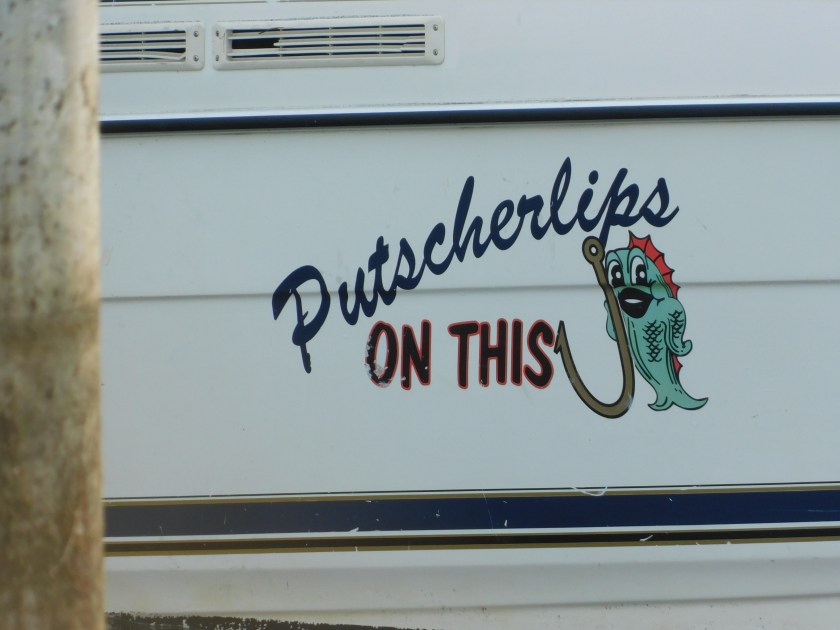
Near where I was watching all this, these guys were putting their private fishing boat back on it’s trailer:


The name of their boat?
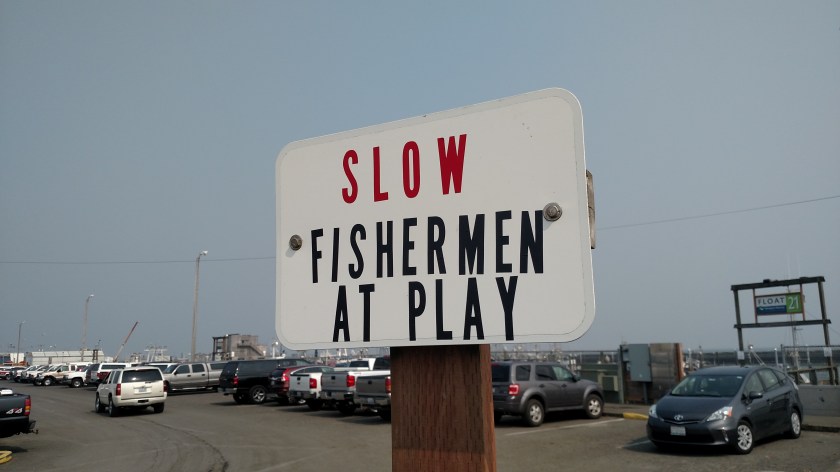
And I saw this makeshift sign near the boat ramp:
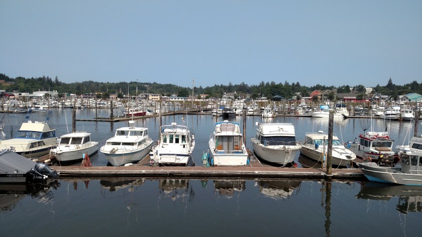
After spending a little more time watching the activity in that part of the harbor I drove out to the main part of town where there are some small motels and several restaurants. I learned that that is where personal pleasure boats are docked and the harbor was much bigger than I first thought. This is from a 3-story tall observation platform located at the end of the main street through town:

That platform also gave me a great view of Grays Harbor, and all the fishing boats coming and going. There was also a huge cargo ship, the Longview Logger, anchored out in the harbor. It looked very much like the ship I saw being loaded with logs down in Coos Bay, Oregon.

And I saw this tugboat, pulling a barge:

There is a Maritime Museum in town:

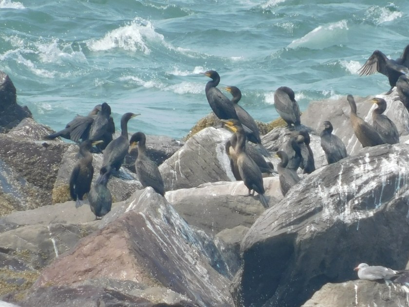
And of course there were shorebirds:
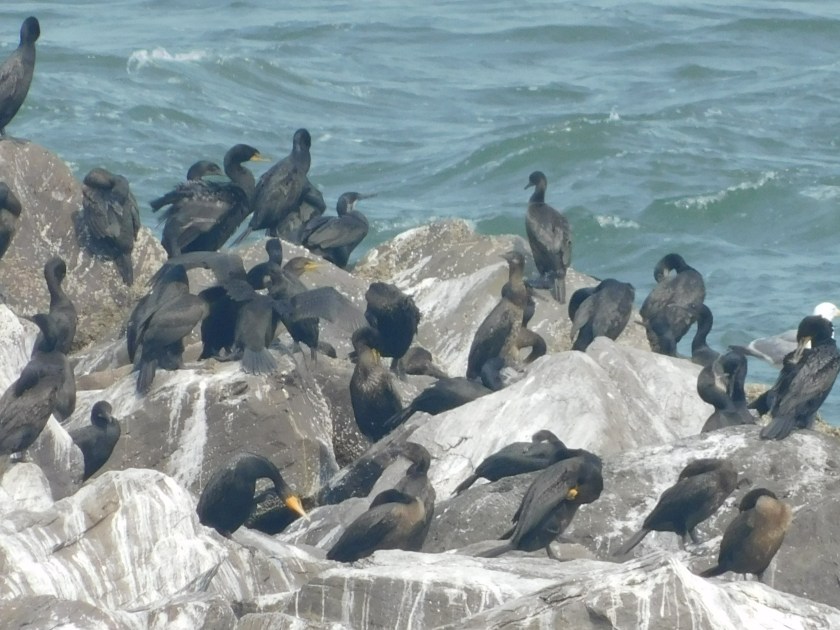
There were a few seagulls in the mix but these were mostly Brandt’s cormorants (with black bills) and Double-Crested cormorants (with yellow bills).
Wednesday I will be driving around to the northeast side of Grays Harbor and will be staying near the town of Hoquiam.
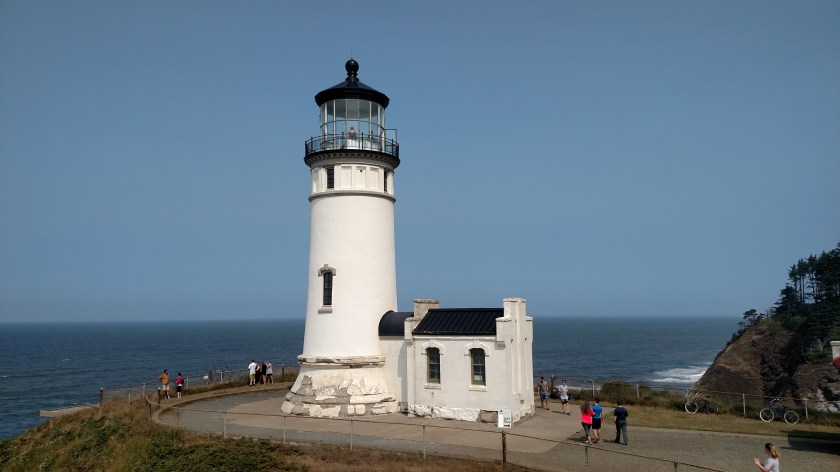
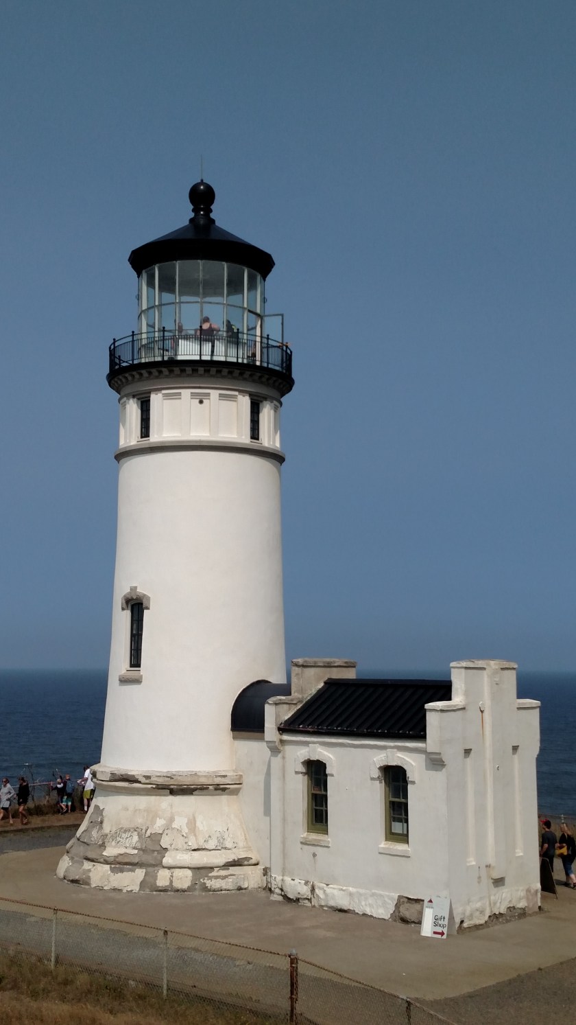
Tuesday I drove up towards Westport, Washington and stopped at this lighthouse a short distance south of town. When it was built in 1898 it was only 400 feet from the ocean but the coastline has been built up as part of a jetty to protect Grays Harbor (one of the few outer-coast harbors in Washington) so it is now about 3,000 feet from the water. At 107 feet in height it is the tallest lighthouse in the state and the third tallest on the west coast.


In 1992 the original light and lens inside the tower was replaced with another type of light (which you can see at the left, near the top of the tower in the second photo above) which only utilizes a 35 watt bulb but, with magnification, can be seen 19 miles out at sea! The original lens is still inside the tower and in 2004 the lighthouse ownership was handed over to a local historical society. They open the facility for tours on weekends.
Monday I drove from where I had spent the weekend in Portland, Oregon north to Astoria, then took the 4-mile long Astoria-Megler bridge over the mighty Columbia River to Washington State. I then headed west to the little town of Ilwaco. This was the port there:


Believe me, Ilwaco isn’t a very big town but because it is right next to the mouth of the Columbia River it’s port is a very busy place.
Next I headed into Cape Disappointment State Park to see the lighthouses (see next post). There is also US Coast Guard base here.

While Coast Guard helicopters and other aircraft are based at the Astoria Coast Guard facility on the Oregon side of the river, this base specializes in water rescue. It is the home of the elite National Motor Lifeboat School which trains personnel from other bases around the country in rough weather and surf rescue operations. It has 9 search and rescue boats which can function in the difficult and life-threatening conditions which often exist in this area.
And let me try to explain how Cape Disappointment got it’s name. In 1775 a Spanish cargo ship was in this area and it’s captain noticed the unusual currents which were affecting his boat. Much of his crew was ill and he didn’t have time to research it further but made note of it. In 1788 another ship came to the area to look into this mysterious occurrence but was unable to replicate it and became disenchanted with this huge waste of time. That captain, of an English vessel, deduced that the “currents” were merely from a sound and not a river, and named the sound “Deception Bay” and the high point on the land “Cape Disappointment” and left in a huff. It wasn’t until 1792 that an American captain, Robert Gray, successfully crossed the Columbia River Bar and discovered the mighty Columbia River which he named after his ship, the Columbia Rediviva.
And yes, lighthouses plural is correct. Because of it’s proximity to the treacherous Columbia River Bar this location has two lighthouses within two miles of each other.
The Cape Disappointment lighthouse was built in 1856. It is 53 feet tall and sits high atop a hill on the north side of the mouth of the Columbia River.
Because of it’s location I could only get pictures from far away (the photo above was taken from the Visitor Center, about a half mile away) or from very close to it. The building you see next to it is for US Coast Guard personnel to keep a visual watch on the sometimes treacherous Columbia River Bar just offshore.


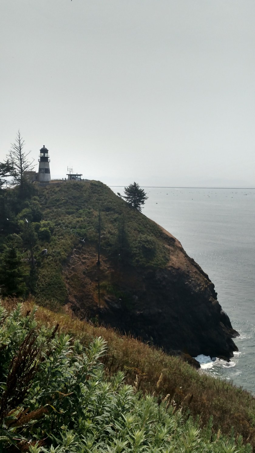
The problem with this lighthouse was that ships approaching from the north, places like Seattle and Alaska, couldn’t see it. A decision was made to construct a second lighthouse, called the North Head lighthouse, just two miles north of this one. It was first illuminated in 1898. It is 65 feet tall and sits at 190 feet above sea level. The lighthouses emit different pulses of light so ships can tell them apart.
The North Head lighthouse structure is now under the purview of the Washington State Park Service (both lighthouses are located within Cape Disappointment State Park). The actual lighthouse operations (both are still in use) are conducted by the Coast Guard, which has a base adjacent to the Park.
Monday I visited this museum, located in Long Beach, Washington. Long Beach is a very small beach town located in extreme southwestern Washington which has the honor of hosting the Washington State International Kite Festival each year (the 2018 edition is being held for 7 days starting next Monday, August 20).
Before we go up to the second floor to look at the kites, there were several interesting things to see on the ground floor of the museum.
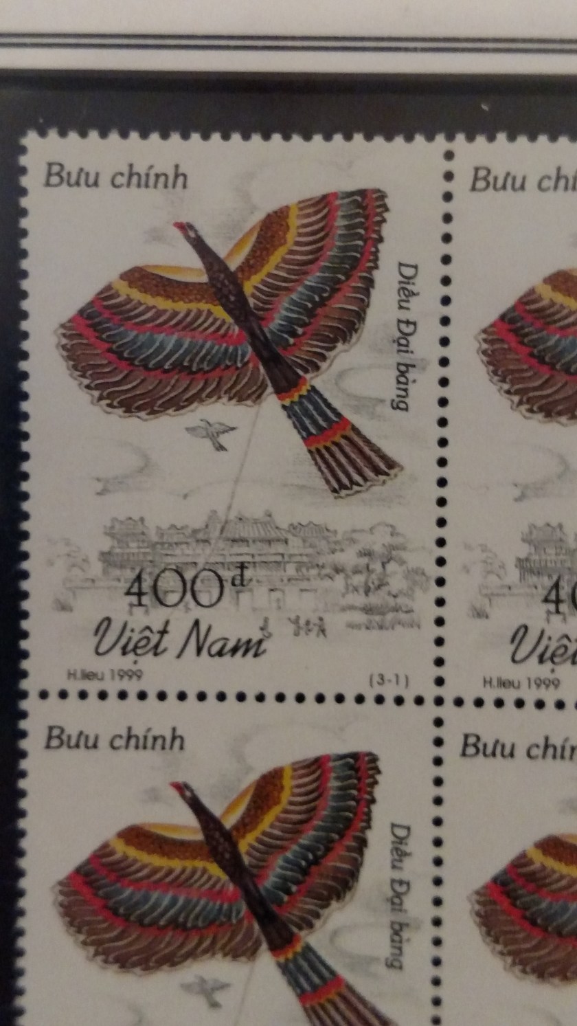
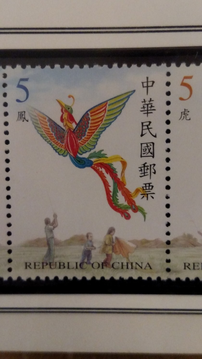
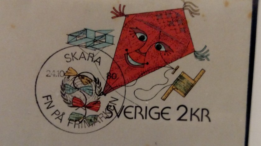
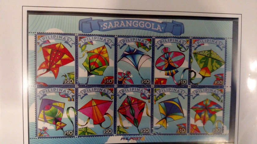
A local stamp collector put together a group of stamps from around the world which had images of kites on them – and there were lots of them. Stamps from other countries are often very elaborate and very colorful. I thought this was a very clever idea. Here are some of my favorites:


Next is a series of posters celebrating festivals from previous years. First, here is the poster for the upcoming festival, the 38th annual:

(Poster artist: Mimi Noyes)
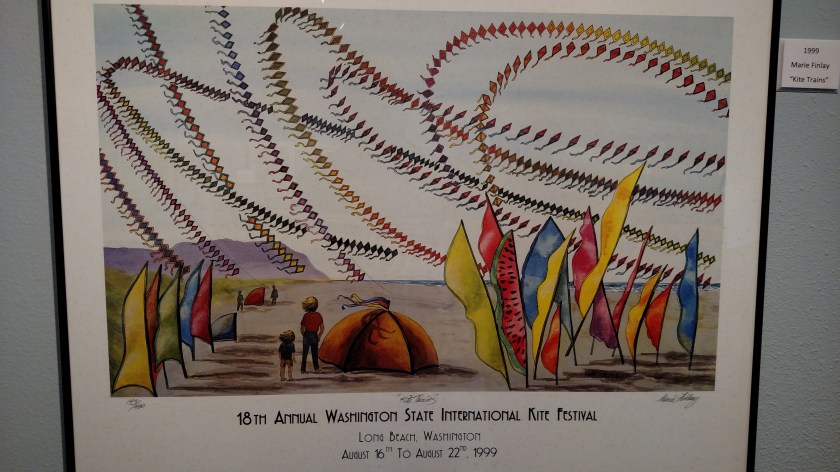
(Poster artist: Marie Finlay)
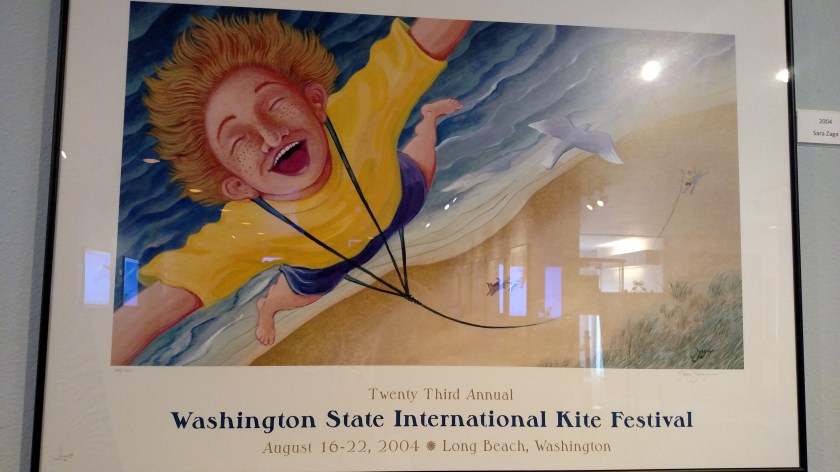
(Poster artist: Sara Zaga)

(Poster artist: Patricia Fagerland)
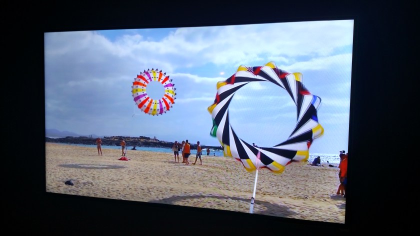
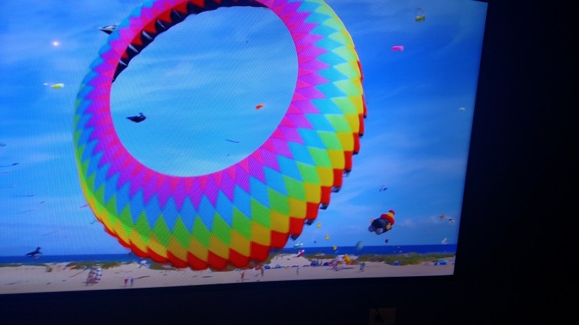
And finally, there was a large video screen running a series of high definition videos of kite flying in action:


Here are some of the unusually shaped kites I saw at the World Kite Museum in Long Beach, Washington on Monday. Evidently kite technology has come a long way since I was a kid…
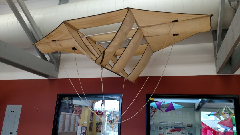
These are two angles of the same kite which was hanging above the stairs leading up to the second floor of the museum:
And these are two angles of the same kite which was resting up against a wall upstairs. It is huge (floor to ceiling).


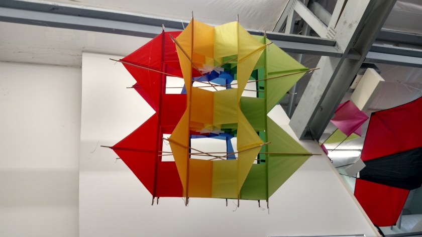
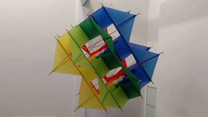
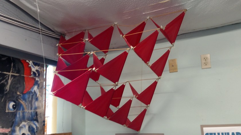
And here are some other kites which were hanging from the ceiling:


And there was a place where kids could build their own, conventional kite:
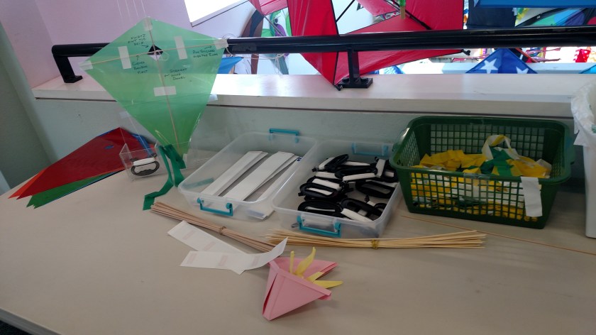
And no, I didn’t.
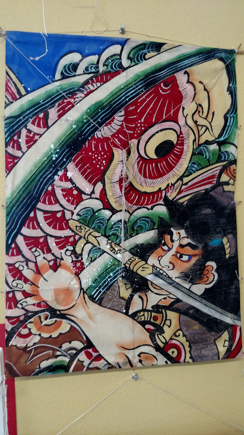
Another interesting display at the World Kite Museum in Long Beach, Washington which I visited on Monday was the section devoted to Japanese, and other oriental kite-makers. These were very elaborate and colorful in design, and often quite large.
This one was probably 8 or 9 feet tall:
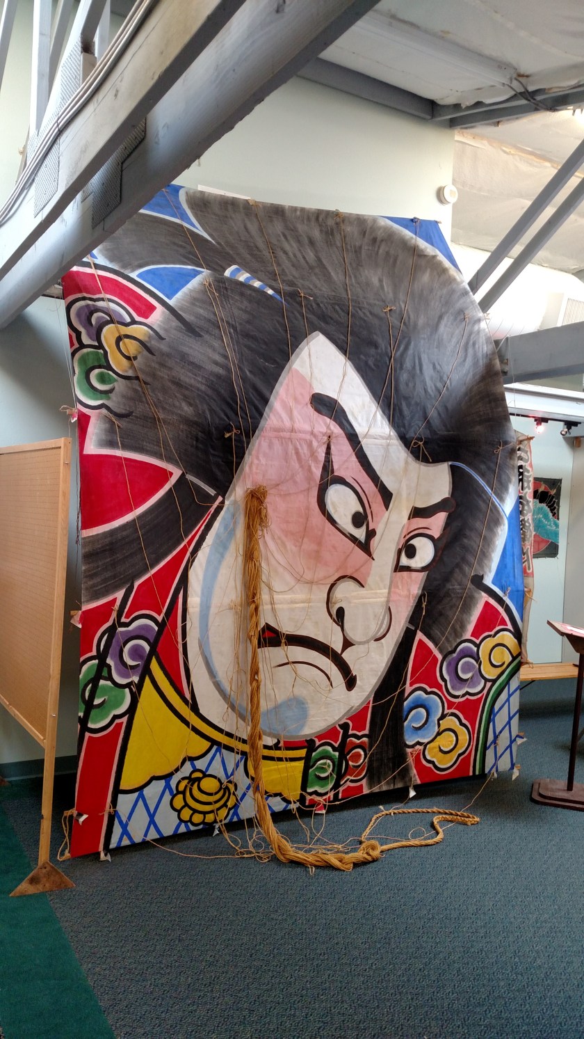
And this one was even bigger, filling a whole window on the second floor of the museum:

This wasn’t as big, but still elaborate:
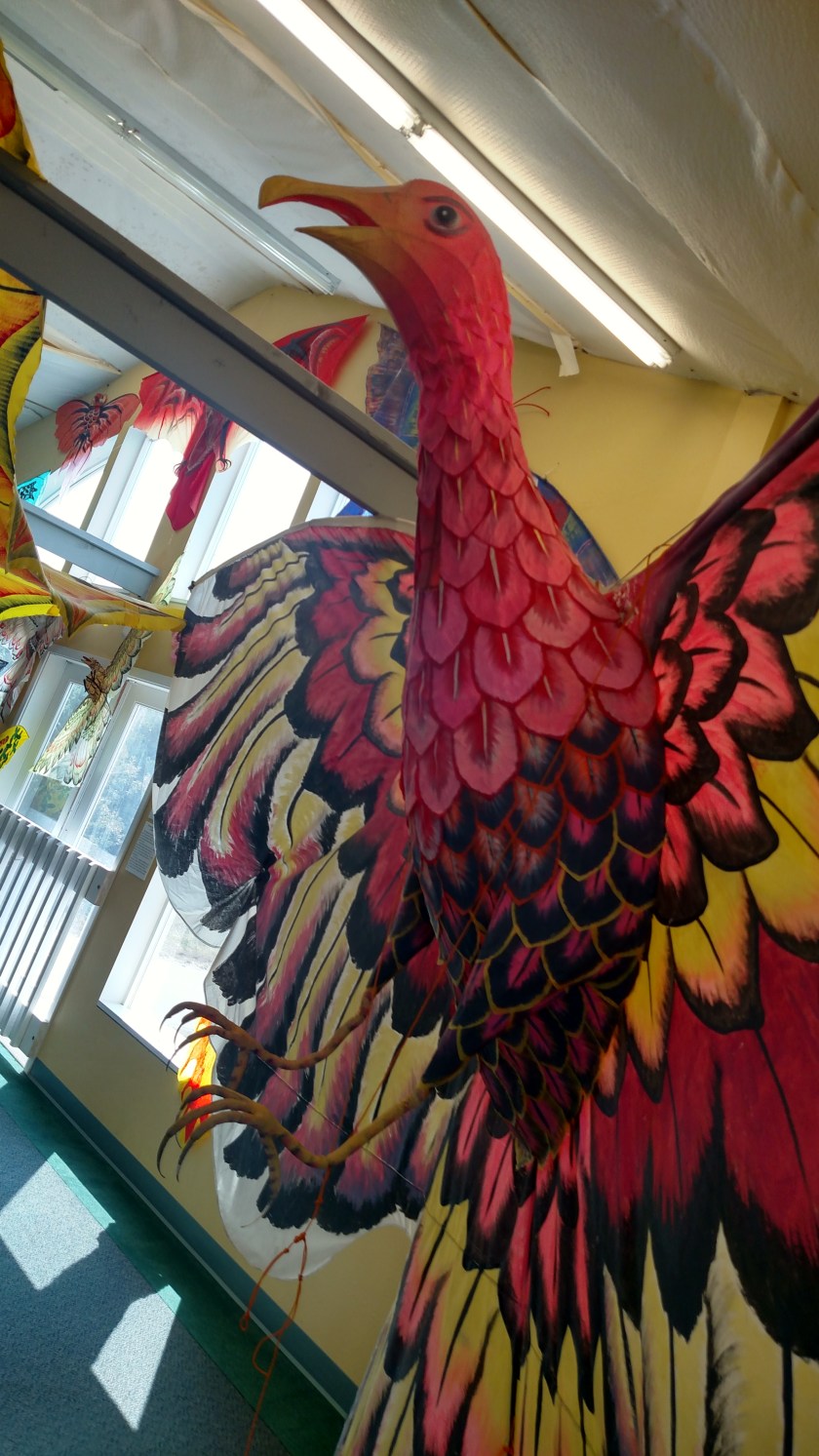
This was one of the largest kites on display – probably 8 feet tall and with a huge wingspan:
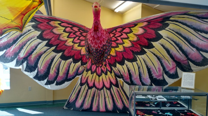
And it was three-dimensional, with the body and talons protruding below it:
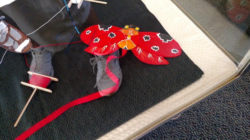
There were some very small kits on display as well. I included the index finger of my left hand touching the glass display case to illustrate how tiny this kite is:

And here is another tiny kite. Please ignore my big feet which I didn’t realize were reflecting in the glass of the display case, and weren’t included to illustrate anything!
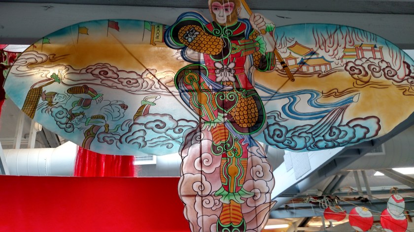
Then there was the “Monkey King” kite, which has a fictional story behind it:
And finally a Dragon kite, with this large, elaborate set of three heads – connected by bamboo:
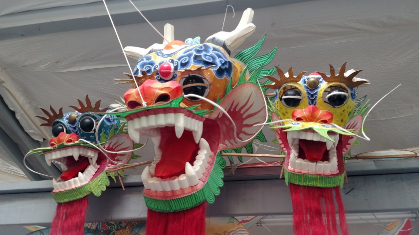
Parts of these heads were plastic (teeth and eyes, specifically) but the remainder was bamboo sticks over which colorful silk was spread and other adornments attached. Dragon heads are supposedly designed to include parts of 9 different animals.
But wait – there’s more…..
This Dragon kite is actually called a “centipede” kite in that a very long tail of long bamboo sticks with thin, lightweight material designed to catch the wind and extend the tail behind the heads. The picture doesn’t do it justice but this centipede tail would VERY long when fully extended.

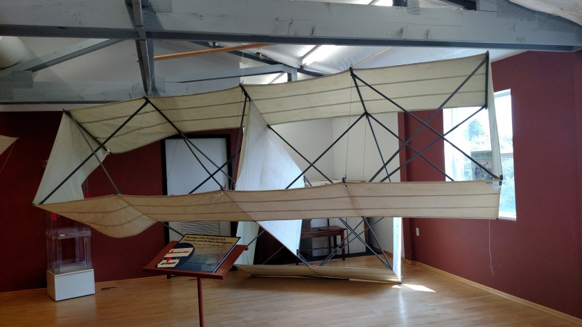
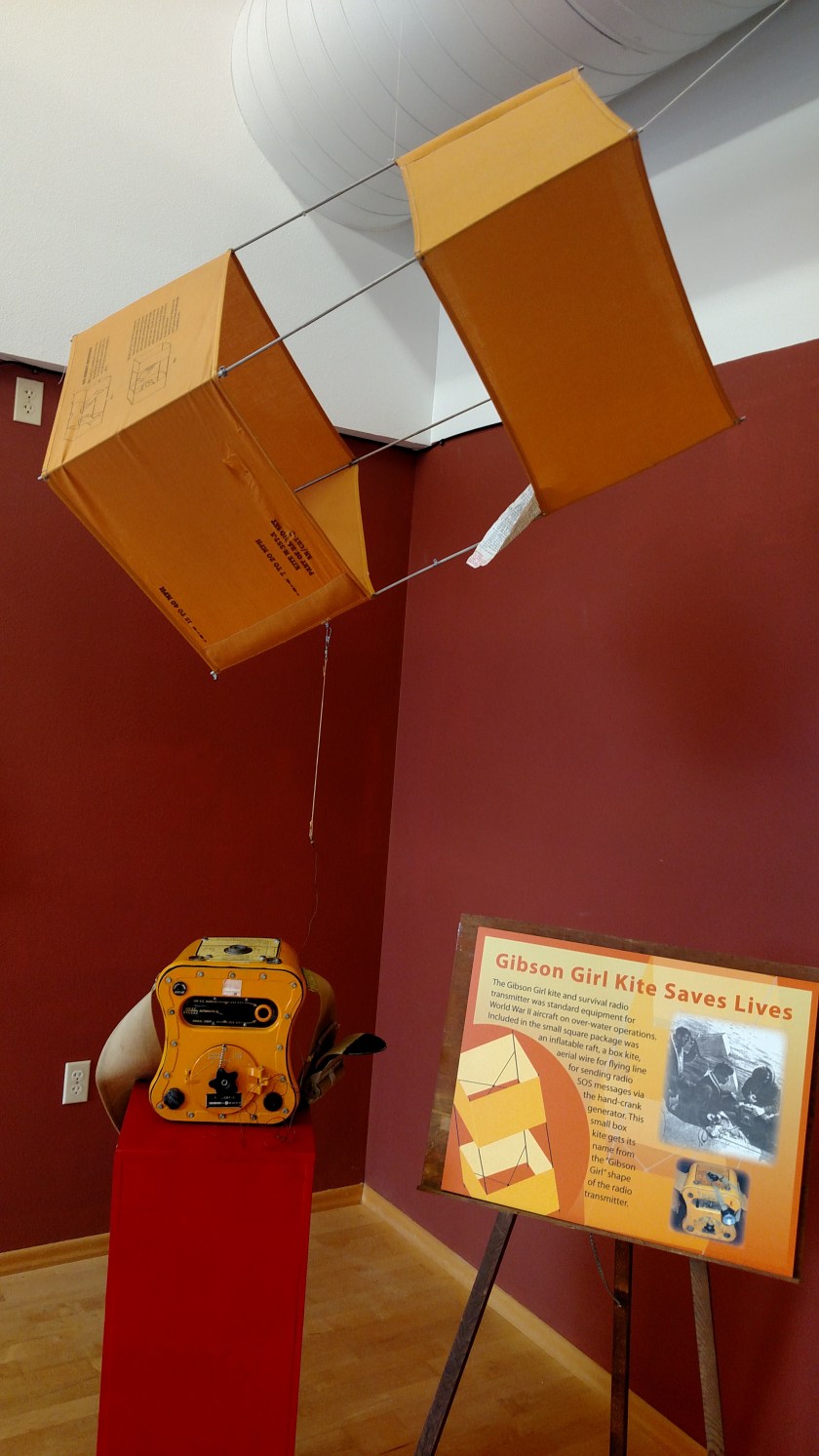
Another interesting part of my visit to the World Kite Museum in Long Beach, Washington on Monday was an area which explained how kites were used by the military, especially during World War II.
Ordinary shaped kites had the image of enemy aircraft painted on them and were then flown to help ground based troops practice firing their weapons at the “planes,” which would then appear at the small size of the real planes they’d be firing at.

Aircraft flying over water were all equipped with a raft, a hand-cranked emergency radio and a box kite which would be assembled and flown to raise the radio antenna to call for help. These saved the lives of countless men who were then rescued.
This unusually shaped kite was flown, then “snagged” by an airplane to deliver mail, maps or orders to ships at sea or troops in the field.
And this large kite would be flown high in the air and 2,000 foot lengths of piano wire would hang below it, literally tearing enemy aircraft which flew through it apart.