Colorado Wolf Center -Overview

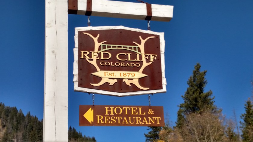
This is the full name of the facility:

IMG_1369

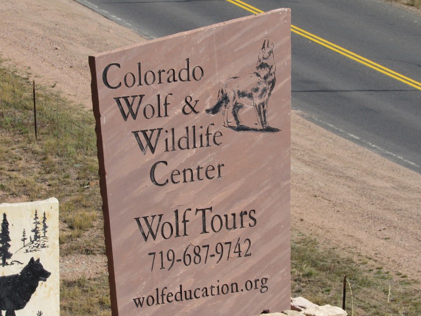
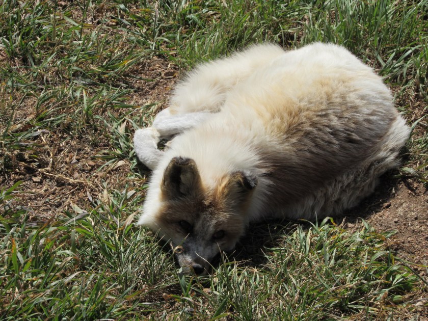
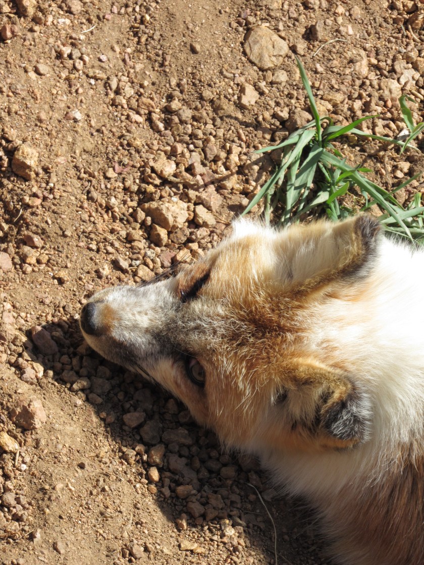
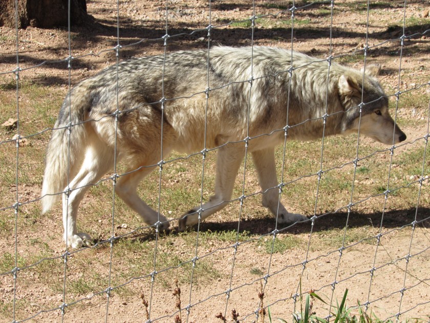
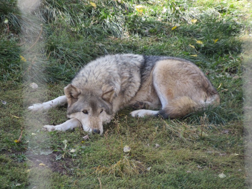
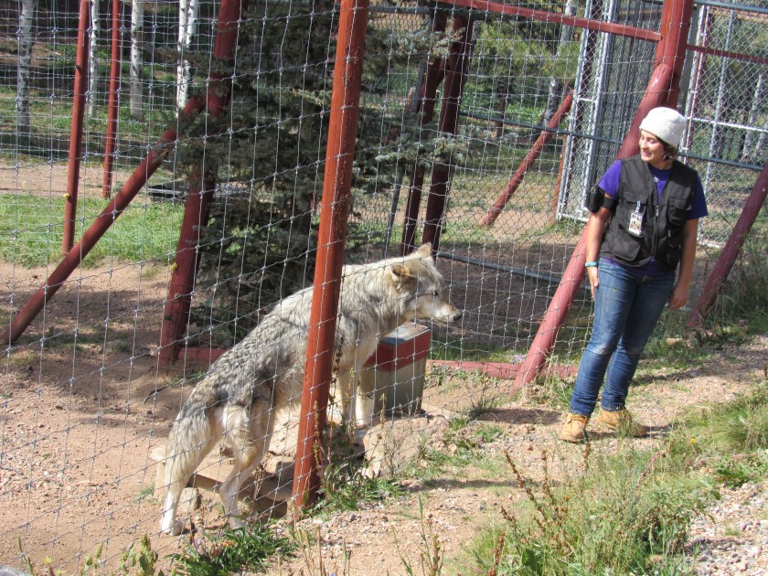
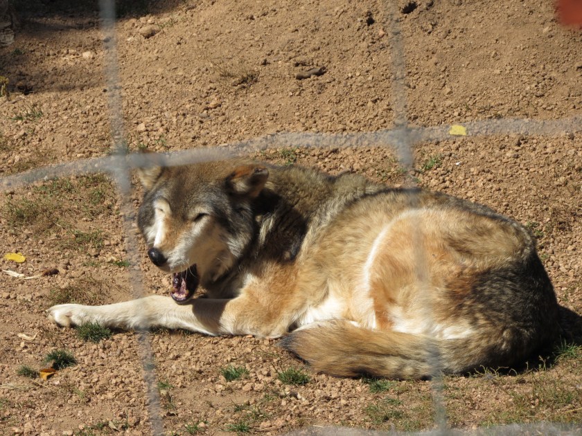
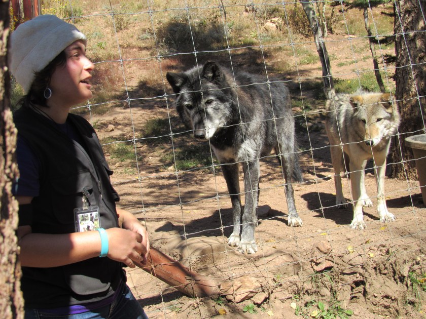
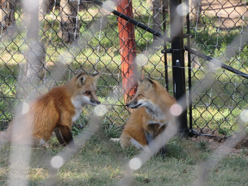
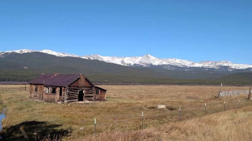
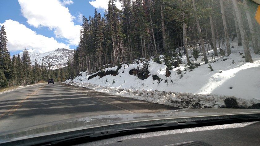
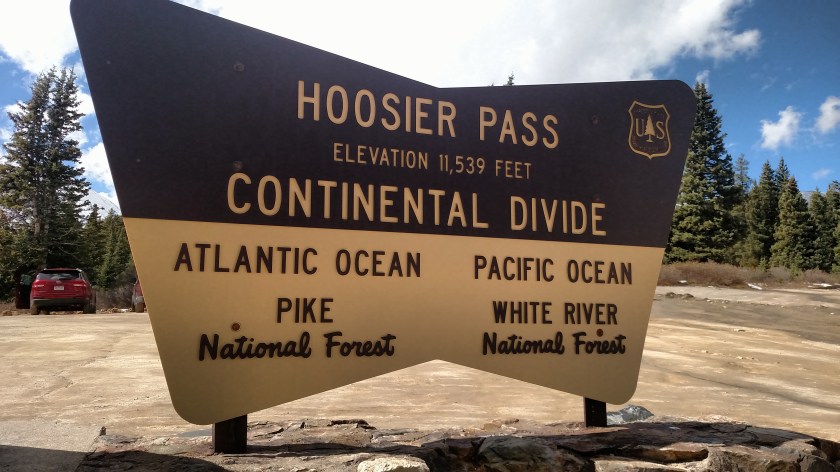
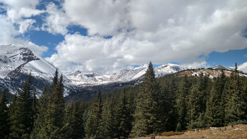
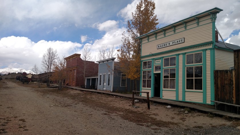
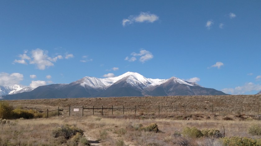
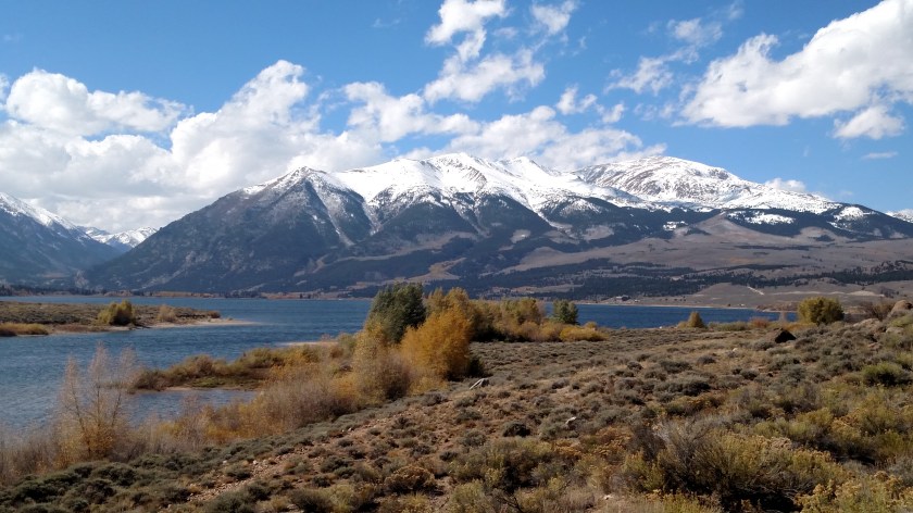
It is a 50-acre sanctuary located near the little town of Divide, Colorado, about 45 minutes west of Colorado Springs.  I had driven out here when I was in the area about a month ago but had just missed the start of a tour and didn’t want to wait around for the next one.  It was also quite hot that day and the few enclosures I could see from the parking lot appeared to be empty, as the animals were either down by the fenceline near the tour group (getting fed treats) or resting in the shade.  It was relatively cool today and the animals seemed to be much more active.

This facility is intended to provide a safe place for the animals and educate the public on their habits and efforts to preserve them.  Several types of wolves are endangered and this facility also helps rehabilitate animals which may have been injured or, in the case of wolf-dog hybrids which some people try to keep as pets, have been abused, neglected or abandoned.

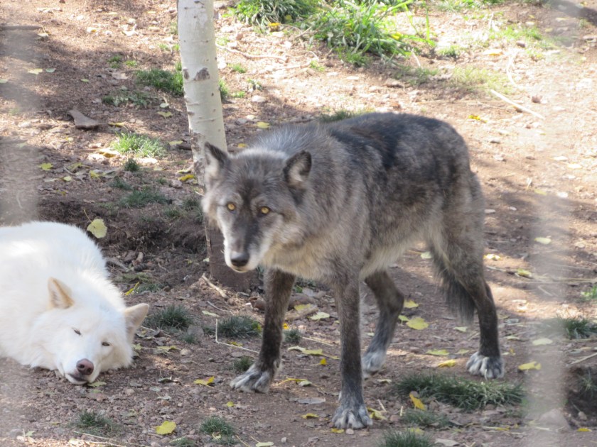
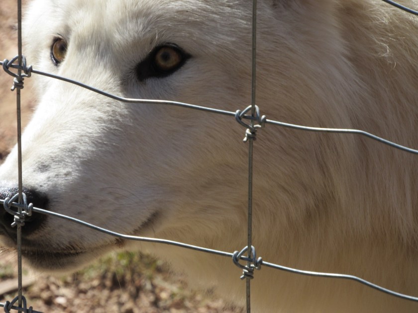
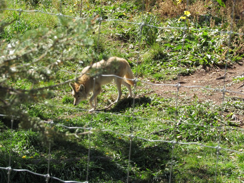
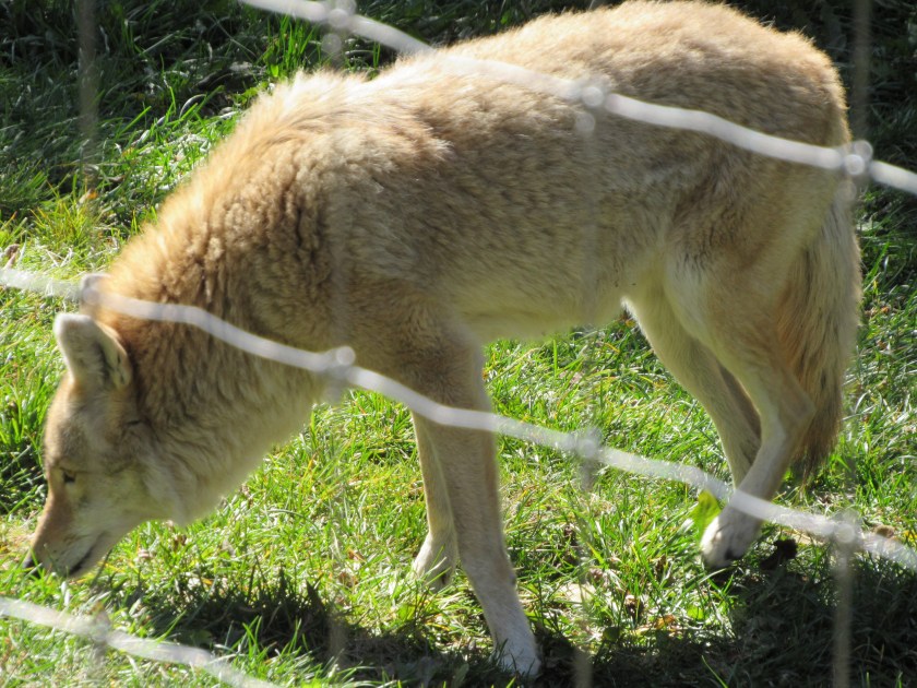
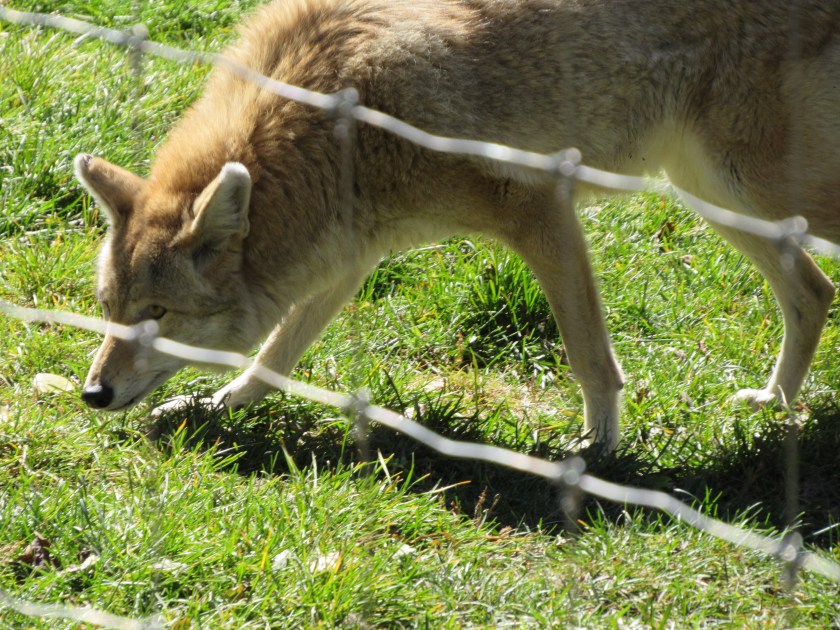
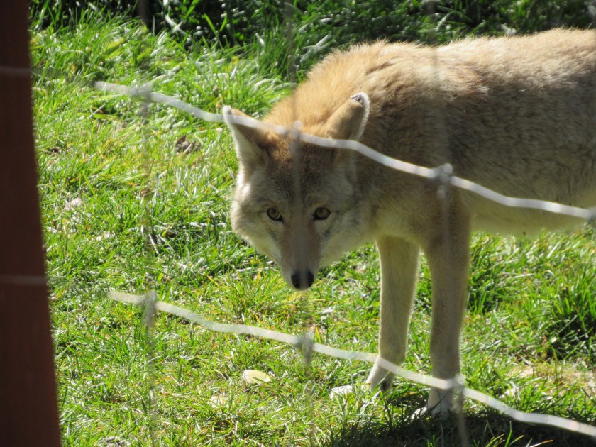
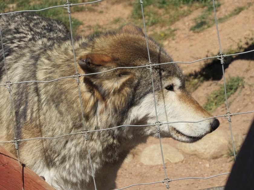
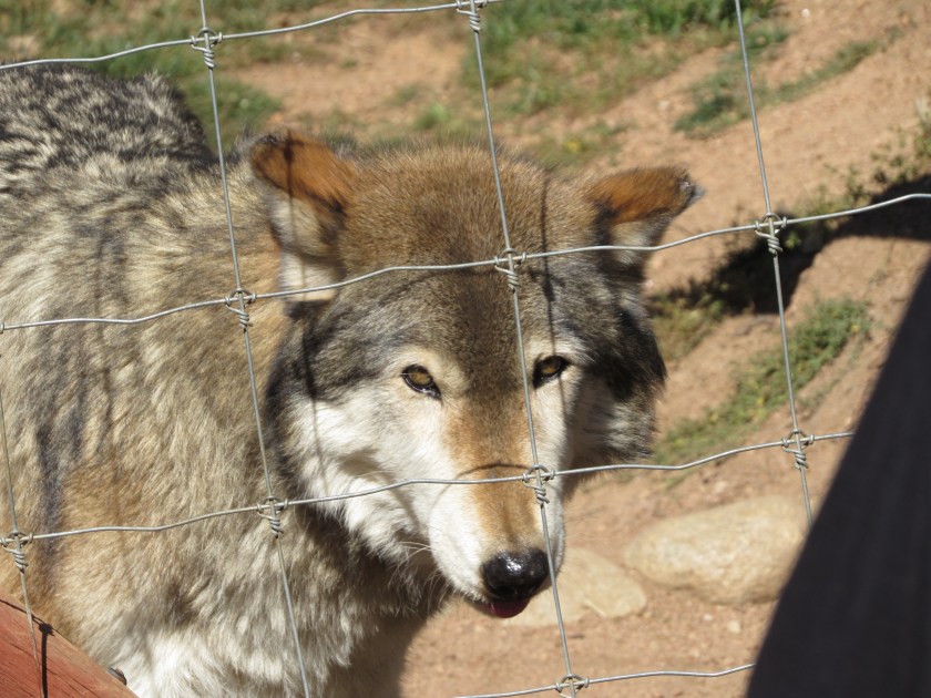
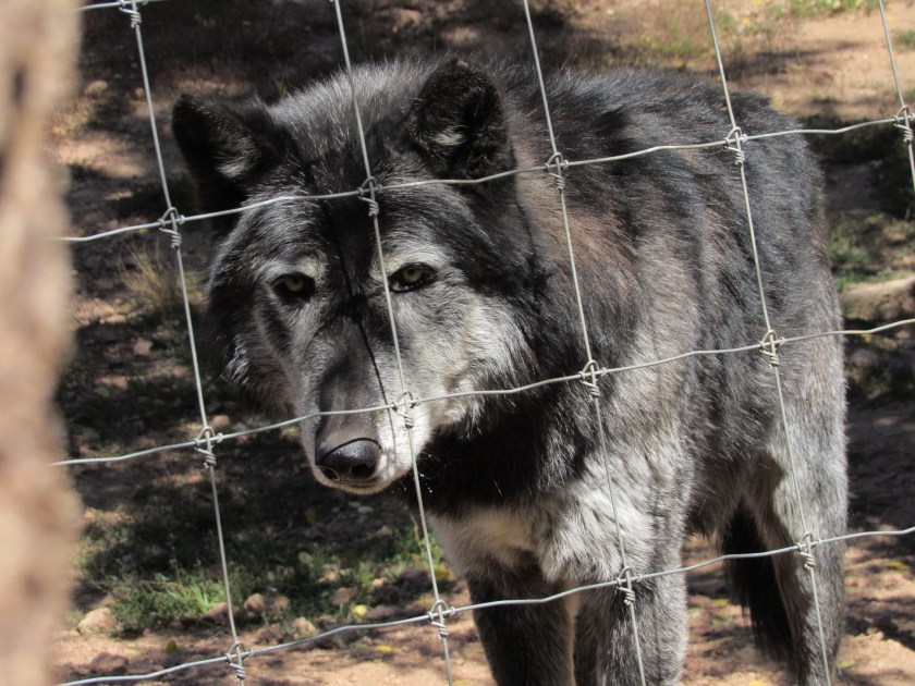
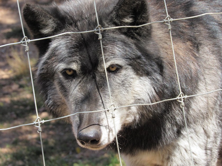
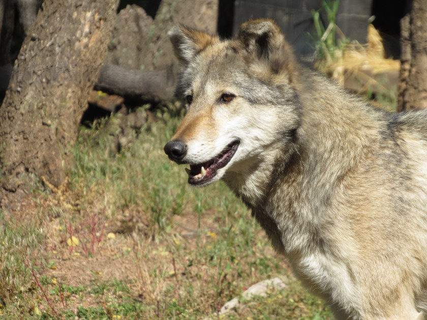
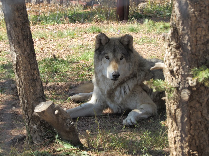
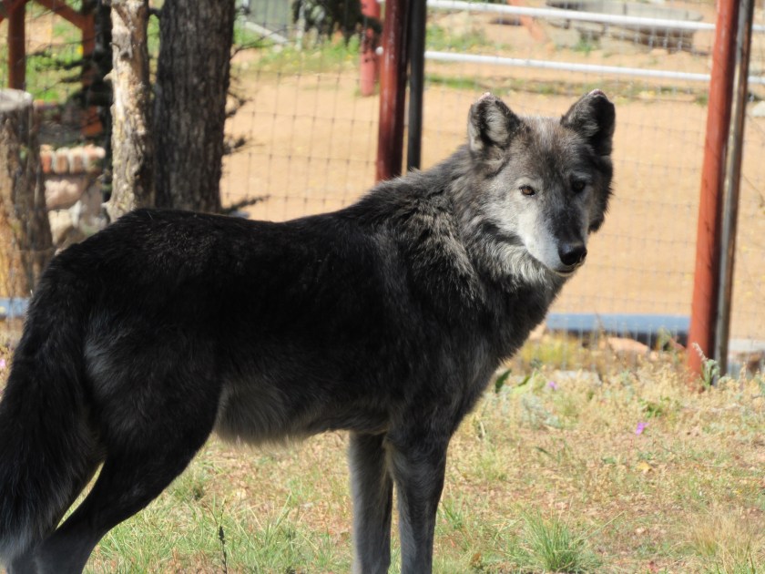
There are several types of animals here, mostly wolves but also foxes and coyotes.  They have red foxes, swift foxes (I tried twice but never saw any of them), timber (or gray) wolves, arctic wolves, endangered Mexican gray wolves, and coyotes.  The only type of wolf they don’t have here is the endangered red wolf.

Here are the ordering rules for the various animals:

Wolves – Males are classed as Alpha, Beta or Omega with Alpha’s as the leaders of the pack.  Alpha Males and Alpha Females are the only ones to breed.  Betas and Omegas serve lesser roles within the pack.  Females are also classed as Alpha, Beta or Omega, and are sometimes referred to as a She-Wolf.  Young wolves are called Pups or Whelps.  A group of wolves is called a Pack or Route.

Foxes – This is a little more complicated.  Males are called Dogs, Tods or Reynards.  Females are called Vixens.  Young foxes are called Kits, Cubs or Pups.  A group of foxes is called a Skulk, Leash or Earth.

Coyotes are simple – Males are called Dogs.  Females are called Bitches. Young coyotes are called Pups.  A group of coyotes is called a Band.

A coyote’s howl contains “yips” and is a fairly high pitch.  A wolf’s howl is deeper and more “mournful”.

Wolves average 50-100 pounds.  Coyotes are smaller, averaging 25-45 pounds.

Timber wolves are found lots of places, but mainly the upper Great Lakes, the Pacific Northwest, and in Alaska (in the US).  Arctic wolves are found in Alaska (in the US).  Red wolves are now found only in North Carolina and are on the “Critically Endangered” list.  Mexican Gray wolves are now found only in Arizona and New Mexico (in the US) and are also on the “Critically Endangered” list, though they are thought to be making a slight comeback.  I saw signs various places in those two states advising people how to behave if they encountered them, and to report any action that needed to be taken against them in the event of any contact or very close encounters.

Colorado Wolf Center (1/3)

Here is the first group of pictures I took on Friday.  There was a red fox enclosure right next to the Visitor Center and that is where the tour started.  This fox is actually a cross-breed with an Arctic Fox so it’s coat is much lighter in color.  It was laying curled up in the sun but would occasionally move it’s head around and look up at us.

IMG_1111

IMG_1142

You’ll see red red foxes at the end of the third picture post.

Next we went past several very large enclosures which had a variety of types of wolves, as well as one with coyotes.  The only type of wolf I mentioned which they do not have here are red wolves which, ironically, are now only found in North Carolina.  They are on the “critically endangered” list and there are believed to be less than 50 left, mostly falling prey to human hunters.

You’ll see coyotes at the start of picture post 2, but here are some of the wolves.  All of the enclosures had the names of the animals listed although I was so busy taking pictures that I don’t remember which is the male and which is the female, and I won’t try to associate names and faces.  There were signs at some, but not all, enclosures which gave details about what type of wolves you were seeing and information about them.

If you want to see more pictures and learn the names, and the meaning of the names, go to their website at wolfeducation.org.  There you’ll find bio’s of the current, and past, animal population here at the Center.

IMG_1147

IMG_1153

IMG_1160

Here is one of the wolves at the fence near our guide, Chantae, who would give them treats.  She is about 5′ 5″ so that gives you some idea how big the wolf is.  Coyotes are generally around 25-45 pounds and wolves are generally twice that big, averaging 50-100 pounds.

IMG_1165

IMG_1175

IMG_1192

IMG_1195

IMG_1203

Colorado Wolf Center (2/3)

Here are more pictures I took on Friday.

The coyotes stayed up at the top of the hill and away from us most of the time.  This one did meander down the hill briefly but soon retreated.

IMG_1213

IMG_1216

IMG_1217

IMG_1218

This male wolf was taking a siesta in the sun.  The female was much more active and stayed by the fenceline for treats.  The animals are fed their main meal in the evening.  The “feeding tour” is more expensive that the regular tour, as is the “full moon” night-time tour.

IMG_1228

IMG_1233

IMG_1240

IMG_1241

IMG_1246

IMG_1252

IMG_1253

Colorado Wolf Center (3/3)

Here is the final set of pictures I took on Friday

IMG_1256

IMG_1258

IMG_1259

IMG_1260

They constantly watched Chantae’s hands, waiting patiently for her to throw them another treat.

IMG_1268

IMG_1300

The last enclosure contained two wolves who are not very comfortable around people and they never approached the fenceline as the others did.  Their names and information panel was at the bottom of the hill (I thought we’d be going out that way but we didn’t) and I wasn’t allowed back down there unescorted.

IMG_1312

IMG_1317

IMG_1326

When we were done with the tour Chantae lead us through a “group howl”.  She demonstrated how we were to do it and on the count of three we all howled (there were about 20 of us on the tour).  Sure enough, the animals howled back and they took turns, answering one another, with the sound going back and forth around the various enclosures for about two minutes.

As I was walking back to my car these two red foxes had come out of hiding and were playing, although as soon as I got the camera ready the one on the right laid down and the other started cleaning and grooming it.  The close fencing (a tighter pattern than on the wolf enclosures) also made it difficult to get a clear shot.

IMG_1358

I used to see red foxes on the property of the farm house I lived in for several years before moving into my current apartment in Durham.  I also heard coyotes howling during the night the last year I lived up there and discovered that there was a den just a few hundred yards up the hill from the house.  Once I knew they were there I would see them occasionally but they always kept their distance.

I’m really glad I went back to this facility as I enjoyed seeing and learning about the various animals.  Yes, they are in captivity but they are very well cared for and seem to be happy where they are, unlike animals I have seen in many zoos who act like they’d much rather be somewhere else.

Children, stop your bickering

(No picture)

When I resumed my scenic drive north of Salida today the first town I came to after proceeding past the turnoff to Independence Pass was Leadville (Lead is pronounced like lead in a pencil).  In addition to being a mining town, Leadville has a feature which most towns don’t, but others are trying to steal the spotlight.

Leadville is the highest incorporated city in the United States (10,152 feet).

There is a town south of Breckenridge, Colorado, Alma, which I went through later in the day which is the highest incorporated town in the United States (10,578 feet).

When I was in Taos, New Mexico about 2 weeks ago I posted that Taos Ski Valley resort is in a village which is the highest municipality in the United States (the highest dwelling there is at 10,350 feet).

There are probably other “highest” claims which would make these comparisons even more confusing but these are the three I have encountered so far and I wanted to point out the distinction between them.


10th Mountain Division

Pam, who was also staying at the Airbnb in Salida, told me about the significance of this memorial, which is located at the entrance to the Ski Cooper resort a few miles north of Leadville, Colorado.  It will require more research that I have time to do now so I will provide the details in a future post.  It is a fascinating story.  Camp Hale was where they trained US troops during World War II for high altitude combat in mountainous and snowy terrain. That training paid off in a big way in northern Italy during the war.

IMG_20171005_095729446_HDR

IMG_20171005_101655958_HDR

IMG_20171005_102403935

Various places north of Salida

Thursday was another travel day.  My destination was Colorado Springs which is east of Salida, but I had some unfinished business to attend to.  I drove north, past all the mountains I took pictures of yesterday and resumed the clockwise scenic loop I started the day before.  Once I got past Leadville, and the location of the Camp Hale memorial  at the entrance to Ski Cooper resort, I continued north on Route 24 towards Vail and Interstate 70.  Eventually my loop would take me south of Breckenridge where I would resume travel on Route 24 east to Colorado Springs.

Here are some of the things I saw along the ride:

IMG_20171005_100801393

IMG_20171005_103654058

Shortly before getting to the dreaded interstate I came across the little town of Red Cliff.

IMG_20171005_110534629_HDR

I didn’t understand the significance of the bridge on the sign until I turned left and took the access road down in to the town.  When I turned right at the bottom of the hill I understood.

IMG_20171005_110121723_HDR

That is the Red Cliff Arch Bridge which carries Route 24 over the Eagle River (and over the Water Street bridge which I was about to traverse to get to the town of Red Cliff which is beyond it).  I often call little towns “cute”.  Sorry, Red Cliff, but I honestly can’t say I can call you cute.  It is an old town built on rugged terrain with bad streets and not many attractive structures.  Functional, perhaps, but not exactly postcard material.  The only thing I saw which I was inspired to take a picture of was this tricked out Dodge, which has evidently been converted to a high-profile 4-wheeler (note the license plate).

IMG_20171005_105636958_HDR

Here is a view of the bridges from above, after I went back up to Route 24 and crossed the high bridge to continue north.  On the right is the road leading down to Red Cliff, which is to the left of the bridge from this vantage point.

IMG_20171005_110930360_HDR

While researching information online I found this picture of the high bridge, taken in the winter:

RedCliffBridge-Winter

(Photo credit: bridgehunter.com)

Route 24 then climbed up over Tennessee Pass and when I stopped to take some pictures of the view I noticed this modern “ghost town” of Gilman down in the valley below.  You’ll see more of Gilman when I post close-ups taken with the digital camera.  I think tomorrow I’ll do a bunch of “close-ups” posts since I am getting a little behind on those.

Gilman was a mining town which was abandoned in 1984 due to the underperformance of the adjacent mine and multiple environmental issues.  It is private land and no longer accessible to the public.

IMG_20171005_112108248

I finally reached I-70 and took it east for about 30 miles, passing Vail and going over Vail Pass.  For those of you hoping to see pictures of Aspen and Vail, sorry to disappoint you.  I visited those towns years ago when I drove to Colorado with my youngest brother and have no desire to revisit them.

When I got to exit 203 I got off the interstate (they had it down to one lane several places and I was very happy I was here mid-day and not during rush hour or in a snow storm).  And speaking of snow, I had heard that this area had received over a foot of snow on Monday.  There was little evidence of that now.  There was some snow in shaded areas but the road itself was clear and dry.

When I got off the interstate I started heading south.  I went through Breckenridge, where I had stayed briefly about a month ago, and took Route 9 south.  Here is a picture of Breckenridge ski area, west of town, with new snow on the slopes.  My brother worked at a ski shop here for one season after graduating from college.

IMG_20171005_124906205

When I got south of town I started to climb Hoosier Pass.  Here I did see more snow which had accumulated next to the road.  I think this was at around 10,500 feet elevation.

IMG_20171005_131336255

I crossed the Continental Divide yet again at Hoosier Pass…

IMG_20171005_131742436

… and had an impressive view of some 14er’s (mountains taller than 14,000 feet) off to my right.

IMG_20171005_131946201_HDR

IMG_20171005_132508866_HDR

When I got to the town of Alma I saw a few businesses with interesting names.  I dedicate this one to my friends Eric and Shawn…

IMG_20171005_133438568_HDR

… not because it is a liquor store but because they are both from Indiana.  I’m sure this will be the very first time they’ve heard the phrase “Hoosier Daddy” (yeah, right).

Note that the owners have highlighted the “420” part of Alma’s zip code (marijuana is legal in Colorado and 420 is a cultural reference to smoking it).

This little guy was perched on the railing in front of a house.  It was mounted on a spring and swayed back and forth in the wind.  I thought it looked pretty cool.

IMG_20171005_133911864


Fairplay, Colorado

Fairplay is a little town located about 20 minutes south of Breckenridge.  I had actually driven through it a few weeks ago on my way down to Colorado Springs the day that my nephew was moving in to his apartment there before starting his senior year at college. At that time, I didn’t realize the significance of Fairplay and the surrounding area.  I now do.  I’ll cut right to the chase.  This area is what the fictional town of South Park, Colorado is based on.

South Park is an animated TV show on Comedy Central which has been aired for over 20 years.  It is hilarious, and contains current day themes as it is produced each week very close to the air date.  A recent episode referenced Trump and his proclivity to tweet about North Korea.

IMG_20171005_142343939

South Park actually refers to the area of southern Park County and includes the towns of Fairplay, Alma and Como (and probably others).  Even before getting to town I saw this sign on Route 9 (which refers to the area, not the show):

IMG_20171005_132100499

Before getting to Fairplay I drive through Alma, which bills itself as the highest incorporated town in the country.  It is very near one of the first “gold rush” towns which formed in the 1860’s.  If you look at the lower left corner of the brown sign above you’ll see the words Gold Rush with a red slash symbol through it.  Evidently open mining has resumed in the area and many of the locals are NOT happy about it.

In Alma there was this business, which I missed the first time I drove through town:

IMG_20171005_133713879

It bills itself as the “Highest Saloon in the USA” (those words appear in the shade at the top of the sign).  Given that marijuana is legal in Colorado, I suppose that phrase can have multiple meanings.

Fairplay hosts an area called South Park City which is a restored mining town and is now a museum.  Next to that area is the current town of Fairplay, which has many active businesses, only one or two of which make any reference to the South Park show.

IMG_20171005_141809816

IMG_20171005_134722947_HDR

IMG_20171005_141722675_HDR

IMG_20171005_140203371_HDR

IMG_20171005_140218434

The storefronts, both in the”historic” town and the current town, resemble those in the show.  I looked and looked but did not see a Rhinoplasty establishment anywhere.

In addition to the T-shirt store out on Route 9 which had the “cutouts” sign (the gray faces are the gravel in the parking lot) there was only one business, about four buildings away from the “South Park City” area, which was one block west of Route 9, which had some South Park references outside it.

IMG_20171005_140249255

Fairplay also hosts an annual Pack-Burro competition (since 1949):

IMG_20171005_141203160_HDR

IMG_20171005_141209021

Mules (burros) played a big role in mining operations before technology took over.  Next to the race-winners sign was this memorial:


IMG_20171005_141106316

North of Salida

Wednesday I started the day with the intention of driving a scenic loop north of Salida, up towards Buena Vista, Leadville, Vail and Frisco before returning to Salida.  The theme for the day quickly became apparent.  Mountains.  Big ones.

There are 58 mountains taller than 14,000 feet in Colorado, more than in any other state.  The locals call them “14ers”.  Today I saw at least 8 of them (I think I saw lots more than that but there just wasn’t enough room on my map to print all their names!).

From south to north (the order in which I saw them) Shavano 14,229, Antero 14,269, Princeton 14,197, Yale 14,196, Harvard 14,420 (they call this road the Collegiate Byway), LaPlata 14,361, Elbert 14,433 (the highest point in Colorado) and Massive 14,421.

Here are some of them, taken with my smartphone camera (you’ll see some better detail shots when I post close-ups, taken with the digital camera):

IMG_20171004_101019625

IMG_20171004_101027236

IMG_20171004_112421867

IMG_20171004_132834733

IMG_20171004_134228793

IMG_20171004_134243919

IMG_20171004_133809703

IMG_20171004_141930026_HDR

These next two were taken looking down, showing the road as I approached, and started to climb, Independence Pass.

IMG_20171004_150301097_HDR

IMG_20171004_150330414

It turns out I never made it any further north than Independence Pass today.  Thursday I hope to pick up where I left off and finish the loop before heading over to Colorado Springs for 4 more nights there.


Independence Pass – Panorama

As I neared the top of Independence Pass I stopped after making a hard left turn at one of the final switchbacks.  The first photo is from the driver’s seat, looking back towards the switchback itself.  I was parked safely off the road at 11,977 feet (allegedly).

IMG_20171004_151714031

The next picture was taken after I got out of the car and walked back towards the area beyond the curve which, as you will note, has NO GUARDRAIL (a scarily common practice out west).

IMG_20171004_151742920

No need for one.  Just pay attention to the goofy yellow arrows as you drive down off the mountain, trying not to pay attention to the spectacular views, and you’ll be just fine…

Next, I decided to take one of my famous panorama series of pictures.  Normally I would do them all from one spot but here I did move a little bit between some shots to keep those pesky yellow signs out of the pictures (and to dodge cars which were careening off the edge).  The sequence is basically panning left to right, 180 degrees from where it starts.

IMG_20171004_151806590

IMG_20171004_151810960

IMG_20171004_151817609

IMG_20171004_151844452

IMG_20171004_151921638

IMG_20171004_152000341_HDR

IMG_20171004_152004299_HDR