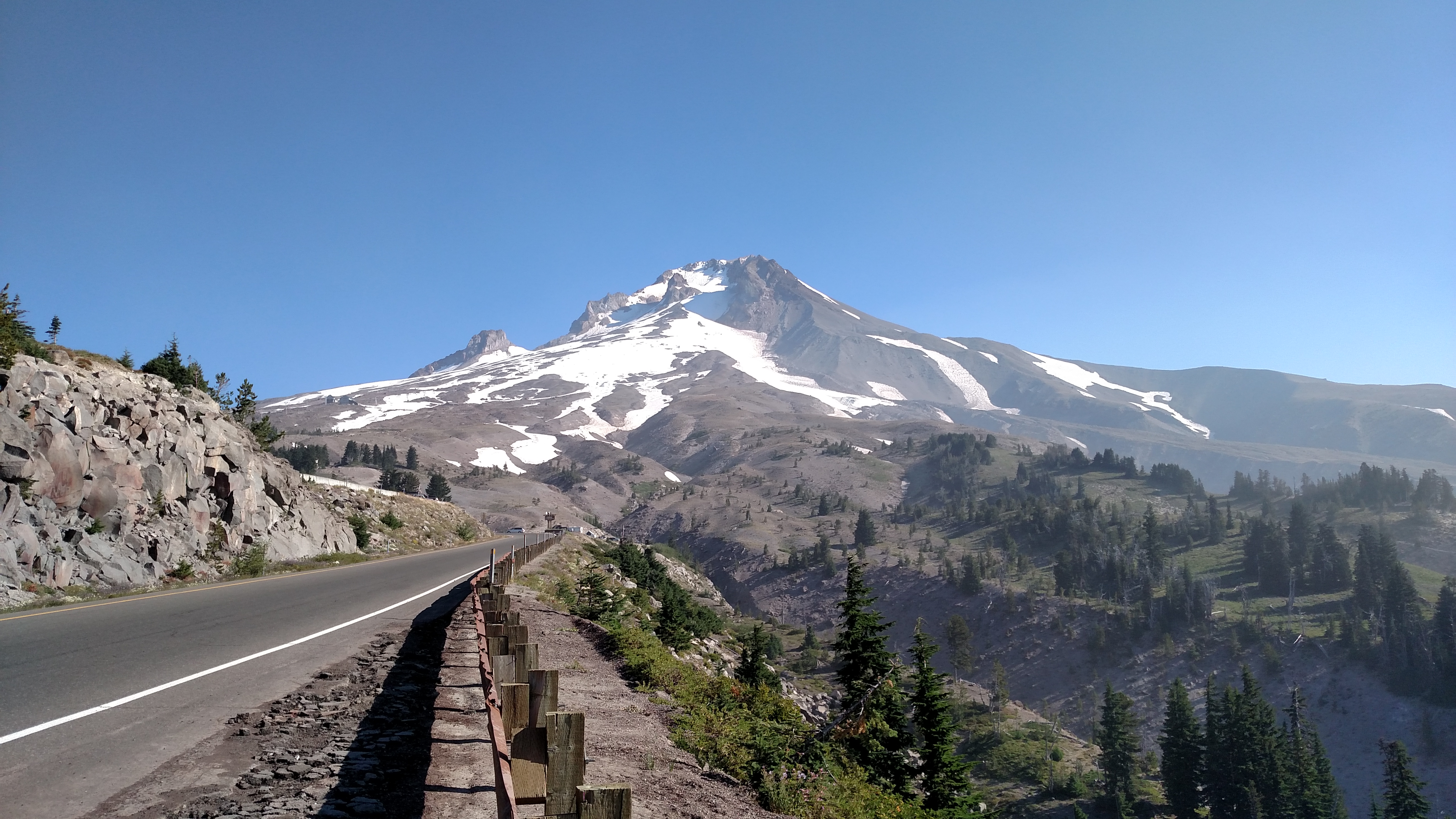
At 11,239 feet peak elevation, Mount Hood is the tallest mountain in Oregon. This photo was taken near the top of the road leading up to the mountain from Route 26. I have a surprise for you at the end of this road…
At 11,239 feet peak elevation, Mount Hood is the tallest mountain in Oregon. This photo was taken near the top of the road leading up to the mountain from Route 26. I have a surprise for you at the end of this road…
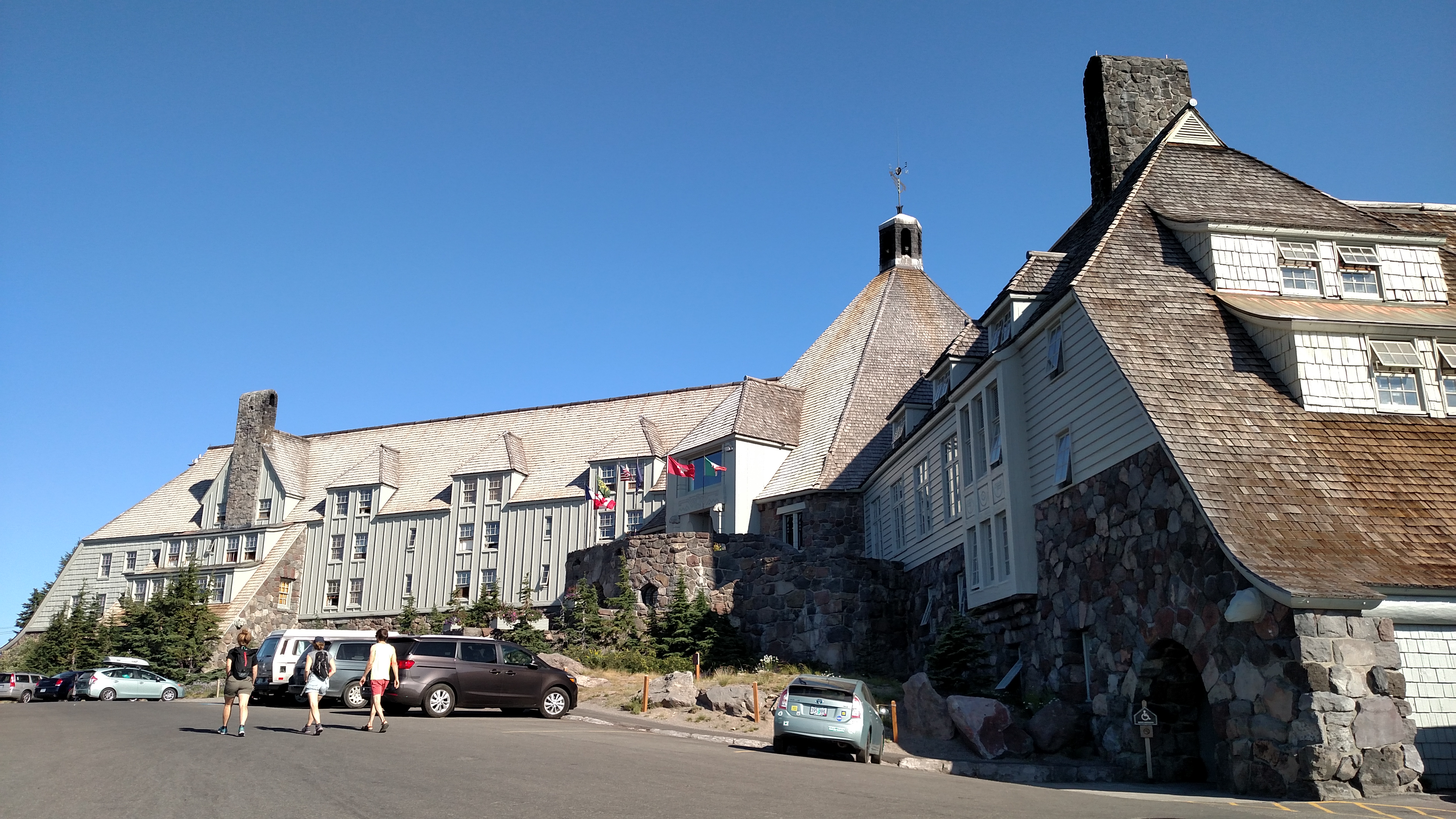
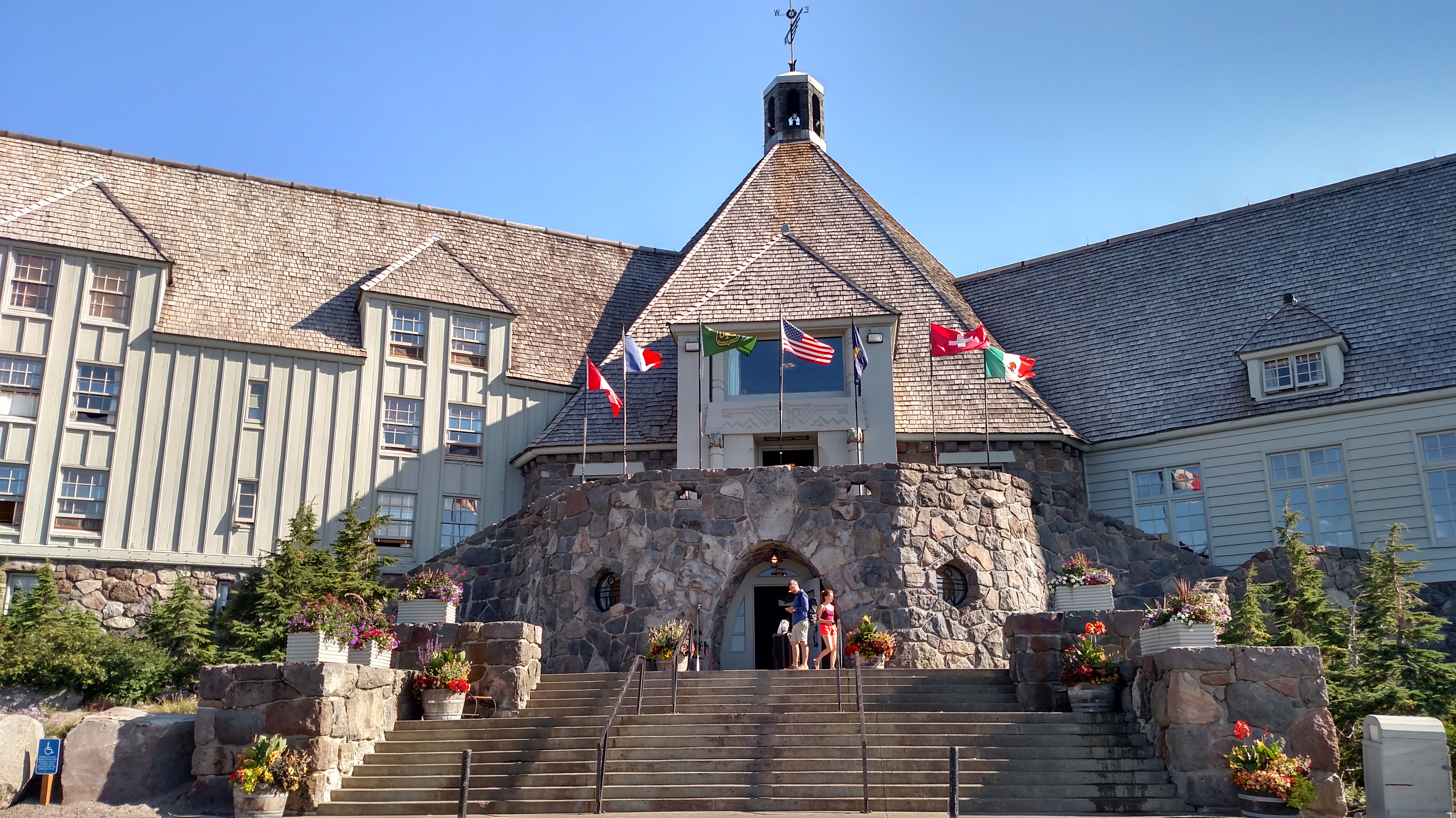
This hotel is located right at the base of Mount Hood. Literally. It is a ski resort.
This hotel appeared in the opening sequences of “The Shining,” the original 1980 classic starring Jack Nicholson and Shelley Duvall, as “The Overlook Inn”. It is one of three hotels in the United States which have some connection to that film.
The Stanley Hotel in Estes Park, Colorado was the actual inspiration for the Stephen King novel. It has the maze which was featured in the movie. I believe it was also used for some of the exterior shots. When I get home I plan to buy the original, uncut version of the movie and watch it again, paying careful attention to the exterior shots. I’ll be in Estes Park in a few weeks so you’ll be seeing more photos of the Stanley Hotel in future posts.
The third hotel, the Ahwahnee, was in Yosemite Park in California (I don’t believe the hotel exists any more), and was the basis for the interior scenes in the movie. The hotel interior used for the movie was constructed in a studio in England and the majority of the movie was actually shot there.
When I came out of the hotel the view looking south from the front steps would have been spectacular… on a clear day. As you will see in the next few posts, this was not a clear day.

I asked the young man at the front desk if there was anything in the hotel that talked about how it was utilized in the movie. Without hesitation he hauled out this ax from behind the counter. He said, “Here, take this anywhere on the property for pictures, just bring it back,” so I marched right across the lobby and took this shot next to one of the fireplaces.
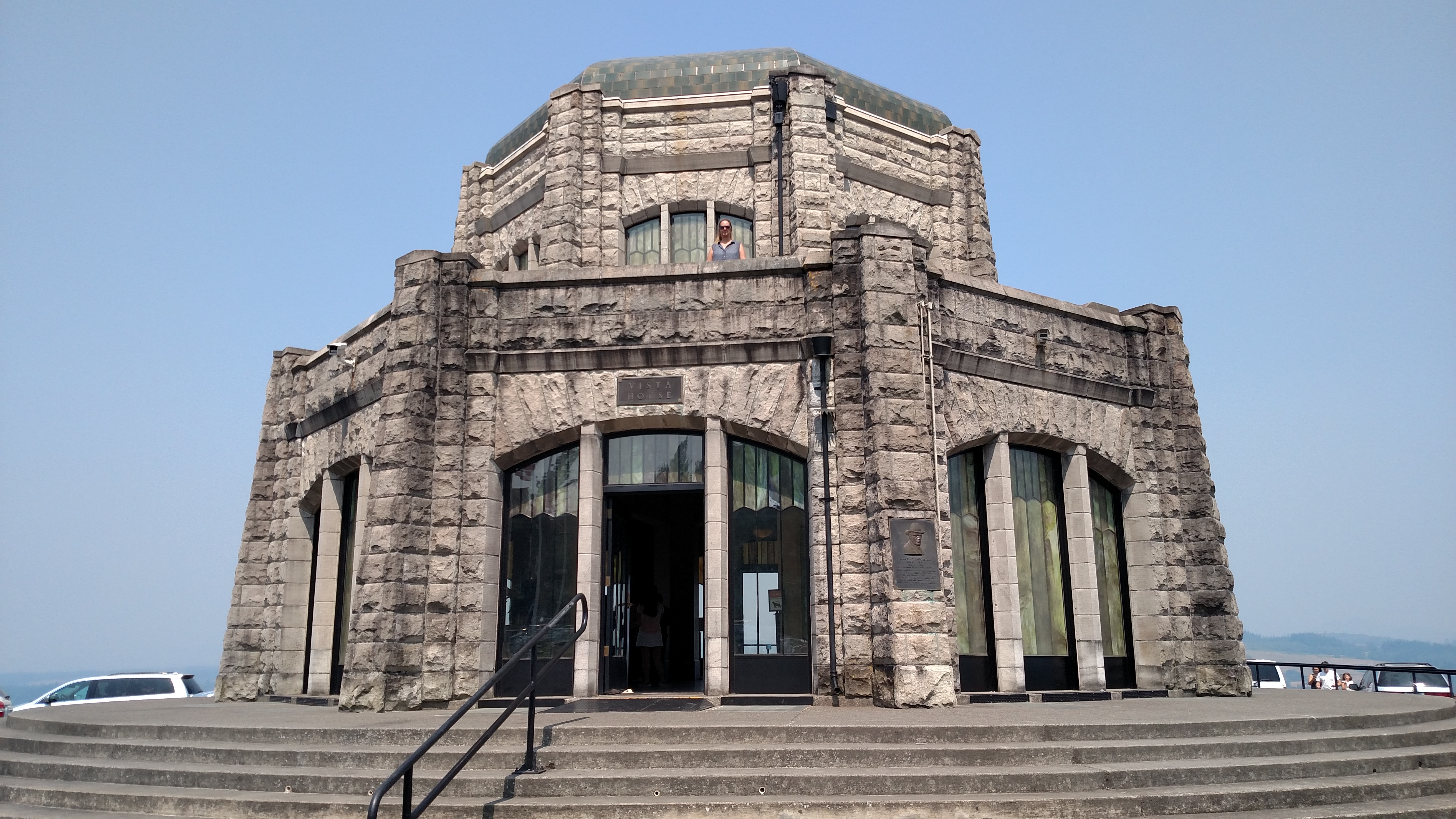
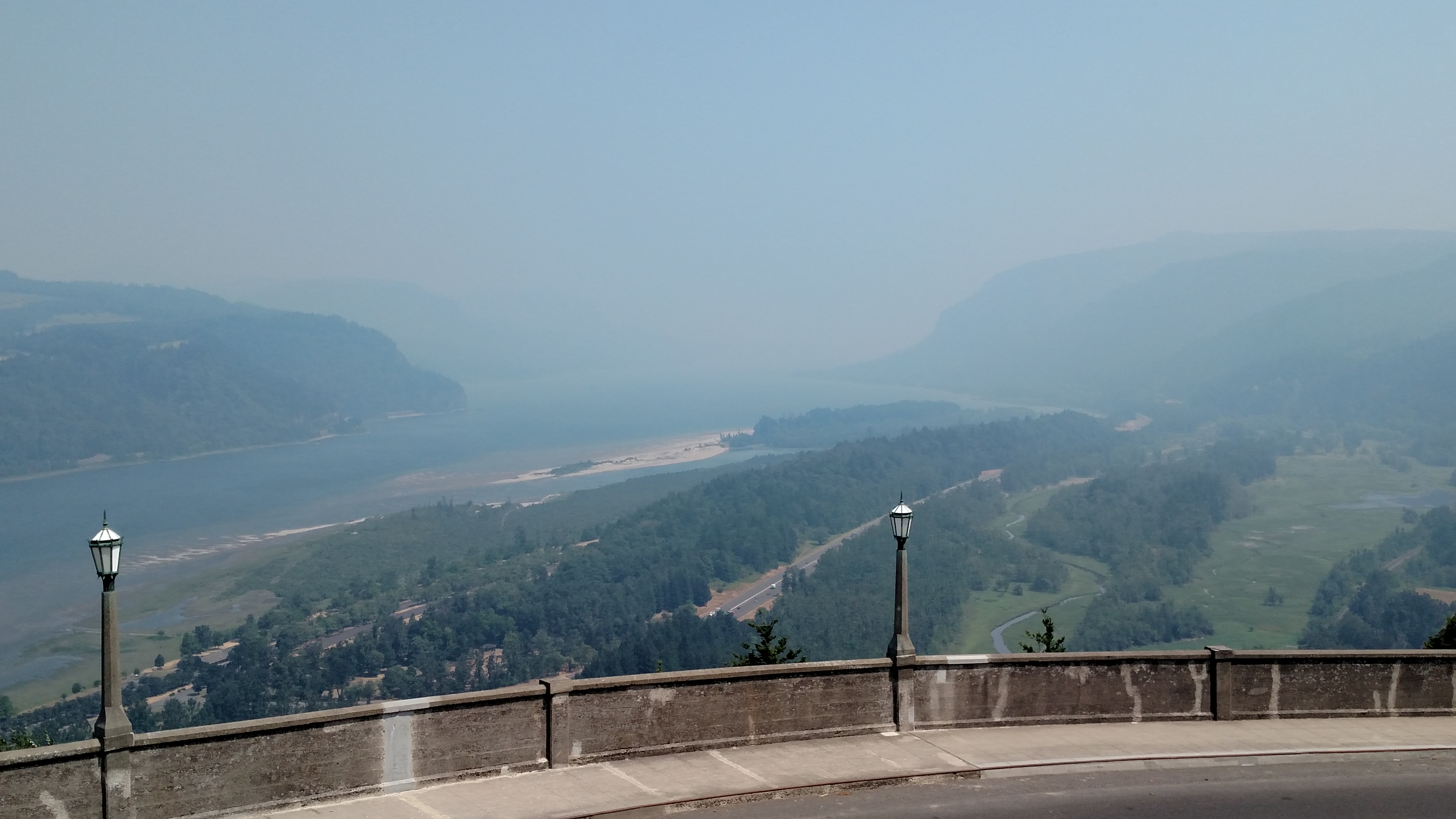
This building is located on an overlook high above the Columbia River (on the Oregon side). Normally this would afford the viewer a very nice vantage point from which to see the river, looking from east to west. Well, maybe on a clear day….
As you can see from the bottom photo the smoke has arrived. Big time. When I was up here at the river just 5 days ago the air was clear and I could see Mt. Hood off in the distance (when looking from the Washington side). Not today. And this isn’t just morning fog that hasn’t burned off yet, this was about 130 in the afternoon local time.
I’m glad I got the river pictures last Saturday when I was up here!
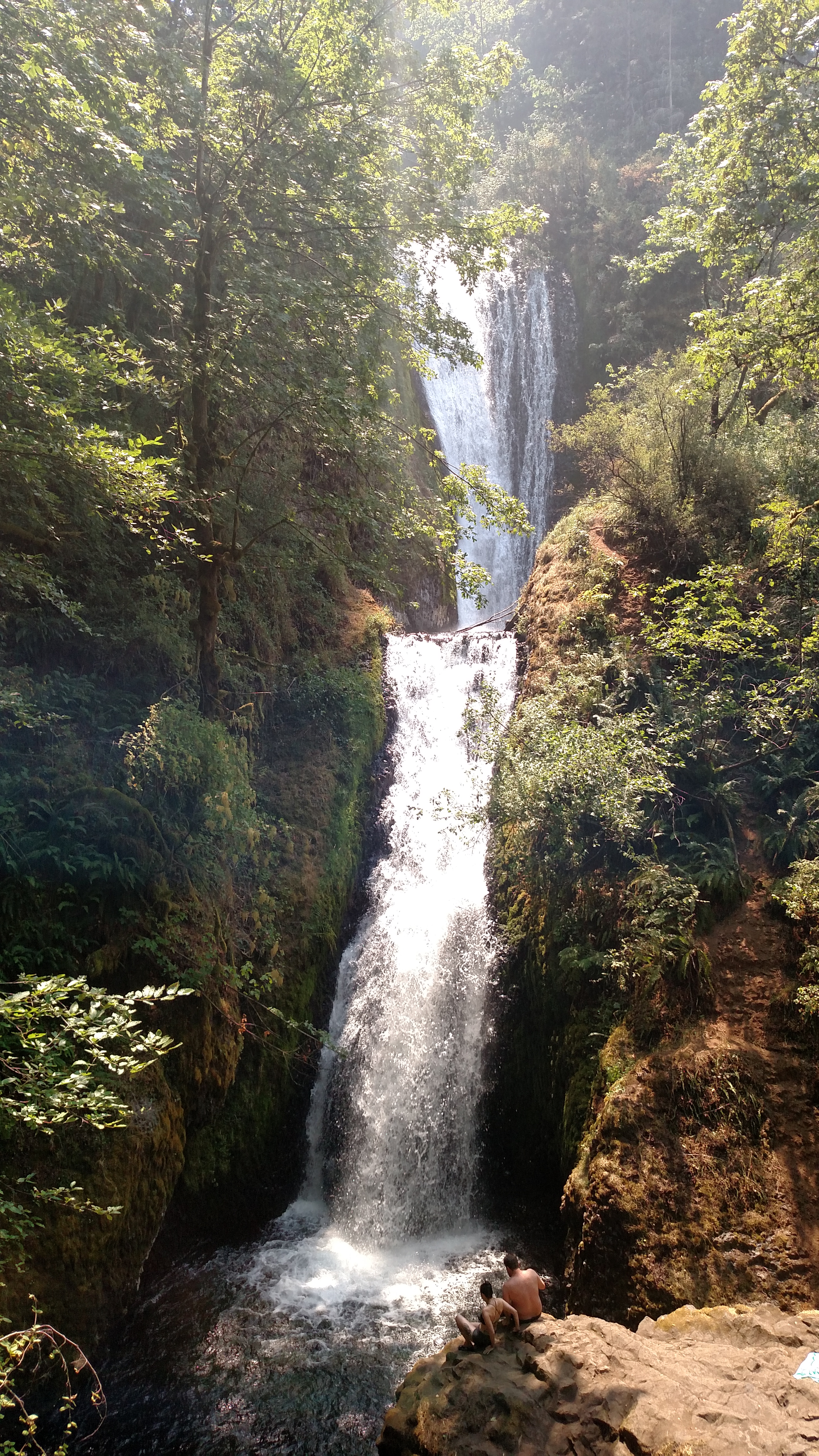
As I was walking down the trail to see this falls I was thinking ahead to what I was going to say in this post. Without having yet seen it I thought I’d say something to the effect, “yeah, but the one in North Carolina is nicer…”. Well, this one’s not too shabby. I think we just need to agree to peacefully coexist. They each have their own merits.
I have seen falls named Bridal Veil in several states (there was one at Yellowstone). I got talking with a woman on the trail on the way back to my car who is from California and she said there is a very nice Bridal Veil Falls at Yosemite.
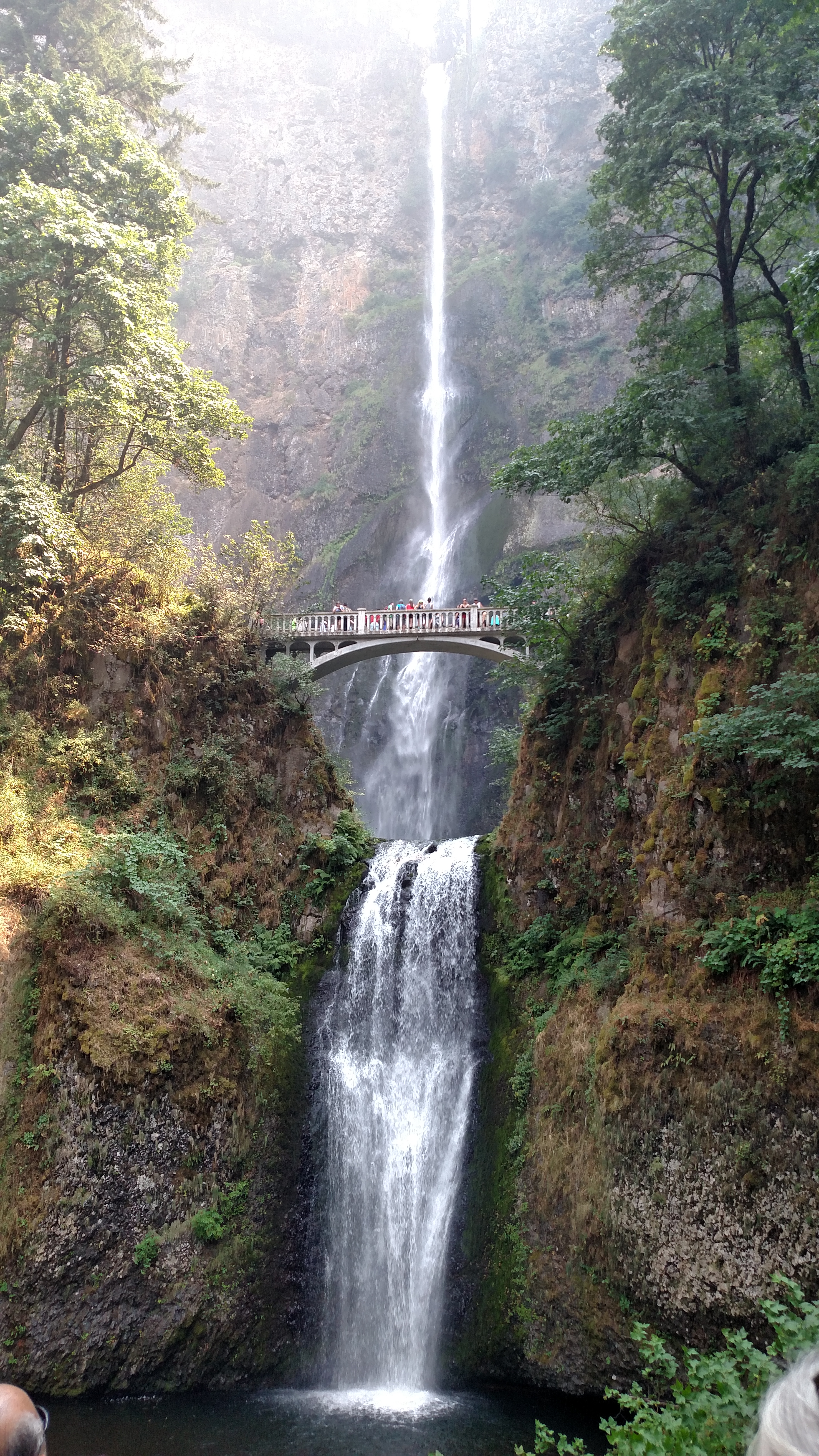
This is the tallest waterfall in Oregon and is located just off old Route 30 which runs parallel to the Columbia River, separating Oregon and Washington. It was PACKED with people and I was incredibly lucky to get “rock star” parking, as a car was just pulling out of a parking space right in front of the Visitor Center.
The Falls drop a total of 620 feet. The upper portion is 542 feet, then there is a gradual 9 foot descent (below the Benson pedestrian bridge you see in the middle of the photo), and finally the last 69 foot drop right in front of the observation area. Very impressive.
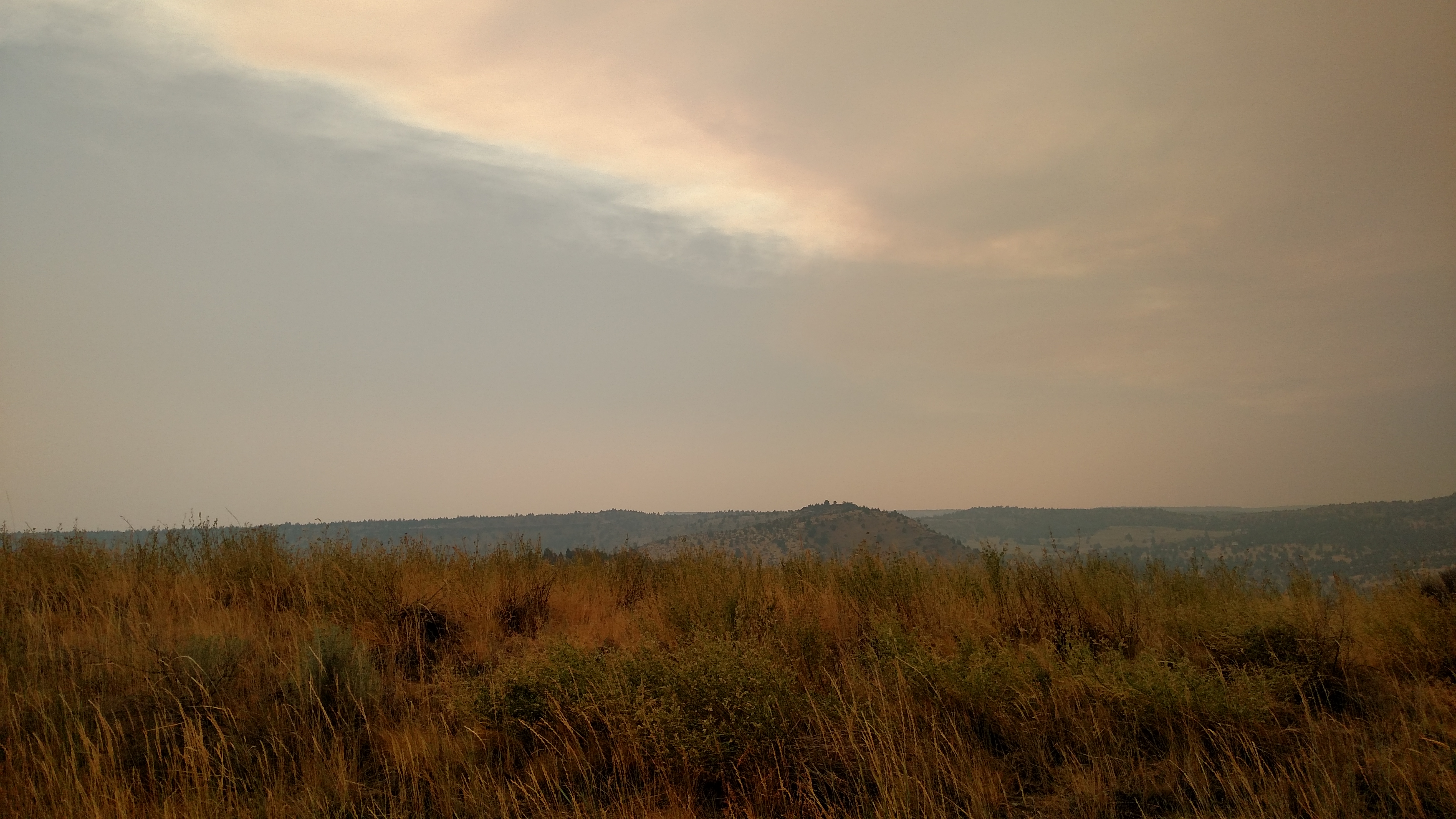

As I headed southeast back to Bend from the Mount Hood area I had the most bizarre experience I’ve ever had while driving. Once I got down off the mountain and the road leveled out I realized that the visibility on either side of the road was noticeably worse than it was just a few hours earlier (views of major mountains I had seen in the morning were now completely obstructed). The closer I got, the heavier and more brownish this haze became. I’ve never been in a sandstorm, but from what I’ve seen in movies this is what it looked like I was approaching. The brownish haze got so heavy that I turned my headlights on (to be seen, not to see) and light colored cars coming the other way looked like they had brown dirt on their hood and windshield (just a reflection). Really, really weird. Well, it was just smoke and once I passed through it the haze became more grayish and visibility improved, somewhat. The photos were taken after I passed through it, one showing the southern edge and the other the northern edge.
First let me say that starting with today’s posts I will reverse the order in which I post pictures. I assume most people go through the blog from the top down. The most recent posts are at the top and that is the way I had been posting pictures, with the last picture I took that day at the top. Well, as I write the commentary that order sometimes makes it awkward when referring to other posts. So I’ve decided to post pictures so that as you scroll down you are seeing things in the same order as I did that day. Wish I would have thought of that sooner.
I also want to point out that as you look at the blog you can left-click on a photo to enlarge it to full screen (at least that is how my laptop responds) and then right-click if you’d like to save it to your computer for future enjoyment.
********
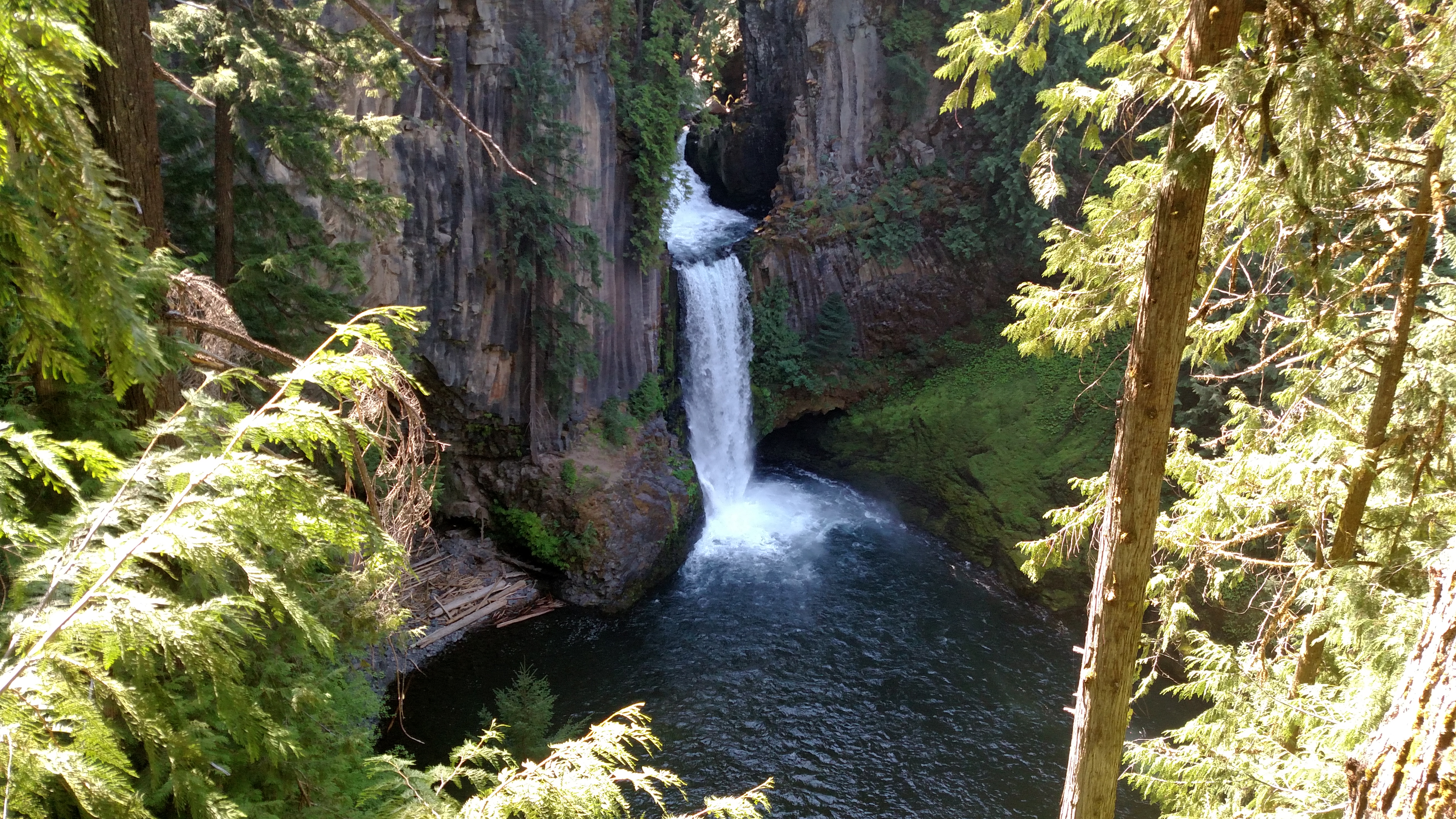
I left the house in Bend early this morning and headed about an hour and a half south on Route 97. My first scenic road of the day, Route 230, then took me west, past the north entrance to Crater Lake, about 85 miles through Umpqua National Forest to the little town of Idlewyd, Oregon. Along the way I stopped at several waterfalls and I liked this one the best. It was a 3/4 mile hike up (and down) a VERY steep incline (twice, once in and once out) to reach the observation platform looking down on the Falls. The Falls itself is at 2,329 feet elevation but the hike probably took me up to about 2,600 feet at the highest point on the path. But it was SO worth it. I’m a little bummed that the sunlight makes the trees in the foreground so bright. It was an absolutely stunning view looking down at the falls. It was a very small observation platform so there weren’t too many options for positioning myself for taking pictures once I got there.
After reaching Idlewyd I doubled back and took another series of scenic roads to reach the south entrance of Crater Lake National Park.
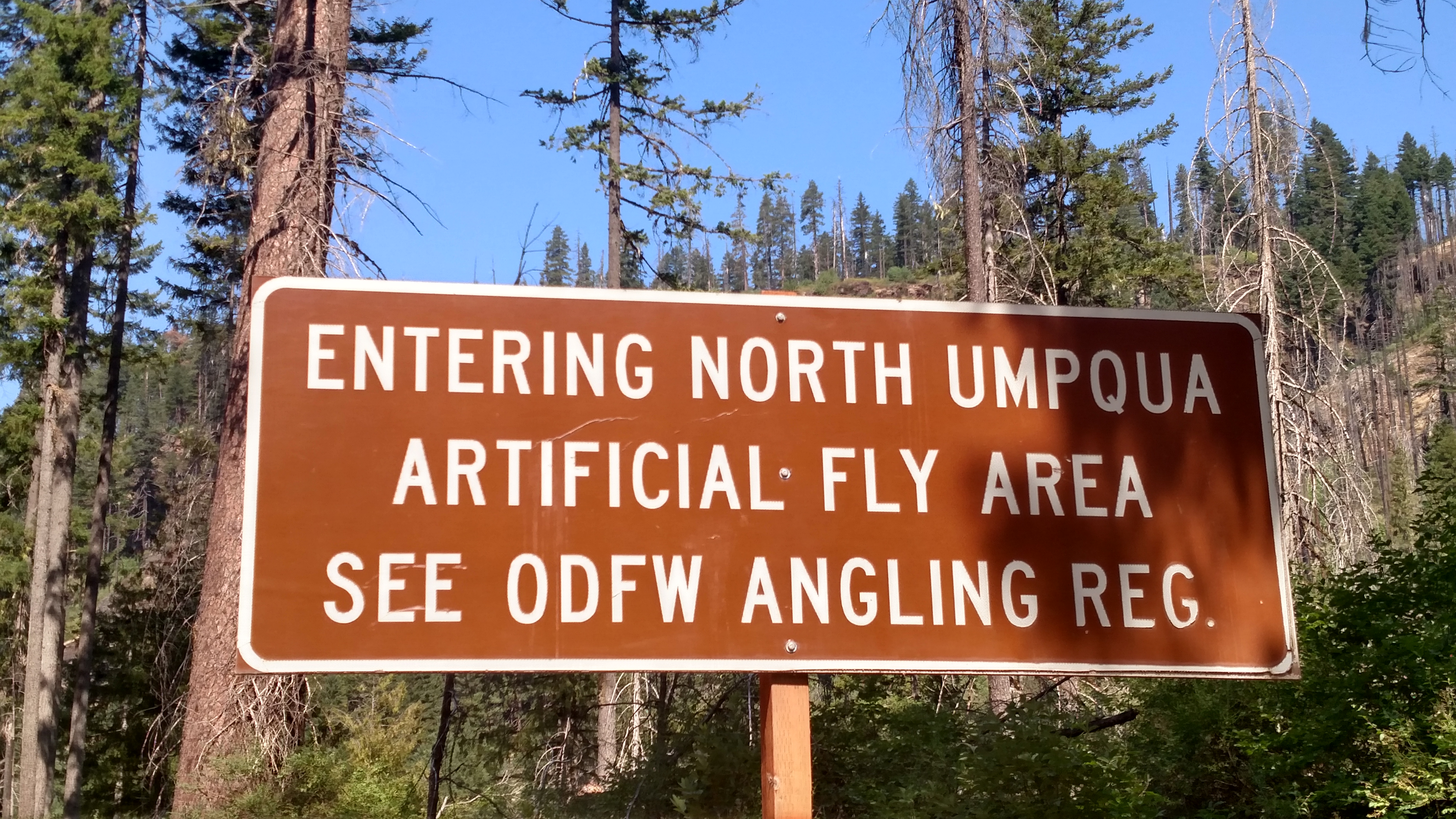
Can’t say as I’ve ever been in an Artificial Fly Area before.
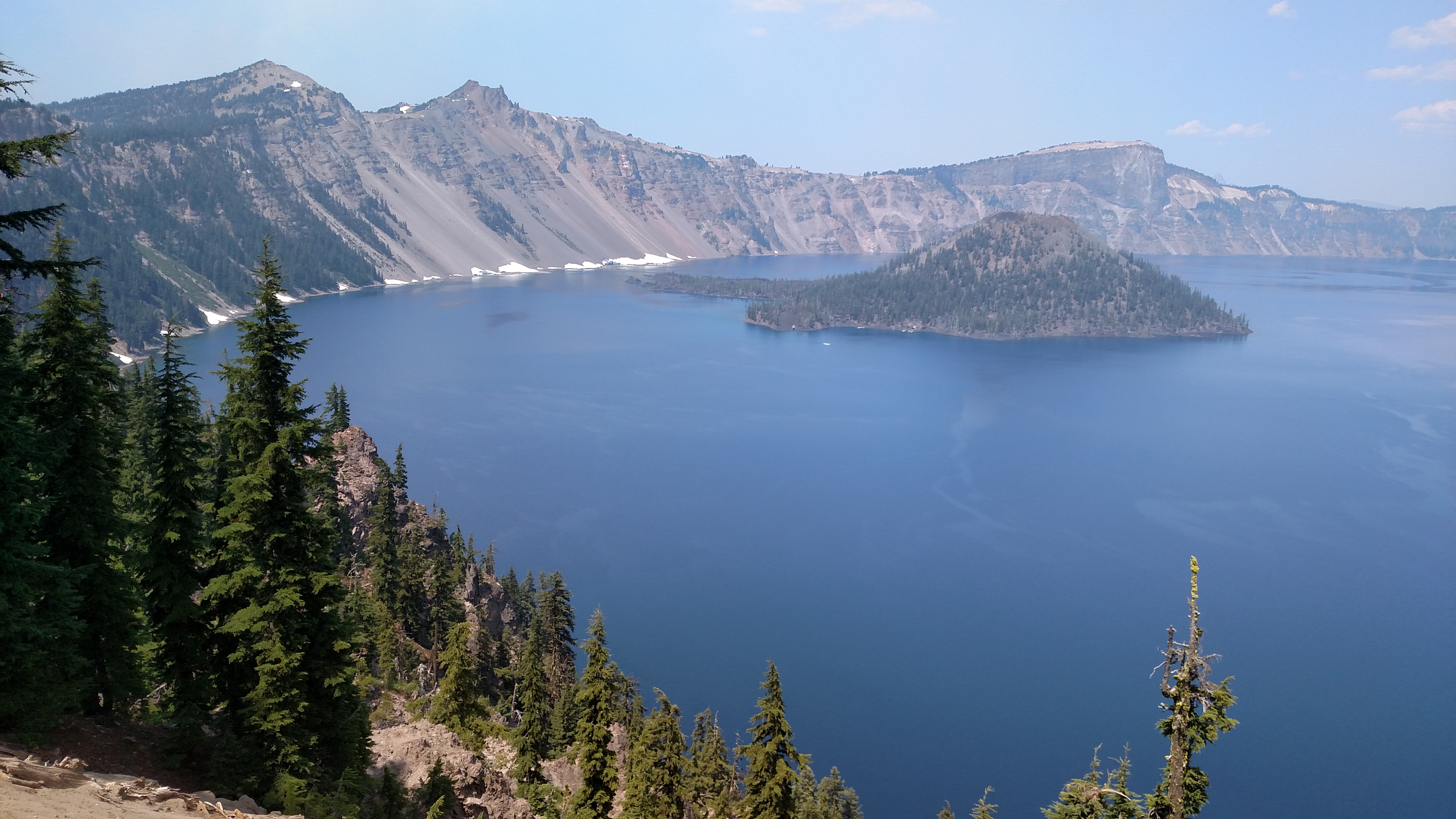
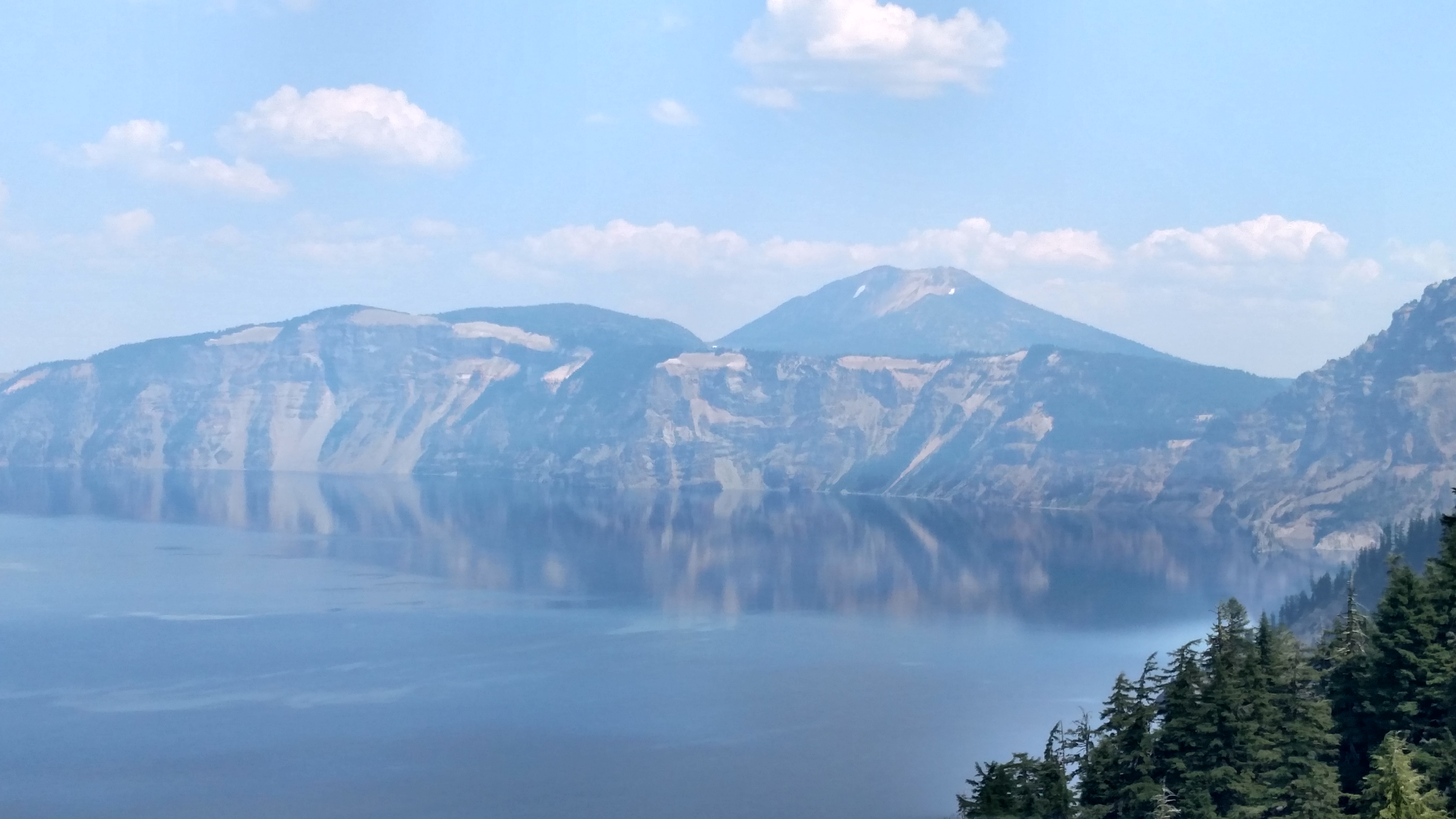
This was my first look at Crater Lake, and boy was I impressed. The lake itself covers 20 square miles and has a surface elevation of 6,173 feet. There is a 33 mile long road which encompasses the lake (Rim Drive, East and West depending on which side of the lake you’re on) affording the viewer numerous vantage points. There are lots of pullout areas for parking and the overlooks provide some spectacular views. It wasn’t too crowded today so I never felt like I was interfering with anyone’s shot while positioning myself for taking pictures.
I will refer to various landmarks by clockface positions. I entered the Park via the south entrance but that actually put me at about 7 o’clock on the map. I traveled Rim Drive in a clockwise direction. I planned my arrival so that I would have the sun behind me as I was on the south and west sides of the lake. Because of the haze looking across the lake I am planning to come back early in the morning on Thursday and revisit the north and east sides of the lake for better pictures of the opposite banks. Because of the terrain there are not as many overlooks on the east side as there are on other parts of the lake.
As I stated, the lake has a surface elevation of 6,173 feet. These two pictures were taken from approximately 7,200 feet, and the highest point I reached today (although I didn’t check it too often) was about 7,800 feet.
According to the official Crater Lake National Park map, this area receives an average of 533 inches of snow each year (that’s 44+ feet for those of you who aren’t beancounters)! It is one of the snowiest inhabited places in North America.
