I took this photo Saturday at the Bourbon, Bites and Brews Fall Festival at the Boone County Distillery in Independence, Kentucky.
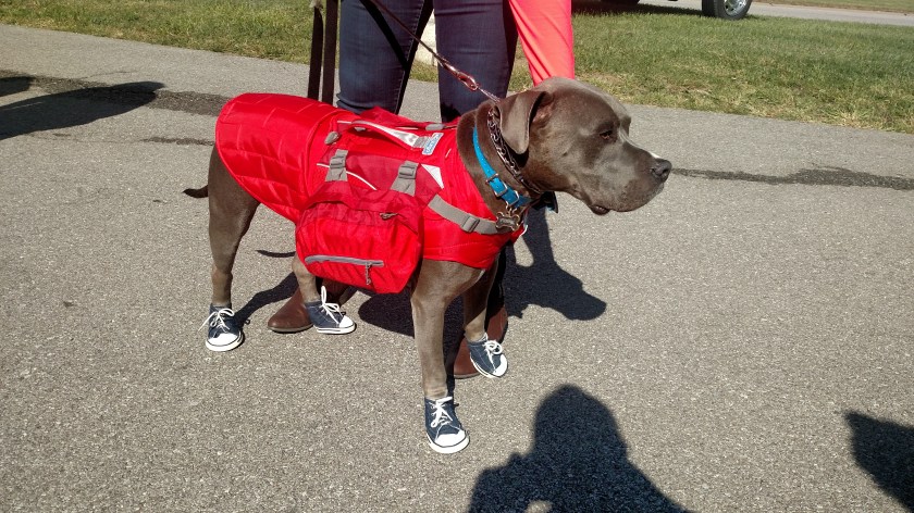
I took this photo Saturday at the Bourbon, Bites and Brews Fall Festival at the Boone County Distillery in Independence, Kentucky.
Meet Luk:

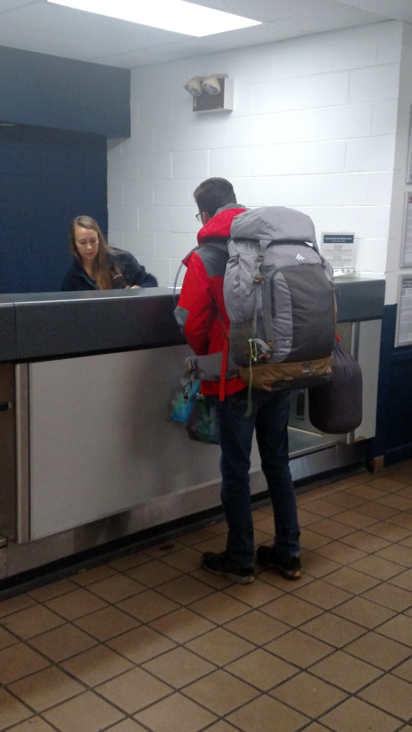
Luk was a guest at the same Airbnb in West Virginia where I stayed Sunday night on my way home from Cincinnati. Luk is from Belgium and is visiting the United States for a few weeks before moving on to several countries in the Far East. He arrived in New York a little over a week before I met him and is working his way south (to southern Florida) over the next month, and will then fly to California before flying over the Pacific to continue his journey. VERY ambitious!
These photos were taken Monday morning when I dropped him off at the bus station. He travels largely on foot but takes buses (and planes) to get from city to city.
Sheesh… and I came all this way…
I am sending this from the Contemporary Art Museum in Cincinnati. I had a great visit here a few years ago but unfortunately most of the museum is closed as they install new exhibits. I will be going to at least two other museums in town today.
No photo.
Tuesday was a travel day as I drove from Ann Arbor, Michigan south to Cincinnati, Ohio. I am in Cincinnati to visit my nephew, whose college graduation I attended at the beginning of this trip back in May. After I leave here I will be visiting other family and friends throughout the northeastern US before heading home to Durham.
I did go to the Henry Ford museum in Dearborn, Michigan yesterday and will be reviewing the 264 pictures I took there before deciding which of them to post. Those photos will probably be the last posts until after I get home in mid-October. Last year I said that I would post pictures from previous trips over the winter but I never did. I promise I will do that this year, though. There won’t be nearly as many pictures because I didn’t have the digital camera and only have photos using the smartphone. There will still be enough to give people a general idea of the places I visited.
And it looks like we have a repeat contest winner – Kendra once again correctly guessed that I would not get bitten by anything bigger than a quarter during my trip!

(Photo credit: flickr.com)
No, that isn’t a photo taken at the Henry Ford museum yesterday. You are looking at a modern day Michigan State Police vehicle. That is a photo I downloaded from the internet. I didn’t get close enough to see a stationary one in person (fortunately!).
I thought I had remembered seeing a police car with a lone red “bubble gum machine” on top while on a previous trip but I couldn’t remember where it was. They have modernized it a bit, I suppose, as it isn’t a light source that revolves like they used to, but is a bright strobe light.
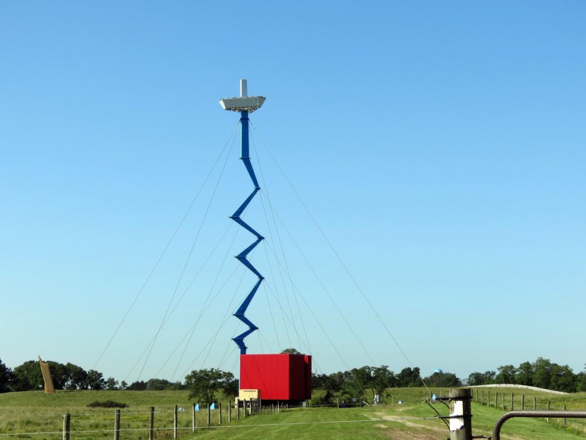
These are two photos I downloaded from the internet. The first is of something I saw as I was driving in to town Saturday afternoon. It was just southeast of the intersection of Highways 23 and 14, east of Ann Arbor. I looked at Google Maps to try and figure out what this thing (which to me looks like a candle and holder suspended high up in the air) is.
Guesses, anyone??
(Photo credit: flickr.com bigjohn1941)
I will tell you at the end of this post. While looking at Google Maps for the answer I also learned something else. That contraption is located on “Domino’s Farms” and the huge office building there is the headquarters of Domino’s Pizza (as well as serving as an office building for many other tenants):

(Photo credit: picssr.com)
This building was designed by renowned architect Frank Lloyd Wright.
And the bizarre looking thing in the top photo is a Verizon cellphone tower.
Here is another photo I took while in upstate Minnesota back in 2015. This was taken from the boat I rode on from the Upper Peninsula out to Mackinac Island (pronounce Mackinac as if the last letter is a w, not a c). I will post photos from the island itself (where the only modes of transportation are walking, horses (riding on them or being pulled in horsedrawn carriages), bicycles, wheelchairs or golf carts (which are only allowed on the golf course itself or to be used by workers in town. People can’t just go joy riding using them)) when I get back to Durham.
I learned on this boat ride that when you are on the west side of the north-south oriented bridge you are on Lake Michigan and when you are on the east side you are on Lake Huron. This was taken while we were on the west side.

Here is another photo I took while in upstate Minnesota back in 2015. The Mississippi River starts at Lake Itasca, which is a short ways southwest of Bemidji. I don’t remember exactly where I was when I took this photo but I believe I was pretty close to that lake. I passed very near there last week on my way to Duluth and that it what prompted me to go back and find this photo.
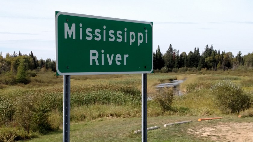
I found a folder on my old computer with some photos I took while in Minnesota back in 2015 (my first year traveling with Airbnb). I will be posting more photos from previous trips once I get back to Durham but for now here is one I referred to the other day when I posted photos of this large bridge in Duluth, Minnesota.
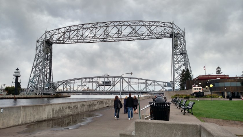
The lower portion raises straight up (possibly as far up so the top of it goes partially in to the bottom of the top portion – got all that??) depending on how tall the ship wanting to pass underneath it is.
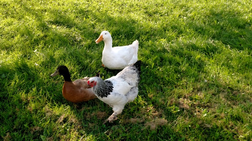
Saturday was a travel day as I drove from Rapid River, Michigan down to the lower part of the state and the town of Ann Arbor. I am staying in the home of a guy who has a farm and raises (primarily) chickens. He was at the Michigan football game when I arrived but told me that when I got to the house I would probably be met by two ducks and one chicken who thinks it’s a duck. He was right…