September 20, 2025
I drove to Fairbanks yesterday after having spent some time in Denali National Park. I didn’t arrive until evening and went straight to my Airbnb which was north of town.
I was surprised to learn that Fairbanks, which recently overtook Juneau as the second largest city in Alaska, isn’t really that big. It has a city population of around 32,500, although there are neighborhoods surrounding the downtown area that could arguably increase the number if pooled together.
Although I will spend two nights here I will only be here one full day, as I will have a long drive tomorrow to get back down near Glennallen. This was more of an orientation stop and I will come back later in my trip to spend three nights and two full days.
When I first left the Airbnb to drive downtown this was the first thing I saw:
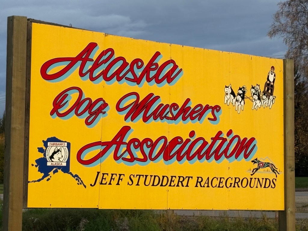
There wasn’t any snow on the ground while I was here so there was no activity at this venue, but I will visit a Musher Museum when I come back to Fairbanks later in my trip. I stopped at Walmart to replenish my food supply and then drove around town a bit to get my bearings. I was at the Morris Thompson Cultural and Visitor Center downtown when it opened.
I picked up maps and brochures so I could find out what was open and what wasn’t. This antler arch was out back:
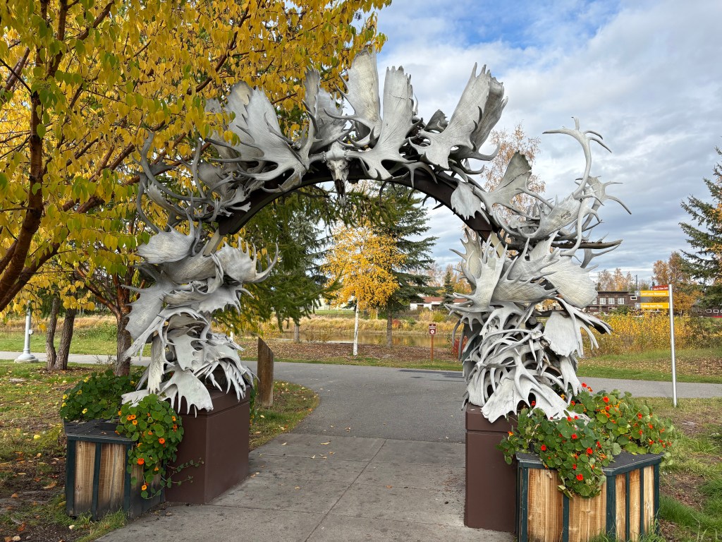
The sign said there were over 100 antlers but I didn’t count them. If you’ve ever been to Jackson, Wyoming they have some much larger arches at all four corners of a city park there, but this wasn’t bad for Fairbanks. This one was mainly moose antlers, with some elk and perhaps caribou thrown in.
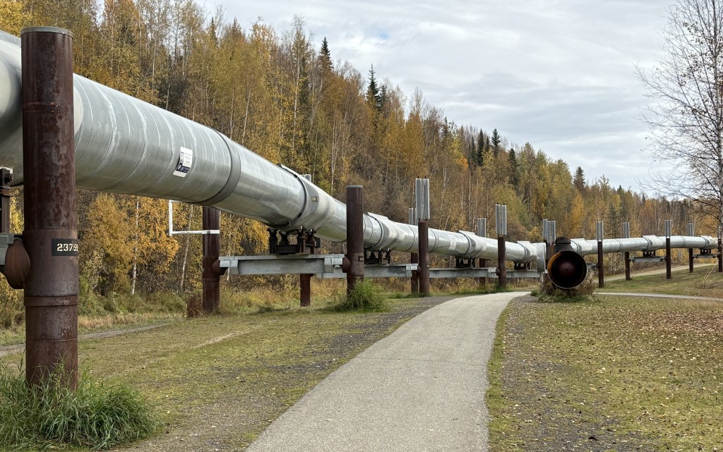
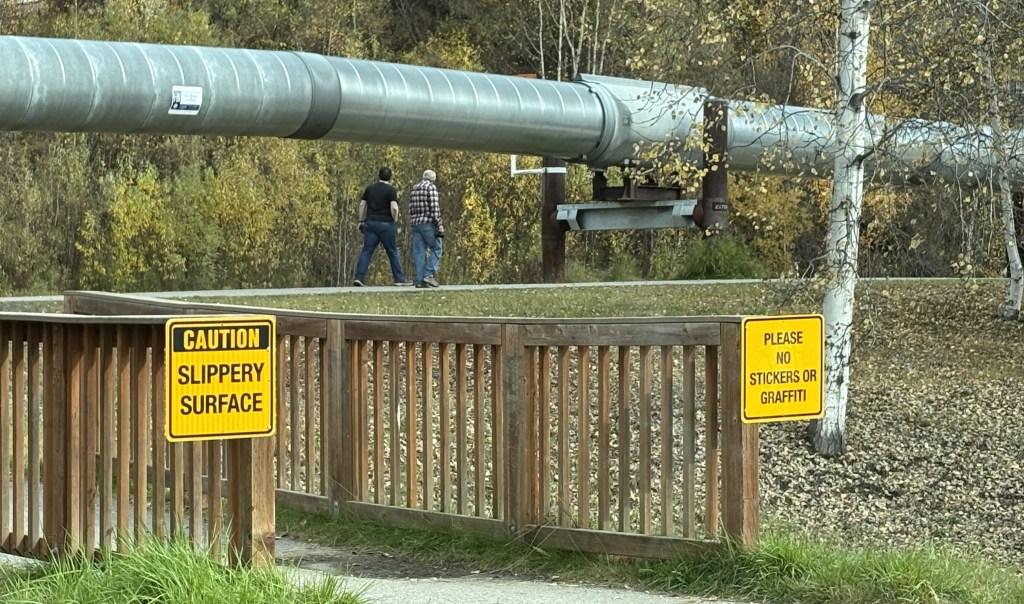
One of the brochures I picked up was for a restaurant called Latitude 65 which I will describe in more detail in the next post. It is further north of town, and as I drove up Hwy 2 towards the restaurant I saw a turnout area for the Trans Alaska Pipeline! I am aware of its existence but never even thought I would see it, and here it was – right next to the highway:
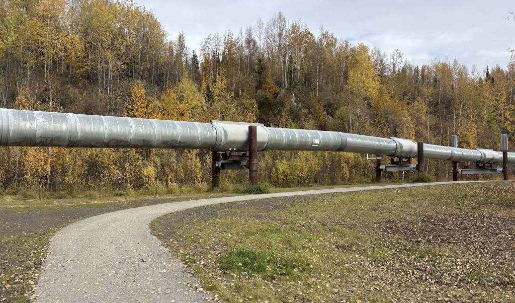
It had come up from underground just north of here.
The pipeline runs from Prudhoe Bay at the top of Alaska all the way down to Valdez, where the crude oil is loaded onto tanker ships.
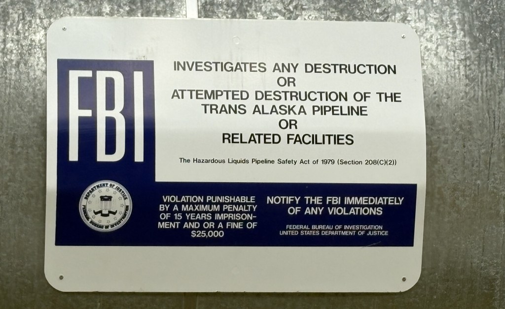
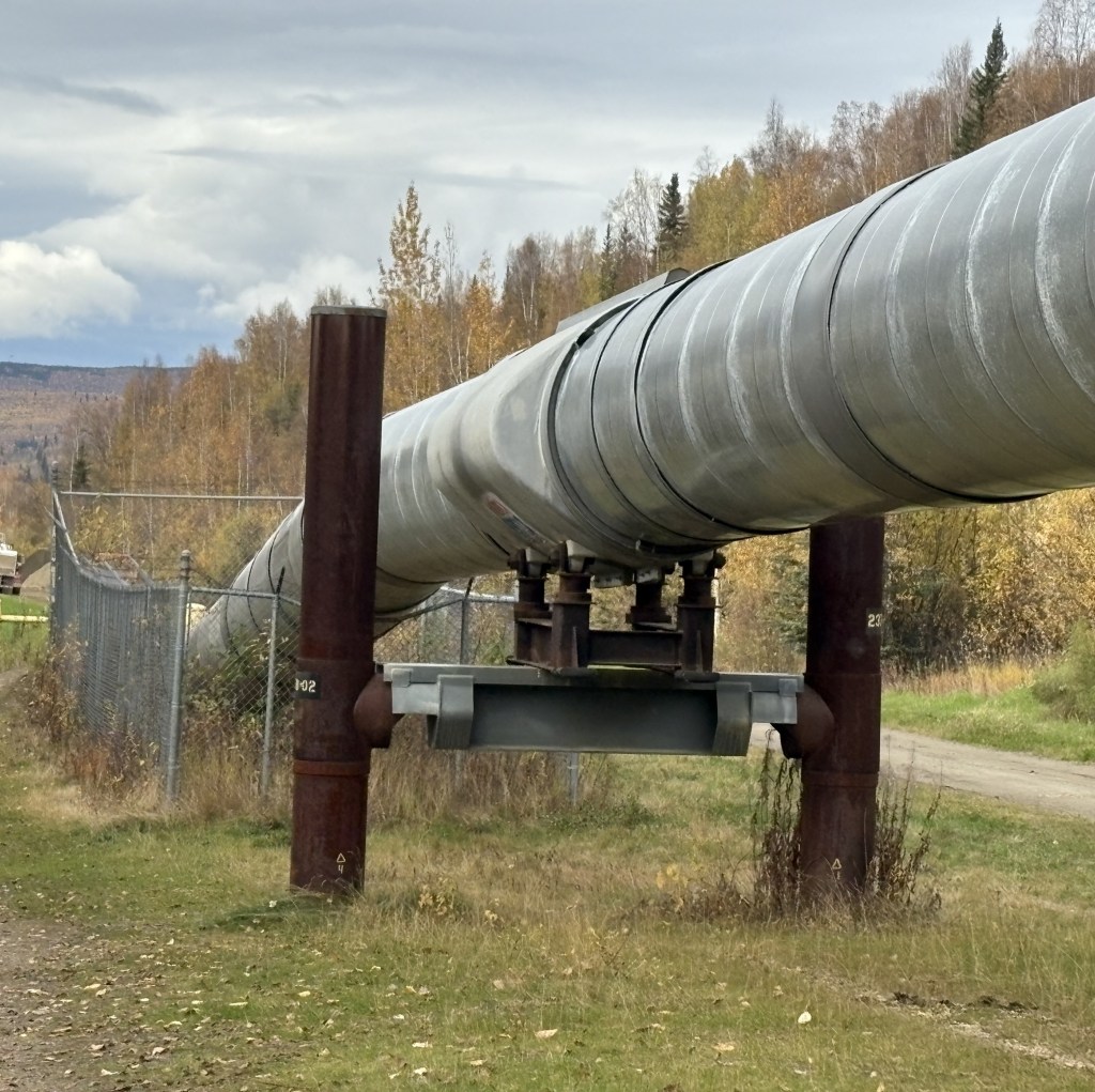
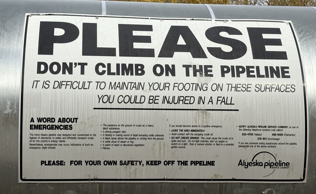
There were other signs discouraging people from climbing on it (it isn’t a toy, people) and also asked that there be no graffiti or other stickers attached.
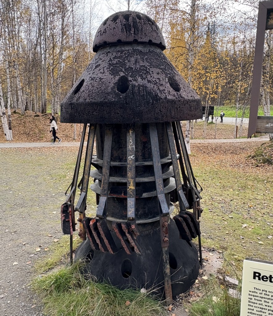
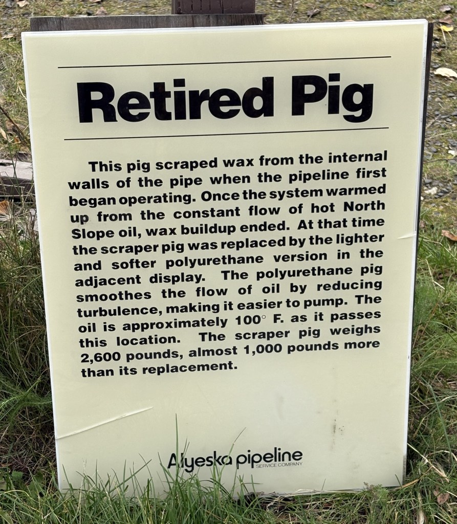
There was also a small display explaining what “pigs” are in the oil pipeline universe. They are used inside the pipeline to keep things from building up inside. When it was being built there was a wax buildup which pigs, like the one shown below, cleared out. The sign indicates that now the oil is constantly flowing past this point at over 100 degrees Fahrenheit so wax is no longer a problem.
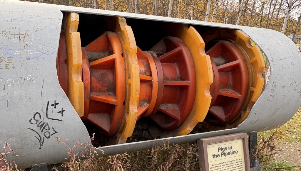
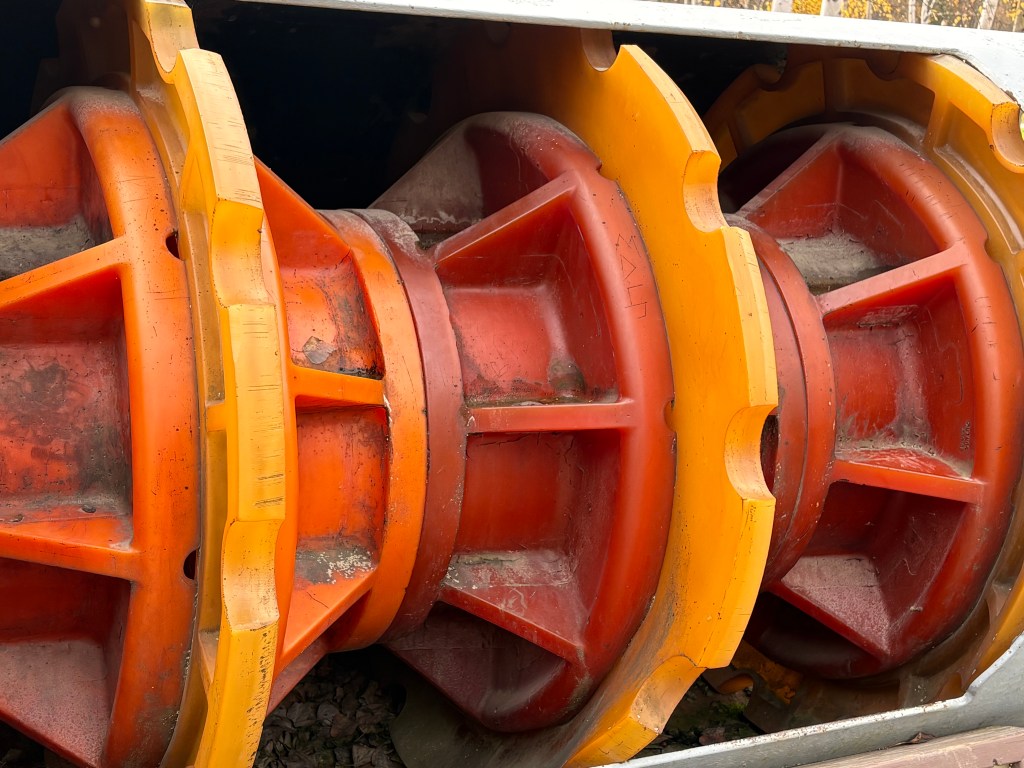
This is a newer version of a pig which helps maintain the flow of oil. You can see on the signs that the pipeline is maintained by the Alyeska Pipeline Service Company, and their white crew-cab pickup trucks made up the vast majority of vehicles I saw as I drove along parts of Highways 2 and 4. The pipeline runs roughly parallel to those two roads, though I would see it in the distance some places.
I will continue with the restaurant I was heading to in the next post.
