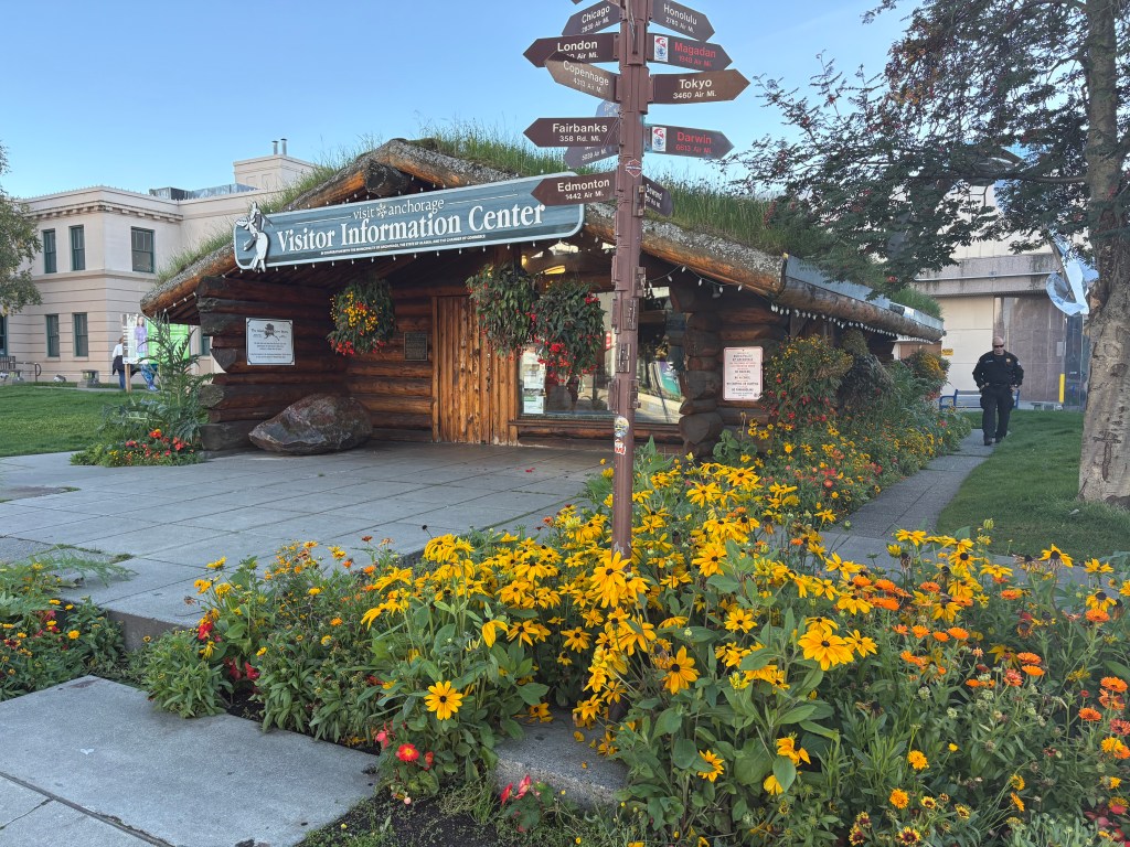
Mount Denali, et al – Part 1 of 2

September 17, 2025

These next two posts will include photos from my first trip to Denali. This first post will show pictures taken on my way north from Anchorage. I have taken LOTS of pictures but have gone through them and selected the best ones for posting.

The name of the mountain itself is subject to some debate but I still call it Denali, as that was the original name given to the mountain centuries ago by the indigenous people who lived here. The name McKinley was first proposed in 1896 to honor candidate, and then President, William McKinley. It was officially changed in 1917 and remained until 2015 when it was changed back to Denali. Our current president changed it back to McKinley in early 2025, shortly after being elected. The National Park has always been called Denali.

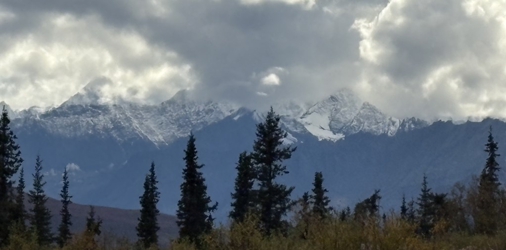
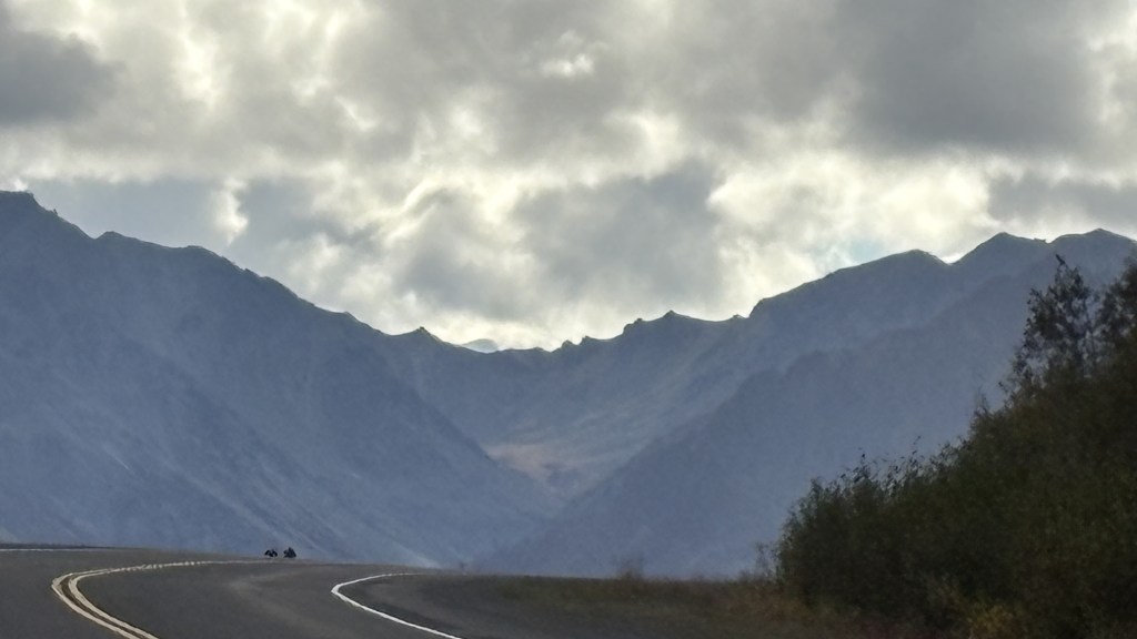
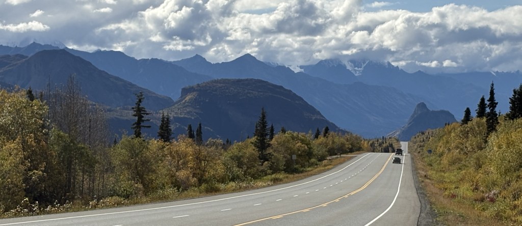
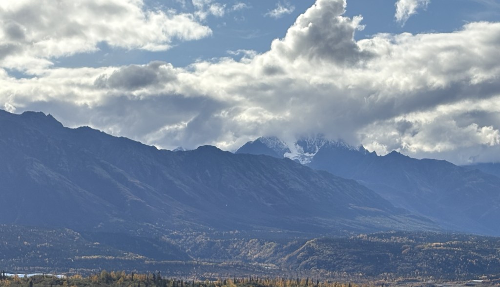
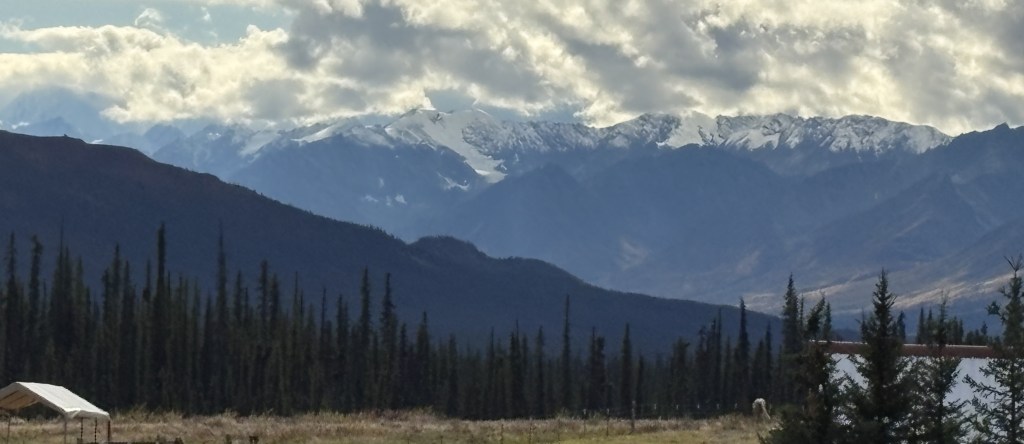
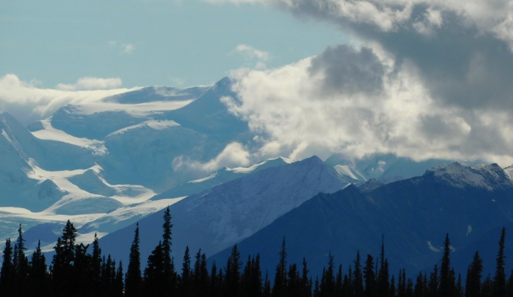
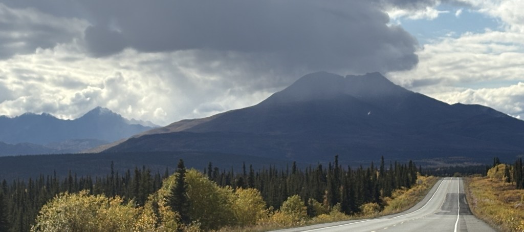
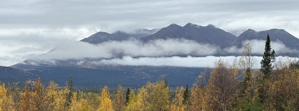
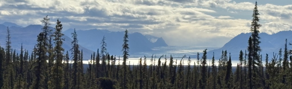
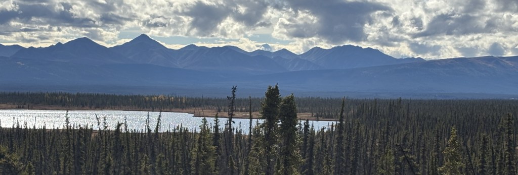
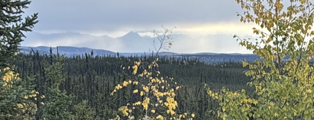
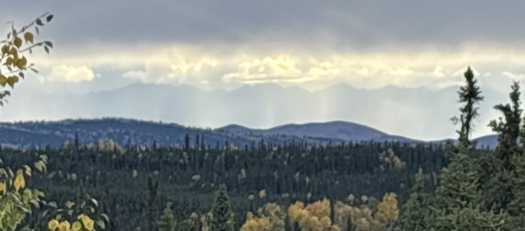
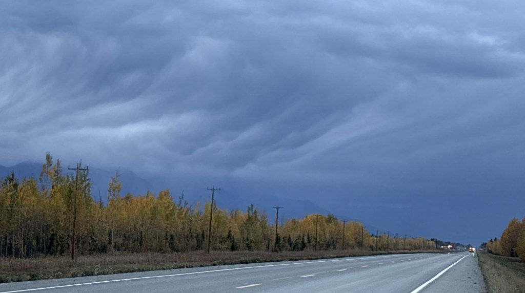
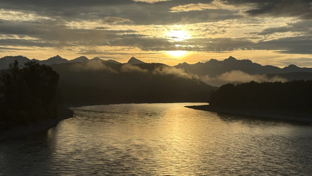
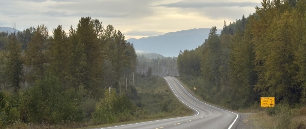
My day actually started off with me driving south from Anchorage towards another destination. I stopped at a pullout area next to the highway to take a photo of something and as I was walking back to my car this is what I saw looking north.

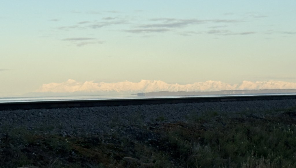
It was a clear morning and I immediately knew that what I was seeing in the distance was what I call the “Denali Complex” – a group of mountains in the Alaska Range. That photo was taken at 813am.

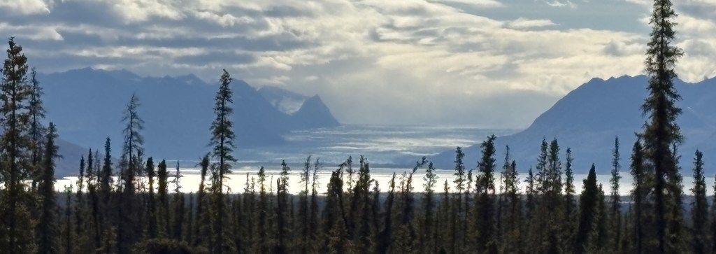
I have learned that only about 1/3 of the people who travel to see Mt. Denali actually get to see it because of its tendency to shroud itself in clouds. When I saw it basking in the sun I told myself “I need to go there RIGHT NOW” and immediately turned my car around and headed north. Using the “calculate distance” feature in Google Maps I determined that I was currently 146 air miles (direct point-to-point) from Mt. Denali, though driving there would be much further and it would take over three hours to get to what I later determined was the best and closest viewing spot that was accessible to me.

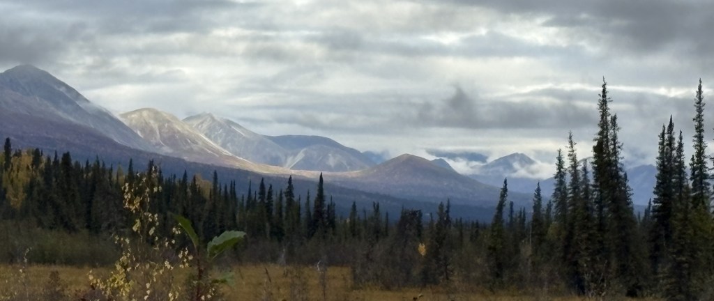
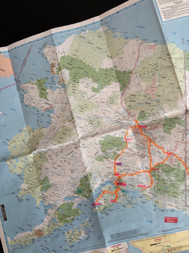
Here is a map which shows some of the nearby landmarks I will be talking about in these two posts.

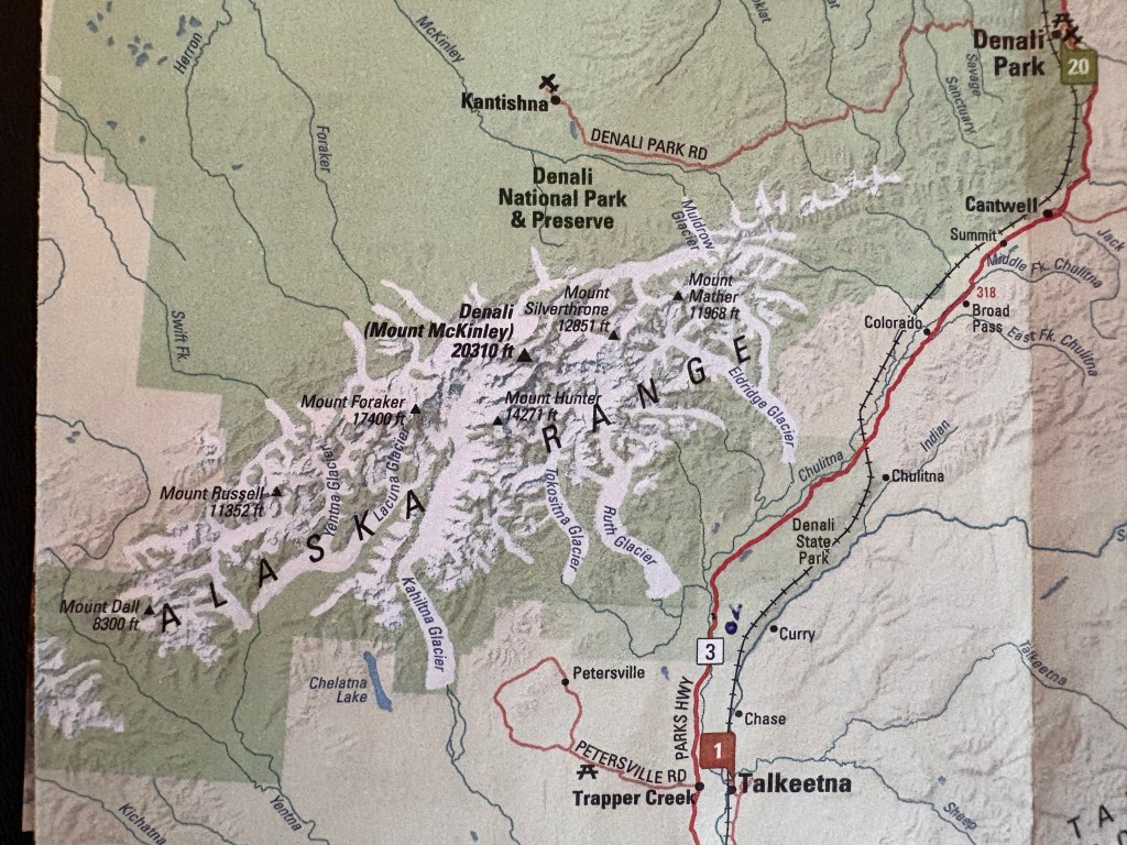
(Photo credit: Alaska.org The Alaska Map)

You can see the names of seven of the major mountains. I will only be talking about three in these two posts: Mt. Foraker (Wife), Mt. Hunter (Child) and Mt. Denali (High One). Hunter is harder to find but it is just above the letter ‘R’ in Range, and is closer to the highway than the other two.

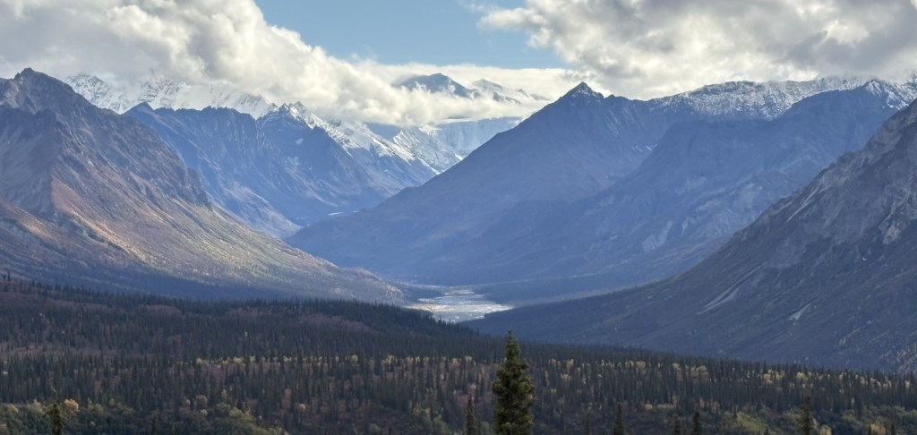
For me the best photo opportunity would be at the South Viewpoint, at the bottom of the map, above the white 3 indicating the highway number. I made a dot and wrote the letter V to show approximately where the viewpoint is (though it is actually on the left side of the road driving north). You can also see on the map that even from the viewpoint the mountains are still pretty far away, and the entrance to Denali National Park is way up at the top of the map, over 100 driving miles from the South Viewpoint.

I saw a sign in “Earthquake Park” on the north side of Anchorage where the Denali mountains are sometimes visible on a clear day. A sign there indicated it is 135 air miles away, so I was already over 10 miles further away, and driving there is not a straight shot.

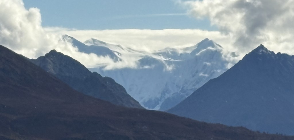
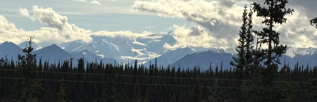
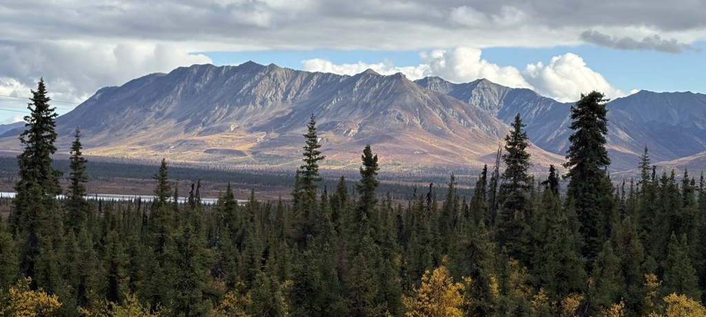
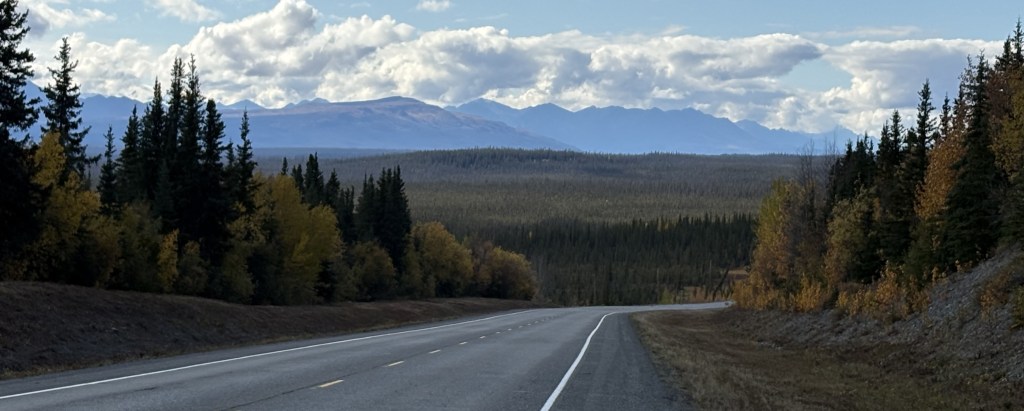
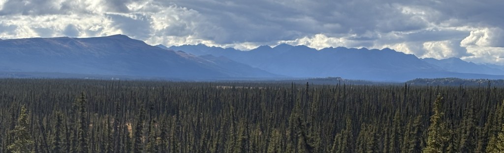
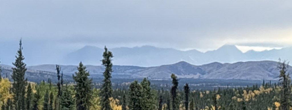
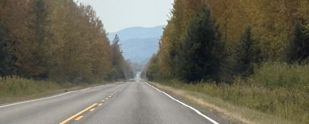
As I drove north, when I got close to the town of Talkeetna I could see Mt. Denali ahead of me.

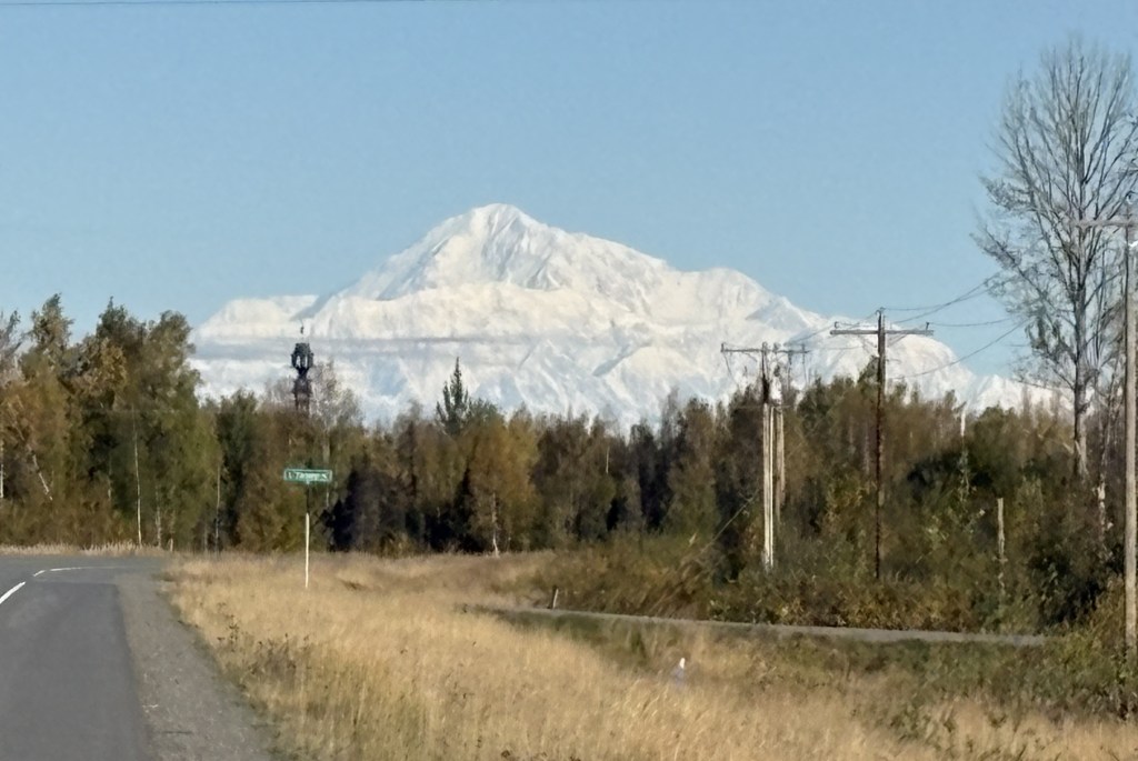
I tried enlarging the image by cropping out some of the top and bottom but it didn’t really improve the image and I thought I would leave it alone so you could see exactly what I was seeing. I’m not sure exactly where I was when I took that photo at 1021am but I believe I was about 78 air miles away.

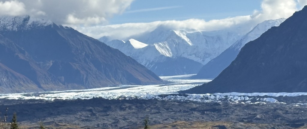
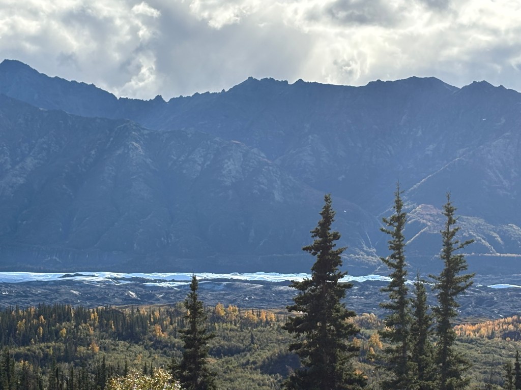
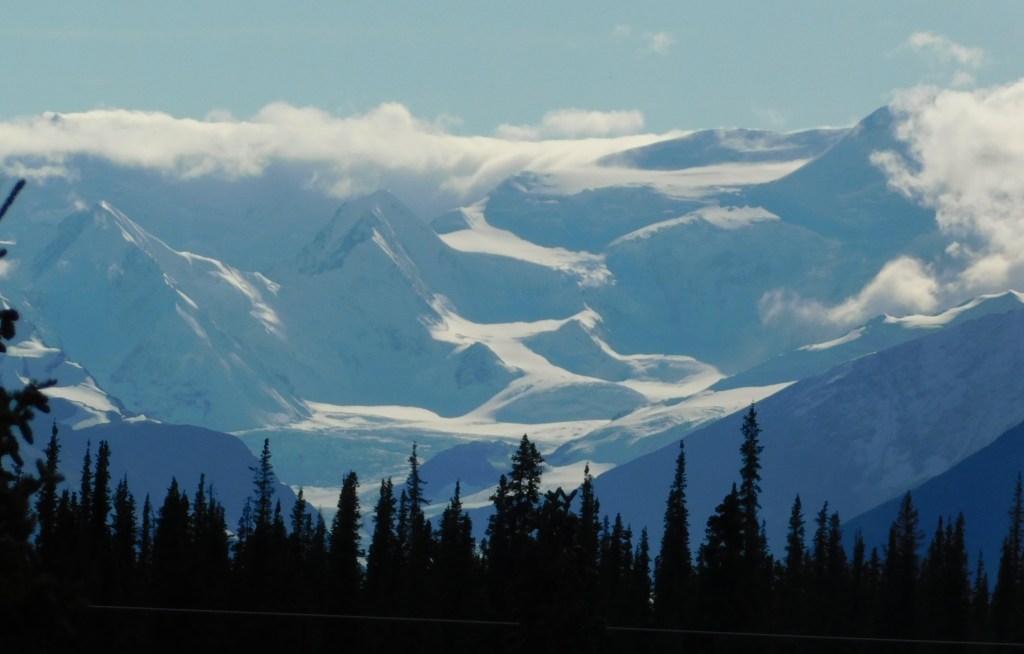
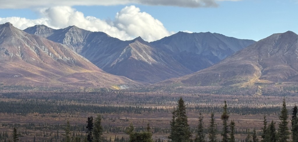
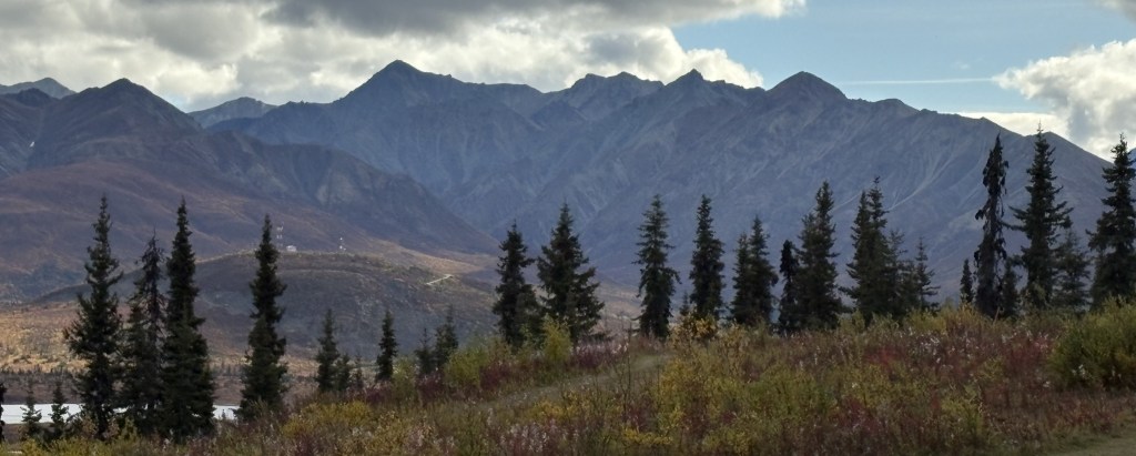
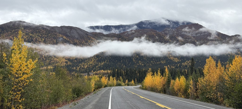
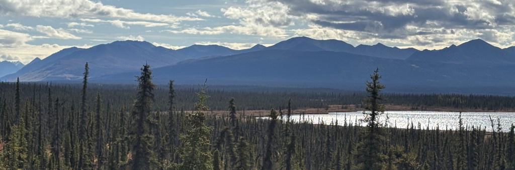
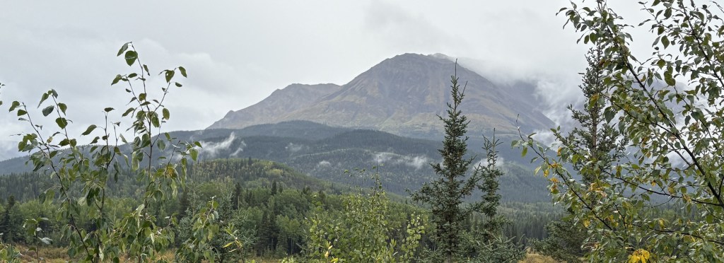
Just before getting to the South Viewpoint I noticed Mt. McKinley Lodge Road to the right side of the highway which appeared to climb a hill. I thought that might give me a better perspective so I drove up a short ways and found a spot where I could park and have an opening in the trees.

From that vantage point this was the view of Mt. Denali:

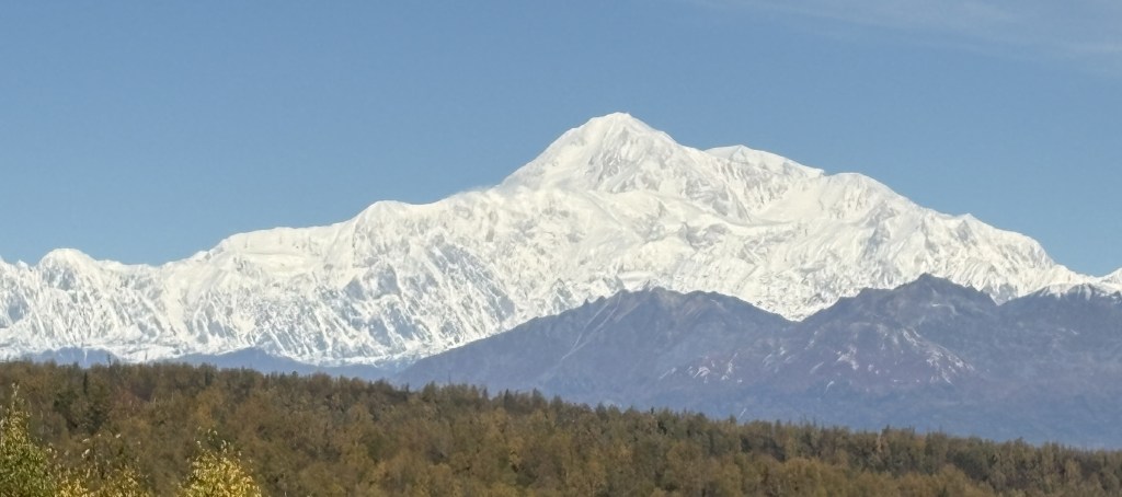
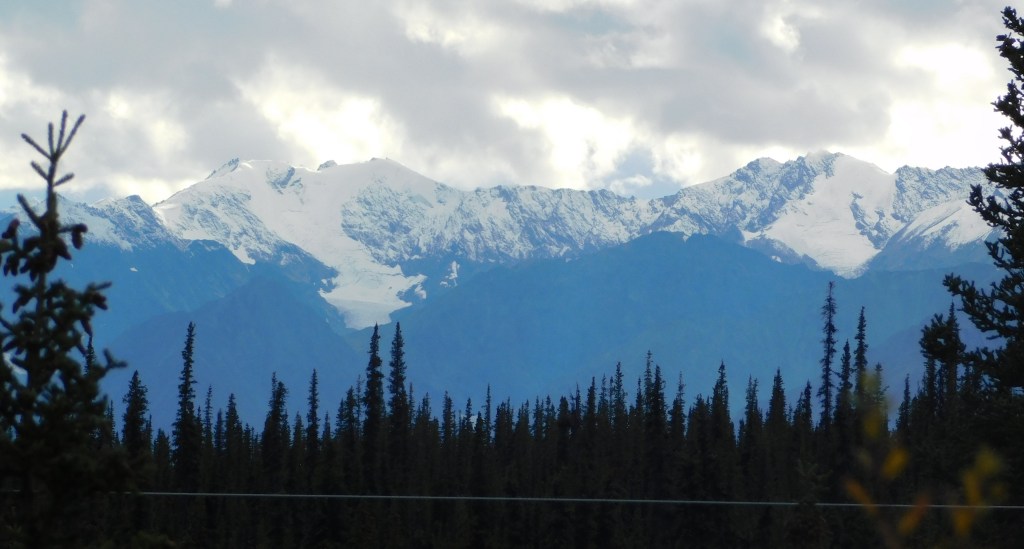
It looks very different from the photo I took south of Talkeetna because of the angle. There is a shorter range of mountains (not currently covered by snow) between where I was and the mountain itself. The highest peak on Denali is obvious and is 20,310 feet above sea level – making it the highest mountain in North America. That is the South peak. The North peak is slightly to the right and is further away from this spot. It rises 19,470 feet above sea level.

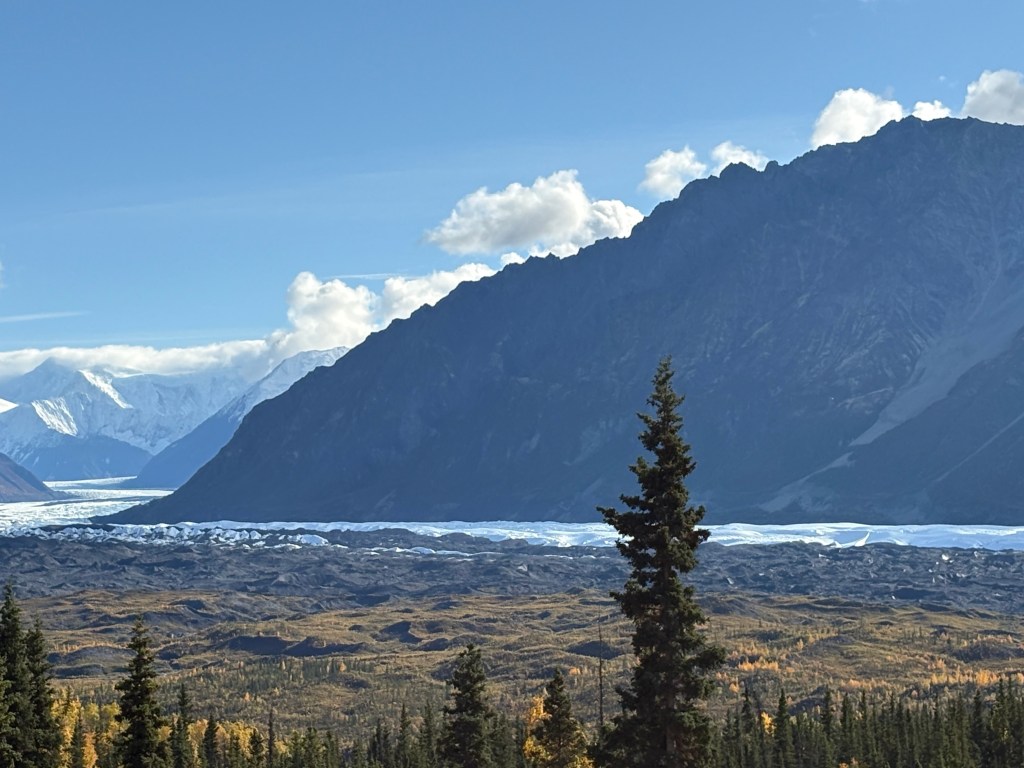
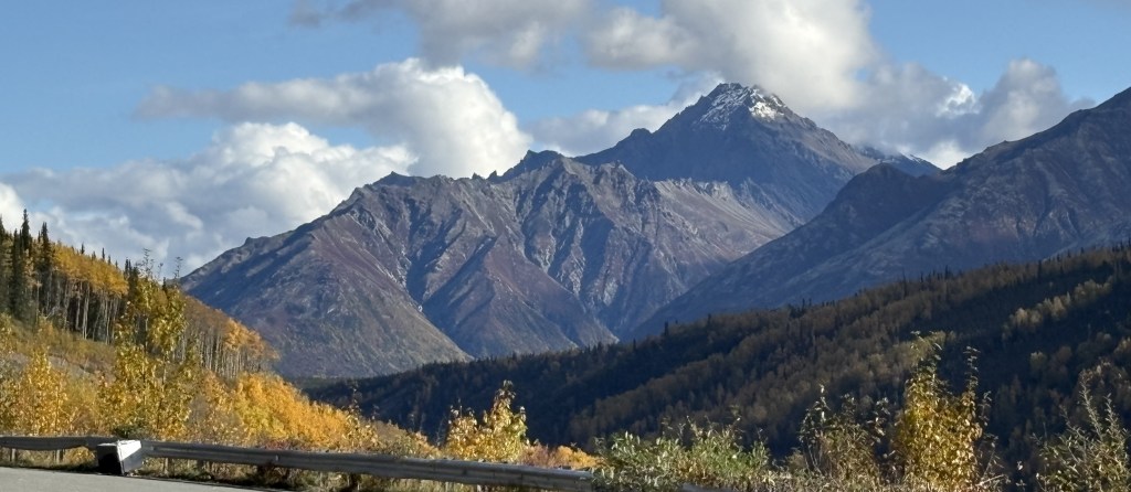
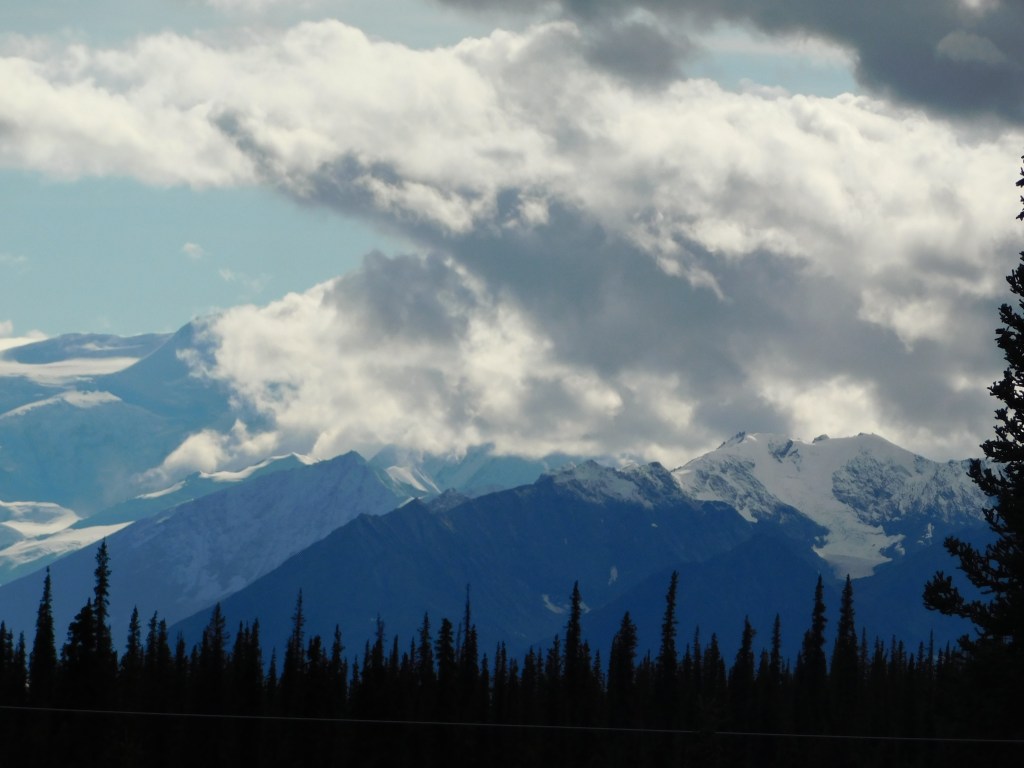
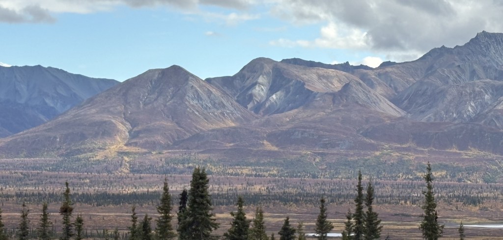
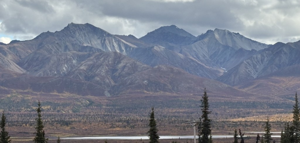
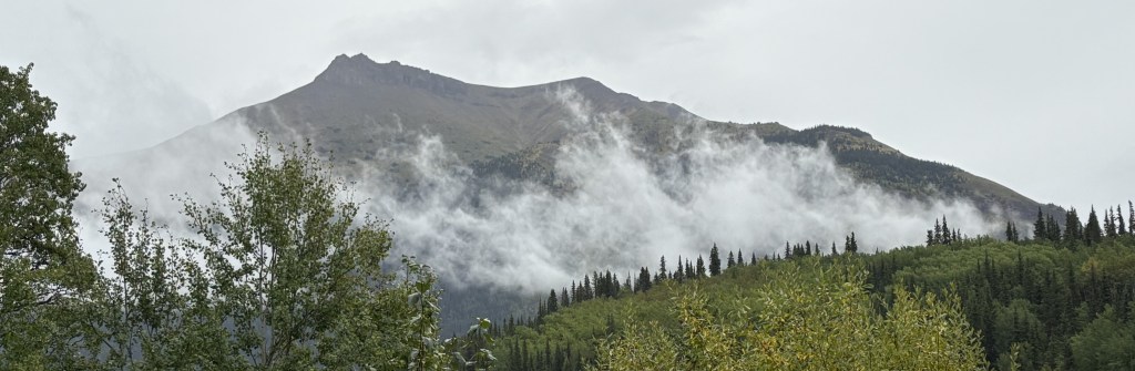
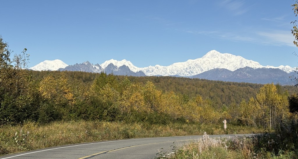
This is a shot of Mt. Denali and Mount Hunter, to the left.

Again, Hunter is shorter, at around 14,000 feet, although it is closer to the highway. From this angle it is almost completely hidden by the black mountains in front of it. The part blocking Hunter from this vantage point is about 4,200 feet tall but it is even closer to the highway, making it an effective impediment to seeing Hunter.

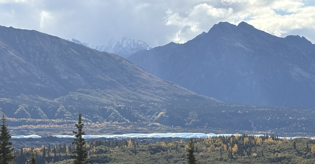
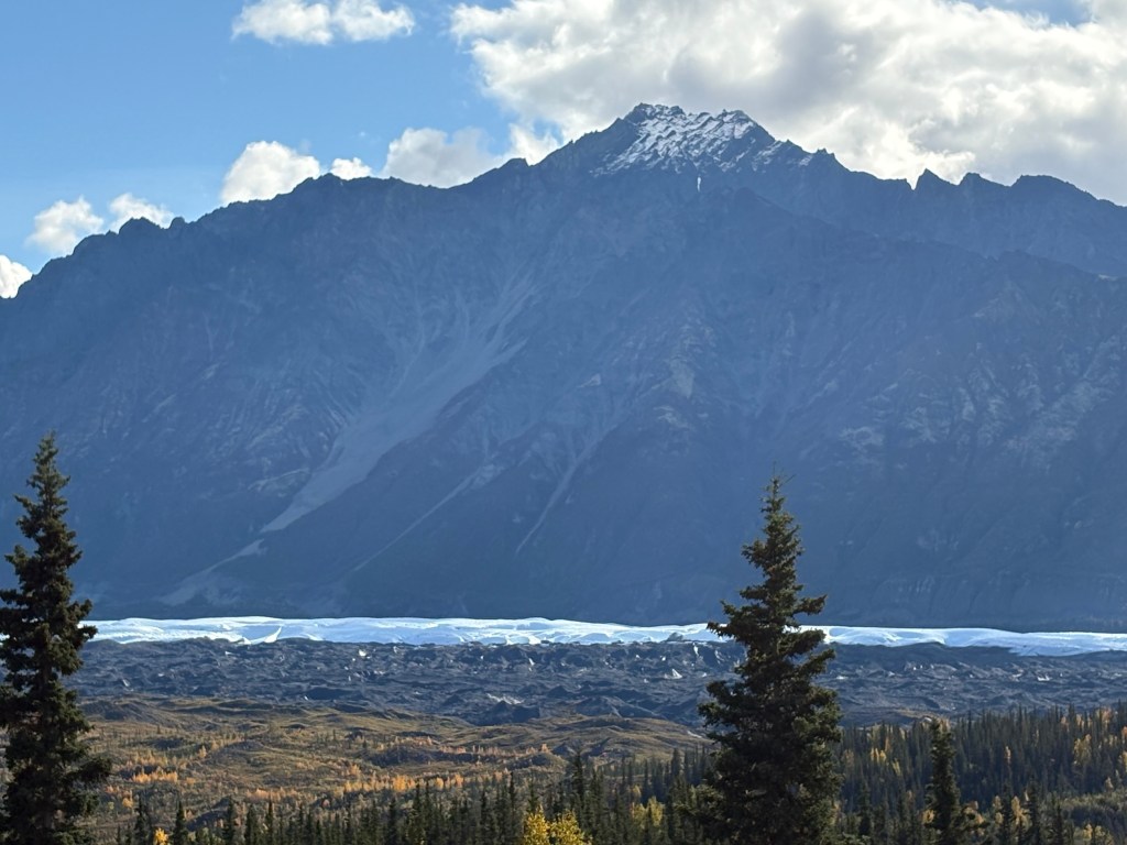
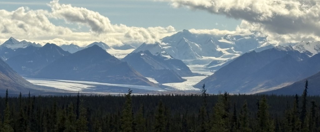
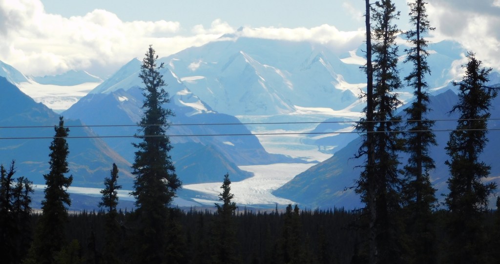
Further to the left is Mt. Foraker. This is the best photograph I have of it:

The other photos above were taken with my smartphone camera but this photo of Foraker was taken with my digital camera and zoom lens. Foraker is 17,400 feet tall, and even with that elevation, from other vantage points it is barely visible due to the black mountains. You will see that in the next post.

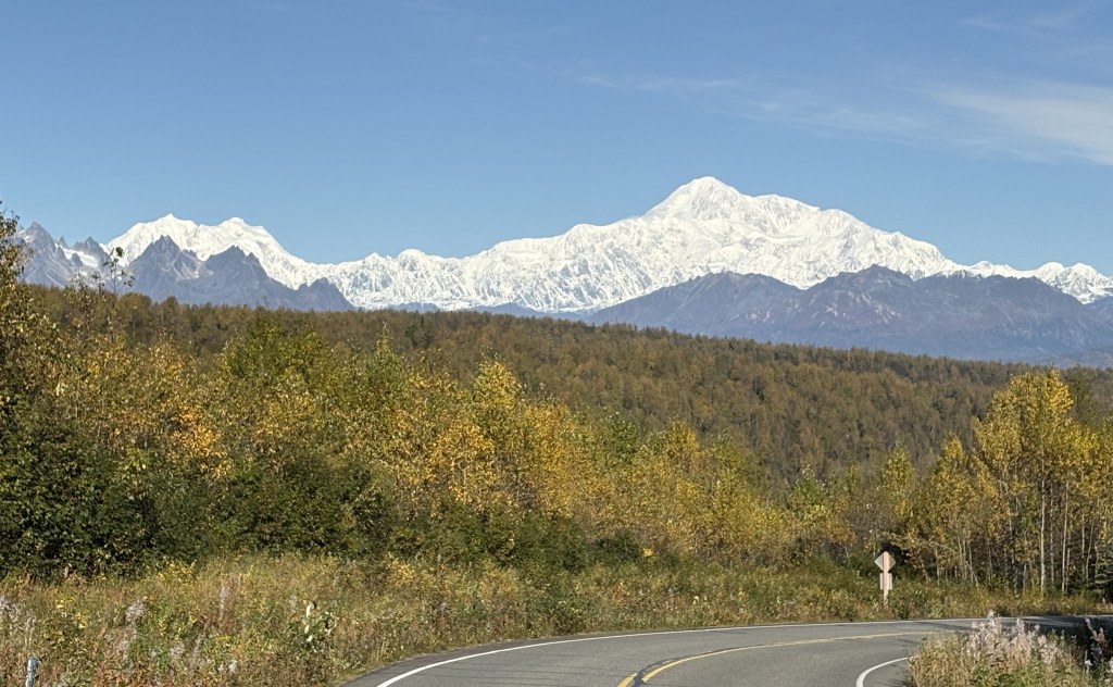
Here is a photo of all three mountains, taken with my smartphone.

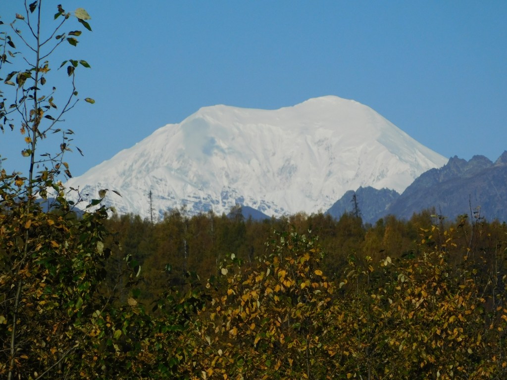
And here is a photo of Denali taken with the zoom lens from this spot:

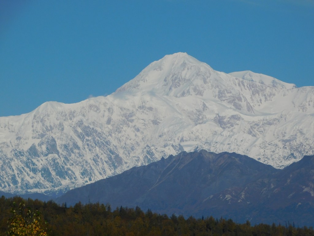
I estimate that I was 43 air miles from Denali at this spot. The photos from this vantage point were taken around 1114am – three hours after I turned around earlier this morning.

The photos in my next post are the best ones I have of Denali and Hunter. As you will see, you will hardly be able to see Foraker from the South Viewpoint, which is only about three miles from here, further up Hwy 3.

My first full day in Anchorage

September 15, 2025

My first day in Anchorage was not terribly productive from a photo standpoint. I had some personal business to attend to, and of course I went to both the Visitor Center (back to the American spelling!) and the Public Library.

The Visitor Center downtown was very interesting:

From the grass on the roof to the abundance of flowers, it was unlike most others I have been to. Unfortunately this building wasn’t open the first time I went and I had to go in a regular office building behind it. I stocked up on maps and brochures, and asked my questions about mountain and glacier identification. This building would be open the second time I went downtown. Not sure why they alternate between the two…

The second place I went was a Walmart in town. I was unable to renew my various prescriptions in Canada because pharmacy’s there will not fill US prescriptions. I kind of screwed up my 90 days from when I left Durham and had to stagger my meds towards the end until I got to Alaska. I had to go and advise them to expect the information from my doctors in Durham, and give them my insurance information. I then reached out to my doctors here in Durham and requested that they send my refill requests to Anchorage. I have one mail order source and I had them sent that (lower priority) refill to my brother in Arizona. They had filled 2 90-day prescriptions with 100 pills each, so I had some of those pills to keep using.

After that I went to the library! My Airbnb didn’t really have a good workspace to use my laptop and I use it quite a bit in the evening when I am on the road. I actually went to the library every day I was in Anchorage (if I wasn’t on the road somewhere). I noticed this sign in the lobby as I was going downstairs to the exit on my first visit there:

I wanted to study the information I had picked up at the Visitor Center and start forming a plan for my days both here and elsewhere. I had been told that many touristy things in Alaska (and Canada, for that matter) shut down after Labor Day. Some restaurants and touristy things in coastal towns that host cruise ships would be open a little longer, but by mid-September they were starting to wind down, too. Several times I would show up somewhere only to learn that the establishment was closed for the season.

I would be in town 4 nights initially and then return for 3 more nights later in my trip. I didn’t actually do that many things in Anchorage but it was a strategic location to operate from.

I will try to break the mountain monotony and entertain you with some oddball photos of things in town that I found interesting (in my own JohnBoy way)…

When I went to McDonalds for coffee this was my order number:

666 – Sign of the devil….

My Airbnb for the first two nights was in a part of town called Spenard (in fact my hostess called her home the “Weathered Den of Spenard” and even had her business license in that name).

That is a sign, evidently an art project, modeled after a Spam can (and with a fake crow).

This is a burger joint who’s parking lot I used to take the photo above so I felt obligated to have lunch there later in the day.

And that is an original 1957 poster they had inside. It was an interesting place!

The word buckaroo has always appealed to me and this club was also across the street from where I had parked, so of course I added it to my collection..

And the political sign on the side of the club also meant something to me, especially when I read the “fine print”. I used to volunteer at a college radio station when I lived in Pennsylvania (while I was still in high school) and one of the radio serials we aired was called Nick Danger, Third Eye – about a fictional detective. Sure enough, here was a Nicholas Danger running for office…

And I will leave you with this beer ad on the side of another building.

As you can probably tell, I gravitate towards strange things sometimes….

Tomorrow – my first trip to Mount Denali!!

Tok to Anchorage – Part 3 of 3

September 14, 2025

As I continue my drive beyond Eureka Roadhouse I will start to see more mountains partially obscured by clouds at their peaks. I strongly suspect they have snow, and possibly glaciers, on them, and in some cases I could barely make out the presence of something in the clouds. My original plan would have had me traversing this section of road 2 or 3 more times, so I was hoping I would get another “bite at the apple” and come back, hopefully armed with maps which might help explain what I was seeing. That did not work out, as I would only pass this way one more time, and it would be heavily overcast and snowing in places! I will explain in more detail what I get to that point.

So let me show you the rest of the pictures I took today:

There was significant cloud cover over the peak shown above, and I could see quite a bit of snow at the base of the clouds, so I believe there is a substantial mountaintop hiding behind those clouds.

That is a different snow-covered mountain than I showed you in the previous post, and the icefield at the base continued a considerable distance. You will see it at the bottom of most of the following pictures.

I was now past the snow-covered “hidden mountains” and was getting into another part of the day’s trip. I was keeping an eye on my GPS unit and realized I still had two hours of driving to get to Anchorage and check in at my Airbnb. The road had gotten narrower and I was in more traffic. Not knowing what was ahead of me I decided it was probably best to stop taking pictures for the day and just focus on driving.

There were of course more mountains along the way, although the road did open up again later, and I passed through at least two medium sized towns. As I approached Anchorage the highway went to 4-lanes, and in some places 6-lanes, so evidently there is enough traffic to warrant that. Getting to downtown Anchorage was easy and it is a very well laid out city.

I regret that I couldn’t retrace my route and show you more, and perhaps better, photos, but I did the best I could. I saw lots of things on my first full day in the state, and believe me – there is lots more to come. I started this as a 4-part post but decided to cut it down to three. I am trying to break down my posts into manageable pieces and not overwhelm people with too much at a time.

Tok to Anchorage – Part 2 of 3

September 14, 2025

As I travel between Tok upstate and Anchorage near the water, the road would take me on a long open stretch between Glennallen and Palmer. A little short of halfway the road rises to an elevation of about 3,000′ (Tok and Glennallen are at around 1,500′). There was a constant string of mountains to the south and I started to see snow on some of them, and the telltale cloud cover which seems to occur if there is snow or a glacier at high elevation.

Some of the mountains shown above have a solid coating of snow. And before I had a chance to stop and get to a place to take those photos, I could tell that the clouds on the right hand side were obscuring an even taller peak covered in snow. I believe that tallest mountain is either Mount Witherspoon (12,012 feet elevation) or Mount Marcus Baker (13,176 feet elevation). And each of the peaks in the photo, snow covered or not, are separate mountains in that “small” area. When I got to Anchorage I asked if there was a map showing the locations of all the glaciers along the coast and was shocked to learn that there are over 100,000 glaciers in Alaska and there are no maps to make identification easy.

Here are a few shots I took with the digital camera and a zoom lens.


And back to my smartphone for the rest of this group as I continue driving towards Anchorage.

That mountain ahead of me had rain falling from the clouds above it. The next ones are what I call the “brown mountains” which appeared to be shorter and without snow on them.

With clouds behind them, that group appeared to be closer to the highway I was on, and were very likely obscuring the view of other mountains behind them. There are lots of mountains between the highway and the coast.

Once I got past Eureka Roadhouse the mountains would start to play hide and seek (in Part 3).

Tok to Anchorage – Part 1 of 3

September 14, 2025

My first full day in Alaska would involve a 318 mile drive on Alaska State Hwy 1, which Google Maps said would take 5 1/2 hours without stops (although I made many stops to take photos). My route would take me southwest to Glennallen, and then west-southwest to Anchorage.

Before I left town I drove from my Airbnb back to the closest gas station to fill my tank. When I went inside to get a cup of coffee I embarrassed myself by trying to pay with a Canadian 5 dollar bill. The clerk asked “Do you have any American money?” and I sheepishly replied “Oh yeah, I’m back in the Unted States now…”. The young man behind me offered to pay for my coffee and I thanked him profusely. I also thanked him for his service, for when he learned I was from North Carolina he informed me he had done some military training in my home state.

It had rained overnight and there were some low clouds when I started out but they soon lifted and it was a nice day to drive. Traffic was light and this stretch of road was in very good shape.

Most of the mountains were on my left, but the photo below was off to the right.

I realize the photo above is quite small but it shows the horizon far to the south to be lined with tall mountains. Wrangell-St. Elias National Park covers a large part of southeast Alaska, and backs up to Kluane National Park across the border in Canada, and between the two of them there are lots and lots of VERY big mountains. I believe the mountains you see above are in Wrangell-St. Elias NP. It is the largest National Park in the United States. Once I reach Glennallen and start driving more to the west towards Anchorage the large mountains you will see are mostly in the Chugach (pronounced CHEW-gatch) Range, which also have some very high peaks.

The gap in the mountains in the two photos above really piqued my interest. I think they may be down at the coast where Valdez is located. I will be going to Valdez later in my trip, but that seems to be the only spot on the map that would have a gap like that.

So while I started the day seeing mainly lower, tree covered mountains, the further I drive I will slowly get closer to the coast and have a slightly better view of those larger mountains. The next part of this post will cover the section of road near a place called Eureka Roadhouse and the types of mountains I was seeing would change slightly.

Highways in Alaska

September 13, 2025

I’ve referenced THE Alaska Highway quite a bit the past few days, but this is a discussion about the highways within the state. They are technically intrastate and not interstate highways because they do not connect to another US state.

I made a post in real-time shortly after arriving in Anchorage about the highway system. I will repeat part of it again and add a photo of my AAA map on which I’ve highlighted all I roads I actually drove on.

(Photo credit: AAA.com Alaska Map)

There are 4 major highways in Alaska, not surprisingly numbered 1, 2, 3 and 4. Yes, there are other, smaller ones I’ll talk about in a minute.

1 – Runs from Tok, southwest through Glennallen, west through Anchorage and south to Homer. 538 miles, 9 hrs 38 min (per Google).

2 – Runs from the Canadian border with Yukon, northwest through Tok, Delta Junction, and Fairbanks plus a few more miles to Livengood. 624 miles, 7 hrs 34 min. The part that runs from the border to Delta Junction is the westernmost part of THE Alaska Highway.

3 – Runs from Palmer north to Fairbanks. 327 miles, 5 hrs 36 min.

4 – Runs from Delta Junction, south through Glennallen to Valdez. 268 miles, 4 hrs 37 min.

I have driven on almost all parts of the those four, and several of the others (to Homer, Seward and Valdez). The picture I posted above does not include the two short roads I drove on in the Alaska panhandle – going south to Haines and then north from Skagway. I took a ferry between the two towns which saved quite a bit of driving by not having to go back up to the Alaska Highway to get to Skagway.

Yes, there are some shorter stretches of highway with different numbers:

11 – The “Dalton Highway” north from Livengood to Prudhoe Bay, a dangerous stretch of road not for the faint of heart and not considered a major highway. I did NOT drive on it.

9 – Which branches off from 1 to run south to Seward.

5 – Which branches off from 2 to run northeast to Chicken. I did NOT drive on it as I was told by one of my Airbnb hosts in Tok that it is either unpaved or not in good shape.

8 – I had not listed this one previously. It runs west to east in the center of the map above between Cantwell and Paxson. The reason I didn’t include it (or drive on it) is that it is a seasonal road and is closed in the winter. It may or may not have even been open while I was there in mid to late September, but I had read numerous places that if you rent a vehicle in Alaska the rental company will likely forbid you to drive on it. I heard stories that it is very rough, and that flat tires are common.

After studying various maps more closely I have discovered a few other very short roads, but my trip focused solely on the 4 primary highways plus ones that would get me to the coastal towns I wanted to visit.

I also mentioned in my original highway post that these primary roads are located in the southeast part of what I call the “mainland” – excluding the Aleutian Islands and the panhandle. Here is another photo of the AAA map illustrating that point.

(Photo credit AAA.com Alaska Map)

Alaska border crossing to Tok, AK

September 13, 2025

This is the last installment documenting my day-long drive from Whitehorse, YT to Tok.

After driving through the worst part of the Alaska Highway I finally reached the border between Canada and Alaska.

There were only two vehicles in line ahead of me, and it didn’t take long to be on my way. The only thing I had to surrender were my mandarin oranges, though my banana and apples were apparently acceptable. The customs agent confiscated a plant from the car ahead of me.

I commented in an earlier post that the first part of the highway once I got into Alaska was pristine, but it didn’t take long for that to change. Roads this far north are a challenge to maintain. The majority of the roads in Alaska were fine, but it is wise to always be alert for changing road conditions. The US didn’t have little roadside signs warning of bad spots, but there were sometimes permanent signs warning of a “Rough Road” ahead, which generally meant those spots were pretty bad. And potholes were definitely a problem in parts of Alaska.

Here are some of the things I saw as I continued on to Tok.

I was still driving northwest, and the highway had changed numbers from Hwy 1 in Canada to Hwy 2 here in Alaska (though I am still on the “Alaska Highway”). I will talk more about other Alaska highways in my next post.

I had driven past the mountains I had seen earlier in the day and now, when I looked left (south), I could see tall mountains way off in the distance (behind lower hills and mountains in the foreground). I don’t really know for a fact but I believe I was seeing the tall mountains in Wrangell-St. Elias National Park. If that is true then I estimate they are about 180 air miles away.

It had also become overcast. I still had about 2 hours of driving to get to Tok.

It was starting to look more ominous on the horizon ahead of me.

There was one place where I once again had to stop and wait for a Pilot Car. I was bracing myself for a long construction zone (the sign had stated the distance) but fortunately, once we got moving I learned that they had just completed an area of new construction and were just painting lines – so we had to weave back and forth to avoid fresh paint and the machinery being used.

Even though I had gained an hour at the border (Alaska has it’s own time zone, which is one hour ahead of Pacific Time) I was starting to get nervous about making it to Tok before dark. You can see the headlights of approaching vehicles in the second photo below, and it did start raining shortly after I took these photos.

I finally made it! My Airbnb hosts were out of town but had given me instructions for getting to my room which was separate from their living quarters. There isn’t much in Tok but I grabbed something to eat and unpacked my stuff for the night. I will have another long drive (with numerous stops for photos) getting to Anchorage tomorrow.

Getting to the Alaska Highway – Part 1 of 2

September 11, 2025

Today is the day I start my trek towards Alaska! I would drive about a half hour west to the small town of Kitwanga and get on Hwy 37, also known as the Stewart-Cassiar Highway, for the 450 mile drive north. Total drive time for the day will be 9 hours.

I saw this when I got out to the main highway after leaving my Airbnb.

That was looking west towards the coast, although the ocean is pretty far away. I don’t know what caused that effect (other than the rising sun), but it really caught my eye. I was driving into town to fill my gas tank before heading north.

When I reached Hwy 37 about a half hour later I turned right and immediately drove over a bridge. This time the dramatic view was to my right – looking east towards the rising sun.

After crossing the bridge I stopped to take pictures of two signs.

The distance sign shows 724 kilometers (450 miles) to get to the Alaska Highway.

Good thing I had just filled my tank! Various people I had spoken with, including the RCMP, had advised me to fill my gas tank at every opportunity along the way. They said there would be a few opportunities (I counted about 6). I did plan to stop about halfway north. I was driving during the day, and the weather and temperature were ok (though it would rain later). The road, however, was a complete unknown and I didn’t really know what to expect. The RCMP told me it is paved most of the way and, of course, to watch out for animals.

Here are some of the things I saw during my drive north:

Right off the bat, a sign warning of animals.

The cloud ceiling had been pretty high when I started out but I could tell that it was starting to lower. It had already started to rain lightly.

I stopped in a pullout area after crossing the Bell 1 bridge. This map shows the route I am taking – from Kitwanga at the bottom to the red arrow in the upper right hand corner (just west of Watson Lake). My destination for the day is a place called Nugget City, less than 2 miles west of the intersection with the Alaska Highway, and it is, barely, in the Yukon Territory province. Also note the bright white area on the left side of the map. That is the southernmost part of the Alaska panhandle. Earlier on my drive I went past the turnoff for Stewart, Alaska. As you can see, a highway does go there but stops just after the border

That is a relatively small sign warning me not to stop as I was in a mud slide area. Terrific…

(continued next post)

2025 Canada/Alaska trip recap

I am back in Durham after my 5-month 2025 road trip. I apologize for the long delay, but I have now reviewed all the photos I took between August 8 and August 31 and will begin posting them in small batches. Some days will have lots of photos, some days will only have a few. I will continue to review photos taken during the remainder of my trip and that should allow continuous posts highlighting my time in Canada and Alaska.

All told, I drove a total of 26,490 miles. 10,061 in the “lower 48” getting to and from western Canada, 12,608 in four of the provinces in Canada, and 4,421 in Alaska.

I spent 142 nights on the road. 20 with family and friends and the remainder in Airbnbs. Most of my time in Canada was spent in British Columbia (33 nights), with 16 in Alberta, 6 in Saskatchewan and 6 in the Yukon Territory (mainly stops while driving to and from Alaska).

I was very fortunate to have had good weather most places, and was able to get in and out of Alaska before any significant snow fell. I encountered little bits here and there, but nothing which impeded my travel. My car was a real trouper, only breaking down one time (in Utah) towards the end of my trip. In all the years I have traveled my cars have treated me very well.

My overall experience was AMAZING! I saw so many beautiful places and met some very nice people along the way – both fellow travelers and my Airbnb hosts. I have had very good luck using Airbnb over the years and find it a pleasant way to get local knowledge as well as staying close to the places I want to see. I passed on some of the more popular ways to see things (by air, by boat or by train) but prefer to do my own thing and travel by car. I avoided some of the more crowded venues.

I hope you enjoy the photos I am about to share.

Texas XX2.2L

They say everything’s bigger in Texas. That may be true until you start talking about Alaska , which in land mass alone, is 2.19 times larger. It’s a big place. And I have only been traveling in a small portion of it. The main roads are all in the southeast corner of the state and there is much, much more land to the north and west.

This is a sign I saw in Earthquake Park, north of Anchorage, a few days ago.

It talks about comparable areas of wetlands between the two. which is a whole nother matter.

There are 4 major highways in Alaska, not surprisingly numbered 1, 2, 3 and 4. Yes, there are other, smaller ones I’ll talk about in a minute.

1 – Runs from Tok, southwest through Glennallen, west through Anchorage and south to Homer. 538 miles, 9 hrs 38 min (per Google).

2 – Runs from the Canadian border with Yukon, northwest through Tok, Delta Junction, and Fairbanks plus a few more miles to Livengood. 624 miles, 7 hrs 34 min.

3 – Runs from Palmer north to Fairbanks. 327 miles, 5 hrs 36 min.

4 – Runs from Delta Junction, south through Glennallen to Valdez. 268 miles, 4 hrs 37 min.

Yes, there are shorter stretches of highway with different numbers:

11 – The “Dalton Highway” north from Livengood to Prudhoe Bay, a dangerous stretch of road not for the faint of heart, and not considered a major highway.

9 – Which branches off from 1 to run south to Seward.

5 – Which branches off from 2 to run northeast to Chicken.

7 & 98, in the Alaskan Panhandle which run south to Haines and Skagway respectively, though I will drive through much more of the Yukon Territory and extreme northwest British Columbia to actually get to them than I will while I am in Alaska.

This is part of the reason I am so far behind posting photos here on the blog. It takes me a long time to get from Point A to Point B, plus the time to stop and take photos. My 2 hr 22 min trip to Valdez took over 6 hours because I stopped every 4 minutes to take pictures! So please be patient with me. Believe me, I am seeing many amazing things EVERY DAY and I am banking lots of photos. I will get caught up eventually.