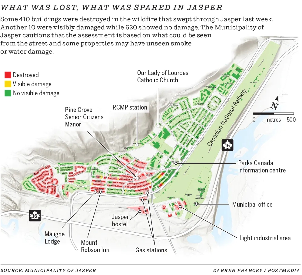
Back to Banff – Post 2 of 2

August 16, 2025

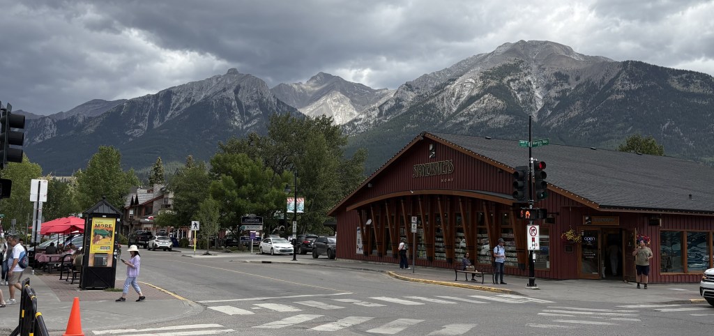
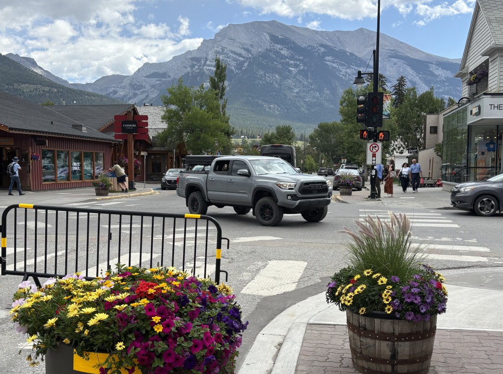
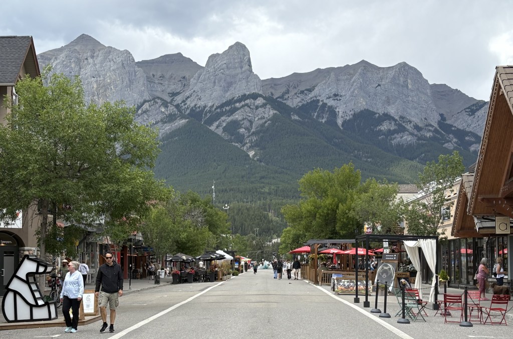
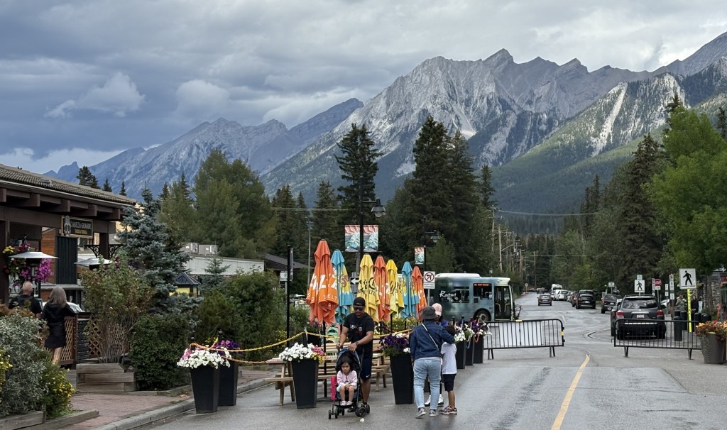
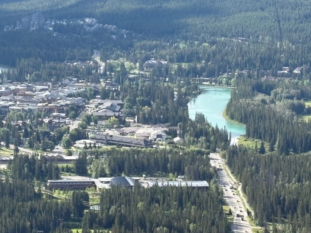
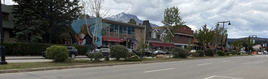
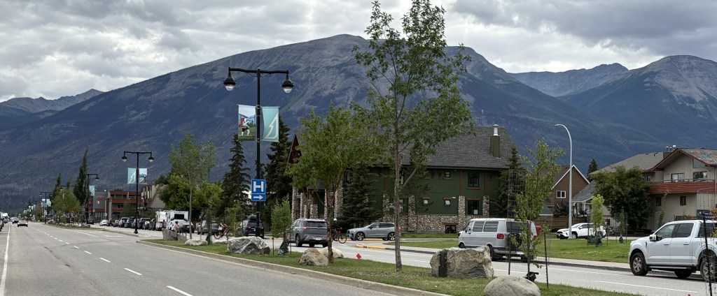
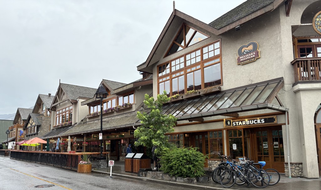
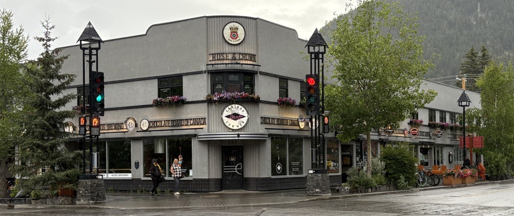
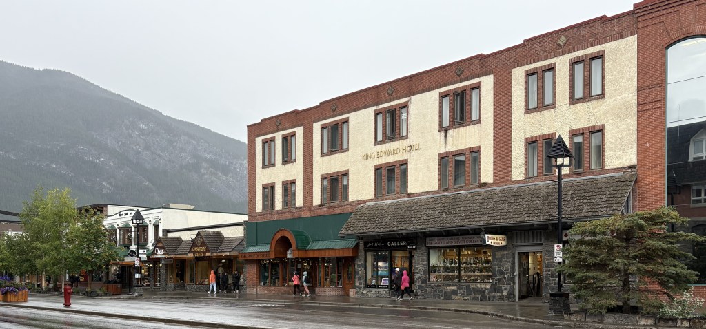
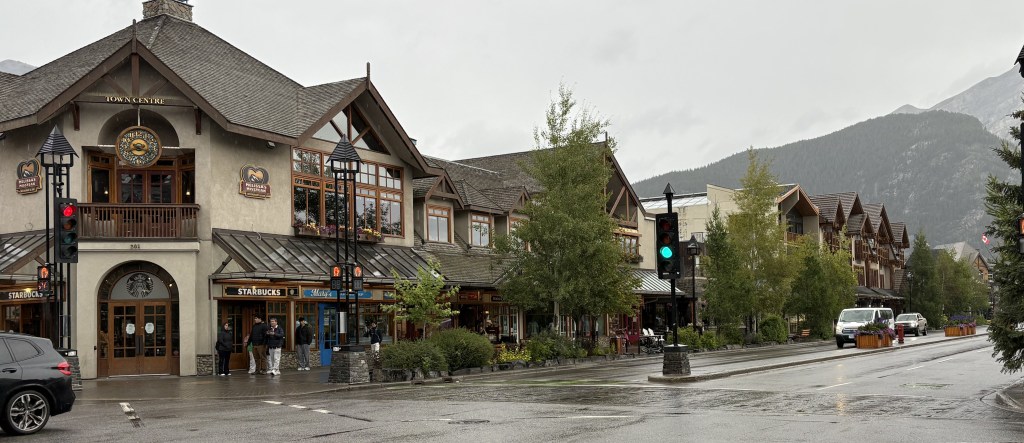
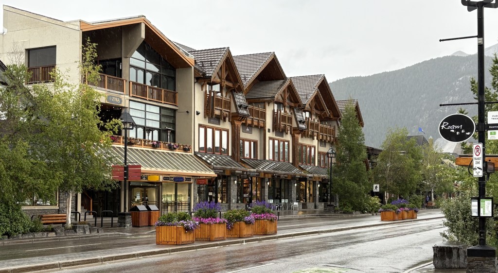
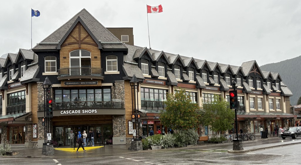
This is part of the downtown shopping area in Banff:

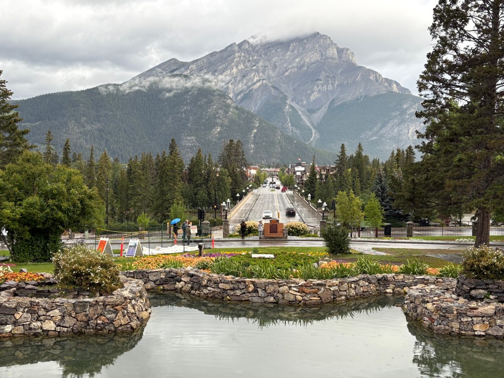
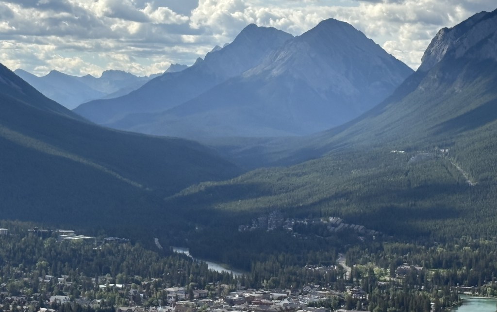
I drove to a viewpoint called “Surprise Corner,” located along the Bow River across from the big Fairmont hotel. I parked in a small parking area and carefully walked down a rocky, muddy path to where I thought I could see the hotel. Well, the viewing opportunities from that low vantage point were not good at all.

Disappointed, I carefully walked back UP the rocky, muddy path to where I had parked my car, only to find a spiffy new viewing deck across the road!

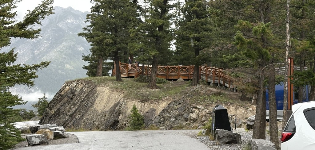
It was above the hill to my left as I drove up to the parking lot for the old trail.

Surprise!!

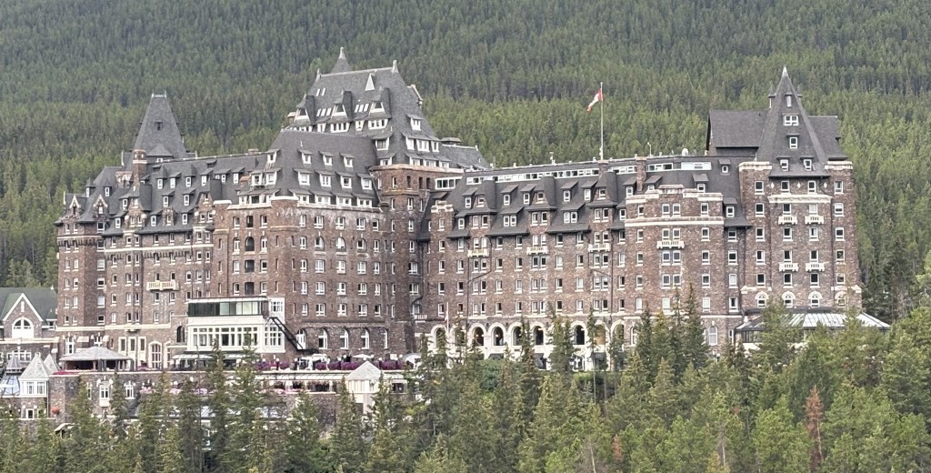
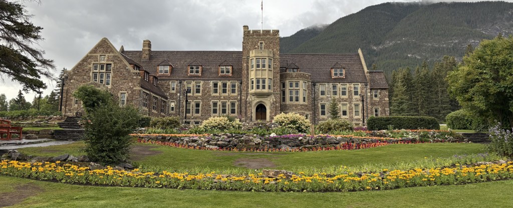
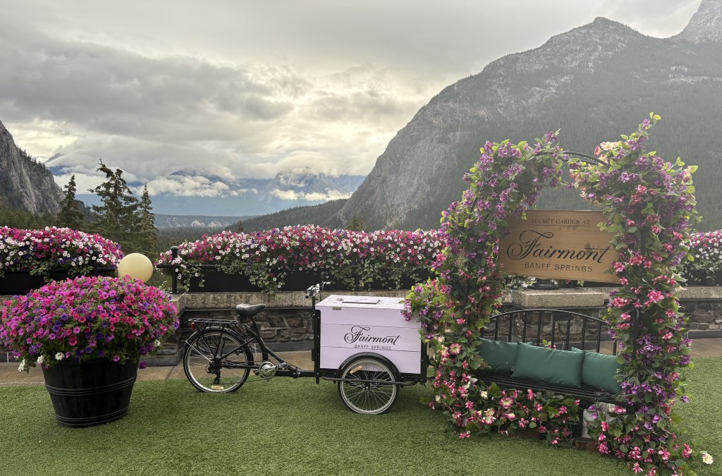
THAT is the Fairmont Banff Springs hotel.

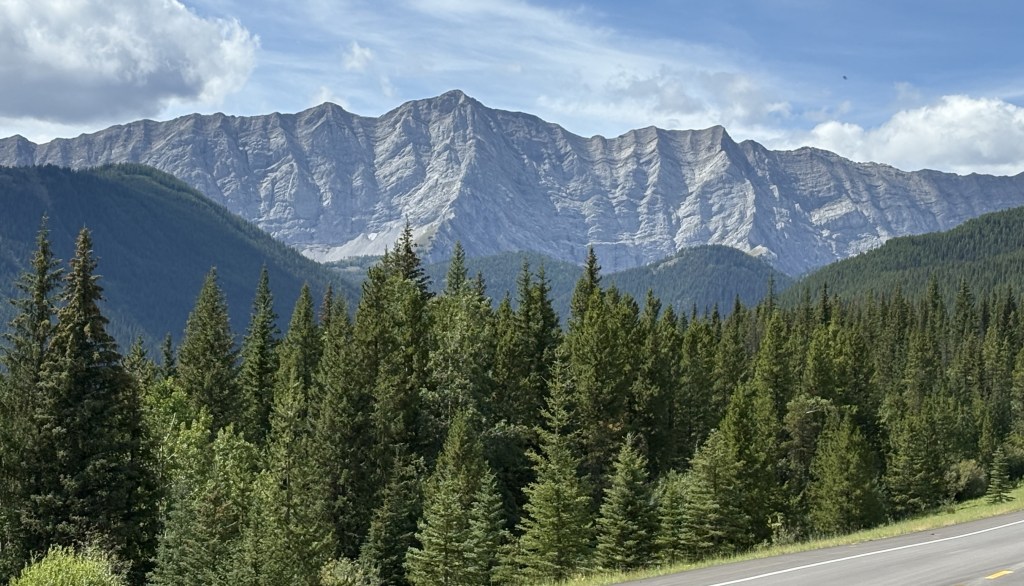
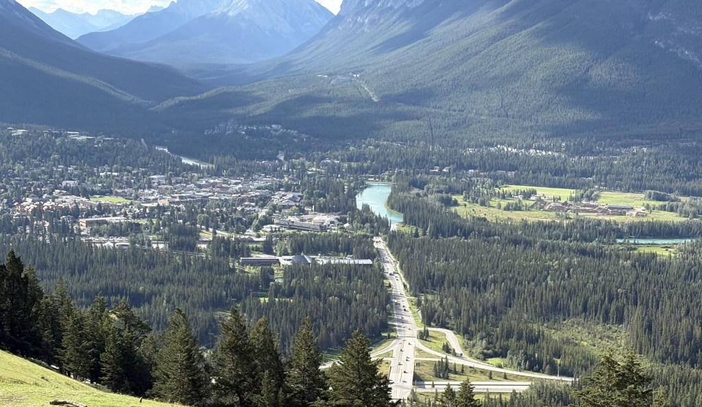
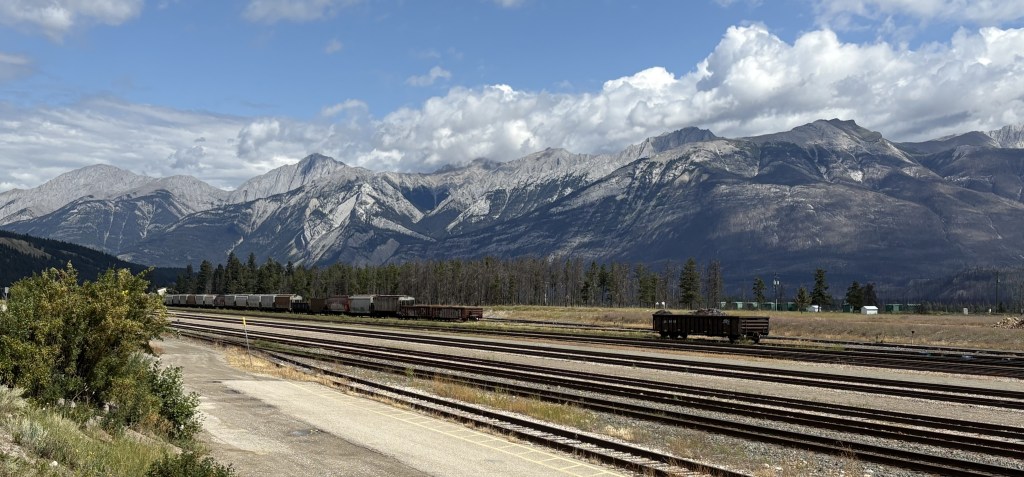
Next I drove out Tunnel Mountain Road. I showed you a photo of Tunnel Mountain in the previous post. Tunnel Mountain Road goes around it, not through it. It would take me away from town and to several viewpoints and trails.

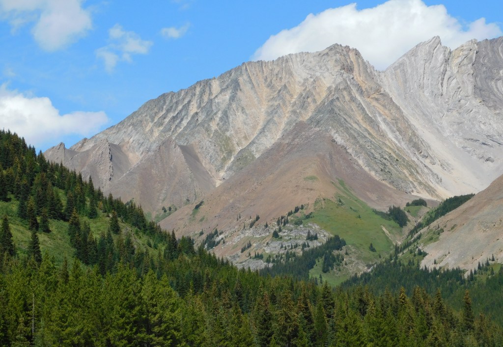
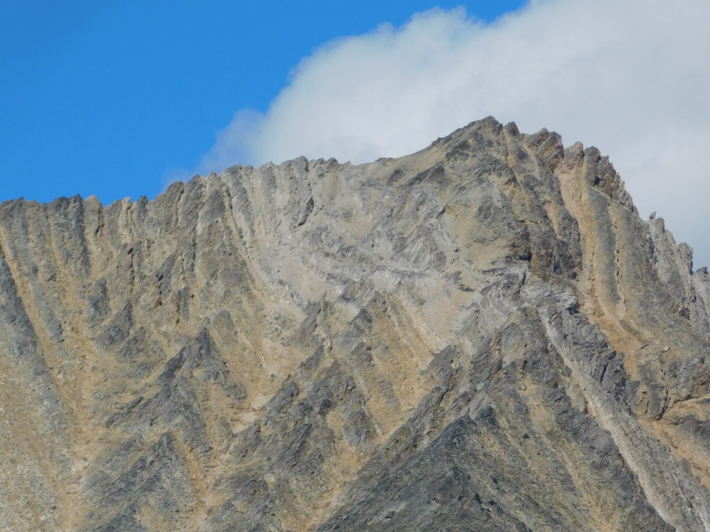
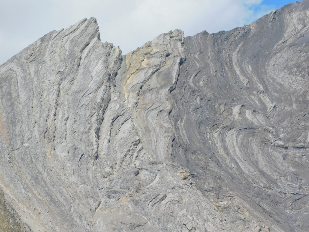
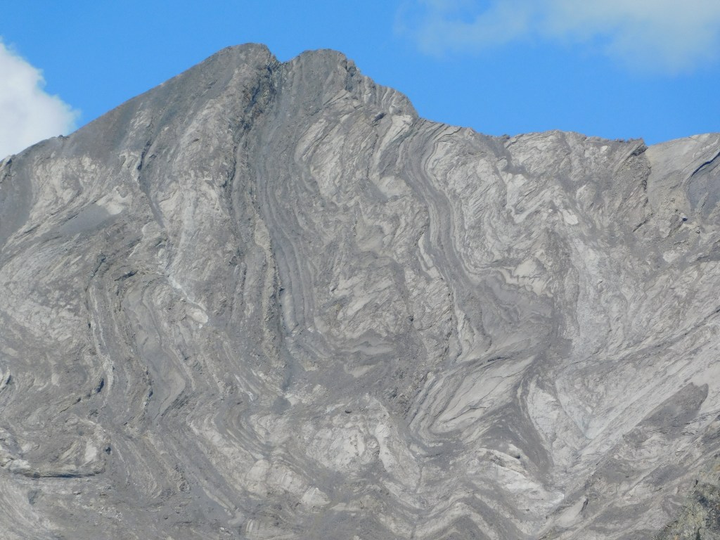
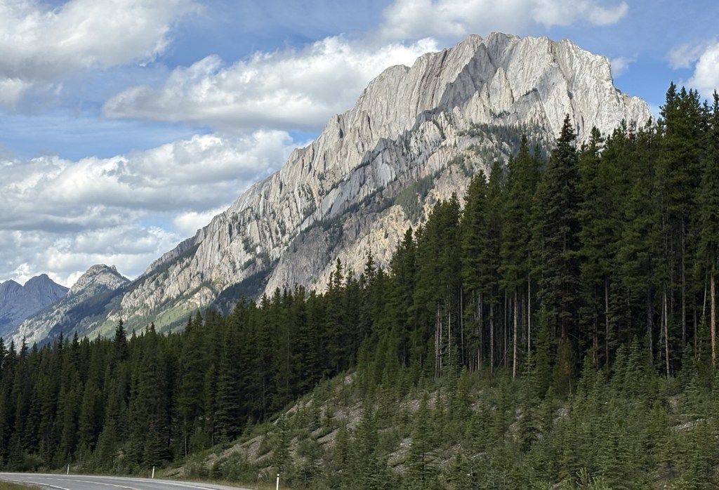
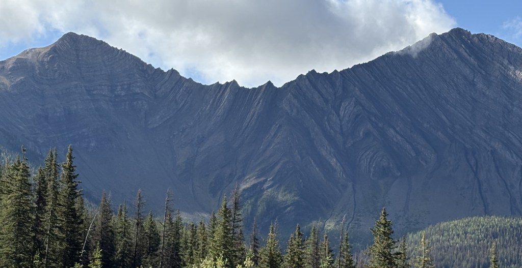
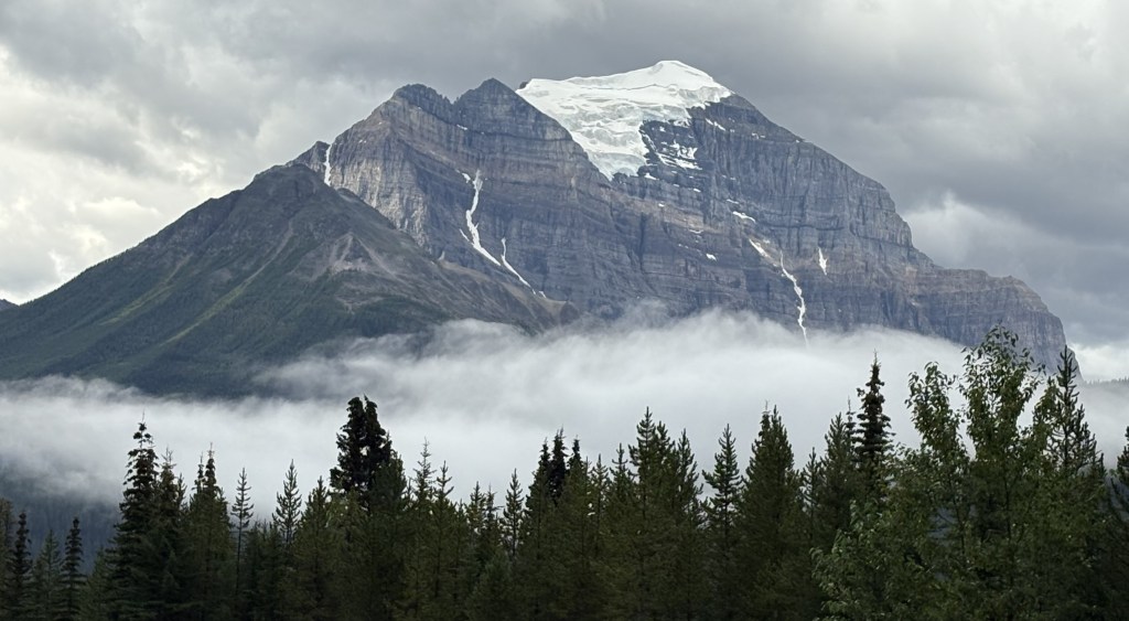
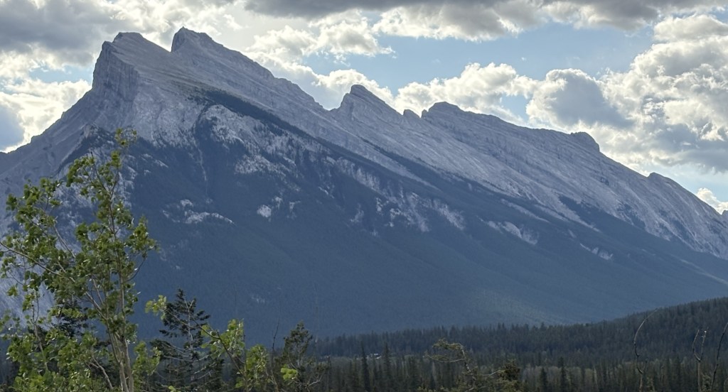
The first stop I came to provides a great view of Mount Rundle.

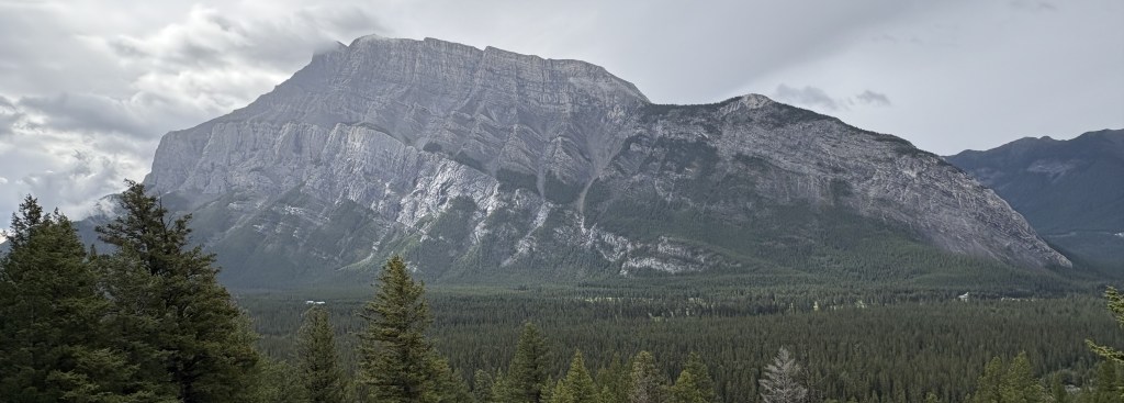
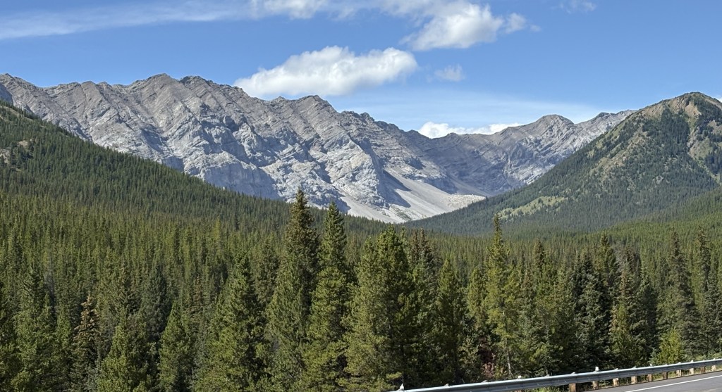
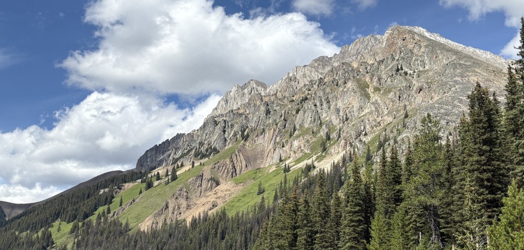
Hard to see from this distance, but there are three distinct “layers” of different kinds of rock, formed over millions of years.

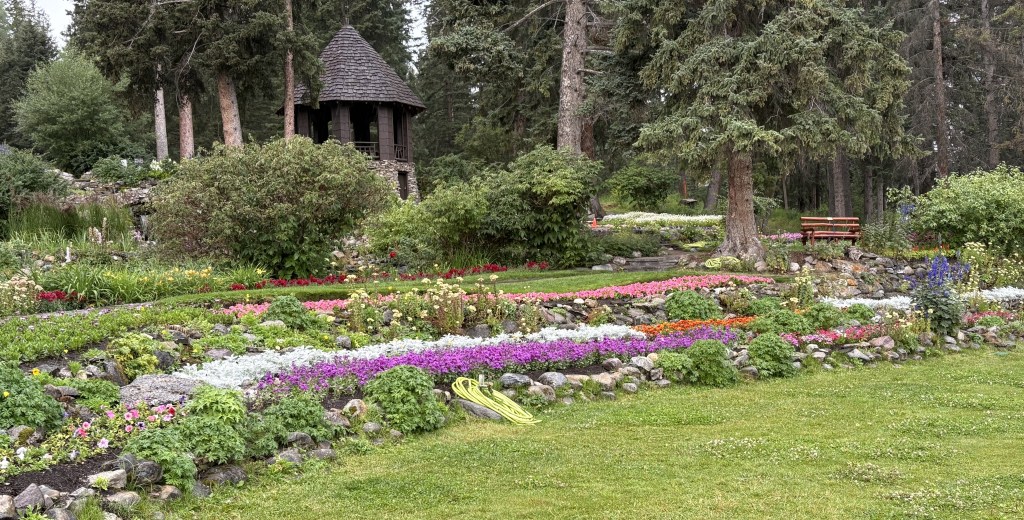
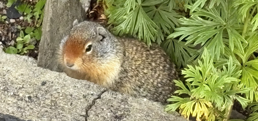
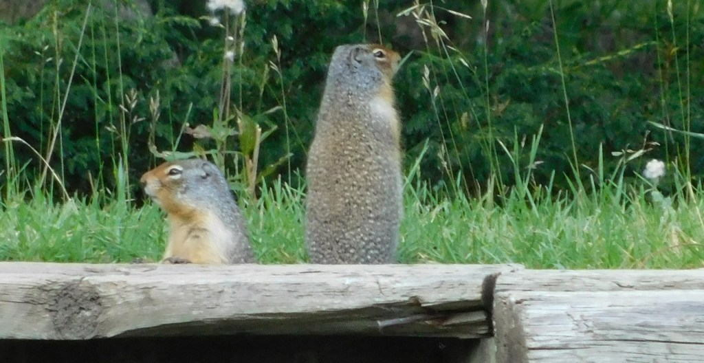
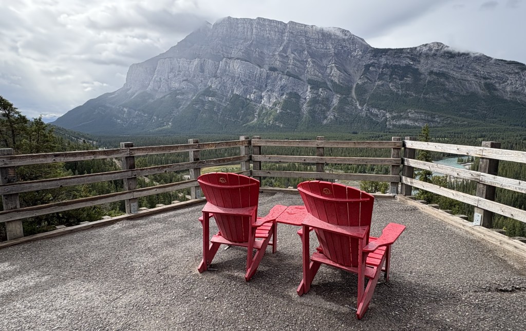
Here are the famous Canadian National Park “red chairs” which are strategically placed through Parks for residents and tourists alike to sit and take some time to soak in and enjoy what there are seeing.

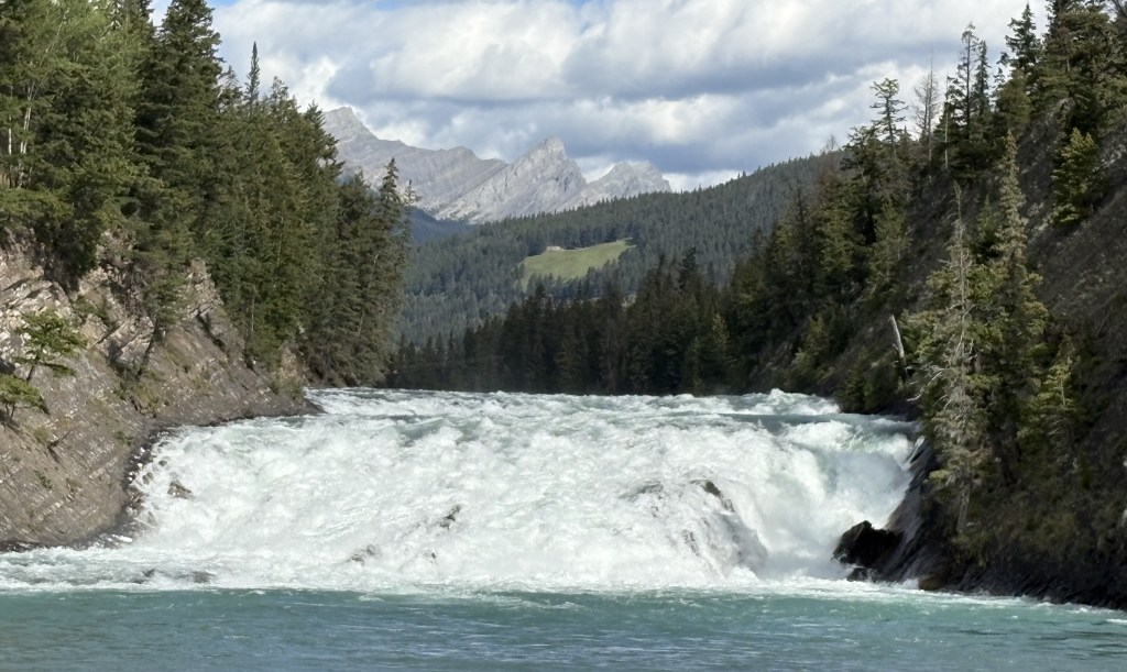
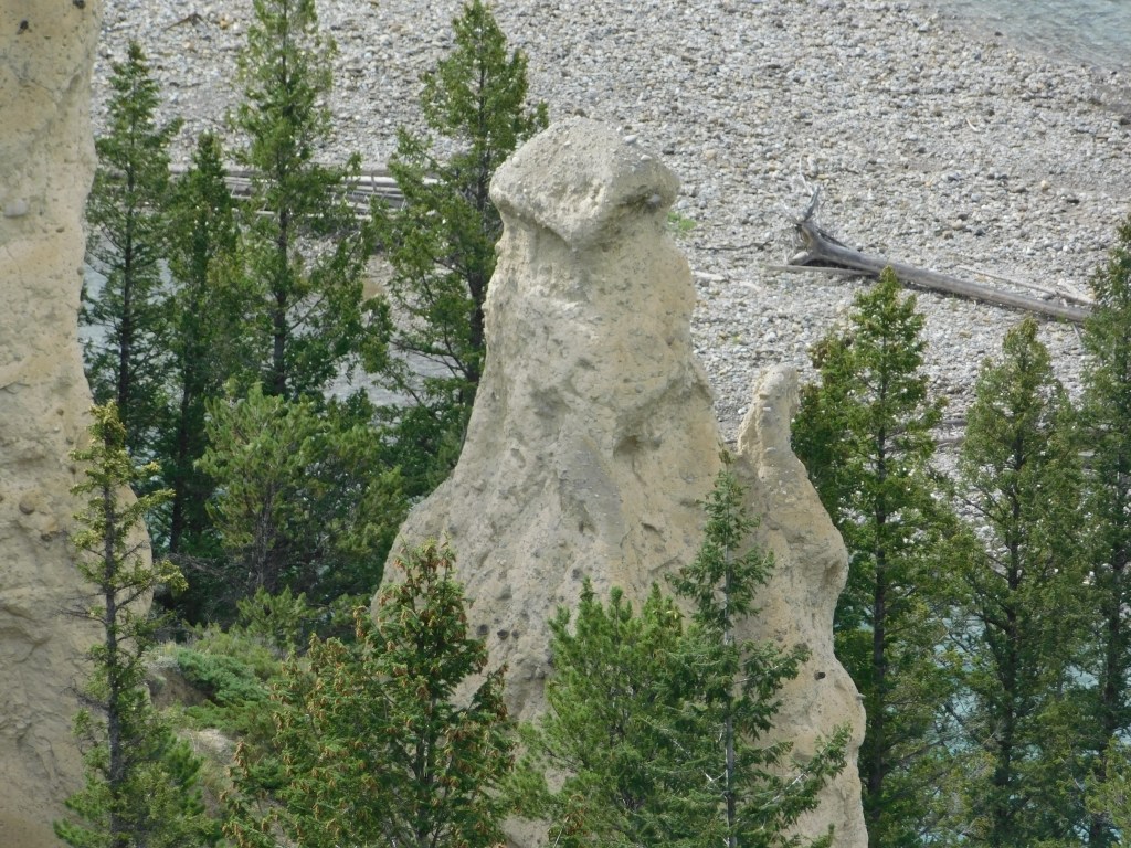
Further up Tunnel Mountain Road I found another viewpoint and trail which would lead me to some “hoodoos,” or natural stone pillars. They are at the bottom of the 3rd photo below, and I could only see the two of them. Sorry, Banff, but after seeing whole National and State Parks with hoodoos in the western US, I can’t say that I was terribly impressed.

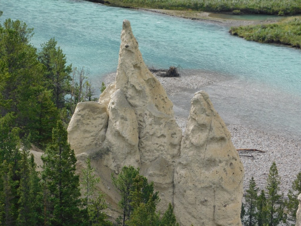
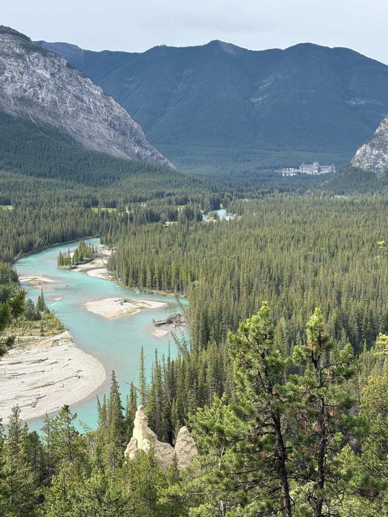
It did make a nice photo, though, with them in the foreground, the Bow River in the center and the Fairmont Banff Springs hotel in the distance.

It was still raining and more tour buses and RV’s were starting to arrive in town so I thought I would try my luck across the Trans Canada Highway and up over a mountain to visit Lake Minnewanka.

Back to Banff – Post 1 of 2

August 16, 2025

Yesterday it rained a good bit and I stayed put in Canmore. Before leaving Durham I had booked all of my Airbnb’s through and including Canmore. I now needed to make a decision about going further east, away from the Canadian Rockies.

The largest wildfire in Canada in 2025 was in Manitoba province, which I was not planning to visit. I did, however, want to go further into Alberta province, and then continue east into Saskatchewan. They, too, were battling wildfires, mainly in the northern parts of their provinces. I was monitoring both the wildfires themselves and what the air quality in and between the towns I wanted to stay in was doing. I decided that with one exception, I would go ahead and book stays in several towns that I originally planned to visit. I cut down on the number of nights and went ahead and made reservations. I did not go to northern Saskatchewan (Prince Albert National Park) because the ongoing fire near there was still burning and the air quality was not good. The air quality in the other towns had improved from unhealthy to acceptable, though some smoke would catch up with me later in my trip.

Having done that, today I drove back up to Banff. The rain was still in the area but it was not a washout. Light rain continued off and on all day but I tried to get out and see more of Banff. I drove up high above town to where the Banff Upper Hot Springs are, as well as the Banff Gondola. I could not drive all the way to the Hot Springs because I didn’t have a reservation there. The Gondola was not yet open, and given the cloud cover I wasn’t optimistic that I would see anything from it anyway. As I started driving back down into town I saw a lone cow moose walking along the road. She turned to walk up into the woods but I was able to take some pictures of her.

I continued on down the hill and parked at the Cascade of Time Garden. It is behind a big building which I believe is used for Park Administration.

That is the view from the front of the building looking across the bridge over the Bow River and down Banff Avenue, the “main street” of Banff. The mountain in the distance is Tunnel Mountain.

This is yet another marmot. I spotted it as I walked around to the front of the building. I stood very still after he ducked down into a hole near the sidewalk and after a short wait he reappeared.

I figured I’d leave him alone and walked down to the very front of the property to take a photo of the building.

About this time I saw a large tour bus pull in and start unloading passengers. I walked back up to where I had seen the marmot and he was still there, roaming amongst the flowers.

I went back to my car and drove to the Fairmont Banff Springs hotel. I had to park on the street behind the hotel and managed to find a way up a set of stairs on the side of it. I couldn’t get a good shot of the hotel itself as I was too close to it, and I would have needed a key card to open any of the entrance doors.

I knew I would be able to take a good picture of the front from one of my next stops so I walked back to my car and drove downtown.

Kananaskis Country – Post 2 of 3

August 14, 2025

I didn’t mention in the first post that Kananaskis Country is big. It covers over 1,500 square miles, larger than four of the six National Parks I visited while based in Golden. Lots provincial parks, rivers, hiking trails, lakes (large and small) and other publicly accessible areas.

Here are more things I saw as I started driving back from the southern end.

At one point I was pretty sure I saw a marmot run across the road. There was a small park nearby so I pulled off the road, parked and waited. Sure enough two them came out of their burrows and looked around.

The small marmot above is acting as a sentry. I had quickly pulled off parallel to the road near the entrance to a parking area and when I stopped I realized it was right in front of my car (like only a few feet away) looking right at me. He never flinched. The only time he moved was when I got out of the car with my camera, at which point he ran back to shelter to alert his friends (which he would have already done audibly). I waited, trying to hide behind the stop sign post, and in a short while he came right back out and resumed him position (I had pulled my car back into the parking area by then).

It was the same thing the first set of marmots I saw were doing. Looking for danger so they can alert others.

This what I had stopped to take a picture of:

This is a sign I have started to see more and more often. I don’t really understand the significance of it, as the intersection I ultimately encounter doesn’t seem to be any different than other intersection.

Just another Canadian thing, I guess…

Kananaskis Country – Post 1 of 3

August 14, 2025

After reviewing literature I picked up while visiting Banff and Canmore I decided to drive down to an area called Kananaskis Country. To get there I would drive 19 miles south and east on Canmore on the Trans Canada Highway and then turn south on Hwy 40. Kananaskis (pronounced cannon-ASK-iss) Country is accessed via a nice, two lane scenic drive through some beautiful countryside.

One of the first things I noticed as I started driving south was the presence of cattleguards in the road (in Canada they call them Texas Gates).

I see them lots of places but hadn’t really noticed them in Canada until now. They keep cattle from leaving areas where farmers or ranchers would like them to stay by creating slots which their hooves would drop into, thereby preventing them from getting by. They are generally accompanied by signs warning drivers of “Free Range” animals ahead. In this case, cattle are allowed to cross the main road to get to fields or pastures on the other side but are prevented from getting too far on the road itself.

While I was now in the foothills of the Canadian Rockies there were still sizeable mountains along my route. There were some low clouds as I drove south but they would lift later in the day. Once again, many of the mountains were different in appearance than others I have seen Canada.

Can you say moo? This is a prime example of what I was talking about earlier. There were no cattleguards preventing these cows from getting up to the main road but there were some going north and south from here to prevent them from walking off.

This was taken from a rise in the road looking back the way I came. You can see it was still overcast up by the TCH but it was getting sunnier where I was headed. I would drive about 40 miles south before turning around to go back.

These were taken at the point where I decided to start back. It was near a small town which I can’t even find on the map. There were lots of stuffed animals, painted white or faded by the sun, attached to the fenceposts near the road.

There was a sign nearby for Bearspaw Nation, which is made up of several indigenous tribes in the area. These animals are generally a memorial to children of indigenous tribes who died in residential schools, apparently a big problem years ago in Canada and perhaps elsewhere. In some cases they are memorials to children killed in accidents or by illness.

I turned around and started heading north. Guess what I found in the road, right around the same place as I saw them before?

I’ve been telling people who ask about how many and what types of animals I have seen during my trip that I have undoubtedly seen more cows in the road (not only here but elsewhere) than anything else. Eagles and moose are probably next, and after that the numbers are very small.

The first photo of the cows was taken at 1117am. The photo above was taken two hours later. I don’t know for a fact but I am pretty sure they are the same cows. I also saw groups of cows resting in the grassy areas next to the road.

Canmore, Alberta

August 13, 2025

I drove south 20 miles from the town of Banff to the town of Canmore, about triple the side of Banff with a permanent population of around 16,000. Canmore is just outside the southern end of Banff National Park. Golden and Canmore were, by far, the most expensive Airbnb’s on my trip but they are both close to the places people want to be and can command higher prices. Staying in Banff proper would have cost even more…

I went downtown and parked and found that I was in a very nice little town that didn’t feel as congested as Banff. They also had a few blocks of their downtown area blocked off to traffic to form a pedestrian mall of sorts. I walked around and went in a few shops and immediately felt at ease. I also noticed that no matter which direction I looked I could see mountains.

I walked a short distance to a town park located along the Bow River.

Before I checked in at my Airbnb I decided to go to the library to print some documents from my computer. What I found there was totally unexpected.

A multi-story climbing wall! The library is located inside the Elevation Place Recreation Centre which also features a fitness gym, an aquatic centre and an art gallery! The climbing walls seemed to be the most popular and there were not only adults but also some rather young, but fearless, children.

Some of the walls go as high as 45 feet and the are some much lower ones which arced out to give an additional challenge to the climbers (not shown).

I stood for quite a while in the entrance area and marveled at the ability of the climbers. I even went back on another day to watch some more as I found it fascinating.

Getting to Banff (the town), Alberta

August 13, 2025

After leaving Yoho National Park I crossed into Banff National Park and began my trek southeast. Jasper and Banff National Parks both have an elongated footprint which slants northwest to southeast. They are both on the spine of the Canadian Rockies and help form the western edge of Alberta province. Banff National Park covers just under 2,600 square miles, about 60% the size of Jasper NP. Banff NP has over 100 named mountain peaks.

Once I pass the town of Lake Louise on the Trans Canada Highway I would travel about 40 miles to get to the town of Banff. I have traveled the northern part of this road twice, both times driving northwest after leaving Kootenay National Park. Today I will be driving southeast so I be seeing a different vantage point of several mountains I have already seen, and will be seeing some new ones which I could not see as I drove north,

The next two sets of mountains were being backlit by the early morning sun as I approached them.

I stopped at a rest area before reaching Banff and took these photos. The first one is looking back northwest towards Kootenay NP.

And this next one is looking back towards the highway I had just driven down, with the upper part of mountain now basking in the morning sun.

The next one is looking southwest towards the town of Banff.

I would soon exit the highway and turn left, climbing a mountain towards the Mount Norquay ski area. From a scenic viewpoint along that road this is the view looking towards the town of Banff. You can see Hwy 1 going from left to right at the bottom of the photo.

Below is a closer look at town. You can see the Bow River on the right and the shopping district to the left of it. If you look closely at the upper left hand corner of the photo you can see the large Fairmont Banff Springs hotel. You will be seeing more photos of all those things in subsequent posts.

Banff sits at an elevation of 4,600 feet and has a permanent population of about 8,300. As with Jasper, and many other towns in Canada, that number increases significantly with year-round visitors. It was named by a railroad executive after his hometown in Scotland.

Below are some of the big mountains west of town. In that photo the Banff Springs Hotel is just right of center at the bottom. To the right and above it is the road leading up to the Banff Hot Springs and the Banff Gondola.

I ventured into town to get some maps and get a feel for the lay of the land. Banff has a reputation for being overrun with tourists, especially in the winter when people are visiting the local ski areas. I would actually be staying in the town of Canmore, about 20 miles further south, for several nights but will make a quick trip into Banff today, and will drive up from Canmore on another day to try and beat the crowds.

Here is the first place I visited when I drove downtown.:

The photo above is of Bow Falls. The Bow River originates at the Bow Glacier up in Jasper National Park, along the Icefields Parkway. It will pass through southern Alberta and Saskatchewan provinces before turning north, pass through Manitoba province and empty into Hudson Bay.

Below are some rafters setting out on the lower part of the Bow River.

After navigating mid-day traffic in town I decided to go back out to the highway and drive down to Canmore and get settled into my Airbnb there. I will return to Banff in a day or two to spend more time here and will have lots of photos to share.

Jasper, Alberta – Part 2

August 8, 2025

After walking and driving through parts of downtown I drove “around back” to see two lakes located behind town. Once I got back there there was absolutely no indication that anything bad had happened.

This is Pyramid Lake, and behind it is Pyramid Mountain.

That is the Pyramid Lake Lodge and across the road is another view of the lake with docks and various watercraft for guests to use.

I wasn’t able to get to Patricia Lake, although I don’t think it was technically off limits.

I drove back towards the downtown area and crossed the Athabasca River to take a quick drive through the Fairmont Jasper Park Lodge property, a high-end hotel. It is on the “fire side” of the tracks but was apparently protected by workers and firefighters and only lost a few small buildings. The main lodge and most of the other buildings appeared to be intact.

Just off the road to the Fairmont property I did see this animal, eating grass in a burned out area of the forest. I initially thought it was a cow moose but I now believe it was an elk because a few minutes later I saw 30 or so elk as I was leaving Jasper. I sent pictures of them to a few friends called them moose and one of my brothers pointed out that they were elk.

This is the intersection of Hwy 16 (Connaught Drive) and Hwy 93 (the Icefields Parkway) as I was leaving town.

Across the intersection is Whistlers Peak which is where the Jasper Sky Tram goes. It is the highest and longest aerial tram in Canada. As far as I can tell that part of the mountain was not affected by the wildfire. Left of that is Marmot Mountain where the Marmot Basin ski area is located. It, too, was unaffected by the fire.

Once I turned south on Hwy 93 there were several vehicles stopped on both sides of the road and people were milling about with their cameras. Of course I stopped and joined them. There were about 30 elk resting on the ground in a grove of burnt out trees. They appeared to be adult females and some younger ones but I didn’t see any antlers so apparently there weren’t any adult males.

I continued south towards Golden, wanting to get there before dark. This is the view as I approached Mt. Hardisty. You can see the burnt out trees on both sides of the highway.

Jasper (the town), Alberta – Part 1

August 8, 2025

I chose Jasper as my first National Park to visit after arriving in Golden (although I drove through 3 others getting there). I really didn’t know what to expect when I got to the town of Jasper, as I was aware of the wildfire in 2024 but didn’t know the extent of damage. The town of Jasper is about a 3 1/2 hour drive (if done non-stop) from Golden, although I stopped many, many places to take pictures.

As I mentioned in the last post, I started seeing evidence of the fire as I drove around two mountains south of town – about 16 miles away. All the trees on either side of Highway 93 were destroyed by the intense fire. When I finally arrived in town around 1 pm, I stopped to walk the main street in town. I also went to the Parks Canada Visitor Centre, which wasn’t affected by the fire. There I was told where I could and couldn’t go within the Park. While I was there, some parts of the Park were still off limits due to damage caused by the wildfire.

Here are some of the things I saw:

Those are railroad tracks on the south side of town, significant because they are a main transcontinental line operated by CN Rail (The Canadian National Railway). Rail traffic through the Park was suspended the night the fire started, and CN Rail brought in one of their firefighting trains to help fight the growing blaze. Just beyond the tracks is the Athabasca River (out of view), and in the distance are the Colin Range of mountains, located southeast of town.

That is the tourist “photo op” sign in Jasper (in a rare moment someone wasn’t having their picture taken in front of it), and behind it is the Parks Canada Visitor Centre.

Those are the views of Connaught Drive, the main street in Jasper, looking in from each end.

This is an Akita taking a break while his handler was on the phone.

This is a statue outside the pizza place where I had lunch.

This is one of the few signs of the fire I saw downtown. It is a set of gas pumps on the same side of the street as the main shops.

Another gas station was destroyed on the other side of the street. The structures destroyed in the fire have been razed and the lots cleared. Many of the businesses which were affected indicate online that they are only “Temporarily Closed”.

Here is a map of downtown Jasper showing which structures were lost in the fire. The map states that 420 structures were destroyed or visibly damaged while 620 showed no damage. Wikipedia states that 358 of 1,113 structures were destroyed. Either way, the town did suffer significant property losses.

(Photo credit: Calgary Herald)

These are trailers which were brought in as temporary housing for some of the residents who lost their homes. I saw them at several locations in the area.

The next post will show some other things I saw in the area before heading back to Golden.

Golden to Jasper NP – getting to the Icefields Parkway

August 8, 2025

Almost all of my drive northward to Jasper National Park involved driving on Highway 93N, which I turned left onto after having driven northeast through Yoho National Park when I left Thursday morning from where I was staying in Golden. The photos I posted previously of several lakes (Herbert, Bow and Peyto) and mountains were actually taken in Banff National Park, a large section of which I would drive through to get to the Parkway. As I post this next set of photos I realize I am STILL in Banff National Park and am still making my way north towards Jasper NP and the town of Jasper. Once I cross the line into Jasper National Park the road will become what is called the Icefields Parkway, so named because of the many mountains which have snow and ice packs (glaciers, or ice fields) on their higher elevations year-round, including these mountains which are still in Banff NP.

The day started out cloudy, and with some low clouds near the mountains. It was rather cold and windy which made it feel quite raw. Here are some of the many glaciers I saw as I drove north.

A closer look at two of the peaks in the photo above from a slightly different angle:

Again with these mountains, it is hard to name names and give elevations because there are rarely signs identifying them. There are two very large icefields I will come to that definitely have names and are the main focus of specific tours which take paying customers directly to them, or to an exclusive observations platform which allow them to take photos. I will point them out when I get to them in the next post.

This is looking back after I started climbing the road through Wilcox Pass:

Driving north through Sunwapta Pass and Wilcox Pass will result in an overall altitude change and will also signify the transition from Banff NP to Jasper NP, and the official start of the Icefields Parkway.

A little color at the viewpoint from which I took the preceding photo:

And a big fat crow, sitting on the ground watching all the tourists getting out of their cars and taking photos of the view looking back at the lower elevation we had just come from.

And a wider view looking back. These photos were all taken August 8, about a month ago as I actually post this. As you can see it was an overcast, albeit clear (air-wise) day. I drove through this same area a few days ago in slightly less ideal conditions due to wildfire smoke which is now being thrust into British Columbia and the Candian Rockies from other parts of Canada, and took more photos which, when it comes time to post them, will show a slightly different look.

Even in the less than ideal conditions cloud-wise, I was glad I got here in early August when I did.

Up next – The Columbia Icefields

Rest Stop between Banff & Yoho NP’s!!

After I had driven through Kootenay National Park the first time (pass #1) I entered Banff National Park and I turned left on the Trans Canada Highway and started heading northwest towards my next stop in Golden, British Columbia. I drove several miles on the TCH (still in Banff NP) and pulled into a rest stop at the border between Banff NP and Yoho NP. That border also represents transitioning from Alberta province (Banff) to British Columbia province (Yoho). One of the more bizarre half-hours I have spent on the road – in three National Parks, two time zones and two provisional border crossings.

And it got even stranger. I ended up parked in that rest stop for almost an hour, which the following photos, all taken there, will help explain.

This shot above is looking across the TCH and the vehicle you see is traveling northeast and about to enter Alberta. If you are paying close attention to what I just described it adds to the bizarre nature of what just happened. Before crossing back into British Columbia the TCH also turned left (for my direction of travel) and whereas I started out driving NW on it I was now heading SW. I’m sure glad my GPS knew what the hell was going on!

Here is a photo of the exit from the rest stop, with the sign welcoming me to British Columbia.

And further back in the rest stop, where my car was parked, a sign welcoming me to Yoho National Park.

Now, if you look at the middle photo above you will see what was happening that caused me to stay right where I was for a while. The tops of many of the mountains I seen thus far today were partially obscured by clouds. No big deal. Well, and I sat in my car watching, the mountains ahead of me were being overtaken by more clouds, and what appeared to be precipitation falling from them. And whatever it was appeared to be coming towards where I was parked.

I was parked at about 5,400 feet elevation and the air temperature was 56 degrees Fahrenheit. I wasn’t sure if the temperature was going to plummet and snow or sleet might start falling so I opted just to stay right where I was.

Well, it never did anything where I was and the clouds and whatever form of precipitation was falling from them never reached me. Once the clouds dissipated I went on my way and drove through Yoho NP to Golden.

I will make a separate post about what types of things can be found in Yoho, as I passed through it several times over the next few days.


As I post this early on Wednesday, September 3 I have just made my Airbnb reservations which will take me from Prince George, BC on the morning of September 10 to arrive in Anchorage, Alaska in the afternoon of Sunday, September 14. I will share the specifics of that trip in another post, and will start planning my itinerary while I am in Alaska. I’m sure I will spend 2 or 3 days in Anchorage getting acclimated and finding out what things are open full time and what things have adjusted to a seasonal schedule.