Getting to the Alaska Highway – Part 2 of 2

September 11, 2025

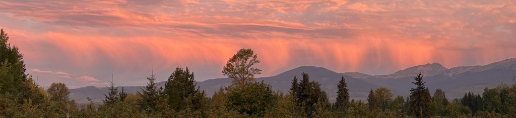
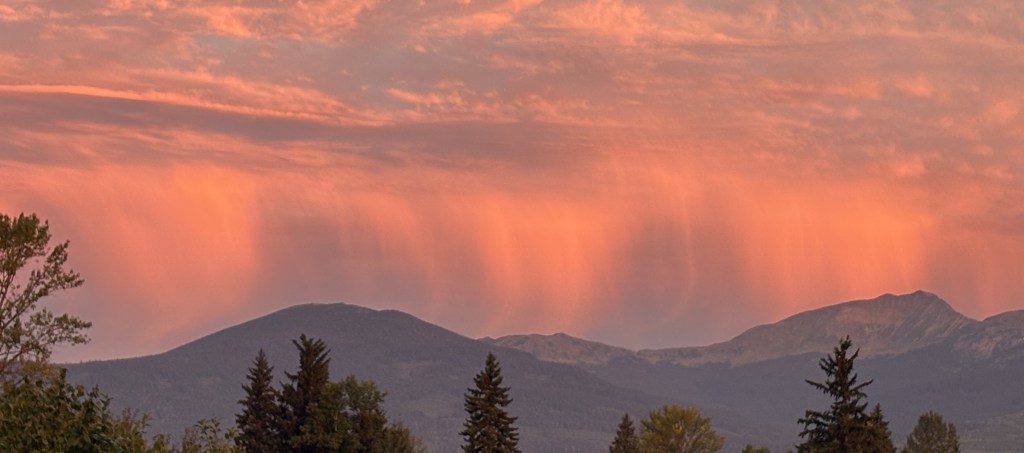
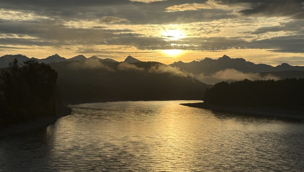
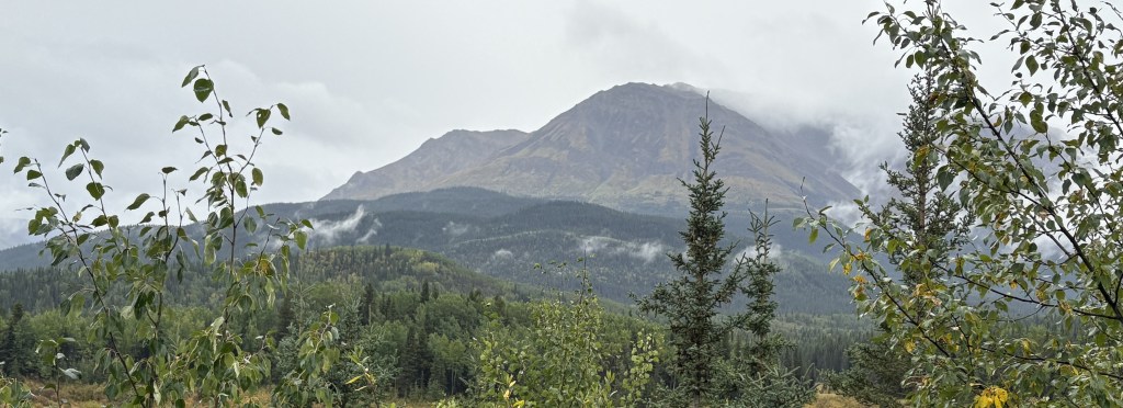
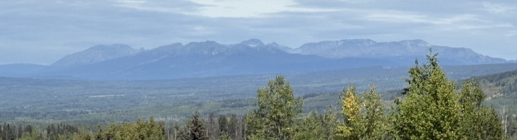
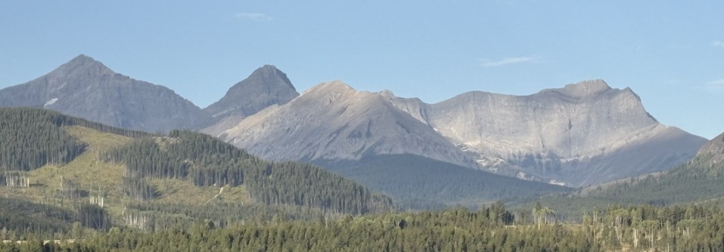
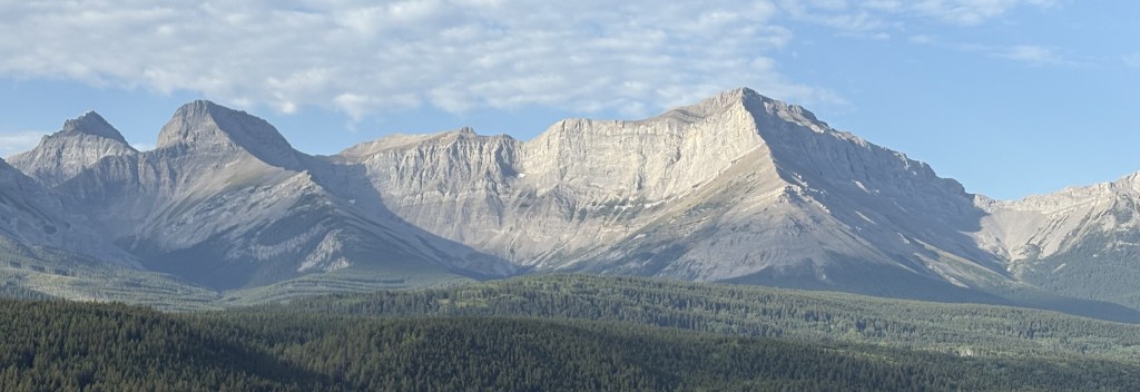
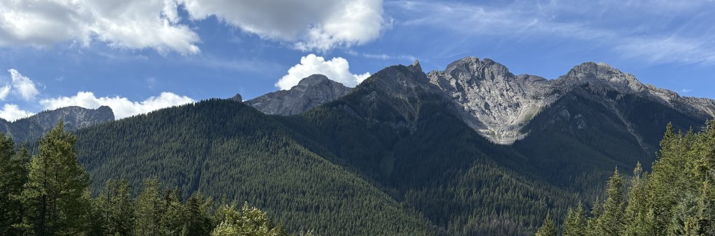
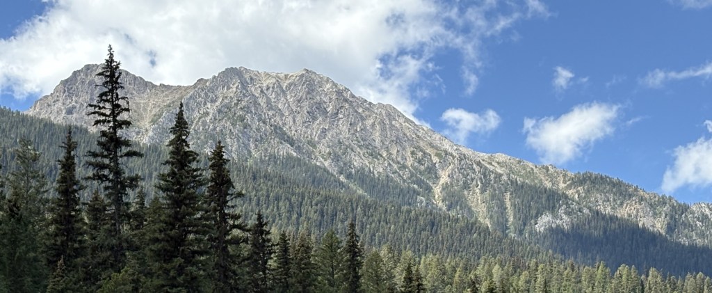
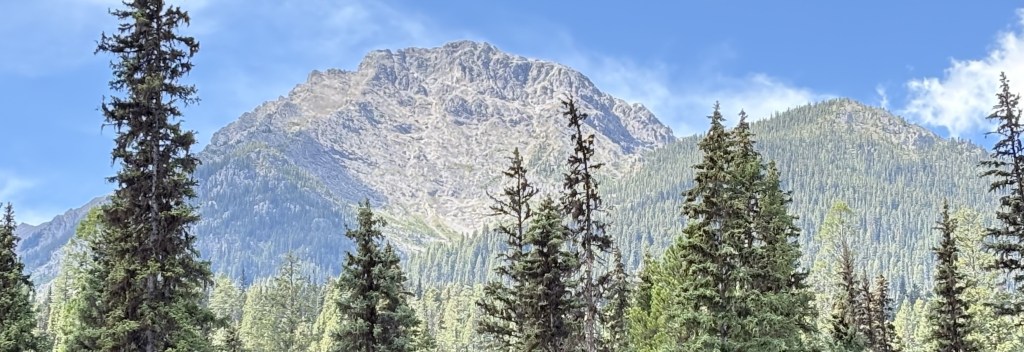
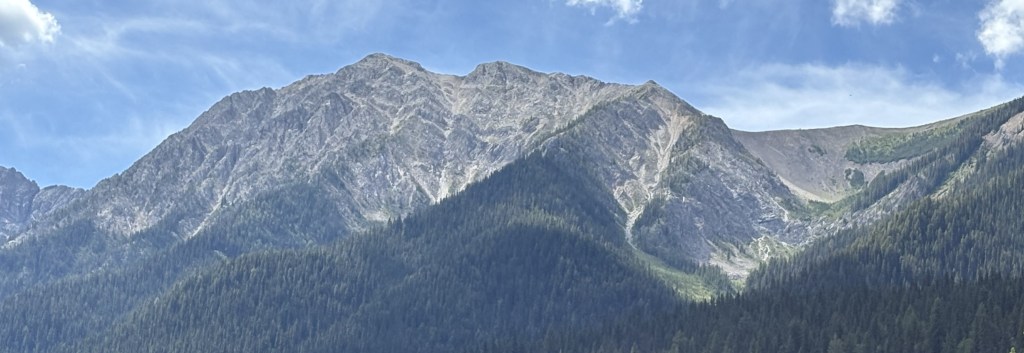
Here are more of the things I saw as I drove through northern British Columbia on my way to the Alaska Highway.

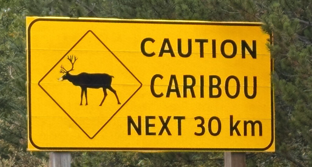
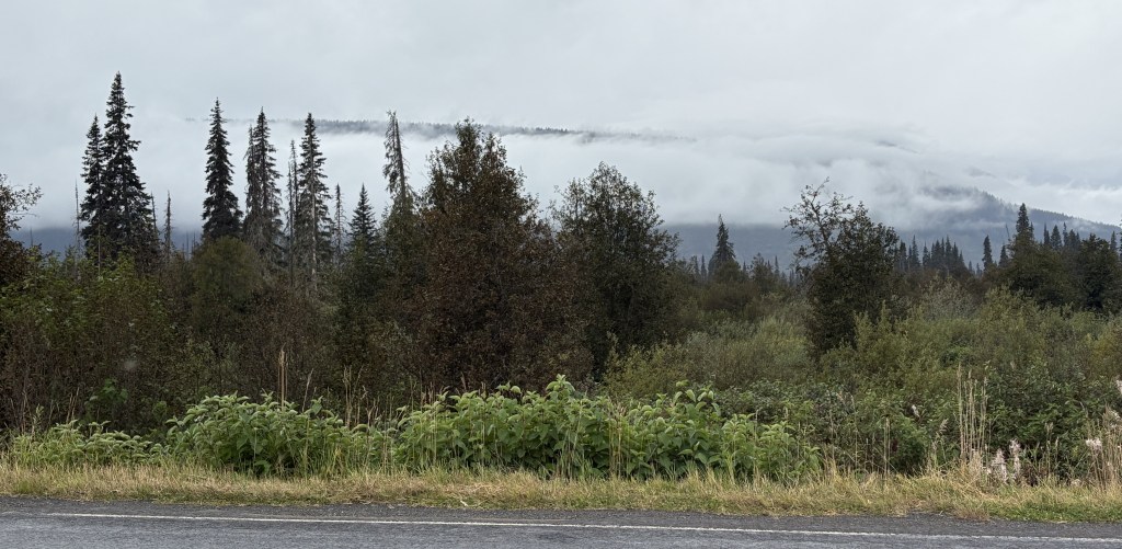
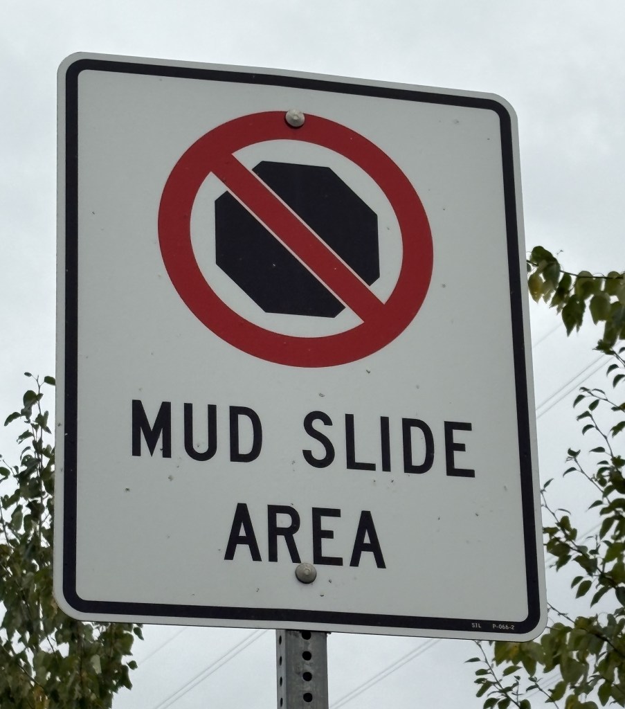
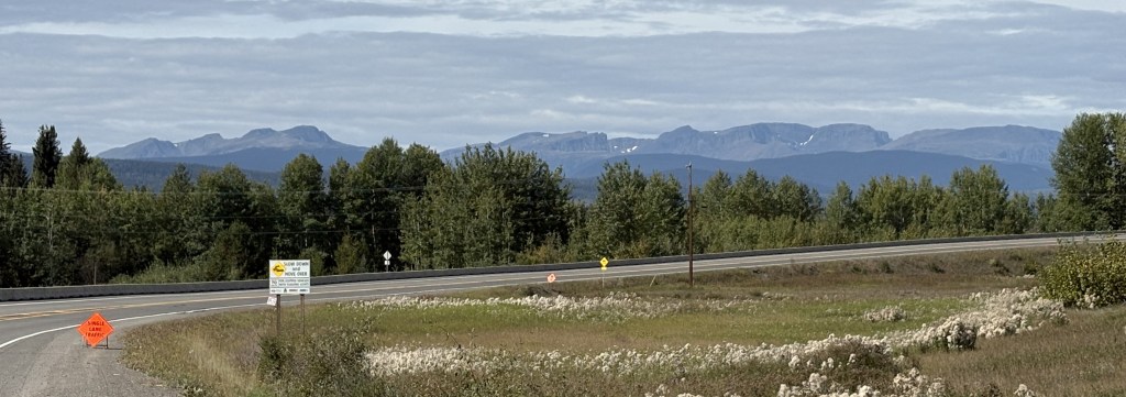
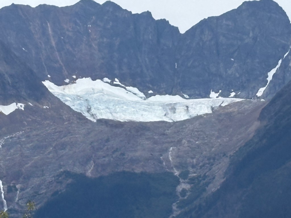
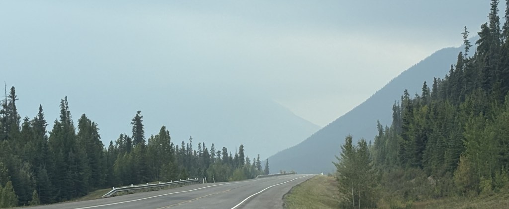
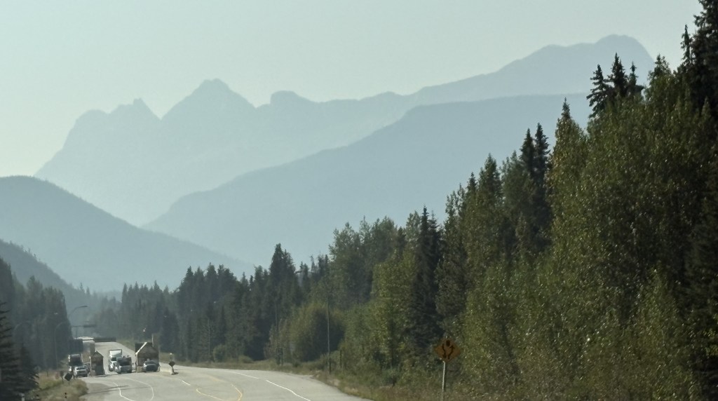
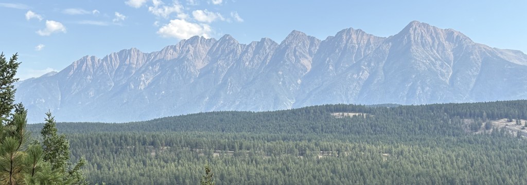
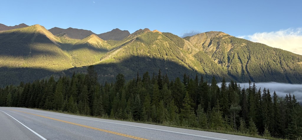
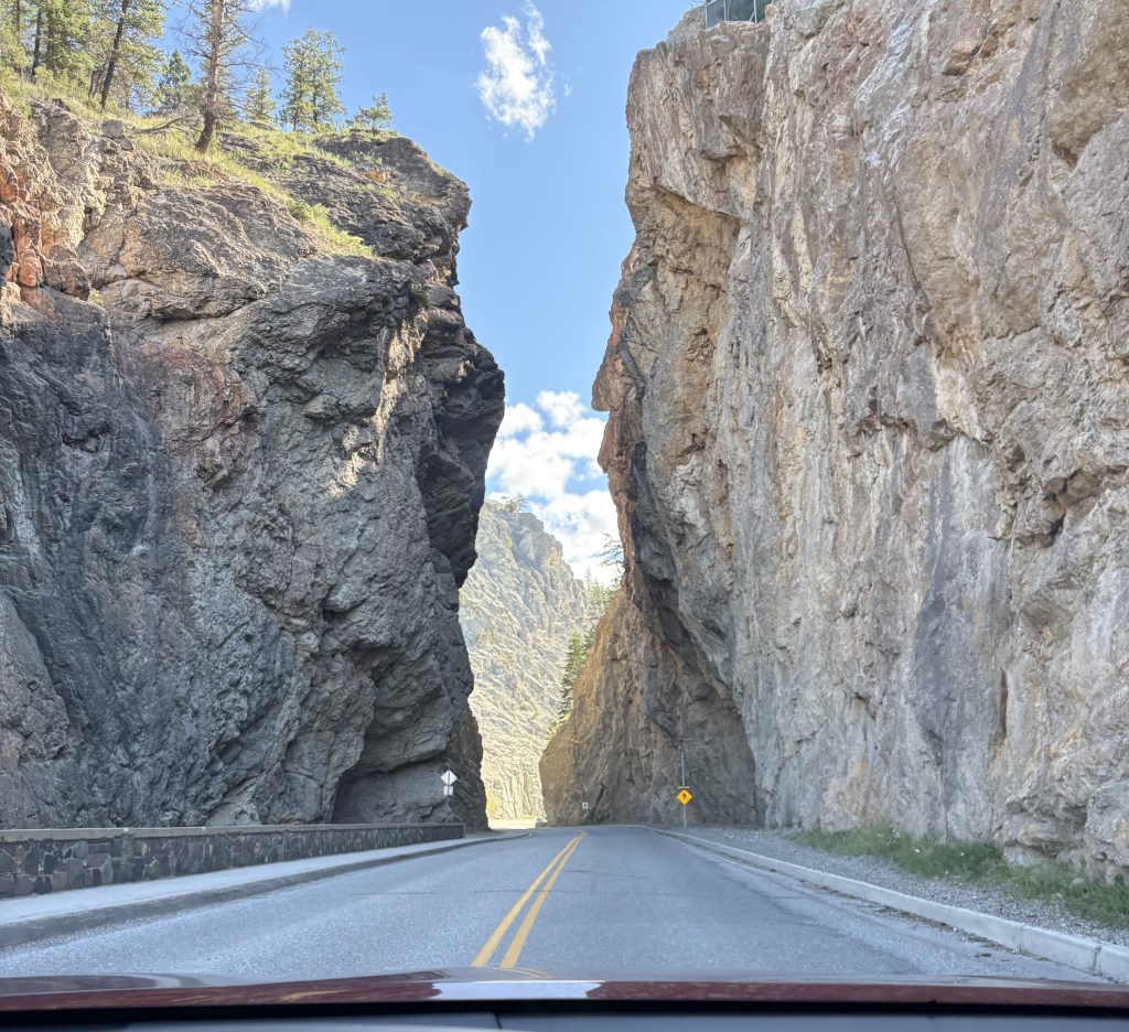
I had seen two handmade signs warning of caribou earlier in my trip, but this was an official one.

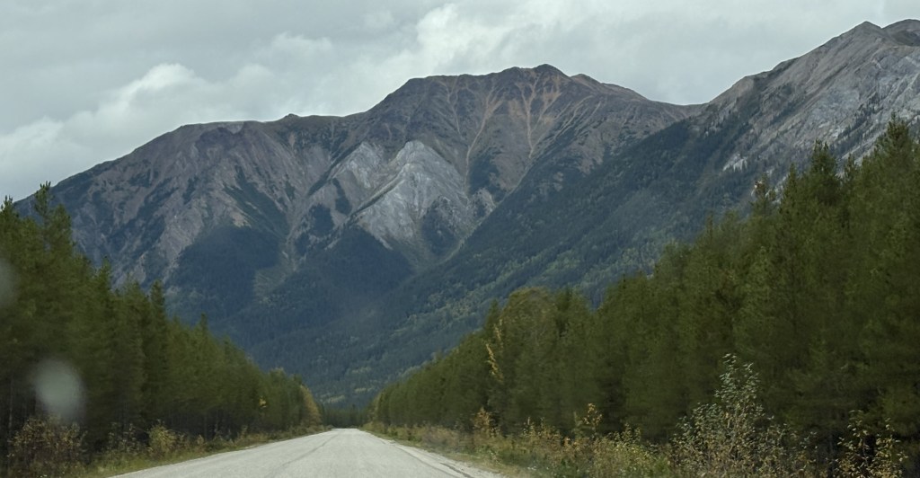
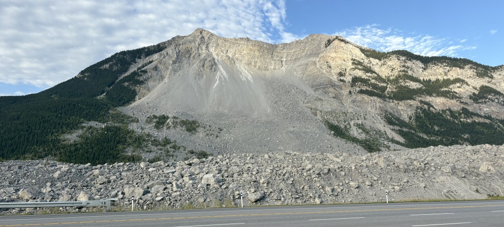
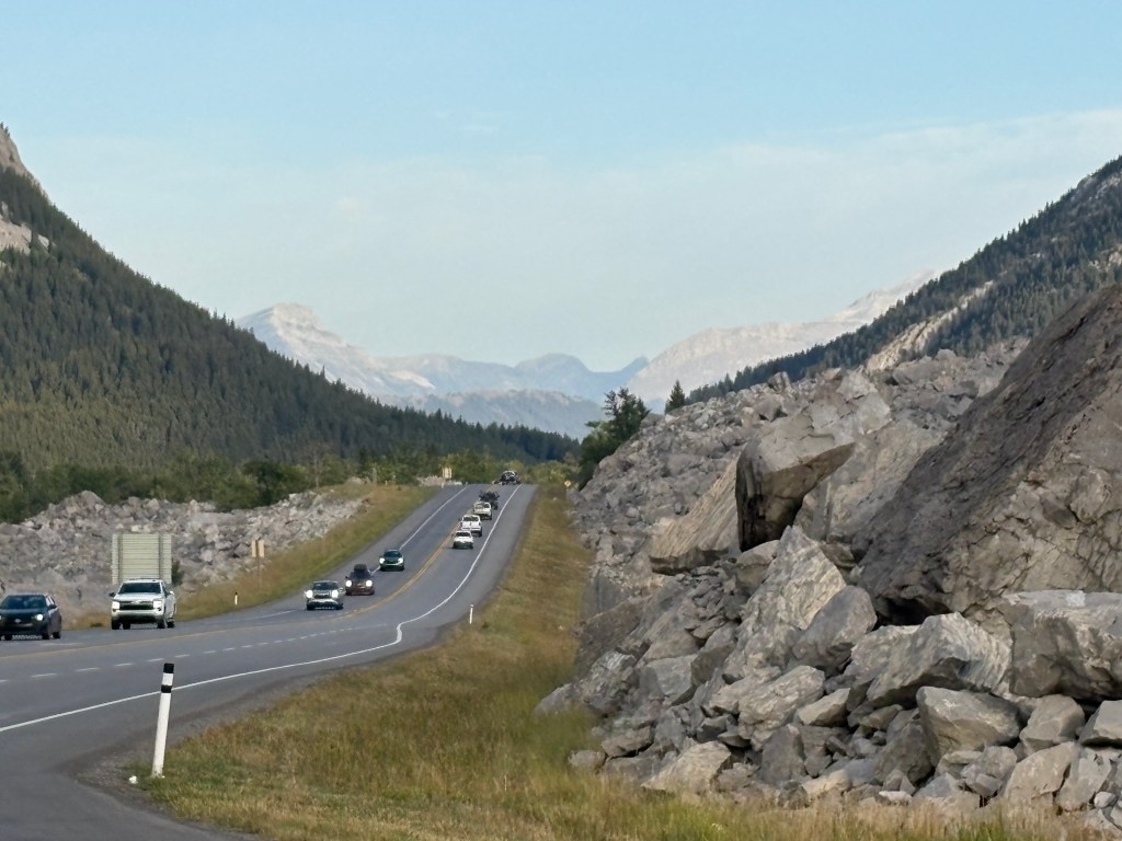
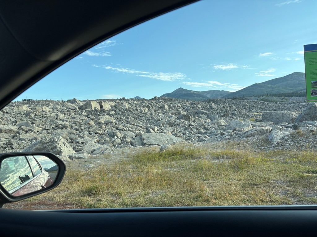
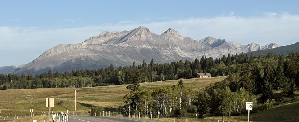
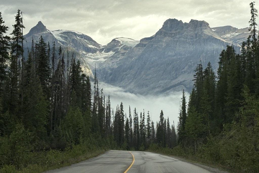
It finally occurred to me that one of the reasons I hadn’t seen any animals on this highway was that in most places the edges of the highway are not trimmed back like on most roads, and animals have plenty of places to remain hidden. I did have to remain vigilant, though, as if any did dart out I wouldn’t have had much time to react.

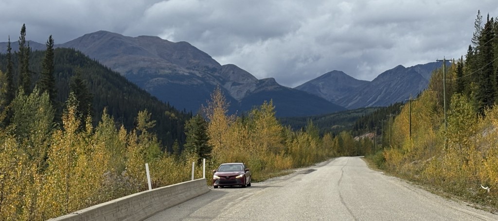
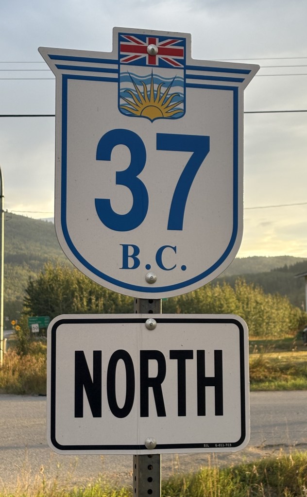
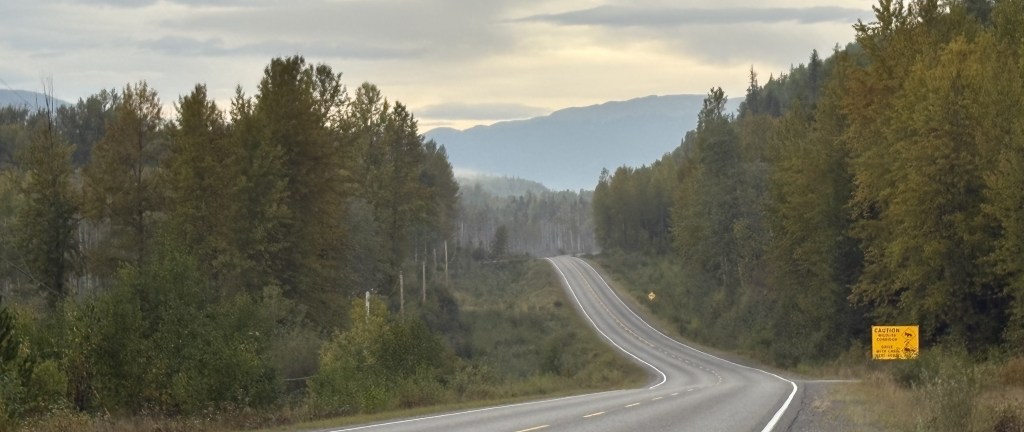
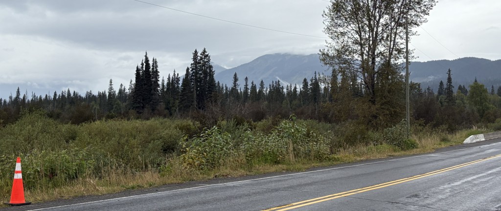
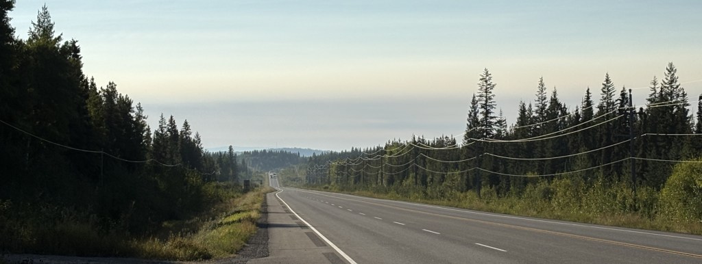
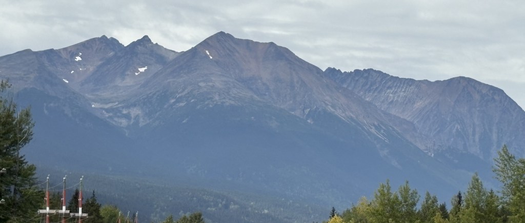
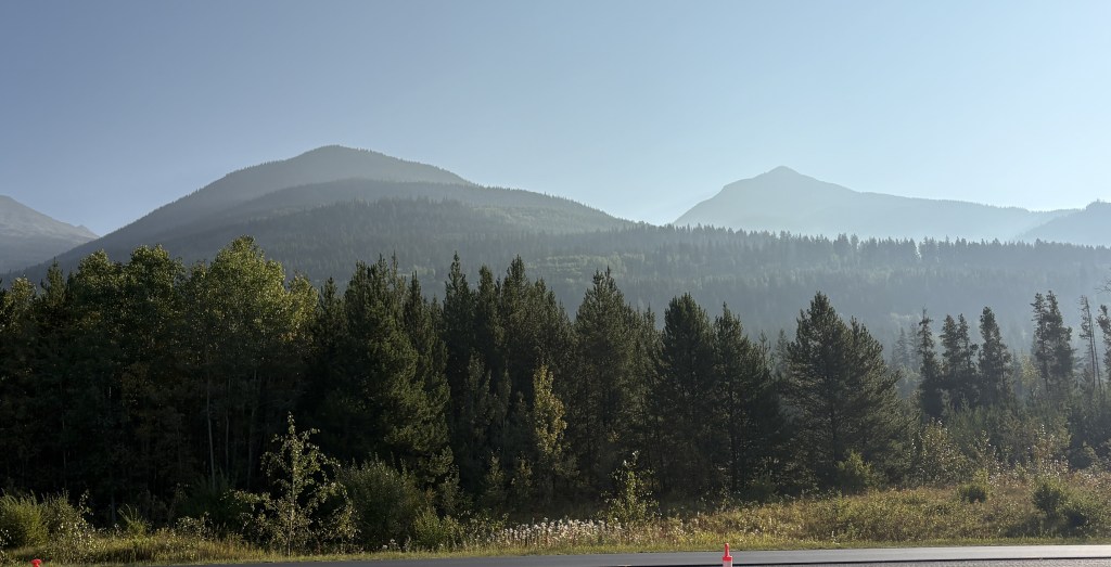
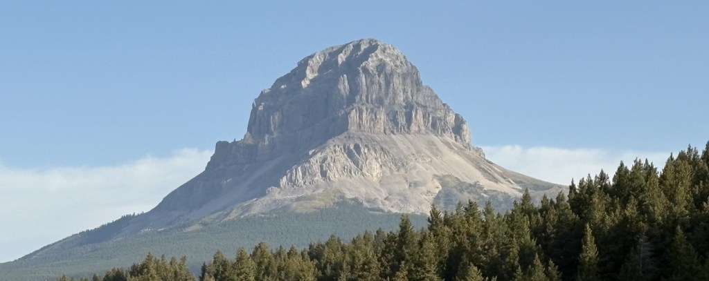
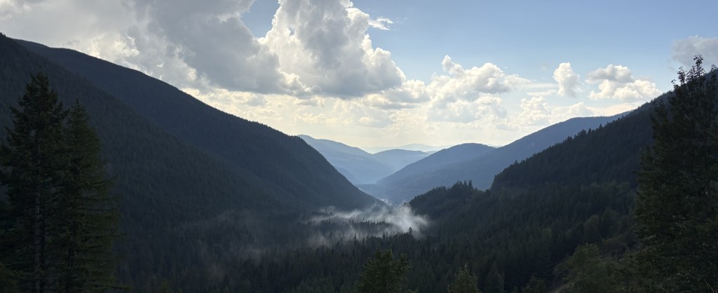
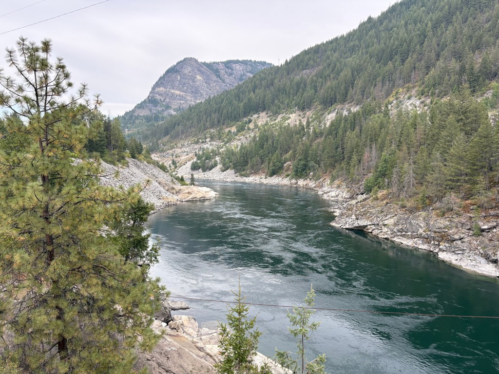
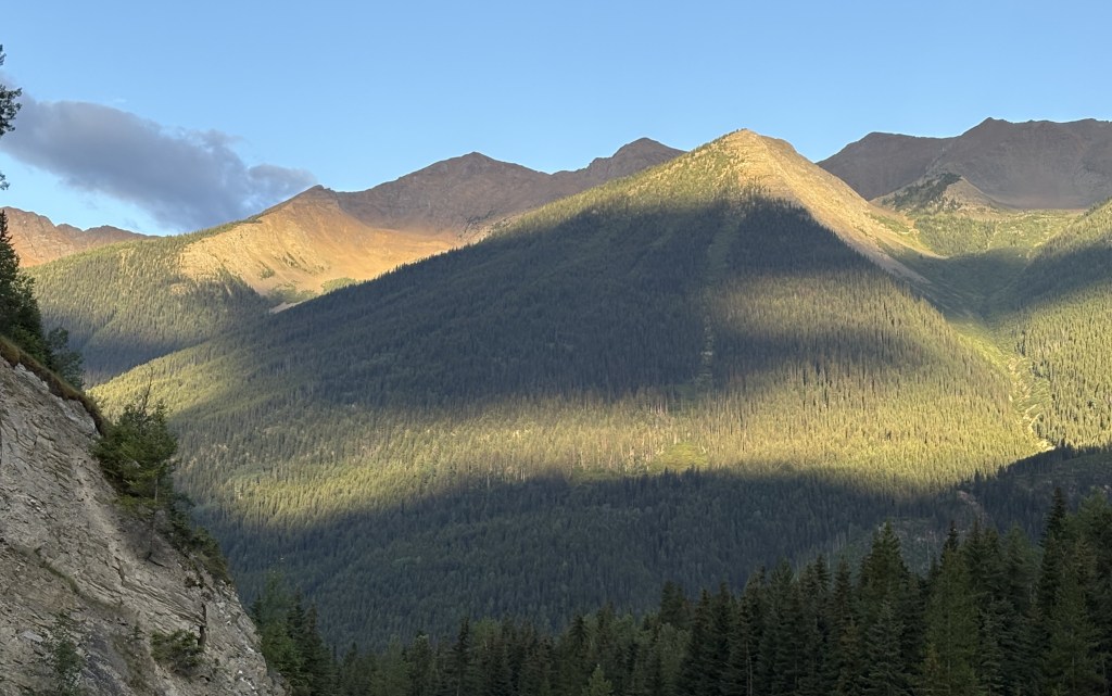
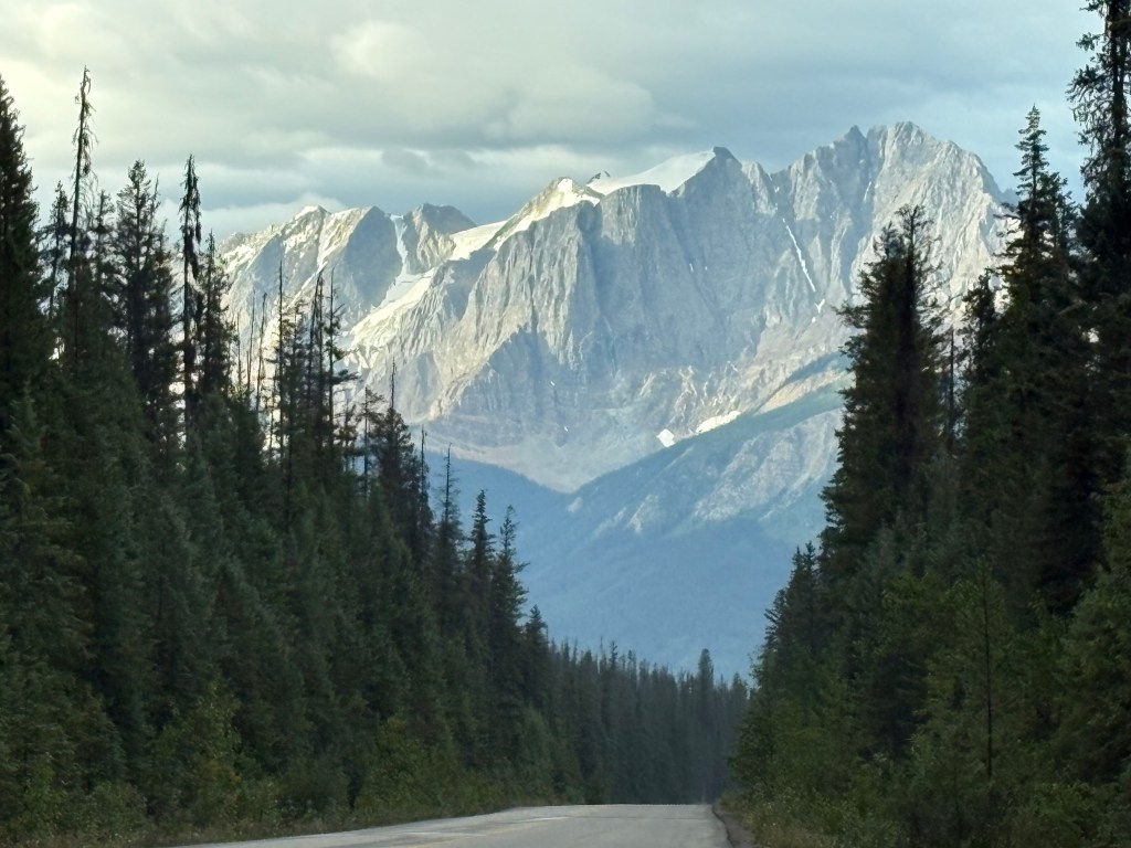
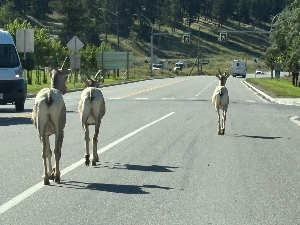
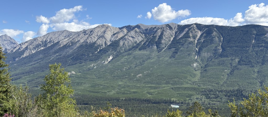
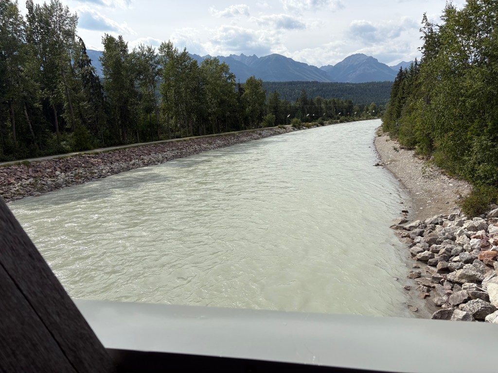
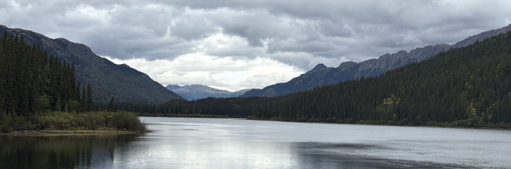
The photo above was the view I had in my direction of travel. I had turned around to come back and take a photo, as I often do.

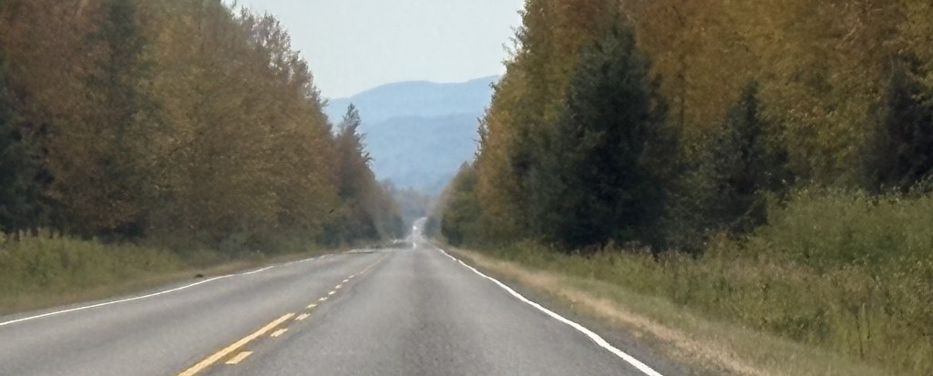
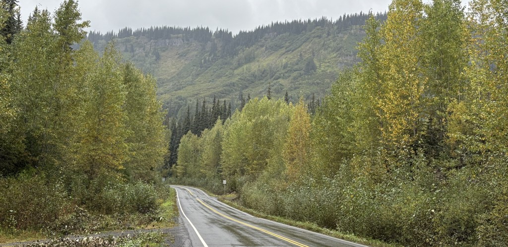
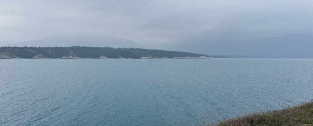
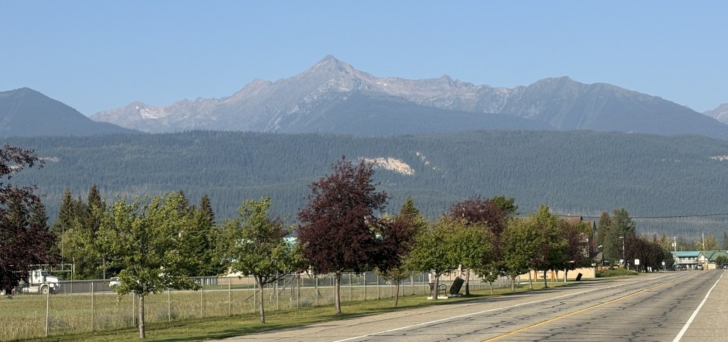
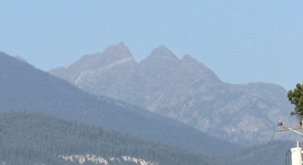
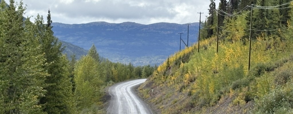
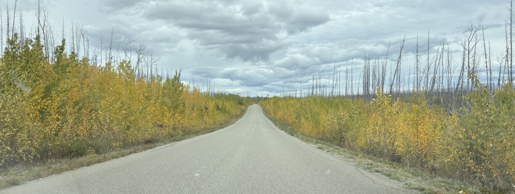
Once I got away from the mountains I had open road as I approached the Yukon Territory. When I got close to the border I drove through a large area which had burned in a wildfire in 2023. The only new or unaffected growth was right along the highway.

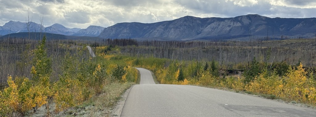
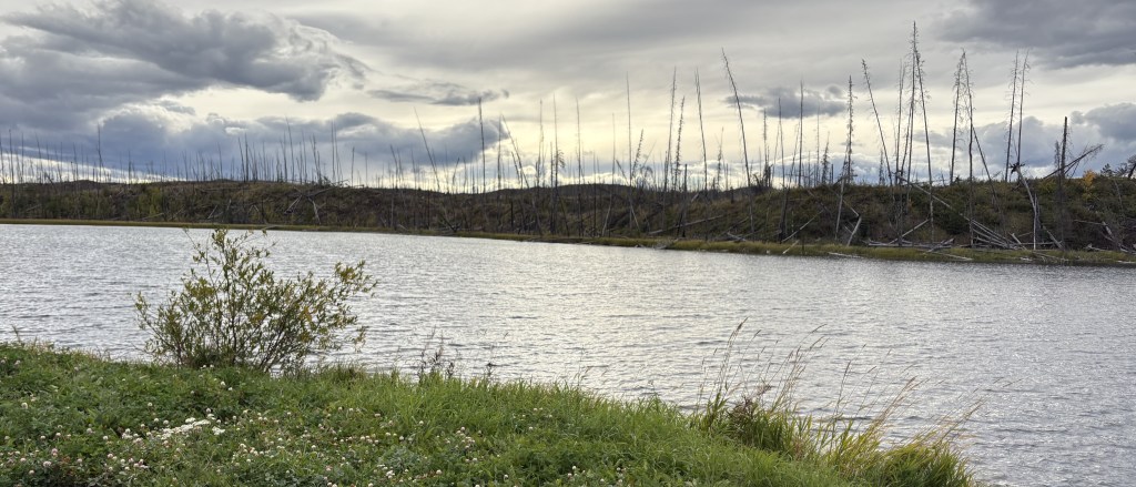
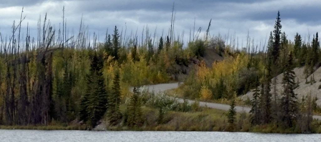
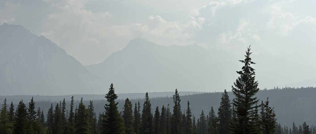
I finally reached the Yukon. Fortunately the wildfire had not made it this far north.

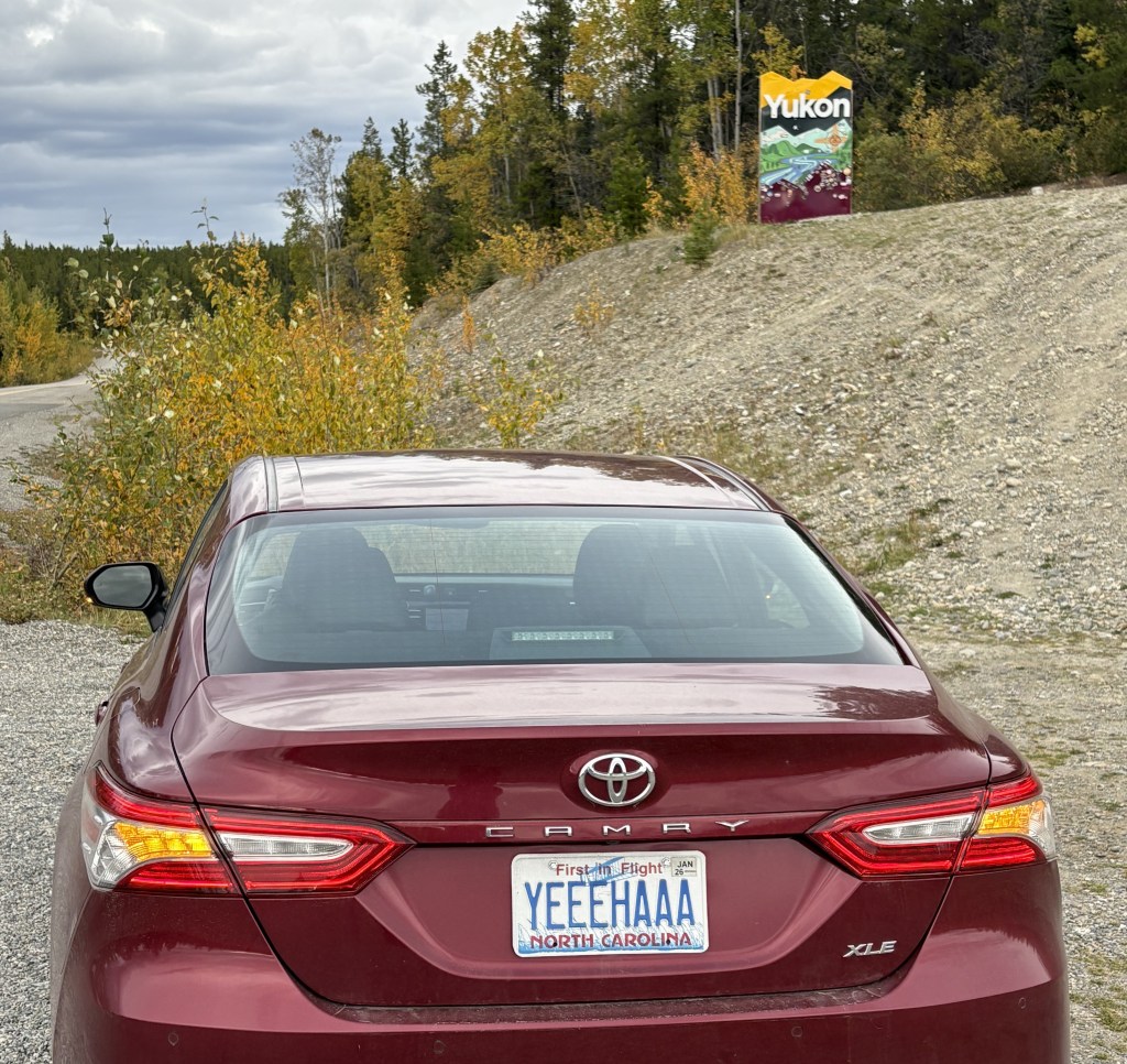
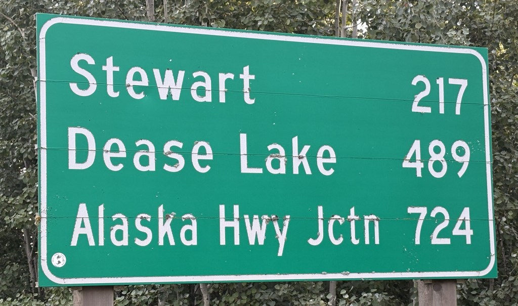
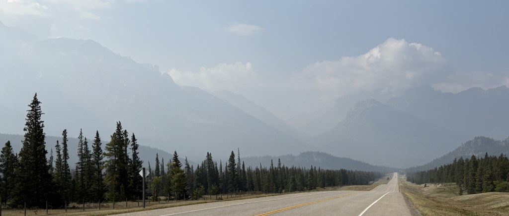
It was only a little further to get to the Alaska Highway, and my Airbnb was less than two miles to the left once I got there.

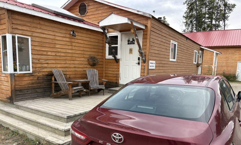
I was in a new cabin in a complex called Nugget City. It had (expensive) gas, a large (expensive) restaurant, and a campground for people with RV’s. The Airbnb rate was pretty steep, too, but that is what happens when you get to a spot where there aren’t many choices. I had seen a few “cheap” Airbnb’s listed along Highway 37, but I backed away when I learned they didn’t have indoor plumbing but only outhouses! I didn’t want my last act to be taken by a bear on my way to or from an outhouse in the middle of the night…

After I unpacked my stuff for the night (clothes, computer and CPAP machine) and rested a bit I drove in to Watson Lake and found a nice little Chinese restaurant which was much more affordable. I will make a post about something I saw there when I start my journey west tomorrow.

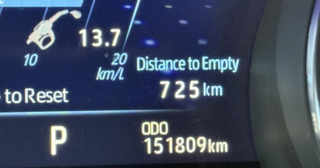
And as you can see, I had stopped for gas along Hwy 37 so I had plenty when I arrived in Nugget City. I will be retracing my route south when I leave Alaska in a few weeks. Unfortunately the complex here in Nugget City will be closed for the season and I will have to book a place in Watson Lake for the return trip.

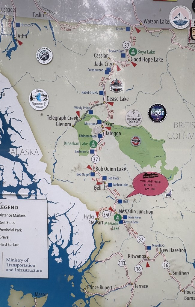
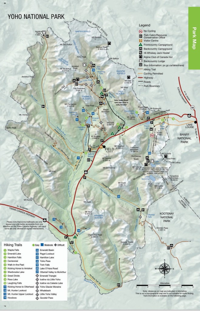
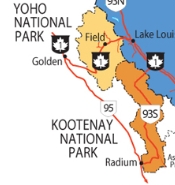
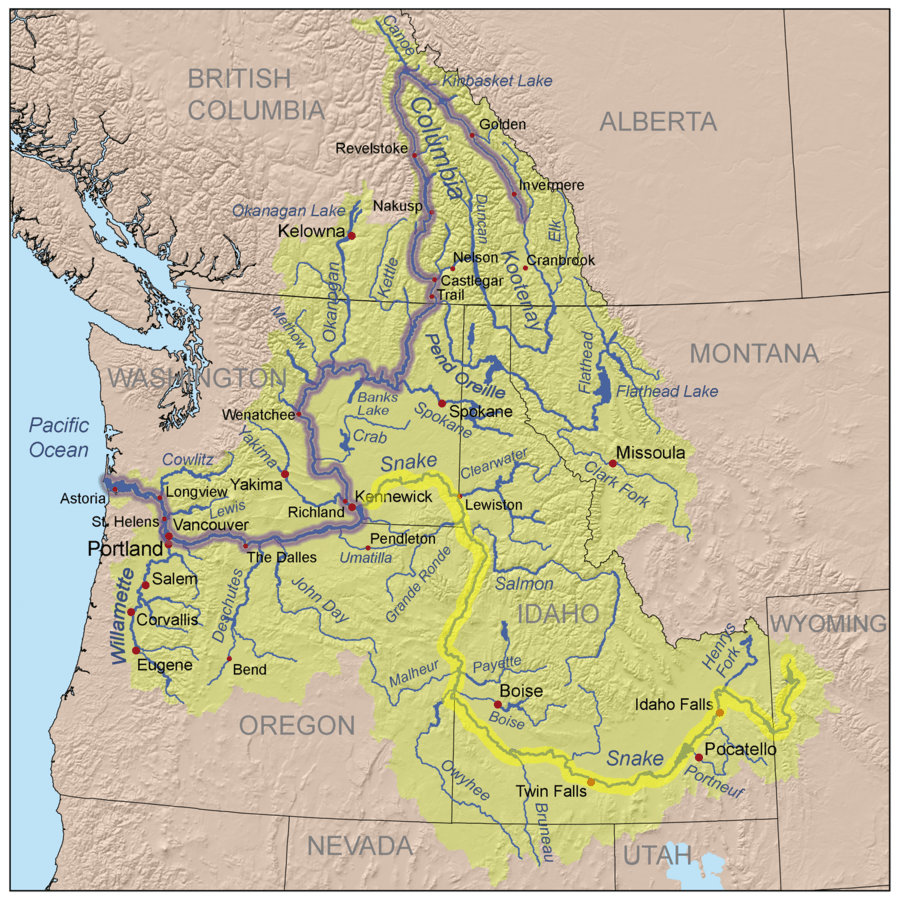
It was a long, but uneventful drive getting here. It was well paved in most spots, with only a few short dirt or gravel patches. The map I showed earlier appeared to show lots of towns along the way, but that wasn’t the case at all. It is quite a desolate road, and those “towns” were usually just a crossroads with only a few buildings and occasionally a gas station. I didn’t see any animals. Not one. But that’s ok, because once I learned that the there wasn’t much of a barrier on either side of the road I was happy the animals and I can continue to peacefully coexist.

Getting to the Alaska Highway – Part 1 of 2

September 11, 2025

Today is the day I start my trek towards Alaska! I would drive about a half hour west to the small town of Kitwanga and get on Hwy 37, also known as the Stewart-Cassiar Highway, for the 450 mile drive north. Total drive time for the day will be 9 hours.

I saw this when I got out to the main highway after leaving my Airbnb.

That was looking west towards the coast, although the ocean is pretty far away. I don’t know what caused that effect (other than the rising sun), but it really caught my eye. I was driving into town to fill my gas tank before heading north.

When I reached Hwy 37 about a half hour later I turned right and immediately drove over a bridge. This time the dramatic view was to my right – looking east towards the rising sun.

After crossing the bridge I stopped to take pictures of two signs.

The distance sign shows 724 kilometers (450 miles) to get to the Alaska Highway.

Good thing I had just filled my tank! Various people I had spoken with, including the RCMP, had advised me to fill my gas tank at every opportunity along the way. They said there would be a few opportunities (I counted about 6). I did plan to stop about halfway north. I was driving during the day, and the weather and temperature were ok (though it would rain later). The road, however, was a complete unknown and I didn’t really know what to expect. The RCMP told me it is paved most of the way and, of course, to watch out for animals.

Here are some of the things I saw during my drive north:

Right off the bat, a sign warning of animals.

The cloud ceiling had been pretty high when I started out but I could tell that it was starting to lower. It had already started to rain lightly.

I stopped in a pullout area after crossing the Bell 1 bridge. This map shows the route I am taking – from Kitwanga at the bottom to the red arrow in the upper right hand corner (just west of Watson Lake). My destination for the day is a place called Nugget City, less than 2 miles west of the intersection with the Alaska Highway, and it is, barely, in the Yukon Territory province. Also note the bright white area on the left side of the map. That is the southernmost part of the Alaska panhandle. Earlier on my drive I went past the turnoff for Stewart, Alaska. As you can see, a highway does go there but stops just after the border

That is a relatively small sign warning me not to stop as I was in a mud slide area. Terrific…

(continued next post)

Prince George to South Hazelton, BC

September 10, 2025

After I left Chetwynd I drove between some smaller mountains in the Rockies chain and was then in open land for quite a while until I reached Prince George. I don’t have any photos to post of Prince George. I can tell you it is a much bigger city that some of the small towns I have been in lately (76,000 people) and I spent my time there preparing for my drive to Alaska.

I bought some more bear spray (I had one older can from 2021, and 2 new ones that I bought before I left Durham, but I bought two more cans). It occurred to me that as soon as you use one you will need another, and from what I had been told, once I got on the road to the Alaska Highway I would likely see lots of bears.

I also went to the Visitor Centre as this was the last big town on the route I was going to take. I asked them for maps and any other information I might need about driving up Hwy 37. I also went to the RCMP (Royal Canadian Mounted Police) station in town. They are the national Canadian police force. I spoke with someone there about my plan to drive the isolated highway north, and who to try and reach in the event of a breakdown or emergency. They assured me that there would be a few places to get gas, though they advised me to have cash on hand because they may not have internet access to process my credit card.

Finally, although I had tried to clean and organize my car while I was in Grande Prairie, I put away my warm weather clothes and got all of my cold weather gear out. I made sure I had layers and a warm blanket in the passenger compartment. I had already stocked up on water and bought some fresh fruit and munchies to have for the ride.


It was a nice morning when I left Prince George to head west to my final overnight stop in British Columbia. It would be about a 5 hour drive.

I drove through lots of open land and went through many small towns:

That sign told me that as much of British Columbia as I had seen between the US border and here, I was only half way north!

I stopped in the small town of Houston for lunch. Right across the highway was the world’s largest fly fishing rod:

This area has lots of waterways which provide copious amounts of trout and salmon.

After driving most of the day in open land I started to see mountains in the distance. Those are coastal mountains which, as that description implies, stretch all the way up the coast and are one of the reasons it is difficult to drive from here to Alaska. You will see tomorrow that I am actually not that far from part of Alaska but there are no roads that go that way.

Those tall mountains are just on the other side of the town of Smithers.

And the mountain on the far right is home to the Hudson Bay glacier:

My Airbnb was in the small town of South Hazelton. They had chickens and goats behind their house and I could watch them from my living room.

And they had a big dog to keep any predators at bay.

I would try and get a full night’s sleep as I will have a 9+ hour drive tomorrow.

Chetwynd, BC – Post 1 of 2

September 8, 2025

I didn’t realize it at the time but the last two nights I spent in Grande Prairie would be my last visit to Alberta province during this trip. My destination today will be Prince George, BC and I will cross the Canadian Rockies for the last time.

The drive to Prince George was to be 6 hours but I encountered an unexpected diversion along the way. Nothing wrong at all, but something that had not popped up on my radar and I found VERY interesting.

Chetwynd, a small town of about 3,000 people, is home to the Chetwynd International Chainsaw Carving Championship. As I was driving in to town I saw lots of these lined up on both sides of the highway, and a concentration of them once I got to Tim Horton’s to stop for coffee. I went back to the “Welcome” sign where the first two I posted were and started taking pictures.

These are all chainsaw carvings, done over a number of years. I will explain shortly.

The competition is held the second week of June and 12 carvers are invited to participate – 4 from Canada, 4 from the United States and 4 from other countries around the world. Each carver is provided with 40-50″ diameter, 8 foot tall piece of western red cedar. They have 35 hours to create their entry.

I don’t know how that 35 hours is spread out, but I would think each artist is probably allowed 10-12 hours per day to work, with meal breaks, and then given time to sleep. The contest runs 4 days, and on the last day there is a 90-minute “quick carve” contest, with those works being put up for auction. The major pieces stay in Chetwynd and are scattered all over town. It seems that the artists have free reign over what they can produce, and there is an amazing variety of works on display.

Here are two shots of the detail on the front of the dragon shown above.

All of this is done with chainsaws, and they are gearing up for the 20th annual competition in June, 2026. I believe technology has improved to the point where woodworkers have smaller, more precise saws for detail work, and some of the pieces I saw had just a stunning amount of fine detail.

I was a little bit challenged with the bright sunshine, and some of my photos didn’t turn out too well because the objects were backlit. I tried to move around to get the best shots.

I will have more photos in the next post. You may also Google the town or contest name to see lots more photos online.

I was really blown away by them, and wished I had more time to spend in town to seek out more of them. Some of the ones I saw were done as far back as 2007 and I didn’t look at all of the signs indicating who the artist was, where then were from and what year the work was produced.

Red Deer, AB to Valemount, BC

September 5, 2025

The wildfire smoke really restricted my activities while I was in Red Deer and my next stop was located well west, of the other side of Jasper National Park, which I hoped would get me out of it. From Red Deer I took Hwy 11 west towards the Park, but to get there I would also have to drive through part of Banff National Park . I could tell it was still smoky when I left Red Deer, and it didn’t improve any as I headed west.

Once I entered Banff National Park I would continue until the road I was on ended at the Icefields Parkway and the Saskatchewan River Crossing. From there I would turn right and continue on up into Jasper National Park and to the town of Jasper, but this time I would turn left instead of right and take Hwy 16W towards Valemount.

(Photo credit: Parks Canada)

I’ve already posted photos from that stretch of road so I won’t post them again.

This was the view as I approached the western entrance to Jasper (as I was going out).

I arrived in Valemount, a village of only about a thousand people, and checked in at my Airbnb. My throat was still sore and I was afraid I might be getting sick so I went to the grocery store in town and bought some cold medicine.

The rest of these photos were taken the next day while I was in Valemount.

It was a nicer day than when I had arrived but I just stayed put since I didn’t feel well. I didn’t think there was much to see here anyway, and I will find the thing I came here to see tomorrow when I head back east.

I will point out that just north of Valemount is Mount Terry Fox. I was happy to see that they named a mountain after him.

Terry Fox was a young man from Winnipeg who lost his right leg to bone cancer. In 1980 he embarked on the “Marathon of Hope” to raise money for cancer research, asking every Canadian to contribute $1. He started in Newfoundland, on the east coast of Canada, and planned to run all the way across the country. He ran for 143 days, averaging around 23 miles per day (a standard marathon is 26 miles) and made it as far as Thunder Bay, Ontario, a distance of 3,338 miles, before illness forced him to stop.

Terry Fox was only 22 when he passed away on June 28, 1981, and he is considered a hero in Canada.

The peak on the right is 8,678 foot tall Mount Terry Fox.

Castlegar Sculpturewalk

August 30, 2025

When I stopped briefly in Castlegar on my way to Cranbrook earlier in my trip I had picked up a brochure about this activity and after looking through it I decided I wanted to come back and check it out for myself. Fortunately it was a nice day, as the sculptures are scattered all over town, though there is a concentration of them in the downtown shopping district.

The artwork in the photo above was featured on the cover of the brochure I had seen. It is called “Dedngon”. Here is another angle of it:

Most of these sculptures are available for sale or lease. The only deterrent to photographing them was that many were backlit by the sun. There were many more than I am going to show you, but I’ve tried to pick the best ones to post. You can Google the name and see photos of many of the ones that I will post, as well as others that are no longer in circulation, or were in parts of town that I didn’t go to. I tried to find all the ones that were downtown or close to it.

The bench above is supposed to represent a tree trunk, with new growth sprouting from the top.

The artwork in the photo above is called “Just Had To Look” and features a small man crawling on a hand held sphere who is peering down into a hole in the surface.

The artwork in the photo above is called “Living Fossil” and is of a swimming white sturgeon.

The artwork in the photo above is called “Don’t Judge Me by My Cover.”

That one is called “Mask of Ooinn” (the first two letters of the last word have characters above them which I am unable to replicate here). It is one of the few sculptures I saw that was not made out of metal. It depicts the chief Norse deity (as stated in the brochure).

“Egghead” was purchased by a local business and is on display outside the public library.

The next two I found in Millenium Park, a large city park east of town and next to the Columbia River.

And the next one is in several parts. It is metal shaped in the form of a curved maple leaf. It covers a bench near the river and has a nice detailed painting inside.

I’ve saved my favorite for last. It is being leased by the city and currently sits out next to the highway coming in to town.

Lethbridge, AB to Castlegar, BC

August 29, 2025

Today will be another driving day. I will be taking Hwy 3 (the Crowsnest Highway) west and will cross the southern end of the Canadian Rockies from east to west. The first 80 miles will be flat prairie and farmland, which I have grown accustomed to while in most of Alberta province. Google Maps indicated it would take about 6 hours, without stops, to get to my destination. Once I hit the Rockies the road will take me through Cranbrook, where I stayed earlier in my trip, and then beyond it to Castlegar. The portion from Lethbridge to Cranbrook will be new to me.

The first item of interest I encountered was as I was getting into the Rockies.

That is the result of the Frank Slide. At 410am on April 29, 1903, the top of the mountain gave way and wiped out a good portion of the town of Frank, a small coal mining town. 70 people perished, either in their homes or in the mines. As you can see, lots of the rock debris made it to where the highway now runs. The photo above is looking left (south) from the highway.

That is how the highway appears now. They obviously had to clear rocks and boulders out of the way to build the road. And this is how it looks now if you look right from the highway:

You can see that with the momentum of the rockslide the debris traveled a significant distance.

OK – so now I’m back in the Rockies. You know what that means…. more mountains!

I believe the mountains above are part of the range I saw as I approached Cranbrook from the west. And I believe the mountains shown below are a little further north in that same mountain range.

OK, that wasn’t so bad was it?

I drove for about 2 1/2 more hours and then crossed a mountain pass which is about an hour and a half from Castlegar.

I believe that photo is dark because there were clouds right overhead shading the valley. It was a bright, sunny day everywhere else.

When I got to Castlegar I stopped in at the Visitor Centre again (I had stopped in briefly when I was coming east and decided that I liked the town enough to some back for a two-night stay).

That is a large metal sculpture of a hummingbird. It is a set-up for tomorrow’s post which will include lots more sculptures.

I did have time after I arrived in Castlegar to visit the “Brilliant Bridge”. Technically it is called the Doukhobor Suspension Bridge National Heritage Site of Canada, and is located in the neighborhood of Brilliant on the opposite side of the Columbia River from the town of Castlegar.

If you look closely at the original concrete stanchion you will see that the bridge was built in 1913.

The original bridge was abandoned in 1966 when a new highway bridge was built not far away. The bridge was restored in the early 1990’s and is now a pedestrian bridge, and a popular landmark in town.

The bridge spans the Upper Kootenay River shortly before it joins the Columbia River not far from here.


Getting back to the official name, the Doukhobors (the Canadian spelling, adding the letter ‘u’) immigrated from Russia to Canada in the early 1900’s. About 7,500 arrived in Canada over a 30 year period, seeking to escape religious persecution. They originally settled in Saskatchewan but later relocated here to British Columbia. (Source: Wikipedia)

There is a Doukhobor Heritage Centre in Castlegar but I didn’t go to it.

Yoho National Park

August 13, 2005

I have driven through Yoho National Park 4 times during my visit to Golden and thought I’d better tell you a little bit about it as I pass through it a final time on my way south to Banff.

The name is an exclamation of surprise in the indigenous Cree language, though there isn’t any record of the Cree people ever having lived here so I don’t really know why it was chosen. The Park covers a little over 500 square miles and has 28 named mountain peaks over 9,800 feet. The tallest is Mount Goodsir at 11,703 feet, not visible from the highway due to closer mountains obscuring the view. As you will see, some of the mountains are low enough to only be covered with trees, and it is a very popular destination among hikers. It may be hard to see but the colored dotted lines on the map represent cycling or hiking trails.

(Photo credit: Parks Canada)

The only road which passes through the Park is the Trans Canada Highway (Hwy 1), shown on the map in red. Several roads branch off from it but I only took one of them as I left Golden.

Emerald Lake (upper portion of the map, above and left of the town of Field) is frequently shown in brochures because of it’s brilliant color. Every time I passed by the road there was an electric sign near the highway exit indicating that the parking lot was full. As I returned from my second trip through Kootenay NP I took a chance and drove up anyway, only to find that traffic was at a standstill before I even got to the parking lot. I sat there for a while hoping to see vehicles leaving but since we seemed to be at a dead stop I turned around and left, deciding that I would drive up first thing in the morning as I was leaving Golden.

Here are some of the things I saw during that drive.

It was a strange morning, cloudwise. The two photos above were taken one minute apart, from the same section of the highway! I know it was clearing in one direction but there were heavy clouds when looking in another.

I drove directly up the mountain to Emerald Lake – no line, no waiting. The parking lot was only partially filled so the “go early” advice was sound.

The lake surface is at 4,267 feet elevation and Golden is at 2,600 feet so I had climbed over 1,600 feet to get here, encountering fog or low clouds along the way.

You can see that the sun was finally able start burning off the fog.

Another lake in the Park, Lake O’Hara (up near Hwy 1), is only accessible by making bus reservations in advance. The long road leading north to Takakkaw Falls is only open a portion of the year and is considered difficult to navigate for large vehicles. Recreational vehicles or vehicles towing trailers are not permitted on it.

From what I’ve read and brochures I’ve seen, Yoho is extremely popular with hikers and I’ve seen many great pictures by visitors who have hiked up to high elevations. If you enjoy hiking you could plan your whole vacation in the Canadian Rockies and have a never-ending variety of things to see.

The photos below were taken as I started driving down to Highway 1.

When I got to the bottom I stopped at Natural Bridge.

Kootenay NP Redux – Part 1 of 3

August 11, 2025

Today I decided to drive back down south and go through Kootenay National Park again. The first time I went through the weather was less than ideal for photos, with some low clouds obscuring some of the mountain tops. The weather was forecast to be better today so I thought I’d give it another go.

Sorry the map is kind of small but it focuses on the route I would take. From Golden I drove south on Highway 95 to the town of Radium Hot Springs. There I would turn left on Highway 93S which goes through Kootenay National Park and up to the Trans Canada Highway (Hwy 1), which I would take back to Golden. The entire loop is about 200 miles.

I did post some photos of my original trek through the Park so you will probably see things you have seen before. I have more photos than what I am about to post but I went through them and eliminated ones that seemed repetitive or were not very clear. I am in the Canadian Rockies so obviously mountains are the main things I see. Many of the mountains have a different appearance than ones I have seen elsewhere so I hope you enjoy the variety as much as I do!

I start off with a few repeat photos from Radium Hot Springs (the town). As I drove in to town around 10am I encountered several young bighorn sheep, strolling down the highway seemingly oblivious to the traffic around them.

I stopped briefly in the Visitor Centre and then drove back about a half mile to enter the Park itself. A short ways in are the actual Radium Hot Springs, which gives the town its name. They are an odorless natural hot springs which are popular among visitors to the area. They have their own fee structure and one must have a Park Pass to access them. I was thankful that Canada waived the entrance fees to their National Parks for the summer, though I was prepared to buy an annual pass when I arrived here.

This time I was better prepared for the first thing I saw after I drove past the hot springs.

There wasn’t anyone behind me so I was able to stop in the road and take that photo through the windshield.

The next thing I saw was also something I didn’t photograph the first time through the Park. A large red rock wall on the left side Highway 93S. This time I pulled off into the area where the entrance gate for the Park is and walked back to take a photo of the wall. I have not seen anything like it so far in Canada and suddenly I felt like I was in southern Utah!

Redstreak Mountain is located right behind the Visitor Centre, and I presume this is how it got its name.

Ok, so from this point forward all you will see are mountains. Most are a fair distance off the road. I have tried to crop the photos to focus on the mountains themselves but occasionally left in more of the surroundings for perspective.

The map for this Park did a much better job of identifying many of the mountains but I will not try to match them to the photos. According to Wikipedia there are 71 named peaks within the Park but the map identifies only about half that many. There are at least 5 mountains over 10,000 feet tall and at least 11 over 9,000 feet tall.

The Park ranges from 3,012 feet elevation at the south entrance to 11,234 feet at Deltaform Mountain, near the north entrance and the Continental Divide. The roadway ranges from around 2,600 feet at Radium Hot Springs to 5,510 feet at Vermilion Pass near the north end of the Park.

The tallest mountain in British Columbia, Mt. Assiniboine (11,870 feet), is located south of the Park in its own Provincial Park. Despite its height it is not visible from within the Park due to other mountains which are closer blocking the view.

Here, now, are three posts with photos of some of the mountains.

Continued in next post

Golden, British Columbia – Part 1

August 10, 2025

After two days of driving to several National Parks I decided to stay in Golden for the day. I knew there were some things here to see, needed to do laundry and wash the car, and just decided to stay close to “home”.

Golden is a small town but is strategically located for my purpose. It sits at an elevation of about 2,600 feet and has a permanent population of about 4,000. There is a ski resort which brings in lots of visitors during the winter, but many people (like me) probably stay here during the other seasons because it is located just outside Yoho National Park and is relatively close to five others.

My Airbnb was located just north of town and every day I drove past another one of the major tourist draws – the Golden Skybridge.

It’s main attraction would be the two suspension bridges, one 492 feet long and 426 feet above Hospital Creek (that alone would probably prevent me from walking out on it, never mind my fear of heights). The smaller one is 459 feet across but “only” 262 feet high. They are the highest suspension bridges in Canada.

There are lots of other activities to engage in which would appeal to adults and children alike. The cost depends on how many of those activities you want to participate in, but I’m sure lots of people think “hey, we’re here… why not?,” especially if they have kids. As I mentioned, I drove past it every day and, with the exception of early morning before it opened, the large parking lot was always packed.

Another place featured in many brochures about Golden is the Kicking Horse pedestrian bridge near downtown. The Kicking Horse name is attached to many things in and around Golden, a river, a mountain, a mountain pass, and the ski area, among others. According to Wikipedia the river got its name in 1858 when a member of the Palliser Expedition was kicked by his packhorse while exploring the river and trying to rescue another horse from it.

The bridge, the longest freestanding timber-framed bridge in Canada, spans the Kicking Horse River. The Kicking Horse river joins the Columbia River just north of the bridge, near the airport and Confluence Park.

Now I know what you’re probably thinking – “JohnBoy, you told us just yesterday that you saw the Columbia River next to the town of Revelstoke, more than two hours west of here”. That’s true, I did. Here’s the deal…

The Columbia River starts at a small lake (not surprisingly, Columbia Lake) near Fairmont Hot Springs, well south of Golden. I passed it as I drove from Cranbrook, in southeast British Columbia, up to Radium Hot Springs, before I turned off to drive through Kootenay National Park. It initially flows NORTH, parallel to Hwy 93/95, and after Radium Hot Springs continues to follow Hwy 95 up to Golden.

(Photo credit: Americanrivers.org)

After passing through Golden it continues north past the Columbia Icefields, where it undoubtedly picks up a lot more water, and continues north until it gets near Mica Creek, where it changes direction and starts heading SOUTH. It will then flow past Revelstoke and continue on down to Castlegar (which you will see when I post photos from there later in my trip). It continues south into Washington State, eventually passing through the Coulee Dam, past Wenatchee, WA on down to the border between Washington and Oregon, where it then flows west, forming the Columbia River Gorge, and eventually out into the Pacific Ocean.

I have more things to show you from in and around Golden and will share them in the next post.