This post documents the second segment of today’s drive.
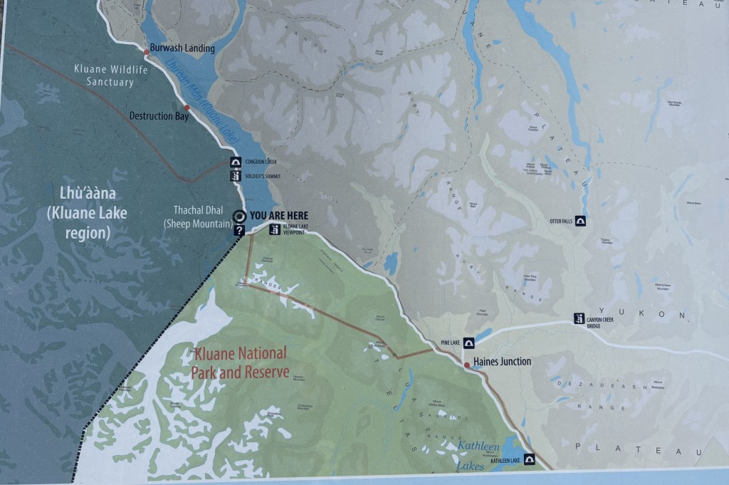
My destination for this segment is the “You Are Here” spot on the left side of the map.
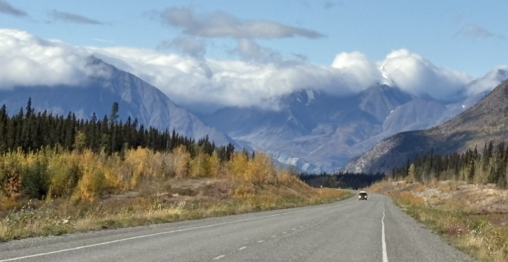
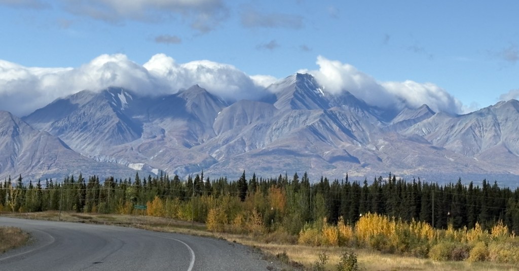
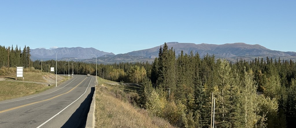
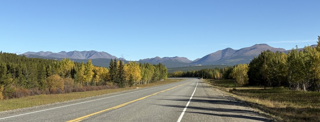
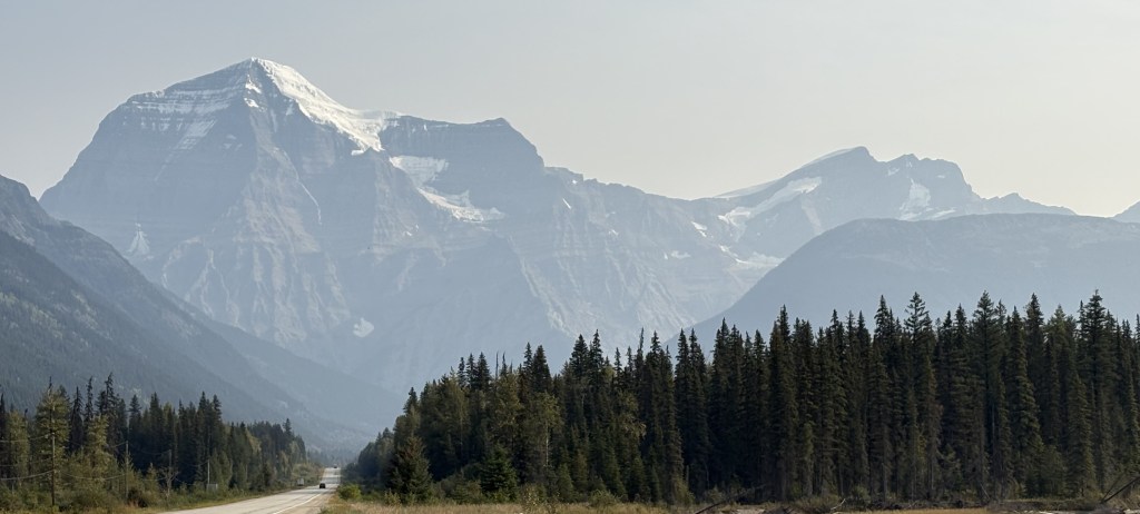
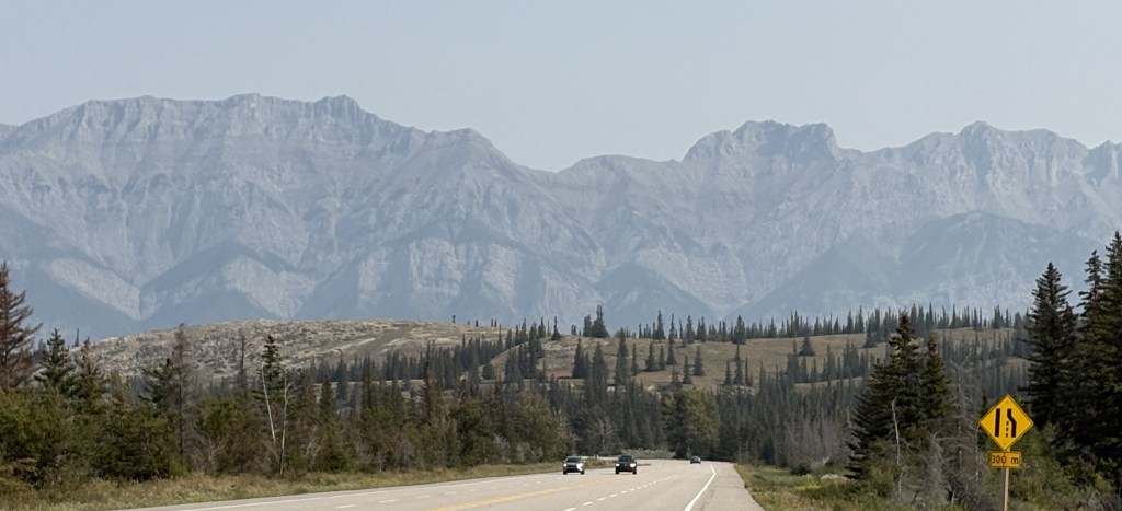
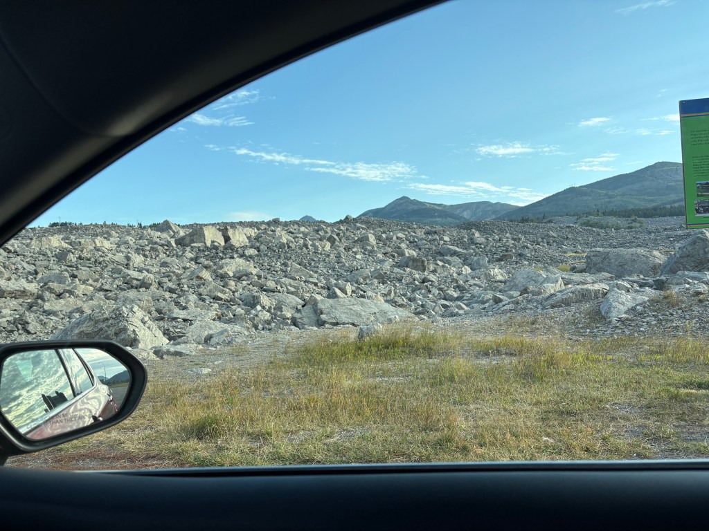
I was seeing lots of BIG mountains ahead of me (in Kluane National Park and Reserve) but after Haines Junction the road turns towards the northwest so I would drive along side, or around, the mountains rather than over them. You can’t always tell from a map, but I have learned that as I approach a sizeable mountain which I will go over (often through a named “pass”) there will be signs for a “Chain Up” area just off the road where vehicles may stop to put chains on their tires. Modern chains may not be chains at all, but other grip- providing equipment which wraps around your tires. When you reach the top of the “pass” there is a “Brake Check” area where big trucks are required to stop to check the condition of their brakes before driving downhill. The required chains may also be removed there, or at the bottom of the hill (I would personally prefer the latter of those two choices).
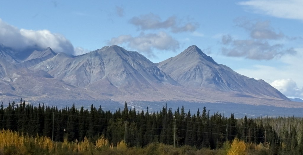
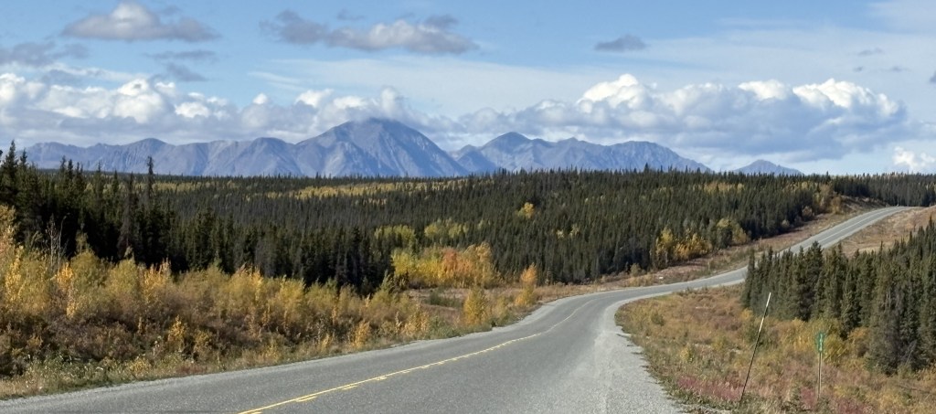
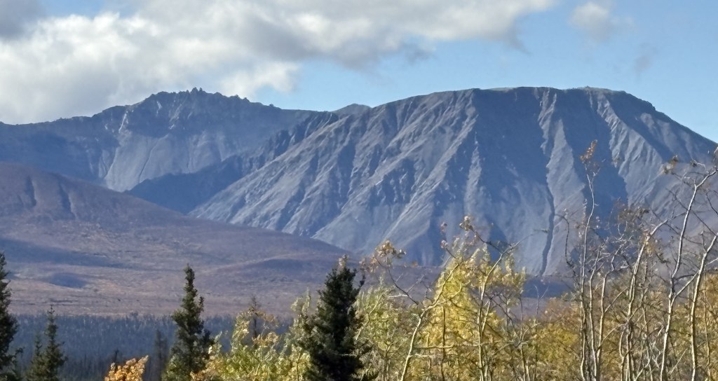
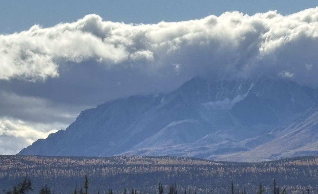
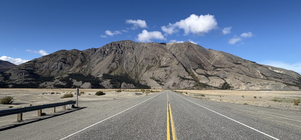
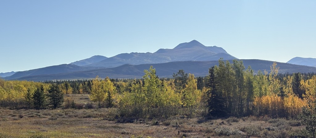
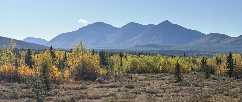
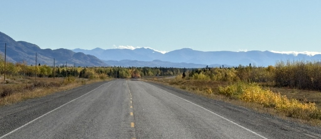
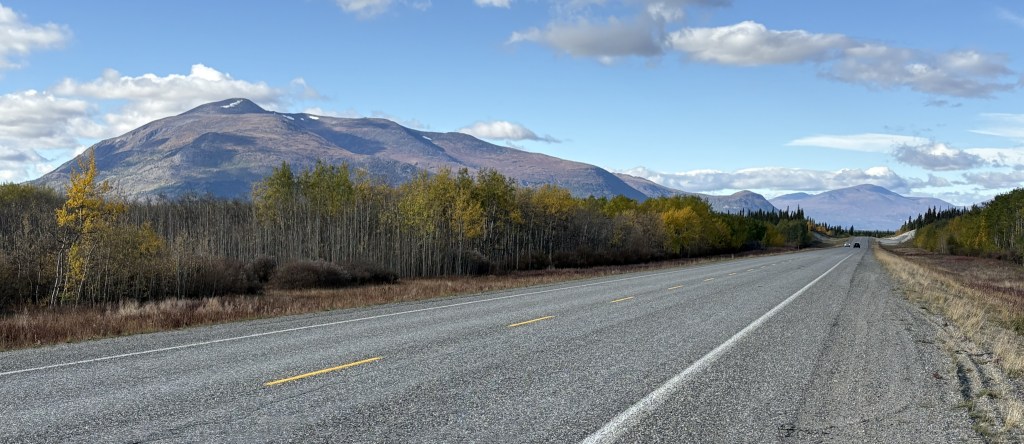
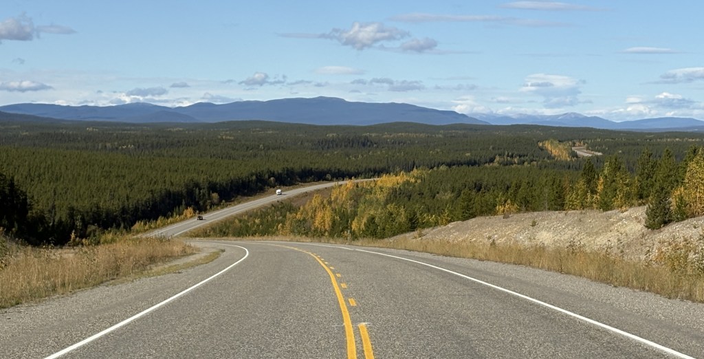
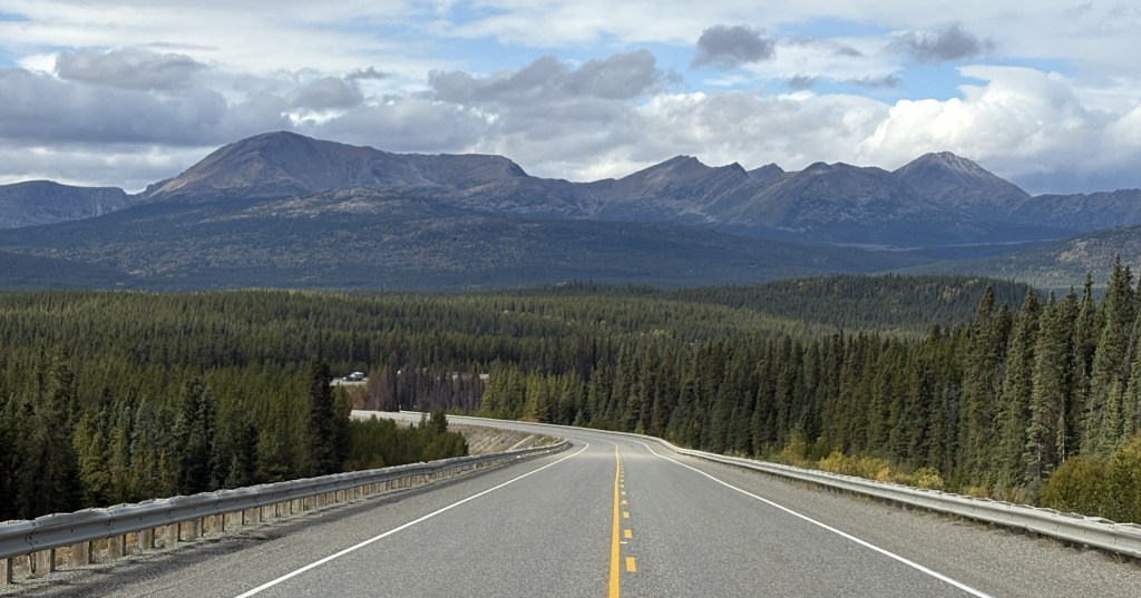
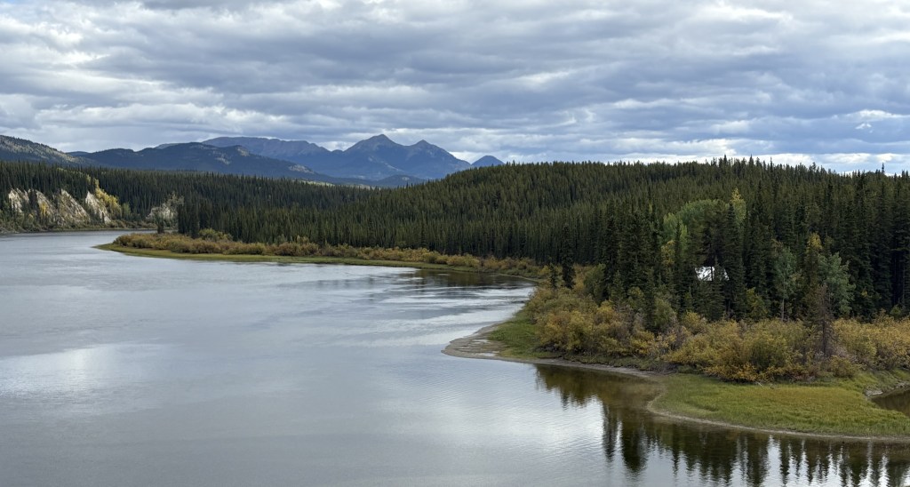
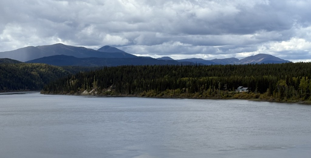
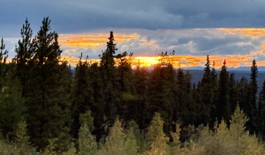
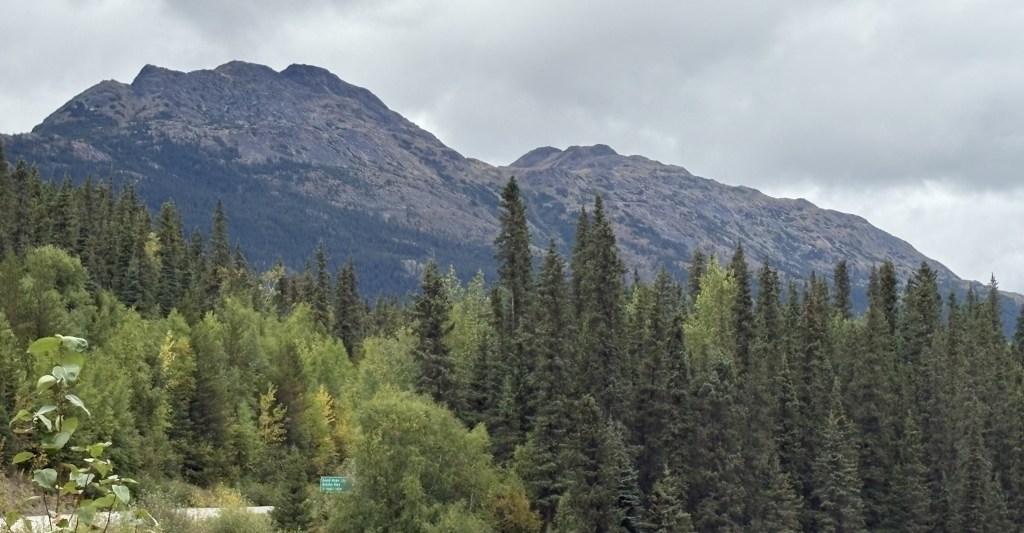
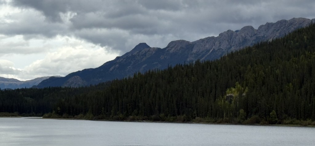
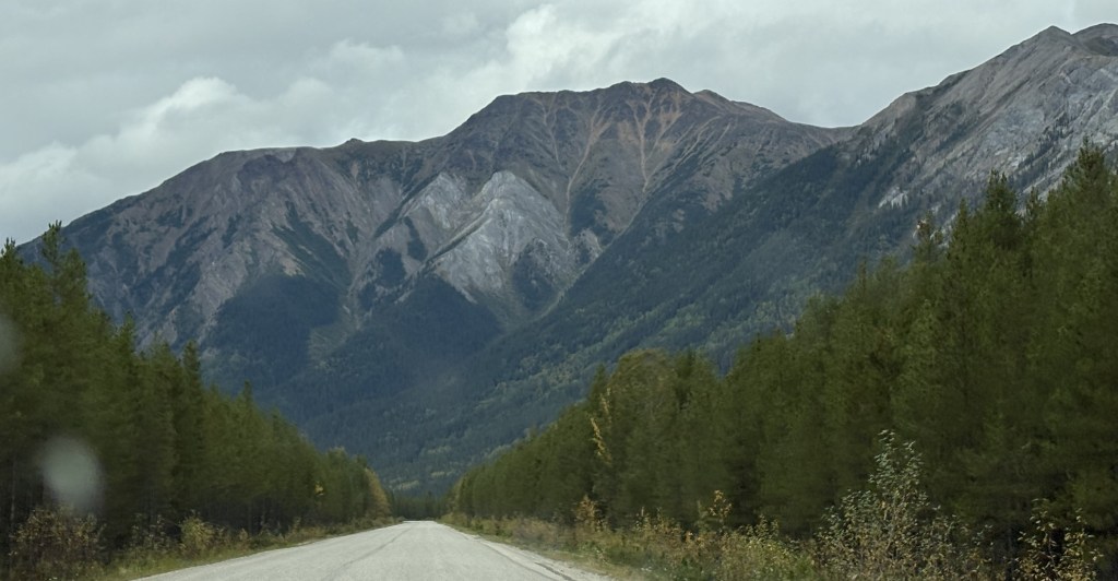
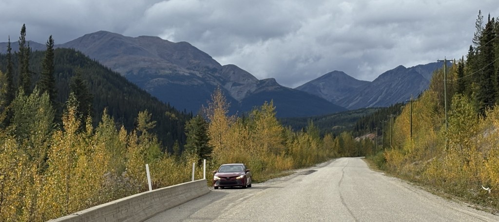
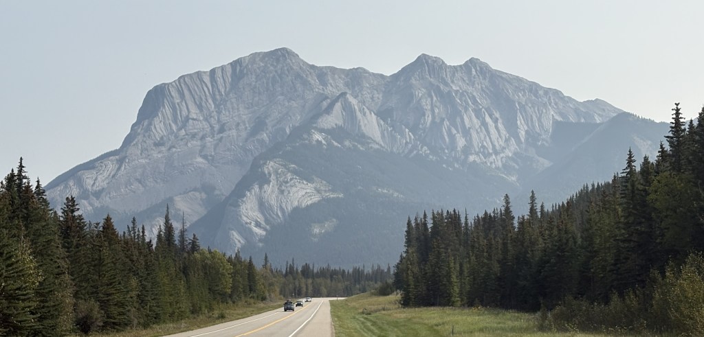
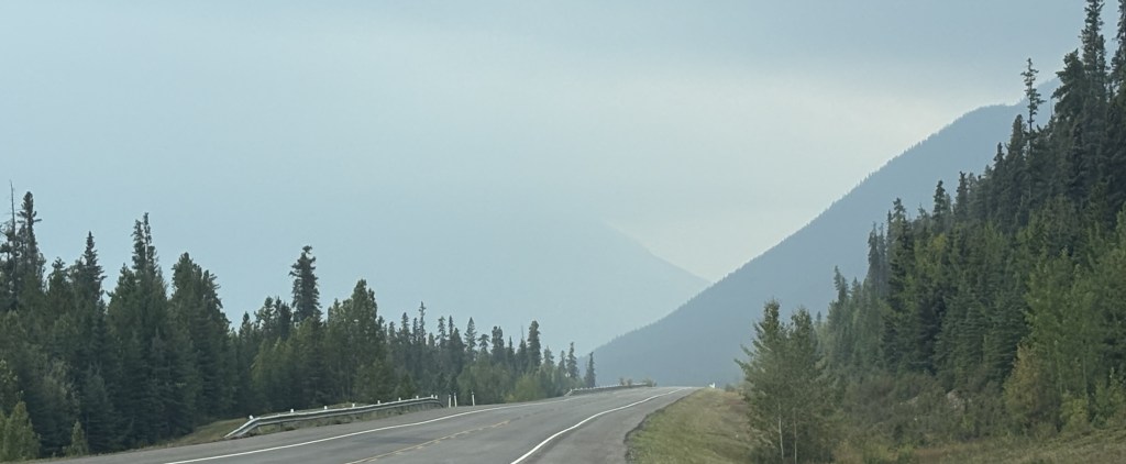
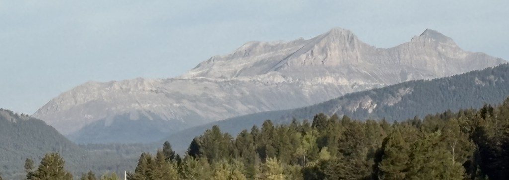
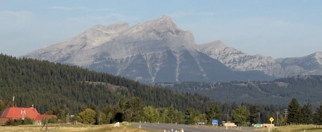
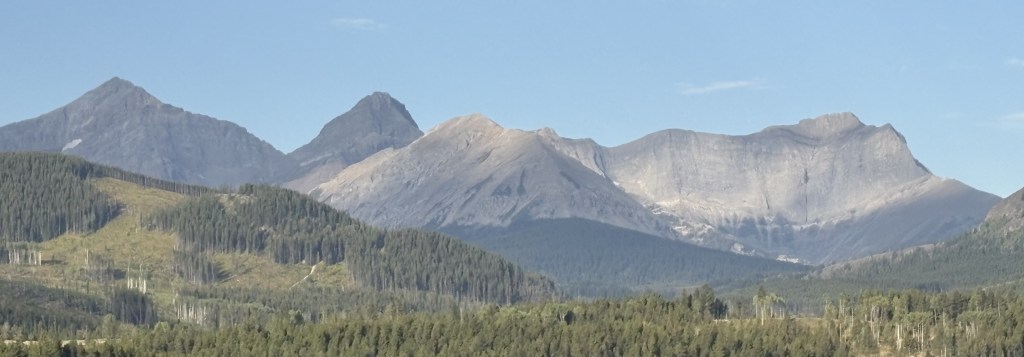
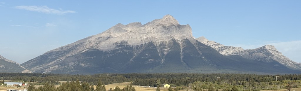
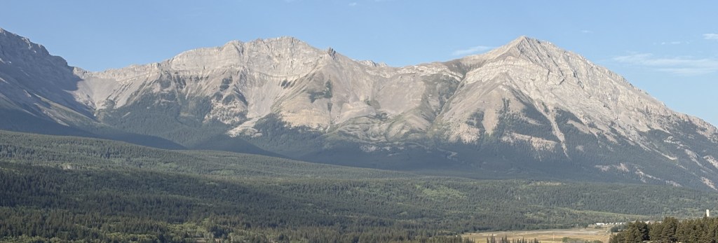
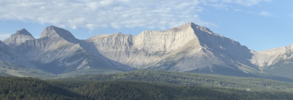
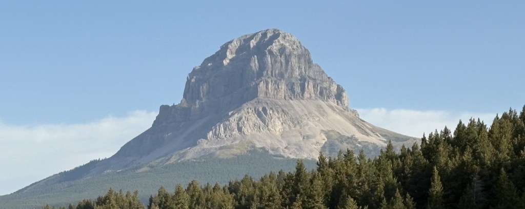
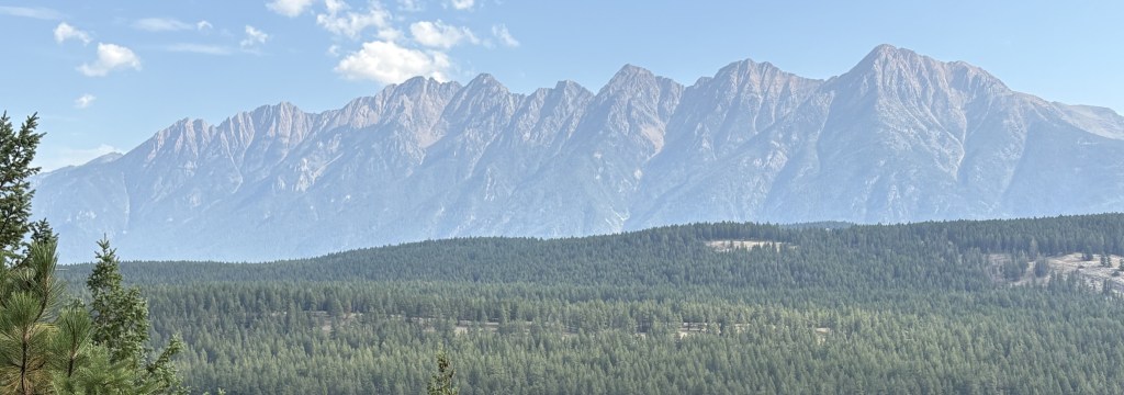
Now, here are the mountains I saw as I drove this section of the Alaska Highway. Once again in this segment of my drive, the road was basically fine, with only a few isolated bad spots.
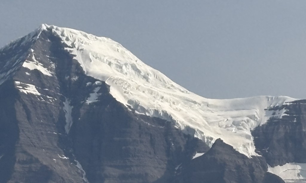
Most of the clouds in the photos above were directly above the mountains to my left. Directly above me, and to my right, it was sunny and clear, and there were breaks in clouds over the mountains in some spots.
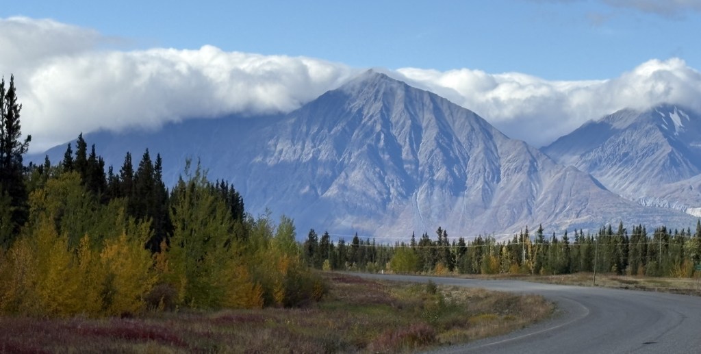
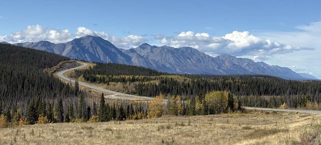
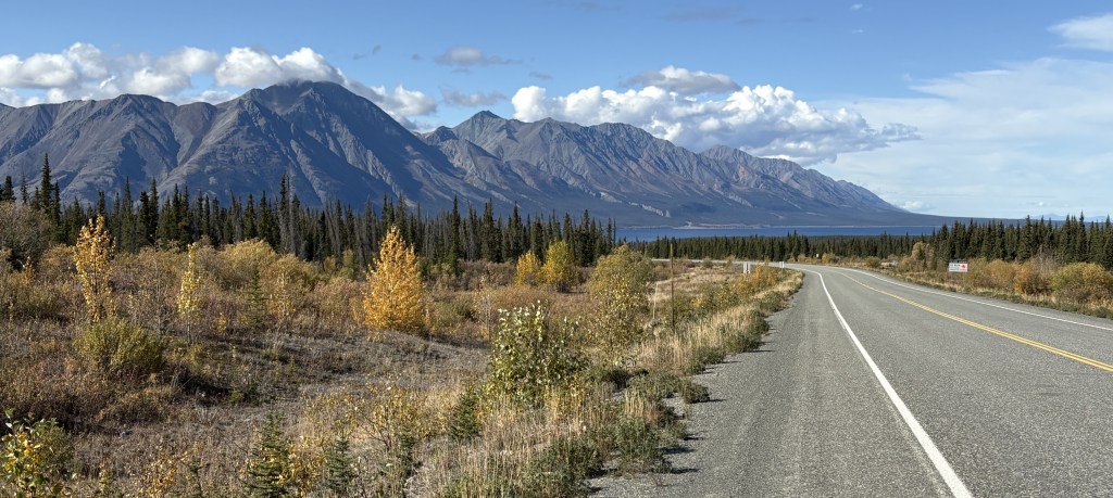
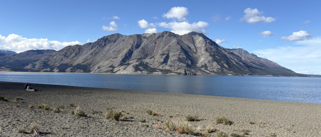
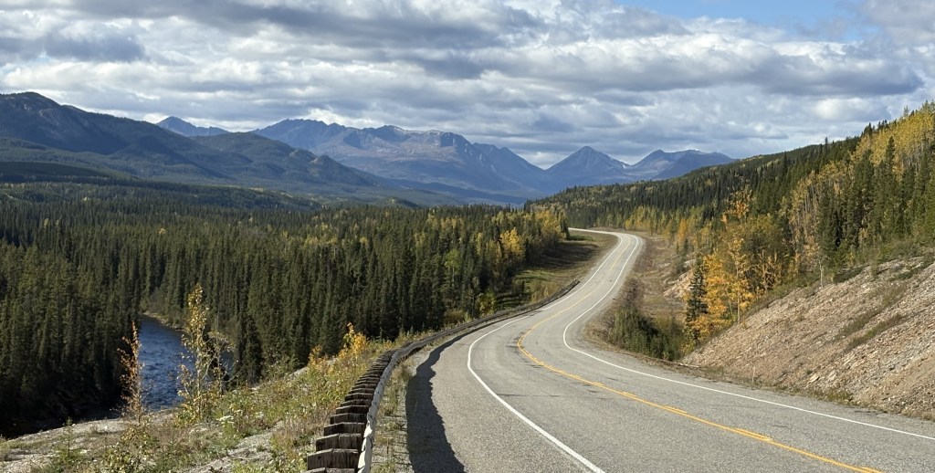
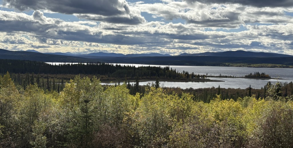
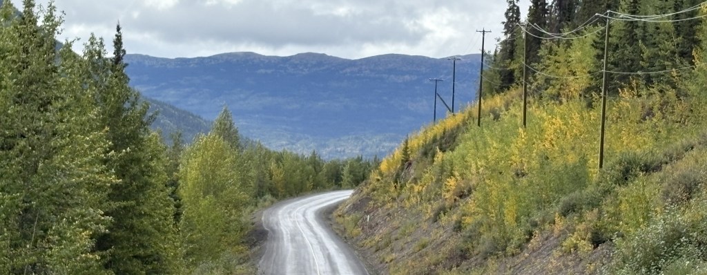
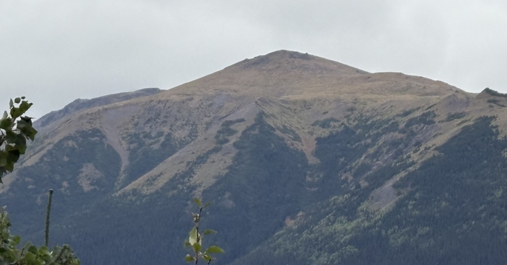
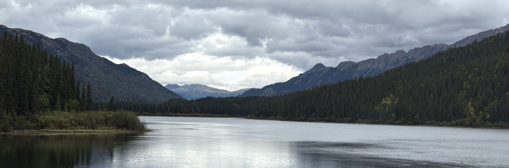
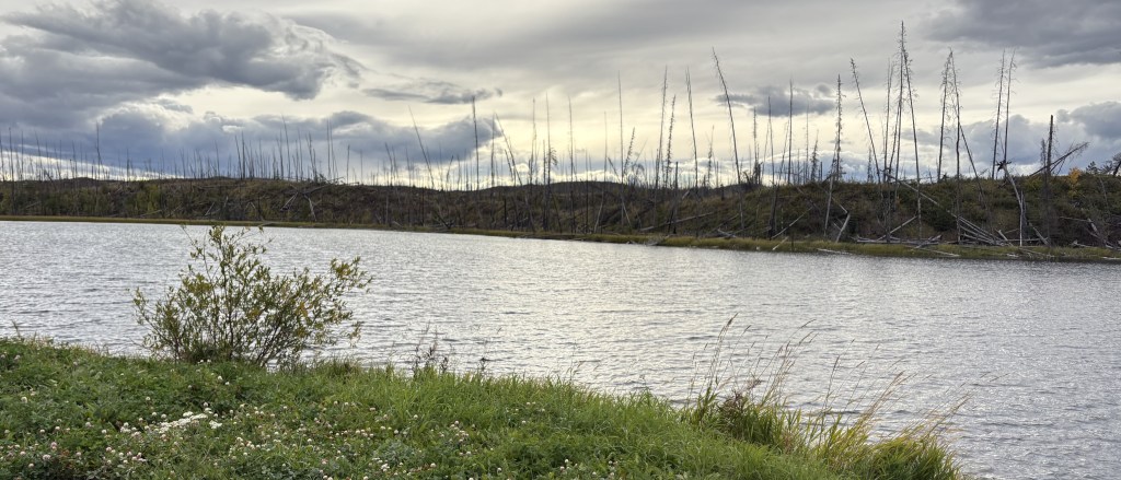
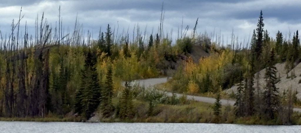
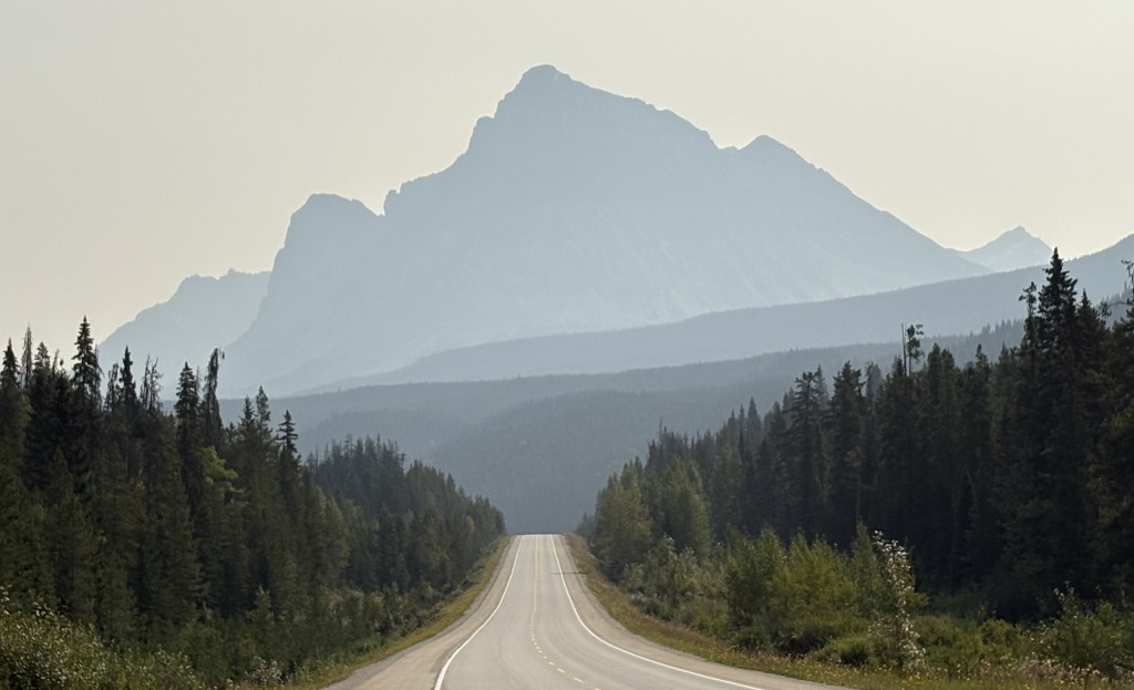
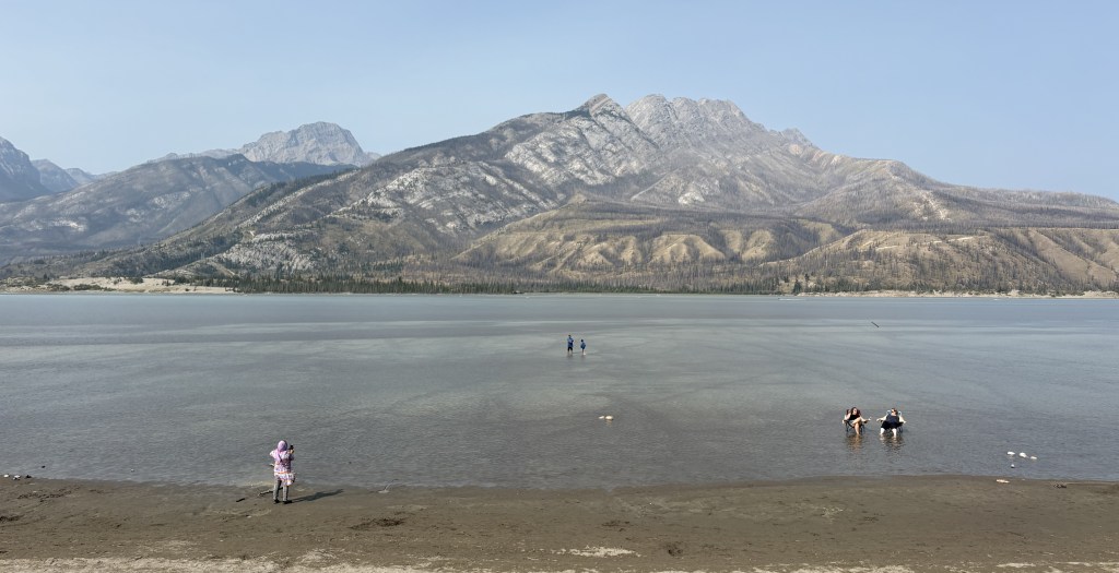
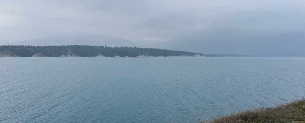
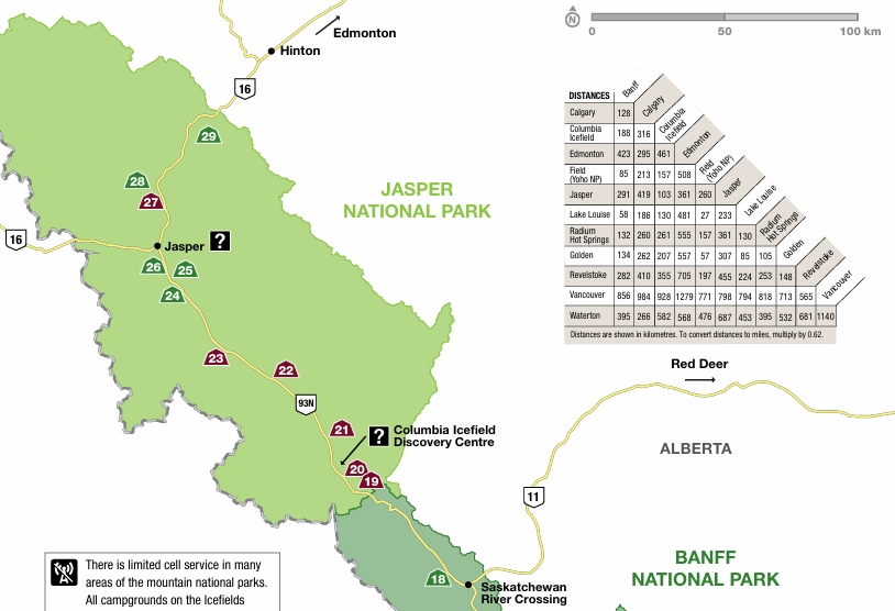
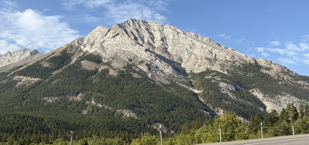
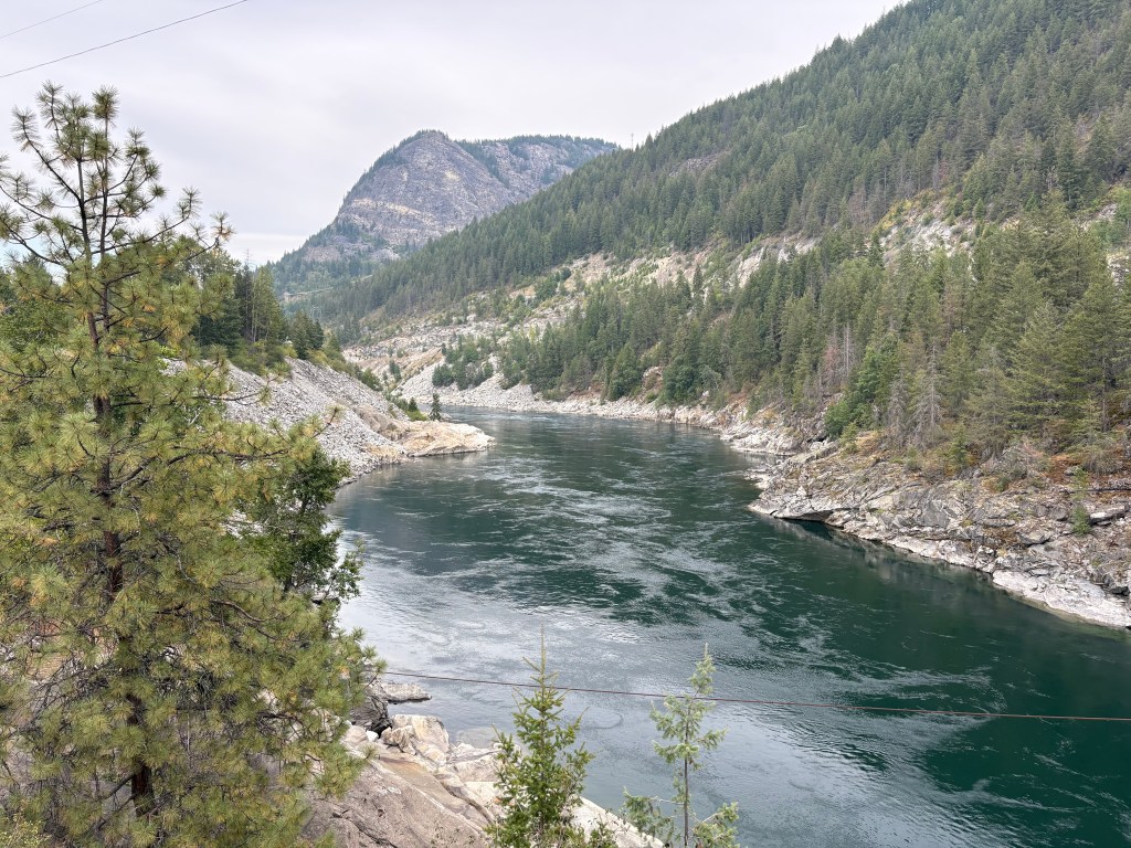
The lake shown above is the southernmost tip of Kluane Lake. The mountain on the other side is Sheep Mountain (where I would encounter warning signs for bighorn sheep, of which I saw none). The road I was on would continue to the left from this spot but then make a turn right to head straight towards the mountain.
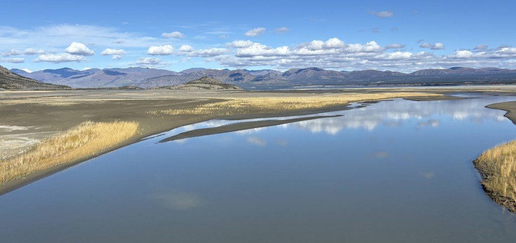
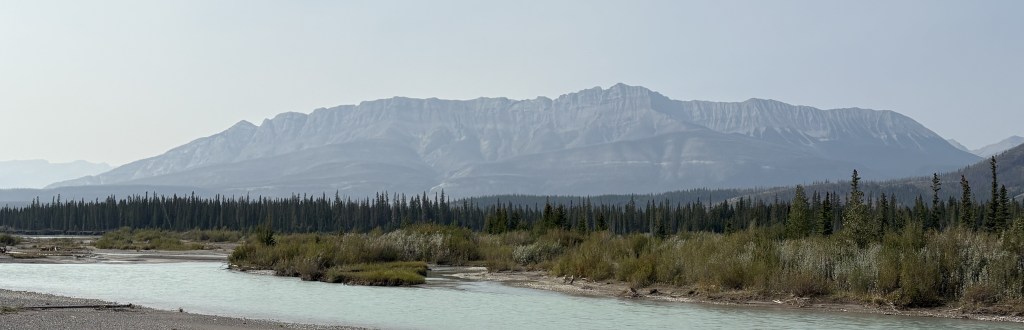
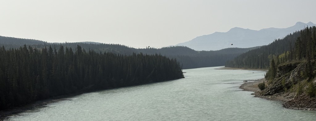
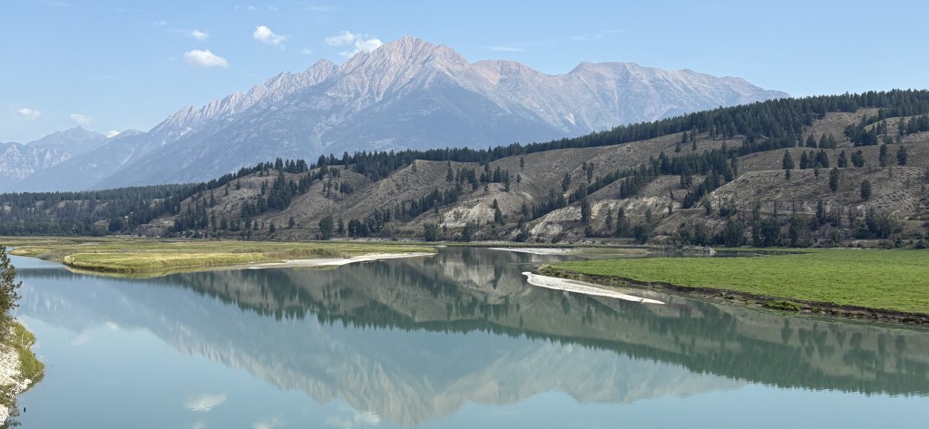
And this was the view from a bridge I drove over where the lake drains into a small river (or vice versa).
I will make the next two posts in this 4-post sequence tomorrow, which will take me to Tok, Alaska.
This is the first of four posts documenting my entry into Alaska! From Whitehorse it will be a 386 mile, 7 1/4 hour drive (without stops!) west across the southern part of the Yukon, eventually turning northwest before reaching the border with Alaska, and ultimately the town of Tok (pronounced toke). There are lots of photos and my goal is to show what it is like to drive this part of the Alaska Highway. The four posts will be:
1 – Whitehorse to Haines Junction, 2 – Haines Junction to Sheep Mountain
3 – Sheep Mountain to the Canada/Alaska border, 4 – The border to Tok, Alaska
Here we go!
It was a nice, clear morning when I left Whitehorse. It is the capital of the Yukon Territory province and has a population of about 35,000 people. According to Wikipedia it is the largest city in northern Canada, which covers quite a bit of land. I would guess what they mean is north of the northern borders of the provinces which border the northern US states in the lower 48.
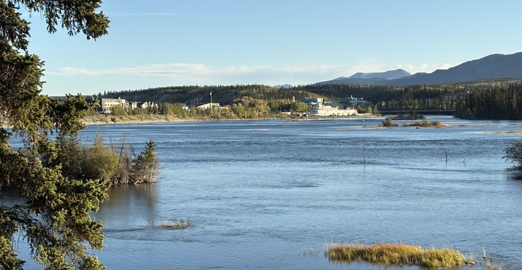
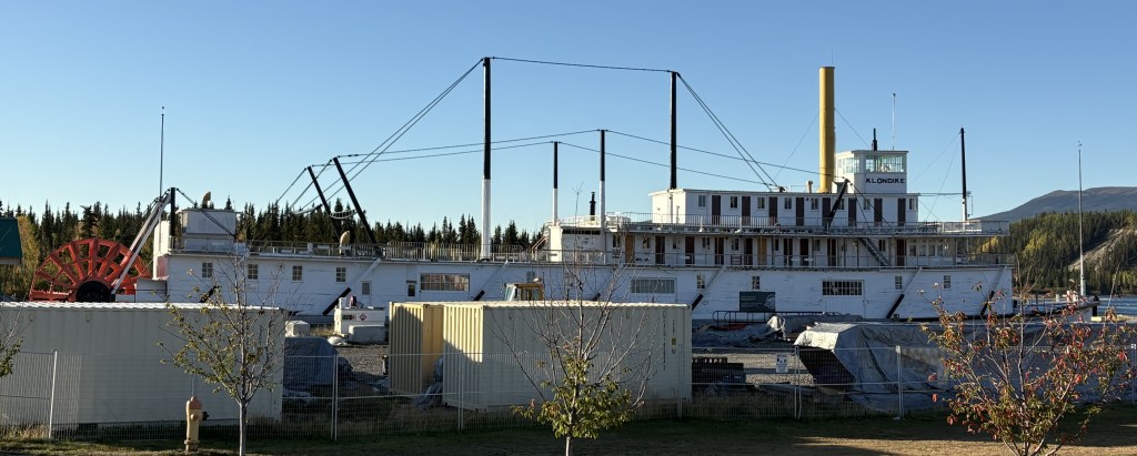
That is looking towards Whitehorse from a pullout area along the Yukon River.
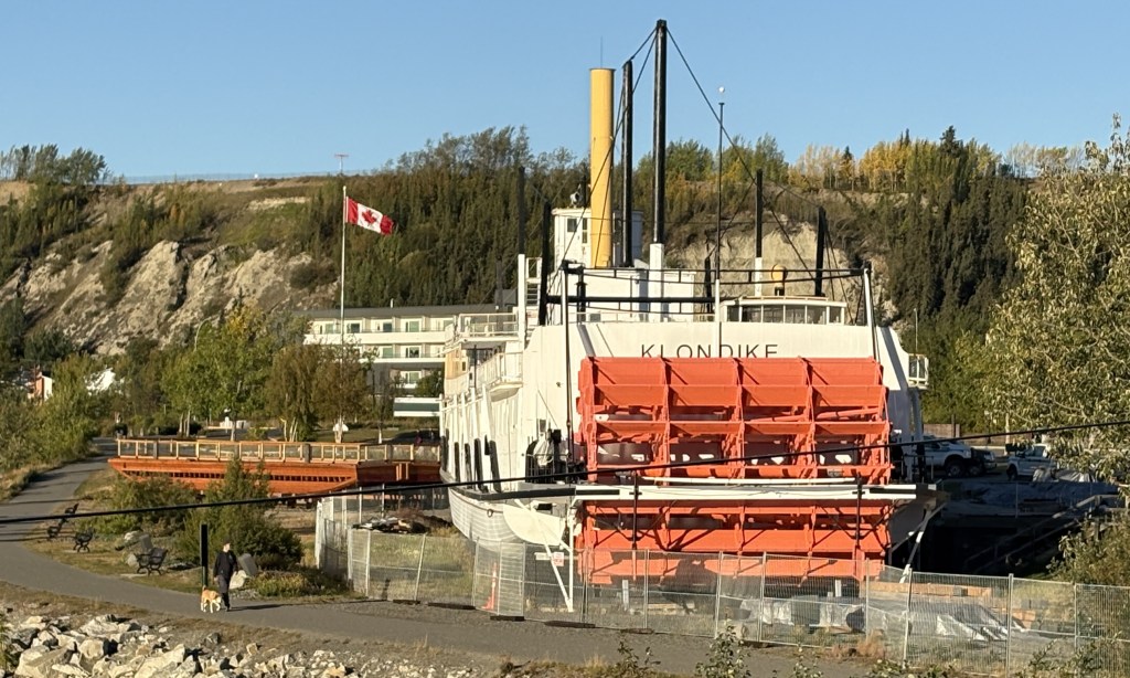
The ship shown above is the SS Klondike. It is now a Canadian National Historic Site and is undergoing a multi-million dollar renovation (hence the fences and shipping containers). It is drydocked here along the river. It was on the right side of the first photograph in this post.
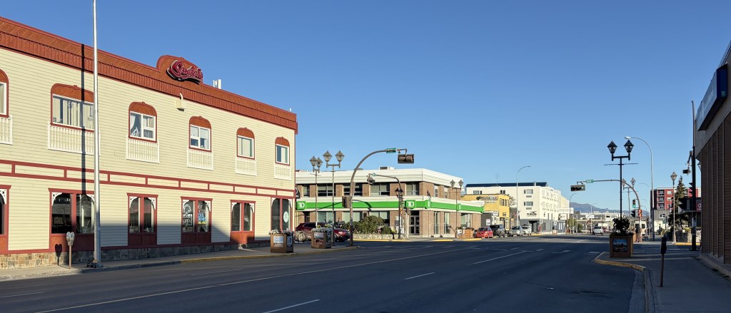
That is part of the downtown area. The town is rather spread out so it is hard to get it in one photo. Suffice it to say that it is a nice, modern town. I will be coming back here on the return trip in a few weeks and plan to spend more time here.
The rest of the photos in this post are from the drive west to Haines Junction.
I have posted the next four photos previously but am repeating them here in the proper sequence in my trip.
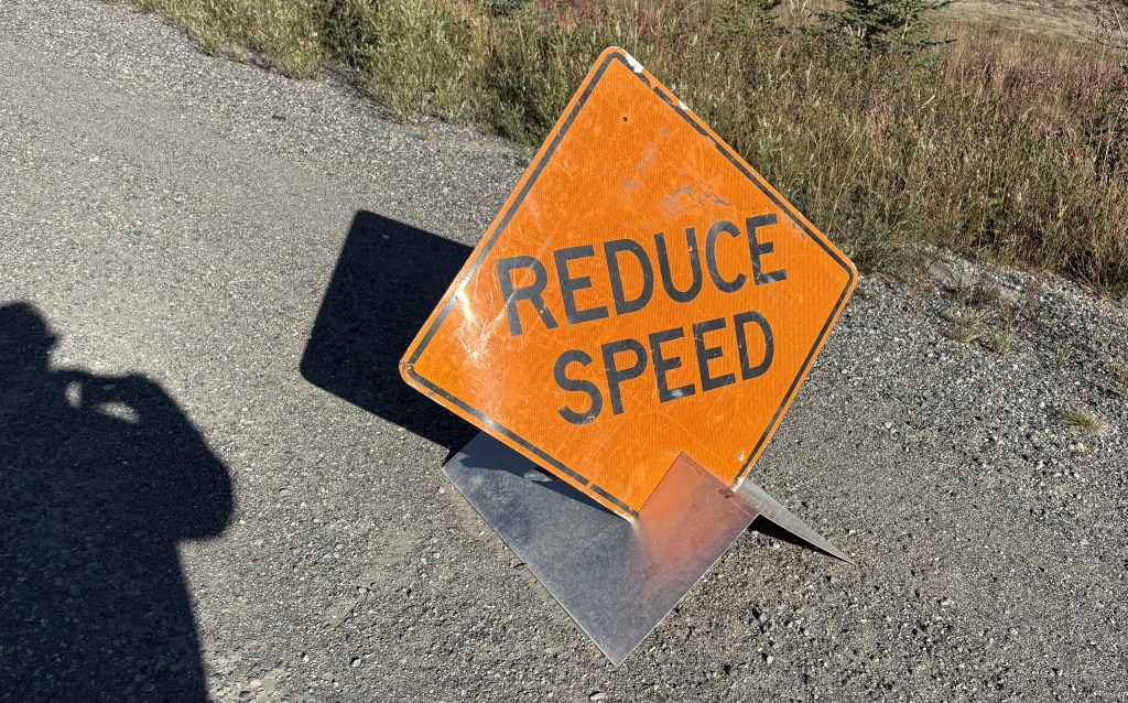
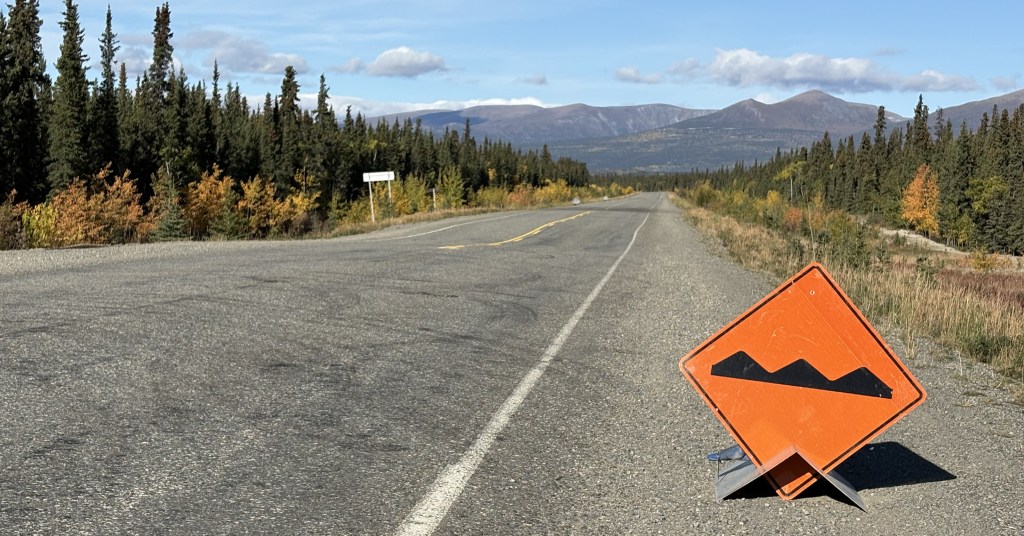
As I explained in the real-time post back in September, these were small signs set up temporarily along “bad” sections of the Alaska Highway. A “bad” section is generally an undulation (bump or dip in the road caused by the temperatures this far north), or potholes or parts of the road which have a rough surface as opposed to the normal pavement. Most of the road is fine, but these signs warn drivers to be especially alert to the condition of the road, especially if there is snow present.
During the day these areas are generally visible to the naked eye, but at night or on a snowy road, these signs should not be ignored.
This second sign indicates that there is a fluctuation in the road surface (up or down) which is what warrants caution. You can see the dip in the road just past these signs. Not too bad at this particular spot but sometimes they are doozies!
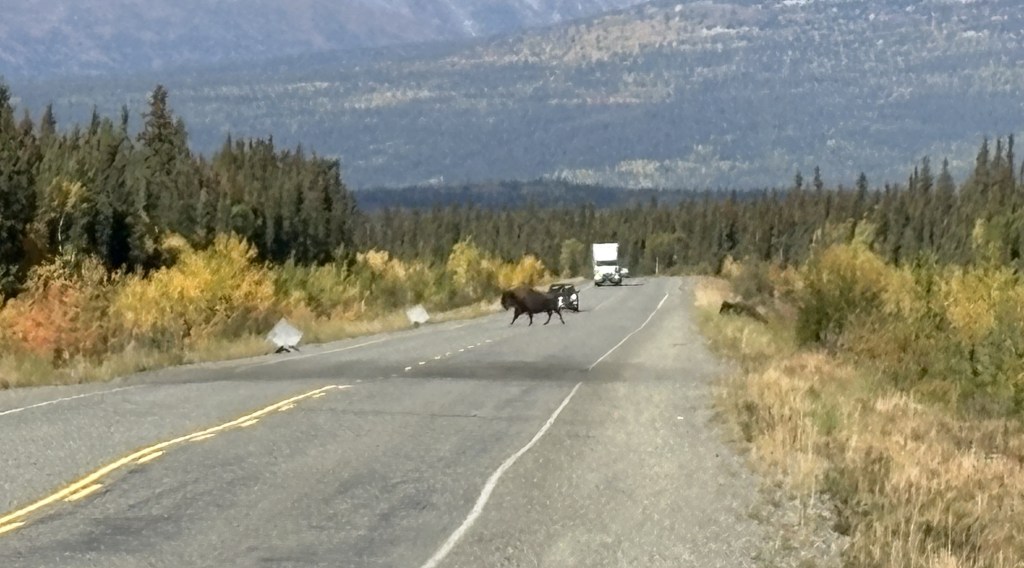
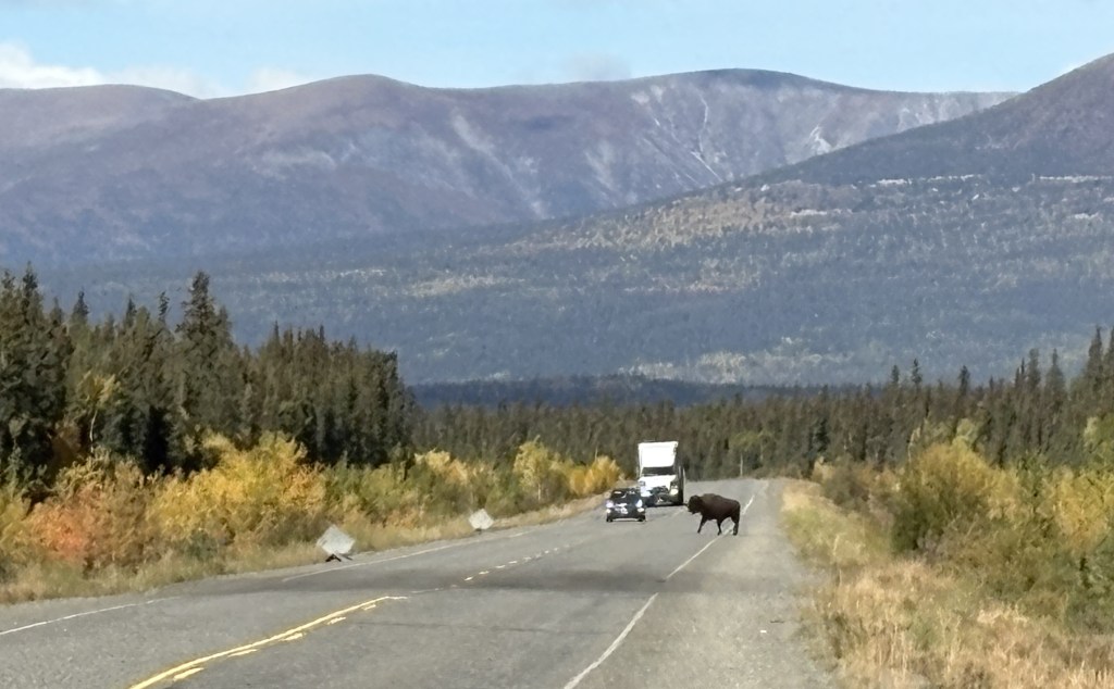
While I was stopped here taking these photos, two bison meandered across the highway further up the road.
You can see the second one climbing the bank on the right.
You can also see the two signs warning drivers coming the other way for a repaved (dark) area on the other side of the dip in the road. These were the only bison I saw during my entire trip, and I would have already been past this spot if I hadn’t stopped to take photos of the two small signs.
There were LOTS of these signs between here and the border and as the road deteriorated the further west I drove, they evidently ran out of signs warning of the bad spots and drivers just needed to be prepared at all times. In addition to the two signs there was sometimes an orange flag attached to the Reduce Speed sign, which meant they were really serious about it. Later in my drive there may only be a flag warning of a bad spot.
As I stated back in my real-time post, I would not want to drive this road at night, not only because of the increased animal-in-the-road risk, but also because I couldn’t see the bad spots before driving over them. I kind of got used to the rhythm needed to pass these areas. If the hazard was on my side and there was no one coming the other way I would sometimes move over to the other lane.
What I have shown in this post is getting as far west as Haines Junction.
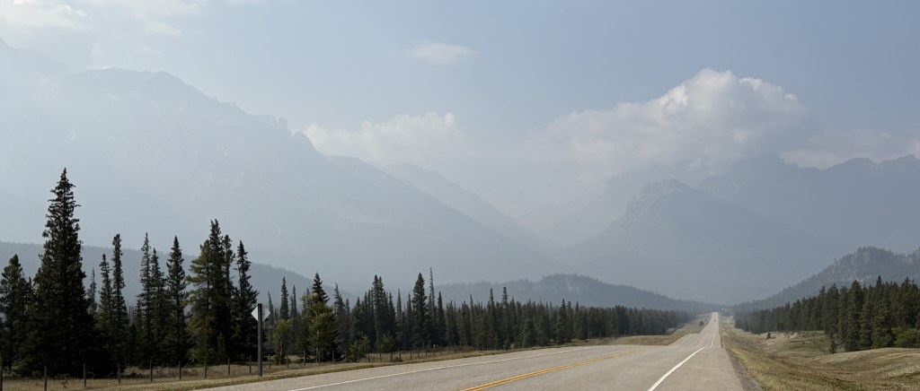
The road on this stretch was pretty good in almost all places, as it will be in the next segment of today’s drive. Thus far it was a nice, clear day and it was a very pleasant drive.
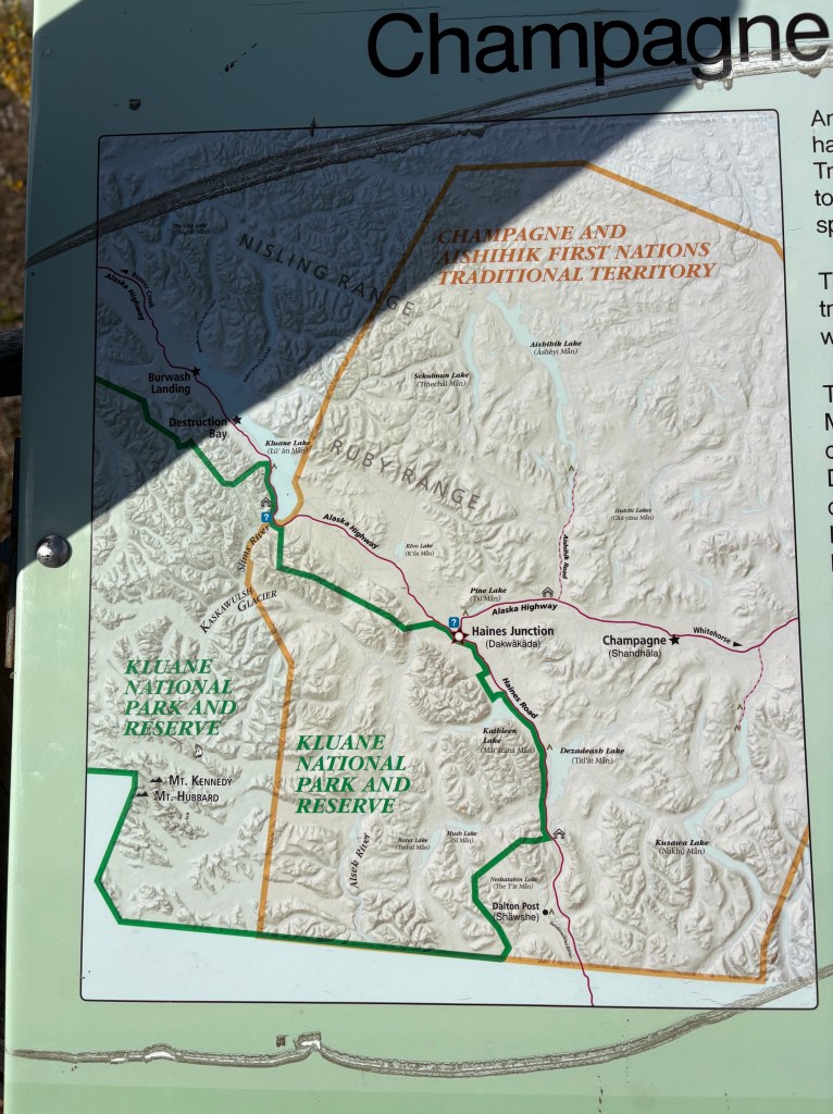
I stopped in Haines Junction at the Kluane National Park and Reserve Visitor Centre, which also housed a Cultural Centre for the Da Ku indigenous First Nations tribes (Champagne and Aishihik ), whose territory I have been driving through. They had lots of displays, and I spent a good bit of time there.
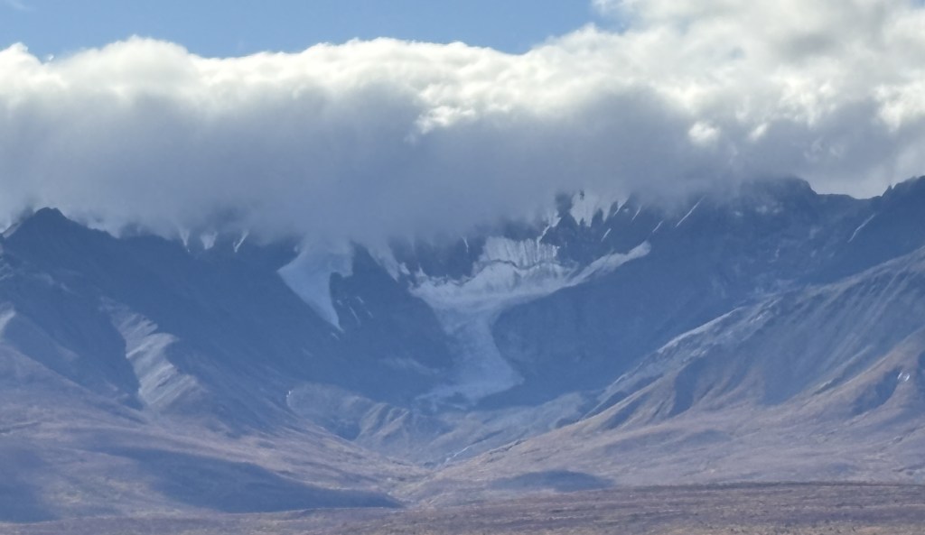
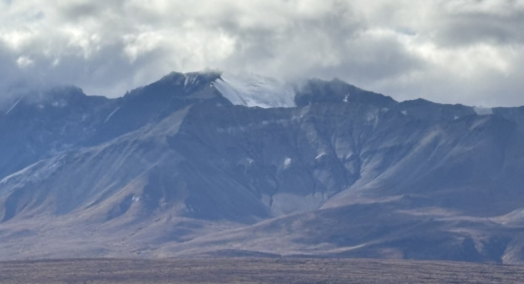
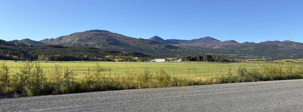
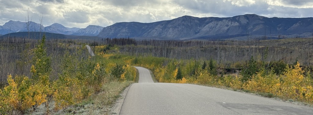
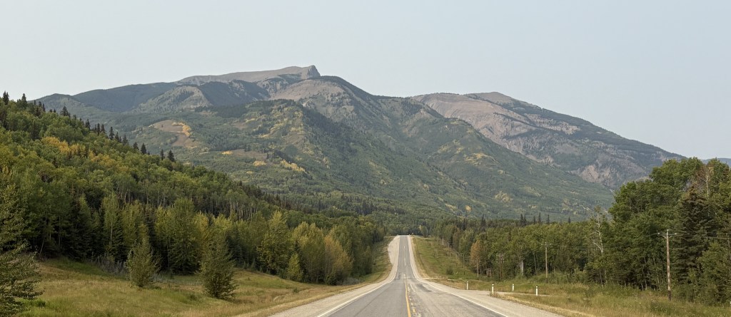
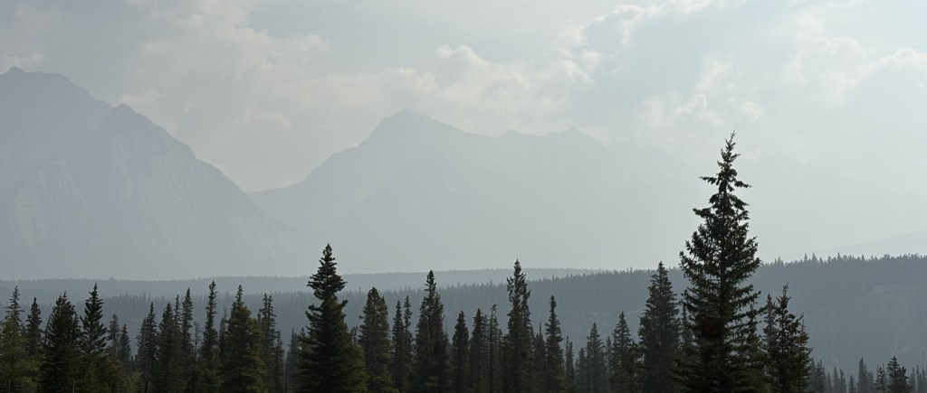
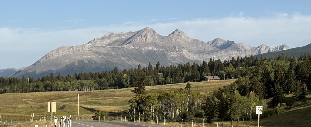
The Kluane National Park and Reserve was dead ahead of where I was driving as I approached Haines Junction. I could see more and more big mountains ahead of me, many with low clouds at the top which I have learned often signifies snow and/or glaciers at their peaks. You will see lots of them in the next two posts. One of the mountains due west of Haines Junction is Mount Logan which, at 19,551 feet, is the highest mountain in Canada (and second tallest in North America, after Denali). It is about 100 air miles away and I could not see it because of other tall mountains blocking the view.
My next post covers Haines Junction to Sheep Mountain, at the southern tip of Kluane Lake on the map shown above (where there is a blue question mark).
Today I will drive part way to Alaska along the Alaska Highway. Years ago it was called the Alcan Highway but these days most people, including mapmakers, appear to just call it the Alaska Highway. The road starts in Dawson Creek, British Columbia and ends in Delta Junction, Alaska, a total distance of 1,422 miles when it was originally built. I drove through Dawson Creek on my way to Grande Prairie just a few days ago but didn’t know at that time that it was where the Alaska Highway starts. I will be driving through Delta Junction during my stay in Alaska.
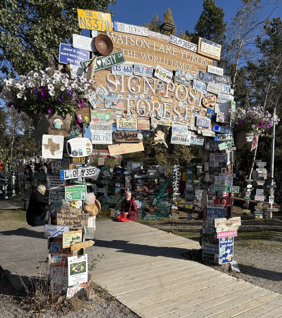
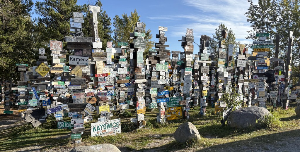
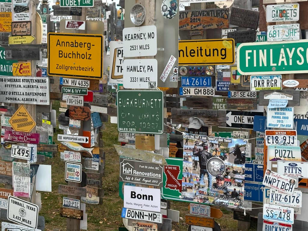
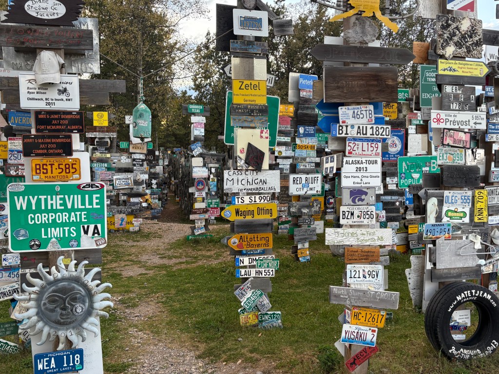
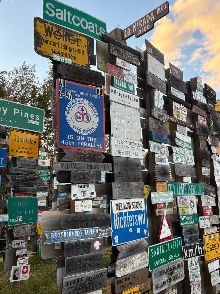
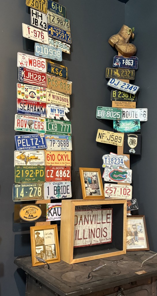
Before I got started, I drove back in to Watson Lake (about 20 miles east of my Airbnb) to top off my gas tank. I saw something there when I drove in for dinner last night that I think you’ll agree is blogworthy. Sign Post Forest.
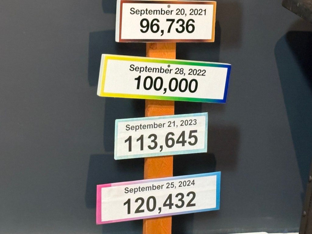
This attraction was started in 1942 by a person in the US military who was convalescing in Watson Lake. He was from Danville, Illinois and erected a wooden stake with a sign from his hometown. It has been added to over the years and according to a sign in the Visitor Centre here there were over 120,000 signs here in September 2024!
I’m sure that number has increased since then (I don’t know how they can keep track), and I’ve also learned that a sister site has been started in Danville, IL.
Also in the Visitor Centre was the original Danville, IL sign which had been erected in 1942.
If you look closely at the photo above you will see two license plates from the Northwest Territories province. Rather than being rectangular they are shaped like a polar bear! I have only seen one on a vehicle in person and wasn’t prepared to take a photo of it. I was hoping to see another but never did. I didn’t realize there were some in the photo until I just now posted it, or I would have taken a closer photo of them.
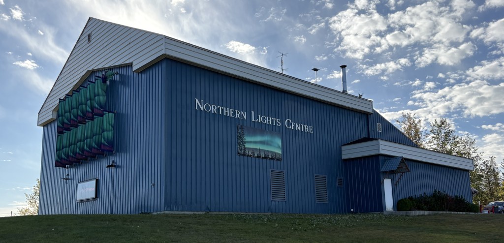
The Northern Lights Centre is also here in Watson Lake, and inside is where I found the local Visitor Centre. The people there were very helpful in giving me more maps and information about my drive across the province.
I had remarked to some friends after I had driven into town for dinner last night that if all of the Alaska Highway was like this 20-mile portion, then I had nothing to worry about. Well, I will say that the majority of what I would end up driving on today was actually in very good shape. With all the cold weather this far north, there were places where the highway department had to fill potholes or patch places where the road had heaved due to frost, but it wouldn’t start going downhill in quality until after I got past Whitehorse.
Here are some of the things I saw as I drove the 258 miles to Whitehorse, the capital of the Yukon Territory province. Google maps indicated it should take about 4 1/2 hours.
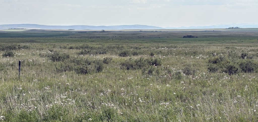
As you might expect – highway, mountains and bodies of water. Not too many towns along the way, but it was wide open road and didn’t feel quite as isolated as Highway 37 was driving north through British Columbia. I didn’t see a single animal in or near the road.
And I meant to include this photo as the final item in my previous post about yesterday’s drive. I had started the day seeing the sun rise in the morning and as I drove back to my Airbnb from dinner I also saw the sun set.
I will only be spending one night in Whitehorse tonight but will stop there again for two nights on by way back to British Columbia. I still have two more weeks to spend in Canada before returning to the lower 48 but I interrupted my original plan to head to Alaska because people kept telling me I’d better get up there so I could get out before the snow started in earnest.
Here are more of the things I saw as I drove through northern British Columbia on my way to the Alaska Highway.
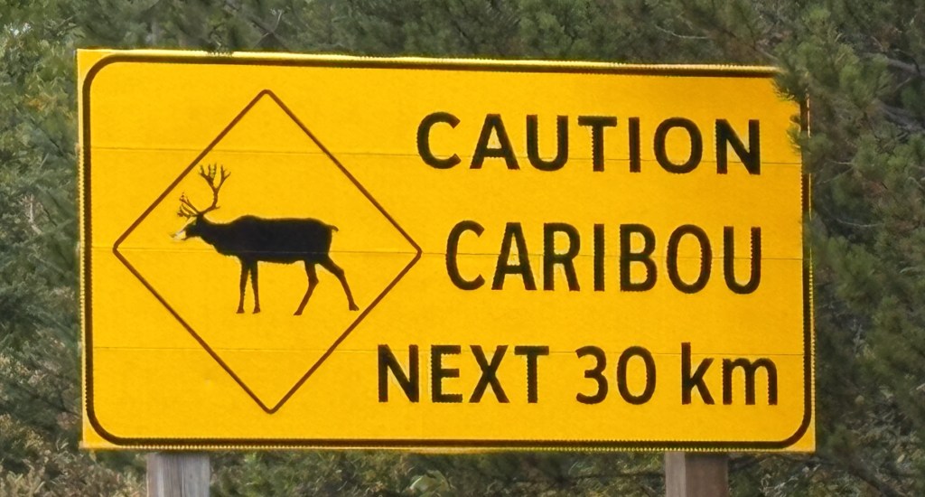
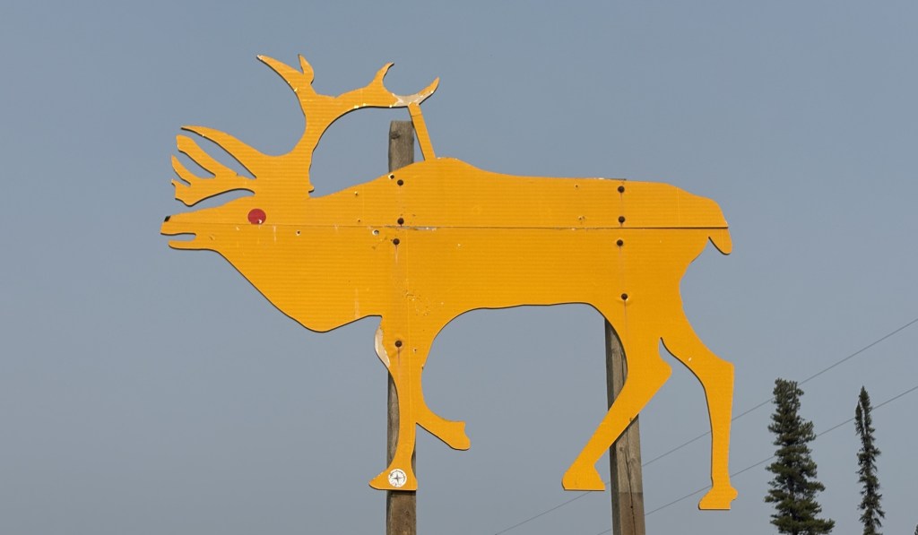
I had seen two handmade signs warning of caribou earlier in my trip, but this was an official one.
It finally occurred to me that one of the reasons I hadn’t seen any animals on this highway was that in most places the edges of the highway are not trimmed back like on most roads, and animals have plenty of places to remain hidden. I did have to remain vigilant, though, as if any did dart out I wouldn’t have had much time to react.
The photo above was the view I had in my direction of travel. I had turned around to come back and take a photo, as I often do.
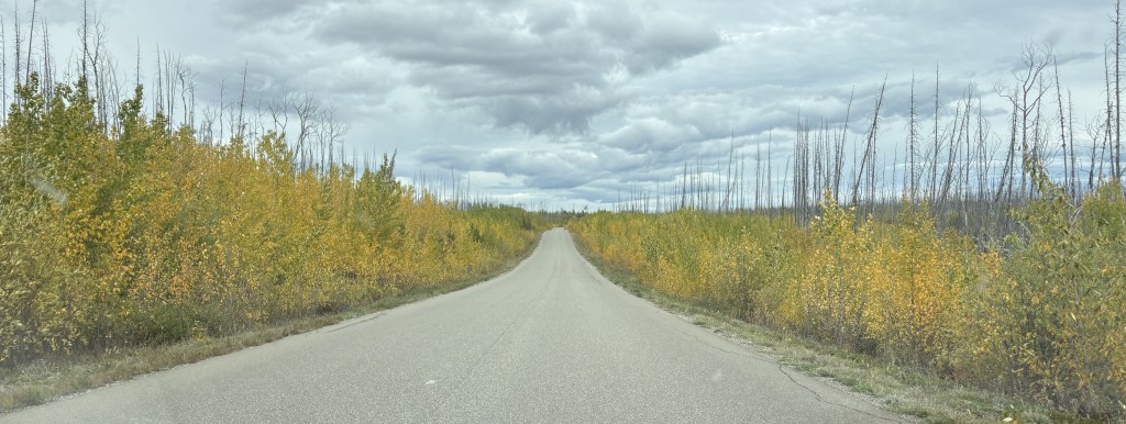
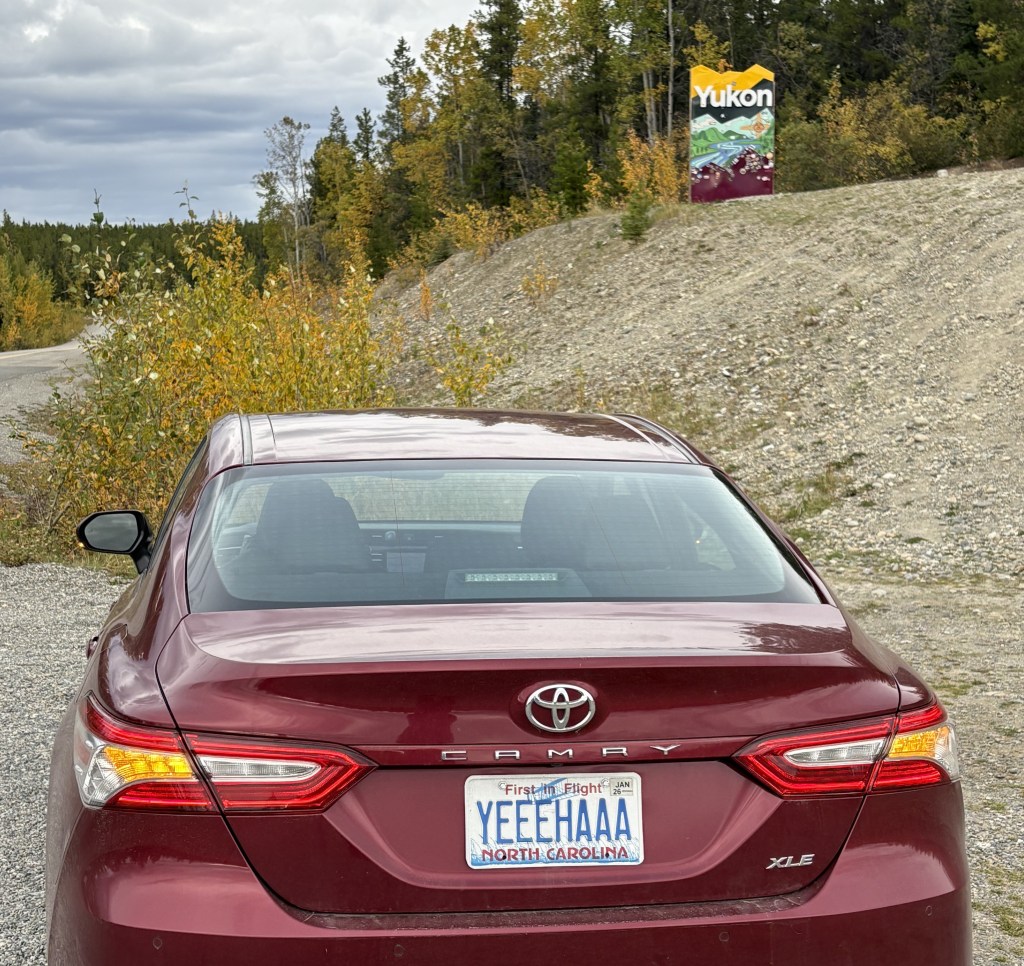
Once I got away from the mountains I had open road as I approached the Yukon Territory. When I got close to the border I drove through a large area which had burned in a wildfire in 2023. The only new or unaffected growth was right along the highway.
I finally reached the Yukon. Fortunately the wildfire had not made it this far north.
It was only a little further to get to the Alaska Highway, and my Airbnb was less than two miles to the left once I got there.
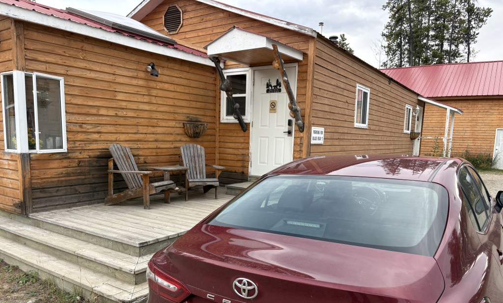
I was in a new cabin in a complex called Nugget City. It had (expensive) gas, a large (expensive) restaurant, and a campground for people with RV’s. The Airbnb rate was pretty steep, too, but that is what happens when you get to a spot where there aren’t many choices. I had seen a few “cheap” Airbnb’s listed along Highway 37, but I backed away when I learned they didn’t have indoor plumbing but only outhouses! I didn’t want my last act to be taken by a bear on my way to or from an outhouse in the middle of the night…
After I unpacked my stuff for the night (clothes, computer and CPAP machine) and rested a bit I drove in to Watson Lake and found a nice little Chinese restaurant which was much more affordable. I will make a post about something I saw there when I start my journey west tomorrow.
And as you can see, I had stopped for gas along Hwy 37 so I had plenty when I arrived in Nugget City. I will be retracing my route south when I leave Alaska in a few weeks. Unfortunately the complex here in Nugget City will be closed for the season and I will have to book a place in Watson Lake for the return trip.
It was a long, but uneventful drive getting here. It was well paved in most spots, with only a few short dirt or gravel patches. The map I showed earlier appeared to show lots of towns along the way, but that wasn’t the case at all. It is quite a desolate road, and those “towns” were usually just a crossroads with only a few buildings and occasionally a gas station. I didn’t see any animals. Not one. But that’s ok, because once I learned that the there wasn’t much of a barrier on either side of the road I was happy the animals and I can continue to peacefully coexist.
I didn’t realize it at the time but the last two nights I spent in Grande Prairie would be my last visit to Alberta province during this trip. My destination today will be Prince George, BC and I will cross the Canadian Rockies for the last time.
The drive to Prince George was to be 6 hours but I encountered an unexpected diversion along the way. Nothing wrong at all, but something that had not popped up on my radar and I found VERY interesting.
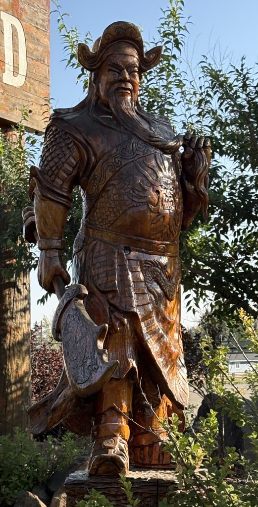
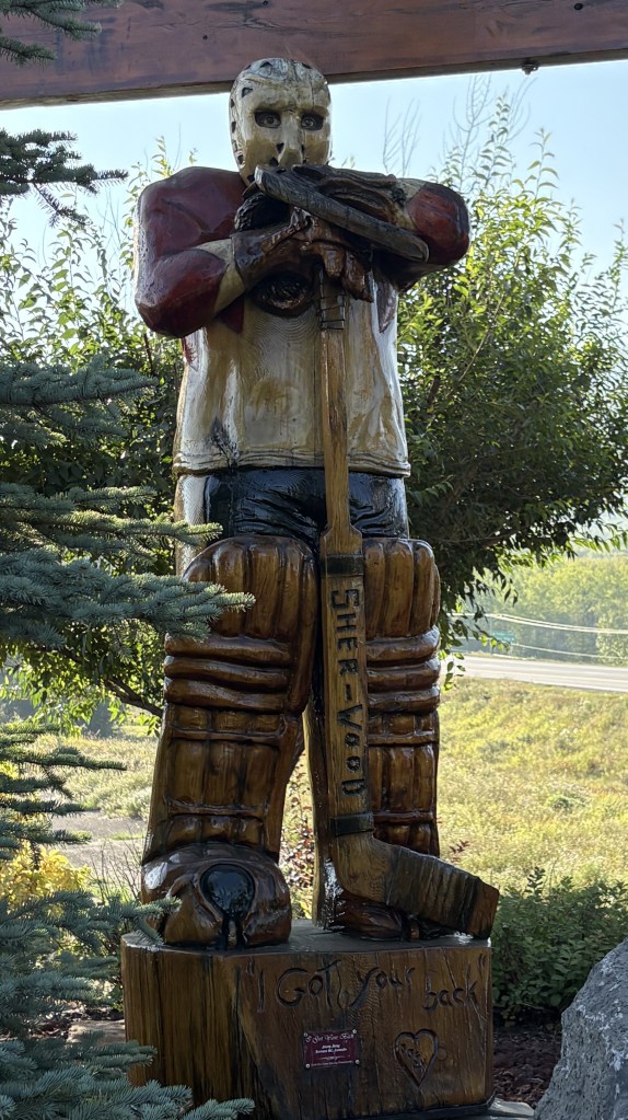
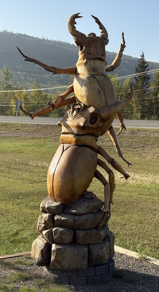
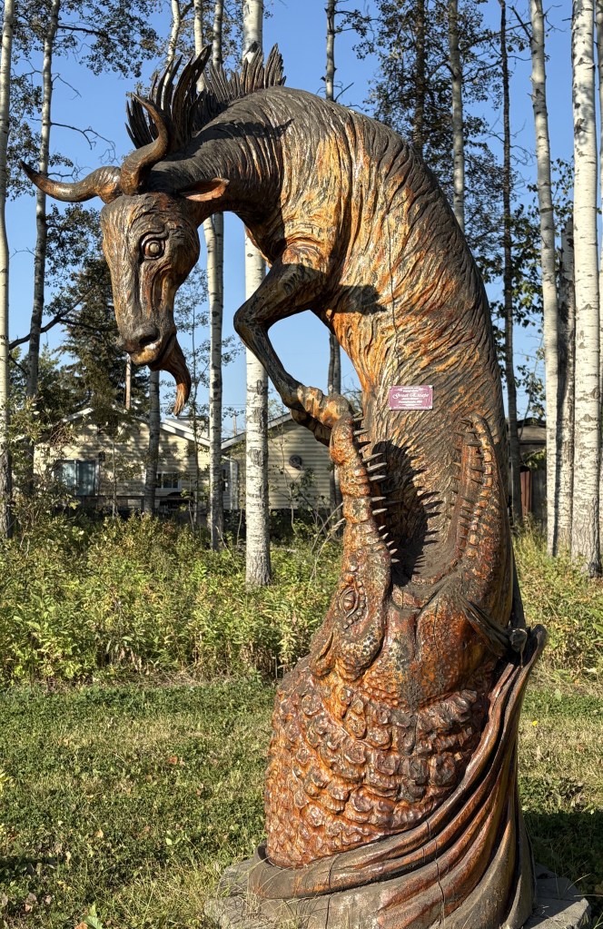
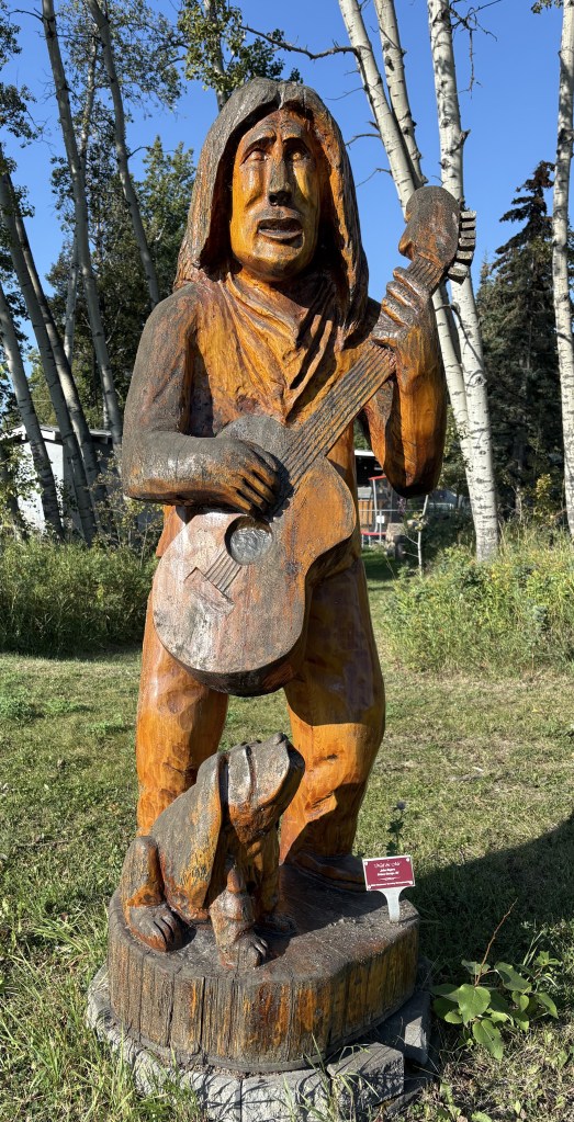
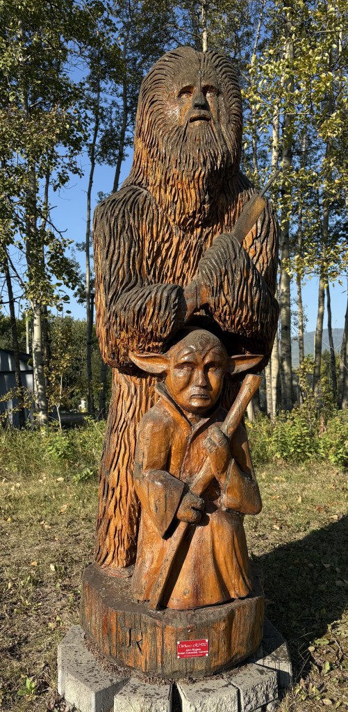
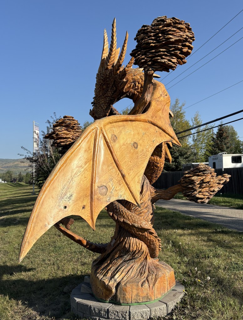
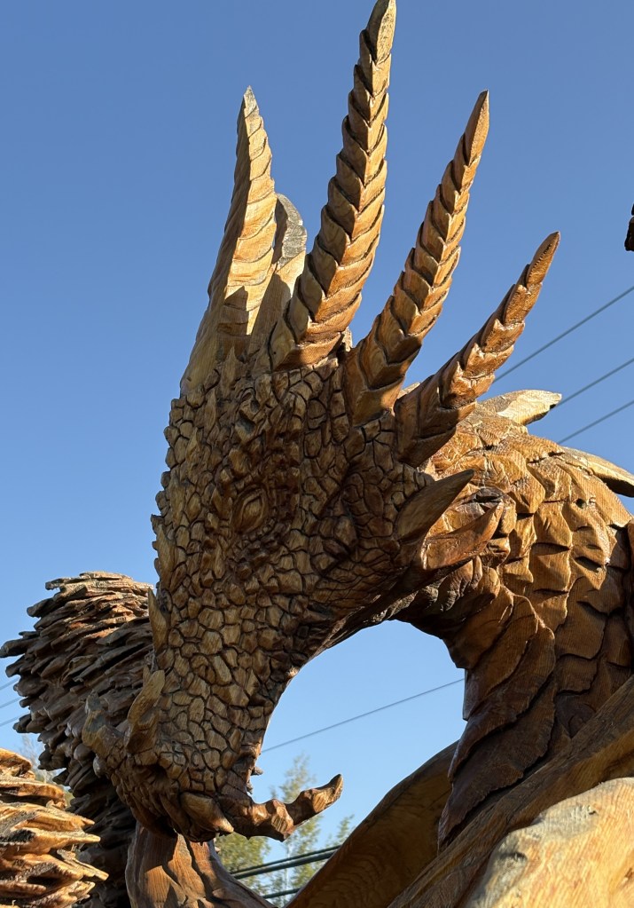
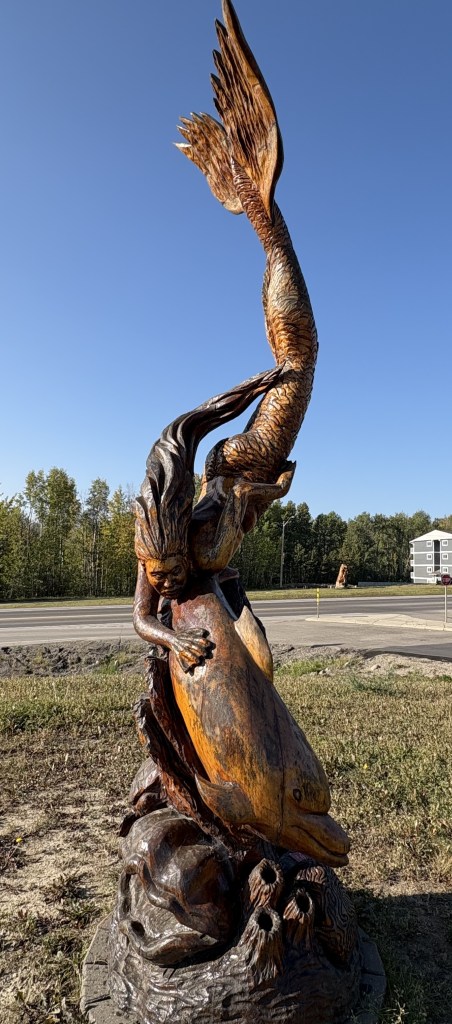
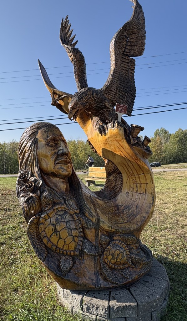
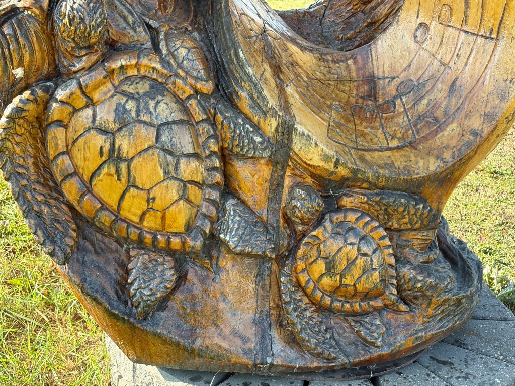
Chetwynd, a small town of about 3,000 people, is home to the Chetwynd International Chainsaw Carving Championship. As I was driving in to town I saw lots of these lined up on both sides of the highway, and a concentration of them once I got to Tim Horton’s to stop for coffee. I went back to the “Welcome” sign where the first two I posted were and started taking pictures.
These are all chainsaw carvings, done over a number of years. I will explain shortly.
The competition is held the second week of June and 12 carvers are invited to participate – 4 from Canada, 4 from the United States and 4 from other countries around the world. Each carver is provided with 40-50″ diameter, 8 foot tall piece of western red cedar. They have 35 hours to create their entry.
I don’t know how that 35 hours is spread out, but I would think each artist is probably allowed 10-12 hours per day to work, with meal breaks, and then given time to sleep. The contest runs 4 days, and on the last day there is a 90-minute “quick carve” contest, with those works being put up for auction. The major pieces stay in Chetwynd and are scattered all over town. It seems that the artists have free reign over what they can produce, and there is an amazing variety of works on display.
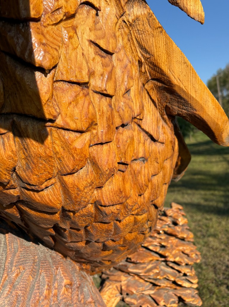
Here are two shots of the detail on the front of the dragon shown above.
All of this is done with chainsaws, and they are gearing up for the 20th annual competition in June, 2026. I believe technology has improved to the point where woodworkers have smaller, more precise saws for detail work, and some of the pieces I saw had just a stunning amount of fine detail.
I was a little bit challenged with the bright sunshine, and some of my photos didn’t turn out too well because the objects were backlit. I tried to move around to get the best shots.
I will have more photos in the next post. You may also Google the town or contest name to see lots more photos online.
I was really blown away by them, and wished I had more time to spend in town to seek out more of them. Some of the ones I saw were done as far back as 2007 and I didn’t look at all of the signs indicating who the artist was, where then were from and what year the work was produced.
After spending two nights in Valemount I would head back east, through Jasper National Park for the last time – this time going west to east on Hwy 16. I would continue on that road to the town of Hinton where I would turn left and head northwest on Hwy 40 to the town of Grande Prairie, Alberta where I would spend two nights. Total travel time was projected to be about 6 hours, roughly the same amount it took me to get to Valemount from Red Deer.
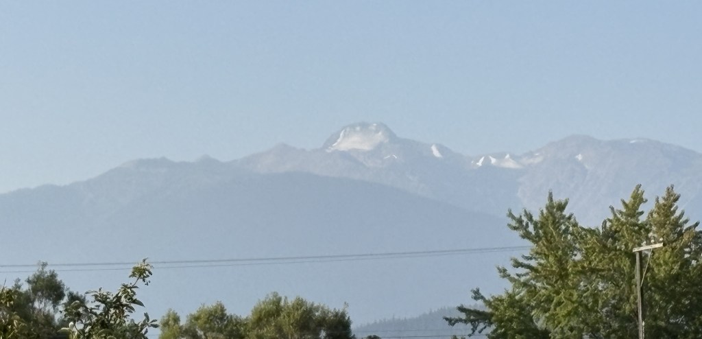
The reason I had come to Valemount was to see Mount Robson, the tallest mountain in the Canadian Rockies. I knew I wanted to see it the first time I drove up to Jasper but got sidetracked with checking out the wildfire damage, and then had a long drive back to Golden. When I got to Valemount one of the first things I asked my Airbnb host was “Where is Mount Robson?”. He said “You drove right past it on your way here”.
I felt kind of silly driving past the tallest mountain around but to my defense, my sightline was blocked by trees as I drove on the highway very close to the base, and there may very well have been clouds obscuring the top. When I drove in the opposite direction today there was no way I would miss it.
THAT is Mount Robson, with the peak reaching up 12,972 feet. And at that altitude there was most certainly a glacier up near the top.
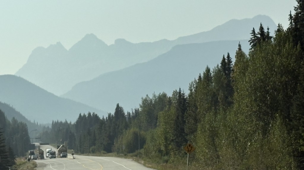
I continued on towards Jasper National Park. The visibility was not any better at far distances than it was on the way west.
But the further east I went it improved quite a bit.
After passing through the town of Jasper I was now covering new territory. This is a large, shallow lake east of town.
Once I reached the town of Hinton I turned left onto Hwy 40 and crossed a river.
The area near the highway really opened up after that and there were smaller mountains and lots of open spaces. At one point I passed this handmade sign:
And shortly after it there was another. It wasn’t until I stopped at a small Visitor Centre in a town further up the road that I was told those two signs represent caribou, and there is a local herd of about 100 that live roughly between them. Later in my trip I would see the normal metal highway signs in various places warning me of caribou, but I never saw any.
The rest of my trip to Grande Prairie was uneventful and I had a quiet day there doing laundry, visiting several small city parks, and doing a much needed cleaning and rearranging of the interior of my car and the trunk. I would soon be heading to Alaska and figured I was probably running out of nice warm days.
The wildfire smoke really restricted my activities while I was in Red Deer and my next stop was located well west, of the other side of Jasper National Park, which I hoped would get me out of it. From Red Deer I took Hwy 11 west towards the Park, but to get there I would also have to drive through part of Banff National Park . I could tell it was still smoky when I left Red Deer, and it didn’t improve any as I headed west.
Once I entered Banff National Park I would continue until the road I was on ended at the Icefields Parkway and the Saskatchewan River Crossing. From there I would turn right and continue on up into Jasper National Park and to the town of Jasper, but this time I would turn left instead of right and take Hwy 16W towards Valemount.
(Photo credit: Parks Canada)
I’ve already posted photos from that stretch of road so I won’t post them again.
This was the view as I approached the western entrance to Jasper (as I was going out).
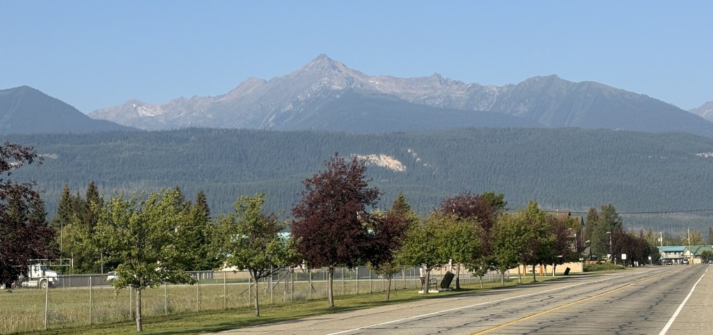
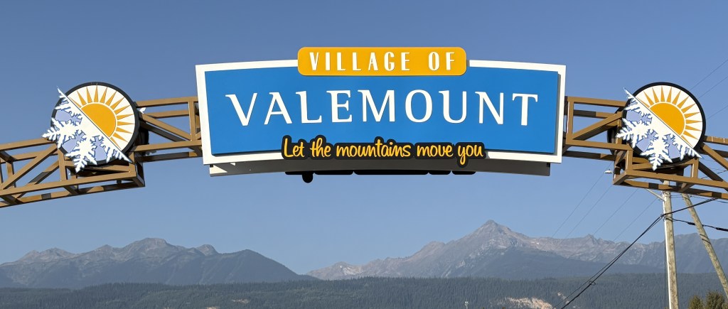
I arrived in Valemount, a village of only about a thousand people, and checked in at my Airbnb. My throat was still sore and I was afraid I might be getting sick so I went to the grocery store in town and bought some cold medicine.
The rest of these photos were taken the next day while I was in Valemount.
It was a nicer day than when I had arrived but I just stayed put since I didn’t feel well. I didn’t think there was much to see here anyway, and I will find the thing I came here to see tomorrow when I head back east.
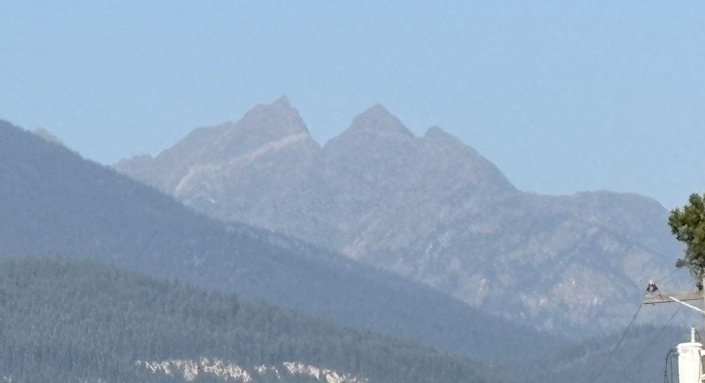
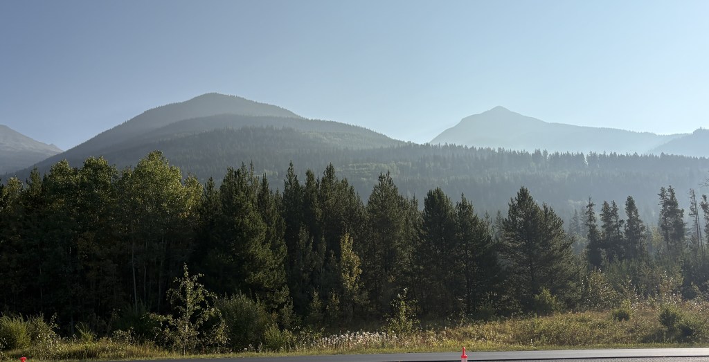
I will point out that just north of Valemount is Mount Terry Fox. I was happy to see that they named a mountain after him.
Terry Fox was a young man from Winnipeg who lost his right leg to bone cancer. In 1980 he embarked on the “Marathon of Hope” to raise money for cancer research, asking every Canadian to contribute $1. He started in Newfoundland, on the east coast of Canada, and planned to run all the way across the country. He ran for 143 days, averaging around 23 miles per day (a standard marathon is 26 miles) and made it as far as Thunder Bay, Ontario, a distance of 3,338 miles, before illness forced him to stop.
Terry Fox was only 22 when he passed away on June 28, 1981, and he is considered a hero in Canada.
The peak on the right is 8,678 foot tall Mount Terry Fox.
I drove north from High River, through Calgary, and took the QEII Highway up to Red Deer, which is about halfway between Calgary and Edmonton. When I modified my original schedule I decided to drop several nights in Edmonton after speaking with someone who lives there who was mystified as to why I would possibly want to go there (” Uh… we have a mall…” ) and decided to add three days in Red Deer instead. My research showed me that there were lots of scenic roads near Red Deer, including the “Cowboy Trail” to the west and the “Dinosaur Trail” to the east.
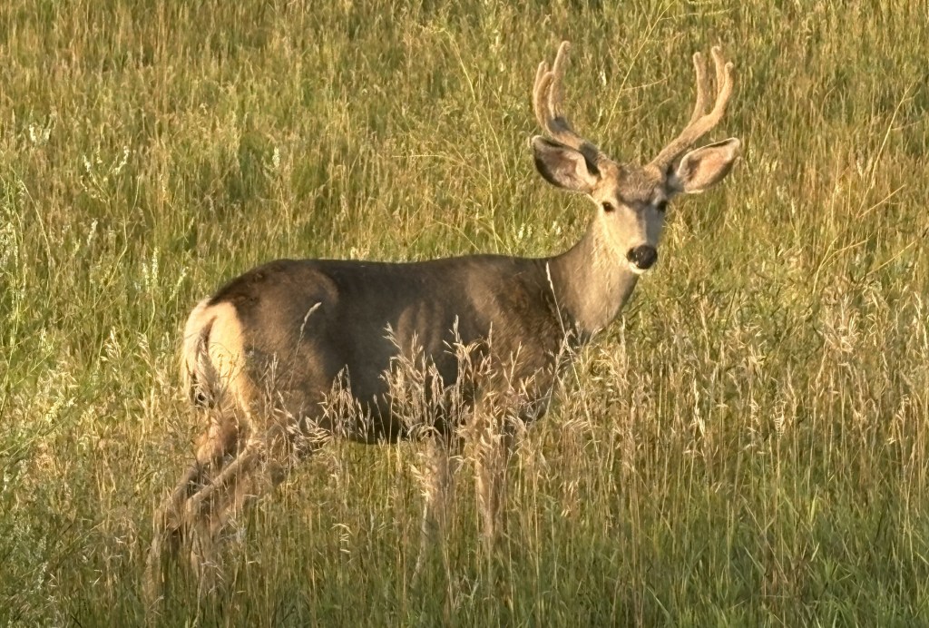
I saw this young buck just off the two lane road I was on as I started to drive the 2 hours it would take me to get to Red Deer..
Well, my plans kind of fell apart as when I approached Red Deer there seemed to be a brown cloud hanging over it. I didn’t think it was big enough to have a smog problem and didn’t even think about the wildfire possibility. I drove around town for a while to get acclimated and then checked in at my Airbnb. I mentioned the “cloud” to my hostess and she said she had heard there was a wildfire up near Edmonton.
I fired up my computer and learned that although there was a small wildfire near Edmonton (a little less than two hours north) it had just been detected the day before and wasn’t very big. When I checked the smoke pattern website I was shocked to learn that what I was experiencing was coming from a large wildfire in the Northwest Territories province, a thousand miles to the north!!
I went out to get something to eat and returned to my Airbnb. By the next day the air quality in Red Deer had changed to unhealthy, and my throat was a little sore from having been outside the day before, so I just stayed put for the day. The next morning I evaluated my options online and decided it should be ok to go back south and east towards the town of Drumheller.
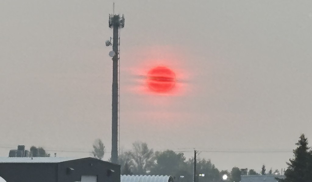
When I started out early in the morning this was the sunrise as seen through the smoke:
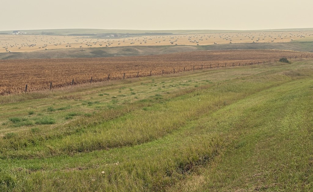
I took the QEII south to try and get away from the smoke, then headed east on a series of smaller two-lane roads through farmland. At the lower speeds it would take almost two hours each way.
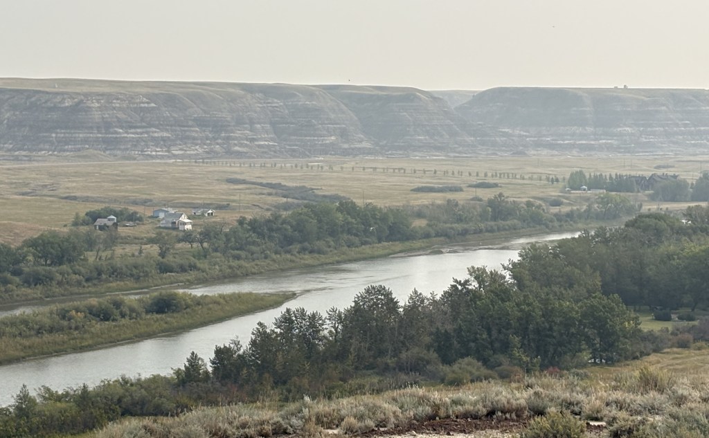
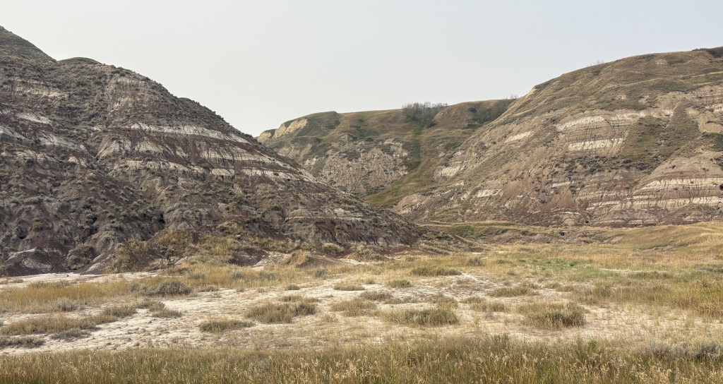
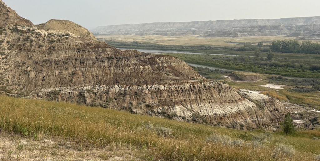
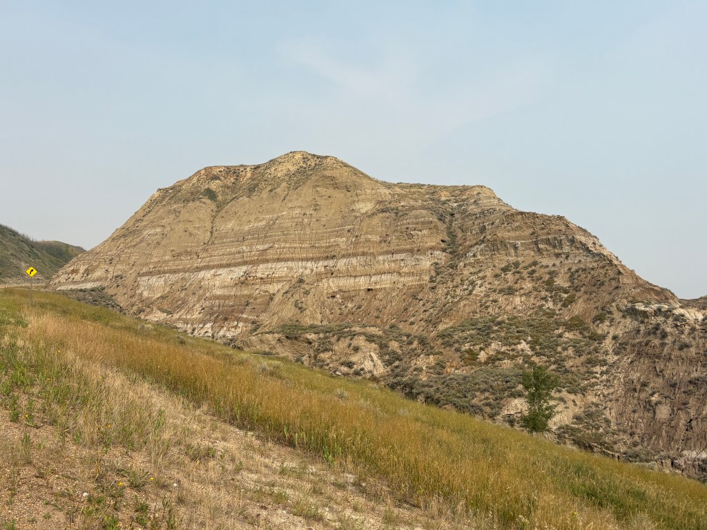
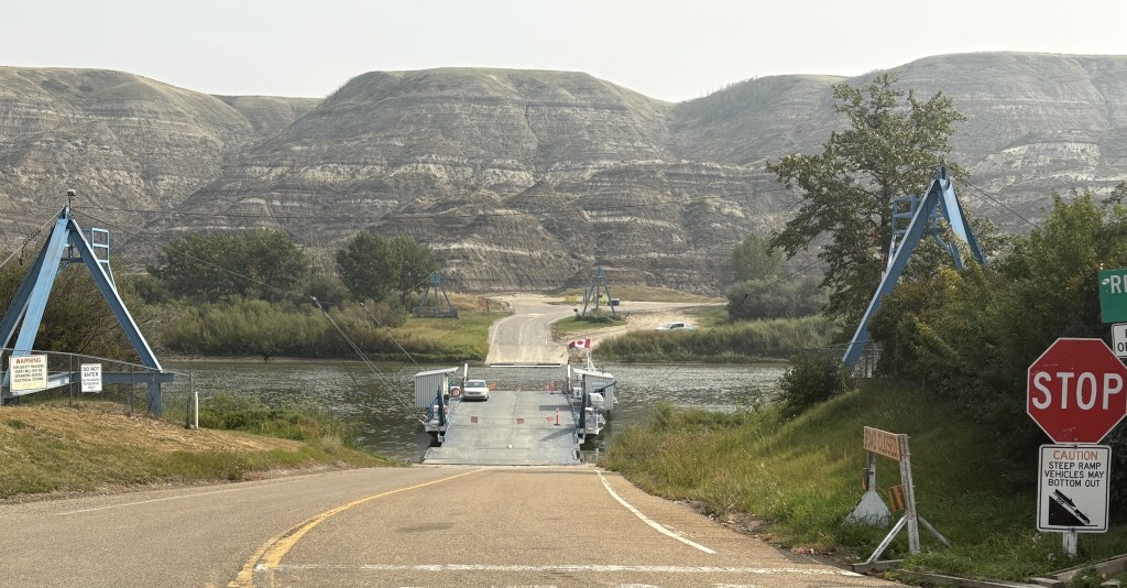
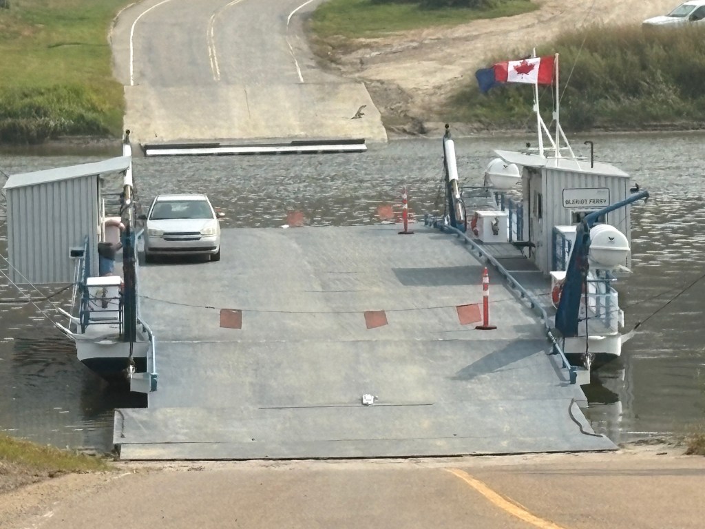
Once I got closer to Drumheller I would drop down into Horsethief Canyon near the Red Deer River.
This is the small Bleriot ferry which can transport up to 13 cars at a time the short distance across the river, which isn’t very wide at this location. I would traverse it later in the day and it only took about two minutes.
Not quite the shortest ferry ride I have been on (it was on a 3-vehicle ferry in Kentucky) but interesting nonetheless.
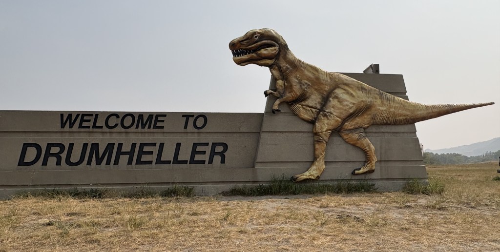
I finally arrived in Drumheller.
If you are so inclined you may take the stairs all the way up and look out of the T-Rex’s mouth. I was not so inclined.
There were several “dinosaur” sites around the area but after checking in at the Visitor Centre I learned that there was generally a good bit of hiking involved and so I decided to pass on it. I was hoping to get some photo ops from the road but the staff didn’t think that would work out too well.
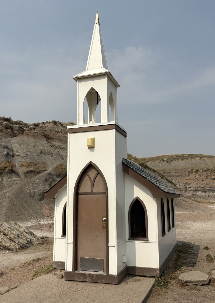
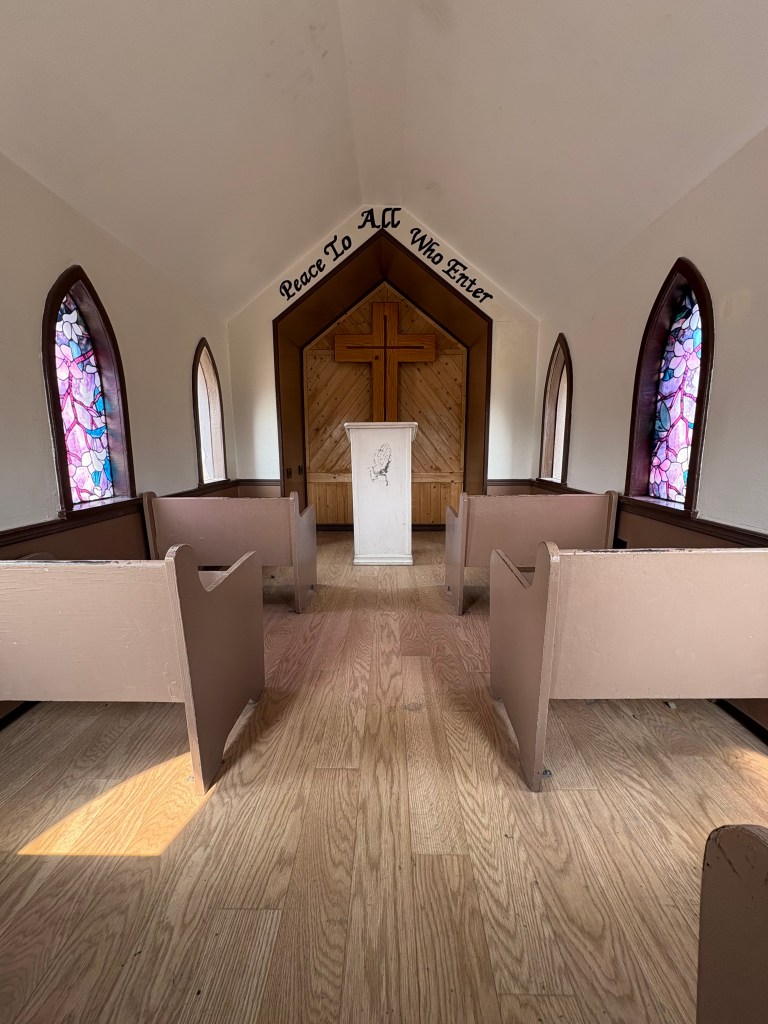
Before leaving Drumheller I did find this tiny little church which only has room for 6 parishioners:
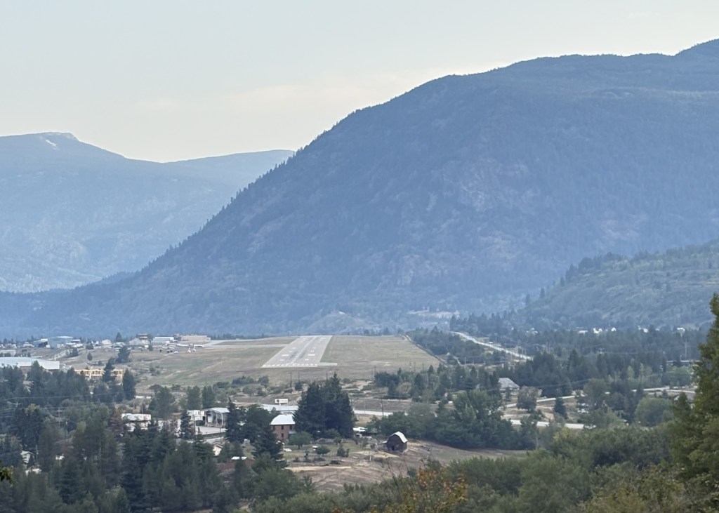
Today I will head back east to Alberta province and start working my way north. Before I leave Castlegar I want to share something I noticed as I drove into town two days ago. When I had been to town previously I approached from the west and left to the south. This trip I came in from the south and noticed this as I was descending Mount Kelly.
I was looking right down the runway of the West Kootenay Regional Airport, and there was a large mountain on the other side. The mountain in the distance is Sentinel Mountain which, at it’s highest point, is 5,456 feet tall. The mountain I was on when I took this photo is even higher at over 6,400 feet. The mountain in the distance isn’t that far from the end of the runway (looks like about 3 miles on Google Maps).
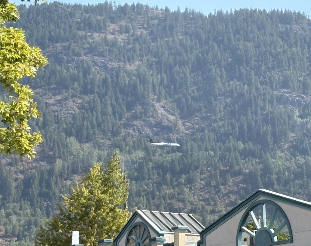
When I was in town yesterday taking pictures of the sculptures I heard, then saw, this mid-size passenger jet flying parallel to the runway and then bank south to make a turn towards the runway.
You can see it in front of the mountain before it would turn right again to land.
Someone at the Visitor Centre told me that the airport is nicknamed “Cancel-gar” by the locals due to the number of flights that get cancelled due to weather or other issues.
Today I would reverse my route from two days ago and shortly after crossing the Canadian Rockies I will turn left onto smaller roads for the rest of the day. I had a few stops planned in Alberta province and the total drive time was projected to be about 7 1/2 hours without stops.
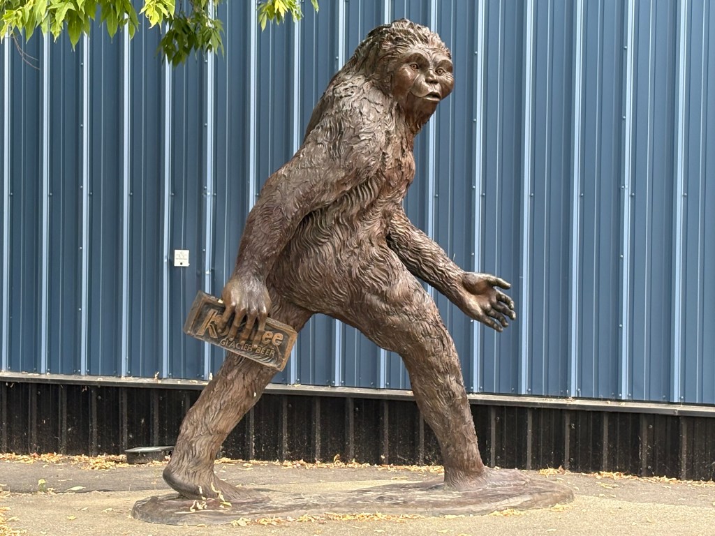
The town of Creston is about an hour and half east of Castlegar. When I had driven through it previously I stopped to get gas in town and drove past the Kokanee Brewery. They market their product as “Glacier Beer” and, despite being acquired by a much larger brewery, still make their beer here.
That is a statue of Bigfoot making off with a case of Kokanee beer.
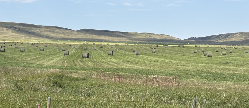
I won’t show any more mountain pictures since you just saw them two days ago. Once I got past the Rockies I headed north to the small town of Longview. My plan was to have a fancy steak dinner at a highly rated steakhouse there but that plan fell apart when I tried to make a reservation. The first day I called they had already started serving customers and the recording said to call another time (well excuuuuuse me!). I called back the next day and the recording told me they had shut down for a week so the staff could have their vacation.
So no steak for JohnBoy.
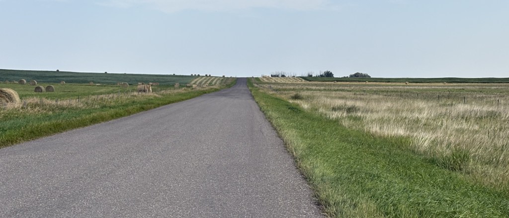
I went to Longview anyway and it was a cute little town:
I didn’t even drive by the steakhouse, which was further up the road, but I did go to an ice cream stand which offered their signature Saskatoon Berry milkshake with fresh, locally grown Saskatoons. Just my luck they were sold out. So no Saskatoon Berries for JohnBoy, either.
I left town and drove east to my next stop. On a very small rural road I stopped to take a photo in each direction. North (left)
East (forward)
South (right)
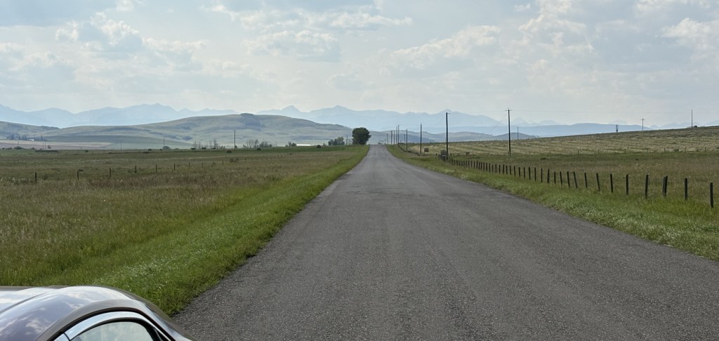
And west (behind me). You can see the Rockies in the distance.
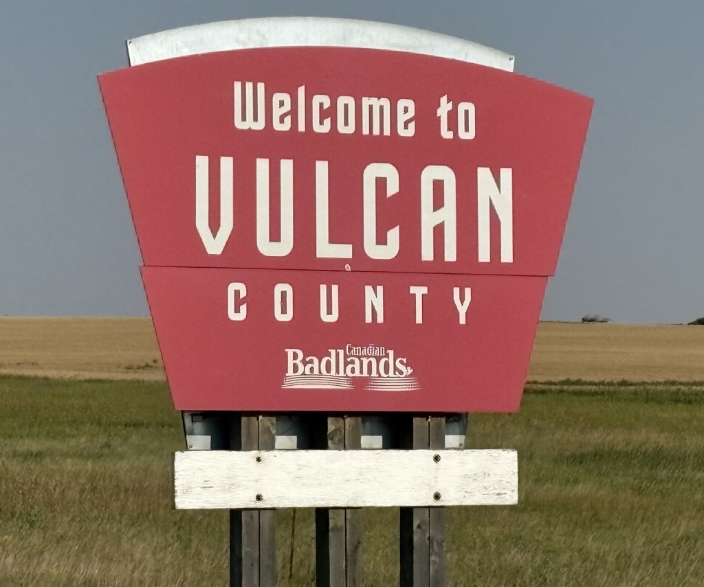
This is where I was now headed:
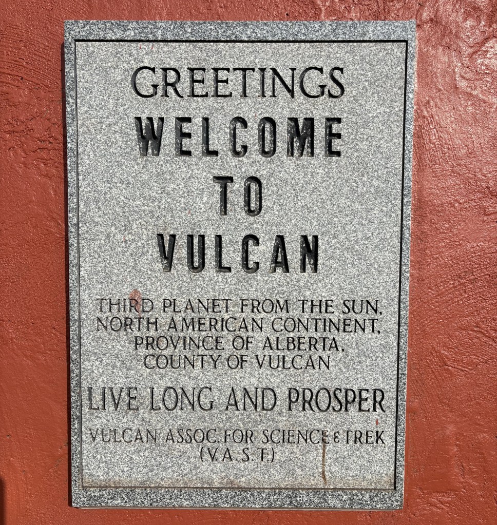
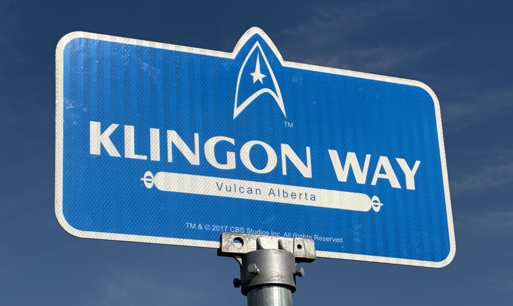
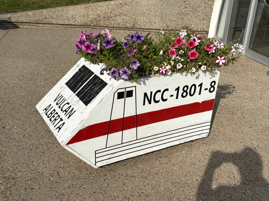
If you are familiar with the original Star Trek TV series you know that Mr. Spock is from the planet Vulcan. Welcome to Vulcan, Alberta!
Once fans of the series discovered that there was a town called Vulcan here they started visiting and things kind of took off from there. Now they have festivals here and Leonard Nimoy, who played Spock, attended at least one. It has taken on a life of its own…
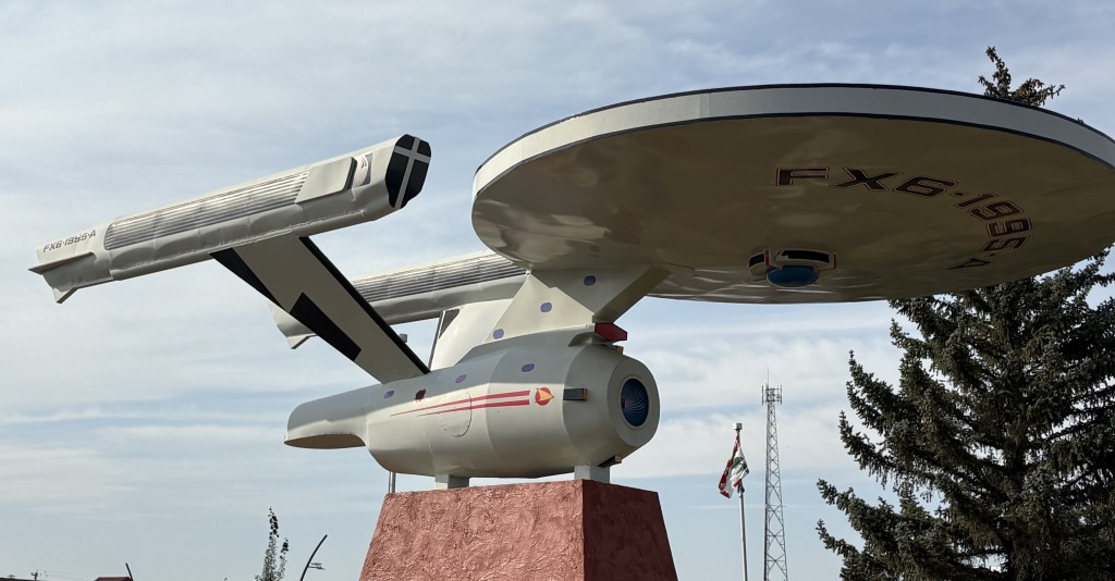
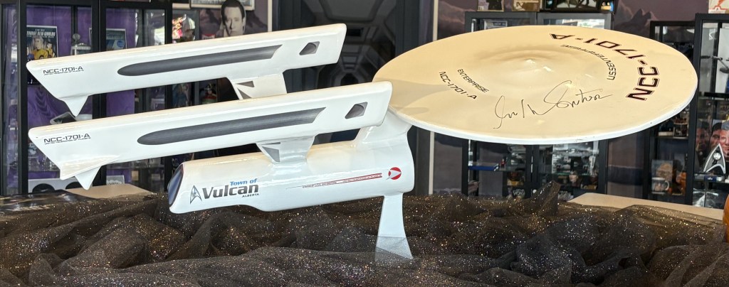
You will notice that the large starship shown above is NOT identified as the Enterprise (possibly due to licensing issues).
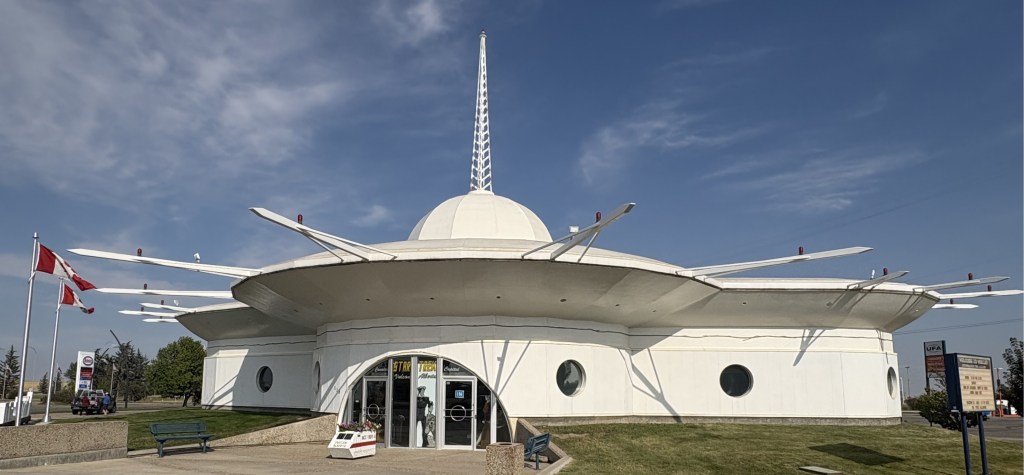
The flower planter located outside the gift shop is a replica of a Federation shuttlecraft.
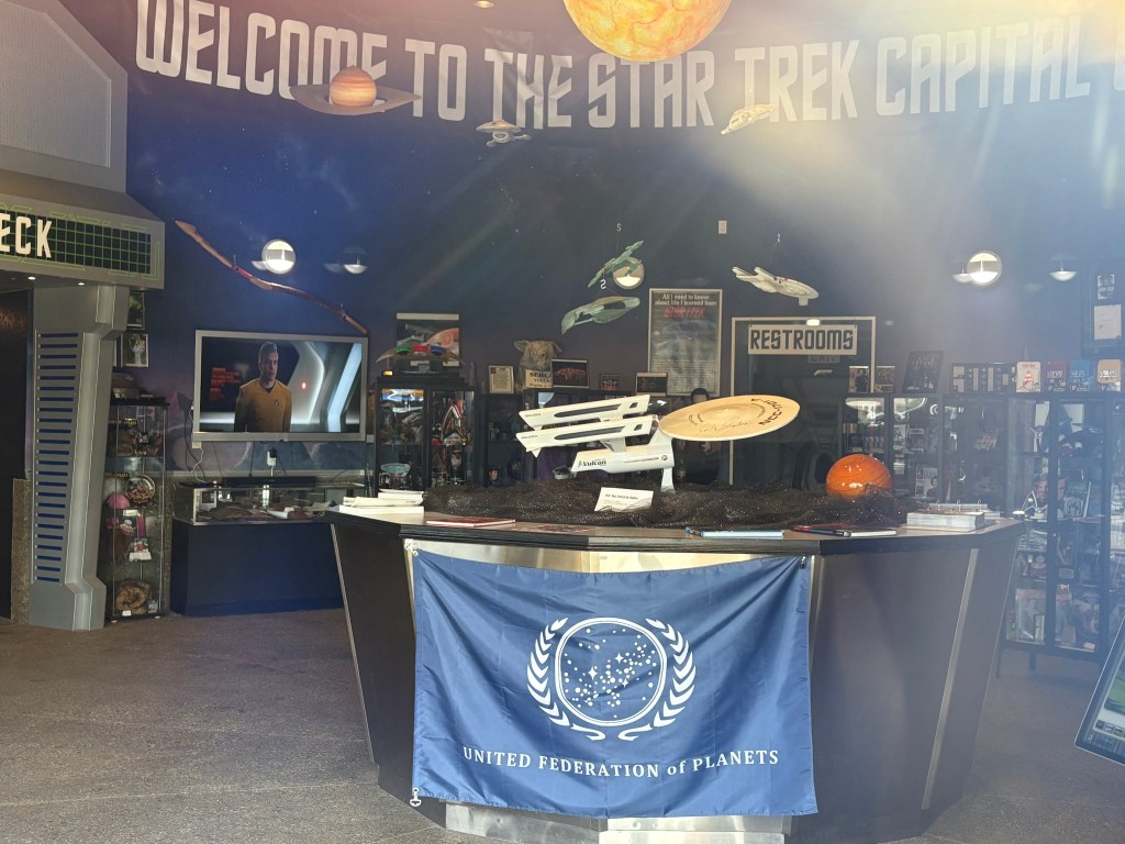
I thought the place was closed so I put my phone up to the glass on the entrance and took this photo – and then saw people moving around inside. Turns out I got there just before closing time.
I walked around inside for a short while looking at the merchandise, and there were many items and photos signed by the cast of the show. One of the brochures I had picked up back when I was in Calgary alerted me to this town. There was also a menu for a local pizzeria which, when the festival occurs, makes a pizza with a Federation logo-shaped crust.
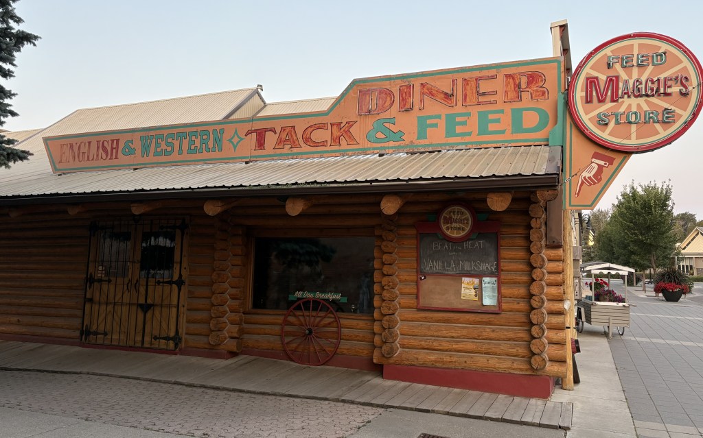
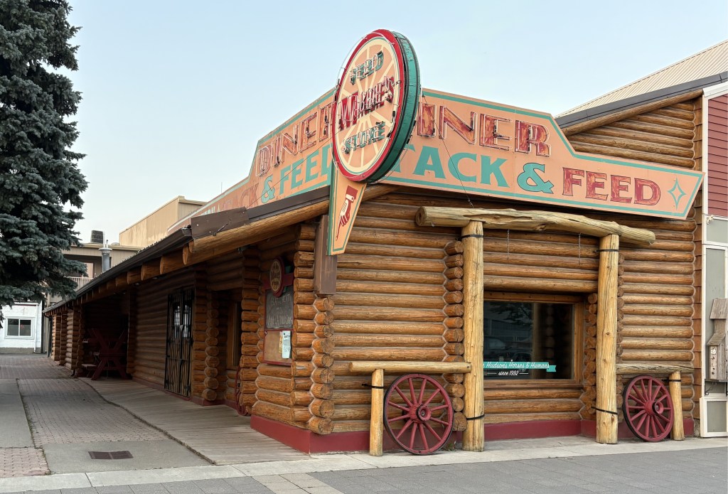
When I left Vulcan I headed back northwest to the town of High River, where I had a one-night Airbnb reservation. I picked it because it was the largest town near here and with all my stops I knew it would be getting dark soon. When I got there I discovered it also has a connection to a TV show.
The Canadian drama “Heartland” is currently in it’s 20th season. Parts of the show are filmed in and around High River, including Maggie’s Feed Store and Diner. The actual ranch featured in the show is on private property, in a nearby town, closer to the Rockies.
This is a “set” used for filming and is not an actual restaurant. I only knew about Heartland, and this set location, because a friend of mine used to watch the show.
Today will be another driving day. I will be taking Hwy 3 (the Crowsnest Highway) west and will cross the southern end of the Canadian Rockies from east to west. The first 80 miles will be flat prairie and farmland, which I have grown accustomed to while in most of Alberta province. Google Maps indicated it would take about 6 hours, without stops, to get to my destination. Once I hit the Rockies the road will take me through Cranbrook, where I stayed earlier in my trip, and then beyond it to Castlegar. The portion from Lethbridge to Cranbrook will be new to me.
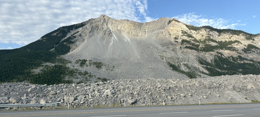
The first item of interest I encountered was as I was getting into the Rockies.
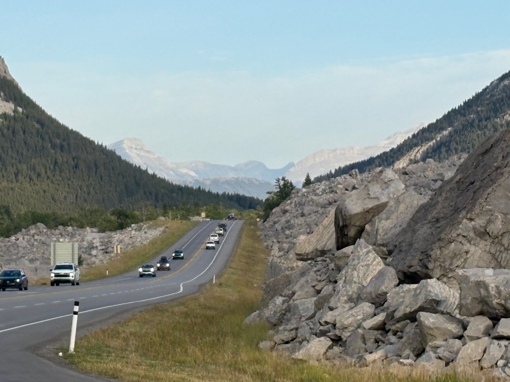
That is the result of the Frank Slide. At 410am on April 29, 1903, the top of the mountain gave way and wiped out a good portion of the town of Frank, a small coal mining town. 70 people perished, either in their homes or in the mines. As you can see, lots of the rock debris made it to where the highway now runs. The photo above is looking left (south) from the highway.
That is how the highway appears now. They obviously had to clear rocks and boulders out of the way to build the road. And this is how it looks now if you look right from the highway:
You can see that with the momentum of the rockslide the debris traveled a significant distance.
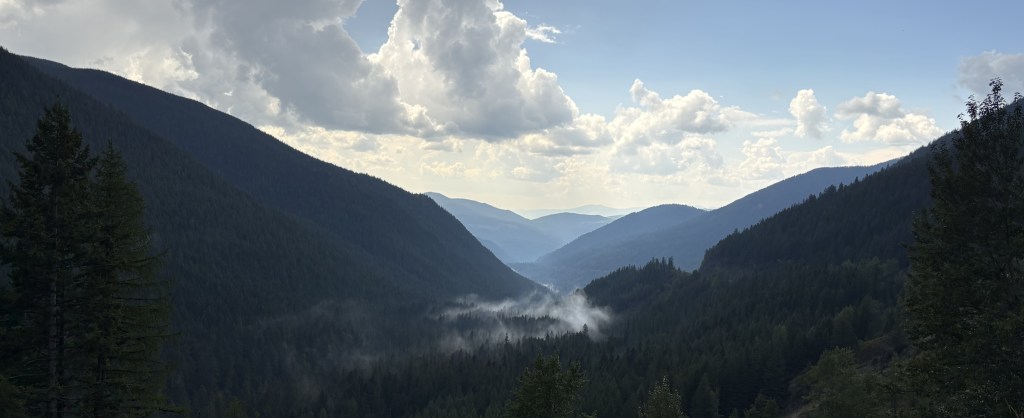
OK – so now I’m back in the Rockies. You know what that means…. more mountains!
I believe the mountains above are part of the range I saw as I approached Cranbrook from the west. And I believe the mountains shown below are a little further north in that same mountain range.
OK, that wasn’t so bad was it?
I drove for about 2 1/2 more hours and then crossed a mountain pass which is about an hour and a half from Castlegar.
I believe that photo is dark because there were clouds right overhead shading the valley. It was a bright, sunny day everywhere else.
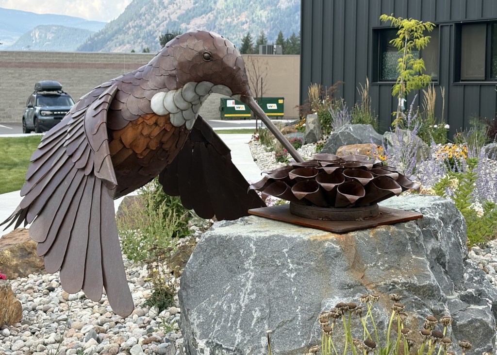
When I got to Castlegar I stopped in at the Visitor Centre again (I had stopped in briefly when I was coming east and decided that I liked the town enough to some back for a two-night stay).
That is a large metal sculpture of a hummingbird. It is a set-up for tomorrow’s post which will include lots more sculptures.
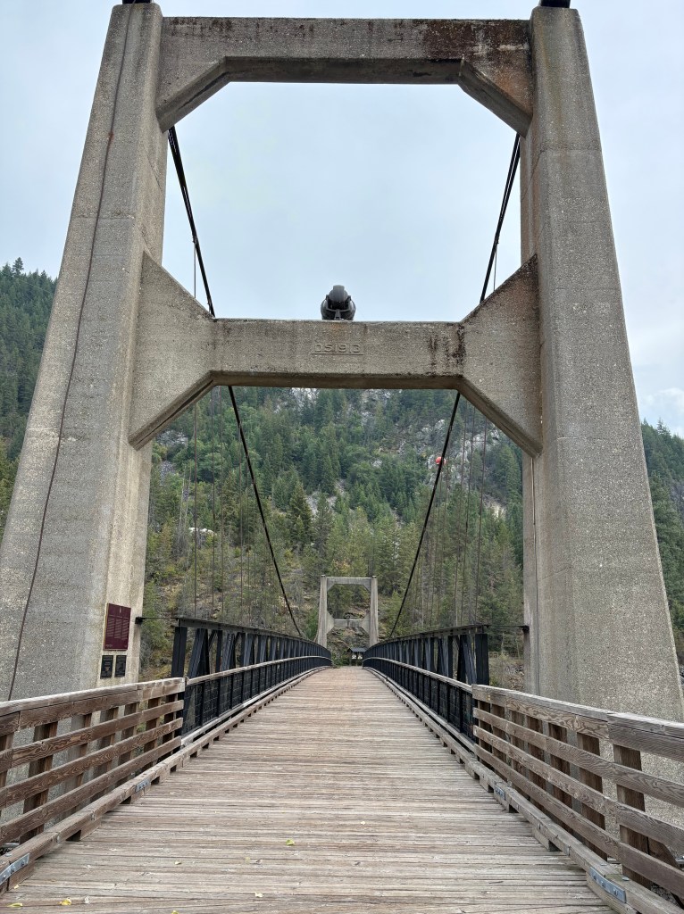
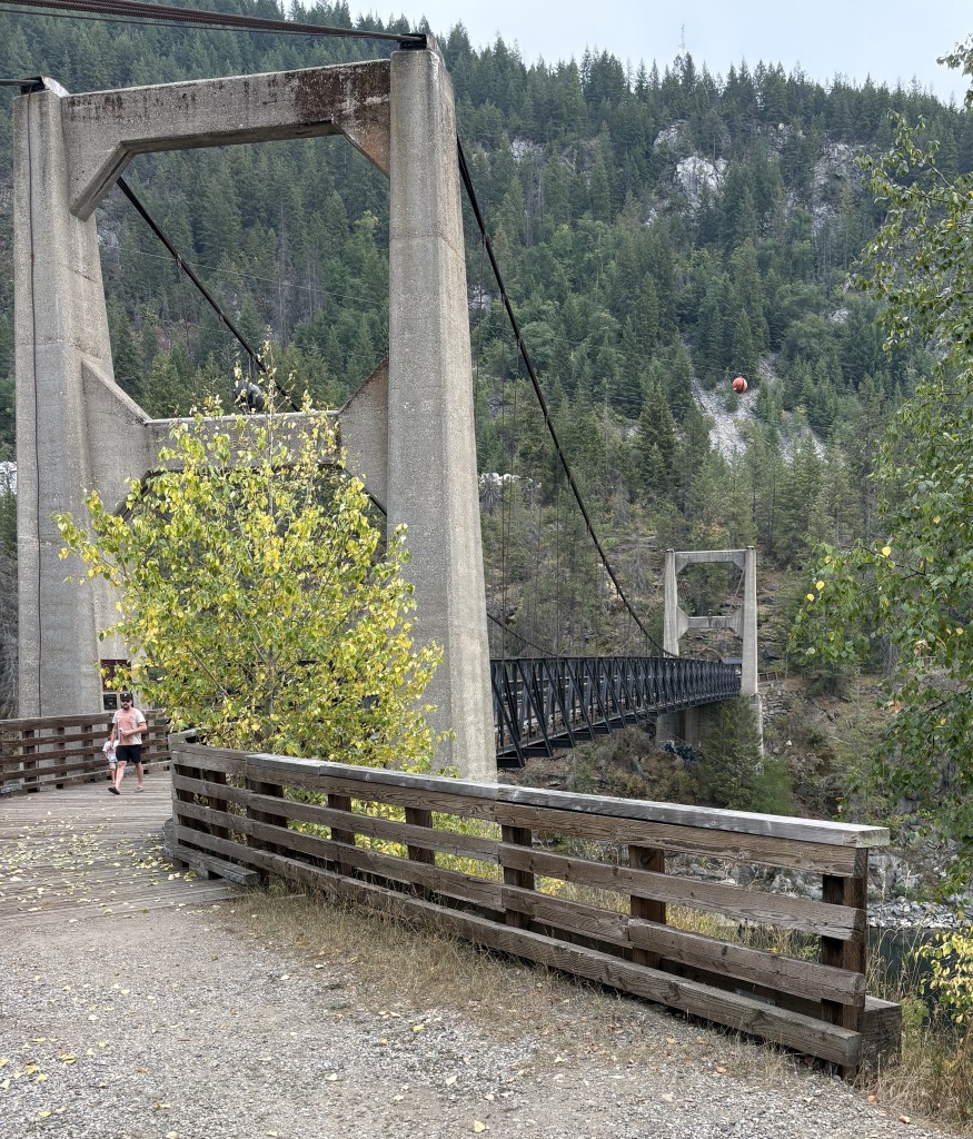
I did have time after I arrived in Castlegar to visit the “Brilliant Bridge”. Technically it is called the Doukhobor Suspension Bridge National Heritage Site of Canada, and is located in the neighborhood of Brilliant on the opposite side of the Columbia River from the town of Castlegar.
If you look closely at the original concrete stanchion you will see that the bridge was built in 1913.
The original bridge was abandoned in 1966 when a new highway bridge was built not far away. The bridge was restored in the early 1990’s and is now a pedestrian bridge, and a popular landmark in town.
The bridge spans the Upper Kootenay River shortly before it joins the Columbia River not far from here.
Getting back to the official name, the Doukhobors (the Canadian spelling, adding the letter ‘u’) immigrated from Russia to Canada in the early 1900’s. About 7,500 arrived in Canada over a 30 year period, seeking to escape religious persecution. They originally settled in Saskatchewan but later relocated here to British Columbia. (Source: Wikipedia)
There is a Doukhobor Heritage Centre in Castlegar but I didn’t go to it.