September 27, 2025
Today’s impromptu trip will take me back up to the southern tip of the Turnagain Arm, where I will once again take the Portage Glacier Road turnoff towards the Begich, Boggs Visitor Center. This time I will travel beyond it to go to the coastal city of Whittier, a town with only one way to get there on land. Not just a road, mind you, but a road through a railroad tunnel. To get there I will have to drive my car through the Anton Anderson Memorial Tunnel which passes through Maynard Mountain – on top of the railroad tracks!
Here is a map of part of the road in from Hwy 1.
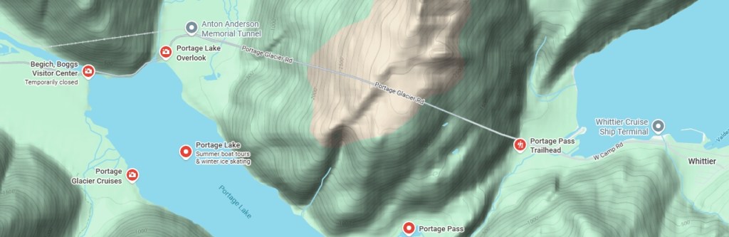
(Photo credit: Google Maps)
Yesterday I had driven in as far as the Visitor Center, on the left side of the map. Coming here today I now knew it was closed but would stop there anyway to use the restroom, as I didn’t know how long the wait might be to get through the tunnel. You may be able to see on the map above that the railroad tracks go through another mountain before getting to the tunnel I will be driving through, whereas the road goes around that first mountain.
As you will see in a moment, this is only a one lane tunnel. Train traffic (the Alaska Railroad, with passengers, as well as freight trains) get priority access to the tunnel, then vehicular traffic queues up at each end to wait for the tunnel to open to their direction of travel.
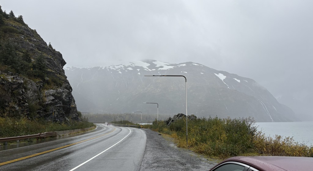
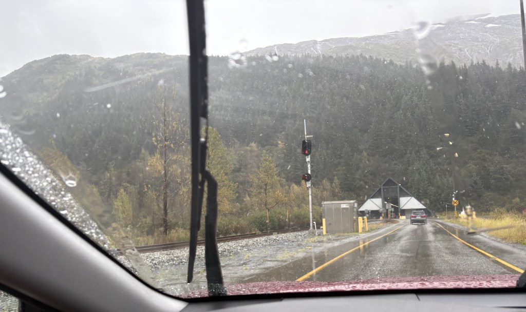
This is the road going around the first mountain to get to the tunnel..
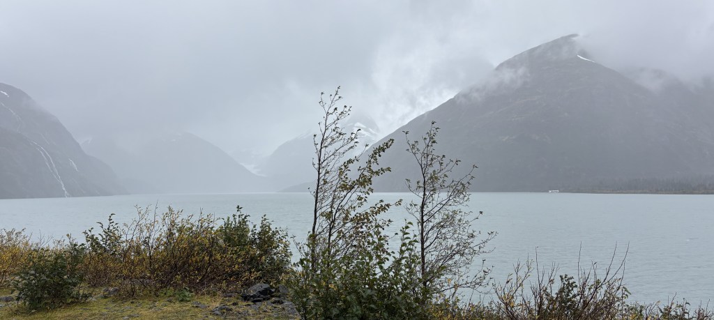
There is a large lake next to the road, and I stopped at an overlook hoping to see the Portage Glacier. It is at the far end in the photo above, and obviously visibility was very poor. The glacier comes right down to the water, but even if it had been a clear day I don’t think I would have been able to see it. I believe there may have been a ship from near the Visitor Center which takes tourists out, but everything was closed for the season.
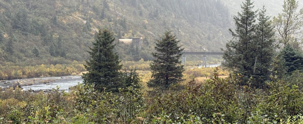
Before getting back in my car I spotted the railroad tracks coming out of the first mountain on my left.
The road continued up to the toll booth and there were then multiple lanes where vehicles line up, by type, to wait for the eastbound vehicular traffic to be allowed through the tunnel. I paid the $13 one-way toll. The green light was on so I was told I could proceed directly to the tunnel.
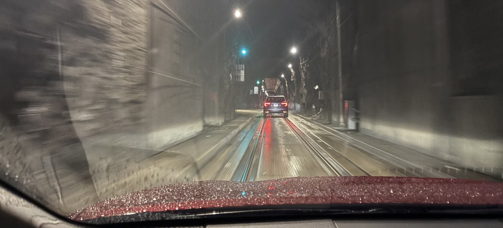
Above is the view I had driving in the tunnel. Yes, I had to take the photo while I was moving, but the speed limit was only 25 mph and I was very careful. Other people have posted videos on YouTube.
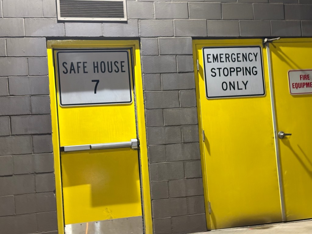
The tunnel is 2.7 miles long, the longest in the US. There are 8 Safe Houses, one every 1,600 feet, within the mountain in case there is a stoppage, earthquake, or other calamity which would force traffic to stop. Each Safe House can hold up to 55 people and has amenities to accommodate them for a period of time.
The tunnel was originally built in the 1940’s for the military. Whittier was originally designed as an Army port, to allow military supplies to come in by ship and then be transported upstate by rail. The tunnel was converted to dual use in 2000, allowing vehicular traffic to share the tunnel with trains.
Whittier is still mainly a port city, but it also hosts cruise ships and obviously attracts a tourist following. As you will see in the next post, there are some places which offer lodging to overnight guests.
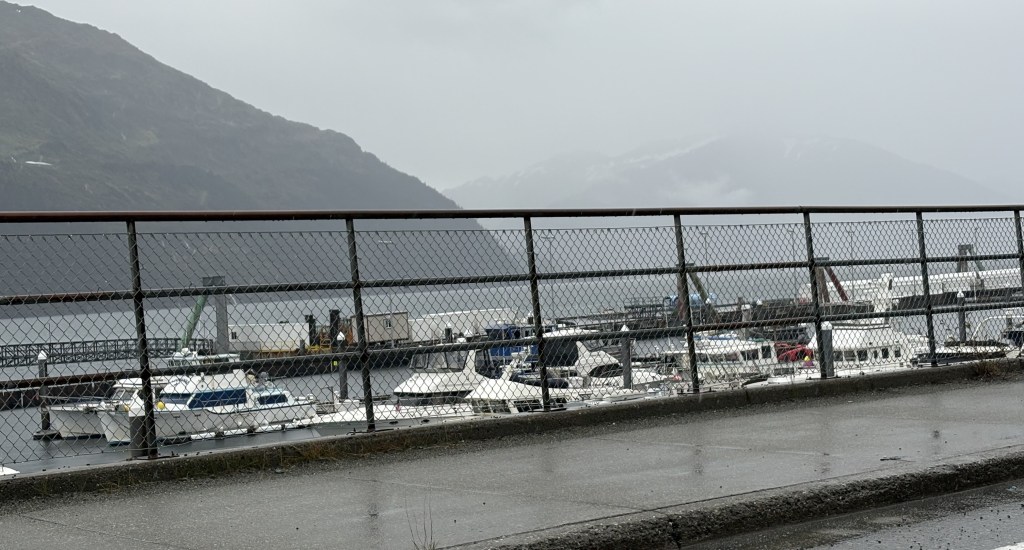
When I got through the tunnel I saw a small harbor to the left of the road, and it is where the cruise ship dock is located. There is a larger harbor closer to town.
The first building I saw when I got to town was the Inn at Whittier.
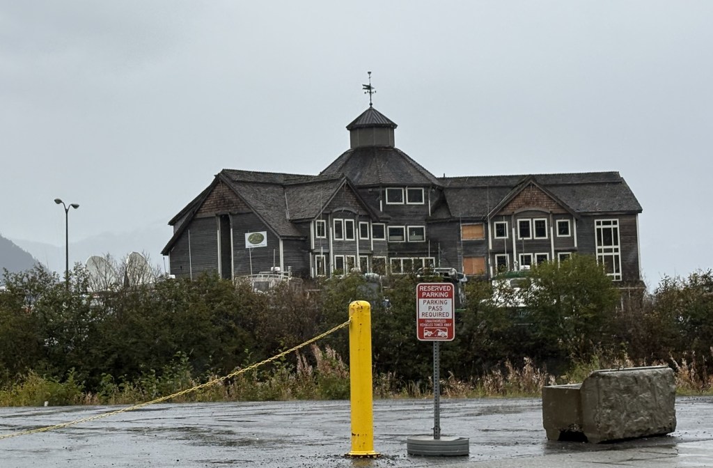
Because some of the windows were boarded up I assumed it was abandoned but I have since learned that the restaurant and lounge are sometimes open but the hotel rooms remain closed. Even the restaurant may have been closed now that cruise ships were done for the season. Whittier was basically a ghost town while I was here, but then again it was cold and raining heavily at times so people wouldn’t have been inclined to be out wandering around. I pretty much stayed in my car and positioned it so I could take pictures out the windows.
Whittier lost many structures in the 1964 earthquake. I read that most wooden structures (the original Army barracks and support structures) were then burned and rebuilt. The Inn was probably built new after the earthquake, but I don’t know why it has fallen into such a state of disrepair.
There is another building that Whittier is perhaps best known for. Begich Towers:
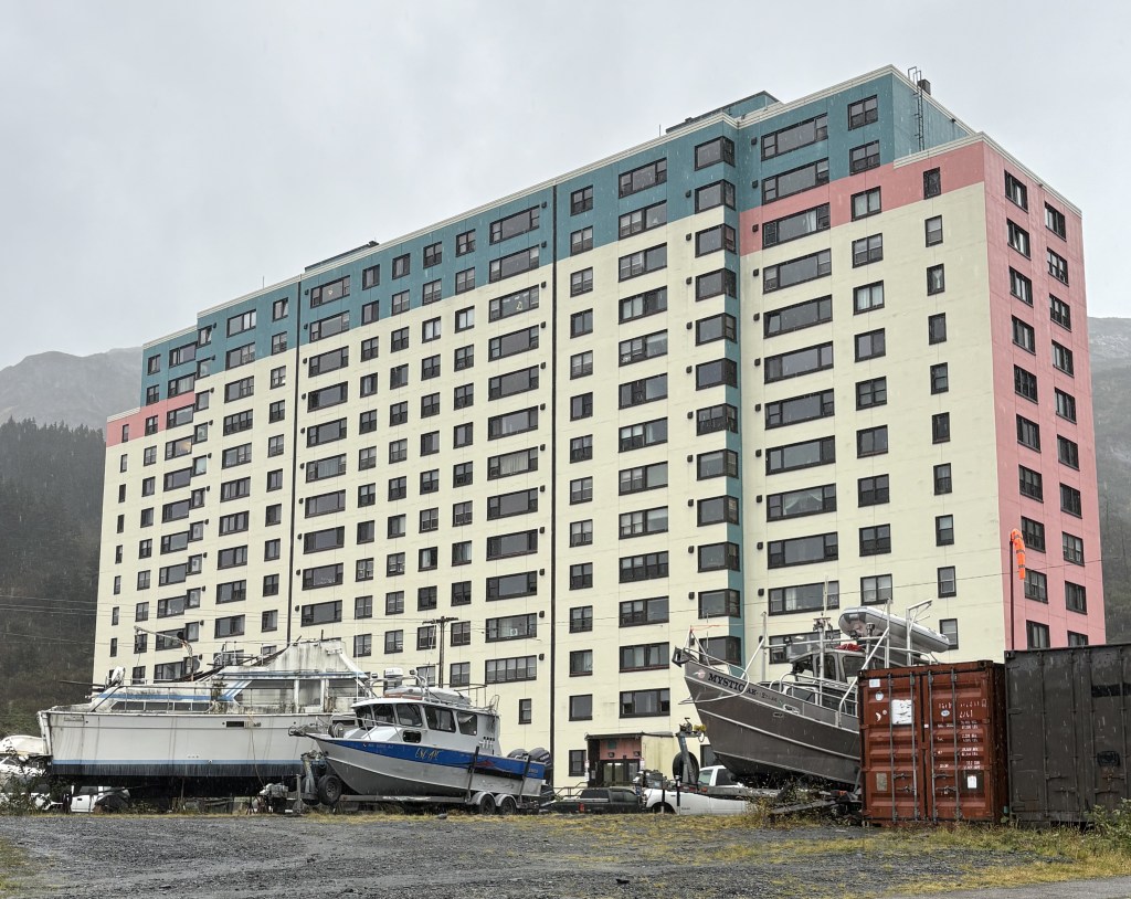
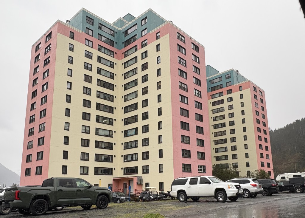
It is 14-stories tall and is made up of of 3 connected towers. Probably 99 percent of the people who live and work in Whittier live in this building. It was built in 1957 for the military and was renamed and converted to condos in 1972. It is essentially self-contained, with a grocery store, bank, etc. inside. There is a small school behind it with access by an underground tunnel.
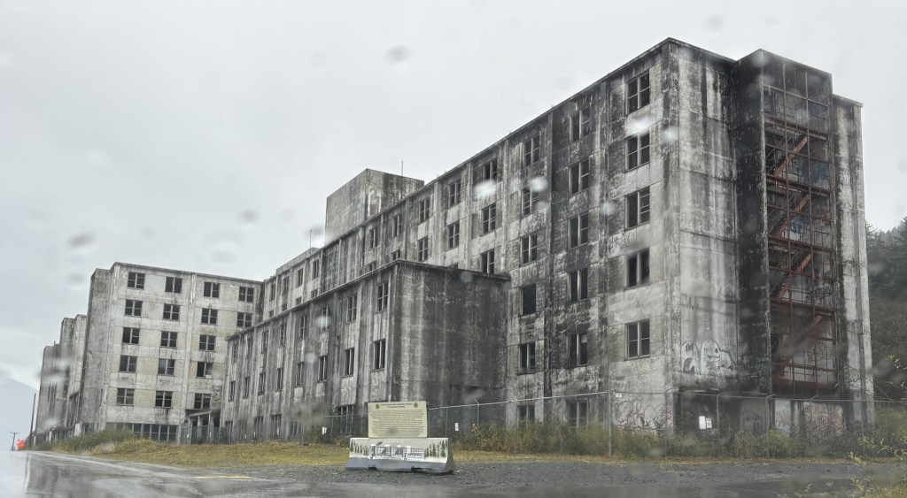
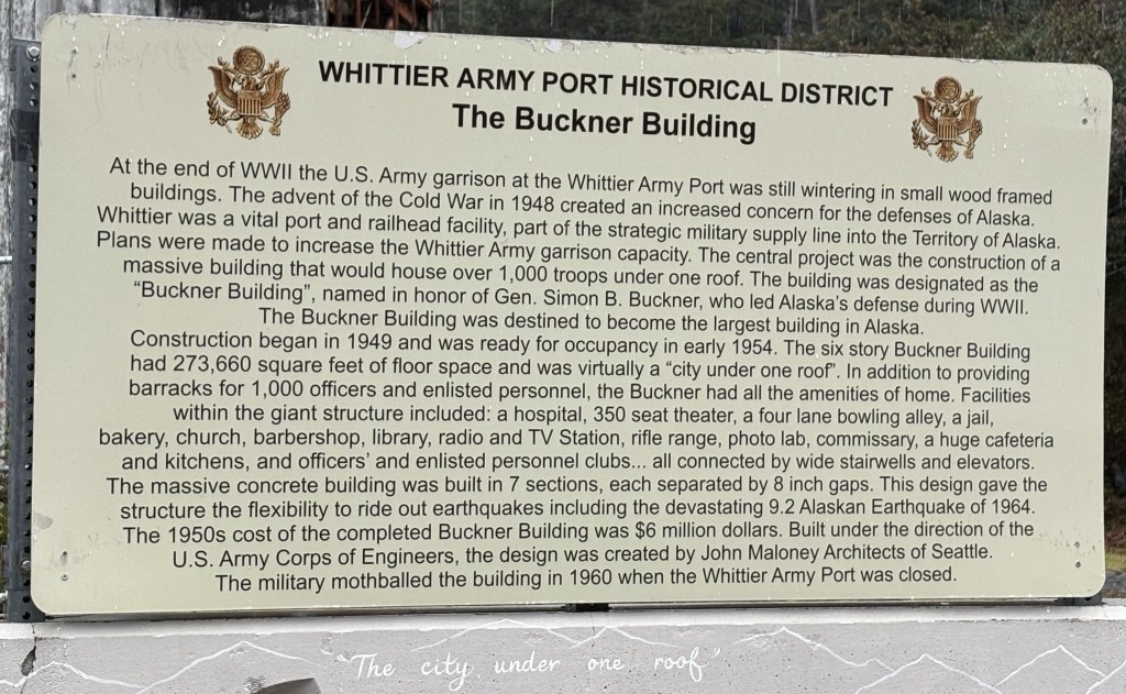
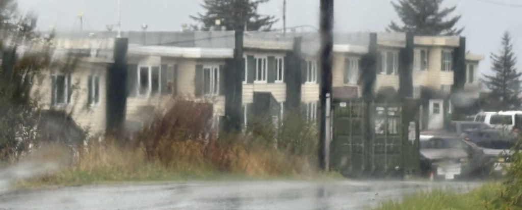
There is another concrete building in town which was built for the military. It is only 6-stories tall, and is called the Buckner Building. It was first occupied in 1954 but closed in 1960, soon after the taller building was built and when the Army presence ended. It gave Whittier the nickname “The city under one roof.”
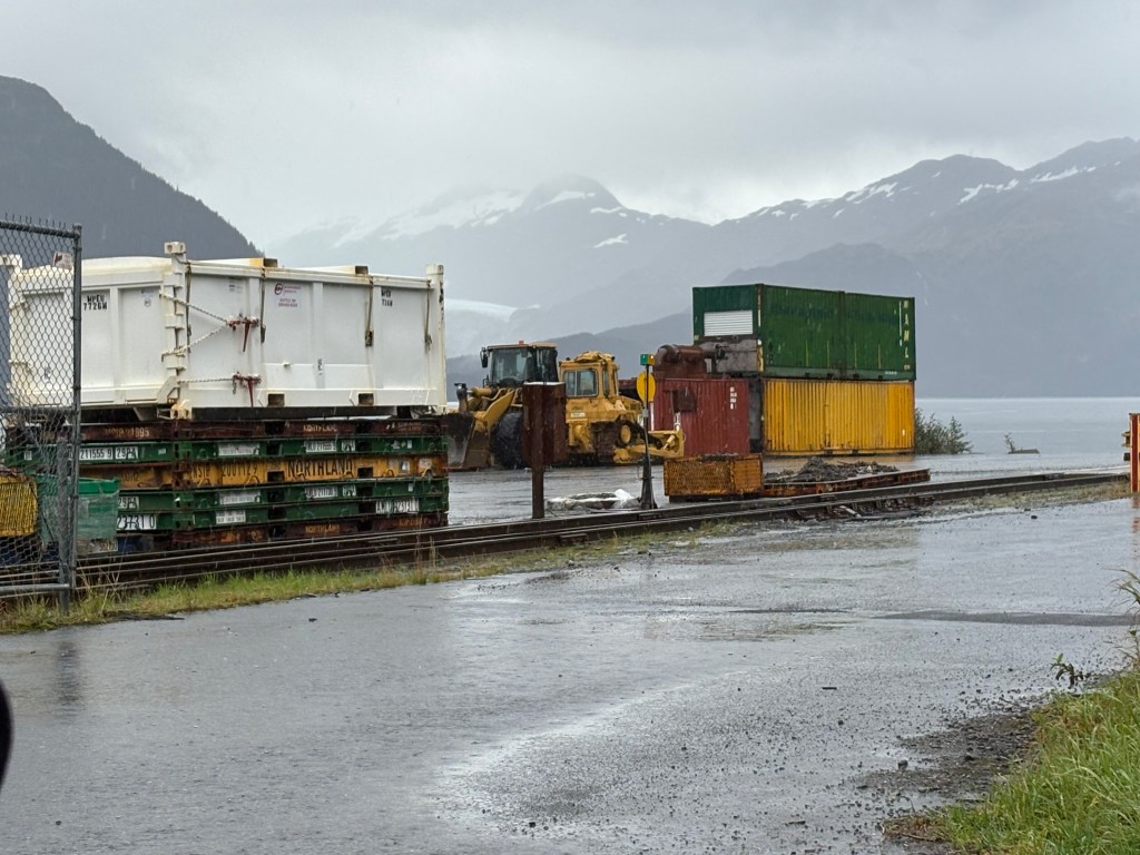
Even without the Army, Whittier is an active port and there were shipping crates stacked everywhere. That and fishing are probably the two main things that people who reside here do for a living. There were many fishing and pleasure craft both in the water and parked on trailers on land. There were some small businesses that cater to tourists, but they were closed for the season.
Here are some of the things I saw as I drove around the small town of Whittier.
That is a small residential building. I guess it accommodates overflow from the big tower, or provides housing for port workers.
(Continued next post)
