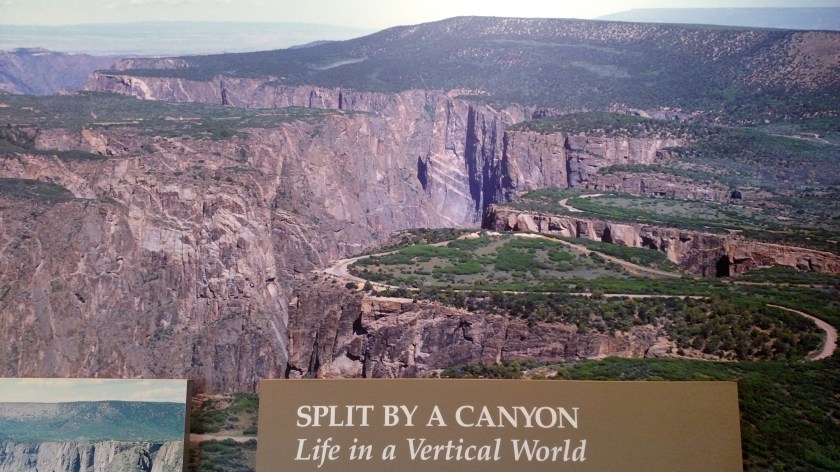
This photo, which was in the Visitor Center, shows the area I was in Tuesday from the air. You can see the road I traveled to get to the various overlooks, and you can see where the canyon curves to the left.
This photo, which was in the Visitor Center, shows the area I was in Tuesday from the air. You can see the road I traveled to get to the various overlooks, and you can see where the canyon curves to the left.
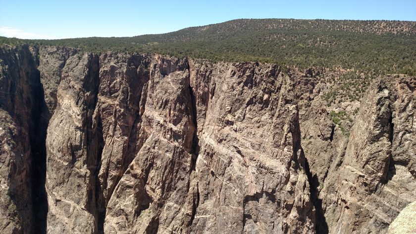
Here are various photos from the South Rim taken Thursday with my smartphone camera. I’ll post some closeups, taken with the digital camera, in a few days when I’m up in Grand Junction.


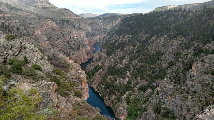
This is where the canyon really opens up as it continues west. The only access is by hiking.

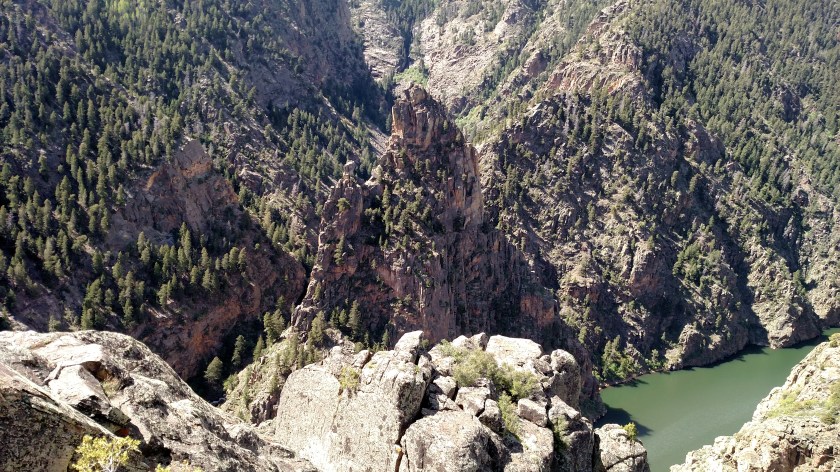
This formation, which can be seen from several overlooks on the South Rim, is one of the most photographed in the Park. Because it is so big and I was so close, it was difficult to get it all in one picture.
At 2,250 feet it is the highest cliff in the state. I zoomed in on some of the interesting “patterns” and will post them in a few days when I am in Grand Junction.
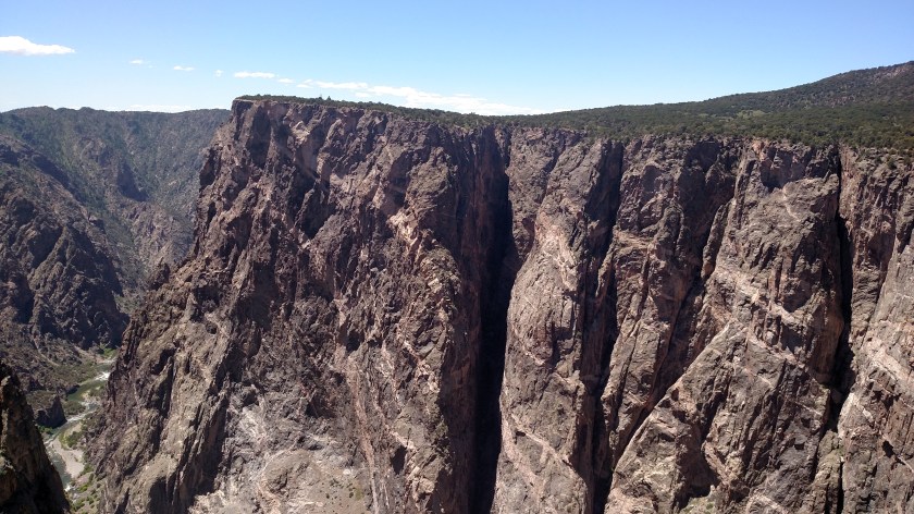


And once again, don’t you dare go over the safety fence!

I am so glad my Airbnb hostess told me about this!
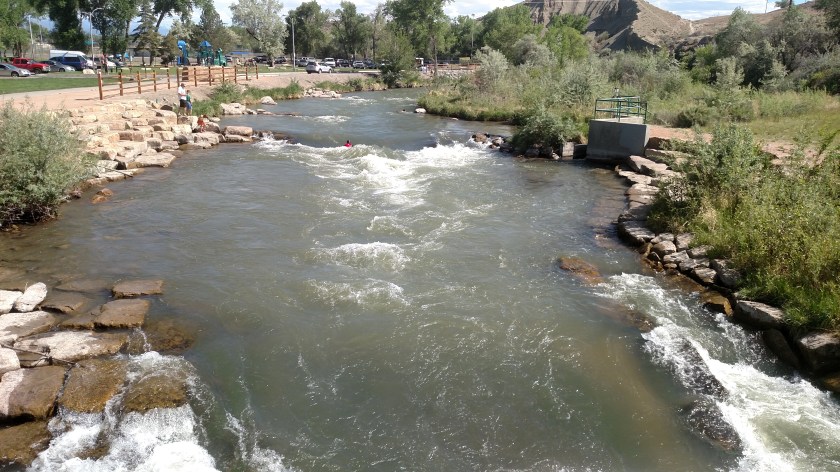
Utilizing 1,000 feet of the Uncompahgre River which flows through the town’s Riverbottom Park, grant money allowed the construction of ramps (put-in and exit points) , bridges, spectator areas, etc. for the formation of the Montrose Water Sports Park, one of the few in the state and one of few in the country to satisfy ADA (Americans with Disabilities Act) standards allowing access for all.
I stopped here yesterday on the way home and found Emergency Rescue crew training underway, as well as kids and other users enjoying the facility.
This guy (red life-vest in the middle of the river) was valiantly trying to stand up on his surfboard while surfing in place (facing IN to the wave, as opposed to riding the wave – which I didn’t even know one could do…).
When I took the photo above I was standing next to a guy in a red watersuit who said he was the “upstream spotter”. Behind us was a large class of rescue workers and trainees (and perhaps regular people who wanted to learn the basics of water rescue) and the spotter had a whistle and would alert them if someone (kayakers, rafters, paddleboarders, etc) were coming downstream so they could clear a path.

When “class” adjourned the members walked upstream and practiced “riding the river” downstream. Tip – apparently you should roll on your back and float feet-first downstream, and roll on your stomach and swim to the bank if you want to stop.
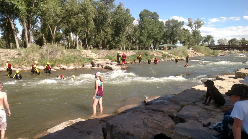

Needless to say, this is probably a VERY popular spot on a hot summer day. The park itself is huge and has many other components (ball fields, skateboard park, open space and picnic areas). A great investment!
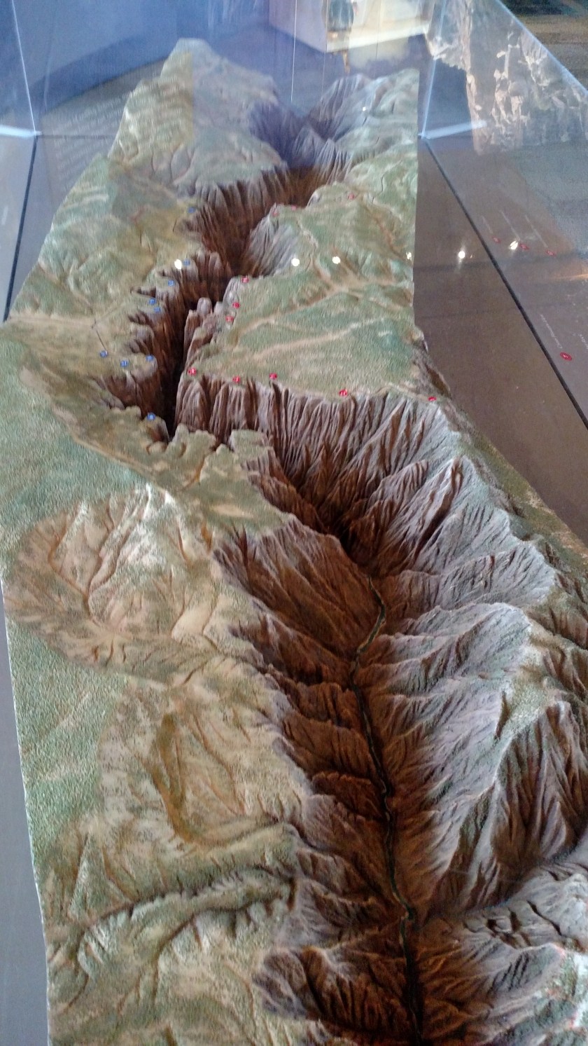
Wednesday I spent much of the day in Black Canyon of the Gunnison National Park. On Tuesday I learned that there are actually two entrances – North and South. I first popped in the South Rim entrance to get a map and take some pictures of the three-dimensional model they have there. I was on that side briefly last year (see posts on September 5, 2017) but felt I had to come back and spend more time here.
The red dots on the model represent overlooks and other landmarks on the South Rim. The blue dots represent overlooks and other landmarks on the North Rim. The Visitor Center (where I took these) in on the South Rim. After taking these initial pictures I traveled over to the North Rim where I spent most of the afternoon. It takes over two hours to get from one side to the other.

This a view of the model looking from the end. I believe I read that the distance from one end to the other (scenic overlooks, accessible by car) is about 12 miles. The Canyon is longer than that but other areas are only accessible my hiking.
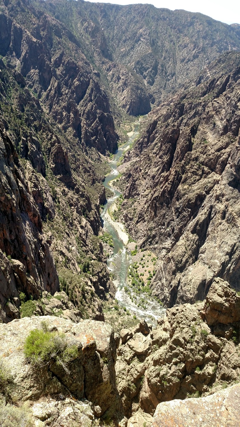
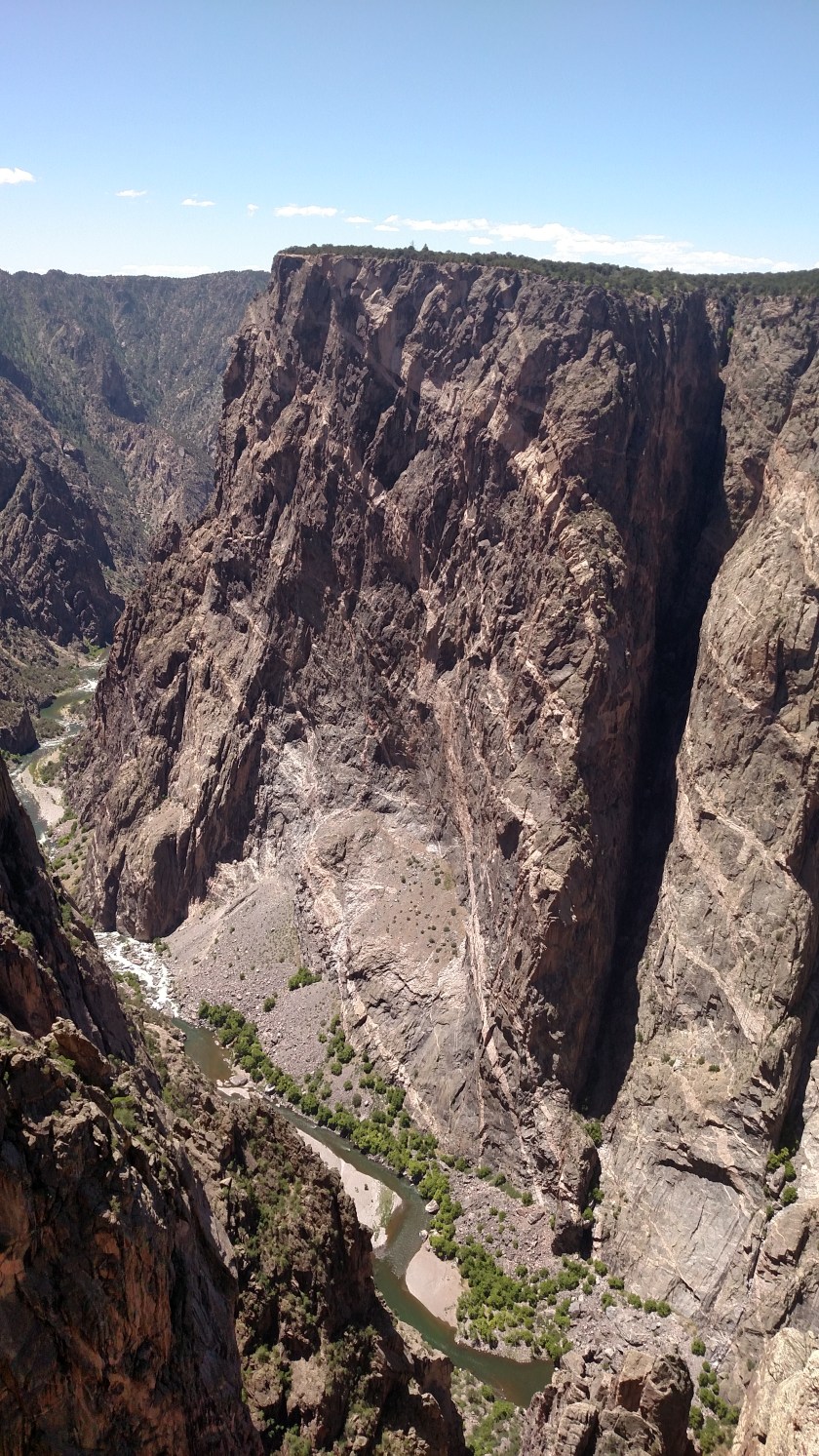
There were 6 overlooks on the North Rim. The vertical drop to the river from the second one I stopped at (The Narrows) is approximately 1,750 feet. And believe me – if you climbed over the safety fence at the overlook you are going approximately 1,750 feet STRAIGHT DOWN.
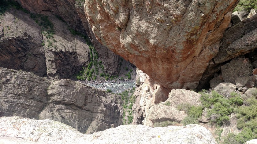
As I took that picture I was thinking “please don’t drop the phone, please don’t drop the phone, please don’t drop the phone…..”
The largest vertical drop in the Park is around 2,700 feet at Warner Point, accessible only by hiking (hence – no photos!).
Black Canyon got it’s name because at some points it is so narrow that certain spots only get 33 minutes of direct sunlight per day. Because of shadows, and when there are clouds overhead, the rock walls appear to be very dark in color. Someone was quoted as saying that “No other canyon combines the depth, narrowness, and sheerness of Black Canyon”.
The Gunnison River drops an average of 95 feet per mile while traversing the Canyon. It one spot, close to the “vertical drop” picture above, the river drops 48o feet in just a two-mile stretch. This gives the river “cutting power” to push downward faster than erosion can widen it.
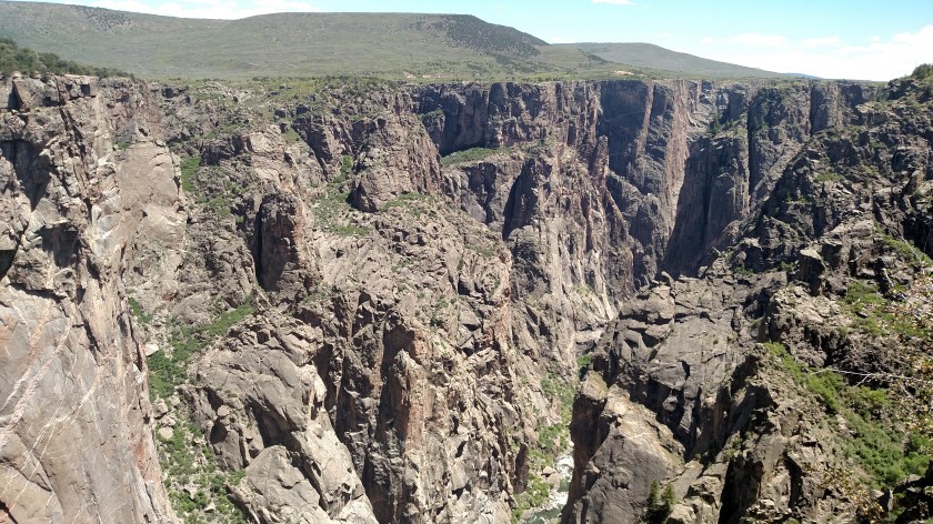
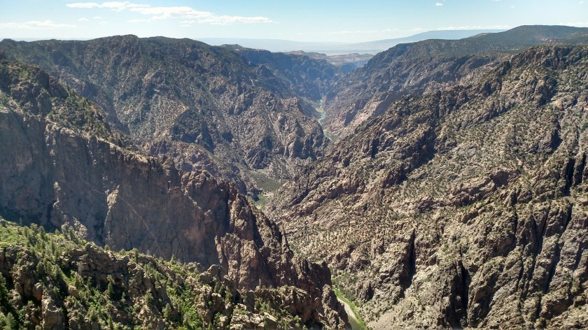
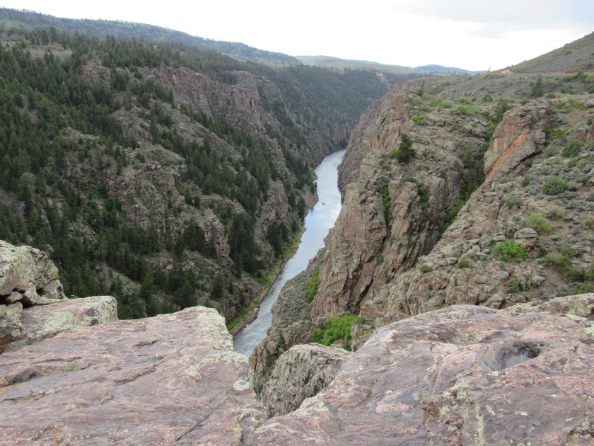
Here are a few pictures I took Wednesday from the North Rim overlooks. I tried to pick the best ones and may post more later after I review them again. I will be spending the day Thursday on the South Rim and will post more pictures from that vantage point (see also the September 5, 2017 posts from when I was here last year).

In the photo above, the river approaches from the left and curves to the left about 3/4 of the way toward the right of the picture. In other words, if I were further to the right you’d be looking out through that part of the Canyon.
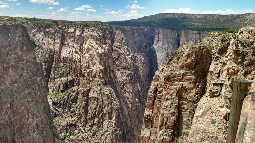


I’ll have to go through my pictures and post more. It is hard to grasp just how deep and narrow the Canyon is at some spots. The pictures really don’t do it justice. There is nothing like seeing it with your own eyes. After I took pictures I just stood and looked at the scenery and watched the birds and lizards. When I got home I was kind of bummed that the photos just don’t convey what I actually saw.
It was also interesting to note that I probably only saw about a dozen cars driving around to the overlooks on the North Rim whereas I saw a dozen cars just in the parking lot at the Visitor Center on the South Rim. The South Rim gets far more traffic because it is easier to get to. I also expect business to pick up this weekend now that Memorial Day is upon us….
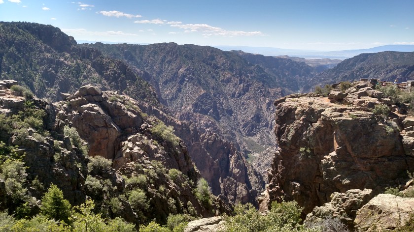
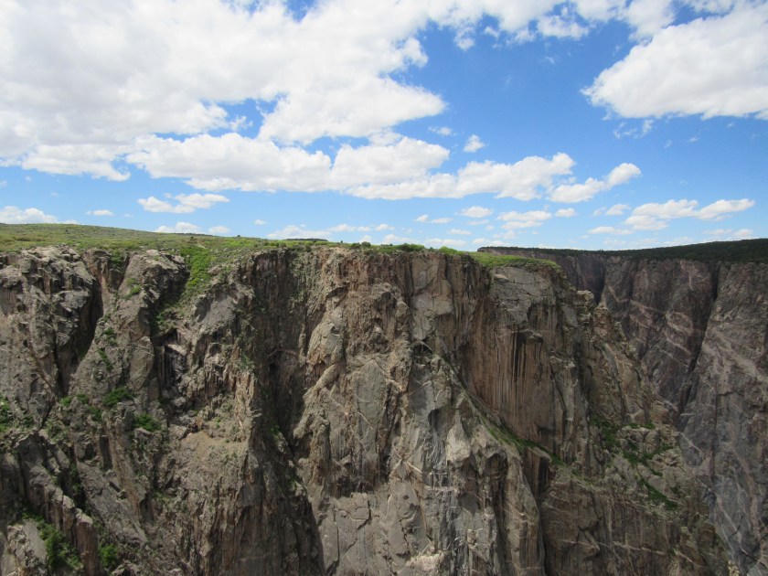
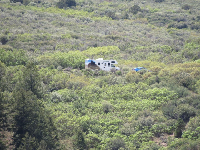
This is the best way I could think of to try and convey just how big the Black Canyon of the Gunnison is. The first picture is looking towards the South Rim from the North Rim (actually, all of these pictures are…).
If I then zoom in to the top/center of the picture you’ll see a large motorhome.

Since I’m looking across the canyon you don’t get a sense of the depth, but believe me – it is substantial.
From another overlook I was able to spot the observation area at the Visitor Center over on the South Rim (see post above).

And yet another example. On the left side of the first picture you’ll see a deep “V” shape of trees. When zoomed in you’ll see a small motorhome and a car. In the foreground is a formation called “Balanced Rock”.

As I drove west on Route 50, this formation was on the opposite side of the western-most Basin (Sapinero) of the Blue Mesa Reservoir.
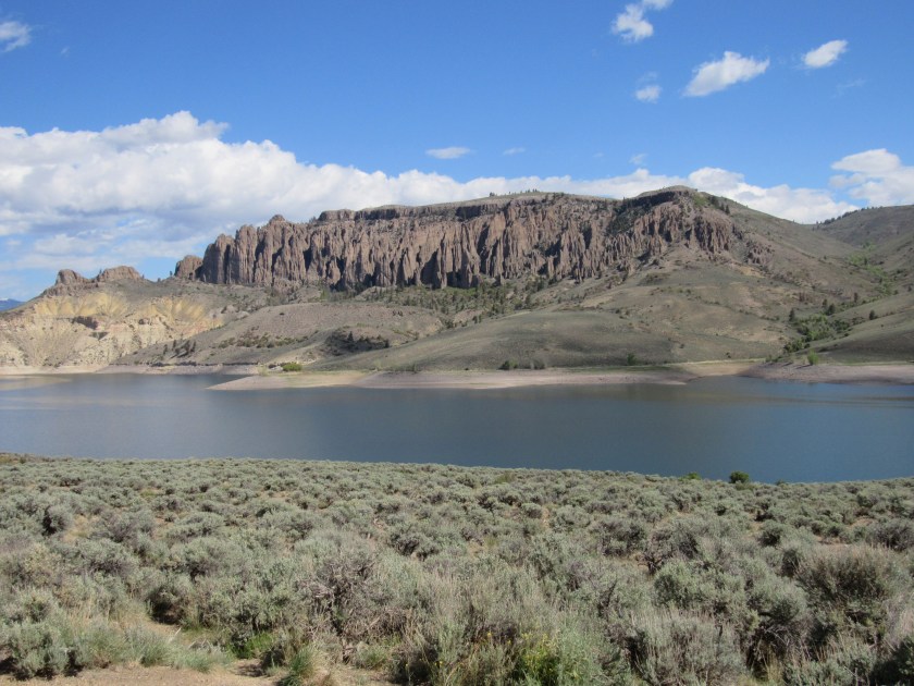
Zooming in a little closer, where the left end meets the water is thought to have formed 150 million years ago.

The little crown at the top off the next portion is thought to have formed 28 million years ago.
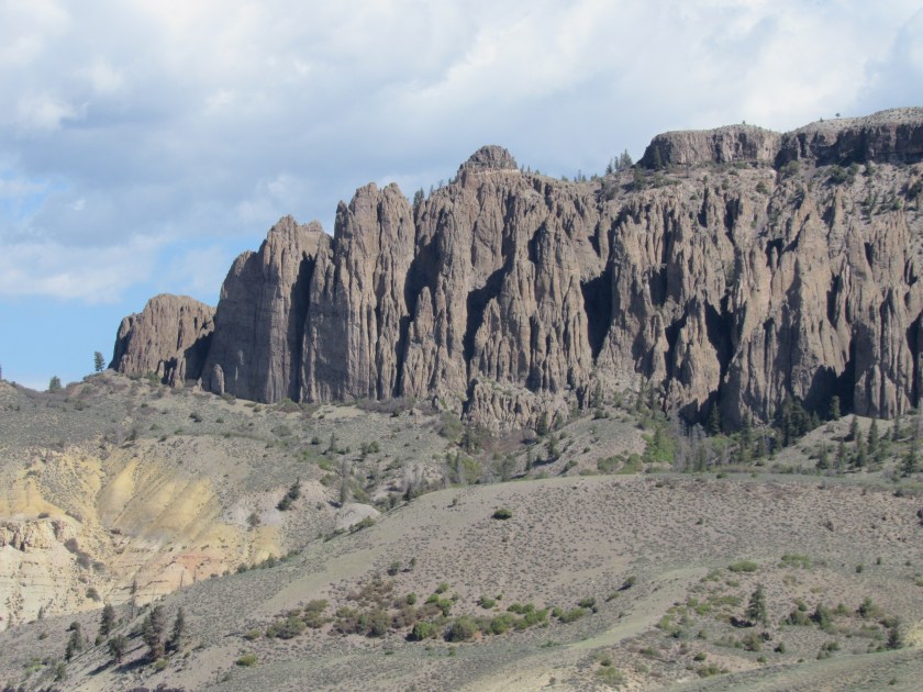
And finally the right portion of the formation.

Here is the same formation Wednesday morning when it was not quite as cloudy.

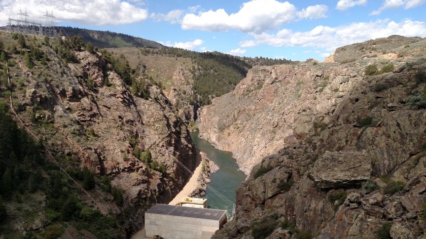
On Tuesday I drove west from Colorado Springs to Montrose. As I approached Montrose I arrived first at the Curecanti National Recreation Area, which consists of three large lakes (they are actually called Basins since they are part of the Blue Mesa Reservoir), then a long, thin Reservoir called Morrow Point, then a long, thin Reservoir called Crystal, then the Gunnison River, which runs through Black Canyon of the Gunnison (get it now?) National Park. Water flows east-to-west through those venues.
The surface of the 3 Blue Mesa Basins are at 7,719 feet. After passing through the first dam, the surfaces of the Morrow and Crystal Reservoirs are at 7,160 feet. After passing through another dam the water enters the Black Canyon at 6,547 feet and then continues to drop very quickly as it passes through the Park.
Here is the water exiting the first dam, flowing west (in this photo, up)
A small cactus (about the size of a large navel orange)

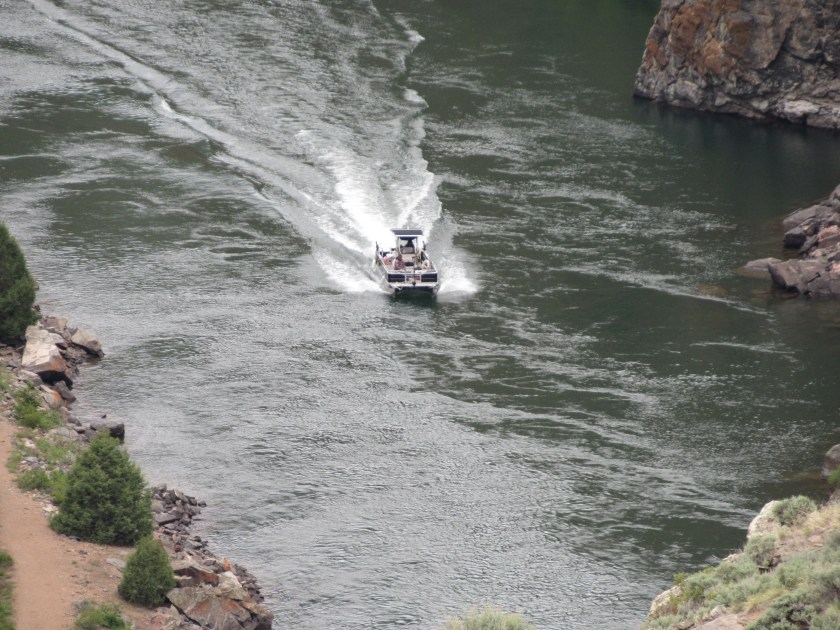
A sequence showing a boat traveling west to east. Look closely in the center of the first picture.
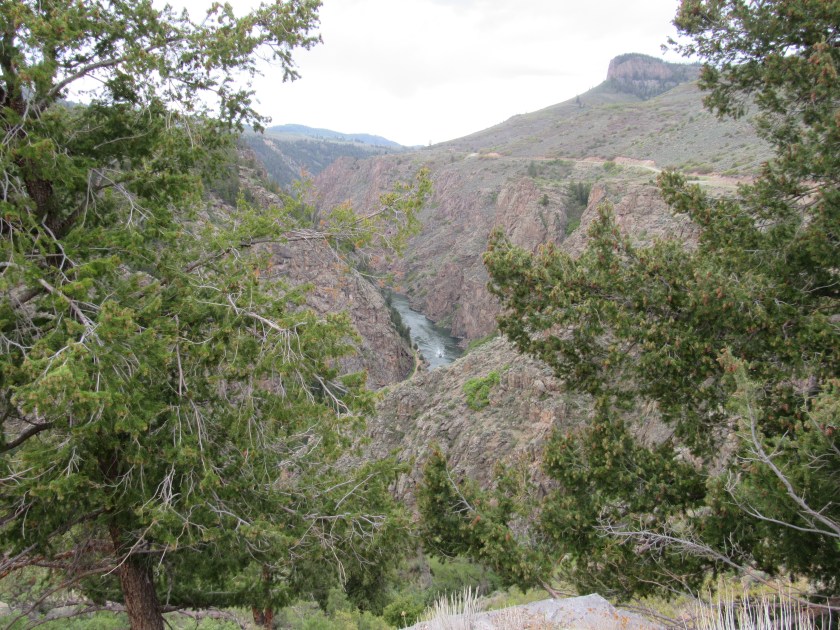

Further west in the Morrow Reservoir (note the difference looking west with cloud cover reflecting off the water versus looking east with blue sky reflecting…). These were taken just a few minutes apart.

This formation is called the Curecanti Needle. The first picture was taken Tuesday, with cloud cover, the second on Wednesday when it was sunny.

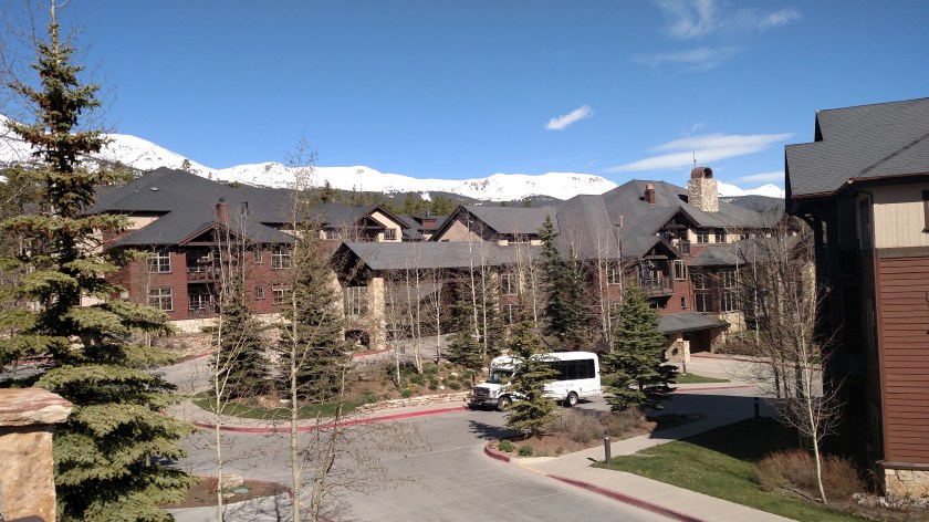
I left Durham on Wednesday, May 9 and drove three days to get to Breckenridge, Colorado Friday night (stopping in Nashville TN and Topeka KS along the way). My brother David and his wife let me use a week of timeshare and I stayed at Grand Timber Lodge, near the base of Peak 8. It was a fantastic week, with highs in the low 60’s and lows in the low 40’s or upper 30’s. I just relaxed and enjoyed the area. The rain and sleet occurred east of Breck, near Denver, so it was a perfect week. It was what they call “mud season”, the period between winter ski season and summer hiking season, so many of the restaurants and shops were closed, but there are so many that there were still plenty of choices (and not too crowded). The resort itself was very nice and I just spent a good bit of time on the property.
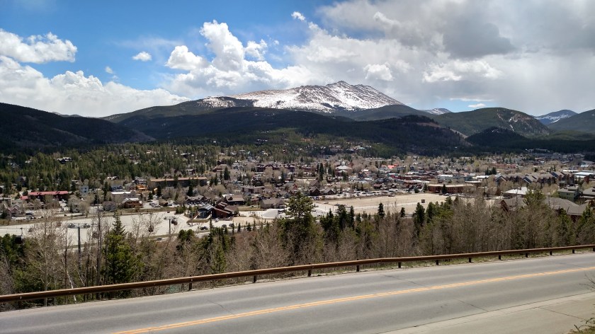
This is from a scenic overlook west of town, looking southeast.
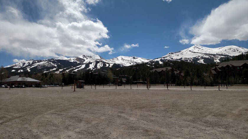
This is from town looking southwest towards the slopes.
This is from across town (going up Boreas Pass) looking west.

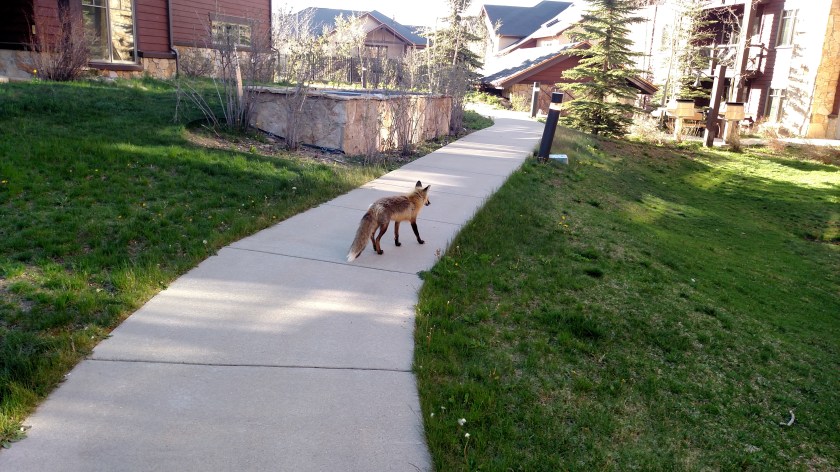
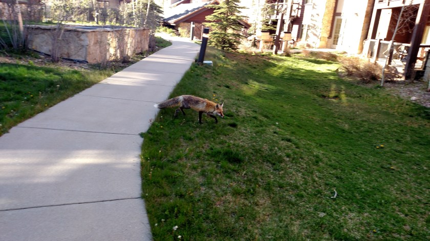
Monday night I was walking from Building 7, where I was staying, towards Building 5 where the Spa and pool are located, when this little guy came trotting along. That night I just froze in place and let him meander by (he wasn’t in any big hurry, and completely ignored me). I didn’t even think of getting my camera out until he was gone but lo and behold, here he was again about the same time Wednesday night. Evidently he is a regular and I suspect someone on the property might be feeding him.
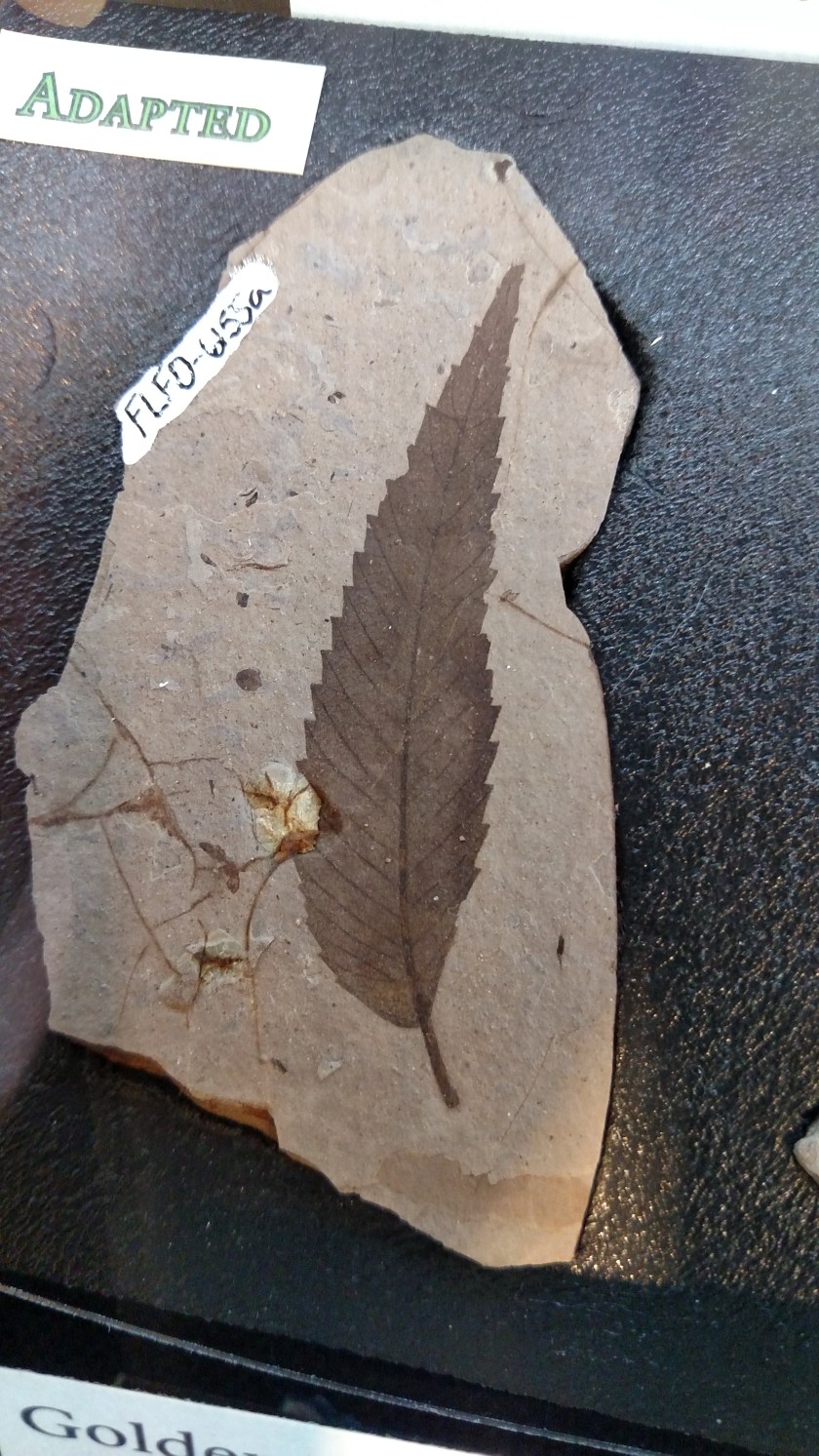
As I drove from Breckenridge down to Colorado Springs I stopped in at the Florissant Fossil Beds, near the town of Florrisant. I was here last year on the day of the solar eclipse and didn’t get a chance to really see the other exhibits. It was quite fascinating to see all the various images which have been captured in the rock (leaves, insects, bird wings, fish, etc).

I was also surprised to learn that years ago (34 million years ago!) there were sequoias in this part of Colorado. I usually think of them as only being in California.


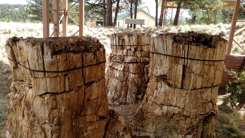
They built shelters over these to protect them from further deterioration. You’ll be seeing live sequoias when I get to northern California in a few weeks.
