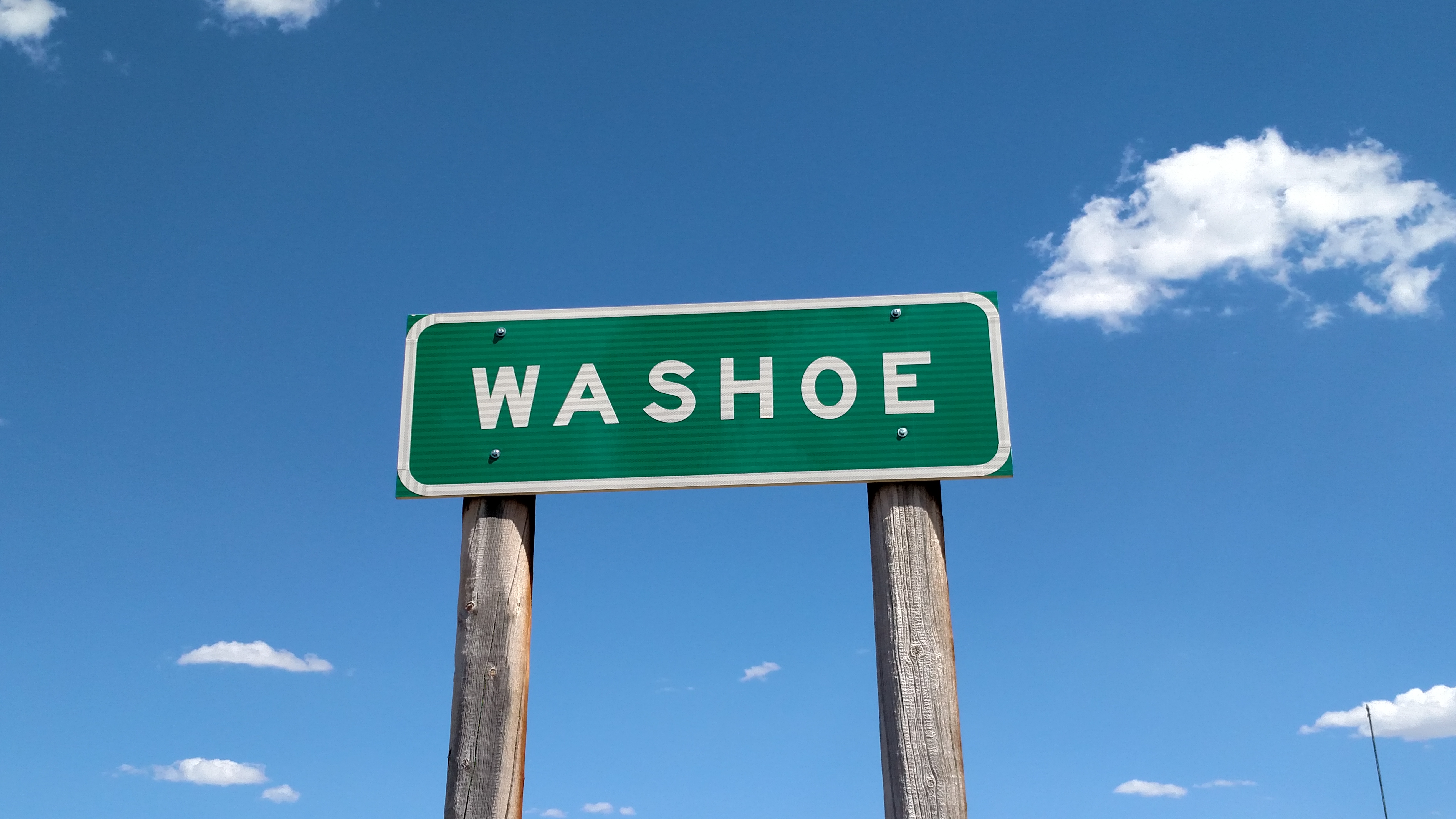
Gesundheit
Gesundheit
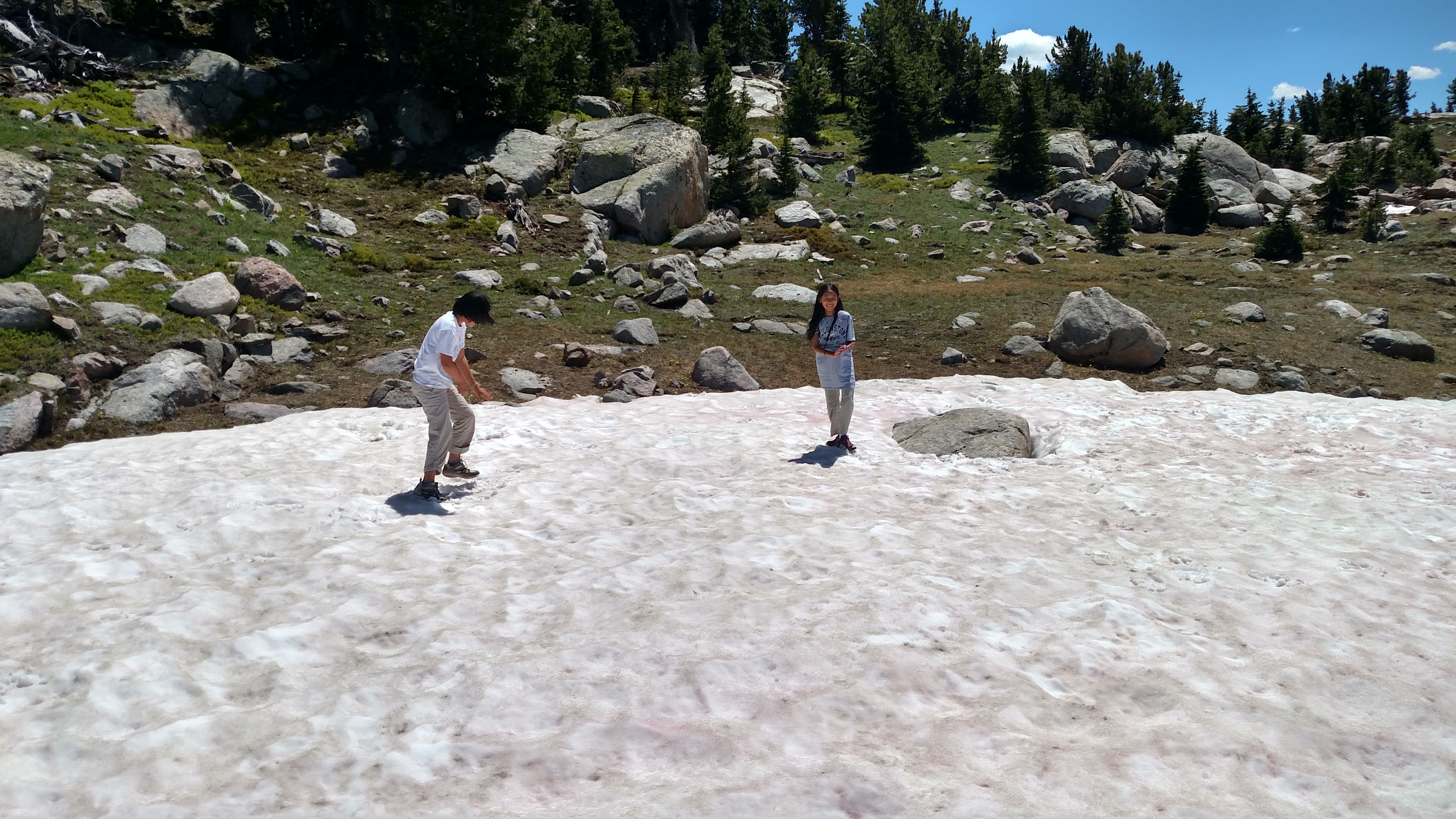
Saw these young ladies frolicking in the snow. Don’t worry, I asked their Dad, who was standing next to me, if it was OK to take their picture before I did (unlike my mother asking our neighbor if it was OK for her to cut some chives after she already had. Frances Grey!!).
And it appears that the mountains with substantial snow left at the top reach 10,000 feet or higher. There is obviously some snow below that level but that is where the serious accumulation remains.
Highest point reached today was 11,052 feet (and STILL no cell service!!). For those of you wondering about the numbers, my spiffy new GPS unit provides altitude on demand. I’m on my 3rd GPS unit, by the way, having thrown the first two out the window when I got aggravated with them.
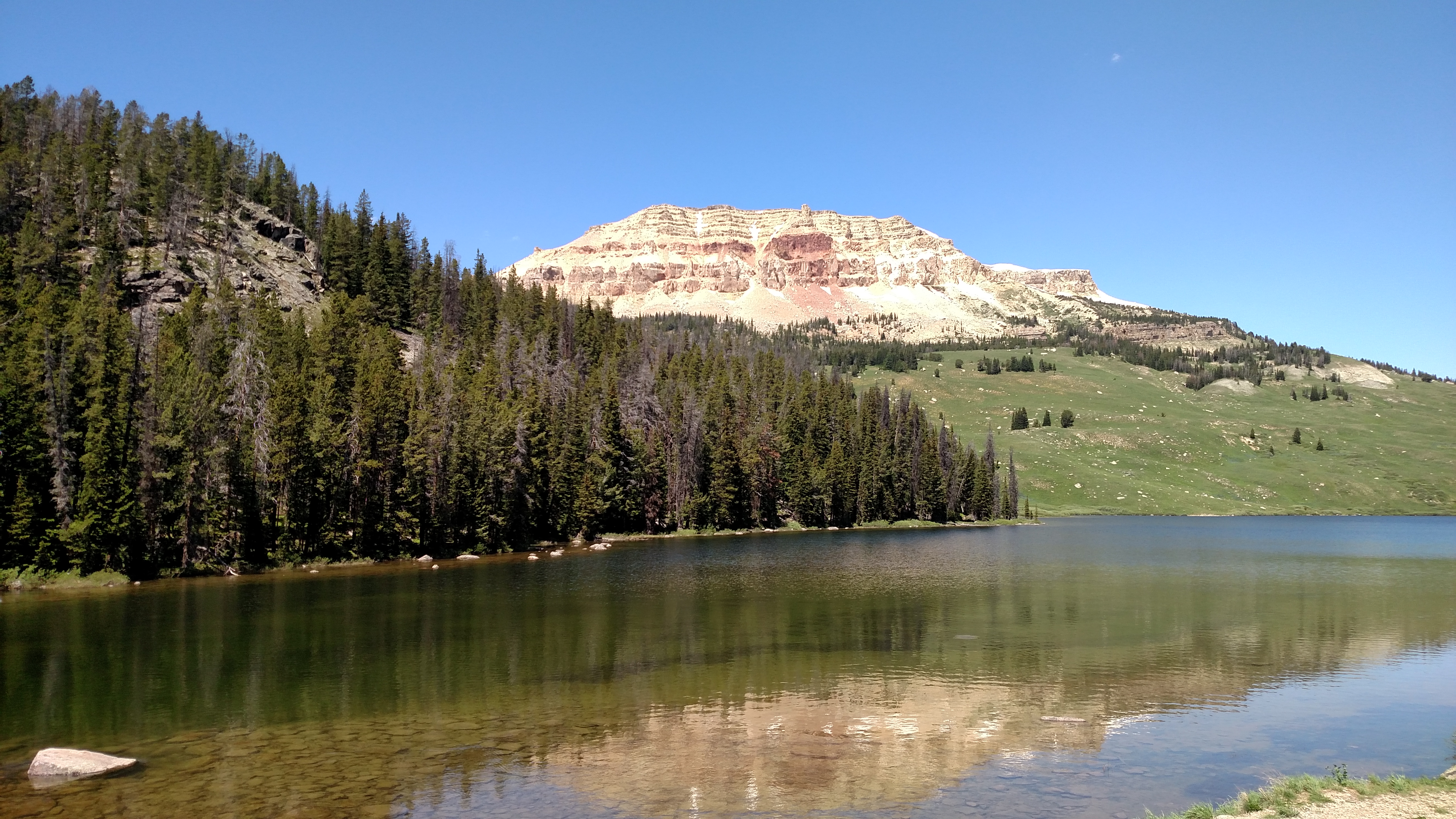
No butt jokes, please! This is Beartooth Butte and Beartooth Lake in the northeast portion of Yellowstone National Park. And it’s butte, pronounced as in “Trump said Macron’s wife was a beaut”.
I have sooooo many mountain pictures and I don’t want to bore you with too many, but when I do post any I’ll try to pick the best ones. As Al Pacino said in “Scent of a Woman”: I’m just gettin’ started…. Given my itinerary expect more mountain, stream, lake and snow pictures to come. And hopefully some interesting wildlife. Saw lots more bison today, alone and in groups. Also had to stop (again) as several cows crossed the road. Is it a herd?? A pack?? A bunch??
Talked with some newlyweds from Oregon who saw a group of antelope being chased by a bear earlier in the day. Still haven’t seen any elusive Bighorn Sheep so far this trip, although there were more warning signs. I did see some ordinary sheep in eastern Wyoming yesterday on my way up here. Alas, no other critters today.
Oh, and I figured out why there weren’t many motorcycles in Sturgis. It’s because they are all in Yellowstone. Saw almost as many bikes as campers & motorhomes, and there were lots of both.

Although I was traveling from South Dakota to Montana I actually did the majority of my driving today in Wyoming. Once I got on the interstate this morning it wasn’t long before I was back in Wyoming. I took I-90 west past Gillette and north towards Sheridan.
A short while after I passed Gillette I got my first glimpse of snow up in the mountains on the horizon ahead of me. I thought I knew where it was but, as usual, I was wrong. I’m going to have to study the map to try and figure out exactly which mountains they were.
In any event, once I got past Sheridan I got off the interstate and started heading due west on my trusty scenic roads. The two roads I took (14 and 14A) cross over the Bighorn Mountains, west of Sheridan. After getting over the first mountain the road splits, with 14 heading southwest and 14A continuing west. I decided to stay on 14 most of the way to Greybull before backtracking and taking 14A to Lovell.
While approaching the mountains from the east I was at about 4,500 feet and it was 84 degrees (at about noon, local time). Once I reached the first mountain peak (Cutler Pass) I was up at 8,347 feet and the temperature had dropped to 60 degrees. I continued down 14 towards the little town of Shell. The photo above was taken about half way down the mountain. I took some other photos which I had intended to post but I don’t think I like how they turned out. They may make an appearance later. Once in Shell I was back down at 4,474 feet and the temp was back up to 87. As I doubled back on 14 I went through Granite Pass (9,033 ft, 69 degrees) and as I went west on 14A the highest point I reached was 9,565 feet, 64 degrees. At that point there were several good sized patches of snow about 100 feet further up the hill on the side of the road. That overlook was just called “Observation Point” so I’m not sure exactly which mountain peak it was.
After that it was a VERY steep descent (10 degree grade, which is fairly steep for truck traffic) and I was quickly down below 5,000 feet. As I drove away from the mountain I noted that while approaching the Bighorns from the east they were a lush green color, almost completely covered with trees, and were very inviting. Looking back from the west, on the other hand, they were rocky, barren and harsh in appearance. Quite a contrast.
Once I got down off the mountain there was a stretch of road that went about 8 miles in a straight line towards a huge lake. When I got there I found that it actually was a lake and not a mirage. I was back down at 4,800 feet, in what was a more desert-like environment, and it was a toasty 93 degrees.
Didn’t see any critters (still no Bighorn Sheep, not even in the Bighorn Mountains). Oh yeah, there was a big black cow that crossed the road in front of me up at about 8,000 feet. She was walking away from me, parallel to the road. I had already slowed down and when I saw her turn to the left I stopped completely as she meandered across the road without a care in the world.
Still thinking about that snow off in the distance… I assumed it was on the Bighorns but was considerably more volume than what I saw up close. There are some mountains south but they are about the same height as what I crossed. And they were too close to be the Rockies. Maybe IT was a mirage…..
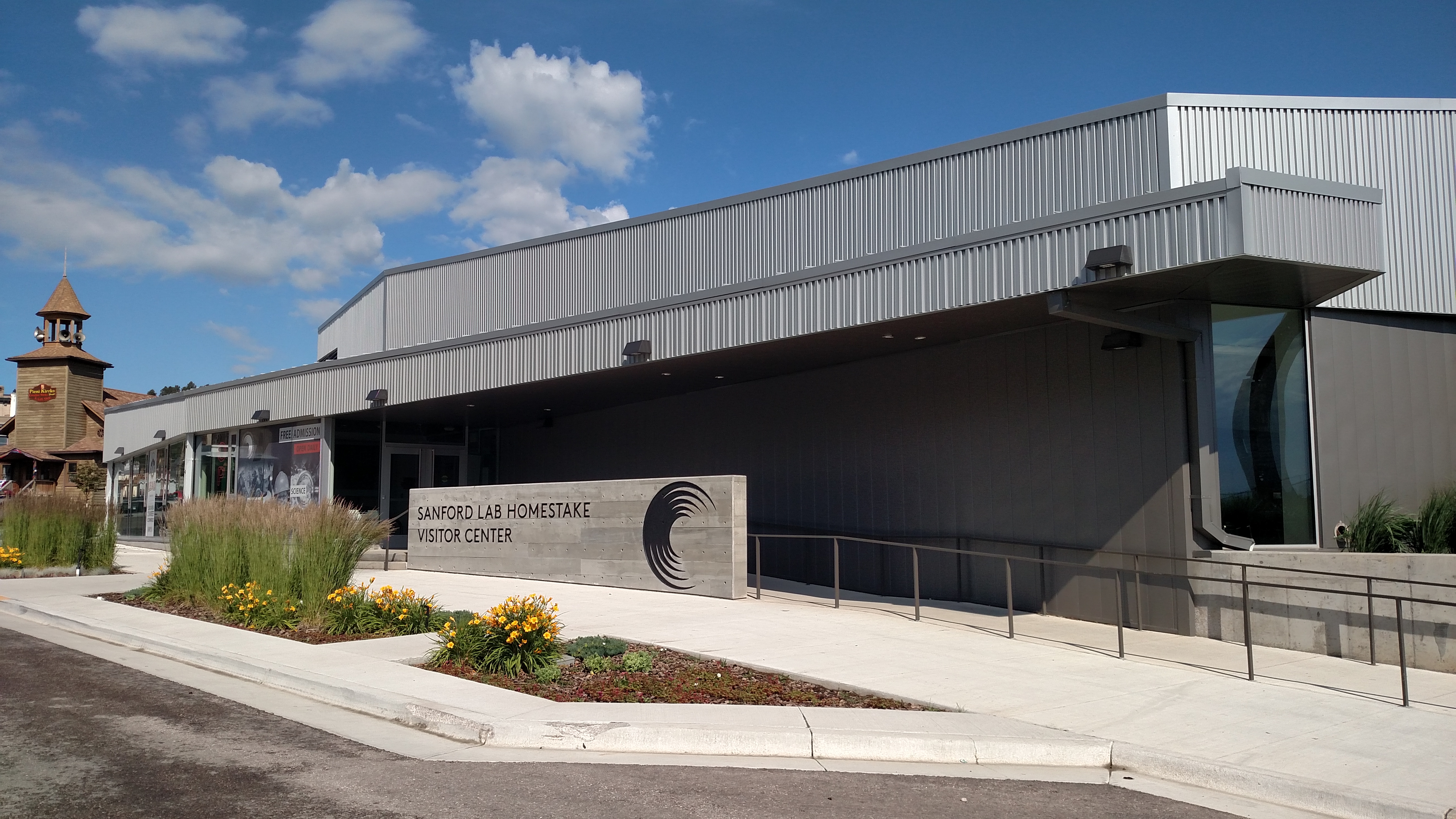
When I was in Lead, South Dakota yesterday I saw several signs for the above-mentioned facility. When I got home last night I Googled it and was so intrigued I thought I’d better come back on my way out of Rapid City to get more information.
What you are looking at is the Visitor Center for the lab. The lab itself is underground in the former Homestake Mine and is not open to the public. Homestake was the largest and deepest gold mine in North America before closing in 2002. Parts of the mine are up to 8,000 feet underground.
This facility is where up to 1,000 people per day, mostly scientists and technicians, work doing scientific research (duh). They mainly study dark matter (although I’d think just about anything 8,000 feet underground would be pretty dark) and neutrino (which I’m not even going to attempt to explain. Just Google it.). Way over MY head!! There are no tours of the facility itself but the Visitor Center did have lots of photos and graphics which attempted to explain exactly what it is they do, as well as giving information on the history and workings of the gold mine which preceded it.
After leaving the Center I drove through Deadwood (the next town over from Lead) again and discovered that I had only walked through the historic Main Street area yesterday, and there was quite a bit more of the town to see. Then I headed out to the interstate and starting working my way towards Bozeman.

I actually visited Devil’s Tower yesterday during my big scenic loop. It is in extreme northeast Wyoming. I was originally planning to stop here on my way to Bozeman today (if at all) but since I passed right by I thought I might as well stop and get a picture.
I say “if at all” because I was here many years ago and had been debating if it was worth the time spent to get here and basically say to myself, yup, it’s still here….
It is a very impressive quirk of nature, though, and it was nice to see it again.
Saw many signs during the day yesterday, both in Wyoming and South Dakota, warning of “Bighorn Sheep Crossing – Next xx Miles”. Well I didn’t see any Bighorn Sheep, crossing or otherwise.
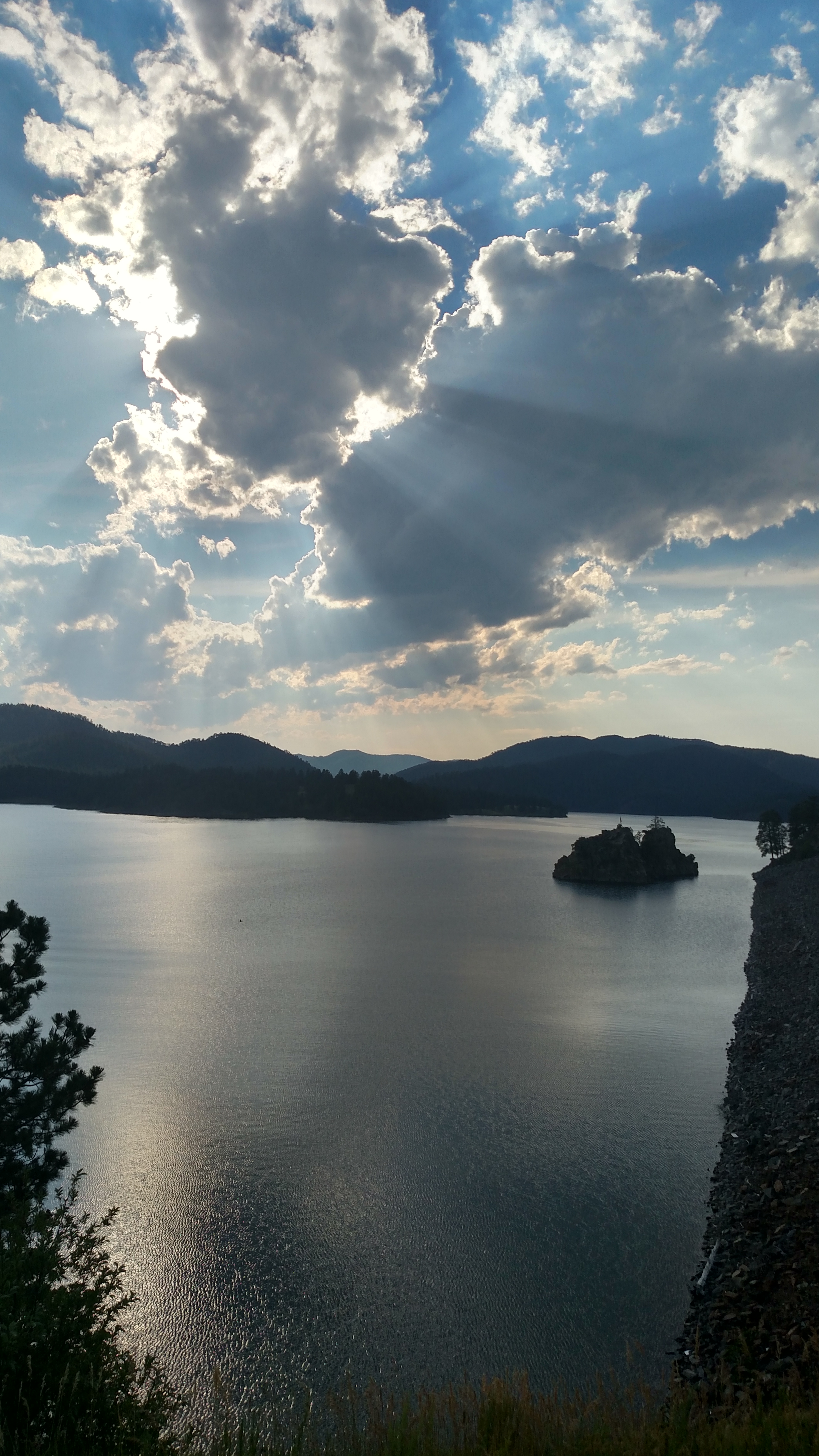
They have lakes too! This is Pactola Lake which I passed on the way back to Rapid City.
Got a little carried away with posts today. Head out to Bozeman MT tomorrow morning (and I’m actually there 6 nights, not just 5). Peace out.
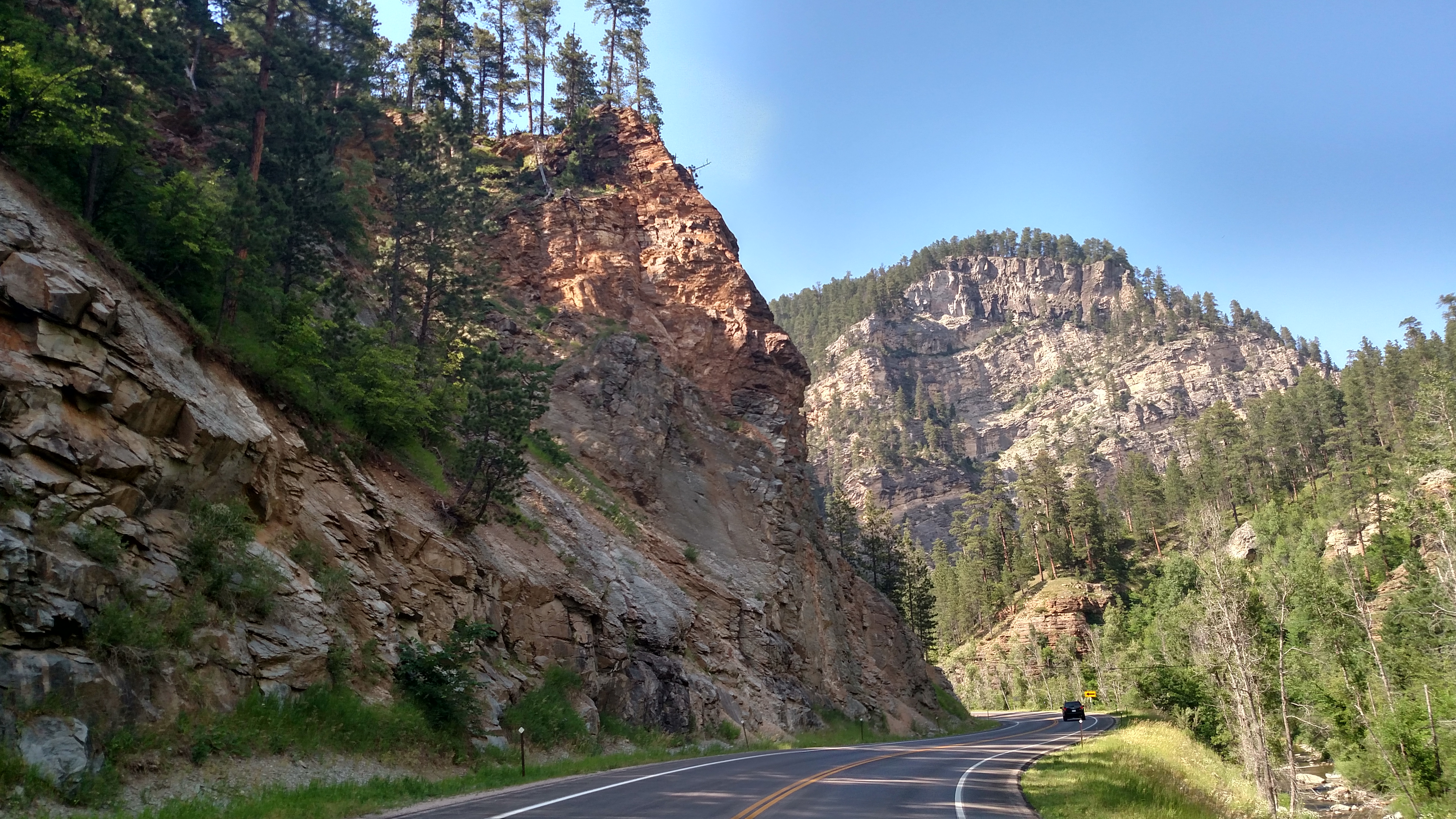
After revisiting the two parks I went to yesterday I took a big long drive on most of the scenic roads in the area (and there are lots!). This also meant crossing over in to Wyoming for about two hours. Once I got back in South Dakota I visited some of the towns located between Rapid City and Belle Fourche. This included Spearfish, Cheyenne Crossing, Lead and Deadwood. Of all those, Deadwood is probably best known. The Main Street there has some nice old hotels and there are some newer ones as well. Lots of bars and restaurants (meaning overpriced steak joints), and of course lots of “gaming establishments”.
I traveled to these towns on the Spearfish Canyon Scenic Byway which was probably one of the best drives on my trip so far, although the Needles Highway yesterday wasn’t too shabby either. Amazing scenery and a picturesque stream running alongside the road in most places. I bet with the right timing for sun placement there is the potential for some spectacular fall foliage shots.
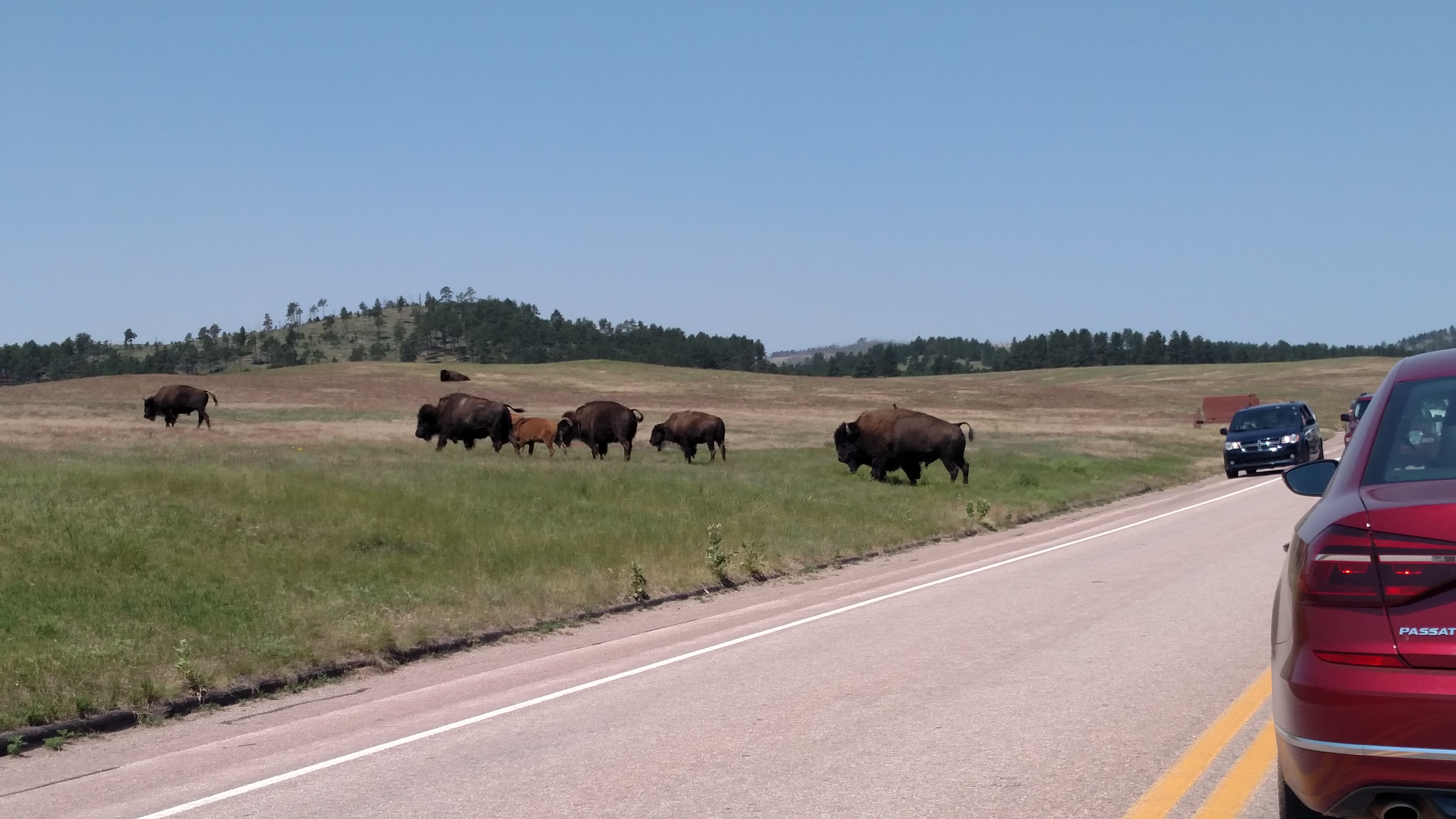
Saw this herd crossing the road near the entrance to the Visitor’s Center at Wind Cave. It was a fairly small group of maybe 20.
As I went down the two unpaved roads today I saw two large herds of bison, both larger than the group I saw yesterday. Actually saw a few making babies (let’s call it “free-ranging”). No, I didn’t take any pictures of them doing the deed. I’ll post bathroom pictures but I don’t want to be accused of peddling bison porn.
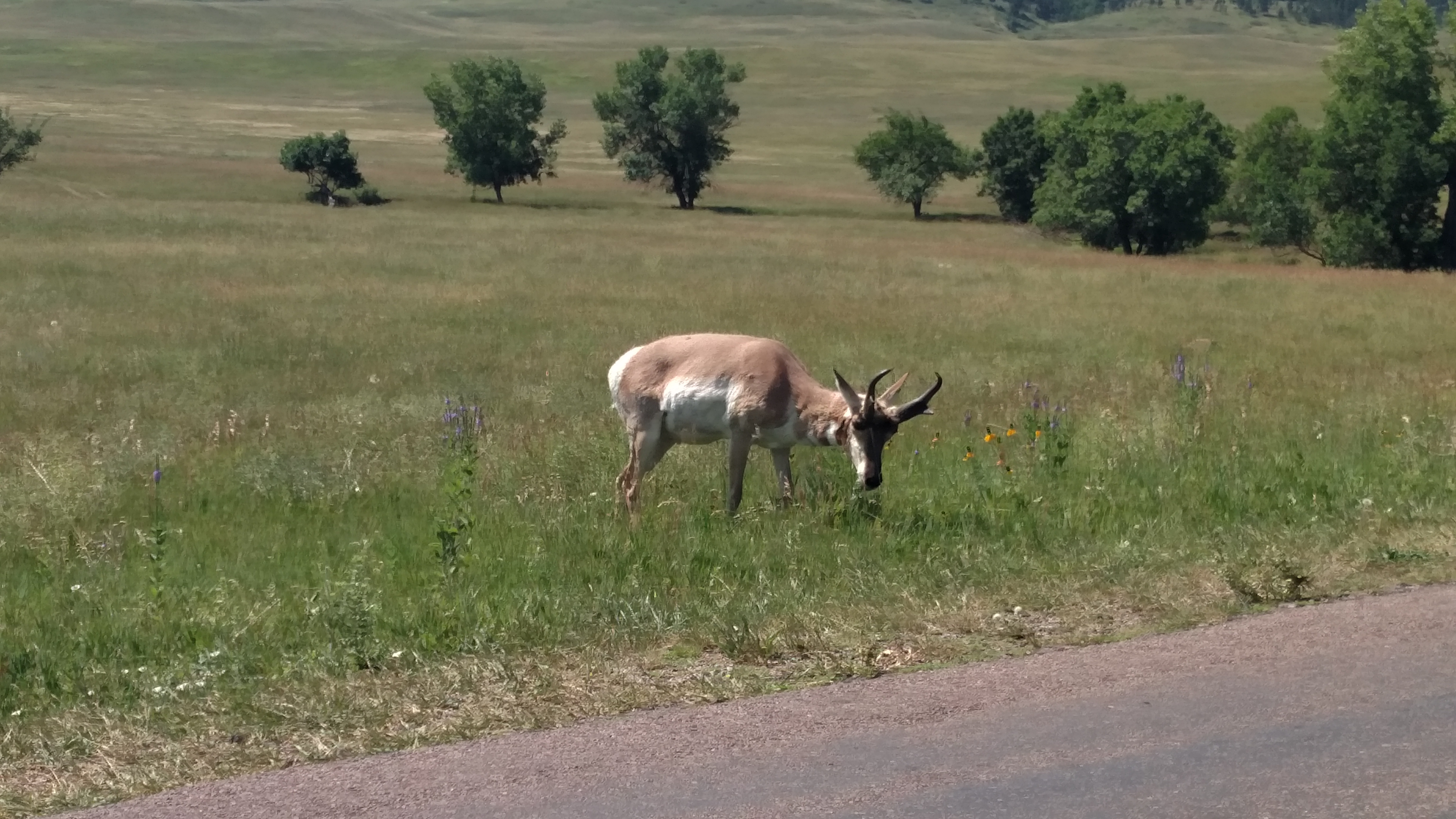
I went back down through Wind Cave today on the two unpaved roads I saw the bison on yesterday. Saw this young pronghorn grazing right next to the road. Also saw an adult later in the morning resting by the side of the paved entrance road.
