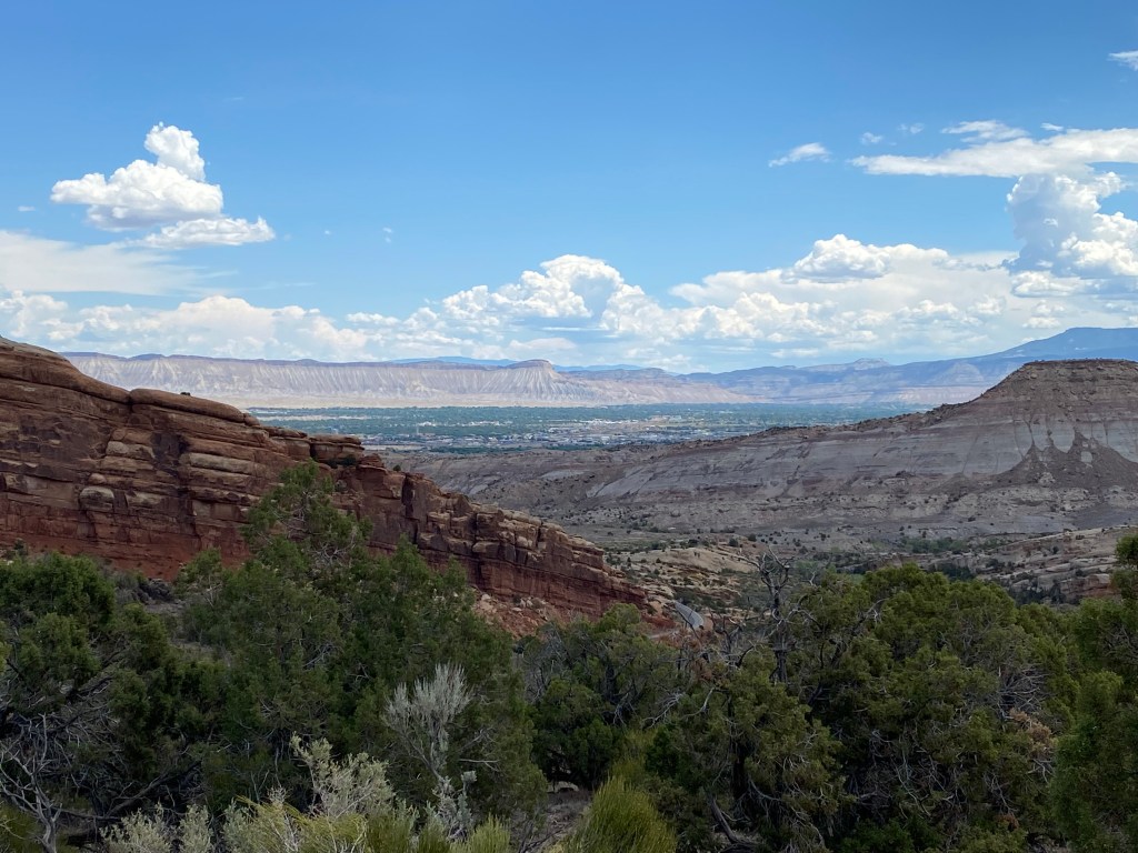
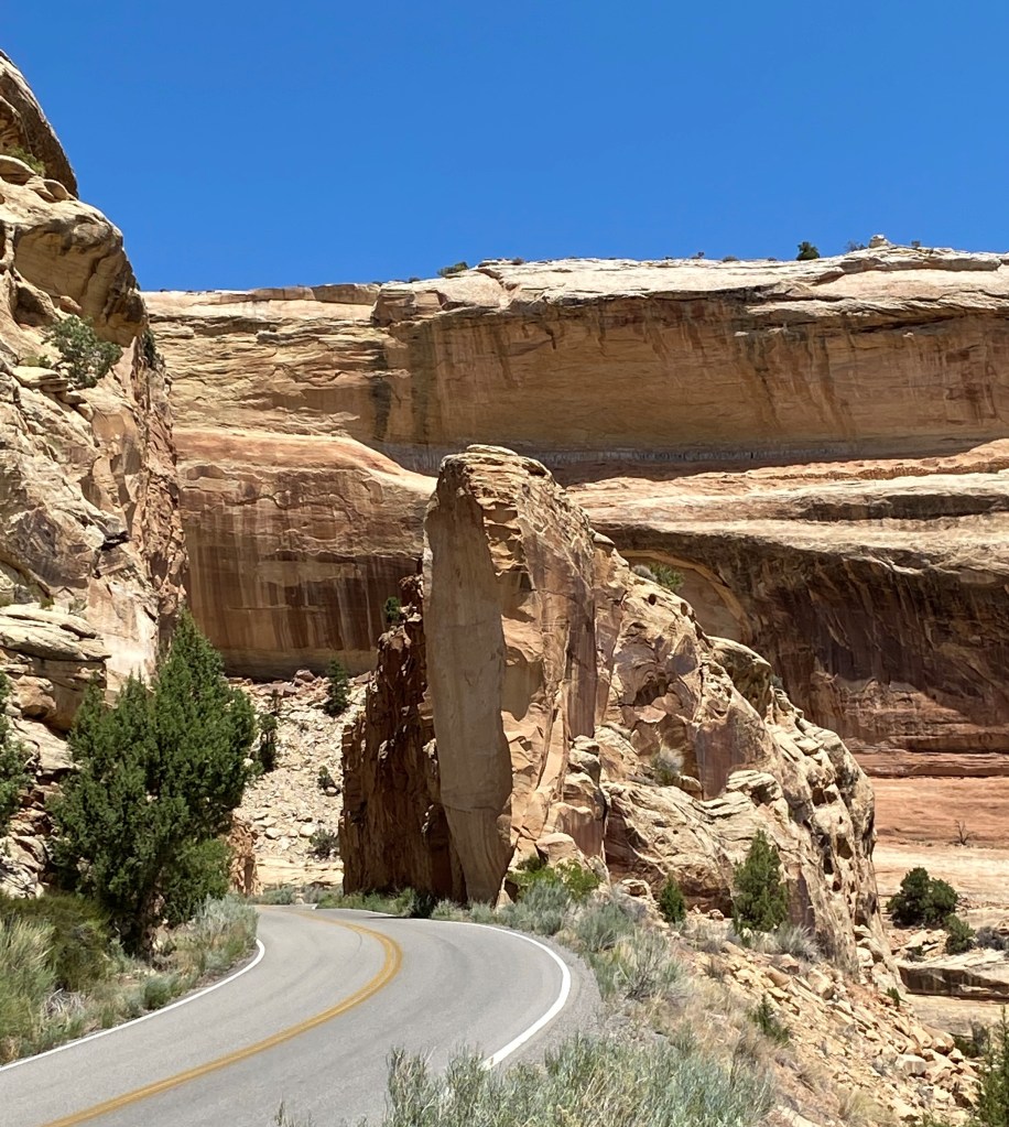
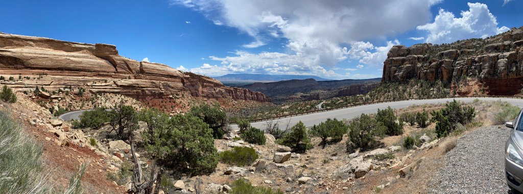
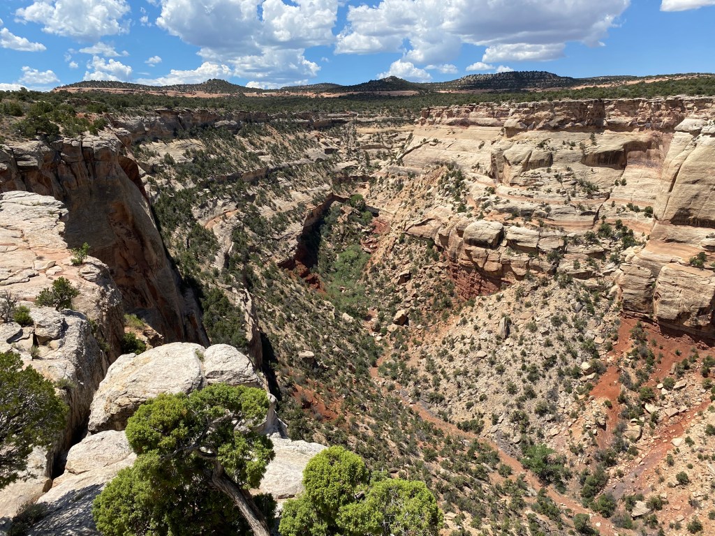
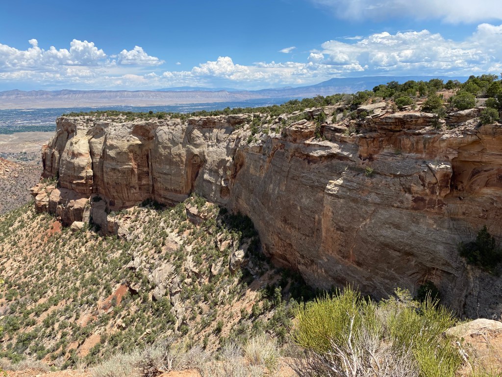
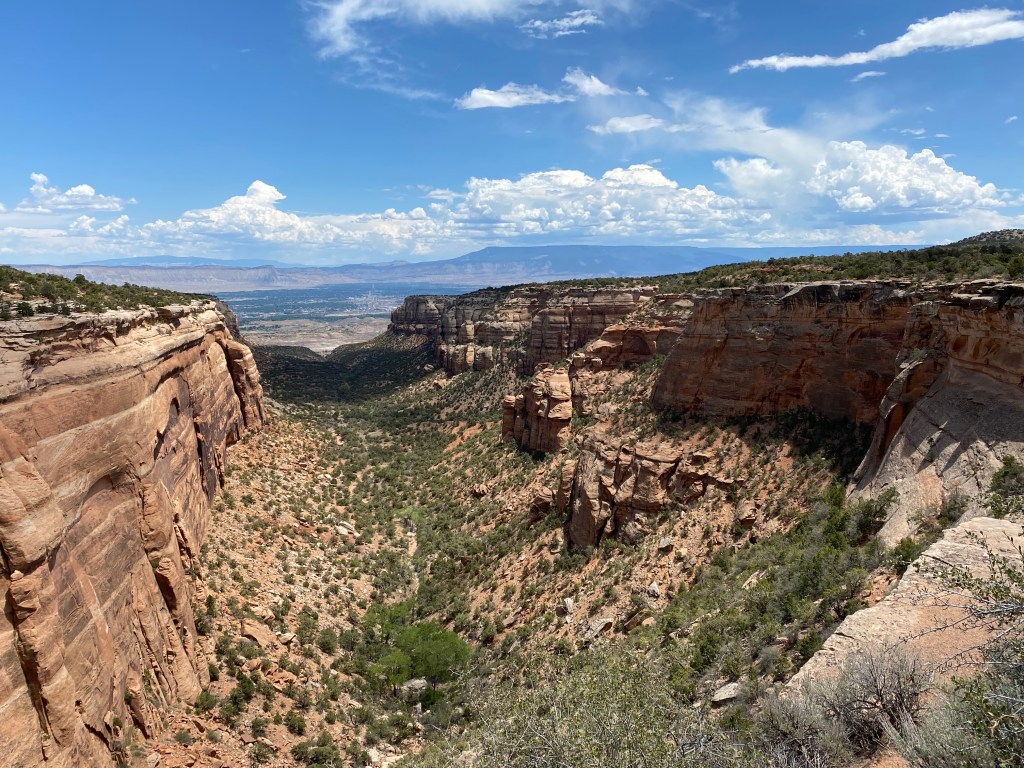
Here are more photos of Colorado National Monument, located just outside of Grand Junction, Colorado. These were taken July 2, 2021.
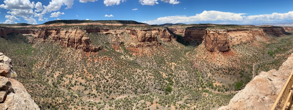
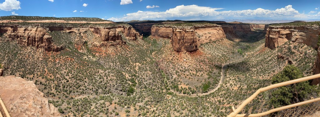


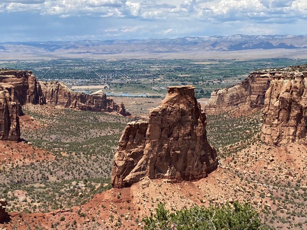
Here are more photos of Colorado National Monument, located just outside of Grand Junction, Colorado. These were taken July 2, 2021.
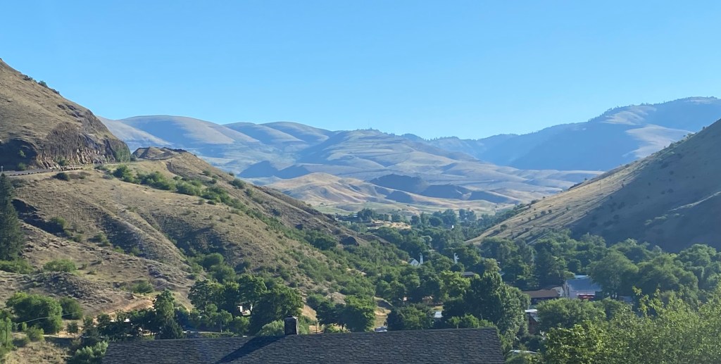
Friday morning I went to have my wheel alignment checked and get a part I needed from the Nissan dealer in town. After that I decided to revisit Colorado National Monument which is just outside of Grand Junction, Colorado. I had been here a few years ago but that was a last minute decision and I made a quick drive through before heading out of town to my next destination. It also let me utilize my new-found “panorama” skills on a few of the photos. It was going to be a nice day (only in the 80’s after a run of 100+ degree days) and I had the rest of the day since I was staying in town.
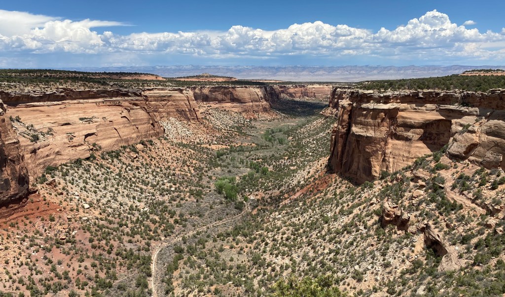
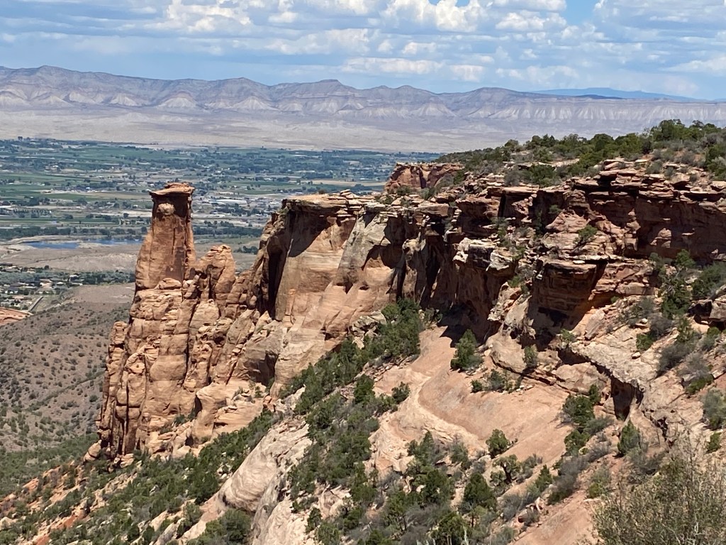
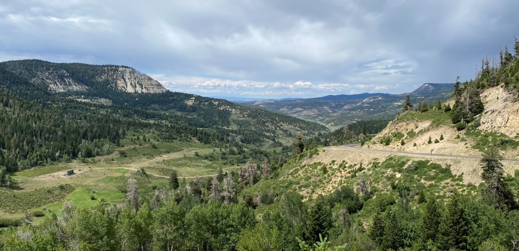
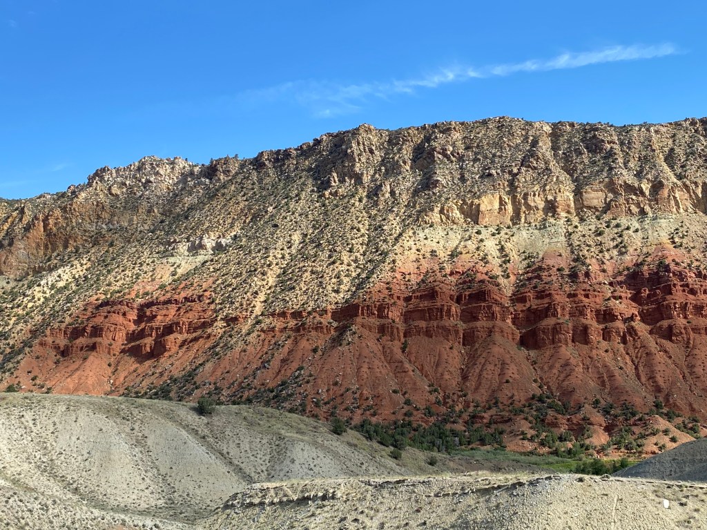
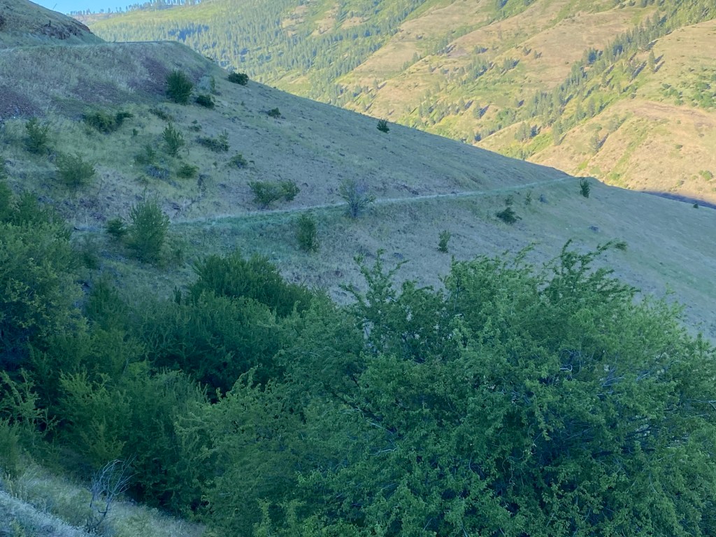
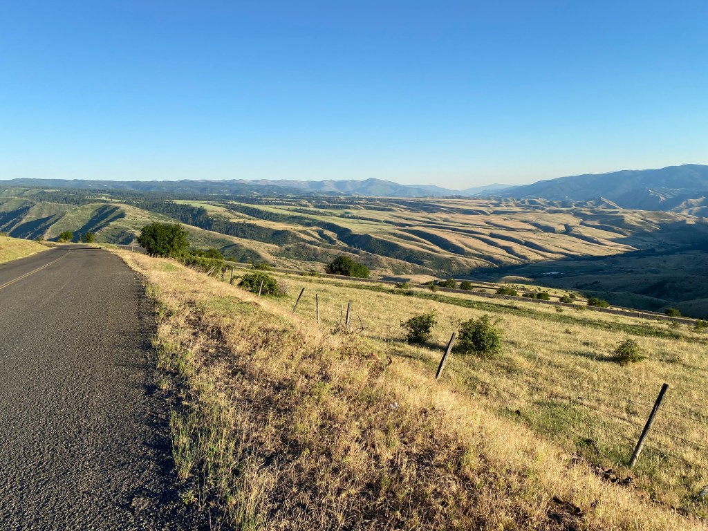
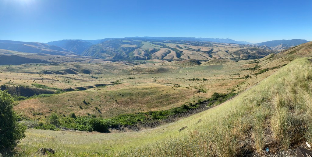
The Monument consists of a 23-mile drive around the top of a curved canyon (well, half a canyon – it is open on the other side). This lets the viewer look down into a variety of different sets of rock formations. I started my drive mid-day so it was ideal having the sun almost directly above me. The road along the top of the Monument curves along the southwest corner, facing the interstate highway to the northeast.


After driving past Flaming Gorge National Recreation Area on Thursday I continued south towards my ultimate destination of Grand Junction, Colorado. The morning was progressing very nicely until I hit a deer as I was driving southeast towards the Colorado state line. I was on a 2-lane highway and I saw a young deer charging the road from my left. The highway was slightly elevated so there was nowhere to pull off to avoid a collision. The deer saw my car and started to change direction but it was too late and I ran over it’s legs. I saw a truck in the other lane swerve to avoid the carcass and I continued driving. There was an area to pull off the road a short distance ahead and I stopped there to assess the damage. It appeared to be light and I decided to go back to the town of Vernal, which I had passed through earlier, to make sure the car ran normally rather than continuing on over 100 miles through a rather sparsely populated area where cell phone service might not be too good if there were problems.
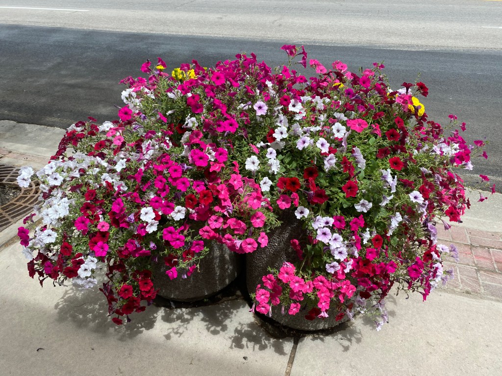
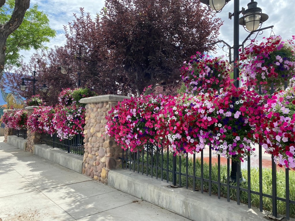
Vernal ended up being a very colorful town, thanks to local businesses planting an abundance of pretty flowers, and that helped brighten my mood.
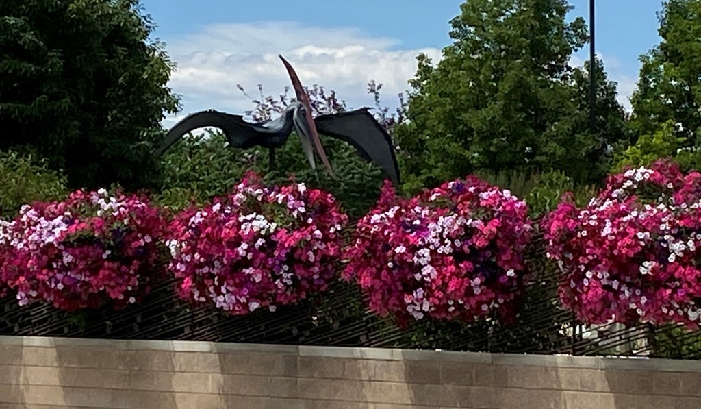
The other thing I should mention about Vernal is that there is a very apparent dinosaur theme in the town:


This is due to the fact that Vernal is located just west of Dinosaur National Monument, which straddles the Utah/Colorado border. It is also part of the “Dinosaur Diamond”, a large area with lots of history and artifacts as they pertain to dinosaurs.
The town of Vernal had several murals and many large dinosaur replicas, mainly serving as gimmicky motel signage. I’ll skip the signs but include some of the replicas which I found outside one of the museums in town:


After I had a chance to calm down a bit from my ordeal, and was confident that the car was at least okay to get me as far as Grand Junction, where I would be for 5 nights and there would be more options for any repairs which might be needed, I got back on the road and continued southward.
By the way, by the time I had turned around after hitting the deer and after assessing the damage to return to Vernal, only about 10 minutes, the deer carcass was gone, although there was a red pickup truck sitting by the road which I’m pretty sure I had seen turn around in the same parking area I had parked in. This was a few days before the 4th of July weekend and I suspect the owner of the pickup treated his buddies to a venison cookout.
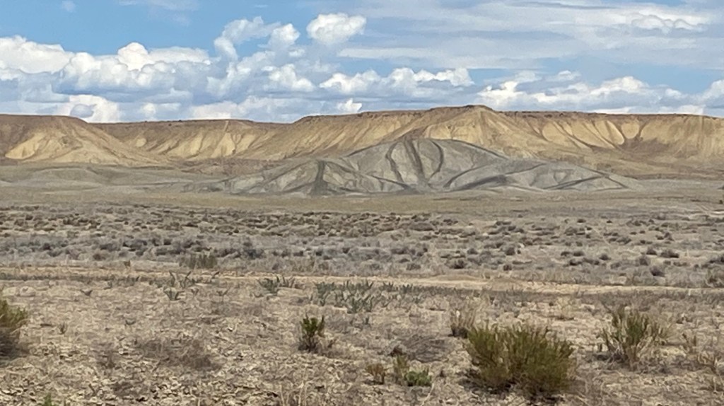
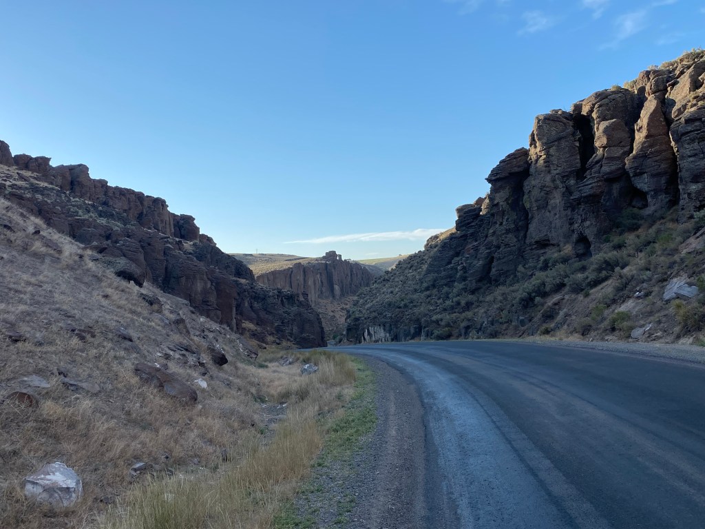
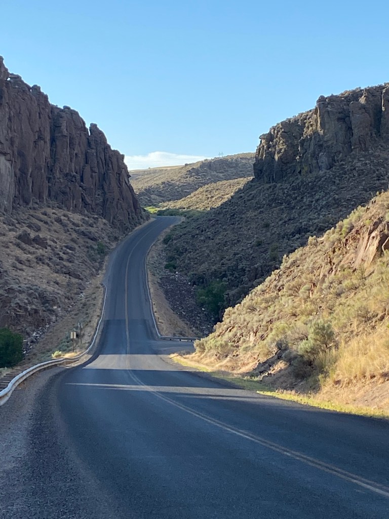
The rest of the drive was uneventful, but much less colorful than Vernal had been. I soon returned to the browns and grays which are seen quite a few places in Utah.
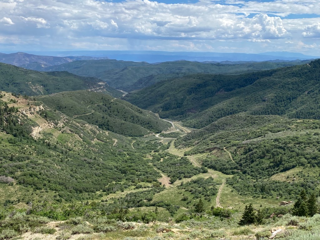
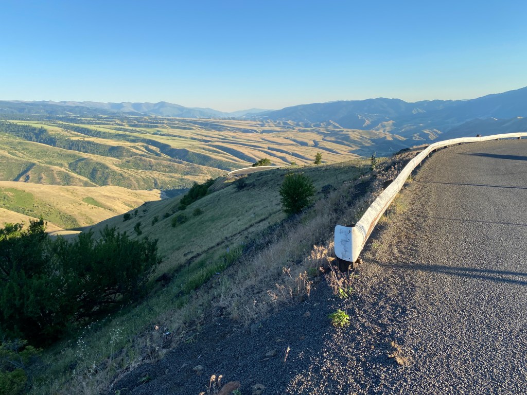
But when I reached Colorado things got a little greener, especially as I crossed through Douglas Pass, up at about 8,300 feet elevation. This was the view near the top looking back the way I had just come:
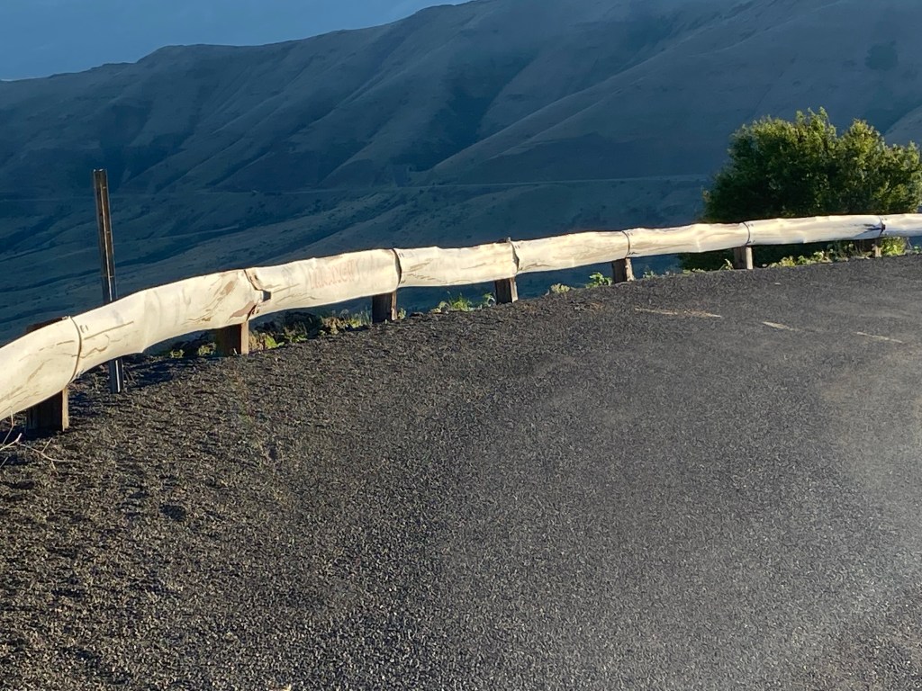
And this was the view looking forward, just a short time later when I reached the peak:
I arrived in Grand Junction without any more difficulties and had the alignment of the car’s wheels checked the next morning (they were right on spec). I also went to the Nissan dealer to get a part to help keep the bodywork behind the left front tire intact (it was loose but not in danger of coming off).
I would be in Grand Junction for 5 nights over the July 4th weekend and would be revisiting some places I had been to before as well as seeing one new venue.
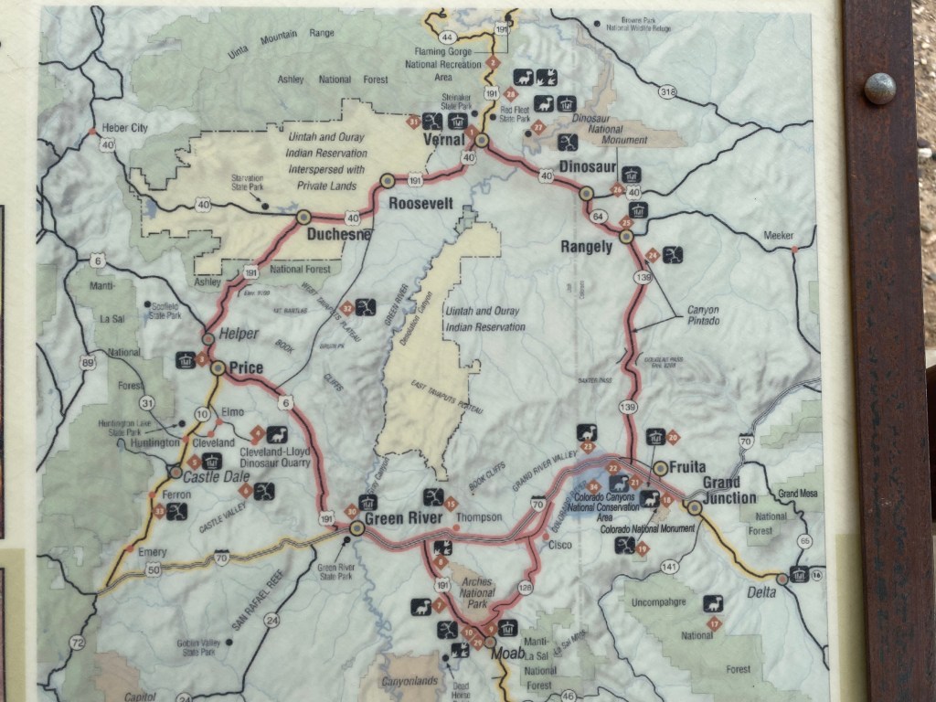
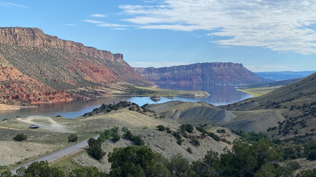
Thursday I traveled from Evanston, WY down to Grand Junction, CO. To accomplish that the scenic roads I chose took me through a small section of Utah. This included approaching the southern edge of Flaming Gorge National Recreation Area by way of a different route than the one we took when we came down from Lander back in June. Here were a few of the things I saw along the way which I wouldn’t have seen, or didn’t stop to take pictures of, on my earlier visit.

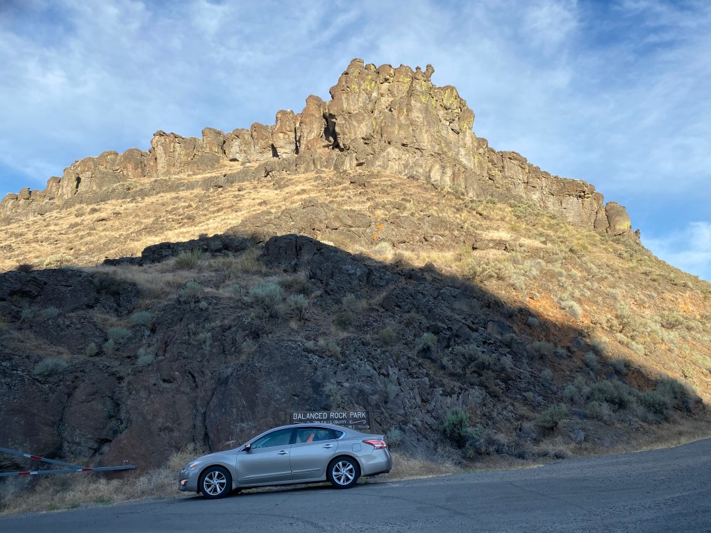
After spending the night in Twin Falls I headed west to the little town of Buhl to see Idaho’s version of “Balanced Rock”. It isn’t very far from Twin Falls but despite my early start it seemed to take forever to get there as my GPS unit sent me on a wild goose chase. I finally made it and was surprised to find myself descending into a 300-foot rocky cavity in the earth’s surface after having driven through many miles of beautiful, flat farmland.

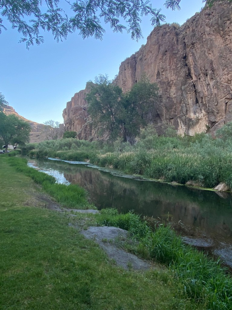
At the lowest point of Balanced Rock Road a small road led off to Balanced Rock Park (lower portion of the photo above). That road led a short ways down to the Salmon Falls River, where there was a small campground and a nice grassy area with picnic tables. A nice, quiet oasis once you got there. I should also mention that the area around Twin Falls is known for their sweet corn and for having lots of salmon farms.

Looking the other direction from the main road was not quite so inviting:

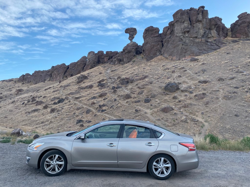
But the river and the campground weren’t the reason I came here. I wanted to see Idaho’s version of Balanced Rock. Kind of like Bridal Veil Falls, there are several places featuring “balanced rocks” scattered throughout the United States, notably at Arches National Park in Utah and at Garden of the Gods in Colorado.
I drove back up the main road to the west and there it was, just off the road to my right – looking like a large question mark:

Having accomplished my first task of the day I headed back towards Interstate 84. While my GPS struggled with getting me to Balanced Rock (in it’s defense – there was no specific address to use getting here, just the town name) she did a much more efficient job of getting me out to the highway.
After I had visited Boise briefly a few years ago I scolded myself for not having visited the Idaho Potato Museum while I was there. Well, as it turns out the Idaho Potato Museum isn’t even in Boise, it is in Blackfoot, 250 miles to the east, so that was my next stop.
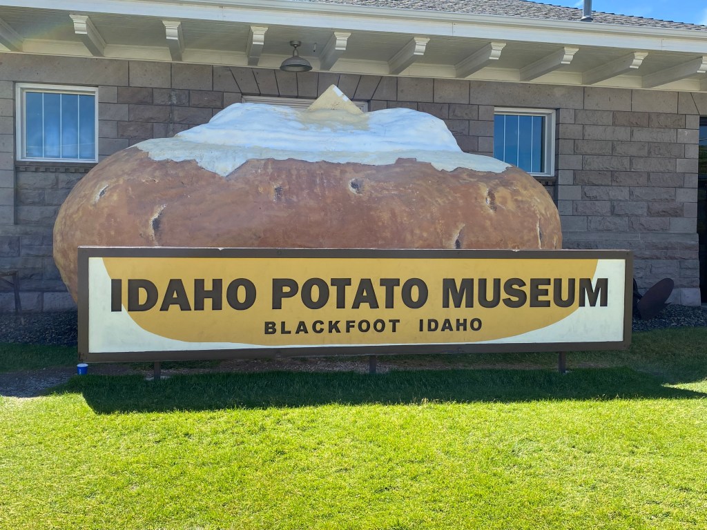
While I was waiting in the gift shop to pay to get in to the museum itself, located in an old railroad depot in town, I decided this was all rather hokey and just a big tourist trap and ended up leaving without even going in. I still had quite a bit of driving ahead of me and headed south.
I ended up taking several scenic roads in the extreme southeast part of the state, going through towns like Soda Springs and Montpelier, and around Bear Lake. I did stop briefly in Montpelier to take a photo of a bench in town which I thought was rather clever:
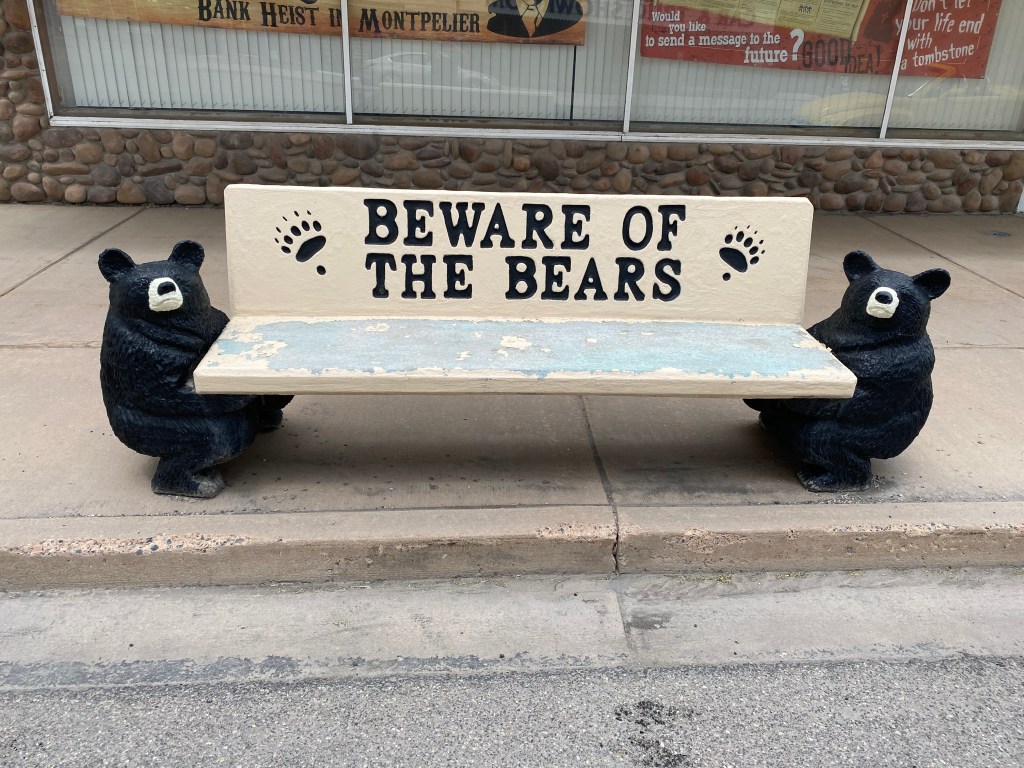
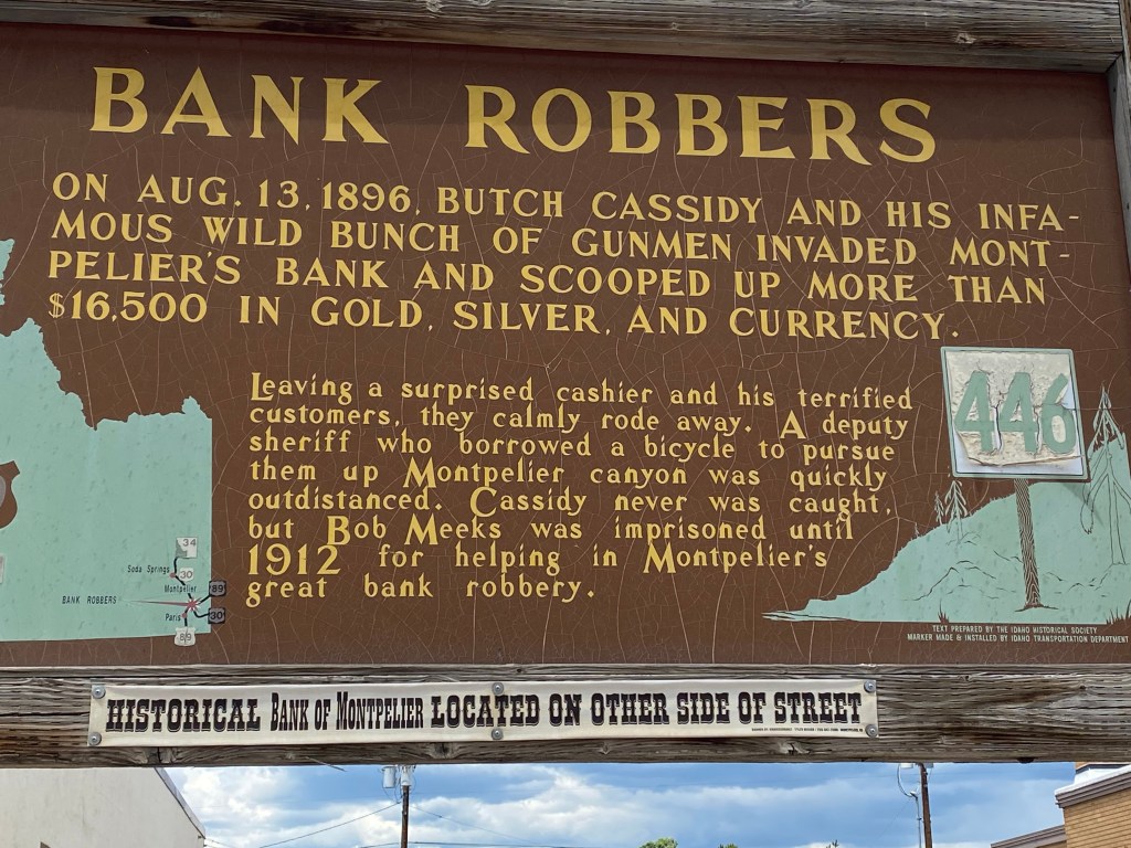
The Bears is the name of the town’s football team (given their proximity to Bear Lake). I also learned that Montpelier was the site of one of Butch Cassidy’s bank robberies.
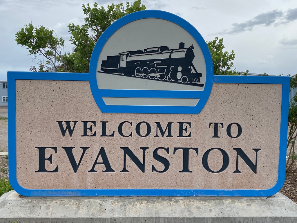
I drove further south and left Idaho to spend the night in Evanston, Wyoming – in the extreme southwest corner of that state. I was born in Evanston, Illinois and when I saw there was an Evanston in Wyoming I couldn’t pass up the chance to stay there.
Tuesday I left White Bird and headed south towards Boise. I opted to take Highway 95 all the way down to Interstate 84 to avoid the construction zone near McCall, and to see some new terrain. I had thought about stopping at the large Birds of Prey sanctuary in Boise but it was approaching 100 degrees when I got to the highway exit (and had been 100 degrees or more both days I was in White Bird). My Airbnb host in White Bird was familiar with the sanctuary but told me it is a large, outdoor facility and there was no guarantee that I’d even see any unusual birds so I decided to pass. If I had known I’d see some California Condors later in the trip, and learn about their connection to the sanctuary, I might have reconsidered. As it is, I will have to make it a point to go there the next time I am in the northwest.
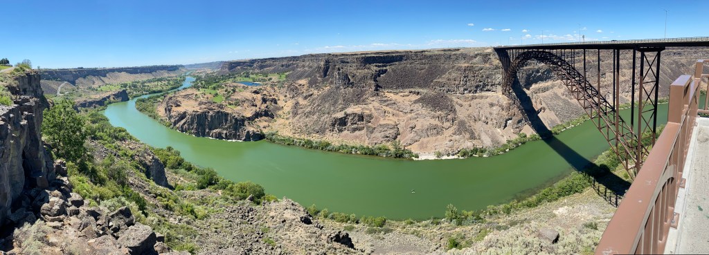
As I arrived in Twin Falls I first had to cross the Perrine Bridge. There was a place to park and take photos on the north side of the river, both looking west (right) and, by walking under the highway, to the east. I’ll skip the westward-looking photo for the moment as I would soon learn that the view looking west was much better from the Visitor Center on the other side of the river. This is a panoramic photo taken as I walked under the highway to get to the east side of the bridge.

And this is the view looking east.
The river you are looking at is my old friend the Snake River and in this photo it is flowing towards you. A little further east of here is the ramp on which daredevil Evel Knievel attempted (but failed) to jump the river back in 1974 on his steam-rocket-propelled motorcycle. The earthen ramp is still there but visitors are discouraged from visiting it as the Twin Falls Police Department uses it as the back of their practice shooting range!
I crossed the bridge (in my car) and stopped in the Visitor Center. That vantage point provides a much better view of the river looking west:

If you look very closely you will see some golf course fairways in the distance, to either side of the river. There are two golf courses down there, one public and one private. Here is a panoramic photo of the river from the Visitor Center, including the bridge.
And here is a photo of the bridge itself.
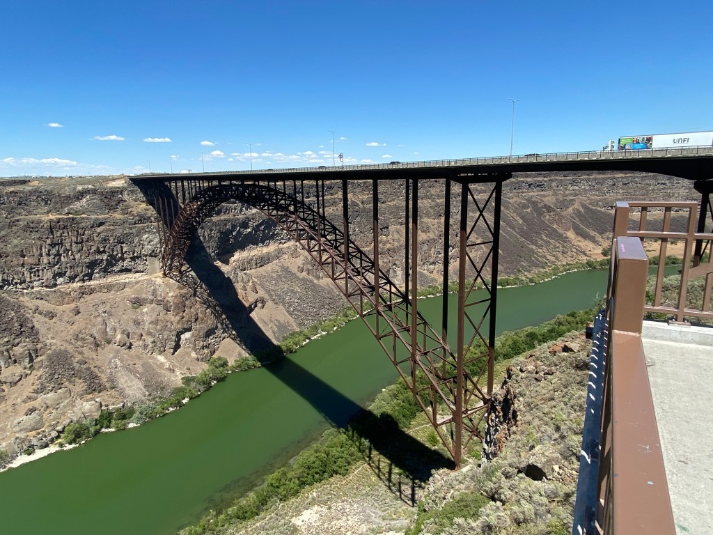
The Perrine Bridge is the only bridge in the US people may “base jump” off of by parachute without needing a permit. I didn’t see anyone doing that while I was there but there were photos in the Visitor Center and I’m sure you can find some online.
Of course the main reason visitors come to Twin Falls is to see the waterfalls. There are many in the area (30 I believe I read somewhere) but the most popular by far are the Shoshone Falls, east of town.

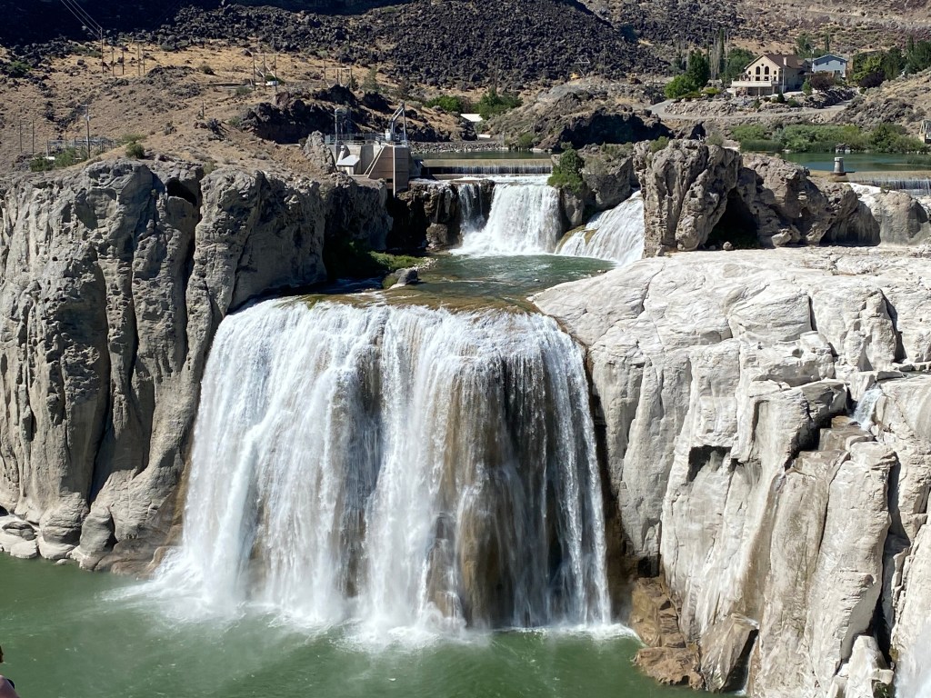
There are some smaller falls to the right, though you have to look very closely at the still photo below to see them. They are easy to spot when the water is flowing, obviously.
The water flow wasn’t nearly as dramatic as it is in the spring after the snowmelt from the mountains further north in Hell’s Canyon. That plus the fact that the water flow is controlled by a dam up-river and the water level overall is unusually low this year.
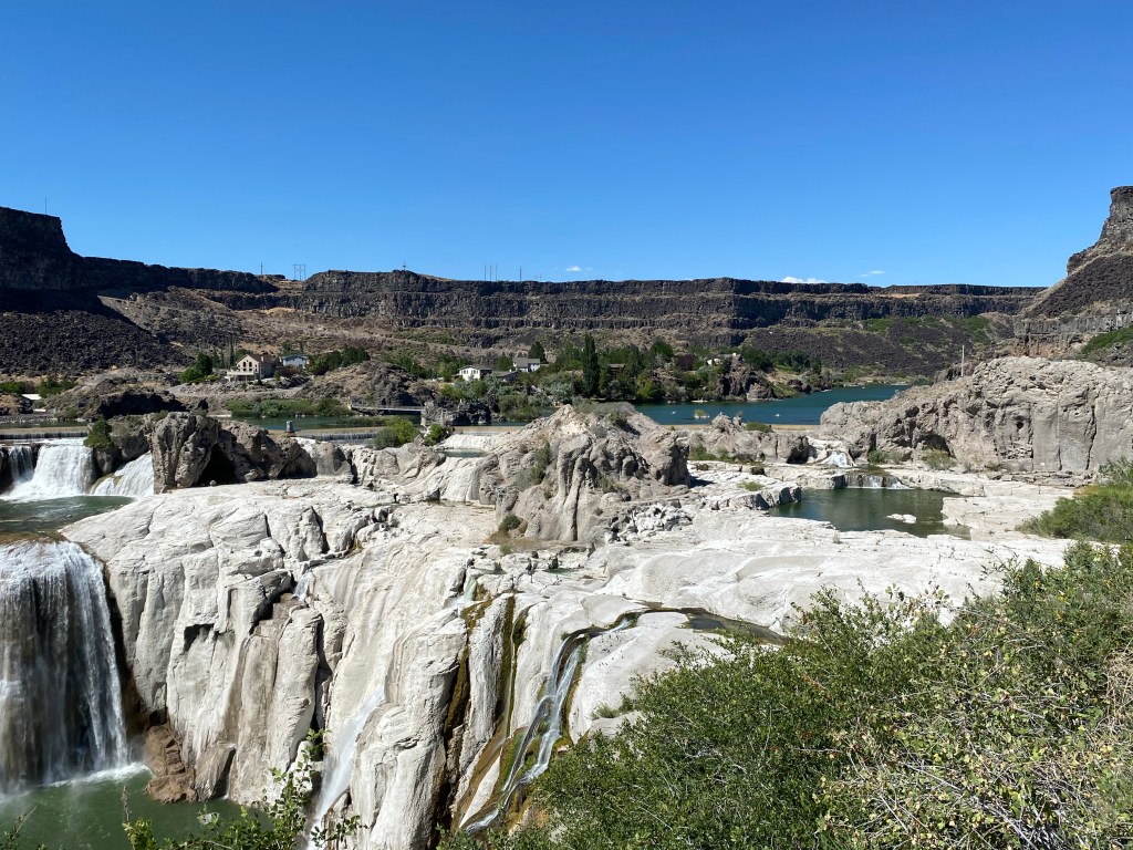
Finally, this is the view from high up in the parking lot, looking at the observation platform with the west-bound river in the distance:

Before leaving White Bird I decided to drive up the “old road”. Highway 95 used to go right through town until the new White Bird Pass opened in 1975. The old road is still there and meets the new road before reaching the old summit. It didn’t appear that the old road beyond that was accessible (it went about 200 feet higher).
The old road was a very slow climb, utilizing long, lazy switchbacks. There were still some old guardrails on some of the sharp curves, although they didn’t look very sturdy. Many of the turns had no guardrail at all, nor did the long straightaways. The road is quite narrow and I wouldn’t want to meet a tractor-trailer going the opposite direction on a curve (or be behind one going up). There were no turnout areas for disabled vehicles. There were very few trees.
I drove all the way up (to where it meets the new road), then stopped at various places on the way down to take pictures. I never met or saw any other vehicles and I will say that the views were spectacular.
The photo above was taken at the turnoff from Highway 95 to the town of White Bird at the base of the mountain. You can see the new highway starting to climb the mountain on the left side of the photo. Way off in the distance, above the town itself and in the center of the photo, you can make out some of the switchbacks of the old road zig-zagging left and right.
The rest of these were taken from near the top as I started to drive back down towards town:

Once I came down the hill a ways this was the view looking back. At the top you can see where the road makes another turn left. In the lower part of the photo you can see a private dirt road leading off to where someone may have lived or had farmland.
In the center of the photo below you can barely see the white guardrails on two left-hand turns further down the hill.

This was looking back at a right-hand turn I had just come through as I descended:

And this was looking ahead at another right-hand turn as I went further down. Note that there are no guard rails at either turn.

There are a few videos on YouTube of vehicles climbing the road. The best one is from a blue pickup truck and runs a little over 7 minutes. Another was taken from a motorcycle and runs about 10 minutes, but the quality on it isn’t as good. There is also at least one video titled White Bird Grade but it is actually of White Bird Pass (the new road).
There is nothing up there and no reason for anyone to go other than to enjoy the views, as I did. There were gates at each end to close the road in inclement weather. It would be fun to drive it on a motorcycle or in a sports car. Just be careful not to run off the road as there isn’t likely to be anyone coming along any time soon to find you!
… and how White Bird got it’s name.
Just north of White Bird (where I was staying for two nights) is the town of Nezperce (see previous post), and just northwest of that is the current center of the Nez Perce Reservation. Nez Perce is one of five federally recognized Native American tribes located in Idaho. It has a rich, and at times, turbulent history.
The tribe was peaceful (when left alone) and it’s members were known as extraordinary horsemen. They are credited with the development of the Appaloosa horse breed. Their name literally means “pierced nose” in French, though there is no evidence that that trait was ever exhibited by their members.
Chief Lawyer, and other members of the tribe, assisted explorers Lewis and Clark in their trek west. Their best known leader was Chief Joseph and there are numerous places named for him throughout the northwest US, as well as references to the tribe itself. At their peak the Nez Perce numbered about 12,000 and at their lowest, 2,000 on the early 1900’s. Today there are about 3,500 members of the Nez Perce tribe.
The Nez Perce homeland originally included most of central Idaho as well as parts of western Montana, southeast Washington and northeast Oregon. In 1855 a treaty established approximately 17 million acres as being the “official” reservation. Later, in 1863, another treaty slashed the size of the reservation down to only 750,000 acres. Many tribe members, including leader Chief Joseph, called it the “Steal” treaty and refused to acquiesce and move to the smaller area. This conflict eventually escalated to become the Nez Perce War, which started about a half mile from current day White Bird on June 17, 1877.
There is a scenic overlook on “new” Highway 95, just north of White Bird which has an information shelter explaining the conflict. It calls this the White Bird Battlefield.
US Army cavalry members approached a Nez Perce settlement here and, though the peaceful tribe members tried to surrender, shots were fired and the conflict quickly got out of control. The tribe members successfully held off the US forces (with loss of life on both sides) and the battle continued at other venues until Chief Joseph finally surrendered to US troops in Montana on October 5, 1877, ending the war. Chief White Bird (aka White Pelican), led this portion of the tribe and had a loyal following of about 50 men, second to Chief Joseph with 60 and ahead of Chief Looking Glass with 40. Chief White Bird led the battle here which is why the battlefield, and now the town, are named for him.
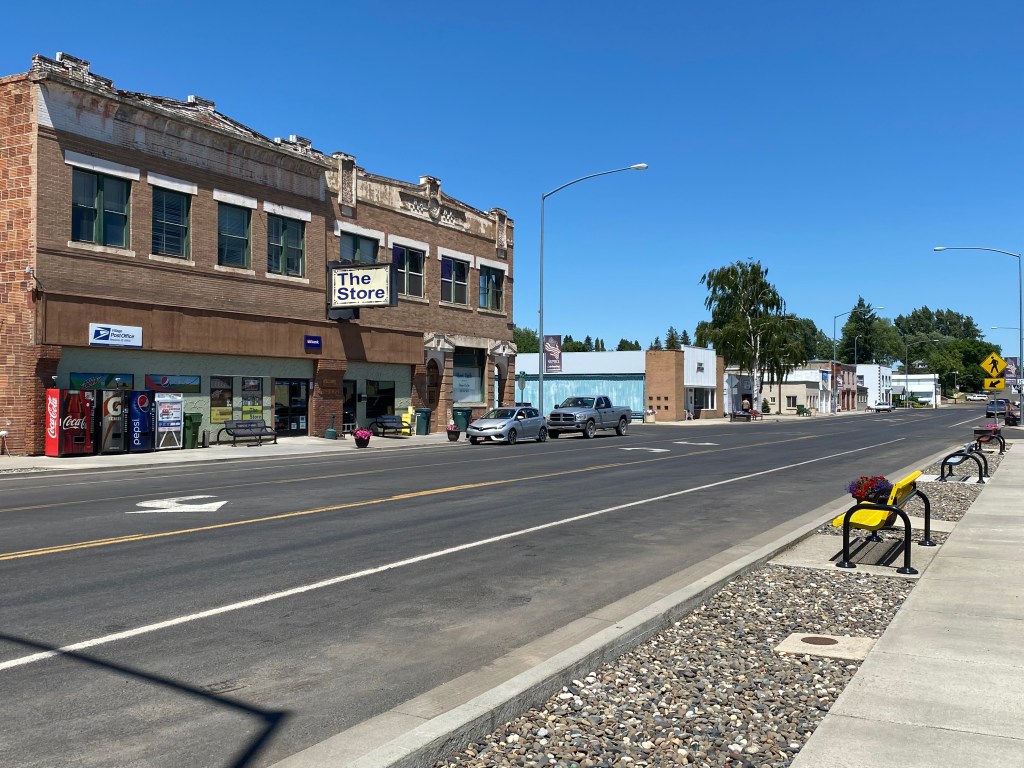
This post is about Nezperce (the town) as opposed to Nez Perce (the Native American tribe). The tribe plays a HUGE role in the history of the area and I will address it in a future post. The town of about 500 residents is located just southeast of the current reservation and apparently has nothing to do with the tribe itself. Curiously the town and (much of) the reservation are located in Lewis County while the “headquarters” of the tribe is located in the town of Lapwai which is in Nez Perce County, immediately to the west of Lewis County.
I kind of stumbled upon the town as I was out driving through farmland north of Grangeville. I saw a sign for it and I knew the name from previous trips out west.
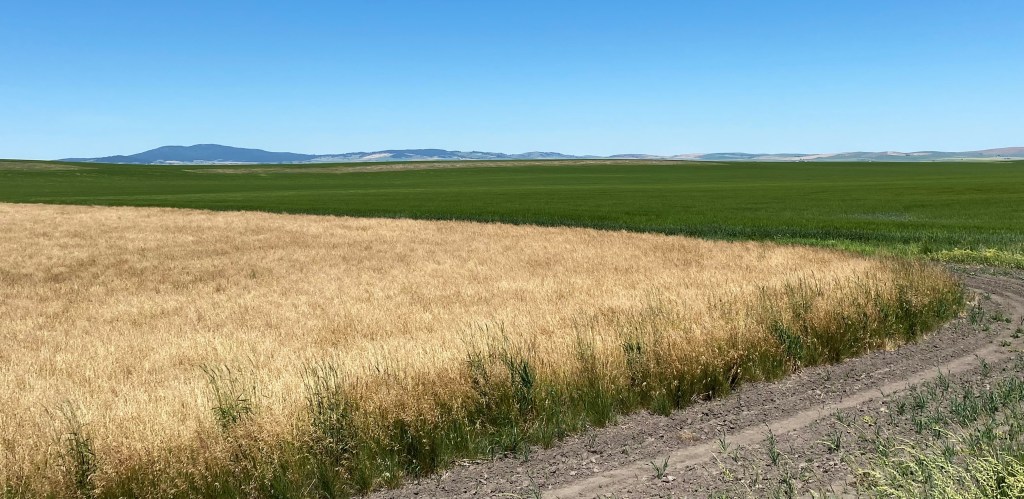
Much of the farmland in Idaho is for growing potatoes (this IS Idaho after all…). I believe the green field in the photo below is potatoes.
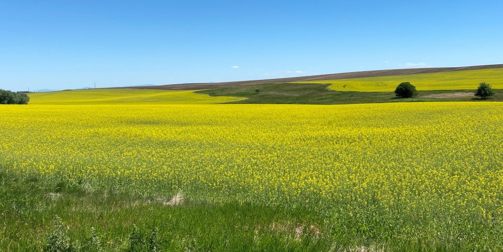
That I expected, but I was surprised at the number of fields in this region where canola is grown. As you will see, canola fields are a very impressive yellow in color.
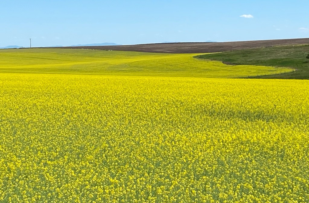

I finally arrived in little Nezperce. By the way, the town (and the tribe) are pronounced NAY pear-SAY. The town name is presented as one word but the tribe is two words.
And this is the arena where they undoubtedly hold rodeos and such:

I drove through town (it didn’t take long!) and when I turned around to head back out the way I came in I noticed this piece of artwork in someone’s front yard:

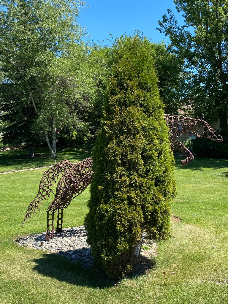
If you zoom in you will see that the horse is made completely of old horseshoes welded together! Very clever and impressive. Later in my trip I would see a pickup truck in New Mexico which belonged to an artist who constructs such pieces of art.
My second surprise in the region north of White Bird and Grangeville was learning about and seeing some of the amazing railroad bridges. First, a word about the name. Camas is short for Camassia – a plant which thrives in open, moist fields (the bluish-purple blooms in the photo below).
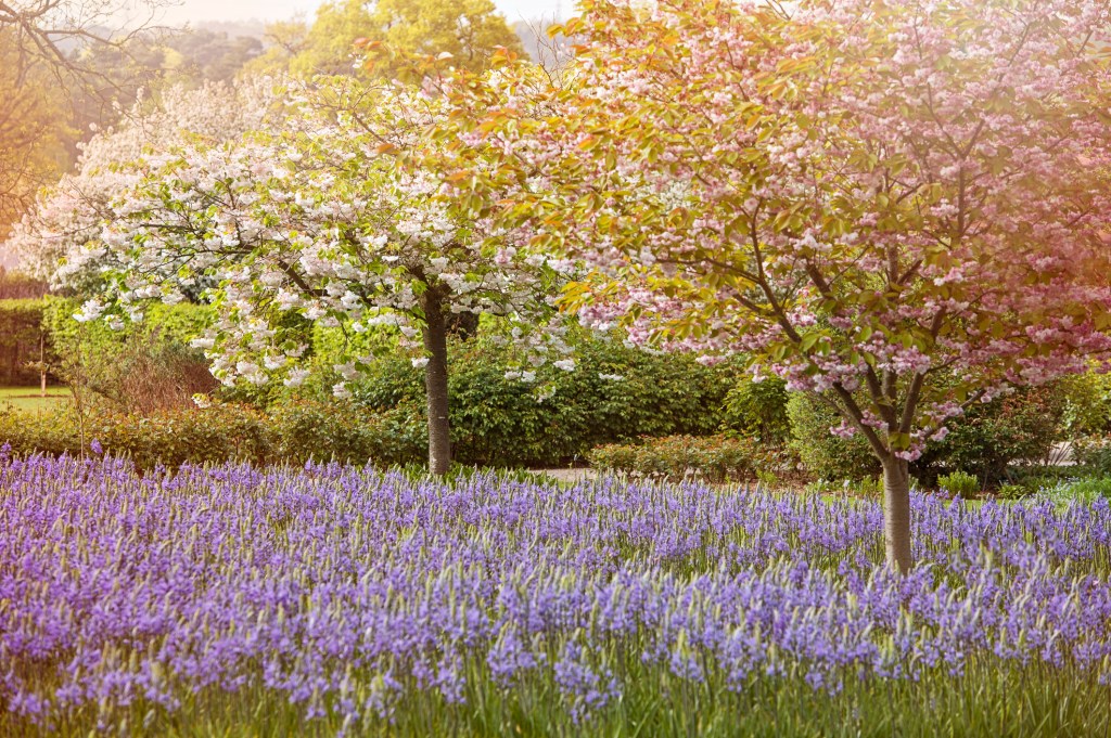
(Photo credit: Getty Images, Copyright: Jacky Parker)
There are many such areas in Idaho, Montana, Oregon, Washington and the southern portions of the western Canadian provinces. Tolo Lake, west of Grangeville, is also located on the “Camas Prairie”.
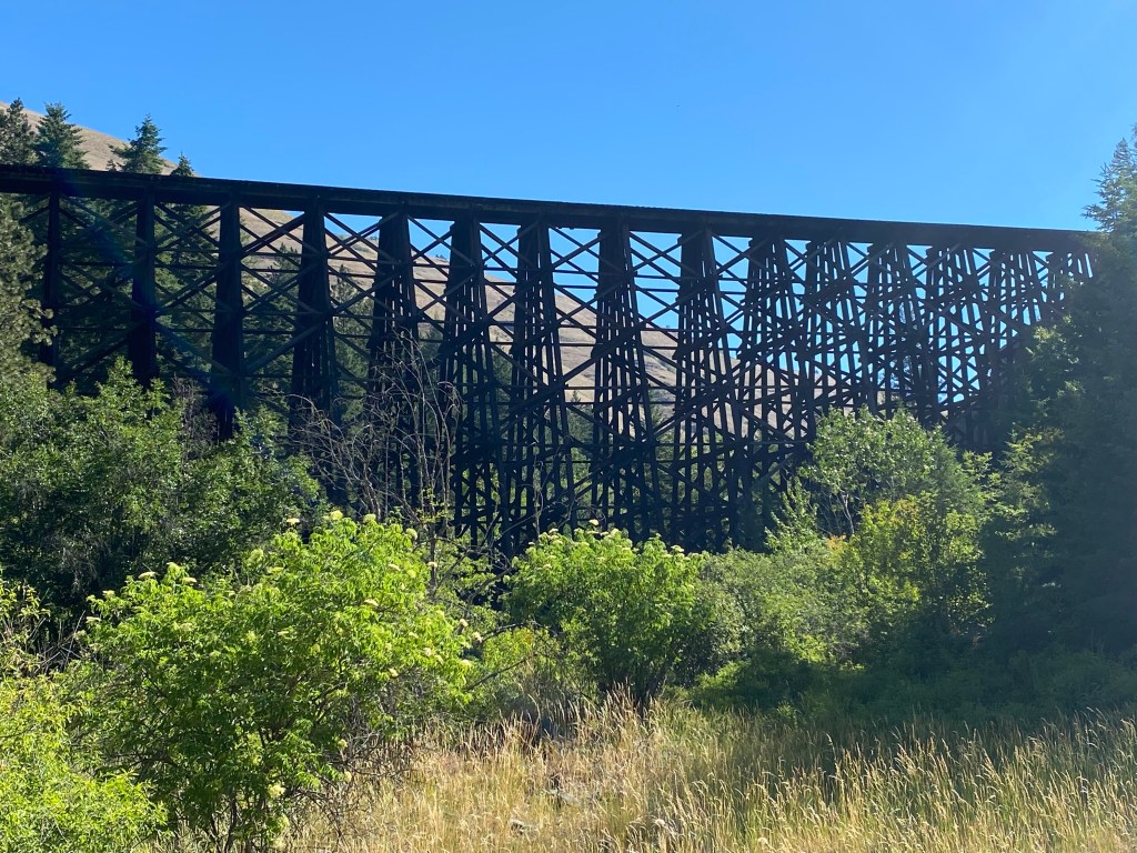
I started seeing some tall, wooden railroad trestles way up high on the hills as I drove along Highway 95, between Cottonwood and Lewiston.

The Camas Prairie Railroad was a joint project of the Western Pacific and Union Pacific Railroads and operated for almost 80 years until 1975. Much of it was built up high on the mountains and many trestles were needed to carry the tracks over canyons and valleys between hilltops. As you will see on a sign later in this post, in one 5-mile stretch there were more than a dozen wooden trestles, some very long and tall, earning the railroad the nickname “the railroad on stilts”.

It is hard to see the wooden trestle in the photo above. It is actually the first one I saw and my eyes were drawn up to it because it was being lit by the (then) late afternoon sun. I’m still kicking myself for not stopping to take a photo of it at that time but I didn’t learn about the others until later. The photo above wasn’t taken until the next morning, when the sun was behind the trestle.
Here are some of the other trestles I could see from the highway:


In addition to the wooden trestles, tunnels were built through some of the mountaintops – including one which was in the shape of a horseshoe. Also, there were some places, such as over Lawyer’s Canyon, which required a metal bridge be built. That bridge still stands today:
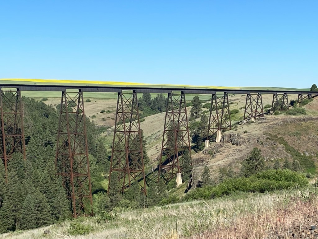
The yellow line above the tracks is actually actually comprised of plants in a field way off in the distance. You’ll see more of them in another post.
Here are two signs about the railroad which I found next to the highway:

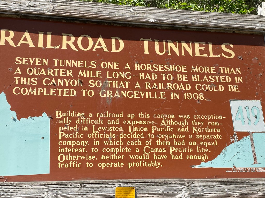
Unfortunately the railroad, as well as several smaller ones which connected to it, was never profitable and was eventually abandoned. While most of the trestles still stand (one wooden one was destroyed in a wildfire and was never rebuilt) the tracks between them have largely been removed.
Books have been written about the railroad and you can find many other photos of some of the huge, in some cases curved, trestles, by searching the internet for the name of the railroad and adding “bridges”.
