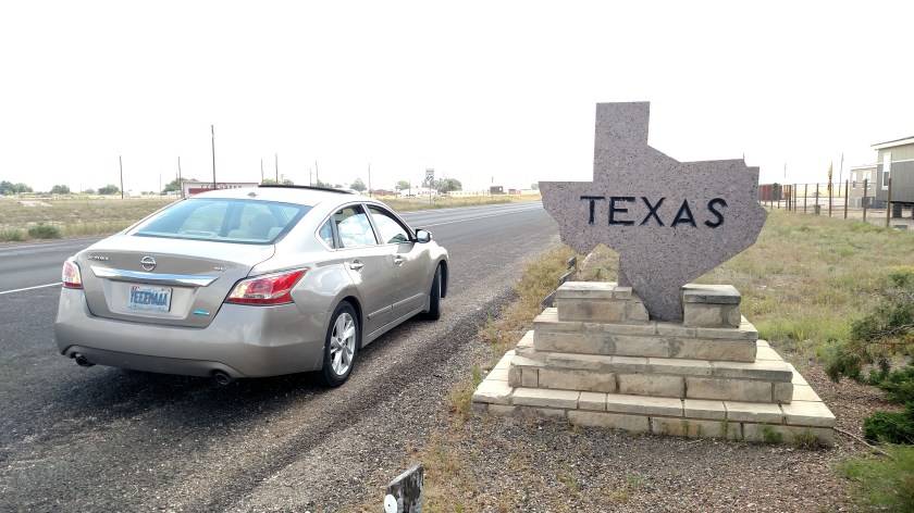
Welcome (back) to Texas?

May 31 & June 1, 2017

After leaving the underground portion of Carlsbad Caverns I drove around some of the scenic surface roads in the National Park there and then went back to the Visitor Center to study many of the indoor displays there.

IMG_20170531_140517896

IMG_20170531_100426973

I then headed out to the main road and continued about 40 miles further south to see a  National Park I have not been to yet.  This meant crossing back into the state of Texas from where I had been in southeast New Mexico.

I hadn’t noticed when I first entered Texas almost three weeks earlier that the entry signs welcoming you to the state were rather puny:

IMG_20170531_165807687_HDR

When I crossed from Louisiana into Texas I did so by crossing a river on a bridge, so I really didn’t notice a sign indicating I was then in the Lone Star State.  The photo above is of the sign I saw when I crossed back into Texas from New Mexico.  Evidently the people who made this rather nice sign out of stone didn’t get the “everything’s bigger in Texas” memo…   More on that later.

I continued south and stopped at the Visitor Center for the Guadalupe Mountains National Park.  I learned there that there are no roads in the Park and that the only ways to access the Park’s rugged peaks is by hiking in on foot or riding on horseback.  Not for me…

The weather had become rather threatening anyway so I stayed in the Visitor Center for a while to wait for the heavy rain which soon arrived to pass.

IMG_20170531_153155780

I drove around a little more before heading back to Carlsbad.

IMG_20170531_163348692

IMG_20170531_165727851

While I was going through pictures for this post I discovered a few I had taken of a rest area in another part of Texas which I had seen about a week earlier (obviously on a much nicer day):

IMG_20170525_150013631

IMG_20170525_150123521

Since they were in Texas I figured I’d include them in this post.

I headed back to Carlsbad for dinner (tacos at a highly recommended food truck) and went back to my Airbnb to monitor the weather radar.  I decided against returning to Carlsbad Caverns for the nightly bat exodus which, as it turns out, was cancelled for that evening anyway.

The next day I headed northeast from Carlsbad to travel to the Texas panhandle and the town of Lubbock, where I would be spending one night.  This meant crossing into Texas one more time, and another small, stone sign:

IMG_20170601_104838288

Before getting to the Texas state line I  had driven through the town of Hobbs, New Mexico.  They are not at all shy about welcoming people to their little slice of the world:

IMG_20170601_113449608

To demonstrate how large those letters are, that’s my car parked off to the left.

OK, Texas, it seems that Hobbs has thrown down the gauntlet.  Looks like you have your work cut out for you….

Carlsbad Caverns – Post 1 of 2

May 31, 2017

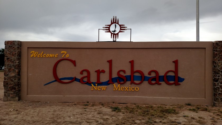
After having traveled east from Las Cruces through the towns of Ruidoso and Roswell I spent the first of two nights in the town of Carlsbad, in southeast New Mexico.  Today I was going to devote the majority of the day to visiting Carlsbad Caverns National Park, about 20 miles southwest of town.  My older brother was born in Albuquerque, New Mexico and as long as I can remember I have wanted to visit Carlsbad Caverns.


HobbsMap

(Photo credit: wiki-travel.com)

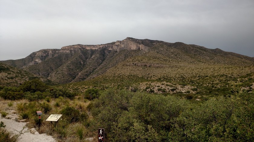
Carlsbad Caverns National Park covers about 73 square miles (above ground).  The elevation is listed as 3,599 feet above sea level, although that number ranges from 3,596 to 6,368 within the Park.  The town of Carlsbad is at 3,295 feet elevation.

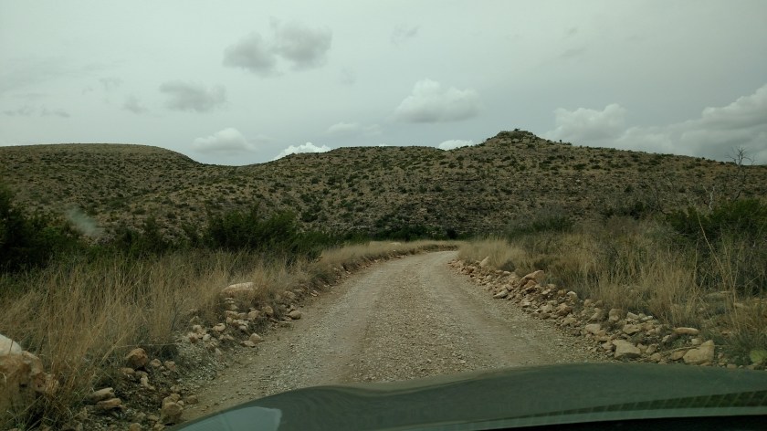
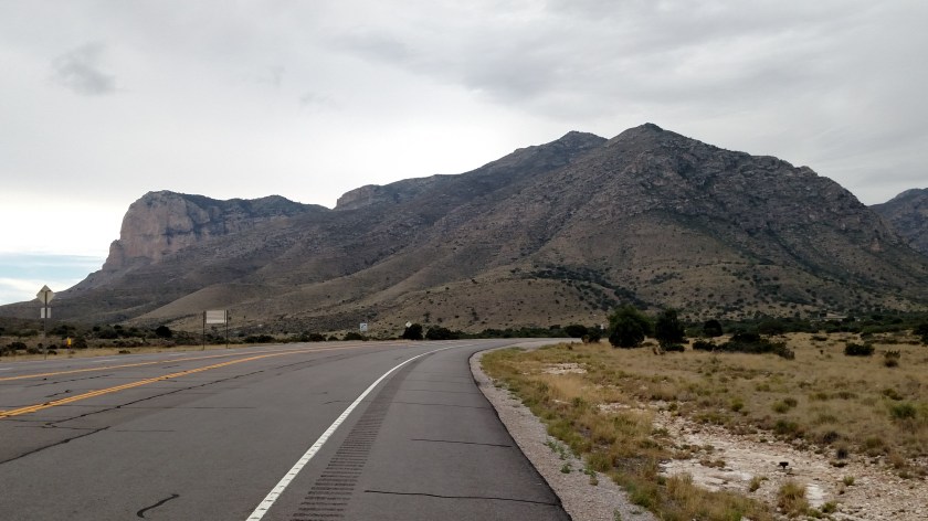
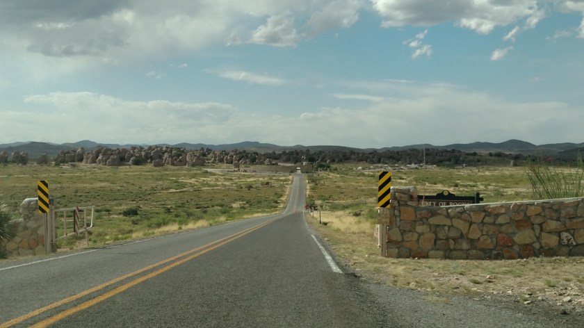
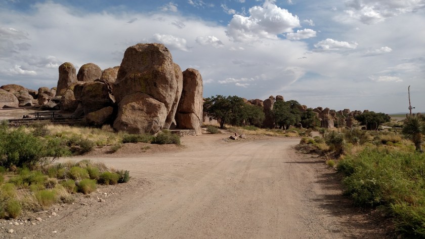
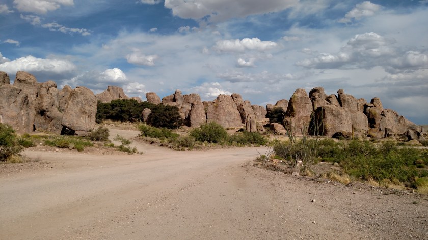
On the road in to the Park from the main highway it was apparent that I was gaining altitude.  As you can see, the vantage point from which I took these photos is higher than the road I came in on.

IMG_20170531_092535602_HDR

IMG_20170531_093035478

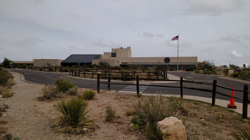
The Visitor Center is located at 4,406 feet elevation.

IMG_20170531_104332427

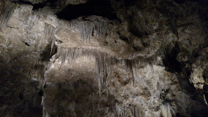
While there are other things to see and do on the property, most people come here for the namesake cave – Carlsbad cavern.  There are over 110 caves in the Park but only three are open to the public.  Carlsbad, covering 8.2 acres, is by far the largest.

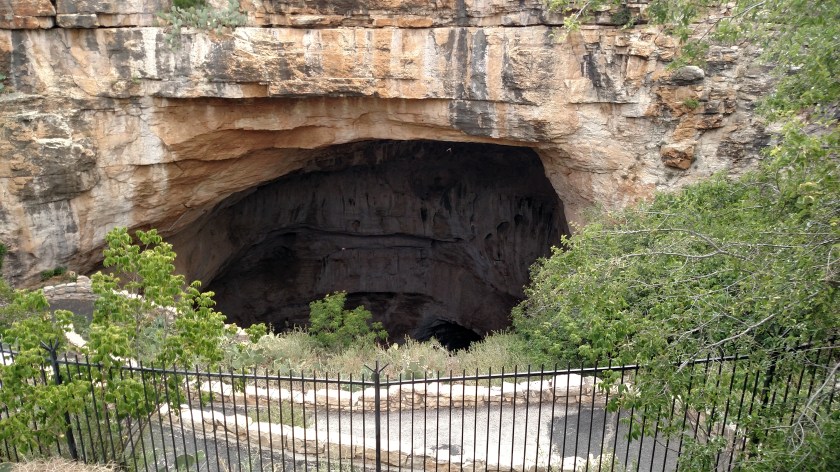
From the Visitor Center the way most people descend to the cavern is through the cleverly named Natural Entrance.  In front of that entrance is an amphitheater:

IMG_20170531_101352012

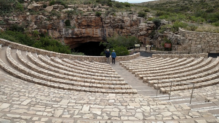
Two things happen here.  For most of the day when the Park is open a ranger speaks to groups of people who are about to descend into the cavern (not in all the seats, mind you – only small groups).  Basic rules are explained (don’t run, use your indoor voice, don’t bother the bats, etc).  One extremely useful piece of advice was to put our cell phones in Airplane mode.  She explained that if you don’t do that you will probably exhaust your battery as your phone searches frantically for a cell signal (which it won’t find underground).  Although there were lots of cars in the parking lot everyone had plenty of room to scatter out so I never felt crowded at all.

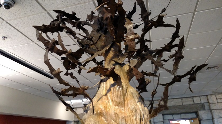
Oh, did I mention the bats?  The other use for the amphitheater seats (which many times probably does fill them all) is the nightly ritual of thousands of bats exiting the cavern in search of food.  Thousands and thousands of Mexican freetail bats call the cavern home.  Each night a single bat can consume up to half it’s body weight in insects.  Since I missed the “bat show” when I was in Austin earlier this in trip I seriously considered coming back in the evening but strong thunderstorms were forecast to develop in the afternoon (they did – not a bad day to be underground) and there was a possibility they would cancel the event for safety (they did).

OK.  Before I take the plunge let me show you what I’m in for:

carlsbadmappostcard

(Photo credit: carlsbadnewmexico.com)

The photo above is on a postcard sold in the Visitor Center.  From the Natural Entrance one must descend approximately 750 feet to get to the cavern floor.  Don’t be misled by the image above – once you’re down there it is fairly level.  Note that the gold color band is about 800 feet down but the lines follow the contour of the surface.  The far end of the “Big Room” is closer to 600 feet down than 800.

At the right side of the photo is a depiction of the Seattle Space Needle which is about 600 feet tall.  The bulk of the cavern is further underground than that.

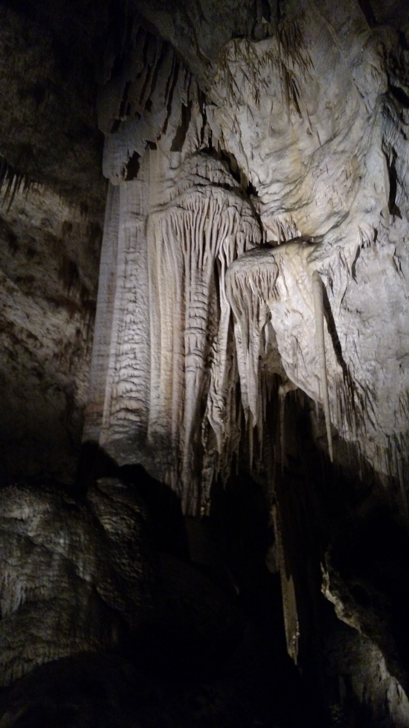
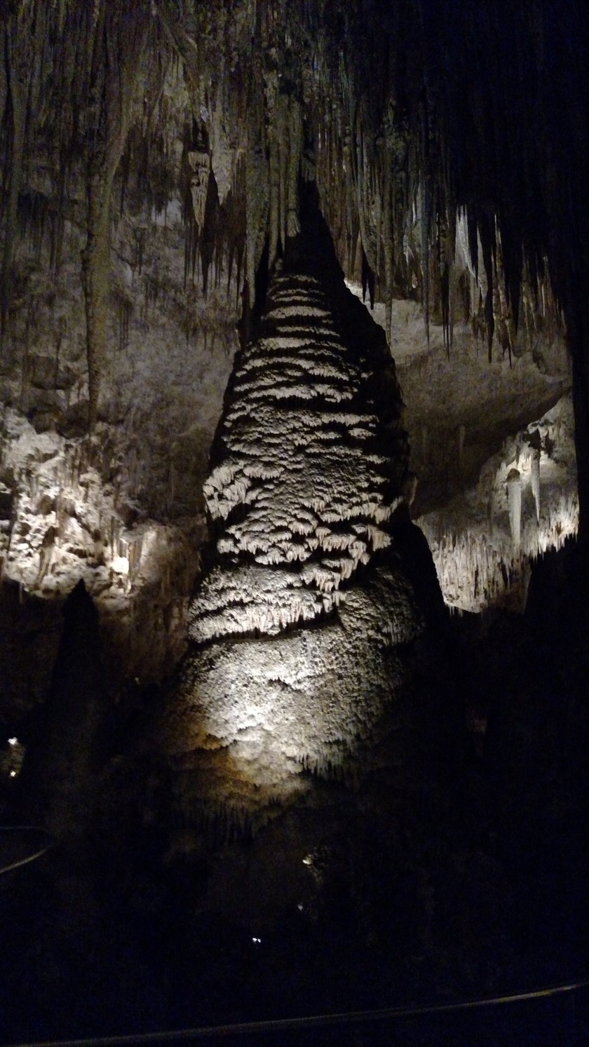
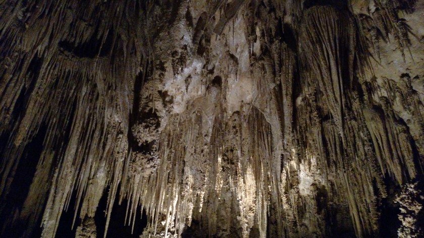
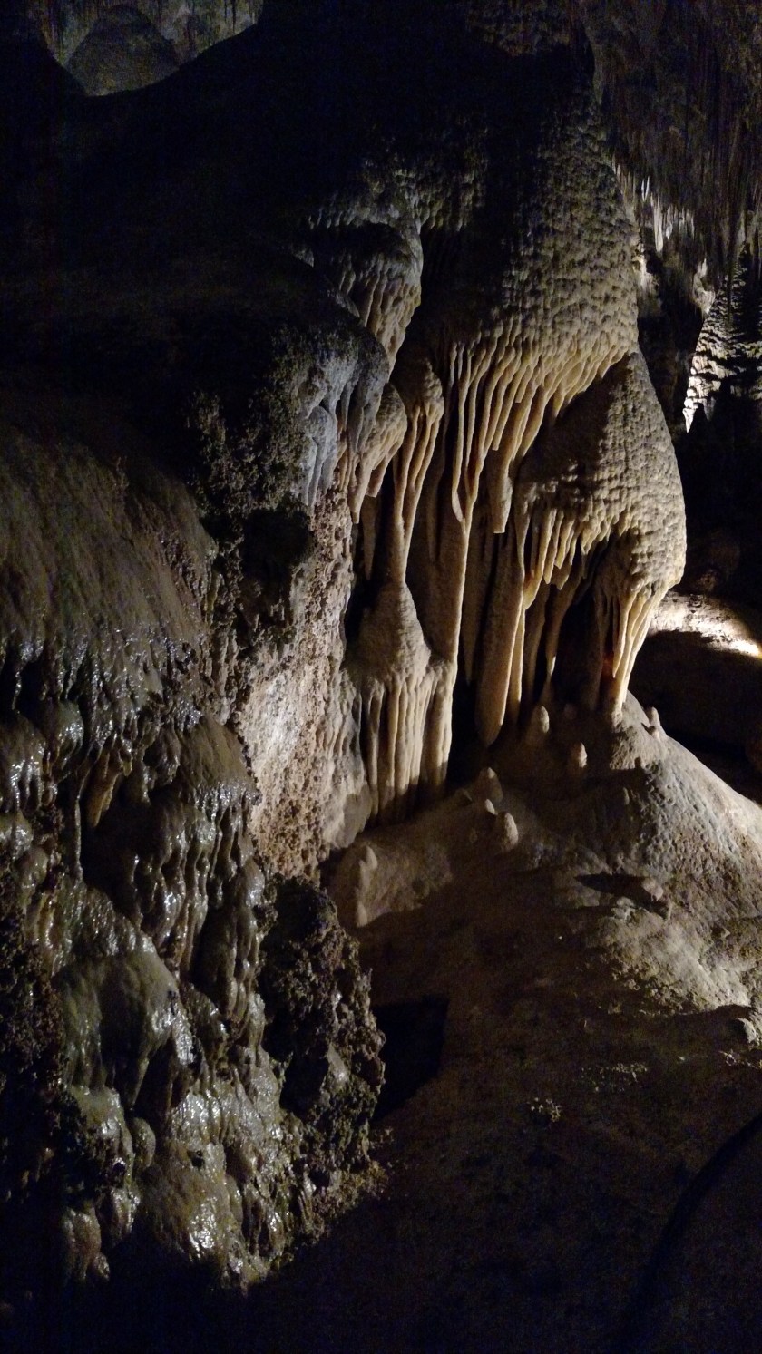
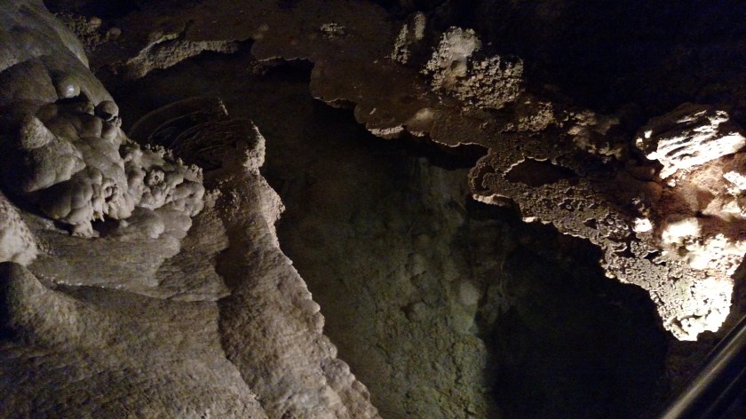
There is a paved pathway the entire length of the cavern which dictates where you may go.  There are sturdy metal handrails most places (both to hold on to and to keep people from straying off the path).  Many of the formations are lit up and although the lighting is generally dim I had no feelings of claustrophobia or being in an extremely dark place.  Most of the cavern is wheelchair accessible and there are emergency call stations located throughout the cavern to summon help in a medical emergency.

Once the small groups are “released” by the ranger at the entrance everyone is on their own.  The cavern tour is “self-guided” and you may take as little or as much time as you like during business hours.

I believe the entire length of the path is about a mile and a quarter, including the descent.  A great feature (especially for me) is that there is an elevator to take you back up to the Visitor Center (believe me, I didn’t mind going down but there was no way I was going to climb back up 750 feet, the height of a 75-story building!).  Those with problems walking or in wheelchairs may also ride the elevator down.

OK – let’s do it:

IMG_20170531_101513395

IMG_20170531_101654003

IMG_20170531_101740140

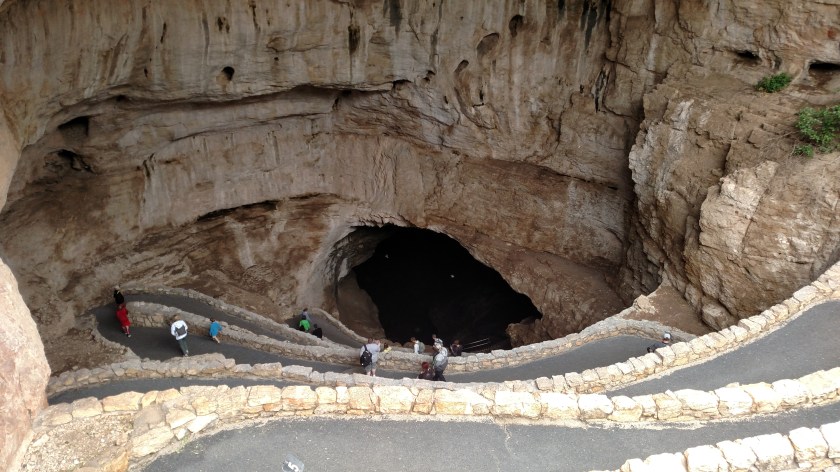
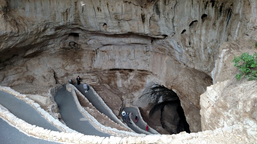
There is a steep series of switchbacks which take you down in to the cavern.

IMG_20170531_102947252

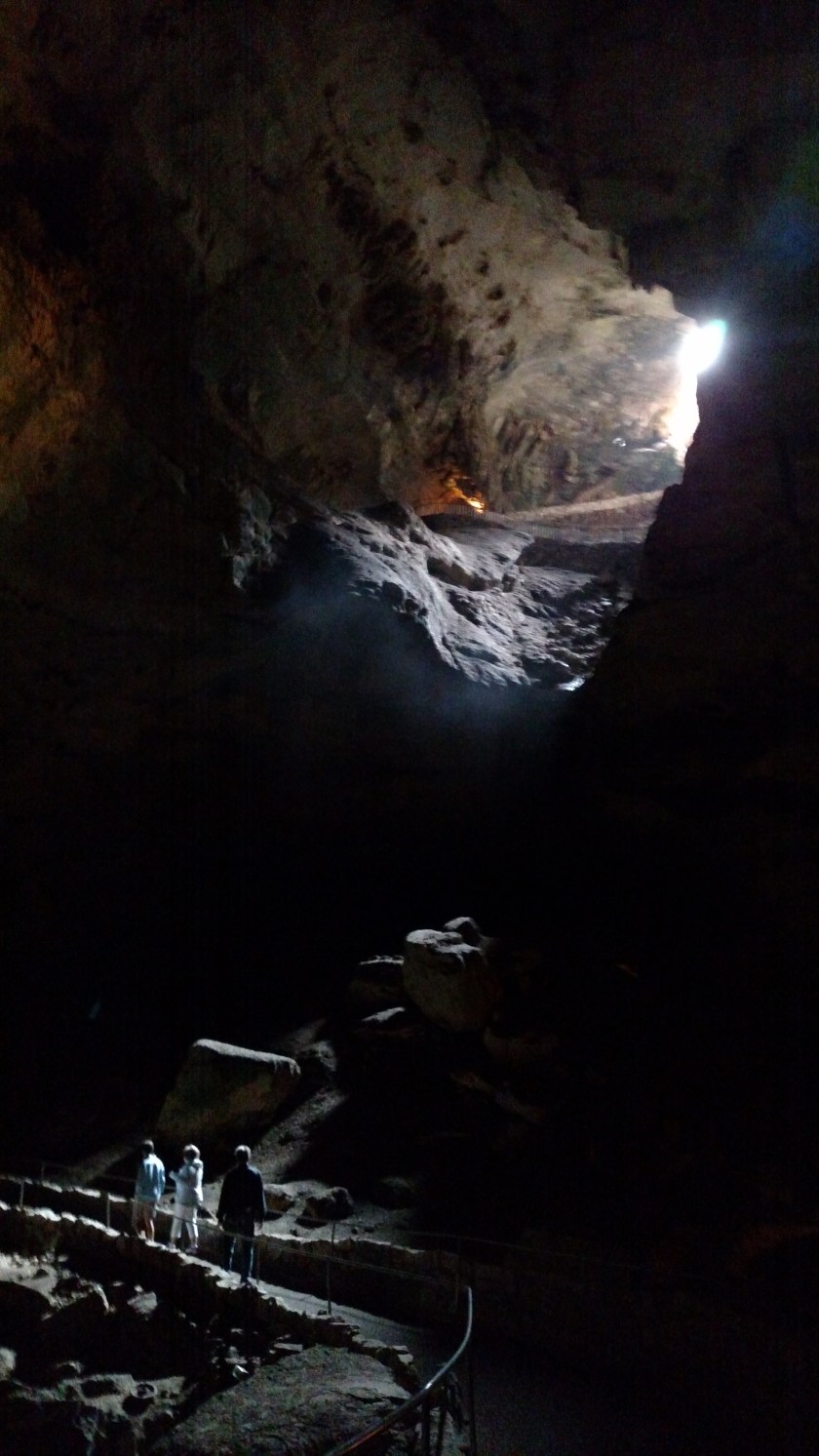
One last look up at “daylight”.  Not too late to turn back….

I proceeded down and spent a total of about 4 1/2 hours in the cavern.  As I will explain in the next post, my photos are terrible.  Many formations are lit up and although using a “flash” is allowed they ask that everyone be mindful of others and not get “flash happy”.  I tried using my flash once or twice but found that it made things worse.  I had all day and just took my time, stopping frequently to put my phone/camera away and just look with my own eyes.   I actually try to do that everywhere I go.   Believe me – this place is incredible and it was nice to just take a break and stand and stare…..

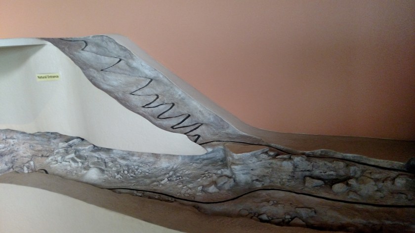
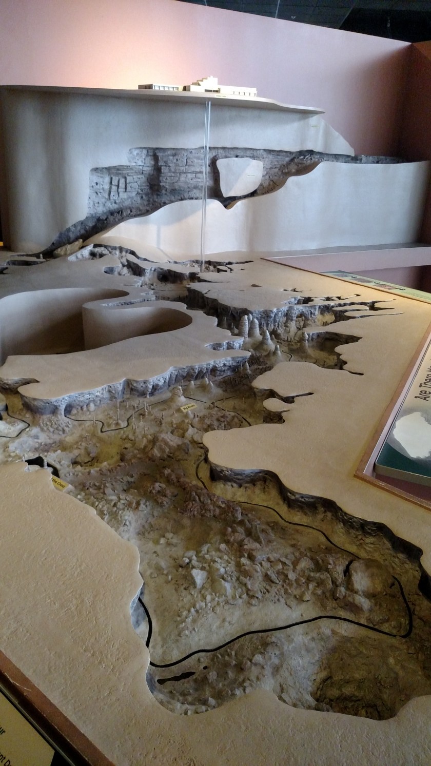
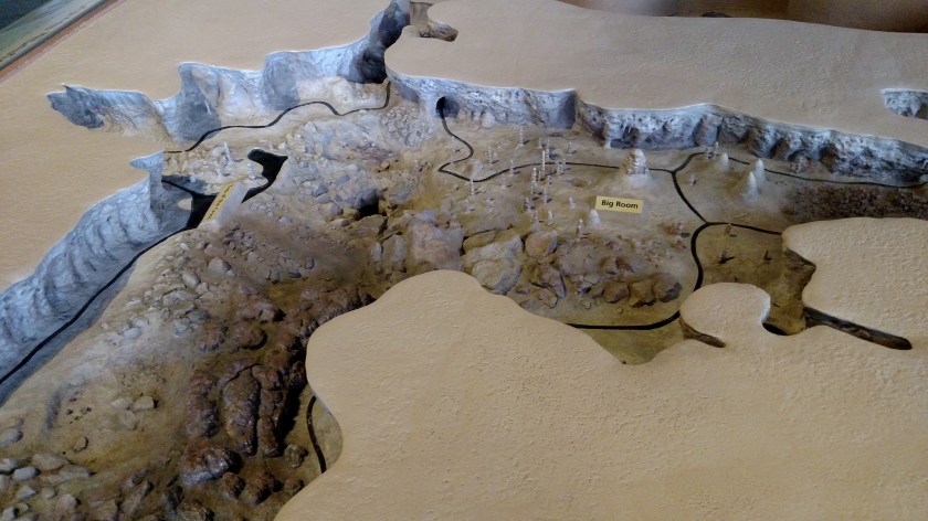
When I got back up to the Visitor Center I saw a, presumably scale, model of the cavern.  You can clearly see the steep descent at the entrance, the elevator shaft, and I took two photos showing much of the “Big Room,” the main chamber.  My photos might make it appear that everything is right in front of you but you are often in huge “rooms” with high ceilings and many formations are off in the distance.  The Big Room is 4,000′ long and 625′ wide.  At it’s highest point the ceiling is 255′ high.

IMG_20170531_141750217

IMG_20170531_141643897

IMG_20170531_141702454

IMG_20170531_141714022

Carlsbad Caverns is truly amazing and is among the highlights of my recent trips.


Carlsbad Caverns – Post 2 of 2

May 31, 2017

This post contains photographs I took while visiting Carlsbad Caverns National Park in southeast New Mexico.

HobbsMap

(Photo credit: wiki-travel.com)

I arrived in the town of Carlsbad the night before, after having visited Ruidoso and Roswell on my way east from Las Cruces, NM.  The Caverns are about 20 miles southwest of the town of Carlsbad.

IMG_20170531_174830616

This post contains photos I took the day I was there.  While I took well over 200 pictures I was extremely disappointed to discover that most of them are not blog-worthy.  In fact, they are terrible!  While the formations I was photographing were clear on my smartphone’s screen evidently a combination of low-light and the slightest movement of the camera as I triggered the shutter was just enough to result in about 200 blurry pictures.  Here are a few that came out reasonably well.  As I mentioned in Post 1, I am so glad that I took lots of time to go through the Cavern and that I periodically put my camera away and just looked at my surroundings.  At least now when I look at my blurry photos I am at least reminded of the things I saw with my own eyes which my mind can recall more clearly.

Post 1 of 2 (above) will explain a little bit about where I am and exactly what you are seeing.

IMG_20170531_112921689

IMG_20170531_113026052

IMG_20170531_113118232

In the photo above, the formation on the right, named Giant Dome, is what’s known as a column.  The formations on the left, named Twin Domes, are stalagmites (pronounced sta-LAG-mites).  A stalagmite is a generally cylindrical cone which rises from the floor of a cave.  A stalactite, on the other hand, is a similar shape which descends from the ceiling of a cave.  A column is formed if and when the two meet.  The way I was taught as a kid to tell the difference between a -mite and a -tite was that a stalactite (which hangs down) has to “hold on tight”.

IMG_20170531_113207096

IMG_20170531_113535464

IMG_20170531_121404381

IMG_20170531_121913876

IMG_20170531_122258124

Below is a pool of crystal clear water, one of several I saw:

IMG_20170531_122602719

To see much better photographs you should check out the National Park Service website.  Go to nps.gov/cave then click on “Learn About the Park” then click on “Photos”.  That logic applies to every National Park in the US National Park system (just change the “cave” portion of the url to the name of the desired Park).

Here is a quote from the NPS website regarding Carlsbad Caverns:

“Photos can never fully capture the grandeur of the Big Room, it’s a place you need to see to believe!”

Amen to that!!  Everything that Roswell wasn’t was more than made up for by the magnificence of Carlsbad Caverns.   I highly recommend a visit in person.


Art in Roswell, New Mexico – Post 1 of 2

May 30, 2017

After I determined that the UFO-related venues in Roswell were somewhat of a bust I was very pleased to find somewhere else to spend some of my afternoon in town – the Anderson Museum of Contemporary Art.  Here are some of the things I saw there:

First, an example of kinetic art.  Imagine the 3-D canvas which, rather than being flat, is comprised by a full-length series of the letter W sticking out at you across the entire width.  I wasn’t very good about taking photos of the little “card” next to the art pieces which credit the artist and explain what the item is called and constructed of.  One famous artist whose work contains many, many examples of this style is Yaacov Agam who, as I write this, is still living.  If you ever get a chance to see his work in person, do so!

In this work, when you view it from the left side you see mainly blue lines with smaller white spaces:

IMG_20170530_150100684_HDR

From the right you see mainly white with smaller areas of blue:

IMG_20170530_150112014

When viewed head-on you see a mixture of the two.

IMG_20170530_150122155_HDR

AND you now see what appears to be three dimensional blocks, suspended in space.  Also, look at the shadow at the bottom to see what I was referring to with the “W””s.

Now, imagine that concept with colors, shapes or pictures and you’ll see examples of Agam’s work.

Here are some three-dimensional wooden shapes which fit together like pieces of a jigsaw puzzle and are contained within a cradle (the first two) or a frame:

IMG_20170530_145537861

IMG_20170530_145543062

IMG_20170530_151343281_HDR

Here is an image created by making cigarette burns in a piece of paper:

IMG_20170530_145700484

IMG_20170530_145707080

And finally, this colorful and shapely mask which is ceramic:

IMG_20170530_144621201

Artists are very clever!


Art in Roswell, New Mexico – Post 2 of 2

May 30, 2017

After I determined that the UFO-related venues in Roswell were somewhat of a bust I was very pleased to find somewhere else to spend some of my afternoon in town – the Anderson Museum of Contemporary Art.

I was intrigued by these sharks made largely from golf bags:

IMG_20170530_150907066

IMG_20170530_144655009

IMG_20170530_144721111

IMG_20170530_144756459

And this one made from a handheld vacuum cleaner:

IMG_20170530_144707809

And this spider made from a toaster:

IMG_20170530_144859884

And this spaceship made from a model of an old-style mobile home:

IMG_20170530_144823525

NASA, take note….

Roswell, New Mexico

May 30, 2017

After having been in the Las Cruces area in southwest New Mexico for the 4-day Memorial Day holiday I now shifted my attention to the southeast portion of the state, specifically Roswell and Carlsbad, two of the towns my visit to which were abandoned during my tornadic visit to the state in 2014.


HobbsMap

(Photo credit: wiki-travel.com)

From Las Cruces I traveled northeast past Alamogordo and Cloudcroft to the Ruidoso area (far left on the map above) and drove a scenic loop up there in the mountains.  From there I proceeded east to Roswell.

Those of you who know me are probably not surprised to hear that I was somewhat of a UFO geek in high school (late 60’s, early 70’s).  For UFO enthusiasts Mecca is Roswell, New Mexico.  In 1947 the US government allegedly recovered a flying saucer which had crashed near Roswell, along with the bodies of the crew.

When I discussed a possible visit to Roswell with a friend who lives in New Mexico back in 2014 he said “don’t bother going there – it’s just a tourist trap”.  I told him “Mark, I can’t go to southeast New Mexico and not have aluminum foil on my head”.   I didn’t plan to be there all day but I at least needed to make an appearance.

Well, I finally made it to Roswell:

IMG_20170530_125053478

IMG_20170530_141650233

I spent about two hours going through a UFO museum downtown and walking up and down the main street observing how the local merchants were using the notoriety.  Can’t say I blame them.  I did have a great lunch at a nice little restaurant and after having complimented the kitchen staff before I left was given an additional salad to take home for dinner (the owner literally tracked me down on the street as I was walking back to my car, talking to fellow travelers who had eaten at the table next to me).

Despite not having very high expectations I must say I came away VERY disappointed.  Something I learned, which perhaps I already knew deep in my mind, was that the UFO didn’t actually crash in Roswell but about 75 miles northwest, closer to Corona (where, ironically, my friend Mark lives with his wife).

IMG_20170530_130649617

I had spent a night in their home back in 2014 (when he convinced me to go north to Santa Fe and Taos rather than south to Roswell and Carlsbad) and he never mentioned this fact.  The reason Roswell gets the notoriety is that the “remains” of the craft and crew were supposedly taken to the closest military base at the time, the Roswell Army Air Field.


Damsel in distress?

May 30, 2017

On my way to Roswell, New Mexico from where I had been staying in Las Cruces I discovered this Wildlife Refuge northeast of Roswell:

IMG_20170530_154942288_HDR

Among other things, this facility boasts the largest variety of odonates in North America, around 100 different kinds.

Whoa.

Odonates? you ask…..

Dragonflies and damselflies.

The difference? you ask…

At first I thought it was a boy/girl thing but the actual distinction lies in a physical trait other than gender. When at rest, a dragonflies wings remain perpendicular to it’s body. A damselfly, on the other hand, sweeps it’s wings back almost parallel to it’s body when at rest.

Witness, a Common Blue damselfly:

CommonBlue

(Photo credit: Jim Almond)

I use this particular damselfly as an example for a particular reason. Last year, when I was in northern California, I spent a few days at the Tule Lake National Wildlife Refuge and saw literally hundreds or thousands of these, or ones very similar, as I drove around that facility. These are quite small, about the length of my little finger, and the ones I saw were electric blue – very striking. I tried taking photos but they were so small that both of my cameras chose to focus on the background rather than the subject.

IMG_20180721_095411623

I’ve been wanting to post this for the past two weeks as I have been seeing lots of dragonflies during my morning walks around a local pond, but for the life of me I couldn’t remember where in my travels I had been to this facility before. As I was combing through my Roswell photos for the next few posts – bingo, there it was.

The title of the post doesn’t mean to state or imply that damselflies are in any way endangered (indeed, the ones at Tule Lake appeared to be quite prolific). I was merely trying to come up with something to pique the reader’s interest.

Oh JohnBoy, you’re such a tease…..

City of Rocks State Park

May 29, 2017

After visiting Gila Cliff Dwellings National Monument in southwest New Mexico I took a series of small, scenic roads back out towards a major highway which would take me back down to Las Cruces.  This wasn’t on my radar but I saw signs for the City of Rocks State Park (not to be confused with City of Rocks National Reserve in Idaho) and had time so I stopped at the Visitor Center to learn more about it.

Two maps to give you the lay of the land:

CityOfRocksStatePark

(Photo credit: campsitephotos.com)

I was now at the red symbol in the center of the map shown above, having driven southeast from north of Silver City with my ultimate destination being Hatch, on the right side of the map.

City of Rocks State Park is a 1,200 acre field of huge volcanic boulders which fell here after an eruption in the Emory Caldera almost 35 million years ago.

Mogollon-Datil-volcanic-field

(Photo credit: researchgate.net)

The Emory Caldera is the large blue oval in the lower central portion of the map above.  The area just south of that blue oval (which contains the number 34.9) is where these boulders now rest.  There is also a smaller yellow area, with the number 28.1 in it, which is a caldera where the Gila Cliff Dwellings are located.

As the name indicates, this is now a New Mexico State Park and there are roads and walking paths which meander through the boulder field.  Many of the clusters of boulders are now overnight campsites or day use picnic areas.

IMG_20170529_171708136

You can see many of the boulders off in the distance as I drove in the entrance road.

IMG_20170529_172300810

IMG_20170529_172345277

IMG_20170529_172416126

IMG_20170529_172617427

IMG_20170529_172844358

IMG_20170529_173047365

IMG_20170529_173147467

IMG_20170529_173246145

After driving through the Park I headed back out to the main road and continued on to the little town of Hatch.  If that name seems familiar it is probably because you have heard of or consumed Hatch hot peppers (usually a memorable experience), which are grown there.

After that I returned to Las Cruces for dinner and my final night there.  Having reached the westernmost point in this trip I will start heading back east, albeit slowly, tomorrow.

Gila Cliff Dwellings – Post 1 of 2

May 29, 2017

My last full day in the Las Cruces area (southwest New Mexico) I headed northwest a little over 3 hours to visit the Gila Cliff Dwelling National Monument.  After driving in to the facility and parking at the Visitor Center I walked back a long path which took me on a gradual incline up to the side of the mountain where I could see and actually walk through the dwellings:

IMG_20170529_140202307_HDR

IMG_20170529_140208765_HDR

IMG_20170529_140418193_HDR

IMG_20170529_140658761_HDR

IMG_20170529_140716067_HDR

IMG_20170529_140720798_HDR

IMG_20170529_140758909

IMG_20170529_140830368

Gila Cliff Dwellings – Post 2 of 2

May 29, 2017

My last full day in the Las Cruces area (southwest New Mexico) I headed northwest a little over 3 hours to visit the Gila Cliff Dwelling National Monument.  After driving in to the facility and parking at the Visitor Center I walked back a long path which took me on a gradual incline up to the side of the mountain where I could see and actually walk through the dwellings:

IMG_20170529_140851394_HDR

IMG_20170529_141310403_HDR

IMG_20170529_141737990

When arriving at the end of the tour everyone had the choice of going back the way they came in or climbing down a wooden ladder for a shorter path back to the parking area.

IMG_20170529_142046601_HDR

IMG_20170529_142127387_HDR

To give you an idea of the scale, there is a man standing in right portion of the photo above.

This post contains mainly earth-tones.  Here are some photos of a cactus with blooms to provide a little color.

IMG_20170529_163902144

IMG_20170529_163852593_HDR

IMG_20170529_163556540