Terra Nova National Park

July 30, 2019

After taking my fabulous scenic drive I continued just a few miles south on the TCH and stopped at Terra Nova (which means Land New.  Newfoundland – get it?).  This isn’t a very big park, only about 150 square miles – a little bit smaller than Zion National Park in Utah.  As I always do, I went first to the Visitor Center to get a map.  It is undergoing complete renovation and was effectively closed (but looks like it will be beautiful when completed) but I did get my map and asked the young lady working there for suggestions as to things I could do while there.  She sent me to two of their overlook areas, at the two highest points in the Park.

This was the view from Blue Hill on the north side of the Park (I had actually driven past the entrance road on my way to the Visitor Center).

IMG_20190730_101959881_HDR

IMG_20190730_102004838_HDR

Those were both taken looking southeast, towards the late morning sun.  There was something else there which I probably should have mentioned earlier in this trip.  Two red chairs.

IMG_20190730_102032424_HDR

This is part of Parks Canada program promoting their National Parks.  They have placed two red Adirondack type chairs (plastic) at prime viewing sites in their parks and encourage visitors to sit and take a few moments to enjoy the view.  What a great idea!!  They also mention that while they’d like you to savor the moment to please not hog the chairs if there are other guests waiting…..

After savoring the moment, as I ALWAYS try to do (after I take my photos I just stand and LOOK at what I’m seeing), I drove back down the hill and went to the Ochre Hill overlook.  This is the highest point in the area and in addition to the steps leading to a large observation deck there is a tall fire tower right next to it.

IMG_20190730_104115410

This view was looking west (note the change in water color).  Looks like a great place for two more red chairs…

IMG_20190730_104316353

There was a sign on the observation deck explaining various things, among them an animal which is unique to Newfoundland – a subspecies of the Marten family called the Newfoundland Pine Marten.  These animals are very shy and are usually found deep in the woods.

Here are some photos of them I found online:

Newfoundland_Pine_Marten

(Photo credit: en.wikipedia.org)

Newfoundland Marten tree

(Photo credit: Brendan Kelly Wildlife Photography)

Newfoundland -Marten

(Photo credit: Kelly Wildlife Photography)

While researching this post I learned that this variation of Marten is the only one with semi-retractable claws.

After viewing the area from Ochre Hill I crossed the TCH to a walking path which would take me around a lake and perhaps offer some wildlife and bird photo ops.  I did walk down to the lake but there were lots of people there (it was becoming a warm day) making noise and it was approaching noon.  I generally don’t have good luck seeing animals mid-day, plus I still had a long drive ahead of me to my next venue, so I passed on the walk and got back on the road.

Gander to Sunnyside, NL

July 30, 2019

Tuesday morning I left Gander and headed south on the Trans Canada Highway.  On the agenda for today – one of my primary scenic roads just before getting to another one of Canada’s National Parks, the Park itself, and a surprise destination recommended by the Airbnb hosts I stayed with my first night in Newfoundland.

IMG_20190728_202043981

When I reached the exit for Glovertown I got off the TCH and drove east on Route 310.  This would take me out to some small towns described in my Scenic Roads in the Maritime Provinces book my friends Eric and Shawn gave me, the basic for this trip.

These were taken when I reached a lake near Traytown:

IMG_20190730_071818572_HDR

DSCN8209

This is the little village of Burnside, where I had a wonderful conversation with a woman who was sitting outside enjoying her morning coffee (and trying to get a signal on her cellphone.  She said the best reception to be found locally is by being out on a boat!).  Burnside is a periodic retreat for her and her kids.

DSCN8220

DSCN8228

This was heading back towards Eastport.

IMG_20190730_083334238_HDR

This is the harbor in the little town of Happy Adventure:

DSCN8251

IMG_20190730_084518475

The beach at Sandy Cove (clever name):

IMG_20190730_085433215

And a rock on a rock….  I saw this while walking back to my car from having taken the Sandy Cove beach photo.  I have been seeing more and more of these in my travels, small painted rocks left various places.  Kind of like being on an Easter egg hunt.

IMG_20190730_085706745

This tall wooden lighthouse model was up on a retaining wall in someone’s yard.  I didn’t get up to check but I bet it’s 5 feet tall:

IMG_20190730_090029395

And this was the drive back out to the TCH, over a bridge and long causeway I had crossed earlier.

IMG_20190730_091901696

By the way, I’d be staying in the small town of Sunnyside Tuesday night but Goobies is what I have highlighted on my map.  Sunnyside is a few miles south of Goobies.

Gander, Newfoundland

July 29, 2019

I spent Monday night in the town of Gander, located in northeastern Newfoundland.  When I arrived in town this was on top of the Welcome sign:

IMG_20190729_171845407

For those of you who don’t know me, I am a helicopter enthusiast.  I have been fascinated by them since I was a kid and for several years, before getting the Airbnb bug, I was learning to fly radio-controlled helicopters.

Exactly two minutes after I took that photo a large, yellow helicopter flew over:

IMG_20190729_172045275

Literally, the time stamp on the first photo is 17:18:45 and second is, you guessed it, 17:20:45.

When I got to my Airbnb I asked my hostess, who lives about a mile from where I took those photos, if there is a reason for the helicopters.  Sure enough, there is a Canadian Search and Rescue squad based next to the Gander International Airport.

IMG_20190730_053705613

IMG_20190730_053842719

This was the helicopter I saw flying.  I took this photo the next morning as I was leaving town to head south to my next stop.

DSCN8207

Twillingate to Gander, NL

July 29, 2019

These are some photos taken at a look off near where Route 340 ends in Twillingate.  There was a high rock peninsula I could walk up on to look out over the water.  The first two are looking down into a cove near where I parked my car.

IMG_20190729_131356396

IMG_20190729_131639573

I had an incredible view over a large expanse of water.  I won’t post those photos (just water, folks, and boo-hoo – no icebergs…) but it was neat to just stand there for a while, ponder the meaning of life and enjoy the journey I’m on.  And in case those of you familiar with this area are wondering, I am NOGO FOGO.  Fogo Island and Change Island are located just off the coast east of here.  Time does not permit me to take the ferry out there this trip but I have already decided I am coming back up here next year (woo-hoo!) to see some of the things I didn’t get to this time around.  The next photo is just a random shot before I left Twillingate and has nothing to do with the islands I just mentioned.

IMG_20190729_131809108

I turned around and started driving back south towards the TCH:

IMG_20190729_134120540

IMG_20190729_135048437

IMG_20190729_151947164

I followed the map in my book to see several small villages off the main road.  This is often where I take many of the photos you see.

IMG_20190729_152123161

I took some other “regular map indicated” scenic roads over towards Musgrave Harbour.  In the little town of Frederickton I saw a sign for Shipwreck Point and of course I had to drive out to the end of it:

IMG_20190729_152538351

The photo above shows what’s left of the SS Ahern Trader which ran aground here in 1960.

This was off Route 330 near the communities of Aspen Cove and Ladle Cove.  The scene below wasn’t staged.  This was exactly how I found it.

IMG_20190729_160451103_HDR

These three buildings were just up the road.  Remember the middle one because you’ll be seeing that theme again in a few days…

IMG_20190729_160615666

IMG_20190729_160651187

IMG_20190729_160720083

Deer Lake to Twillingate, NL

July 29, 2019

Before I post photos from this leg of my journey I have 3 more pictures from up near Quirpon which I want to share.  This shot is in that village itself.  At the extreme northern end of the Northern Peninsula of Newfoundland I noticed that many of the bodies of water, both large and small, had huge rocks (too big for a single person to move) in the shallow water close to the shore.

IMG_20190728_071802407_HDR

These two shots are from just down the road in little Saint Lunaire-Griquet:

IMG_20190728_072907156_HDR

IMG_20190728_073132141

OK – now that I was back in Deer Lake (Monday morning) I headed east on the Trans Canada Highway towards my next overnight stop in Gander.

IMG_20190728_202015671

As I drove east I saw several good photo ops.

Someone thought this sign needed a visual aid:

DSCN8192

DSCN8195

The State of North Carolina would run out of these signs…

IMG_20190729_084720142

IMG_20190729_083654491_HDR

IMG_20190729_084155667_HDR

IMG_20190729_093348452

When I got to Route 340 I turned north and took one of my primary scenic routes (from my book – they are always highlighted on orange on my maps) up to Twillingate.

This was a Railroad Park in Lewisporte:

IMG_20190729_111018874

IMG_20190729_111049641_HDR

This was further north up the road:

IMG_20190729_112005506

This is the Interpretive Centre near Boyd’s Cove.  As I drove out the very bumpy road to get to it I couldn’t understand why it wasn’t IN the town of Boyd’s Cove until I got there and found that it is mainly about the indigenous Beothuk people and is out in the boonies next to a reconstructed village (which I didn’t pay to go in to see).

IMG_20190729_115832897

Back out on Route 340 here are more things I saw as I drove north towards Twillingate, at the end of the highway.

IMG_20190729_122322451

IMG_20190729_124218560

The shot below was taken just before I got to town.  You are now looking out northeast towards the Atlantic Ocean beyond the two rock peninsulas.

IMG_20190729_130652572

L’Anse aux Meadows

July 28, 2019

Just west of where I was staying in Quirpon, Newfoundland is the small coastal village of L’Anse aux Meadows. It was here that a husband/wife team of archaeologists helped unearth what is now the only known Viking settlement in North America. This discovery only “recently” occurred in the 1960’s.

IMG_20190728_183321503

My Airbnb host actually works at the National Historic site there and it was clear from our discussion the night I arrived that he is very passionate about it. I’m normally not much of a history buff and don’t often visit or spend much time at these types of places but I was planning to see this one anyway (they’re the Vikings for crying out loud…). He said there would be a 17-minute movie and I could then take a 45 minute guided walking tour of the grounds.

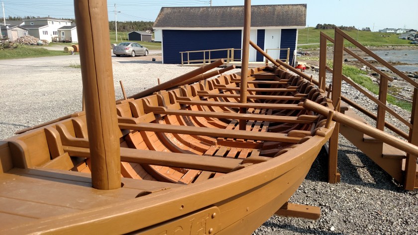
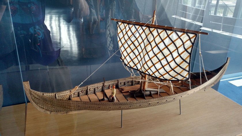
I went to the Visitor Center and took a casual look around. This is a model of a Viking “landing craft”. They had a number of different of ships for various applications.

IMG_20190728_090403846_HDR

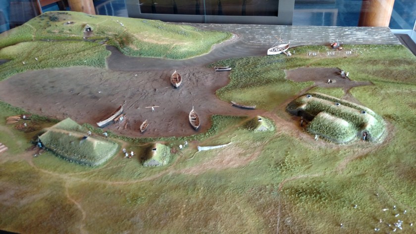
And this is a model of the replica village, near the actual archaeologic dig, which depicts how it might have looked 1,000 years ago when they first arrived. Yes, the Norsemen came to North America 500 years before Christopher Columbus. When they arrived they encountered the indigenous Dorset people (who, under there breaths were probably saying “dibs”).

IMG_20190728_090555356

I often skip the introductory video but my host had convinced me that I should take the time to watch it and I’m glad I did. I must say that it is, by far, the best such movie I have ever seen. Modern and extremely well done.

After the movie it was time for our tour.

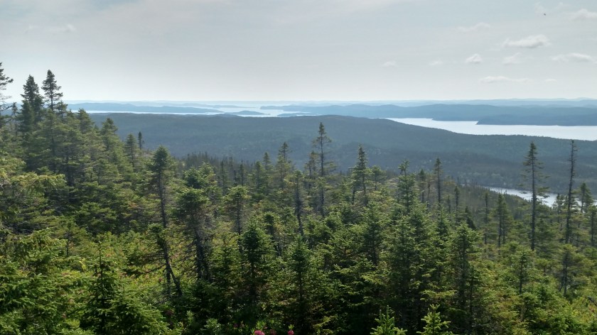
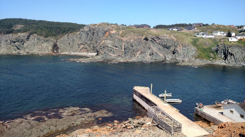
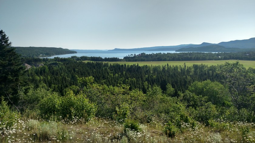
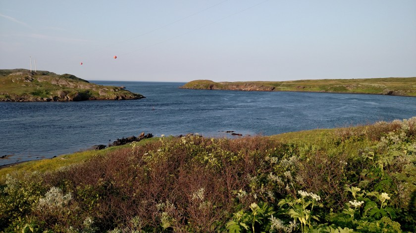
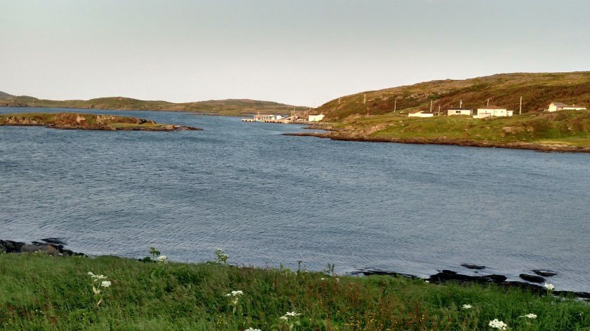
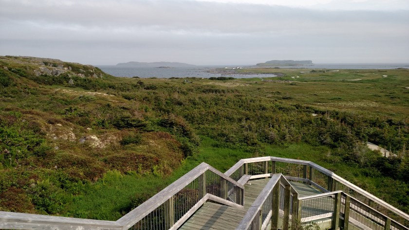
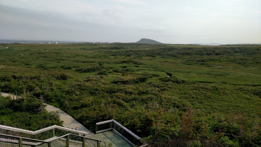
This is the view from the back deck of the Visitor Center looking down at the recreated village and neighboring landscape:

IMG_20190728_091148729

IMG_20190728_091153701

Our extremely knowledgeable guide, Paul, took us down a series of wooden walkways and, with his permission, out on some of the actual ground where the foundations were discovered, and explained the likely background of the arrival and the people who landed here. First of all, Viking is generally misused. According to Paul, Viking isn’t something you are it’s something you do – you go “a Vikin”. The proper term for people from Scandinavia is Norsemen.

Second, the overall image people have been “taught” about Norsemen is somewhat incorrect. Think the “Vikings” had dragons at the front of their huge sailing ships and wore helmets with horns? OK – where’s your proof, Skippy? Yes, the Norsemen were skilled ship builders and sailors and possessed strong military prowess. Yes, they did have dragons (well, dragon heads) carved at the front, and sometimes rear, of their oceangoing ships. Horns? Not so much. There is NO archaeological evidence to support the notion that Norse helmets had horns (or worse yet that they had horns growing out of their heads!).

The “Vikings” have a bad reputation as a people who would swoop in and rape, pillage and plunder their victims. That they were violent pirates and heathens. To use a word my Airbnb host said during our discussion the night I arrived, the Norsemen have been demonized, themselves made victims of clichés and stereotypes. More likely, to use a phrase I read online, they merely “raided and traded”.

Norsemen built a variety of ships, either for merchant trading or warfare, and were highly skilled sailors. They came through Greenland, Iceland and eventually here – at the northern tip of Newfoundland. They named various regions of this “new world” for their various attributes: Helluland (stone), Greenland (open farmland), Markland (forests) and Vinland (wine country – yay!!).

That last one, Vinland, is rather curious. What became known as Vinland covers a wide area – the south coast of Labrador, the north and west coast of Newfoundland, the eastern portion of New Brunswick and Nova Scotia provinces and all of Prince Edward Island. Only one problem – grapes don’t grow in Newfoundland. Never have. In fact, the only one of those areas I mentioned which grows grapes (and has butternut trees) is New Brunswick province yet there were very small traces of butternuts found here.

Ok, so we walk around the grounds listening to Paul and eventually come to little mounds which were the foundations of buildings unearthed during the archaeological dig in the 60’s. Artifacts found here tell the story of who was here, how many and what they likely did. They weren’t here long in the grand scheme of things.

Once Paul “released” us we were free to roam through the reconstructed village and interact with the people working there who were in period costumes (like the guy on the left in the first photo below), who shared stories of how the people lived.

IMG_20190728_103005578

IMG_20190728_103021091

IMG_20190728_103127963_HDR

IMG_20190728_103113764_HDR

The brown you are seeing around the doorways isn’t wood, it’s peat.

IMG_20190728_103229410

ADDITIONAL INFORMATION – Added after original post:

My friend and frequent commenter Shawn asked if I had taken any photos of the interior.  I did not take inside photos.  It was understandably very dark inside and with all the other tour guests watching and workers explaining their crafts I didn’t want to use the flash.  I looked online and there are photos of these structures specifically and of similar structures at other venues.  These modern recreations have safety and aesthetic enhancements (like wooden paneling and benches for guests) which the originals likely wouldn’t have had.

Thanks, Shawn, for a great question.


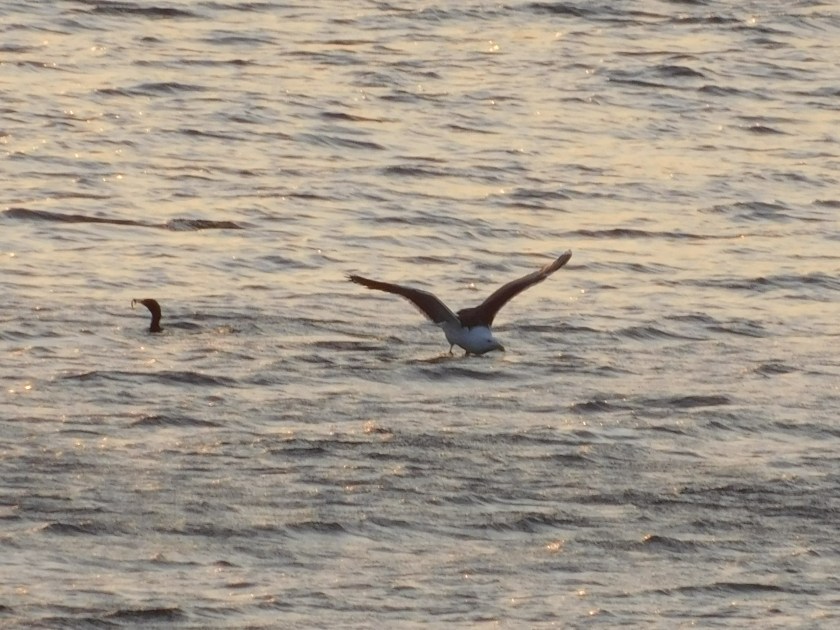
And one more thing – Icebergs!! I was really bummed that I didn’t see any but I had read in my research for this trip that I might. They are generally small by the time they get this far south, but there are organized “iceberg” boat trips which embark from this area and there were several icebergs (maybe the size of a small strip mall), floating by just offshore, in the introductory video I had seen. When I arrived Saturday night my Airbnb hosts offered me a drink and it was served over actual iceberg ice!

As I walked back up the path to the Visitor Center I returned to this piece of artwork, recently installed, which we had seen on our walk down to the village.

IMG_20190728_103737965_HDR

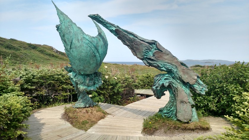
It depicts the “new land” on the right, and the Norse ship with it’s billowing sails and evil dragon head at the front, on the left.

IMG_20190728_103758181

And finally, in the little village of L’Anse aux Meadows not far from the site, a huge statue of Leif Erikson (some prefer Ericson).

IMG_20190728_110904014_HDR

Please note that he didn’t have horns!

Tickle Me Elmo

July 28, 2019

With apologies to the Sesame Street brand….

In addition to what they taught me Saturday night about gannets, my Airbnb hosts also helped me understand what a “tickle” is in the nautical sense.  I had seen several “tickles” on maps of Newfoundland and Labrador.  Black Tickle in Labrador is known for having an abundance of polar bears.  In Newfoundland there is Tickle Cove, Tickle Harbour and, my favorite, Leading Tickles.

A tickle is a short, narrow strait between two pieces of land.  The waves in the water “tickle” the coastline or “tickle” the bottom of a boat.  Apparently it is a nautical term unique to Newfoundland and Labrador.

If I understood my host correctly, this is a “tickle” on the opposite side of town from where they live in Quirpon:

IMG_20190727_184222933


Raleigh, Newfoundland

July 28, 2019

I live in Durham, North Carolina and people often combine our town with our state capital, Raleigh, which is about 1/2 hour away.  They then call our area Raleigh/Durham.

There is a town called Raleigh not far from where I was staying in Quirpon so before I left Sunday morning I had to go check it out.  They recently completed a Historic Village, recreating what the town’s cod fishing area looked like years ago.  They built what would have been fisherman’s bunkhouses…

IMG_20190728_075348731

… and a pier, or wharf, with buildings called “stages” out at the end.  These buildings were where the cod were processed for salting and drying.

IMG_20190728_075258728_HDR

DSCN8178

IMG_20190728_075407903_HDR

IMG_20190728_075447188

The photo above is almost identical to the picture on the cover of the Newfoundland and Labrador travel map!

DSCN8184

These metal bars appear to be anchors.  I wasn’t allowed to walk all the way out on the wharf since I wasn’t on an organized tour.

DSCN8181

Sunrise in Quirpon

July 28, 2019

My Airbnb hosts told me that if I was up early enough Sunday morning to be sure and go outside to see the sun rise:

IMG_20190728_051140615

DSCN8122

IMG_20190728_052130866_HDR

IMG_20190728_052932295_HDR

While I was waiting between shots I got some photos of what appears to be a cormorant and (definitely) a seagull hanging out together in the water.  The cormorant would dive periodically and the seagull would flap it’s wings like it was going to fly away but they pretty much stayed in the same area for a while.

DSCN8164

DSCN8167

DSCN8168

Gros Morne to Quirpon, Newfoundland

July 27, 2019

IMG_20190728_201957850

Saturday, after my boat trip on the Western Brook Pond fjord, I continued north on Route 430 up the west side of the long Northern Peninsula portion of Newfoundland.  After leaving Gros Morne National Park the road pretty much runs right next to the Gulf of St. Lawrence most of the way north until it turns inland towards St. Anthony which is on the east side of the Peninsula.  I would be spending Saturday night at an Airbnb in the little town of Quirpon (pronounced kar-POON – which I wouldn’t have guessed in a million years), north of St. Anthony – almost as far north as one can drive in Newfoundland.

IMG_20190727_132609392

I made a quick side trip into the town of Port au Croix.  There I found a replica of a “chaloupe,” a longboat often used by 8 to 10 oarsmen.

IMG_20190727_155054143

IMG_20190727_155142532

IMG_20190727_155133195

Further up the road – more mountains, different in appearance from what I had seen so far while in Newfoundland.  These have some lighter shades of green and have “bands” of rock running across them.  They were pretty far from the highway so I can’t tell of they are covered with trees or just vegetation, and they appear to be bare at the top.

IMG_20190727_162028287

As I drove further north this is a closer shot of the mountain on the left in the photo above:

IMG_20190727_162421664

And even further up the road, another one.  I can’t tell from my map which mountains they are or how tall they are.

IMG_20190727_162940265

Meanwhile the road continues to go straight for long stretches as a time, right next to the water.

IMG_20190727_163258358

I finally made it up to where the road crosses the Peninsula over towards St. Anthony.  I passed the St. Anthony airport, whose three letter designation is YAY which I thought was pretty cool.

I finally made it to Quirpon.  Quirpon used to be a fishing town until the government put the kibosh on the commercial cod fishing industry in 1992.

This is the view from my Airbnb host’s front yard overlooking Quirpon Harbour.

IMG_20190727_192230511_HDR

IMG_20190727_192234209_HDR

We sat around a fire pit (without a fire – it was quite warm all day) talking and my host pointed out something I had never seen before.  Out beyond the first island which juts in from the left of the photo, white birds were diving into the water from fairly high up.  These were Northern Gannets (rhymes with Janets).  I was too far away to get photos, even with my zoom lens, but here are photos I found online:

GannetInFlight

(Photo credit: en.wikipedia.org)

A unique thing about gannets is that when they dive they pull in their wings and develop a long, slender profile – like a dart.  Here is a sequence showing the dive.  Note how the bird looks just before hitting the water:

GannetDiving

(Photo credit: benporterwildlife.wordpress.com)