Dean Creek Elk Viewing Area

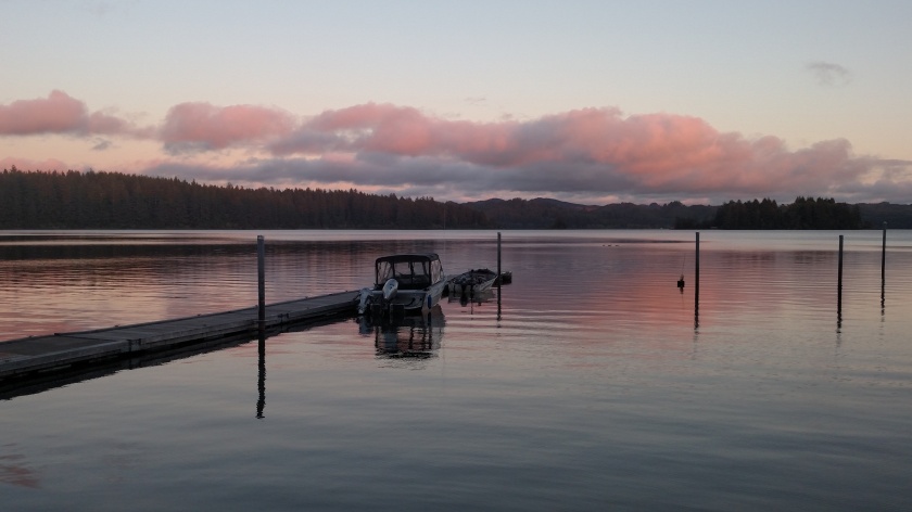
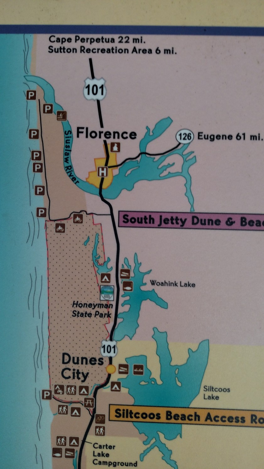
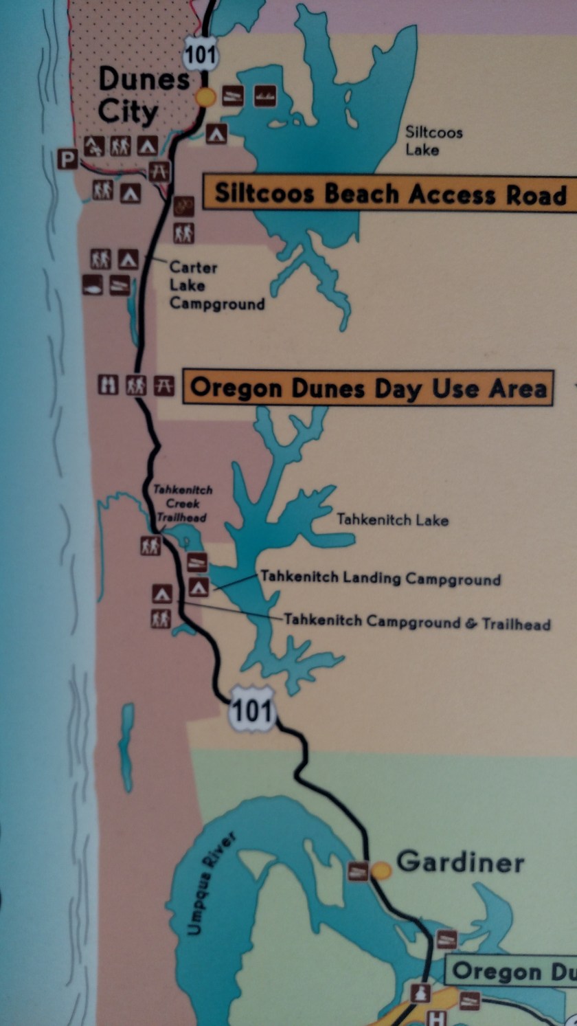
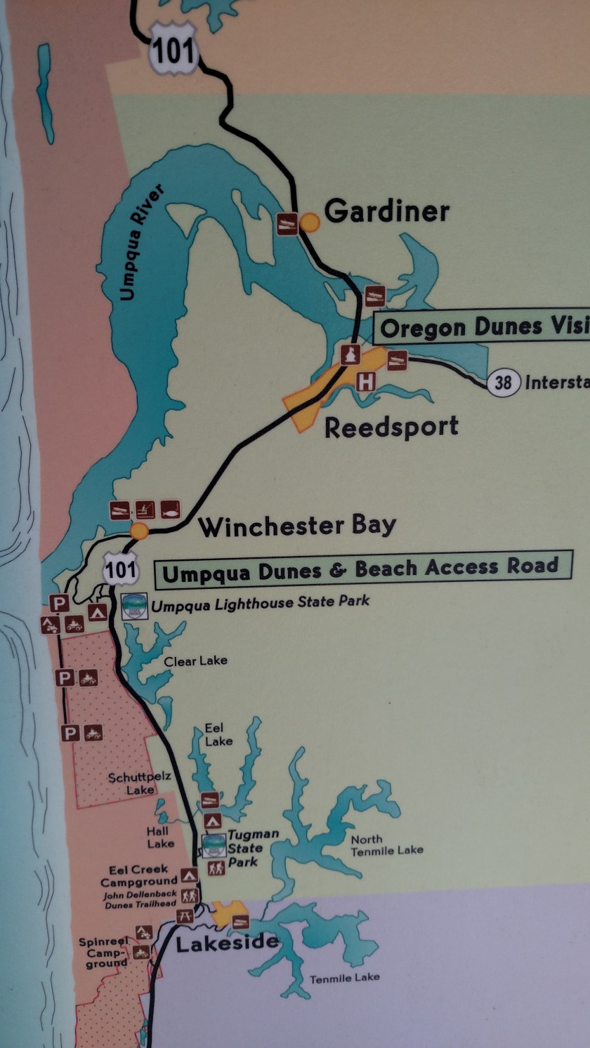
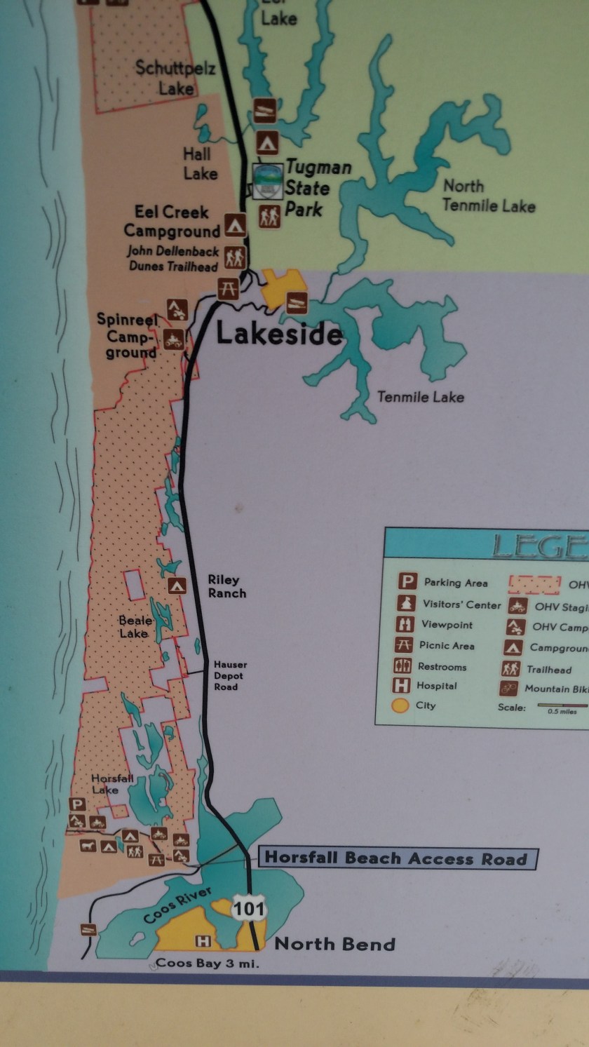
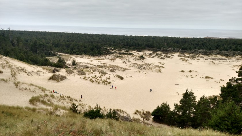
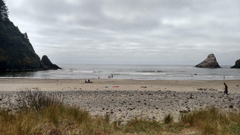
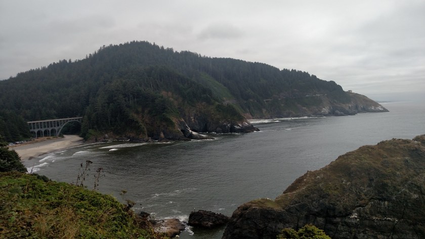
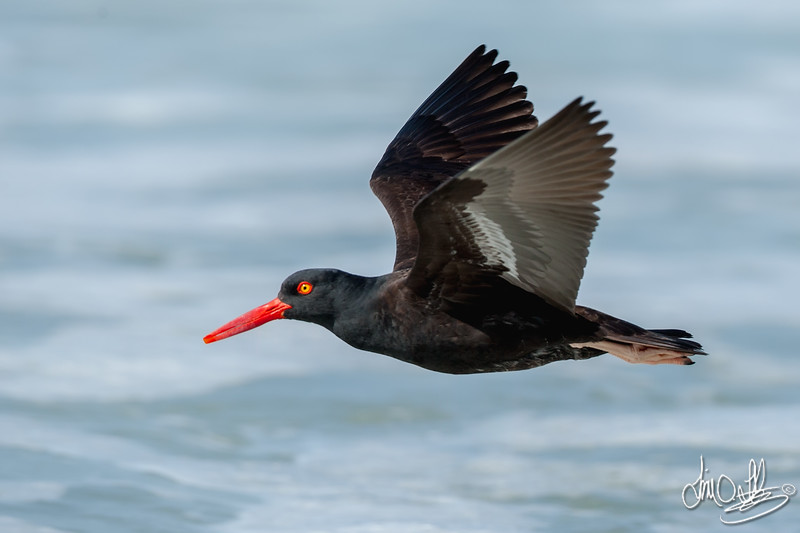
I am pleased to report that I have FINALLY seen a fairly large number of elk in the wild.  I had stopped at this area a few miles east of Reedsport, Oregon on Wednesday as I drove up to Florence, which features a lengthy parking area parallel to the main road (but separated from it) where people can safely watch the fields for elk which have come out of the wooded area behind it.  These are free range elk but evidently choose to hang out in this area on a fairly regular basis.

When I stopped by on Wednesday I saw, of course, zero elk.  Par for the course for me.  I have been to a huge elk preserve outside of Jackson, Wyoming on two different trips there and didn’t see any there either.  Nor did I see any in central Pennsylvania (a state I’ve lived in most of my life and didn’t even KNOW there were elk there).  A few years ago I was driving through rural northern Wisconsin at night (I had put myself “on the clock” and arrived later than expected at my Airbnb there).  That night I saw signs warning of elk crossing the road for the next 20 miles.  I’ve wanted to see an elk in the wild but was glad that I DIDN’T see any that night!

But I digress…

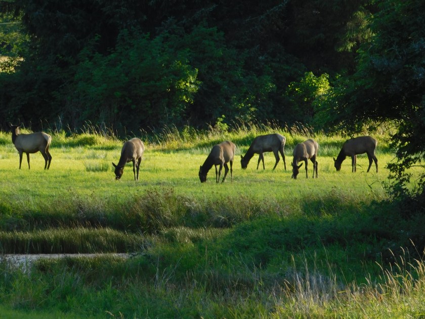
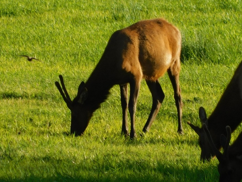
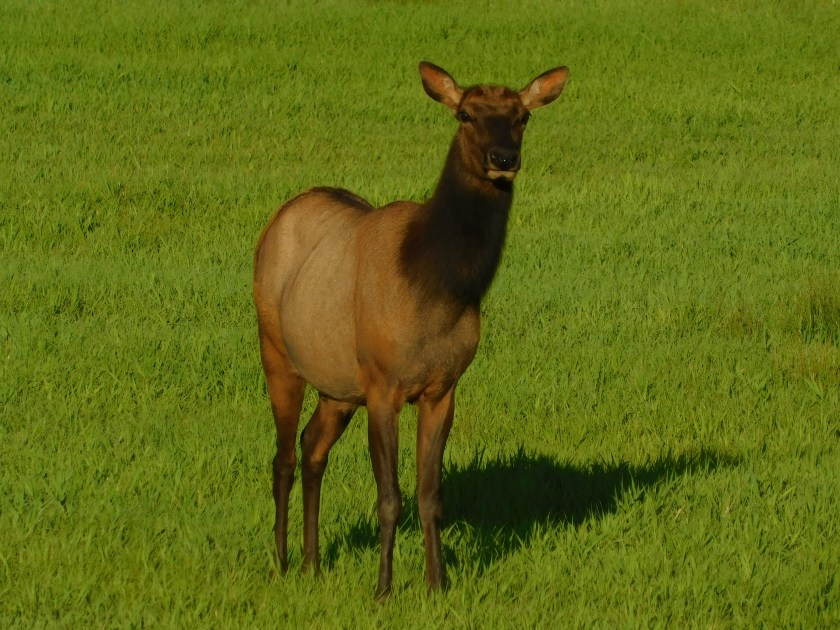
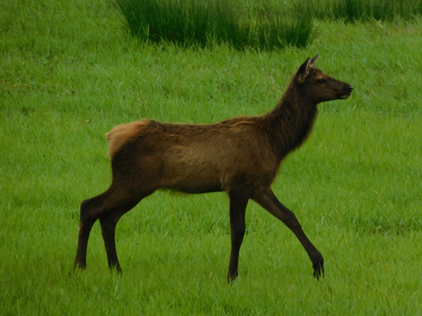
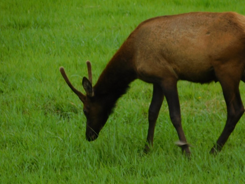
Thursday afternoon I returned to this area near Reedsport and, sure enough, there were maybe 30 elk out grazing in the fields.  There were quite a few adult females (called cows) and their offspring, which were obviously smaller in size but were getting pretty big.  I did not see any adult males (called bulls).

DSCN5419

DSCN5420

DSCN5426

DSCN5429

DSCN5439

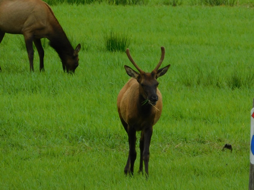
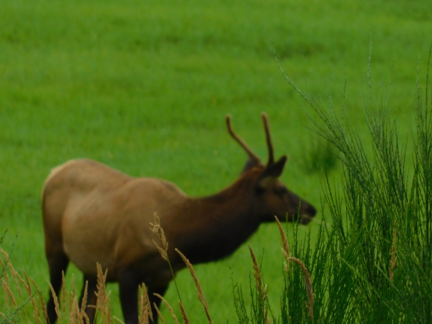
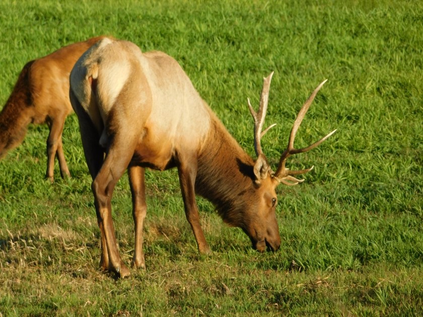
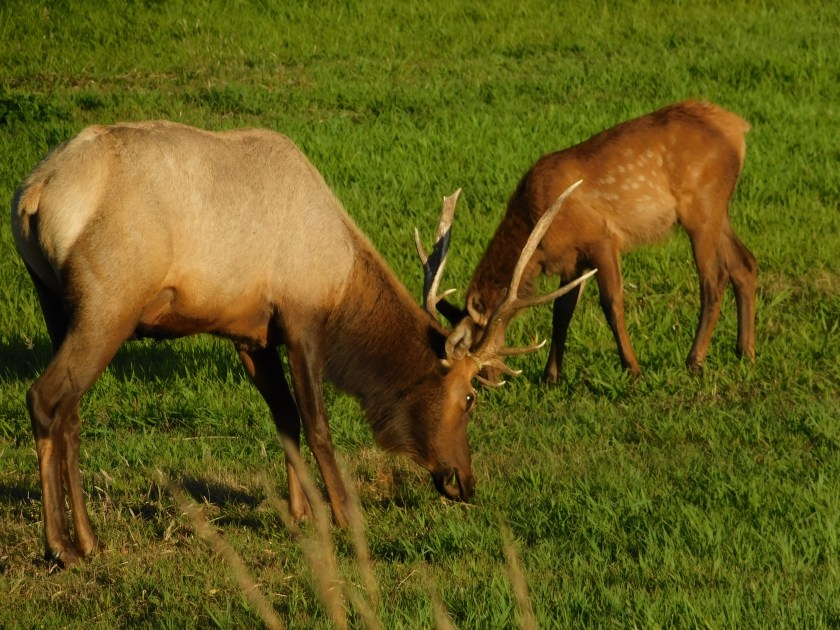
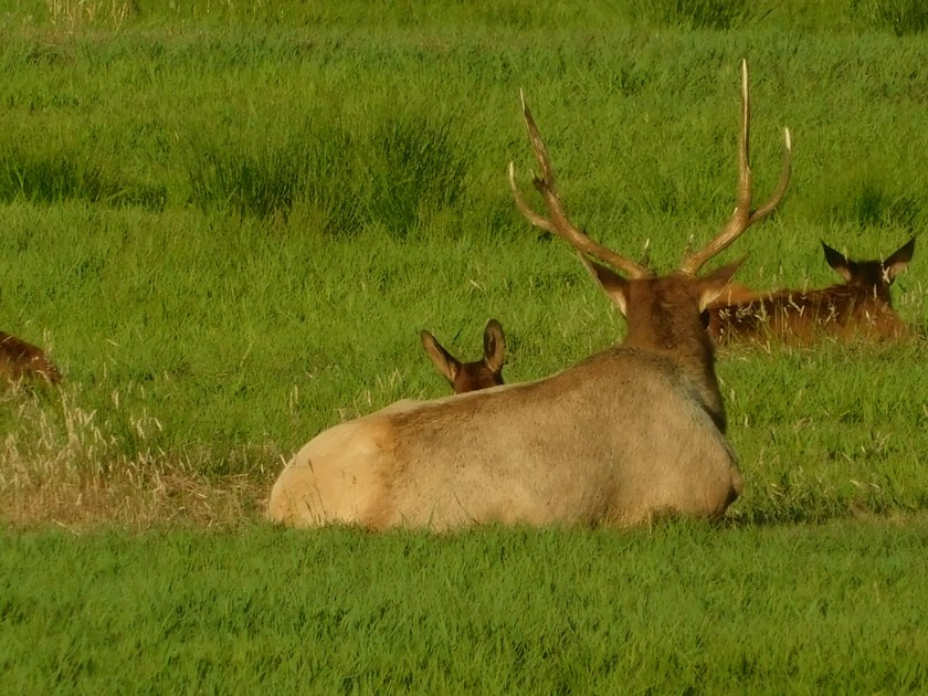
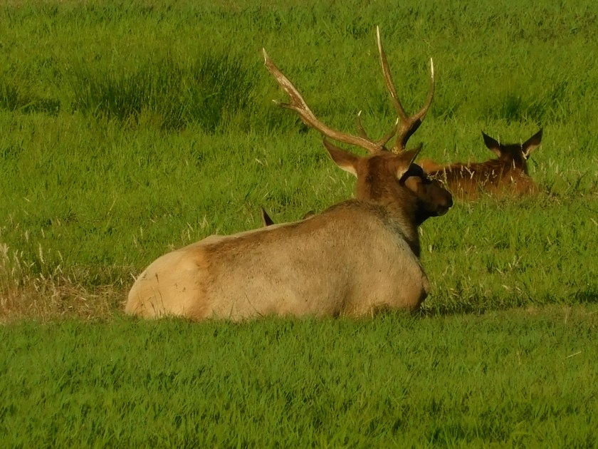
I returned Thursday in the late afternoon and spotted one huge bull – although he wasn’t in the “viewing area” but in a field about a half mile before it (where there wasn’t anywhere to safely park).  I went and got pictures of the other elk (maybe twice as many as I had seen earlier in the day) then parked back towards town and walked back along the main road to get some pictures of the bull.  This group of cows was evidently his “harem” – that’s really what they call it.  Adult males will amass a loyal following of females which he breeds with and that group is, in fact, called a harem.

DSCN5442

DSCN5443

DSCN5446

DSCN5456

DSCN5457

DSCN5460

DSCN5462

DSCN5463

DSCN5465

DSCN5466

Darling’s RV Campground & Marina

This was my Airbnb home for two nights while staying near Florence, Oregon.  I was in a one-room apartment without any scenic view (which I knew when I made the reservation) but I was there mainly to sleep, shower and post my blog.  The other features of the facility more than made up for it.  The campground sits a short ways off busy Highway 101 so there was virtually no traffic other than people coming to the campground itself and a handful of neighbors.  The campground sits just across a small road from the north shore of Sitcoos Lake, and they have a few docks where you may rent boats, jetskis and kayaks or put your own in the water and enjoy the lake.

IMG_20180802_190546047_HDR

IMG_20180802_190551349_HDR

IMG_20180802_190556511_HDR

The current owners bought the dormant 100-year old resort about 4 years ago and have breathed new life into it by putting in a lot of hard work and long hours.  They have a small, friendly staff who help maintain the grounds and cook 3-meals a day in their restaurant/pub.  It is a wholesome, family environment and reminded me very much of a husband/wife operated resort in the Pocono Mountains of Pennsylvania which was a client of mine when I lived and worked up there.  Most of the guests here have their own motorhomes or large pull-behind trailers but there were also some more primitive campsites and rental units like the one I stayed in.

Thursday evening, my final night there, I caught these scenes in the early evening as the sun was setting out over the ocean:

IMG_20180802_202404676_HDR

IMG_20180802_202438476_HDR

IMG_20180802_202652780

IMG_20180802_202811071

IMG_20180802_202917486_HDR

IMG_20180802_203255423

IMG_20180802_203337907

IMG_20180802_203745593_HDR

Oregon Dunes National Recreation Area

Wednesday I traveled about 40 miles north of where I had been staying in Glasgow (North Bend), Oregon to the town of Florence.  In that distance I only saw the ocean twice, briefly.  Not because of coastal fog.  Because of sand.

That 40 mile stretch comprises most of the Oregon Dunes National Recreation Area, part of the Siuslaw National Forest.  Huge sand dunes, some as high as 500 feet, stretch along the coast as far as the eye can see – and they block the view of the ocean from Highway 101.  I saw the ocean when I stopped to visit the Umpqua River Lighthouse and I saw it again when I climbed a wooden staircase to a viewing platform at the Oregon Dunes Day Use Observation Area.  After that I didn’t see it until I was well north of Florence at the Heceta Head Lighthouse.

Here is a 4-part view of a map covering the 40-mile stretch.

IMG_20180801_140603970

IMG_20180801_140608167

IMG_20180801_140614348

IMG_20180801_140618496

Some areas of the dunes are for people only – no OHV’s (Off Highway Vehicles) are permitted, but there are several large areas (with red dots) where people (with recreation permits) can take their own OHV’s, or they can rent them from several vendors in the area.  There are also companies which will take you on a ride, or will take large groups in huge dune buggy-type vehicles.

IMG_20180803_082413308_HDR

IMG_20180803_082452879_HDR

Parts of the dunes are temporarily off-limits to everyone to help protect the Snowy Plover while it is nesting:

Snowy_Plover audubon.org mike baird

(Photo credit: Mike Baird  audubon.org)

Here was what I saw from the Ocean Dunes Day Use Area.  This is a 3-shot panorama, looking left to right.  The people in the second photo are two adults running down the hill.  In the third photo there are several people of all ages.

IMG_20180801_141137353

IMG_20180801_141044028_HDR

IMG_20180801_141143329_HDR

DSCN5358

When I left the Airbnb I was staying at on Thursday I noticed that there was a huge sand dune where the road I was on met Highway 101:

DSCN5478

And here are two photos I found online:

Alottasand DinaPavlis

(Photo credit: Dina Pavlis  alottasand.com)

Oregon Sand thewandererschuckandkate blogspot

(Photo credit: thewandererschuckandkate.blogspot.com)


Umpqua River Lighthouse

Can you spot the lighthouse in this photo?

IMG_20180801_111358437_HDR

It isn’t where you’d expect it to be.  Need help?  About a third of the way in from the right, look straight down from the end of the rock jetty which extends out into the ocean.  There you’ll see the top of the Umpqua River Lighthouse.  And by the way, inside the “triangle” in the ocean at the center of the photo they farm mussels and oysters.

IMG_20180801_114017104_HDR

This lighthouse stands 61 feet tall and is located at a Coast Guard housing complex about a mile inland near the mouth of Winchester Bay, Oregon.  It is 165 feet above sea level. This is actually the second lighthouse near this location.  The first was built in 1857 but was destroyed by a flood in 1864, hence the decision to built the replacement further inland and on higher ground.  This one was commissioned in 1894 and is still operational.

A unique feature of this lighthouse is the light it emits.  Instead of a standard white beacon it has a partially colored lens and emits two white bursts of light, followed by a red one.

IMG_20180801_113713380_HDR

DSCN5348

DSCN5351

Here are photos I found online:

umpqua_rb lighthousefriends

(Photo credit:  lighthousefriends.com)

Here is the inside of the lens:

Umpqua-Lighthouse DennisSkogsbergh

(Photo credit & copyright: Dennis Skogsbergh)


Reedsport & Gardiner, Oregon

Wednesday on my way north from Glasgow to Florence I passed through these two towns which are located on opposite sides of the Umpqua River.

These were taken at a shipyard in Reedsport.  This appears to be a tugboat which is probably here for repairs or upgrades.

DSCN5363

DSCN5364

DSCN5365

And I was told by someone who works here that this is a new ship being built for a customer:

DSCN5368

DSCN5369

DSCN5374

Further up the road is the little town of Gardiner.  According to a sign along the highway a ship from Boston (owned by a man named Gardiner) ran aground near here in 1850.  Much of the cargo was successfully unloaded and this became known as “Gardiner’s town”.  A sawmill was built in 1864 and another was added in 1877, making Gardiner a very successful lumber port.  A major fire destroyed much of the town in 1880.  The town was rebuilt and from 1885-1916 was one of the busiest towns on the Oregon coast.  There is no longer a sawmill or lumber factory here but here is the town of Gardiner today:

IMG_20180801_133319977_HDR

IMG_20180801_133244177_HDR

IMG_20180801_133219218_HDR

And here is the view looking out at the river.  Off to the right the railroad tracks lead to  large fields and a few buildings where the lumber mills once stood.

IMG_20180801_133523080

Heceta Head Lighthouse

Wednesday I drove about 16 miles beyond the town of Florence, Oregon to get to this historic lighthouse.  The Heceta (pronounced ha-SEE-ta) Head Lighthouse was commissioned in 1894 and is still operational.  It is 56 feet tall and sits approximately 205 feet above sea level.

Here is an image from the highway as I approached the lighthouse from the south (Highway 101 rose several hundred feet above the ocean a few miles before I got to the exit but had dropped back down as you will see shortly):

DSCN5388

Once I got off the highway I drove to the parking area at a small beach.

IMG_20180801_151926109_HDR

IMG_20180801_151930696_HDR

From this vantage point I could see the assistant lightkeeper’s house but not the lighthouse itself.  I had to walk up a half-mile path to get to the lighthouse.  Along the way was a map which shows the overlapping “coverage” area several of the lighthouses in Oregon I have shown you provides.

IMG_20180801_152417732

This lighthouse’s beam is the brightest in the state and can be seen 21 miles offshore.

Further up the path I had a nice view looking down at the beach area where I had parked.  You can see the highway bridge I crossed and then drove under to get to the parking area.

IMG_20180801_152746400_HDR

There was another sign with a photo of the lighthouse and both lightkeeper houses taken years ago before the trees got so tall.

IMG_20180801_152426485

The big house on the left is no longer standing but the smaller structure behind it is a gift shop.  Here is a closer look at the house which is still standing (now a Bed & Breakfast).

IMG_20180801_153111414_HDR

IMG_20180801_153204046_HDR

I continued walking up the hill and finally made it to the lighthouse, which is similar in design to the Umpqua River lighthouse I had seen earlier in the day..

IMG_20180801_153952688

Here is the view looking south towards the coast.

IMG_20180801_154024366

And when I left I was able to stop at a second overlook on the highway (there were tour buses there when I was driving north):

DSCN5402

DSCN5408


I think I can, I think I can…

Shortly after arriving at Shore Acres State Park Tuesday morning I saw two guys with radio-controlled trucks on the rocks out by the ocean:

DSCN4995

DSCN4996

DSCN4997

DSCN5001

DSCN5003

DSCN5008

DSCN5011

Finally, after several attempts but without manual intervention, he made it!

DSCN5012

It was no surprise when I got out to the parking lot to see what the “driver” and his buddy arrived in:

DSCN5088

IMG_20180731_113249739

I just wish I had a real helicopter to use when I go fly my radio-controlled models…


Shore Acres State Park – Various

Tuesday I spent several hours at this Oregon State Park, just south of Charleston.  This Park was once the site of a mansion owned by a wealthy local businessman which sat high on a cliff overlooking the Pacific.  The house is gone but there is an observation area out by the ocean which offers some spectacular views, both to the north and south:

IMG_20180731_101236941_HDR

IMG_20180731_101526594_HDR

IMG_20180731_102244334

IMG_20180731_102250554

About 20 minutes after I took those photos, surprise surprise, a quick batch of coastal fog moved in:

IMG_20180731_103958503_HDR

IMG_20180731_104046041

DSCN5046

IMG_20180731_104037544_HDR

After the fog cleared (it didn’t last long) I stood at a high point above the ocean and waited for some coastal birds I have been keeping an eye out for.  When I first walked around to get the lay of the land I didn’t have my digital camera with me.  When it became apparent I would need it I went to retrieve it and saw this young buck munching on some grass near the parking lot:

IMG_20180731_102821506

IMG_20180731_102819849

He wandered into the woods but I’d see him again shortly.  As I continued walking towards where I had parked I saw an usually colored squirrel:

IMG_20180731_102910009

By the time I got a picture it had moved pretty far away.  I returned to the spot several times during the day but never saw it again.  It is a Douglas Squirrel and is dark on it’s back but had red or brown fur on it’s chest:

douglas_squirrel_munsel_odfw

(Photo credit: Kathy Munsel)

Ashok Khosla-Douglassquirrel

(Photo credit: Ashok Khosla)

Once I had the digital camera and was walking back to watch for birds I saw the deer again, this time standing on his hind legs to eat berries out of a tree (when I lived in the farmhouse in Durham I used to see fully grown deer do this in the apple tree orchard just up the hill from the house).

DSCN5070

DSCN5071

DSCN5073

DSCN5074

Back at the ocean overlook I spotted this rock down by the water with a very interesting pattern on it:

DSCN5133

DSCN5134

Shore Acres State Park – Birds

Tuesday I visited this Oregon State Park just south of Charleston.  I finally was able to track down two birds I have been keeping an eye out for (after having seen pictures of them on signs near overlooks), and had one unexpected visitor.

First, the Pigeon Guillemot.  I mainly saw these floating on the water.  At one point two of them stood on a rock but I didn’t have my digital camera with me.  Once I had it, they stayed in the water the rest of the time.  An interesting feature of these birds is that their feet are bright red and the inside of their mouth is the same color.

DSCN5289

DSCN5283

DSCN5293

DSCN5296

Here is a photo I found online:

PigeonGuillemot JacobDrucker

(Photo credit:  Jacob Drucker)

Next up – the Black Oystercatcher.  I have looked and looked in areas where I thought I’d find these distinctive birds with bright red bills and pink legs, both at low and high tide, and Tuesday I finally found one – way offshore on a rock formation.

DSCN5138

Here are some better photos I found online:

Black_Oystercatcher DickDaniels

(Photo credit: Dick Daniels)

BlackOystercatcher TimFoltz

(Photo credit & copyright: Tim Foltz)

And finally, as I waited and waited for the first two to show up, this Belted Kingfisher landed on a rock down near the water close to the cliff where I was watching from:

DSCN5121

DSCN5127

Shore Acres State Park – Flowers 1/2

Tuesday I spent some time at this Oregon State Park, on the site of the former Louis Simpson estate.  Mr. Simpson, a wealthy lumberman and shipbuilder, imported plants from all over the world and had several acres of formal gardens next to his mansion which sat on a cliff overlooking the ocean.  The mansion and gardens fell into disrepair during the Great Depression and the state bought the property from Mr. Simpson.  The house was too expensive for the state to restore and maintain and was razed but the gardens have been restored and are now part of a gorgeous State Park, just south of Charleston.

IMG_20180731_115310349

IMG_20180731_115515145

IMG_20180731_115541963

IMG_20180731_115610851

IMG_20180731_121317540

IMG_20180731_121323099

IMG_20180731_121340420

IMG_20180731_121643772

DSCN5140

DSCN5141