Jasper (the town), Alberta – Part 1

August 8, 2025

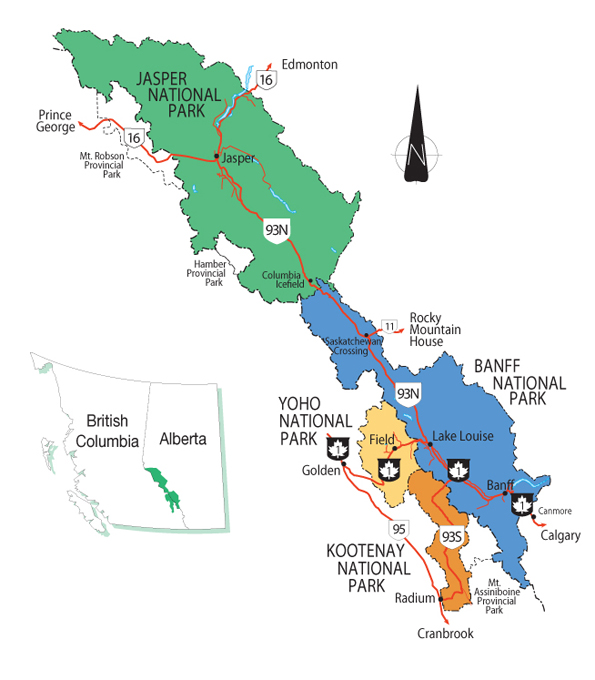
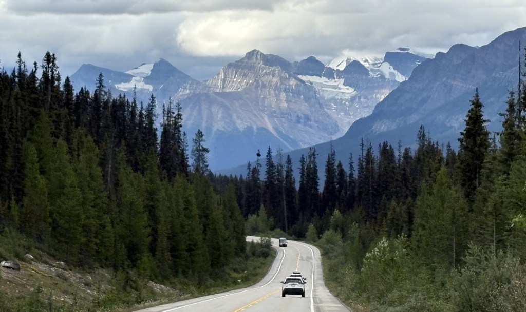
I chose Jasper as my first National Park to visit after arriving in Golden (although I drove through 3 others getting there). I really didn’t know what to expect when I got to the town of Jasper, as I was aware of the wildfire in 2024 but didn’t know the extent of damage. The town of Jasper is about a 3 1/2 hour drive (if done non-stop) from Golden, although I stopped many, many places to take pictures.

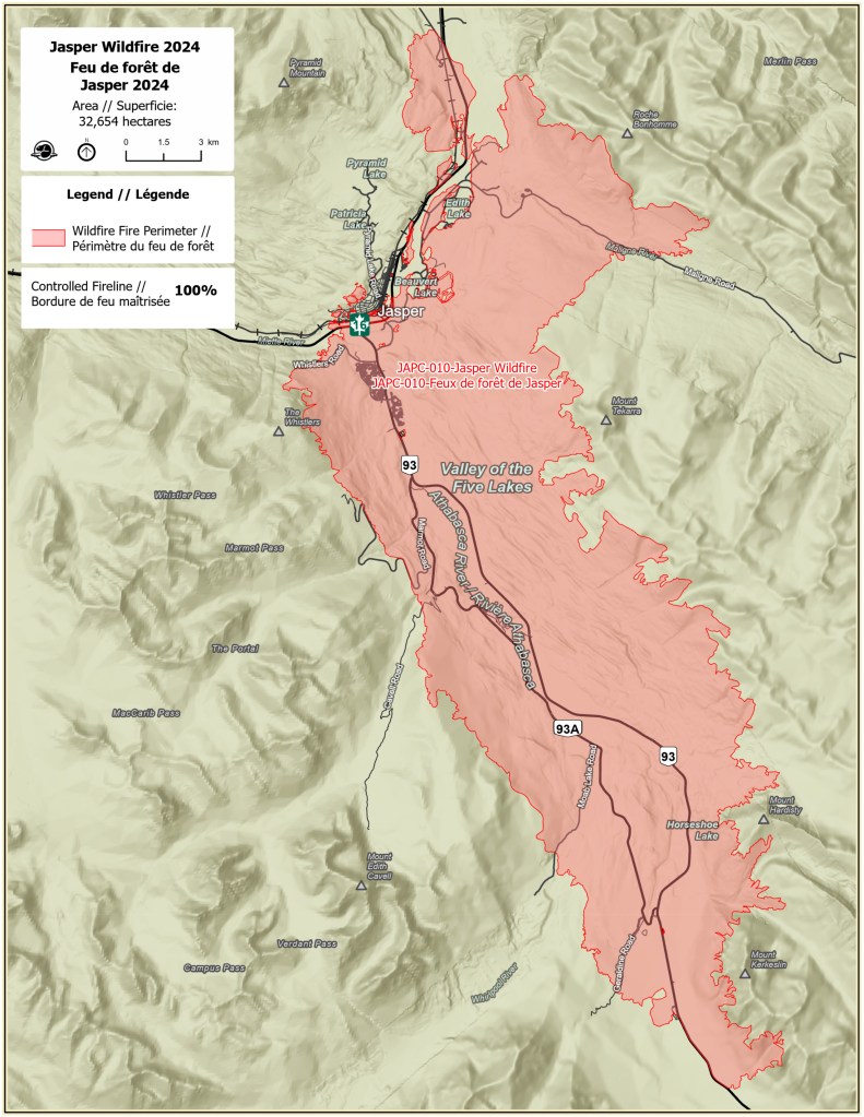
As I mentioned in the last post, I started seeing evidence of the fire as I drove around two mountains south of town – about 16 miles away. All the trees on either side of Highway 93 were destroyed by the intense fire. When I finally arrived in town around 1 pm, I stopped to walk the main street in town. I also went to the Parks Canada Visitor Centre, which wasn’t affected by the fire. There I was told where I could and couldn’t go within the Park. While I was there, some parts of the Park were still off limits due to damage caused by the wildfire.

Here are some of the things I saw:

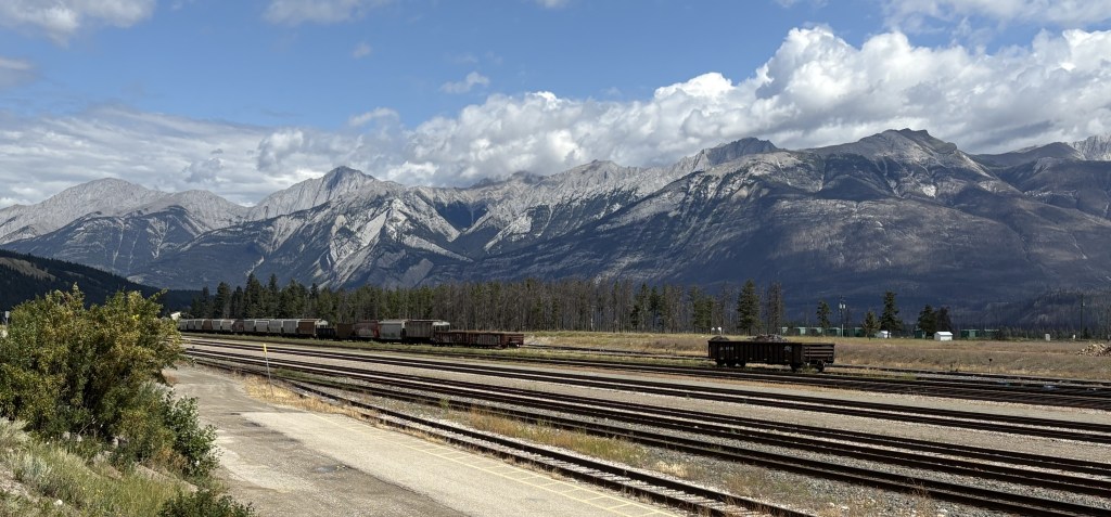
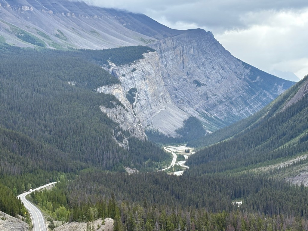
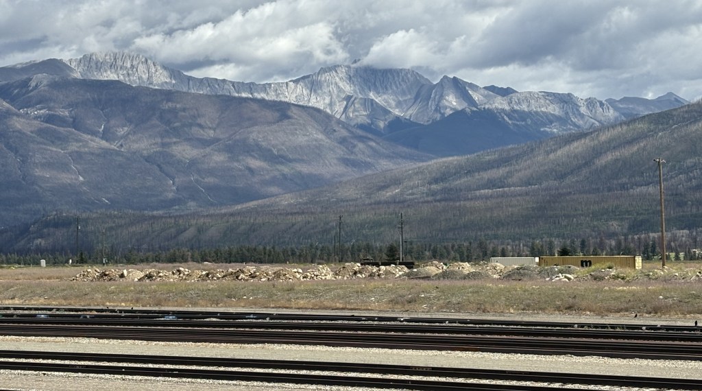
Those are railroad tracks on the south side of town, significant because they are a main transcontinental line operated by CN Rail (The Canadian National Railway). Rail traffic through the Park was suspended the night the fire started, and CN Rail brought in one of their firefighting trains to help fight the growing blaze. Just beyond the tracks is the Athabasca River (out of view), and in the distance are the Colin Range of mountains, located southeast of town.

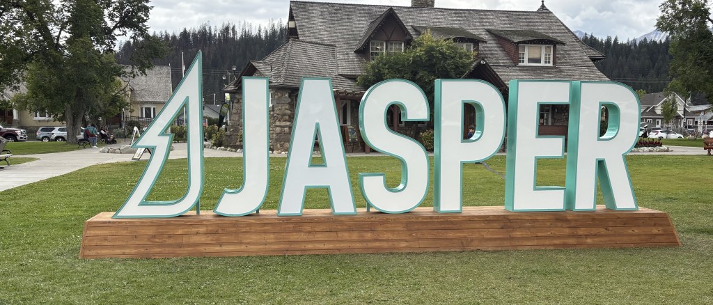
That is the tourist “photo op” sign in Jasper (in a rare moment someone wasn’t having their picture taken in front of it), and behind it is the Parks Canada Visitor Centre.

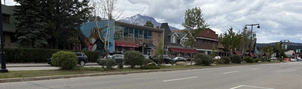
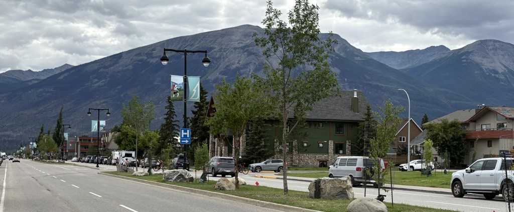
Those are the views of Connaught Drive, the main street in Jasper, looking in from each end.

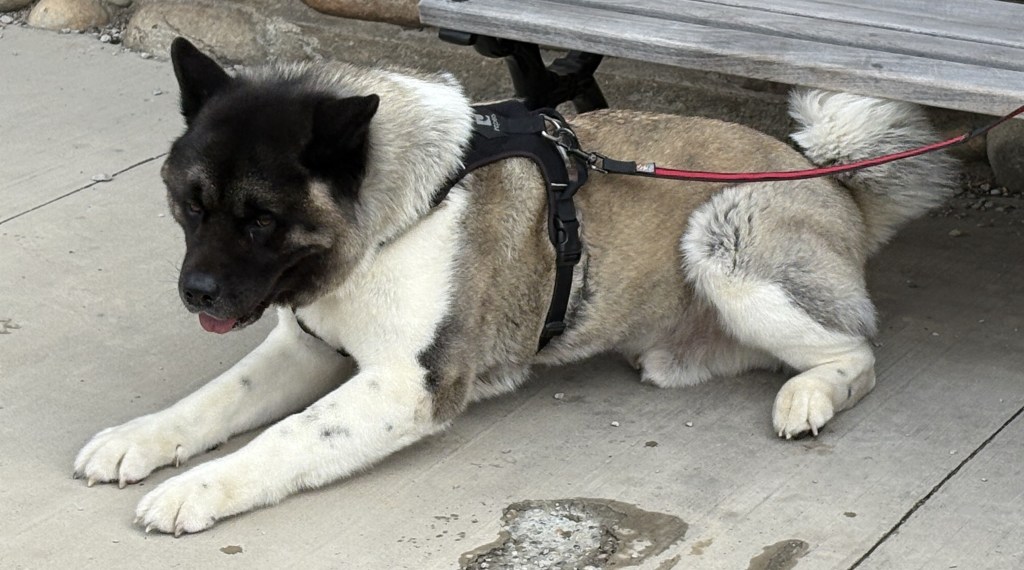
This is an Akita taking a break while his handler was on the phone.

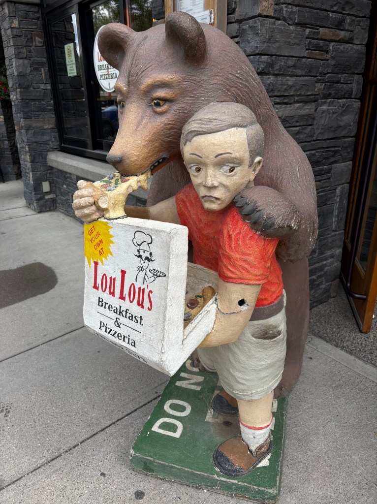
This is a statue outside the pizza place where I had lunch.

This is one of the few signs of the fire I saw downtown. It is a set of gas pumps on the same side of the street as the main shops.

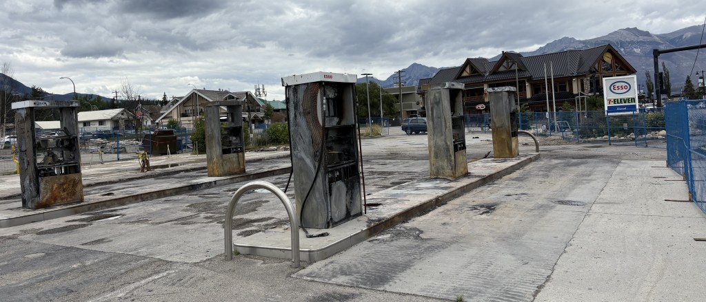
Another gas station was destroyed on the other side of the street. The structures destroyed in the fire have been razed and the lots cleared. Many of the businesses which were affected indicate online that they are only “Temporarily Closed”.

Here is a map of downtown Jasper showing which structures were lost in the fire. The map states that 420 structures were destroyed or visibly damaged while 620 showed no damage. Wikipedia states that 358 of 1,113 structures were destroyed. Either way, the town did suffer significant property losses.

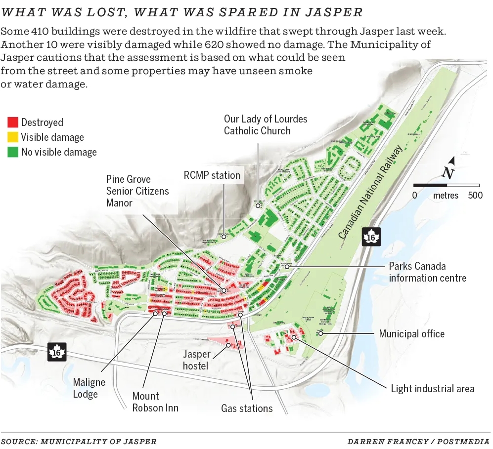
(Photo credit: Calgary Herald)

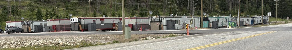
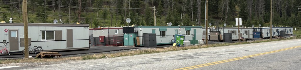
These are trailers which were brought in as temporary housing for some of the residents who lost their homes. I saw them at several locations in the area.

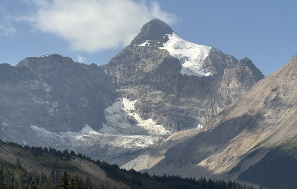
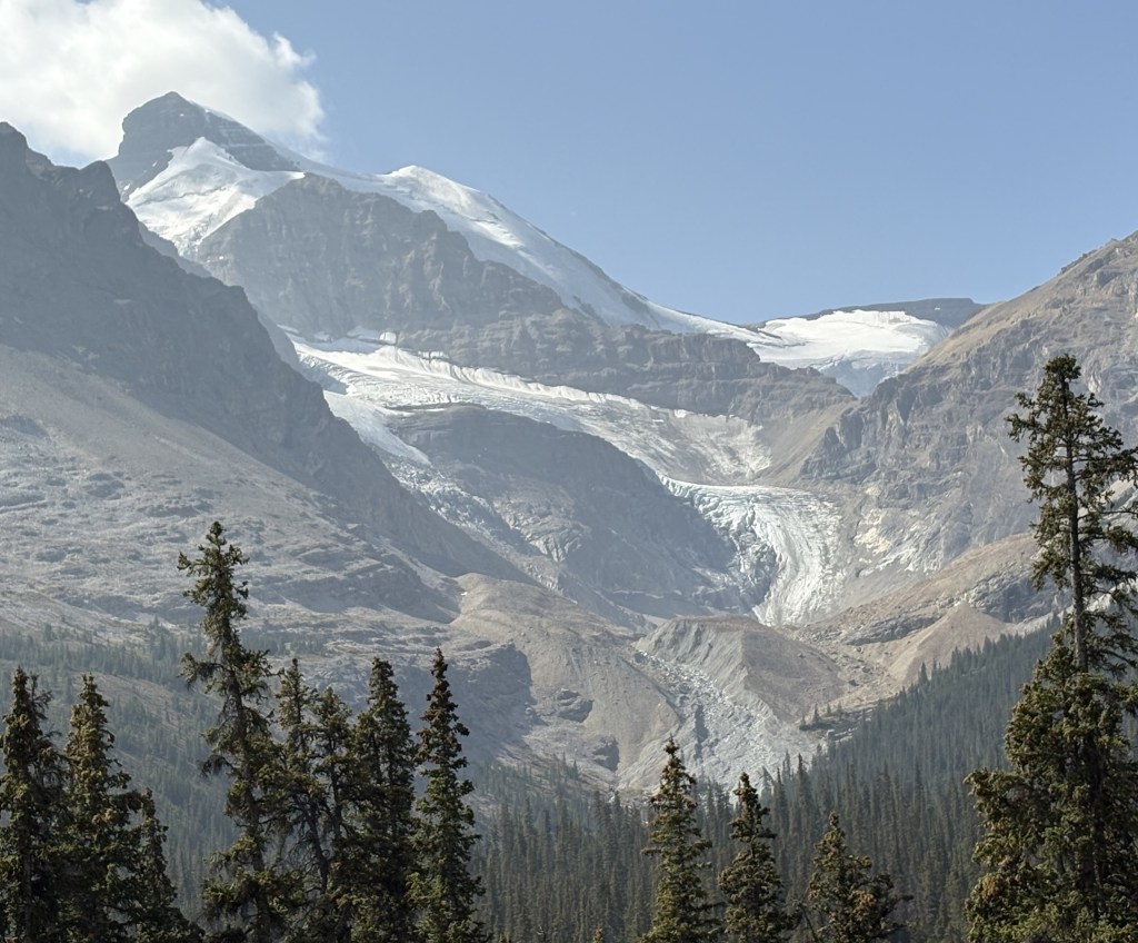
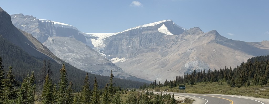
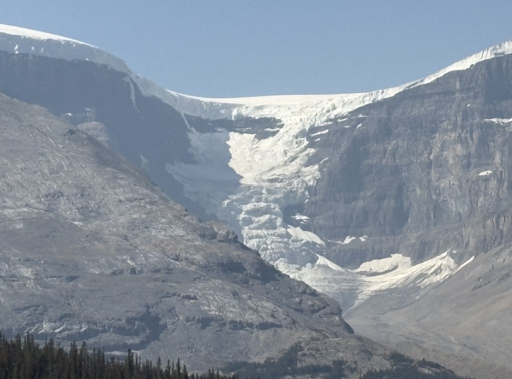
The next post will show some other things I saw in the area before heading back to Golden.

2024 Jasper Wildfire

August 8, 2025

I am now approaching the town of Jasper, AB from the south and have started to see damage caused by the massive wildfire which started a little over a year before I arrived in early August, 2025. You won’t see much evidence of it in my photos but I would be remiss if I didn’t explain what happened.

Jasper National Park is the largest of the six National Parks I would visit over the next few days from my base in Golden, BC. At 4,335 square miles it is larger than Yellowstone National Park (3,472 square miles). Comprised mainly of mountains, forests, lakes and rivers, it is a popular tourist destination.

The town of Jasper has a population of around 4,800 permanent residents according to the 2021 Census. That population swells significantly over the summer months.

Around 700pm the evening of July 22, 2024, a fire was detected northeast of town. A short time later, other fires were discovered well south of town. All of the fires are believed to have been started by lightning, and spread rapidly.

Within several hours, authorities made the decision to evacuate the entire Park! This was done due to the weather and ground conditions, as well as the forecast for the coming days. There are not many escape options, and it was the middle of summer so there were thousands of people visiting the area, in hotels, camping or staying in their RV’s. It is estimated that 25,000 residents, employees and visitors were told to immediately evacuate the town and Park.

Here is a map of the area eventually consumed by the fire.

(Photo credit: Parks Canada)

As I stated, the fire started July 22, 2024 and wasn’t considered “under control” until September 7, more than a month later. Due to the remote wooded areas within the Park it wasn’t actually considered “extinguished” until April 1, 2025! In all, the fire consumed 156 square miles.

I am approaching the town on Route 93 and started seeing burnt out areas on both sides of the road after I drove around Mount Kerkeslin and Mount Hardisty at the bottom of the photo. Everyone south of town was probably encouraged to drive south on 93. People in and around the town of Jasper could go either east or west on Route 16. Due to the fact that some of the fires were northeast of town, most people probably went west and eventually ended up in Valemount, which quickly became overrun with evacuees.

Only one death was attributed to the fire. A 24-year old trained firefighter died northeast of town when a tree fell on him. He had come up from Calgary to assist in fighting the blaze. No doubt that quick action by authorities, mere hours after the small fires were first discovered, saved countless other lives.

I will discuss the impact on the town of Jasper in my next post.

Icefields Parkway to Jasper, AB

August 8, 2025

To refresh your memory, I effectively stopped making “current” posts with photos I had taken August 8 while en route from the town of Golden, BC to the town of Jasper, AB.

(Photo credit: Parks Canada)

On July 7 I had traveled through Kootenay National Park (brown) and then through part of Banff NP (blue) and Yoho NP (yellow) to get to Golden, where I would be based for 6 nights. The following day I backtracked to Lake Louise and went north towards Jasper National Park (green) and have already posted photos taken in the northern part of Banff NP getting to the point where I crossed into Jasper NP, which is where the Columbia Icefield is located. The entire road (Highway 93N from Lake Louise to the town of Jasper) is called the Icefields Parkway and is considered by many to be among the most scenic roads in Canada.

Here are more photos I took as I traveled north, deeper into Jasper NP.

The two photos above are of the Athabasca Glacier, the largest one in a group of six which comprise the Columbia Icefield. I actually took those photos on my way south back towards Golden after having been to the town on Jasper.

The Columbia Icefield is a major tourist draw, so much so that I didn’t take part in the guided bus tour and excursion to the new Icefield Skywalk (a viewing platform similar to the one in the western Grand Canyon). To do those things most people make reservations at the Icefields Center, a large building next to the highway. Here are two photos I found on someone else’s blog:

(Photo credit: Thebanffblog.com)

Those blue buses will transport you to the base of the glacier so you may get an up-close look. They also give you exclusive access to the Columbia Icefield Skywalk:

(Photo credit: Thebanffblog.com)

There is another company that has large, red and white specialty vehicles with oversized snow tires which will actually take you out onto the glacier itself.

So you must park your car and use other means of transportation to truly experience the glaciers. I didn’t do any of those things.

I opted to continue driving north as I wanted to see the town of Jasper and get back to Golden before dark.

I am embarrassed to admit that I don’t know the names of the rest of these mountains. I have scoured maps and brochures but they don’t always name them and even looking at pictures online didn’t help, as they are often taken from other vantage points. In hindsight I wish I had taken better notes of exactly where I was when I took each photo. Most things don’t have signs explaining what you are looking at, and even using the time stamp on the photo didn’t help much since I make so many stops and frequently backtrack if I see something interesting.

My apologies!

I have the tour bus that was on the road ahead of me to thank for the last two photos. It had pulled off the side of the road to let the passengers take pictures of the bighorn sheep high up on the rocky hill next to the highway. I wouldn’t have seen it otherwise.

If you are a hiker and plan to visit the Canadian Rockies I strongly encourage you to budget considerably more time than I did. There are MANY popular campgrounds and hiking opportunities and they can get you to places where you’ll have even more incredible views than I had from the road.

2025 Canada/Alaska trip recap

I am back in Durham after my 5-month 2025 road trip. I apologize for the long delay, but I have now reviewed all the photos I took between August 8 and August 31 and will begin posting them in small batches. Some days will have lots of photos, some days will only have a few. I will continue to review photos taken during the remainder of my trip and that should allow continuous posts highlighting my time in Canada and Alaska.

All told, I drove a total of 26,490 miles. 10,061 in the “lower 48” getting to and from western Canada, 12,608 in four of the provinces in Canada, and 4,421 in Alaska.

I spent 142 nights on the road. 20 with family and friends and the remainder in Airbnbs. Most of my time in Canada was spent in British Columbia (33 nights), with 16 in Alberta, 6 in Saskatchewan and 6 in the Yukon Territory (mainly stops while driving to and from Alaska).

I was very fortunate to have had good weather most places, and was able to get in and out of Alaska before any significant snow fell. I encountered little bits here and there, but nothing which impeded my travel. My car was a real trouper, only breaking down one time (in Utah) towards the end of my trip. In all the years I have traveled my cars have treated me very well.

My overall experience was AMAZING! I saw so many beautiful places and met some very nice people along the way – both fellow travelers and my Airbnb hosts. I have had very good luck using Airbnb over the years and find it a pleasant way to get local knowledge as well as staying close to the places I want to see. I passed on some of the more popular ways to see things (by air, by boat or by train) but prefer to do my own thing and travel by car. I avoided some of the more crowded venues.

I hope you enjoy the photos I am about to share.

Welcome back to the United States, JohnBoy…

…. now let me see your oranges!

Real time post – A week ago today I crossed the border from the Yukon Territory into the United States near Beaver Creek, YT. It was around 6pm PDT, which then became 5pm AKDT when I crossed the line. As big as Alaska is, most of it is in one time zone – except the extreme southern Aleutian Islands which are on Hawaii Time. And Alaska only has one Area Code – 907.

Actually, I was already in the US – I had crossed the line about 30 miles earlier but the Customs Inspection Station wasn’t until later. I guess they really want to nab you before you can slink back into Canada.

When it got to be my turn it was pretty straightforward until we got to the subject of fruit. The agent was only interested in my 1 1/3 bags of mandarin oranges which I had purchased at a Walmart in Prince George, BC. He didn’t seem to care about the one banana I had left, or the two partial bags of apples I was packing.

He confiscated them. (He took two large potted plants from the woman in the car ahead of me. Lord knows what was in the U-Haul her traveling companion was driving).

Maybe he was hungry and was outfitting his apartment.

Anyway – I was cleared to go shortly thereafter and on my way to Tok (pronounced toke), AK.

And I just talked about road conditions in my last post. The first 10 miles or so of the highway in the US were pristine. Newly paved and without blemishes. (Take THAT, Canada… we know how to do roads over here!)

Then things started to go south. Same issues as in Canada except little or no warning at offending spots, and POTHOLES! Lots of POTHOLES! I honestly don’t think I saw a single pothole on the Alaska Highway in the Yukon. I swear they must go out every morning and patch them before they get worse. Not so on the US side.

Guess AKDOT needs to tuck it’s tail between it’s legs….


In their defense, I will give AKDOT kudos for repairing the road near Anchorage after a major earthquake many years ago. I remember seeing news stories about how they removed and replaced entire sections of the badly damaged roadway in record time. They apparently had all the materials ready to go, and moved in as soon as it was safe to do the rebuild.

That IS impressive.

SLOW means SLOW

I should have posted this earlier after I had driven across the southern edge of British Columbia the second week I was in Canada. During that leg of my trip I had to drive across a few small mountains (fortunately I drive around most of the big ones) and in lots of places the speed limit would drop as I approached turns, not uncommon on mountain roads. Now I will admit I sometimes channel my inner Shane van Gisbergen (* see footnote at end of post) and take some of these turns at speed, going wide on entry, hitting the apex, and going wide on exit. I am an experienced driver (though not on the proverbial closed course, so don’t start emulating me – I will plead the fifth) and only do this when I am well aware of the lack of traffic around me. In fact, when I was on Vancouver Island and drove north to Port Hardy my Airbnb host told me – “You will enjoy the road going up there. It is in good shape and you may not even need to slow down, just hold onto the wheel with both hands”. He was right!

I have learned, however, that when you see this sign:

that you need to SLOW DOWN. In Canada, when they say slow down they mean it! This also rang true in the Canadian Rockies. In the Canadian National Parks their roads are wide, sometimes multi-lane affairs (with passing lanes in some areas) and with a 90/kph speed limit in most places, but on tight turns you still need to slow down.

Even further evidence of this is when I crossed the southern edge of the Yukon Territory on my way west to Alaska. I was traveling on the Alaska Highway, what would be known as the Trans Canada Highway in other parts of Canada, is still referred to by its former name once one gets close to the US state. Because of the extreme cold this far north, parts of the Alaska Highway deteriorate rather quickly as potholes develop and/or the roadway “heaves,” creating undulations which, if repeated over a short distance, cause your vehicle to “porpoise” as if you were a dolphin swimming in front of a cruise ship. At full speed the result of these, usually unexpected, undulations can become catastrophic, hence the need to SLOW DOWN. These conditions can develop very quickly and randomly so instead of permanent signs, as was shown above, the Canadian Department of Transportation (probably called Transportation Canada) puts out temporary signs at each bad spot in the road.

And there are many.

Sometimes you only get the second sign, indicating a bump or dip in the road (which you can also see in the photo above. This one didn’t require any patches but can still catch the driver off guard), but the two signs generally travel in pairs. And God forbid you see an orange flag next to the Slow Down sign, as it means a severe undulation or road heave, which is sometimes like driving over a speed bump (or as Peter Sellers called it in the Inspector Clouseau movies, a “bimp”). Remember it – Orange Flag means SLOW DOWN, and big yellow sign saying SLOW means SLOW DOWN.

Now in addition to the signs, during the day the driver can often see major patches made on the road in advance, as they are all black of an otherwise gray roadway, and with black tire marks from the heavy equipment used to make the repairs. And often, if the repairs were major, they result in a very uneven surface, again necessitating a reduction in speed. I wouldn’t want to drive these roads at night – not only because of the risk of animals in the road, but also the inability to see the defects before arriving at them.

When I got in the extreme western part of the Yukon, “Transportation Canada” evidently ran out of small signs as there were NUMEROUS, major patches which were not marked (except an occasional orange flag). So in addition to worrying about animals in the road I also had to be on my toes for road conditions. I would sometimes cross to the opposite lane if the damage was confined to my side, again, well aware of other traffic around me.

And speaking of animals in the road – as I was taking the two orange sign photos above I saw two bison casually cross the road well ahead of me:

If I hadn’t stopped to take my pictures I would have missed it. One of the FEW wildlife sightings I have had during this entire trip.

And I will also note that the car which had stopped to let the bison cross the road also stopped when she got up to my car to ask if I had broken down. I assured her, no, I was just out of the car taking pictures but thanked her for her concern and for stopping to inquire. Before she drove off, she observed “They’re not tame” and I said “No ma’am, they’re not.”


  • Shane van Gisbergen is race car driver from New Zealand. He used to race in the Australian “Supercar” series but came to America to compete in the inaugural NASCAR Cup Series street race in Chicago three years ago. He won. His first ever race in a Cup car, which some full time NASCAR drivers can’t even drive, AND he is used to steering from the right side of the car! Trackhouse Racing team owner Justin Marks, himself a very successful road course driver, had provided a car for him to use in the race and immediately signed him to a full-time contract. He now competes full time in the Cup Series and wins most of the road course and street races he participates in, including the Xfinity “minor league” Series. Experienced NASCAR drivers openly marvel at his ability. He still struggles on the ovals, but he’s a damn good driver and loves his NASCAR!

Golden to Jasper NP – getting to the Icefields Parkway

August 8, 2025

Almost all of my drive northward to Jasper National Park involved driving on Highway 93N, which I turned left onto after having driven northeast through Yoho National Park when I left Thursday morning from where I was staying in Golden. The photos I posted previously of several lakes (Herbert, Bow and Peyto) and mountains were actually taken in Banff National Park, a large section of which I would drive through to get to the Parkway. As I post this next set of photos I realize I am STILL in Banff National Park and am still making my way north towards Jasper NP and the town of Jasper. Once I cross the line into Jasper National Park the road will become what is called the Icefields Parkway, so named because of the many mountains which have snow and ice packs (glaciers, or ice fields) on their higher elevations year-round, including these mountains which are still in Banff NP.

The day started out cloudy, and with some low clouds near the mountains. It was rather cold and windy which made it feel quite raw. Here are some of the many glaciers I saw as I drove north.

A closer look at two of the peaks in the photo above from a slightly different angle:

Again with these mountains, it is hard to name names and give elevations because there are rarely signs identifying them. There are two very large icefields I will come to that definitely have names and are the main focus of specific tours which take paying customers directly to them, or to an exclusive observations platform which allow them to take photos. I will point them out when I get to them in the next post.

This is looking back after I started climbing the road through Wilcox Pass:

Driving north through Sunwapta Pass and Wilcox Pass will result in an overall altitude change and will also signify the transition from Banff NP to Jasper NP, and the official start of the Icefields Parkway.

A little color at the viewpoint from which I took the preceding photo:

And a big fat crow, sitting on the ground watching all the tourists getting out of their cars and taking photos of the view looking back at the lower elevation we had just come from.

And a wider view looking back. These photos were all taken August 8, about a month ago as I actually post this. As you can see it was an overcast, albeit clear (air-wise) day. I drove through this same area a few days ago in slightly less ideal conditions due to wildfire smoke which is now being thrust into British Columbia and the Candian Rockies from other parts of Canada, and took more photos which, when it comes time to post them, will show a slightly different look.

Even in the less than ideal conditions cloud-wise, I was glad I got here in early August when I did.

Up next – The Columbia Icefields

Golden to Jasper National Park

August 8, 2025

The first full day based in Golden I decided to drive to up to Jasper National Park to see how the recovery from the devastating wildfire last year is coming along, and to see the extent of damage for myself. To get there I would first have to go back through Yoho National Park to get to Hwy 93. I then drove quite a while in Banff NP before actually getting to Jasper NP at the start of the “Icefields Parkway,” which is considered by some to be the most scenic drive in Canada. So I will break this first Jasper post up into 4 parts – Going through Banff NP, driving up the Icefields Parkway, Jasper NP and, finally, the town of Jasper.


After driving north through Yoho NP I turned left on Route 93 to head towards the town of Jasper. Mapquest says the total drive time from Golden to the town of Jasper is 3 1/2 hours. It will take considerably longer than that because it seemed like I was stopping every 10 minutes to take photos of something.

As soon as I got on Rte 93 I started taking pictures. This is Herbert Lake. Looking left:

And looking right:

It’s all on one side of the highway, it’s just a big lake! Seemingly everywhere you look up here there are mountains.

And this is just getting from Point A to Point B!

A closer look at the mountain on the right, and the more of many glaciers you will see.

One of the amusing trailhead and campsite signs I saw.

I wonder if this mosquito attracts many humans? I suspect so….

Rivers and streams come in two types up here – glacier fed and normal rain runoff. This is an example of the latter:

Crystal clear, and very cold, water

This is my first look at Bow Lake, fed by the Bow Glacier. Remember that name, as it will be a recurring theme once I get further down the road to the town of Banff.

Glacier fed lakes and rivers have various tints, depending on the minerals released when the ice pack (glacier) on top of the mountain melts. This one is a very pretty turquoise color. As you can tell from the photos it was overcast this morning so the color of the water isn’t as rich as it would be if there was a bright blue sky overhead. Bow Lake is quite large. This is a little further up the road where there was a pullout for cars and tour buses to stop.

Sometimes the reward for taking pictures is being in the right place at precicely the right time. As I was walking back to the pullout area where I had parked my car the sun came out behind me VERY briefly. Just long enough to create a rainbow over the lake.

The photos don’t really do it justice. Because I was so close to it the colors in the rainbow were very vivid, especially the blues, indigos and violets.

This was walking up the hill to another lake just up the road. Peyto Lake is also glacier fed, from the, you guessed it, Peyto Glacier.

There was a sign indicating we were at 2,078 meters elevation (6,817 feet), the highest point on the Icefields Parkway. I presume they were talking about the roadway getting here, as we were still walking up a VERY steep, albeit paved, trail to get to a scenic viewpoint for the lake below. I was huffing and puffing, and exclaimed to another person walking near me that I didn’t expect to have to climb a mountain to see a lake. I found him when we got to the observation platform and told him it was SO worth it.

The glacier, which you can’t really see because of the clouds, is in the upper far left corner of both photos above. If you look closely you can see how the water drains down through the brownish gray area to get to the lake itself.

Here’s the whole lake in one photo:

The next section of my journey to the town of Jasper would take me through the Icefields Parkway. If you think you’ve seen some glaciers so far, you ain’t seen nothin’ yet!

The six Canadian National Parks near Golden

Before I post any more Park pictures let me show part of the Jasper National Park Visitor Guide, published and distributed to Park guests by Parks Canada.

(Photo credit: Parks Canada)

This will give you the “lay of the land” as I describe the Parks I went through while I was based in the town of Golden (bottom center of map, above the words Glacier National Park). The two biggest Parks are Jasper and Banff, both in light green on the map above. They hug the peaks of the Canadian Rockies.

Jasper is the largest, at 4,335 square miles. This makes it larger than Yellowstone, one of the best known American National Parks in northwest Wyoming, which covers 3,472 square miles. It is hard to visualize the comparison because Yellowstone is basically rectangular whereas Jasper is elongated as it spreads down the Canadian Rockies. Believe me, it covers a lot of territory.

Banff, perhaps the best known Canadian National Park, covers 2,564 square miles. That makes it a little less than half the size of Jasper. It stretches out to about the same length in the Rockies but isn’t as wide in the northwest portion.

Kootenay, which I already made one post about, is the next largest. The map above is a little deceiving with regard to Kootenay and Yoho, which are shown in the same color. It appears that a highway separates them, but there is more of Yoho on the south side of the Trans Canada Highway than the map above indicates. The map in the Yoho Visitor Guide gives a much more accurate depiction:

(Photo credit: Parks Canada)

This second map clearly shows how I drove through Kootenay from Radium Hot Springs at the bottom of the map, out to the Trans Canada Highway (Route 1) in Banff NP, left towards Lake Louise, then curving left again to enter Yoho NP and drive past the town of Field to get to Golden.

The two remaining Parks, Glacier and Mount Revelstoke, are both quite small and I drove west to see both of them the third day I was based in Golden.

Rest Stop between Banff & Yoho NP’s!!

After I had driven through Kootenay National Park the first time (pass #1) I entered Banff National Park and I turned left on the Trans Canada Highway and started heading northwest towards my next stop in Golden, British Columbia. I drove several miles on the TCH (still in Banff NP) and pulled into a rest stop at the border between Banff NP and Yoho NP. That border also represents transitioning from Alberta province (Banff) to British Columbia province (Yoho). One of the more bizarre half-hours I have spent on the road – in three National Parks, two time zones and two provisional border crossings.

And it got even stranger. I ended up parked in that rest stop for almost an hour, which the following photos, all taken there, will help explain.

This shot above is looking across the TCH and the vehicle you see is traveling northeast and about to enter Alberta. If you are paying close attention to what I just described it adds to the bizarre nature of what just happened. Before crossing back into British Columbia the TCH also turned left (for my direction of travel) and whereas I started out driving NW on it I was now heading SW. I’m sure glad my GPS knew what the hell was going on!

Here is a photo of the exit from the rest stop, with the sign welcoming me to British Columbia.

And further back in the rest stop, where my car was parked, a sign welcoming me to Yoho National Park.

Now, if you look at the middle photo above you will see what was happening that caused me to stay right where I was for a while. The tops of many of the mountains I seen thus far today were partially obscured by clouds. No big deal. Well, and I sat in my car watching, the mountains ahead of me were being overtaken by more clouds, and what appeared to be precipitation falling from them. And whatever it was appeared to be coming towards where I was parked.

I was parked at about 5,400 feet elevation and the air temperature was 56 degrees Fahrenheit. I wasn’t sure if the temperature was going to plummet and snow or sleet might start falling so I opted just to stay right where I was.

Well, it never did anything where I was and the clouds and whatever form of precipitation was falling from them never reached me. Once the clouds dissipated I went on my way and drove through Yoho NP to Golden.

I will make a separate post about what types of things can be found in Yoho, as I passed through it several times over the next few days.


As I post this early on Wednesday, September 3 I have just made my Airbnb reservations which will take me from Prince George, BC on the morning of September 10 to arrive in Anchorage, Alaska in the afternoon of Sunday, September 14. I will share the specifics of that trip in another post, and will start planning my itinerary while I am in Alaska. I’m sure I will spend 2 or 3 days in Anchorage getting acclimated and finding out what things are open full time and what things have adjusted to a seasonal schedule.