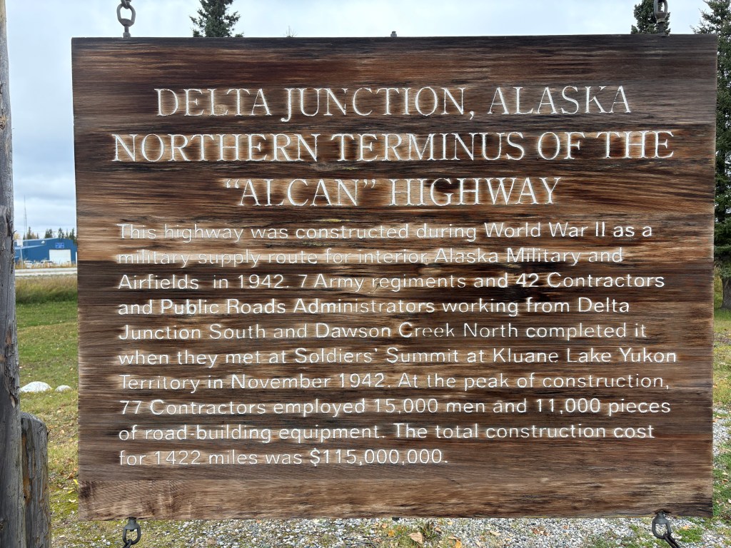
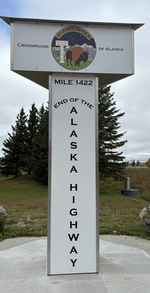
Here are more of the things I saw as I drove south. About 20 minutes after having seen where the Trans Alaska Pipeline was hoisted over a river I arrived in the small city of Delta Junction. As you will see, this is there the Alaska Highway ends.
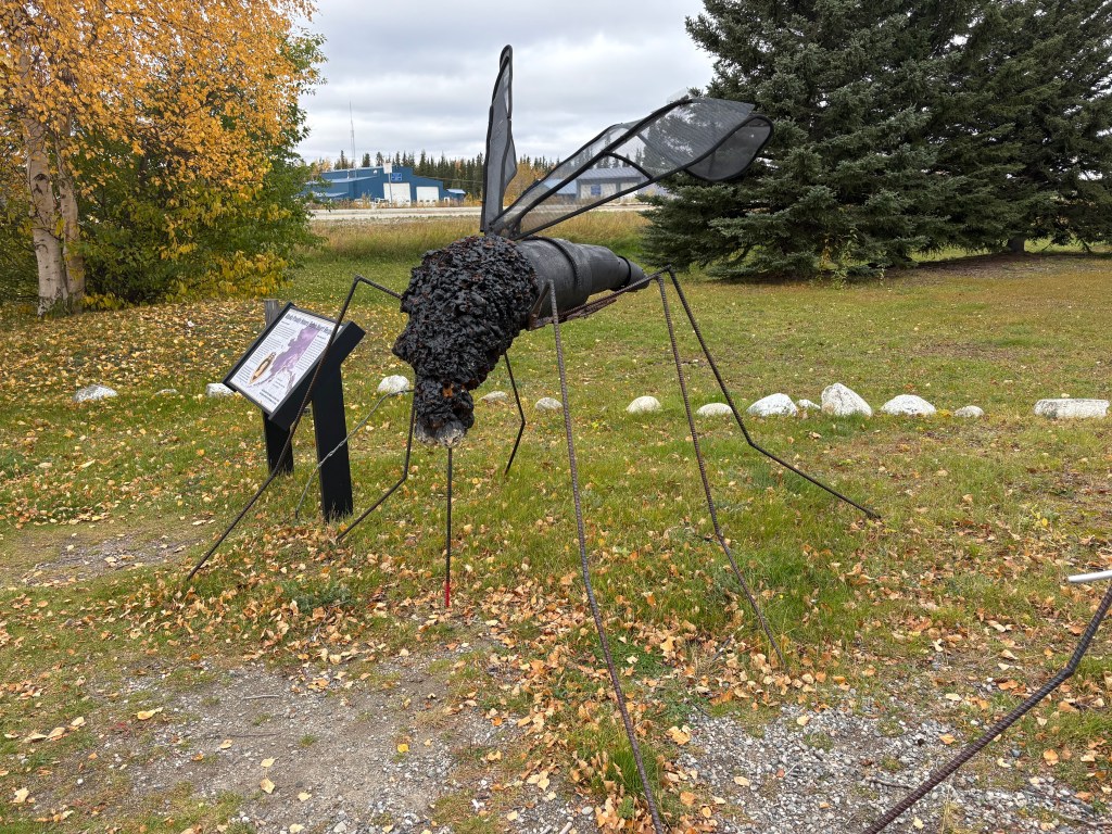
Oh, and there is a much-larger-than-life mosquito here, too.
Why, I don’t know….
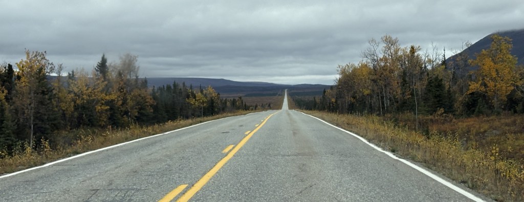
After taking a lunch break here I continued south, this time on Hwy 4. Highway 2, which had brought me down from Fairbanks, goes southeast from here to get to Tok, AK and eventually the Canadian border. I will take it when I leave this part of Alaska later in my trip.
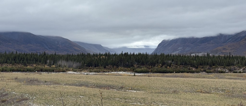
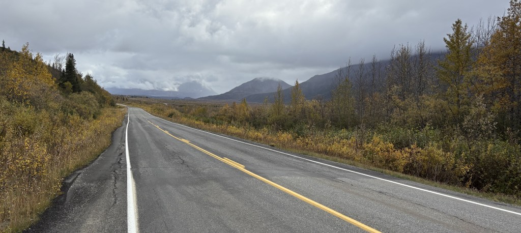
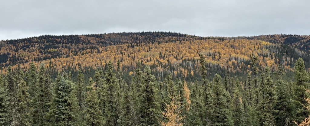
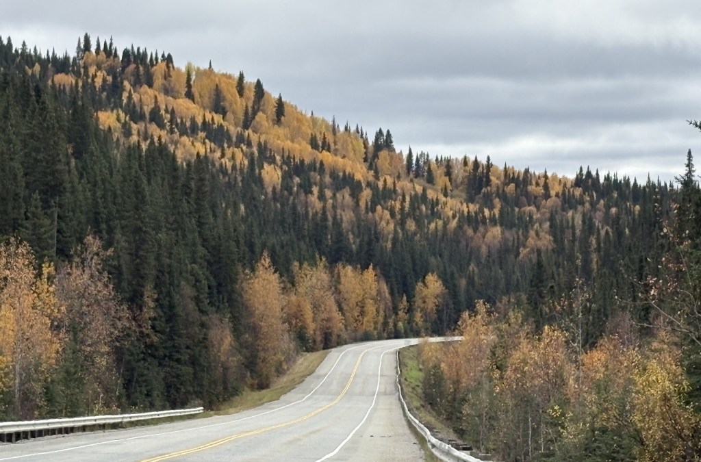
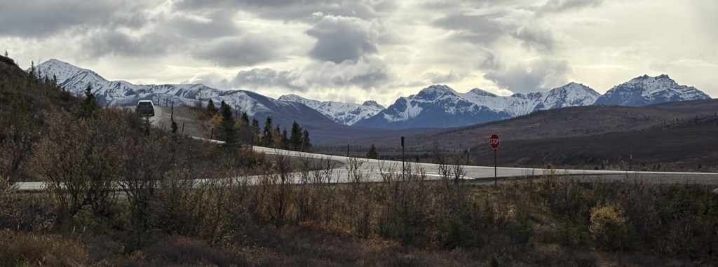
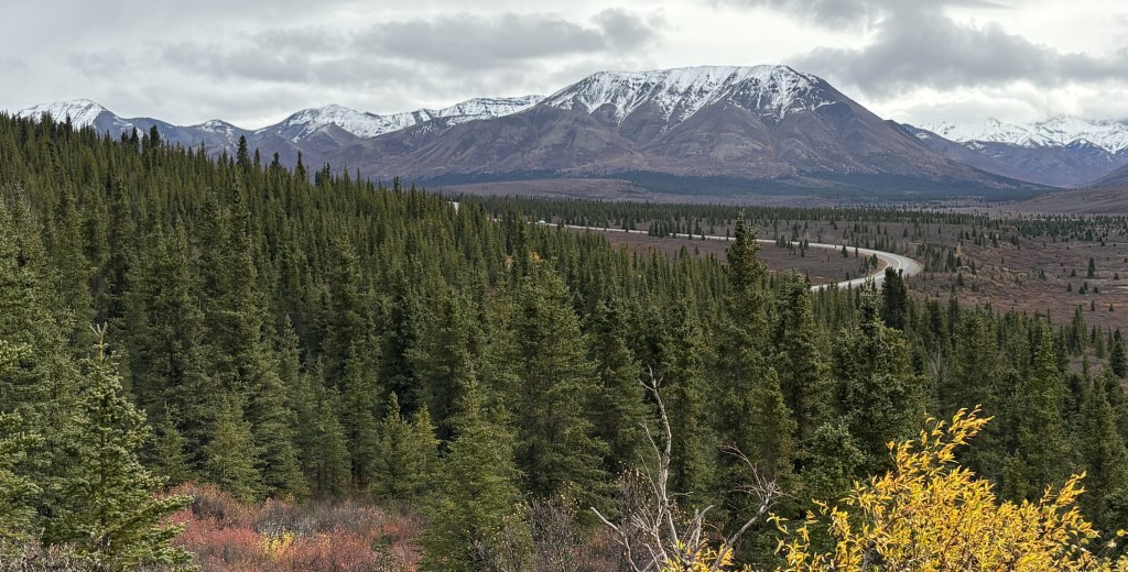
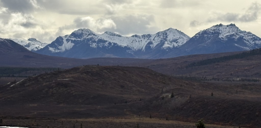
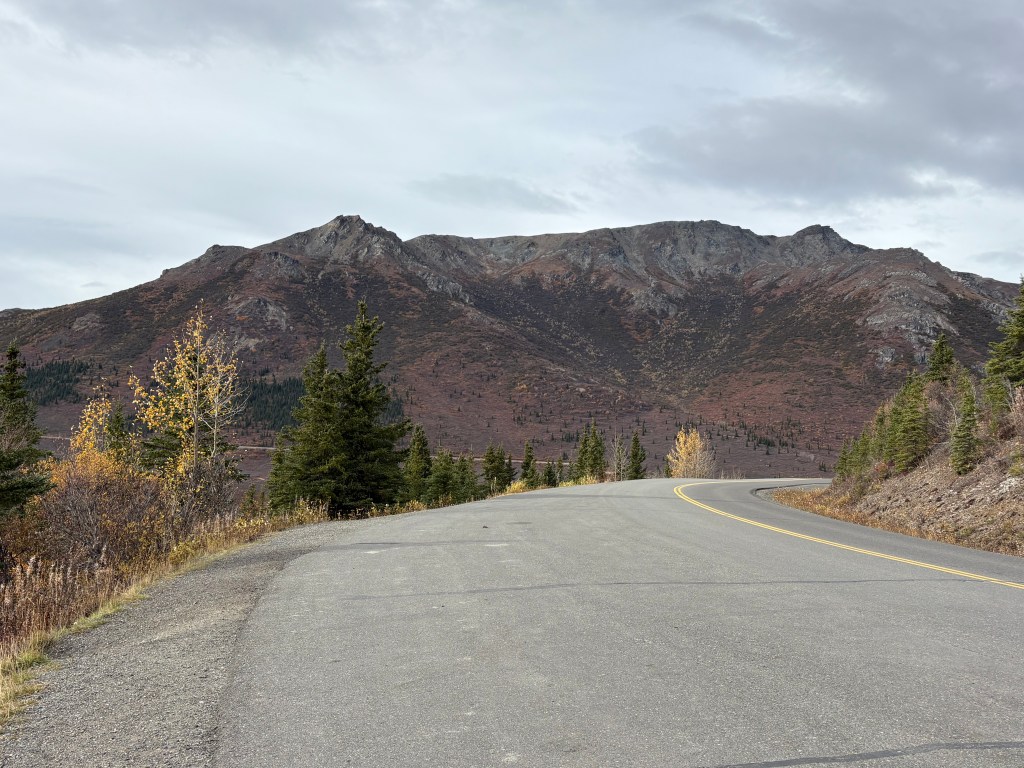
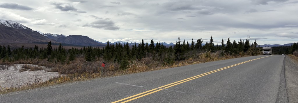
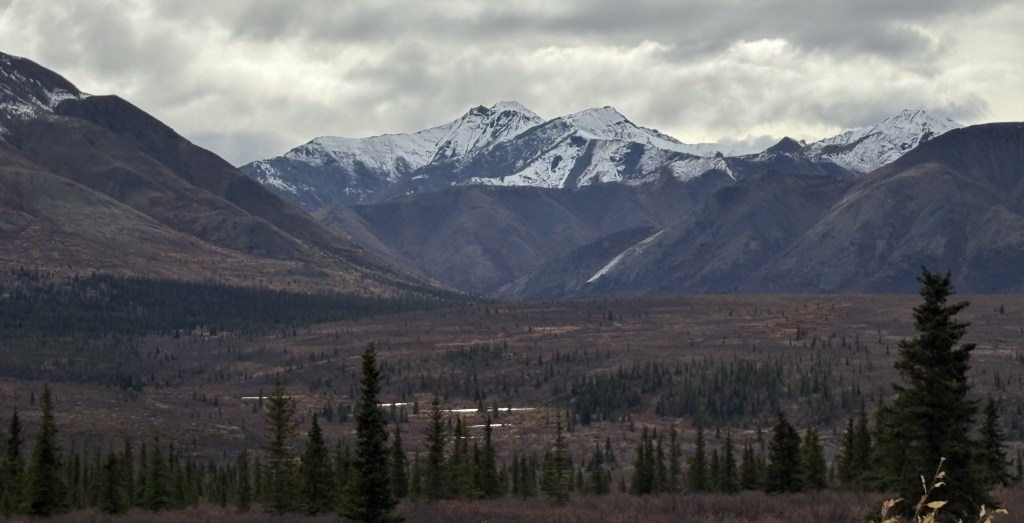
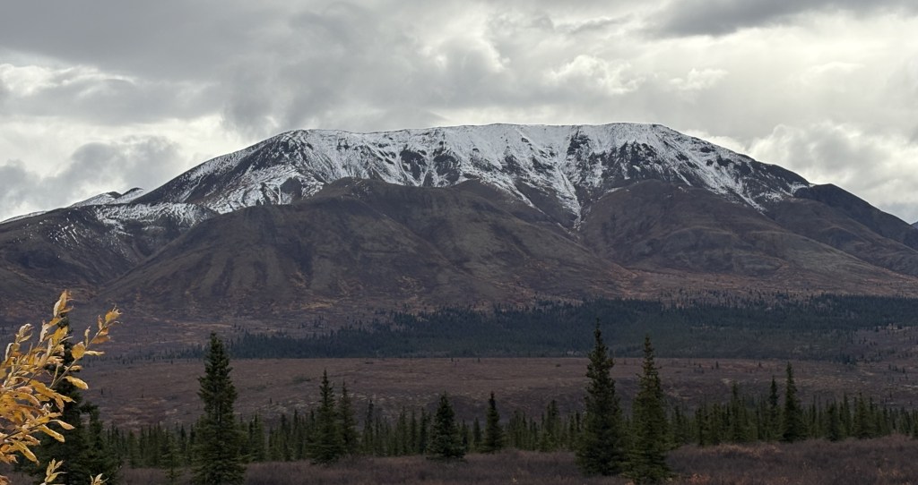
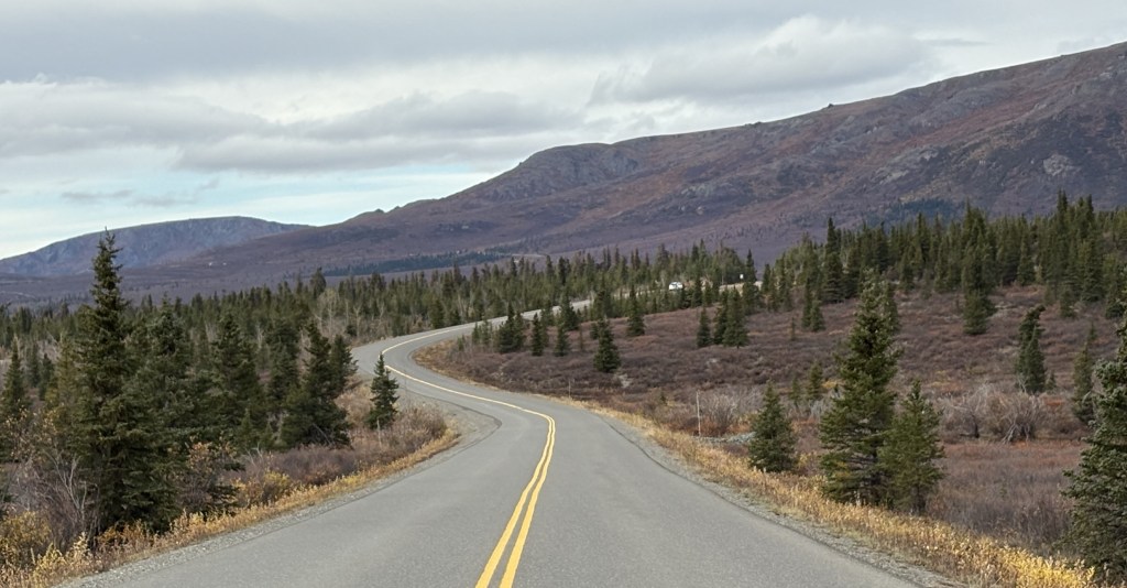
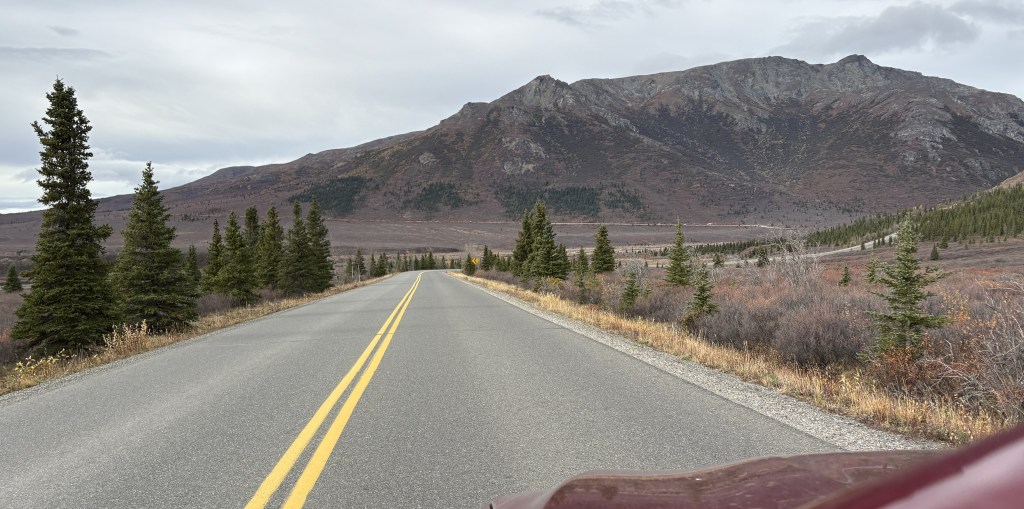
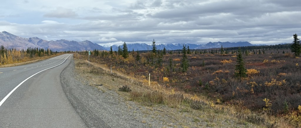
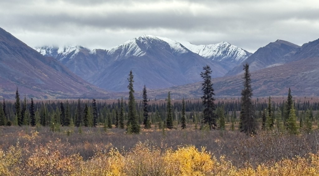
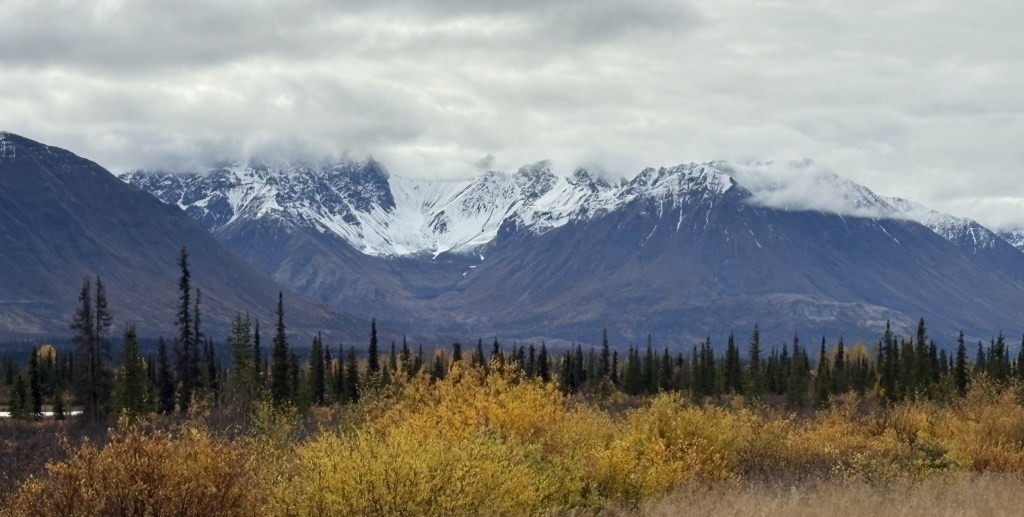
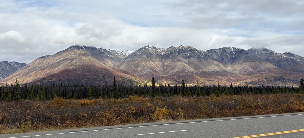
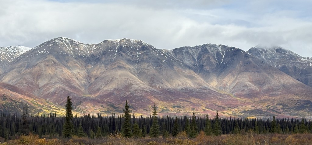
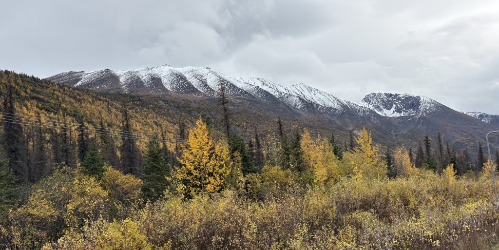
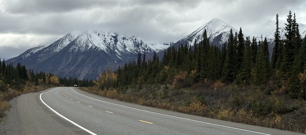
As I drove south on Hwy 4 I continued to pass low mountains, but I would drive through another portion of the Alaska Range of taller mountains, though they were further off the highway. It had been overcast all day and some of the clouds were starting to lower.
Looked like a long drive….
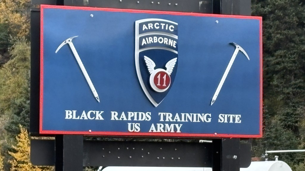
I passed another military training site but there didn’t seem to be anything going on. I presume it is for training in cold and snowy conditions. All I could see was a building next to the highway.
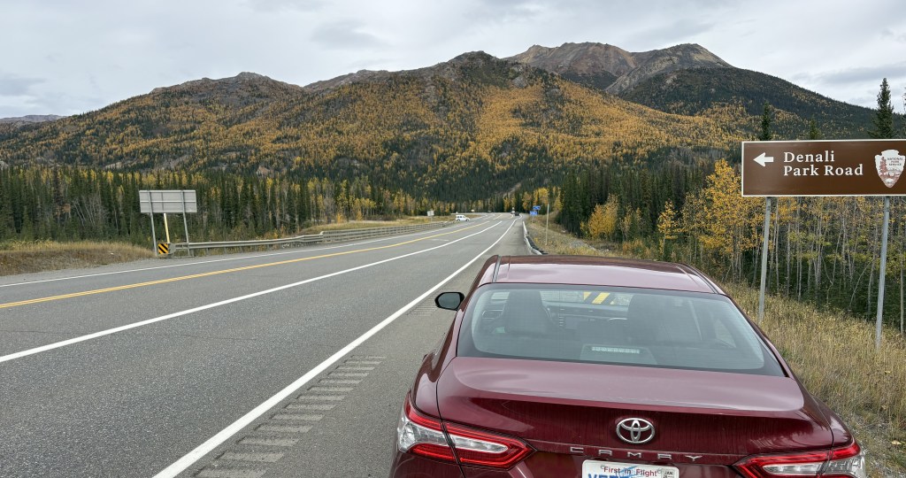
If there hadn’t been a sign there I would have driven right past it.
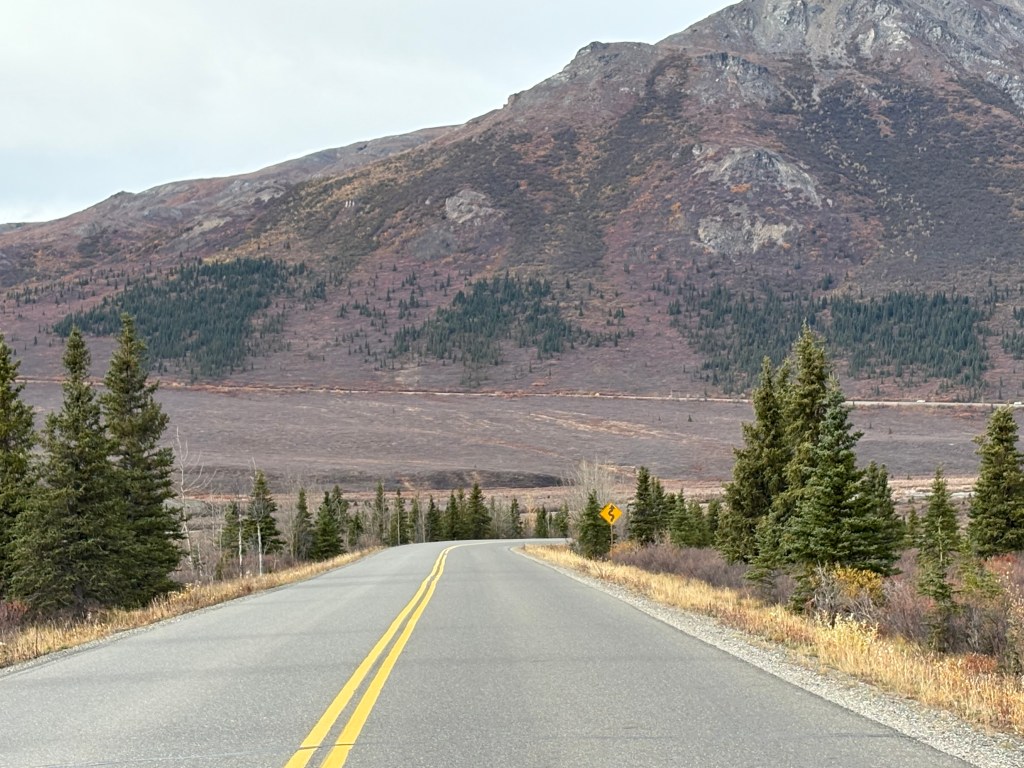
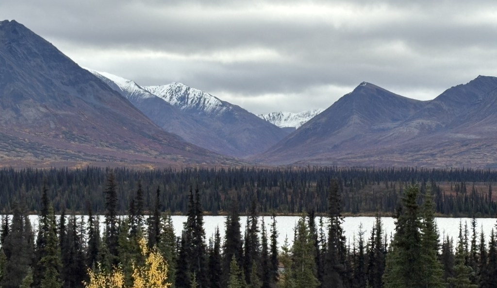
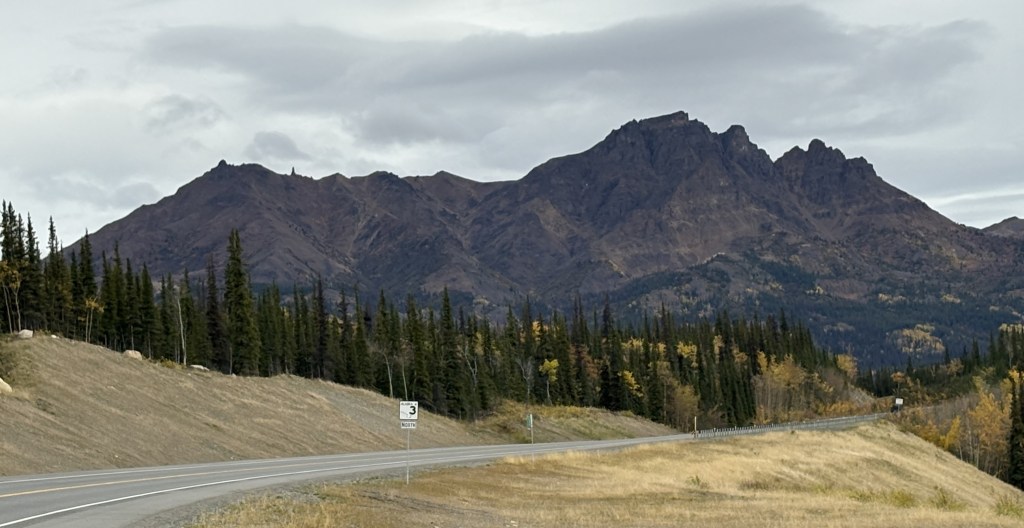
As you may have guessed looking at some of these photos, after Delta Junction there are no towns or villages out here. I saw a small number of motels that were closed and abandoned, but no stores, gas stations or residential housing. In the winter I doubt if this portion of the highway gets much traffic unless the military is engaged in training exercises. I had hardly seen any traffic when I was on Hwy 2, and saw even less now that I was on Hwy 4.
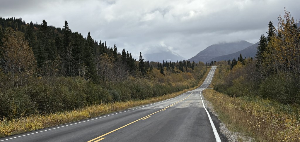
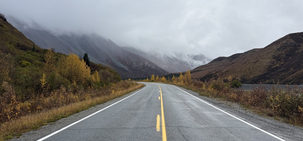
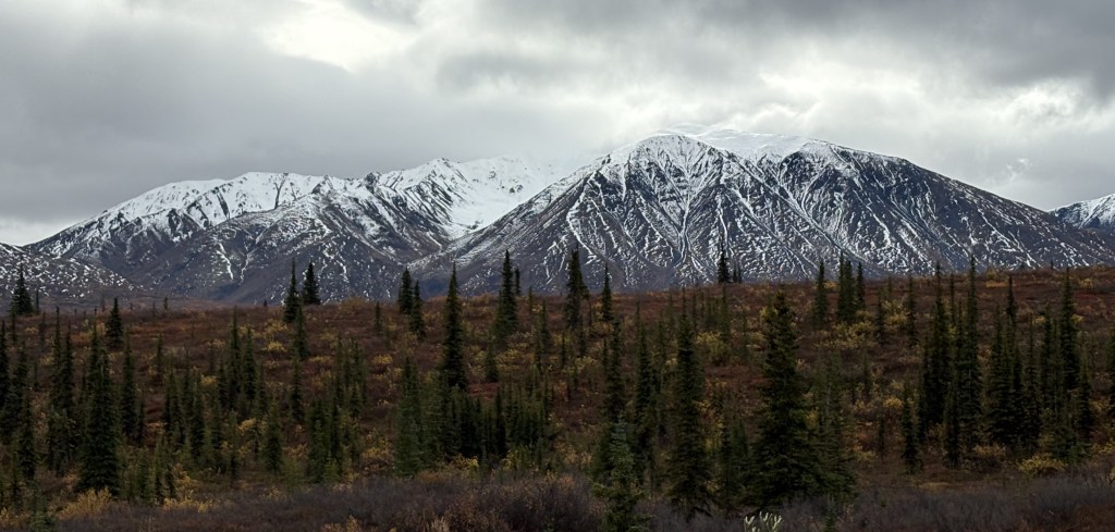
The road just went on and on, and it didn’t look like I was going to get a very good look at any on the mountains due to low clouds.
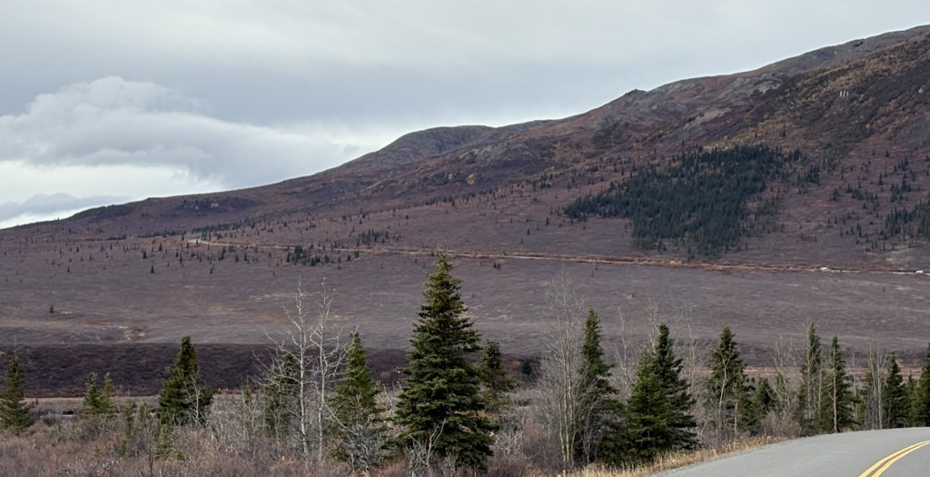
And the hillside right next to the highway kind of closed in for a short while.
When I arrived in Fairbanks two days ago I had just driven the final two hours north and east from Denali National Park. It was an uneventful trip, and I didn’t stop to take any pictures. The scenery was pretty much open and there really wasn’t much to see.
I have a long drive today to get way down to Gakona and will stop and take pictures throughout the day to memorialize my trip. Here are some of the things I saw as I drove south on Hwy 2 as far as Delta Junction.
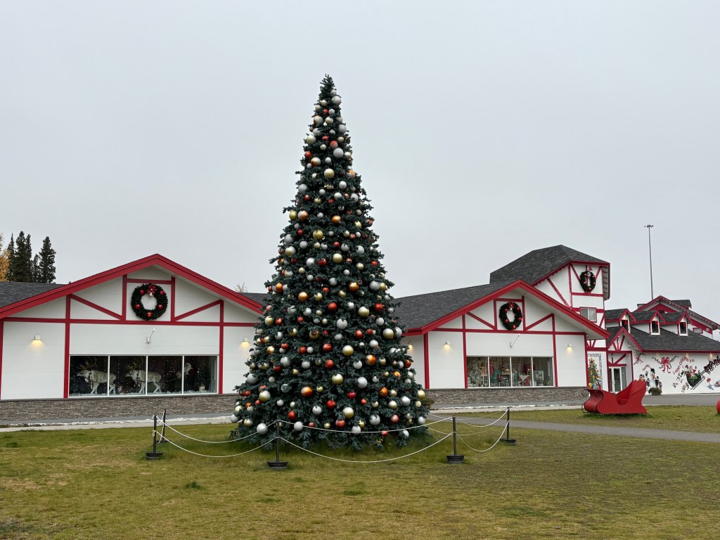
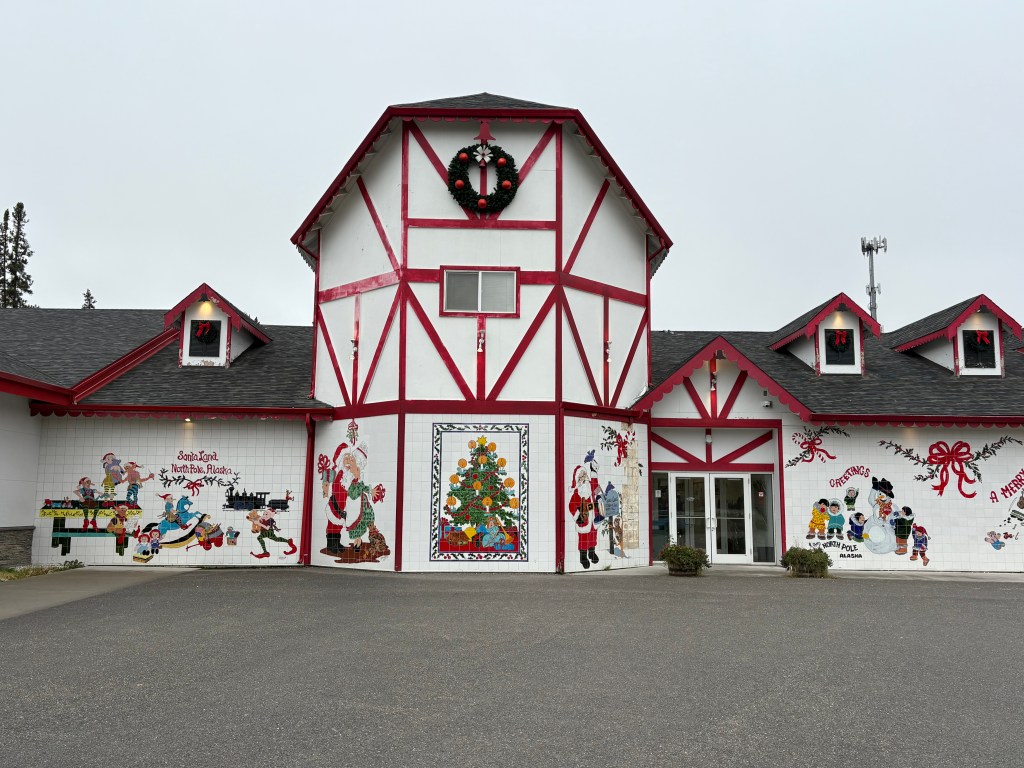
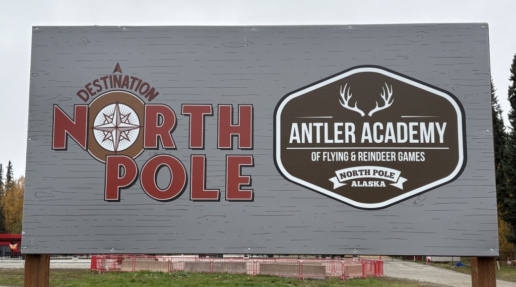
My first stop was in North Pole, Alaska – about 14 miles from Anchorage.
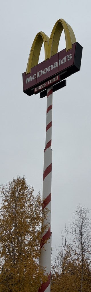
Basically a tourist trap, and while I didn’t go inside I did at least stop to take pictures. Even the McDonald’s off the exit got in the spirit by painting their highway sign like a candy cane.
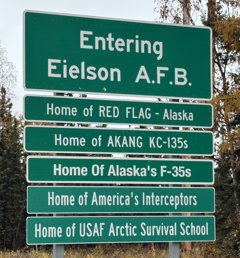
Further down the highway I would drive through Eielson Air Force Base. The sign as I approached indicated they have quite a bit of hardware and personnel here.
The highway ran parallel to the runway and control tower. I did stop to take pictures of some planes parked on the tarmac but will not post them. I will elaborate later in my trip when I pass through this area again before leaving this part of Alaska.
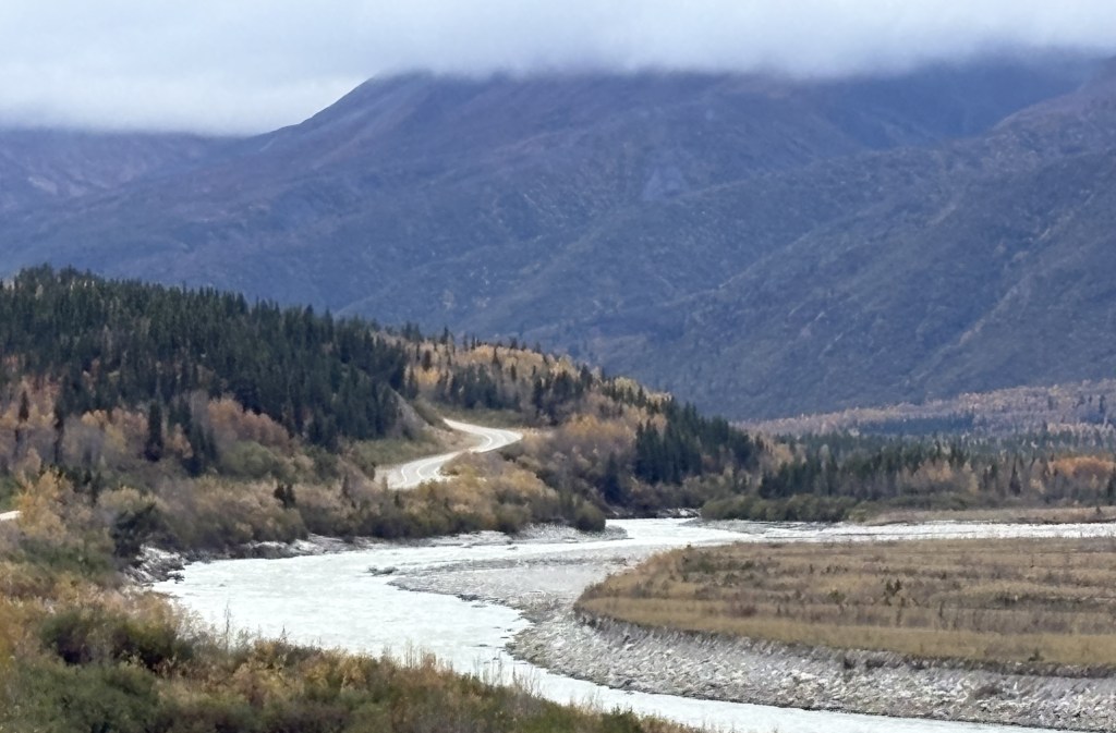
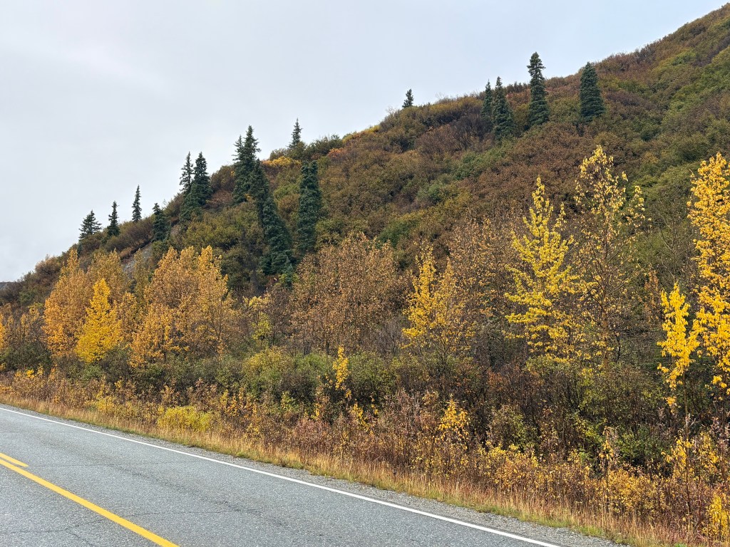
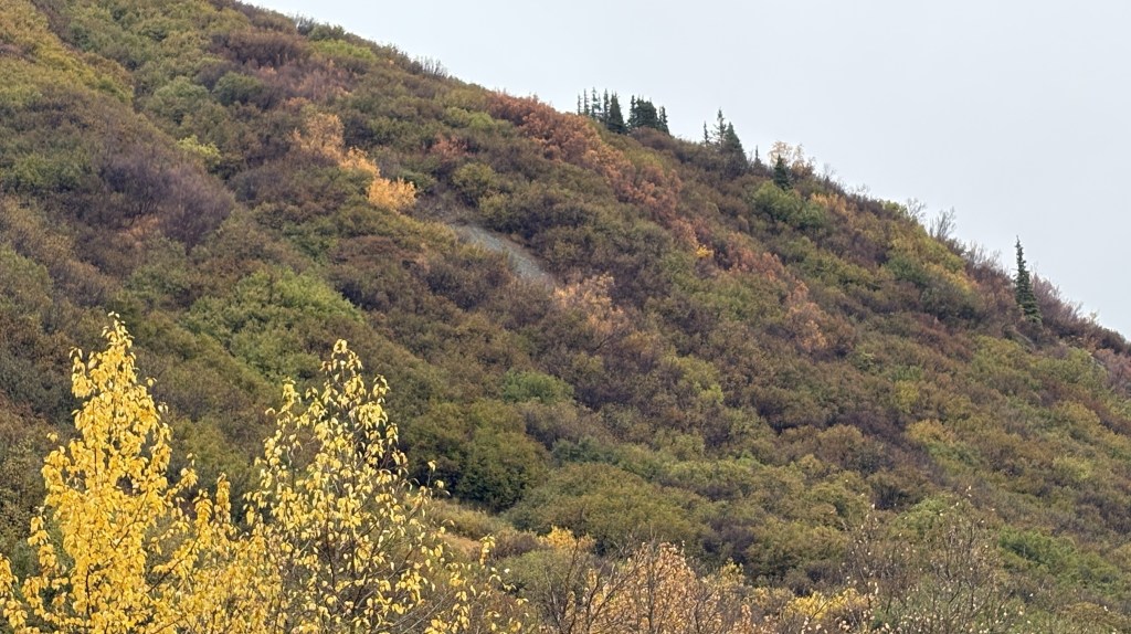
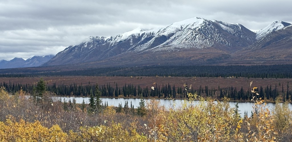
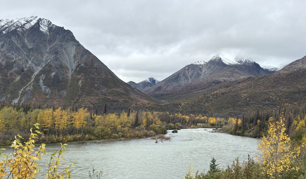
The rest of the drive as far as Delta Junction was mainly near low, tree covered mountains.
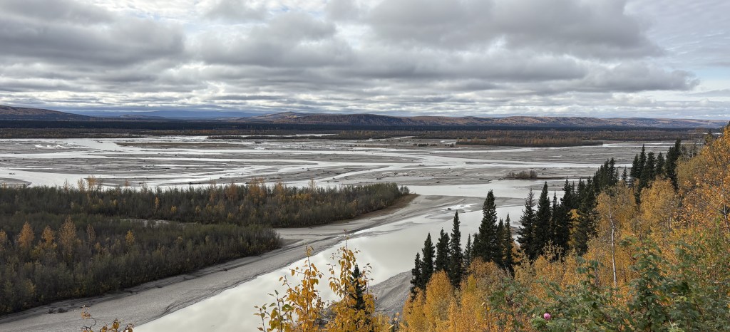
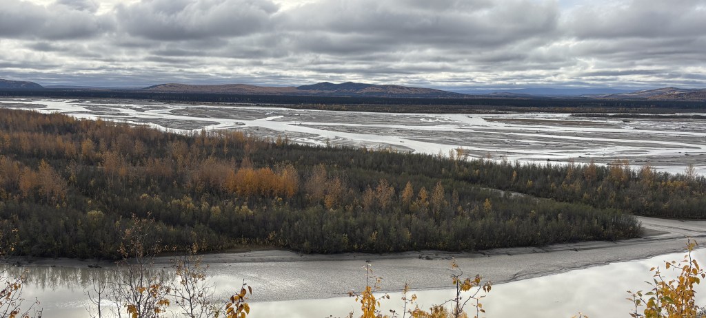
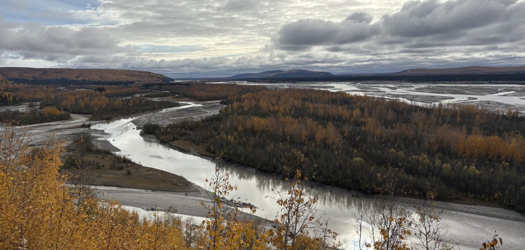
I did drive next to a very wide river for a short distance. The water level was pretty low right now but I suspect it gets considerably higher as snowmelt makes its way to it from mountains upstream in the Spring and Summer.
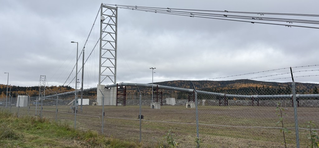
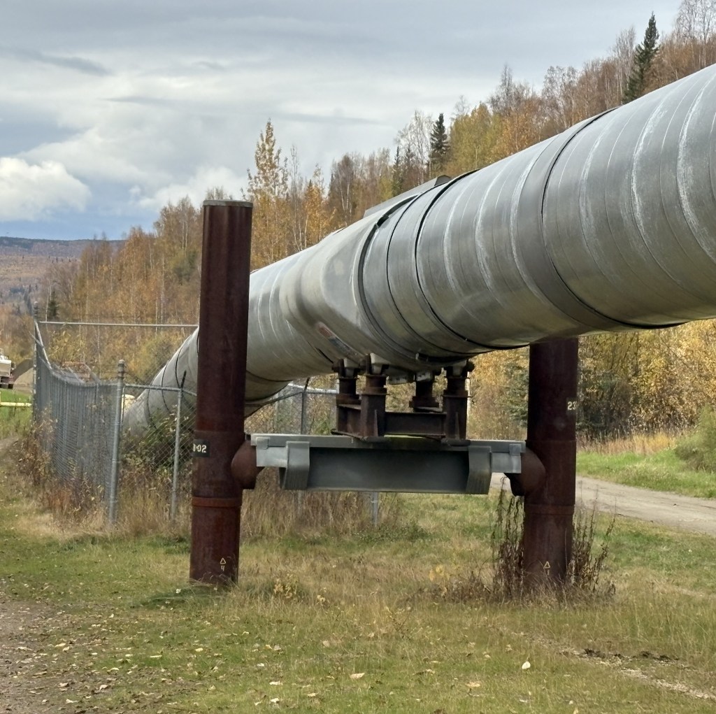
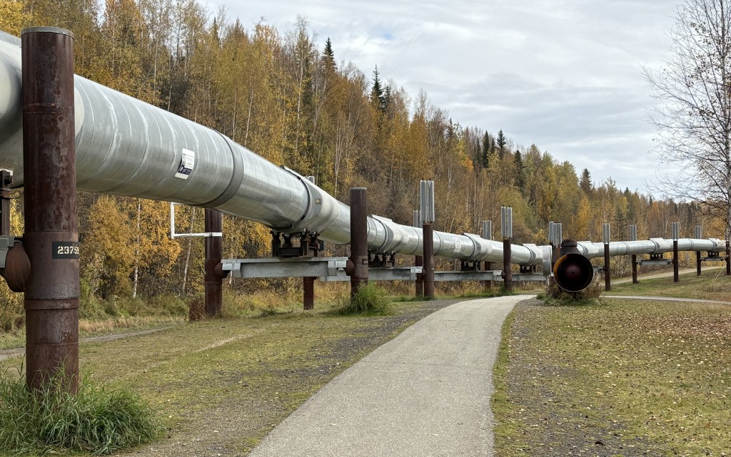
Later I drove over a bridge and on my left was a section of the Trans Alaska Pipeline. There were stanchions and support wires to carry it over the river.
On several of my trips around the US and Canada I have seen signs indicating I was crossing the 45th Parallel – or a point halfway between the equator and the North Pole. When I saw a brochure in the Visitor Center for the Latitude 65 Restaurant I assumed it must be at or above the 65th Parallel. I was already further north than I had ever been but if I was this close I HAD to cross that line…
After stopping at the Trans Alaska Pipeline pullout I got back on Hwy 2 and continued driving north. The total distance from Fairbanks to the restaurant is about 45 miles.
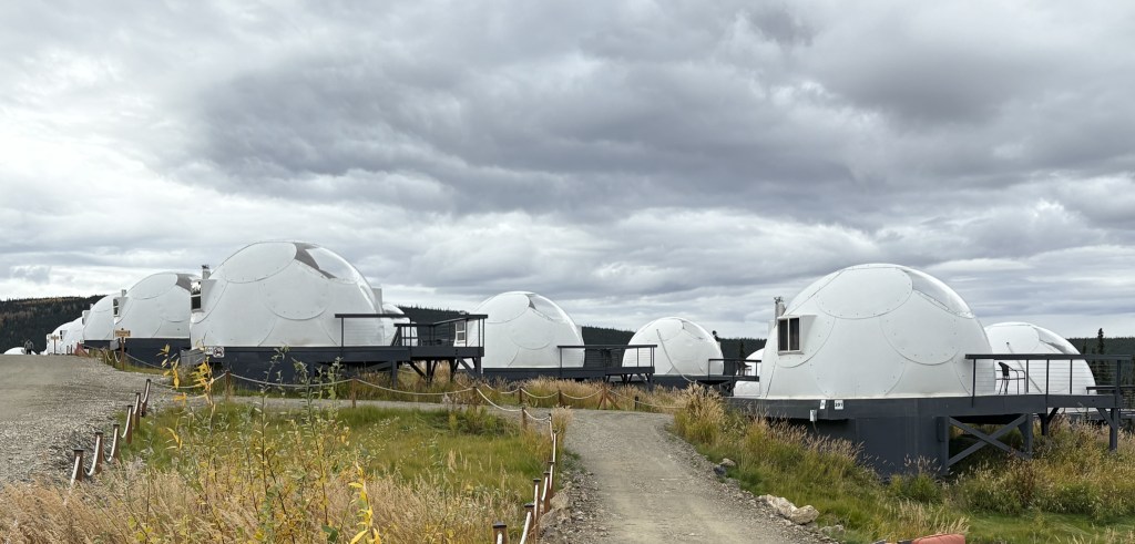
When I was climbing a fairly substantial mountain, as I approached the top my GPS told me to turn left. I was immediately put on a dirt road and my GPS advised me I still had 3 1/2 miles to go! After driving a short distance on what became a rough, washboard road I thought “who in their right mind would put a restaurant way out here???”
When I finally arrived this is what I found:
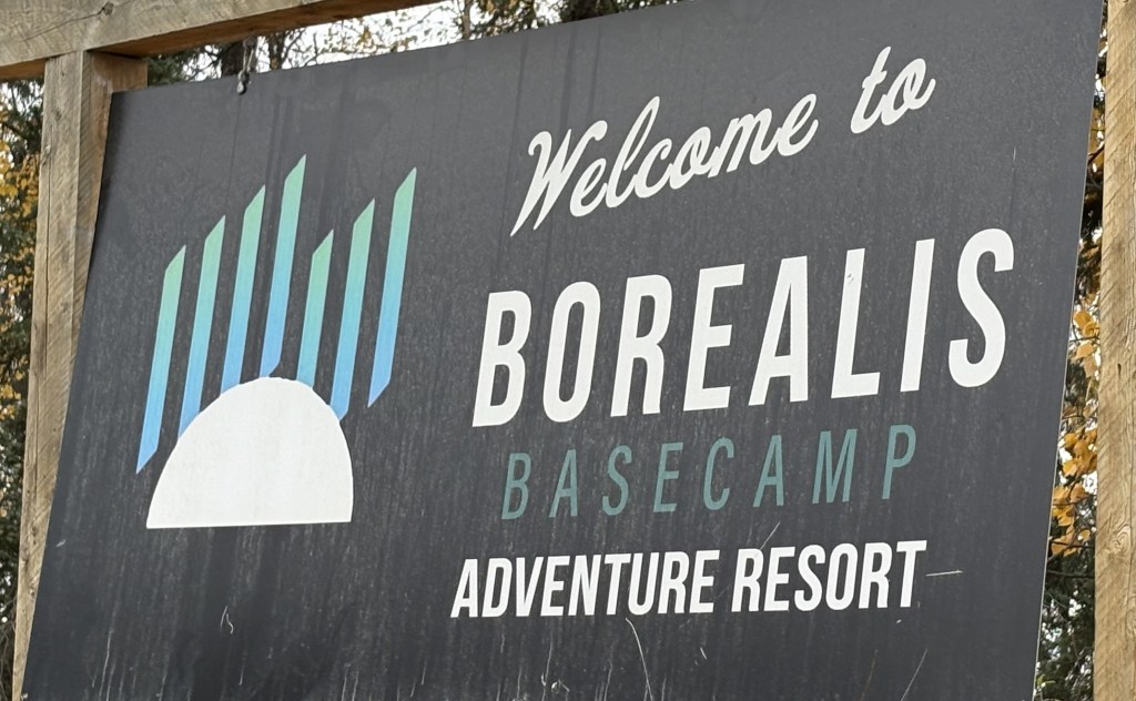
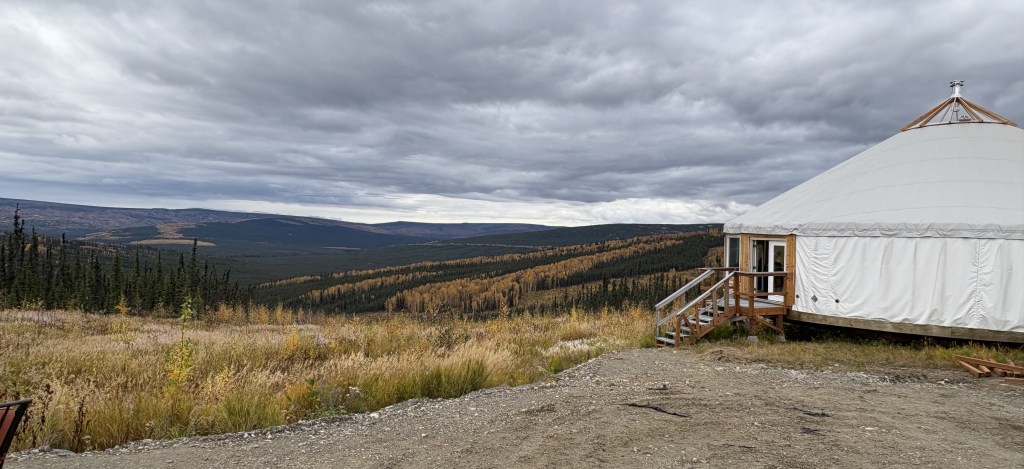
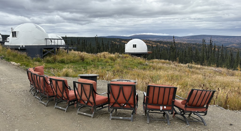
I call them alien pods but in reality they are part of Borealis Basecamp – a niche facility aimed at folks who want to see the Aurora Borealis (Northern Lights).
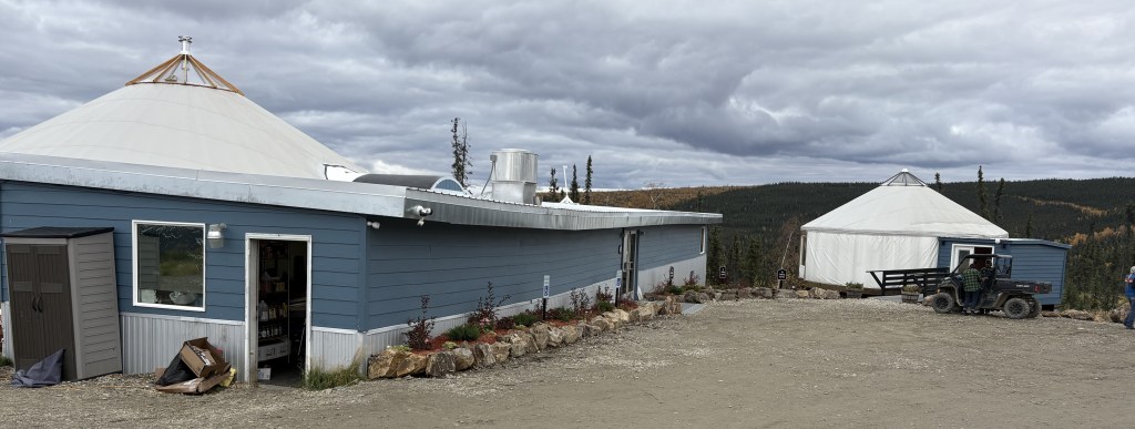
Yes, the restaurant was here, too – but was in a large yurt with a view.
The photo above shows the kitchen and storage building and a small yurt out back. A much larger yurt was on the other side of the main building, with a fabulous view.
From what I have read on their website, people pay over a thousand dollars per night to stay in one of the “igloos” which have clear fiberglass ceilings, hoping that they will be here on a night – a) when it is not overcast, and b) when the lights are actually visible. I have yet to see them, anywhere, but will have one minor sighting later in my trip.
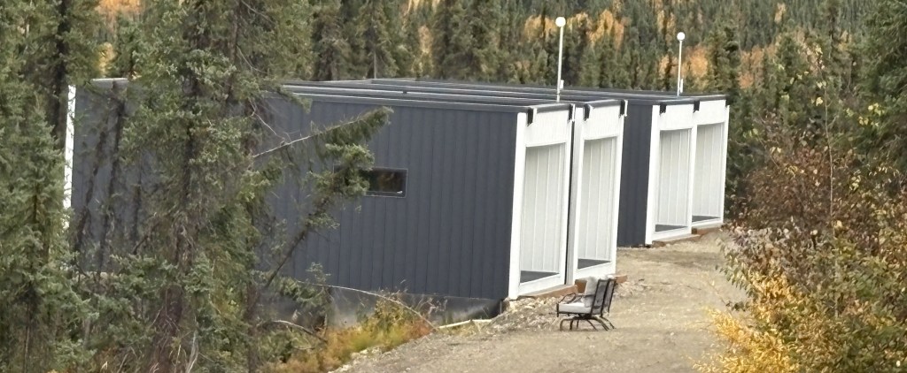
In addition to the “igloos” there are some “cubes” for people who want a little more room, although I believe they need to go outside to see the lights, or look through a normal sliding glass door.
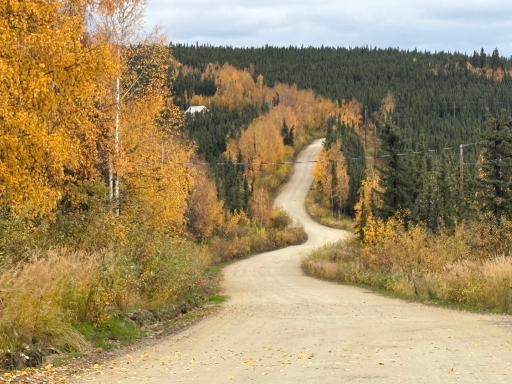
This was the road as I was leaving:
There were several places where there were signs like this:
When I got back out to the Highway I headed south towards Fairbanks. I stopped at a large sign I had seen as I drove north.
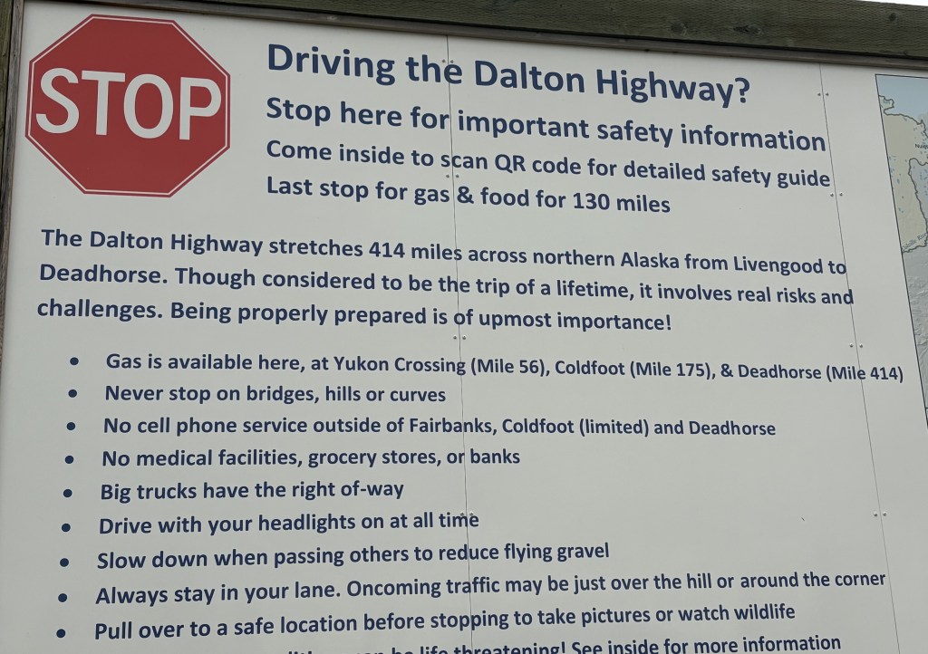
The road I was on, Highway 2, continues north to a town called Livengood, then becomes Highway 11 – also known as the Dalton Highway. It is a very dangerous road, which is in notoriously poor condition and favors big, heavy trucks. I don’t believe rental car agencies allow their vehicles to be driven on the Dalton Highway.
I wasn’t even near Livengood and from there it would have been 115 miles to get to the Arctic Circle, and another 299 miles to the end. I believe I’ll just settle for getting as far as the 65th Parallel, thank you very much.
I drove to Fairbanks yesterday after having spent some time in Denali National Park. I didn’t arrive until evening and went straight to my Airbnb which was north of town.
I was surprised to learn that Fairbanks, which recently overtook Juneau as the second largest city in Alaska, isn’t really that big. It has a city population of around 32,500, although there are neighborhoods surrounding the downtown area that could arguably increase the number if pooled together.
Although I will spend two nights here I will only be here one full day, as I will have a long drive tomorrow to get back down near Glennallen. This was more of an orientation stop and I will come back later in my trip to spend three nights and two full days.
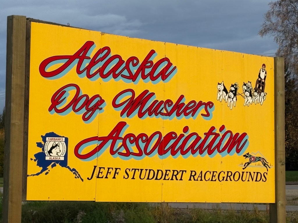
When I first left the Airbnb to drive downtown this was the first thing I saw:
There wasn’t any snow on the ground while I was here so there was no activity at this venue, but I will visit a Musher Museum when I come back to Fairbanks later in my trip. I stopped at Walmart to replenish my food supply and then drove around town a bit to get my bearings. I was at the Morris Thompson Cultural and Visitor Center downtown when it opened.
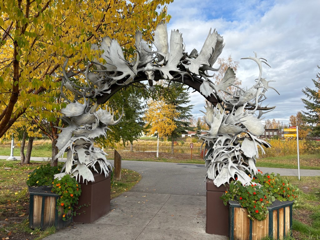
I picked up maps and brochures so I could find out what was open and what wasn’t. This antler arch was out back:
The sign said there were over 100 antlers but I didn’t count them. If you’ve ever been to Jackson, Wyoming they have some much larger arches at all four corners of a city park there, but this wasn’t bad for Fairbanks. This one was mainly moose antlers, with some elk and perhaps caribou thrown in.
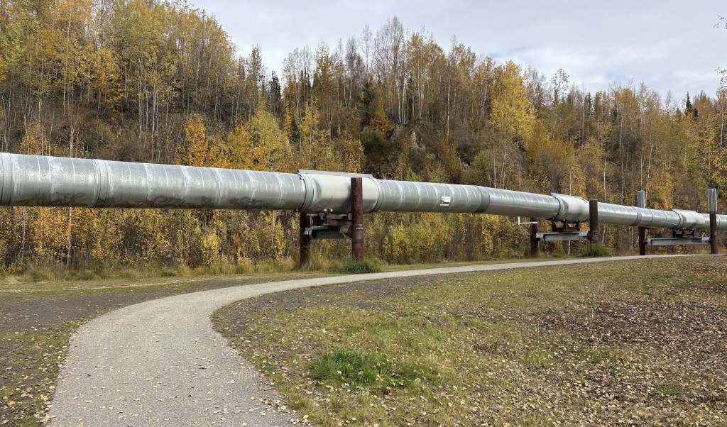
One of the brochures I picked up was for a restaurant called Latitude 65 which I will describe in more detail in the next post. It is further north of town, and as I drove up Hwy 2 towards the restaurant I saw a turnout area for the Trans Alaska Pipeline! I am aware of its existence but never even thought I would see it, and here it was – right next to the highway:
It had come up from underground just north of here.
The pipeline runs from Prudhoe Bay at the top of Alaska all the way down to Valdez, where the crude oil is loaded onto tanker ships.
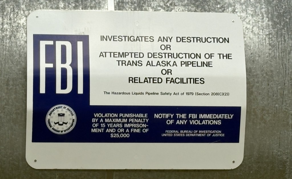
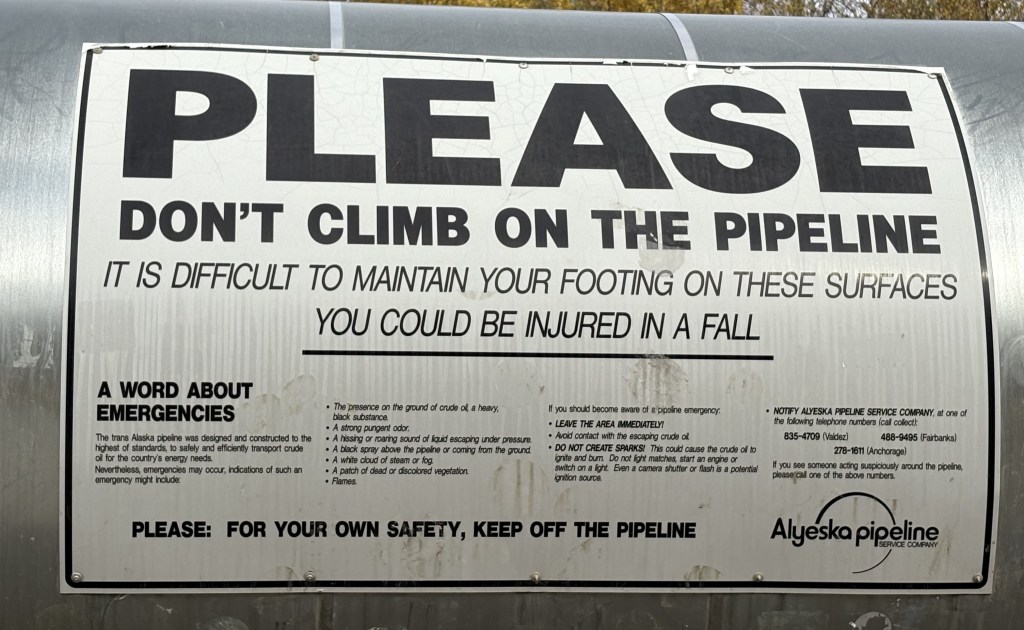
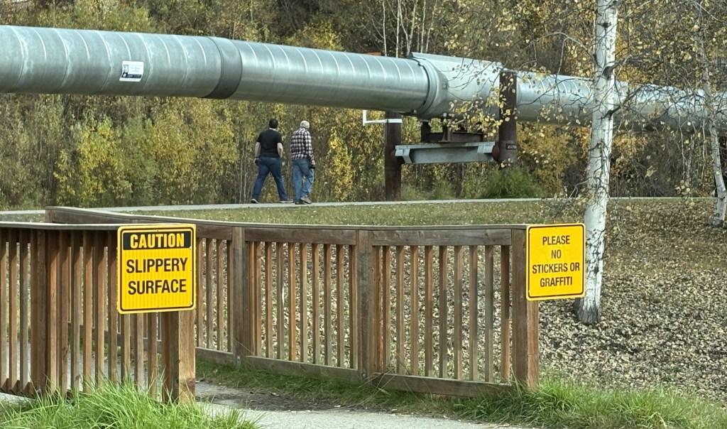
There were other signs discouraging people from climbing on it (it isn’t a toy, people) and also asked that there be no graffiti or other stickers attached.
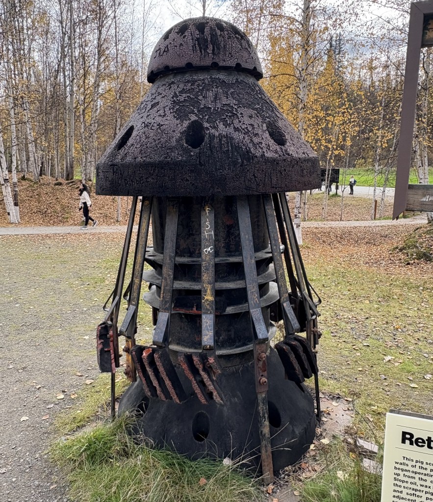
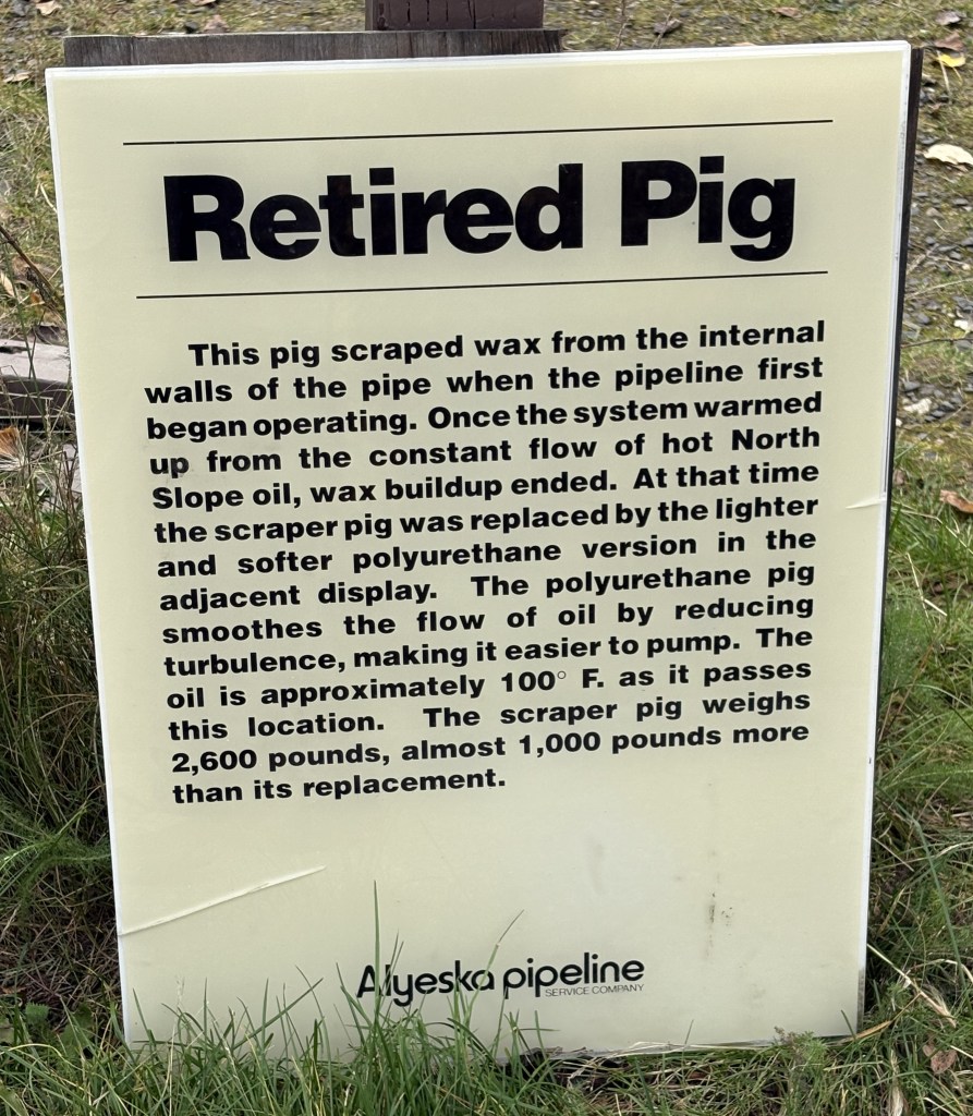
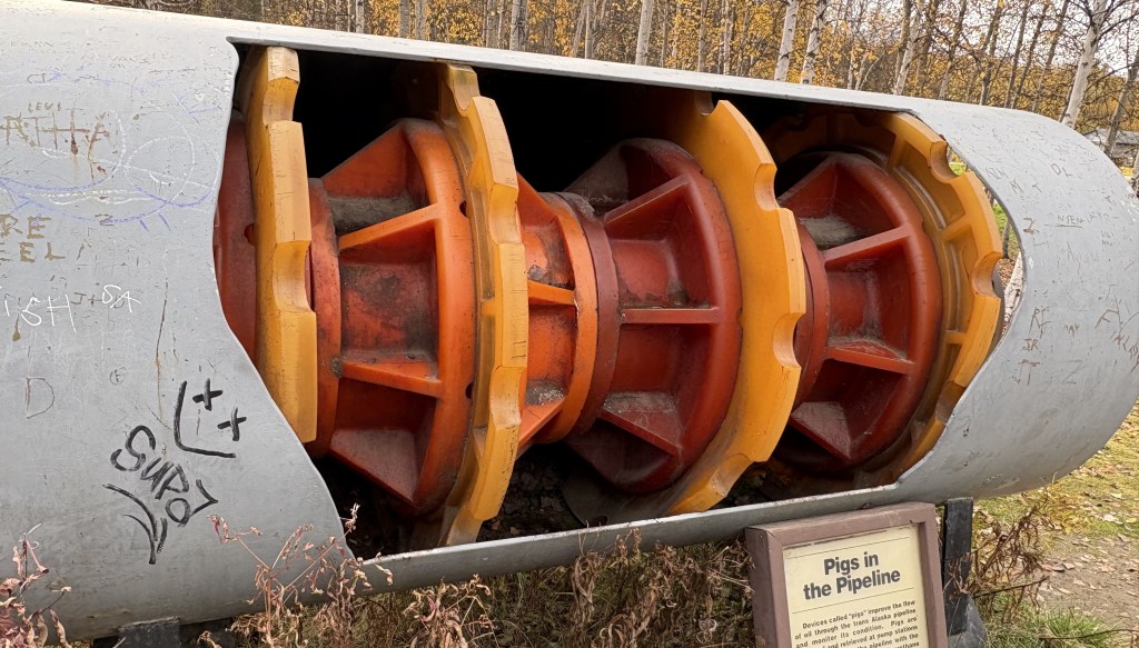
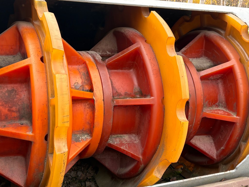
There was also a small display explaining what “pigs” are in the oil pipeline universe. They are used inside the pipeline to keep things from building up inside. When it was being built there was a wax buildup which pigs, like the one shown below, cleared out. The sign indicates that now the oil is constantly flowing past this point at over 100 degrees Fahrenheit so wax is no longer a problem.
This is a newer version of a pig which helps maintain the flow of oil. You can see on the signs that the pipeline is maintained by the Alyeska Pipeline Service Company, and their white crew-cab pickup trucks made up the vast majority of vehicles I saw as I drove along parts of Highways 2 and 4. The pipeline runs roughly parallel to those two roads, though I would see it in the distance some places.
I will continue with the restaurant I was heading to in the next post.
Part 1 of this post included photos of my drive in to the 15-mile mark, which is where the paved road ends. Here are some of the things I saw on the way out. I still had a 2-hour drive to get to Fairbanks before dark so I could only spend a short time in Denali National Park today, but I will be coming back for 3 1/2 days later in my trip.
That is the view looking back out at Park Road from the parking area next to the Savage River. You will see a few more of those mountains on the way out.
That is a full view of the mountain on the other side of the river from the parking area.
That is a view of the Savage River looking south from a point near the bridge over the river.
That is a wider view looking southwest from the high point on the access road. There were no signs indicating that Mt. Denali might have been visible from this spot.
That is the paved road going back towards the entrance.
That is the small pullout area next to the road at the high point on the access road. I will be spending lots of time there when I come back, scanning the areas around me with binoculars.
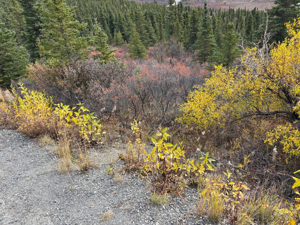
The brown bushes with the red-ish tops are the scrub brush I described earlier. It effectively covers the ground in many areas near the access road. It varied in height, and I don’t know how receptive animals are to walking through it. It may have contributed to the low number of animals I saw while I was here.
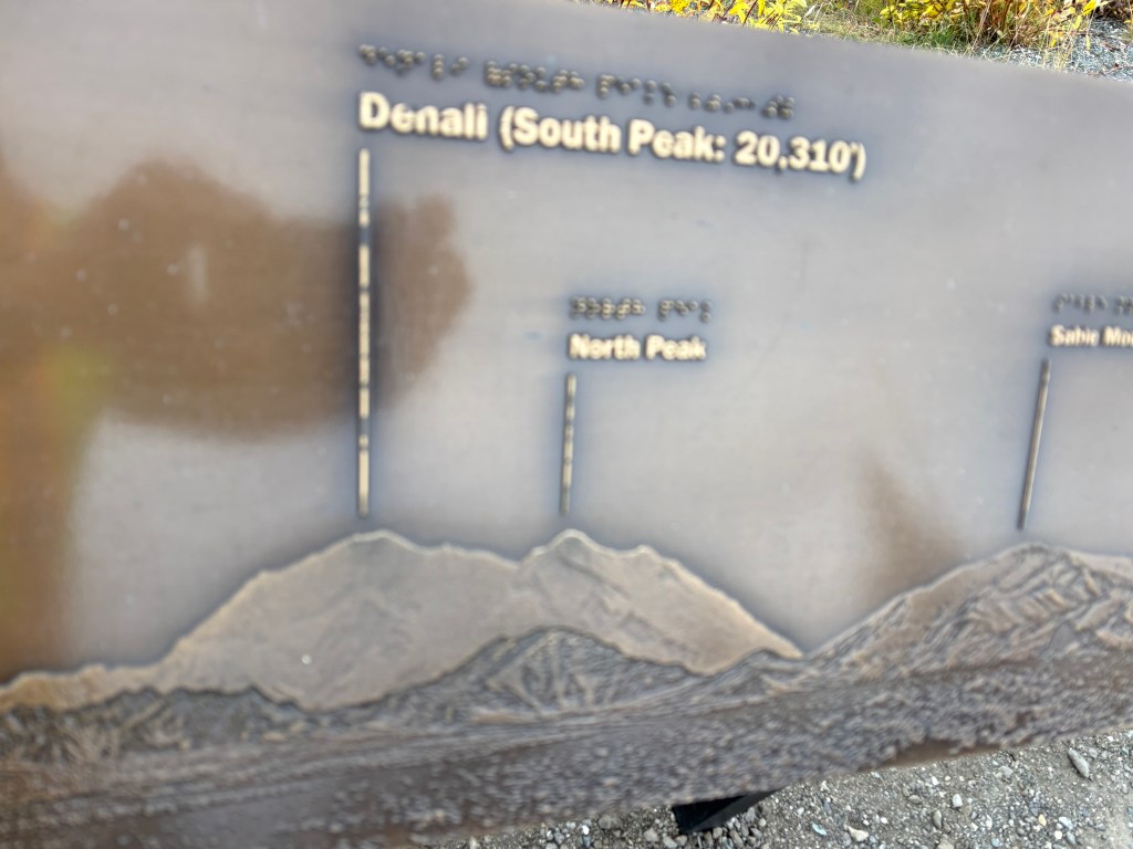
Below is a sign at the one spot on the access road (probably around mile 9) where there was a sign indicating where to look to see Mt. Denali:
And here is the photo I took looking roughly in that direction:
Sable Mountain is the one just right of center with snow on it. The tiny peak to the left of it is above the black spot in the upper photo. The mountain on the left is the lower mountain in the center of the upper photo. Therefore, Mt. Denali was NOT visible from this vantage point today. If it had been it would have risen right where the tiny peak meets Sable Mountain and would have descended on the left, out of the frame (there was a pine tree there). Believe me, if I had seen it I would have zoomed in and taken lots of photos. I haven’t checked all of my other photos yet to see if I ever saw it, but I don’t believe I did.
Another visitor checked Google Maps on his phone and said that Mt. Denali was 71 miles away from this vantage point.
I would have loved to have asked the rangers when I came back if my thinking was correct, and also if I could have seen Mt. Denali from the high spot on the access road, but the Park was affected by the US government shutdown when I came back, so the Visitor Center was closed and there were no rangers to ask.
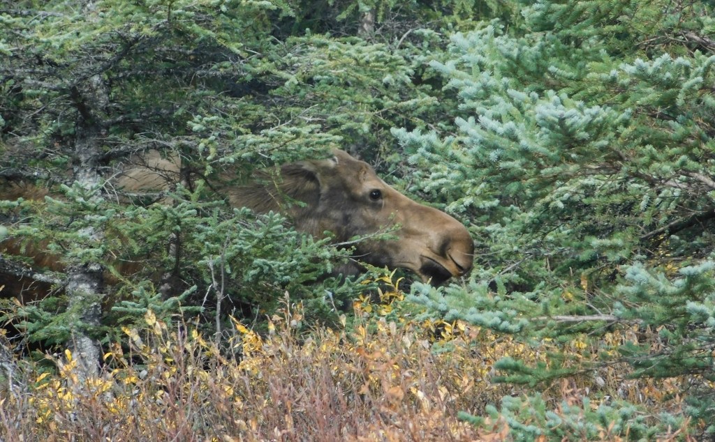
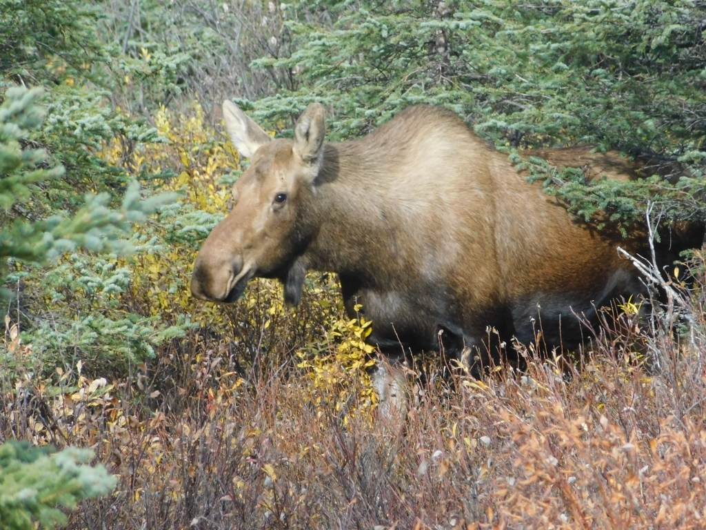
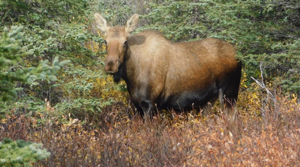
On my way out I did see this cow moose, not too far off the road:
It seemed that she had no trouble walking through the scrub brush. I wondered if grizzly bears would walk through it, but I suppose a several hundred pound grizzly bear pretty much goes anywhere it wants to.
I decided to spend a little bit of time in Denali National Park while on my way to Fairbanks so I could get an idea what to expect when I come back later to spend several days here.
One of the signs at the entrance had a great photo of Mt. Denali, as seen from high above Wonder Lake, well within the Park.
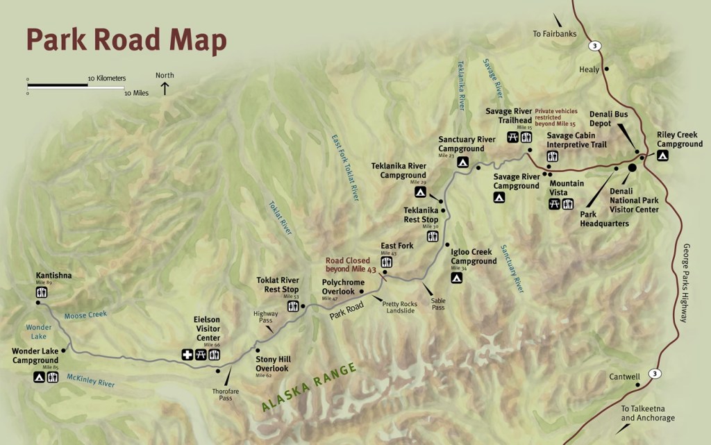
Here is a map of the only road within the Park.
(Photo credit: NPS.gov/Denali)
The majority of the time that the Park is open, passenger vehicles may only drive the first 15 miles of the road unless they have a special permit to go further. Park buses transport visitors deeper into the Park, and are the best way to see much more of the Park’s interior (and get closer to Mt. Denali itself).
The buses stopped running for the season on September 15, so the rangers told me I could now travel an additional 15 miles (on an unpaved road) IF the weather permitted it. I was here on the 19th, but the road had already been shut down once this month for a snow event.
Here are some of the things I saw on this first visit:
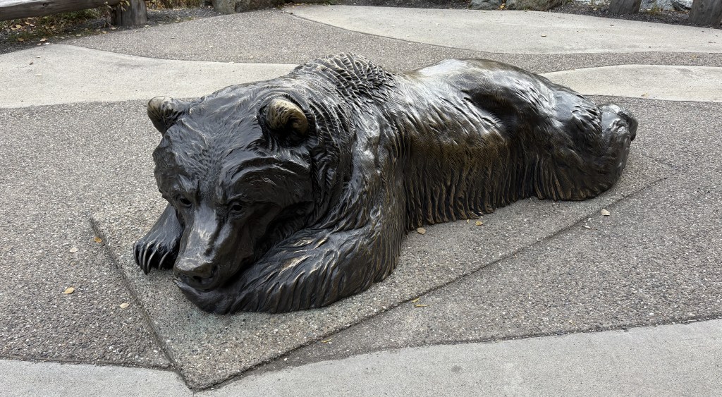
That is a metallic bear outside the Visitor Center.
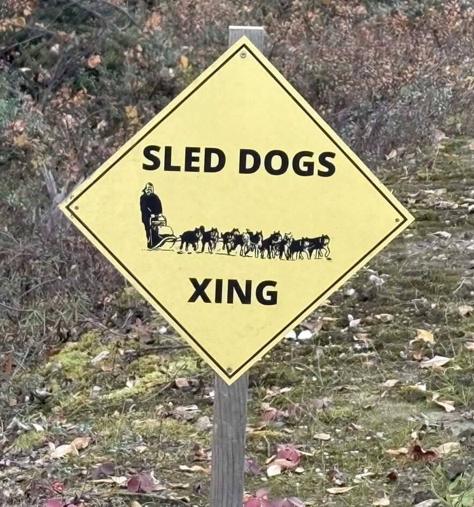
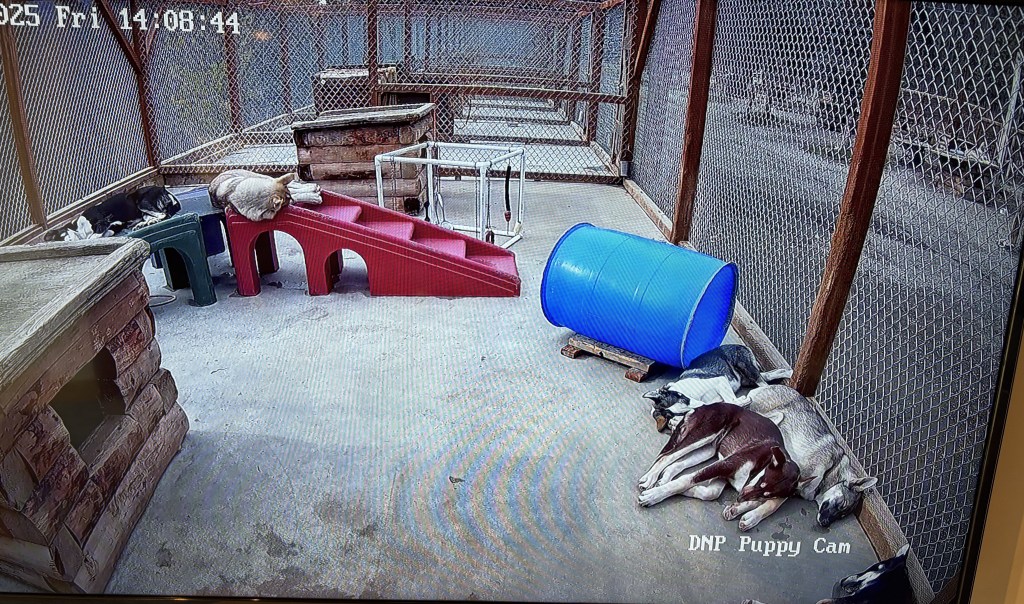
That is a view of the “Puppy Cam”. There were signs on Park Road which warned drivers to watch out for Sled Dogs which may be exercising along the road. As you can see, they were all zonked out in one of their enclosures and I never did see any out and about.
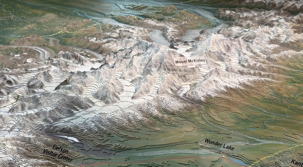
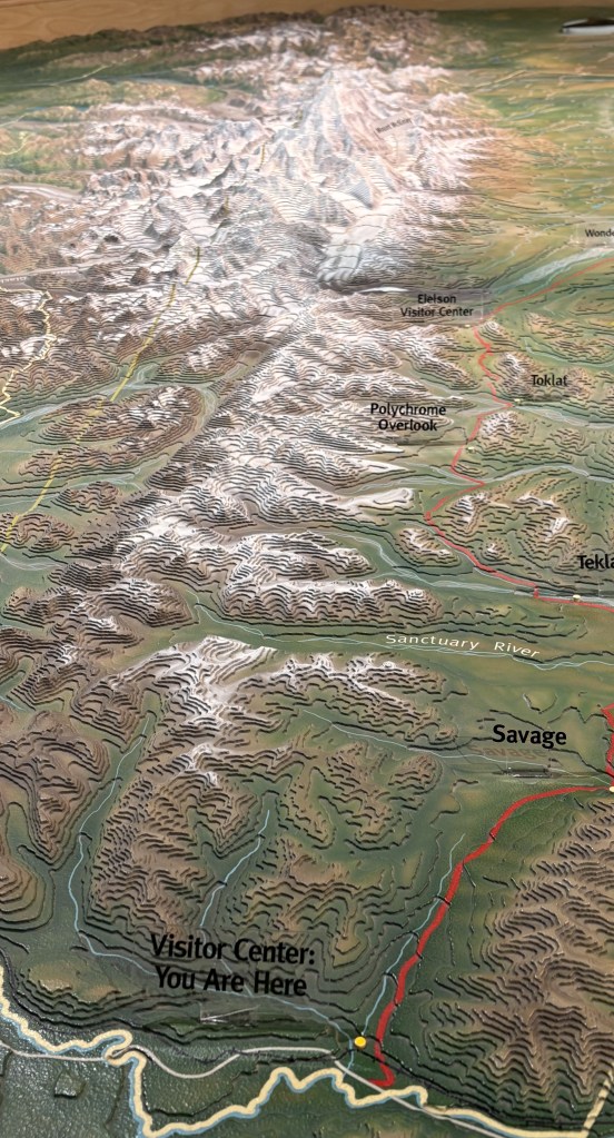
That is a 3-D relief map showing Mount Denali (aka Mt. McKinley) and it’s proximity to Wonder Lake. In the lower left hand corner you can also see a reference to the Eielson Visitor Center, located within the Park and only accessible by bus. I am at the Main Visitor Center out near Hwy 3.
That is another angle of the relief map showing the Main Visitor Center at the bottom, and revealing that from this vantage point, and the first 15 miles of the Park Road I was allowed to drive on (to the Savage River), I would be looking down the spine of what I call the “Denali Complex” of mountains. There is one spot where I theoretically could see Mt. Denali from the Park Road but we’ll see how well that works out…
OK. Enough talk. Let’s get out on Park Road and see what’s in store for us.
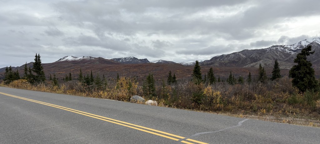
From the Visitor Center the road climbs up to about 3,000 feet elevation and is then fairly level for most of the first 15 miles. There are mountains on both sides, but fairly far off the road. There were 3 or 4 wide, rocky spots (shown above) where the snowmelt drains from the mountains on the right (north of the road) towards the south. The photos above are looking south so the water would be running away from here in the Spring.
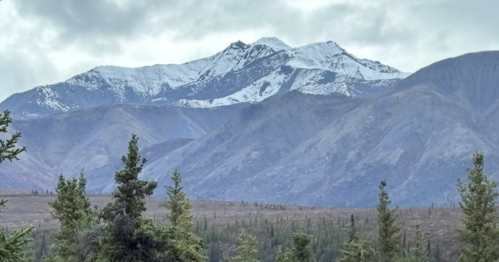
The photo above is looking north from the same spot on the road. Those mountains are a little closer to the road and not as tall or “jagged” as the ones to the south.
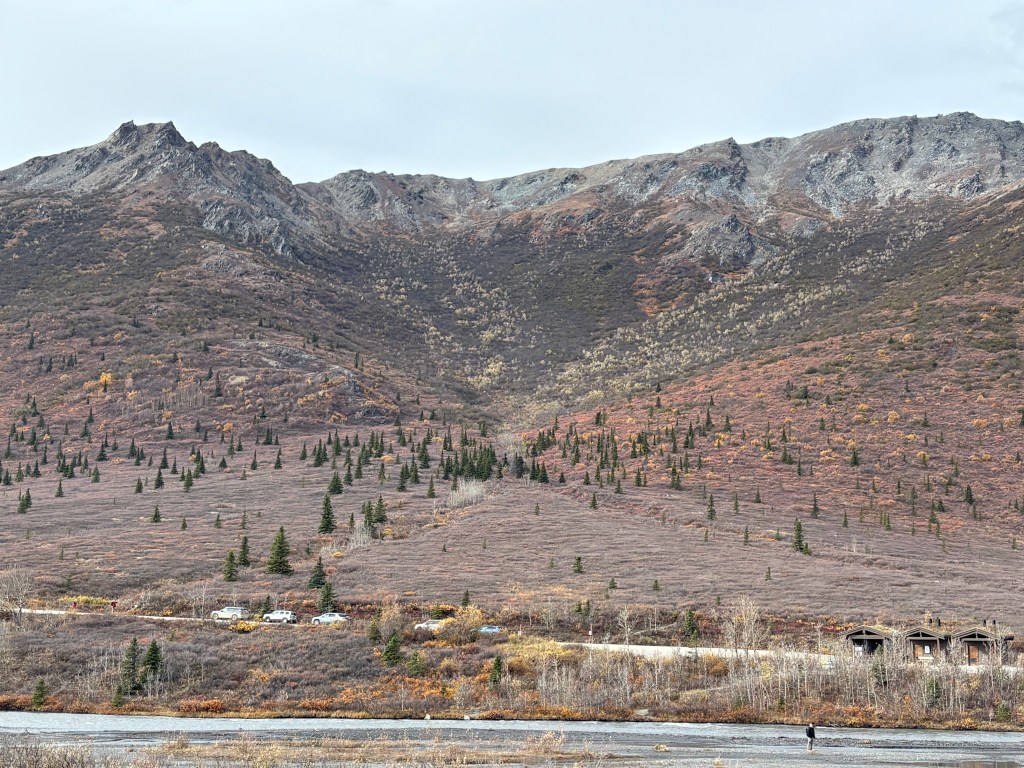
The mountains to the south are taller and many had snow on them already. I don’t believe I saw snow on the mountains to the north this trip but they will have snow when I return in about 2 weeks.
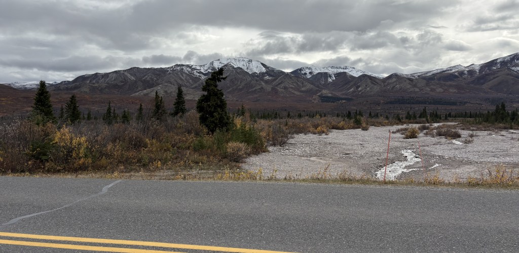
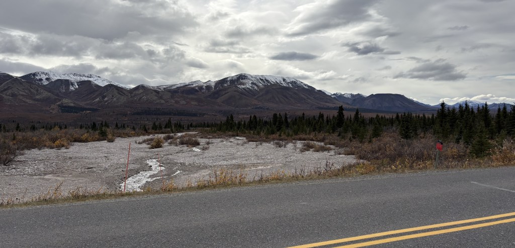
This is getting close to the 15 mile-mark and the road changes elevation slightly before going up to a high point, then dropping down to the Savage River. You can see relatively short pine trees scattered about and brown scrub brush (you’ll see a better photo of it in the next post) in the “open” areas. The scrub brush ranged from knee-high to almost chest-high in places.
The photo above shows a large brown mountain which is on the other side of the Savage River. You can see a road climbing the hill to the left but it is the dirt road on the other side of the 15-mile bridge.
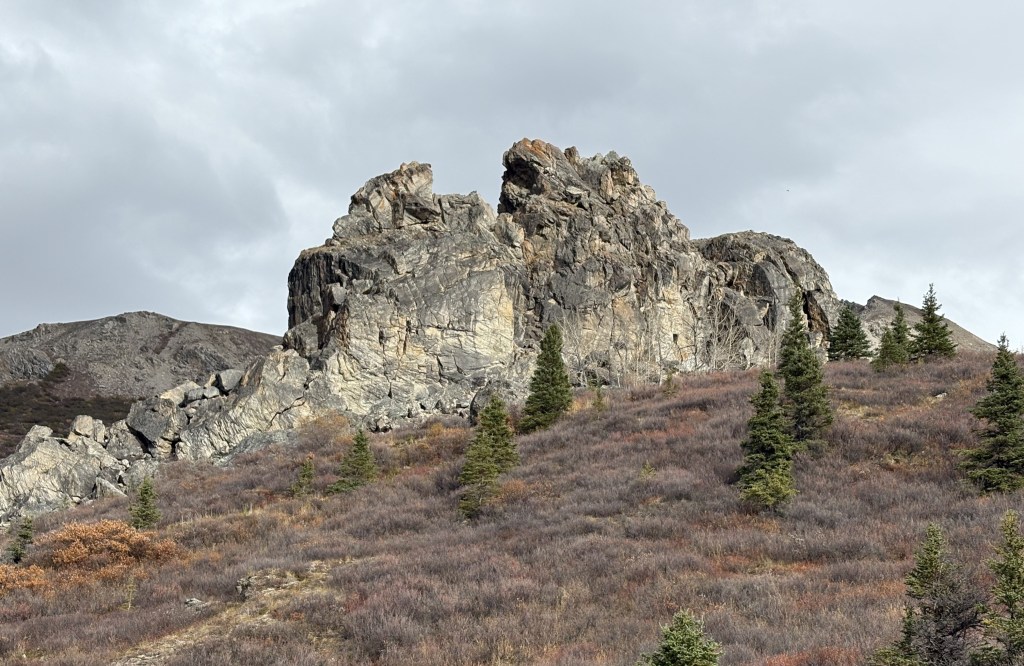
The rock formation shown above is next to a parking area just before the bridge.
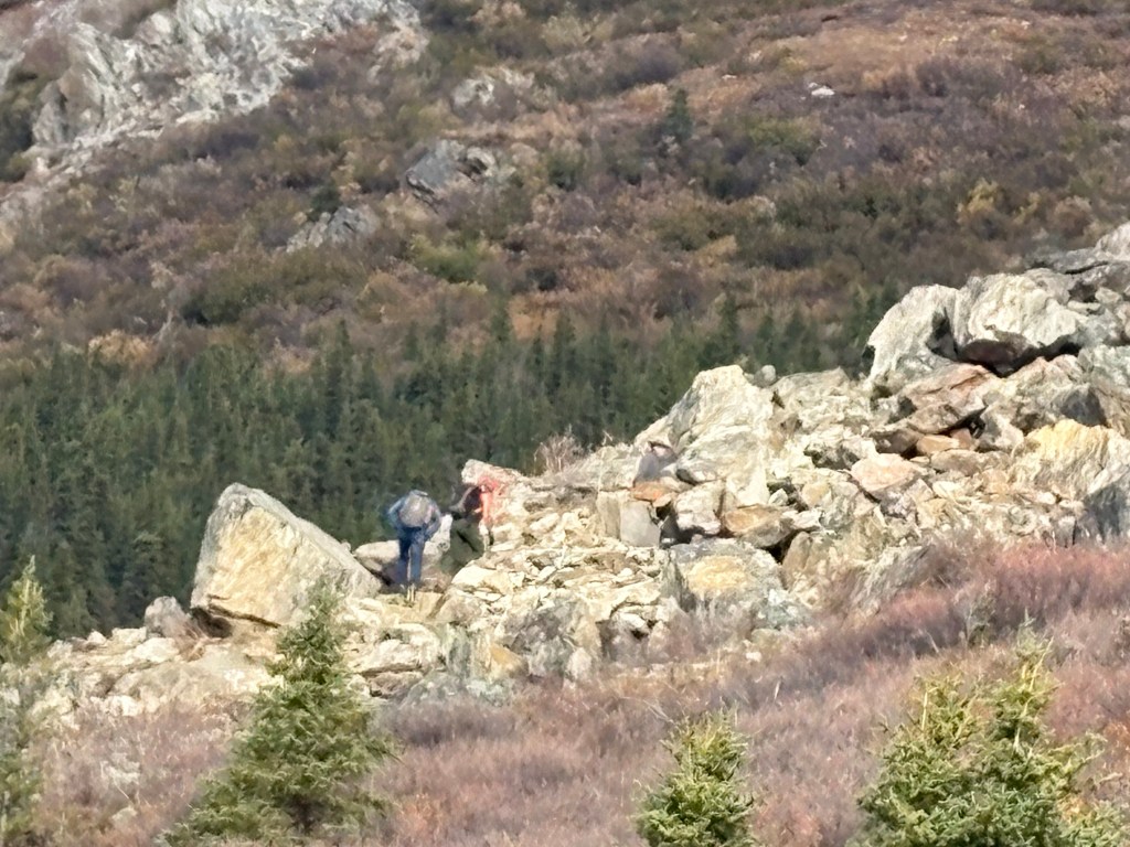
That shows two hikers near the left base of the big formation, giving it some size perspective.
That is from that parking area looking north. There are hiking trails on both sides of the river, which is between the two hills.
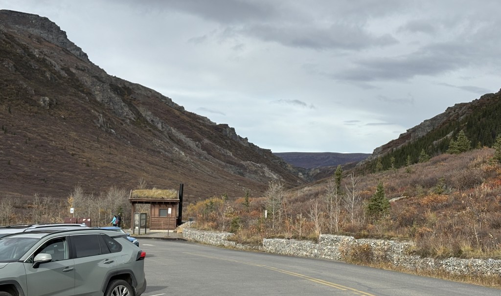
That is the bridge going over the Savage River (2,780 feet elevation at this point). The dirt road to the left on the other side continues deeper into the Park. The road on the right appeared to be additional parking for hikers. There is a shack on the other side of the bridge in which a ranger will check permits for those drivers wanting to go further. There was a gate on this side of the bridge which was closed if people weren’t supposed to continue due to weather.
I was told by the rangers that people could continue to Mile 30 since the buses were no longer running, which is why you are seeing vehicles on the other side.
The next post will contain photos driving back out towards Hwy 3, a chance to perhaps see Mt. Denali, and my first wildlife sighting in the Park.
Here are more things I saw as I drove north on Hwy 3 from Talkeetna and the Denali Viewpoints towards Denali National Park.
I am adding more lines of text here to try and make the photo below appear larger in the actual post.
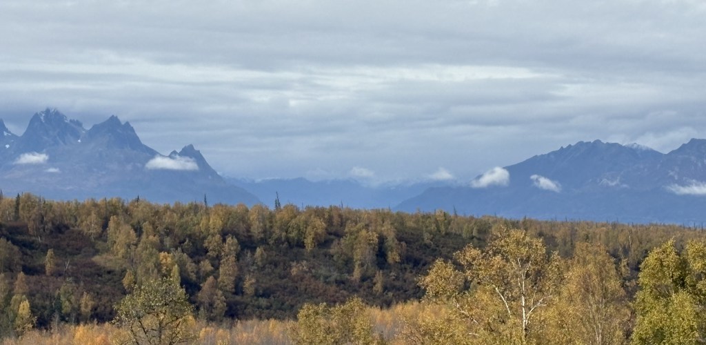
If you look closely at the two photos above you may notice that the ground at the base of the mountains is multi-colored. This was the first area where I noticed it, and it will continue to appear in many parts of Alaska. You will see better examples of the effect in future posts. I have determined that it is multi-colored vegetation. There are also some places where parts of the mountains themselves display various colors due to different kinds of volcanic rock, but the areas in these photos were all at low elevation and are definitely vegetation.
The photo above was taken as I was arriving in the little town of Cantwell. I am very happy that I took all of the photos in this two-part post up to this point today because when I travel this route again in about 2 weeks I wouldn’t have seen ANY of what I photographed due to extremely low visibility.
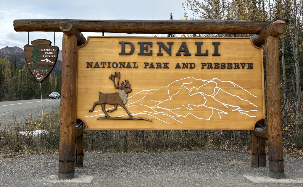
I finally arrived at the entrance road to Denali National Park. According to their Park map it is 120 miles further north to get to Fairbanks, and it is 237 miles south back to Anchorage.
My next posts will include photos from within the Park. I will only be here for about two hours today to pickup maps and get a feel for what to expect in the small part of the Park I will be able to access. I will explain further in my next post. I will have to leave later in the day because I still have a two hour drive to Fairbanks. When I return to the Park later in my trip to spend 3 1/2 days here I will be staying in Healy which is only about 20 miles up the road.
Today I will drive from Talkeetna to Fairbanks, with an orientation stop in Denali National Park itself. Most of the photos of Mt. Denali I have posted thus far were taken at several viewpoints along Hwy 3. Those stops were all located in Denali State Park, not the National Park, and were about 100 miles from the National Park entrance.
Denali National Park (and Preserve) is enormous. At over 6 million acres it covers 9,446 square miles and is larger than the state of New Hampshire. And I stand corrected on a comment I made a few days ago. Denali National Park WAS at one time called Mount McKinley National Park. Even though our current president changed the name of the mountain back to McKinley, the Park is still (as of this writing) called Denali.
My first stop on the way to Fairbanks will be at the viewpoints I took photos from the past two days. You may recall that the first day was sunny and clear, but coming up to Talkeetna yesterday it was overcast and the snow-covered “Denali Complex” mountains were completely obscured. Today would be somewhere in between.
When I left my Airbnb in Talkeetna I saw two moose (a parent and a youngster) cross the road a ways ahead of me as I was driving back to Hwy 3. I was actually on my phone (hands free) dictating a voicemail message to some friends back home. I remember saying “OMG – there are two moose – gotta go…” and terminating the call but by the time I stopped and got my phone out of the cupholder carrier to take a picture they were in the woods on the opposite side of the road.
I stopped at a gas station when I got out to Hwy 3 to top off my tank for the day and saw this Denali bus.
Strange for two reasons – a) I was 136 miles from the Park entrance, and b) the buses had stopped running several days earlier on a pre-arranged schedule.
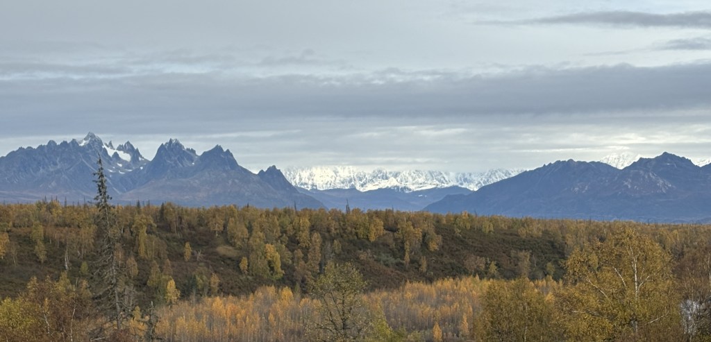
After filling my tank and getting coffee I headed for the Southern Viewpoint. This is what I saw when I got there:
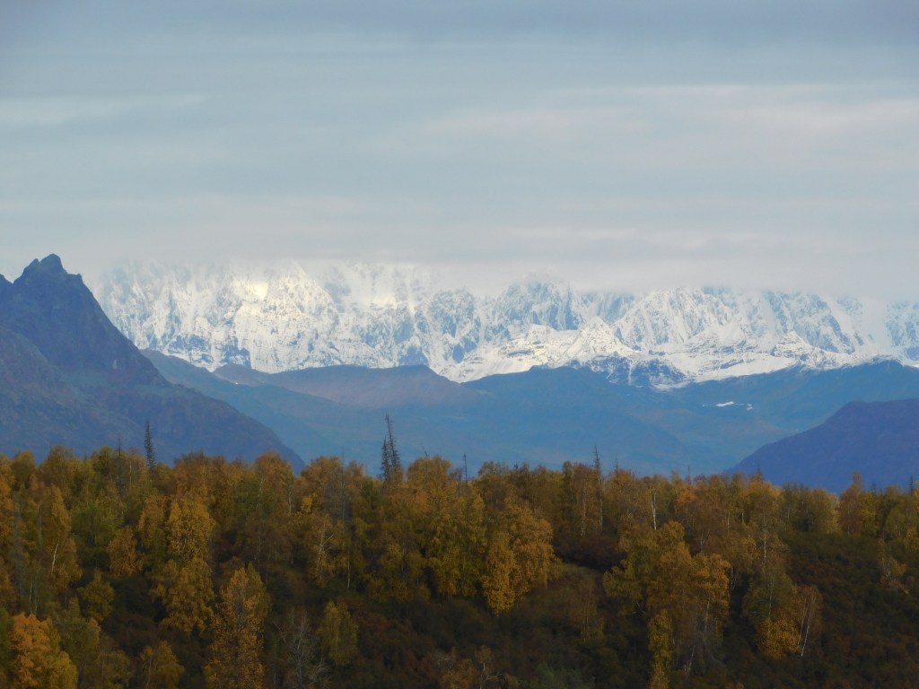
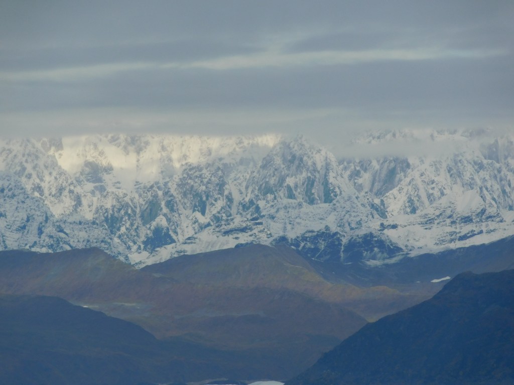
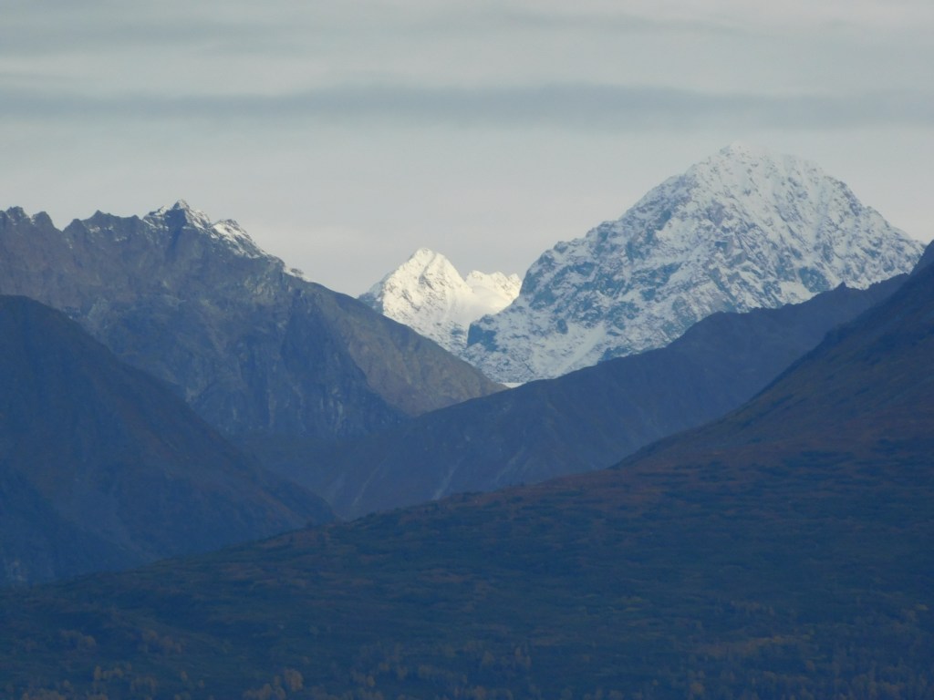
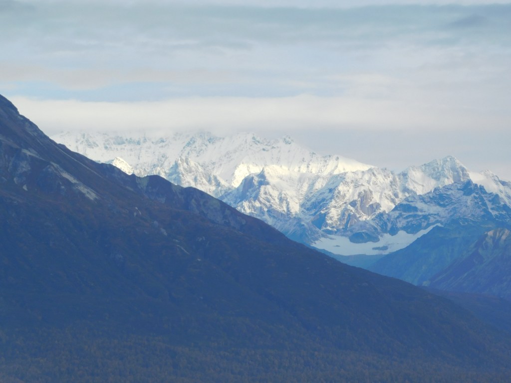
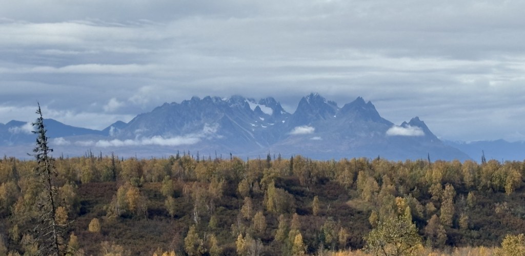
I could only see the base of the big mountains. This is a closer view with the digital camera and zoom lens:
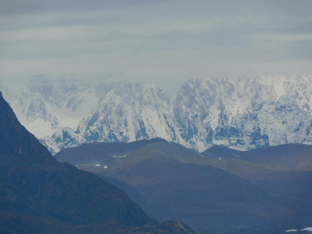
I drove a few miles further north on Hwy 3 to the Campground Viewpoint. It wasn’t any better. These are zoomed in even closer with the digital camera.
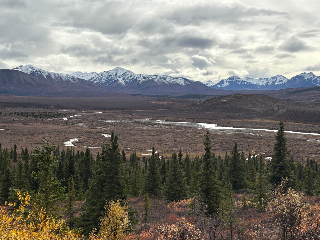
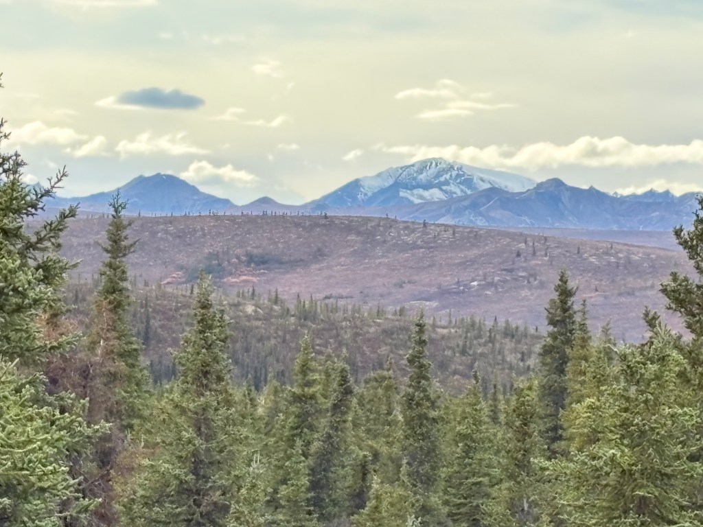
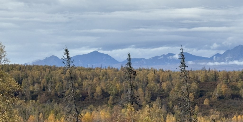
And here are some other mountains I could see further north in the Alaska Range (with the digital camera):
Those are the last pictures of the mountains from Hwy 3 that I will take on this trip. When I come back up this way for the final time on October 1 I wouldn’t even see the black mountains in the foreground as that day would have extremely low clouds and I could only see about a mile in any direction until I got further north of these viewpoints.
When I come back up Hwy 3 for the final time this trip I will spend 3 1/2 days in the National Park and will have views of other mountains, but for reasons I will explain later it is doubtful that I will see Mt. Denali again.
I will, however, be spending about 2 hours in Denali National Park later today so you will get a first look at some of the mountains I could see from within the Park.
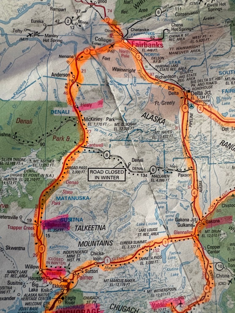
I referenced this “loop” in my previous post and thought it might be wise to post a picture of map and explain my thinking:
(Photo credit: AAA.com Alaska Map)
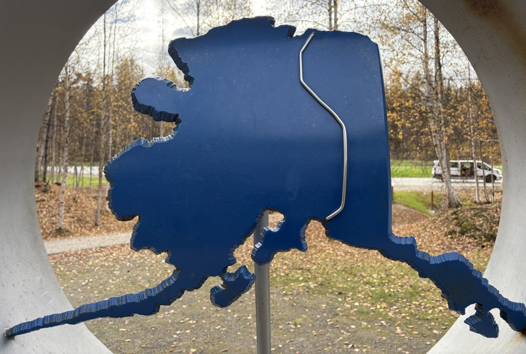
The two biggest towns in Alaska are Anchorage and Fairbanks. There are major highways (1,2,3 and 4) which connect them in a loop fashion. I will use smaller towns along them to illustrate my overview.
A small town fairly close to Anchorage (lower left corner of the map) is called Wasilla. From there north to Fairbanks is 316 driving miles on Hwy 3 and according to Google Maps takes 5 hours 22 minutes to drive. Coming down the east side of the loop, Fairbanks to Glennallen is in two parts – Fairbanks southeast to Delta Junction on Hwy 2, then Delta Junction south to Glennallen on Hwy 4. Total distance of those two parts is 247 miles and drive time is 4 hours 20 minutes. Then from Glennallen roughly west to Wasilla is on Hwy 1. Distance is 148 miles and drive time is 2 hours 38 minutes.
To do the whole loop covers 711 miles and takes 12 hours and 20 minutes (without stops). Hence the need to break it up into bite-sized pieces.
This first lap I am stopping in Talkeetna, Fairbanks, Gakona (near Glennallen) and eventually back to Anchorage. I was originally going to do a second loop in the opposite direction later in the trip because I often see things driving the opposite direction on some roads than I saw going the other way. It turned out that I would do both loops in the same direction for reasons which I will explain when I get to that point in my trip.
My first loop is to visit those towns and get a feel for road conditions and elevation changes. This is my first time in Alaska and I have no idea what to expect. My first big lesson was that Talkeetna is a LONG way from Denali National Park, and the Alaska Range where the Denali Mountains are located is also a LONG way from Denali National Park. On my second loop I will stay in Healy, about 20 miles north of the Park entrance, and visit the Park for 3 1/2 days with much less driving!
When I left Anchorage to make my first loop up to Fairbanks and back (covering several days) I had booked my first Airbnb in the little town of Talkeetna (pronounced tal-KEET-na). I drove past the turnoff when I made my impromptu trip up to see Mount Denali on a clear day yesterday. Talkeetna is actually about 14 miles off Hwy 3 on a roughly parallel road. Today I once again overshot the turnoff and went right to the various viewpoints I had visited the day before.
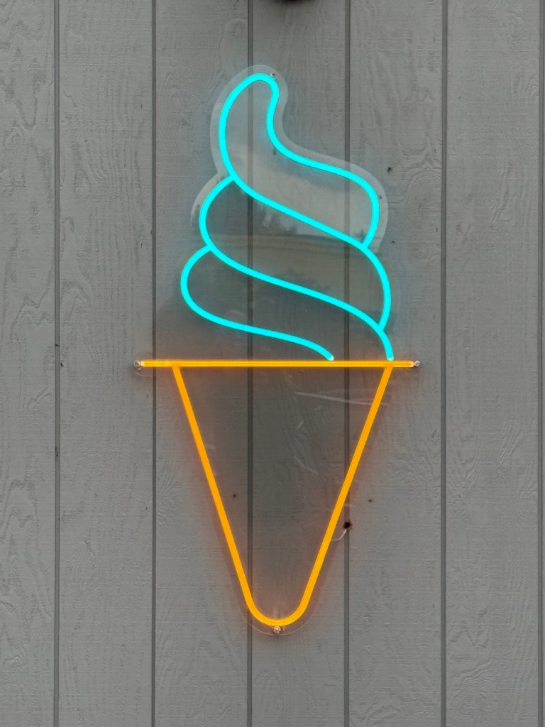
Before I left Anchorage I took this photo of a neon sign I saw on a tiny ice cream shop I drove past every day. For some reason I liked it’s simplicity:
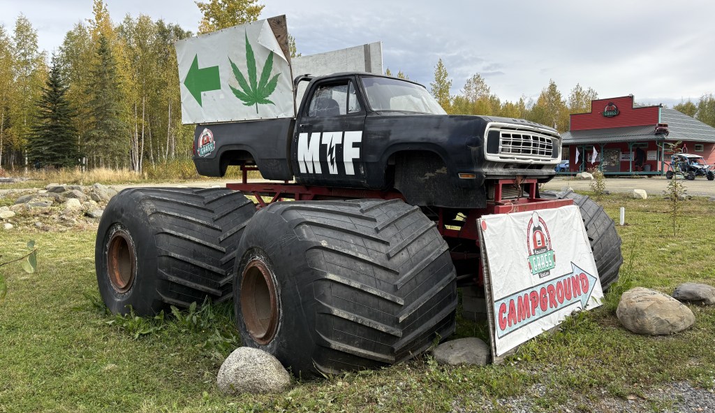
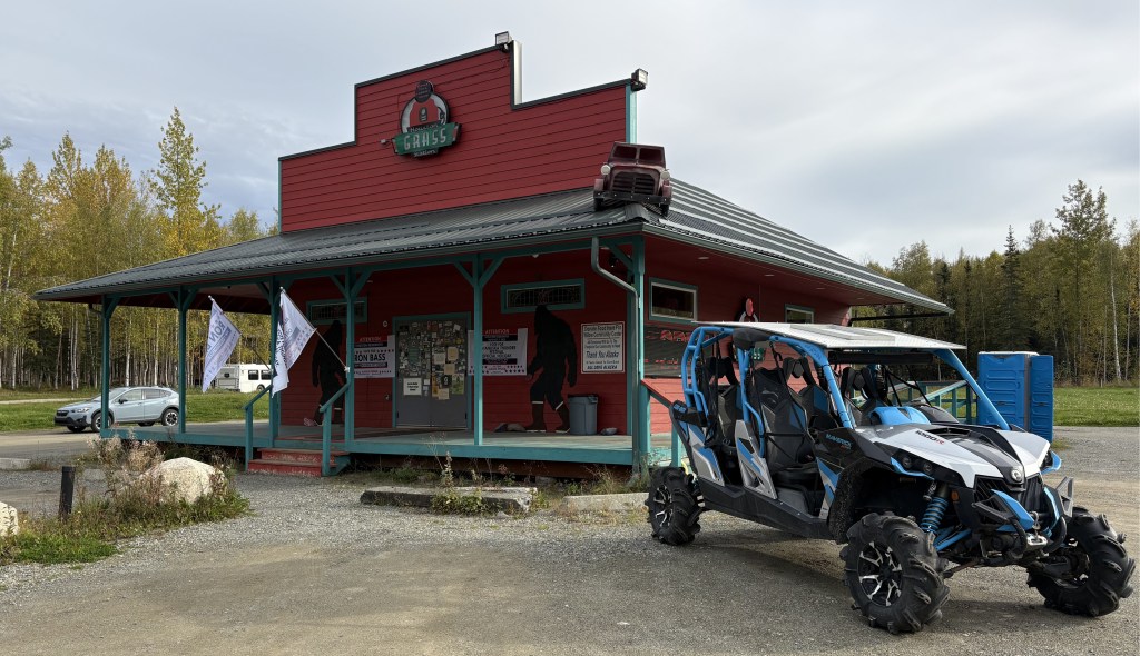
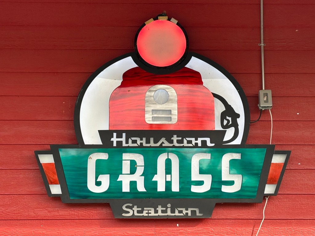
As I drove north on Hwy 3 I saw this vehicle just off the highway to my right, in the little town of Houston AK.
It was promoting the “Grass Station,” a marijuana dispensary (of which there are many on Canada and Alaska).
Points for being clever.
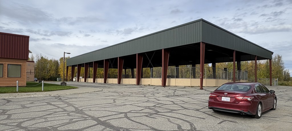
I also passed an elementary school with this impressive (covered) outdoor recreation space for the kids to safely play away from the highway:
There was also a fenced in area on a grassy lawn on the other side of the building with the usual park-type playground equipment for kids.
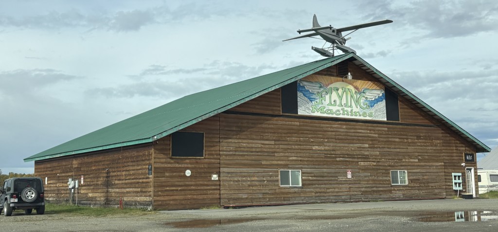
Just up the road from the school was a company which apparently makes and/or markets seaplanes:
The plane on the roof was motorized to rotate slowly. There was a small lake behind this building with a few seaplanes docked, and I took a video of one taking off. I saw LOTS of seaplanes flying around while I was in Anchorage and will have photos later in the trip of a lake by the Anchorage International Airport which claims to have the highest concentration of seaplanes in the world.
When I finally made it to the South Viewpoint I had visited on a clear day yesterday, this is what I saw:
Exactly NONE of the big, snow covered Denali mountains. Only the shorter black mountains in front of them.
I really had nothing else to do so I just hung around and talked with other visitors. It was too far to drive up to the actual Denali National Park entrance, and I will be stopping there tomorrow on my way to Fairbanks.
After a while I headed back to Talkeetna to be there at my check-in time. It was a nice new house (bigger than a tiny house but not by much) and even had heated floors! What a concept. It had two levels (my part was at ground level) which is why I really didn’t think of it as a tiny house. The owners lived nearby but I never had a chance to meet them. The house was on a rough unpaved road and was in the woods. They told me I might see moose in the yard but I never did, though two walked across the road a short ways in front of me as I was leaving the next morning. It happened too quick for me to get photos.
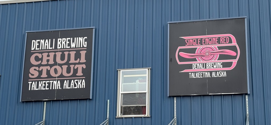
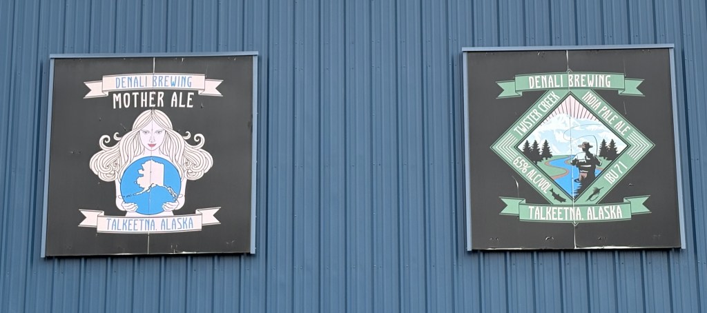
I did come upon the Denali Brewing Company on my way to the Airbnb. I was surprised to find it near such a small town.
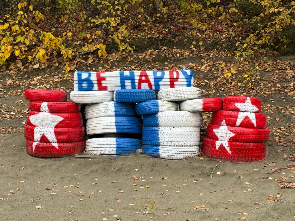
Oh, and I had seen this colorful display just off Hwy 3 as I drove south to Talkeetna from the Viewpoint.
It was across a large sandy area from the highway but the colors caught my eye so I parked and walked over to take a photo.
Tomorrow I will drive much further north to get to Denali National Park itself and will have a few hours there to get a sneak preview of the Park before continuing on to Fairbanks.