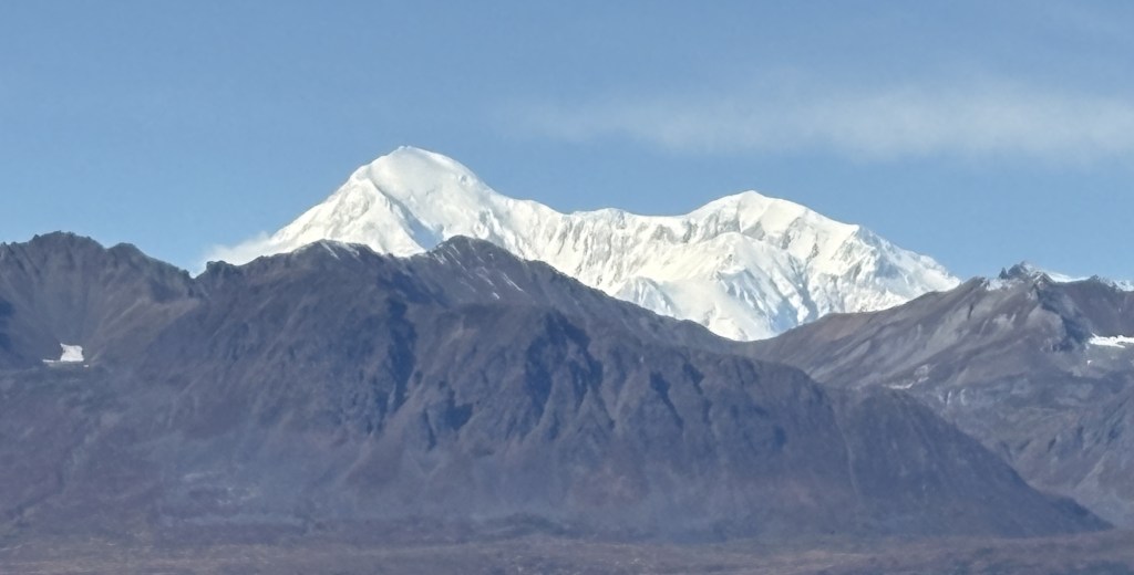
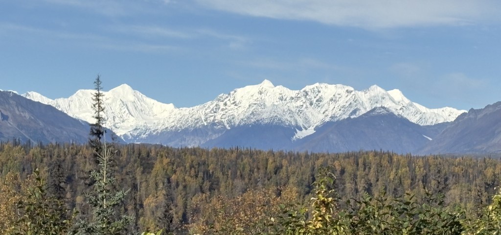
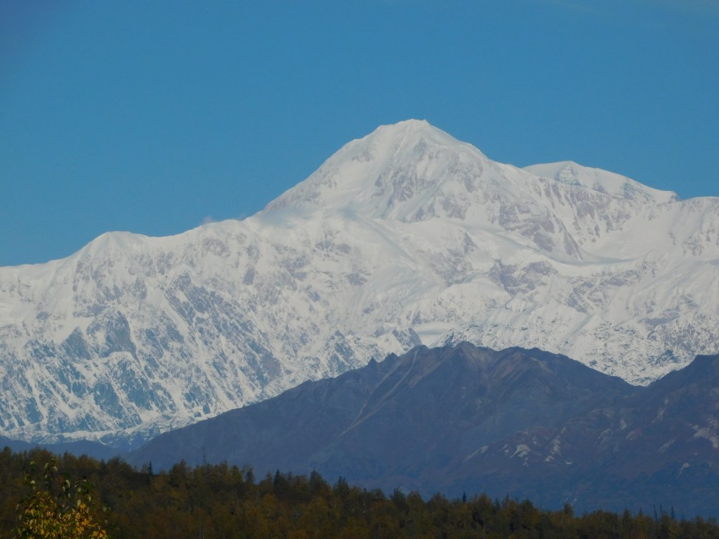
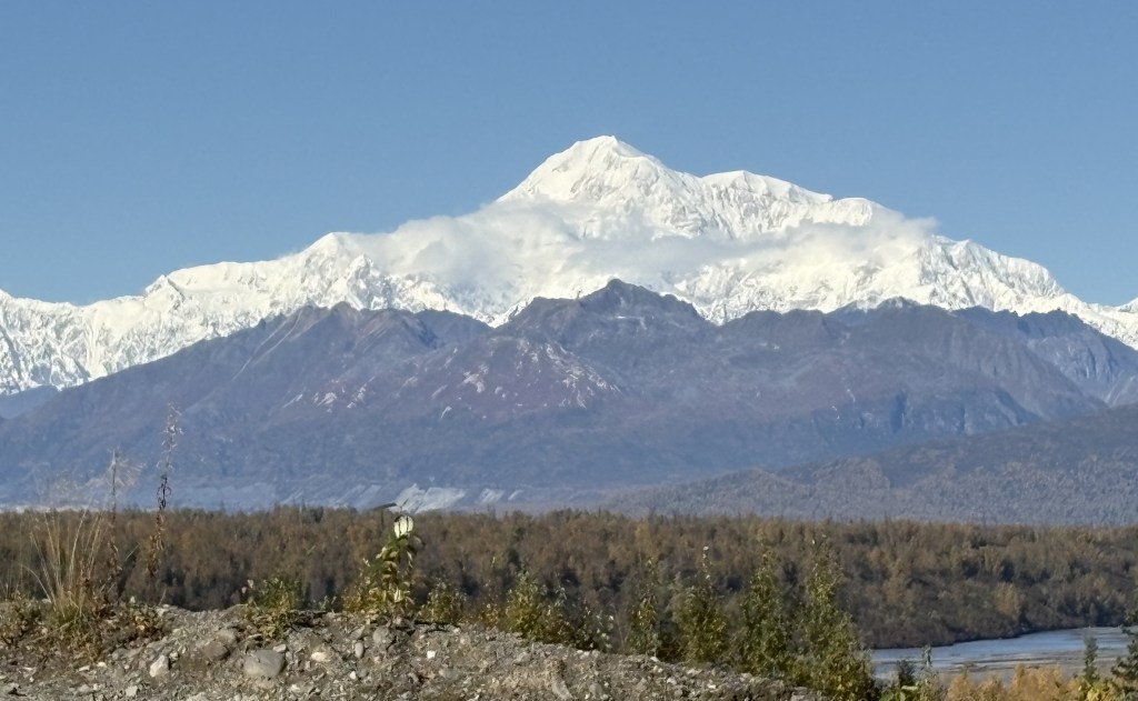
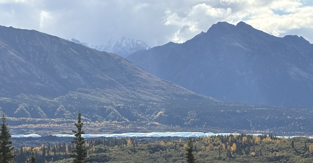
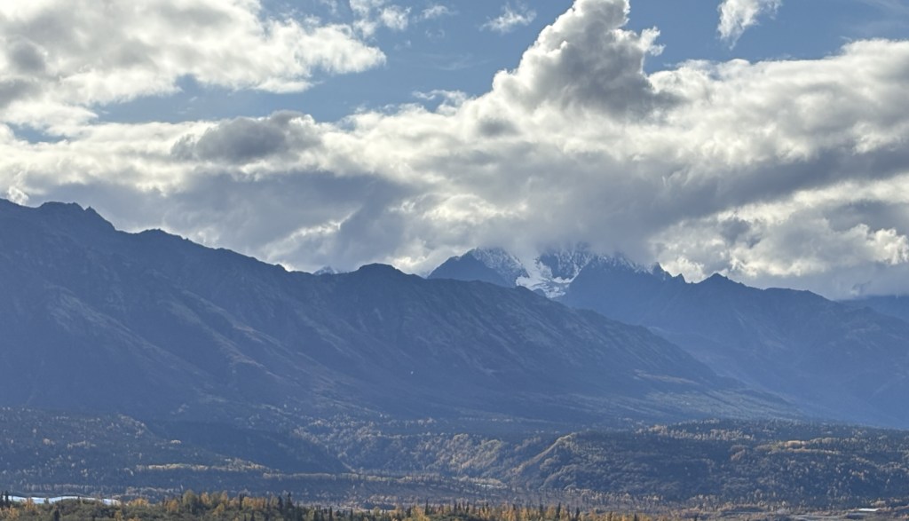
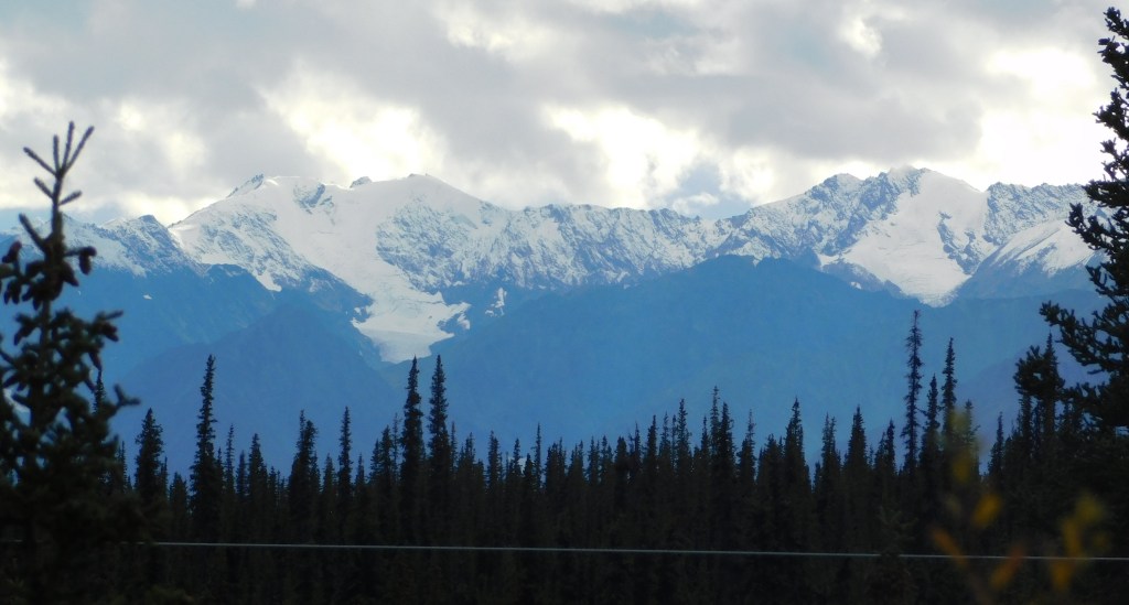
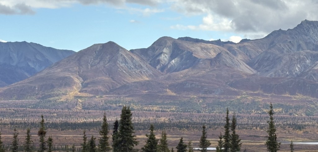
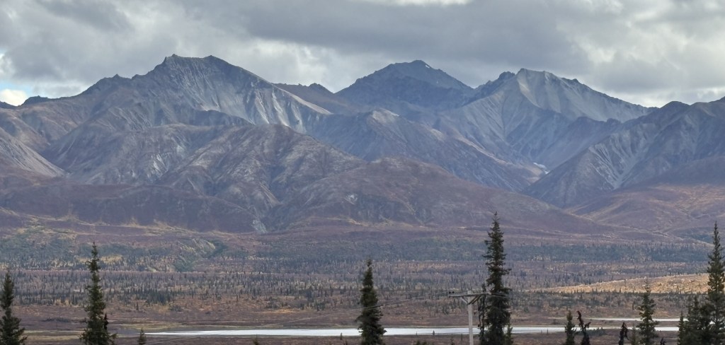
There were a few other mountains in the “Denali Complex” that I could see as I drove about 30 miles further north on Hwy 3 from the Southern Viewpoint. They are mostly other large mountains, but I don’t know exactly which ones they are. And I found three more of Mt. Denali itself, taken from a more northerly viewpoint and which clearly shows the separation of the South and North peaks. Let me show those first:
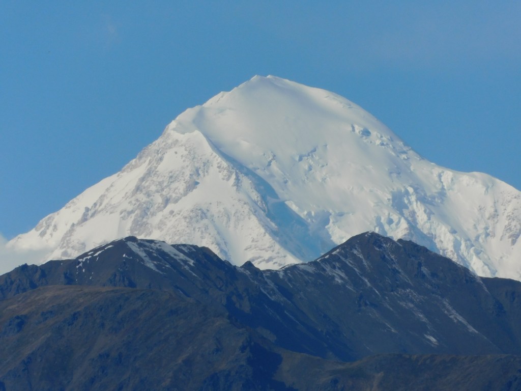
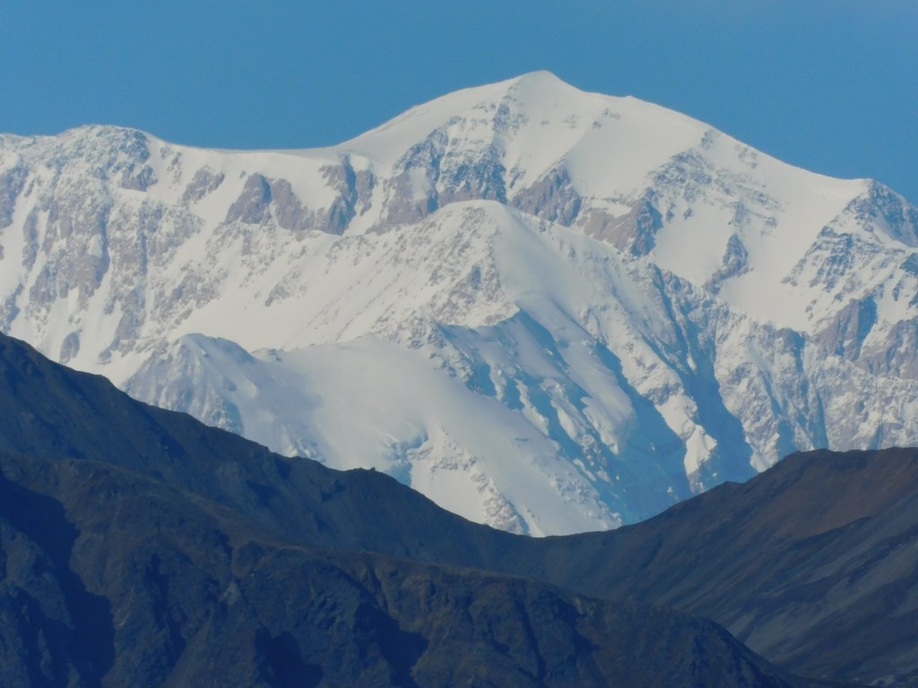
And I used the digital camera with zoom lens to get a closer look at the two main peaks:
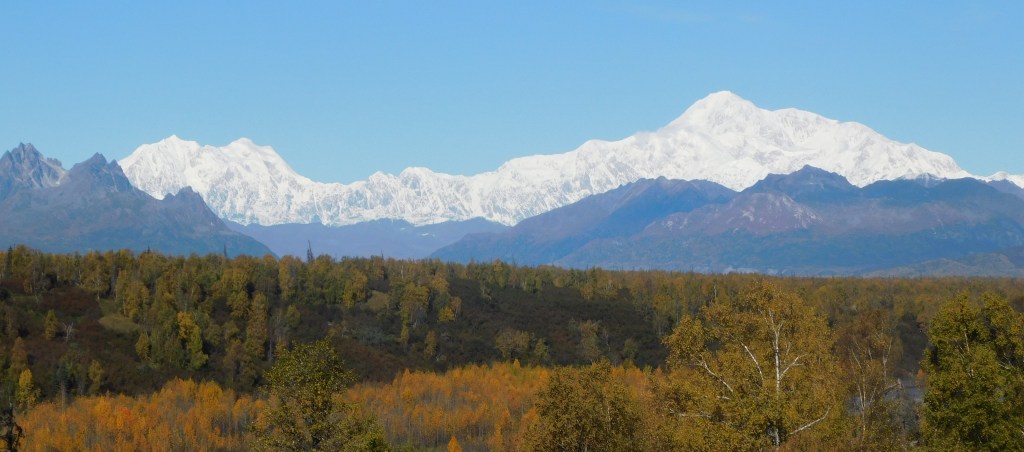
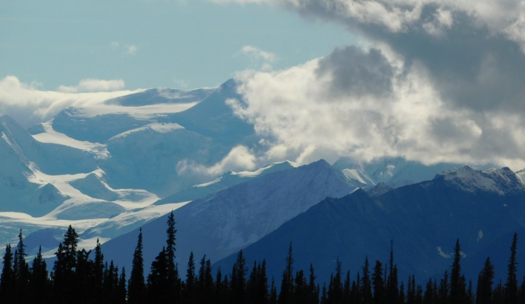
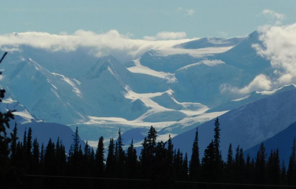
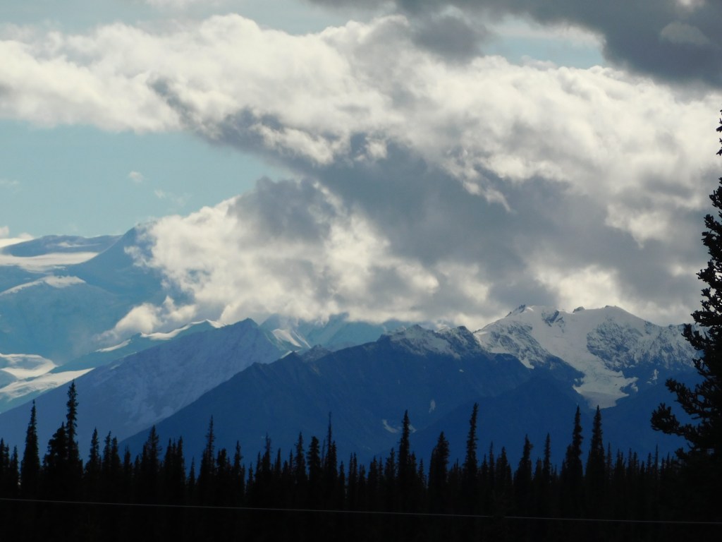
The rest of these are mountains further northeast of Mt. Denali itself. One of them is probably Mt. Silverthorne and another may be Mt. Mather. The Alaska Range continues for quite a distance, and the entire range is aligned from southwest to northeast.
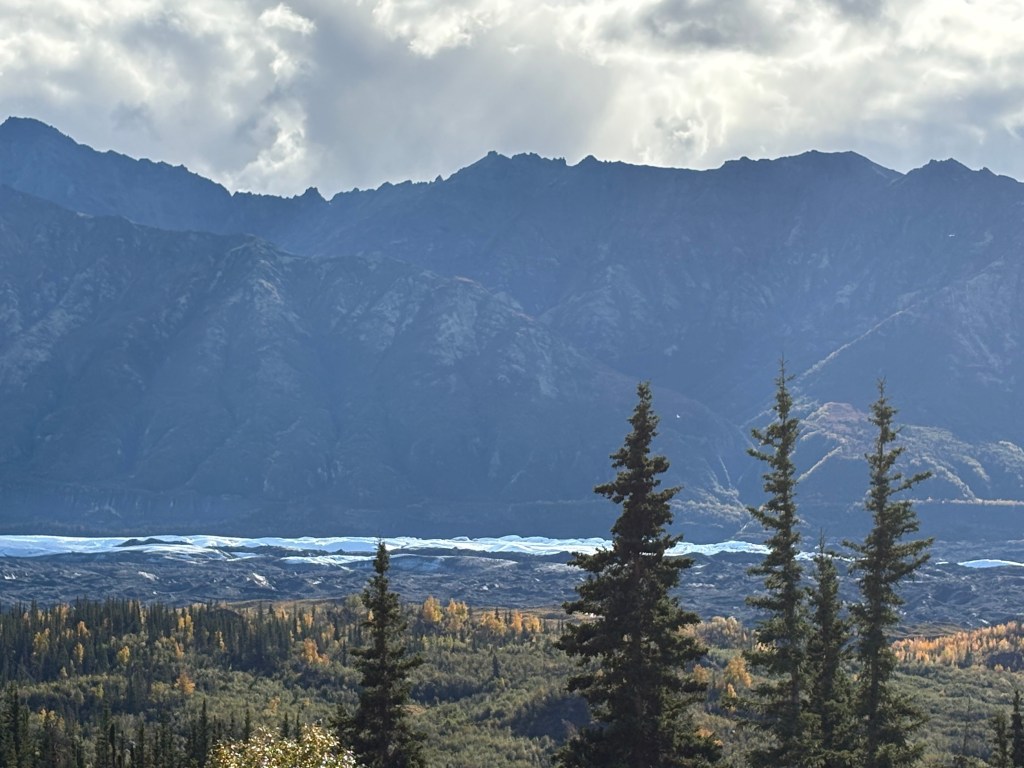
Some photos were taken from the highway and some are from the North Viewpoint (but there was no sign there identifying them as there was at the South Viewpoint). I didn’t want to post these with the others as I presumed that most people were interested in the three main mountains.
The mountains in the Alaska Range southwest of Mt. Foraker are further away from the highway so I never even got a glimpse of them as I drove north. The road had trees on the side in many places which blocked my view, and of course I was mainly focused on driving.
The second one appears to be the same mountain on the left in the photo above it, but the road had turned left so I was looking right at it. They were taken 2 minutes apart.
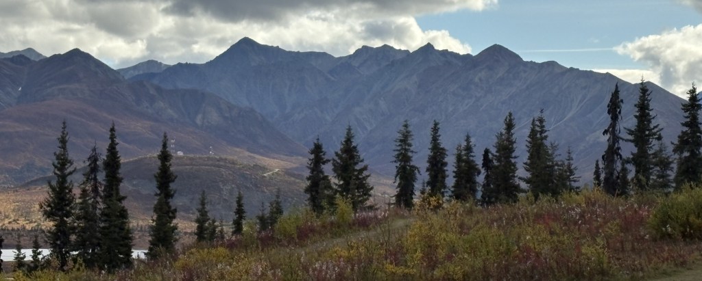
These were all taken the same day as I took the main Denali photos. I would come back up here the next day but you will see in the next post that it was overcast and I couldn’t see these mountains at all.
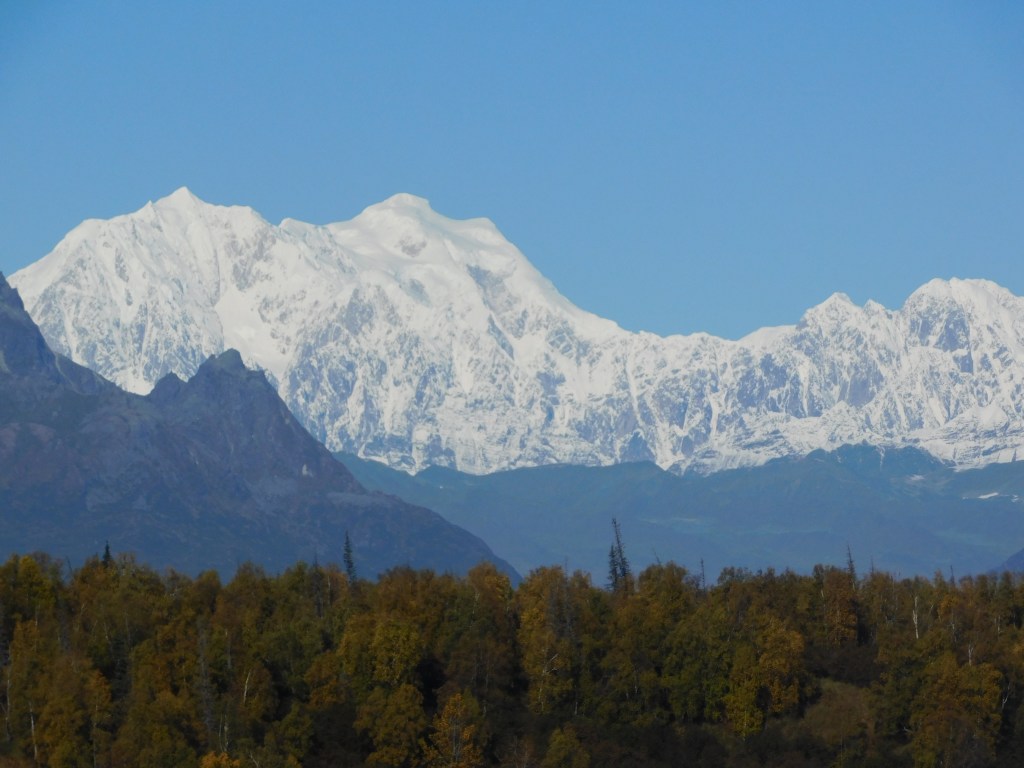
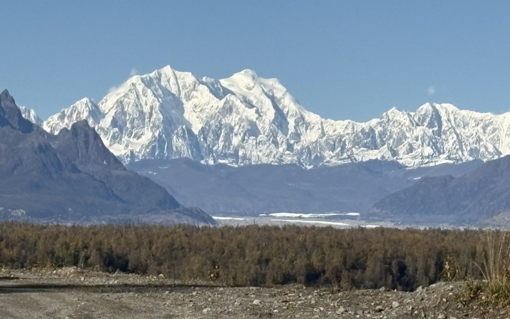
These are photos taken at the Denali South Viewpoint. There were signs indicating which mountains I was looking at, how far away they are, and how tall the black mountains (without snow) in front of them are.
We’ll get Mt. Foraker out of the way first. I posted a photo taken from the side road at a higher elevation, which gave me a very good view (see previous post). This was the view from the South Viewpoint:
Not real impressive, eh? Despite Mount Foraker being 17,400 feet tall, the view was being blocked by a 5,150 foot tall mountain (which actually had a little bit of snow on it) much closer to the viewpoint, so you can only see two small parts of Foraker! Signage at the viewpoint indicated Foraker was 45.5 air miles away.
Hunter mountain was a little better. This was taken with the zoom lens:
Mt Hunter is on the left side of the photo above and is actually comprised of three peaks, South (left) at 13,967 feet. Middle (above the right peak on the black mountain) at 13,400 feet, and North (right, in the center of the photo) at 14,574 feet. The whole mountain is on an angle with the right side further away than the left side. Hunter is closer to the road but is still partially blocked by the smaller 4,205 foot peak even closer to the road. The signs at the viewpoint indicated that Hunter North Peak was 37 air miles away.
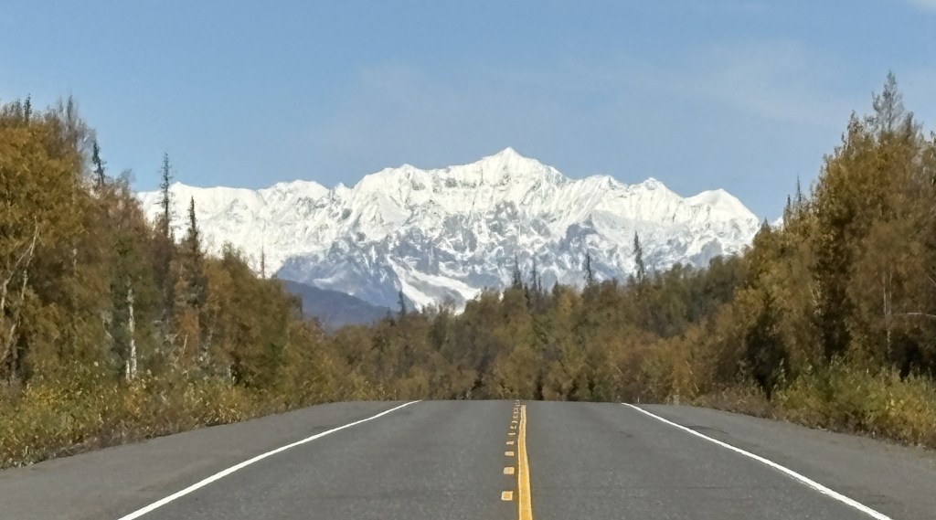
Here is my best shot of Denali, taken with my smartphone camera:
There will be another one from a little further up the road. Again, the main peak is at 20,310 feet elevation but the black mountain in front is at 5,160 feet and is closer to the viewpoint. South (main) peak was 41.5 air miles away, North peak (to the right) was 43 air miles away.
Here is a shot of Hunter and Denali together (digital w/zoom):
There were 3 other viewpoints further up the road. Campground (just a small pull off area next to the road), 3 miles away, Veterans Park, 15 miles away, and North Viewpoint, 30 miles away.
Here are three photos from Campground:
Foraker:
Still mainly blocked.
Hunter:
Much more defined. I am personally shocked in the difference between this photo of Hunter and the others. I don’t tinker with camera settings other than zooming in.
Denali:
A wider view but with the pesky black mountain blocking. You can also see a wisp of clouds starting to form.
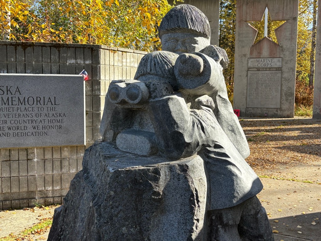
I stopped at Veterans Park further up the road. There were several sobering historical and memorial tributes to various conflicts and branches of the service, as well as this statue:
Here is what the soldier with the binoculars was looking at (Denali):
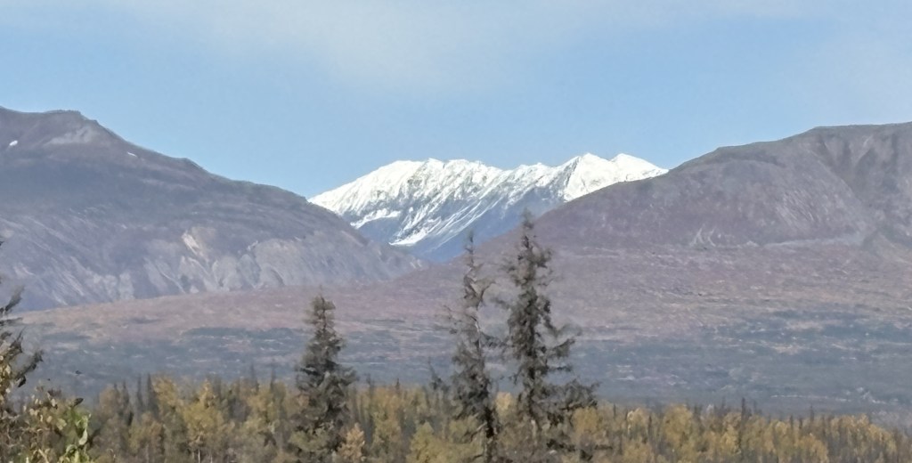
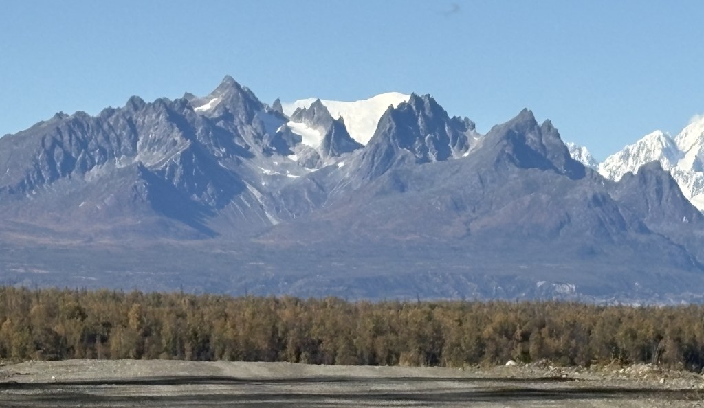
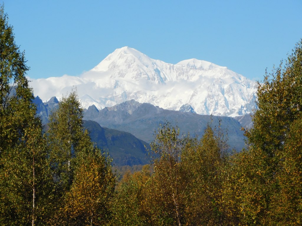
I drove up to the North Viewpoint but after having been to the others, I was not terribly impressed with what I was seeing.
I had only come up to try and see these mountains on a clear day, and had to drive back to Anchorage for the night. I would come back to these places again when I will be spending a night in Talkeetna, and a third time when I drive from Talkeetna up to Fairbanks, with a brief orientation stop in Denali National Park.
I will return later in my trip when I will spend 3 1/2 days in Denali National Park on my second trip to Fairbanks. Due to weather conditions I will not see these mountains again, and there aren’t many opportunities from within the Park itself which I will explain when I get to that point in my trip.
I was VERY happy that I had the opportunity to come up today and be part of the 33% that could actually see Mt. Denali.
My first day in Anchorage was not terribly productive from a photo standpoint. I had some personal business to attend to, and of course I went to both the Visitor Center (back to the American spelling!) and the Public Library.
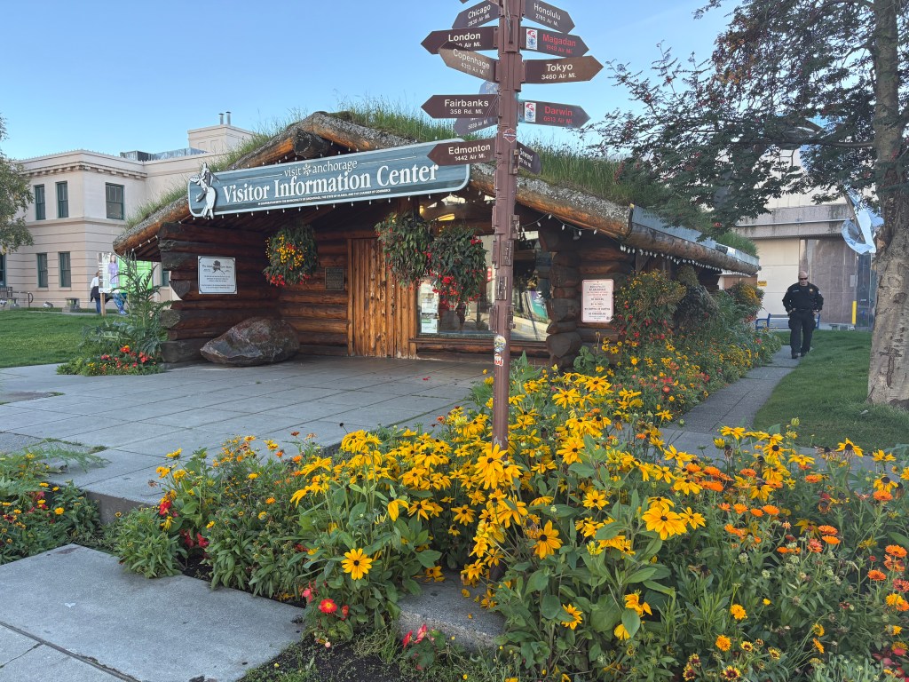
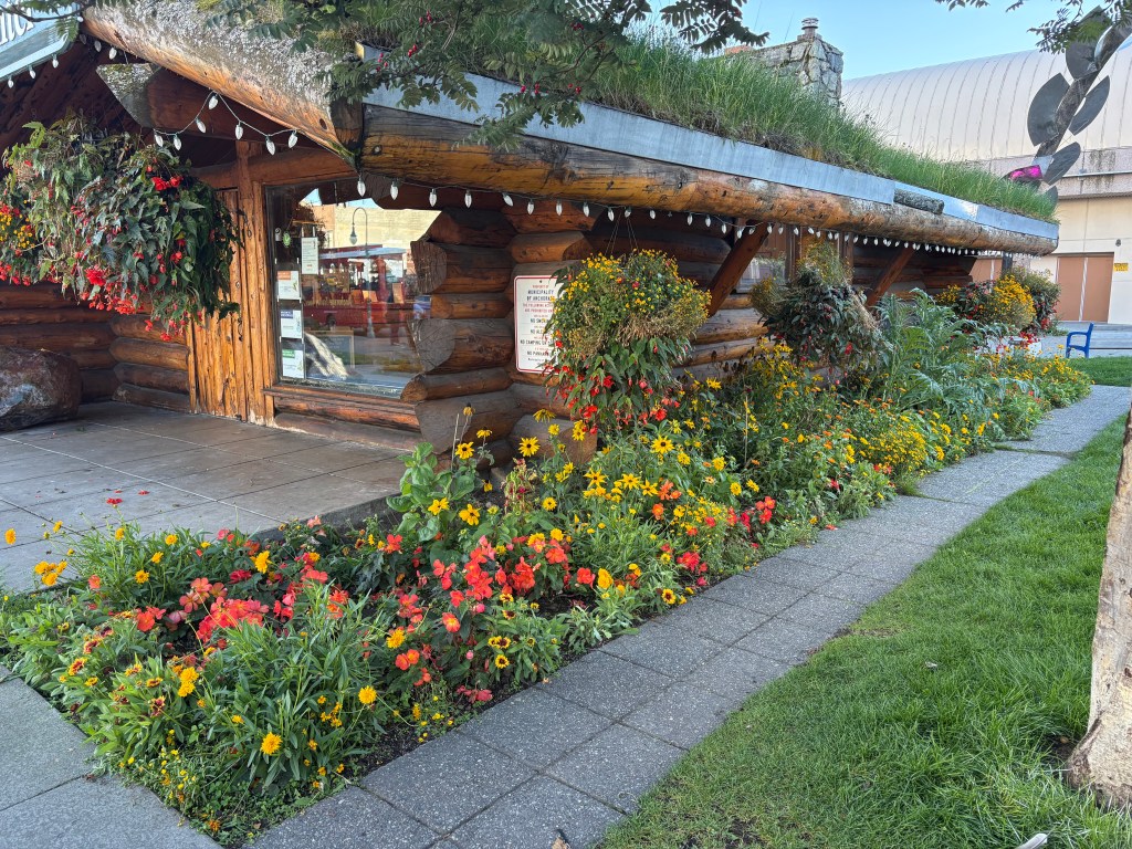
The Visitor Center downtown was very interesting:
From the grass on the roof to the abundance of flowers, it was unlike most others I have been to. Unfortunately this building wasn’t open the first time I went and I had to go in a regular office building behind it. I stocked up on maps and brochures, and asked my questions about mountain and glacier identification. This building would be open the second time I went downtown. Not sure why they alternate between the two…
The second place I went was a Walmart in town. I was unable to renew my various prescriptions in Canada because pharmacy’s there will not fill US prescriptions. I kind of screwed up my 90 days from when I left Durham and had to stagger my meds towards the end until I got to Alaska. I had to go and advise them to expect the information from my doctors in Durham, and give them my insurance information. I then reached out to my doctors here in Durham and requested that they send my refill requests to Anchorage. I have one mail order source and I had them sent that (lower priority) refill to my brother in Arizona. They had filled 2 90-day prescriptions with 100 pills each, so I had some of those pills to keep using.
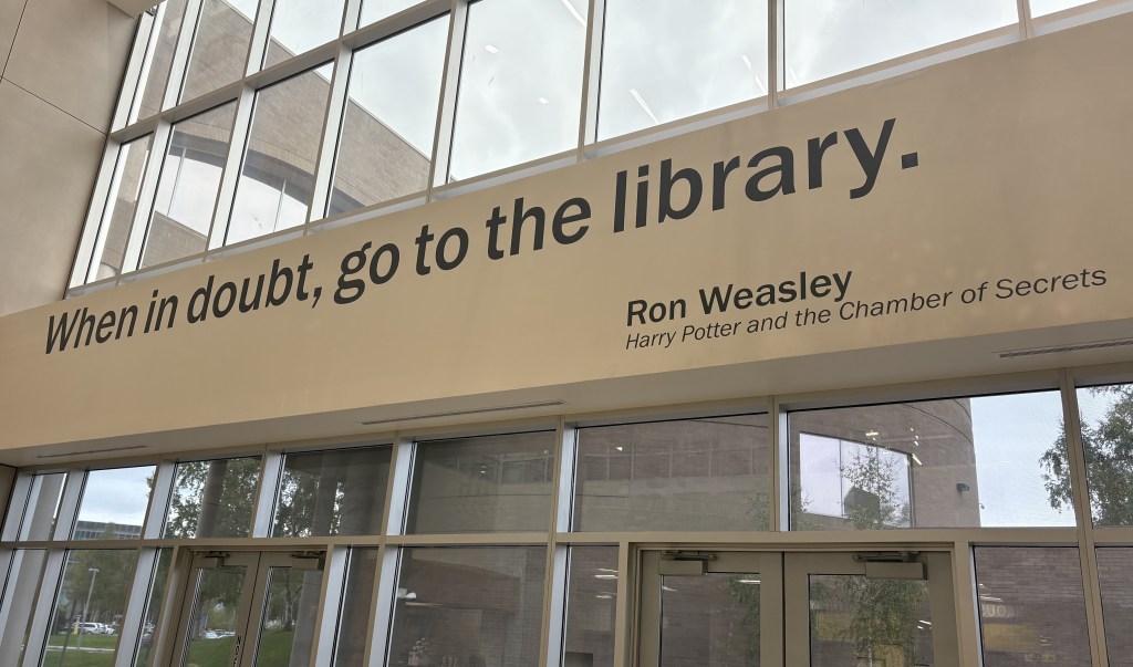
After that I went to the library! My Airbnb didn’t really have a good workspace to use my laptop and I use it quite a bit in the evening when I am on the road. I actually went to the library every day I was in Anchorage (if I wasn’t on the road somewhere). I noticed this sign in the lobby as I was going downstairs to the exit on my first visit there:
I wanted to study the information I had picked up at the Visitor Center and start forming a plan for my days both here and elsewhere. I had been told that many touristy things in Alaska (and Canada, for that matter) shut down after Labor Day. Some restaurants and touristy things in coastal towns that host cruise ships would be open a little longer, but by mid-September they were starting to wind down, too. Several times I would show up somewhere only to learn that the establishment was closed for the season.
I would be in town 4 nights initially and then return for 3 more nights later in my trip. I didn’t actually do that many things in Anchorage but it was a strategic location to operate from.
I will try to break the mountain monotony and entertain you with some oddball photos of things in town that I found interesting (in my own JohnBoy way)…
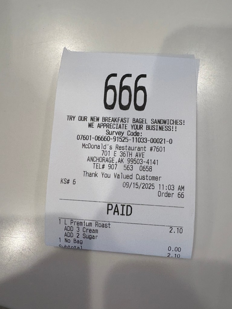
When I went to McDonalds for coffee this was my order number:
666 – Sign of the devil….
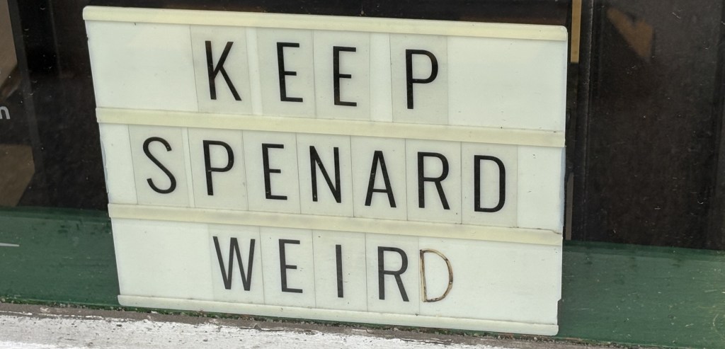
My Airbnb for the first two nights was in a part of town called Spenard (in fact my hostess called her home the “Weathered Den of Spenard” and even had her business license in that name).
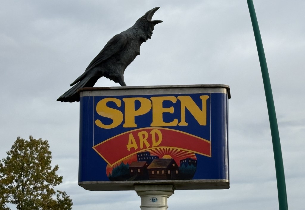
That is a sign, evidently an art project, modeled after a Spam can (and with a fake crow).
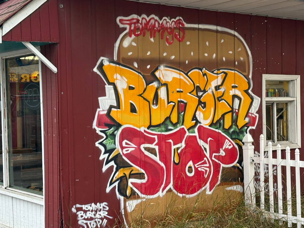
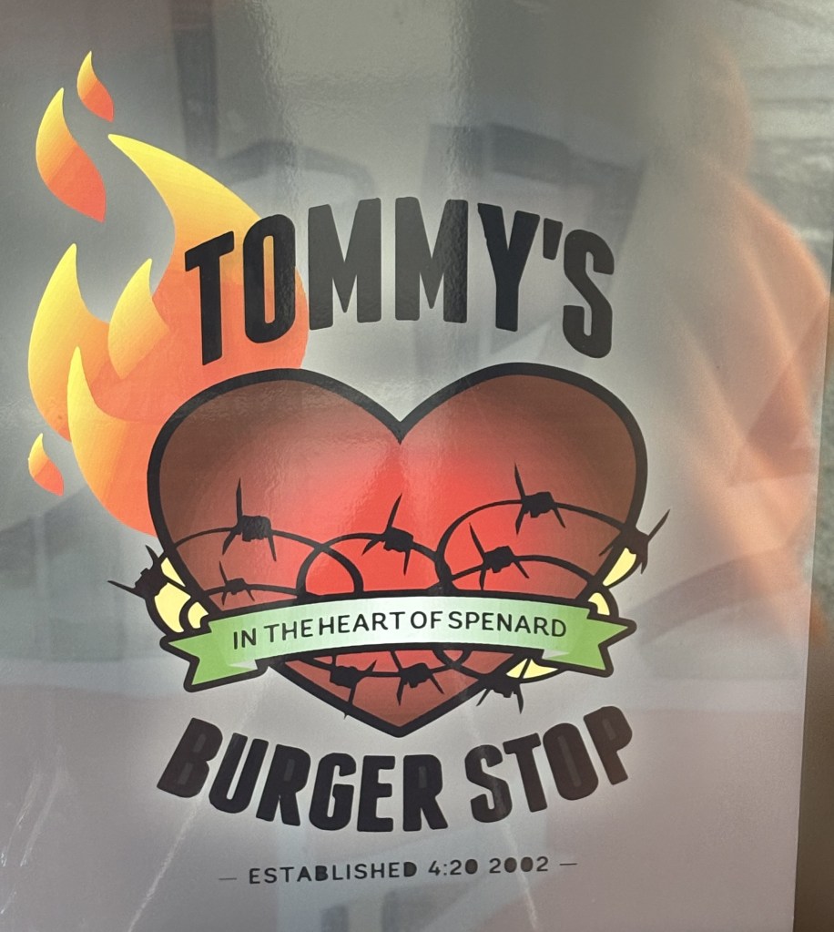
This is a burger joint who’s parking lot I used to take the photo above so I felt obligated to have lunch there later in the day.
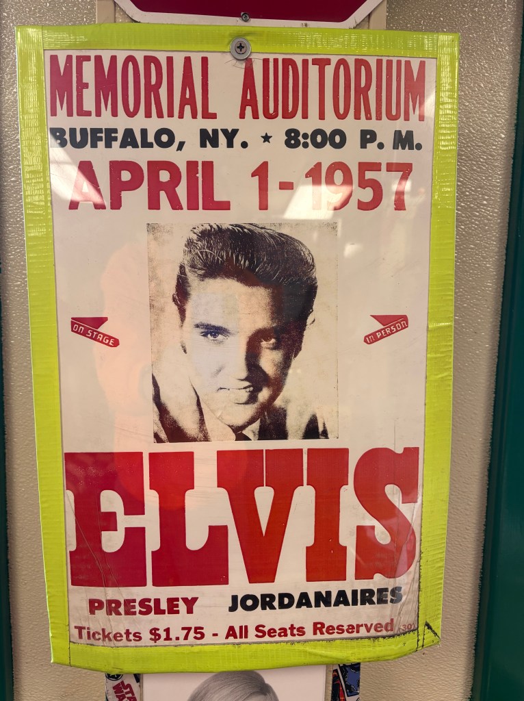
And that is an original 1957 poster they had inside. It was an interesting place!
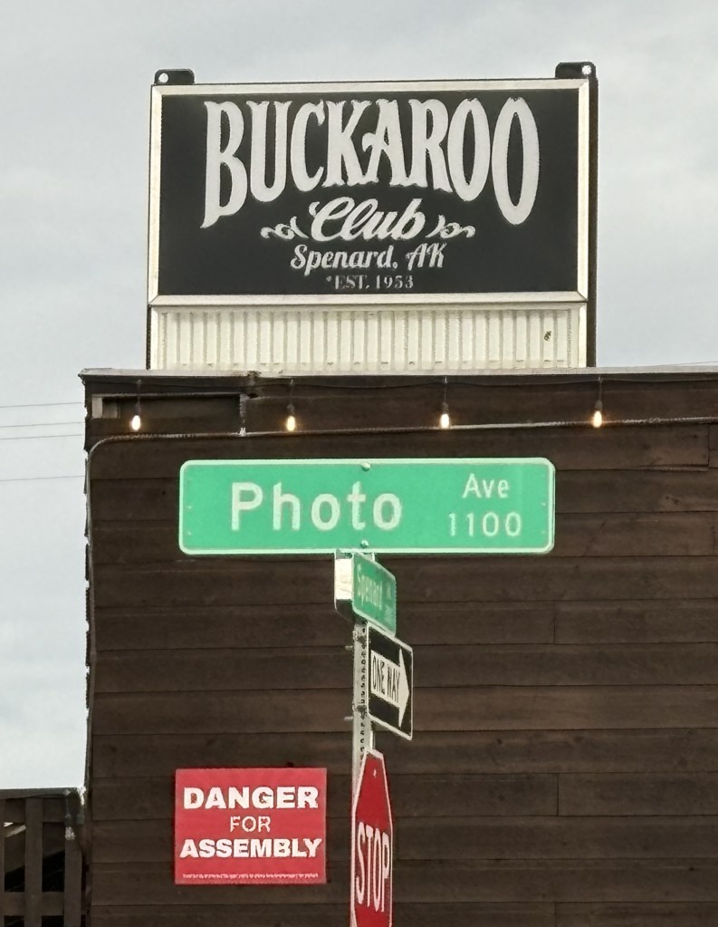
The word buckaroo has always appealed to me and this club was also across the street from where I had parked, so of course I added it to my collection..
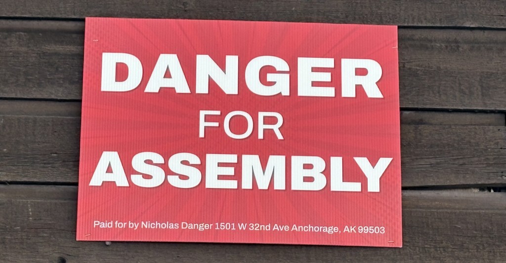
And the political sign on the side of the club also meant something to me, especially when I read the “fine print”. I used to volunteer at a college radio station when I lived in Pennsylvania (while I was still in high school) and one of the radio serials we aired was called Nick Danger, Third Eye – about a fictional detective. Sure enough, here was a Nicholas Danger running for office…
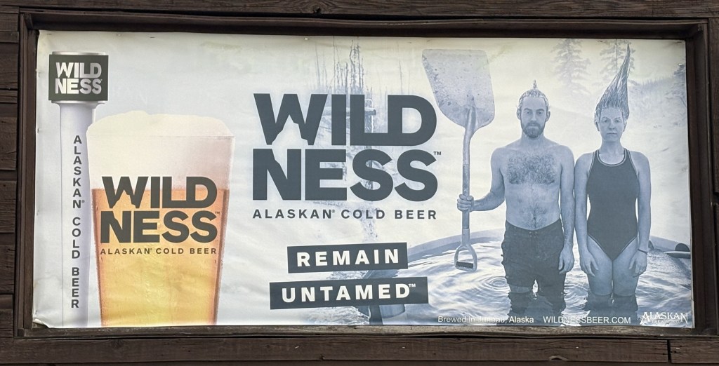
And I will leave you with this beer ad on the side of another building.
As you can probably tell, I gravitate towards strange things sometimes….
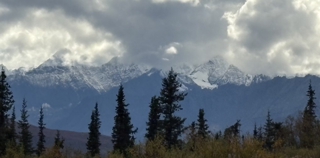
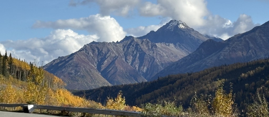
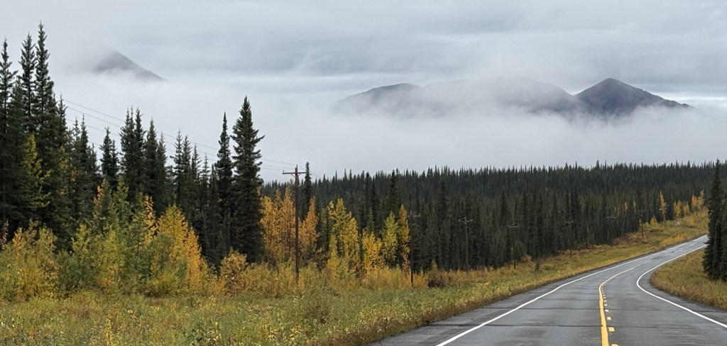
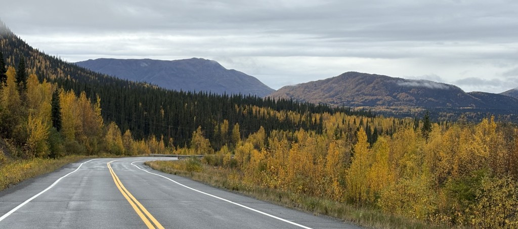
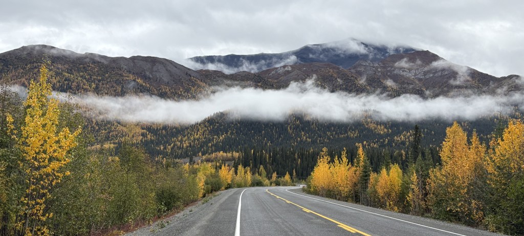
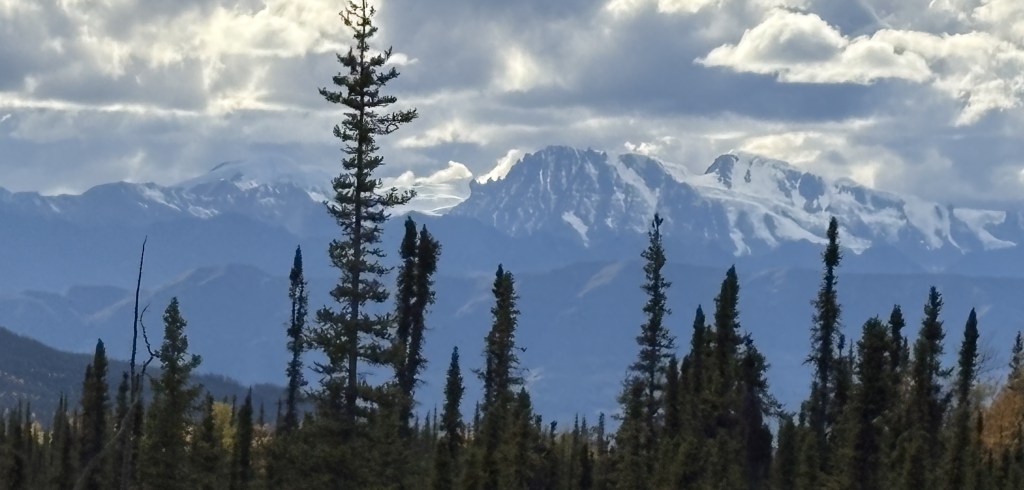
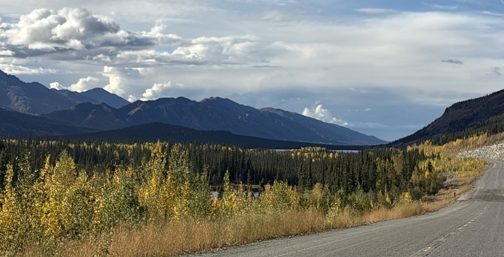
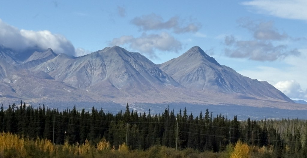
As I continue my drive beyond Eureka Roadhouse I will start to see more mountains partially obscured by clouds at their peaks. I strongly suspect they have snow, and possibly glaciers, on them, and in some cases I could barely make out the presence of something in the clouds. My original plan would have had me traversing this section of road 2 or 3 more times, so I was hoping I would get another “bite at the apple” and come back, hopefully armed with maps which might help explain what I was seeing. That did not work out, as I would only pass this way one more time, and it would be heavily overcast and snowing in places! I will explain in more detail what I get to that point.
So let me show you the rest of the pictures I took today:
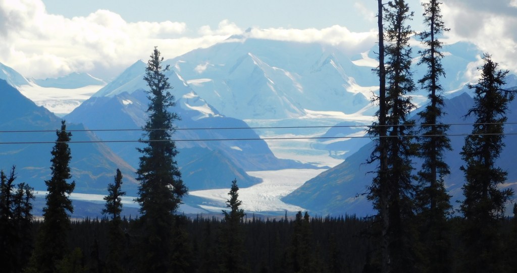
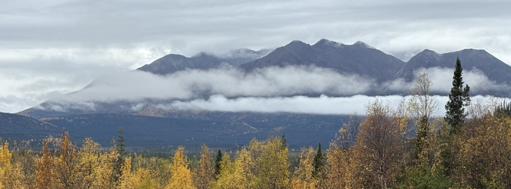
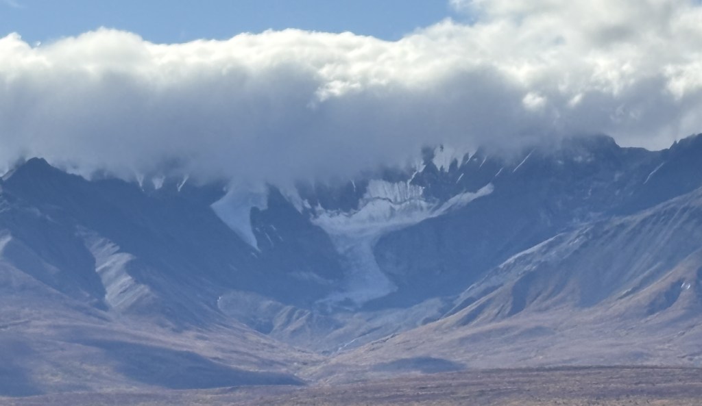
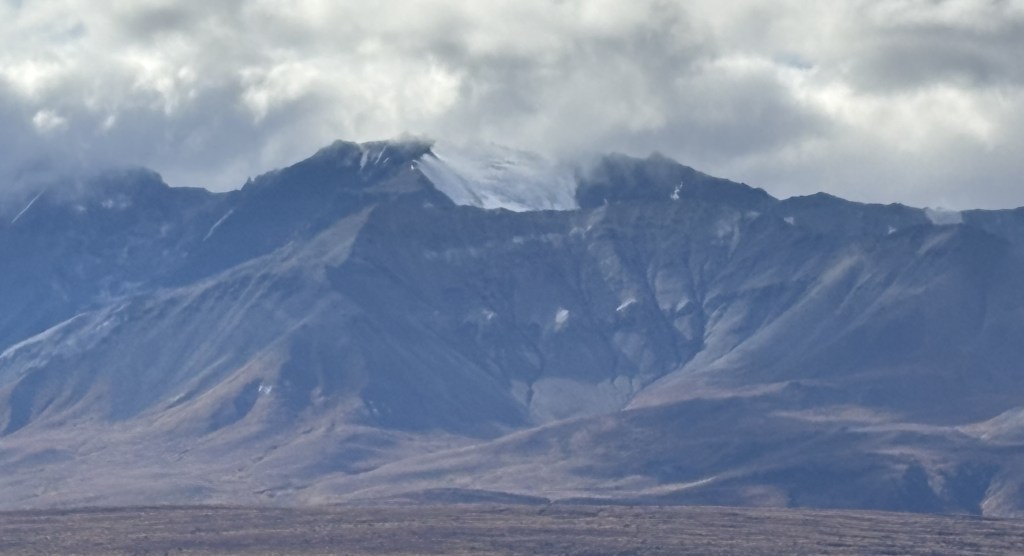
There was significant cloud cover over the peak shown above, and I could see quite a bit of snow at the base of the clouds, so I believe there is a substantial mountaintop hiding behind those clouds.
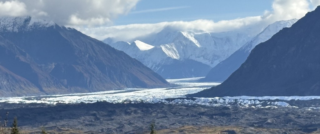
That is a different snow-covered mountain than I showed you in the previous post, and the icefield at the base continued a considerable distance. You will see it at the bottom of most of the following pictures.
I was now past the snow-covered “hidden mountains” and was getting into another part of the day’s trip. I was keeping an eye on my GPS unit and realized I still had two hours of driving to get to Anchorage and check in at my Airbnb. The road had gotten narrower and I was in more traffic. Not knowing what was ahead of me I decided it was probably best to stop taking pictures for the day and just focus on driving.
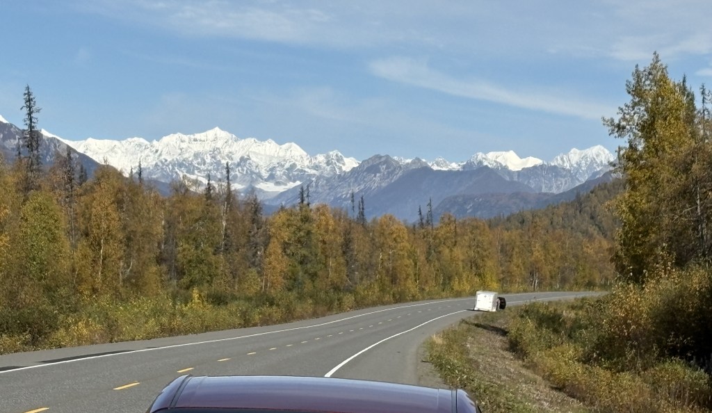
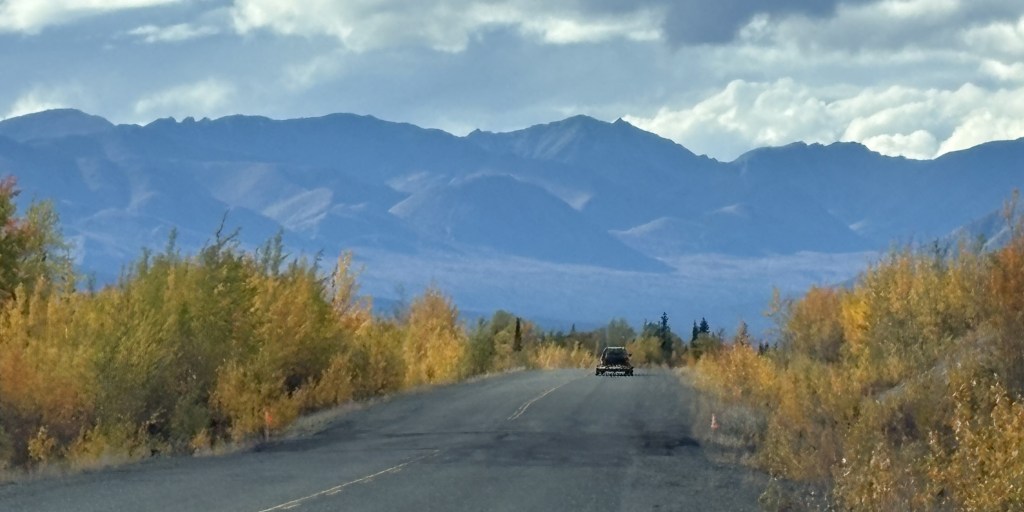
There were of course more mountains along the way, although the road did open up again later, and I passed through at least two medium sized towns. As I approached Anchorage the highway went to 4-lanes, and in some places 6-lanes, so evidently there is enough traffic to warrant that. Getting to downtown Anchorage was easy and it is a very well laid out city.
I regret that I couldn’t retrace my route and show you more, and perhaps better, photos, but I did the best I could. I saw lots of things on my first full day in the state, and believe me – there is lots more to come. I started this as a 4-part post but decided to cut it down to three. I am trying to break down my posts into manageable pieces and not overwhelm people with too much at a time.
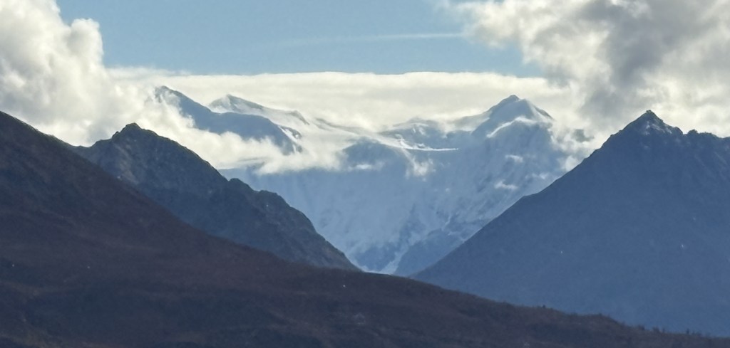
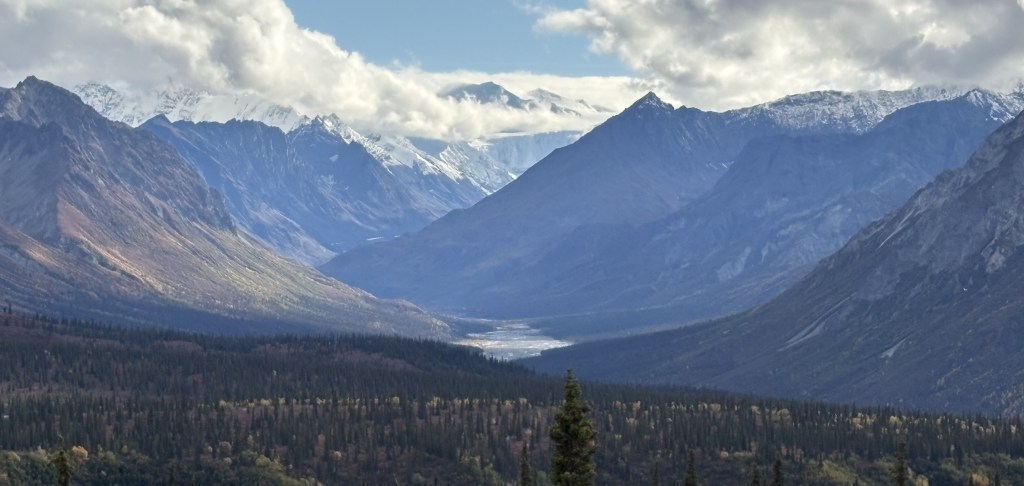
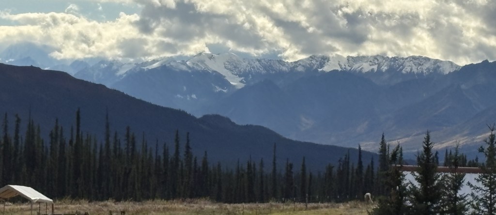
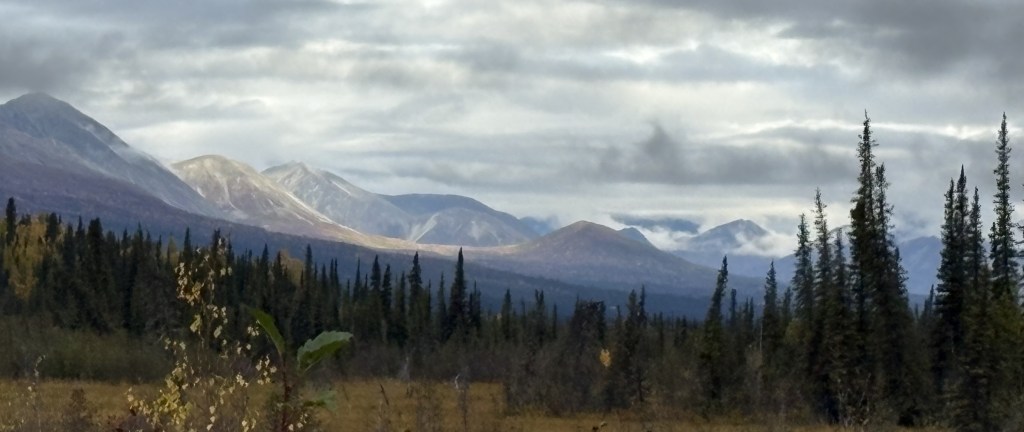
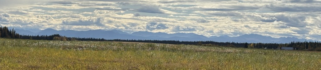
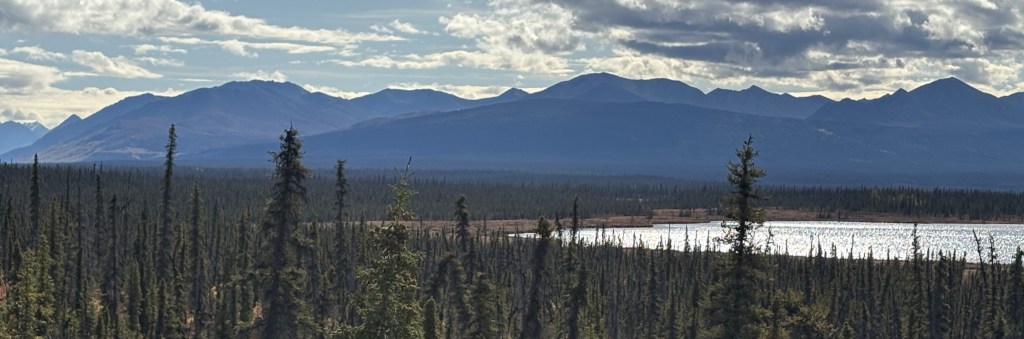
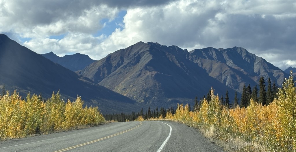
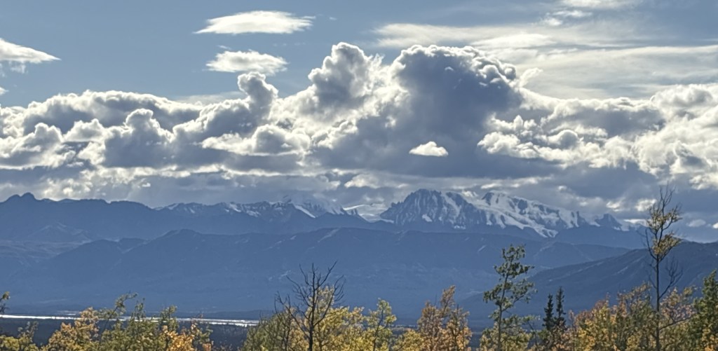
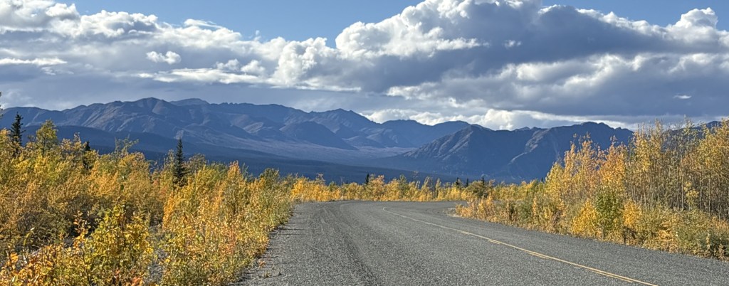
As I travel between Tok upstate and Anchorage near the water, the road would take me on a long open stretch between Glennallen and Palmer. A little short of halfway the road rises to an elevation of about 3,000′ (Tok and Glennallen are at around 1,500′). There was a constant string of mountains to the south and I started to see snow on some of them, and the telltale cloud cover which seems to occur if there is snow or a glacier at high elevation.
Some of the mountains shown above have a solid coating of snow. And before I had a chance to stop and get to a place to take those photos, I could tell that the clouds on the right hand side were obscuring an even taller peak covered in snow. I believe that tallest mountain is either Mount Witherspoon (12,012 feet elevation) or Mount Marcus Baker (13,176 feet elevation). And each of the peaks in the photo, snow covered or not, are separate mountains in that “small” area. When I got to Anchorage I asked if there was a map showing the locations of all the glaciers along the coast and was shocked to learn that there are over 100,000 glaciers in Alaska and there are no maps to make identification easy.
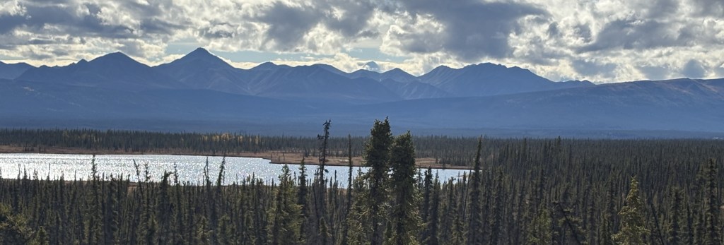
Here are a few shots I took with the digital camera and a zoom lens.
And back to my smartphone for the rest of this group as I continue driving towards Anchorage.
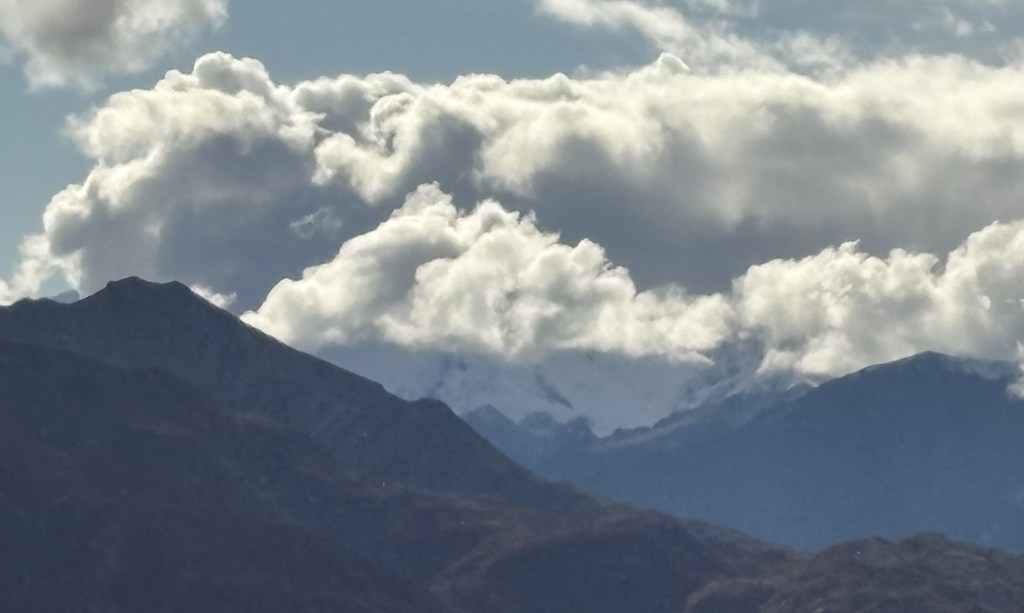
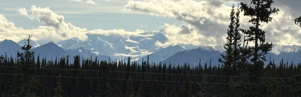
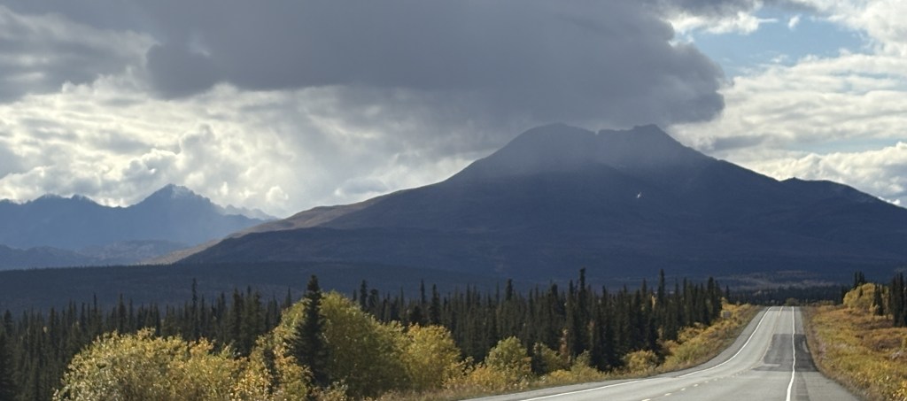
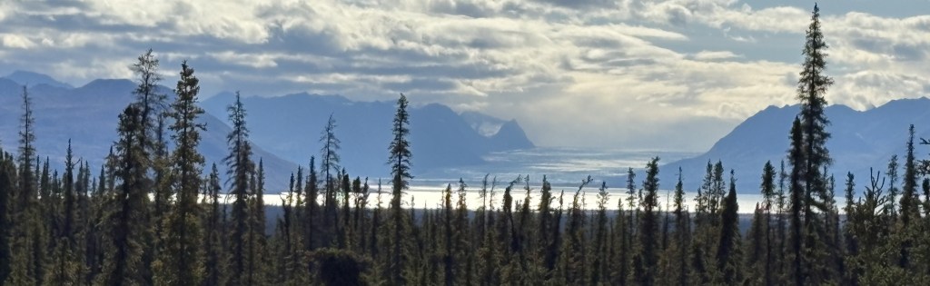
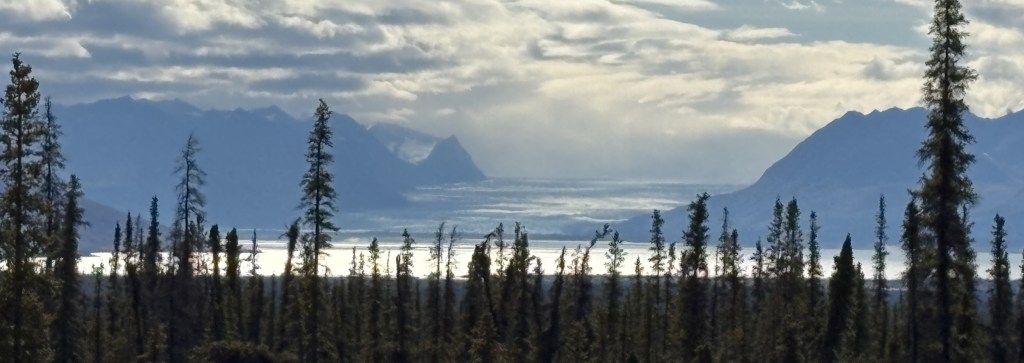
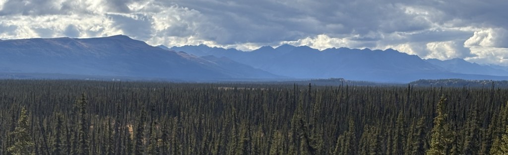
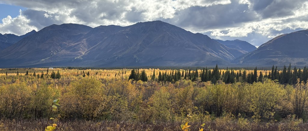
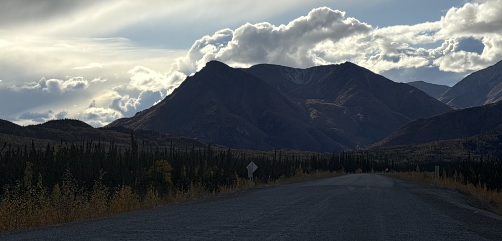
That mountain ahead of me had rain falling from the clouds above it. The next ones are what I call the “brown mountains” which appeared to be shorter and without snow on them.
With clouds behind them, that group appeared to be closer to the highway I was on, and were very likely obscuring the view of other mountains behind them. There are lots of mountains between the highway and the coast.
Once I got past Eureka Roadhouse the mountains would start to play hide and seek (in Part 3).
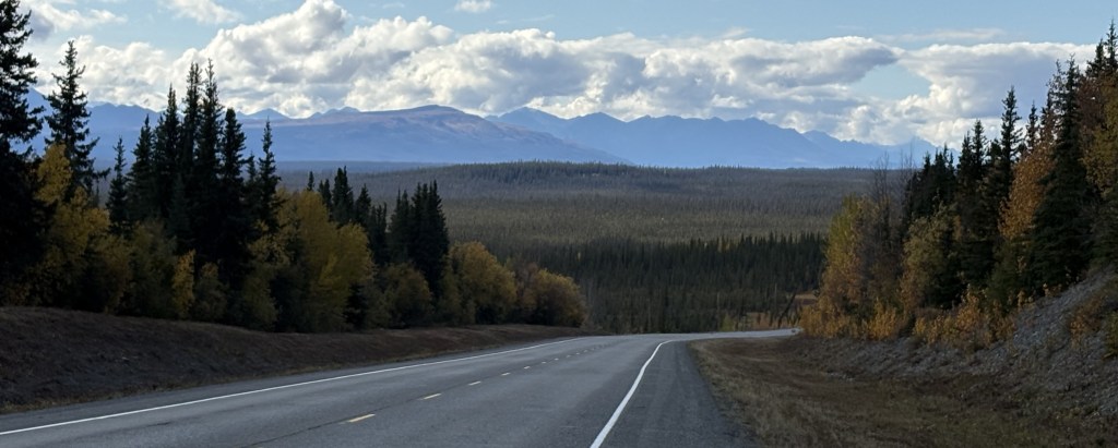
My first full day in Alaska would involve a 318 mile drive on Alaska State Hwy 1, which Google Maps said would take 5 1/2 hours without stops (although I made many stops to take photos). My route would take me southwest to Glennallen, and then west-southwest to Anchorage.
Before I left town I drove from my Airbnb back to the closest gas station to fill my tank. When I went inside to get a cup of coffee I embarrassed myself by trying to pay with a Canadian 5 dollar bill. The clerk asked “Do you have any American money?” and I sheepishly replied “Oh yeah, I’m back in the Unted States now…”. The young man behind me offered to pay for my coffee and I thanked him profusely. I also thanked him for his service, for when he learned I was from North Carolina he informed me he had done some military training in my home state.
It had rained overnight and there were some low clouds when I started out but they soon lifted and it was a nice day to drive. Traffic was light and this stretch of road was in very good shape.
Most of the mountains were on my left, but the photo below was off to the right.
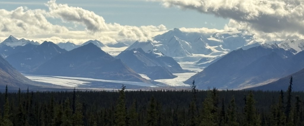
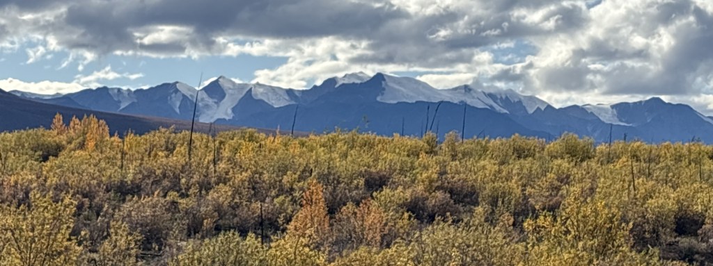
I realize the photo above is quite small but it shows the horizon far to the south to be lined with tall mountains. Wrangell-St. Elias National Park covers a large part of southeast Alaska, and backs up to Kluane National Park across the border in Canada, and between the two of them there are lots and lots of VERY big mountains. I believe the mountains you see above are in Wrangell-St. Elias NP. It is the largest National Park in the United States. Once I reach Glennallen and start driving more to the west towards Anchorage the large mountains you will see are mostly in the Chugach (pronounced CHEW-gatch) Range, which also have some very high peaks.
The gap in the mountains in the two photos above really piqued my interest. I think they may be down at the coast where Valdez is located. I will be going to Valdez later in my trip, but that seems to be the only spot on the map that would have a gap like that.
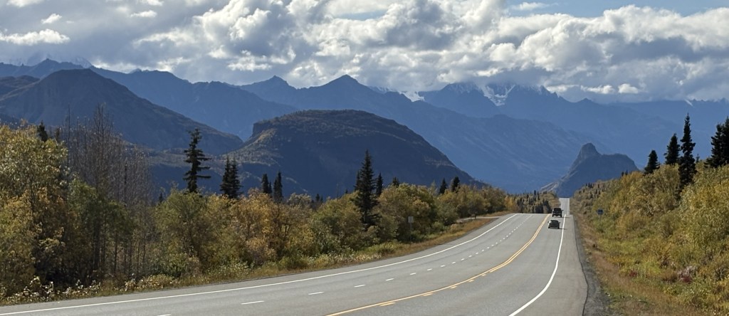
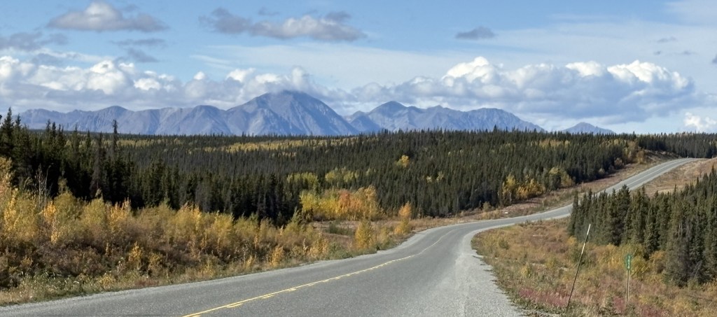
So while I started the day seeing mainly lower, tree covered mountains, the further I drive I will slowly get closer to the coast and have a slightly better view of those larger mountains. The next part of this post will cover the section of road near a place called Eureka Roadhouse and the types of mountains I was seeing would change slightly.
I’ve referenced THE Alaska Highway quite a bit the past few days, but this is a discussion about the highways within the state. They are technically intrastate and not interstate highways because they do not connect to another US state.
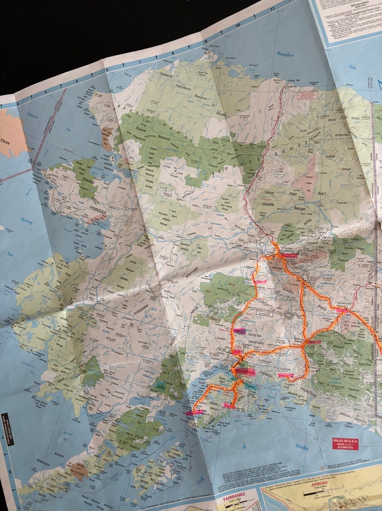
I made a post in real-time shortly after arriving in Anchorage about the highway system. I will repeat part of it again and add a photo of my AAA map on which I’ve highlighted all I roads I actually drove on.
(Photo credit: AAA.com Alaska Map)
There are 4 major highways in Alaska, not surprisingly numbered 1, 2, 3 and 4. Yes, there are other, smaller ones I’ll talk about in a minute.
1 – Runs from Tok, southwest through Glennallen, west through Anchorage and south to Homer. 538 miles, 9 hrs 38 min (per Google).
2 – Runs from the Canadian border with Yukon, northwest through Tok, Delta Junction, and Fairbanks plus a few more miles to Livengood. 624 miles, 7 hrs 34 min. The part that runs from the border to Delta Junction is the westernmost part of THE Alaska Highway.
3 – Runs from Palmer north to Fairbanks. 327 miles, 5 hrs 36 min.
4 – Runs from Delta Junction, south through Glennallen to Valdez. 268 miles, 4 hrs 37 min.
I have driven on almost all parts of the those four, and several of the others (to Homer, Seward and Valdez). The picture I posted above does not include the two short roads I drove on in the Alaska panhandle – going south to Haines and then north from Skagway. I took a ferry between the two towns which saved quite a bit of driving by not having to go back up to the Alaska Highway to get to Skagway.
Yes, there are some shorter stretches of highway with different numbers:
11 – The “Dalton Highway” north from Livengood to Prudhoe Bay, a dangerous stretch of road not for the faint of heart and not considered a major highway. I did NOT drive on it.
9 – Which branches off from 1 to run south to Seward.
5 – Which branches off from 2 to run northeast to Chicken. I did NOT drive on it as I was told by one of my Airbnb hosts in Tok that it is either unpaved or not in good shape.
8 – I had not listed this one previously. It runs west to east in the center of the map above between Cantwell and Paxson. The reason I didn’t include it (or drive on it) is that it is a seasonal road and is closed in the winter. It may or may not have even been open while I was there in mid to late September, but I had read numerous places that if you rent a vehicle in Alaska the rental company will likely forbid you to drive on it. I heard stories that it is very rough, and that flat tires are common.
After studying various maps more closely I have discovered a few other very short roads, but my trip focused solely on the 4 primary highways plus ones that would get me to the coastal towns I wanted to visit.
I also mentioned in my original highway post that these primary roads are located in the southeast part of what I call the “mainland” – excluding the Aleutian Islands and the panhandle. Here is another photo of the AAA map illustrating that point.
This is part three of my drive from Whitehorse, YT to Tok, AK.
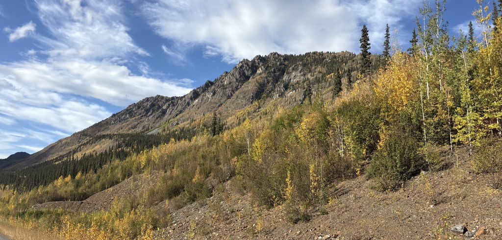
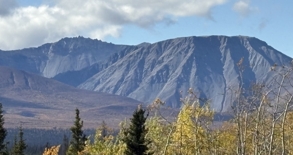
After driving around the base of Sheep Mountain I would continue about 30 miles alongside Kluane Lake. Large mountains would dominate the area left of the roadway, some of which had snow cover and/or glaciers so there were clouds hugging the tops of them. I also suspected there might be more mountains on the other side.
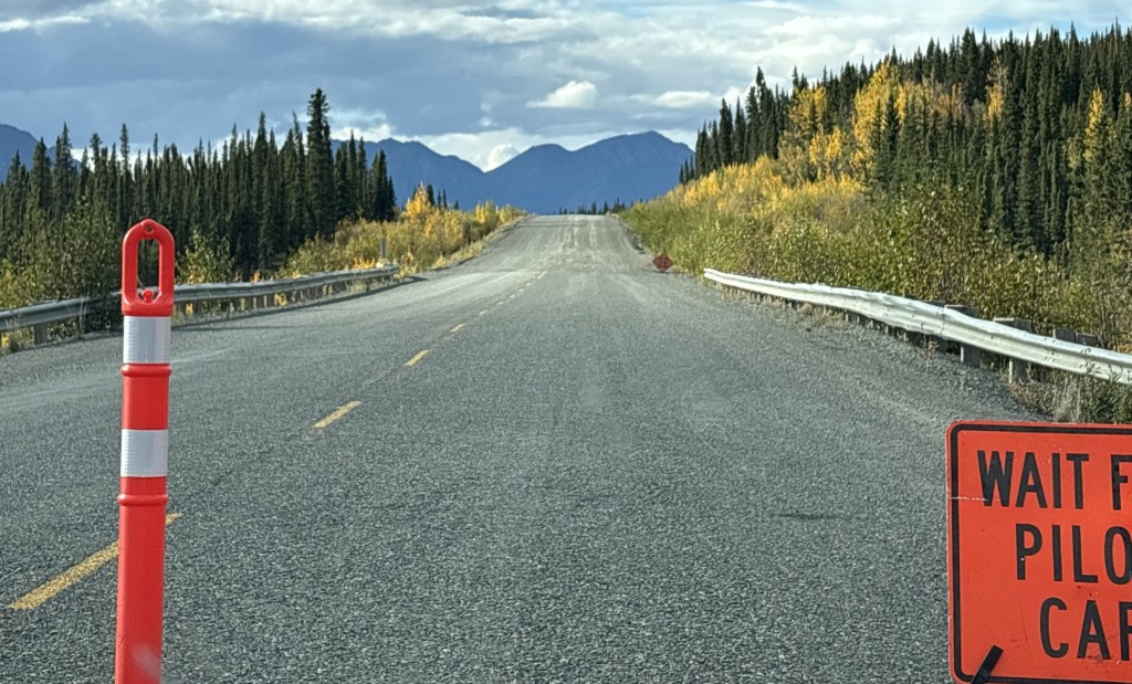
This is also the stretch where the condition of the Alaska Highway would go downhill in places. I had been warned when I was in Watson Lake that this portion of the highway would be slow going. In addition to the aforementioned dips, humps and places where the surface of the road was patched, there would also be stretches which were gravel, in some cases where the highway department had ripped up the pavement completely and was laying down a foundation for new pavement. There were also many spots where the road would alternate between paved and gravel in rapid succession (why I don’t know). For the most part, this stretch of road had little or no warning about bad spots. I had to drive extremely slow in many places, and if a vehicle came up behind me I generally pulled over and let it go on ahead.
Here are some of the things I saw on this stretch of road:
This was one of the places where I had to stop and wait for a “Pilot Car” to follow through a long construction zone. Up ahead you can see that the road changes from paved to gravel, and in some places would be mainly dirt. I had commented earlier in the blog that Canadian roads by and large didn’t have potholes, but after driving this road back east about a month later I take that back. These unpaved stretches did, in fact, have potholes and some places it was very slow going, even without an escort.
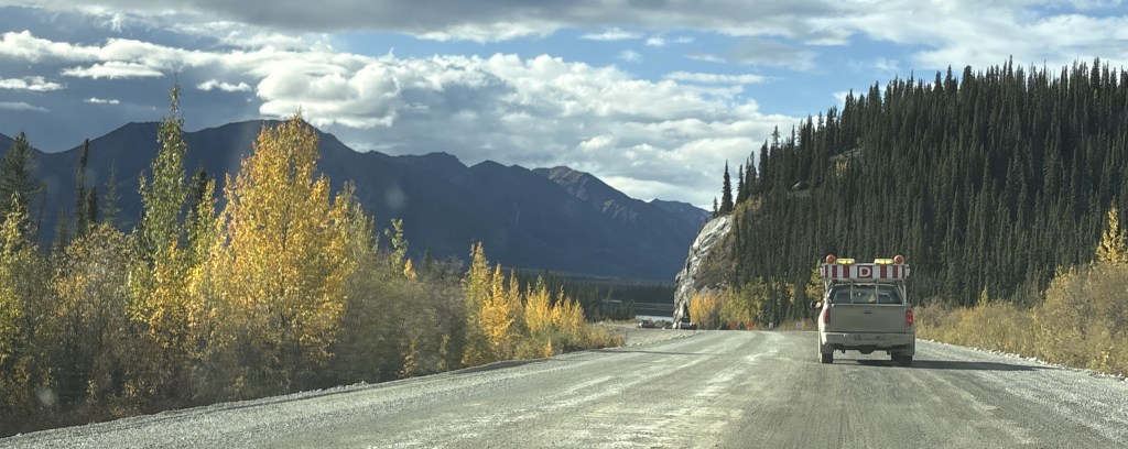
That is me following the Pilot Car (truck). While in these gravel zones large tandem construction trucks would occasionally whiz by at full speed, kicking up rocks. Sometimes they were overtaking us and sometimes they were going in the opposite direction.
I had had been warned not to follow other vehicles too closely but there was nothing I could do about vehicles going the other way other than hope they would slow down. I also tried to pull as far right as I safely could, but if I was stopped waiting for an escort vehicle I was a sitting duck. I did end up getting a crack on my windshield on the way back to Canada.
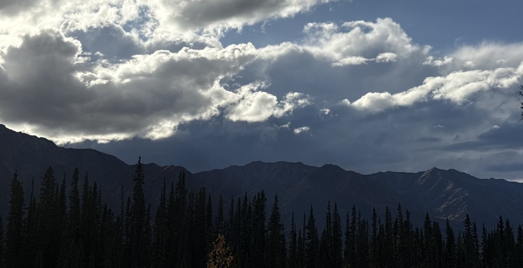
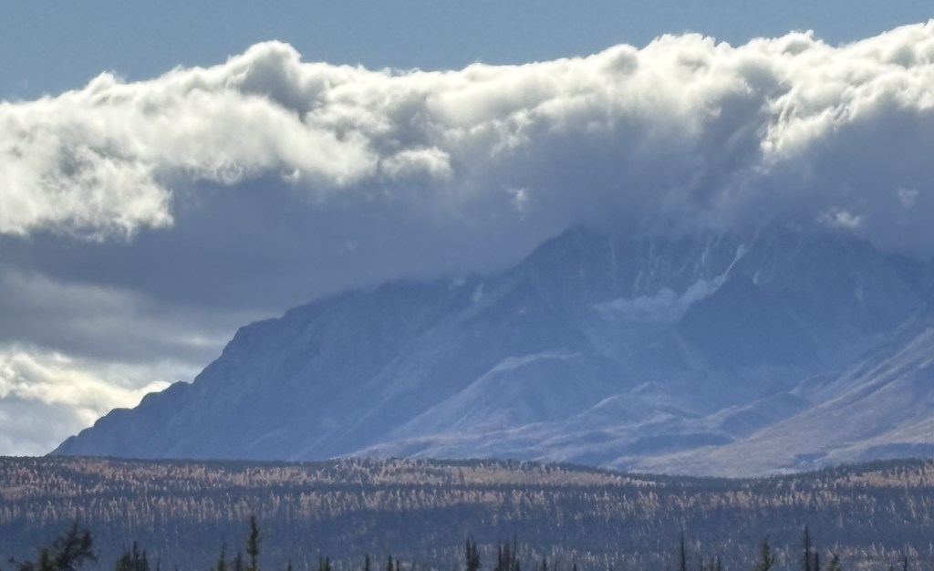
The sky looking west was getting more ominous, and I suspected that there might be bad weather on the other side.
To my right it was still sunny and mostly clear.
But there were places where I was getting close enough to the mountains on the left to be in the shadow of the clouds.
I would soon reach the border and will finish my report on the trek to Tok, AK in my next post.
This post documents the second segment of today’s drive.
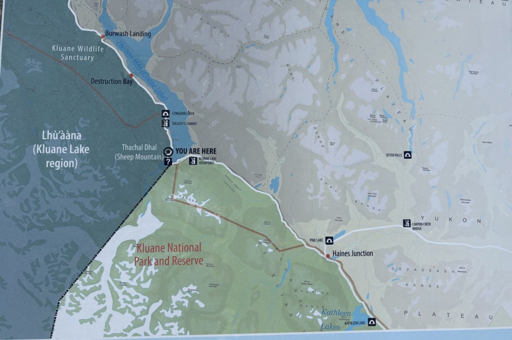
My destination for this segment is the “You Are Here” spot on the left side of the map.
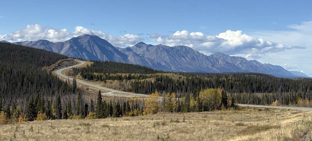
I was seeing lots of BIG mountains ahead of me (in Kluane National Park and Reserve) but after Haines Junction the road turns towards the northwest so I would drive along side, or around, the mountains rather than over them. You can’t always tell from a map, but I have learned that as I approach a sizeable mountain which I will go over (often through a named “pass”) there will be signs for a “Chain Up” area just off the road where vehicles may stop to put chains on their tires. Modern chains may not be chains at all, but other grip- providing equipment which wraps around your tires. When you reach the top of the “pass” there is a “Brake Check” area where big trucks are required to stop to check the condition of their brakes before driving downhill. The required chains may also be removed there, or at the bottom of the hill (I would personally prefer the latter of those two choices).
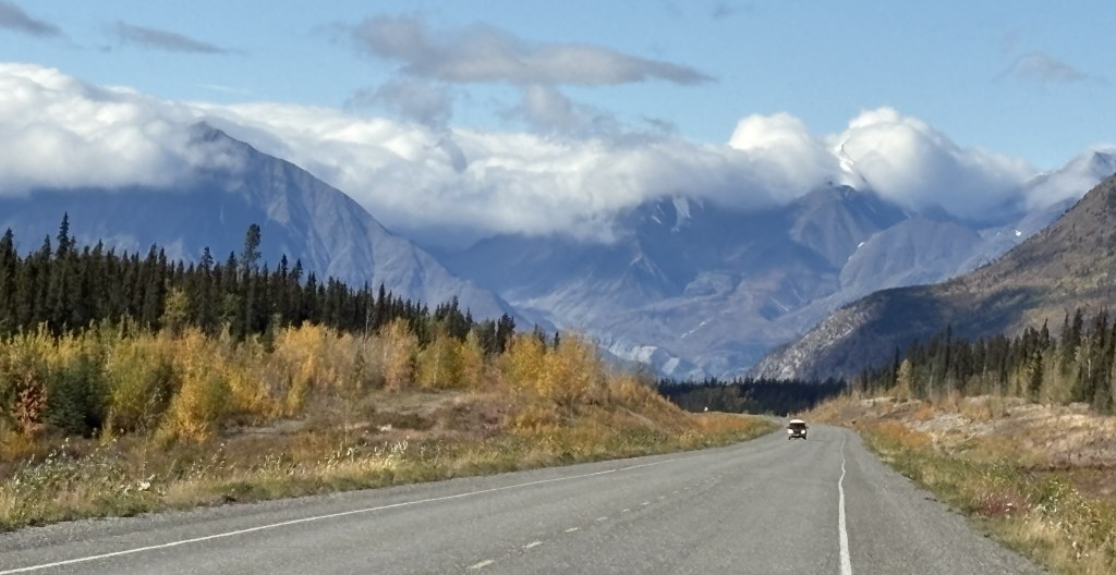
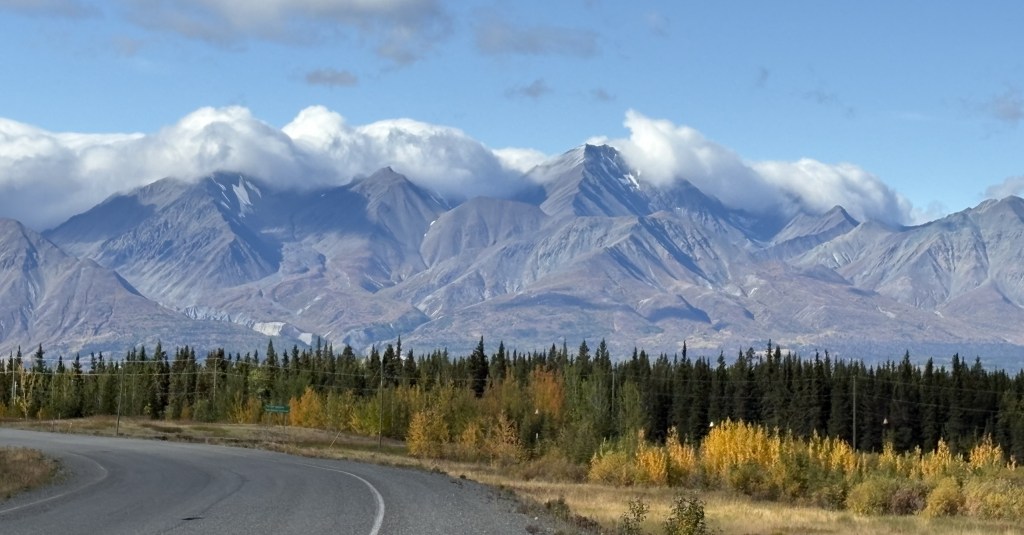
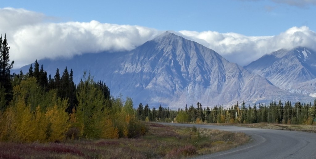
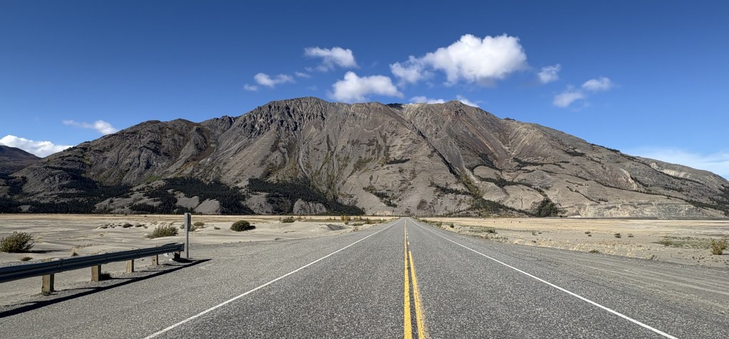
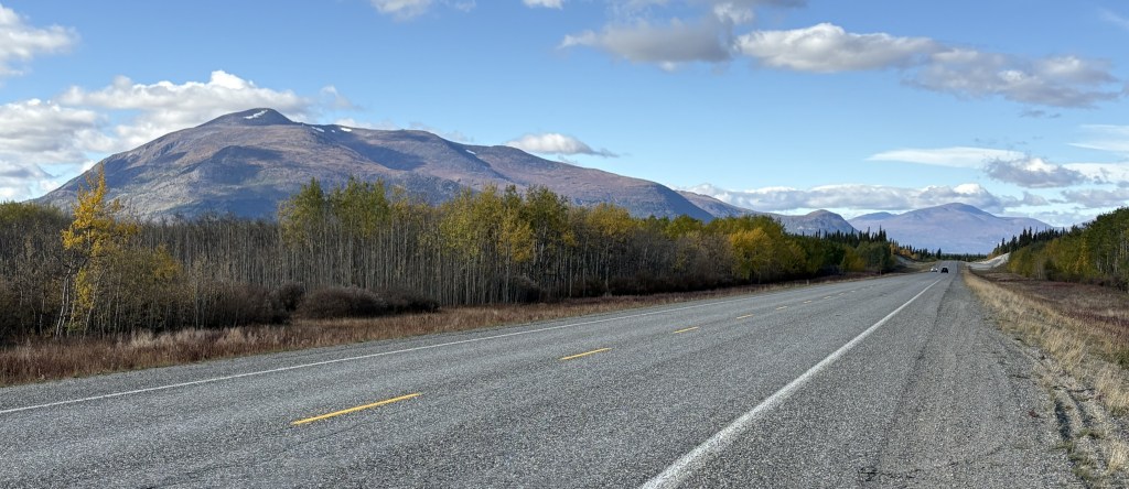
Now, here are the mountains I saw as I drove this section of the Alaska Highway. Once again in this segment of my drive, the road was basically fine, with only a few isolated bad spots.
Most of the clouds in the photos above were directly above the mountains to my left. Directly above me, and to my right, it was sunny and clear, and there were breaks in clouds over the mountains in some spots.
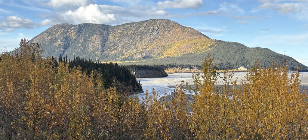
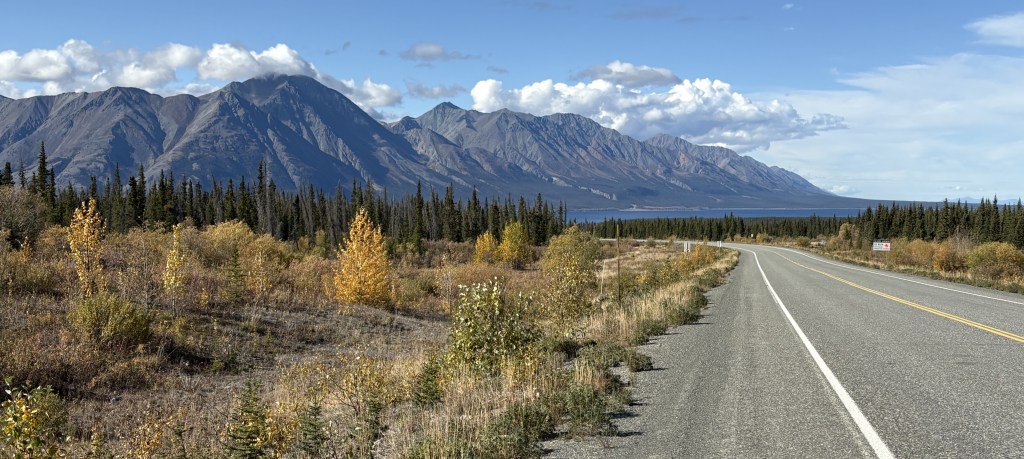
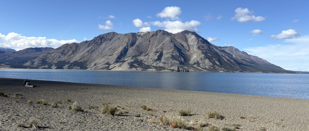
The lake shown above is the southernmost tip of Kluane Lake. The mountain on the other side is Sheep Mountain (where I would encounter warning signs for bighorn sheep, of which I saw none). The road I was on would continue to the left from this spot but then make a turn right to head straight towards the mountain.
And this was the view from a bridge I drove over where the lake drains into a small river (or vice versa).
I will make the next two posts in this 4-post sequence tomorrow, which will take me to Tok, Alaska.
This is the first of four posts documenting my entry into Alaska! From Whitehorse it will be a 386 mile, 7 1/4 hour drive (without stops!) west across the southern part of the Yukon, eventually turning northwest before reaching the border with Alaska, and ultimately the town of Tok (pronounced toke). There are lots of photos and my goal is to show what it is like to drive this part of the Alaska Highway. The four posts will be:
1 – Whitehorse to Haines Junction, 2 – Haines Junction to Sheep Mountain
3 – Sheep Mountain to the Canada/Alaska border, 4 – The border to Tok, Alaska
Here we go!
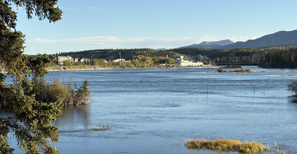
It was a nice, clear morning when I left Whitehorse. It is the capital of the Yukon Territory province and has a population of about 35,000 people. According to Wikipedia it is the largest city in northern Canada, which covers quite a bit of land. I would guess what they mean is north of the northern borders of the provinces which border the northern US states in the lower 48.
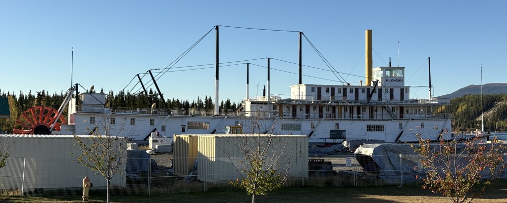
That is looking towards Whitehorse from a pullout area along the Yukon River.
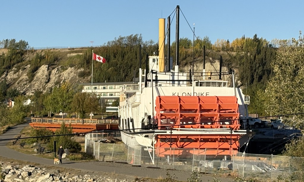
The ship shown above is the SS Klondike. It is now a Canadian National Historic Site and is undergoing a multi-million dollar renovation (hence the fences and shipping containers). It is drydocked here along the river. It was on the right side of the first photograph in this post.
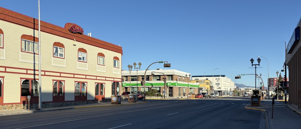
That is part of the downtown area. The town is rather spread out so it is hard to get it in one photo. Suffice it to say that it is a nice, modern town. I will be coming back here on the return trip in a few weeks and plan to spend more time here.
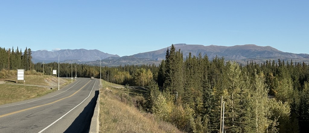
The rest of the photos in this post are from the drive west to Haines Junction.
I have posted the next four photos previously but am repeating them here in the proper sequence in my trip.
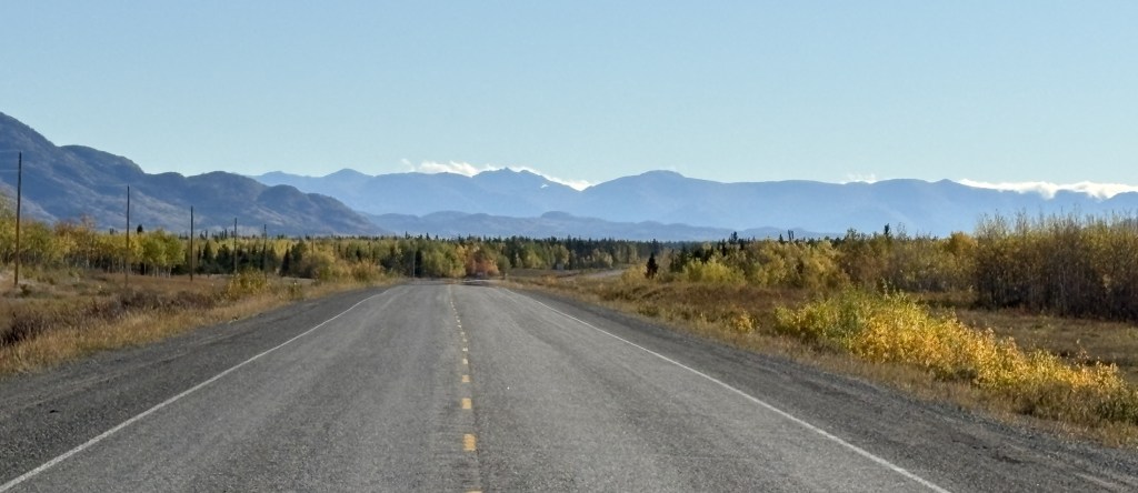
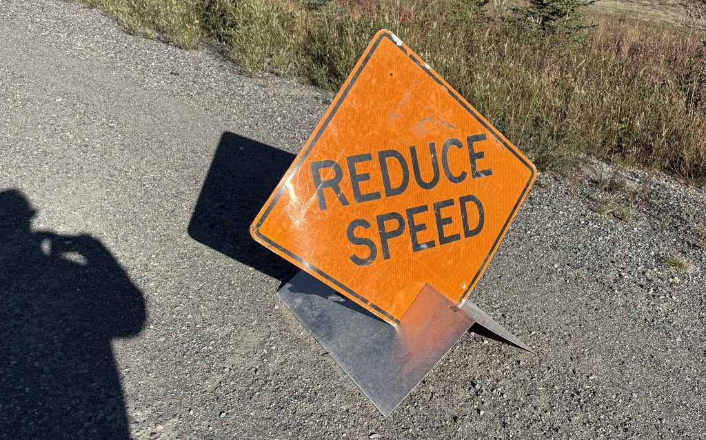
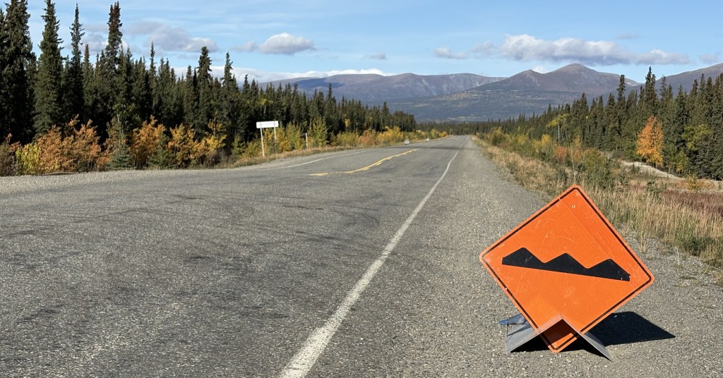
As I explained in the real-time post back in September, these were small signs set up temporarily along “bad” sections of the Alaska Highway. A “bad” section is generally an undulation (bump or dip in the road caused by the temperatures this far north), or potholes or parts of the road which have a rough surface as opposed to the normal pavement. Most of the road is fine, but these signs warn drivers to be especially alert to the condition of the road, especially if there is snow present.
During the day these areas are generally visible to the naked eye, but at night or on a snowy road, these signs should not be ignored.
This second sign indicates that there is a fluctuation in the road surface (up or down) which is what warrants caution. You can see the dip in the road just past these signs. Not too bad at this particular spot but sometimes they are doozies!
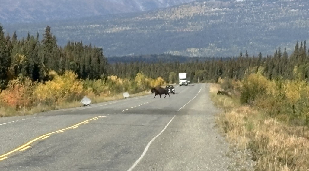
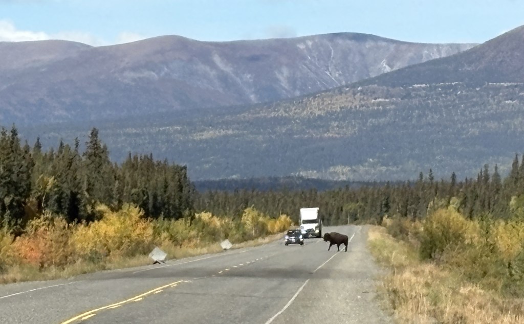
While I was stopped here taking these photos, two bison meandered across the highway further up the road.
You can see the second one climbing the bank on the right.
You can also see the two signs warning drivers coming the other way for a repaved (dark) area on the other side of the dip in the road. These were the only bison I saw during my entire trip, and I would have already been past this spot if I hadn’t stopped to take photos of the two small signs.
There were LOTS of these signs between here and the border and as the road deteriorated the further west I drove, they evidently ran out of signs warning of the bad spots and drivers just needed to be prepared at all times. In addition to the two signs there was sometimes an orange flag attached to the Reduce Speed sign, which meant they were really serious about it. Later in my drive there may only be a flag warning of a bad spot.
As I stated back in my real-time post, I would not want to drive this road at night, not only because of the increased animal-in-the-road risk, but also because I couldn’t see the bad spots before driving over them. I kind of got used to the rhythm needed to pass these areas. If the hazard was on my side and there was no one coming the other way I would sometimes move over to the other lane.
What I have shown in this post is getting as far west as Haines Junction.
The road on this stretch was pretty good in almost all places, as it will be in the next segment of today’s drive. Thus far it was a nice, clear day and it was a very pleasant drive.
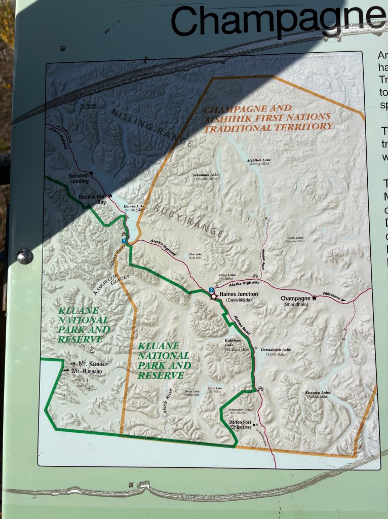
I stopped in Haines Junction at the Kluane National Park and Reserve Visitor Centre, which also housed a Cultural Centre for the Da Ku indigenous First Nations tribes (Champagne and Aishihik ), whose territory I have been driving through. They had lots of displays, and I spent a good bit of time there.
The Kluane National Park and Reserve was dead ahead of where I was driving as I approached Haines Junction. I could see more and more big mountains ahead of me, many with low clouds at the top which I have learned often signifies snow and/or glaciers at their peaks. You will see lots of them in the next two posts. One of the mountains due west of Haines Junction is Mount Logan which, at 19,551 feet, is the highest mountain in Canada (and second tallest in North America, after Denali). It is about 100 air miles away and I could not see it because of other tall mountains blocking the view.
My next post covers Haines Junction to Sheep Mountain, at the southern tip of Kluane Lake on the map shown above (where there is a blue question mark).