While I was to be based in White Bird for two days all of my road trips were north of there. With my early start I arrived in the area by mid-day Sunday so I had some time to start exploring.
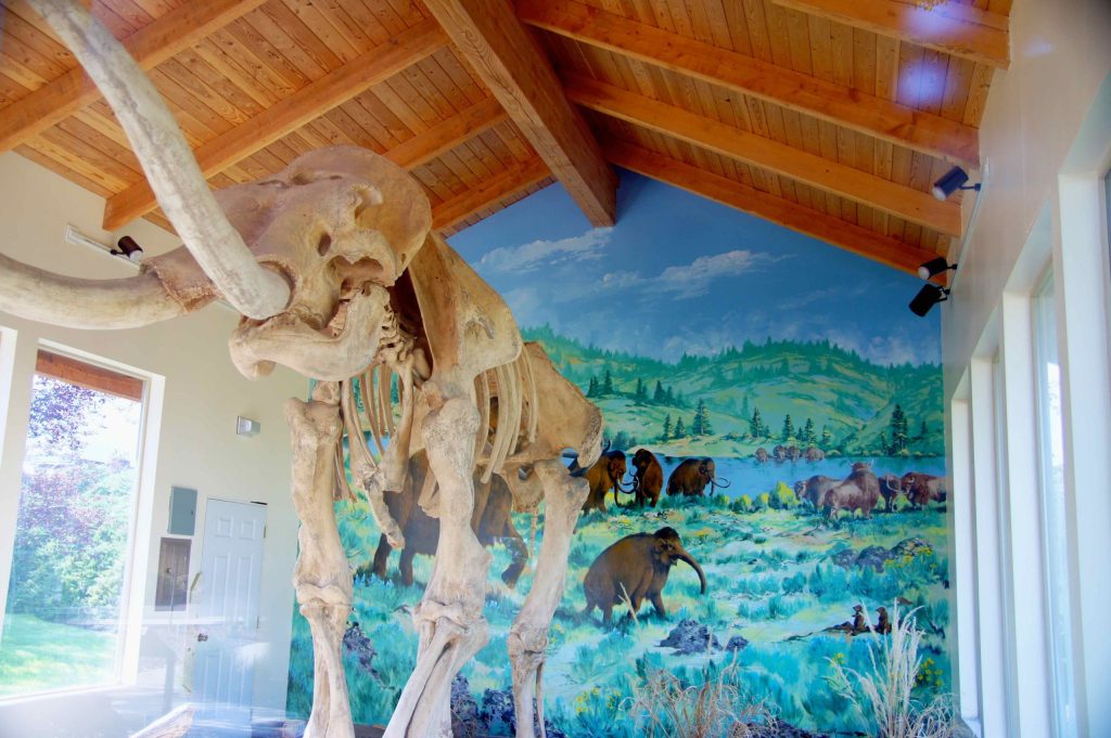
Grangeville is a larger town, located 17 miles north of White Bird on (new) Highway 95. My first surprise when I drove up to Grangeville after I arrived in the area was a sign pointing west to Tolo Lake, about 5 miles away. It was at that lake where remains of Columbian mammoths were found when the lake was being worked on by volunteers for “fishing and wildlife improvements” in 1994. Experts were brought in and the lake was drained. Many skeletal remains were found and it is one of the largest Columbian mammoth “graveyards” to be discovered in the United States.
Male Columbian mammoths were about 14 feet tall and 17 feet long and were believed to have weighed about 10 tons. My first encounter with mammoth research was when I visited “The Mammoth Site” in South Dakota back in 2017.
Tolo Lake was later refilled with water and is now a “protected site” pending the receipt of more funds to continue the research. I drove out to the lake but there is nothing there to see except a few signs discussing the findings. There is a building behind the Grangeville Chamber of Commerce Visitor Center downtown which houses a full-size replica of a Columbian mammoth skeleton:
(Photo credit: blog.goodsam.com)
I took some photos of my own but the display is surrounded by glass and it reflected the outdoor scenery behind me. Signage at the display suggested returning at night to get better photos when the display is lit up from inside the building but I try not to go out at night when I am traveling in areas with which I am not familiar.
Sunday morning, after a warm night and a cold shower in Horseshoe Bend, I headed north for my next stop in tiny White Bird, Idaho. The key word there is “tiny”. When I Googled the name to get some information about it I learned that in 2019 the population was only 53 – half what it was in the year 2000. Also, the town only covers 42 acres! Nevertheless, I found a great Airbnb there and got a great rate because it was a new listing and there was a discount for the first few guests that made reservations.
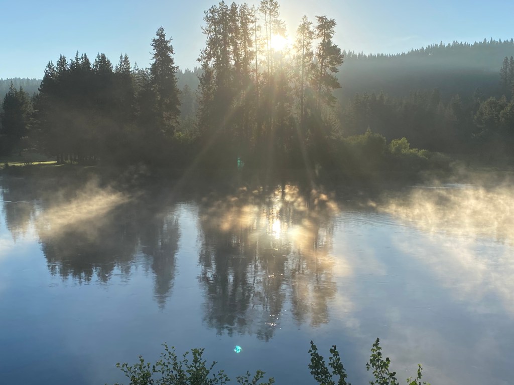
I left Horseshoe Bend and proceeded north on Route 55. I had driven part of this route back in 2017 when I traveled from Boise up to McCall, ID. Today I would continue on past McCall where I picked up Route 95 towards White Bird, about 150 miles from Horseshoe Bend. For the first part of the trip I would be driving parallel to the Payette River. In the early hours of Sunday morning there was a mist rising above the water:
The drive to McCall is very nice, with some great views of the river, but I posted photos back in 2017 and won’t repeat them. There was one section of the road which was under construction (to blast away part of a mountain cliff adjacent to the roadway) and I didn’t feel very comfortable while driving it so I made a note to change my route in order to avoid it on my way south in a few days.
I did make it safely to McCall, then took Highway 95 further north to Riggins. There I crossed the “Time Zone Bridge” and was now in the Pacific Time zone.
I had been to Coeur d’Alene in northern Idaho back in 2017 but forgot that the northern half of Idaho is in the Pacific Time zone while the southern half is in the Mountain Time zone. Seems kind of screwy to split a state horizontally rather than vertically but then I don’t make the rules…. I had been through Riggins back in 2017 but on that trip I had arrived from the west, via Oregon, when I stopped at Hell’s Canyon, and the Snake River, which separates Oregon and Idaho. The Snake River is only about 8 miles west of this bridge.
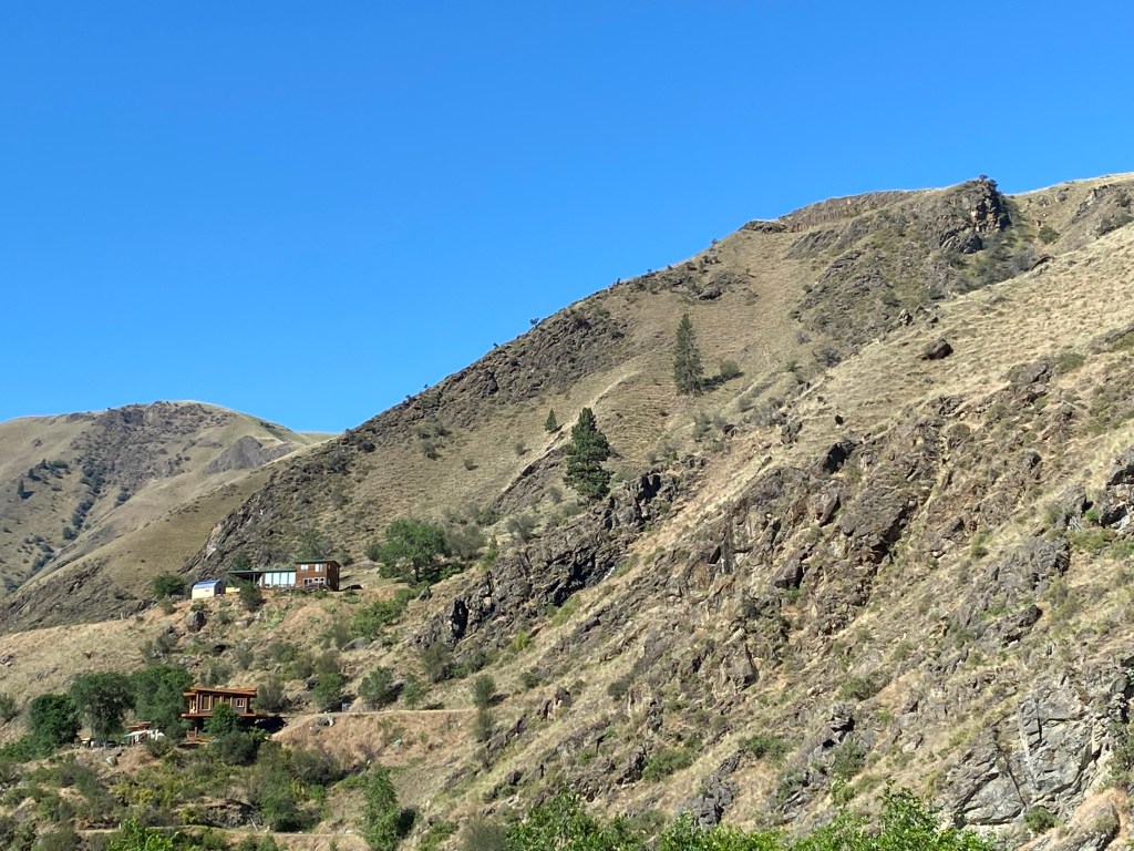
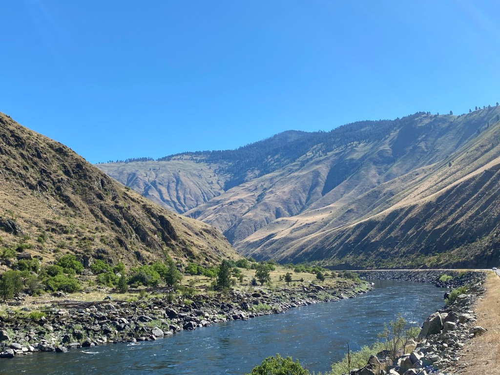
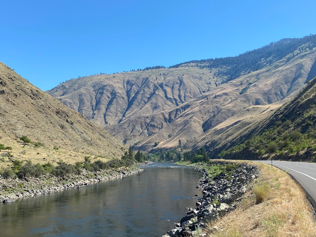
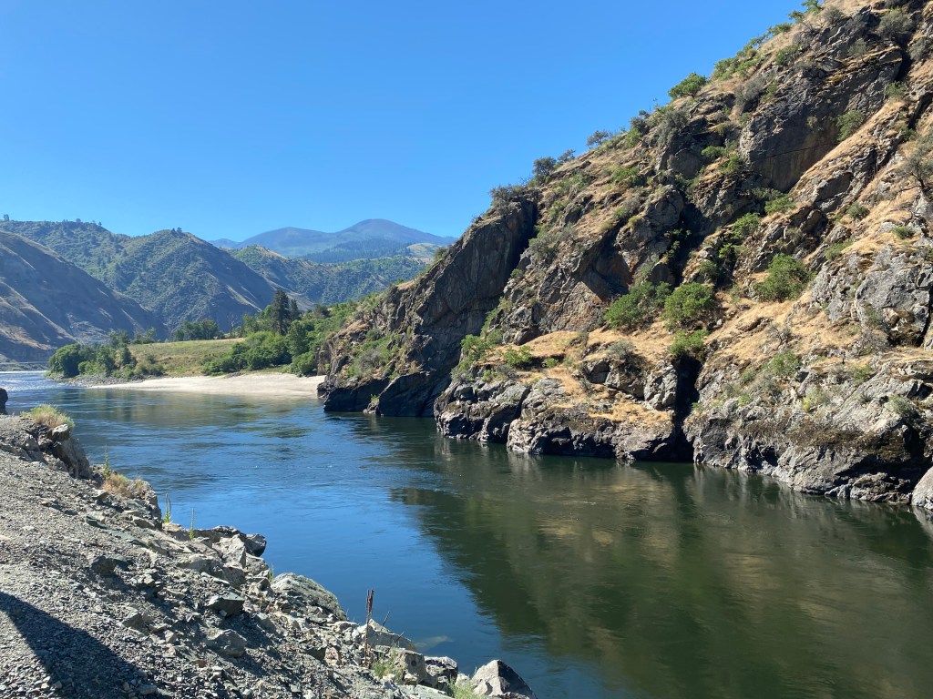
From this point northward I would be driving on Route 95 alongside the Salmon River until I got to White Bird. There were some beautiful places to stop and enjoy the view along the way:
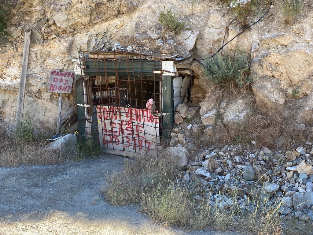
At one place where I parked to take some photos I spotted the entrance to an old mine just off the road:
There’s contact information on the sign if you want to lease it or enter into a joint venture with the owner….
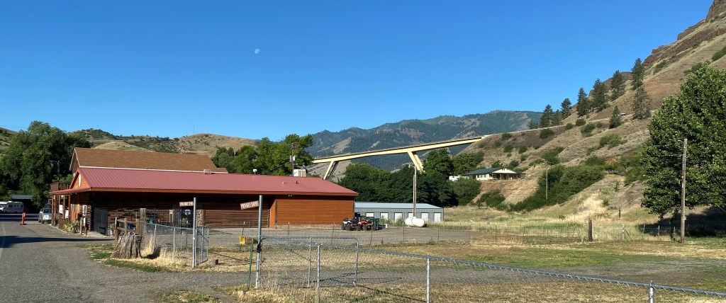
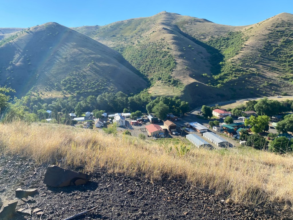
I finally reached the turnoff for White Bird. The town itself is located below the level of the highway, at an elevation of 1,581 feet, in White Bird Canyon.
The turnoff for White Bird is left of the new highway bridge in the photo above (photo is looking south). That bridge takes Route 95 onto the new road which was completed in 1975. More on that in a minute. Here are some photos of town taken from a scenic turnout on the new highway.
Old Route 95 used to go right through town and then proceeded up the mountain. The old highway was completed in 1915 and gained almost 2,900 feet in elevation, to it’s highest point of 4,429 feet, in just 14 miles. It achieved that through a series of long switchbacks. If all the turns were combined into circles there would be 37 of them! It was a narrow, dangerous road and it is hard to imagine cars, much less large trucks, trying to navigate it in both directions. I would drive up Old Highway 95 before I left town and will post some photos in a few days.
The new Highway 95 is much wider, including long passing lanes, and is steeper but with fewer turns. It only attains a height of 4,245 feet before descending on the north side of the mountain.
White Bird would be my base for the next two nights and I would be making several scenic drives north of town in the next two days and learn about some new and interesting things.