After visiting Arches National Park Saturday morning I headed south on Highway 191 to what I have been calling the “east entrance of Canyonlands”. Canyonlands is another big National Park in southeast Utah. I skipped it entirely the first time I was in the area and went in the north entrance a year later, seeing only a small portion of the Park.
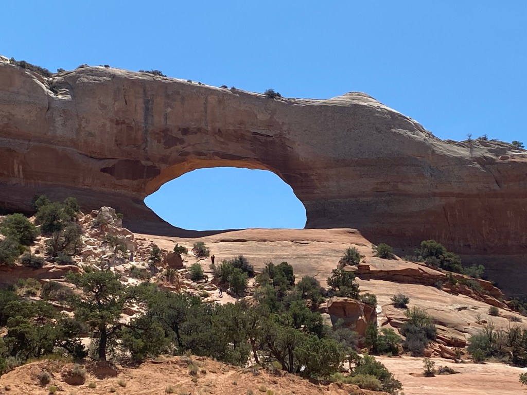
From the entrance to Arches I drove south, through the town of Moab and would continue about 40 miles. I passed another arch, Wilson Arch, along the way, just off the highway to my left. To give you some idea of the size, there are people standing down near the trees just below the open area under the arch.
I eventually came to the road which would take me back to the “Needles Overlook”.
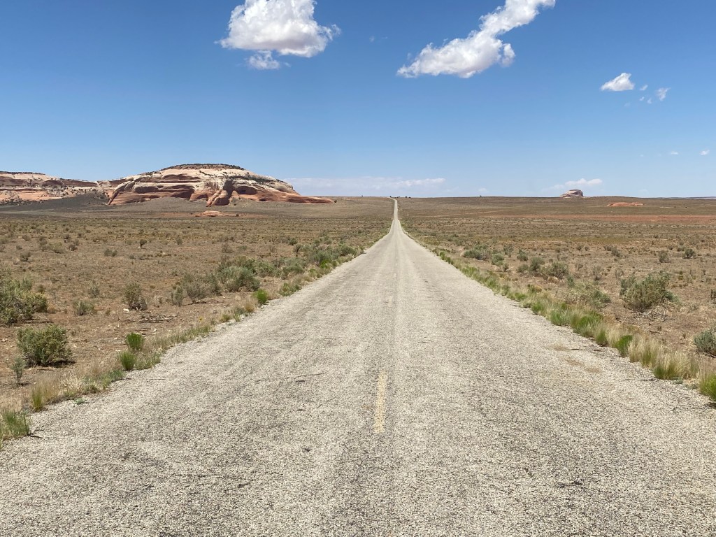
I would take that road 22 miles out into the desert. As my friend, Max, pointed out to me, the Needles Overlook isn’t in Canyonlands at all – and he’s right. The overlook is a high point which allows the viewer to look out a vast distance, most of which is the southern part of Canyonlands, but isn’t in the Park itself.
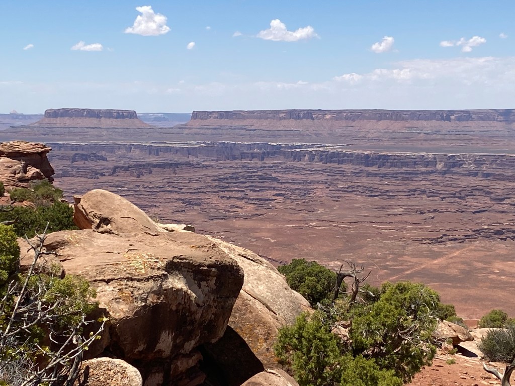
The “Needles” is an area in the extreme southern part of the Park, hence the name of the place I was going. The view took in a huge area and without knowing more about the terrain it was difficult to pick out landmarks, including the Needles. I met some people while I was out at the overlook who were camping down in the Needles and they pointed southwest from where we were but I couldn’t see anything that far out in the distance which seemed to fit the description.
Because everything was so far away the landscape didn’t lend itself to taking a panorama so we have to go old school and use multiple photos.
This was looking north (right) from the overlook, panning left-to-right. The first photo starts looking out towards the western horizon and the next two photos bring the view around to the right, ending looking slightly back towards the way I had driven in.

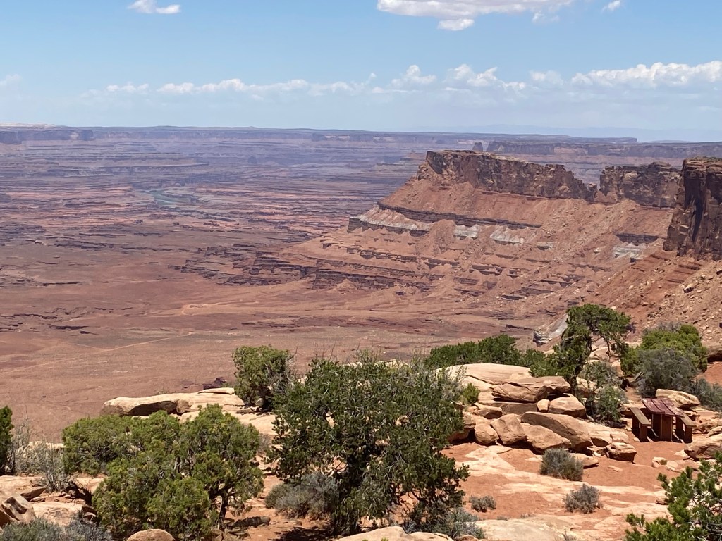
And looking left from the overlook wasn’t much different. These are again in a left-to-right sequence, starting looking “back” as I had driven in and working west towards the horizon looking, more or less straight out as I drove in.

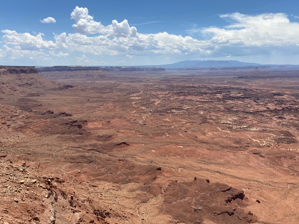
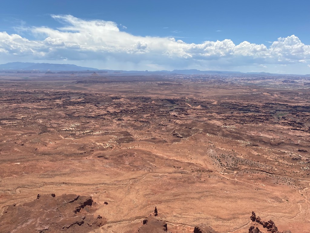
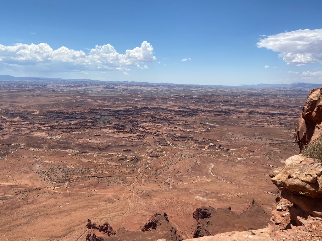
As you can see, it is a huge, rugged rock and dirt area virtually devoid of trees. There are two rivers which come down from the north (right), the Colorado and the Green, and they meet in the southern part of the Park before continuing (as the Colorado) down to Lake Powell in Arizona. As you may be aware from news reports, the river levels are dreadfully low this year and Lake Powell is so low that authorities are hard-pressed to use the water for power generation.
According to the map legend, looking straight out from the overlook it is about 5 miles to get to the eastern Canyonlands Park border, then another 12 or 13 miles to get to the other side. It is about the same distance if you swing the ruler down to the southern end of the Park (past the “Needles”). There are very few roads out into Canyonlands (one the reasons it hasn’t been a priority for me) and it is best seen on foot.
I tried cropping the photos to eliminate some sky and a little of the foreground to try and help you see things better but it didn’t really help as everything is so far away.
Later in my trip I would attempt to get to the “Needles”, utilizing the southeast entrance to the Park, from where I was staying in southwest Colorado but I can tell you right now that attempt failed as a severe thunderstorm was developing and was heading right for the area I was planning to visit. I got as far as the entrance road from Highway 191 but decided not to go any further.
