Yesterday I posted two photos of a gentleman creating a piece of artwork based on what he was inspired by at the Grand Canyon. Here is a closer look at what he was working on.


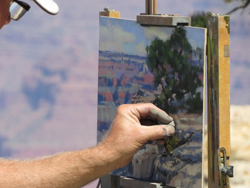

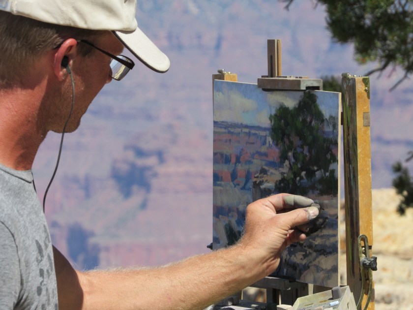
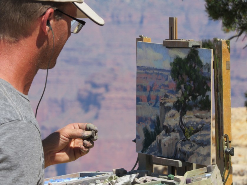
Yesterday I posted two photos of a gentleman creating a piece of artwork based on what he was inspired by at the Grand Canyon. Here is a closer look at what he was working on.
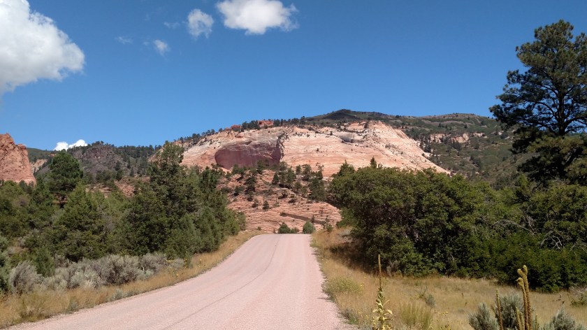
Monday morning I left Kanab to head south to the North Rim of the Grand Canyon one last time before going on to Flagstaff, Arizona for 4 nights. These were some of the things I saw before and after leaving the Park.
Before getting to the entrance of North Rim I went through the little town of Jacob Lake. I have actually been spending a good bit of time there lately, trying to get a photo of an animal which is unique to this area. I only saw three, and never was in a position to get a good photo, so I have resorted once again to the miracle of the internet.
This is a Kaibab (pronounced k-EYE-bob) Squirrel, found only in a very small area between the town of Jacob Lake and the North Rim. This area is within the Kaibab National Forest which has lots of Ponderosa Pine, a type of tree favored by these squirrels. The three I saw were all larger than a normal squirrel, had dark brown (almost black) fur and big, puffy snow white tails. A ranger I spoke with in the Park said she had seen a lot fewer squirrels this year than she has in the past, which is perhaps why I had such a hard time finding any.
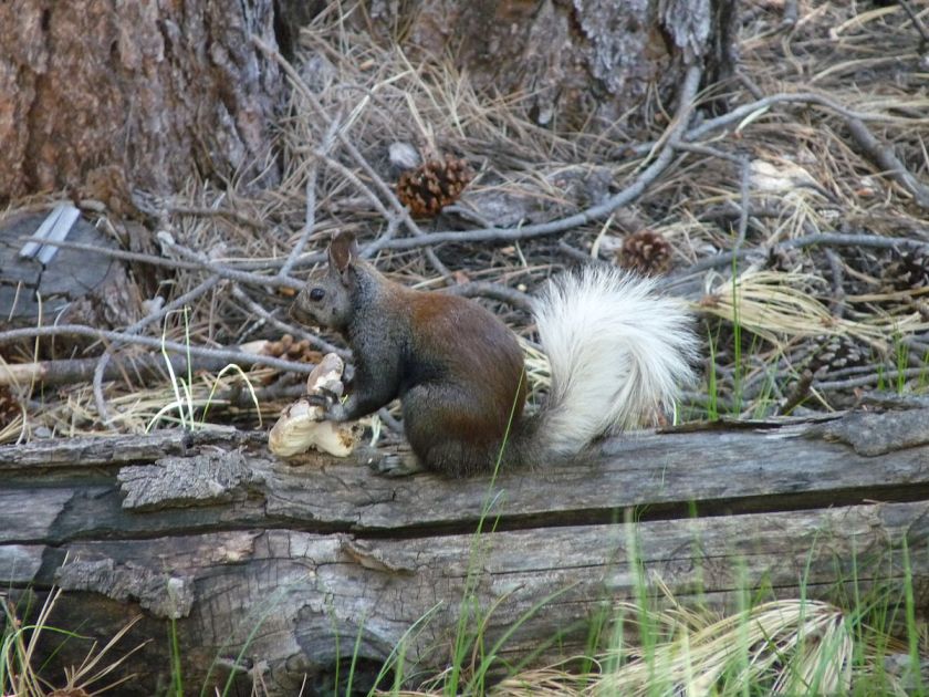
(Photo credit: wikimedia.org)

(Photo credit: ejphoto.com)
The rest of these pictures I took myself.
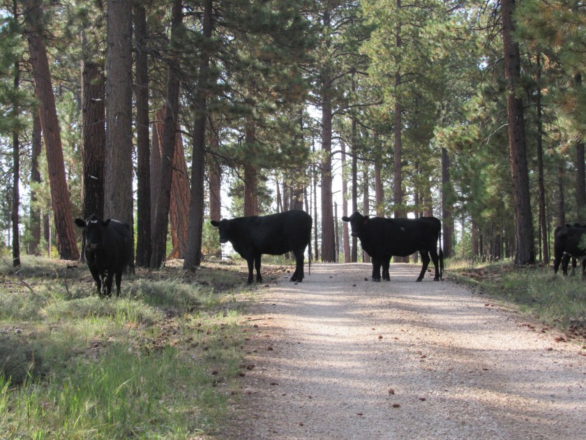
As I was traversing the 7-mile stretch of Forest Road 205 for the umpteenth time looking for the elusive Kaibab Squirrels, I came across this group of Moo Cows. This time I was way outnumbered (there were more off to the right) and they looked like they meant business. I figured they would probably block my way until I gave each of them some moo-lah and all I had were large bills, but after taking a few photos I started driving forward slowly and sure enough, the seas parted and I was on my way.
Further on down the road I saw what I am quite sure is a California Condor circling slowly off to the right of Route 67. He had been circling quite low but by the time I turned around and went back he had gone up much higher. It it hard to follow a bird in flight when you are zoomed in on it but I was able to get one clear picture.
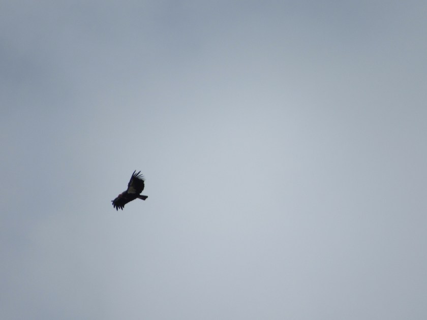
It was huge, and had feathers extending out from the tips of it’s wings which is why I think it was a condor and not just a run-of-the-mill vulture. I would see more condors once I got down to the South Rim of the Grand Canyon.
This is the sign they use in Arizona to indicate you are on a Scenic Byway.

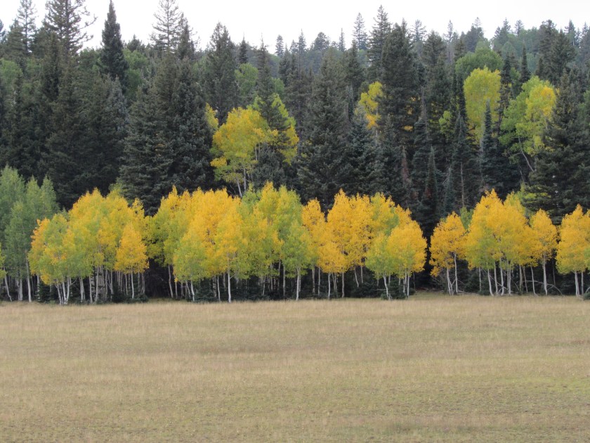
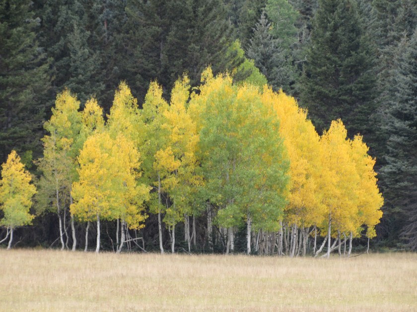
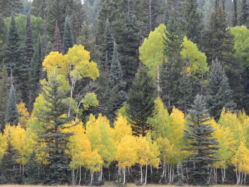
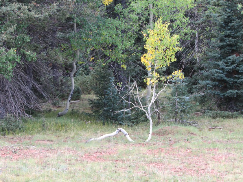
Before getting to the Park entrance I saw some more colorful Aspen trees, as well as a few with oddly shaped trunks.

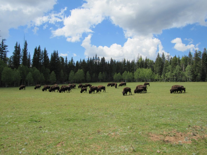
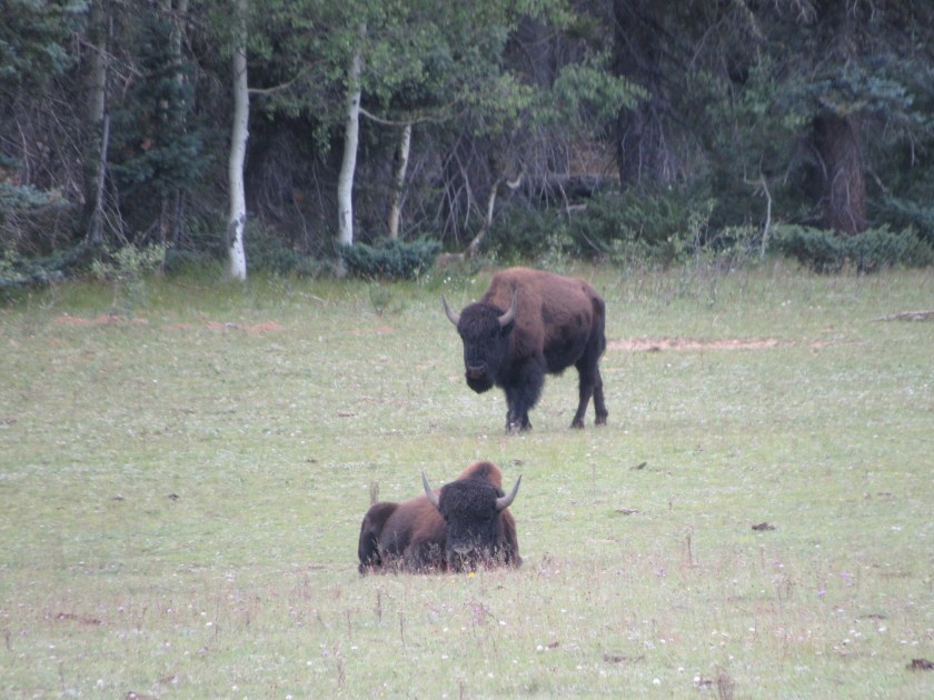
About a quarter mile after passing through the entrance to the North Rim there were two large herd of bison, close to a hundred on each side of the road. They seemed oblivious to the tourists who were all stopping to take pictures (the ranger at the gate told us to stay in our vehicles but not everyone listened. I did – I took these by holding the camera out the driver’s side window, or looking through the open passenger’s side window).

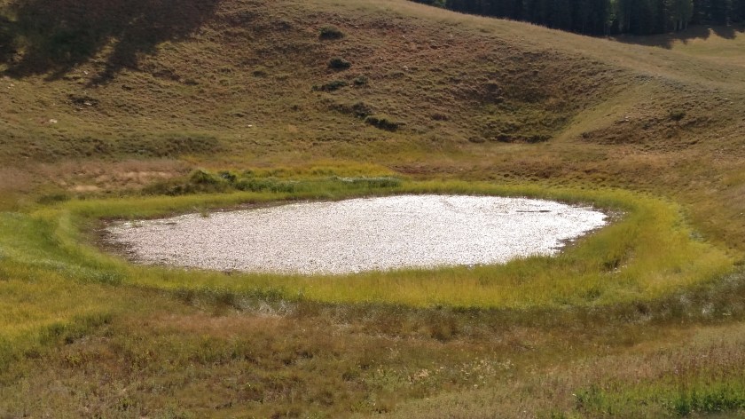
Further on down the road I passed a tiny pond off to the left side of the road. What caught my eye was that the edge seemed to glisten, as if the sun was reflecting off shards of glass. I went back and got out of the car, trying to capture that effect on camera but was unsuccessful. What I was seeing was, in fact, the sun reflecting off small spots of water around the perimeter of the algae which was on the surface of the pond. The sun did give the entire algae layer a silvery glow.
This is a cairn. A cairn is a man-made pile of stones, often used as trail markers or as a landmark. I have seen many simple cairns, a small stack of similarly shaped stones in a pyramid-type pattern, made by industrious individuals at various places but this is, by far, the most elaborate one I’ve seen so far. It was on a small, gravel back road I was using to get to a scenic overlook. Somebody had lots of time on their hands and used it very creatively.

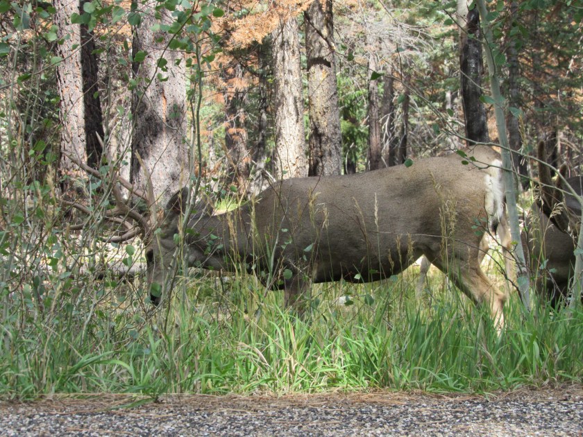
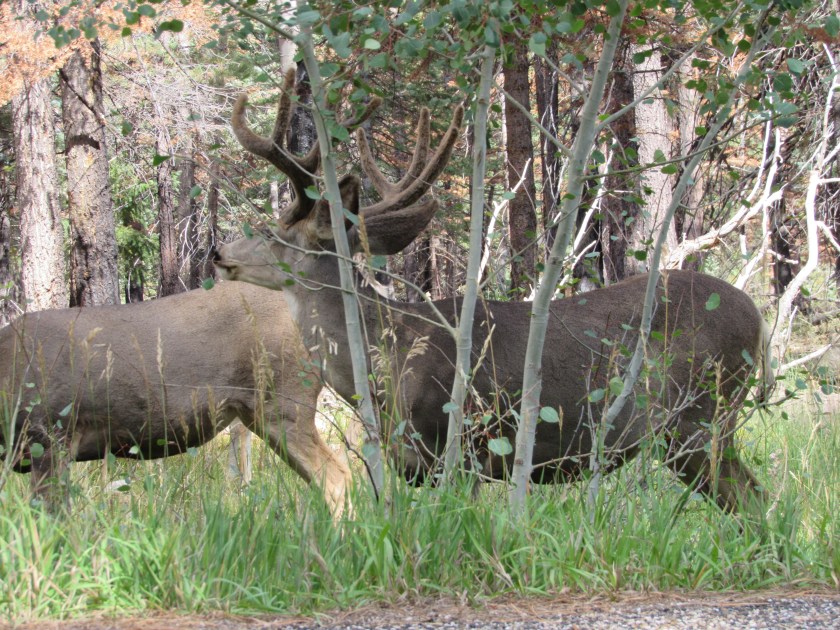
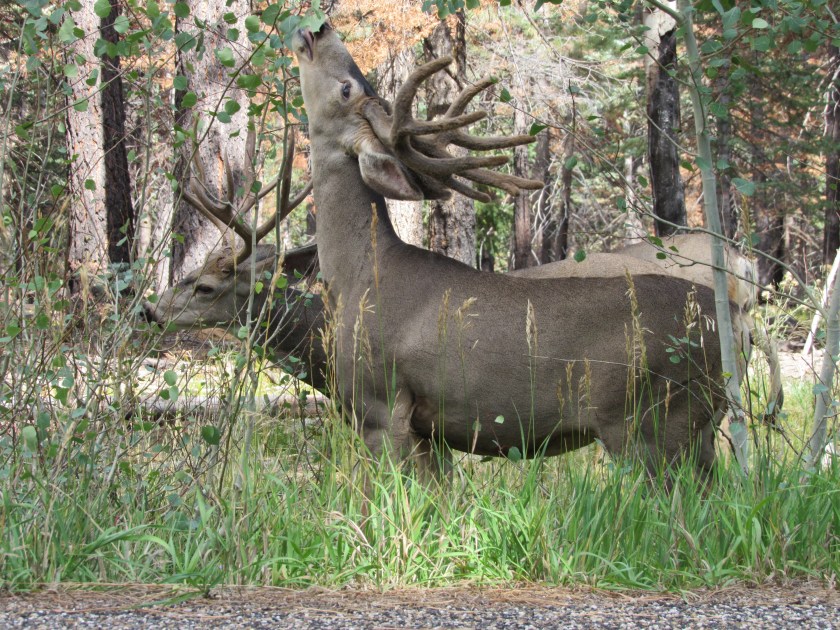
I finally made it to the Lodge inside the Park and spent some time out near the campground looking for Kaibab Squirrels. As I was leaving I saw these two bucks devouring an Aspen bush right next to the road. Again, these pictures were taken without leaving the comfort (and safety) of my car.
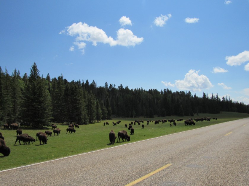
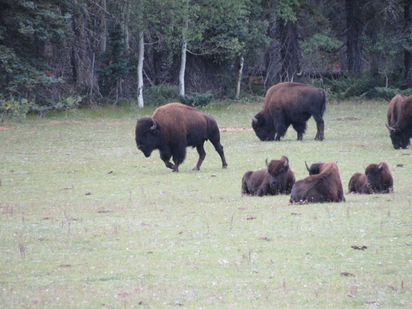
When I got to the entrance gate the bison had all shifted to the left side of the road and were further off the road, taking it easy. This is only a small portion of the 140+ bison I saw as I was leaving the Park.

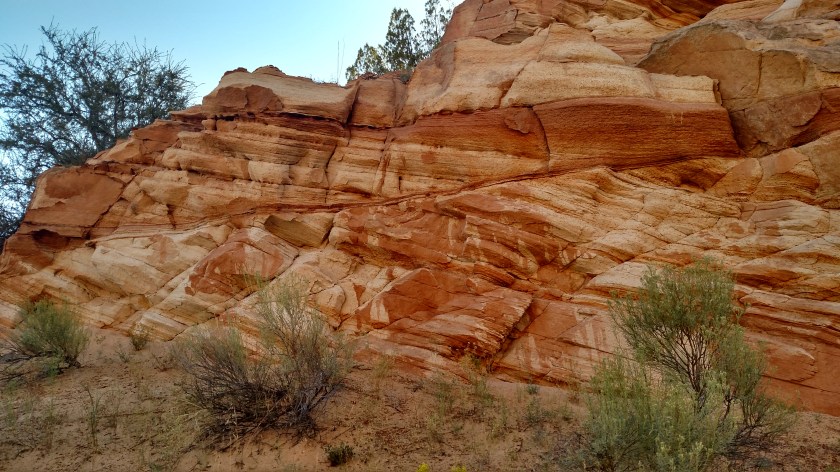
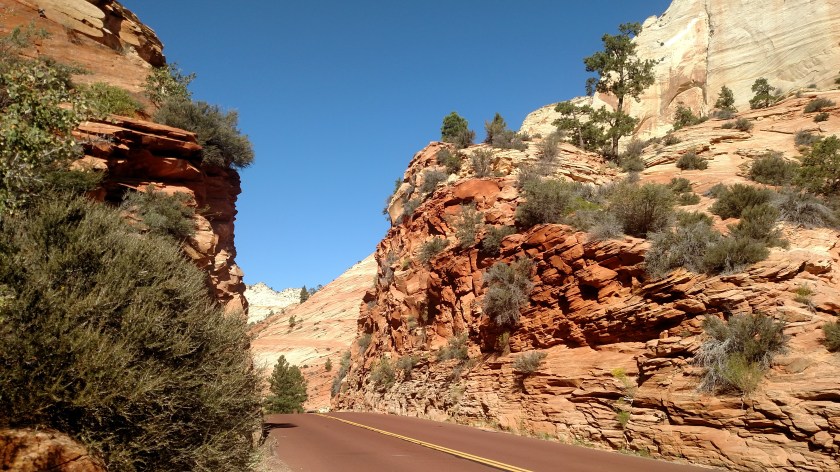
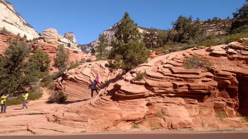
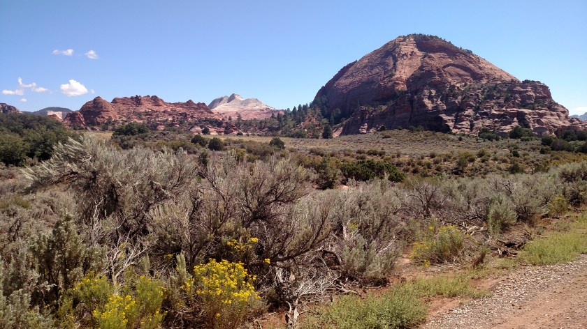
Sunday morning (the Sunday after Labor Day weekend) I headed north out of Kanab on Route 89 with the intent of spending a good portion of the day in Zion National Park, which is not far away. Before I even got to the Park entrance I made many stops to admire and photograph some of the many rock formations located right along the highway. The morning sun really lit up the formations to my left.

And even the elaborate formations on my right caught my eye.


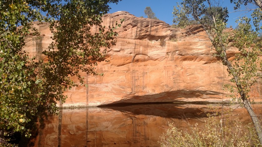
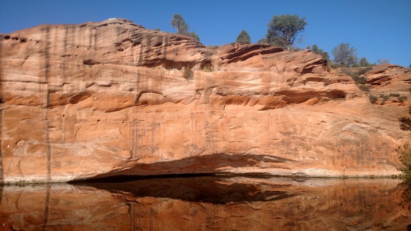
I soon came across an abandoned property which had once been some type of tourist attraction. It was fenced off, with signs warning people to keep out, but I quickly became obsessed with this huge formation with a dead-calm reflective lake in front of it.


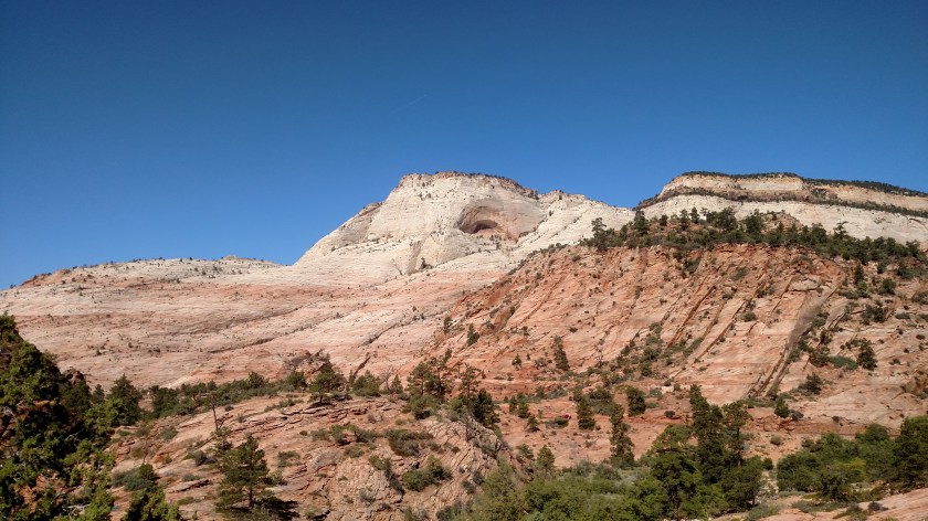
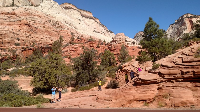
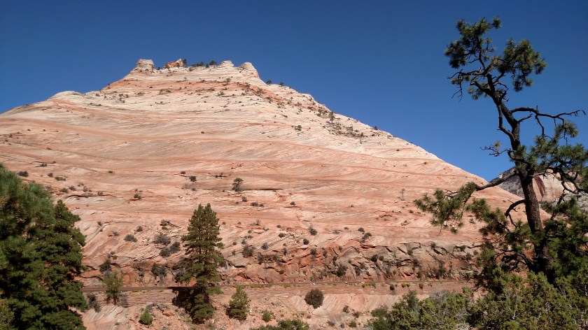
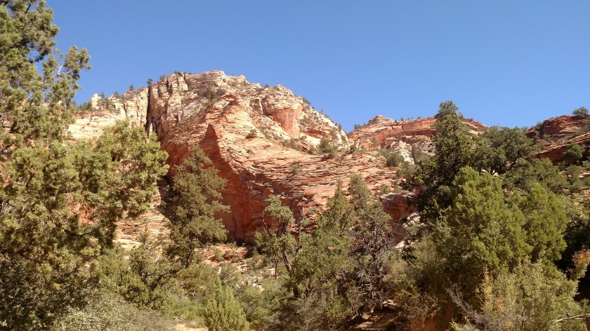
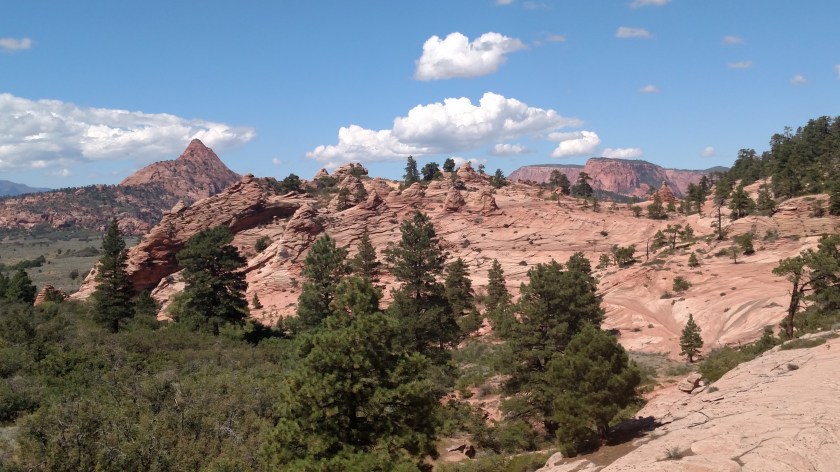
These are some of the things I saw while driving through Zion National Park on the Sunday after Labor Day. These were all taken with the smartphone camera. Closeups taken with the digital camera will be posted later.
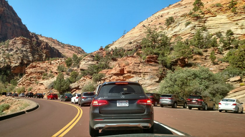
My original plan was to park my car when I got to Zion and use the Park’s bus system to get around. Parking is very limited and there is one big section of the Park which is only accessible by bus. When I saw the amount of traffic in the Park, especially the number of tour buses, I quickly decided to simply stop at as many pullouts as I could and abandoned the bus idea. Consequently, you are only seeing a small portion of what Zion has to offer.
I was at Zion several years ago and of all the National Parks I have actually been to so far, it is one of my favorites. I strongly encourage everyone to visit it and see for themselves. It is a quick, easy ride from Las Vegas and can easily be seen in one day. Just don’t come the Sunday after Labor Day!


These are some of the things I saw while driving through Zion National Park on the Sunday after Labor Day. These were all taken with the smartphone camera. Closeups taken with the digital camera will be posted later.

This was the line to get through the tunnel. It is one reason I decided to abandon my plan to use the Park’s bus system to get around.


After going through Zion from east to west I decided to take a scenic loop counterclockwise to get back to Kanab. Once I was outside the Park I went through a series of small towns and when I got to Virgin I turned right on the 23-mile road to the Kolob Reservoir I had started to drive the day I came down from upstate Utah.
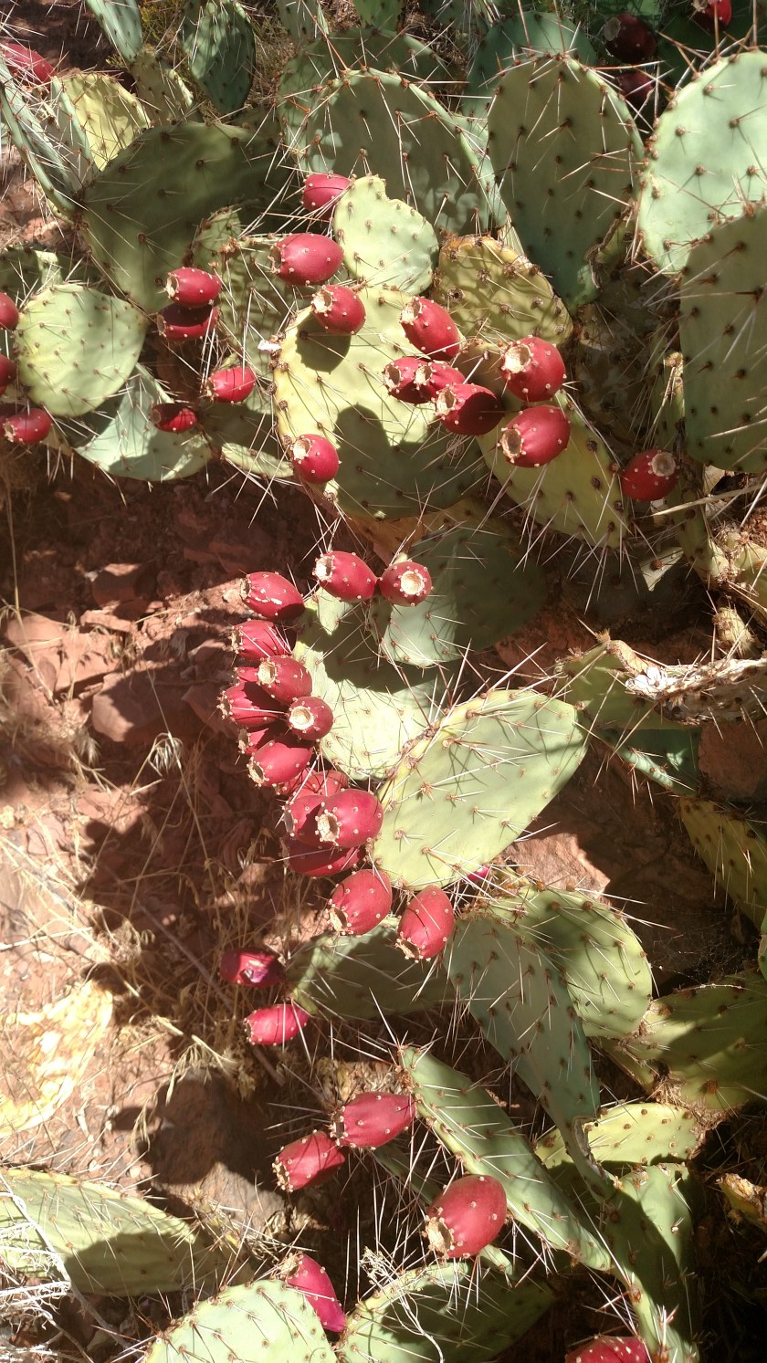
I didn’t know radishes came from the cactus plant. Actually, the red objects are the flowers (or fruit) of the prickly pear cactus and are called figs or tunas and can be cleaned and cut open for their juice. It is a popular additive for making jellies and jams, or syrup for use on salads or in drinks such as margaritas. Yummy!


Upon reaching the reservoir I turned around and headed back down to Route 9. Turning right again, I continued west to LaVerkin, turned left and went to the town of Hurricane where I picked up Route 59 which would take me east and in to Arizona before turning left in Fredonia to get back to Kanab in time for dinner.
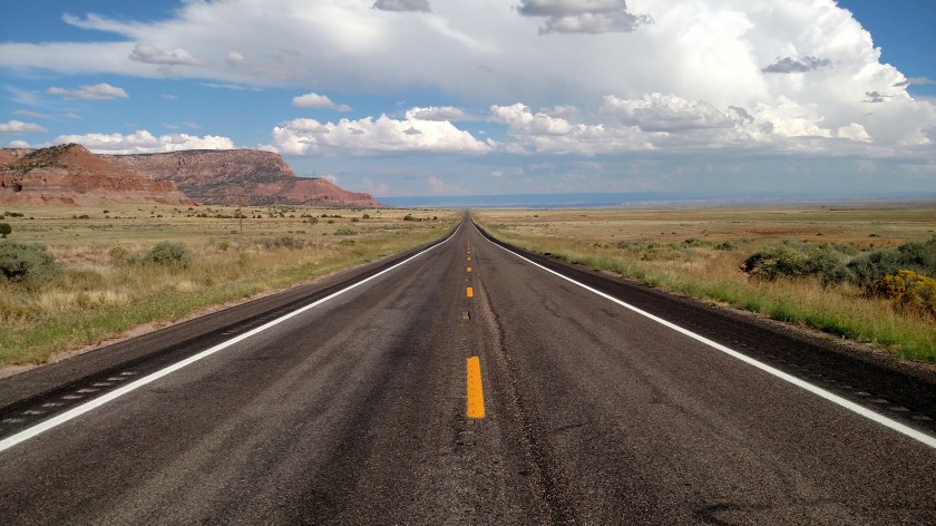
Once I crossed in to Arizona the road opened up and I had mountains to my left and open desert to my right.
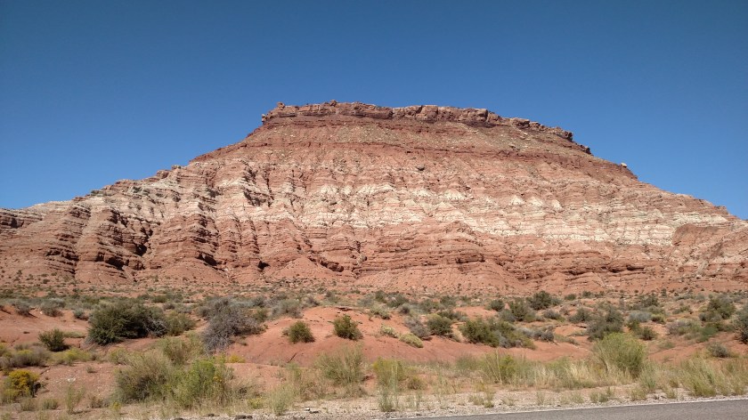
This was one of the many formations to my left as I headed towards Fredonia.
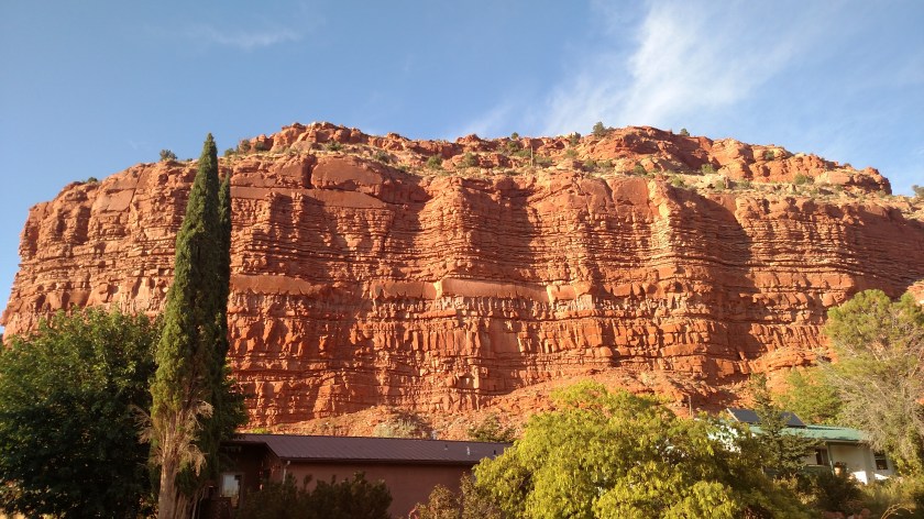
This formation is located right across the street from where I was staying in Kanab.
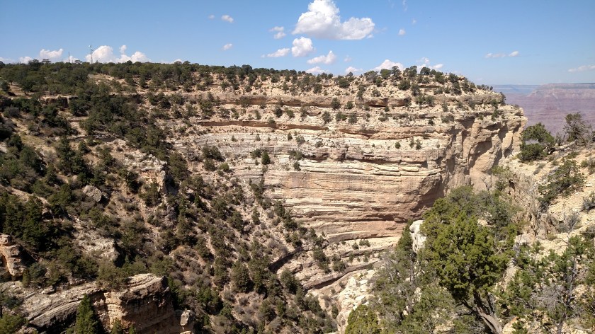
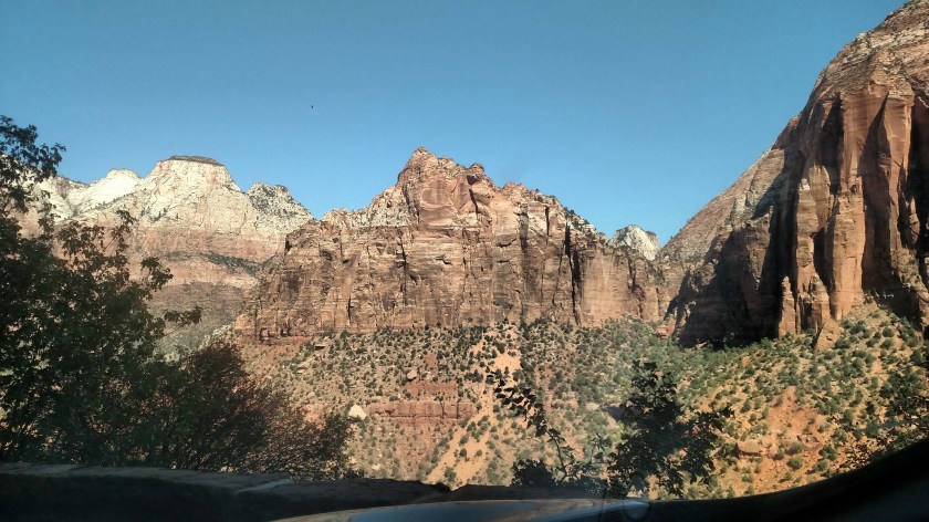
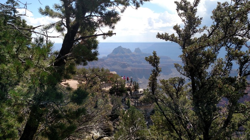
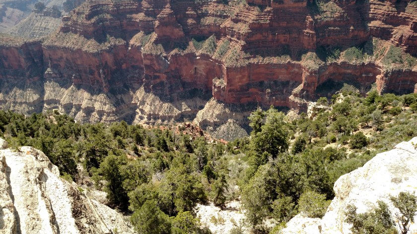
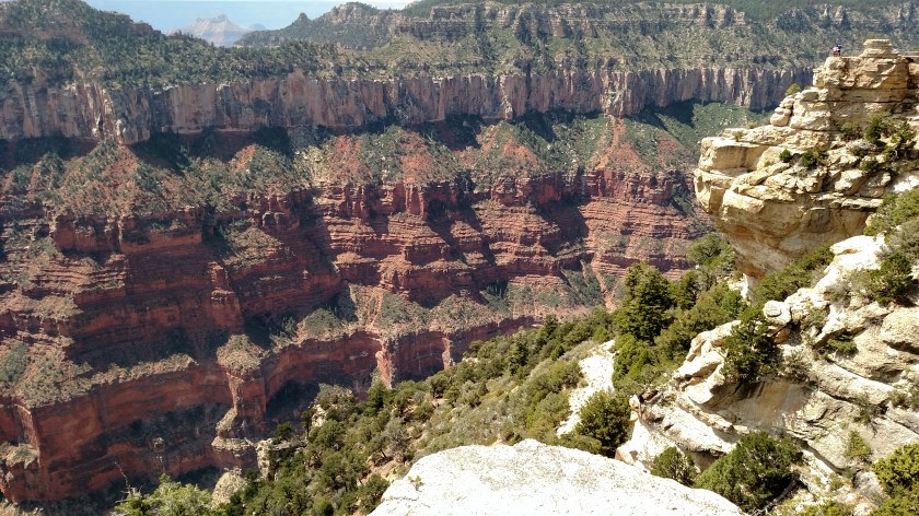
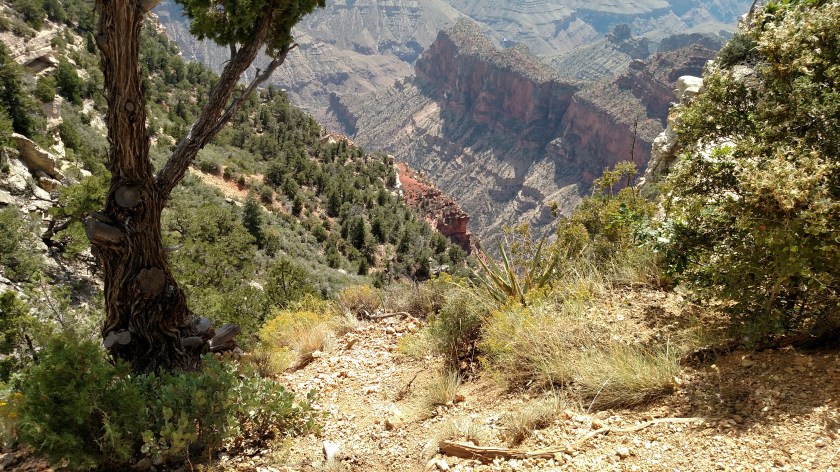
These are photos taken mid-day Monday at the North Rim. Bright sunshine as opposed to the heavy overcast in the pictures I took at this venue a few days earlier. These were all taken with my smartphone camera. I did take some closeups from here today, as well as some wildlife photos, which I will post in the future.
It was still a little hazy when I first arrived but visibility improved before I left to head down to Flagstaff, Arizona for the next 4 nights.


These are photos taken mid-day Monday at the North Rim. Bright sunshine as opposed to the heavy overcast in the pictures I took at this venue a few days earlier. These were all taken with my smartphone camera. I did take some closeups from here today, as well as some wildlife photos, which I will post in the future.


Looking down an exposed embankment. Careful, JohnBoy….


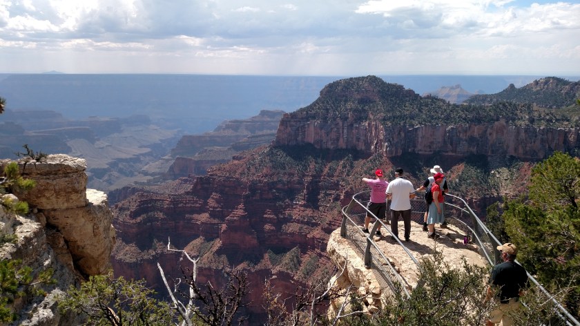
As is the case in many National Parks, and even out and about on local roads and scenic overlooks, you must be VERY CAREFUL where you step, and how close to the edge you get.
After walking out to one of the viewpoints I walked back up the steps towards the Lodge and saw this tree, which I thought made an interesting picture.
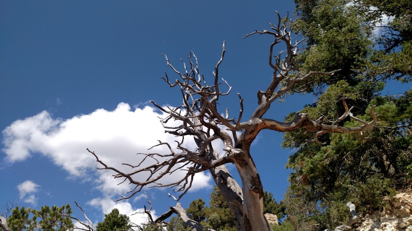
I took one photo, then another from a little further back.

I still wanted to get further away and looked behind me before I took yet another step back. Good thing I did. This is the ledge I would have dropped off of.
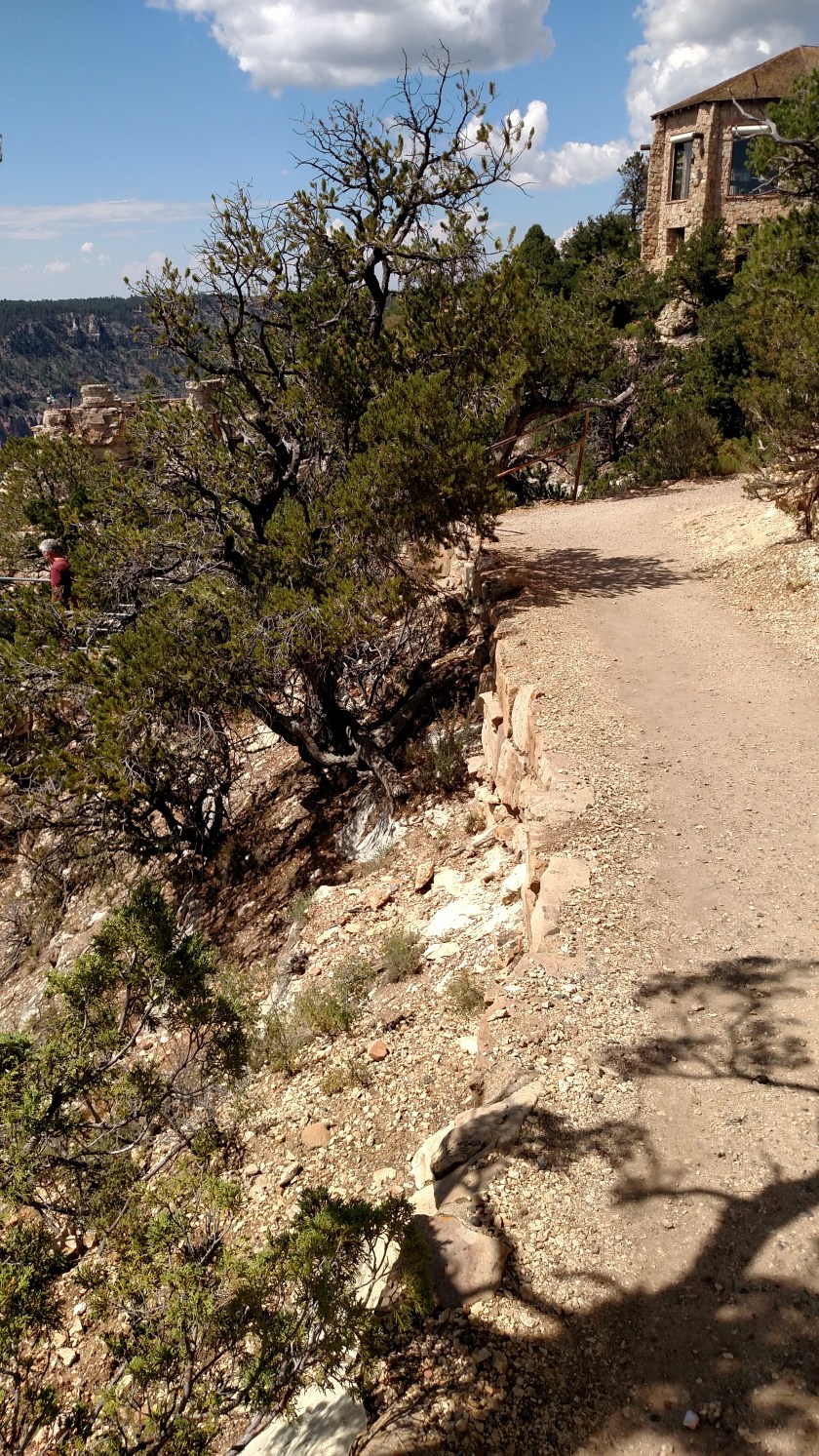
And would then have fallen down this embankment.

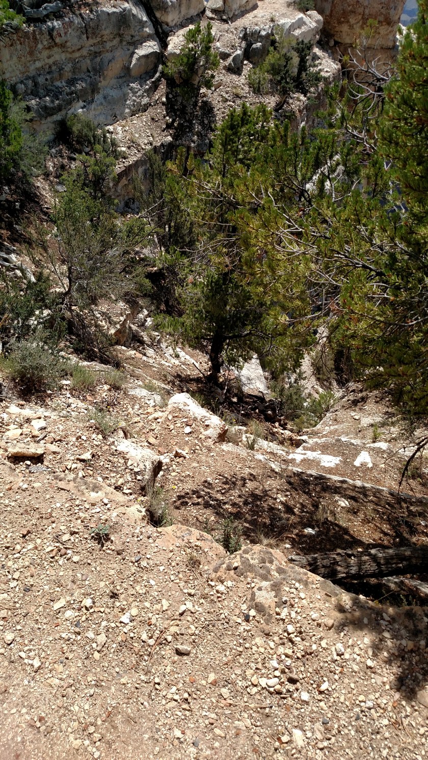
You have GOT TO pay attention to your surroundings at all times. Many people have literally fallen to their deaths, or suffered severe injuries, trying to take that perfect selfie.
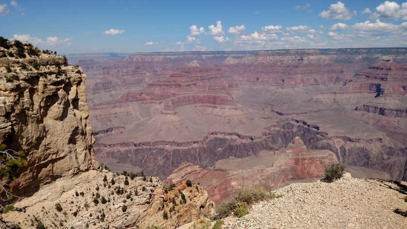
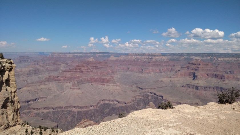
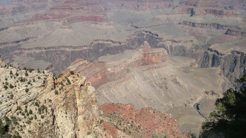
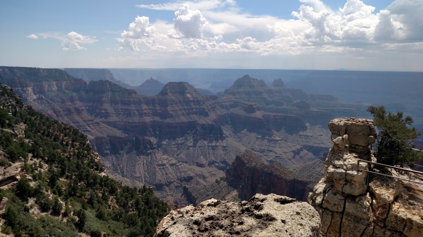
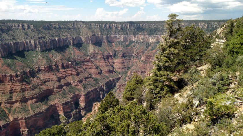
These are all photos taken Tuesday at the Grand Canyon (South Rim) using my smartphone camera. I’ll post closeups taken with the digital camera at a later date.
These pictures were taken between 1000am and 1130am local time. Colors change slightly throughout the day as the sun changes position and as I move to new vantage points. It also depends on whether I am standing in shade or sun, and whether I am looking down into the canyon or shooting across it with sky included.
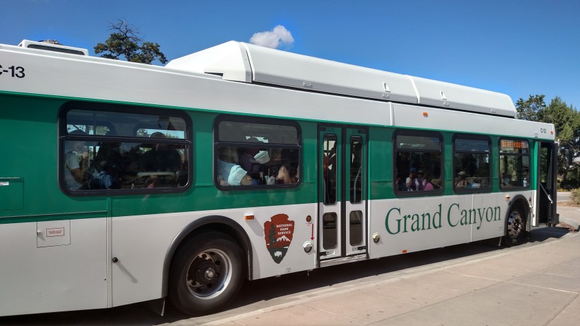
This was my vehicular mode of transportation once I got to the Park (the Grand Canyon is a National Park). The Park is incredibly well organized and they do a fantastic job of schleping people around with a minimal amount of aggravation. Parking is very limited, and many of the viewpoints are only accessible by shuttle bus, so better to park and let them do the driving (and not worry about parking or pulling out in traffic). Plus it reduces pollution. The view from the North Rim was noticeably more hazy (no buses used up there). Also, North Rim is higher and the viewer is looking more in to the sun than from the South Rim vantage points.
South Rim has 4 basic areas of exposure to the Canyon itself. I parked the car in one of the lots adjacent to the main Visitor Center (after around noon they encourage people to park in a nearby town and take a free shuttle bus, the purple route, in, as the lots inside the Park fill up). I took two bus routes (blue to red) to get as far west as they allow vehicles to travel. I then started working my way back east towards the Visitor Center. The red route services the viewing points at the extreme western area of the accessible part of the Park (which is only a fraction of the true southern rim of the Canyon). The blue route traverses a large area which contains many of the lodges, restaurants, lecture and entertainment venues, administration buildings, medical, search and rescue, maintenance, etc. East of the Visitor Center is the orange route. And finally, there are about 25 miles of viewpoints which are accessible only with your own vehicle. That takes you out to the East entrance, which is how I will go in tomorrow (and I’ll do the orange route viewpoints).
Today I used the Main entrance (from the south) and left via the East entrance.
The majority of the South Rim, the western portion between where I was today and Las Vegas, is only accessible by hiking (or off-road vehicles where allowed, and they don’t allow many!). Also, commercial (tourist) helicopter traffic is no longer allowed over the Canyon (thank goodness!!!). It was stopped in the late 80’s after too many accidents occurred. There are still helicopter service providers (a dozen or so helis buzzed over as I was waiting at the entrance to get in) but they aren’t allowed to fly over or into the Canyon itself (or only at the areas far away from the South Rim viewpoints). So it was very quiet and peaceful once at the actual viewpoints.
Enough talk! Let’s get to the pictures…. I started taking Canyon pictures around 1030am local time. You will notice that the colors get richer as the day progresses and the sun gets higher.