Navajo Bridge

After finishing up things in the Page, Arizona area I continued making my clockwise loop back towards Kanab.  I stayed on Route 89 until I got to the town of Bitter Springs.  Getting there required making a fairly substantial elevation drop to the desert floor.  Once there, I turned right on Route 89A which would take me to the next series of sights.

First up – the Navajo Bridge, which spans the Colorado River.  Given the reduction in altitude, the drop from the bridge to the water is less than half what it was at Horseshoe Bend, up in Page.

IMG_20170909_142536579_HDR

IMG_20170909_142546582

IMG_20170909_142617660

This was taken from the pedestrian bridge which is located alongside the vehicular bridge.

IMG_20170909_142828042_HDR

And this is looked the other way, northeast, away from the pedestrian bridge.

IMG_20170909_142934682

IMG_20170909_142939176

IMG_20170909_142943876

And these give you some idea of what is in the area if you stop looking down.  First looking northwest, which was my direction of travel….

IMG_20170909_142953245

…. and then looking southeast, which is where I was coming from.

IMG_20170909_143005261


Grand Canyon North Rim – Lodge

It had started to rain when I arrived at the Visitor Center and Grand Canyon Lodge on Friday.  Inside the Lodge is a restaurant and a large observation room with three huge windows overlooking the Canyon.  On either side of that room are outdoor decks with Adirondack chairs for relaxing while you enjoy the view.  There weren’t any takers today, as everyone wanted to lounge on the huge, dry, comfortable leather couches in the observation room, or stand and stare at the view.

IMG_20170908_102618322

IMG_20170908_103509876_HDR

This was the deck outside the left set of doors.

IMG_20170908_113205498_HDR

IMG_20170908_113238648_HDR

IMG_20170908_113216547_HDR

IMG_20170908_113200673_HDR

And this was the area outside the right set.  The restaurant is inside the building on this side, and the path down to the overlook I went out on was over here as well.

IMG_20170908_113411574_HDR

IMG_20170908_114725754_HDR


Grand Canyon NR – Close-ups (1/3)

These are pictures I took with the digital camera on Friday at the North Rim.  They are all from two scenic roads north of the Lodge which ultimately lead out to Imperial Point and Cape Royal, respectively.  These appear in the order I took them, with improving, then deteriorating weather conditions.

I did not take any photos with the digital camera from the Lodge itself due to the heavy overcast.

IMG_5934

IMG_5936

IMG_5938

IMG_5958

IMG_5965

IMG_5967

IMG_5994

IMG_5997

IMG_5998

IMG_6008

IMG_6009


Toadstools! 

My Airbnb host in Kanab told me about this place which is about 35 miles east of town.  Saturday started out as a damp, dreary morning with a low cloud ceiling as there has been rain overnight.  As I drove east, however, visibility improved and I decided to make the one-mile trek back to see these curious formations.  They are sometimes called Hoodoos.

The “path” was mostly in a dry, sandy creek bed.  The overnight rain evidently hadn’t reached this far east so it was kind of like walking on the beach.  Occasionally the path went near some large rock over-hangings and there were some interesting layers of rock which had broken away underneath.

IMG_20170909_095708242

IMG_20170909_095727286

IMG_20170909_095735992

I found this rock in the path and it made me think of the Star Destroyer ship from the movie Star Wars.

IMG_20170909_100545265

IMG_20170909_100608202

I finally made it back to the eerie landscape where the toadstool formations are.  What follows are many photos from various angles of the main formation, as well as some standalone ones nearby.  The pictures in this post were all taken with the smartphone camera.  A post with other photos taken with the digital camera follows.

Toadstools are natural spires with a large rock sitting on top.  These aren’t things made as a prank by college kids.

IMG_20170909_104041465

IMG_20170909_103121023_HDR

IMG_20170909_101407550

IMG_20170909_101252474

IMG_20170909_103808053_HDR

IMG_20170909_104803790_HDR

There is another location with many toadstools (Hoodoos) in the town of Page, which I drove through later in the day after I crossed into Arizona.  That venue requires a considerable hike which I was not going to make.  I’m sure you can find photos online if you Google: Page Arizona Hoodoos.  They are even more spectacular that these.

I believe there may have been other toadstool formations at this location as well, but rain was moving back in so I made the one-mile trek back to my car.  I arrived there just in the nick of time, as a gentle rain started to fall which quickly became a hard rain as I drove away.  I hope the creek-bed didn’t fill up for the folks who were going in as I was coming out!


Toadstools – Close-ups

It was about a mile walk back to the area where the toadstool formations were located.  Much of the “path” was actually a dry, sandy creek bed which probably fills rapidly with water when the monsoon rains hit.  It had rained overnight west of Kanab but evidently not over this direction, as the creek bed was dry.

Once you get back to where the toadstool formations are located you are in an eerie, moon-like landscape with many large grayish-white rocks with wind-swept swirl patterns and many rounded nooks and crannies.  The “path” was not as obvious back here and I found myself in many dead-ends.

IMG_6170

IMG_6190

IMG_6191

IMG_6196

IMG_6205

IMG_6206

Nearby are many reddish-brown formations, such as the main attraction which is brown but sits high atop a white base.

Front:

IMG_6200

Back:

IMG_6214

IMG_6227

And behind the main attraction are some smaller, standalone formations.

IMG_6220

IMG_6181

IMG_6179

IMG_6180

I believe this one fell over.

IMG_6208

IMG_6231

IMG_6242

Kanab to Grand Canyon – North Rim (NR)

Before leaving Kanab this morning I looked at the radar to see what the weather situation was going to be for the day.  Sure enough, several pockets of rain were heading north from Arizona.  The largest and most intense areas of rain appeared as though they would pass by to the west, probably hitting Zion National Park later in the morning.  Another, smaller area looked like it would pass by to the east, probably hitting Grand Staircase – Escalade National Monument later in the morning.  So I decided to head towards the North Rim of the Grand Canyon, which was my primary goal for the day anyway.

And before I left town I treated my car windows with Rain-X and installed a new set of wiper blades.  Today would be the most significant daytime rain I would experience since leaving Durham on July 5!  It had rained some that day when I got to Tennessee, and it rained some at night while I was in South Dakota and Montana, but it has basically been bone dry since then.  Sometimes rain was forecast for the area I was in but I was elsewhere when it hit since I move around alot.  Out here in the west you can often see where it is raining nearby but it may be sunny where you are.

When my preparations were complete (including a stop at a local grocery store for Gatorade, a sandwich and cole slaw for lunch and a few other items) I set off for the Grand Canyon!  I drove south on Route 89A and soon crossed into Arizona.  I drove for about an hour until I reached Jacob Lake, where I had to make a decision whether to commit to the Canyon and keep going straight on Route 67, or turn east and stay on Route 89A and make a big counterclockwise loop to see things to the east.  I no longer had access to radar so I trusted my eyes and continued towards the Canyon.  I could always retreat if things got out of hand.

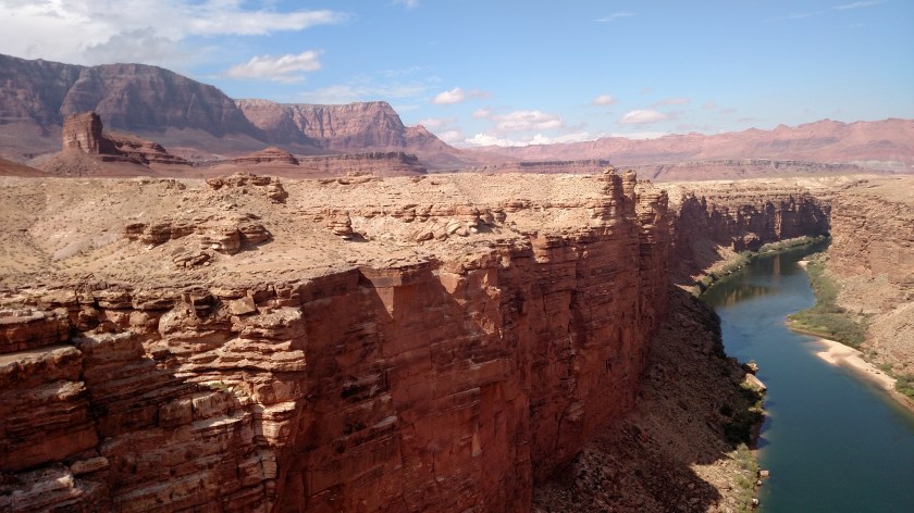
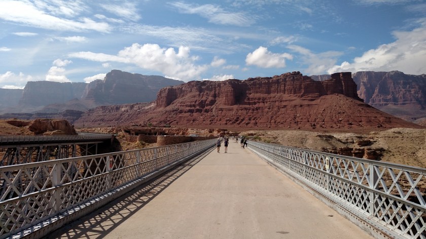
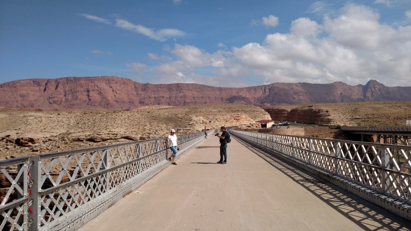
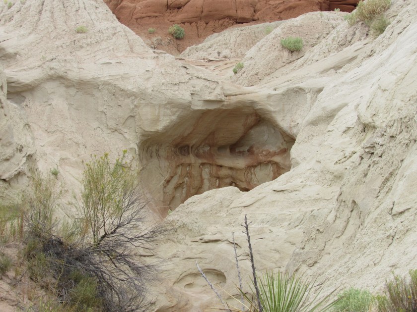
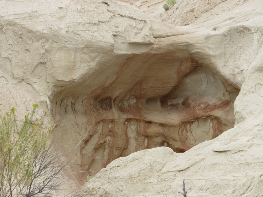
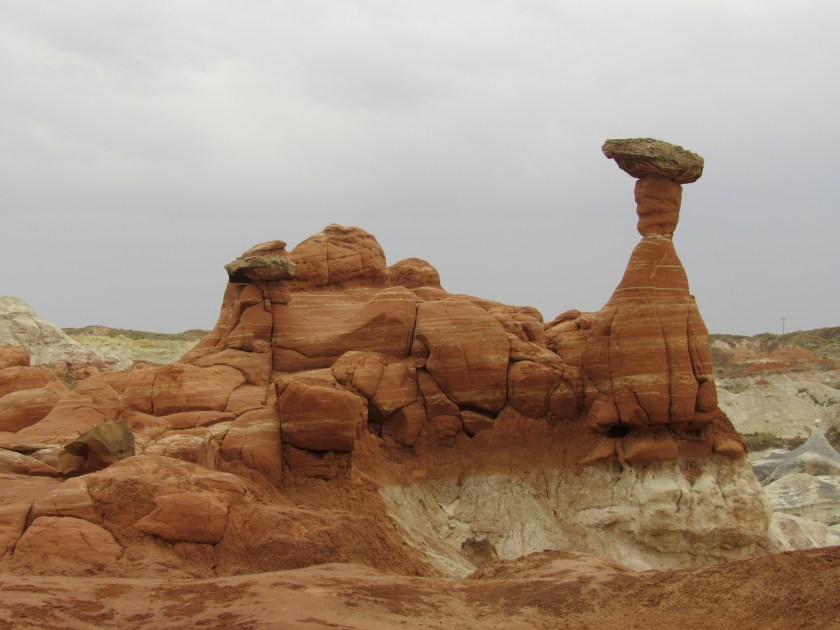
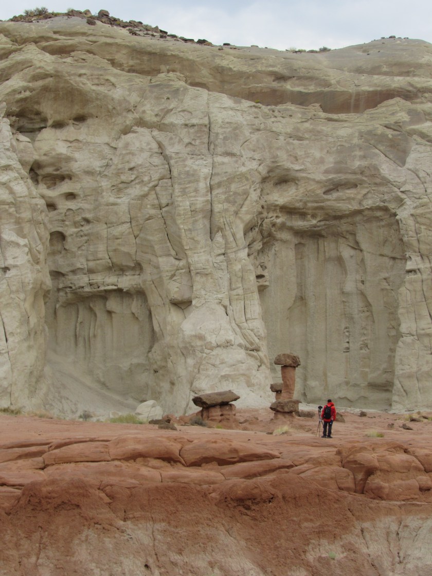
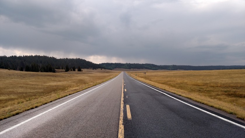
Both roads (89A and 67) were very pleasant rides, through a variety of terrains.  There was very little traffic, and I stopped frequently to take in the sights, shoot some photos with both cameras (mostly the digital, which you’ll see some of eventually) and look for critters.  It wasn’t all that far to get to the Canyon entrance but it took a while with all the stops I made.

IMG_20170908_100157150

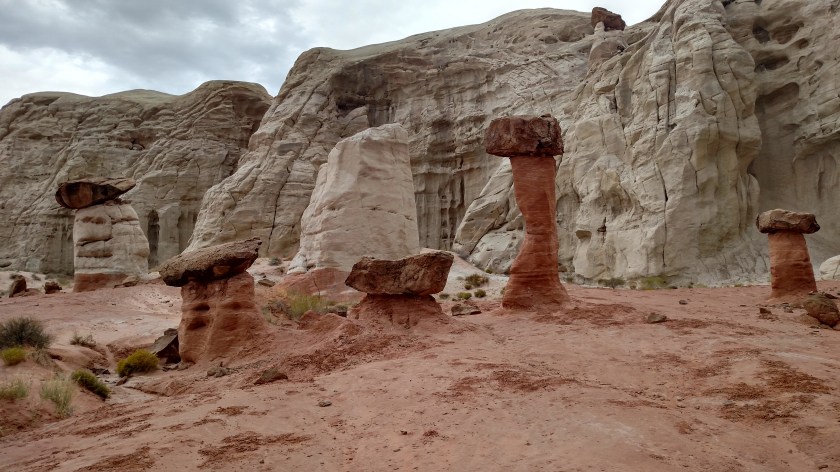
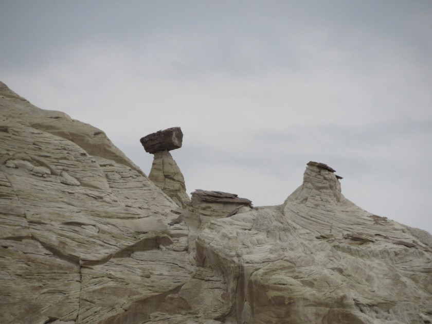
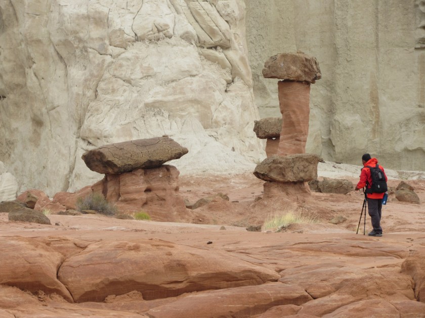
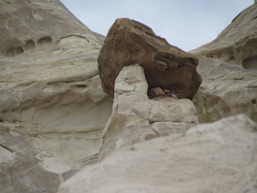
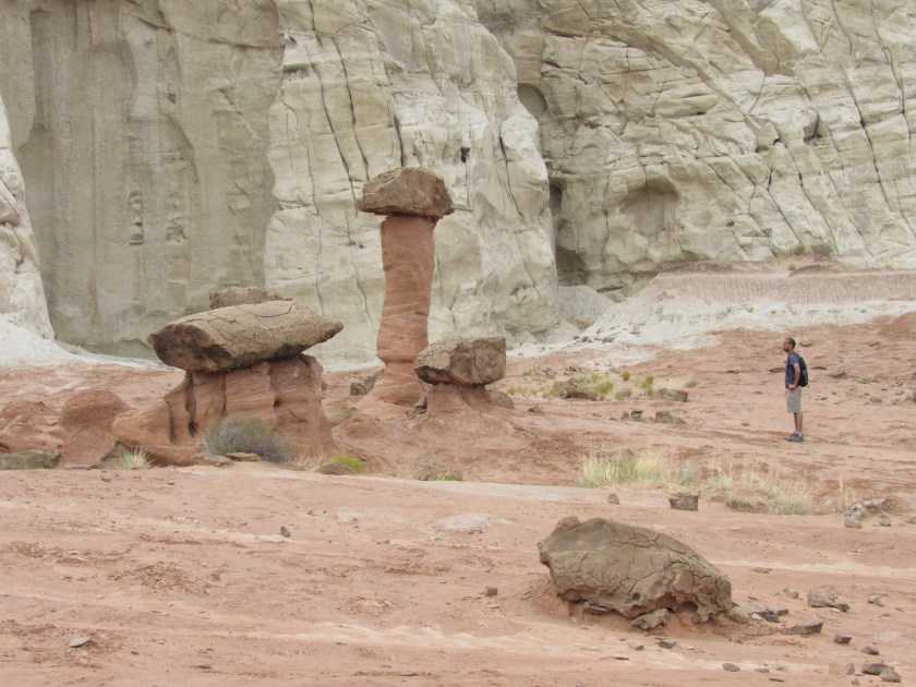
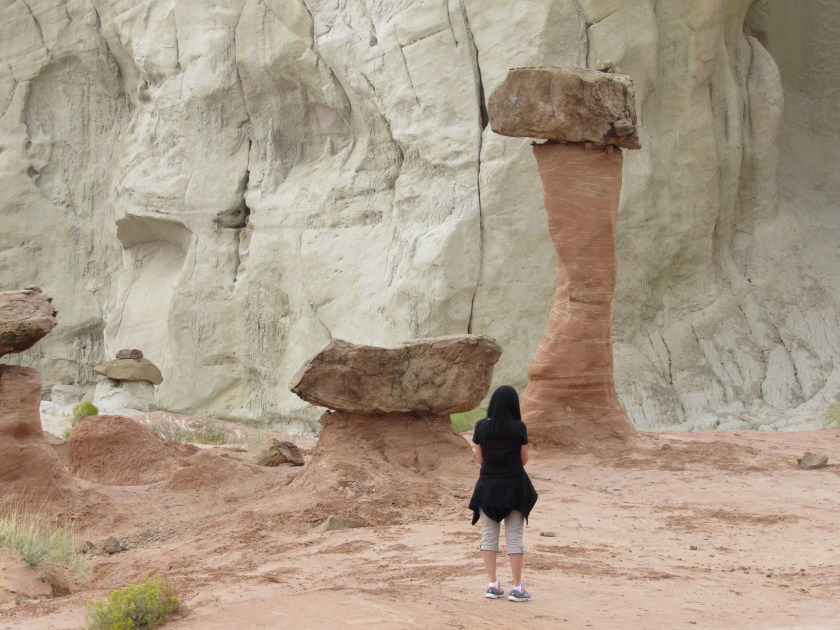
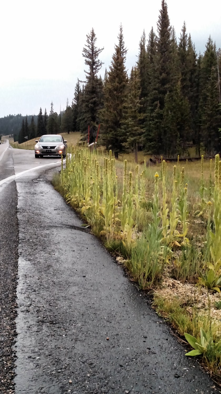
I am accumulating more pictures like the one above for my “Go play in the street” series….

IMG_20170908_101739862

IMG_20170908_102406588_HDR

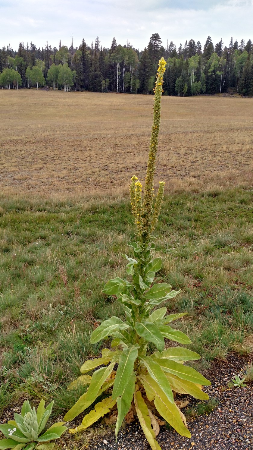
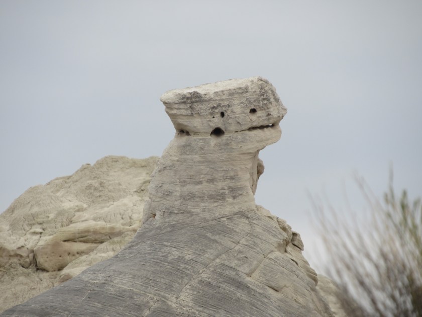
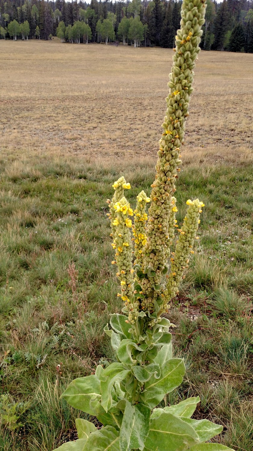
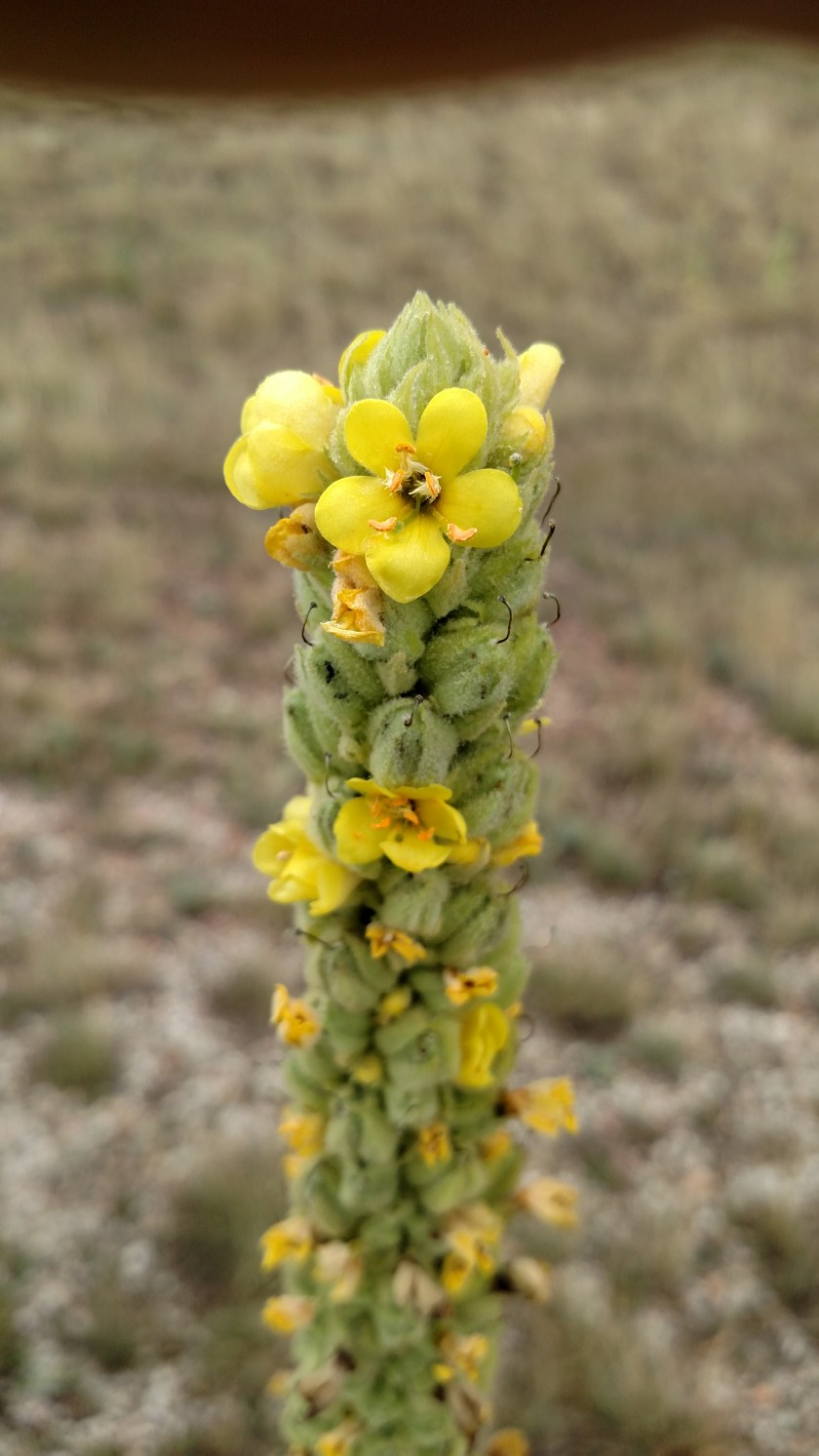
This native plant thinks it will grow up to be a Saguaro cactus.

IMG_20170908_102411552

IMG_20170908_101359457

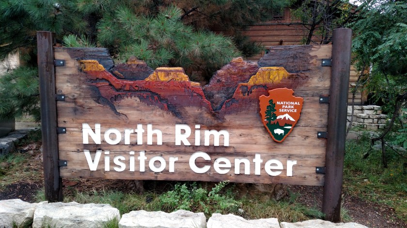
Shortly after I passed through the entrance to the Park (The Grand Canyon is a National Park, by the way) a huge bolt of lightning hit a ways up the road ahead of me, followed quickly by a loud rumble of thunder.  That means six more weeks of summer, right??

It rained hard, briefly, then slacked off to a gentle, steady rain until I got to the Visitor Center.  I had forgotten that Arizona doesn’t play the Daylight Savings Time game so that meant I had a bonus hour to spend (well not really, until I went to Arizona and stayed there, which I will in a few days).

IMG_20170908_111233468

IMG_20170908_101742708

IMG_20170908_101751238

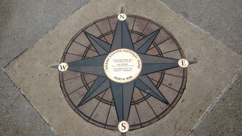
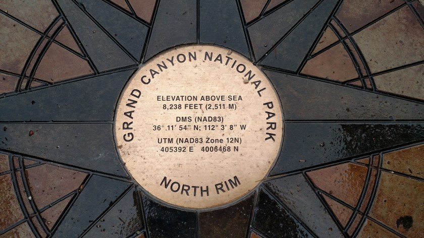
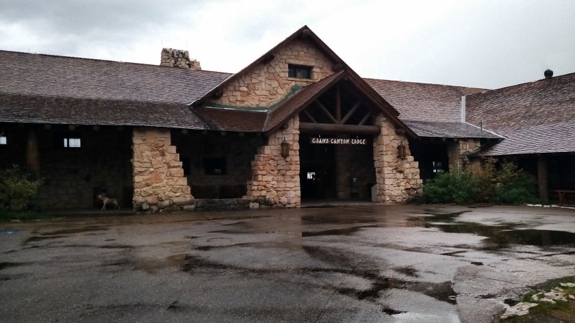
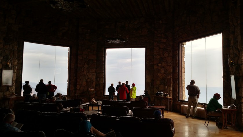
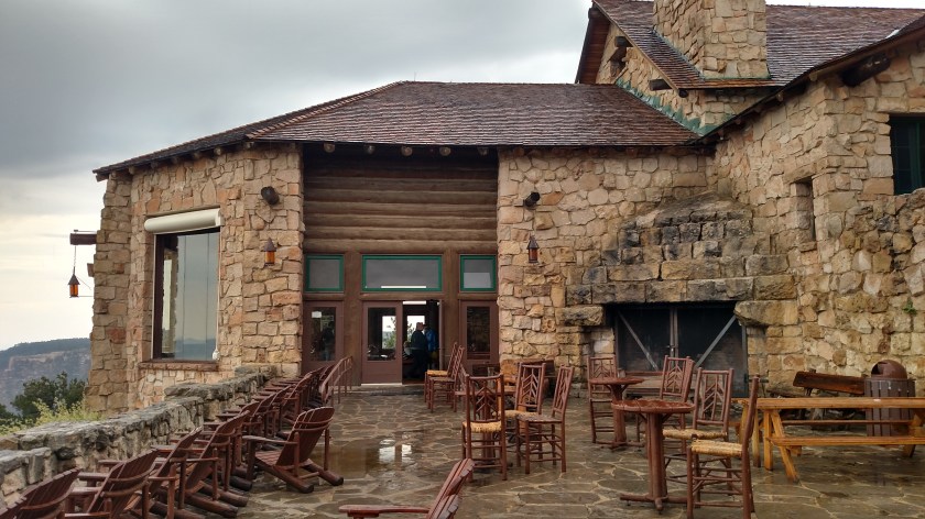
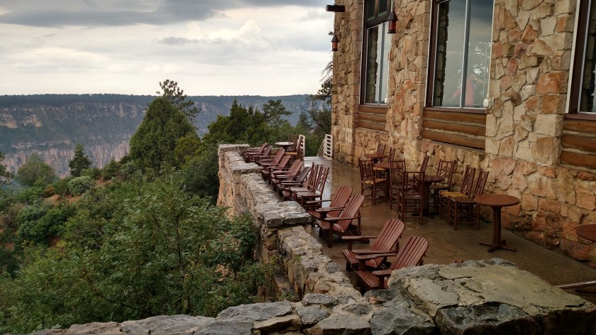
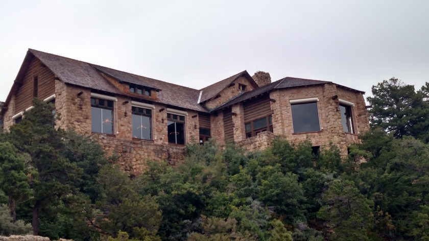
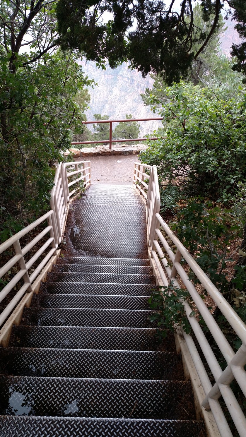
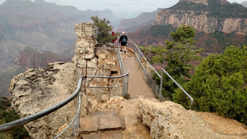
It continued to rain lightly, off and on, for about an hour after I arrived.  I went in the various buildings and took some initial pictures (I’ll post pictures of the Lodge itself in the future).  While waiting out the rain I went back to the dry comfort of my car (and I lucked out by getting rock star parking) and enjoyed my picnic lunch which I bought  before leaving Kanab.

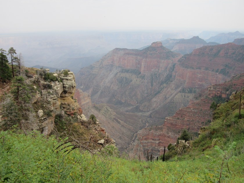
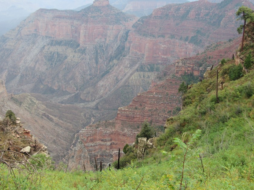
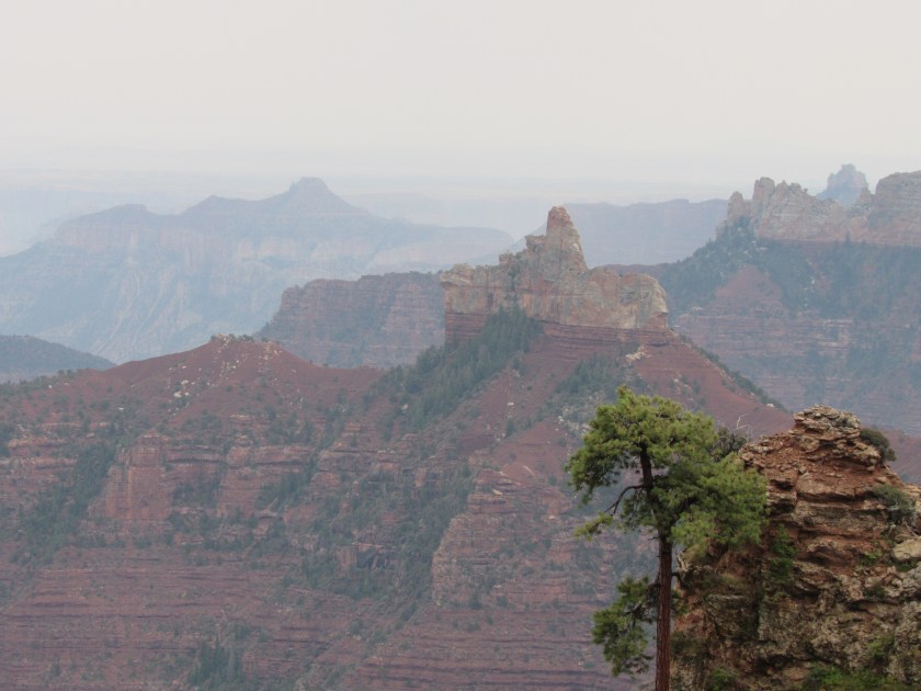
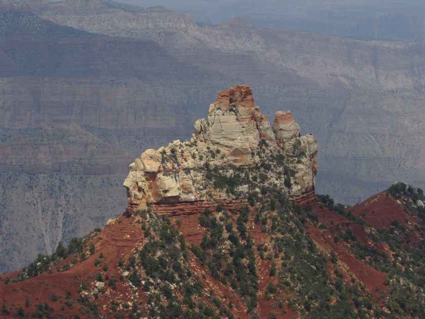
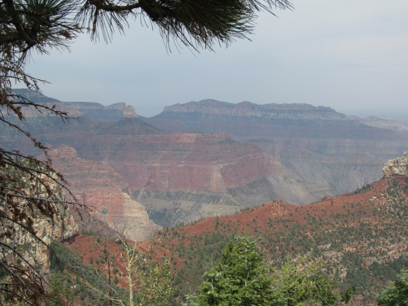
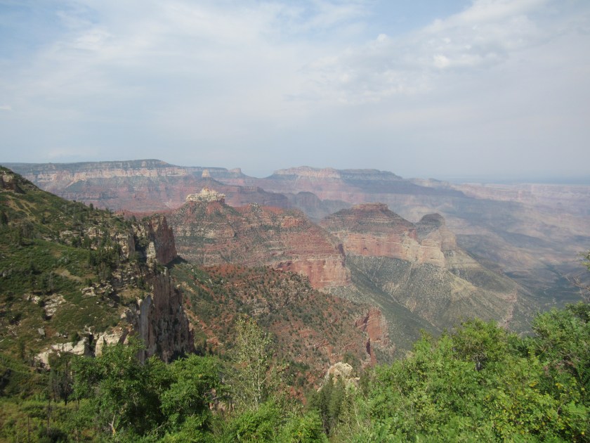
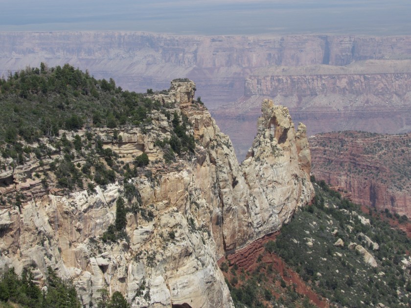
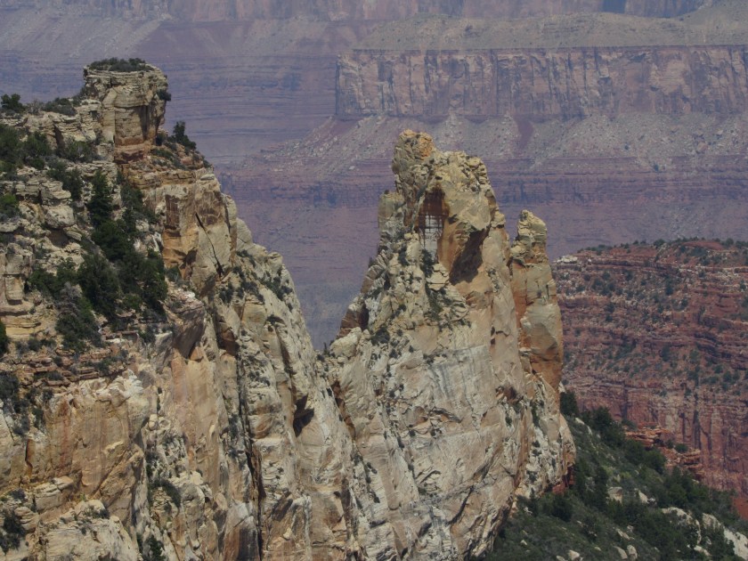
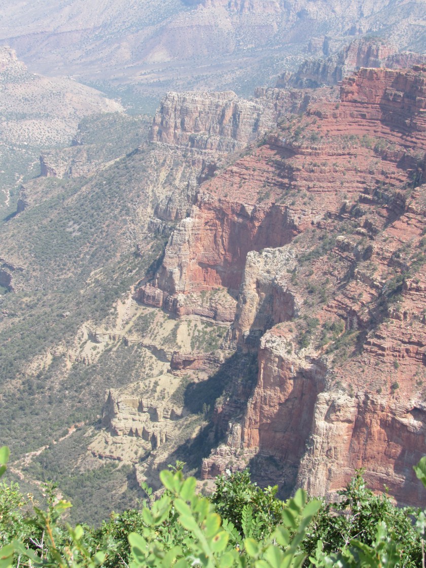
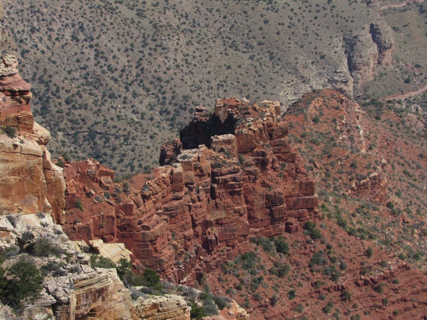
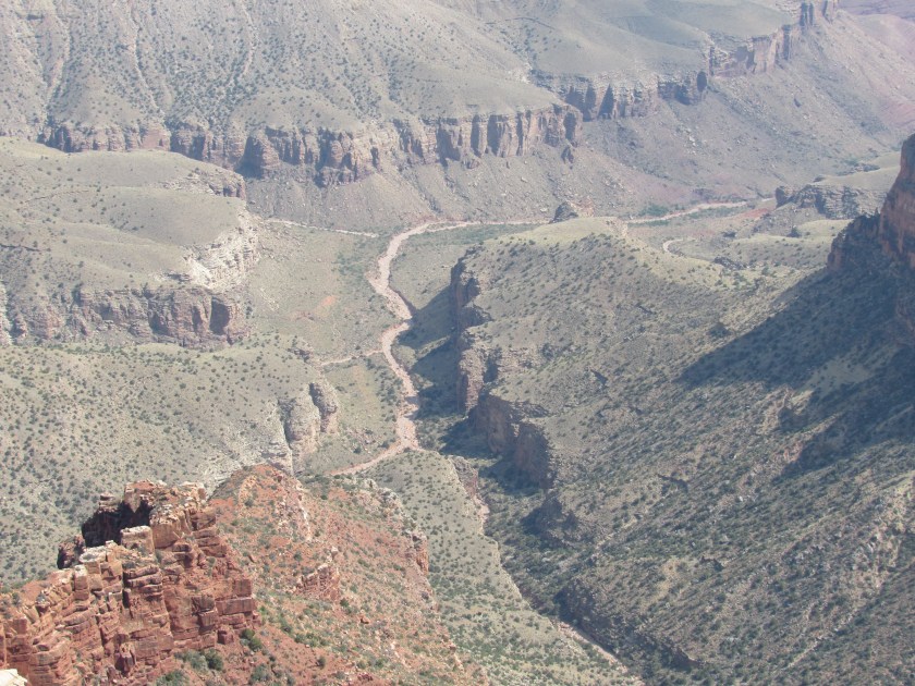
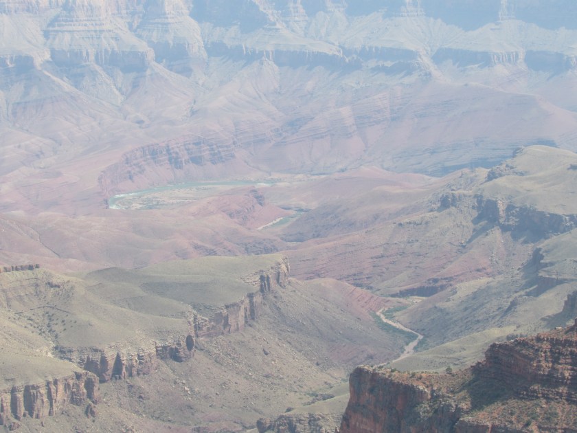
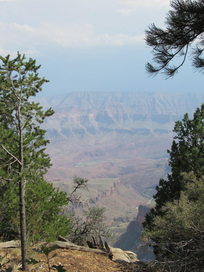
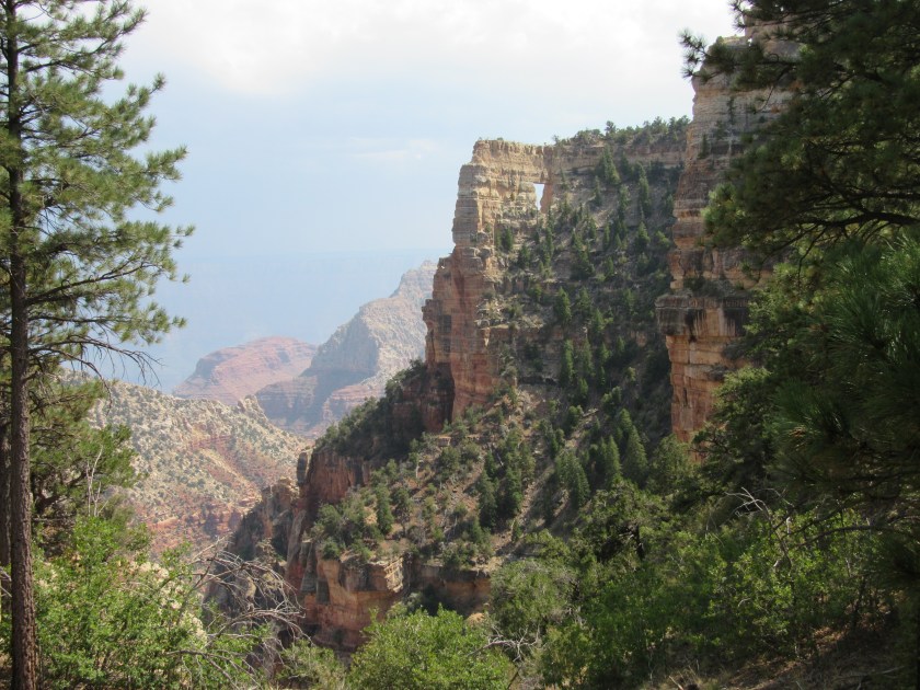
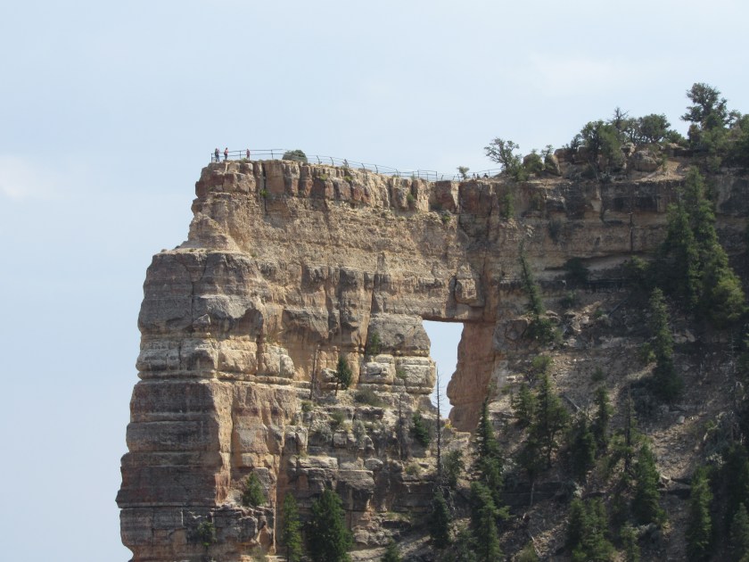
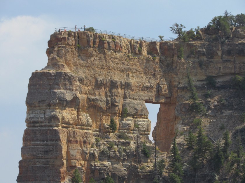
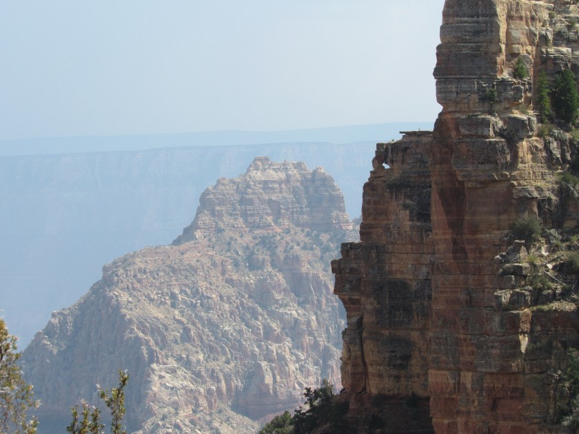
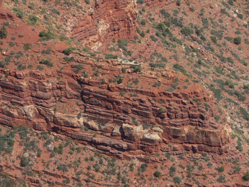
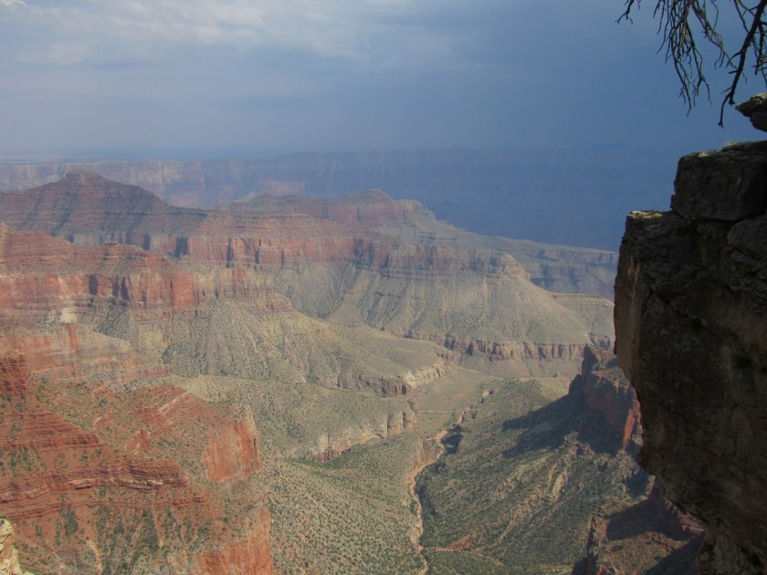
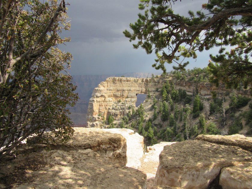
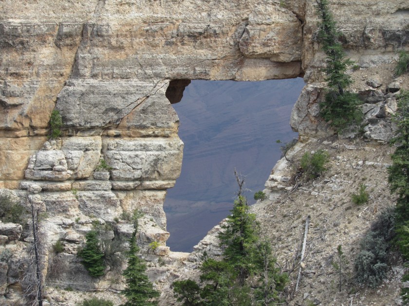
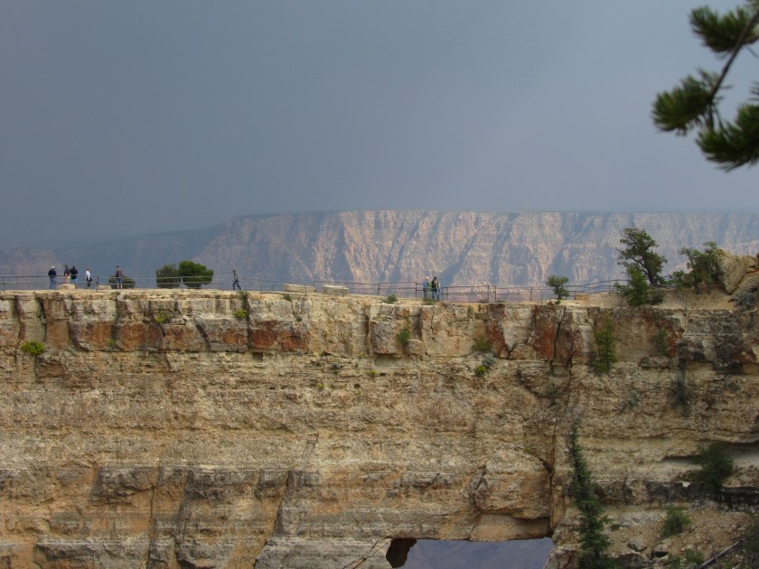
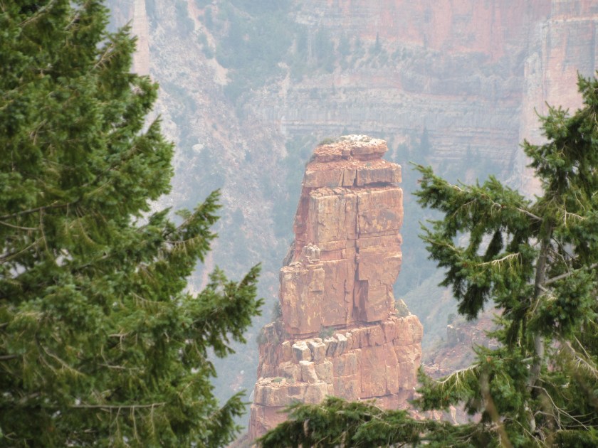
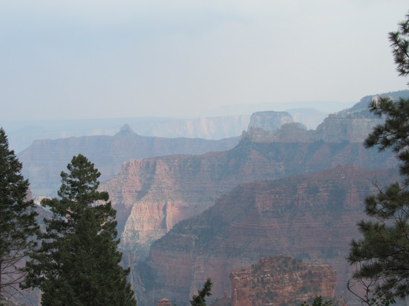
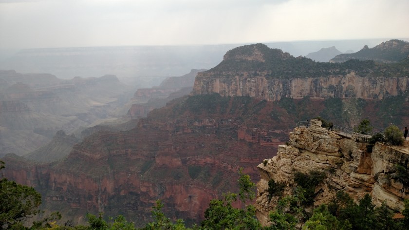
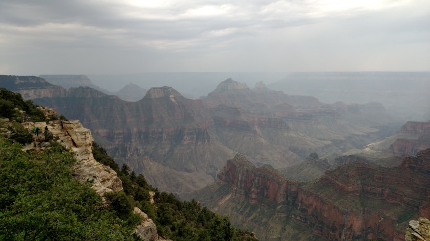
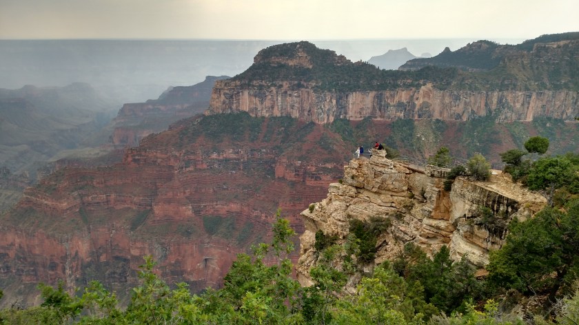
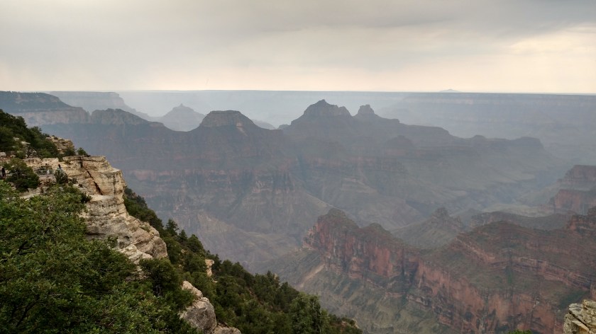
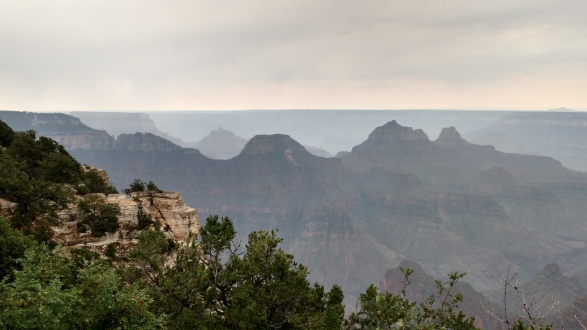
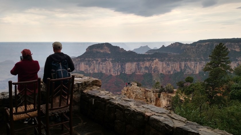
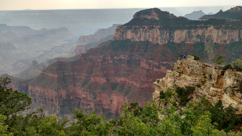
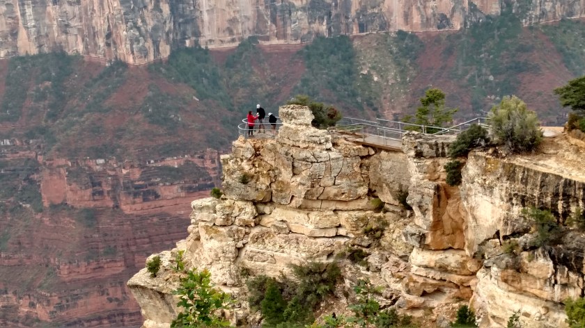
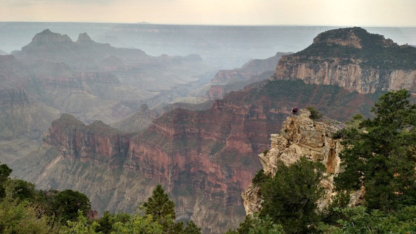
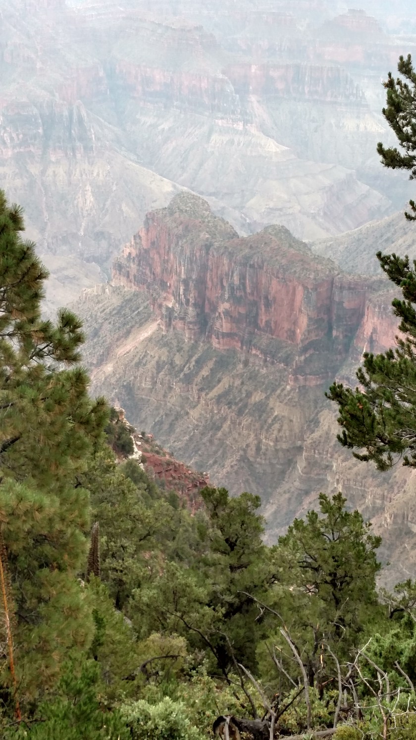
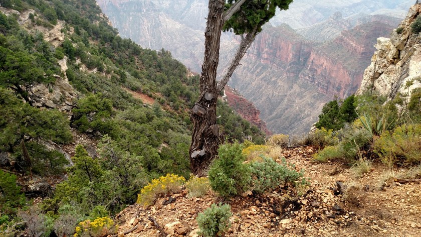
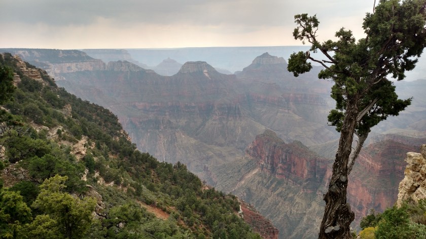
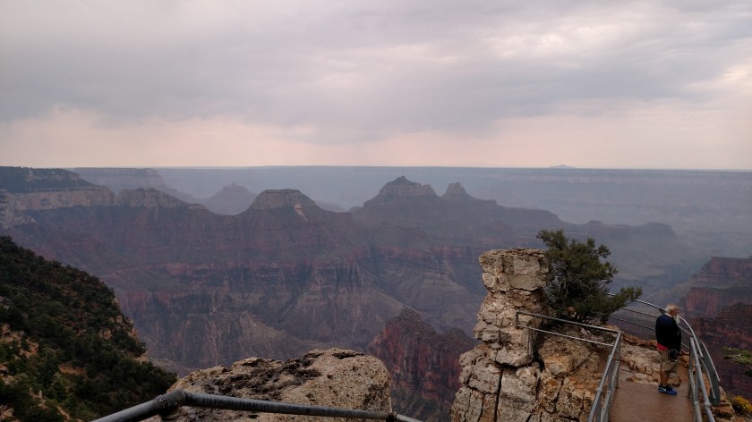
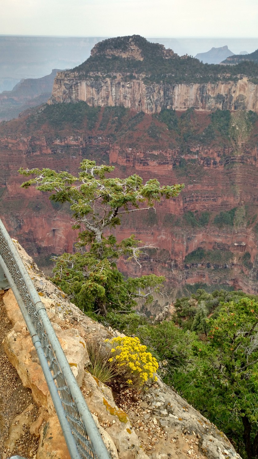
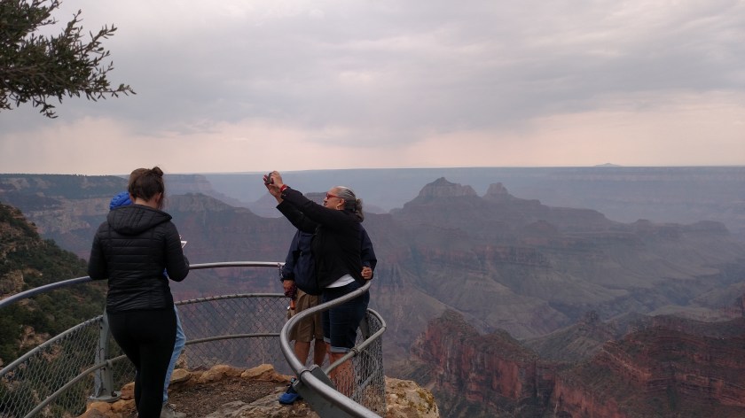
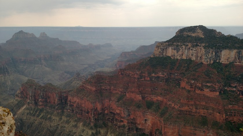
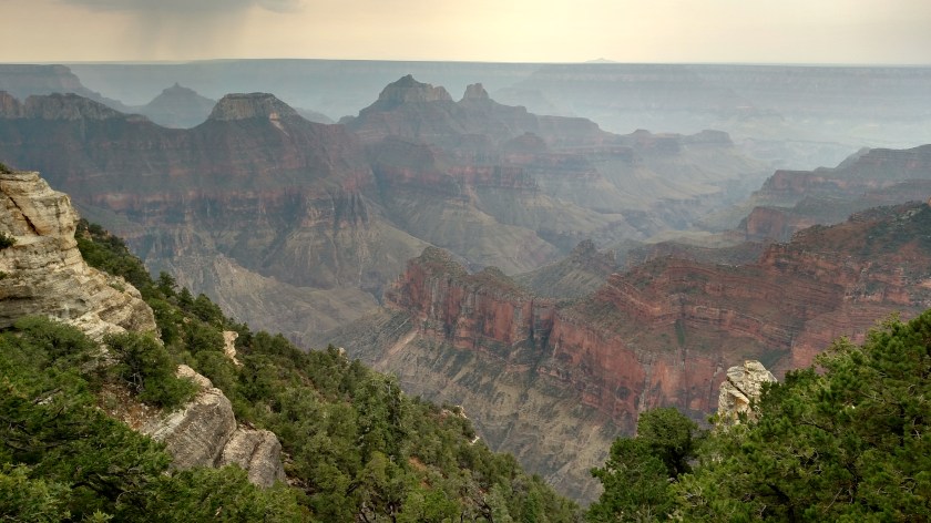
Now, on with the show.   I know you are anxious to see pictures of the Canyon….

Grand Canyon NR – from Lodge (1/2)

These photos were taken looking south over the Canyon (North Rim) from the Grand Canyon Lodge using my smartphone camera.  A storm system had moved through as I was coming in the Park entrance from the north.  Upon arrival I first went to the Lodge, while it continued to rain off and on for about an hour.  I kept moving around, taking pictures from many of the same vantage points so you will probably see similar or seemingly identical pictures but they were taken at different times under improving conditions.

One of the advantages of the rain was that the many visitors which were also here stayed mainly indoors.  This gave me lots of flexibility to move around, keeping myself and my smartphone dry under an umbrella.  I’m sure it will be alot more crowded when I come back on a nicer day.

As you’ll see, even with the rain and heavy cloud deck the sights are still amazing.  The sun would come out later (although not while I was at the Lodge) so you’ll see a little more color and shadows as you go through today’s posts.

Enjoy!

IMG_20170908_103129298

IMG_20170908_103330038

IMG_20170908_104837779_HDR

IMG_20170908_112715724_HDR

IMG_20170908_112924126_HDR

IMG_20170908_113427626_HDR

IMG_20170908_113518272_HDR

IMG_20170908_113538713_HDR


Grand Canyon NR – from Lodge (2/2)

These photos were taken looking south over the Canyon (North Rim) from the Grand Canyon Lodge using my smartphone camera.  A storm system had moved through as I was coming in the Park entrance from the north.  Upon arrival I first went to the Lodge, while it continued to rain off and on for about an hour.  I kept moving around, taking pictures from many of the same vantage points so you will probably see similar or seemingly identical pictures but they were taken at different times under improving conditions.

IMG_20170908_113639075_HDR

I decided to make the trek out to the Overlook shown above.  To do so, I first needed to go down the wet, metal staircase leading away from the Lodge…..

IMG_20170908_113748122

…. and then venture out the dirt and rock (and eventually paved) walkway to the Overlook platform itself.  Some interesting views looking downward.

IMG_20170908_113911532_HDR

Working without a net…..   Looking down near the Overlook walkway.

IMG_20170908_114019363

IMG_20170908_114036407_HDR

Going out onto the Overlook itself (while taking deep breaths).

IMG_20170908_114308207

IMG_20170908_114419387

Pay no attention to the sidewalk slowly deteriorating beneath your feet…..

IMG_20170908_114544195

IMG_20170908_114601167_HDR

IMG_20170908_114614084

IMG_20170908_114618944

IMG_20170908_120849304_HDR