Butterfingers JohnBoy

I swear to God this actually happened today exactly as I’m about to tell it.

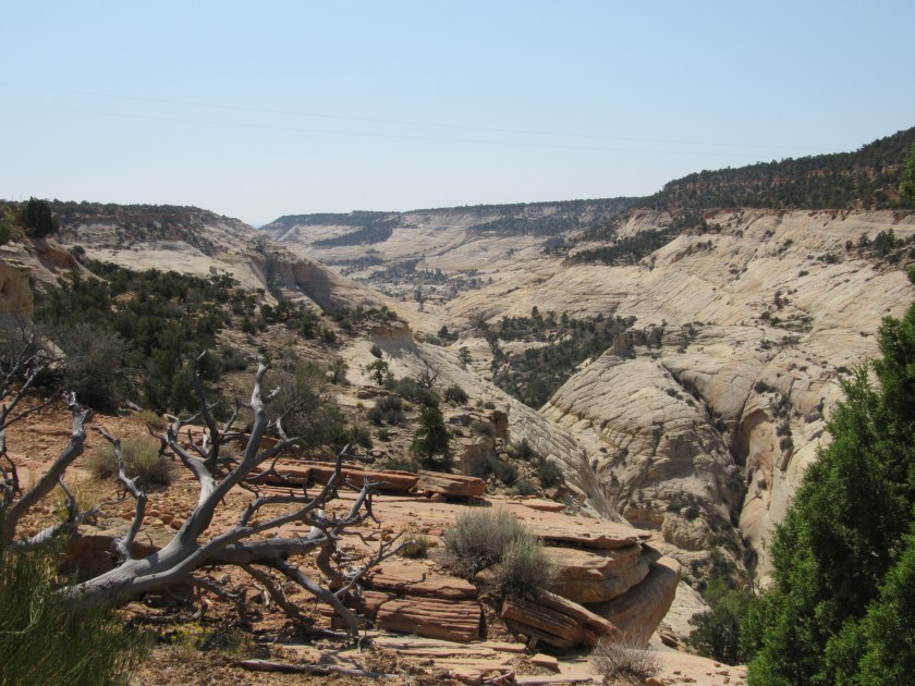
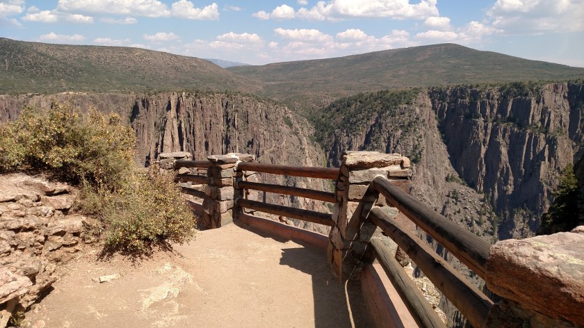
While at Black Canyon of the Gunnison National Park I went to the overlook area outside the Visitor Center.  At one of the wooden railings (shown below) I leaned out a little to take a picture with my smartphone while commenting to the people standing near me that one of these days I’m going to drop it while doing such foolish things, given my clumsiness.

IMG_20170904_140609052

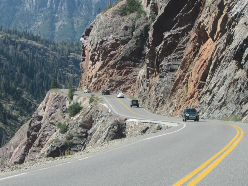
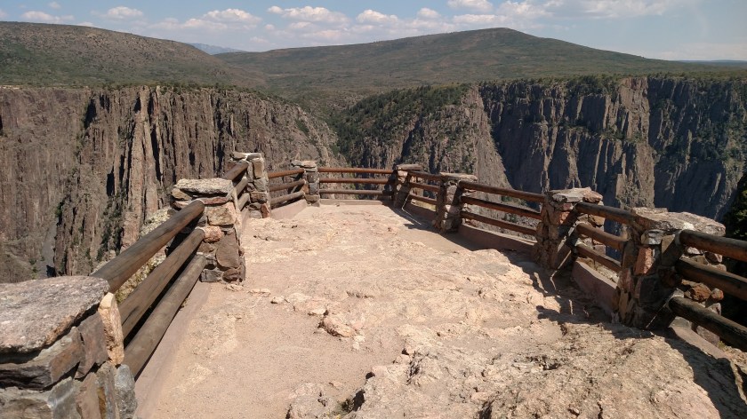
I proceeded further out the observation deck which, interestingly, slopes downward as it goes further away from the Visitor Center, giving an added sense of impending calamity to Mr. Smiley Pants I’m Afraid of Heights JohnBoy.

IMG_20170904_140408720

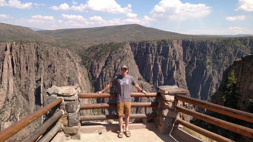
I recruited this volunteer (who was visiting the Park from New Jersey with his girlfriend) to show that from my vantage point I was looking downward.  I also learned, as we were walking back to our vehicles, that they both attended East Stroudsburg University in Pennsylvania (I used to live in Stroudsburg).

IMG_20170904_140703948

This is a popular place for visitors to have their pictures taken and, sure enough, a woman asked if I’d mind taking a group photo of her and her friends.  I said of course I wouldn’t mind, put my phone in my pocket and took the two devices she gave me, one a digital camera which appeared to be more complex and expensive than mine, and her iPhone.  I took two pictures with her digital camera.  I then transferred it to my left hand and in doing so became JohnBoy the Juggler.

elfic-the-juggler

(Photo credit: circusberzerous.co.uk)

When she had given me the phone I observed and commented out loud that just about every other iPhone I have used to take other people’s pictures with during this trip had a cracked screen (not a fake screen cover, which you can buy, but an actual cracked screen) and I said “guess you never dropped it, eh?”.   I even joked about being afraid of dropping my own phone over the edge earlier.

As I was swapping the two cameras the iPhone slipped out of my right hand.  I was able to keep hitting it from below to keep it in the air until I finally grabbed it.

Disaster was averted.


Dangerous Road in Ouray, Colorado

My travels today took me close enough to Ouray, CO that I had to go back and cheat death once more in order to get photographic evidence of my claim that you would drop straight down off the road if you should drive over the edge.

As you can see, these were taken from the relative safety of the northbound side of the road.  I still couldn’t bring myself to release my death grip of the steering wheel going the other way, although there was an even better spot to make my point.

From this vantage point you can see three spots where the drop off is straight.  One near the top, where the highway department has reinforced the bank underneath the road (thanks, guys!) and also left of the Jeep and below the Jeep.  I have zoomed in to that area to further illustrate my point, and to show Shawn that I STOPPED IN THE ROAD to take these pictures, even though the signs clearly told drivers not to stop.

IMG_5554

IMG_5556

I also found this photo online which, according to an anonymous Facebook source, was taken by a local and is on display in an Ouray micro-brewery.  In it you can see the river far below the road’s edge.  The photographer clearly has a sense of humor, as well as no apparent fear of heights.

BikeLane-LookingDown

(Photo credit: Unidentified source)


Arches – Close-ups (1 of 2)

Here are some of the things I saw while driving through Arches National Park in Utah.

IMG_4701

IMG_4709

I should mention that crews are prepping the roads and pullouts in the Park for re-paving so there are orange barrels all through the property.  In fact, from Sunday through Thursday they kick everyone out at 7 PM so they can get their work done without totally disrupting the flow of traffic during the day.

IMG_4717

IMG_4721

If you look closely at the bottom right corner of the photo above you’ll see the tops of vehicles driving through the Park.  This gives you some idea how big these rock formations are.  There is also a brown road sign in the lower left corner.

IMG_4722

Again, look at the road at the bottom of the photo above to gauge the size of what you are seeing.

IMG_4725

IMG_4728

After Calf Creek – Close-ups (1 of 2)

I stopped at the Calf Creek Campground and Recreation Area in Grand Staircase – Escalante National Monument in southern Utah for two reasons.  First, I had met the couple who are working there for the summer as campground hosts while I was visiting Capitol Reef National Park earlier in the week (they were also visiting that Park on their day off).  They said I should stop in and see them while touring the Monument.  I did so, and spent about a half hour visiting with them there.

Secondly, a young lady where I was buying provisions in Richfield, near where I was staying in Joseph said that I should stop at Calf Creek to see the beautiful waterfall.  I wasn’t willing to hike the 3 miles in to see it up close but the campground hosts told me how to see it from a vantage point just a short walk off the highway, high above.  I tried, but just couldn’t spot where it was.  The pictures I found later online are very nice and I wish I could have seen it firsthand, even if only from a distance.

After leaving the campground here are some of the things I saw before leaving the portion of the Monument I had seen today (I’ll be touring the southern portion of this huge Monument in about a week when I am staying in Kanab, UT).

IMG_4986

IMG_4989

IMG_4991

IMG_5004

IMG_4997

IMG_5002

IMG_5003

IMG_5042

IMG_5049

IMG_5059

IMG_5062

IMG_5069

Arches’ Arches

As promised, here are the arches I saw Thursday while I was at Arches National Park.

IMG_4776

IMG_4775

IMG_4793

IMG_4814

IMG_4858

IMG_4863

IMG_4864

The main attraction at Arches is Delicate Arch.  If you’ve ever seen a Utah license plate, you’ve seen Delicate Arch.

And don’t adjust your set.  As seen from the vantage point where I took these photos the ground at the Arch does slope quite a bit downward from right to left.

IMG_4816

IMG_4817

IMG_4819

IMG_4820

IMG_4831

IMG_4833

I’m going back to Arches on Sunday on my way to Grand Junction, Colorado.  There was a small section of the Park which was closed the day I was there and it is supposed to reopen for the holiday weekend.

I’ll post the other “zoom” pictures from Arches at a later date.  I hit you with a lot of brown pictures yesterday so I’m going to add a lot of other colors today.


Various places today

You don’t know how disappointed I was when I discovered that I apparently didn’t take a picture that I would have bet money I did.

This is Weston and his Dad.

IMG_20170902_121313356

Dad was trying to teach Weston to jump down from the ledge in front of the water dispenser (while securely holding his hands, of course).  Weston was reluctant, and repeatedly tried stepping off instead of jumping.  I tried to put my two cents in and kind of act like I was jumping off a ledge.  Weston caught on and sure enough, jump he did.  I was sure I caught him in mid-air on my smartphone camera, but it isn’t there.  I am just sick about it.  Weston got all excited and wanted to do it again and again.  His parents were being very patient with me and I didn’t want to wear out my welcome.  If they are looking at the blog I am SO SORRY that I didn’t capture Weston’s moment of discovery.  It was priceless.

********

Later in the day a pickup truck pulled out a ways up the road in front of me.  When I caught up I saw that there were three guys in the back, all dressed up.  When it pulled into a picnic area further down the road I pulled in too.  I told the guys I thought they were a little overdressed for the weather.  As you can probably guess from the photo, they were participating is a wedding and the reception (and maybe even the ceremony itself) was being held there.

IMG_20170902_160406152_HDR

********

After completing the scenic rectangle today (you’ll read about it shortly)  I headed back home.  I got off I-15 at mile marker 95 and drove east to Route 89, a nice scenic road I had taken back to Joseph yesterday.  I wanted to stop at the boyhood home of Butch Cassidy, just south of Circleville, Utah.  As it turns out, it is closed for restoration.  Bummer.

I drove the rest of the way back to Joseph on Route 89.  I saw this formation just as I was getting in to town.

IMG_5318

And this is the view from the back yard of where I’m staying, looking south.  This was taken shortly before sunset.

IMG_20170902_191940502


Grand Staircase – Escalante National Monument

When I started the day Thursday my plan was to take the scenic route down to Bryce Canyon National Park.  To do that I would head east from where I am staying in Joseph as if I were going back to Capitol Reef National Park.  When I got to the town of Torrey I would then turn right and head south on scenic Route 12 towards Bryce.  Little did I know that that road would take me somewhere else first.

Looking at the map I thought this National Monument was further south and east than it is.  I was planning to visit it the next day.  Well, the next day turned into today (Thursday).

Grand Staircase – Escalante National Monument is an area encompassing a whopping 1.88 million acres!  That works out to roughly 2,900 square miles.  That is 100 square miles less than the states of Rhode Island and Delaware combined.

After passing through the little town of Boulder, Utah I started to get my first glimpse.  I am only posting some of what I saw from Boulder to when I arrived at Calf Creek Falls Campground and Recreation Area.  I’ll have a story to tell about that place tomorrow, when I’ll post more pictures of what I saw at Calf Creek and beyond.

IMG_4920

IMG_4921

IMG_4928

IMG_4929

IMG_4939

IMG_4924

IMG_4925

IMG_4946

IMG_4947

IMG_4950

IMG_4953

IMG_4967

Life will find a way.   This little plant is growing…..

IMG_4970

….way up on top of this big rock (upper center of photo below).

IMG_4972

IMG_4982