As I was driving back north to Bend and was approaching the little town of Crescent, which is about 45 miles south of Bend, I noticed two small airplanes flying VERY low above the trees to the right of the highway. I knew I had seen a small airport the days I drove south on Route 97 but couldn’t remember exactly where it was. Then I saw the smoke…
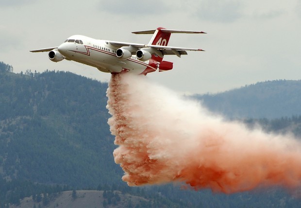
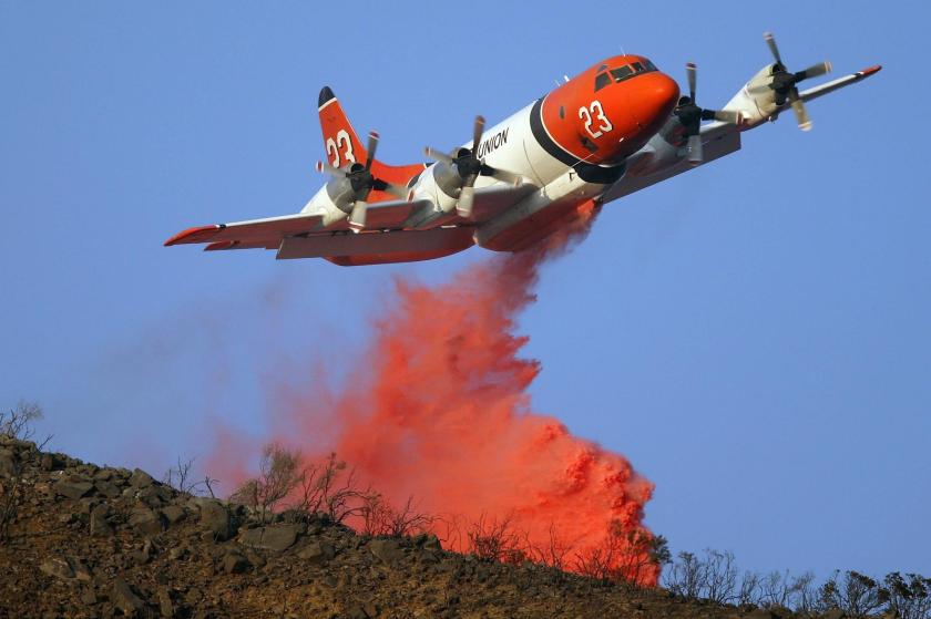
A fire flared up around 4 o’clock just east of the highway. Shortly after seeing the two small private planes I saw a larger red and white propeller driven airplane with the unmistakable red and white markings of the US Forest Service. Shortly after that, here came the small jet (small for a jet, but bigger than the prop plane). It was going to drop orange fire retardant on the fire. Soon after that here came an even bigger prop plane, also there to drop retardant. They fly incredibly low when dropping their cargo to be sure they hit their target.
Then there were the helicopters. I first saw the green one going left over the highway to a nearby lake to refill it’s water bucket. I tried to find the lake so I could take pictures of it hovering there. Not knowing the local lay of the land I went to the wrong lake. The one he was using was actually much closer to the highway (just behind a roadside house, in fact). After waiting a few minutes with no helicopter I went back out towards the highway and parked in an area where some of the local residents had gathered.
I spoke with a woman who lives about a quarter mile from the fire. She said they already suspect it was arson. There is an underground gas pipeline located near the fire which they hope doesn’t become a factor. She told me which lake they were probably drawing water from so I drive about a quarter mile up Route 97 and parked my car.
As I waited for the green helicopter to come and refill here came an even bigger yellow helicopter. As soon as one headed back to the fire (only about 3 miles away) the other one arrived to fill up. I have some great video of each of them approaching, hovering over the lake (well, you can hear them but my view was obstructed by trees) and then fly back to the fire scene.

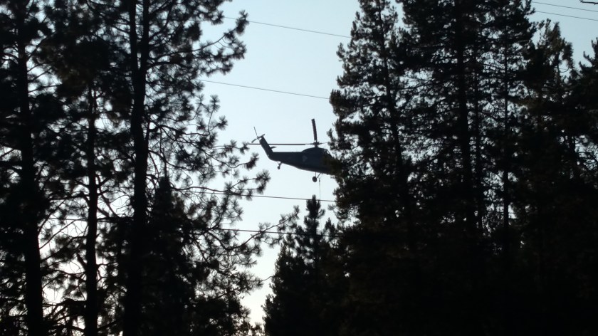
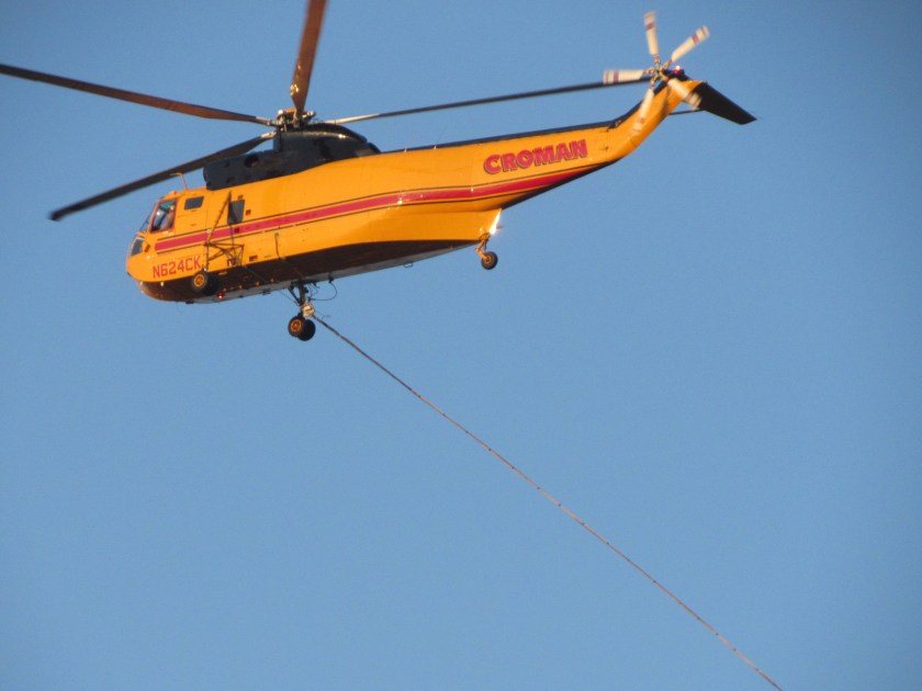
These are photos I took of the two huge Sikorsky helicopters being used to fight the 3 hours-old Crescent Fire, about 45 miles south of Bend, Oregon. The top and bottom photos show the helicopters returning to a nearby lake to refill the large (probably as much as 600 gallon) water buckets which were hanging below the aircraft. The middle photo is of the green helicopter hovering over the lake. I imagine the helicopters are made even more difficult to fly and maneuver when there is a 600 gallon of water pendulum swinging underneath it!
********
I stayed in Crescent for about an hour. By this time it was getting close to sunset and the helicopters left for their home base. The two big planes made about 3 passes each and then went back to base to refill. I presume they’ll be back tomorrow, if needed.
I surmise that the red and white prop plane was there to survey the property surrounding the fire and advise all the pilots where houses and other buildings were, give exact GPS coordinates of the fire, observe and report any potential obstacles (power lines, etc) and so on. It made multiple passes over the area while I was there.
I’m not sure what the two private planes were doing. One may have been serving as a sort of air traffic controller in the sky to coordinate all the various aircraft in the area. I presume (and would hope) that airspace over and near an active fire is quickly considered restricted airspace to keep private aircraft out and protect the pilots and aircraft actually fighting the fire.
There was a lot of activity in the hour that I was there and I must say I was incredibly impressed how quickly all the various aircraft were on scene to assist in controlling the fire, which had only started 3 hours earlier. I may go down that way tomorrow morning, although given the proximity to the highway I wouldn’t be surprised if Route 97 is closed in that area and there are detours.
I’m hearing that other fires in the area are growing very rapidly. I’ve learned that the brown smoke I saw coming home from the Mt. Hood area on Wednesday was caused by a 4,600 acre fire burning west of the Warm Springs Indian Reservation, which I drove through going to and from Mt. Hood.