Bison at National Park Visitor Center

Saturday morning I drove west from Bismarck to visit Theodore Roosevelt National Park in southwest North Dakota.  At one of the Visitor Centers just off the dreaded interstate this huge bison was munching on grass in the circle between the incoming traffic lane and the parking area.  He seemed oblivious to all the attention he was getting.

DSCN7475

DSCN7476

DSCN7455

DSCN7468

I have lots more pictures to post from the Park but will review them and post them Sunday morning.

Wahkpa Chu’gn Buffalo Jump

This is probably the most interesting thing I found in the Havre, Montana area on Wednesday.  As I was driving through town early Wednesday to get my bearings I saw this sign near the Best Western motel just west of the downtown district:

IMG_20180905_091954383

When I first saw the term “Buffalo Jump,” and before going back for a picture of the sign, the first thing that entered my mind was a competition, like bull riding, to see who could make their bison jump the highest or furthest.  Of course that’s ridiculous and it turns out it is nothing like that at all.

This is the recently (1960’s) discovered area just west of town where several native American tribes drove buffalo off the steep cliffs overlooking the Milk River and slaughtered the injured bison for food and pelts. Wakpka Chu’gn (pronounced walk-paw-chew-gun) is derived from the Indian words for Milk River, which runs just north of Havre.  Other signs directed me a little further west, where I had seen a teepee and bison statue next to the road but didn’t realize the significance of it.

IMG_20180905_092434296

That sign is in front of a strip mall, behind which the site was discovered.  Other sites nearby were inadvertently destroyed when the railroad ran a series of tracks just north of Havre and roughly parallel to the river.

IMG_20180905_092809303_HDR

The site was open for regular tours during the summer months but since it is now past Labor Day it is open by appointment only.


Thursday is yet another travel day as I go from north-central Montana over to south-central North Dakota.  I will head east, a little over 300 miles on Highway 2, a 2-lane, 70 mile per hour highway to Williston, ND and will then take a series of smaller, scenic roads south, zig-zagging south and east to Bismarck.  I will lose another hour by crossing into the Central time zone but will be back in Mountain time briefly on Friday when I backtrack to Theodore Roosevelt National Park in extreme western North Dakota.  That Park, split in two parts, will have scenic loops in both halves so once again I am hoping to have some good photo ops.  I traveled 3 different directions from Havre on Wednesday and while it is pretty countryside there was nothing which particularly caught my eye.

I am hoping to see more examples of “strip cropping” like I saw last year.  The fields I have seen thus far in Montana have been fairly ordinary.

Havre, Montana

Tuesday was a travel day as I went from Spokane, Washington north and east to north-central Montana and the little town of Havre (pronounced as if you reverse the last two letters – HAVE-r).  Monday night the smoke moved back into the Spokane area and when I left around 8 o’clock Tuesday morning the air quality was the worst I had seen the whole time I was there.  Fortunately they had great weather Friday through Monday for the food and music festival being held downtown and early reports were that attendance was up 15 to 20 percent from last year.

I headed east on the dreaded interstate, quickly reaching the Idaho border, past Coeur d’Alene and through about 70 miles of Idaho before crossing over into Montana.  I stayed on the dreaded interstate until I got past Missoula and then switched to more scenic Highway 200 which was a more direct path to my destination.  The road was only two lanes in most spots but traffic was light and the speed limit was 70 so I still made good time.  In Great Falls I got on Highway 87 which was a very pleasant drive of a little over 100 miles, pretty much a straight shot, to Havre.

Once I got past Missoula the landscape really opened up to huge fields on both sides of the road with crops and some cattle.  Montana is a big wheat producing state and I suspect that is what many of the fields contained, although I learned last year that some farmers do what is called “strip cropping” where they will plant long rows of alternating crops.  It creates an interesting visual effect which I wish I had taken photos of last year when I traveled from Bozeman up to Glacier National Park.  I didn’t see anything quite that dramatic or photogenic this year but in places it looked as if they had planted 1/10 of a mile of regular wheat (light brown, like sourdough) then 1/10 of a mile of dark wheat (like pumpernickel) and those rows went out for a mile or more.  I know that’s not how bread works, and the alternate rows may have contained something totally different, but my point is it looked really cool.  This photo, which I found online, illustrates what I am trying to describe:

MontanaWheat alamy dot com

(Photo credit:  alamy.com)

Those colors are exaggerated but that pattern is what I am talking about.

Here are the actual colors I did see.  This is looking right (east) off Highway 87:

IMG_20180904_164456831

IMG_20180904_164530171

And looking left (west):

IMG_20180904_164513075

Now imagine those two colors planted in the same field, side by side, like the internet photo above.

At one point, near the town of Fort Benton, I saw a turnoff for a scenic overlook.  Based on those fields of grain I didn’t expect to see anything different but I stopped anyway.  Much to my surprise, just below the surface area I had been seeing from the road, was the Missouri River!

IMG_20180904_162439243

IMG_20180904_162514538

I kind of knew it was in the area because part of what I plan to go see on Wednesday is a National Recreation Area and various Wildlife Preserves which border the river as it goes east through the state.  But I had no idea that I was that close to it and seeing it just off the highway was a bit of a shock.

I arrived in Havre and am staying it a beautiful home up on a hill south of town.  This is the view from the living room upstairs looking east towards Saddle Butte.  My guest room downstairs has the same view.

IMG_20180904_194237833_HDR

I will be out exploring the area on Wednesday and will hopefully have some good photo opportunities.

Once I got past Coeur d’Alene yesterday the smoke cleared and visibility was good the rest of the day.  I should now be far enough east of the wildfires that hopefully the smoke shouldn’t be a problem for me going forward.

Manito Park – Spokane, WA

Sunday I went back to spend more time at this large city park in southern Spokane.  I had visited parts of the park (general areas, a large rose garden and a small Japanese garden) but I neglected to visit the Duncan Garden portion and I’m glad I went back to see it.

IMG_20180902_112617552_HDR

IMG_20180902_113037063_HDR

IMG_20180902_113127023_HDR

It was a beautiful day with pleasant temperatures and no smoke!  The glass building you see in the second and third photos above is the Gaiser Conservatory.  Inside that building I found these plants:

A Lollipop plant:

IMG_20180902_114923394_HDR

IMG_20180902_113638381

A Burro-tail:

IMG_20180902_115227631

And several varieties of cactus plants, most of which were not labeled:

IMG_20180902_115332189

IMG_20180902_115400196

IMG_20180902_115415930

IMG_20180902_115524289

I have visited lots of city and county parks in and around Spokane in the last three days and, frankly, haven’t done much else.  I did go back to my Airbnb Saturday mid-day to watch the NASCAR Xfinity race from Darlington and came home early Sunday to listen to the NASCAR Cup race from the same track.  Monday I should have no distractions and plan to spend the entire day outdoors.  Tuesday will be a travel day as I head further east to northern Montana.  There will be a large National Recreation Area near there I plan to visit on Wednesday.


Friday in Spokane

Friday was my first full day in Spokane (pronounced spo-CAN), Washington which in the extreme eastern part of the state, not far from the border with Idaho.  Getting here on Thursday was no big deal although the drive on my scenic roads took most of the day.  The only wildfire smoke I encountered on Thursday was near Twisp (as expected) but I didn’t notice it until I was about a half hour away from town and the road I was on would then turn slightly northeast whereas the majority of the smoke was southeast (towards Chelan and Wenatchee) so I drove out of it just as quickly as I had driven into it and the rest of the day was gorgeous.

Friday morning I drove downtown to go to the Visitor Center for maps and brochures.  When I got back to my car I had a low-tire-inflation warning so I found a gas station to put more air in it (it wasn’t even noticeably low but was 10 lbs. lower than the others), then took it to  Discount Tire on the north side of town.  Turns out there was a nail in it.  I ate lunch up near where I had the tire fixed, then drove back into town to visit Riverside Park, the largest park in the area and right across the Spokane River from the downtown area.

Much to my surprise I discovered that it was the site of “Pig-Out in the Park,” a six-day extravaganza of fair-food and free music:

IMG_20180831_132811466

IMG_20180831_132700577_HDR

IMG_20180831_132824030_HDR

The building on the left in the photo above houses a hand-carved wooden carousel, made by Charles Looff in 1909.  The carousel was restored and moved to this enclosed, climate-controlled building back in 1975 (it ceased operations in 1968 at it’s prior home).

IMG_20180831_133149327


IMG_20180831_133210440

I had seen another Looff carousel last year, I believe in Missoula, Montana.

Just outside the carousel building was this large water fountain.  The temperature was in the low 70’s and the kids were having a blast running through it.

IMG_20180831_133907786

IMG_20180831_133928715

IMG_20180831_134117042

This is the view from outside the carousel building, looking over the river at the area where most of the food vendors were:

IMG_20180831_133244284

The clock tower was part of the old railroad station and the clock is hand-wound once a day.  The metal structure in the center of the photo was part of the US Pavilion at Expo 74, held in Spokane, and the ground underneath it is being re-worked to become a more useable area of the park.  Riverside Park is usually a large open-space for people to enjoy when not being used for special events.

There was at least one vendor selling frozen “Nitro Puffs,” also known as “Dragon Puffs,” which are supposedly all the rage at State Fairs and outdoor festivals this year.  The puffs are treated with liquid nitrogen and then have smoke vapors emanating from them.  I saw a guy standing next to me eating them and smoke came out of his nose.  I asked if I could take a photo for the blog but the next three bites didn’t have the same result so I left him alone and you’ll just have to take my word for it.  I had actually just read an article online a few days ago about this trend and apparently the FDA is discouraging it because it can harm people with asthma or other ailments.  I really don’t think liquid nitrogen was intended for human consumption…

This huge wagon is supposedly the world’s largest Radio Flyer replica:

IMG_20180831_142500972_HDR

Friday was a beautiful day and you’d never know there were wildfires in other parts of the area.  I had feared that the air quality here would have gotten worse again by the time I got here but the weather forecast last night sounded pretty optimistic for the remainder of the Labor Day weekend.

I don’t really have any big plans while I’m here so I will probably just visit many of the other city parks (they have lots) and may even go back down to Riverside Park.


Travel Day & Air Quality Maps

Thursday I am heading over to eastern Washington to spend my final 5 nights in the state.  Here is what the AirNow.gov nationwide map looked like last Thursday:

AirQuality082318

Yellow is Acceptable, Orange is Bad, Red is Very Bad (Unhealthy), Purple is Hazardous.  As you can see, this time last week things looked pretty bleak for the Northwest US and Southwestern Canada.

Here’s what it looks like this morning:

AirQuality083018

As you can see, there is a small area of orange in eastern Washington and within that orange area is one red spot – Spokane.  Where am I going for the next 5 days??  Spokane.

The area just north of Mount Vernon got some rain yesterday morning which moved east along the border with Canada and I think that, along with other areas of rain in the past week, have contributed to the temporarily improved readings.  The fires continue, though, so I expect smoke and bad air to return.

Padilla Bay Interpretive Center

Wednesday I drove out to this facility, not far from where I am staying in Mount Vernon.  It is part of the Padilla Bay National Estuarine Research Reserve, an 11,000 acre protected area in and near the Salish Sea and the saltwater delta of the Skagit River (which runs adjacent to downtown Mount Vernon).  In additional to several rooms of displays and photographs explaining the research which occurs here there were several aquariums with some of the critters which live underwater.

Starry Flounder

IMG_20180829_105103863

Coonstripe Shrimp

IMG_20180829_105739796

Painted Anemone

IMG_20180829_105416682

Giant Pink Star (probably 3 feet across.  It was clinging to the glass so you are seeing the underside of it)

IMG_20180829_105456829

IMG_20180829_105501400

Red Sea Urchin

IMG_20180829_110327027

There were lots of other things in the tanks but these were the most photogenic and many were too dark for the camera to focus on them properly (my smartphone camera likes to push my buttons by focusing on the wrong thing…)

Go ahead, count ’em. I’ll wait….

How many sailboat masts do you see?

IMG_20180828_110343081

I don’t think I’ve presented this challenge yet this year.  I had the opportunity when I was down in Olympia but I passed.  When I saw this marina in Anacortes I realized I had another bite at the apple….

UPDATE – Actually, I did do this when I was down in Sequoia National Park.  Well, it’s been a while so here it is anyway.

Whidbey Island

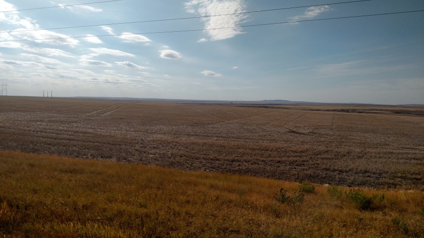
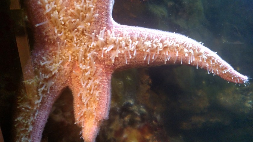
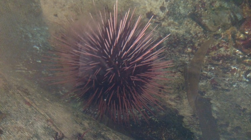
Tuesday I spent much of the day out on Whidbey Island, the largest of all the islands in the various waterways in northwest Washington.  I could see Whidbey Island from Port Townsend (only 4 miles and a short ferry ride away) but I didn’t go out there because the wildfire smoke was limiting visibility and the air quality was poor.  From the east side (I am currently staying in Mount Vernon, north of Seattle) I could drive out onto the island over a series of bridges.

First I went back to downtown Mount Vernon to take some pictures with the sun behind me.  When I arrived in town Monday afternoon I spent a good bit of time walking around downtown and along the waterfront (along the Skagit River).

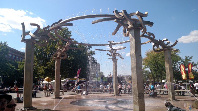
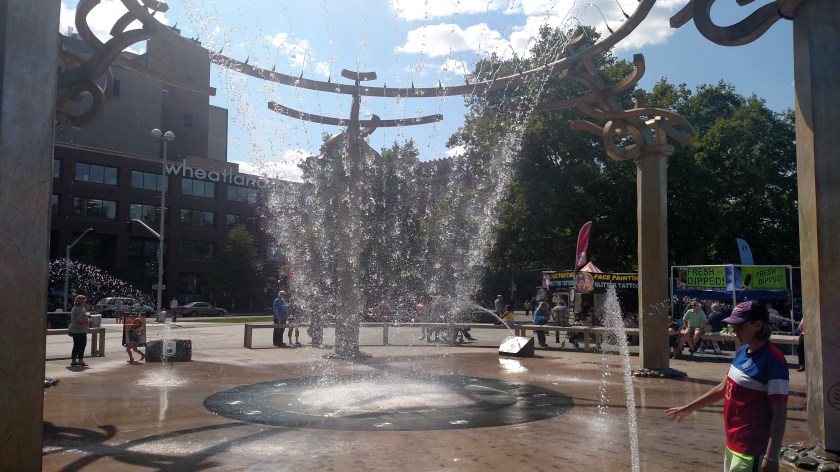
This large piece of art is located along the waterfront.  Many of the Indian tribes in the area utilize fish in their tribal logo and this symbolizes salmon swimming upstream.

IMG_20180828_092931378

And this area in Washington includes the largest growers of tulips in North America.

IMG_20180828_093118785

Many of the local fields are bursting with color in April when the tulips bloom.

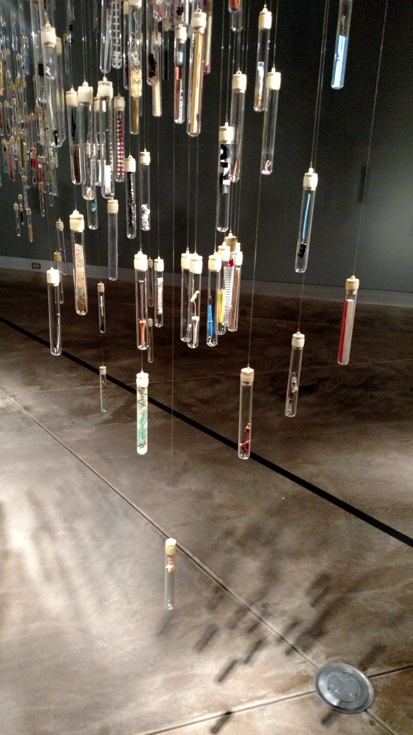
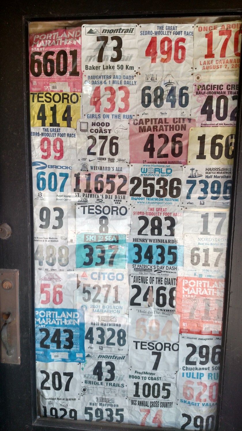
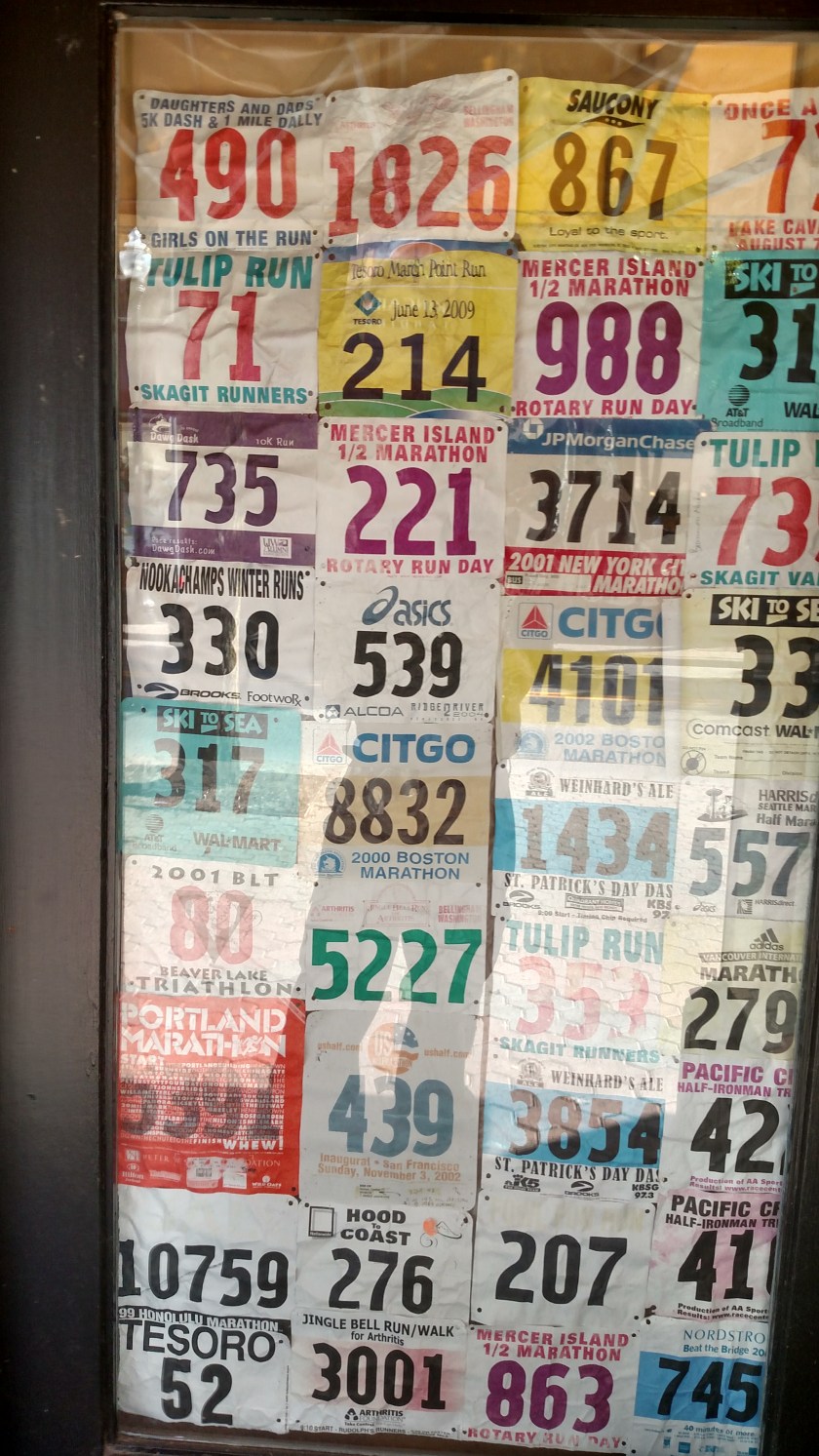
One of the merchants in town sells items for runners, joggers and other exercise-minded individuals and these “entry numbers” from various marathons lined two of the unused doors to their store:

IMG_20180827_154251501_HDR

IMG_20180827_154259002_HDR

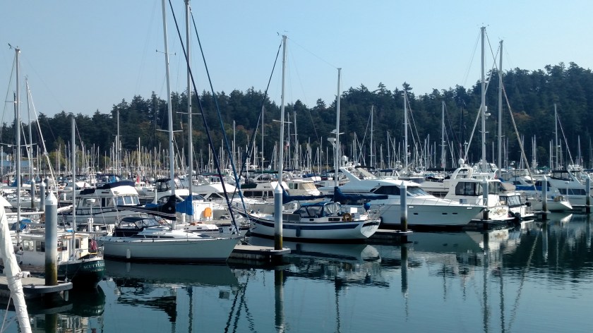
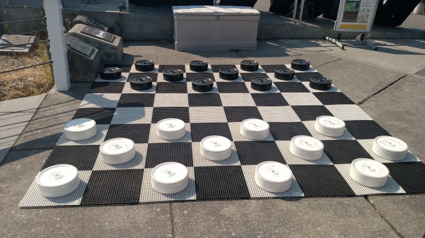
Next I headed out to Whidbey Island.  First stop was the town of Anacortes which is actually on Fidalgo Island.  Last year I saw several chessboards outside in various places which consisted of child-sized chess pieces.  This is the first checkers board I saw along the same line, this one at a marina.

IMG_20180828_110228235

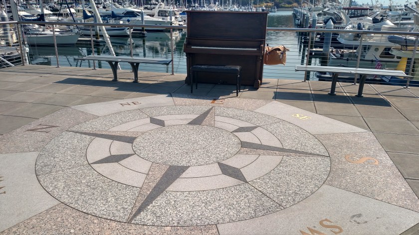
Also, overlook the ships in the marina, a piano for anyone with a sudden desire to “tickle the ivories”.  If my older brother was here he’d have knocked out a few tunes.  Me, I can’t even play “chopsticks”.

IMG_20180828_110325089_HDR

I have seen these in a few places and there were several people at various times playing one when I was in Port Angeles.

Next up, cross the Deception Pass Bridge and start my trek out on Whidbey Island.  The first big town I came to was Oak Harbor.  I drove down to the “historic” part of town overlooking the water but the tide was out and it wasn’t very impressive.  The only excitement in Oak Harbor was when several military jets from the nearby Whidbey Island Naval Air Station made a low, slow pass over the highway as they came in to land.

Next stop, Coupeville.  This is where I would have ended up if I had taken the ferry over from Port Townsend.  The town and harbor are on the opposite side of the island and several miles from the ferry terminal so I am really glad I didn’t take the ferry as a “walk-on” planning to walk into town!  Coupeville has a charming little main street area with restaurants, art galleries and gift shops.  There was also a large building out at the end of a wooden dock with several such shops.  Out on the deck on the water-side of that building was this bell for people to ring when they see a whale.

IMG_20180828_130525734

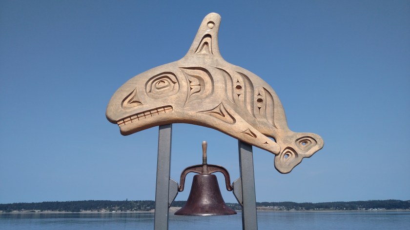
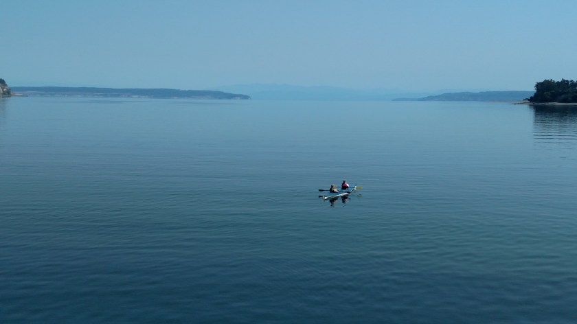
I went into one of the gift shops to ask when was the last time the bell was rung and the clerk said it was one day last week.  Evidently Orcas (Killer Whales) are often seen here.  The only action I saw while was standing on the deck looking out over the water were these people kayaking:

IMG_20180828_130239358

IMG_20180828_130400496

As I was walking back to my car I saw this ice cream shop:

IMG_20180828_131252891

There was a sign on the building indicating that this was the original location of what would become “Seattle’s Best Coffee”.  Two brothers opened a coffee shop at this location in 1969 and in 1991 their blend was named as Seattle’s Best!

I drove further south, through Greenbank and past Freeland and finally arrived at Clinton.

IMG_20180828_140511006

I could have taken a ferry there back over to the mainland at Mukilteo (and visited the lighthouse there) but I decided to turn around and drive back north to Mount Vernon.  It was a beautiful day, sunny and with very little wind.  I think the warmest it got was the low-70’s.  The wildfire smoke has mysteriously disappeared.  In fact, when I checked the Air Quality website Monday night I thought maybe it wasn’t working properly because ALL the oranges, reds, maroons and purples were gone!  I don’t know where all the smoke went but at least for now the air quality and visibility in the region is back to normal.  As I post this on Wednesday morning at 840 local time the only orange spot showing up in the state of Washington is in Twisp.  Maybe they’re mad that I have a new favorite town….

I will be driving through Twisp Thursday as I head east to my last stop in Washington, Spokane.  I will be there 5 nights, through all of the upcoming Labor Day weekend.  I know they had a little rain over the weekend which is maybe why the smoke went away but given all the fires still burning in the area I’m sure the smoke will be back.

After I leave Spokane next Tuesday I’ll be stopping in Montana, North Dakota, Minnesota and Michigan (both the UP and the mitten) before visiting family and friends in the northeast.


Museum of Glass – Tacoma, WA

Monday, as I traveled from Olympia to Mount Vernon, Washington I stopped in Tacoma to visit this museum.  The admission price had been reduced because one of the major display areas was closed to set up a new exhibit but there were still lots of things to see and do.

One of the current exhibits was a little confusing to me at the time but since I have learned more about it I guess it is starting to make sense.  It is called “Foraging the Hive” and is a large room with thousands of glass test tubes hanging from the ceiling:

IMG_20180827_101137647

IMG_20180827_101247538

IMG_20180827_101312652

Each test tube contains tiny, random items.  The artist’s intent is to mimic the behavior of bees, who gather and manipulate pollen to populate identically shaped chambers in their hive.  The artist wanted people (friends, family, museum employees and even museum visitors) to gather, manipulate and place items of their choosing into glass test tubes which are then sealed with beeswax and become part of the “hive”.

The large room with the current exhibit had black lines on the floor which visitors aren’t supposed to cross but out in the main lobby were some examples of what’s inside the glass test tubes so I took a few closeups of those:

IMG_20180827_103012533

IMG_20180827_103047409

IMG_20180827_103117373

IMG_20180827_103237313

I wished I had some tiny helicopter parts or other items from home so since I didn’t have anything “uniquely JohnBoy” I didn’t create any test tubes of my own to add to the work.

Another place to visit in the Museum was their “Hot Shop”.  There was a Visiting Artist from Seattle named Brent Rogers (black t-shirt, center of the photo facing away from the camera) who was finishing up a piece he had been working on.  The woman in the lower right corner was providing commentary on what was taking place and there were several helpers scurrying about.  There was also someone working a video camera and there was a large TV screen where closeups of the work-in-progress were displayed and showed exactly what was being done to it.  I was at a museum and hot shop in St. Petersburg, Florida back in January and watched a vase being made from start to finish.  It was quite interesting to see all the steps involved and how colors and patterns are added to the final product.

IMG_20180827_104319342

IMG_20180827_104405013

During breaks the artist and workers are available to answer questions from the visitors watching from the stadium-style seats.

The Museum also has a one-of-a-kind Mobile Hot Shop which they take to schools, art festivals, State Fairs, etc. to promote interest in the field of glassblowing.