Buon Giorno… and Ciao!

After I left Stovepipe Wells Village I continued driving west.  I stopped on a downhill slope to take some pictures and I noticed some people standing in the road, maybe a mile ahead of me.  When I resumed driving I reached them and discovered it was four young people who were posing in various scenarios in the road for pictures.  I turned around and went back to ask if they wanted a picture of all of them together.

Turns out they are from Italy and are visiting the US on holiday (I told them I have a friend in Durham who is in the US from Rome as a grad student at Duke University).  After I took pictures with their cameras I started to drive away, but stopped again and walked back to ask if I could get a photo for the blog.  They happily obliged.

IMG_20180606_112820667

And after that photo I continued driving west out of Death Valley… so I say Ciao!, leaving it behind for others to enjoy.

IMG_20180606_113824834.jpg

Charcoal Kilns side trip

After I left the western edge of Death Valley proper I continued west. Shortly after taking the photos in the post above this one I passed the 1,000 foot elevation marker, then 2, 3 and 4,000 feet. At that point I concluded I must have missed my turn. I wanted to turn left on a road which would take me out to the Charcoal Kilns.

I backtracked and figured out what had happened. Between the 1,000 and 2,000 feet markers I had stopped at a small rest area.

IMG_20180606_121106700

Without going into took much detail let’s just say I was releasing some of the copious amounts of water and Gatorade I had been drinking yesterday and today….

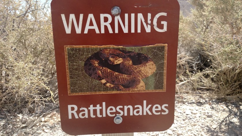
When I pulled back out on the road I looked left to make sure there wasn’t any traffic coming so I failed to see the sign:

IMG_20180606_135650656

The National Park Service generally does a great job marking roads, especially to landmarks. Well, they dropped the ball on this one. I had been keeping an eye out for Emigrant Canyon Road, a 26-mile road leading back to the former Charcoal Kilns, the major attraction at the end of that road. Well this sign only refers to Wildrose. Terrific. Even if I had seen the sign I wouldn’t have thought it was my turn. Wildrose is a small campground along that road, and it isn’t even called Wildrose Road. Any what about Thorndike and Mahogany Flat campgrounds? Why weren’t they included? And the sign doesn’t say boo about Charcoal Kilns.

Well, I drove back the road with the hope of seeing Charcoal Kilns. That hope was dashed when I learned that the final mile or two of the road are dirt and rock, a JohnBoy no go. I did try proceeding very slowly when I got past the “Pavement Ends” sign but it was just too rough and I didn’t want to take a chance ruining my relatively new Michelins, so after about a tenth of a mile I turned around.

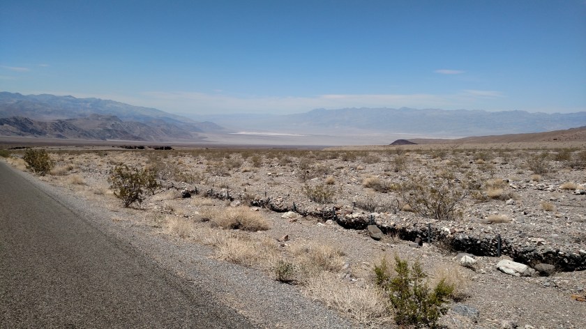
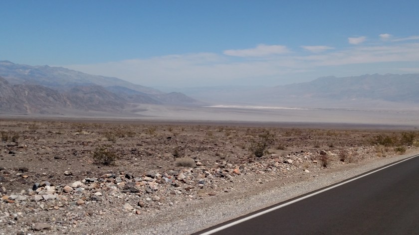
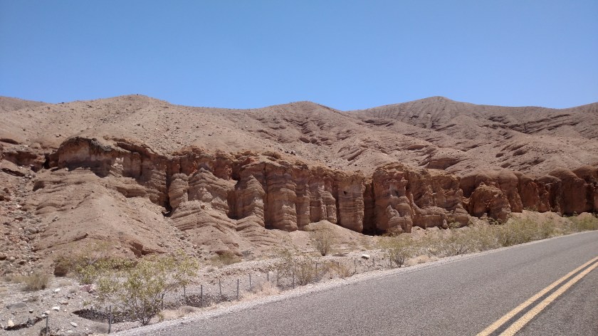
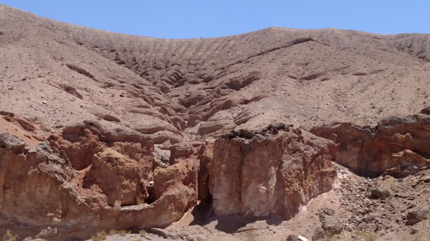
Nevertheless I did get to see some pretty scenery, different from what I had been seeing the past few days.

IMG_20180606_121427234

IMG_20180606_121538893

IMG_20180606_124834500

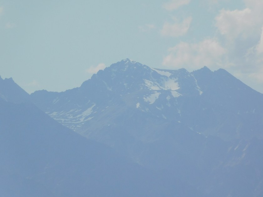
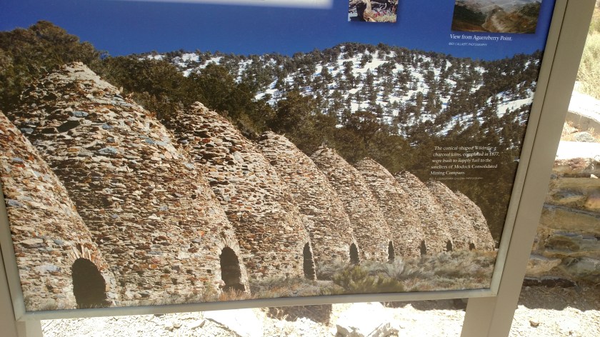
This was a picture on an information sign which shows my intended destination:

IMG_20180606_131209647

IMG_20180606_131707253

This is one lone flower that was along the road at one spot:

IMG_20180606_133254906

IMG_20180606_133413738

IMG_20180606_134352202

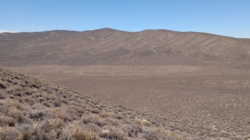
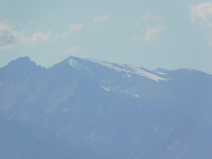
And as I drove back out to the main road, this was my last look at Death Valley proper, way off in the distance. I was now over 2,000 feet up and the temperature, once I got away from the desert floor, was in the low 80’s. With a steady wind it was actually very pleasant.

IMG_20180606_135311144

Star Wars Canyon – Jedi Transition

This has to be, by far, the most exciting unexpected find I have come across in my four years of traveling across the United States. After stopping for lunch in Panamint Springs I continued west and climbed up a large mountain. At the top there is a Vista Point (overlook) called Father Crowley. This is at the very westernmost boundary of Death Valley National Park. From the overlook you may look down into Rainbow Canyon. I stopped there to take some photos and learned something VERY interesting….

This is looking west (left from the overlook) towards the top of the Canyon:

DSCN0963

And these are looking east (right) from the overlook:

DSCN0962

DSCN0959

DSCN0960

Before I stopped for lunch I saw a lone military jet making a low pass over the mountains in front of me (which I had now climbed to the top of) from north to south. When I got to the overlook I noticed a guy at the extreme east end with a camera on a tripod but just standing around, not actively taking pictures. I walked down and asked him what he was “stalking”. His response, and the video he showed me, totally blew me away.

Jet pilots, I presume from the nearby Naval Air Warfare Center training grounds (and perhaps even from Nellis Air Force Base near Las Vegas) call this “Star Wars Canyon”, and practice flying down into the canyon from left to right as seen in the photos above. I didn’t actually see this happen, but the guy showed me a video clip he had taken earlier in the afternoon. The plane descended well below where we were standing. When I got to Barstow I Googled it and found some amazing still photos. I then went on YouTube and found some even more amazing video clips.

Go to either of those sites and enter “Military jets Father Crowley” or “Star Wars Canyon” and you’ll see what I’m talking about. And this is not confined to just small jets, there is a video of a C-130, a large 4-engine propeller driven plane, making the “Jedi Transition”. It is INCREDIBLE! If you watch the videos be sure to see a few where you see the plane way down in the Canyon, banking to the right. Some videos lose the plane soon after it goes in the Canyon.

You don’t know how tempted I am to go back up there today, but there is no guarantee of if or when the planes will make their runs. I waited around for a while yesterday but still had a several hour drive to get to Barstow before dark.

May the Force be with you!

Snow on the mountains

After I left Death Valley National Park on the west side I continued driving west to get to Route 395 in Olancha, which would take me south to Barstow, CA where I would be spending the night.  After being in temperatures well over 100 degrees for several days I thought I’d never see snow again, but I noticed a little bit of lingering snow on some of the mountains to my northwest and according to the AAA map of California, there is a string of 14’ers there – mountains higher than 14,000 feet elevation.  These peaks include Mt Langley (14,026), Mt. Whitney (14,494, the highest point in California) and Mt. Williamson (14,370).

DSCN0987

DSCN0988

DSCN0989


Danger, Will Robinson… Danger!!!

No, it hasn’t happened yet…

For those of you who may be new to the blog, I am having a little contest. Enter “While you’re waiting” in the search box on the Home page to go back to last week and read the details and hazard a guess if you’d like.

You’d be surprised how many times I have just positioned car in the road, or off on the shoulder on either side of the road, so I could just roll down the window and take photos from the air-conditioned comfort of my car. I am trying hard not to”invite the bite”.

Grand Junction, Colorado – Loose ends

When I was in Grand Junction over Memorial Day weekend I discovered that the city feature various pieces of art sculpture all over town.  These metal horse sculptures were in a traffic circle, of all places, as I got off the dreaded interstate on Horizon Drive.  There were a total of 5 horses, 4 full grown and one colt:

IMG_20180528_184017915

IMG_20180528_184031183

And I’ve decided what will be at the top of my list to-do the next time I am in Grand Junction.  When I went to the Visitor Center Saturday morning I saw a brochure for JetBoatColorado – which features a high-speed, daredevil type ride on the Colorado River not far from Grand Junction.  The company also offers a low-speed morning ride along the river to see many scenic views and various wildlife.

JetBoatColorado2

(Photo credit: TripAdvisor.com/JetBoatColorado)

I didn’t know about this in advance but may come back to do it some time.  They apparently also operate similar experiences other places so I may run into them somewhere else in my travels.