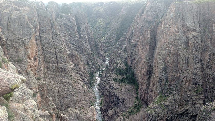
Here are more photos I took from Black Canyon – North Rim.

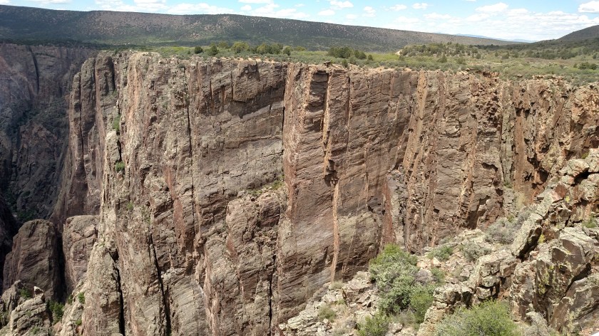


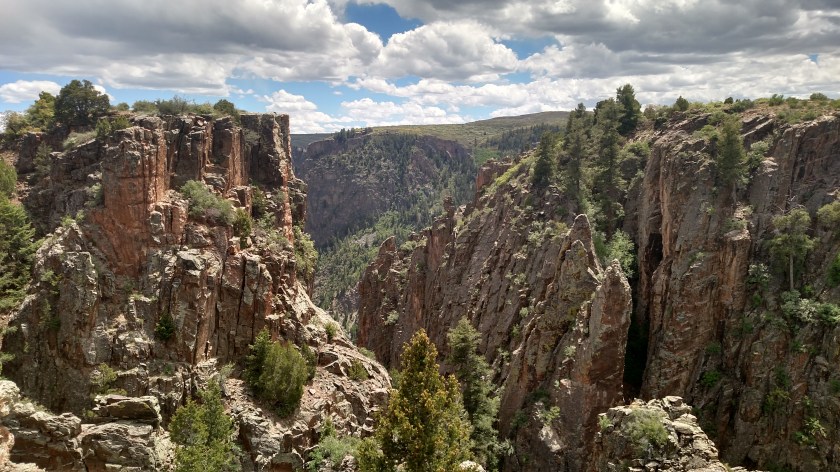
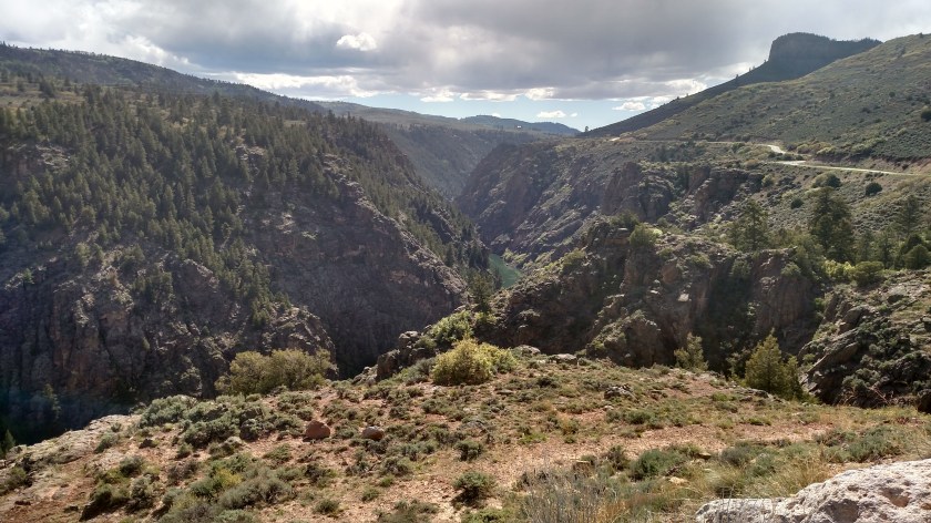
Here are more photos I took from Black Canyon – North Rim.
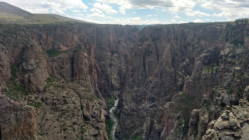
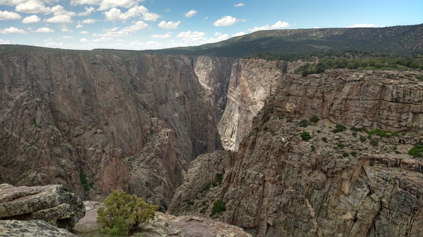
Here are some more photos I took from Black Canyon – North Rim.


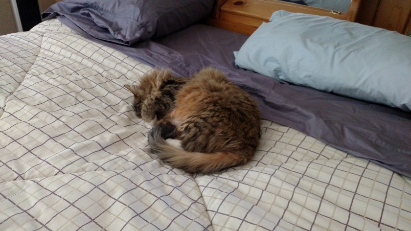
My Airbnb hostess back in Montrose spent one of the nights while I was there at a friends house. Her friend, who lives a distance from town, had recently been in the hospital and Camille was bringing her food and was going to take her to a doctor’s appointment the next day. I was given instructions not to let her cat outside after dark (the cat has figured out a way to open the cat door, even when it is “closed”).
While I was posting the blog the next morning, and before I opened the cat door for her use, I discovered her in my room, curled up on the bed with her paws covering her eyes – sound asleep.
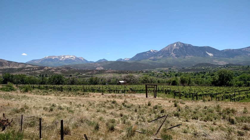
Friday was a travel day, as I went from Montrose up to Grand Junction, Colorado. The actual distance between the two towns isn’t very great, and I had already traveled the scenic roads in the area which were on my list, but my Airbnb hostess suggested I drive northeast of Montrose and as you will see, it was a very pleasant and scenic drive.
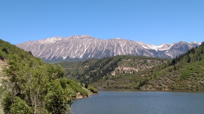
I went north of Montrose to Delta, then turned right and traveled northeast through Paonia and Redstone to Glenwood Springs, where I got on the dreaded interstate and drove west to Grand Junction. By the way, Grand Junction is named for the confluence of the Colorado and Gunnison rivers. The Upper Colorado River used to be called the Grand River, hence the name “Grand Junction”.
Before I headed north I had one last look at the mountains south of town, down near Ouray and Telluride:

Then I drove north.


This poster was in the restaurant where I had lunch on Friday. Sorry for the poor picture quality. I tried downloading the image from the internet but I can’t seem to save it in a format which I may post to the blog.
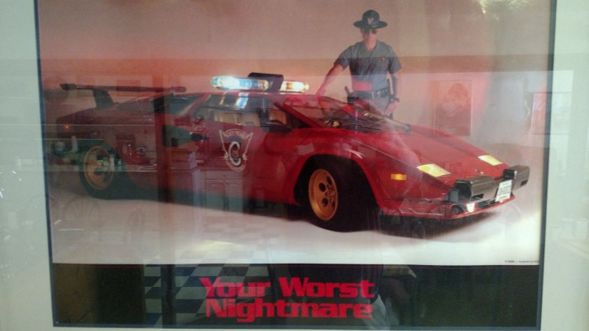
(Photo credit: Dr. Bert Bergland, poster copyright Autovia Limited)
The photo shows a 1988 Lamborghini Countach decked out in Colorado Highway Patrol livery, with an actual state trooper posing menacingly next to it. True story – that trooper actually pulled Dr. Bergland over for speeding while he was taking his very pregnant wife to the hospital to have their son delivered.
If you Google Your Worst Nightmare Lamborghini you’ll find a better picture.
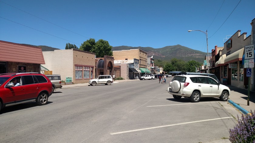
This poster was in a little diner in Paonia, Colorado cleverly named “The Diner”. Paonia is a cute little town.
After lunch (I had steak & eggs, just like the astronauts!) I went to the town park to re-fill my water bottles in the shade. The park was next to an elementary school which had this artwork in front of it.
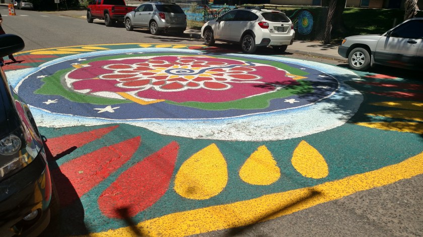
Someone obviously put a lot of effort into it.
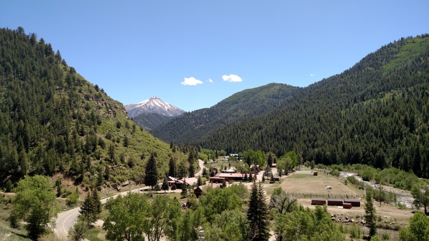
These are what’s left of the historic Redstone “Beehive” Coke Ovens.

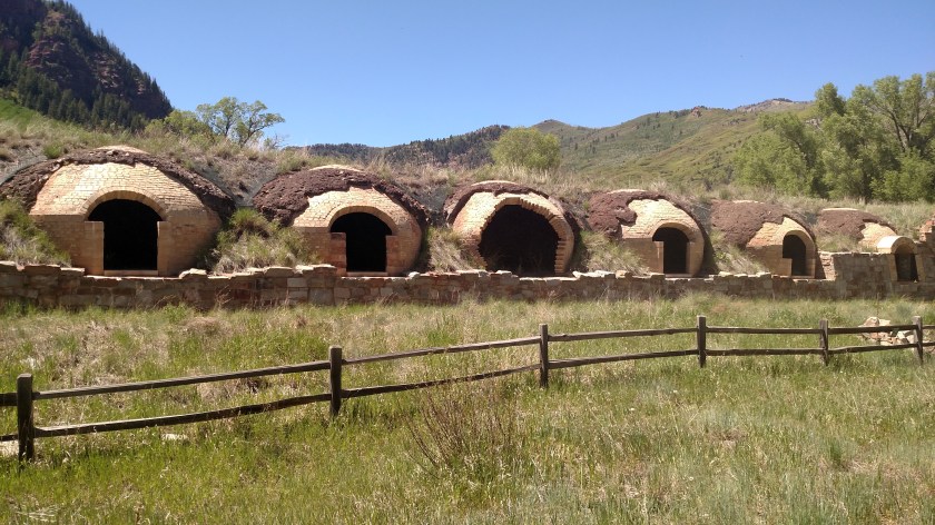
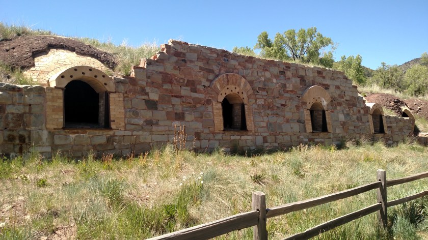
In the late 1890’s, Colorado Fuel & Iron company started mining operations to extract coal from the earth and convert it to coke (a form of fuel, not the soft drink). That company ceased operations in 1908 and the ovens sat idle until 1956 when Mid-Continent Coal & Coke Company resumed mining operations (although they may or may not have used the ovens – probably not. Update – they used more modern coking technology). Three events – an explosion in 1959 which killed 9 workers, another explosion in 1981 which killed 15 more workers, and a disastrous fire in 1990 caused that company to cease operations in 1991.
The little town of Redstone did survive, even though there is not local industry to support it.
Once I reached the dreaded interstate at Glenwood Springs I headed west towards Grand Junction, where I will be staying the next four nights. About halfway there I came to the little town of Parachute (great name, eh?). This set of solar panels was outside the Visitor Center (which was curiously closed at 411 PM on the Friday going into Memorial Day weekend. Guess they weren’t expecting any visitors!). This is the most unique design for panels I have ever seen. Next week you will be seeing another interesting solar panel…

The photo below was taken from the interstate (while stopped, even though that isn’t legal – Shawn). I am staying very close to the Utah state line and this is to demonstrate that I am now making the transition from the mountains of Colorado to the deserts of the western states. The forecast for at least the next 8 days is hot and dry. Time to haul out the short pants, sunscreen, lip balm and aloe vera! Tip – Keep a bottle of aloe vera in your cooler when you travel and in your refrigerator at home. While it does NOT provide protection from the sun, it gives great relief for sun and wind-dried skin, and provides relief from sunburn. I learned that in Durango last year and my Airbnb hostess there came to the rescue and taught me a valuable lesson.
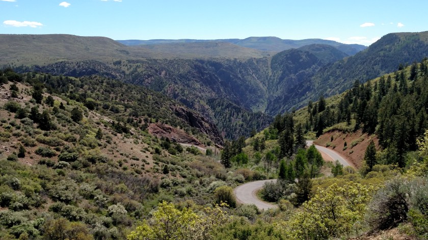
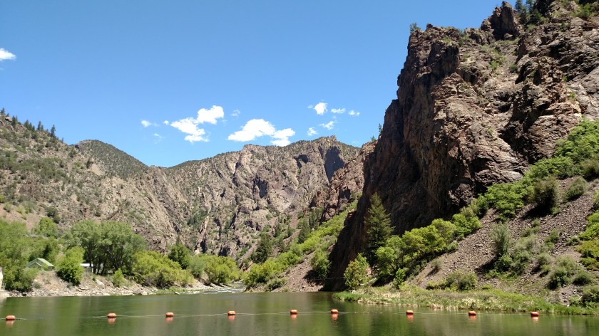
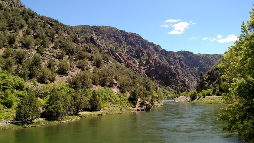
If you make a hard right as soon as you enter the Park from the south you will drive down a paved road to what is called the East Portal. This is the point where water from the various reservoirs to the east go through one final dam and becomes the Gunnison River. This is the water’s entry to the Park.
Driving down the road you drop from approximately 8,100 feet elevation (there was no phone service in most of the Park so my GPS apps wouldn’t work) to 6,500 feet in very short order. This is achieved by a series of switchbacks and, in spots, a 16 degree grade.
When I was back at the River Gorge near Canon City a few days ago I met a couple from southern Louisiana and they told me about this road, otherwise I probably wouldn’t have known about it.
As you will see, it was worth the trip!
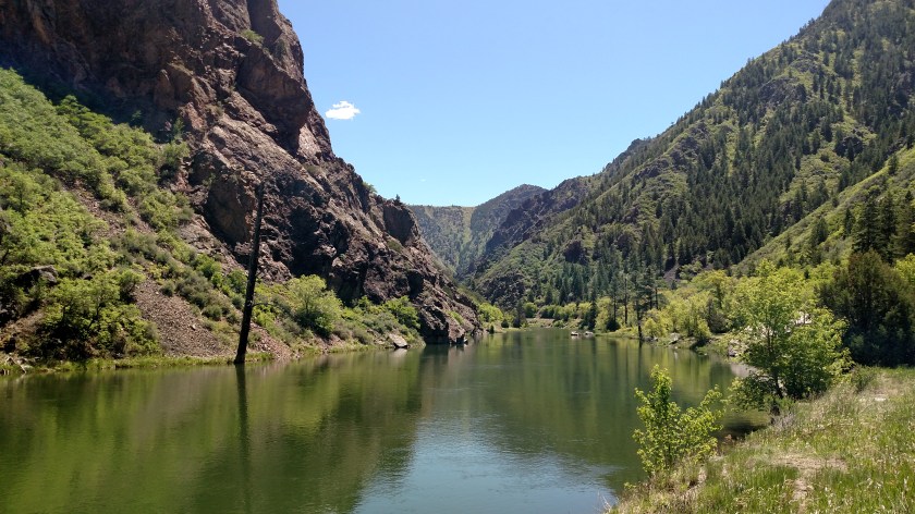
If you look closely at the photo below you will see a man fishing in the middle of the river. This is actually a small river created by a “diversion dam” and is not the Gunnison. This is looking away from the dam.
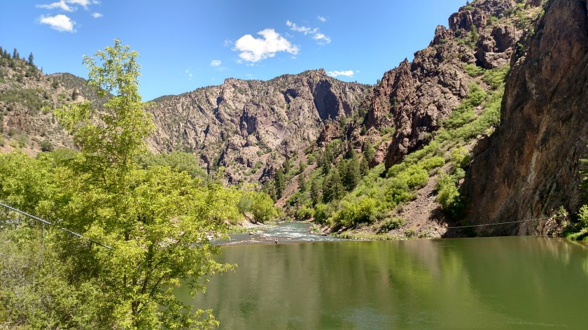
These are looking towards the dam. There is also a tunnel under the dam but that is off limits to the public, hence – no photos.
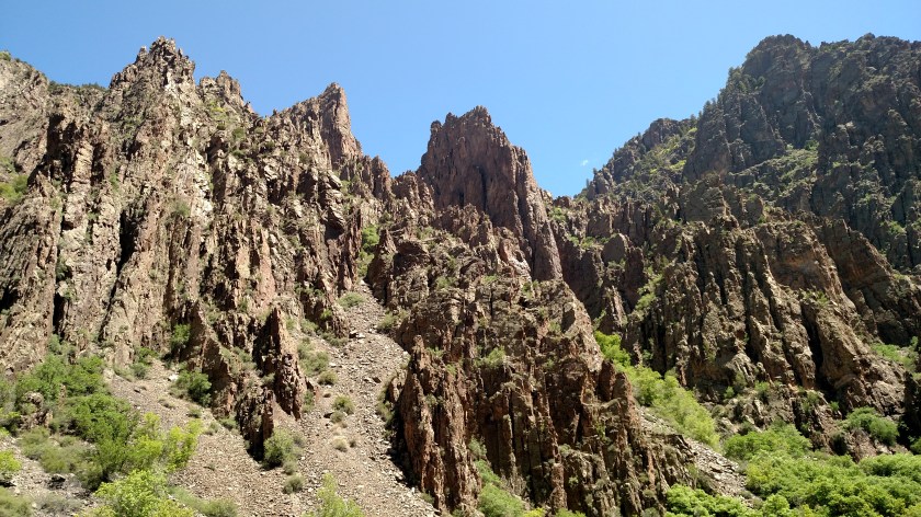

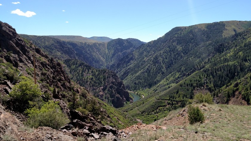
This is the first overlook when you enter the Park at the South entrance. I posted pictures from the same vantage point last year (September 5, 2017). If you go back and look at that post again (either using the calendar on the Home Page or enter “Black Canyon” in the search line) you will see that on that day the foreground was in the shade and the background was sunny. It is pretty clear from that photo which this is called the “Black Canyon”.

Looking at the right side (partially shaded):

Looking at the left side:

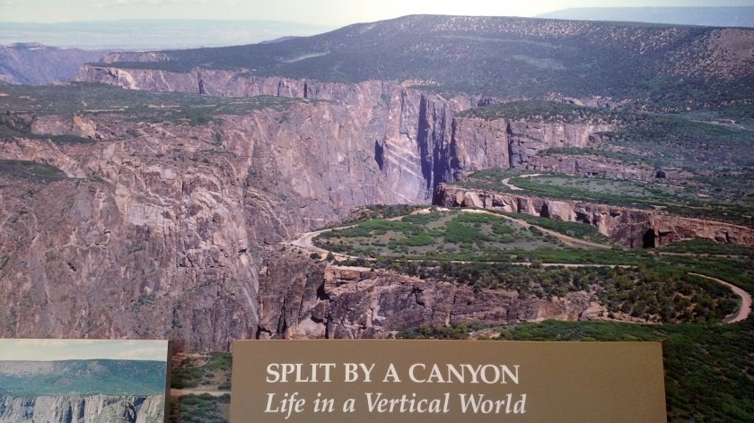
This photo, which was in the Visitor Center, shows the area I was in Tuesday from the air. You can see the road I traveled to get to the various overlooks, and you can see where the canyon curves to the left.