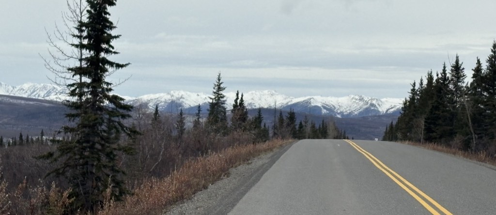
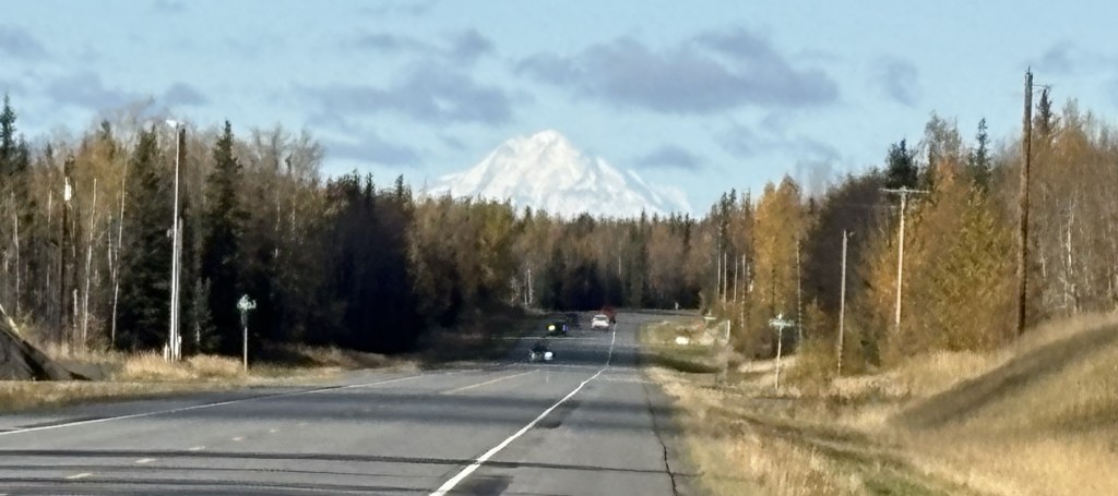
The only road that goes in to Denali National Park extends 92 miles west from the main Visitor Center. The first 15 miles, which are paved, are open to all visitors using their personal vehicles. When the buses stopped running on September 15, the next 15 miles are also opened to all visitors, weather permitting. That goes at far as the Teklanika River campground, and was where I had to turn around today.
Beyond that campground the road continues to Mile Marker 53, the Toklat River ranger station, then to Mile Marker 66, the Eielson Visitor Center, then to Mile Marker 85, Wonder Lake (which has a spectacular view of Mt. Denali), and ends at Mile Marker 92, where there is an airstrip for planes.
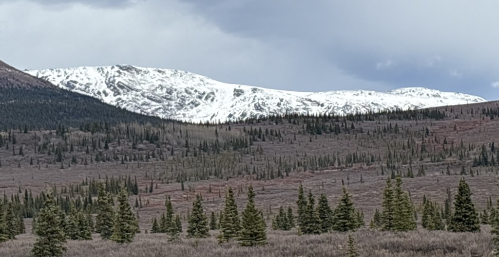
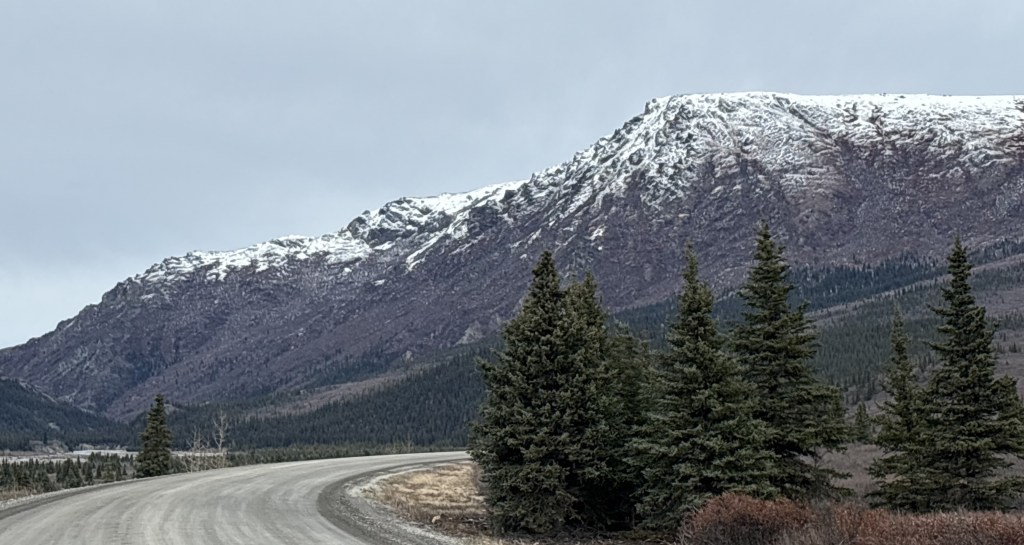
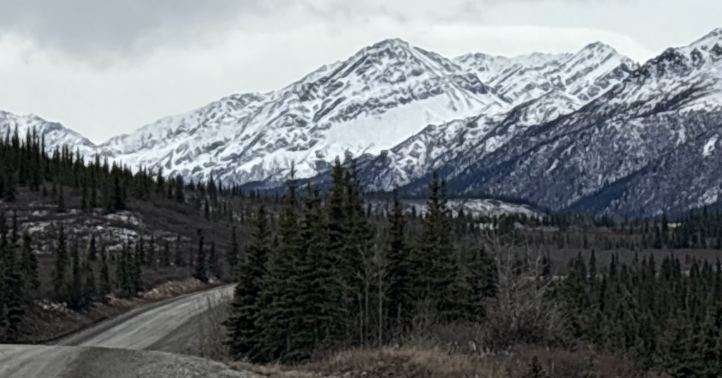
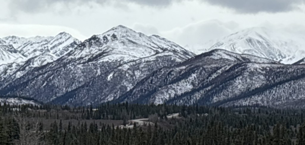
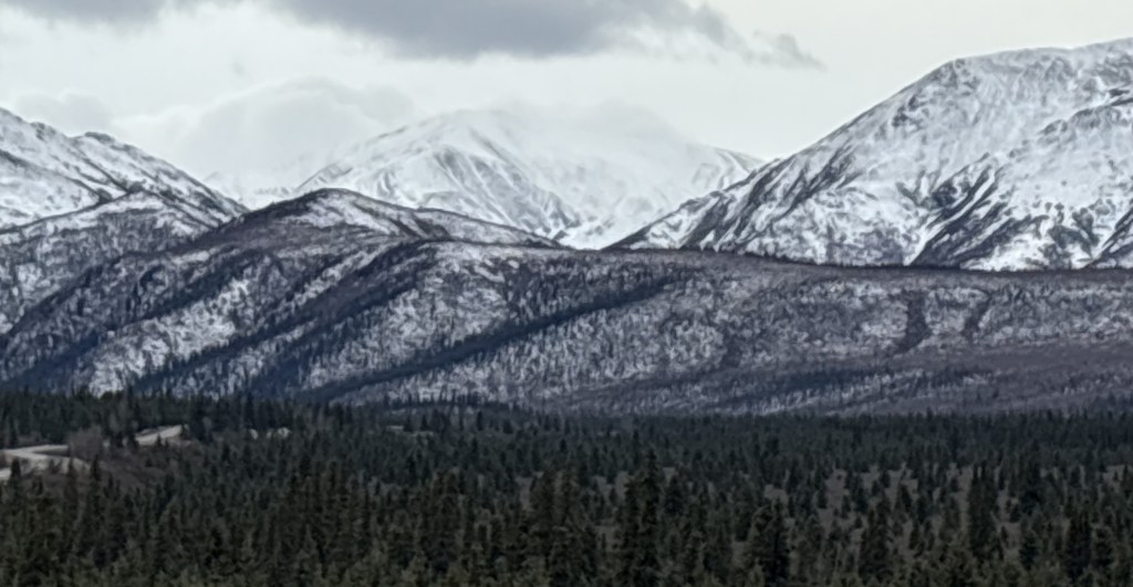
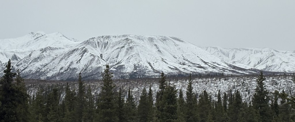
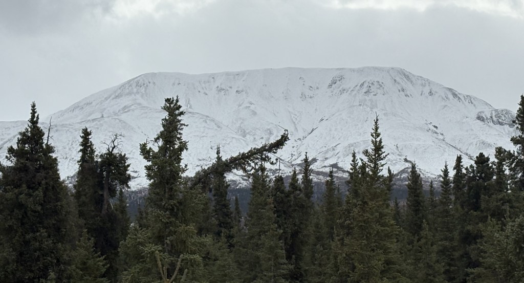
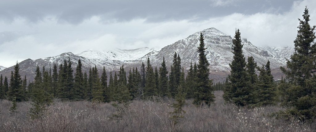
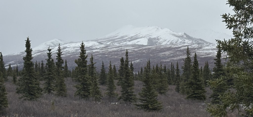
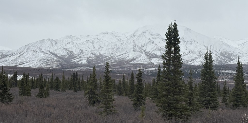
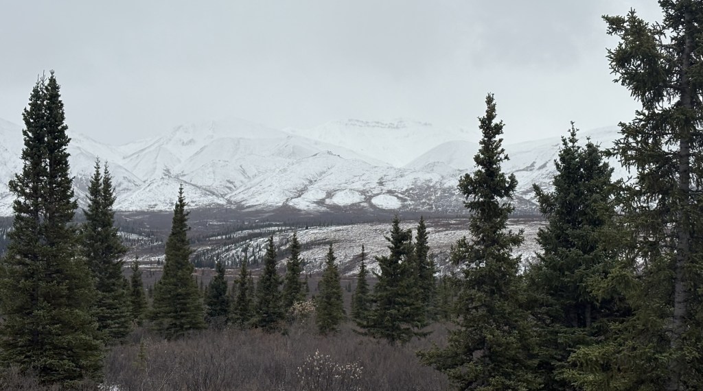
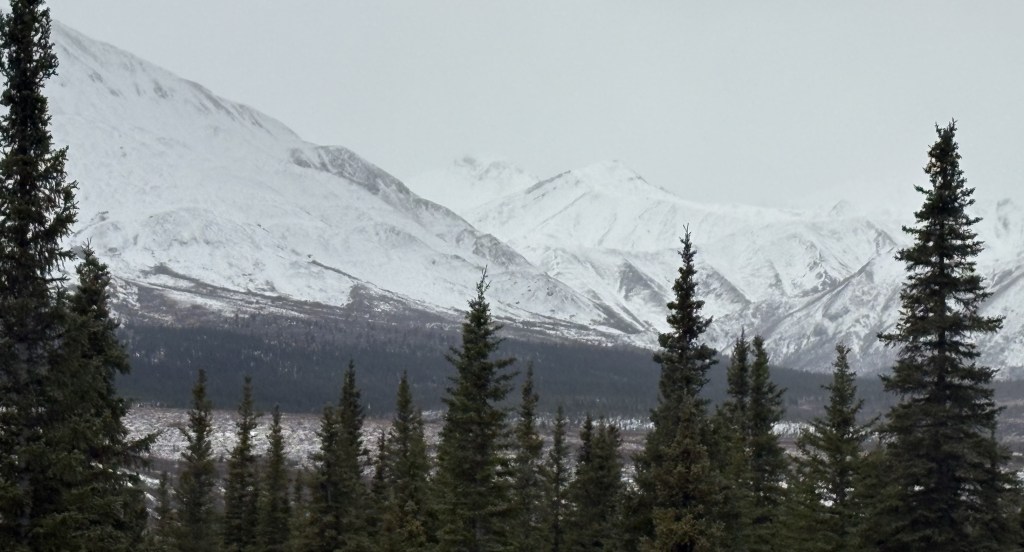
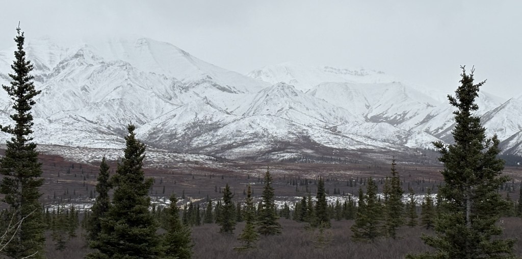
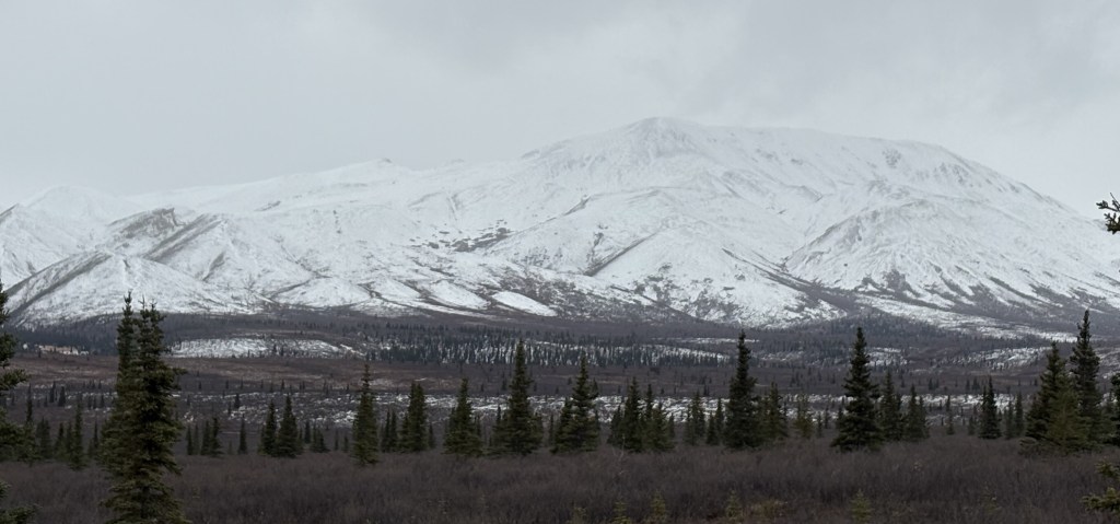
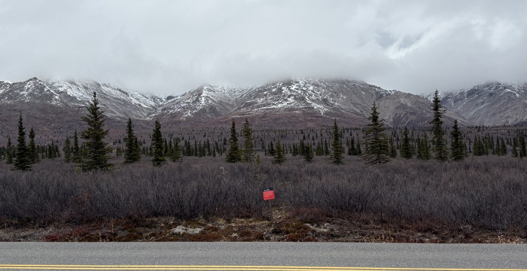
Here are more of the things I saw as I drove from Mile Marker 15 to Mile Marker 30:
That was as far as I was allowed to drive in today. I don’t think I was anywhere near Mt. Denali itself so I doubt if I somehow got a photo of it. I wasn’t very close to any of the mountains I saw, and the road went up and down between hills which probably blocked my view looking deeper into the Park.
I stopped taking photos and focused more on looking for animals on the way out. It was almost 6pm when I turned around and I’ve heard that wildlife sighting typically increase in the morning early morning and early evening. Black bears may have started hibernating but grizzly bears may have still be out and about. I did speak to a couple from Europe when I was here two weeks ago and they had a video of three grizzly bears crossing the road just a few feet in front of their vehicle, and they said it was on the section of road back here.
If I had known that I wouldn’t have an opportunity to speak with any rangers on this visit I might have asked more questions when I was here about two weeks ago. Never having been here I had no idea what to expect.
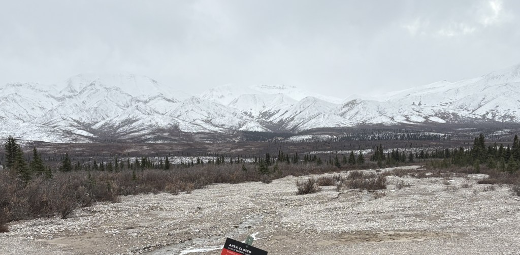
This was my only opportunity to drive the additional 15 miles in. There will be more snow arriving overnight and the gate at the Savage River bridge was closed for the remainder of my visit.
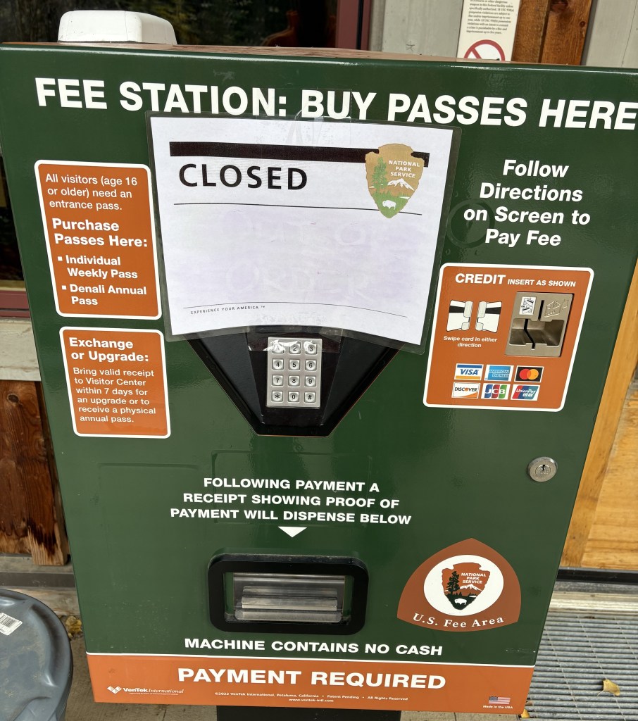
Having driven up from Wasilla, I had now arrived at the Park. My first sign that there was something amiss was when I pulled into the parking lot at the Visitor Center. Hardly any cars. I had been here about two weeks ago and while it wasn’t “packed” by any means, there were definitely a lot more vehicles. I also discovered that the large Visitor Center I had been in two weeks ago was closed, with a sign directing people to the “Winter Visitor Center,” a short walk away.
I walked down the hill to the other Visitor Center, only to find that it, too, was closed.
I walked back to where I had parked and found that a few other vehicles had arrived. I told them not to bother going down the hill. This was when someone mentioned that the US Government had “shut down” the night before due to a funding bill not being passed. I knew that the last time that happened the National Parks remained open, but with limited staffing. I explained that in my opinion, if we weren’t supposed to go in they would most likely have had a barrier across the road to keep us out.
I went ahead and drove in, but I believe most of the people I had seen probably left, thinking the Park was actually closed, because I hardly saw any vehicles after I went in. I did see two Park rangers drive by at various times during the day but they never stopped to talk with me.
My first stop was at the viewpoint where I theoretically could have seen Mt. Denali if the conditions were right. Given how poor the distance visibility was as I drove up I wasn’t terribly optimistic.
Nope. I could barely even see the shorter mountains which were much closer.
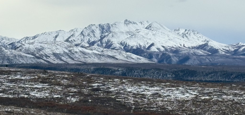
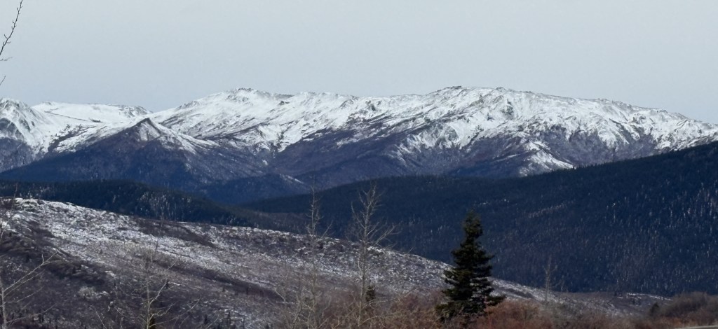
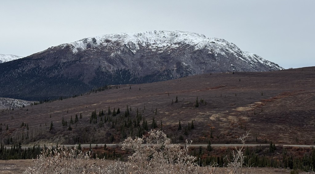
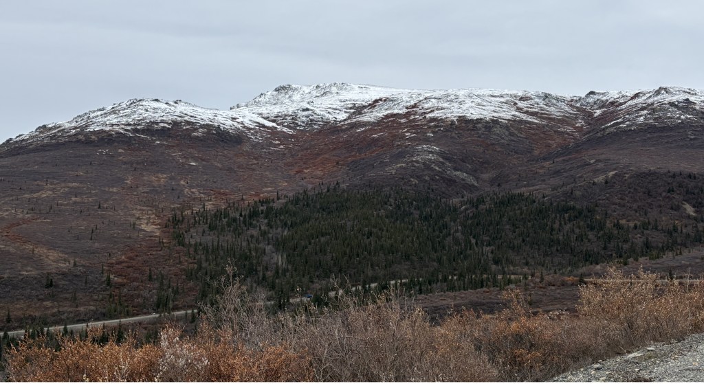
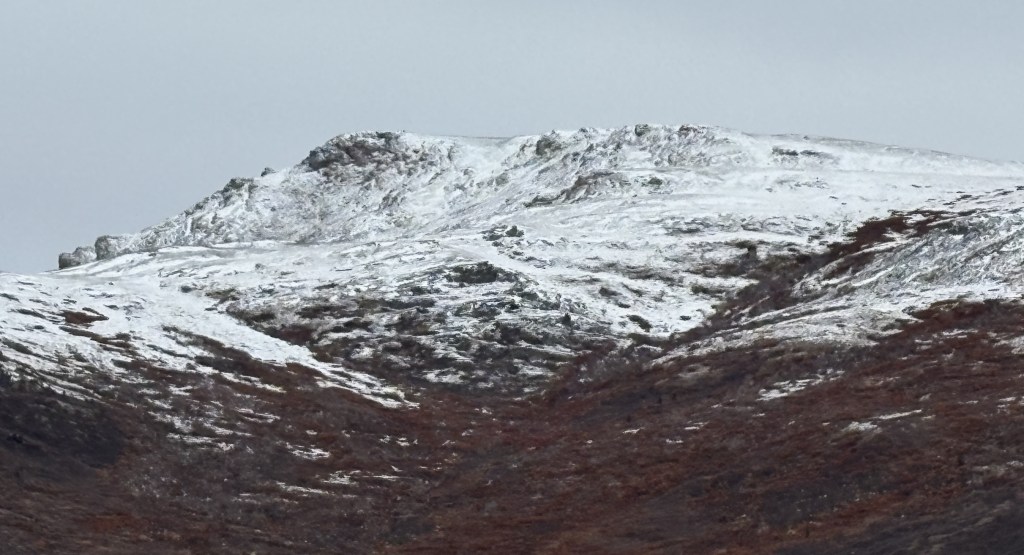
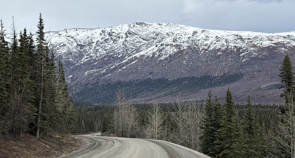
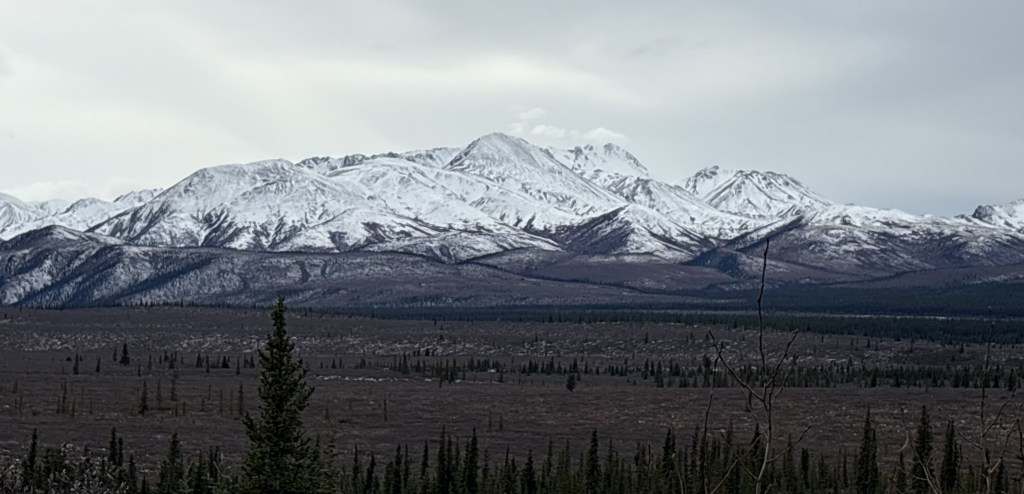
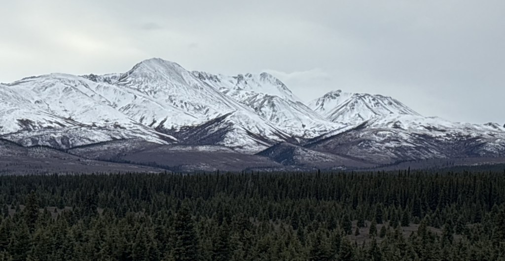
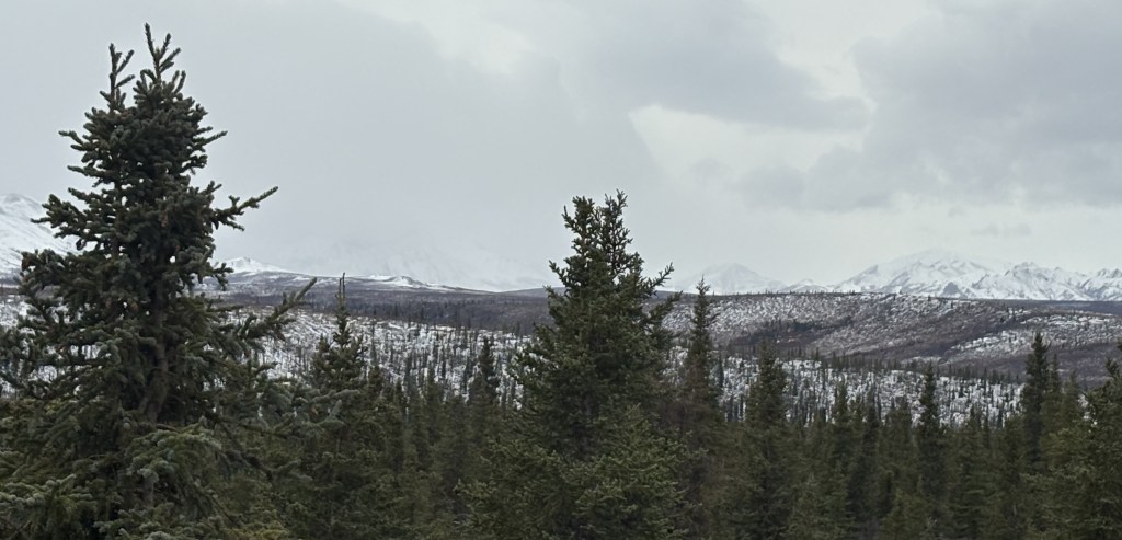
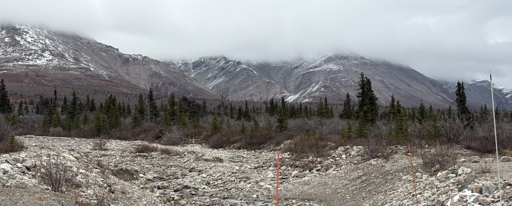
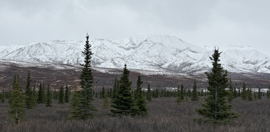
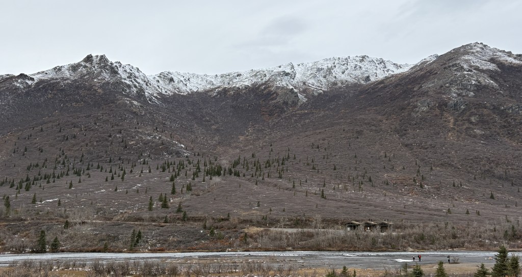
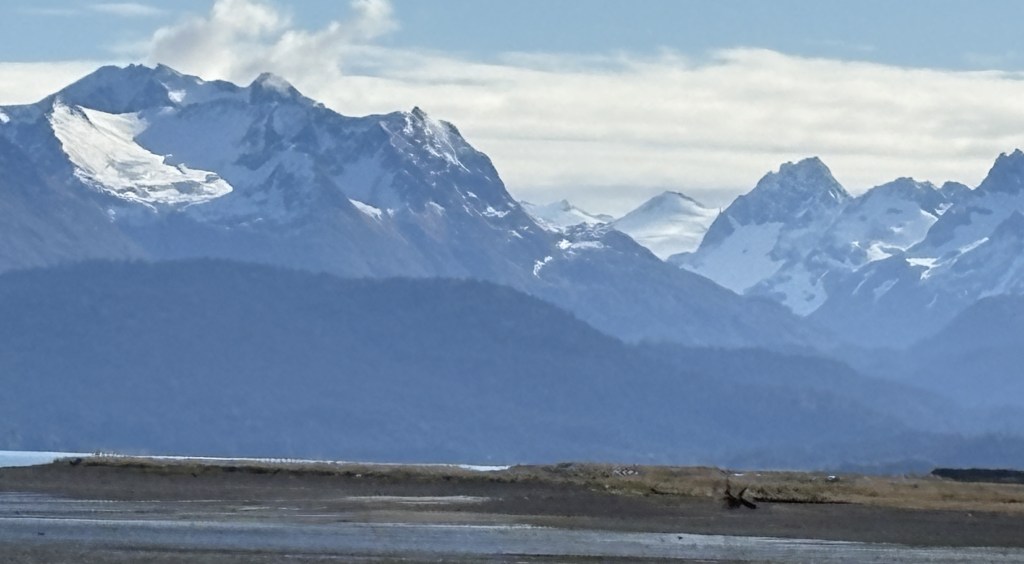
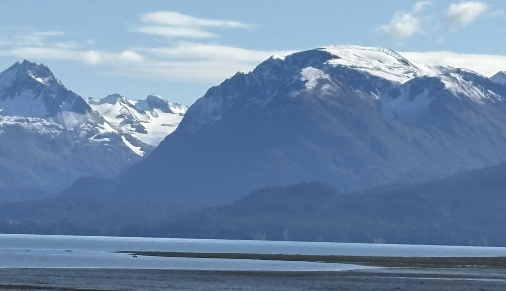
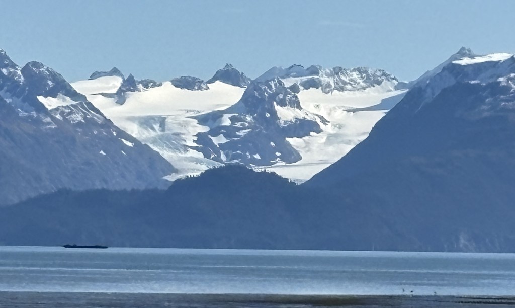
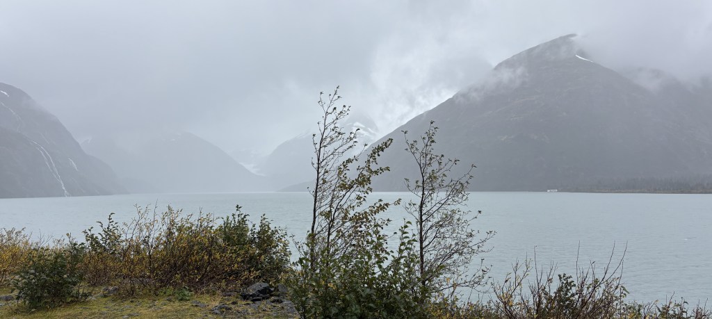
I proceeded to drive in on the 15 miles of paved road which I knew would be open. There had obviously been some snowfall recently and these are the things I saw. Most of the mountains I will show you were on the left side of the road going in. Having been here two weeks ago, I knew they were larger and more “impressive” than the ones on the right.
The next two were on the right. They basically start higher than the road surface so I was looking up at them.
Back to the left side:
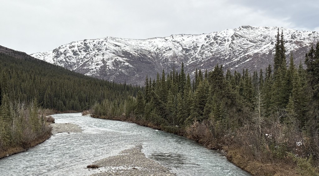
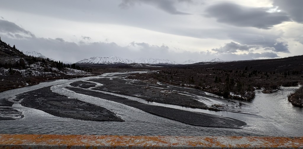
The next shot is looking right from the same spot on the road. This is one of the places which drain water runoff from the mountains on the right, downhill to a river near the base of the mountains on the left.
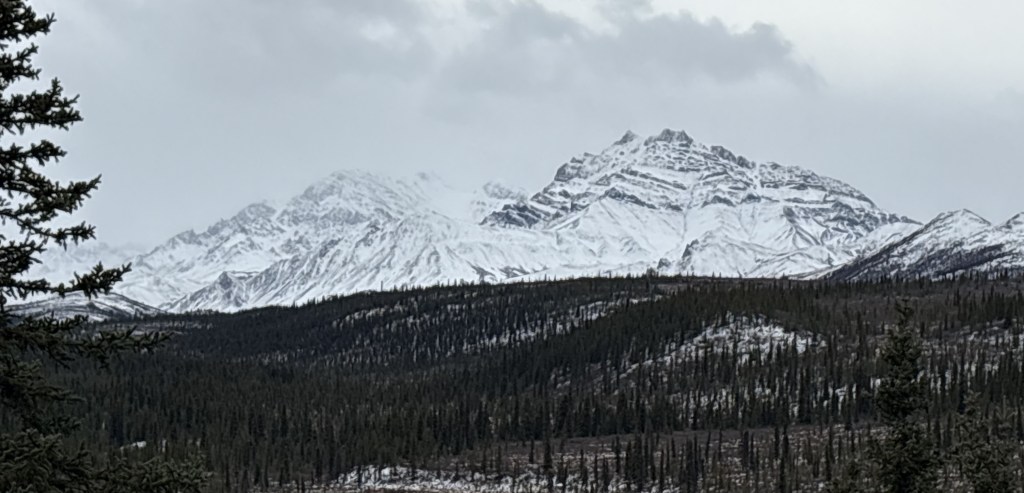
Three more on the left:
One last one on the right:
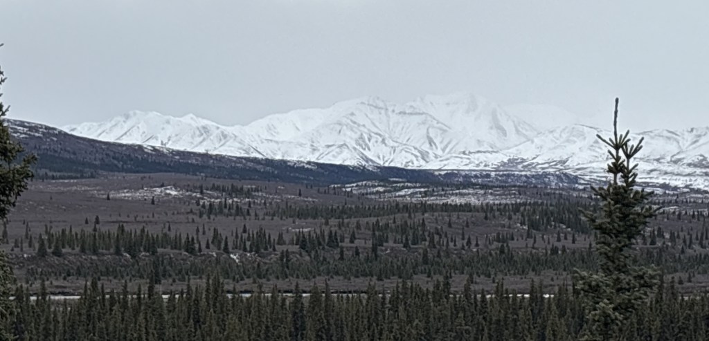
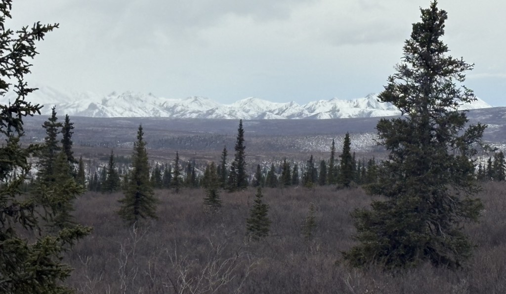
This is from the road looking back towards the Park entrance.
I honestly didn’t remember that I could see that many mountains looking that direction but there they are. They may not have had snow on them when I was here previously, so wouldn’t have been as noticeable.
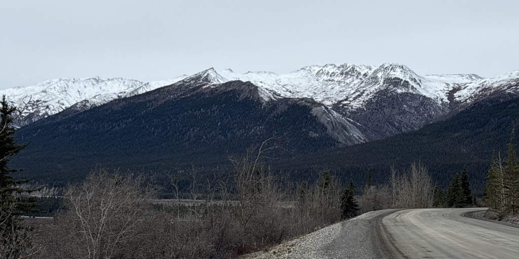
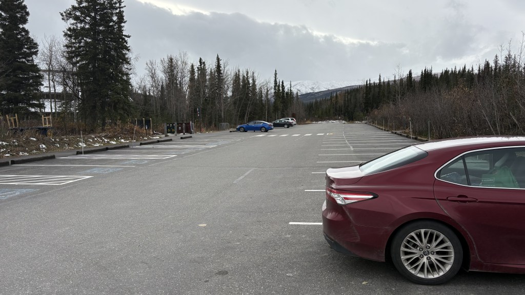
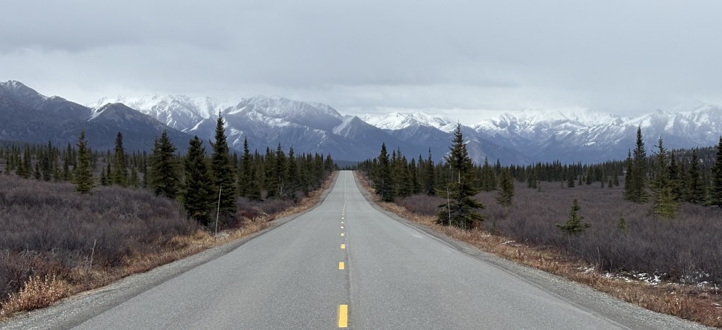
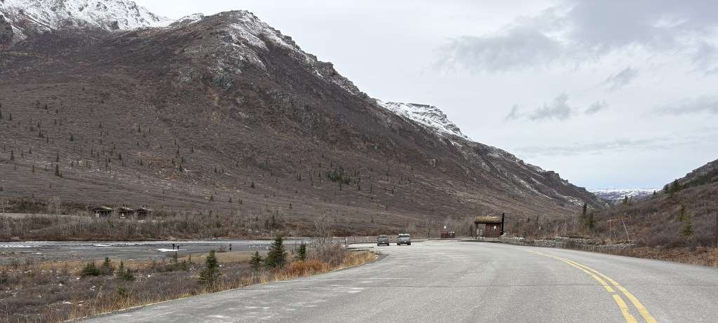
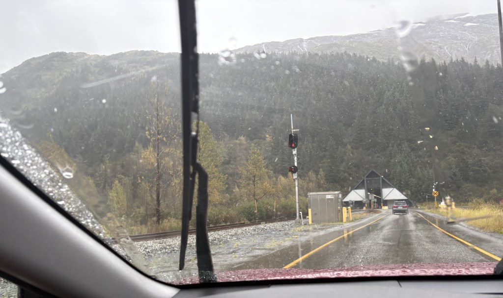
I continued deeper into the Park towards the gate at the 15-mile mark.
This is the small parking area there. It is the end of the paved road and is normally where regular vehicles must stop and turn around. As you can see, there were only two vehicles parked there, and it was 440pm.
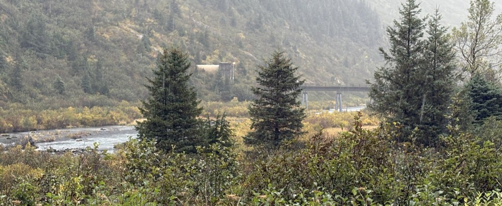
This is the mountain on the opposite side of the Savage River:
And this is the bridge which crosses the river.
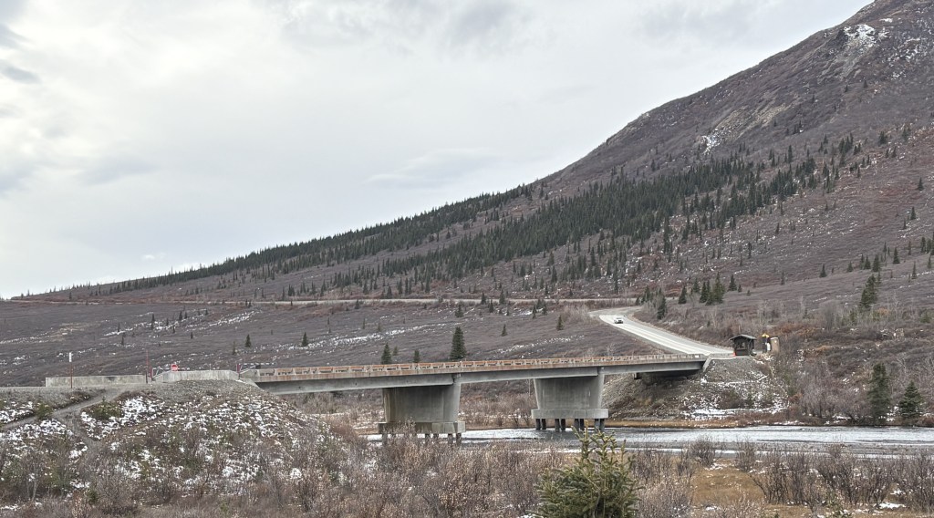
This is me driving over the bridge!
The gate was OPEN and the rangers I had spoken with two weeks ago told me that since the Park buses had stopped running for the season, visitors were allowed to drive in an additional 15 miles on a dirt road, weather permitting. As it turned out, there will be snow coming overnight so today will be the only day I will be able to drive to the “Back 15”.
I will show you those photos tomorrow in the next two posts. There are lots of photos but I have gone through them several times trying to pick the best ones. I will tell you now that I saw NO animals! Based on my discussions with other visitors two weeks ago it sounded like the “Back 15” was the most likely place to see bears, but don’t get your hopes up. While I spent lots of time every day scanning the fields for moose or bears (sometimes with my binoculars), I hardly saw any animals the whole time I was here.
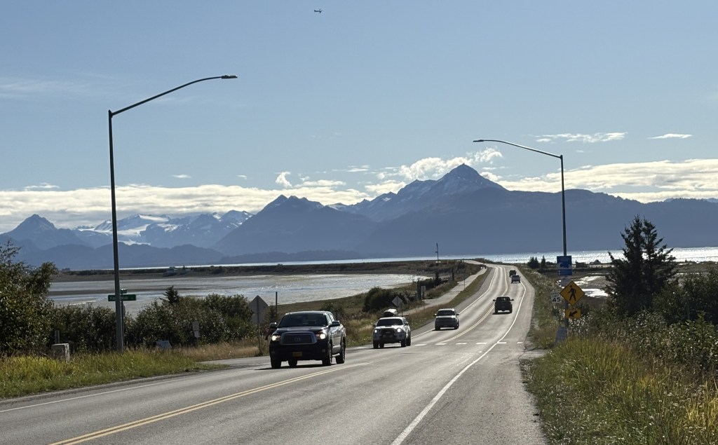
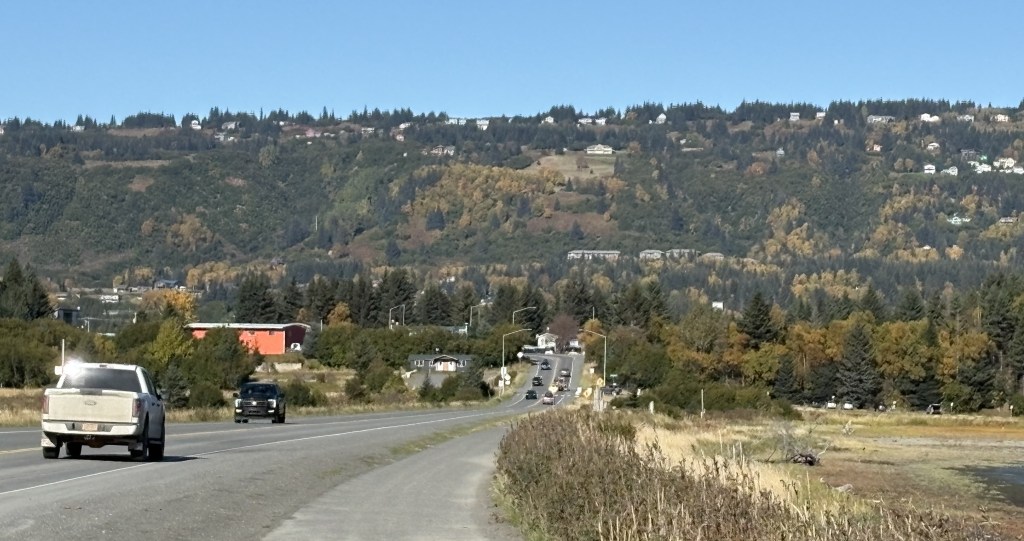
Today I will travel from Homer to Wasilla – northeast of Anchorage. I chose to overshoot Anchorage because I will be driving up to Denali National Park tomorrow and I wanted to shorten that drive.
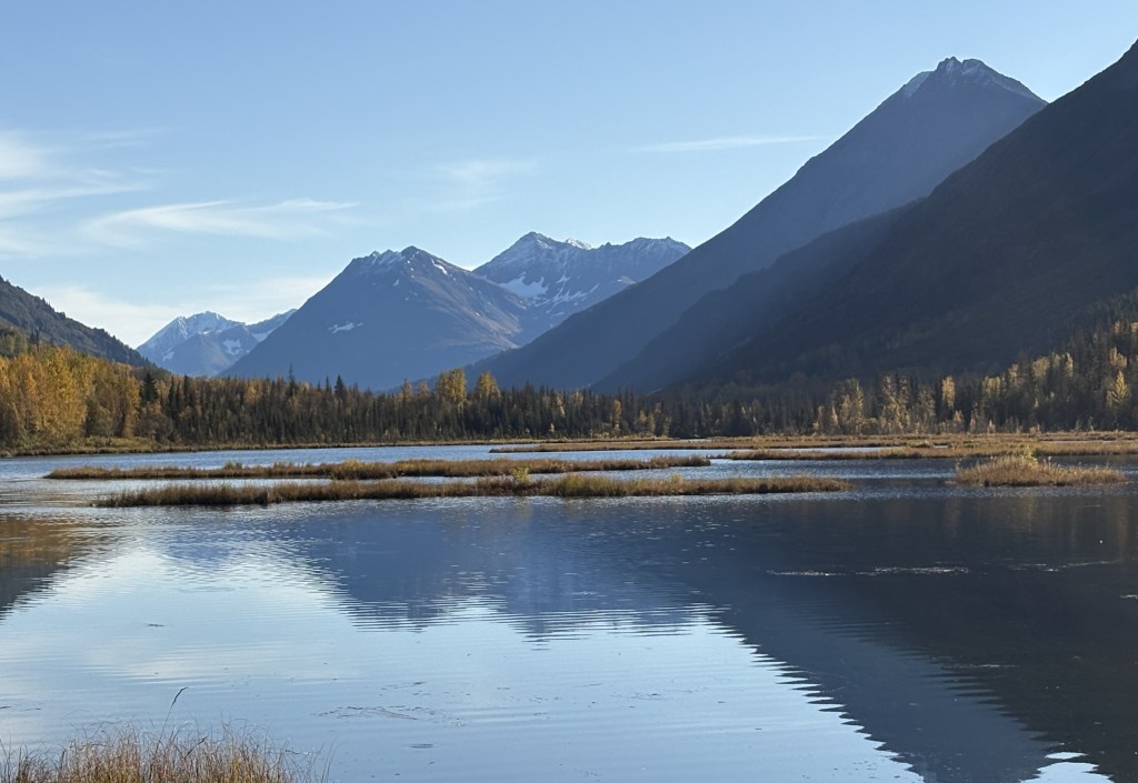
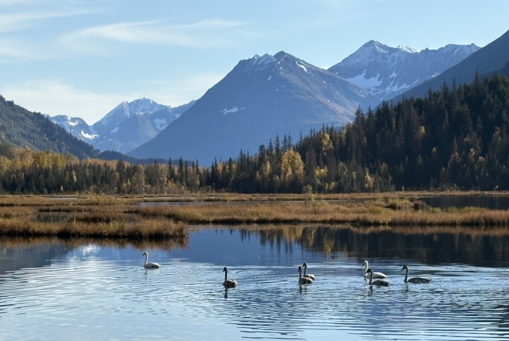
I am going to break up the posts for today into three parts: Homer to Tern Lake (where Hwy 1 meets Hwy 9, which comes up from Seward), Tern Lake to just south of Anchorage, and from that point the rest of the way to Wasilla.
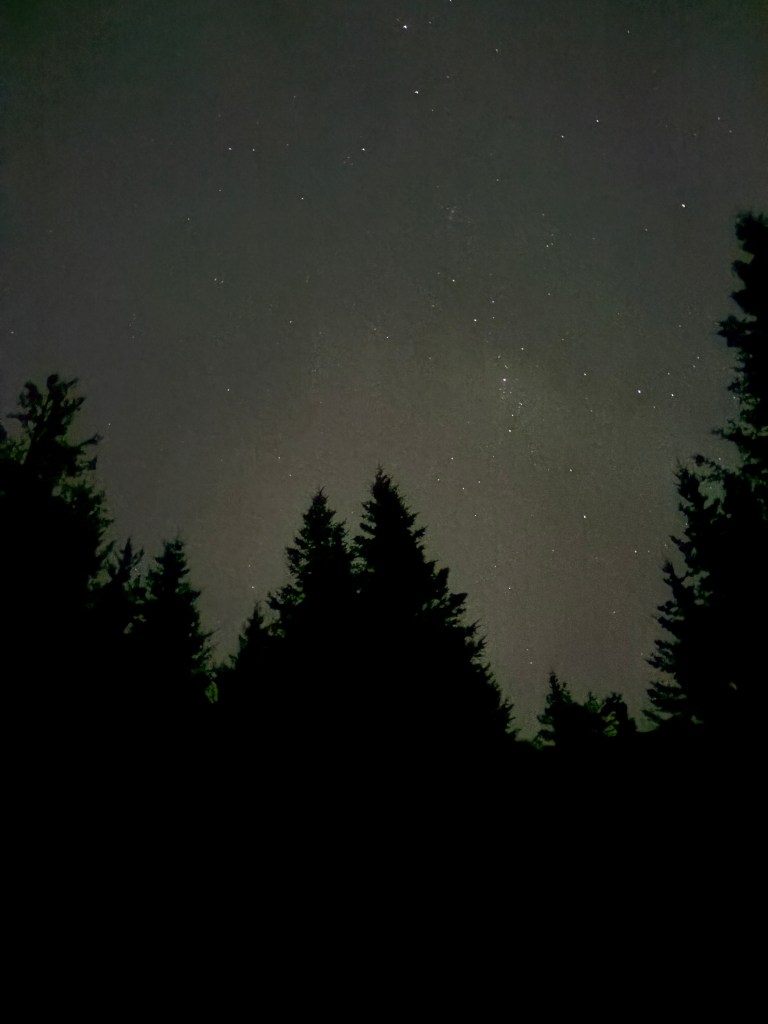
I had missed out on the Northern Lights the first night I spent in Homer. I was awake again shortly after midnight and went outside. This time I used my smartphone camera to look at the sky, as I had been told it is more sensitive to the wavelengths of the Lights and will show things the unaided eye may not see.
Still no luck. Perhaps they showed up later, but at night I try to sleep as much as I can so I didn’t venture out again.
After daylight I drove a “mountain” route of backroads out to the highway because I wanted to try and spot some moose or other animals in more secluded areas where they would more likely be. No luck.
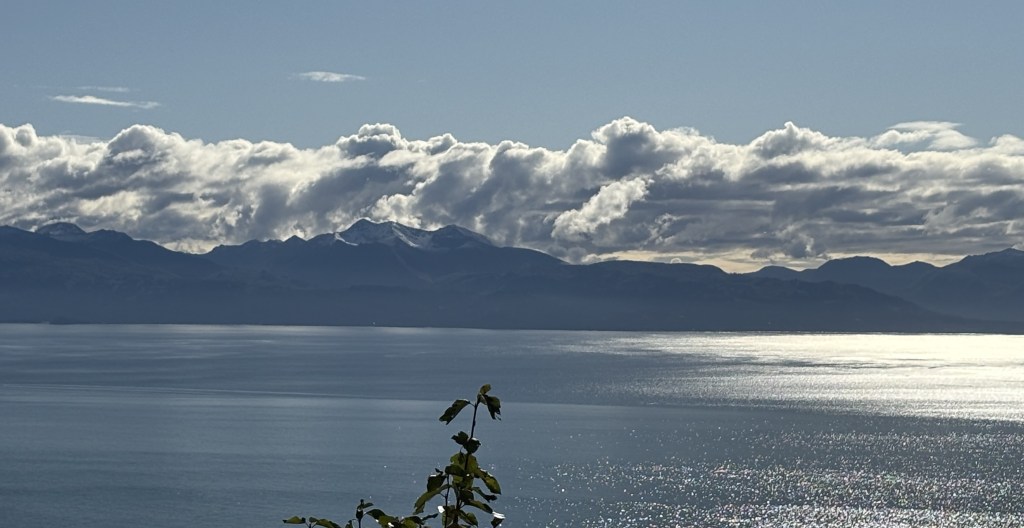
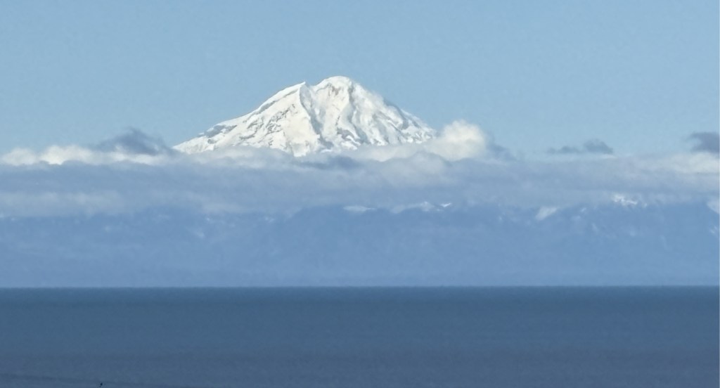
When I got out to the highway I stopped at the viewpoint which had the best view of the two volcanoes over in Lake Clark National Park, on the other side of the Cook Inlet. I have already posted pictures of them but the viewing conditions were a little better, and I had the morning sun rising behind me as I looked west.
This is Mount Iliamna:
And this is Mount Redoubt:
When I got further to where the large moose was located it had indeed shed it’s human-added apparel.
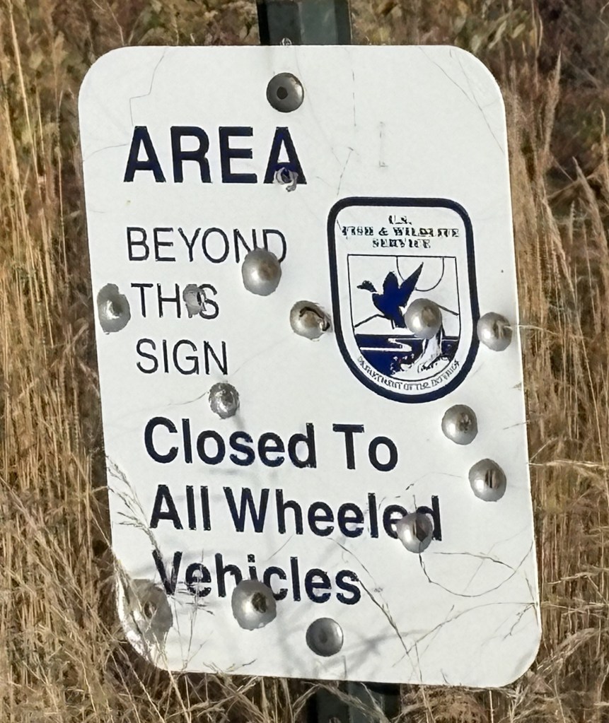
When I got to the Kenai National Wildlife Refuge I saw this sign which some people apparently didn’t agree with.
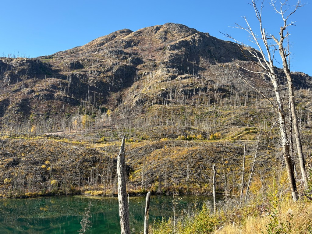
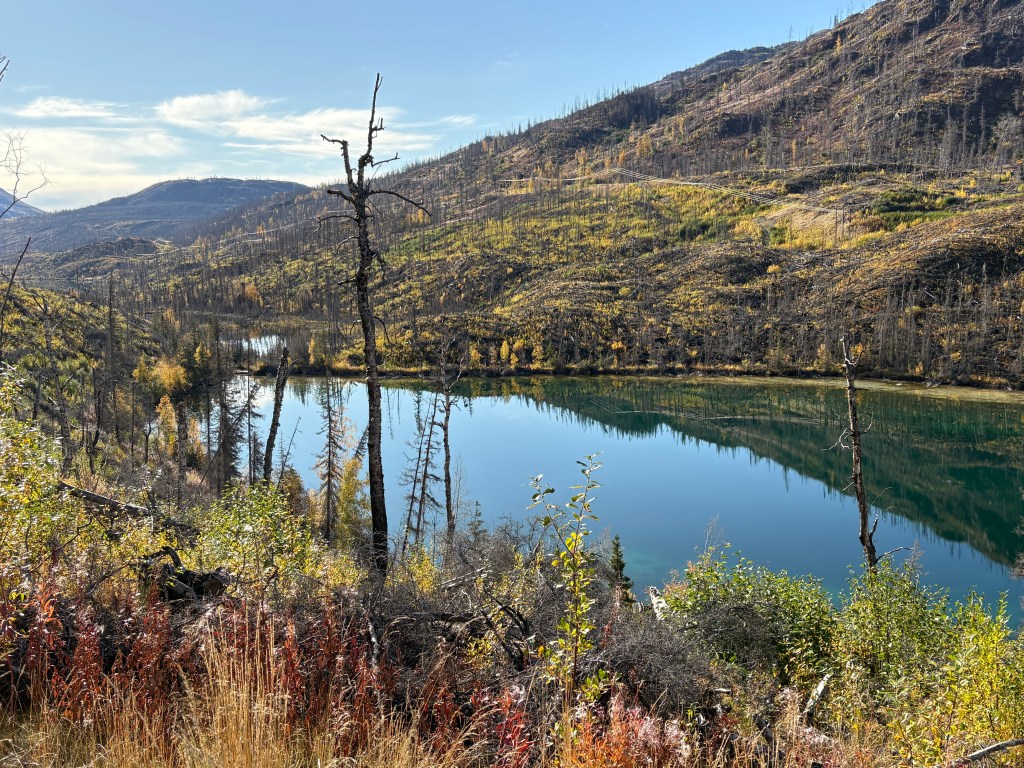
These are from a rest area within the Refuge which show some of the damage a wildfire had done.
I finally got to Tern Lake, which is where the road I was on met the road which had taken me to Seward and Whittier. The photos I posted from the lake previously were plagued by low clouds but today was mostly clear.
It had taken me 3 1/2 hours to get this far and I still had a long ways to go.
I tried posting this yesterday before Part 2 but for some reason it didn’t go through properly.
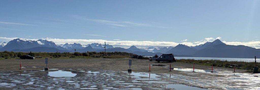
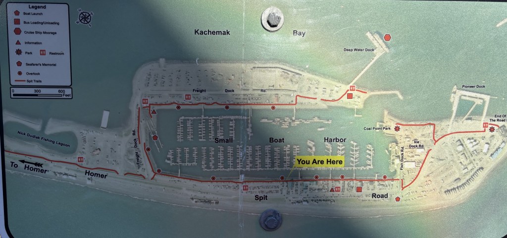
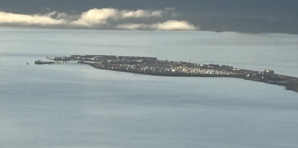
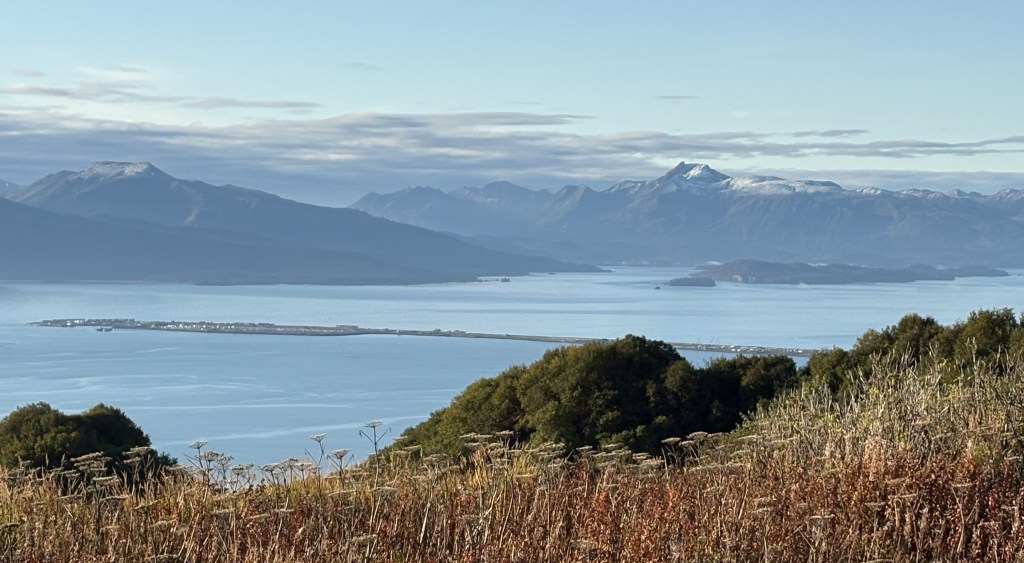
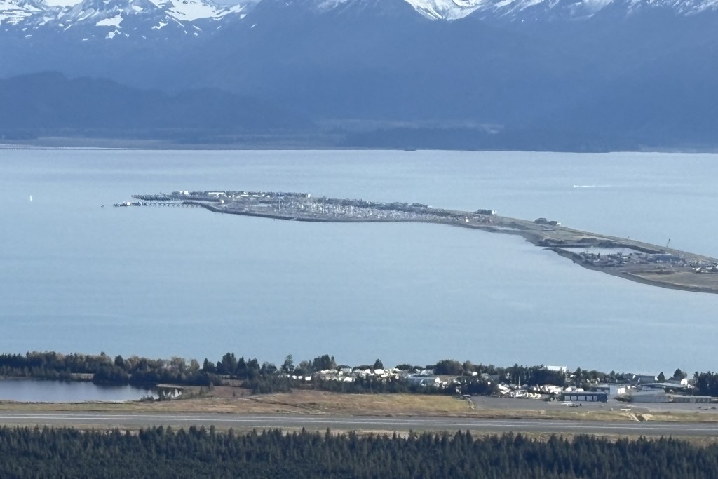
As I explained in a previous post, the Home Spit is a stretch of land that juts out 4 1/2 miles into Kachemak Bay. I drove out there just after noon and these are some of the things I saw.
The first place I stopped was at a large campground. There were only a few vehicles parked there but there wasn’t anyone camping. I was told it gets incredibly busy there in the summer but it is almost October and the people who parked here were probably walking, jogging or bicycling. As you can see, the campground sits just above sea level.
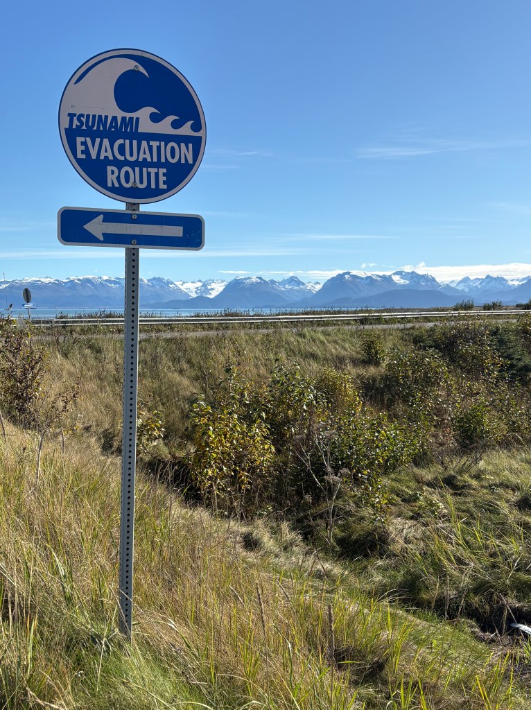
As I drove back up to the road I was not at all surprised to see this sign.
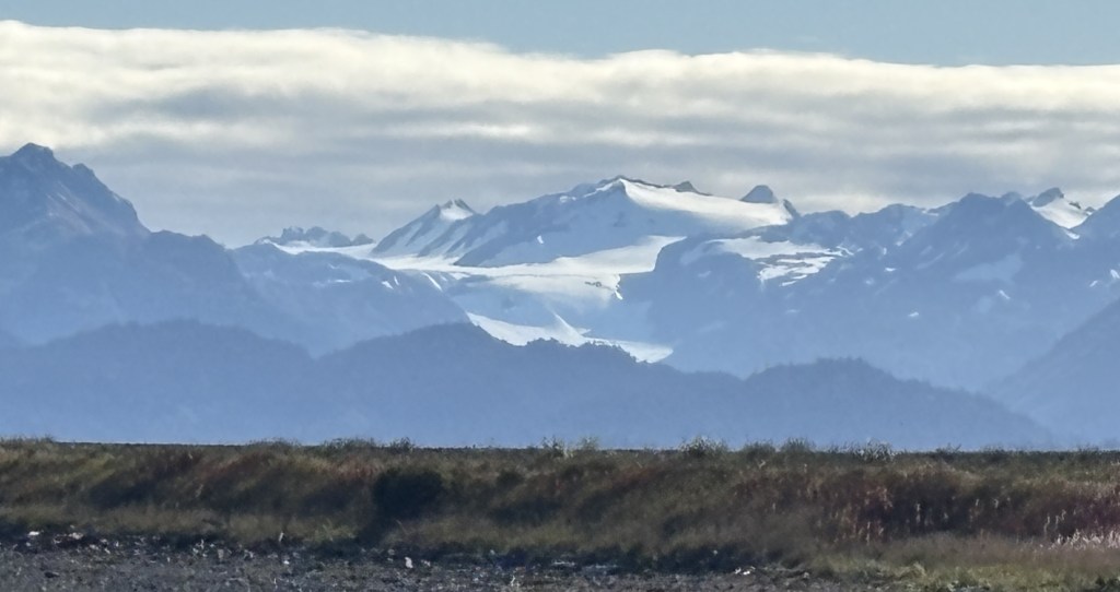
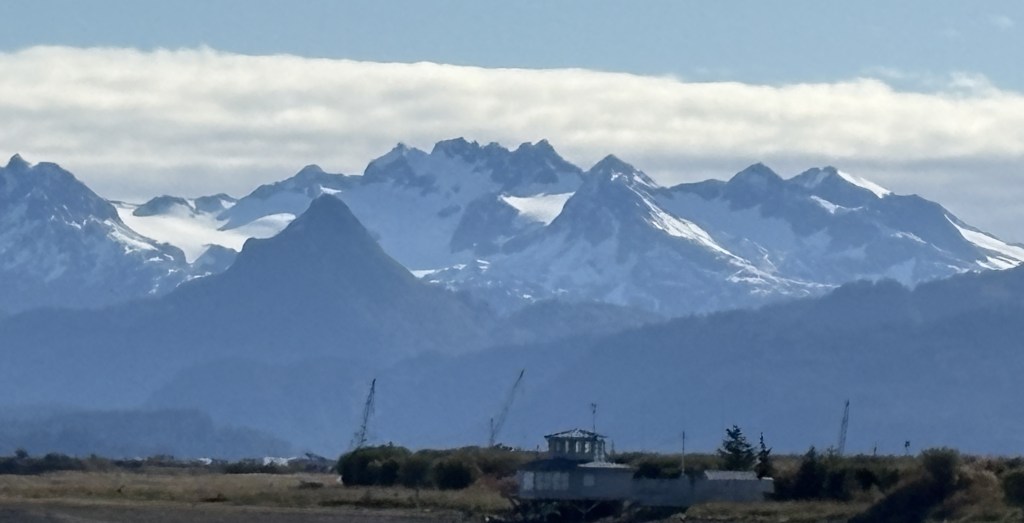
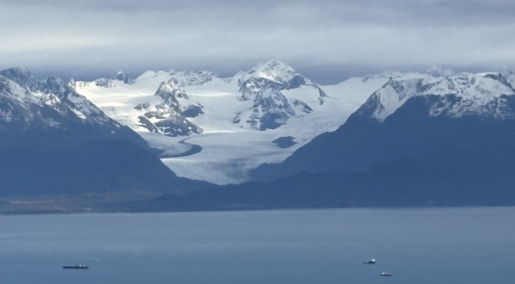
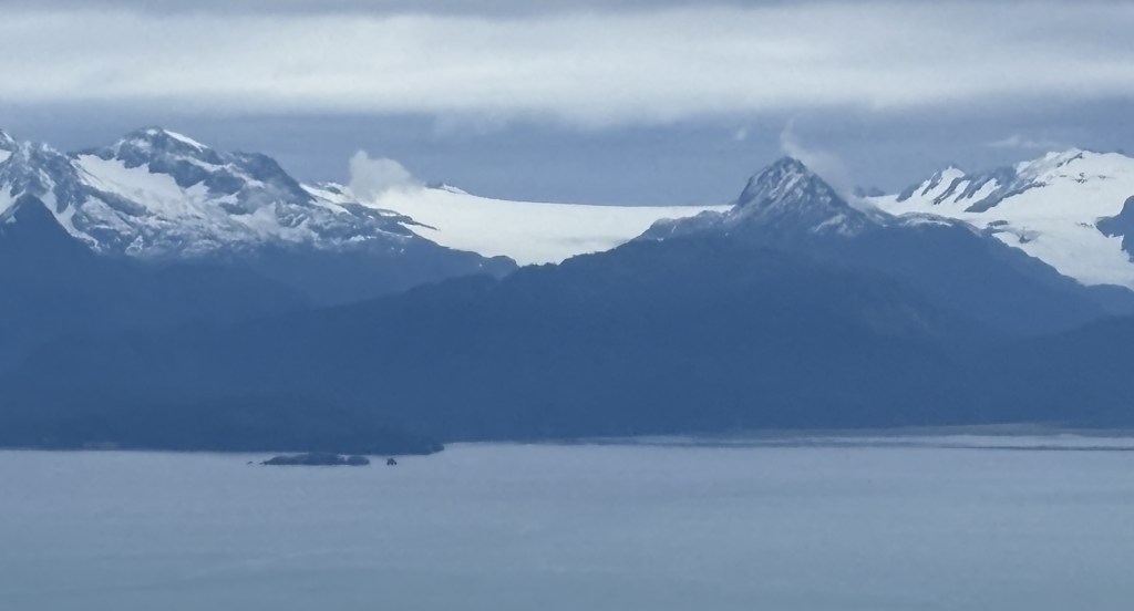
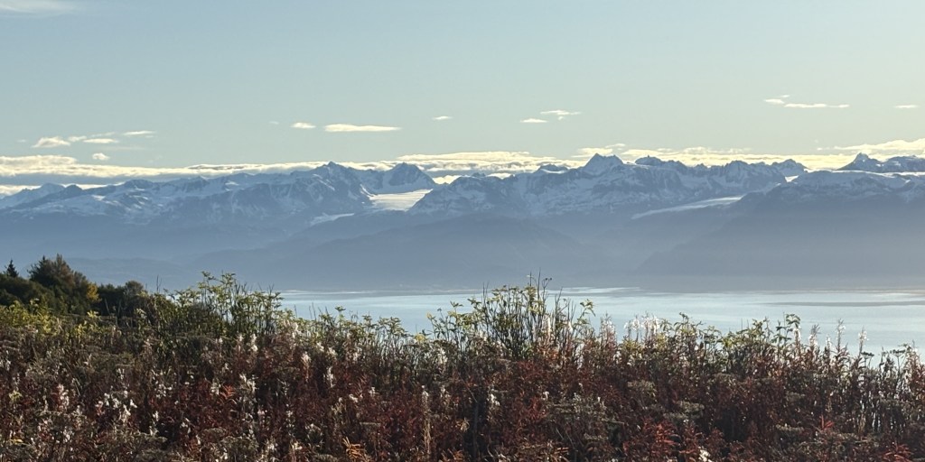
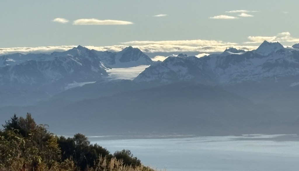
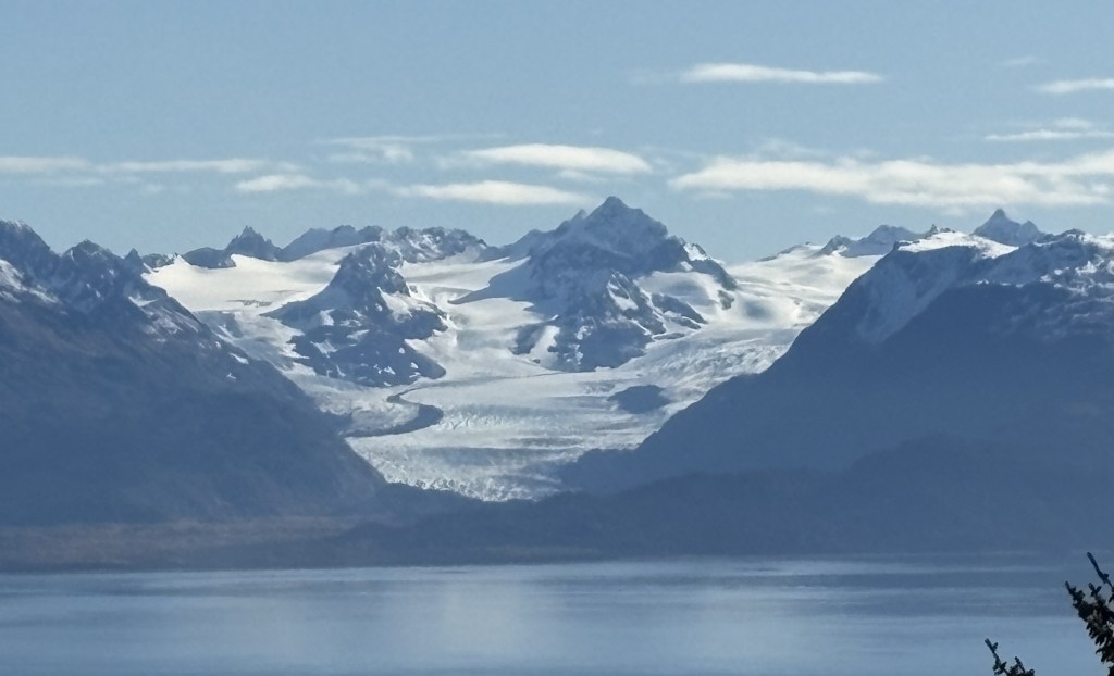
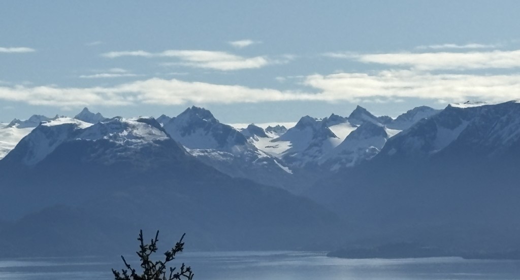
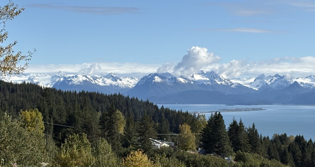
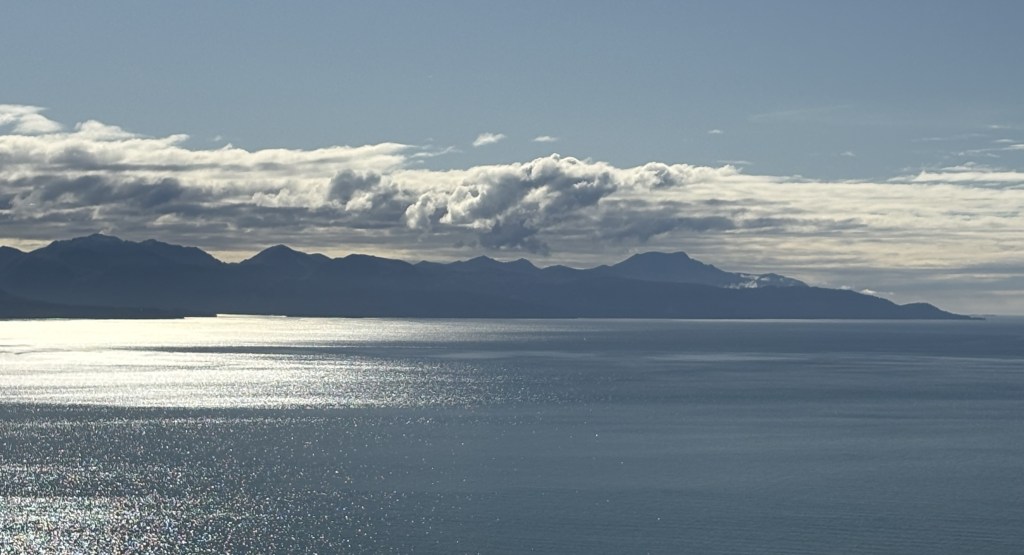
I was closer to the mountains on the far side of the Bay so I had a better look at them, as well as some of the glaciers.
This was looking back at the mainland. You can see that the hill above Homer is fairly high.
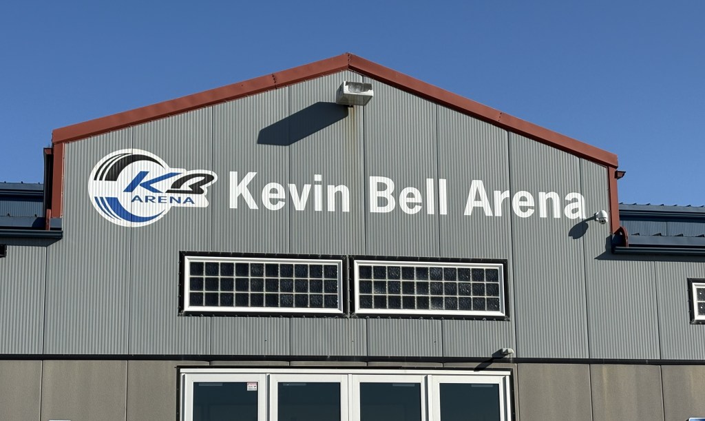
There was a sports arena further out the Spit.
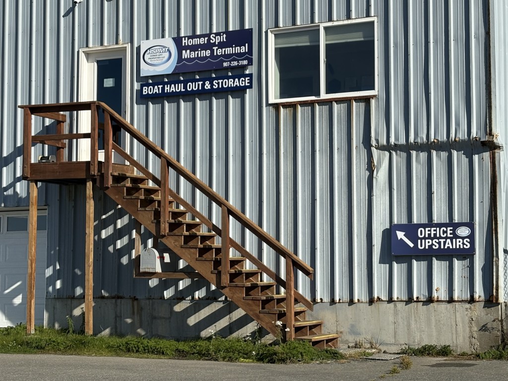
There were also several fishing and marine related businesses and offices.
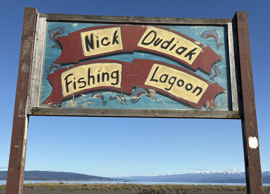
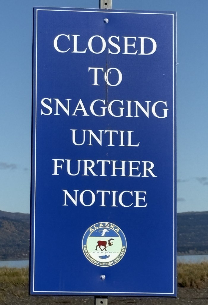
Just before I reached the large harbor I came to this well known fishing hole which I had read about.
I’m not a fisherman but apparently “snagging” is the term for hooking a fish somewhere other than in it’s mouth.
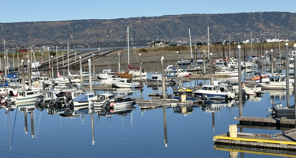
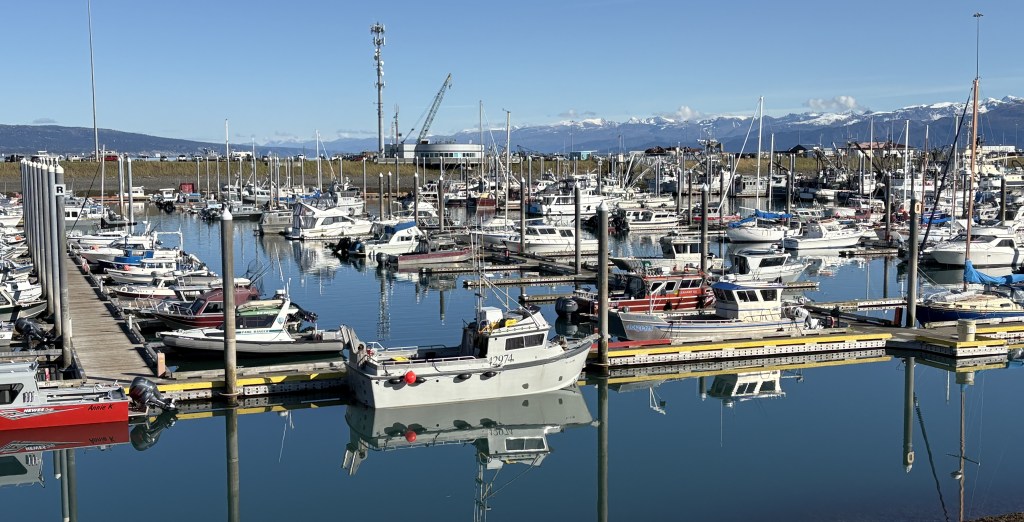
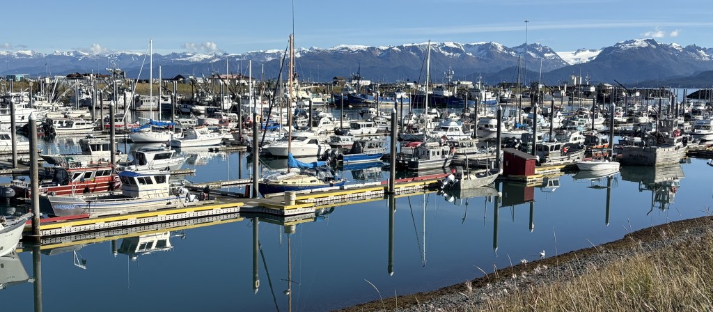
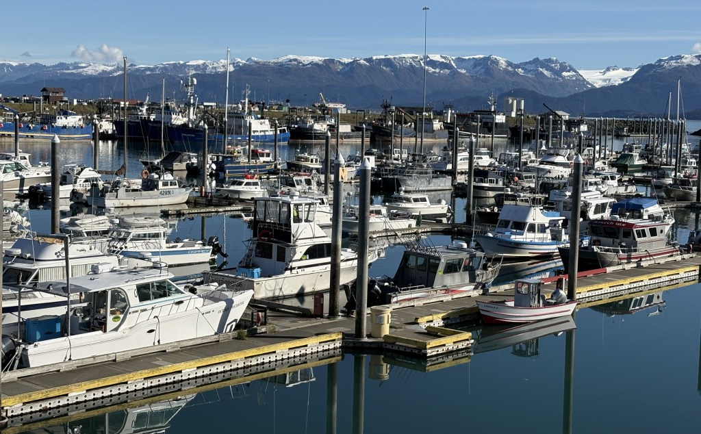
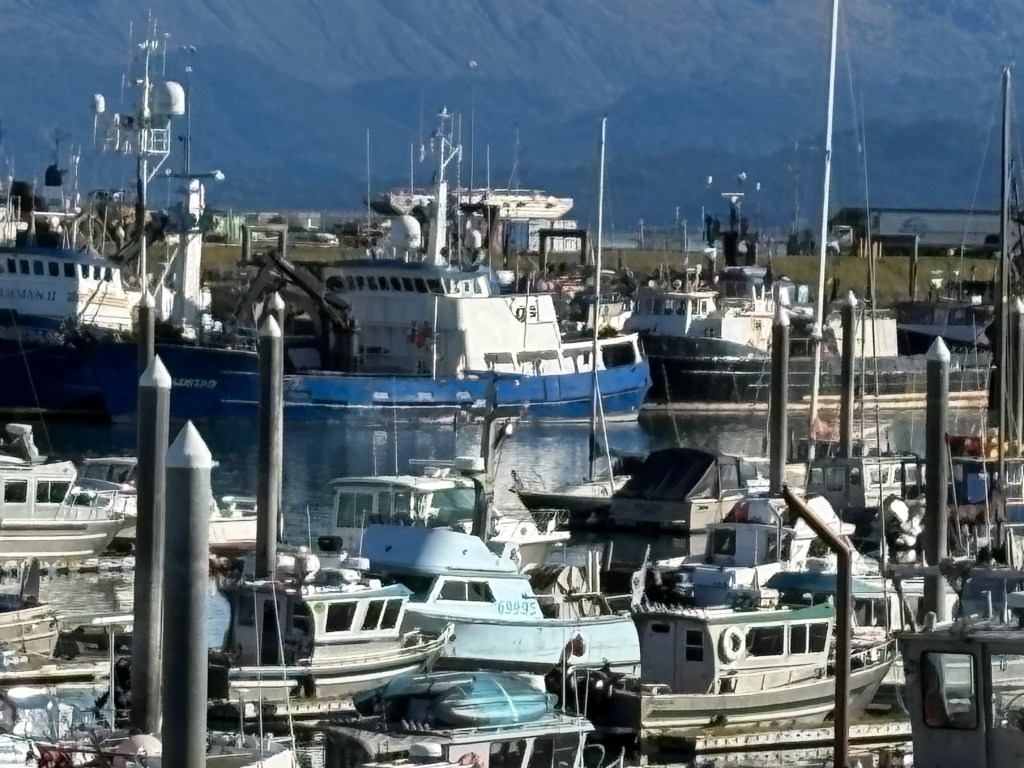
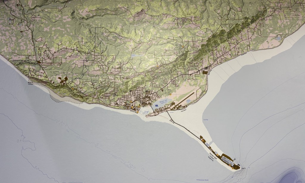
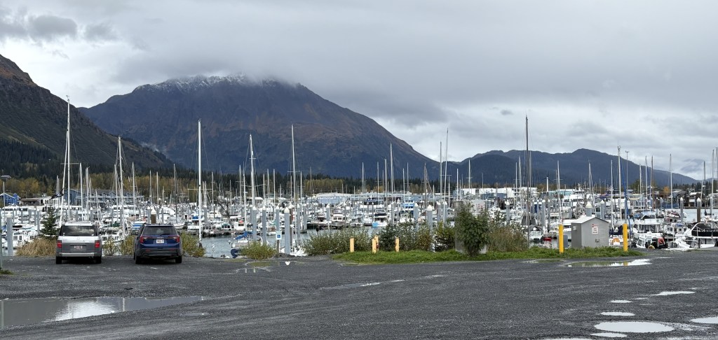
This is the harbor where all the boats in Homer are docked. I had been told to keep an eye out for a ship featured on “The Deadliest Catch” tv show, which is often docked here when not out filming, but I did not see it. The Deep Sea dock (upper right on the map shown below) is where cruise ships dock to load or unload their passengers
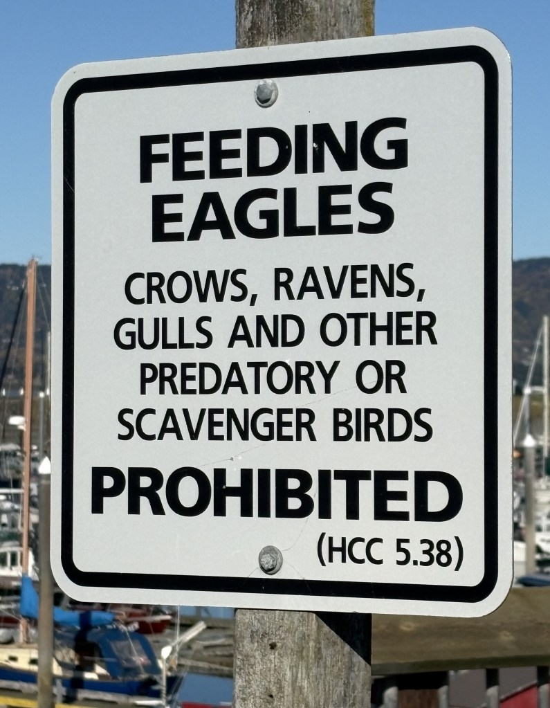
I had read that at one time a local woman attracted quite a following by feeding bald eagles out at the far end of the Spit, but after her passing that practice is no longer allowed.
Beyond the harbor are several restaurants, boat charter businesses (fishing or sightseeing), as well as a variety of shops and art galleries. I will show you some of them in Part 2 of this post. There was also another campground and even some apartment buildings. There is a resort at the far end of the Spit.
The Spit dropped 2 or 3 feet as a result of the 1964 earthquake, centered east of Anchorage, and parts of the Spit now flood at high tide. Newer buildings and walkways are raised up off the ground to protect them from minor flooding.
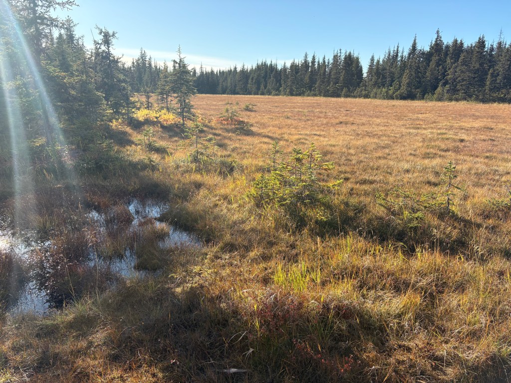
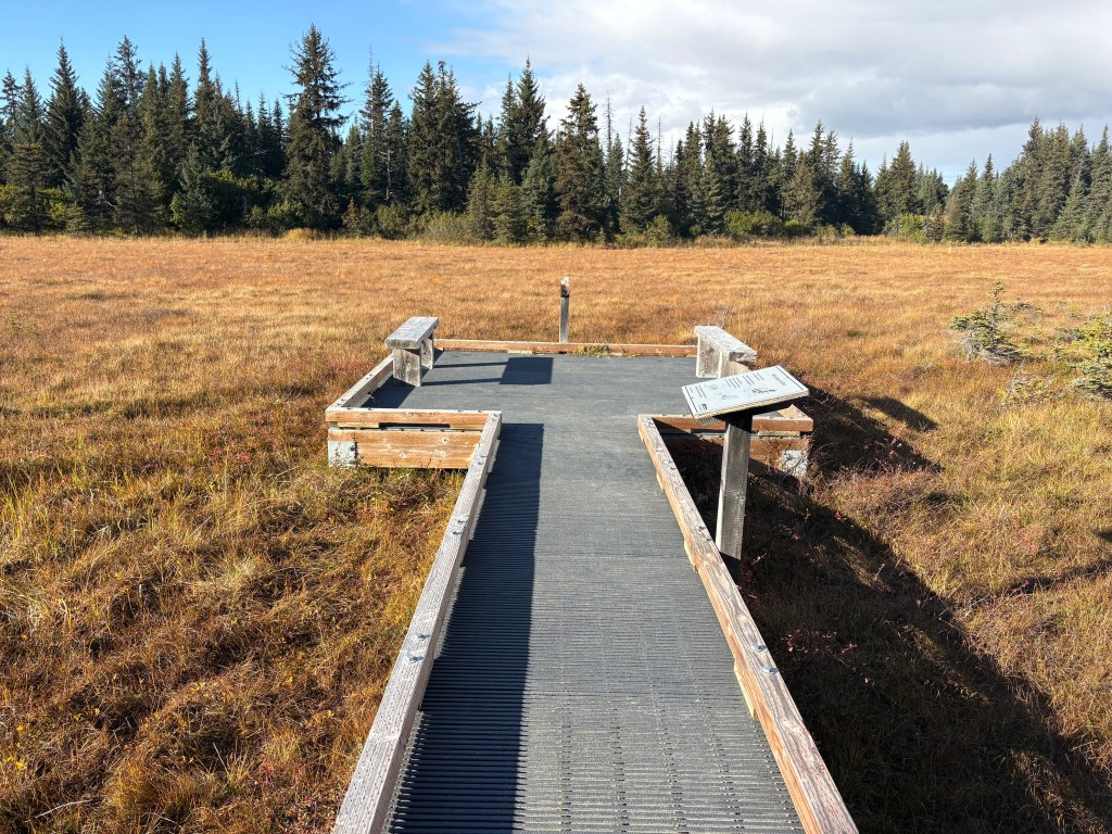
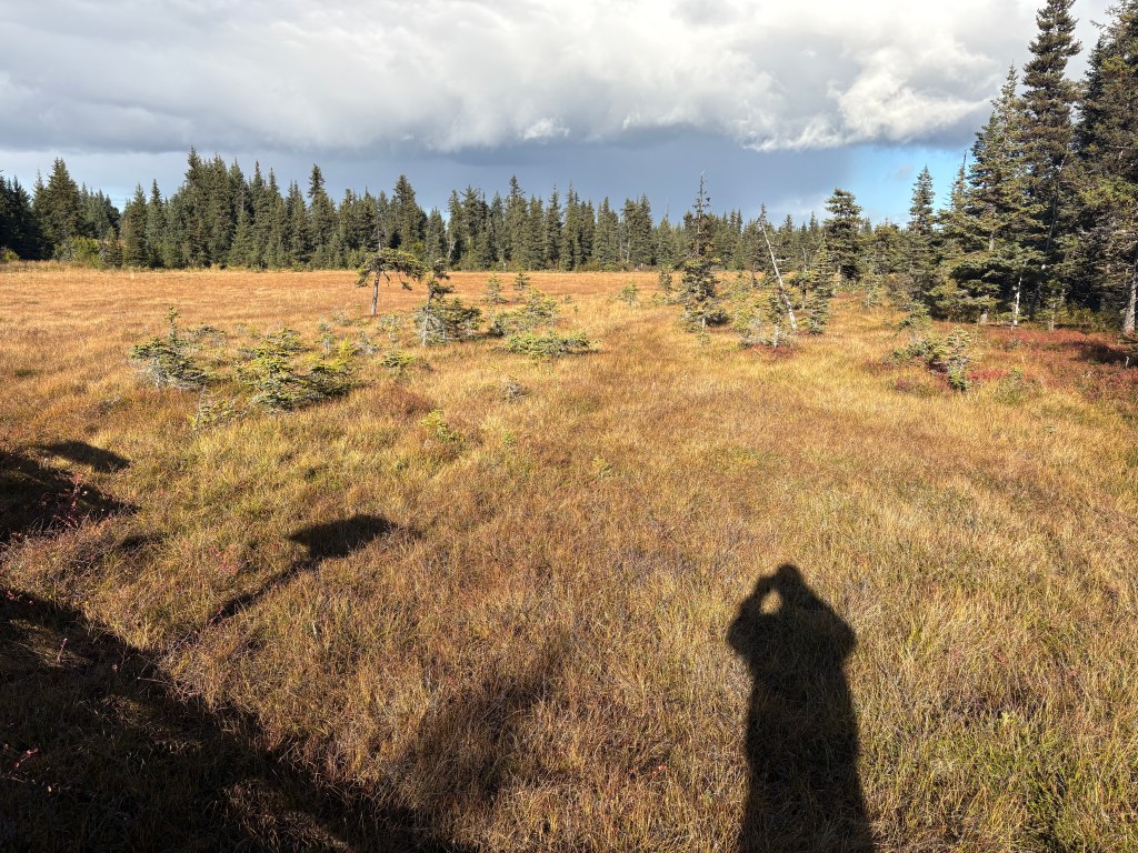
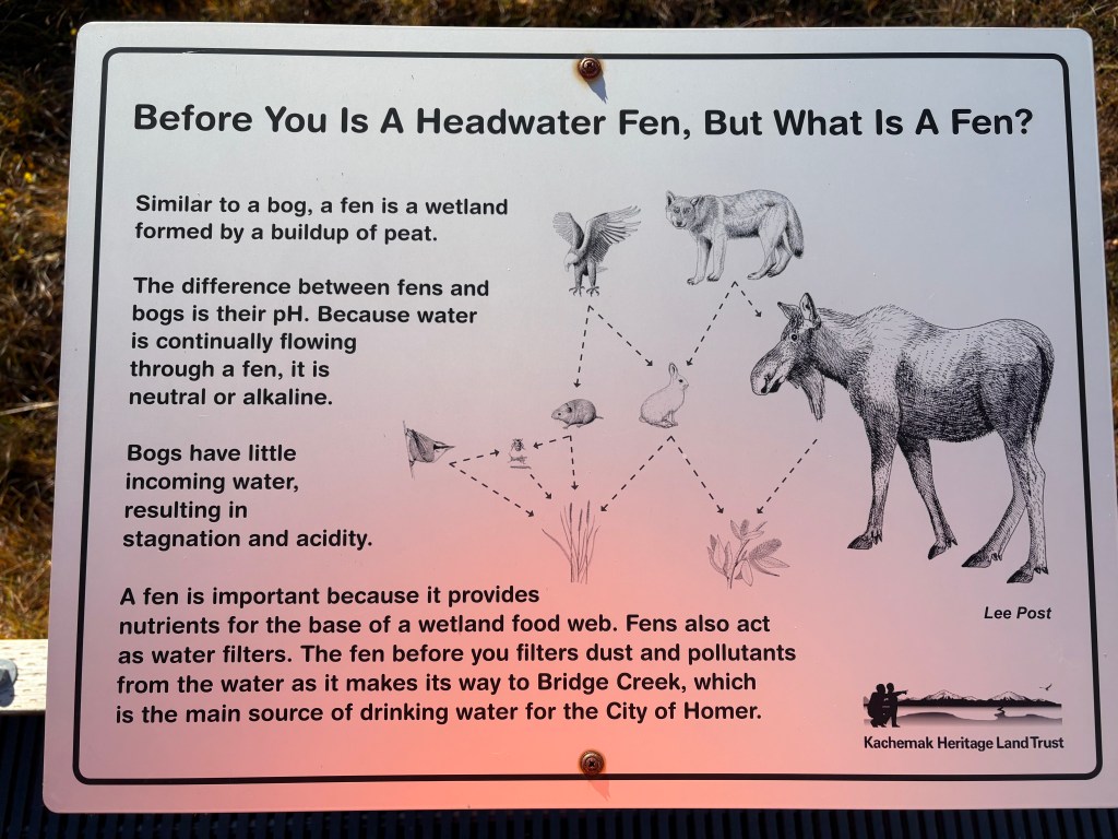
Here are more photos from in and around Homer. First, a few more photos that I actually took yesterday . The first two are a closer look at two of the glaciers which were in the panorama shots I posted yesterday. There are also three from something called a Fen, which was very close to the overlook located high over town. I will include a sign located there which explains what it is.
And here is the Kachemak Headwater Fen, located just a short ways up the road from the viewpoint overlooking the Bay.
I stopped at the Fen several times during my stay in Homer, hoping I might see moose or other animals. I never saw a thing. It was a very peaceful place, though.
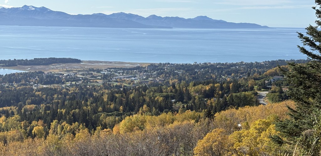
I had arrived on a Sunday and the Visitor Center wasn’t open, although they did have maps located outside and that was how I was able to find the high overlook. I went there first today and took some photos before driving down into town when the Visitor Center opened.
First, a little bit closer look at the far end of Homer Spit, which was now getting the morning sun.
I drove further east on some of the high roads hoping to get a look “around the corner” of the Bay but didn’t have much luck. Trees were blocking the view many places, and when I reached a point where I could go no further I turned around and headed back to the overlook.
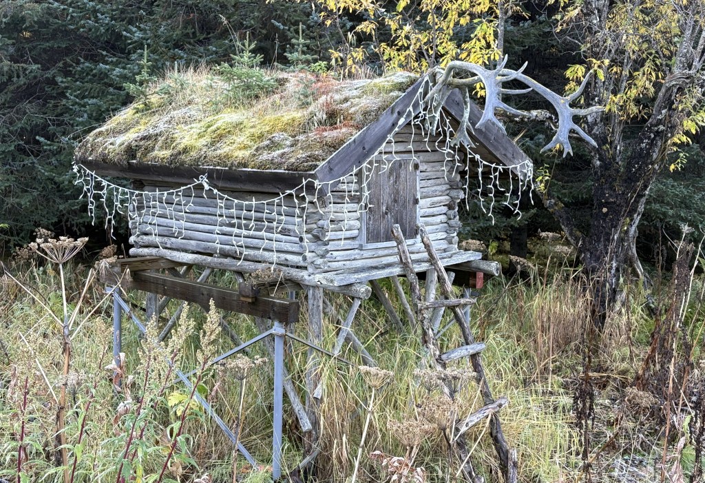
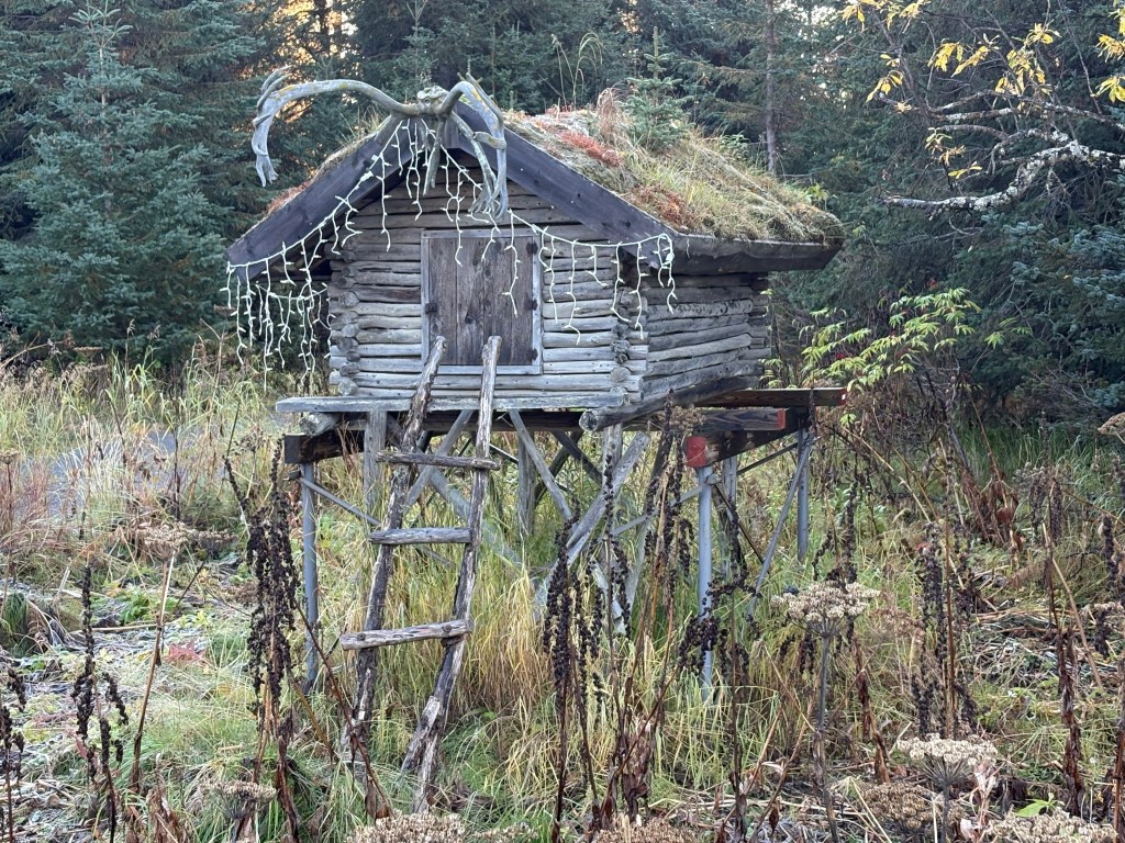
This was a quirky little structure located in front of a house that was for sale. I’m not quite sure what the purpose of it is other than as a landmark to help people find the house, which wasn’t visible from the road.
These were some of the things I saw from further east of the overlook. These were taken just after 9am and the sun was coming up over the mountains to the south.
I drove into town and spent a good bit of time at the Visitor Center. Here is a map of town, and the Spit, from above.
I had gone outside a little after midnight to see if I could spot the Northern Lights. Most of the places I had been so far in Alaska were plagued with cloudy skies (when I arrived in the state I was told it was the “rainy season”). The sky was crystal clear and the stars were amazing. Because I was above town there was no light pollution and I wished I had a telescope. But no Lights.
While I was at the Visitor Center the person there asked me “Oh, did you see the Lights last night?” and I told her no, I had gone out a little after midnight with no luck. She said “Oh, they were at 2 and they were really “dancing””. Terrific.
I drove back to the overlook high above town. It was now just after noon and the sun was pretty high in the sky.
And this is a look at town from above. I never found a central business district. Many of the businesses were along the highway I had come in on.
Homer has a population of around 6,000 people. The town is listed with an elevation of 95 feet. Homer was formed in 1964, the same month as the big earthquake up near Anchorage. The already-close-to-sea-level Spit dropped by 2-3 feet in places and some areas now experience flooding at high tide. Other than the harbor, there wasn’t any severe damage in Homer, and no lives were lost.
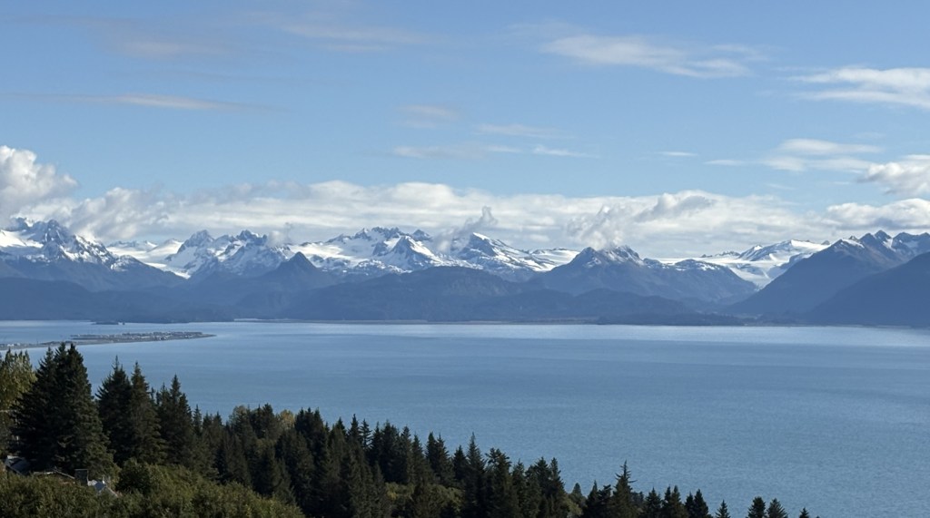
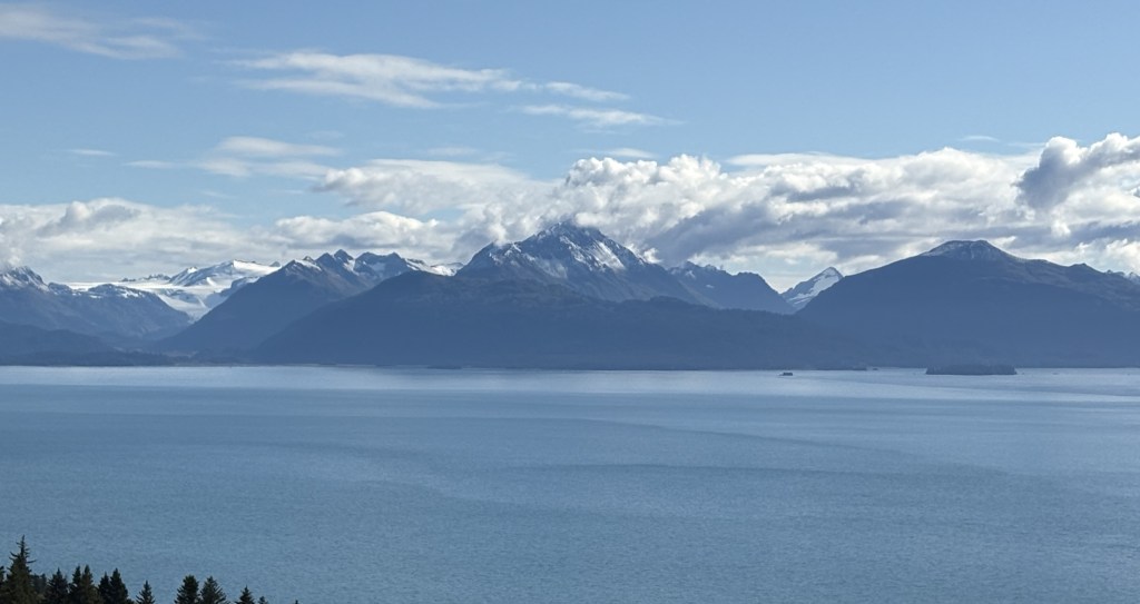
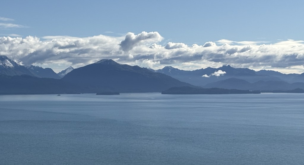
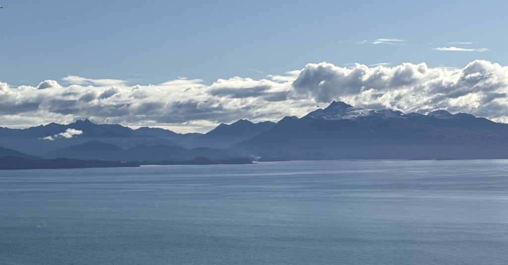
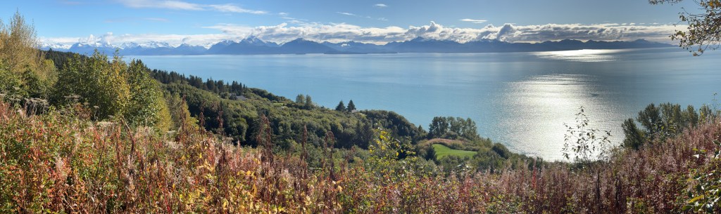
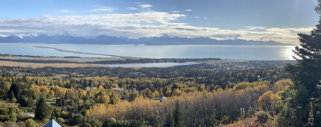
When I finally made it to Homer my first stop was at an overlook just off the highway. It was fairly high on a hill overlooking most of Kachemak Bay. The mountains you will see across the Bay are part of the Kenai Peninsula, on which Homer sits. The Bay wraps around further to the left
The first 7 pictures will form a panorama looking from left to right from this vantage point. I will later find an even higher point from which to view the Bay and there will be similar photos in future posts.
Here is a panoramic shot I took with my phone. It ends up being much smaller than a regular photo.
And here is an experiment. I copied another panorama photo and cropped it into two parts. I am posting them here so I can see how each type of photo appears on the blog.
Those last two were taken from the other viewpoint I mentioned above. It overlooks the town of Homer, and I will be spending quite a bit of time up there.
The land mass which juts out into Kachemak Bay is the Homer Spit. I had never heard the word spit used to describe a geographic feature until I was on Vancouver Island in British Columbia my first week in western Canada. When I stayed in Campbell River that town had a spit which went out into the water.
The Homer Spit goes out about 4 1/2 miles and there are a number of businesses and a large boat harbor out there. I will have photos in a future post.
For now, here is a better photo of it from the high viewpoint.
It is connected to land (without a bridge) and the highway goes out almost all the way to the end, where a resort is located.
After I left the first overlook I drove into town and at one point had this view from the highway.
Those are one (or two) of the glaciers on the far mountains. There will be more photos of them in future posts.
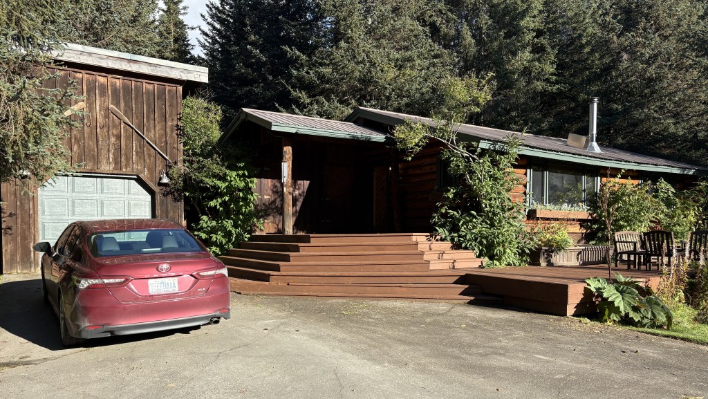
This was my Airbnb while I stayed in Homer. It was high up on a mountain above town, not far from the high viewpoint.
It is a recently renovated cabin and I had the whole place to myself. I called the co-owner as I was leaving Homer to tell him that it was one of the nicest Airbnb’s I had stayed in. He and his brother inherited it from their parents and decided to make some changes to it and list it on Airbnb.
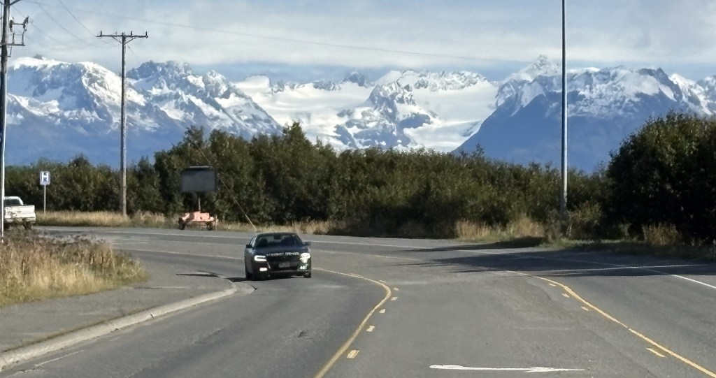
As I continued my drive from Seward to Homer I had now driven out of the mountains and wasn’t expecting to see any more until I got to Homer. There frankly wasn’t much to see, and when I got to the Kenai Wildlife Refuge (in prior post) I discovered that a large part of it had suffered a wildfire, and trees in that area were mostly bare.
I was shocked when further down the road I saw this ahead of me:
I stopped and texted that photo to some family and friends, expressing my surprise at seeing such a large mountain ahead of me. It didn’t dawn on me until almost two hours later exactly what I was seeing.
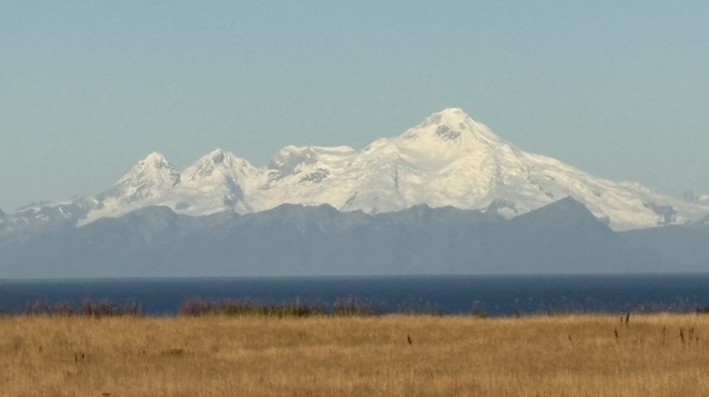
I had failed to grasp the fact that I was driving west for quite a while before turning south. What I was seeing was Mount Redoubt, a volcano, across Cook Inlet and in Lake Clark National Park, on the “mainland” of Alaska (I was now on the Kenai Peninsula). This became clearer as I drove south and could see it, and another large volcano, now on my right and across Cook Inlet.
Once I got closer to Homer there was a pullout where I had a fairly good view.
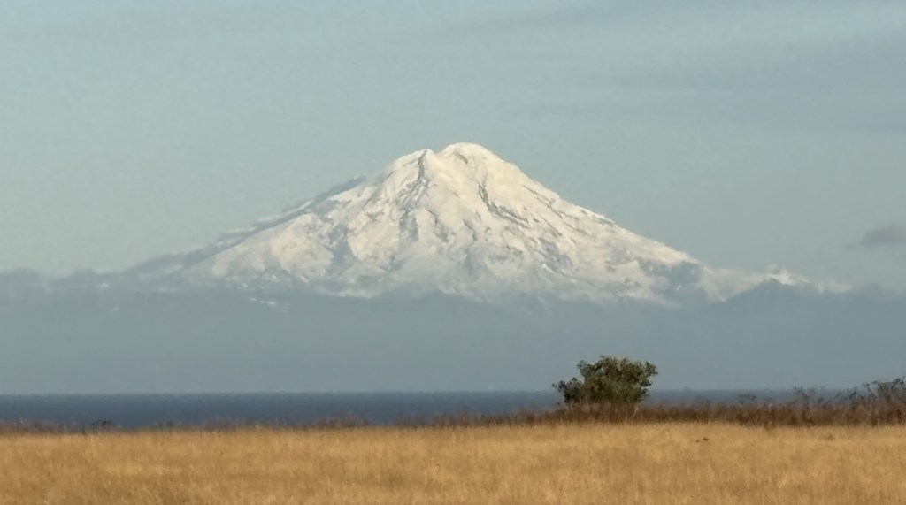
This is another photo of Mount Redoubt, with Cook Inlet in the foreground:
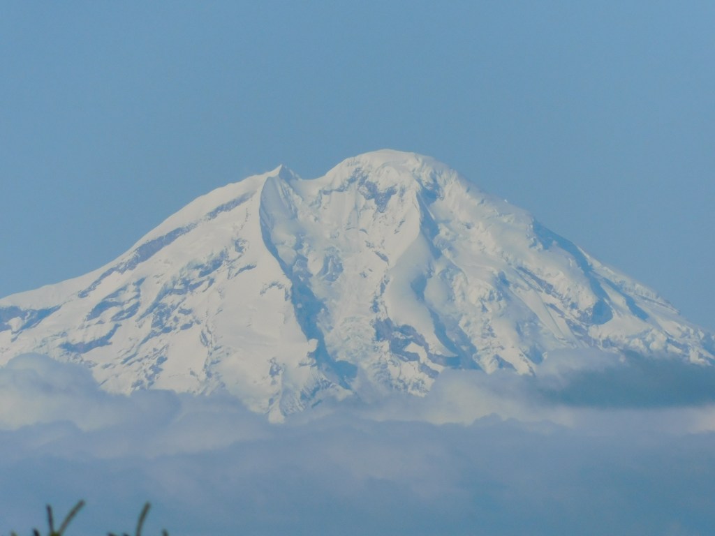
And here is a closeup using the digital camera with a zoom lens:
For some reason my digital camera makes snow look much darker than it is.
Mount Redoubt is 10,197 feet tall and is considered a highly active volcano, even though it wasn’t emitting steam or lava at the moment. The most recent eruption was in 2009.
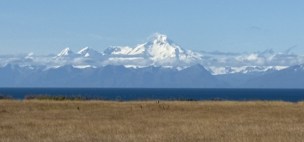
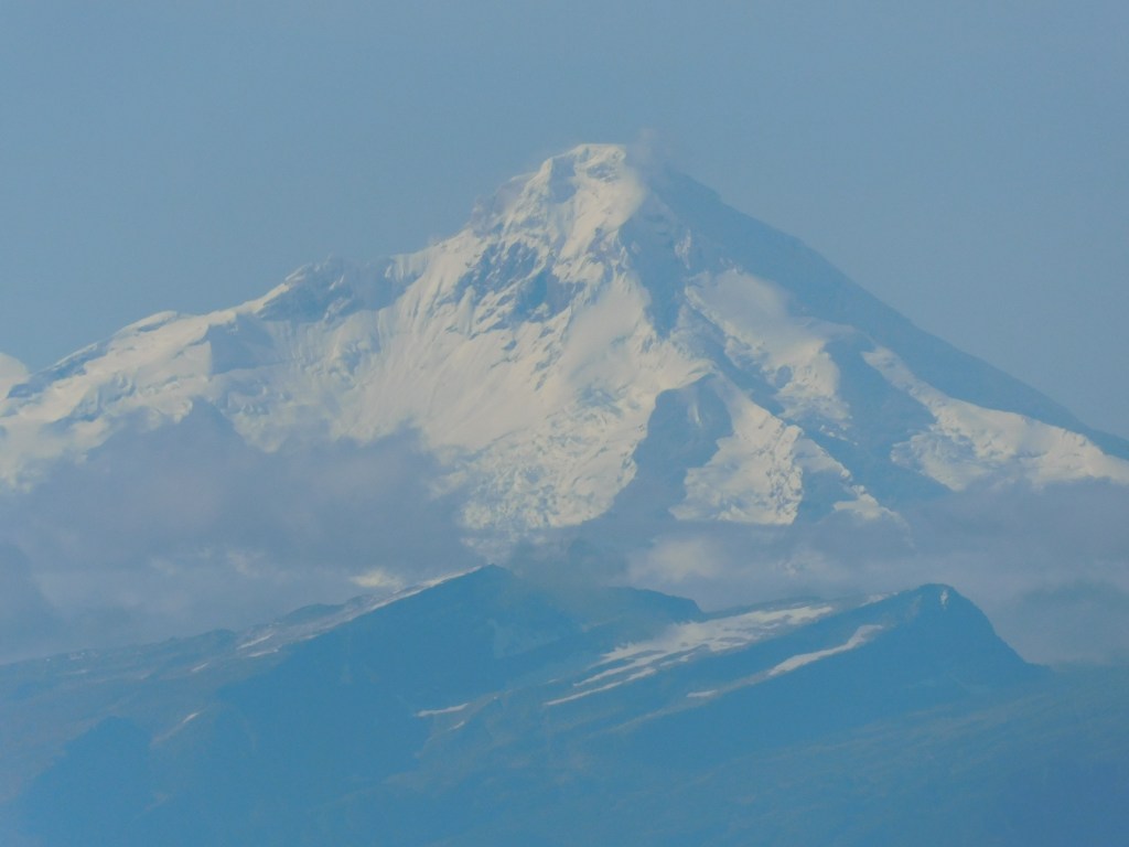
To the south of Mount Redoubt I could also see Mount Iliamna, another active volcano. Again, you can see Cook Inlet beyond the brown grass in the foreground and, like Mount Denali, there is a range of shorter black mountains in front of the higher peaks.
And a closeup of the main peak.
Mount Iliamna is 10,016 feet tall and is much less of a threat for a major eruption.
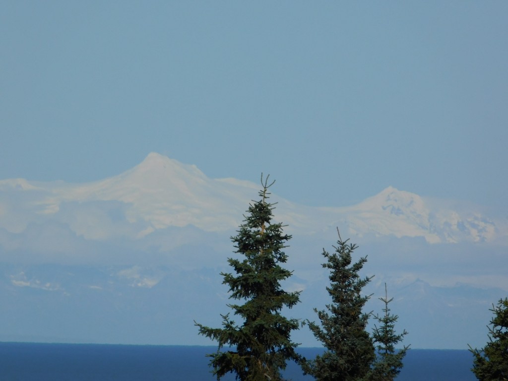
A third mountain I could see to the northwest may be Mount Spurr. It is located 80 miles due west of Anchorage and I was actually concerned about the possibility of it erupting during my trip.
I showed that photo to someone in the Homer Visitor Center and she agreed that it is probably Mount Spurr. When I first arrived in Canada on this trip, and was out on Vancouver Island, there was a tsunami alert issued for coastal British Columbia and the northwest United States after a major earthquake in Russia. I actually altered my plans for the next day on Vancouver Island, though there were no significant waves reported. I did read, however, that Mount Spurr in Alaska showed some signs of life after the earthquake in Russia, although it calmed down a few days later.
Mount Spurr is roughly 80 miles due west of Anchorage. Scientists monitor it very closely as the last time there was even a minor eruption, the volcanic ash caused problems in and around Anchorage.
I will make another post with photos taken after my arrival in Homer.
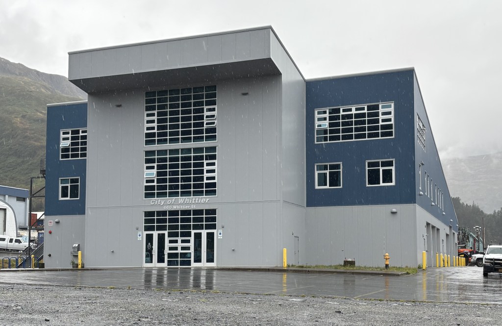
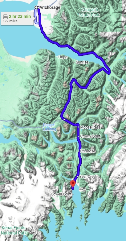
Today’s impromptu trip will take me back up to the southern tip of the Turnagain Arm, where I will once again take the Portage Glacier Road turnoff towards the Begich, Boggs Visitor Center. This time I will travel beyond it to go to the coastal city of Whittier, a town with only one way to get there on land. Not just a road, mind you, but a road through a railroad tunnel. To get there I will have to drive my car through the Anton Anderson Memorial Tunnel which passes through Maynard Mountain – on top of the railroad tracks!
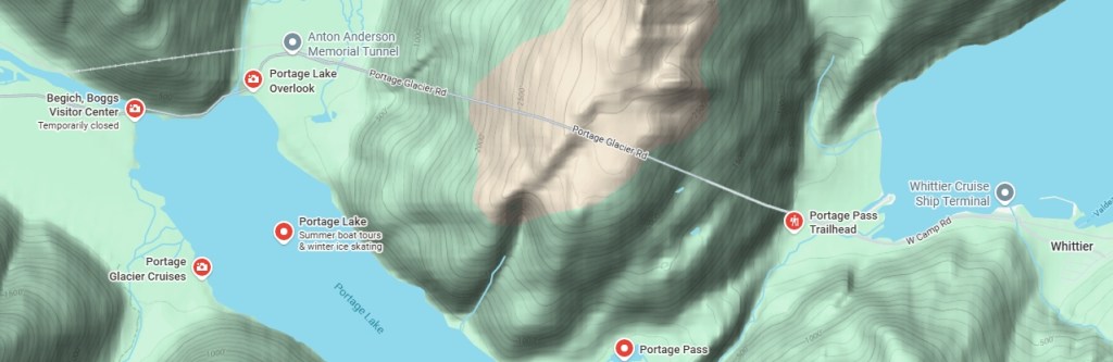
Here is a map of part of the road in from Hwy 1.
(Photo credit: Google Maps)
Yesterday I had driven in as far as the Visitor Center, on the left side of the map. Coming here today I now knew it was closed but would stop there anyway to use the restroom, as I didn’t know how long the wait might be to get through the tunnel. You may be able to see on the map above that the railroad tracks go through another mountain before getting to the tunnel I will be driving through, whereas the road goes around that first mountain.
As you will see in a moment, this is only a one lane tunnel. Train traffic (the Alaska Railroad, with passengers, as well as freight trains) get priority access to the tunnel, then vehicular traffic queues up at each end to wait for the tunnel to open to their direction of travel.
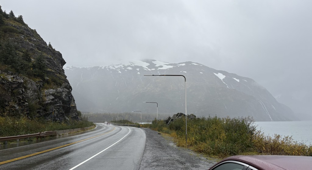
This is the road going around the first mountain to get to the tunnel..
There is a large lake next to the road, and I stopped at an overlook hoping to see the Portage Glacier. It is at the far end in the photo above, and obviously visibility was very poor. The glacier comes right down to the water, but even if it had been a clear day I don’t think I would have been able to see it. I believe there may have been a ship from near the Visitor Center which takes tourists out, but everything was closed for the season.
Before getting back in my car I spotted the railroad tracks coming out of the first mountain on my left.
The road continued up to the toll booth and there were then multiple lanes where vehicles line up, by type, to wait for the eastbound vehicular traffic to be allowed through the tunnel. I paid the $13 one-way toll. The green light was on so I was told I could proceed directly to the tunnel.
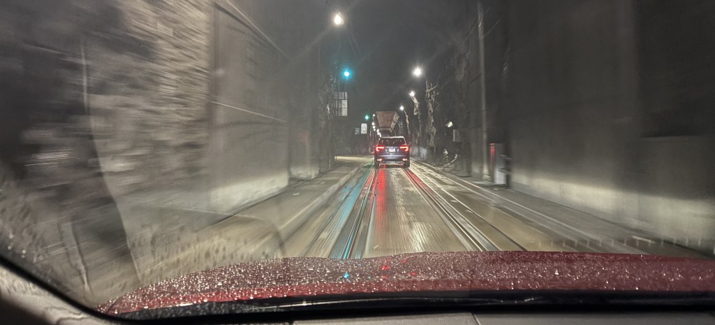
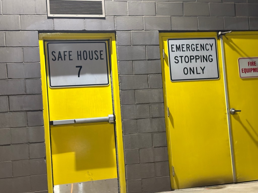
Above is the view I had driving in the tunnel. Yes, I had to take the photo while I was moving, but the speed limit was only 25 mph and I was very careful. Other people have posted videos on YouTube.
The tunnel is 2.7 miles long, the longest in the US. There are 8 Safe Houses, one every 1,600 feet, within the mountain in case there is a stoppage, earthquake, or other calamity which would force traffic to stop. Each Safe House can hold up to 55 people and has amenities to accommodate them for a period of time.
The tunnel was originally built in the 1940’s for the military. Whittier was originally designed as an Army port, to allow military supplies to come in by ship and then be transported upstate by rail. The tunnel was converted to dual use in 2000, allowing vehicular traffic to share the tunnel with trains.
Whittier is still mainly a port city, but it also hosts cruise ships and obviously attracts a tourist following. As you will see in the next post, there are some places which offer lodging to overnight guests.
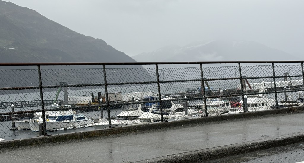
When I got through the tunnel I saw a small harbor to the left of the road, and it is where the cruise ship dock is located. There is a larger harbor closer to town.
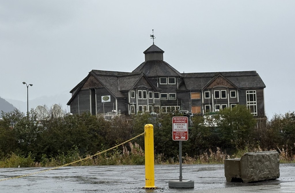
The first building I saw when I got to town was the Inn at Whittier.
Because some of the windows were boarded up I assumed it was abandoned but I have since learned that the restaurant and lounge are sometimes open but the hotel rooms remain closed. Even the restaurant may have been closed now that cruise ships were done for the season. Whittier was basically a ghost town while I was here, but then again it was cold and raining heavily at times so people wouldn’t have been inclined to be out wandering around. I pretty much stayed in my car and positioned it so I could take pictures out the windows.
Whittier lost many structures in the 1964 earthquake. I read that most wooden structures (the original Army barracks and support structures) were then burned and rebuilt. The Inn was probably built new after the earthquake, but I don’t know why it has fallen into such a state of disrepair.
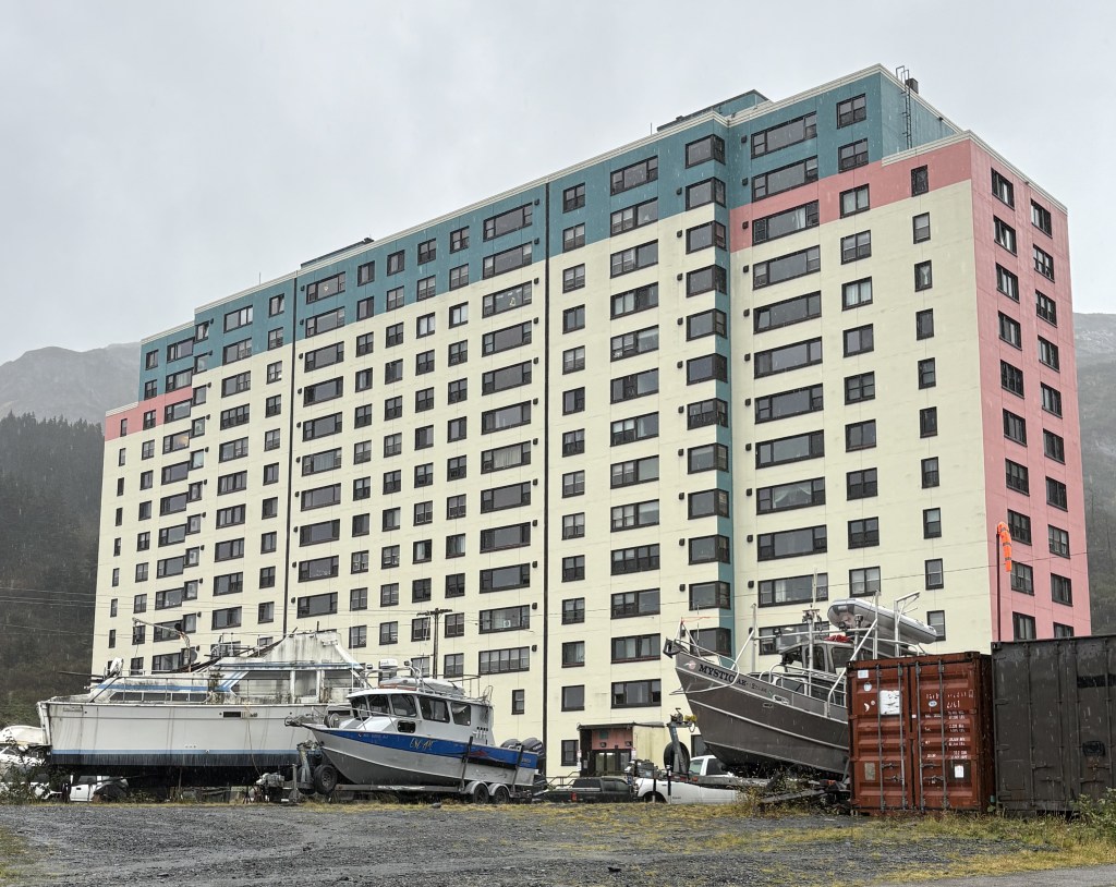
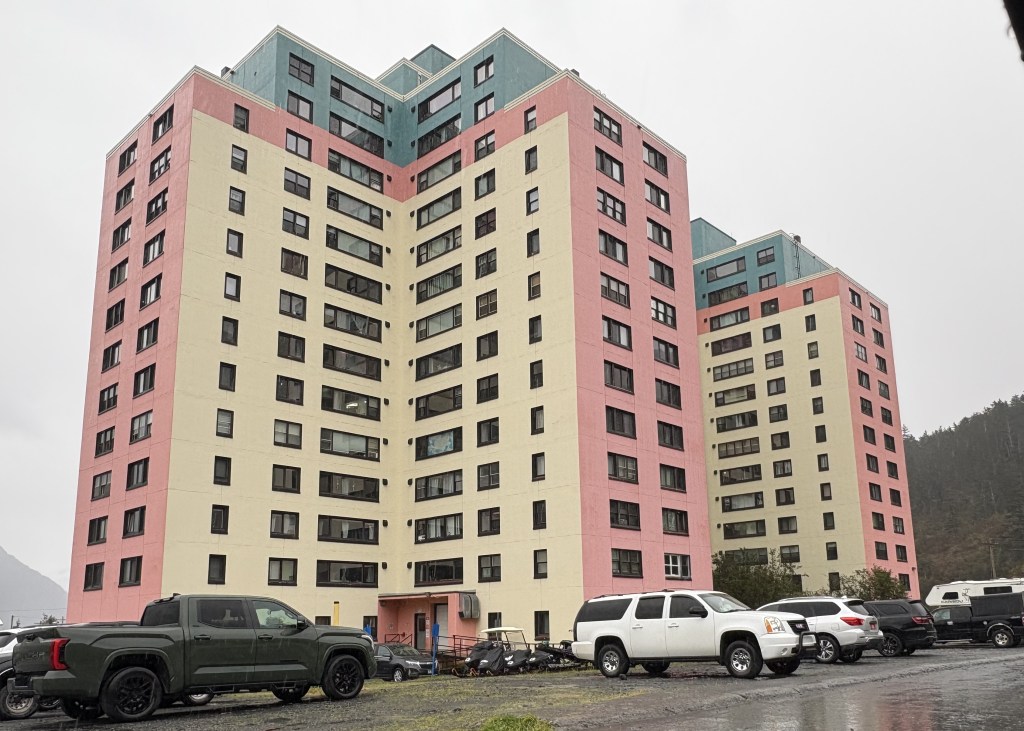
There is another building that Whittier is perhaps best known for. Begich Towers:
It is 14-stories tall and is made up of of 3 connected towers. Probably 99 percent of the people who live and work in Whittier live in this building. It was built in 1957 for the military and was renamed and converted to condos in 1972. It is essentially self-contained, with a grocery store, bank, etc. inside. There is a small school behind it with access by an underground tunnel.
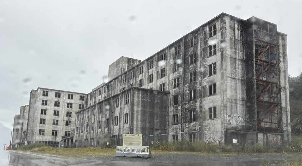
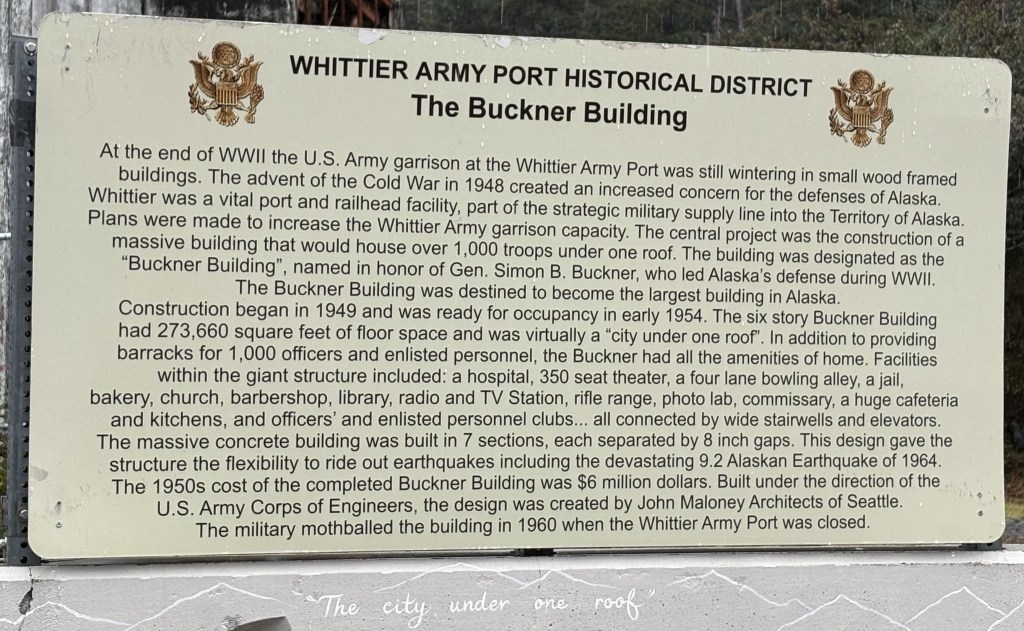
There is another concrete building in town which was built for the military. It is only 6-stories tall, and is called the Buckner Building. It was first occupied in 1954 but closed in 1960, soon after the taller building was built and when the Army presence ended. It gave Whittier the nickname “The city under one roof.”
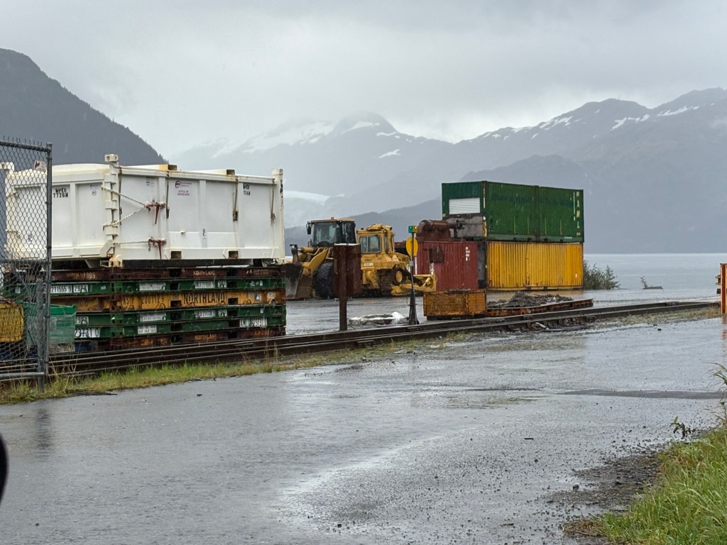
Even without the Army, Whittier is an active port and there were shipping crates stacked everywhere. That and fishing are probably the two main things that people who reside here do for a living. There were many fishing and pleasure craft both in the water and parked on trailers on land. There were some small businesses that cater to tourists, but they were closed for the season.
Here are some of the things I saw as I drove around the small town of Whittier.
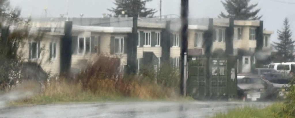
That is a small residential building. I guess it accommodates overflow from the big tower, or provides housing for port workers.
After studying the materials I picked up at the Seward Visitor Center when I arrived yesterday, I discovered that there was another part of town I hadn’t seen yet. I thought I might go to the Aquarium, and on the map it was a few blocks south of where I had been yesterday. The person I spoke with had verified that they opened at 10am and that was when I arrived – to find it locked, with a sign indicating that it opened at noon!
I made a command decision to go on a road trip to a place I had hoped I might have stopped at on the way down from Anchorage yesterday, but with the poor visibility I passed it by. I stayed in Seward for about an hour and then headed off on my new plan.
(Photo credit: Google Maps)
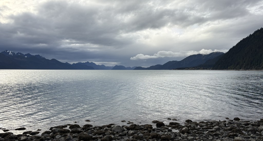
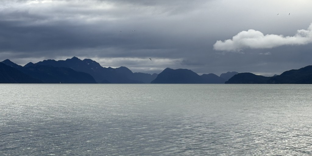
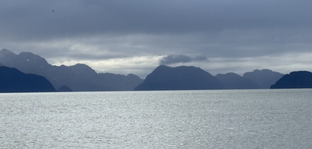
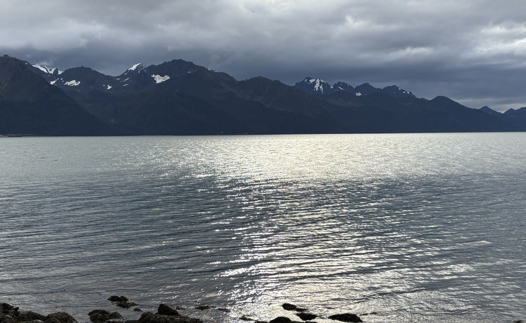
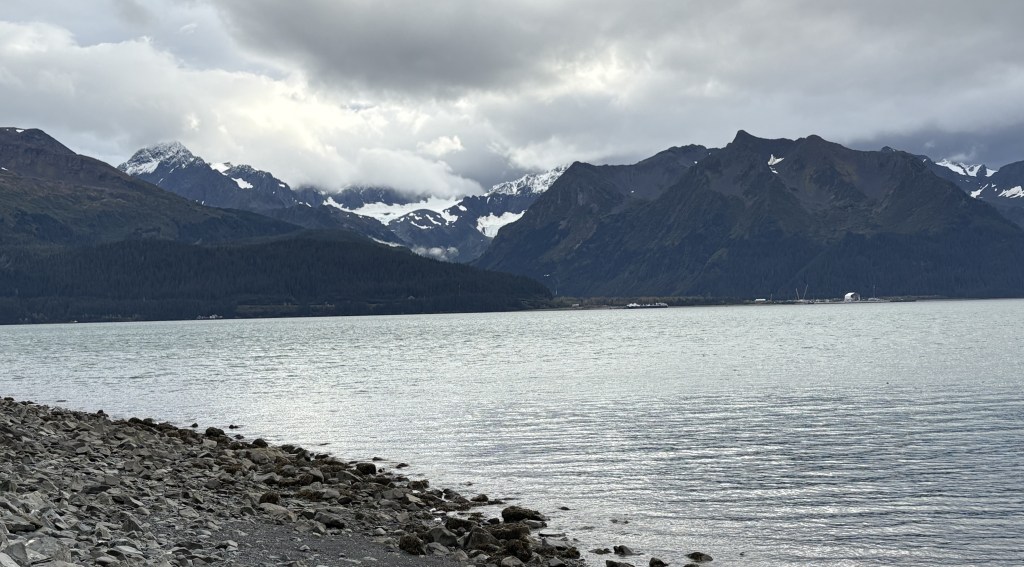
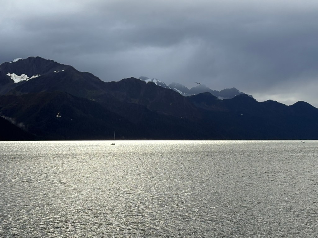
This is the view looking south at Resurrection Bay from the southernmost part of Seward.
That is a wide view. Here are two shots zoomed in a bit:
It looks like it is closed in by mountains. This is why I reposted the map showing my route down from Anchorage. As you can see at the bottom of the map above, there is a large opening out to the Pacific Ocean, but from town the view is looking southeast so some of the land masses you see are islands beyond the east side of the opening, and you can also see “mainland” mountains on either side of the Bay which close in a bit as they approach the opening.
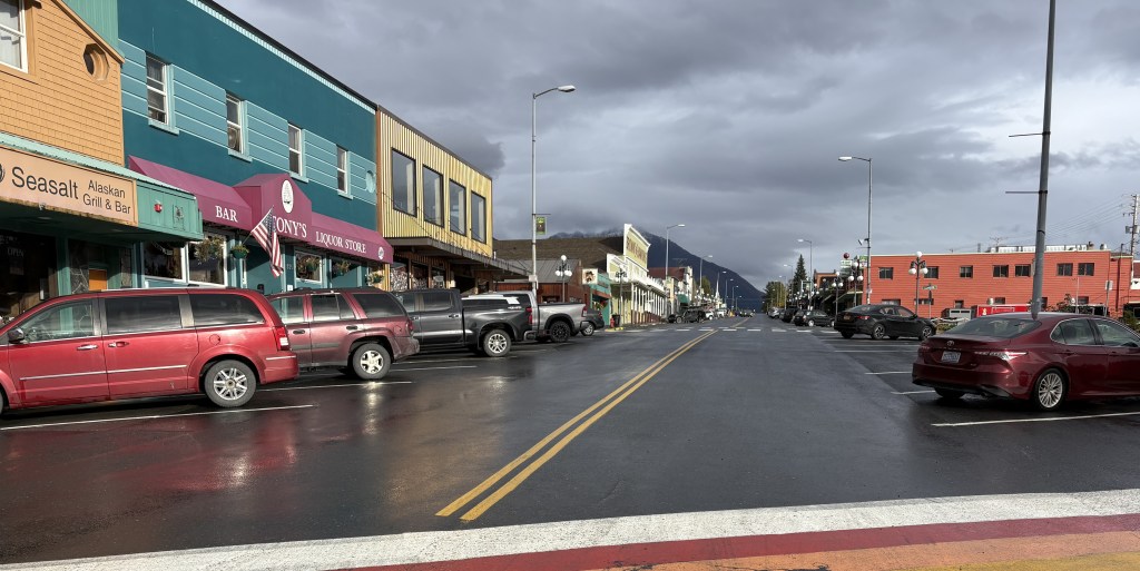
Here is a photo looking up “Main Street” (actually, 4th Avenue) from the Aquarium. It goes on for several blocks before reaching the area I was in yesterday. 3rd Avenue, one block to the left from this view, is Highway 9, locally known as the Seward Highway, which is Highway 1 from Anchorage as far south as Tern Lake, where Highway 9 turns off to come down here. The highway ends just south of the Aquarium.
There were lots of stores and gift shops, and more restaurants, down at this end than there were where I was yesterday. Most of these restaurants were still open and had not closed for the season.
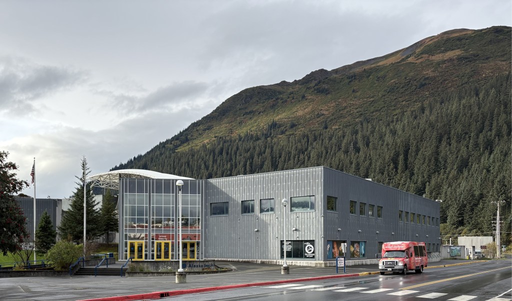
This is the “not-open-until-noon” Aquarium:
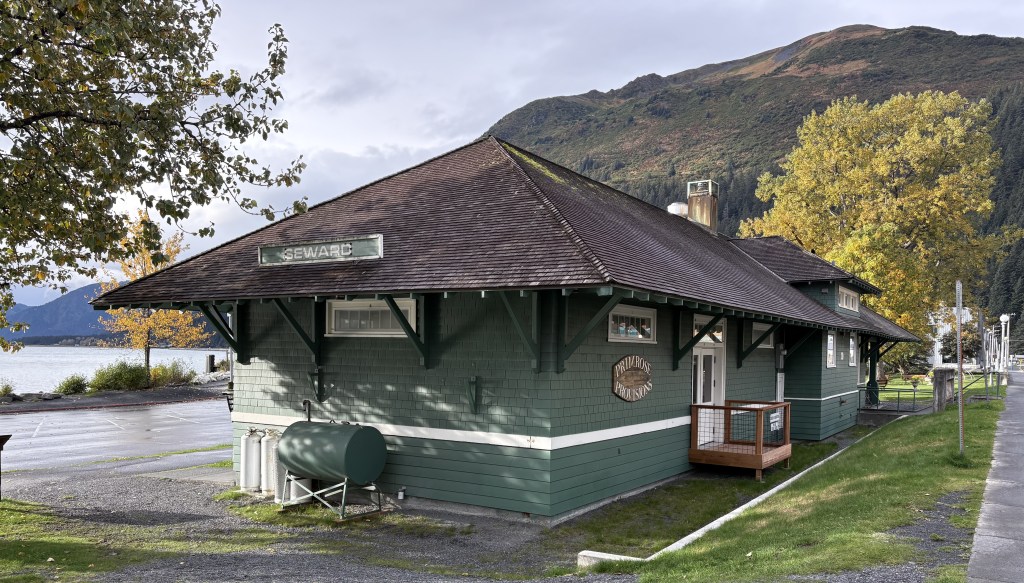
This is the original railroad station, located next to the Aquarium. It now houses some gift shops.
There was a large parking lot, and tables scattered about for tourists to relax and take in the views of the Bay. I could also see a bunch of mountains from down at this end of town, mainly going up the east side of the Bay.
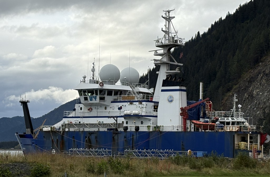
On the opposite side of the Aquarium was a large research ship operated by the University of Alaska – Fairbanks.
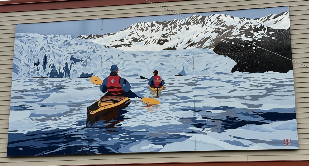
There was a mural on this side of town highlighting the recreation aspect of Seward.
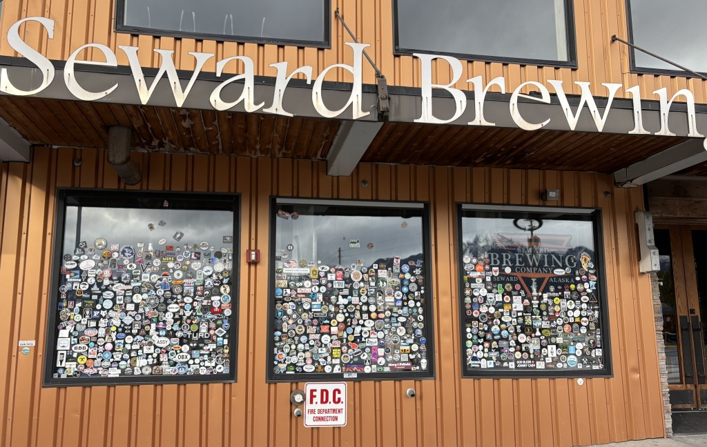
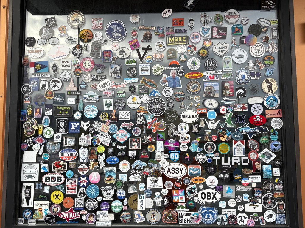
On 4th Avenue, the three windows of the Seward Brewing Company caught my eye because of the stickers plastered all over them:
You get the idea….
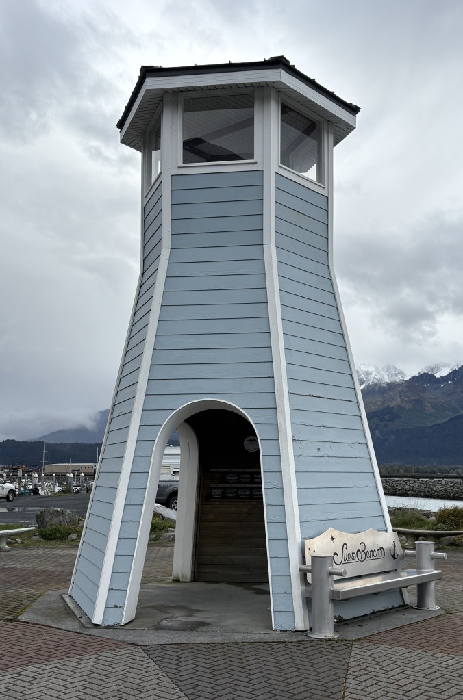
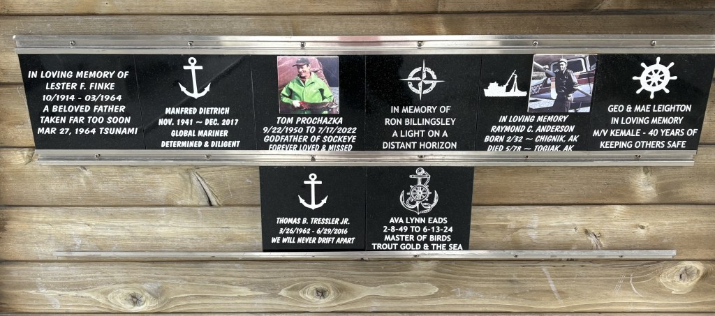
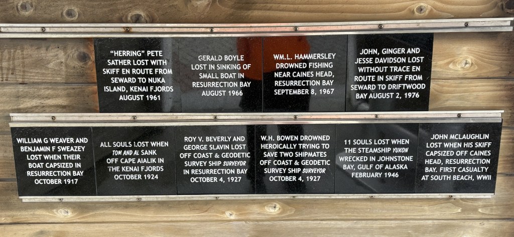
Closer to the harbor I found the Mariner’s Memorial.
Inside were lots of memorials to people lost at sea. Here is a small portion.
There were many more, but I figured they’d be so small that you wouldn’t be able to read them.
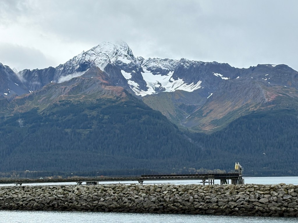
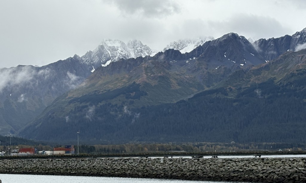
Here are some other things I saw as I walked around the area on this side of town:
Here is another angle looking at the harbor from near the Mariner’s Memorial.
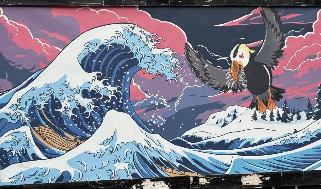
Here is a small mural on a cannibis dispensary called the Tufted Puffin:
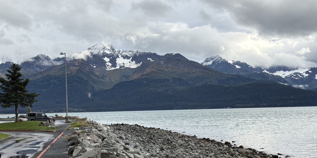
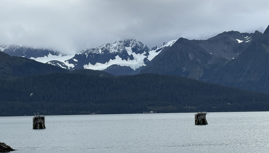
Here are two mountain views from north of town looking east, towards where my Airbnb was located.
I would have a long drive to get to my surprise destination, and will return to Seward for the night, but will have another set of mountain pictures from Seward taken before I leave tomorrow morning for Homer.
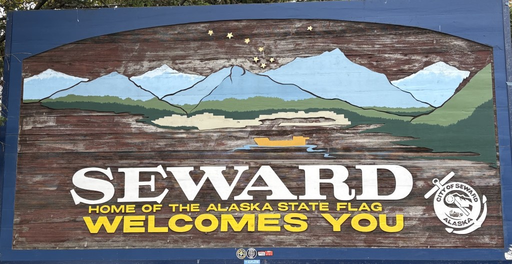
I arrived in Seward around 330 in the afternoon, having driven down from Anchorage. I will be here two nights before moving on to Homer.
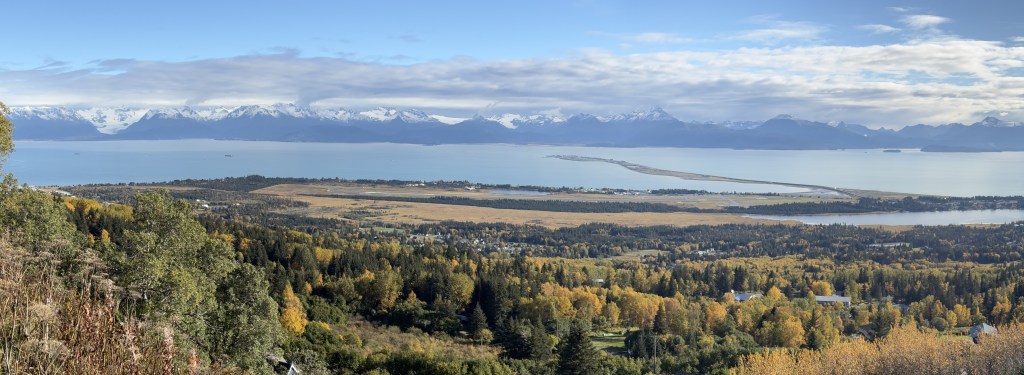
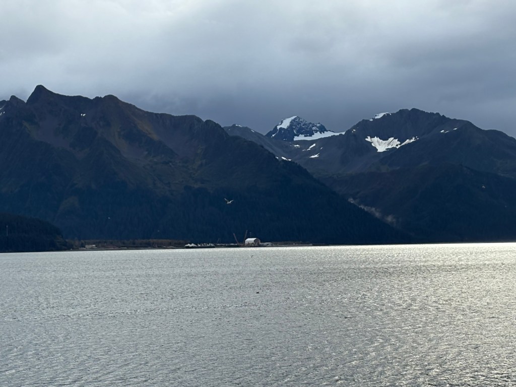
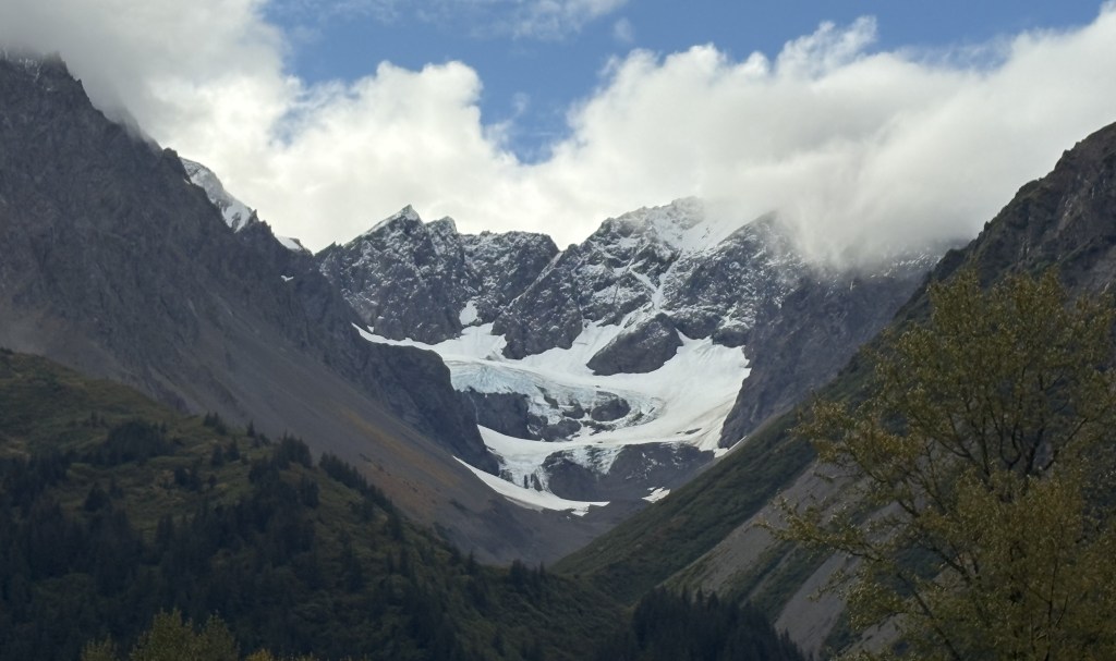
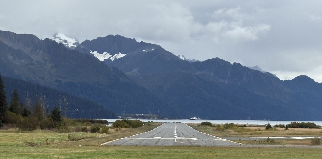
This is the main runway at the Seward airport, which I passed as I was approaching town. Seward lies alongside Resurrection Bay and there are lots of mountains with some snow and glaciers on them in just about every direction. The best mountain photos will be taken the morning that I leave but you will see some each day.
This next photo is looking a little to the right from the same spot.
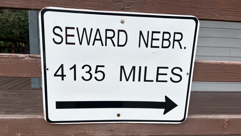
I chuckled when I saw this sign on the Visitor Center. It indicates that if you were headed to Seward, Nebraska you must have taken a wrong turn somewhere along the way.
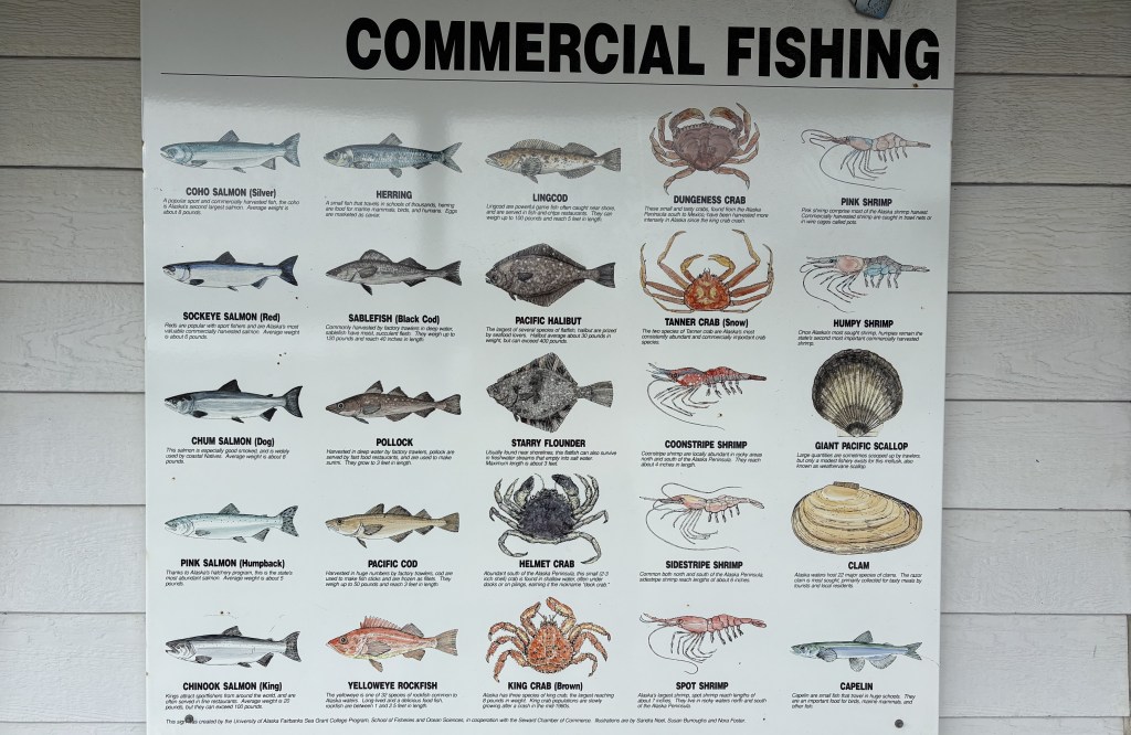
Fishing is the main occupation in Seward and this sign shows some of the many types of fish that are caught here. I would have Black Cod (Sablefish), which I had never heard of, for dinner.
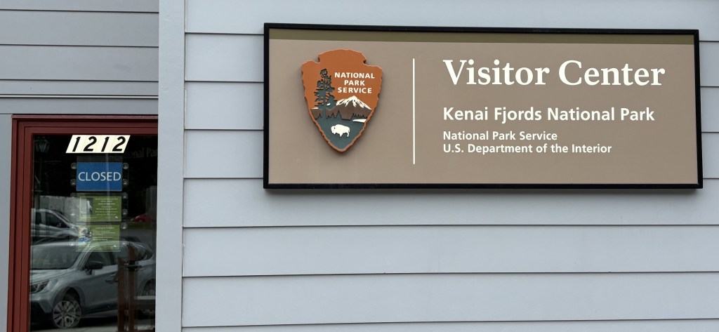
Looking at the map it appeared that there is only one road in to Kenai Fjords National Park. I would have liked to learn more but as you can see, the visitor center was closed for the season. There are 8 National Parks in Alaska and this is one of only three which are accessible by car.
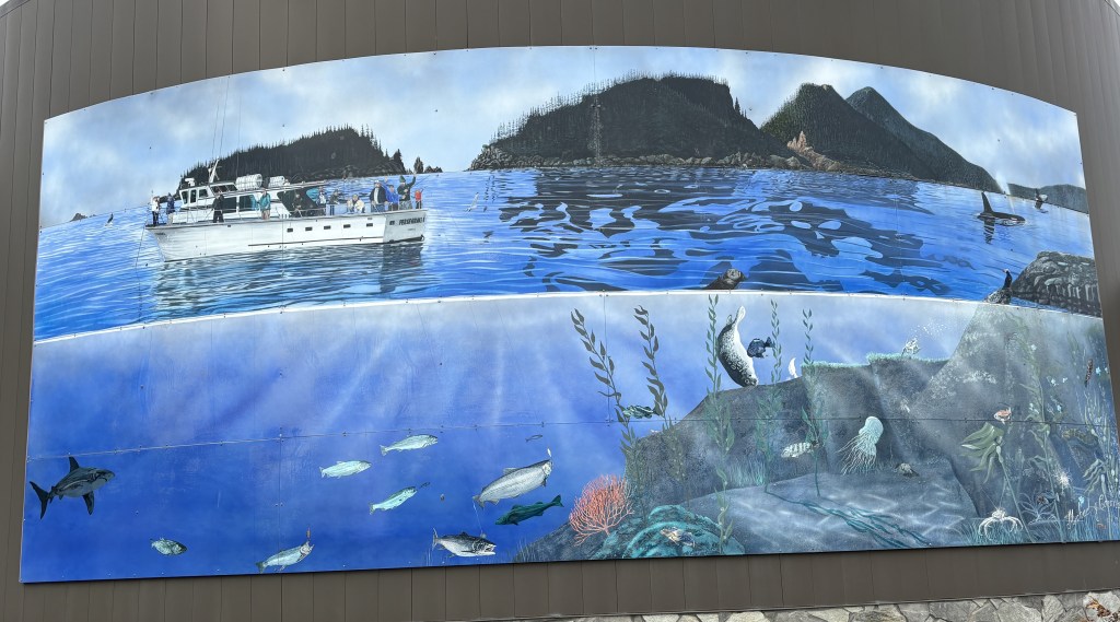
Seward has lots of murals scattered around town. This is one of the bigger ones, showcasing the local fishing industry.
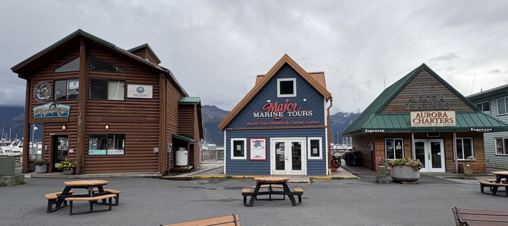
Being a fishing town, Seward also has a number of charter boat tours which go out on Resurrection Bay. Most were closed for the season, as were most of the restaurants in this part of town. There was a dock for cruise ships but that season had ended as well. The town was very quiet.
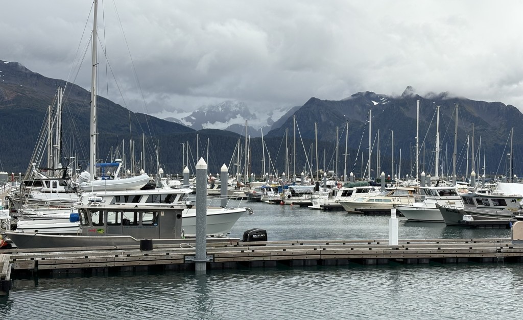
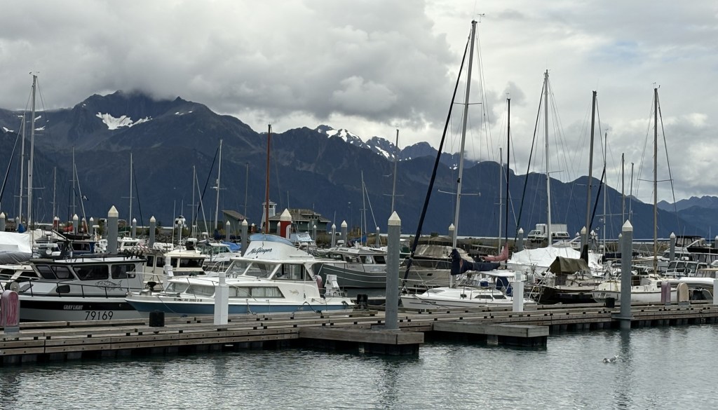
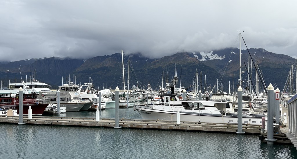
Here are some photos of the harbor:
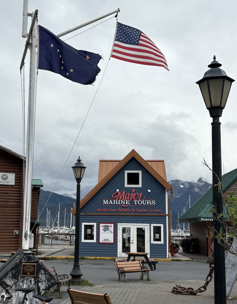
Below is a photo of the 1964 Earthquake Memorial, showing both the American and Alaskan flags. 13 people in Seward died as a result of the earthquake, and a portion of the water frontage slid into Resurrection Bay. Much of the fishing infrastructure was destroyed. I had seen a photo up in Anchorage of the severe damage to the railroad yards here in Seward.
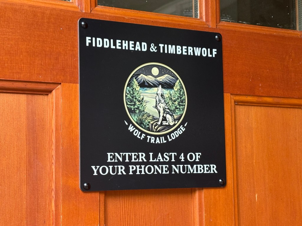
This was on the door to my Airbnb foyer (I was in the Timberwolf suite). They were wrong about the access code but we quickly got it straightened out.
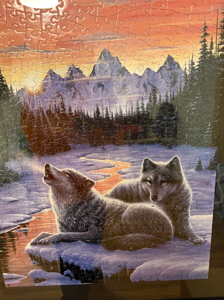
I have friends in Raleigh who are huge jigsaw puzzle fans and I was pleased to see this completed puzzle mounted on the wall inside my suite.
I will go back into town tomorrow morning before going on another excursion for part of the day.