Cactus! Post 1 of 2

May 25, 2017

I started the day driving north from Alpine towards Fort Davis to stop at a facility I had seen the day I arrived in the area but didn’t have time to visit – the Chihuahuan Desert Nature Center:

IMG_20170525_111726151

Here is a map of the total area covered by the Chihuahuan Desert:

IMG_20170525_095735959

Fort Davis is located in Texas,  west southwest of Fort Stockton.

The Nature Center and Botanical Gardens had a wide variety of full sized plants outdoors on a nice walking path.  What intrigued me even more (and provided better photos) were the wide variety of young plants located inside the greenhouse.  All the plants you are about to see are native to the Chihuahuan Desert.

IMG_20170525_093539112

IMG_20170525_093557781_HDR

IMG_20170525_093650260

IMG_20170525_093657532_HDR

IMG_20170525_093723385_HDR

IMG_20170525_093730676

IMG_20170525_093818636_HDR

IMG_20170525_093910660

When I was finished at the Nature Center (more photos in Post 2) I returned to Alpine, then continued south to make a large clockwise loop on a series of scenic roads.

Yesterday I drove to and through Big Bend National Park before returning to Alpine (335 miles total for the day). Today I traveled south on Route 138 (which I had driven north on the previous afternoon) to Terlingua, then west through Big Bend State Park to the town of Presidio (on one of my primary scenic roads), then north on Route  67 to Marfa.  What I did there will appear in another post.


FortDavis area

Total mileage for the day – 326 miles.

Big Bend National Park – Post 1 of 3

May 24, 2017

BigBendNatlPark

(Photo credit: nps.gov)

As you may have guessed from this map of the vicinity where I was staying (in Alpine in the upper left hand corner) one of the places I wanted to visit during my stay was Big Bend National Park along the US border with Mexico.  At 1,252 square miles Big Bend is bigger than the entire state of Rhode Island (“only” 1,212 square miles).

From Alpine I drove 31 miles east to Marathon, then 69 miles south to the Park.  Just before I entered the Park a bobcat trotted across the road about 70 feet in front of my car, not in any particular hurry but too quick for me to get the camera on my phone activated.

IMG_20170524_101432109

Once in the Park I drove to the Panther Junction Visitor Center.

BigBendMap

(Photo credit: desertsportstx.com)

From the Visitor Center you have the option to go east towards Boquillas or west to Castolon.  I headed east first.  Later in the day I went west and after getting to Castolon (the road was closed there because of damage from flooding earlier in the year) I backtracked and exited the Park towards Study Butte.  From there I took Route 118 back to Alpine.

IMG_20170524_104050573

IMG_20170524_105135413

IMG_20170524_120312596

I took a gravel side road at one point which would take me down very close to the Rio Grande River and got these photos.  Later in the day I saw a truck hauling a big trailer ignore the warning signs and try to enter the same, narrow road.  I doubt if he got very far and I have no idea how he would have gotten out.  Those signs are there for a reason, folks….

IMG_20170524_120914409

The road looked plenty wide there but got narrow very quickly.  That’s part of it in the distance.

IMG_20170524_121052171

You can see a vehicle on the road ahead of me.

IMG_20170524_121134290

IMG_20170524_121552368

We finally came to a parking area near this abandoned building.

IMG_20170524_122134928

In the parking lot was a small area where someone was selling handmade crafts (supposedly from the Mexico side).

IMG_20170524_122254358

There were lots more than that.  I bought 2.  There was no one there but there was a coffee can with a slot in the lid (honor system).  I bought two items, a peacock (about 9 inches from nose to tail) and a scorpion (only about 4 inches long).

IMG_20190531_092640859_HDR

IMG_20190531_092706494

I put my $16 in the slot and was on my way.

IMG_20170524_122655608


Big Bend National Park – Post 2 of 3

May 24, 2017

Here are more photos from my visit to Big Bend National Park in southwest Texas.  Posts 2 and 3 will just contain photos.  Post 1 will provide some insight on the Park and my visit there.

IMG_20170524_124408844

IMG_20170524_125021249

IMG_20170524_131802020

The photo above is of the Boquillas Crossing Port of Entry station at the far end of the east branch of the road in the Park.  The photo below is of the Rio Grande River, directly behind the station.  It separates the United States from Mexico along the entire border with Texas.

IMG_20170524_133259569

IMG_20170524_133923259

IMG_20170524_143101235

IMG_20170524_143401020

IMG_20170524_143902652

IMG_20170524_150509662

IMG_20170524_150627447

Alpine, Texas

May 23, 2017

After spending a full week in the Austin/San Antonio area it was time to move on.  Next stop, the little town of Alpine, 426 miles and 6 1/2 hours to the west.  I headed towards San Antonio on the dreaded interstate, took the bypass around the west side of town and got on state highway 90 which would carry me west.  If you do the math you’ll learn about something else which is bigger in Texas – speed limits! I was shocked when I entered the state on highway 21, and today when I got on highway 90, at how high the speed limits were.  Open roads (not interstates) were often 70 or 75 and when you got to a small town it might drop to 50 or 55.  In North Carolina you’re lucky to do 55 on a state road and usually 35 through towns.

After driving around San Antonio (where I saw a multi-level golf driving range pointed directly towards a Mercedes-Benz car dealership next to it) state highway 90 took me west through the towns on Hondo, Uvalde and eventually to Del Rio, right at the Mexican border.  Call me crazy (believe me, you won’t be the first…) but I’ve always wanted to go to Del Rio, the home of one of shock-jock Don Imus’ fictional characters on his WNBC radio show back in the early 70’s.- The Right Reverend Billy Sol Hargis. That character was a radio evangelist from the First Church of the Gooey Death and Discount House of Worship in Del Rio, Texas.  Every time Imus did his schtick as Rev. Hargis gospel singers sung his theme:

I don’t care if it rains or freezes,

long as I got my plastic Jesus,

riding on the dashboard of my car…

I can go a hundred miles an hour,

long as I got the Almighty power,

glued up there by my pair of fuzzy dice….

(to hear it for yourself there is an audio clip on YouTube)

But enough reminiscing….

After Del Rio it was a very long drive further west to Alpine.

BigBendNatlPark


(photo credit: nps.gov)

The map above picks up Route 90 at Dryden.  About halfway between Marathon and Alpine I almost drove off the road laughing when I saw this just off the highway to my left.  I turned around and stopped to check it out…

IMG_20170523_163803848_HDR

IMG_20170523_163821842_HDR

IMG_20170523_163911960_HDR

There is a set of railroad tracks right behind this structure and evidently some enterprising artist decided to transform an abandoned railroad equipment shed into the “Marathon Target”.  The signage is made of wood but the scale and letter font is right on the mark (on target, if you will…).  I think it’s hysterical.

Once in Alpine I checked in to my little “casita with the red door”:

IMG_20170523_170017862

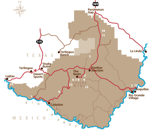
There were other casitas (small houses) on the property, each with a brightly colored door of a different color.  I would be here for 3 nights and chose Alpine for it’s strategic location to several of the things I wanted to see while in this part of the state. Here’s another map which shows where most of these destinations are in relation to Alpine.

FortDavis area

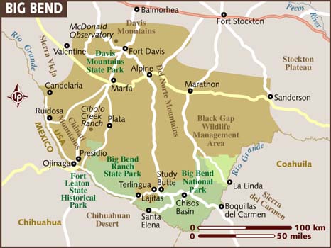
(Photo credit: lonelyplanet.com)

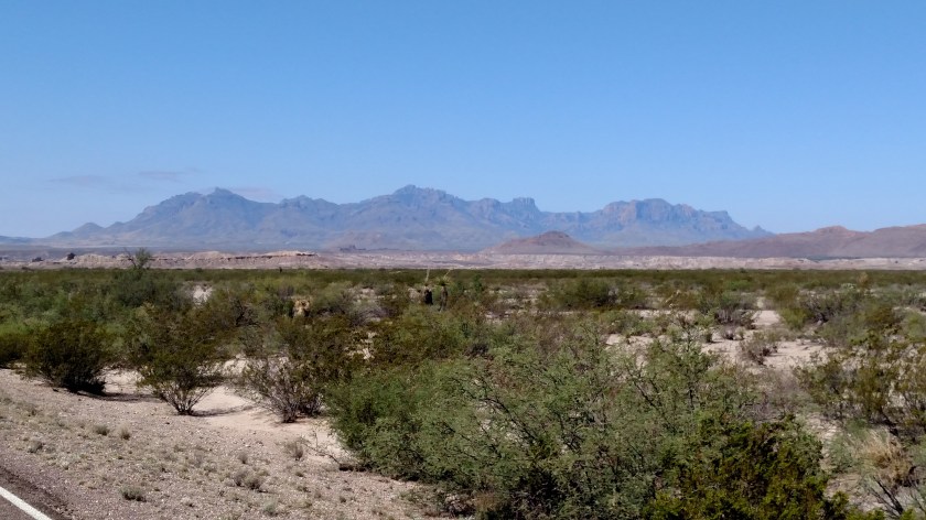
I arrived in Alpine on a Tuesday.  One of my destinations was McDonald Observatory, in the upper left corner of the map above.  They hold “star parties” for the public on Tuesday, Friday and Saturday nights.  I would be traveling further west Friday morning so Tuesday was my only opportunity to attend.  I broke my rule of not driving in unfamiliar areas at night and headed an hour and 15 minutes north to the Observatory.  Most of the day I was traveling in flat, desert conditions but this journey north would take me up into the mountains.

IMG_20170523_180450118_HDR

IMG_20170523_180852381

IMG_20170523_182446012_HDR

You can see two of the telescope “shells” in the photo above.

IMG_20170523_182919841

I will be making an entire post about the Observatory, and will be returning to this area in the coming days so you’ll be seeing and reading more about the area.

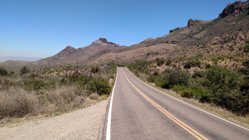
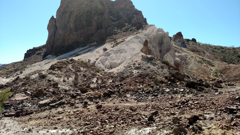
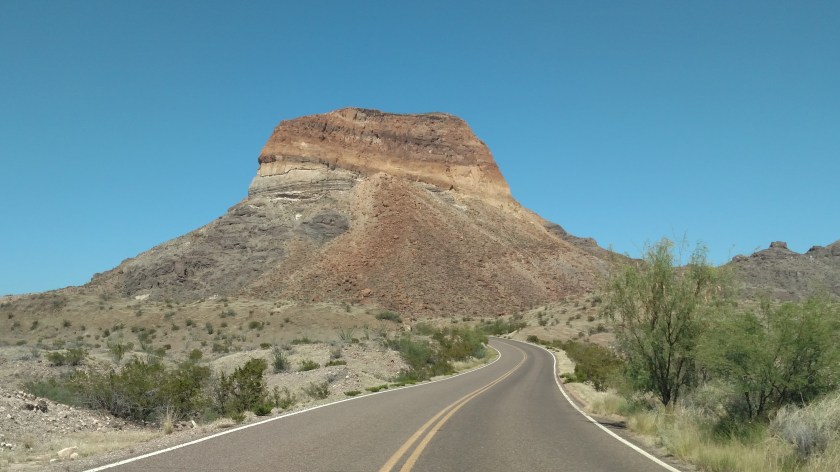
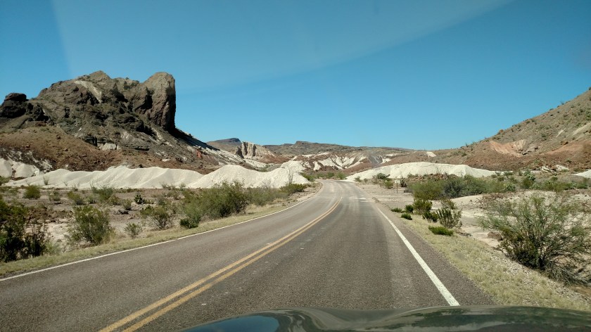
Another of the things I wanted to do in this area was one of my primary scenic roads, the white loop west of Fort Davis on the map above.  I drove it clockwise Tuesday afternoon, while killing time for nightfall and the “star party”.

It was a long but very rewarding day.  All told, 624 miles added to the odometer.


Austin, Texas – Days 2 & 3

May 21 and 22, 2017

I visited Austin two more times while I was in the area, to eat at a few more recommended venues and see one or two more sites.

First, some clouds I saw in the sky while driving back downtown from a great tamale restaurant on the northwest side of town.  I don’t recall ever seeing clouds with “waves” on the bottom of them.  I hope the pictures do them justice:

IMG_20170521_151229173_HDR

IMG_20170521_151234382_HDR

IMG_20170521_151504915

IMG_20170521_151531600_HDR

Back in town I visited a few funky stores on a commercial strip south of town.  I saw them earlier in the week while I was in town and wanted to walk up and down that street and stop in a few of them.  That is where I saw this colorful man making balloon animals for kids:

IMG_20170521_160547559_HDR

And I saw this t-shirt in one of the more unusual toy stores:

IMG_20170521_163518175_HDR

And I saw this large piece of art on one of the side streets:
IMG_20170521_164408622

IMG_20170521_164428305

The last day I was in Austin I visited the Congress Avenue Bridge (now named for Ann Richards, a Texas politician perhaps best known for her witty jab at President George H. W. Bush). This bridge is famous for the roughly million and a half Mexican free-tailed bats who live underneath it during the day and come out to hunt for food at night.  The nightly (March through early Fall) ritual is viewed by thousands of people each year.

This sculpture was up at street level approaching the bridge from the south:

IMG_20170522_141050455_HDR

I knew about the bat flights but chose not to stick around to see it happen at sunset and then have to drive back to where I was staying.  Here are some photos of the nightly ritual I found in a park under the bridge.  If you are interested in seeing video of the bats in flight there are several of them on YouTube.

IMG_20170522_135424792

IMG_20170522_135503380

IMG_20170522_135516086

Part of my final day was also dedicated to doing more mundane tasks such as laundry and having some routine car maintenance performed.


Circuit of the Americas – Post 1 of 2

On day five of my trip to south-central Texas I headed north towards Austin.  First thing in the morning, though, I actually headed east from where I was staying in Buda to the town of Elroy to tour the beautiful Formula 1 racetrack called “Circuit of the Americas”.  F1, as it is known, which races at venues all over the world, used to run their United States race at Indianapolis Motor Speedway (I almost went one year but didn’t).  In 2010 they announced that they’d be building their own track, thank you very much, near Austin, Texas – far enough south that they wouldn’t have to worry about cold winter temperatures buckling the track surface.  The track opened in 2012.  It’s future is uncertain, however.  They have commitments through 2021 but are seeking $25 million from the State of Texas to help support the facility and have so far been turned down.  This a state-of-the-art F1, FIA Class 1 facility which was built at no small expense specifically for racing and I can’t imagine F1, who, as I like to say, “has more money than God,” letting it go.  I certainly hope not.

I tried to find a map online showing both Austin and the track but was unsuccessful.  CoTA, as it is known, is about 15 miles southeast of downtown Austin, about 5 miles past the airport.

Here is a map of the track configuration:

COTA Tesla map

(Photo credit: Teslarati.com)

The track is 3.427 miles in length, has 20 turns, and features 133 feet of elevation changes.  To best illustrate those elevation changes here is a photo I found online published by a motorcycle magazine for one of their articles about a bike race held at CoTA.  It shows the track surface as if it were a roller coaster, a pretty clever idea I must say.  Please note that the elevation changes are exaggerated (at least for Turn 1) but this gets the point across.

cota-coaster-numbers

(Photo credit: CoTA and cycleworld.com)

I knew I’d be doing the tour one day while I was in the area so I actually swung by the track at the end of my first day in Austin a few days earlier to make sure I knew how to get to it and roughly how long it would take from where I was staying.  I got a picture of the back of the grandstands and the track logo while I was there:

IMG_20170518_174933902

IMG_20170518_175343971

I got to the track about a half-hour early the day of my tour and ended up getting a private tour because I was the only customer they had for 10’oclock!  A very nice and well-informed woman drove me around the outside of the track and explained some of the history of the facility which has only been open a few years.

The most prominent feature of the track, which you’ll see in many of my photos, is the 251-foot tall Observation Tower.  Because if it’s popularity fans must pay to go up in it during a race and may only stay a certain amount of time.  My tour guide told me a story about Bernie Ecclestone, the former President of F1, kicking all the fans out so he could entertain his friends up there (and what Bernie wanted, Bernie got).  Needless to say those fans who had ponied up good money were NOT happy! We were not allowed to go up in it during the tour (the only disappointment).  Well, we couldn’t go on the track itself either, since the Porsche club was having an event and we were in a non-Porsche van, so I guess there were two disappointments….

IMG_20170521_093056408

IMG_20170521_101309184

IMG_20170521_101909849

IMG_20170521_102005722

IMG_20170521_102613928

IMG_20170521_102617820

The last shot in this post is looking down toward the main straightaway and start/finish from up at Turn 1.  Race vehicles run counterclockwise around the track so they would be coming towards me from this vantage point.

IMG_20170521_102622627

Next we go to the main grandstand and then cross under the track to the infield (see CoTA Post 2 of 2).

Circuit of the Americas – Post 2 of 2

May 21, 2017

On day five of my trip to south-central Texas I headed north towards Austin.  First thing in the morning I actually headed east from where I was staying in Buda to the town of Elroy to tour the beautiful Formula 1 racetrack called “Circuit of the Americas” near there.

Here are more photos taken during my “private tour” of the facility.

These are views from the main grandstand on the front stretch, where the races start and finish (race vehicles traveling counter-clockwise).  There are also private suites on the top level which I am standing in front of.

IMG_20170521_103650087_HDR

IMG_20170521_103654586_HDR

IMG_20170521_103738783

We then went through a tunnel under the track surface to the infield where we’d visit other parts of the facility.  First stop over there – Race Control.  They were running a small event for the Porsche Club so there was only a small crew of officials working there.  Believe me, on a major race day it would be packed and visitors wouldn’t get near the place.

Race Control has monitors which can view every part of the track and officials have radio contact with track and safety workers at areas all around the track.

IMG_20170521_105228746

IMG_20170521_105043304

As we walked through the corridors of the building inside the track (which houses hospitality suites, offices, and has garages at ground level) I saw this photo of the Observation Tower lit up during a night race.  If you look closely you’ll see the reflection of me taking the picture and my trusty tour guide standing next to me.

IMG_20170521_105358351

Here is a better picture of her (sorry, I don’t recall her name) standing in Victory Lane (in F1 they call it “the podium” and is occupied by the top 3 race finishers, like at the Olympics).  She is standing next to a life-sized cardboard standup of Lewis Hamilton, my favorite F1 driver.  They had standups of most of the drivers so visitors could have their photo taken with their favorite.  She took one of me but it will never see the light of day…

IMG_20170521_110120008_HDR

This is the view of the front stretch from the paddock (garage) side of the track and you can see the podium on the left.  Pit road is between where I’m standing on the track from this vantage point and you can see the track climb up to Turn 1 in the distance.

IMG_20170521_110345182_HDR

Before we went back outside the track we saw a small, permanent music amphitheater located behind the Observation Tower.

IMG_20170521_113137179_HDR

For bigger concerts a big stage can be constructed between turns 11 and 12 (across from 9 & 10, near the letter H, but inside the track).

COTA Tesla map

(Photo credit: Teslarati.com)

And finally, one last view of a car on the track before I left.

IMG_20170521_113536647

This tour, and the chance to see this gorgeous facility up close, is definitely on the short list of the many highlights of my recent trips.

If you want to watch this year’s F1 race from COTA tune to ESPN on Sunday, November 3 at 2pm Eastern time.  This track now hosts the IndyCar series as well.  They had their inaugural race back in March.  I doubt if NASCAR will ever race here.  There is an ongoing dispute between the sanctioning bodies as November 3 is the same date they run the Fall race at the NASCAR track up in Fort Worth.  Although they probably draw totally different crowds, Bruton Smith (who owns Texas Motor Speedway) is not at all pleased that they run the Formula 1 race in Texas on the same day, at overlapping times.

McNay Art Museum – Post 1 of 2

May 20, 2017

Day four of my week in south-central trip meant a trip back south to San Antonio.  It was threatening to rain (though it never did…) and I try to limit indoor activities to days that are rainy or too hot.  I visited the McNay Art Museum in San Antonio and enjoyed it very much.

IMG_20170520_094445957

IMG_20170520_094524193

IMG_20170520_094606734_HDR

IMG_20170520_100431890_HDR

IMG_20170520_100749993

The photo above is actually the sink in the Men’s room!  It has to be the most unusual one I have ever seen…

IMG_20170520_100815195

IMG_20170520_102046815

IMG_20170520_102134069

IMG_20170520_102243551

IMG_20170520_102709008

IMG_20170520_104233731

The curved thing in the photo above is actually balancing on the tabletop at just one point.  It would move with the air current just enough to convince you it wasn’t fixed in place.  There were signs advising guests not to touch it (and, lest you be tempted, someone was watching…).