Cape Breton Highlands NP – West side

July 22, 2019

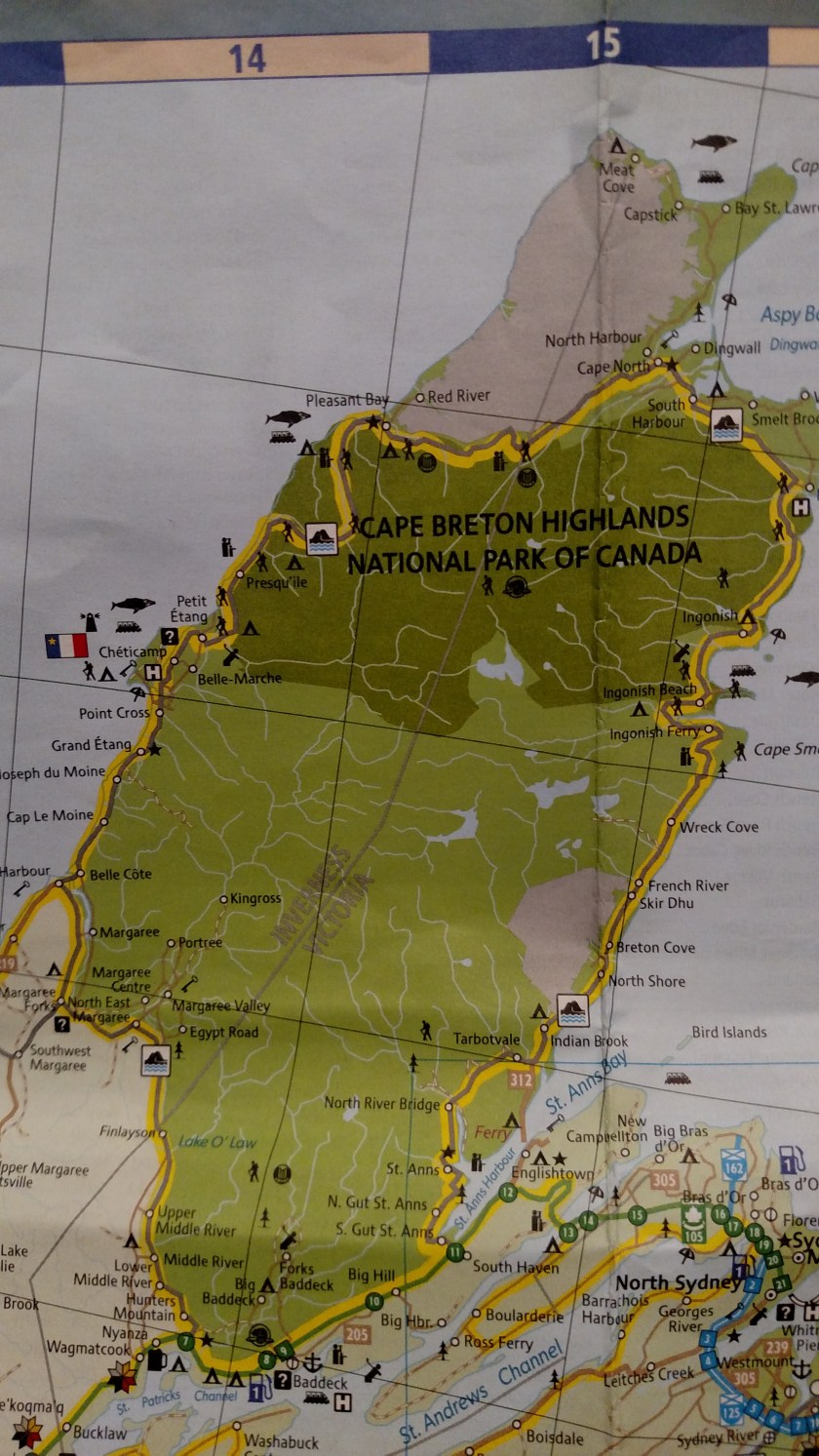
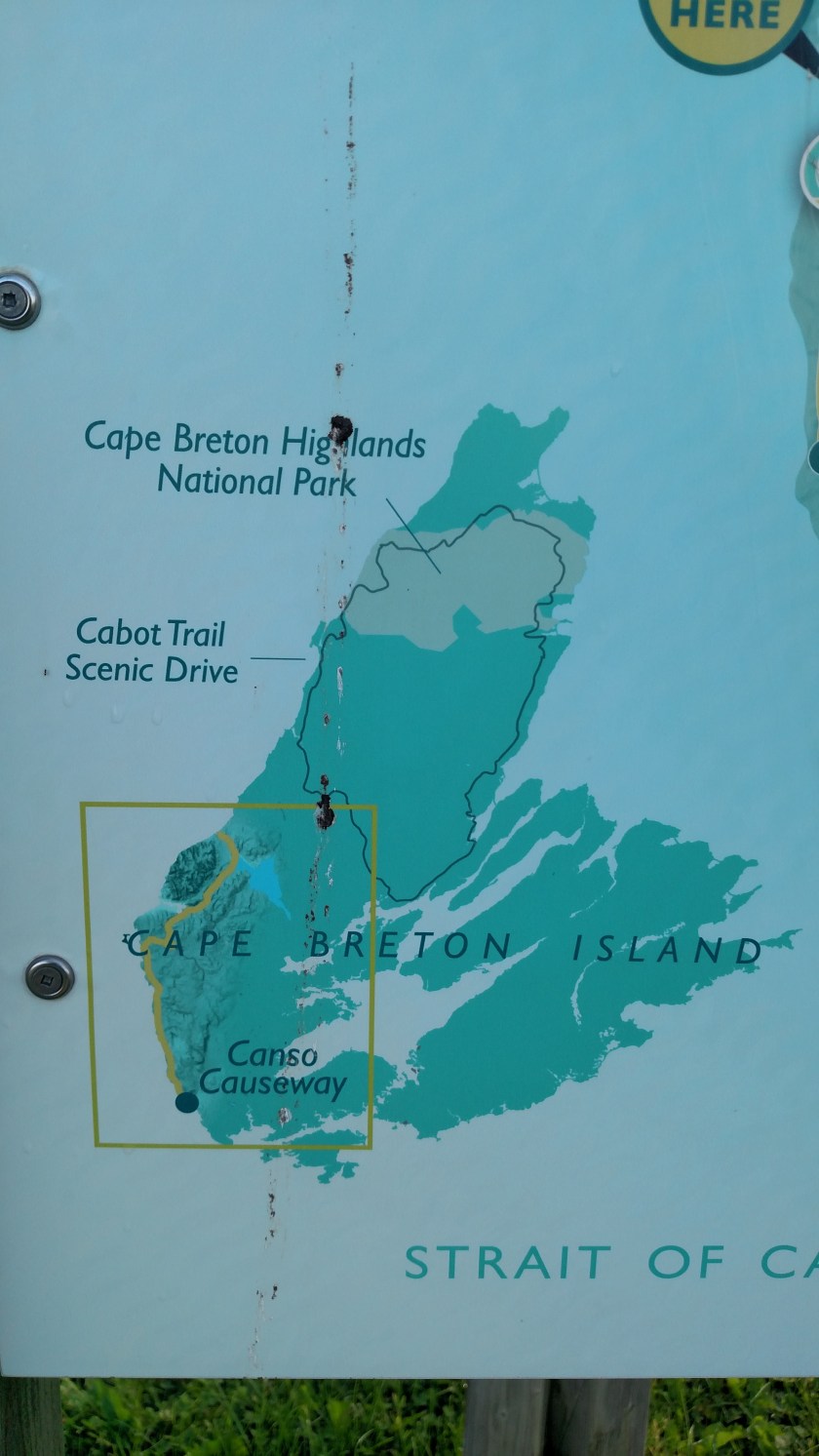
Monday I drove north along the west side of Cape Breton Highlands National Park (NP).  The pictures I took Monday didn’t turn out very well and I went up to the Park again Tuesday and Wednesday.  These photos are what seem to be the best shots from all three days (so you will see variations is sky quality and cloud cover).

IMG_20190724_071404553

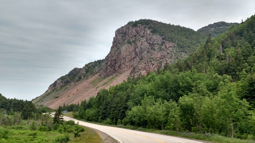
Shortly after entering the Park at the southwest entrance the first thing you come to is Grande Falaise, a rock wall that kind of reminds me, in shape, of Half Dome in Yosemite National Park (although they are very different in composition and height).

IMG_20190724_110700458_HDR

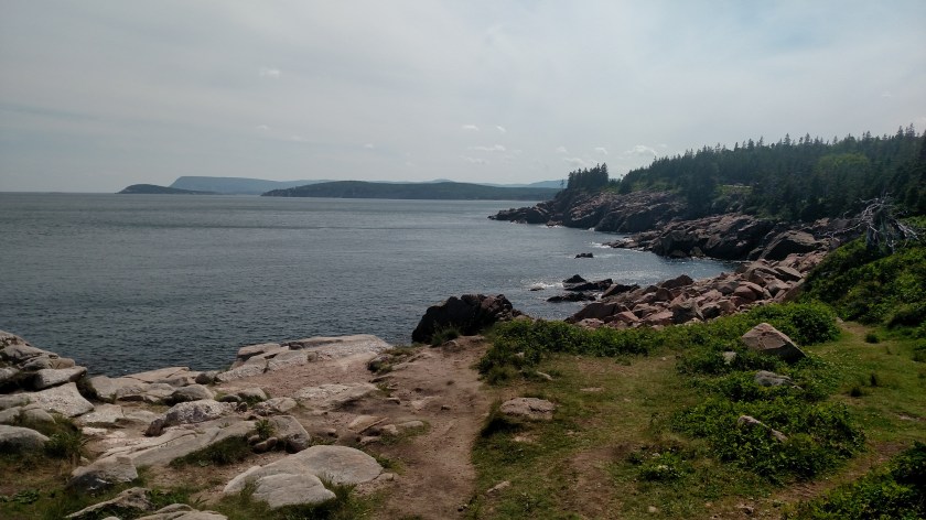
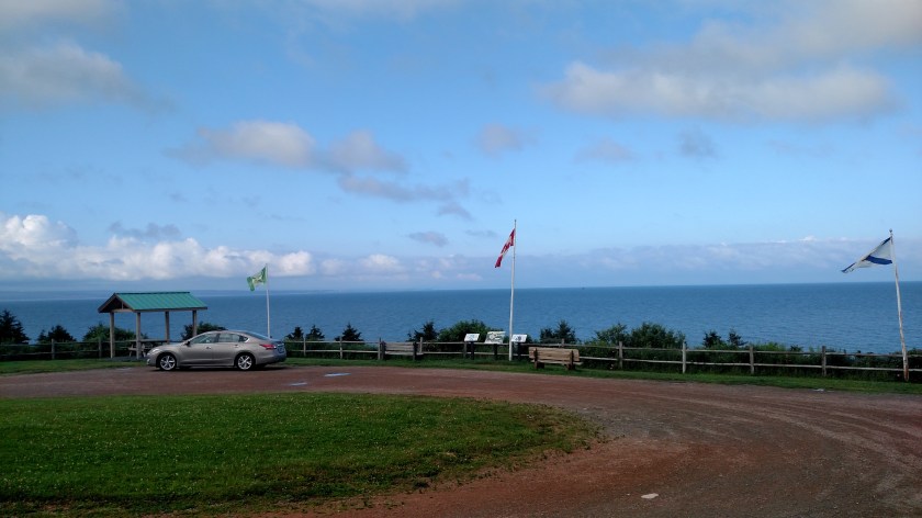
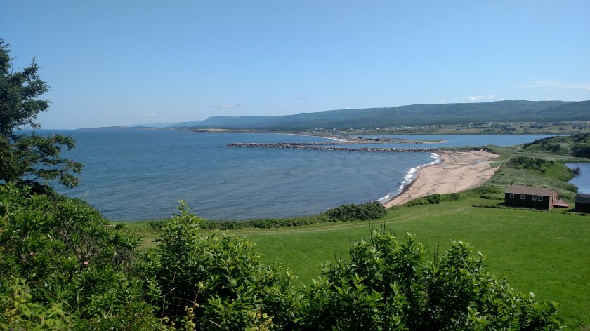
Next is a small parking area to the left just before the first uphill climb.  The road will go up and down along the coast for a while before making a final ascent into the mountains.  This post will cover the territory between Park entrance and that climb into the mountains.  I will make another post about the mountains and the northern edge of the Park.  The post below this one covers the east coast portion of the Park.

This is the view from atop the hill looking back.


IMG_20190723_161738405_HDR

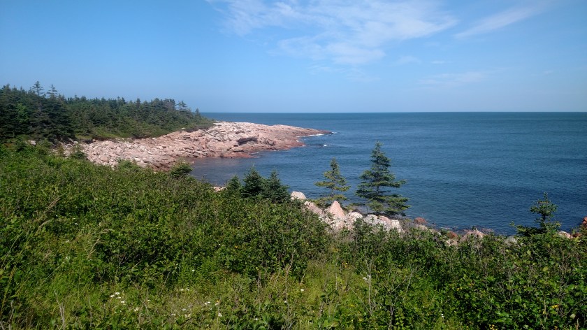
And a view from the first lookoff area at the coastline looking south:


IMG_20190723_161705194_HDR


IMG_20190723_161714387_HDR

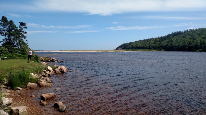
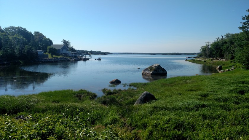
The road then goes back down near the water level.  Once down there there are two ponds, one to the left as the road turns towards the water and one on the right.

Left side of the road, looking south:

IMG_20190724_111240958_HDR

Right side of the road, looking north:

IMG_20190724_111308684_HDR

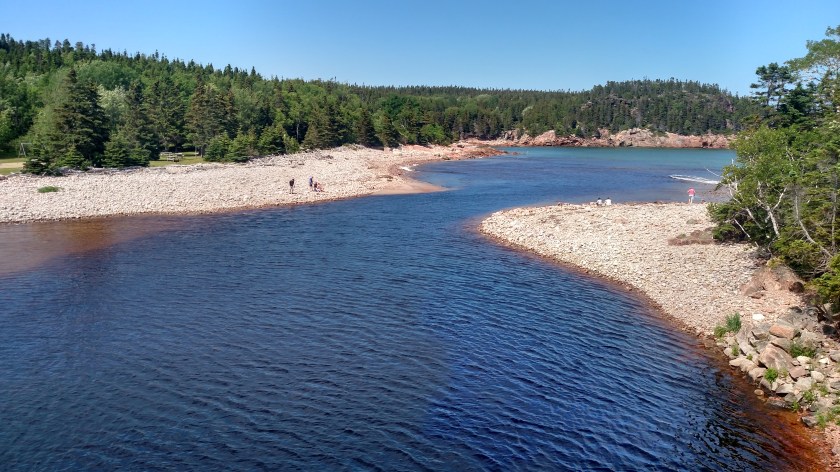
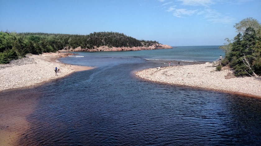
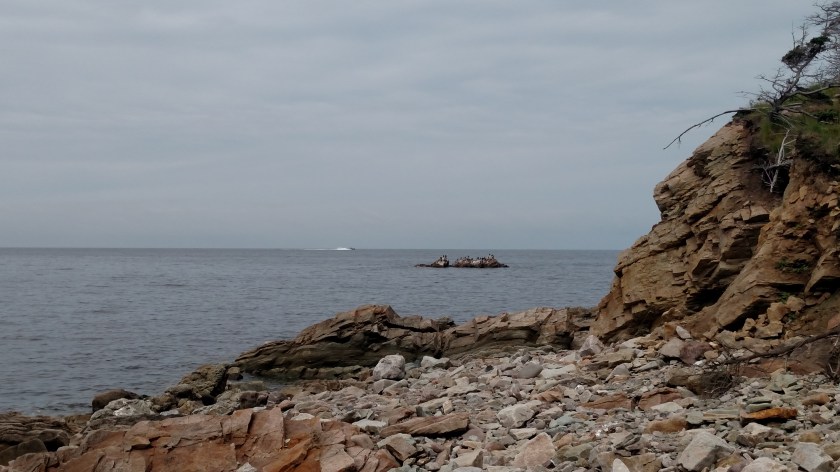
I drove out to the end of the parking area to the right of the pond in the first photo above to see Pillar Rock:

IMG_20190724_111459718

And some shore birds out on a rock looking right towards the Gulf:

IMG_20190724_111520335

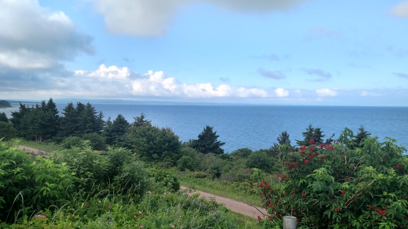
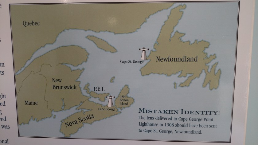
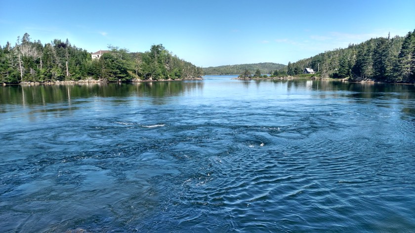
The road then straightens out parallel to the water on it’s left, which at this point is the Gulf of St. Lawrence.  When I got out to the southern coast of Nova Scotia about a week ago I said that from that point forward all views of non-lake “big water” would be the Atlantic Ocean.  That was NOT correct!  Once I got up to the north coast near New Glasgow the large bodies of water off the coast are influenced by the St. Lawrence River which separates the northeast US from Canada.  It dumps out into the Atlantic Ocean north of here.  From this side of Cape Breton Island you are seeing the Gulf of Saint Lawrence and when on the east side of the Island you are, in fact, seeing the Atlantic.

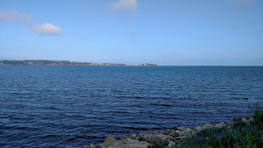
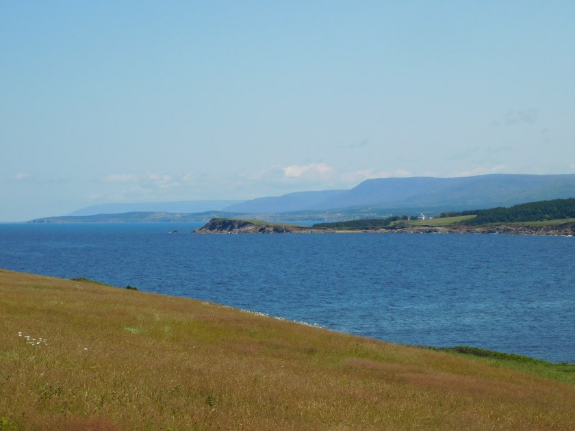
Now that we have that straightened out….  Looking back south once the road gets out to the Gulf one sees Presq’ile:

IMG_20190724_111741818

And looking north the road continues ahead of me:

IMG_20190724_111813508_HDR

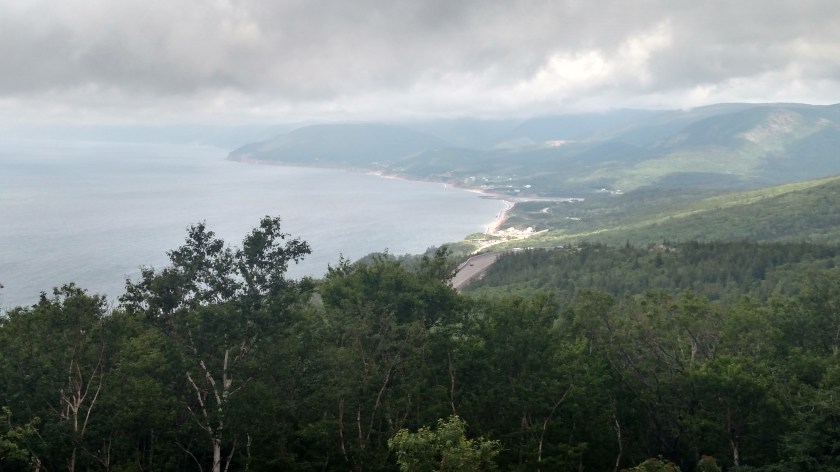
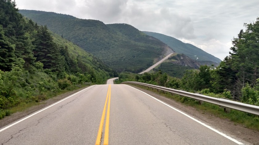
The road then climbs another hill and I stopped at the Cap Rouge Lookoff.  This is the view of the road looking north, ahead of me:

IMG_20190724_112057551

DSCN7965

And looking back from where I just traveled:


IMG_20190724_112634238_HDR

When I drove the road going the other direction Tuesday I was struck by how different this looks when actually seen from the road (as the driver sees it) so I donned my trusty Safety Sam vest and stood out in the road taking pictures:

IMG_20190724_113925029_HDR

And from off the left side of the road – same spot:

IMG_20190723_160115671_HDR

Cap Rouge was also where I took the pictures of the clouds Monday.  This was looking up at the mountains from that parking area:

IMG_20190722_130655519_HDR

IMG_20190722_130658965_HDR

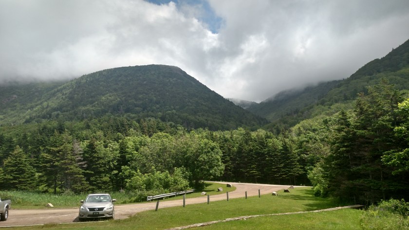
The first mountain the road would be climbing is French Mountain, which is just under 1,500 feet tall.  On Monday the low cloud deck was just below the very tops of the mountains.  I will be making a separate post about the mountains and the north edge of the Park.


Cape Breton Highlands NP – East side

July 22, 2019

Monday when I arrived on Cape Breton Island I drove around the upper end of the island clockwise – up the west side and down the east side.  I just reviewed the pictures from the west side and am very disappointed at how they turned out so I am going to try again today and hopefully post better quality pictures.  Despite the clear skies which appeared in the pictures I presented in “The Cabot Trail” post, when I entered the Cape Breton Highlands National Park (NP) at the southwest corner of the Park, low clouds had developed and the pictures are very poor.

For example….

IMG_20190722_130658965_HDR

IMG_20190722_135955869_HDR

Upon reaching the northwest corner of the Park I drove over to the other side and it was like I was in a totally different world….

IMG_20190724_071344457

At the top of the map is Neil’s Harbour:

IMG_20190722_145857387

IMG_20190722_150013288

This next shot is the same body of water but looking back west, towards the road which I am now traveling south on.  The thick clouds on the west side didn’t make it all the way over across the wide northern part of the island.

IMG_20190722_145943230

Further south, Black Brook Beach:

IMG_20190722_150819350_HDR

IMG_20190722_150847194

IMG_20190722_150912625_HDR

And further yet, MacKinnons Cove:

IMG_20190722_151336946

IMG_20190722_151542431

IMG_20190722_151606576

Next up, Green Cove:

IMG_20190722_151851782

IMG_20190722_151856249

IMG_20190722_152025865

IMG_20190722_152052735

And last stop as I approached the southeast corner of the Park, Lakie’s Head:

IMG_20190722_152556171


IMG_20190722_152620634

In the bottom photo you can see Ingonish Island (on the left), Middle Head (a peninsula sticking out from the mainland, in the center of the photo) and Cape Smokey off in the distance (between those two).  Those two photos also demonstrate the effect of clear, blue skies on taking photos of water.  The top photo was looking northeast, over the Atlantic Ocean and with clear skies.  The bottom photo was taken looking due south, and high, thin clouds were moving in, creating a more grayish look to the water.

There was a little more to see in the Park but there was road construction which restricted vehicles to only one alternating lane of travel and stopping within the work zone was prohibited.

More rain is coming in today (I am posting this Wednesday morning) but after I shower I will head back up to the west side and take more photos.  I was up there Tuesday afternoon and am now kicking myself (Ow!) for not taking more photos then.  They wouldn’t have been ideal either but they probably would have been better than Monday’s photos.


The Cabot Trail

July 22, 2019

I traveled along most of this 185 mile loop yesterday.  It continues up the west coast of Cape Breton Island from Margaree Forks, where Route 19 ended.  I would be on this road for about 25 miles before crossing in to Cape Breton Highlands National Park.  I would be in and out of the Park (the darker green area on the map below) several times before exiting it on the east coast at Ingonish Beach.  The Cabot Trail continues south to Hunter’s Mountain before looping back northwest to Margaree Forks.

IMG_20190722_205126798

Here are some of the things I saw:

IMG_20190722_112743777

Yet another harbor, this one at Grand Etang.  On the right you can see a fishing boat that had just come back in to the harbor.

IMG_20190722_113826428

This is a majestic church in Cheticamp:

IMG_20190722_115135065

IMG_20190722_115306415

And this was a view crossing a bridge over the Cheticamp River, just before the southwest entrance to Cape Breton Highlands National Park:

IMG_20190722_121501020_HDR

I am posting this Tuesday morning.  I am planning to go back to the north end of the island later today but I woke up to steady rain which has let up slightly but there is another batch coming.  There may be a break later so I need to get up there before it does.  I wasn’t expecting rain until tomorrow so maybe it will get in and out early…

I may get back to North Sydney early to post more of yesterday’s photos and get a badly needed haircut!


Ceilidh Coastal Trail – Post 1 of 2

July 22, 2019

Monday I headed east from New Glasgow and crossed a bridge onto Cape Breton Island.

IMG_20190722_205039554

Cape Breton (pronounced BRETT-on) Island covers almost 4,000 square miles, making up roughly 18% of the total area of Nova Scotia.  Most of the province is a peninsula attached to the southeast portion of New Brunswick.  Cape Breton Island extends northeast from the peninsula.

After coming east from New Glasgow on TCH-104, the scenic route I drove on Monday began in the southwest corner of the island, on Highway 19 (aka the Ceilidh Coastal Trail).  A Ceilidh (pronounced KAY-lee) is a social event comprised of Scottish or Irish folk music, singing, traditional dancing and storytelling.

IMG_20190722_205114608

In Canada what we in the US call a scenic overlook is referred to as a “look-off”.  I stopped at this one shortly after I started driving north.

IMG_20190722_082627225

This was looking back towards the way I came over from New Glasgow.  The mainland juts out to the right on the horizon

IMG_20190722_082405797_HDR

IMG_20190722_082418863_HDR

IMG_20190722_082719634

Next up, the little town of Judique – with a musical history.

DSCN7880

This is the Celtic Music Interpretive Centre in Judique.

IMG_20190722_084114166

This was a little park & walking trail just past Judique.  Note that the bicycle rack is in the shape of music notes.

IMG_20190722_084509488

IMG_20190722_084604865

This was a map near the walking trail showing the island and the three main components I would be seeing during today’s drive, the Ceilidh Trail (inside the box), The Cabot Trail which I would drive the majority of next, and Cape Breton Highlands Park near the top of the island.  I will be driving all the way out to Meat Cove at the northern tip on Tuesday.

IMG_20190722_084654170

This was the view of an island a short ways offshore, looking west near Port Hood.

IMG_20190722_091404269

And further up the road I started seeing mountains.  The island becomes more mountainous as you drive north.

IMG_20190722_092911212

IMG_20190722_093607077_HDR

Ceilidh Coastal Trail – Post 2 of 2

July 22, 2019

Continuing on up the west coast of Cape Breton Island this was near the town of Mabou:

IMG_20190722_093712606

IMG_20190722_093925470

IMG_20190722_093954107

IMG_20190722_094106570

Further up the road were these two small abandoned houses.  A man was mowing the yard with a large John Deere tractor but conveniently drove behind the house on the left as I was preparing to take the photo.

IMG_20190722_095223418

Next up, a little town of Inverness.  This is their harbor, located on MacIsaac’s Pond on the south side of town.

IMG_20190722_100713662

As you can see, this is their Visitor Center.

IMG_20190722_100952139

Further up the road I saw a dirt road leading left off the highway up to a graveyard on a hill overlooking the water to the west and the town of Whale Cove looking east towards the road:

IMG_20190722_104433855

IMG_20190722_104356355

Looking south:

IMG_20190722_105621902

Looking north:

IMG_20190722_104833779

IMG_20190722_105051274

This was taken with the digital camera, zoomed in towards the area seen on the left side of the photo above.  The mountains in the distance will include Cape Breton Highlands National Park.

DSCN7893

This the view driving in to Margaree Forks on Route 19, the Ceilidh Coastal Trail.  That highway ends here and I will turn left onto another road.

IMG_20190722_111249084

And this is the view after the bridge carrying the other highway on up the coast towards the Park.  That highway doesn’t have a number but is called The Cabot Trail and makes a huge loop.  If you look closely you’ll see two kayakers to the right of the bridge.

IMG_20190722_111836240

I will continue posting tomorrow starting with The Cabot Trail and continuing on into Cape Breton Highlands National Park.  I took over 320 photos today and need a little time to sort through them all.  I drove the Cabot Trail clockwise today and plan to drive it the other direction on Tuesday.  Unfortunately it looks like the next two days may be rainy so I’m glad I got some fairly good pictures today.

Antigonish, Nova Scotia

July 21, 2019

My short scenic drive Sunday ended in this little inland town (pronounced anta-goNISH) not far from the bridge which will take me over to Cape Breton Island tomorrow.

IMG_20190721_124156864

IMG_20190721_123419381_HDR

IMG_20190721_123430077_HDR

I finally found some plaid!!

IMG_20190721_123455987

IMG_20190721_123801986

IMG_20190721_123906477

IMG_20190721_124047656_HDR

IMG_20190721_124301046

I was hoping to drive a little further today but there were thunderboomies approaching from the west so I hopped on TCH-104 and scooted back over to New Glasgow, arriving there shortly before the rain let loose.  The storms were with a cold front which would lower the temperature and humidity.  The heat wave which has affected much of the eastern US made it up here too, though not quite as bad.  My two days in New Glasgow reached the mid to upper 80’s in the afternoon, somewhat unusual for this area.

New Glasgow to Antigonish, NS

July 21, 2019

Sunday I made a short road trip east of New Glasgow.  I headed over to Routes 245 and 337 to drive along the “shark’s fin”:

IMG_20190721_091825923

First stop – Arisaig where I found a harbor, a lighthouse and a lobster Interpretive Centre.

DSCN7871

DSCN7868

This is the current lighthouse, a replica of the original.  The first lighthouse was built here in 1895 and was modified a few years later.  It was destroyed by fire in the 1930’s.  Volunteers built this replica in 2007.

IMG_20190721_103134045

IMG_20190721_103806201

Next to the harbor there was a little restaurant serving Sunday brunch out on their deck.  Meet Killan who was entertaining the customers with some fiddle music.  I’m getting closer to Scotland every day….

IMG_20190721_104447970_HDR

This is the St. Margaret of Scotland church, across the highway from the road leading down to the harbor and lighthouse.

IMG_20190721_105240242

Further up the road was this canoe in a small pond on someone’s property.

DSCN7865

Further up the road were these pretty flowers.  Looks like a good opportunity to play “Go ahead, count ’em.  I’ll wait…”

IMG_20190721_110209246

IMG_20190721_110218540

Up at the top of the “fin” I found the Cape George lighthouse.  It is the third one to exist at this location, the first one having been built in 1861.  It sits 360 feet above sea level (I was surprised to see the sign state feet and not meters).

IMG_20190721_112319155

Around the bend from Cape George is Ballantynes Cove, with – you guessed it – a harbor AND a Bluefin Tuna Interpretive Centre.

DSCN7873

IMG_20190721_115310723

For an interpretive centre I didn’t find it very informative.  One of the three things I learned was that the a lens for the Cape SAINT George lighthouse in Newfoundland was inadvertently delivered here to the Cape George lighthouse back in 1908.  Oops.

IMG_20190721_115347018

IMG_20190721_115403760

Second – meet Jenna Gavin, who at age 12 landed this 618 pound bluefin tuna in 2014.

JennaGavin

(Photo credit: cbc.ca)

The third thing: Congratulating Jenna is Ken Fraser (they are both local residents) who himself landed the world record 1,496 pound bluefin tuna back in 1979 – a record which still stands today.  Talk about a “Big Kahuna Tuna”….

KenFraser

(Photo credit: marlinmag.com)


Memory Lane, Lake Charlotte, NS

July 20, 2019

As I was driving east on Route 7 on my way to New Glasgow I came to the little town of Lake Charlotte where I found this roadside attraction.  It is a retro 1940’s village that takes you back in time.  Most of these buildings were transported here from other parts of the province.  Admission for seniors was only $6 so I ponied up some cash and went in to check it out.  Many of the buildings were open but I only went in a few of them.

IMG_20190720_100509850

This was inside the Hocking General Store (Entrance)

IMG_20190720_101113323

IMG_20190720_101123096

The Village garage and gas station:

IMG_20190720_101717316

And by the way, up here in Canada Esso is still called Esso, not Exxon.

The Clam Harbour United Church:

IMG_20190720_101820179

The Little Harbour one room schoolhouse:

IMG_20190720_101839690

The Family barn/garden shed:

IMG_20190720_101929915_HDR

The ice house:

IMG_20190720_102032680

The residence (Webber House):

IMG_20190720_102106401_HDR

The Norm Hutt boat house:

IMG_20190720_102233912

IMG_20190720_102213150

IMG_20190720_102152398

And the fisherman’s storehouse:

IMG_20190720_102317947

IMG_20190720_102350190

There was also a dining hall which served food but I was there before it opened.

IMG_20190720_102600789_HDR

If you like what you see grab your passport and get up here Saturday, October 10, 2019 for the 16th Annual Atlantic Canada Harmonica Festival!


Halifax to New Glasgow, NS

July 20, 2019

Saturday I would head east from Halifax, going further out beyond the scenic roads I drove on yesterday to see more of the southern coast before going north across the province to New Glasgow, the Birthplace of Nova Scotia.

IMG_20190721_054218259

I took the expressway, NS-107 (the blue road), back out to Musquodoboit Harbour (where it ended) and resumed my drive east on scenic Route 7.  I went as far as Sheet Harbour where I turned left and headed north on Highway 374 which would take me to New Glasgow.

If you had asked me that morning what things I might see along the way this would not have been amongst my guesses.  Just before entering the little town of Head of Jeddore I saw these along the road:

IMG_20190720_093436549

Evidently someone is a big “The Simpsons” fan…

These large wooden signs were on both sides of the road, at a kid’s entertainment facility (mini-golf, bowling, etc).

IMG_20190720_093257248

IMG_20190720_093316500

IMG_20190720_093511919

IMG_20190720_093714084

They were spot on.  Looked exactly like the TV characters.  There were a few other things there as well:

IMG_20190720_093351877

Slip inside this costume and you might be chosen to be Marvel Comics next superhero – Grasshopperman???  or woman???

IMG_20190720_093405554

This is a cube shaped rock painted as a Rubik’s Cube.  On NS-107 I had also seen a huge, cube-like rock painted as a die (1/2 of a pair of dice).

IMG_20190720_093837472

There was a house behind the facility and I saw a young couple outside.  I went over to ask if they had done the artwork and the woman said it was all done by her father.

Ready for more water pictures??  One of my sisters-in-law already asked me if I’m bored with water scenes.  I admit they are all kind of blending together but today I saw some exceptionally nice views.  I actually took photos of more but the ones facing into the sun were kind of washed out so I only picked the best ones.

IMG_20190720_094425668

IMG_20190720_094815765

IMG_20190720_095355662

The photo above was taken near a bridge, looking inland.  You can see the water rushing in very quickly, creating several small whirlpools.

IMG_20190720_095434545_HDR

Standing there watching it I could actually the effect of the water coming in sucking in standing water from the right side.

IMG_20190720_095805197_HDR

IMG_20190720_110701123

IMG_20190720_111413058

After getting to Sheets Harbour I proceeded north, passing care-free through my first RCMP (“the Mounties”) speedtrap.  I had my cruise control set right on the speed limit (90 km or roughly 56 mph).  Everything is Canada is metric so distances and speed limits are stated in kilometers.  I set cruise control on the highway but am having trouble not exceeding the lower limits going in and out of small towns (which I do alot of on my smaller, scenic roads).  When I see a sign that says 50 (they only show the digits) my first instinct is to go 50 mph (but they mean 31 mph..).  Route 374 was a pleasant drive, not unlike roads in eastern Pennsylvania or western North Carolina.

I had to chuckle when I arrived in New Glasgow and saw this sign attached to a utility pole:

IMG_20190721_094255863_HDR

IMG_20190721_094314796_HDR


Looks like I’m getting closer to “Celtic country” after all…

After stopping to say hello to my Airbnb hosts I set out for a late lunch and a scenic drive west along Route 6, along the water (I thought) to Amherst, near the border with neighboring New Brunswick.  It ended up being more inland than I expected (look closer at the map, dummy!) but it was still a pleasant drive.

IMG_20190721_054236593

Once I got to Amherst, which I had stopped in my first day in Nova Scotia, I hopped on TCH-104 (the Trans-Canada Highway) for a faster trip back to New Glasgow.  I cruised through another RCMP speedtrap on it as well but once again escaped unscathed.


Halifax & Dartmouth, Nova Scotia

July 19, 2019

IMG_20190721_054140671

Friday I backtracked along the route I had come in to Halifax on to stop at another memorial site which I missed the turnoff for yesterday – this one for the SS Atlantic.

On April 1, 1873 that ship, carrying an estimated 975 passengers, ran aground near the small town of Terence Bay (lower left corner on the map above).

SS Atlantic photo

(Photo credit: theglobeandmail.com)

SSAtlantic

(Photo credit: ssatlantic.com)

The ship, aka RMS Atlantic, was owned by White Star Line (the folks who brought you the also-ill-fated Titanic).  She was sailing from Liverpool, England to New York City.  The ship could be propelled by sails and/or coal-generated steam.  It was a dark and stormy night, to borrow that phrase, and the sails were useless against the strong currents of the storm.  The captain, fearing that they might not have enough coal on board to make it to New York, ordered the ship to stop in Halifax, a port with which both he and the crew were unfamiliar.

The ship was off course and ran aground at 315 am local time on what is now called Mars Head, near the towns of Lower Prospect and Terence Bay.  Lifeboats were lowered but they were all carried off or destroyed by the heavy seas.  Because they were close to shore some of the passengers and crew were able to make it to land and an estimated 562 people died, including all the women and all but one child.  It was the worst maritime disaster in the North Atlantic prior to Titanic and remains the worst Canadian maritime accident of all time.

IMG_20190719_102039682

IMG_20190719_102621566_HDR

IMG_20190719_102540044

IMG_20190719_102704903

IMG_20190719_102747183

IMG_20190719_102945985_HDR

Another moment of silence, please…


Next I headed over to the east side of Halifax to drive on some scenic roads near the ocean.  Before that – lunch.

I was in Halifax and wanted to try their tasty snack – a Donair.  This is similar to a Greek Gyro – a large round of pita bread wrapped around meat, tomato, onion and drizzled with garlicky white Donair sauce.

halfiax-donair

(Photo credit:  Mr. Donair – a fast-food chain, not a person)

Mr. Donair (chain) claims to have created the Donair in the early 70’s, naming it after the Turkish doner.  I ate at a chain called King Donair (“the King of Donairs”) which claims to have introduced Canada to the Donair in 1973.  Boys, boys… don’t make me stop the car…

A Donair is stuffed with Donair meat.   Hmmmmm….  That makes me a little nervous.  Is it from a Free Range Donair??  Cage-Free, perhaps??  And the “secret sauce”??  What’s THAT all about??

The meat is supposedly beef, cooked on a vertical spit and shaved off to place on the pita bread, then curled up with one open end.  The entire thing is then wrapped in aluminum foil.

IMG_20190719_111428878

Mine was quite messy but wasn’t terrible.  My mother would have said “It’s not something I’d miss…”

I resisted the temptation to don one of King Donair’s crowns while I was eating:

IMG_20190719_111347452

After lunch I drove out several small coastal roads (shown in yellow on the map) as far as Musquodoboit Harbour, then south to spend some time overlooking the ocean at Martinique Beach.  I then drove back up to NS-107 (shown in blue) to return to town.  It is a 2-lane, limited access highway with a much higher speed limit.

Close to town I drove to the north side of the city of Dartmouth, stopping at Lake Banook.  It is home to both the Mic Mac Amateur Aquatic Club and the Banook Canoe Club.  There are lots of buoys out in the lake to create “lanes” to help keep all the boaters organized and avoid collisions.  There was a nearby gondola where I could watch the boaters from the shade.

IMG_20190719_152342677

IMG_20190719_152350283_HDR

IMG_20190719_153926917

IMG_20190719_153933893

After watching the boaters for a while I drove up and around another big body of water (the Bedford Basin) and back down to the south side of Halifax where I was staying.