Saturday morning – Before Toadstools

Before I get to Saturday morning’s activities I forgot to post two pictures I had taken the morning before on my way to the Grand Canyon North Rim.

Not exactly sure what is going on here.  As I was driving down the road I noticed these four birds just standing there with their winds extended.  At first I thought they were just air-drying their wings, but upon further review I think perhaps these were four males showing off to attract the lone female.

IMG_5903

IMG_5904

All I know is they knocked it off after I started taking pictures.

********

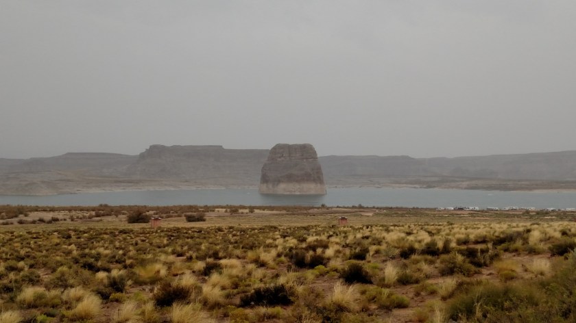
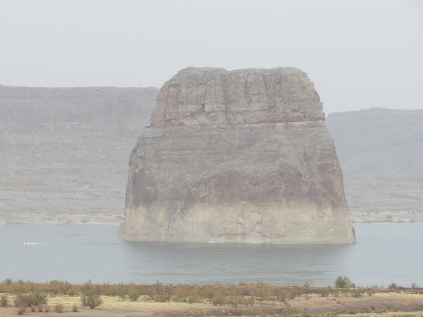
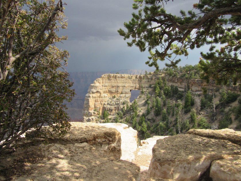
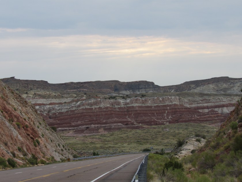
When I left Kanab Saturday morning for a big scenic drive to the east, the weather looked pretty dismal.  Lots of rain had moved through overnight and the cloud deck was still very low.

IMG_20170909_075543473

Fortunately, the weather would improve.

********

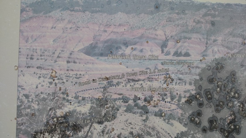
I saw a Historic Marker sign and was intrigued by what it said.  When I stopped to read the actual marker I was interested to learn that a short drive away sits the ghost town of Pahreah, near the Paria River (not sure why the different spellings).  The ghost town is often used as a movie set when filming westerns and such.  The sign next to the dirt road warned that driving on it should not be attempted when the road is wet.  I would have liked to have seen the little town but it had rained a good bit overnight so I didn’t chance it.  I’d like to get back to Durham without having to call AAA again!

IMG_20170909_083150708

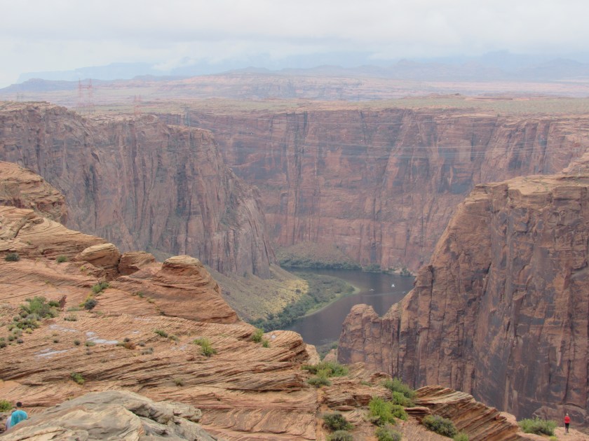
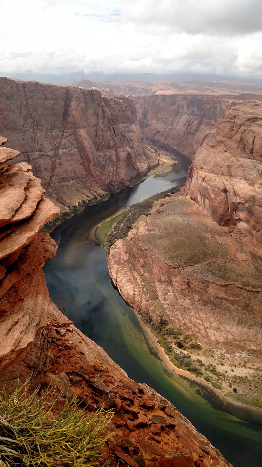
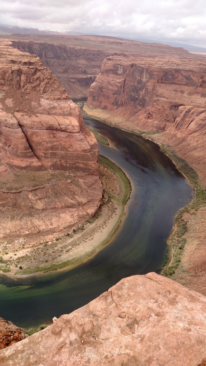
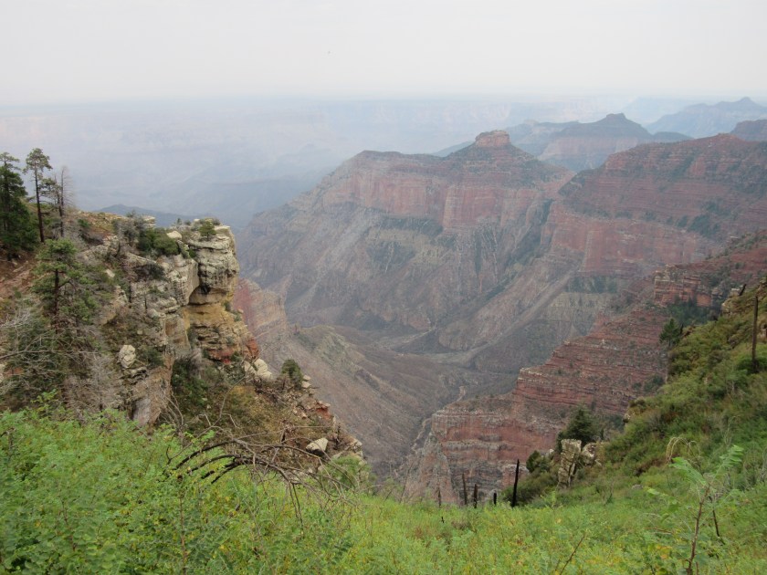
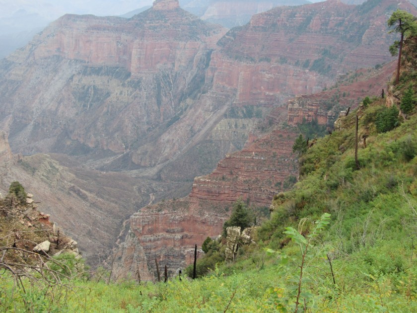
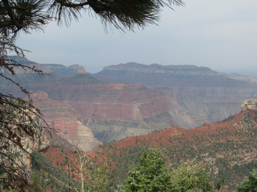
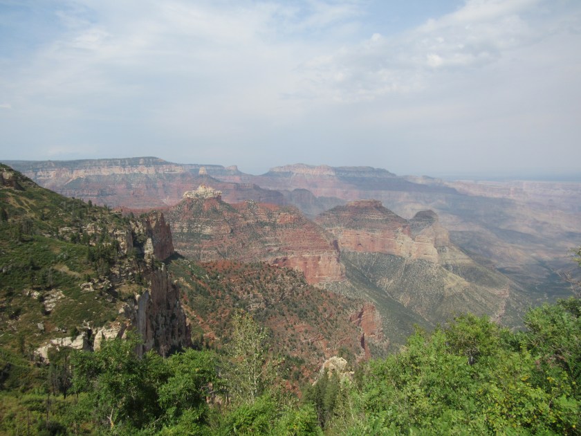
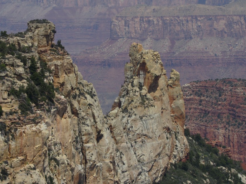
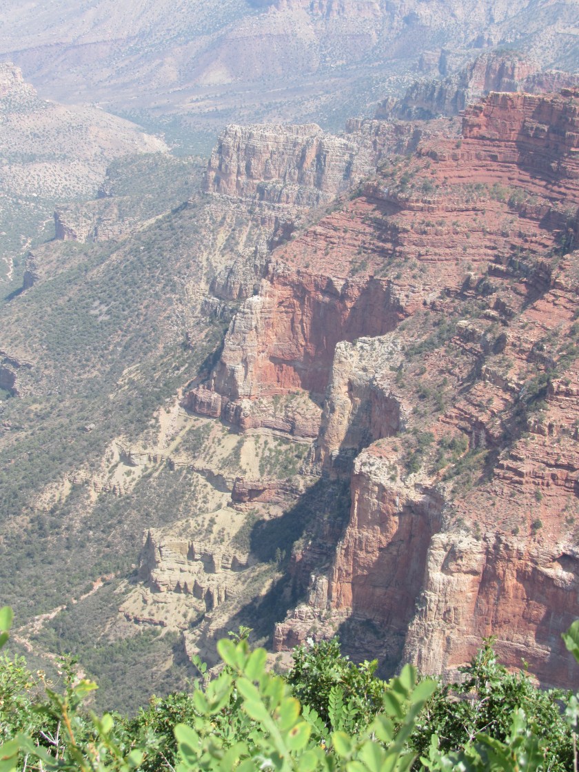
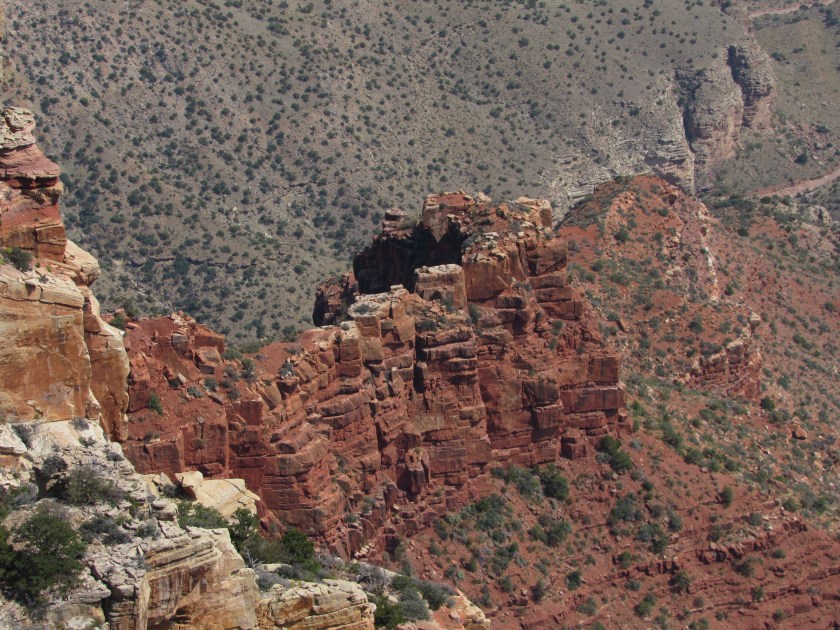
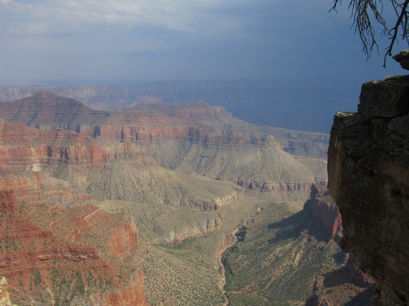
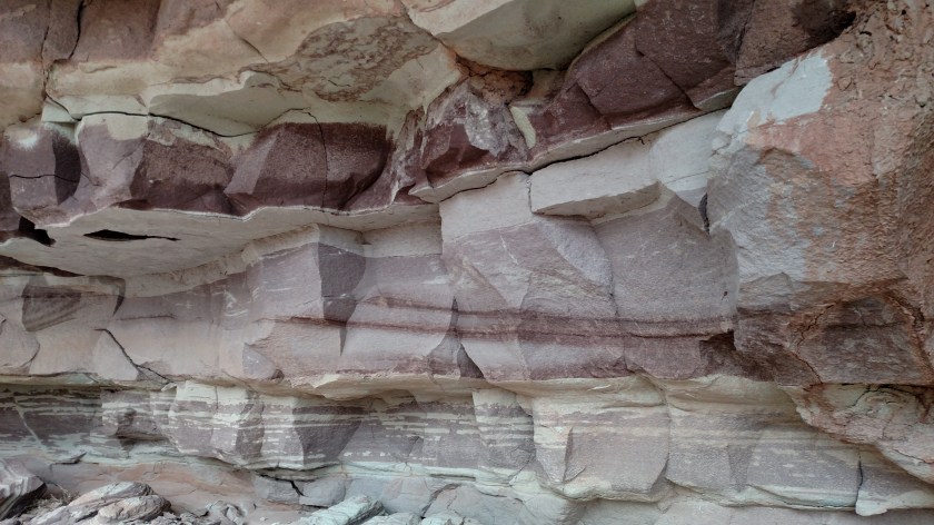
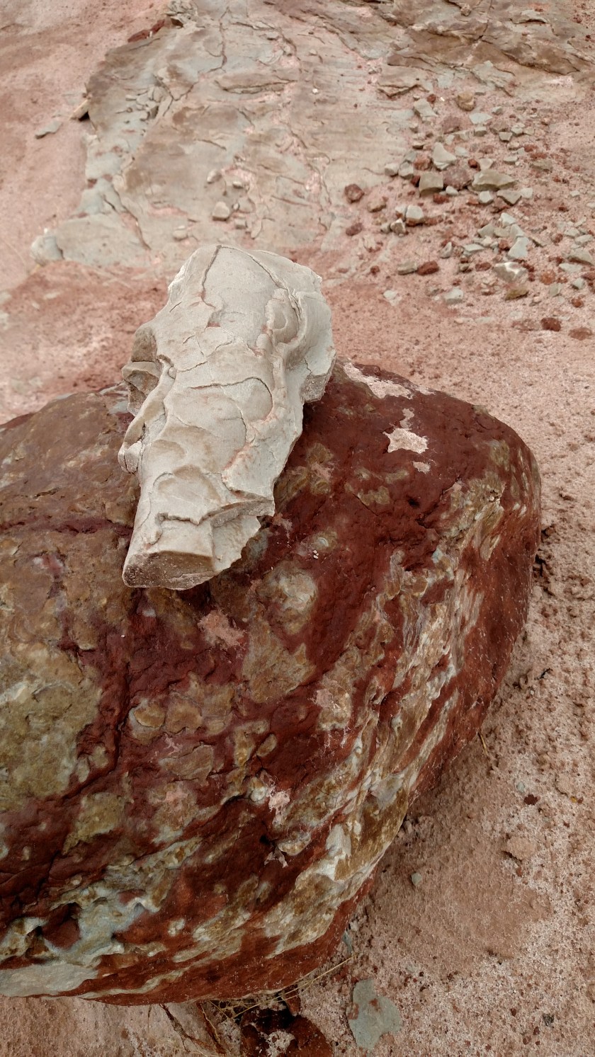
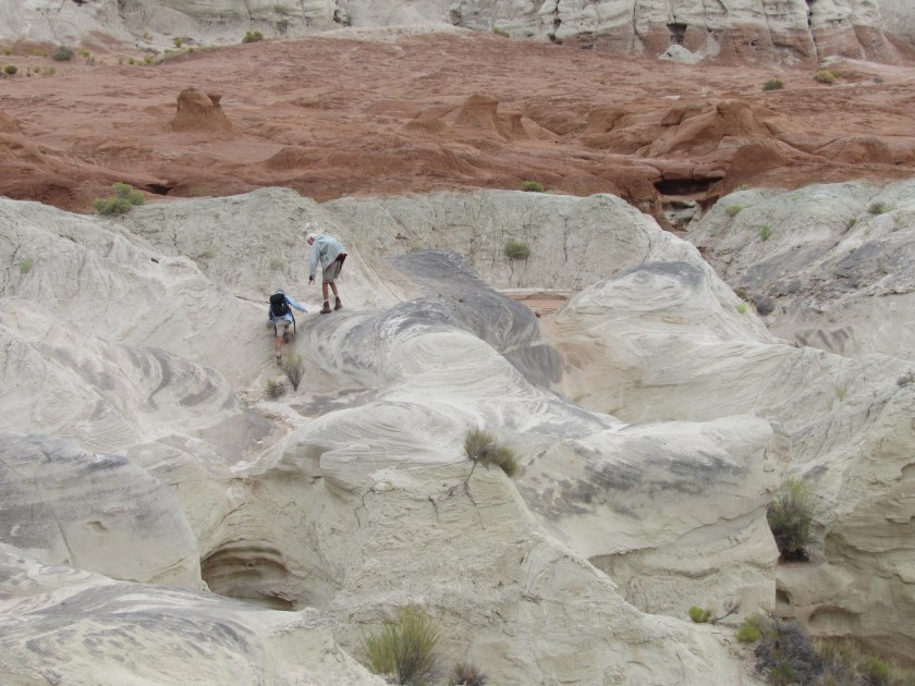
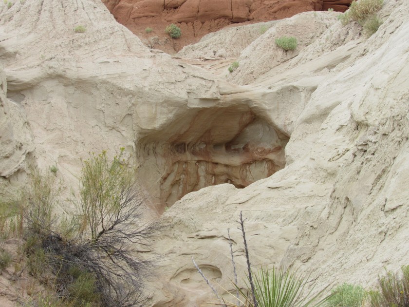
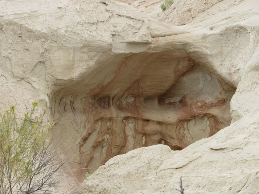
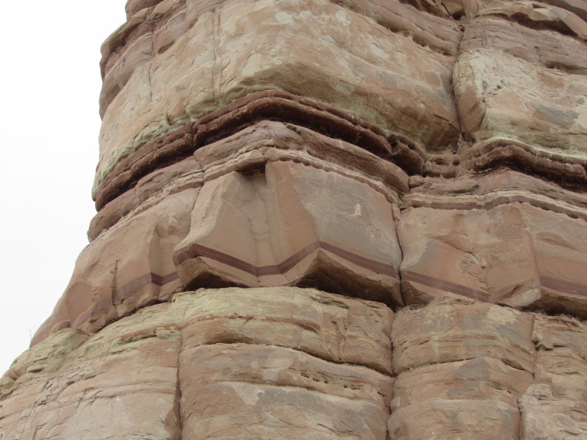
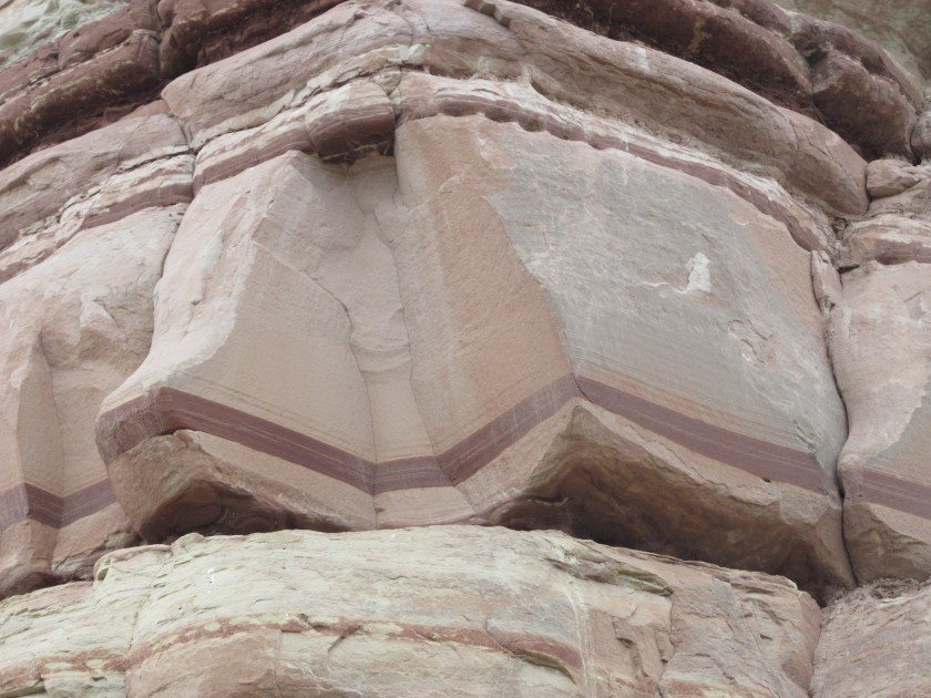
I drove about 10 miles or so further east over nice, but nondescript terrain.  Then I went through a series of turns which dropped me a fair amount in elevation.  The scenery on that portion of the road, as well as what followed, was more dramatic.

IMG_20170909_085214156_HDR

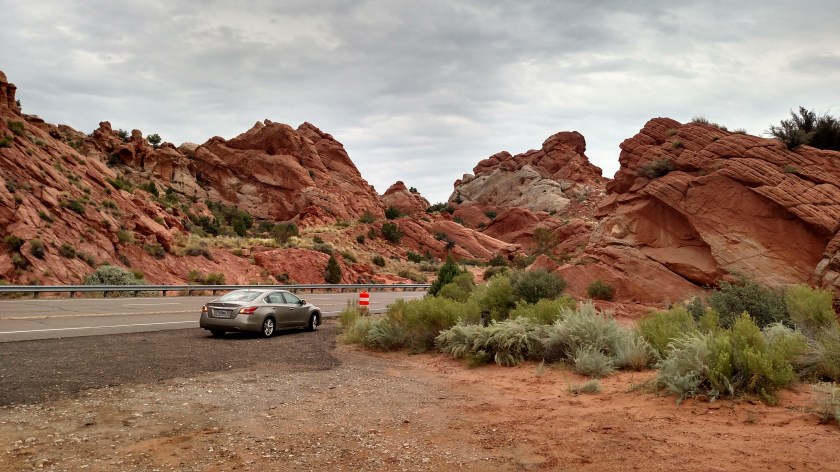
Why the orange barrel, you ask?  Evidently someone started making the next right-hand turn a tad early and had an oops.

IMG_20170909_085250984

IMG_20170909_085319344

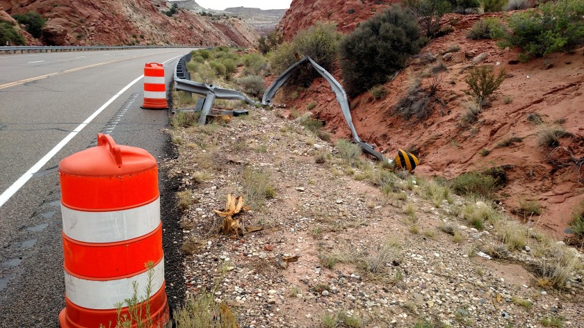
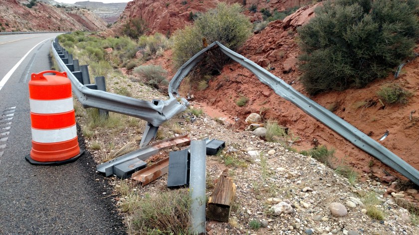
Maybe they were distracted by the scenery.

IMG_6112

IMG_6113

IMG_20170909_085300400_HDR

IMG_20170909_085427637_HDR

IMG_6134

IMG_6140

IMG_6141

IMG_6144

IMG_20170909_093227263

IMG_20170909_093227263

IMG_6151

IMG_6152

IMG_6162

IMG_6163

IMG_6166

IMG_6168

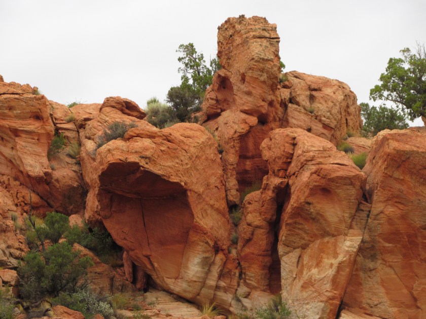
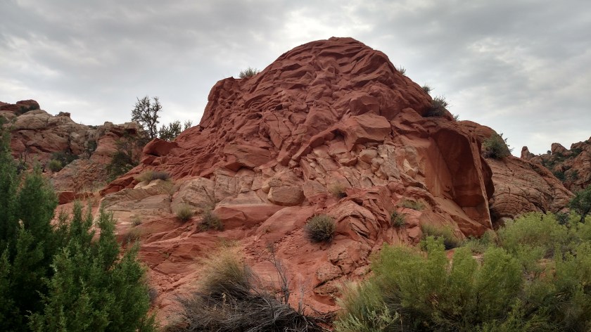
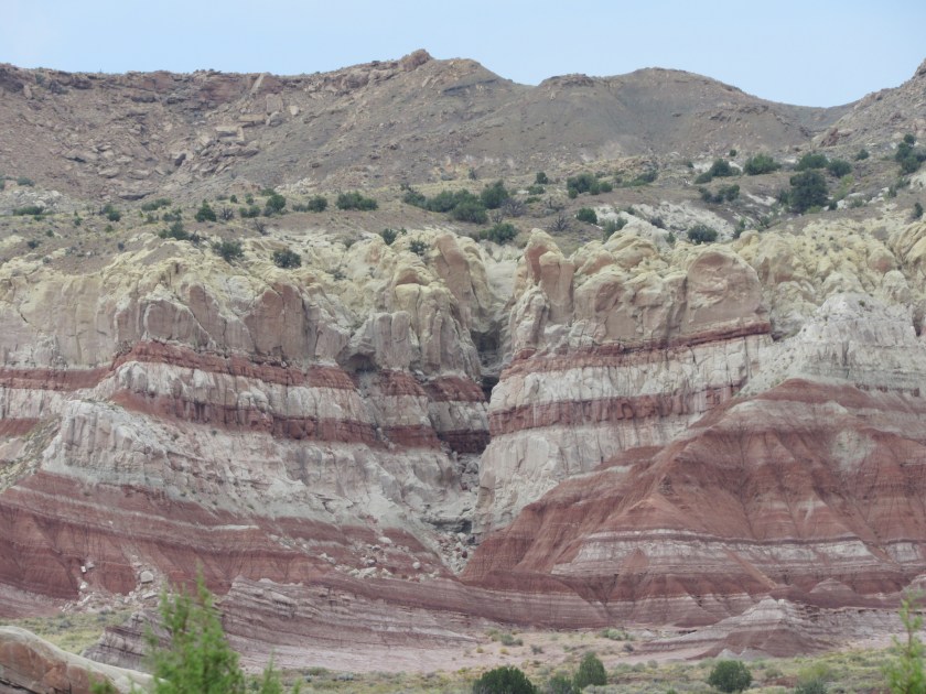
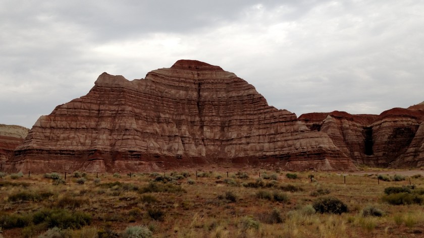
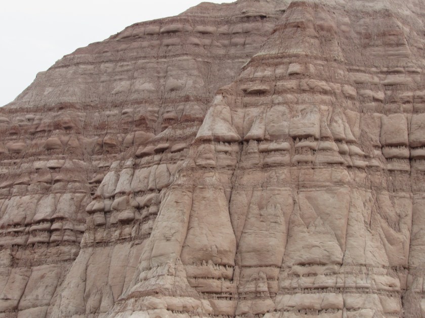
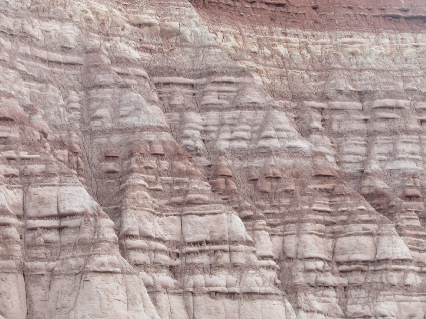
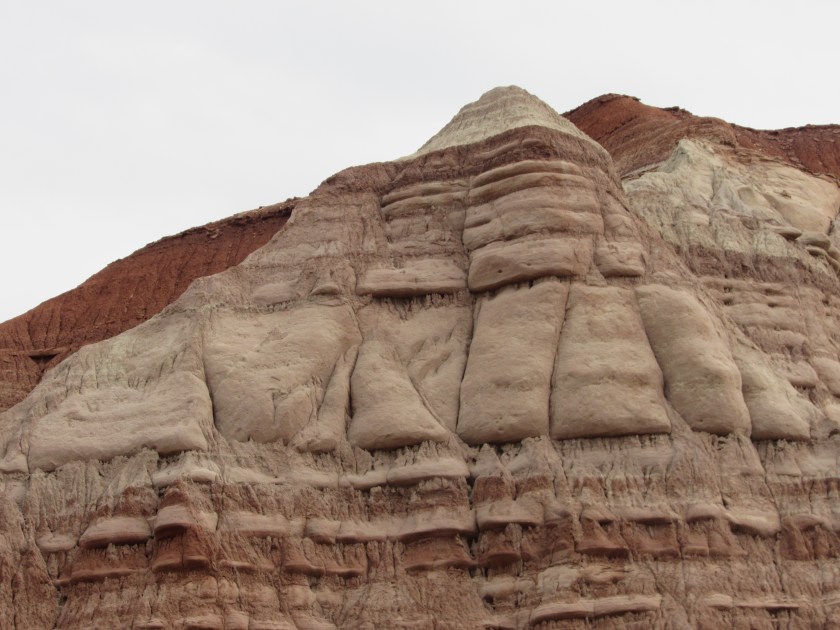
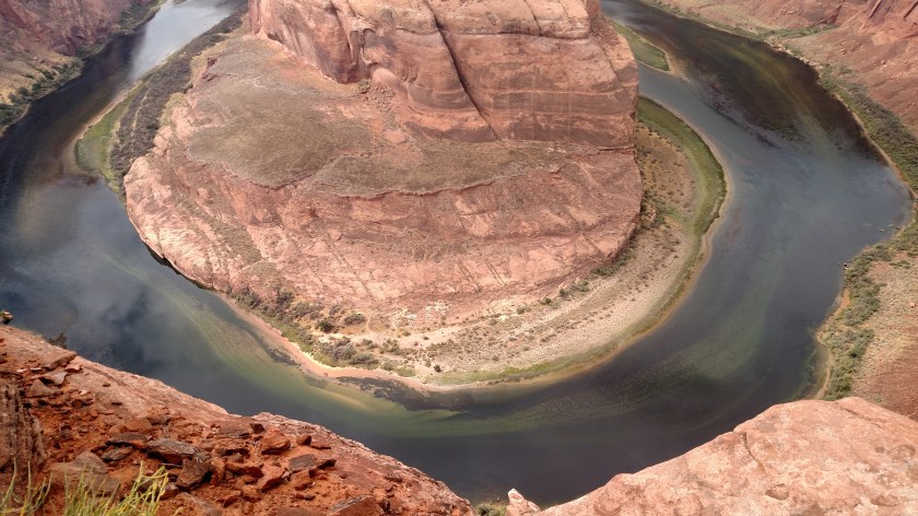
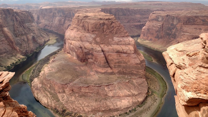
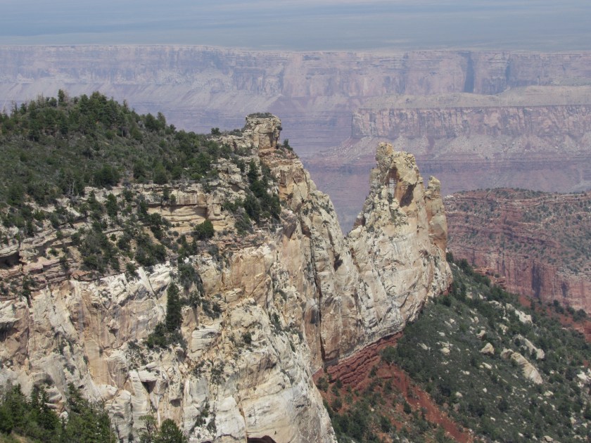
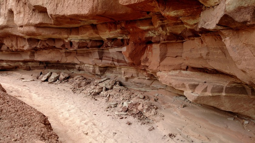
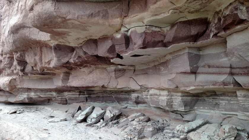
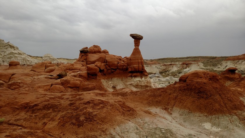
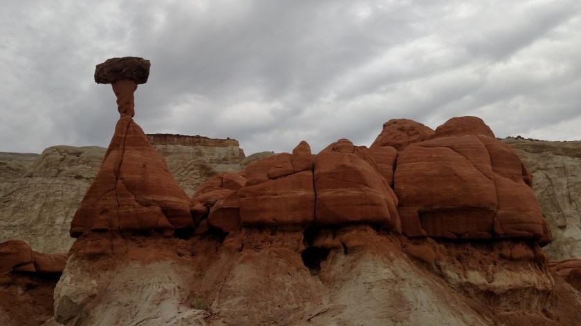
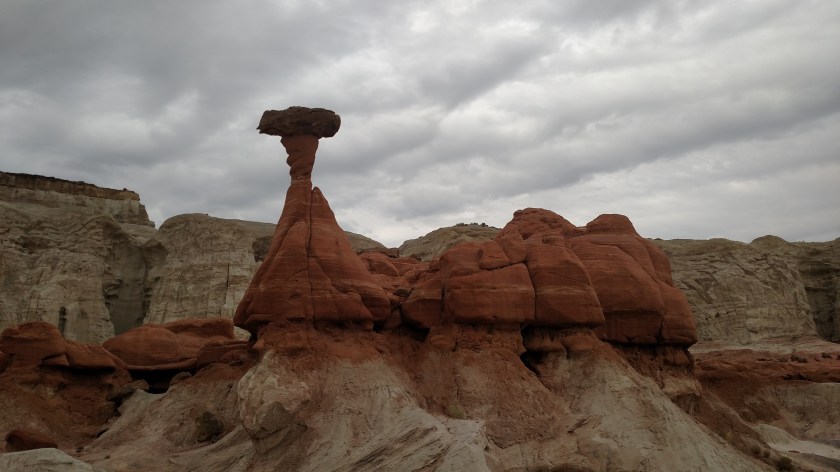
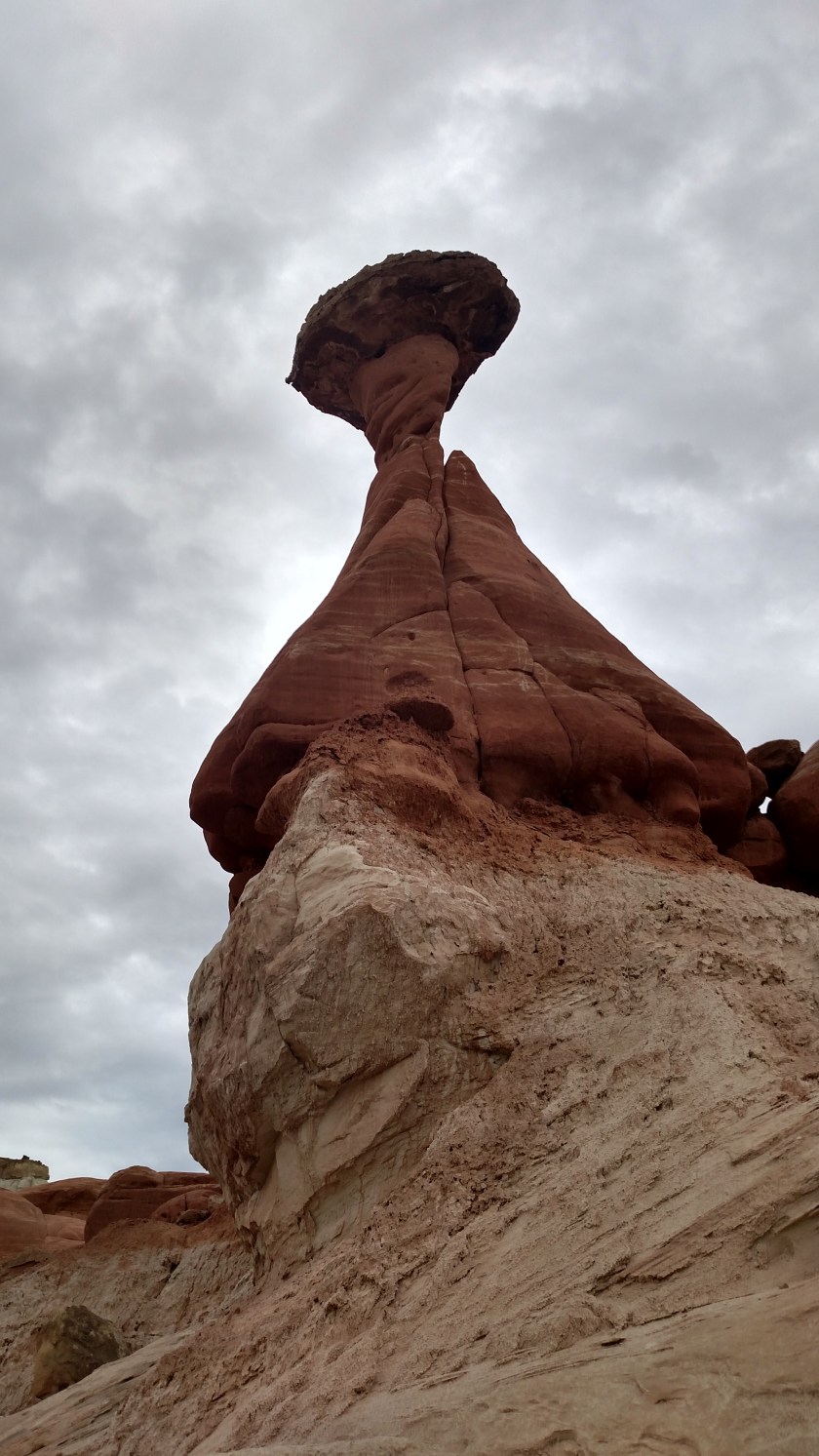
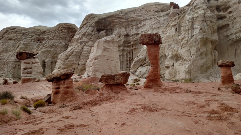
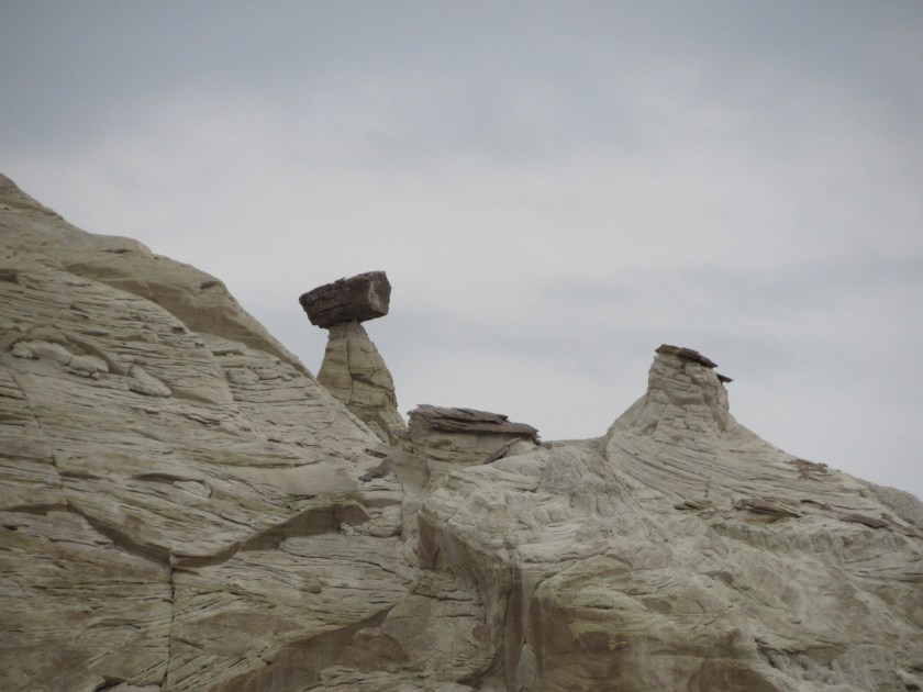
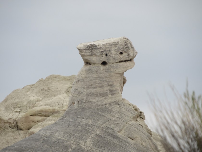
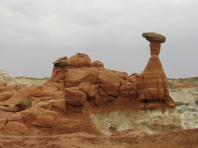
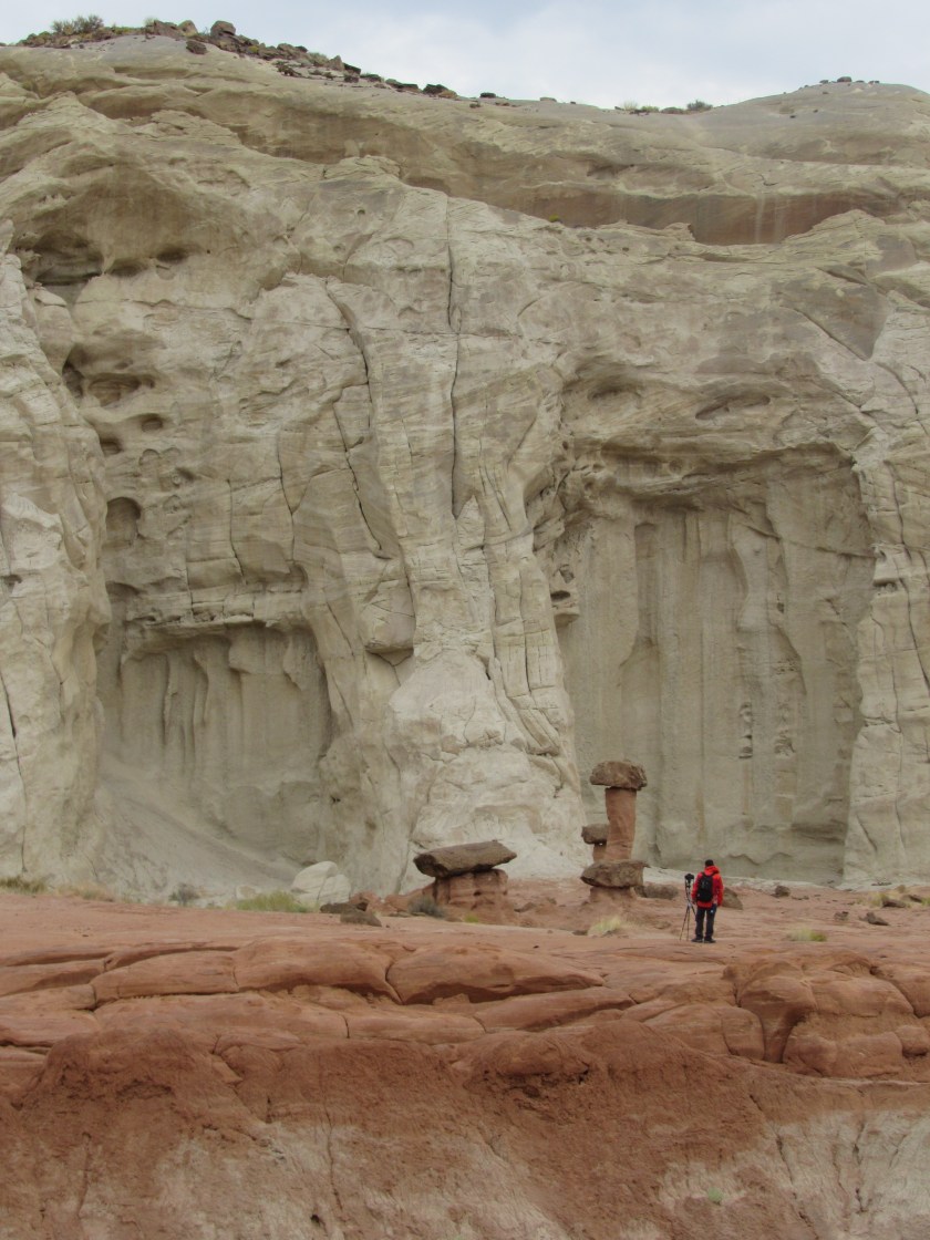
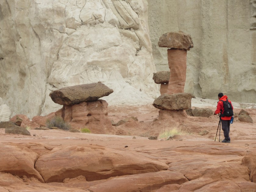
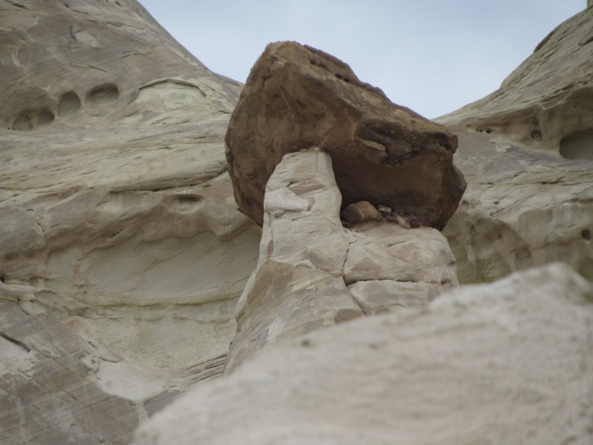
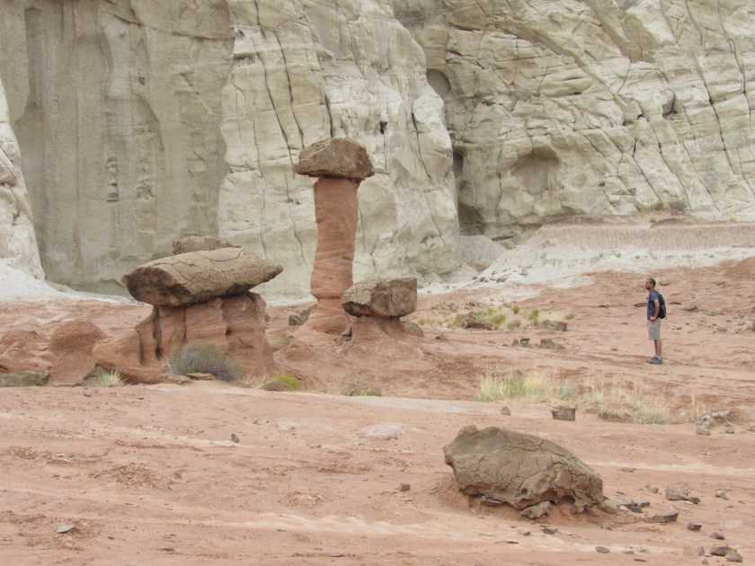
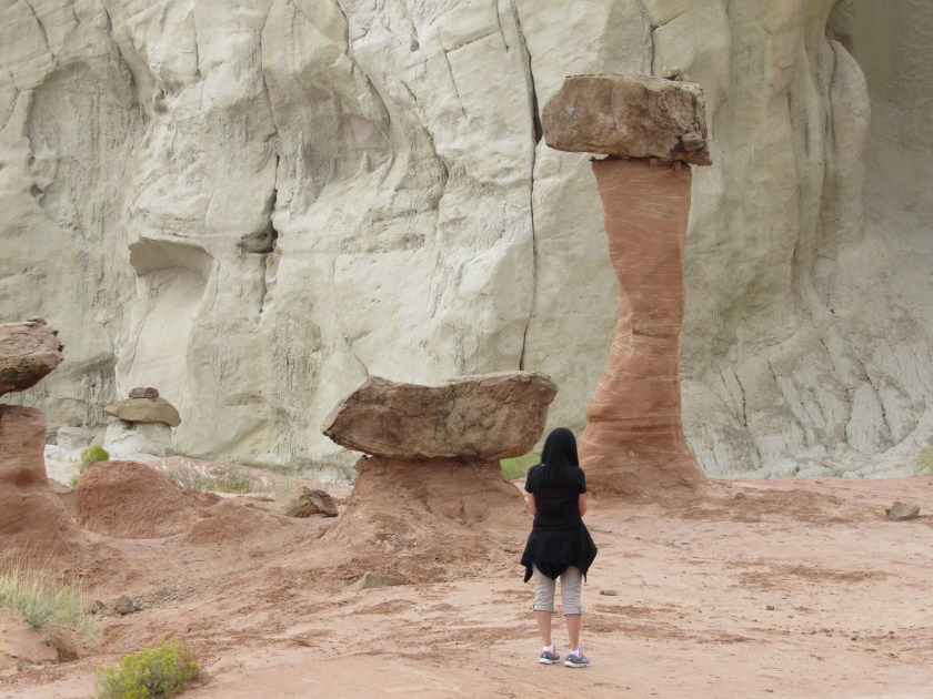
It would be behind these formations that I found the “Toadstools” (yesterday’s post).

Saturday morning – After Toadstools

These were taken after I visited the “Toadstools” formations, about a half hour east of Kanab.

When I got out to where I had parked the car a light rain had started to fall.  Actually, before I got to the car I should mention that something ran across the path in front of me, scaring me half to death.  I think it might have been a jackrabbit (a rabbit variation with very long legs and very big ears).  Either that or it was a kangaroo.

Anyway, when I got to the parking area two trucks were pulling in with UTV’s on trailers (no longer just all terrain vehicles – these are utility terrain vehicles thank you very much).  These vehicles can hold four people properly strapped in, plus a two-martini lunch (for those who like theirs shaken, not stirred).

IMG_20170909_112405910

IMG_20170909_112446743_HDR

I told the two couples who got out of the trucks that the UTV’s were way too clean.  They said they had just driven through some heavy rain which washed all the fun-mud off them.  They were driving west towards Kanab, and I would be driving east and into the rain they had just experienced.  They weren’t planning to use these vehicles here, they just stopped to see the Toadstools.

I continued on east and soon came to the recreation area they had been at earlier in the morning.  This huge rock sits in the middle of a lake.  It is called Lone Rock, and is part of the Big Water Recreation Area.  The lake (actually, it is part of the Colorado River) continues east towards the Glen Canyon Dam, and there is a marina with larger boats and other pleasure craft further downriver.  Lone Rock is next to the Big Water Campground.

IMG_20170909_121639624

IMG_6262

If you look closely at the photo above you will see someone jet-skiing on the river.  Here is another photo from a slightly different vantage point which gives you some idea how big Lone Rock is.

IMG_6267

I continued on towards the Glen Canyon Dam.  Once I passed over the dam I came to an overlook which offered some pretty dramatic views.  The dam itself wasn’t all that impressive, in my opinion, plus there were lots of power lines and such so it wasn’t a very good photo op.

IMG_6308

IMG_6307

I took advantage of my newfound spy status to take some photos of people without their knowledge.

IMG_6311

IMG_6331

IMG_6333

After leaving the Dam area I moved on to the next venue.  While walking up the hill to that viewing area I caught these folks candidly as well.  At first I thought the guy in the photo below was proposing, but after examining another photo which was zoomed in more he was just taking her picture.

IMG_6348

These folks (different from the “proposal” couple) were using their dog, Suki, as a prop.  Evidently Suki isn’t afraid of heights, and fortunately they weren’t offering her for sacrifice…

IMG_6350

Suki is SO cute….

IMG_20170909_140841194

IMG_20170909_140848961


Horseshoe Bend

After proceeding over the Glen Canyon Dam Bridge I arrived in the town of Page, Arizona.  Here I found something I had already bought a picture of the day before.

The picture I bought was taken by a professional photographer, either using a special lens or after being hoisted by a crane.  I have neither of those items in my repertoire so you’ll have to settle for a two-part picture, given the size of the object and my proximity to it.

This is a bend in the Colorado River as seen from 1,000 feet above (yikes!).  Believe me, it took all the courage I could muster to get the shot of the actual bend in the river, achieved pretty much by walking close to the edge (I SERIOUSLY considered crawling out but already looked silly enough in my Safety Sam vest, and there were lots of people around) and holding my phone WAY out in front of me, hoping I was holding it at the correct angle.  I’m relieved these came out fairly well because I don’t care to go back.

IMG_20170909_140958230

IMG_20170909_141034716

IMG_20170909_141040537

IMG_20170909_141043405

I looked around for another sturdy spot and thought I’d better try again, just to be sure.

IMG_20170909_141123799

IMG_20170909_141120884

IMG_20170909_141222255

IMG_20170909_141320748

Navajo Bridge

After finishing up things in the Page, Arizona area I continued making my clockwise loop back towards Kanab.  I stayed on Route 89 until I got to the town of Bitter Springs.  Getting there required making a fairly substantial elevation drop to the desert floor.  Once there, I turned right on Route 89A which would take me to the next series of sights.

First up – the Navajo Bridge, which spans the Colorado River.  Given the reduction in altitude, the drop from the bridge to the water is less than half what it was at Horseshoe Bend, up in Page.

IMG_20170909_142536579_HDR

IMG_20170909_142546582

IMG_20170909_142617660

This was taken from the pedestrian bridge which is located alongside the vehicular bridge.

IMG_20170909_142828042_HDR

And this is looked the other way, northeast, away from the pedestrian bridge.

IMG_20170909_142934682

IMG_20170909_142939176

IMG_20170909_142943876

And these give you some idea of what is in the area if you stop looking down.  First looking northwest, which was my direction of travel….

IMG_20170909_142953245

…. and then looking southeast, which is where I was coming from.

IMG_20170909_143005261


Grand Canyon North Rim – Lodge

It had started to rain when I arrived at the Visitor Center and Grand Canyon Lodge on Friday.  Inside the Lodge is a restaurant and a large observation room with three huge windows overlooking the Canyon.  On either side of that room are outdoor decks with Adirondack chairs for relaxing while you enjoy the view.  There weren’t any takers today, as everyone wanted to lounge on the huge, dry, comfortable leather couches in the observation room, or stand and stare at the view.

IMG_20170908_102618322

IMG_20170908_103509876_HDR

This was the deck outside the left set of doors.

IMG_20170908_113205498_HDR

IMG_20170908_113238648_HDR

IMG_20170908_113216547_HDR

IMG_20170908_113200673_HDR

And this was the area outside the right set.  The restaurant is inside the building on this side, and the path down to the overlook I went out on was over here as well.

IMG_20170908_113411574_HDR

IMG_20170908_114725754_HDR


Grand Canyon NR – Close-ups (1/3)

These are pictures I took with the digital camera on Friday at the North Rim.  They are all from two scenic roads north of the Lodge which ultimately lead out to Imperial Point and Cape Royal, respectively.  These appear in the order I took them, with improving, then deteriorating weather conditions.

I did not take any photos with the digital camera from the Lodge itself due to the heavy overcast.

IMG_5934

IMG_5936

IMG_5938

IMG_5958

IMG_5965

IMG_5967

IMG_5994

IMG_5997

IMG_5998

IMG_6008

IMG_6009


Toadstools! 

My Airbnb host in Kanab told me about this place which is about 35 miles east of town.  Saturday started out as a damp, dreary morning with a low cloud ceiling as there has been rain overnight.  As I drove east, however, visibility improved and I decided to make the one-mile trek back to see these curious formations.  They are sometimes called Hoodoos.

The “path” was mostly in a dry, sandy creek bed.  The overnight rain evidently hadn’t reached this far east so it was kind of like walking on the beach.  Occasionally the path went near some large rock over-hangings and there were some interesting layers of rock which had broken away underneath.

IMG_20170909_095708242

IMG_20170909_095727286

IMG_20170909_095735992

I found this rock in the path and it made me think of the Star Destroyer ship from the movie Star Wars.

IMG_20170909_100545265

IMG_20170909_100608202

I finally made it back to the eerie landscape where the toadstool formations are.  What follows are many photos from various angles of the main formation, as well as some standalone ones nearby.  The pictures in this post were all taken with the smartphone camera.  A post with other photos taken with the digital camera follows.

Toadstools are natural spires with a large rock sitting on top.  These aren’t things made as a prank by college kids.

IMG_20170909_104041465

IMG_20170909_103121023_HDR

IMG_20170909_101407550

IMG_20170909_101252474

IMG_20170909_103808053_HDR

IMG_20170909_104803790_HDR

There is another location with many toadstools (Hoodoos) in the town of Page, which I drove through later in the day after I crossed into Arizona.  That venue requires a considerable hike which I was not going to make.  I’m sure you can find photos online if you Google: Page Arizona Hoodoos.  They are even more spectacular that these.

I believe there may have been other toadstool formations at this location as well, but rain was moving back in so I made the one-mile trek back to my car.  I arrived there just in the nick of time, as a gentle rain started to fall which quickly became a hard rain as I drove away.  I hope the creek-bed didn’t fill up for the folks who were going in as I was coming out!


Toadstools – Close-ups

It was about a mile walk back to the area where the toadstool formations were located.  Much of the “path” was actually a dry, sandy creek bed which probably fills rapidly with water when the monsoon rains hit.  It had rained overnight west of Kanab but evidently not over this direction, as the creek bed was dry.

Once you get back to where the toadstool formations are located you are in an eerie, moon-like landscape with many large grayish-white rocks with wind-swept swirl patterns and many rounded nooks and crannies.  The “path” was not as obvious back here and I found myself in many dead-ends.

IMG_6170

IMG_6190

IMG_6191

IMG_6196

IMG_6205

IMG_6206

Nearby are many reddish-brown formations, such as the main attraction which is brown but sits high atop a white base.

Front:

IMG_6200

Back:

IMG_6214

IMG_6227

And behind the main attraction are some smaller, standalone formations.

IMG_6220

IMG_6181

IMG_6179

IMG_6180

I believe this one fell over.

IMG_6208

IMG_6231

IMG_6242