At Moore Park on the south end of Upper Klamath Lake. A very nice breeze and cooler than the Lava Beds!
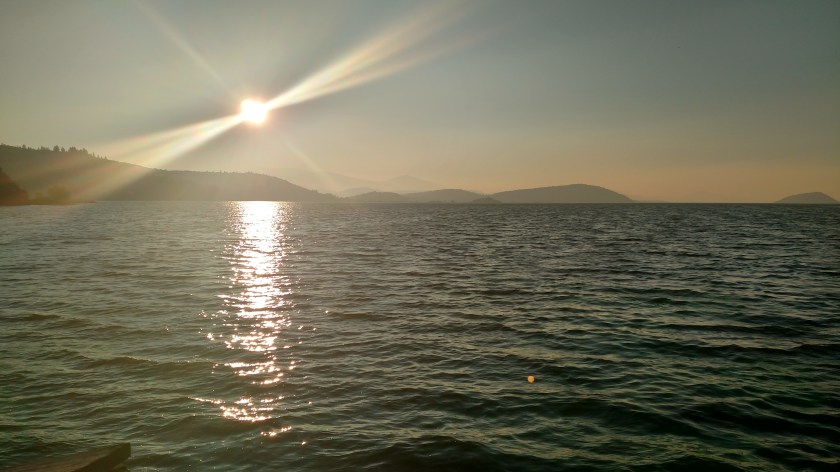
At Moore Park on the south end of Upper Klamath Lake. A very nice breeze and cooler than the Lava Beds!
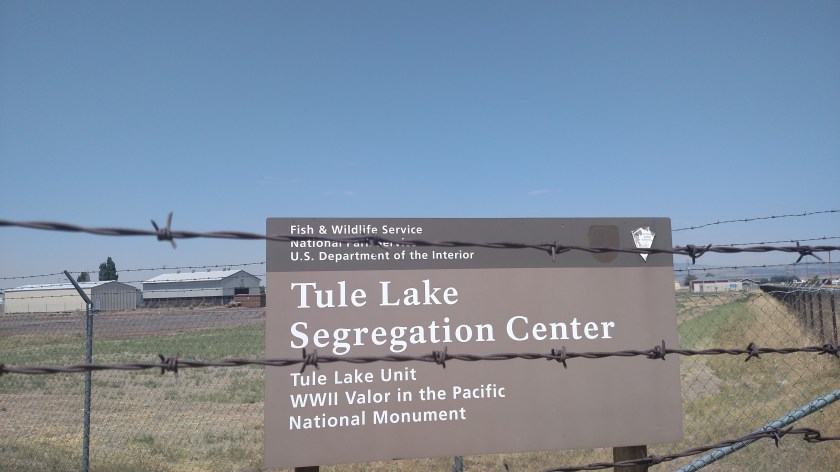
On my way home from the Lava Beds National Monument this afternoon I stopped at the site of this, now defunct, facility after having learned details about it while at the Lava Beds (and it had been mentioned by my Airbnb hostess here in Klamath Falls).
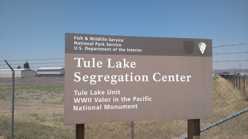
After the Japanese attacked Pearl Harbor the United States government, in it’s infinite wisdom, rounded up approximately 120,000 people of Japanese ancestry living in the western United States (most of whom were American citizens) and placed them in 10 different “War Relocation Centers”. In 1943 the government gave them all a “questionnaire” to determine their loyalty to this country. Persons who refused to complete it, or who “failed,” were brought to this facility (one of the 10) which was renamed to be a “Segregation Center” and basically became a maximum security prison.
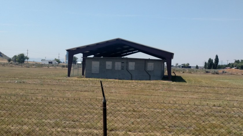
In 1944 local farmers petitioned the federal government for manpower assistance. 150 Italian POWs (Prisoners of War) converted the facility to house 800 German POWs who were then used to help farmers tend to and harvest their crops. The occupants were released at the end of World War II.
Given it’s ultimate mission I thought it appropriate to back up a step or two and get more barbed wire in the shot:
And this was all I could see that remains of the facility, a concrete barracks, now covered with a metal canopy (again with barbed wire for effect):
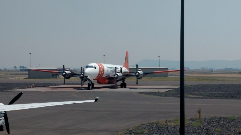
On my way down to the Lava Beds National Monument this morning I passed by the Klamath Falls Regional Airport and noticed a sign to this memorial. I stopped in on my way home this afternoon.

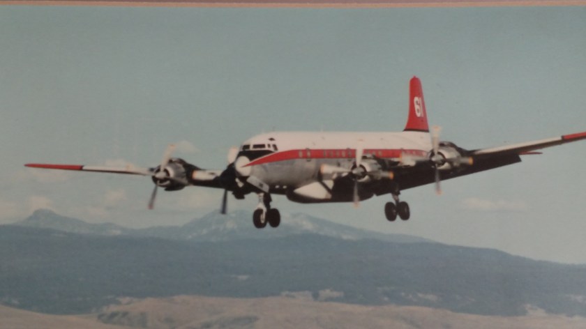
On October 1, 1992 both crew members on board fire-fighting Tanker 61 lost their lives when their plane (according to an eyewitness) clipped some trees while dropping fire retardant on the Cleveland Fire in the Eldorado National Forest, in California southwest of Lake Tahoe. The crash started a second fire about two miles from the fire they were trying to extinguish.
This is Tanker 62, thankfully sitting on the tarmac at the airport this afternoon:
Here is a photo of Tanker 61 in flight:
And of Tanker 61 “doing it’s thing”

Killed in the crash were pilot Chuck Sheridan, who flew his entire 6 year career from this base.
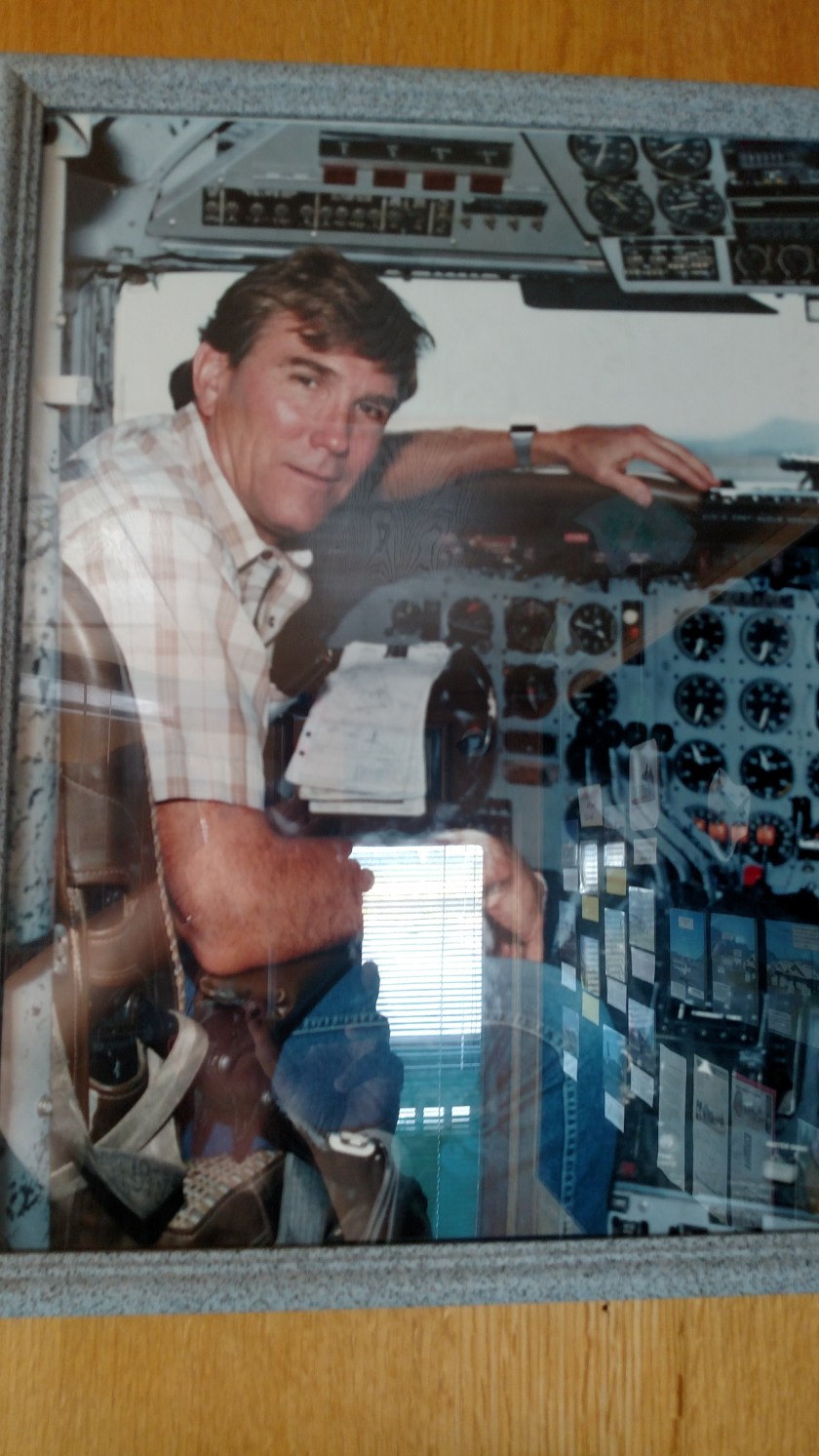
And co-pilot Leonard Martin, who had served in that capacity for 1 year.

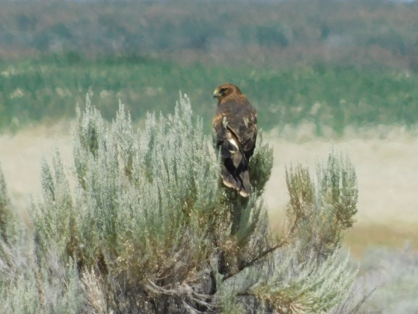
Saturday I drove down to visit the Lava Beds National Monument (which I will have other posts about). Now while I am staying in Klamath Falls, Oregon for a few days, the Lava Beds are about 45 miles south, in northern California. Both on the way to and from the Lava Beds I passed through portions of the huge Tule Lake National Wildlife Refuge. Here are some photos I was able to capture today using the digital camera:
I’m quite sure this is a Northern Harrier (a type of hawk). It was pretty far off the road but I could tell it was very big:
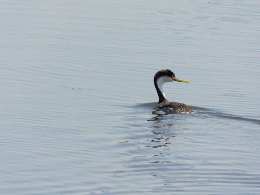
This red-eyed wonder is a Western Grebe. They are like loons and some waterfowl I saw while I was in Arcata (but haven’t posted about yet) in that they will dive underwater for a minute or more while searching for food. They really do have red eyes, although I think I was real lucky on this shot to get some great sun reflection (kind of “red eye” for birds!):


This is a Red-winged Blackbird:

And as I watching several of these to try and get these shots this one took flight towards where I was parked:

This is an American White Pelican. This Wildlife Preserve near Klamath Falls was the first place I ever saw a reference to these (I was here briefly last year after visiting nearby Crater Lake), although I never actually saw any until I was in Aurora, Colorado (near Denver) towards the end of my trip last year (Search for “Pelican Point” on the Home page, or use the calendar there to locate posts from 10/16/17).
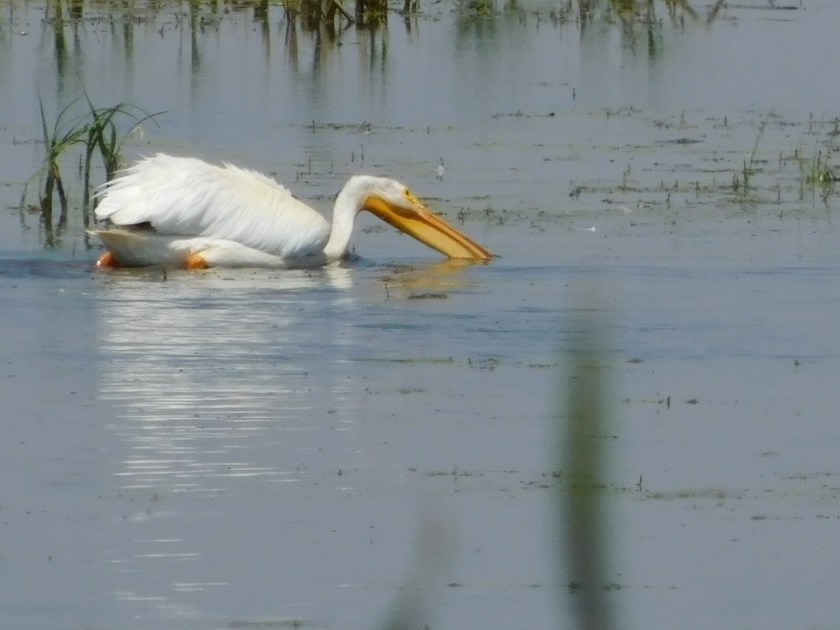
Unlike brown pelicans who dive from the air for fish these pelicans sit on the water and dip them out. Then they lift their heads and swallow their catch.
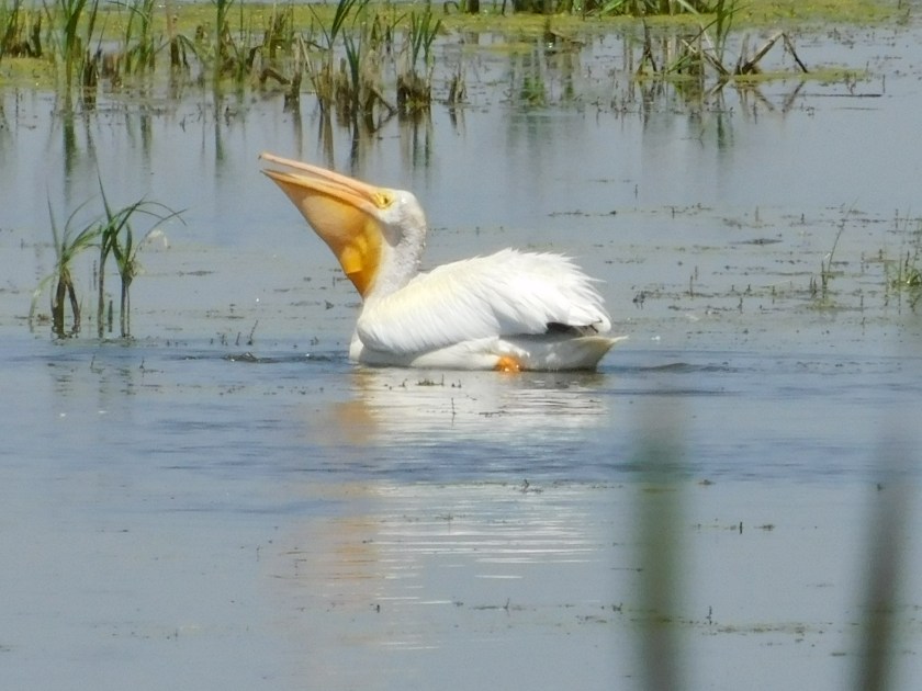
Then, like bobbing for apples, they go back for more…
They release the water from their pouch (but not the fish)…

Then lift and swallow:

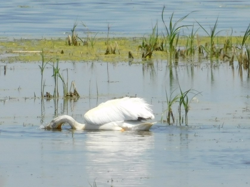
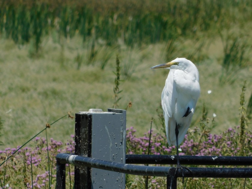
Finally, this is a Great Egret, perched on a nearby work platform, grooming itself while keeping an eye on the lake:


I may go back down to the Preserve on Sunday and try my luck getting more pictures.
I didn’t plan for this to happen but here goes….
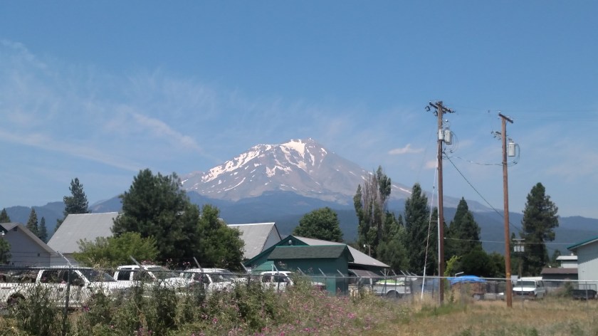
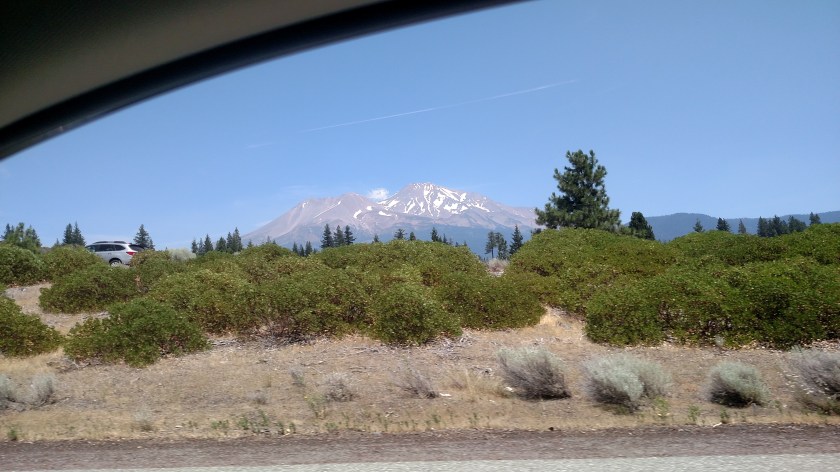
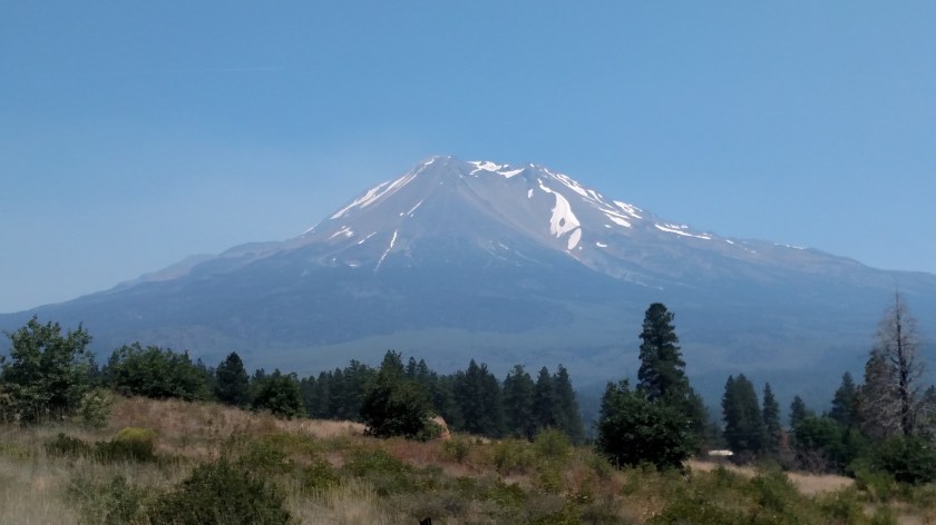
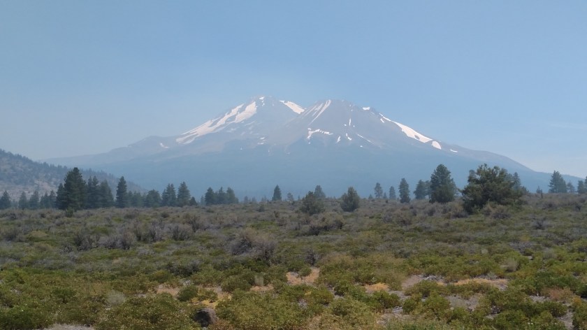
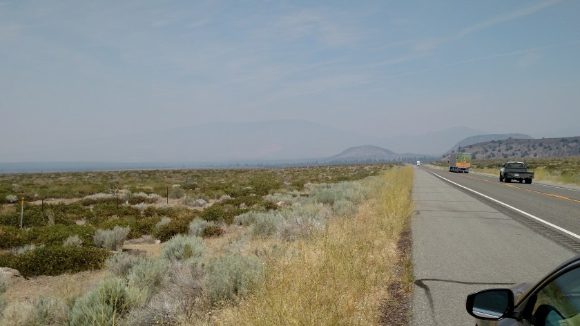
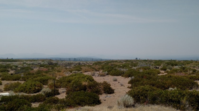
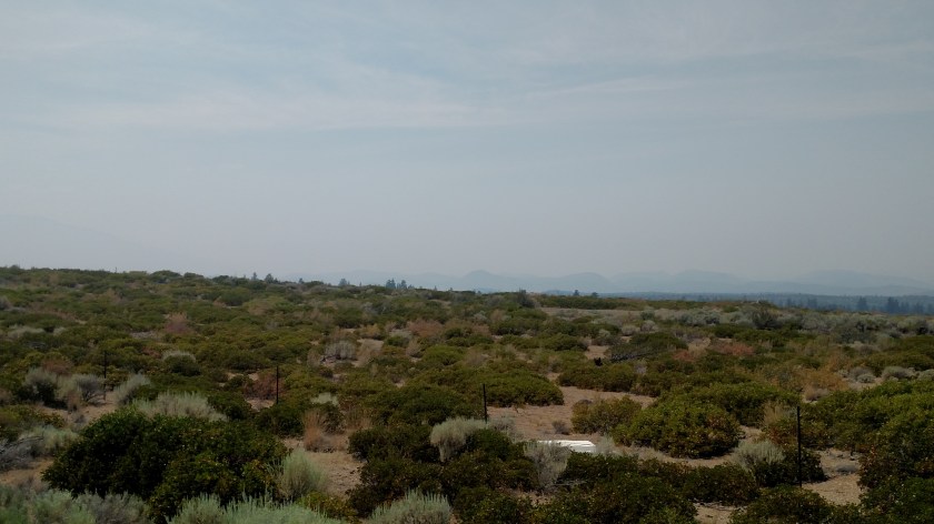
Friday was a travel day as I drove from where I was staying in Quincy, California up to Klamath Falls, Oregon (which, by the way is pronounced CLAM-ith, not CLAY-mith as I have been saying for the past year). My series of scenic roads took me around the western side of Mount Shasta, a 14,179 foot tall mountain in northeast California. Little did I know that the Klamathon Fire had occurred near Mount Shasta beginning back on July 5th, and lingering smoke was still very evident in a widespread area north and west of the mountain. Here is a series of photos I shot while traveling through the area Friday afternoon.
I took the first two pictures only to send to a friend of mine in Durham, showing her the snow on the mountain. They were taken as I approached the mountain from the southeast.
115pm, from a Vista Point (scenic overlook) along Route 89, SE of the mountain:

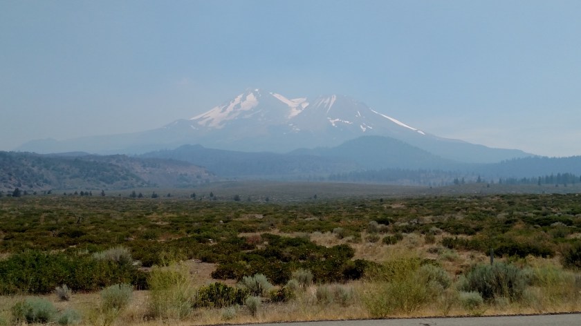
130pm, from the little town of McCloud, SSE of the mountain.
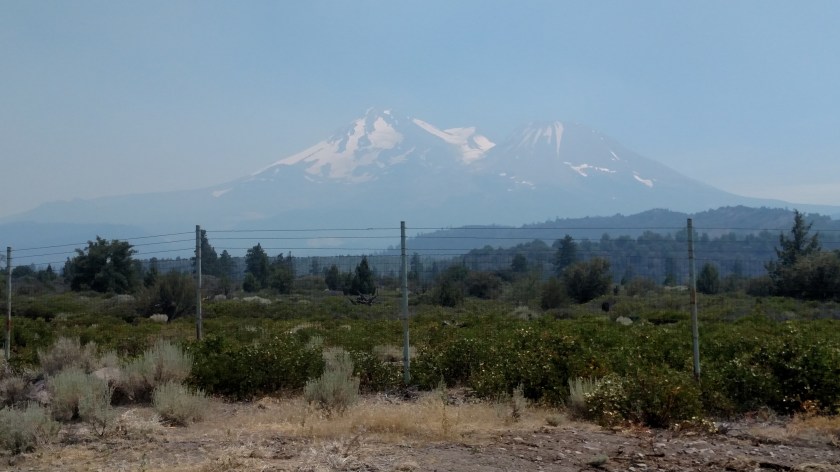
151pm, from Interstate 5 (while stopped in one-lane highway construction traffic, Shawn), west of the mountain:
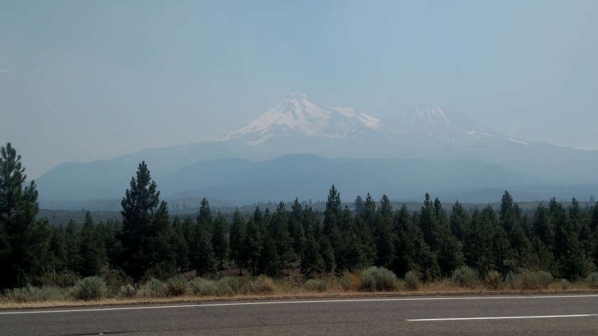
200pm, now on Route 97, northwest of the mountain, and starting to drive north and east away from it:
214pm:
217pm, from the vantage point where I took the photos in the previous post, Klamathon Fire:
220pm:
224pm:
And finally, 232pm, from another Vista Point specifically built for folks to stop and view the mountain – which you can now barely see:

Friday was a travel day, as I drove from where I was staying in Quincy, California north to the town of Klamath Falls, just across the state line in Oregon. To get there I took a series of scenic roads which would ultimately take me out to Interstate 5 (pardon me, “The 5”) near Mount Shasta, California. When I exited “The 5,” after only having been on it for 9 miles, I got on Route 97 which would take me northeast to Klamath Falls. As soon as I got away from the dreaded interstate and got to an elevation where I could see off to the left this is what I encountered:

Wildfire smoke. Big time. I knew about the Klamathon Fire and knew it was up this direction but didn’t know to what extent, if any, I would interact with it or exactly where it was. Now I do.
Off to the left of the highway from this vantage point is (or was) the little town of Holbrook, which is where the fire was located. The Klamathon Fire started July 5 and has damaged or destroyed 38,000 acres of land and 82 structures. A 72 year-old man was found dead in his home and his death is linked to the fire (I’m not sure if it was from fire itself or smoke).
Here is a panorama looking left from my vantage point parked along Route 97. There are lots of things (large and small mountains, etc) out there but you can barely see them:

Holbrook is not far from where I took these photos and is about 60 miles southwest of where I am now staying in Klamath Falls.
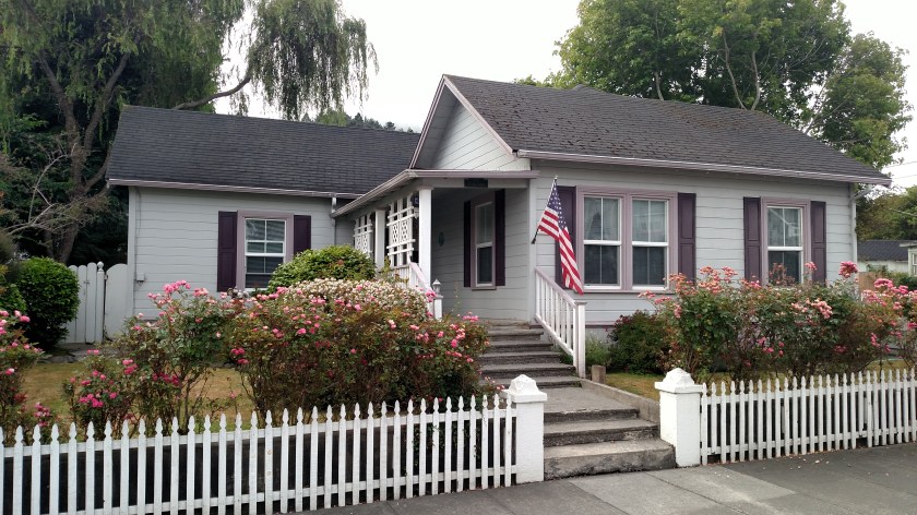
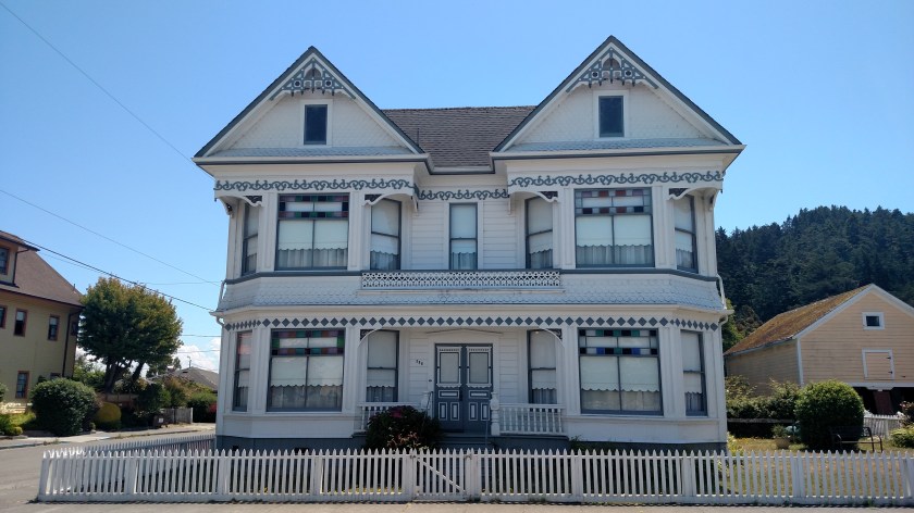
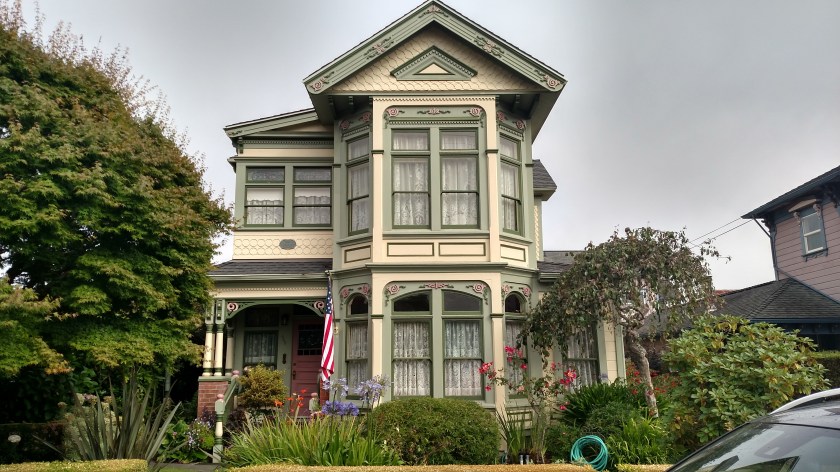
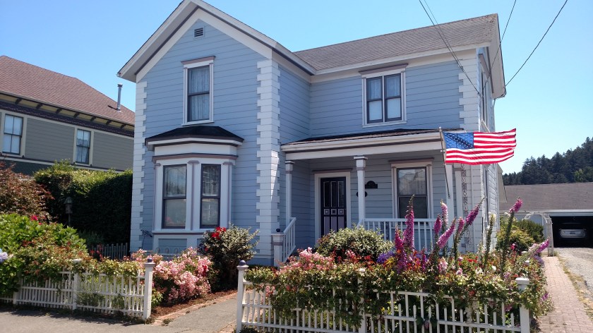
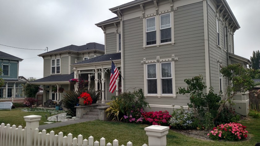
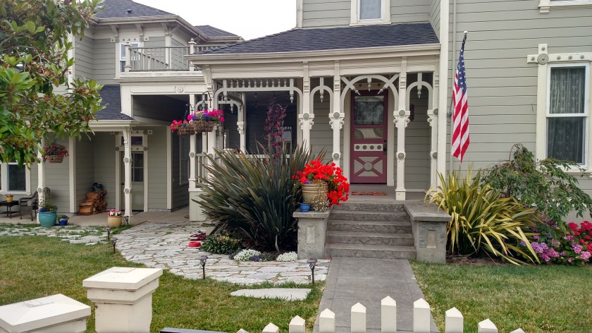
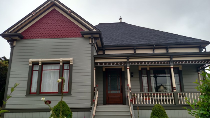
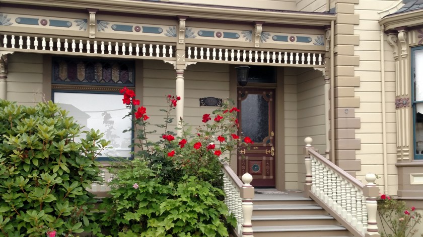
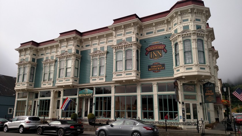
Ferndale (population 1,371) is a little town about 20 miles south of Eureka, California which is best known for it’s large number of Victorian homes and buildings. I drove down to Ferndale Sunday morning of the weekend I was staying in Arcata. Here are some of the houses I saw:
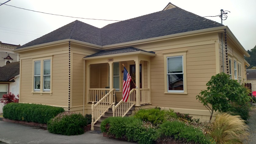
What I loved about this first house is that the gutters off the main roof, instead of feeding the rainwater through a drainpipe, dropped it through a series of little cups which would overflow and send the water to the next cup down the line. The narrow drainpipe in the next photo removes water from the small roof over the front porch.

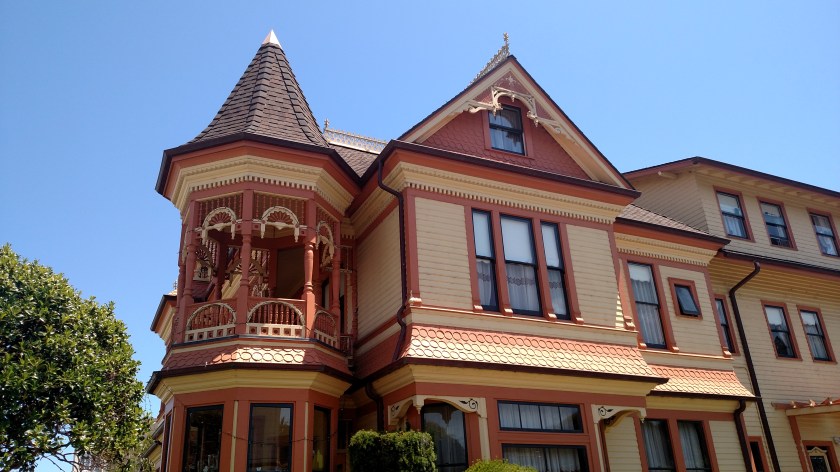
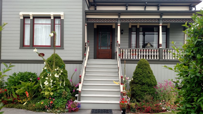
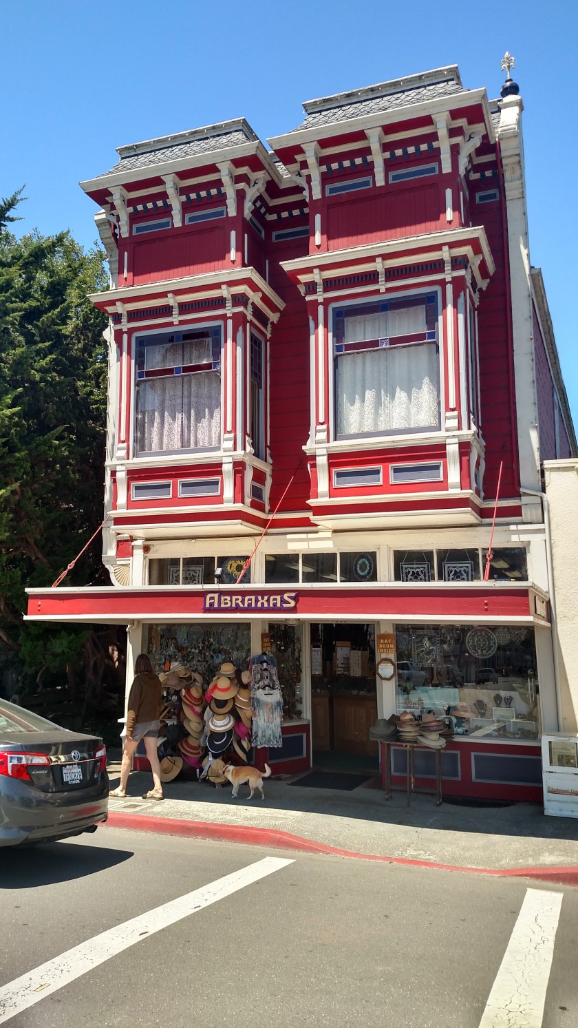
This next photo was taken shortly before 9am, while it was still overcast. When I came back in to Ferndale from having driven out to The Lost Coast I revisited some of the houses to get better photos after the sun had come out.

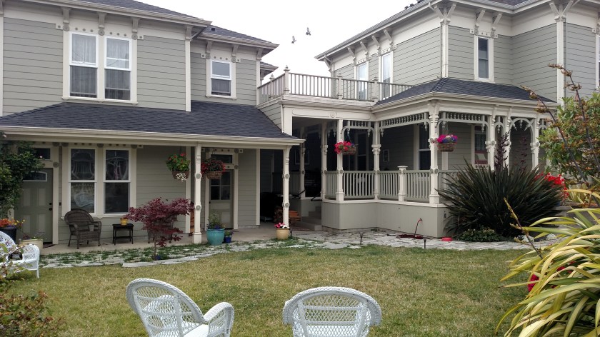
Same house, shortly before 1pm:
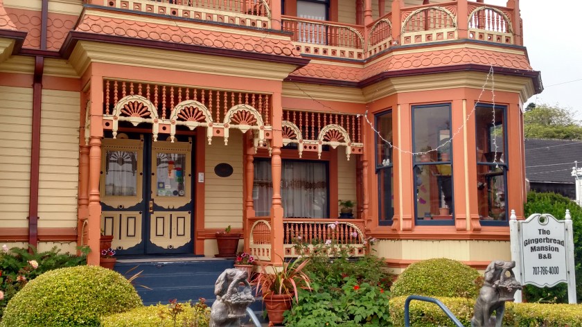
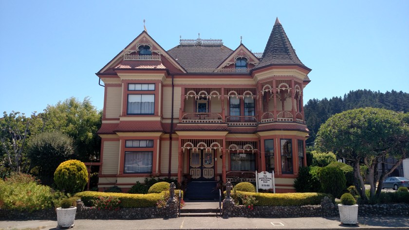
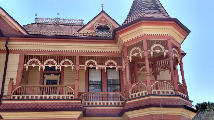
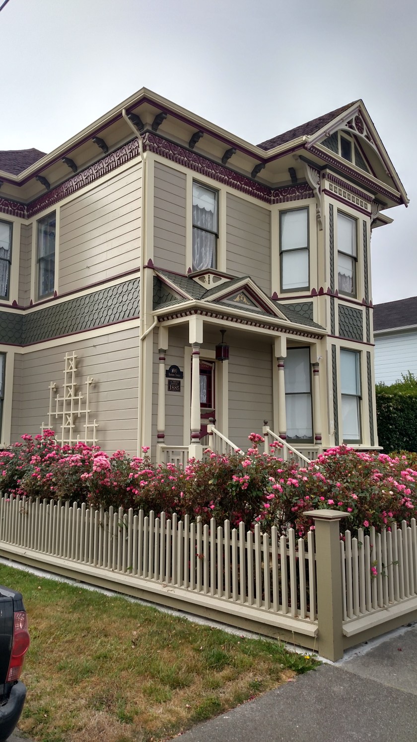
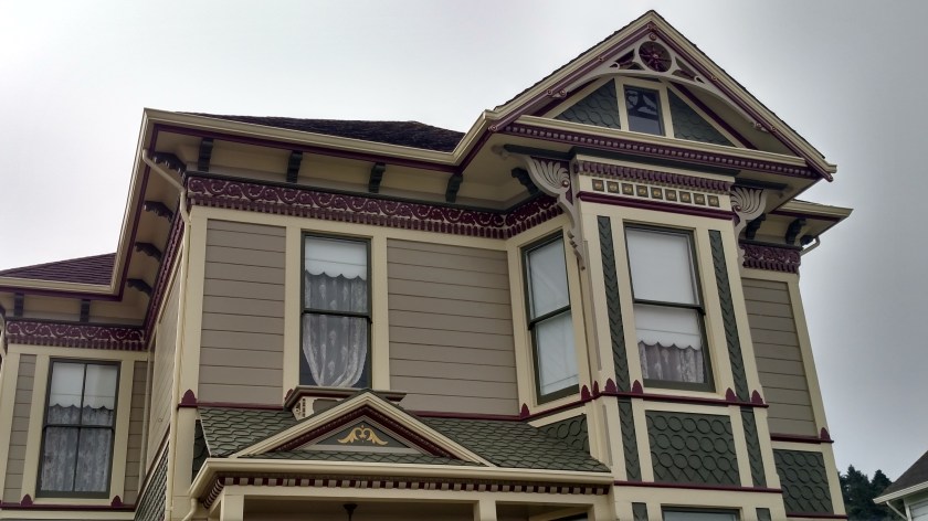
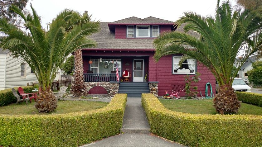
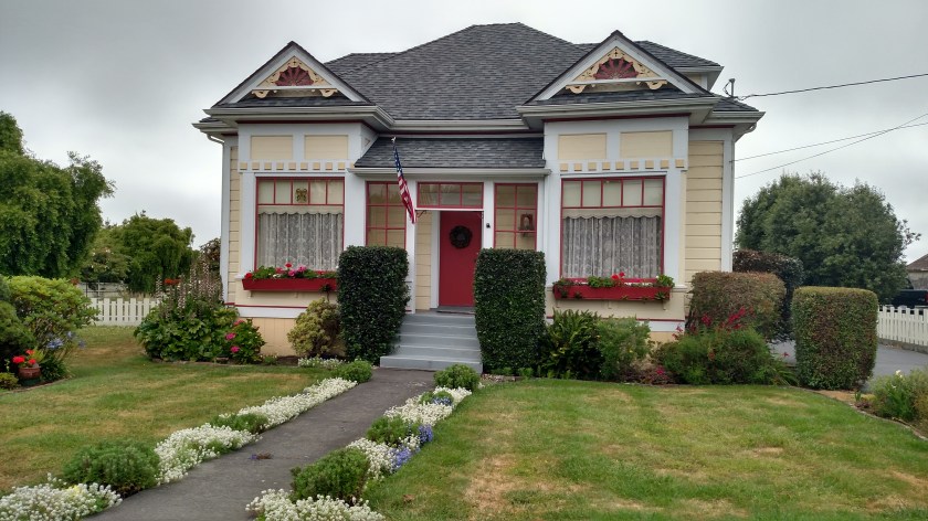
Same thing with this next house, the “Gingerbread House,” which is right across the street from the white house shown above.
Morning photos:


And early afternoon photos:
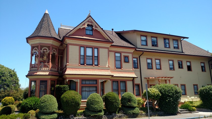
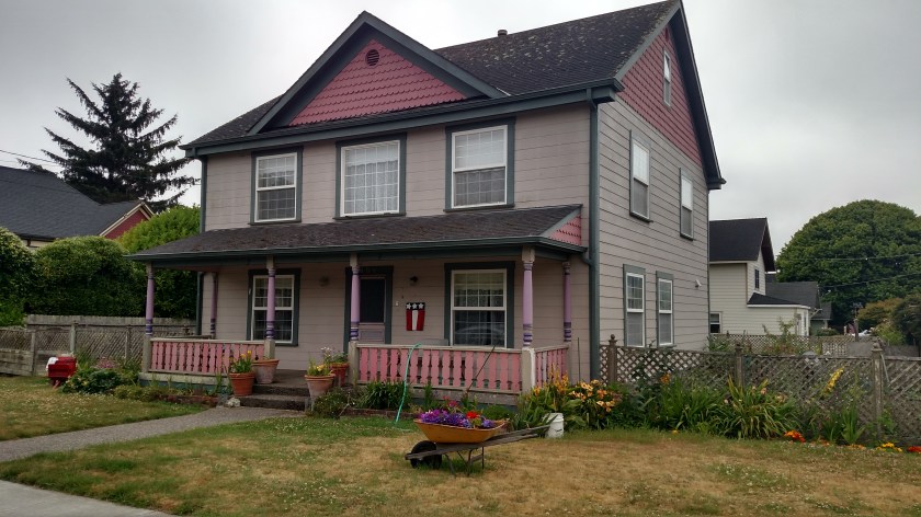
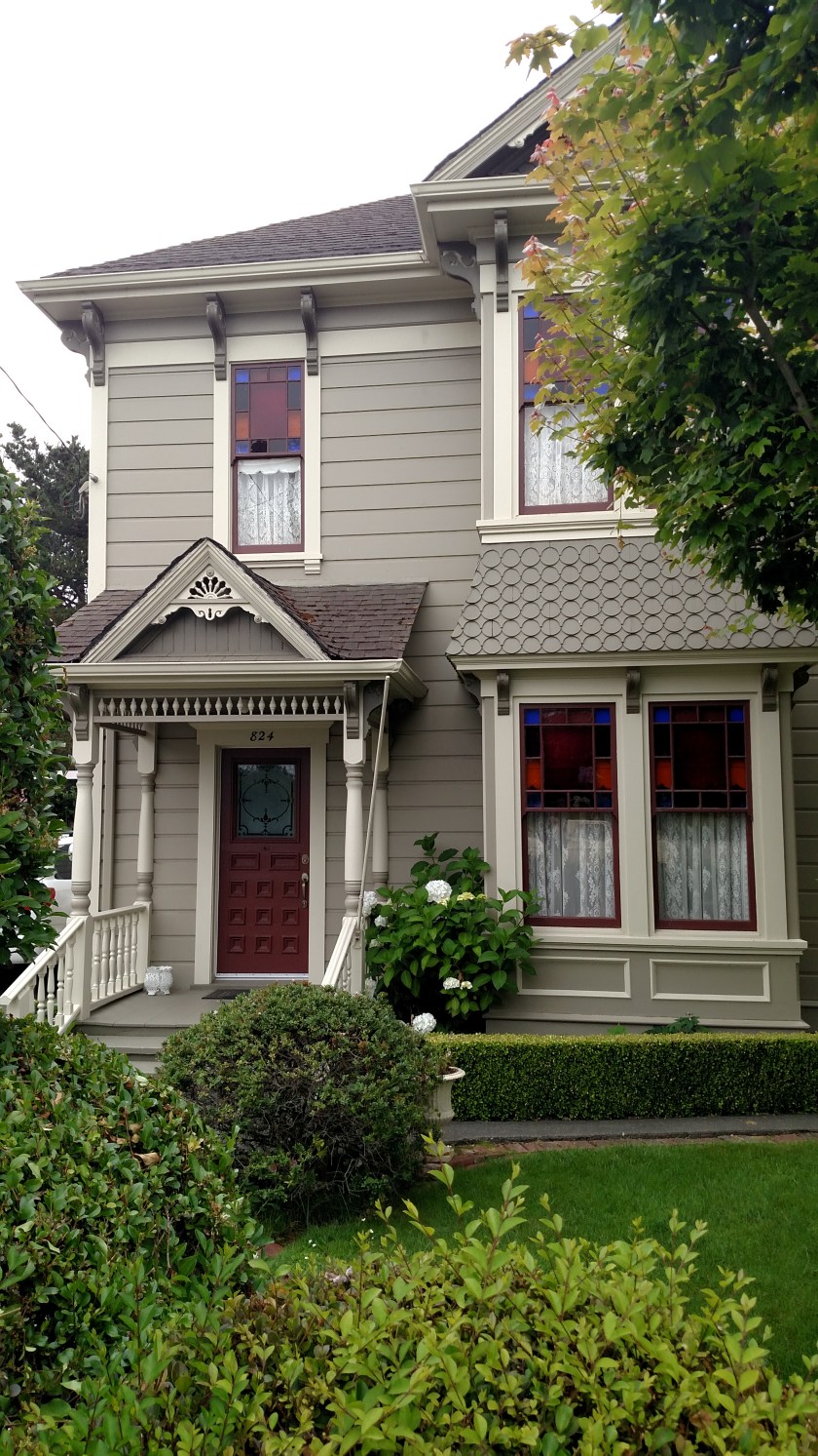
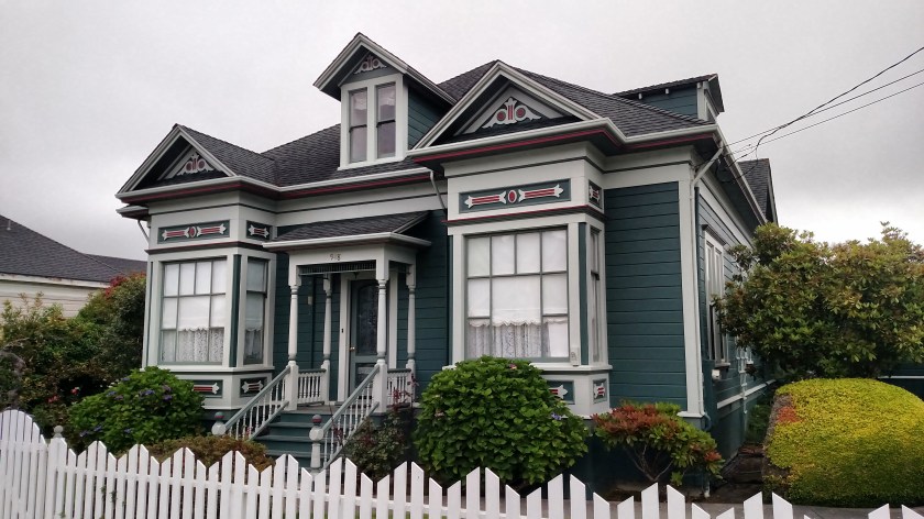
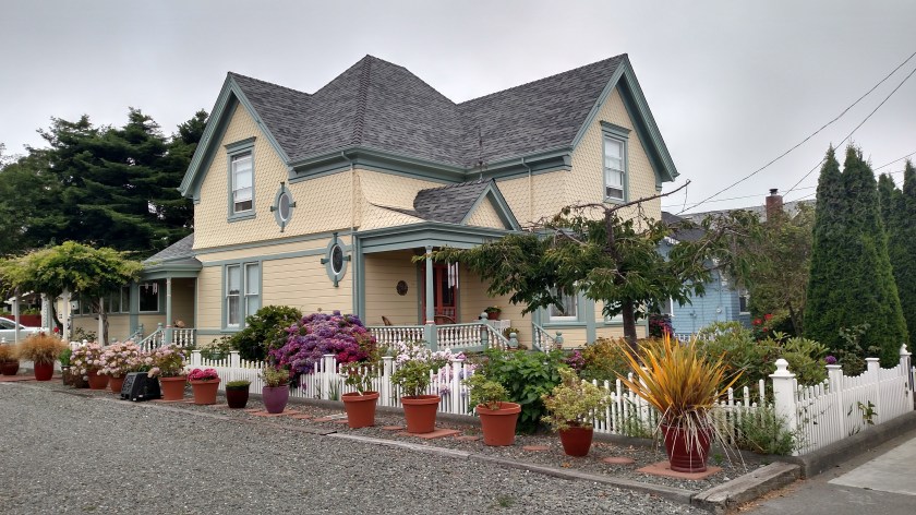
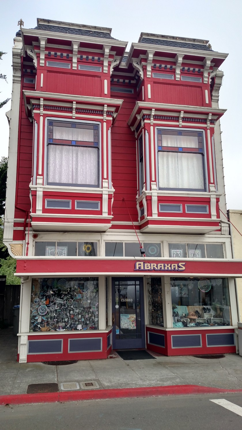
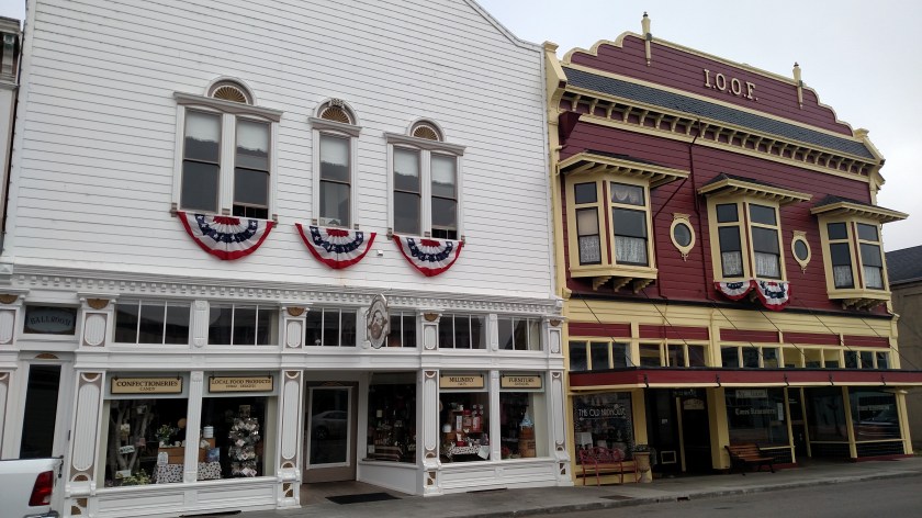
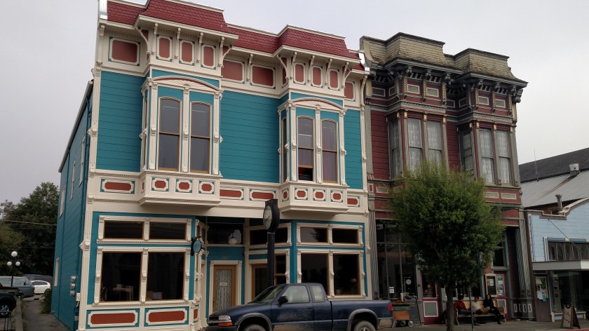
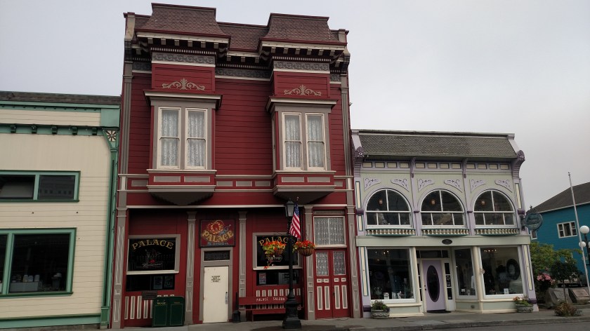
Other houses in town:


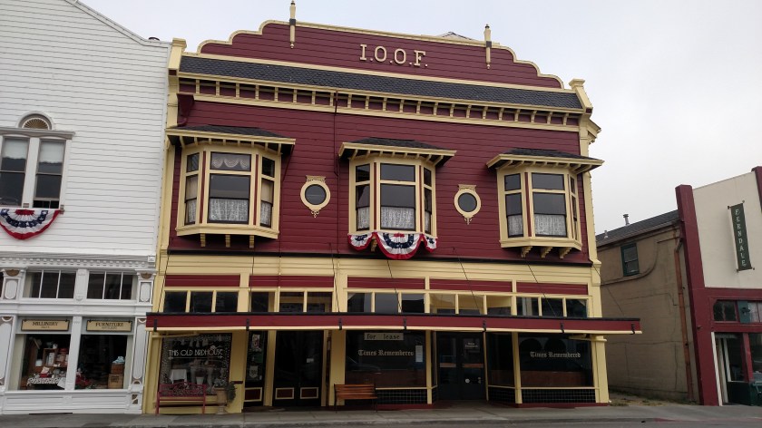
Ferndale (population 1,371) is a little town about 20 miles south of Eureka, California which is best known for it’s large number of Victorian homes and buildings. I drove down to Ferndale Sunday morning of the weekend I was staying in Arcata. Here are some of the houses I saw:


Ferndale (population 1,371) is a little town about 20 miles south of Eureka, California which is best known for it’s large number of Victorian homes and buildings. I drove down to Ferndale Sunday morning of the weekend I was staying in Arcata. Here are some of the houses I saw:


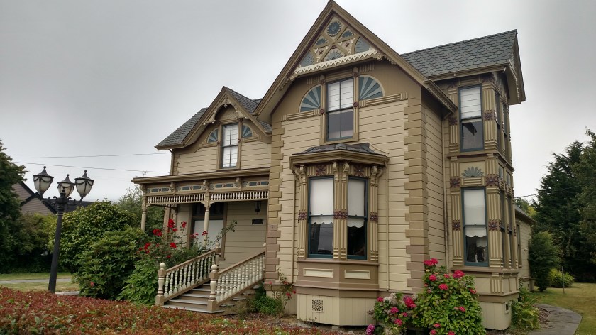


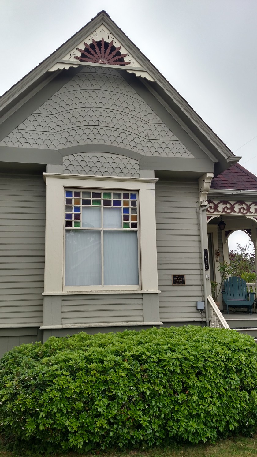
Ferndale (population 1,371) is a little town about 20 miles south of Eureka, California which is best known for it’s large number of Victorian homes and buildings. I drove down to Ferndale Sunday morning of the weekend I was staying in Arcata. Here are some of the things I saw:
 \
\


While I was walking around Ferndale I noticed this variation of an artichoke (a globe artichoke), which has a huge purple flower on top.

I also noticed, about 3 blocks back from Main Street, what I thought were going to be terraced gardens going up a hillside. Turns out it is a cemetery.

I then took a few steps right across the road to include the sign…

I guess they just couldn’t bring themselves to say “Dead End”

