Here are more flowers I saw at this Oregon State Park, which sits above the ocean just south of Charleston. These are in the restored formal gardens of the former Louis Simpson estate.


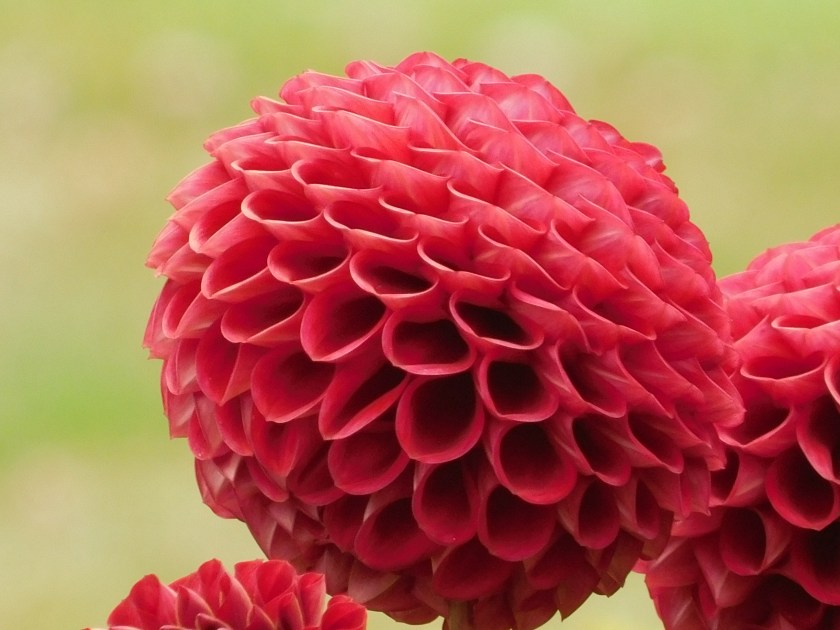

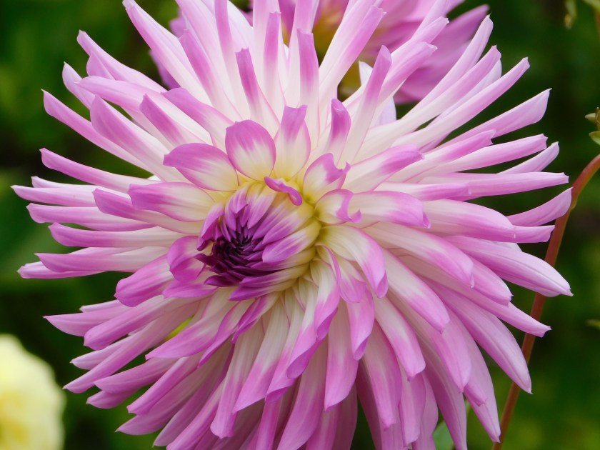

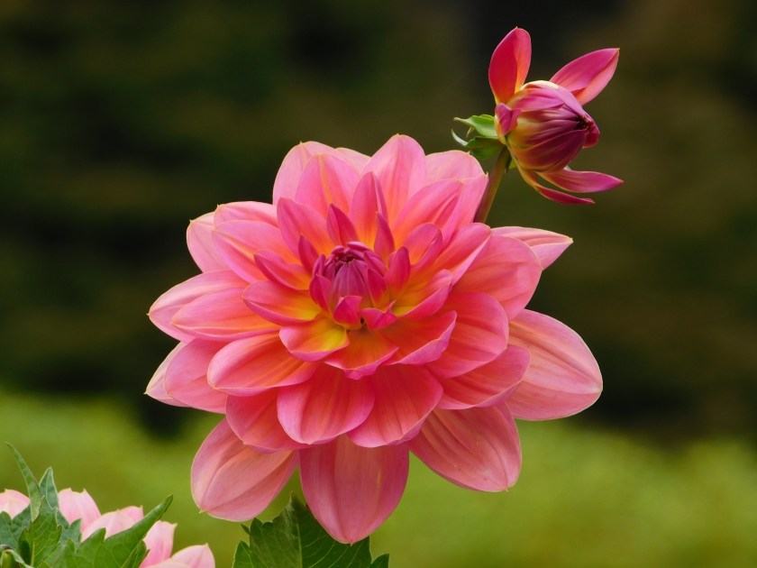


Here are more flowers I saw at this Oregon State Park, which sits above the ocean just south of Charleston. These are in the restored formal gardens of the former Louis Simpson estate.
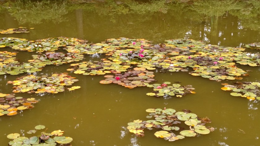
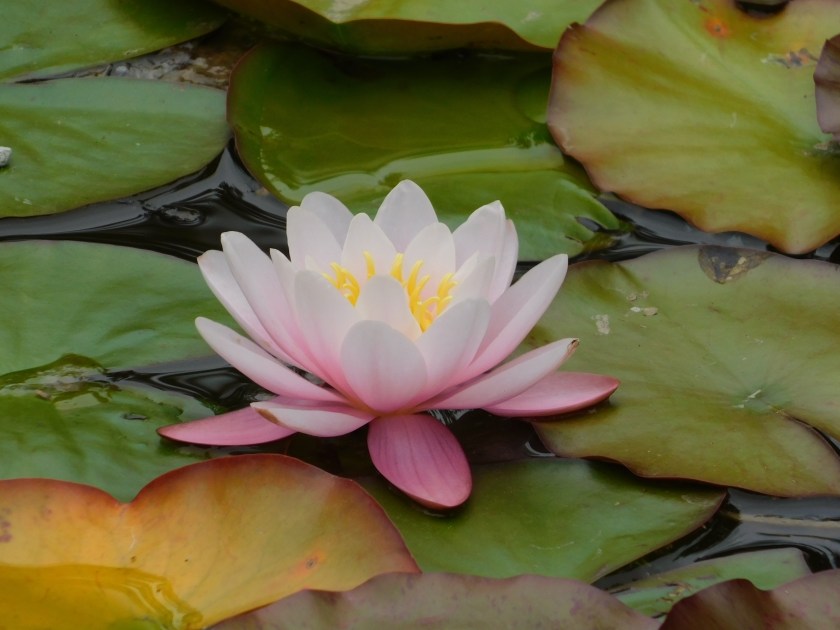
Another section of the gardens at the former Louis Simpson estate (now an Oregon State Park) is the 100-foot long lily pond.


For three nights I have been staying in Glasgow, just north of this town in southwest Oregon. With a population of just over 16,000, Coos Bay is the largest town on the Oregon coast. It also has the largest deep-draft coastal harbor in the state. As I write this there is a huge cargo ship down on the inland portion of the Bay which is loading an incredible amount of logs to be taken somewhere in the world. The Coos River creates a large bay on the east (inland) side of the city, then bends around on the north side (I have to cross a bridge there to get to where I’m staying) and creates another bay on the west side of town before opening up out into the ocean. That west bay, between Coos Bay and Charleston is where most of the fishing boats dock. The two big industries here are fishing and logging.
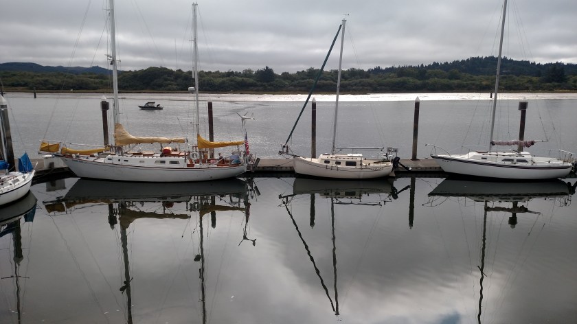
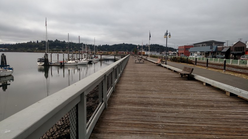
Monday morning I went downtown and spent some time along the boardwalk, which runs along the inland bay. This is the calmer side where most people dock their pleasure crafts.


This is a little restaurant which sits right down by the water:

Before they opened at 11 o’clock I could watch this guy skillfully cleaning fish outside the building:

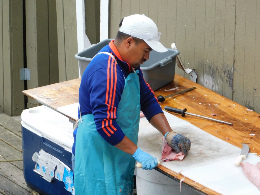
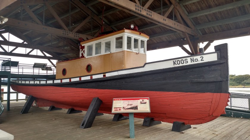
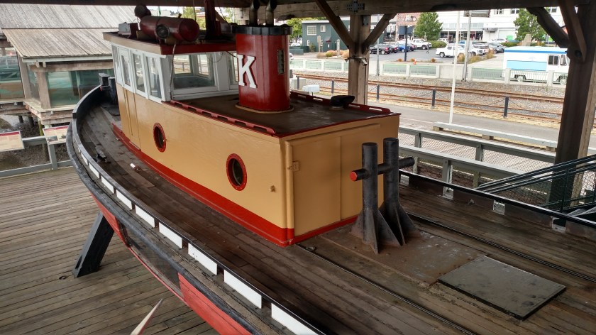
I hung around until they opened and had a bowl of clam chowder. While I waited I checked out this old, restored tugboat which was on display under cover up along the boardwalk:
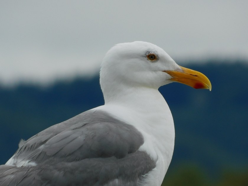
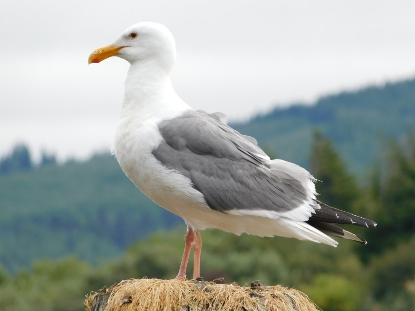
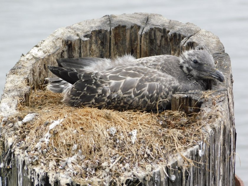
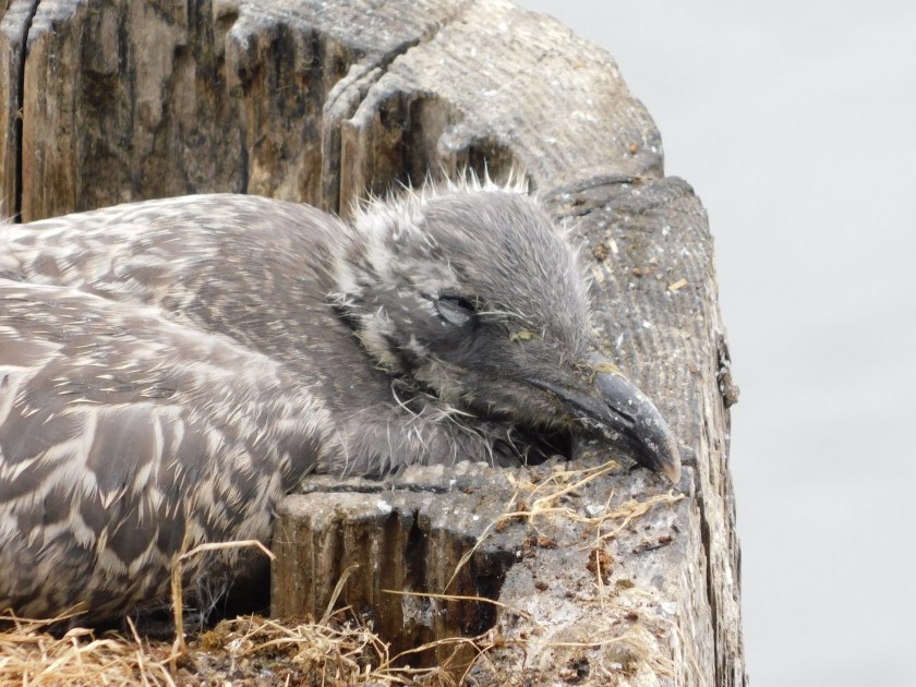
And while I was on the upper platform looking down on the boat I caught these birds out on the posts which support the dock:

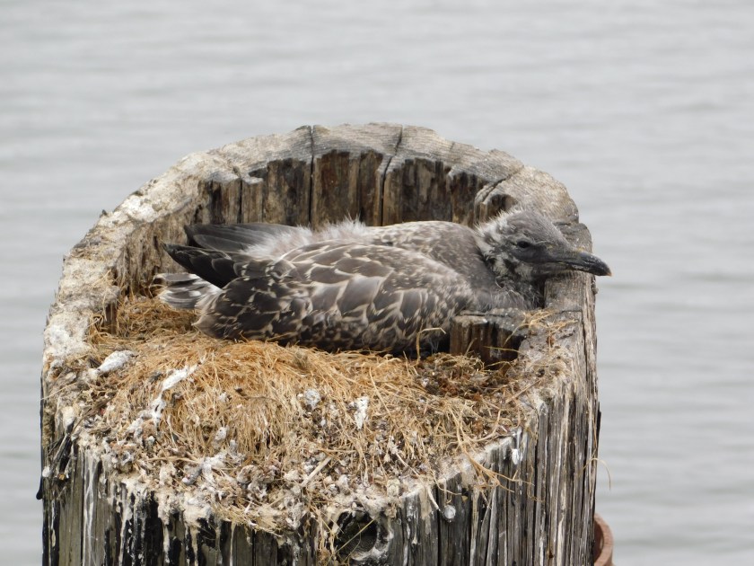
At first I thought this gray bird was lying on eggs but he or she got up at one point to shift positions before taking a siesta and I didn’t see any eggs.

There is a scenic road which takes you south along the coast a few miles from Charleston, Oregon, not far from Coos Bay. This was the area from which I could view the Cape Arago lighthouse and also has two State Parks, one of which I will be posting pictures from tomorrow.
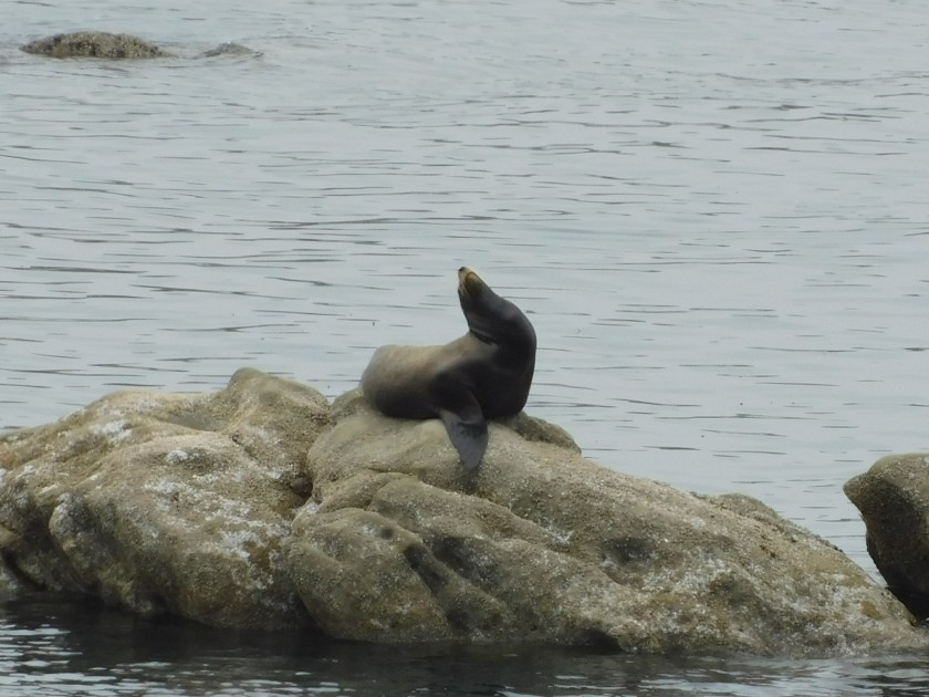
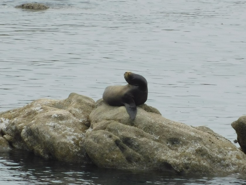
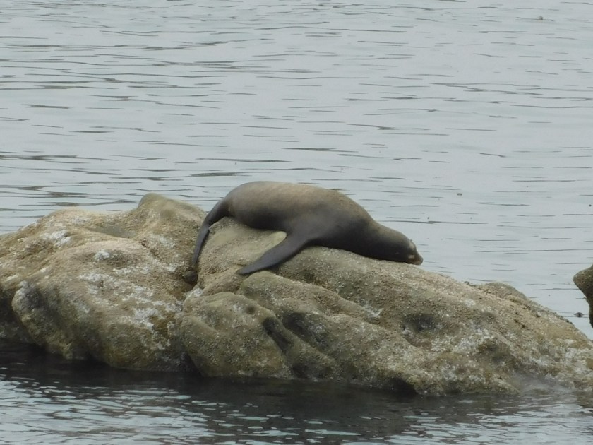
Along that road is an overlook which allows people to watch and hear the activity out on the rocks offshore. This is where literally hundreds of seals and sea lions like to play in the water and, more often, nap and “sing” on the rocks.

The photo above was taken Tuesday at low tide, when a much larger area of rocks is exposed and the seals and sea lions were on the rocky areas much further out in the ocean. The rest of these photos were taken Sunday at high tide when the water came almost all the way up to the mainland and the seals and sea lions were much closer.
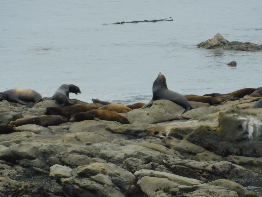


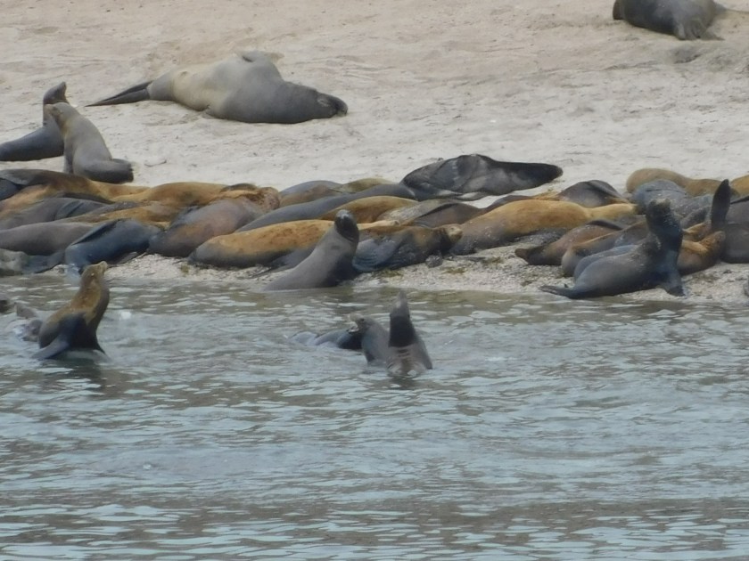
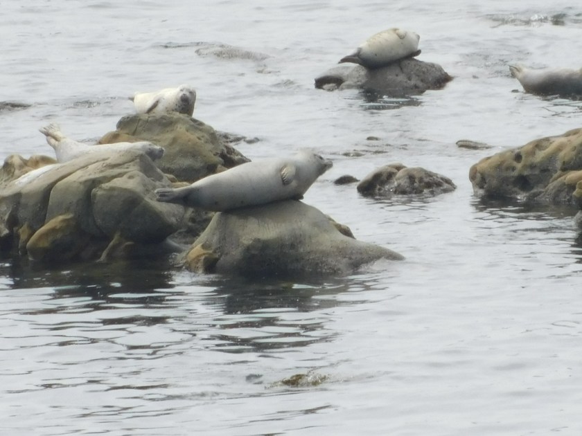
There are different types of both animals which hang out along this part of the coast and their “barking” goes on non-stop. It sometimes has a very rhythmic, musical quality to it. Sea lions are generally smaller in size that seals and the easiest way to tell them apart is how they use their flippers to move around on land.
This seal evidently had barked himself to the point of exhaustion. This sequence of shots were all taken within a minute:

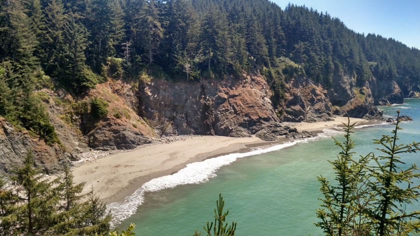
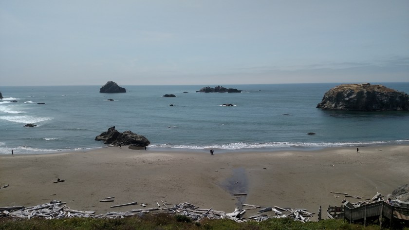
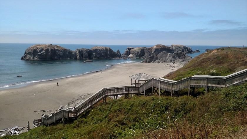
Monday afternoon I returned to this State Park, just south “Old Town” Bandon, Oregon. The views from atop the beachside cliffs are incredible:
Since it was sunny (it was socked in by coastal fog the day before when I was here) I got another photo of “Cosmo,” a larger than life Tufted Puffin made entirely of litter found along the beach.
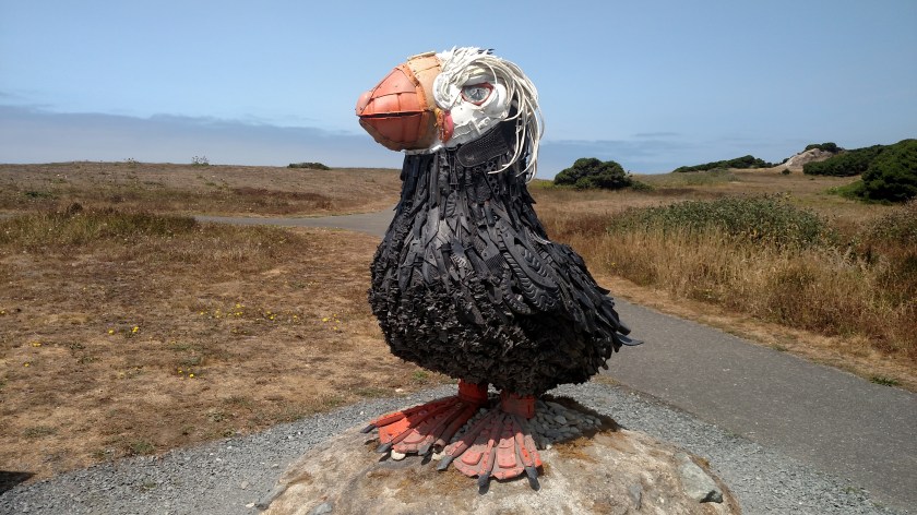


There is an organization in Bandon which specializes in making these art pieces out of trash from the beach. Here is another one I saw downtown:

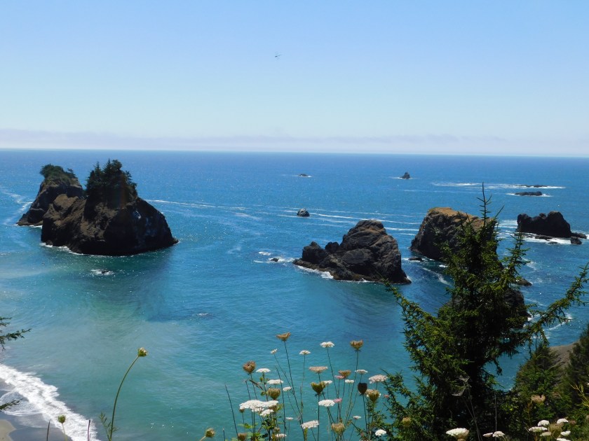
But let’s go back to the nice ocean views:

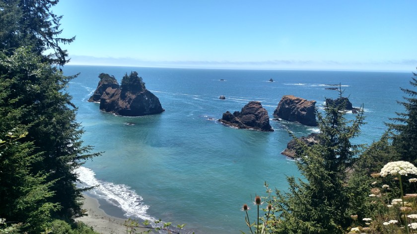
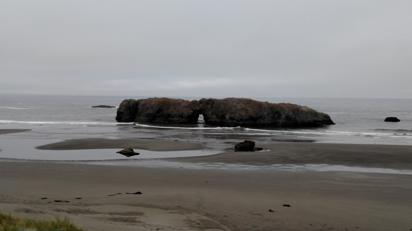
Here is a rock formation I’m going to be talking about in the next post:
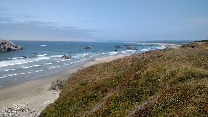
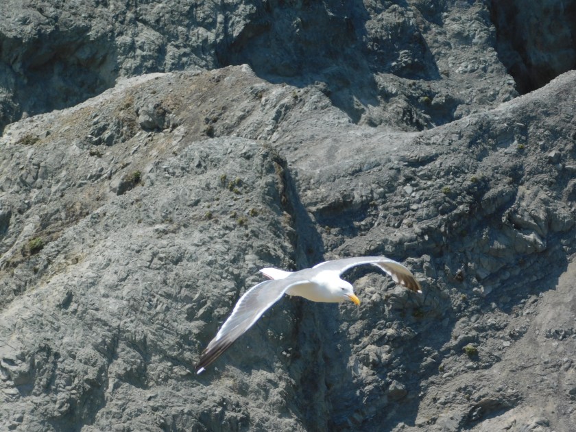
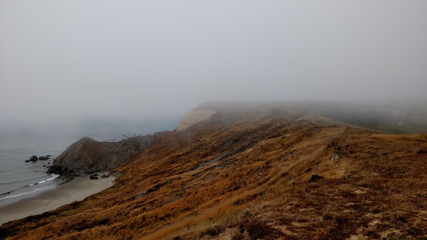
This was an absolutely gorgeous spot to hang out, even if you never set foot on the sand below. I preferred standing atop the cliffs watching the seagulls soar by above and, more often, below me along the hill.
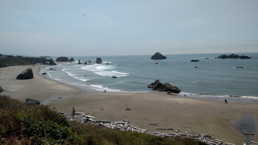
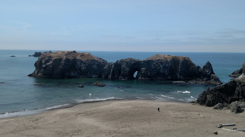
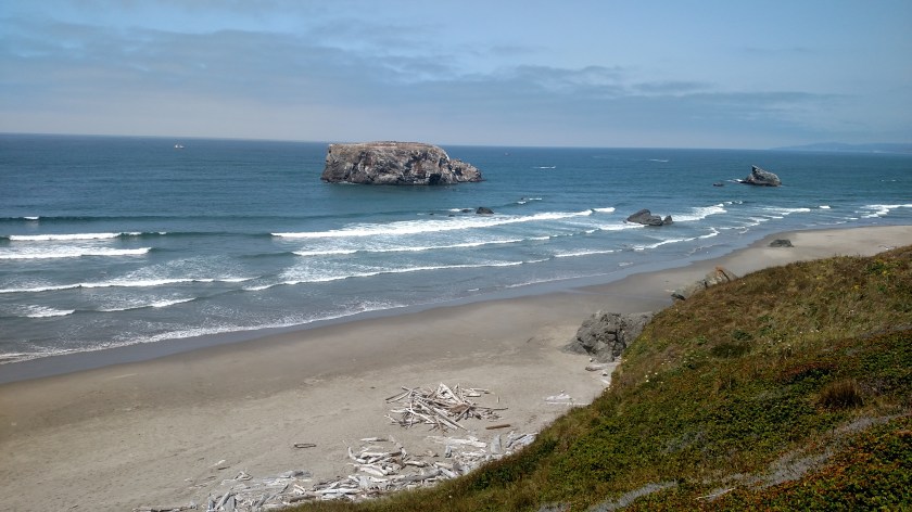
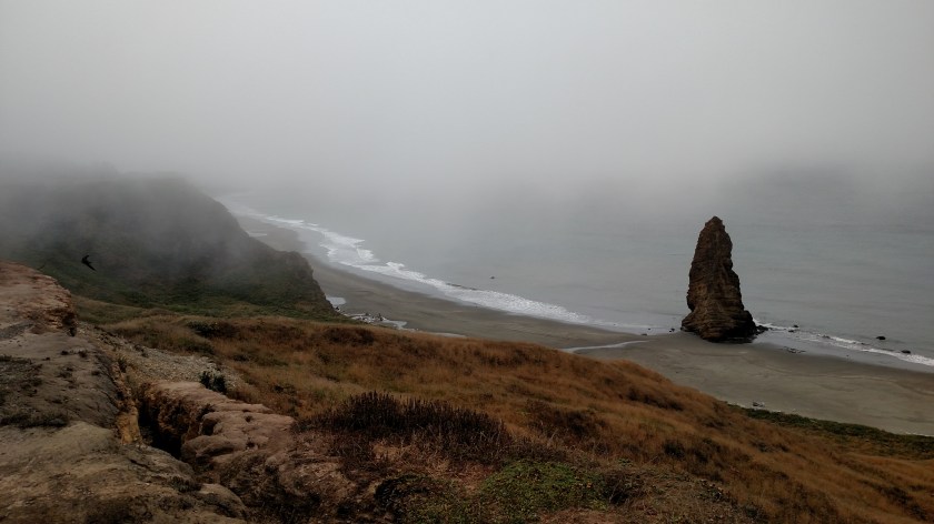
Monday when I went back to the Face Rock Scenic Viewpoint near Bandon, Oregon the visibility was considerably better than it had been the day before:
Sunday at 220pm:

Monday at 204pm:
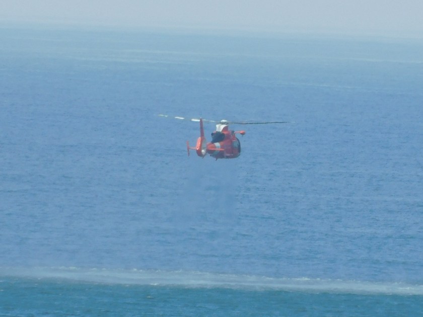
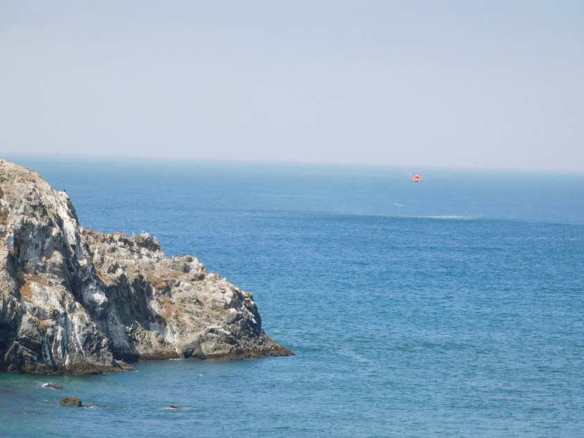
I was standing out on a cliff at a point close to the ocean, watching the seagulls fly by close to me as they had the day before. I noticed a red Coast Guard helicopter flying down the coast, maybe a mile out over the ocean – a fairly common sight. When it got south of the major rock formations it made a wide turn left, towards the beach.
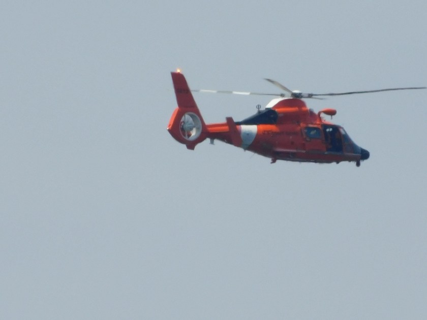
I presumed it was just turning around to head back north. I went back to watching the birds but after a minute or so I could still hear it. I walked north on the hill I was on and saw that it had taken a position low by the water on the opposite side of a big rock formation which had been blocking my view.
The fact that you can see a small part of that formation in this next photo is just due to the alignment of it between me and the helicopter, the heli was probably a quarter mile or more further out over the ocean.

The chopper was hovering “tail-in” in radio control helicopter pilot-speak, meaning the tail would be facing me if this were one of my models and I were controlling it. I didn’t see any boats in distress (although there were some floating nearby which could have come to the aid of anyone stranded in the water) so I ultimately decided that this was likely just a training exercise.
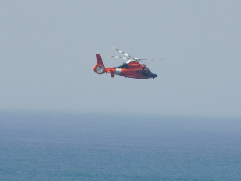
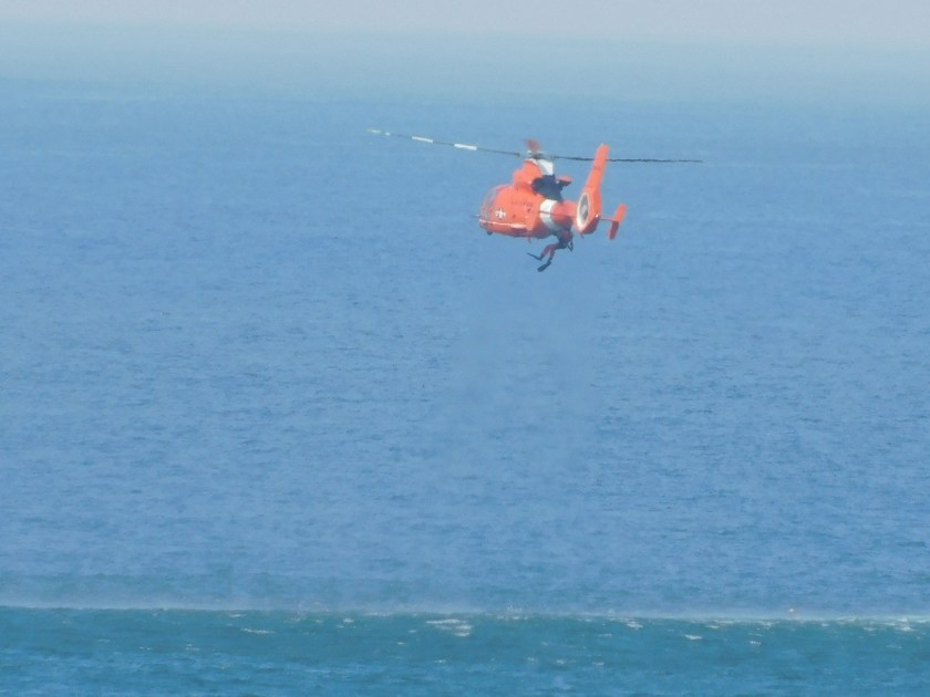
Shortly after taking the photo above I could see a diver exit the right side of the aircraft and he or she was ultimately lowered down to the ocean.
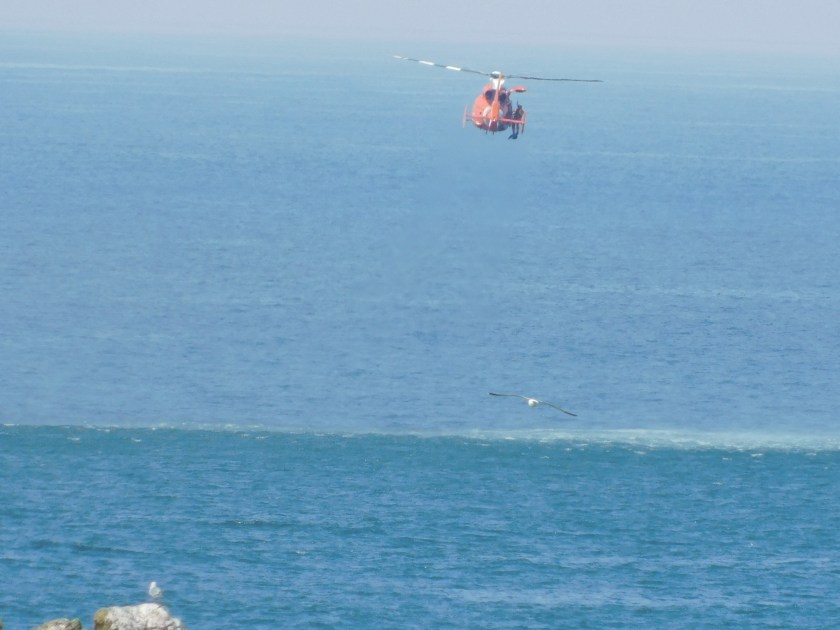
The helicopter hovered where it was for a while, probably only 40 feet above the water.
After a few minutes the helicopter rose higher and made a slow “orbit” clockwise:
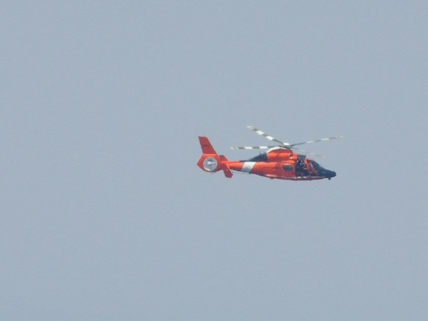

Then it resumed it’s position hovering above the spot where it had dropped the diver:
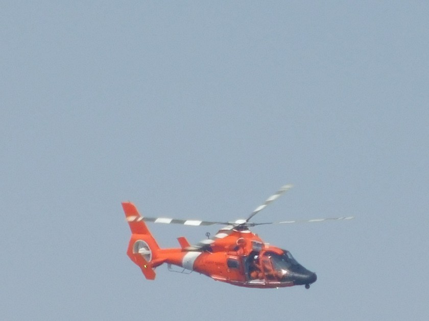
It sat there for a good 20 minutes more, systematically raising and lowering people to the ocean below:
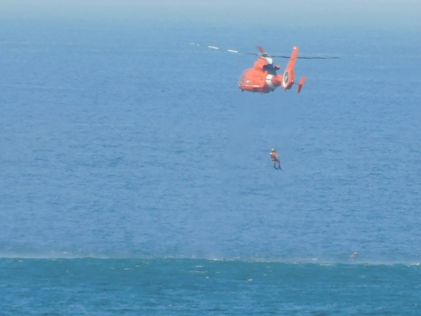

The entire exercise lasted about 45 minutes, at which point the helicopter raised up high and flew north up the coast.
Sunday morning I left where I had been staying in Gold Beach and continued driving north up the Oregon coast.
This is Sisters Rock, which is where I think I want to build my dream house…

I stood there for a long time and just enjoyed the solitude. There was hardly any traffic on the highway behind me, there were hardly any birds and the ocean was quietly coming in to the beach. It was very relaxing.
Ultimately I set my daydreams aside and pressed forward….
I soon arrived in the little town of Port Orford:
This is the Port itself.
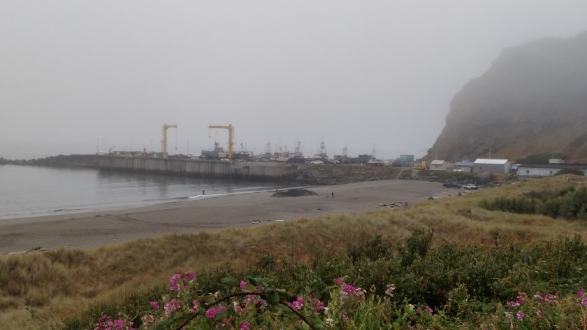
On the hill to the right was a Coast Guard station, which also used the Port to launch ships to rescue people stranded at sea. The facility now houses the Coast Guard Lifeboat Museum:
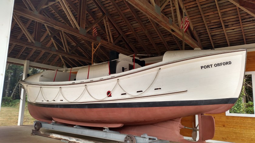
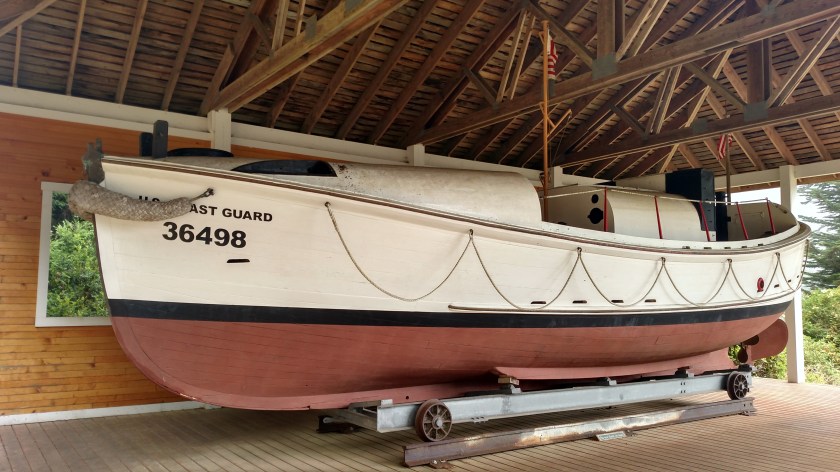
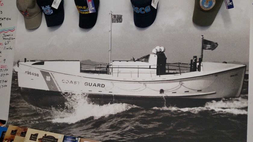
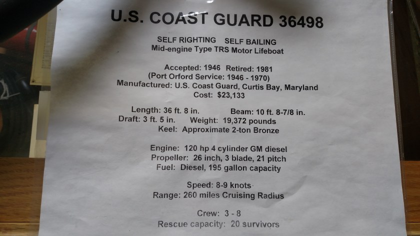
I had a lengthy and, at times, amusing conversation with the woman volunteer who was at the entry to the museum (and her husband was in another room to explain some of the history of the facility).
Further up the road I stopped at a State Park near Bandon. The coast remained socked in. I took lots of pictures but you can’t see very much so I won’t post most of them (I returned to the same place on Monday and it was totally clear so I’ll post those photos next). I do want to post one from Sunday, though.
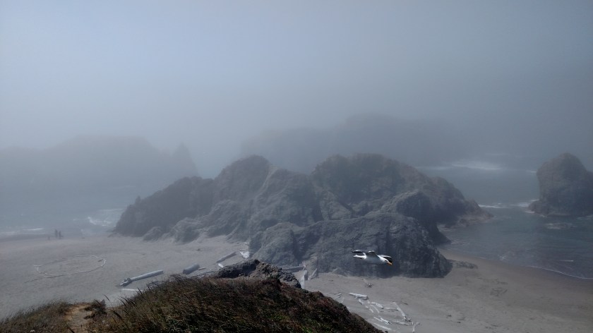
The thing that was really cool about this spot was the seagulls. I stood at the top of a cliff overlooking the beach and the multiple rock formations just offshore. Well, the seagulls would come zipping by where I was standing, only about a foot or two off the bank and sometimes not very far from me. I was hoping the pictures I took with my smartphone would better reflect what I was experiencing. I stood there watching quite a while, and returned to the same spot on Monday.
I drove into Bandon and an area called Old Town, your basic tourist town with many nice restaurants and shops, although there is also a very busy marina. When I left Bandon to head north to Coos Bay I stopped at a store to buy something and saw this in the parking lot:

I saw lots of electric car charging stations in California (as well as the cars that use them) and I expect I’ll be seeing lots more in Oregon and Washington.
Sunday afternoon I continued driving north in coastal Oregon to my next 3-night stop in Glasgow, just north of Coos Bay. I would see (or try to see) 3 lighthouses during this leg of my trip. First stop – Cape Blanco, the oldest standing lighthouse on the Oregon Coast.
This was the scene from the area leading out to the lighthouse. Highway 101, which is the main coastal road I will be on for several weeks, was relatively clear of fog, though overcast. Every time I brushed the coast, however, the marine layer lurked. This was evident as I drove a few miles west to the lighthouse:
I went in the Visitor Center for a while and by the time I came out it had cleared just a little:

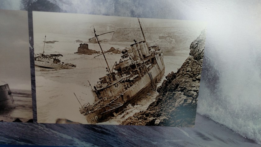
Cape Blanco is the westernmost point in the lower 48 states. This lighthouse was commissioned in 1870 and is still operational today. It is 63 feet tall and sits at 256 feet above sea level. In the Visitor Center I saw this photo of a ship (one of many) which didn’t heed the warning:

I headed back out to Highway 101 and continued north to the town of Bandon. On the opposite side of the bay sits the Coquille River Lighthouse:
The first two photos were actually taken Monday. I got there around noon on Sunday and the photo of the east side of the lighthouse was rather dark. I did take the third photo, of the west side, on Sunday.
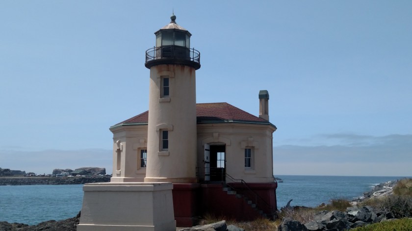


This lighthouse was not so much to protect ships from the coastline but, rather, to guide ships into the Coquille River bay and harbor. It was commissioned in 1896 but was taken out of service in 1939 after improvements were made to the river channel and navigation technology improved. The tower is no longer accessible but the building houses the Visitor Center. This tower is 40 feet tall.
Further north I missed my turn for Route 540 and ended up driving in to Coos Bay, the largest town on the Oregon Coast. I had dinner, then backtracked to the third lighthouse on my list, at Cape Arago. I already knew I wouldn’t be able to get out to the lighthouse itself but the brochure I had indicated there was a viewing area about a quarter mile away near the entrance to Sunset Bay State Park. I didn’t get there until almost 6pm local time and as I approached from the north I knew it wasn’t going to go well. It had been foggy along the coast all day and now the evening fog was getting even heavier is so this was all I could see:

It’s out there – on land just to the right of the center of the photo. Here is a photo I took Monday from roughly the same vantage point:


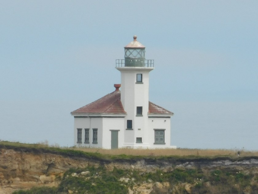
The reason I said that Cape Blanco was the oldest standing lighthouse (1870) is that this is actually the third lighthouse to be built at Cape Arago. The first was commissioned in 1866 but became a victim of physical deterioration and land erosion. A second lighthouse was built in 1908 and ultimately suffered the same fate. This one was commissioned in 1934 but was taken out of service in 2006. It is 44 feet tall and sits 100 feet above sea level.
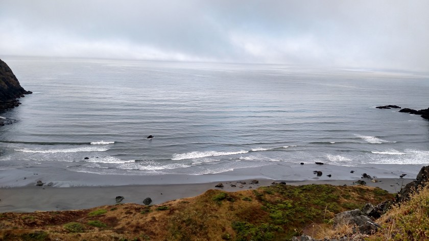
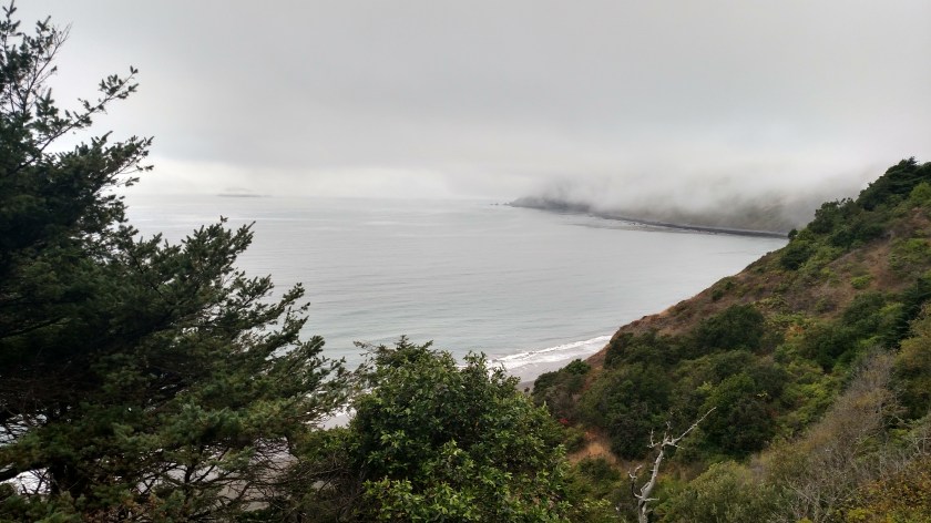
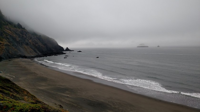
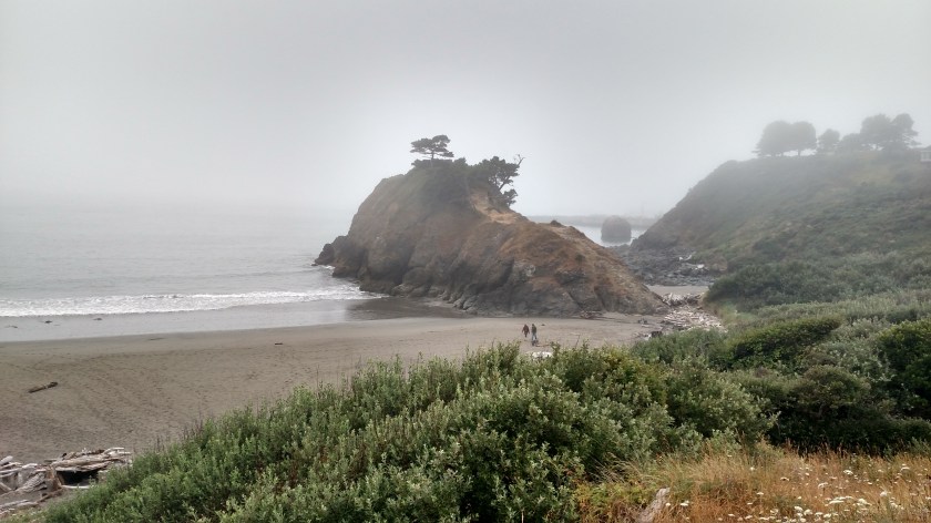
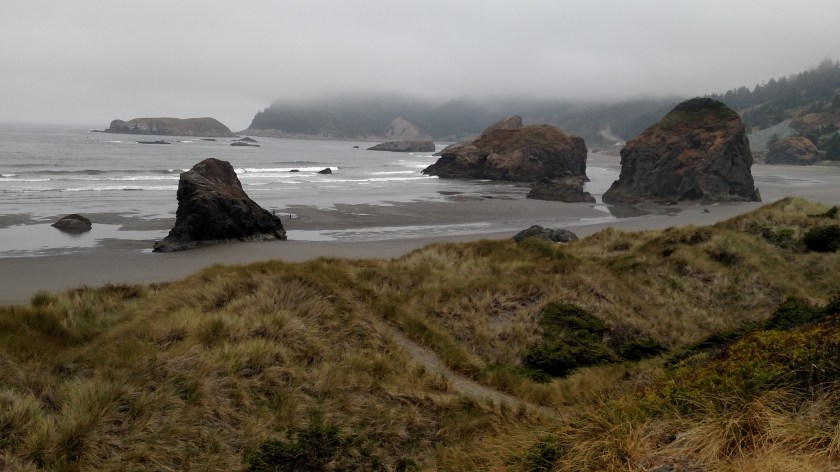
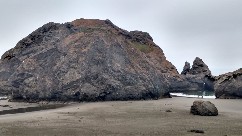
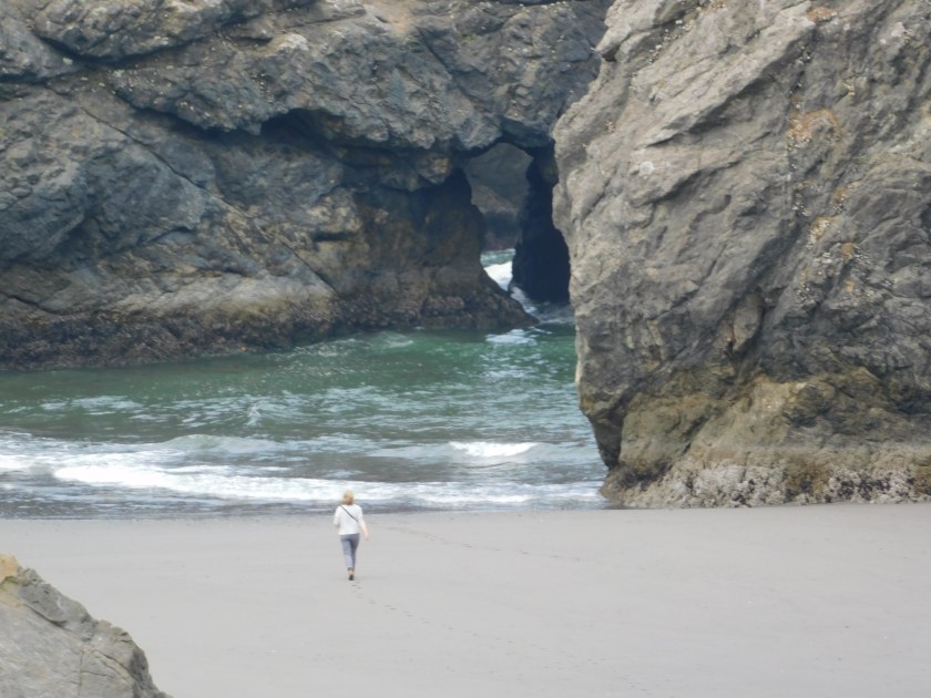
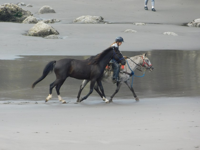
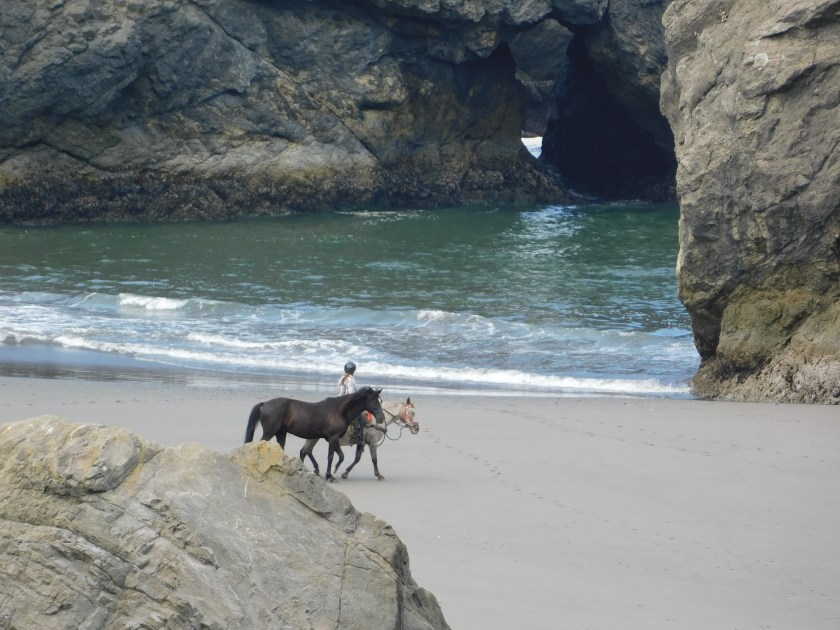
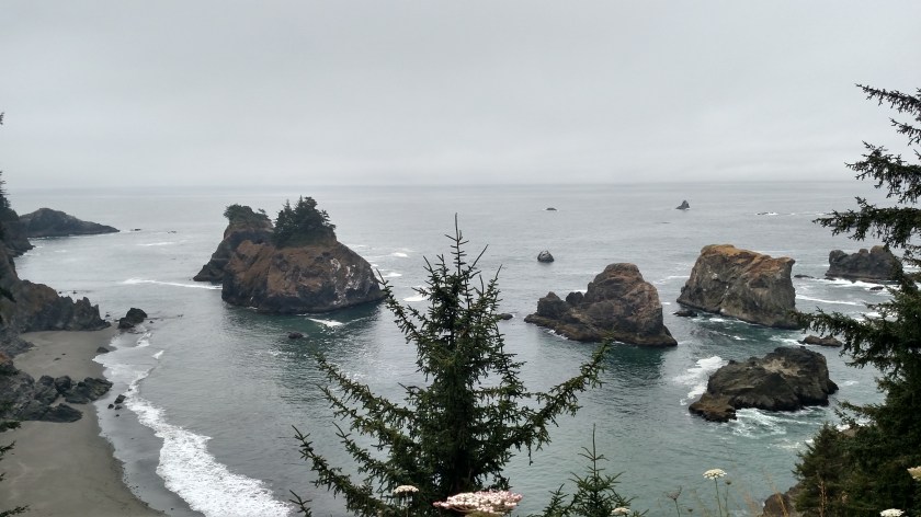
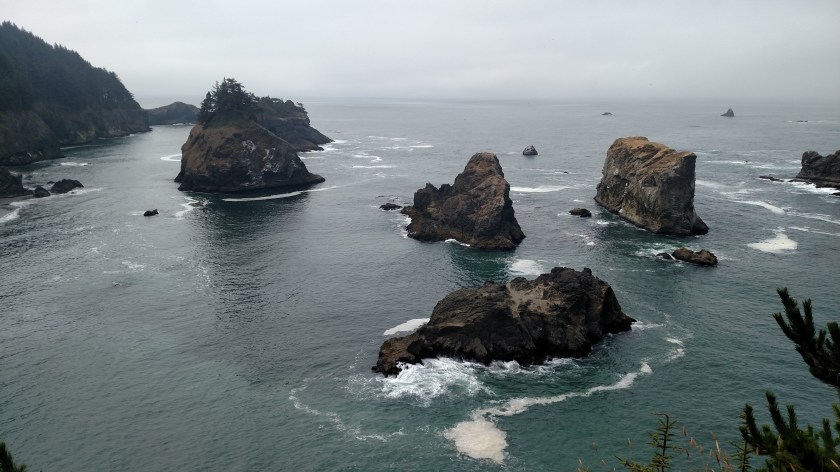
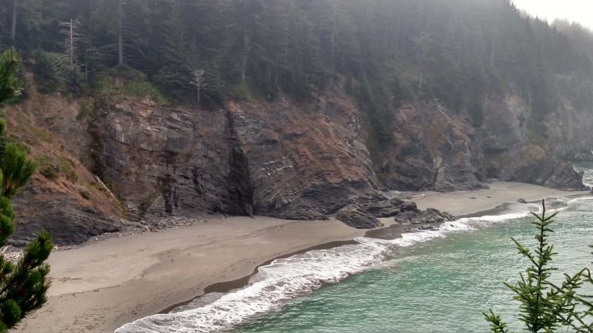
Saturday I went back to many of the same spots on the southwest Oregon coast which I had stopped at Friday when I entered the state from California. These were taken at various times Saturday morning. Some, but not all, of the beach pictures have people (or animals) in them as a size reference.

About 20 minutes after I took the photo above the sun started to break through the fog:
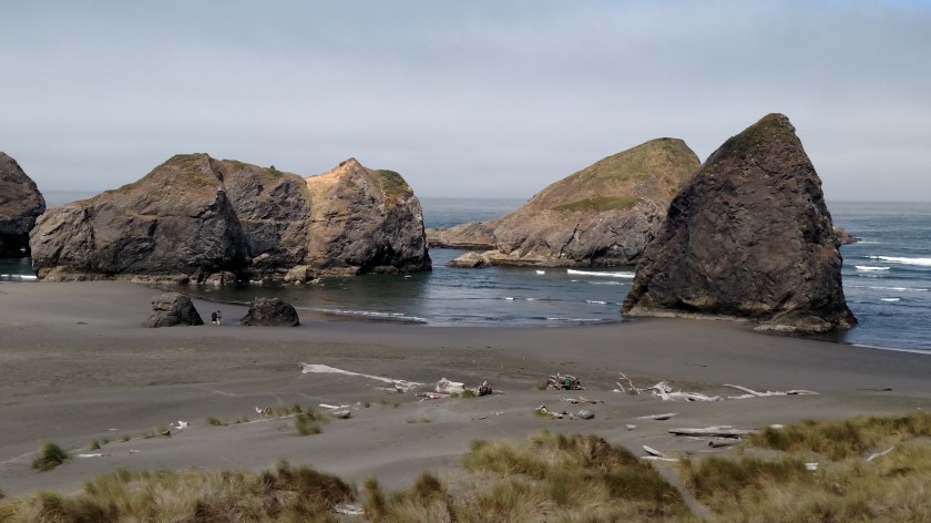
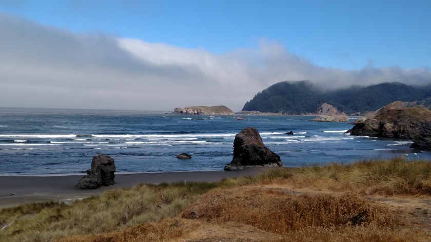

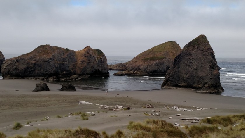
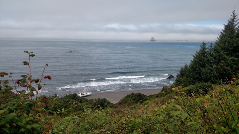
Saturday I went back to many of the same spots on the southwest Oregon coast which I had stopped at Friday when I entered the state from California. These were taken at various times Saturday morning and afternoon. From some vantage points you will see a big difference between photos in the morning before the fog burned off and later in the day when the sun was out and the ocean reflected the blue sky.
Someone seems to have misplaced their boat (it appears to have been abandoned on shore)

And then the sun came out….