As I proceeded south I passed Titus Canyon, which is a popular spot with tourists but has a dirt and rock access road. I learned my lesson last year about driving on such roads with my car (a Nissan Altima) as I cut a tire on the road leading in and out of Chaco Canyon in Arizona. Although it deprives me of seeing some of the sights, I have learned to stay on paved roads.
I also passed the road for Salt Creek. A gentleman I had spoken with earlier in the day recommended that I go see it but again, dirt road. Evidently there is a creek there where fish have adapted to actually tolerate the extreme temperatures and high salt content. They are called “pupfish” and if you Google that you will find images of them.
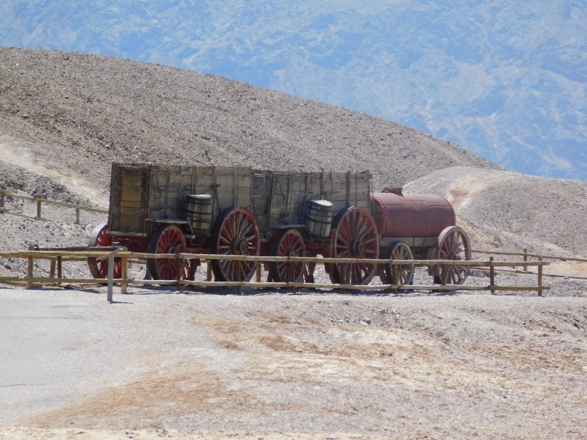
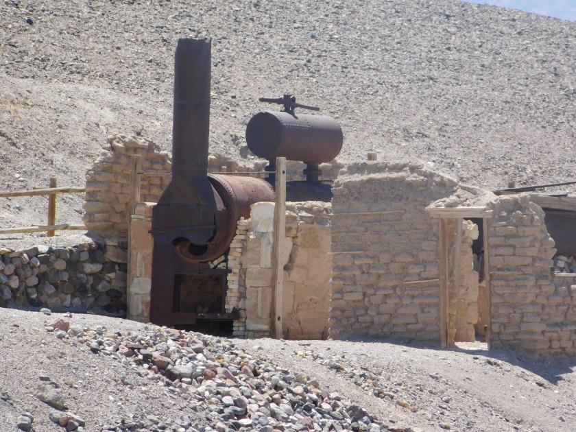
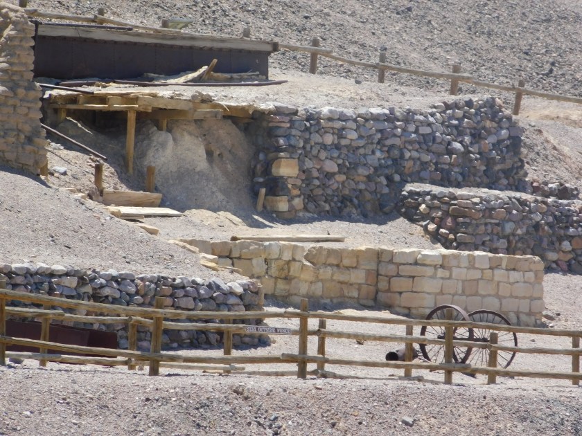
Next I came to the site of the old Harmony Borax Works, which operated from 1883 to 1888. Borax is a mineral, and despite the rumors of gold and other treasures in the valley, was the most profitable resource to ever be harvested here. Borax was called the “White Gold of the Desert”. Remember Borax laundry detergent? “It’s stronger than dirt!” was their tag line. It was also called 20-mule team Borax because of the teams comprised of 20 mules, pulling the wagons used to transport the product to market.


Just before getting to the Visitor Center I passed a sign indicating that I was parked right at sea level:
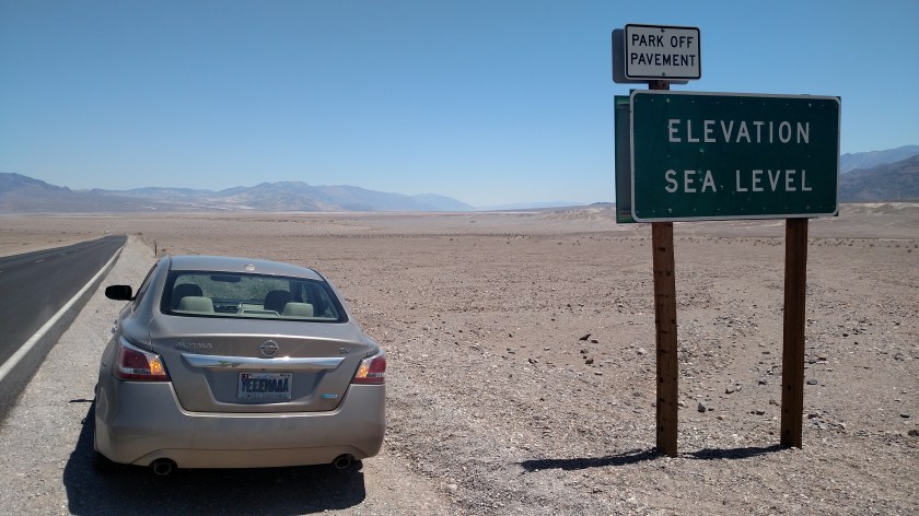
You may or may not be able to tell, but the car is sloping forward (downward). I am beginning my descent into the belly of the beast.
The Furnace Creek Visitor Center sits at 190 feet BELOW sea level. It is near the spot where the highest temperature ever recorded in the world occurred in July of 1913 – at 134 degrees Fahrenheit. Once I got to the Visitor Center I learned that Death Valley averages only 2 inches of rain per year. And some years they don’t get ANY rain. Zip, Zero, Nada.
The Visitor Center has this model showing the Valley:
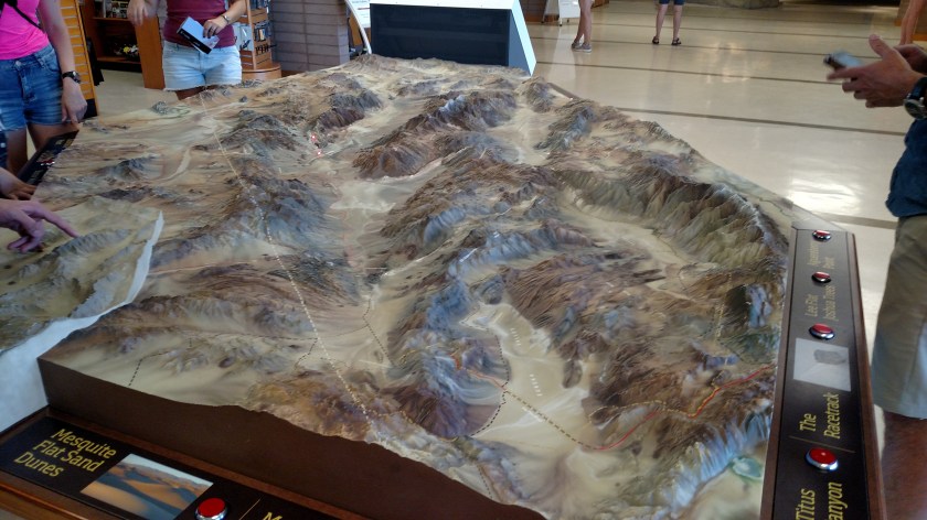
You could press buttons and it would show where in the Park various landmarks were located. Here is a relief map which may help you visualize the area a little better:

And here are two satellite photos, the first is the northern portion of the Park, the second is the southern portion:

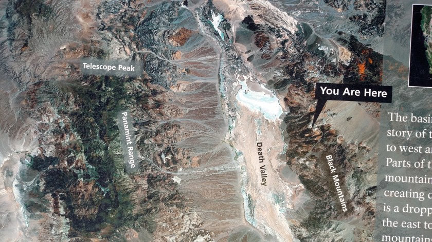
The “You Are Here” references are actually to Dante’s Peak, which I’ll get to in the next post.
Right next to the Visitor Center is a small, privately owned gas station. Here is what people who came unprepared are expected to pay:

There really isn’t any excuse for anyone coming here and needing to buy gas. I paid 2.959 for regular unleaded in Pahrump. Yes, the Park is big, but I drove a good bit the first day and only used a little more than half a tank. If you come here low on fuel you deserve to pay this price!
Here are some more photos taken at various points up to this part of my first day in the Park. I haven’t looked at the digital camera photos yet, but since the valley is so big, I used the smartphone camera for most pictures. There really wasn’t much to zoom in on!


This concludes first-day coverage on the central portion of the Park. The next post covers some areas south of the Visitor Center.
