Dinosaur Tracks

This little area was located a short distance up the gravel road from the Parowan Gap Petroglyphs site.  I didn’t walk around too much, and only saw one place where a footprint had been preserved on a big rock:

IMG_20180601_130126402

IMG_20180601_130130254

This impression was made by a 3-toed hadrosaur some 65-75 million years ago.

I did see these two characters out basking in the sun:

DSCN0414

DSCN0417

DSCN0422

DSCN0423

DSCN0427

Parowan Gap Petroglyphs

My Airbnb host here in Cedar City, Utah told me about this place, which is located out in the desert about 20 miles northwest of town.

IMG_20180601_122707817

IMG_20180601_122931116

IMG_20180601_123521313

Petroglyphs are drawings and symbols etched into rock.  These are thought to have been done by the Paiute and/or Fremont Indian tribes many years ago.

Here is an interpretation of what some of the symbols represent:

IMG_20180601_123838631

And here are photos of some of the symbols:

DSCN0381

DSCN0382

DSCN0383

DSCN0384

DSCN0385

DSCN0391

DSCN0392

DSCN0393

Mountain Meadows Massacre

No photo.

I took a scenic route to drive from St. George back up to Cedar City.  It was a beautiful drive but I did notice two signs which I was curious to learn more about.  When I got back to my Airbnb I did some research and learned of a tragic event in Mormon, and American, history.

The first sign said “Mountain Meadows Massacre – Men’s Burial Site” pointing to the left side of the road, and a short ways up the road another sign which said “Mountain Meadows Massacre – Women’s Burial Site” pointing to the right side of the road.

The Mountain Meadows Massacre occurred between September 7 and September 11, 1857.  A wagon train of emigrants from Arkansas was passing through southern Utah on their way to California.  They were attacked by the “Nauvoo Nation,” part of the Utah Territorial Militia, which was comprised of Mormons!!  They are thought to have recruited some members on the Paiute Native American tribe to assist in the massacre so they could put the blame on them.  Between 120 and 140 men, women and older children are thought to have been killed, and only 17 children under the age of 7 were spared.

The men who headed the attack wrote to, then President of the Mormon Church, Brigham Young asking for his advice but the response tragically arrived two days after the slaughter occurred.  The advice was to leave them alone and let them be on their way.

Only one of the organizers of the attack was convicted of the crime, and was executed by firing squad.

The burial sites were only recently discovered, in 2014, by archeologists.

St. George, Utah – Various locations

While I was in St. George Friday morning I decided to check out some other things in town before heading back up to Cedar City.  I stopped at the city’s Visitor Center to ask questions and get maps.  Only two blocks away was Brigham Young’s house (well, his Winter house!).

IMG_20180601_094410753_HDR

IMG_20180601_094450274

IMG_20180601_094518769_HDR

As I walked back to my car I saw this sculpture in a traffic circle:

IMG_20180601_094814018

And then I came across a statue of Brigham Young, seated on a bench in front of a bank:

IMG_20180601_095214181_HDR

About 100 feet away was this colorful bison statue:

IMG_20180601_095302758

Go Trailblazers!!

And finally, across the street was a statue of a young girl sporting a cape, riding on top of a paper airplane:

IMG_20180601_095457476

And here is a nice flowering shrub located outside the Visitor Center:

IMG_20180601_092442733

Mormon Temples

Thursday while I was in St. George, Utah to see the Mormon Temple there I spoke with two young ladies in the Temple Visitor Center.  When I told them I was staying up in Cedar City they asked me if I had seen the Temple there.  Before leaving Friday morning to go back down to St. George to get better photos of that Temple (in the morning sun) I looked up the address of the Temple in Cedar City.  It is across town from where I am staying and, once I knew what it looked like, I could see it sitting high on a hill on the other side of the interstate.

Cedar City:

IMG_20180601_073648147

IMG_20180601_073828776

St. George:

IMG_20180601_083724867_HDR

IMG_20180601_084051183_HDR

I had a very nice conversation with a couple sitting outside the Temple who were waiting to attend a wedding there (I wondered why there were so many people around at 9 o’clock in the morning).  They were interested in hearing about my trip and shared some insights on other Mormon Temples and a celebration/ceremony which occurs annually up near where I stayed when I was in Southern Utah last year.

I have seen several Mormon Temples in my travels and they are always magnificent structures with beautifully landscaped grounds.


Zion National Park

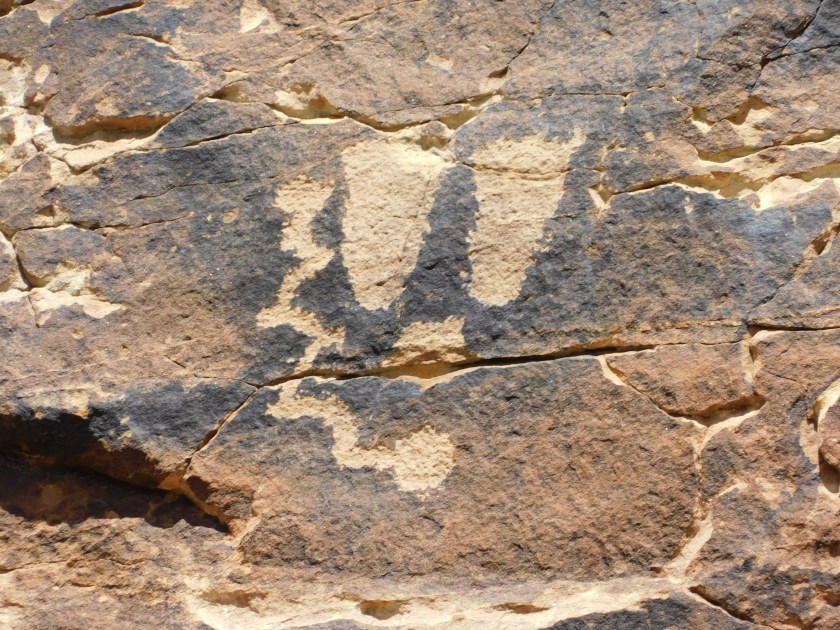
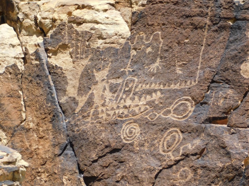
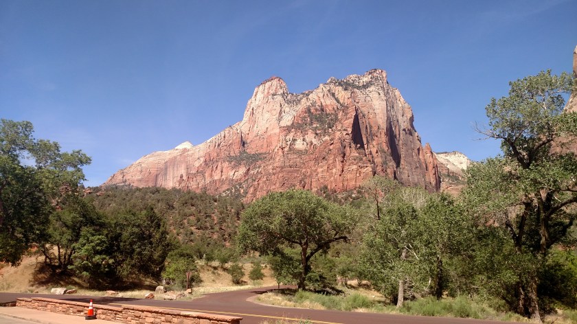
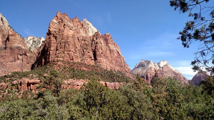
Thursday was the third time I have been to Zion.  I was here several years ago which is a story I will tell when I post some closeups I today took with the digital camera.  I also stopped here last year when I was staying down in Kanab, but the Park was packed and I only took pictures from the main road.  You can find those photos if you enter “Zion” in the search box on the Home page, then look at the posts dated in 2017.

The main road through Zion goes from west to east.  Visitors may see many interesting views from that road, but parking is tedious (believe me, people manage to find every nook and cranny on the roadside) and crossing the road as a pedestrian is dangerous.

There is also a road which goes to the north, up into the Canyon, and the only way to get there is to take the free Shuttle Bus.  This is by far the most relaxing way to see the Park.  Parking is VERY limited (not much at the Visitor Center, and last year even the overflow lots outside the Park were full).  Even though the signs at the entrance said that the Visitor Center lot was full, contrarian that I am had to try it and sure enough, a truck was just backing out of a spot so I snagged a place right next to the Visitor Center.

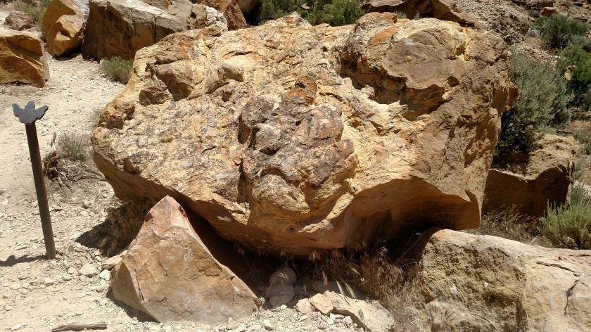
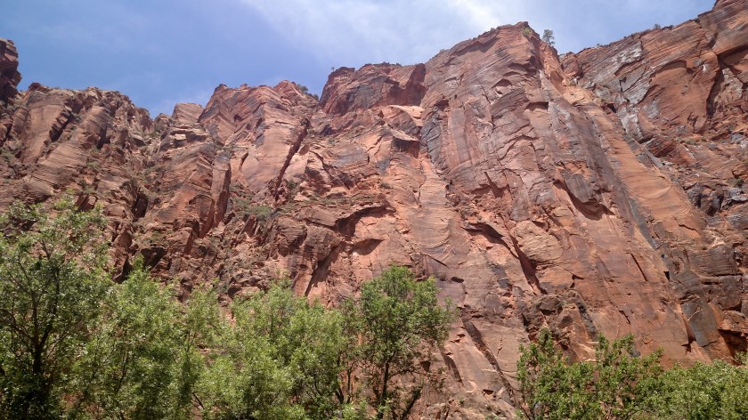
As with the scenery in many Parks, there is lots of repetition and I’ll try not to bore you with too many pictures of basically the same thing.

IMG_20180531_110540228

IMG_20180531_112634081

This is the Zion Lodge.  It is a hotel and has a number of restaurants, and is one of the Shuttle Stops in the Canyon.  The only vehicles permitted in the Canyon are Shuttle Buses, Park employees, and visitors staying at the Lodge (and they are only allowed to drive to the Lodge.  There is no vehicle parking allowed along the road or in any of the overlooks where the Shuttle Buses stop).

IMG_20180531_115333876

IMG_20180531_115455843

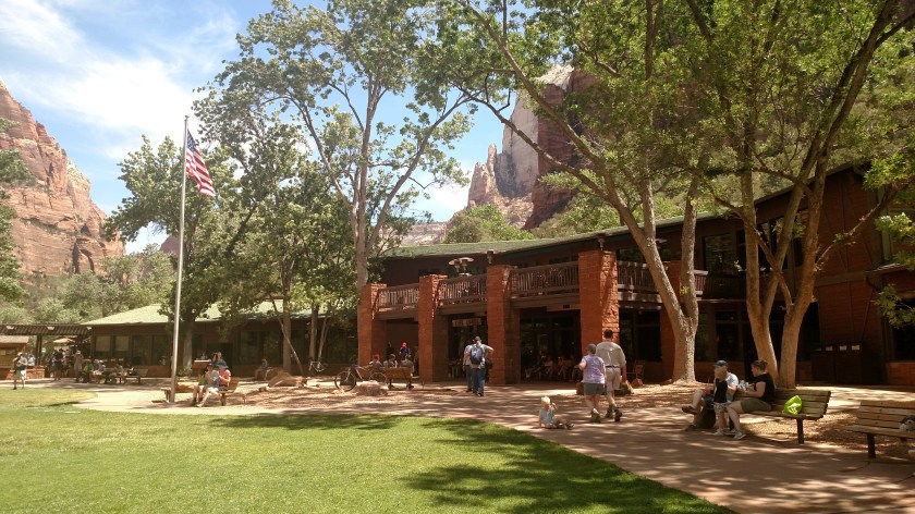
There were seven Shuttle Stops, including the Lodge, where I got off the shuttle to take pictures.  Shuttles run every few minutes you could spend as much time as you wanted at each stop before catching a bus to take you further.  Shuttle Stops are also where hikers may embark on some of the many trails through the Park, ranging in difficulty from easy to extremely strenuous.  I also saw a number of folks on bicycles.  The Park was busy but not really crowded.  The weather was pleasant, though it got VERY windy in the mid-afternoon.

I was surprised to find that when I got back to the car the temperature was in the low 90’s.  It didn’t feel that warm in the Canyon, though the elevation does increase from the Visitor Center up to the last Shuttle Stop.

IMG_20180531_120941835

IMG_20180531_123246177

IMG_20180531_130938208

IMG_20180531_134627335

IMG_20180531_134709080

As I drove down to Zion in the morning I noticed that Kolob Canyon, which is technically part of Zion National Park but is located just off the dreaded interstate several miles north of the main Park, was closed for a series of construction projects.  I am glad I stopped there when I was in the area last year.  To see those photos, enter “Kolob” in the search box on the Home page.

I will post closeups taken with the digital camera either later today or over the weekend.  I will also share my amusing JohnBoy stories about the Park.

Zion National Park – Overview

I saw this 3-panel panorama of “Zion from the air” at the Visitor Center.  Zion is a very compact park, with many high mountains in a relatively small area.

This is the panorama looking from left to right.  The white lines point to various landmarks described in the upper portion of the panels.

IMG_20180531_100715857

IMG_20180531_100722142

IMG_20180531_100727951

The picture quality isn’t very good due to reflection of light, and you may be able to find a better, single photo online.

Mountain Climbers in Zion

As we approached the next to last Shuttle Bus stop in the Park the driver told us to look up to our right to see some mountain climbers.  I couldn’t spot them as we drive past but when I disembarked at that Shuttle Stop I finally saw one of them.

Look at the bottom of the white horizontal stripes:

DSCN0341

DSCN0340

DSCN0342

DSCN0344

DSCN0345

I waited at the Shuttle Stop for a while hoping they might come out to ride the Shuttle back to the Visitor Center.  Sure enough, about 15 minutes later they emerged.

Meet Alex and Brandon, the intrepid climbers.

IMG_20180531_133918782

They are both from the Midwest and came out Utah to do some climbing.  I thought they had descended from the mountain because of the high winds (there had been a weather advisory on the radio in the morning warning of gusts up to 50 mph in the afternoon) but they said no, wind was not a problem.  They descended because they were going to scope some other spots in the Park to find “a better climb”.

Road to Zion

Thursday I drove down to Zion National Park, about an hour from where I am staying in Cedar City, Utah.  As I approached the Park from the west I drove through a series of small towns and as I drove past this house the two towering pine trees caught my eye.

IMG_20180531_093450428

On the way out of the Park in the afternoon I stopped to inquire what kind of trees they are.  I had a very nice conversation with the gentleman who lives there and we shared stories about places we have been and where throughout the United States and the world his job had taken him.  He also suggested that I drive down to St. George, Utah, which I did – and will do again today.

The trees are Italian Cypress.  In addition to the pretty flowers out by the sidewalk he was also very proud of the Mexican Primrose, which were planted in beds right in front of his porch.

IMG_20180531_153640027

IMG_20180531_153646678

St. George, Utah

This is a “teaser” post.  When I stopped to speak with the gentleman who lived in the little house with the big trees, he asked if I had seen the Mormon Temple down in St. George (about 30 miles south of Zion).  I had not been there and had time, so I made a quick trip down before heading back to Cedar City.

The pictures I took of the Temple were facing into the sun so they are not very good.  The photo below is a side view.  I am going to go back down there this morning to get photos with the sun behind me, and will post them later today or over the weekend.  I will spend much of the day here in Cedar City and need to review pictures and get caught up on some posting!  I may make some posts tonight as I will probably get up early tomorrow to drive to Nevada, taking scenic roads and stopping to take photos along the way.

IMG_20180531_172827477_HDR