Well, after my first post of the day a few minutes ago it looks like I need an editor/proofreader! Welsome?? Sheesh. I generally end up tweaking things soon after I post them so y’all may want to look at the blog rather that opening and reading the posts from your e-mail indicating that a new post exists, which will most likely contain errors.
When I entered Wyoming on Thursday I continued on I-80 West through Cheyenne and Laramie to the little town of Rawlins. There I took Hwy 287 northwest to Lander. That road, in the southern part of the state, was pretty much wide open but became a little more hilly (not quite mountainous) as I drove on. This was the view from an overlook which my GPS unit said was 38 miles from my brother’s house:
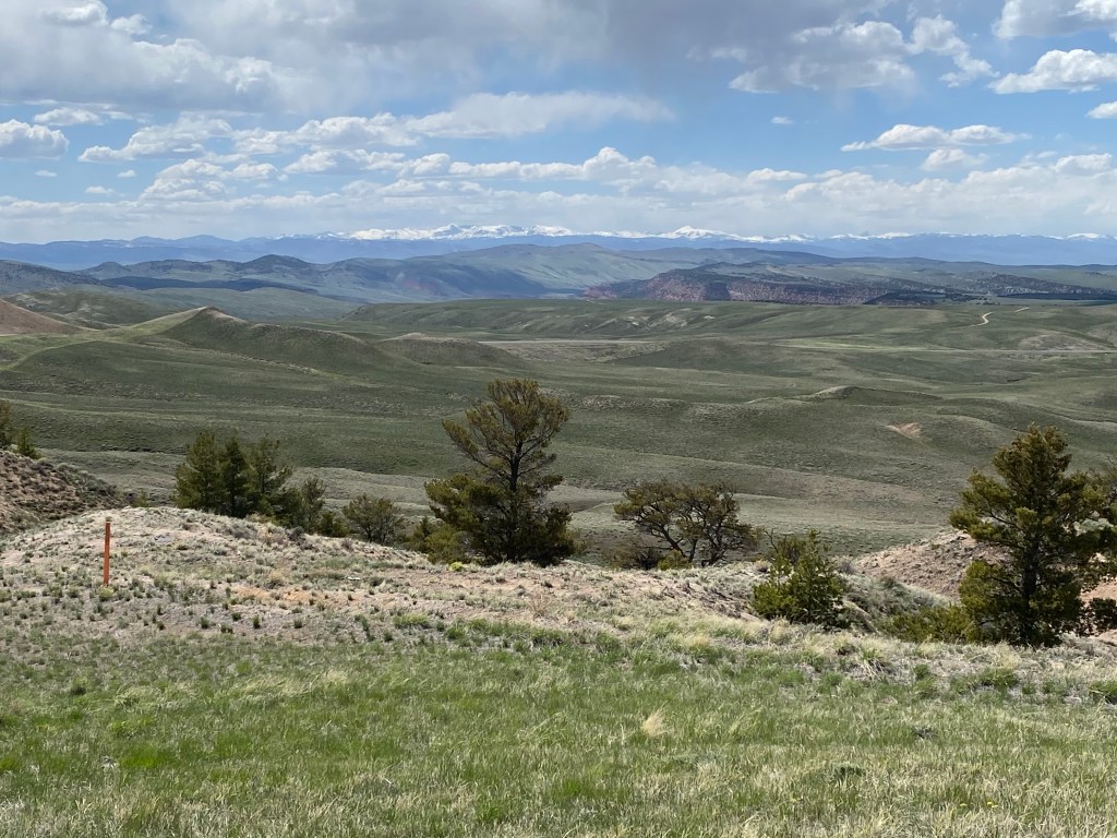
Pending further research, my guess that one of those mountains in the distance with snow on them is Gannett Peak, which at 13,804 feet is the highest point in Wyoming.
Signage at this, the Beaver Rim Overlook, informed me that I was looking at the Wind River Mountains. The land ahead of you is Fremont County, where my destination of Lander is located, and is nearly the size of the state of Vermont!! And I always thought things were bigger in Texas!
Fremont County alone is home to 70 miles of the Oregon Trail and also hosts 626 lakes and reservoirs. The County is also home to both the Eastern Shoshone and Northern Arapaho indigenous American tribes. There is a casino near Lander which I am sure I will stop in at somewhere in my travels. What do you think, put is all on Red or Black????
